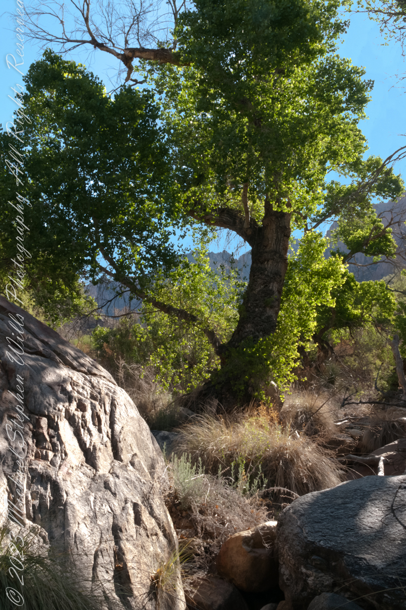
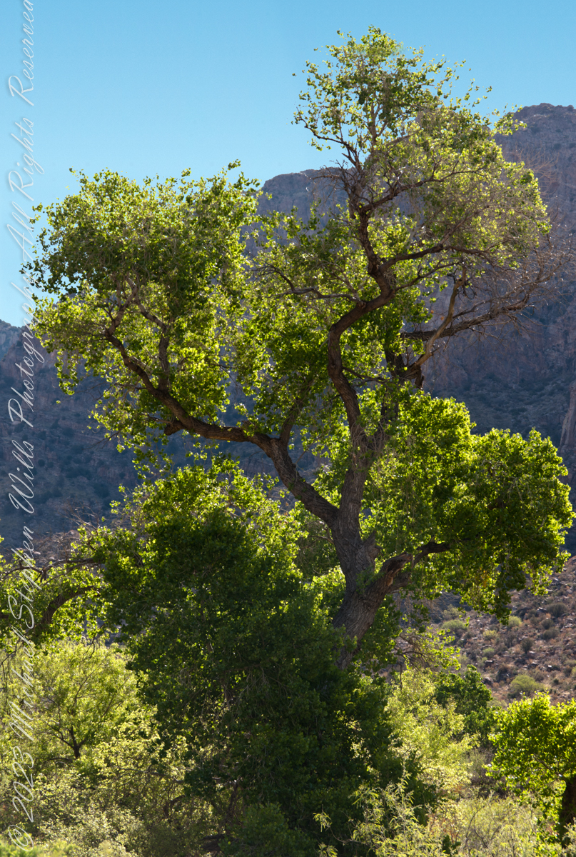
A large Fremont’s Cottonwood Offers shade and protection along the Pima Canyon Trail.
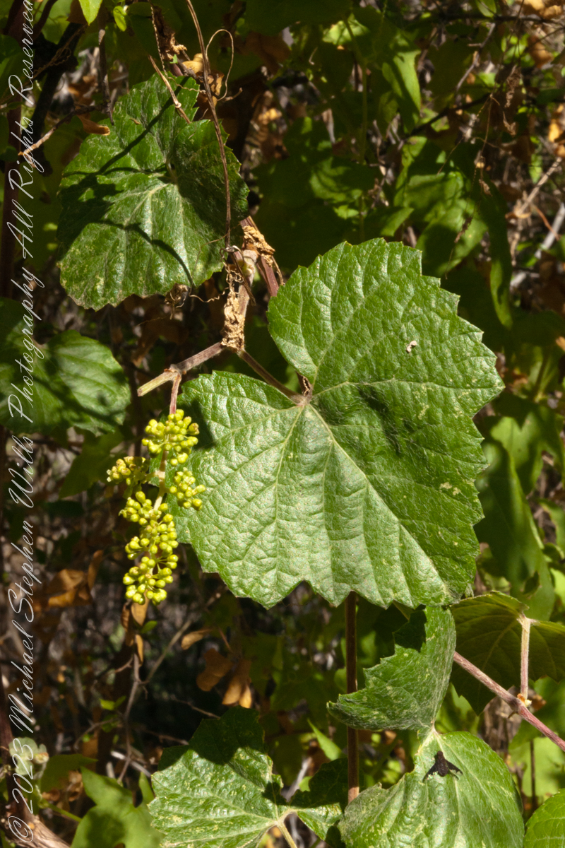
In the shade, a grapevine, offers a vain promise of grapes.
The cottonwood’s deep roots draw water from a mountain stream.
Native Americans in the Western United States and Mexico used parts of Frémont’s cottonwood variously for a medicine, in basket weaving, for tool making, and for musical instruments. The inner bark of Frémont’s cottonwood contains vitamin C and was chewed as an antiscorbutic – treatment for vitamin C deficiency. The bark and leaves could be used to make poultices to reduce inflammation or to treat wounds.
The Pima people of southern Arizona and northern Mexico lived along Sonoran Desert watercourses and used twigs from the tree in the fine and intricate baskets they wove. The Cahuilla people of southern California used the tree’s wood for tool making, the Pueblo peoples for drums, and the Lower Colorado River Quechan people in ritual cremations. The Hopi of Northeastern Arizona carve the root of the cottonwood to create kachina dolls.
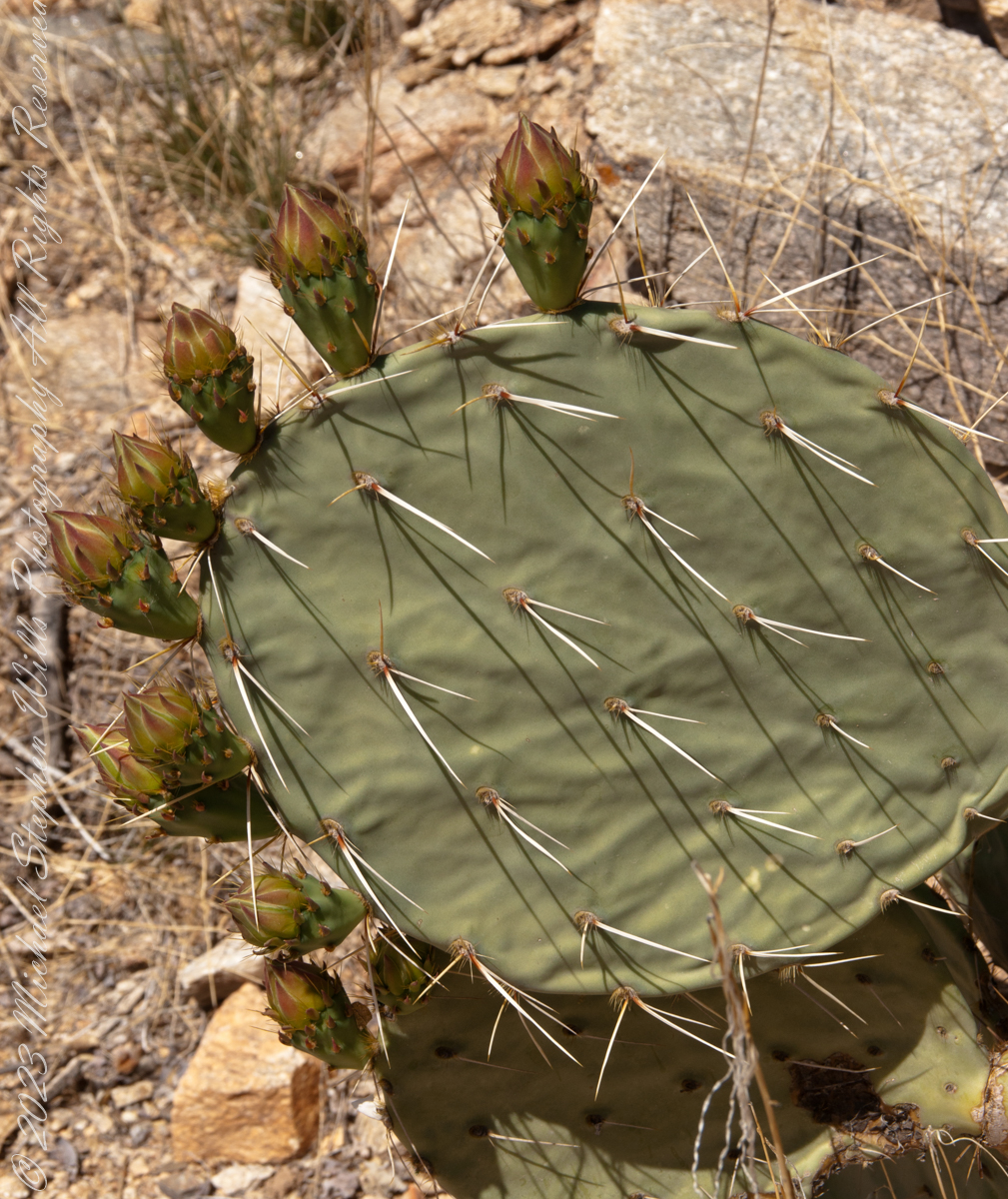
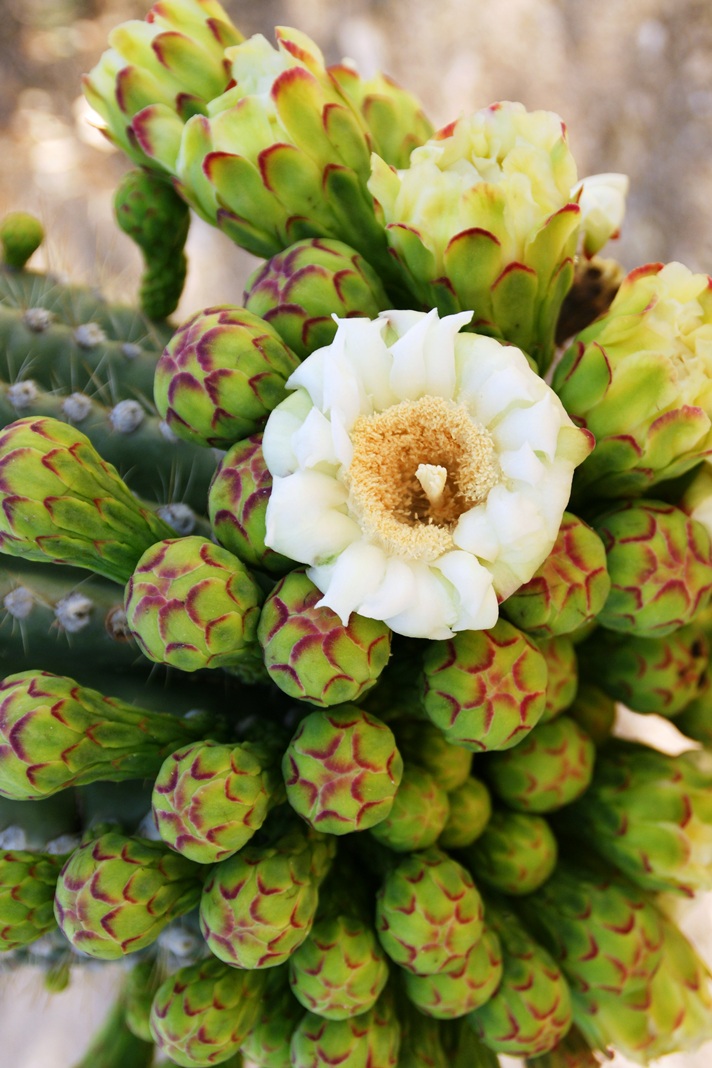
Here are 8 flower bud growing from one cladode (pad). There is a 9th bud on a second cladode. What is interesting about these pads are the needle shadows. Although thin, each provides some protection from the sun.
Cactus Closeup
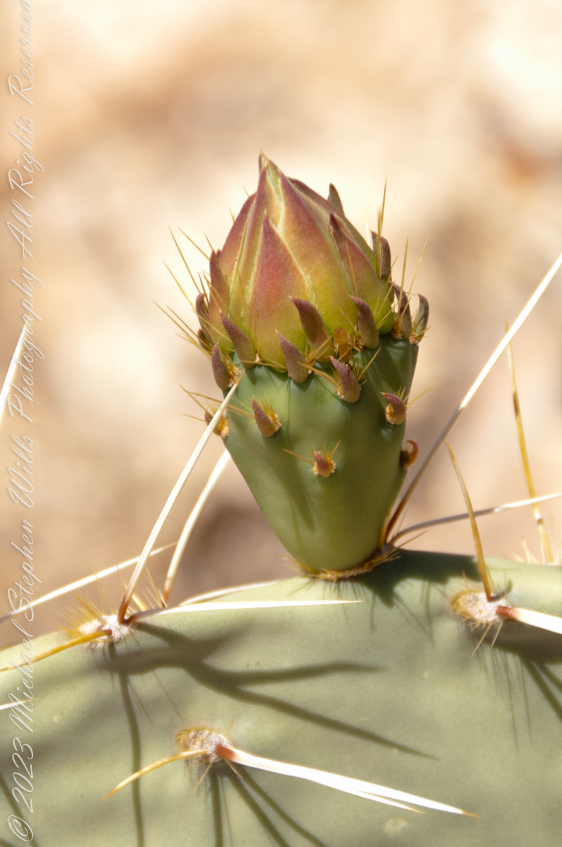
This delicate bud will develop into a flower and, then, into a cactus fruit (in spanish, tuna). The fruit retains those tiny spines, called glochids, which detach on the smallest contact. The pads are also covered with them.
Prickly pears are known for growing into thickets. The Cuban government created a “cactus curtain” of prickly pears around the Guantanamo naval base in the 1960’s, to prevent Cubans from escaping to refuge in the United States.
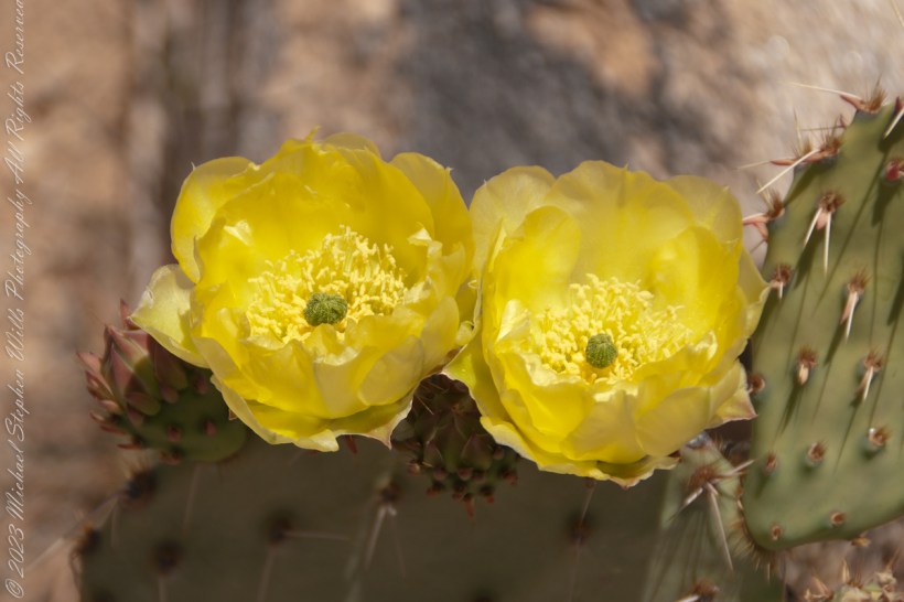
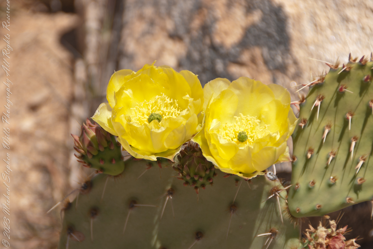
Cactus Flowers
Look closely at the anthers of these flowers. Each curls over when touched, depositing its pollen. The habit of prickly pears to grow together in thickets mean there are clusters of blossoms in springtime.
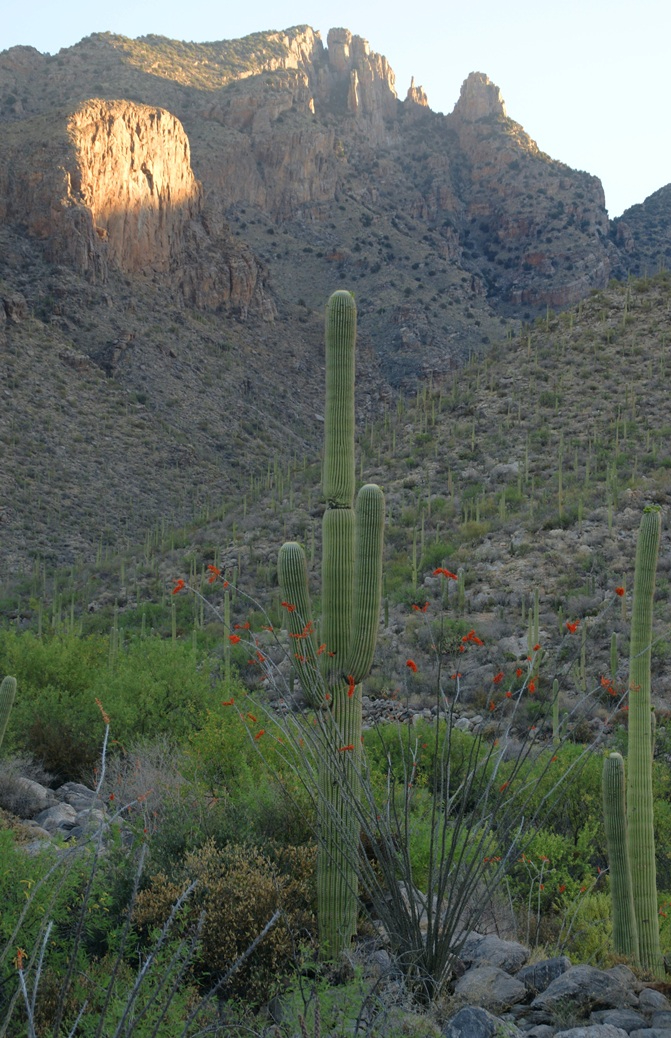
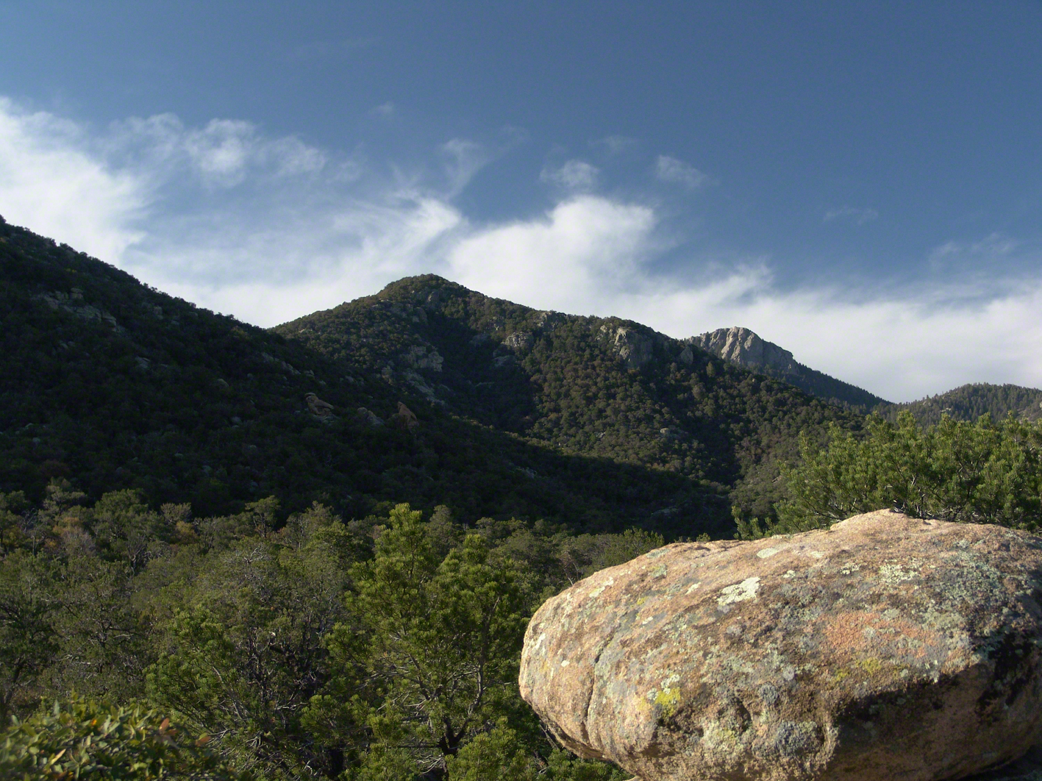
My visit to Finger Rock Canyon of the Santa Catalina Mountains filled two mornings. On the first morning, the subject was the lower canyon as morning light filtered over the eastern ridge.
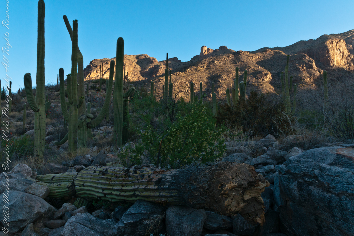
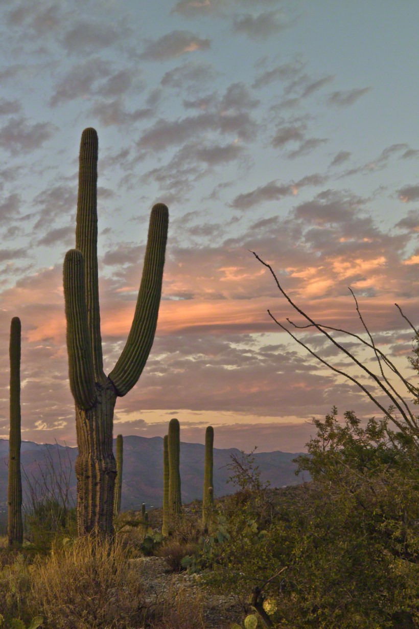
Early morning to the north / northwest looking over a 20-foot fallen Saguaro Cactus (Carnegiea gigantean), toward lower ridges of the Santa Catalina Mountains. The saguaro is among a stand of healthy fellows, some with new growth and flowers on the tips of arms and main columns. This giant must have grown over rock through 60 years. It was brought down when the roots weakened. Specimens that are more reliably rooted can live to 200 years.
A clump of brittlebush shrub (Encelia farinosa) grows from the same rock.
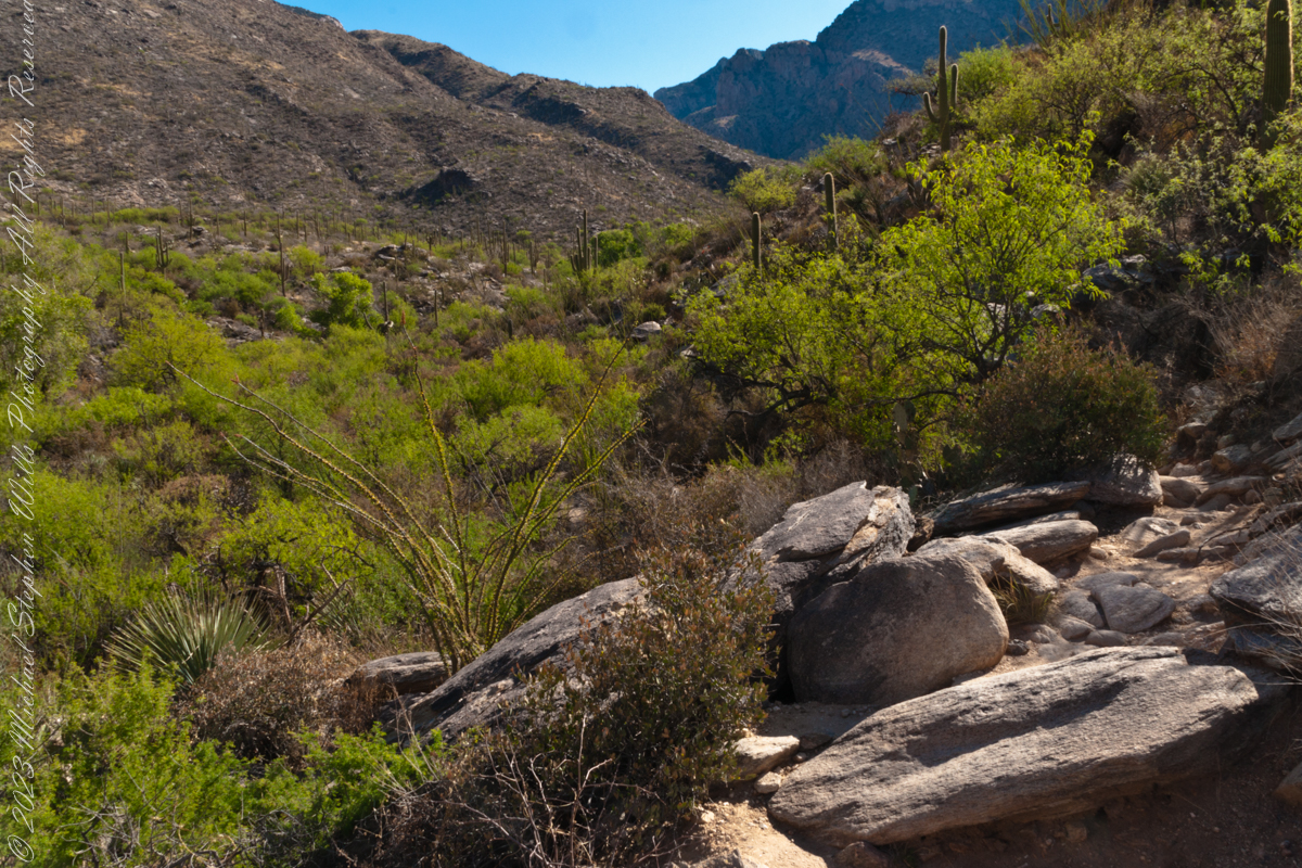
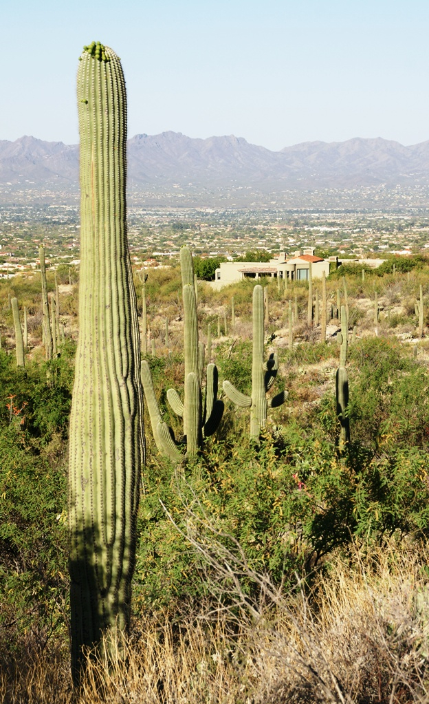
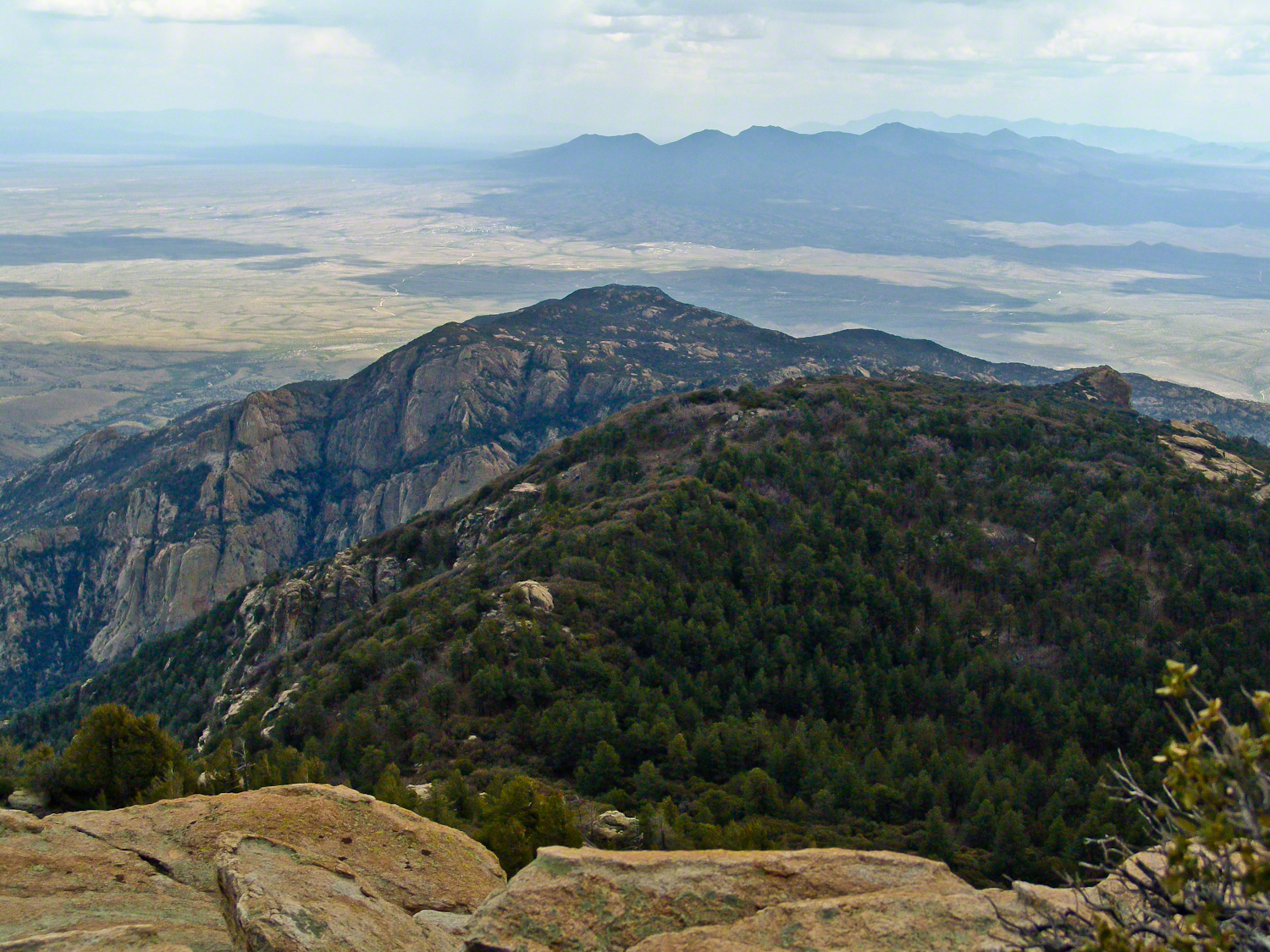
Pima Canyon is the next over, behind that near ridge which provides similar shade. Unlike Finger Rock Canyon, the Pima Canyon trail follows the western cliff and loses the shade much sooner. During our three-week trip, my wife, Pam, and I visited Pima in our first week.
These photos were taken between 6:20 and 7:00 am.
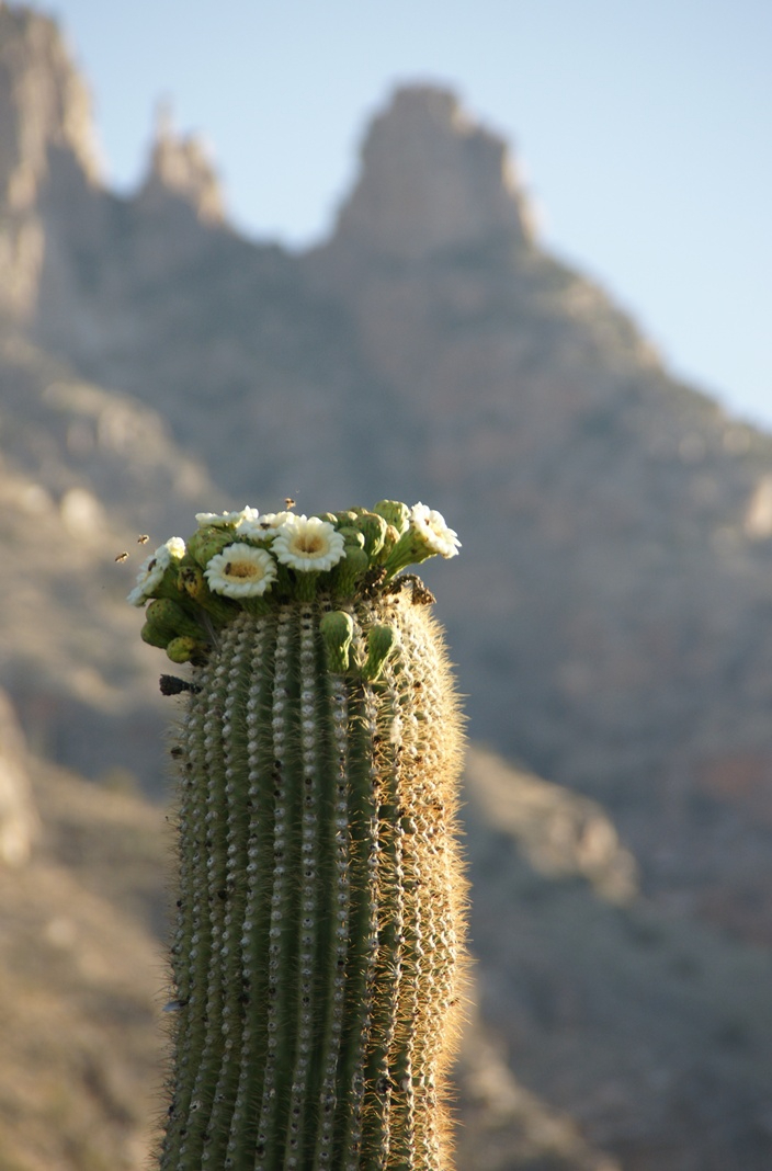
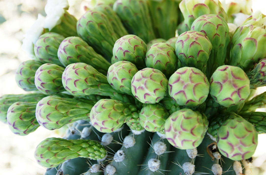
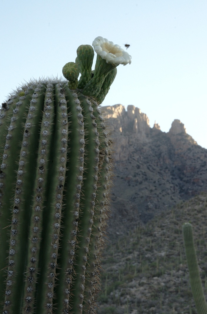
Along the trail I noticed a multitude of buds on the tip of selected saguaro arms. In a previous blog, there’s a photo of this same saguaro in the shade. The following series captures the one blossoming top just as the sun passes over the eastern, shadowing, ridge.
The same saguaro, two minutes later…….
Here is a portion of the saguaro forest, around 7 am with the lower canyon filled with light. There are a few foothill homes with west and southwest Tucson. The Tucson Mountains are in the distance.
These photographs are a continuation of blogs from two days’ exploration of Finger Rock Canyon of the Santa Catalina Mountains, southern Arizona. Here we explore the nature of the Saguaro blossom.
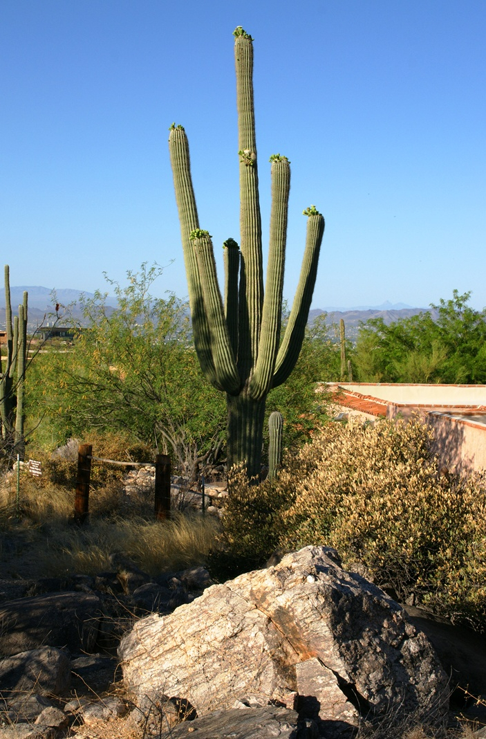
Saguaro flowers start as buds on the tip of the cactus body or arm. The specimen in the photograph below, growing in the yard of a foothills home on the border of federal land, is over 30 feet tall and, at the end of April 2011, buds are sprouting from every tip. Look closely for opening buds and full saguaro blossoms.
Flower buds grow only from some tips and around the center, along the sides, not from the point at the very end of the tip, from which the limb grows.
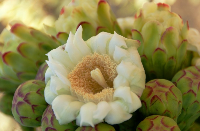
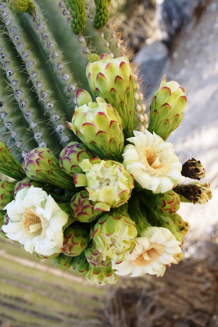
These buds first appeared mid-April and are here shown in the latter stages of maturity, prior to opening. Sometimes, the base of an arm weakens and the arm lowers close to the ground while remaining healthy. While descending the canyon I noticed this had happened to the arm of a particularly large specimen, an arm in full flower. This and the following photographs are from that arm.
I have read that each flower opens in the cool of the night and lasts only until the following afternoon. Here is a fully blossomed flower with a pair of opening buds.
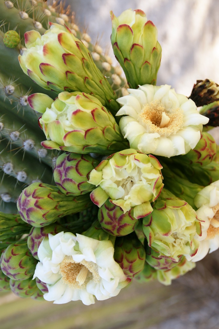
And more, from a different view of the same arm.
A saguaro flower in full bloom, having opened the previous night. This flower will last a single day. It will wilt in the heat of a single afternoon and close. In this brief time, flying animals will pollinate it. You can see numerous honey bees on the flowers, in a previous blog, “Saguaro Flowers in Finger Rock Canyon.”
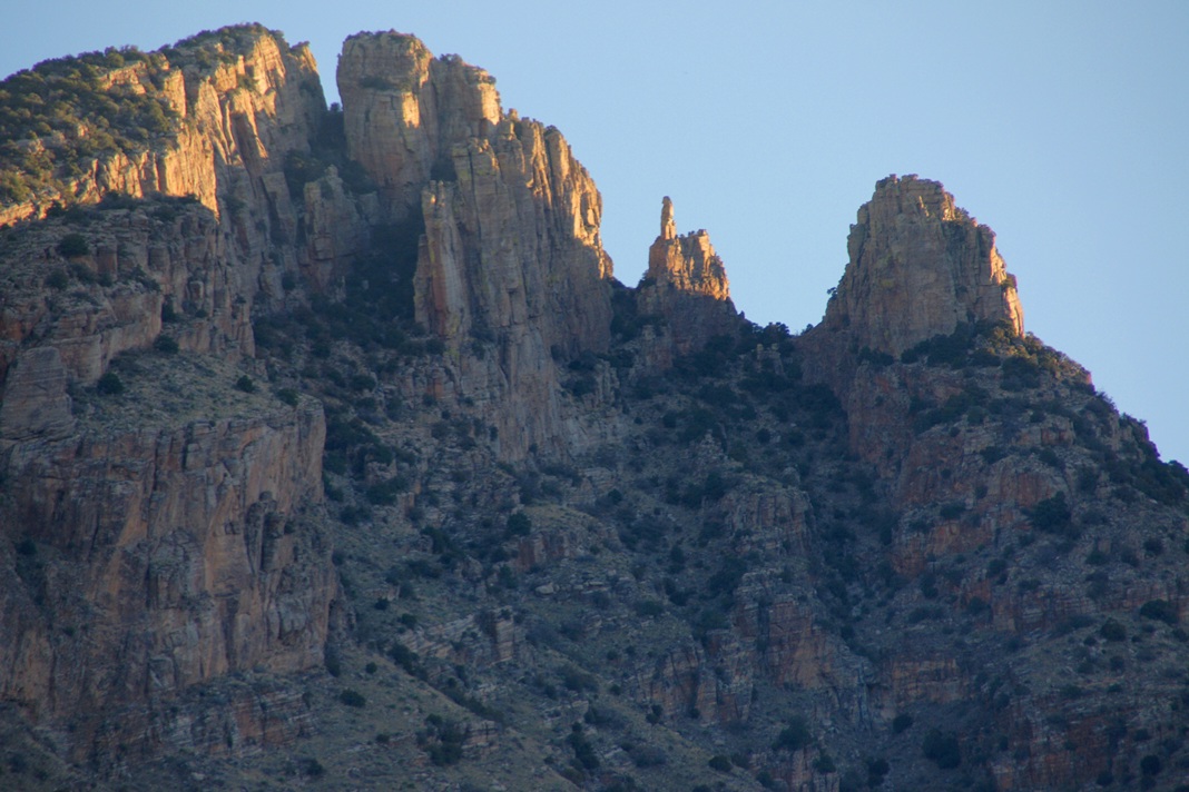
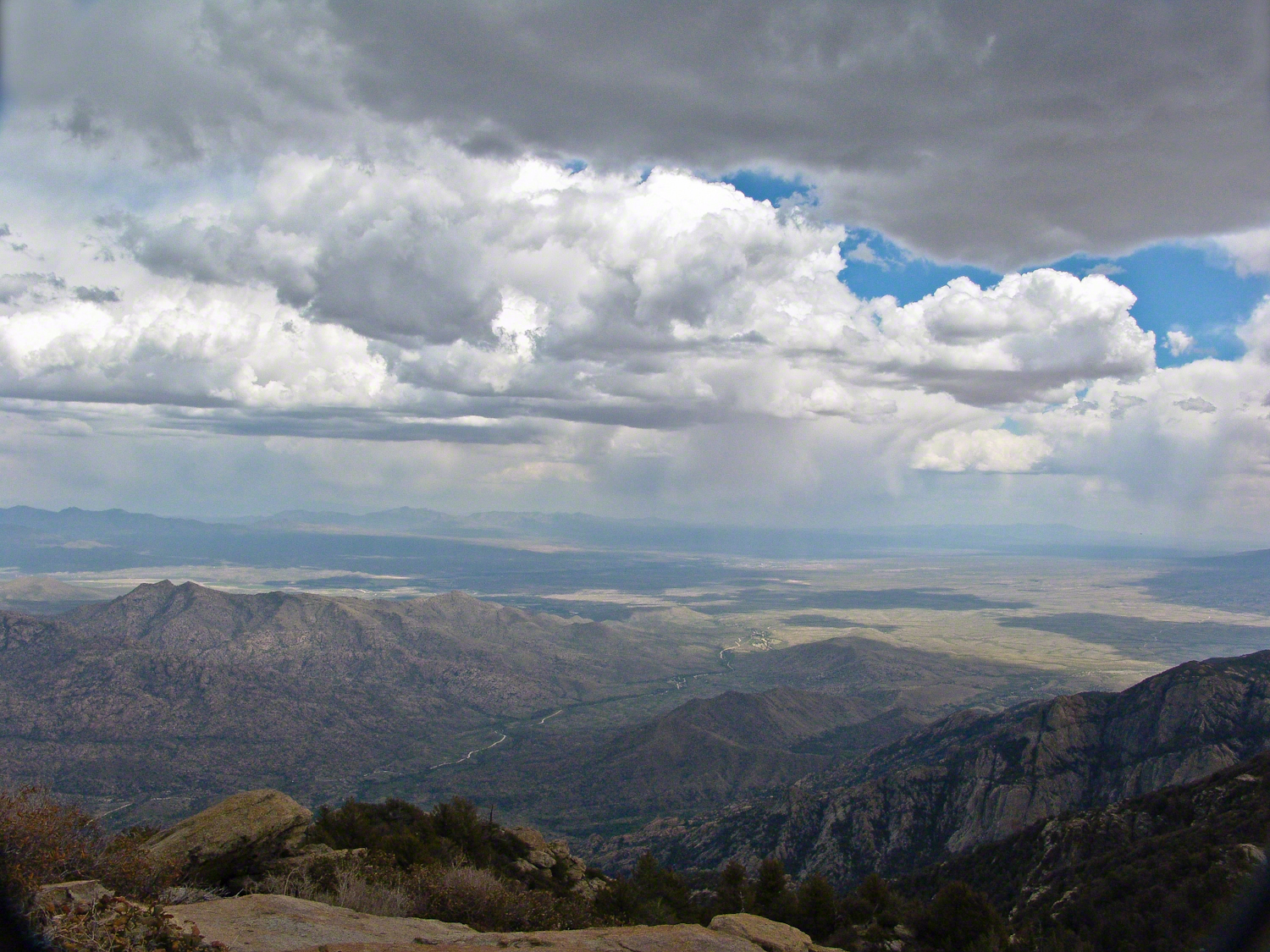
The perfection of April in Tucson is nowhere better than mornings spent in Finger Rock Canyon of the Catalina Mountains. Oriented on a north/south axis, the eastern cliffs shed a long shadow well past 9:30 am. For early risers such as me, this means no hat and cool hiking to the canyon head: the trail hugs the eastern cliffs.
These three shots were taken 5:30 – 6:00 am mountain time (Arizona does not follow daylight savings time except on the Navajo Reservation).
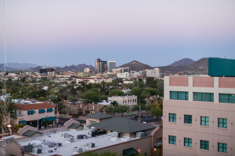
In town for a University of Arizona event I gazed from the Marriott before dawn to remember painting “A” mountain with the Sophos service club a half century ago. The tradition continues.
The view to the southwest includes University Neighborhood, downtown Tucson skyscrapers, “A” Mountain (painted red, white and blue November 2010), Tucson Mountains.
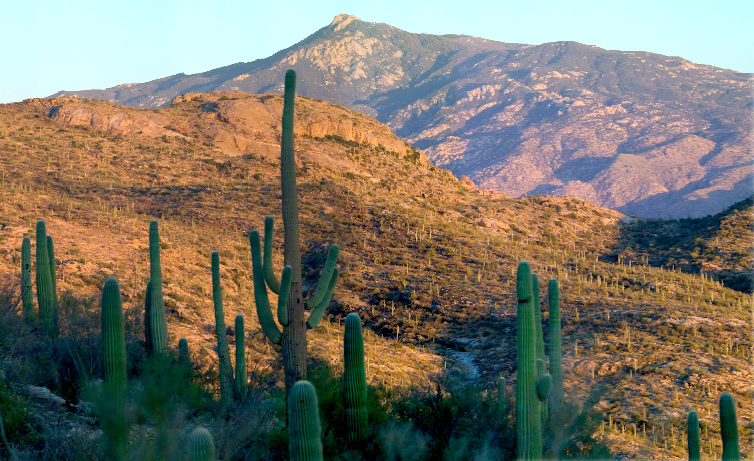
November is a special time for the ranges and basins of southern Arizona deserts. Climb a bajada of foothills, face west and wait for the sunset. That is what I did this day, November 3, 2005. East of Tucson the Saguaro National Monument at the foot of the Rincon Mountain Wilderness is where I parked, unpacked the photo gear and climbed the side of the Tanque Verde Ridge for a favorable view. Weather was pushing high level moisture from the west, clouds were developing.
You see here a shot from that session. In the distance, looking across Tanque Verde, are the Santa Catalina mountains. Months since the last rainfall, the giant Saguaros are using internal moisture reserves drawn up from a shallow root system, the flesh is less plump, the supporting structure of the ribs, always evident, are more pronounced. The last light catches these ribs in relief against a dramatic sky.
The Rincons are one of 42 Sky Mountain islands isolated from each other by the gradual warming and drying climate changes since the last ice age, 10,000 years ago. While this marvelous environment of oak and pine forests only accessible with much effort on foot, it is literally visible from every point of the Tucson valley and million human inhabitants.
Rincon is Spanish for corner, the mountains are called that from their shape enclosing a space on the west, northwest until recently used for ranching and is now falling into use for tract housing. The mountains themselves are reserved as wilderness, parts in the Saguaro National Park and the Coronado National Forest.
In the past 44 years I was lucky enough to visit the Rincon Wilderness interior three times, shouldering different style backpacks onto the mountain, walking different boots. The first, during college the 1970’s, a party of six left from the end of Speedway, up the Douglas Springs trail. The climb was an exercise in desert survival that several friendships did not survive, replace by new friends met on Mica Mountain. I have no photographs from that experience, only memories and the backpack.
Reconnecting with Arizona in 2004, thirty one years after that first experience, I took no chances. My first attempt on Rincon Peak was a success. Risk and effort were reduced, not eliminated by hiring a guide for the four day trip. We made it to Rincon Peak via the Turkey Creek Trail out of Happy Valley, climbing a mountain buttress, views ever widening and lengthening.
These are some photographs from that experience and a landscape photograph of the peak at sunset, taken the following year.
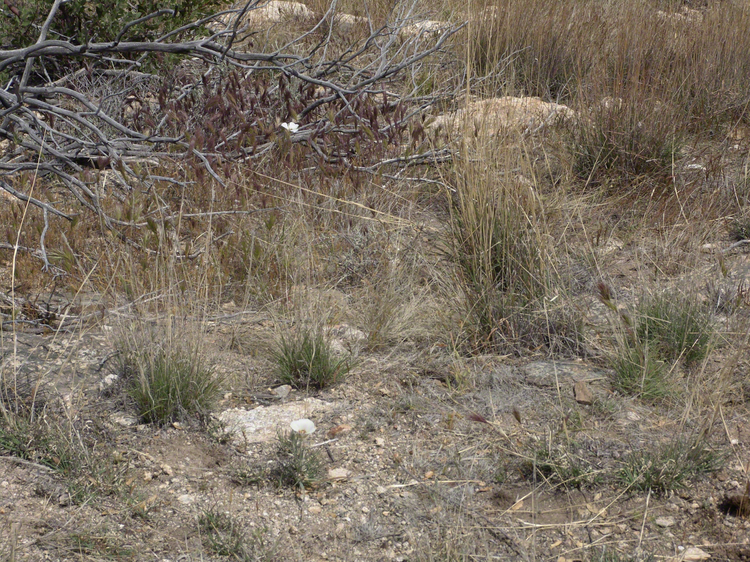
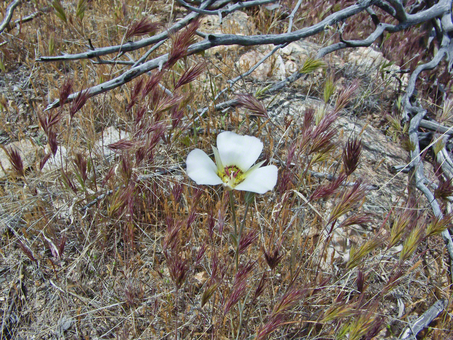
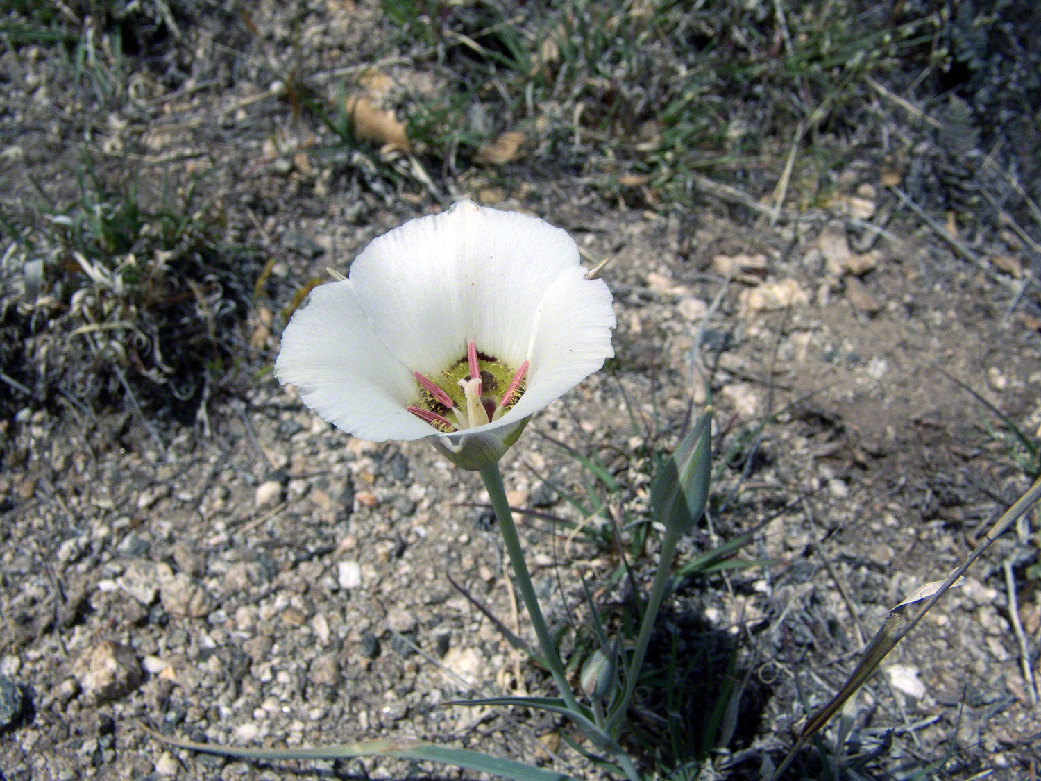
Sego Lilies bloom among a stricken oak and drying grasses on the Turkey Creek trail. This is an overview of the environment, it is the winter rains that trigger the bloom.
We paused while I unpacked my gear to capture Sego Lilies growing along the Turkey Creek Trail.
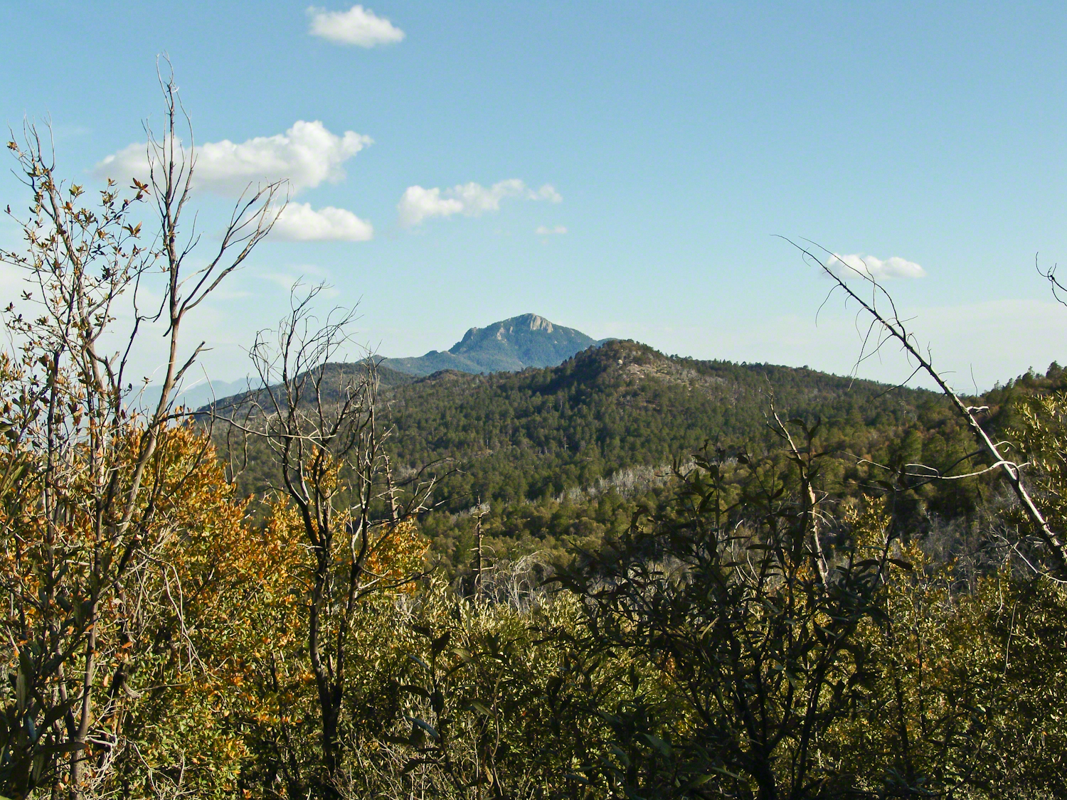
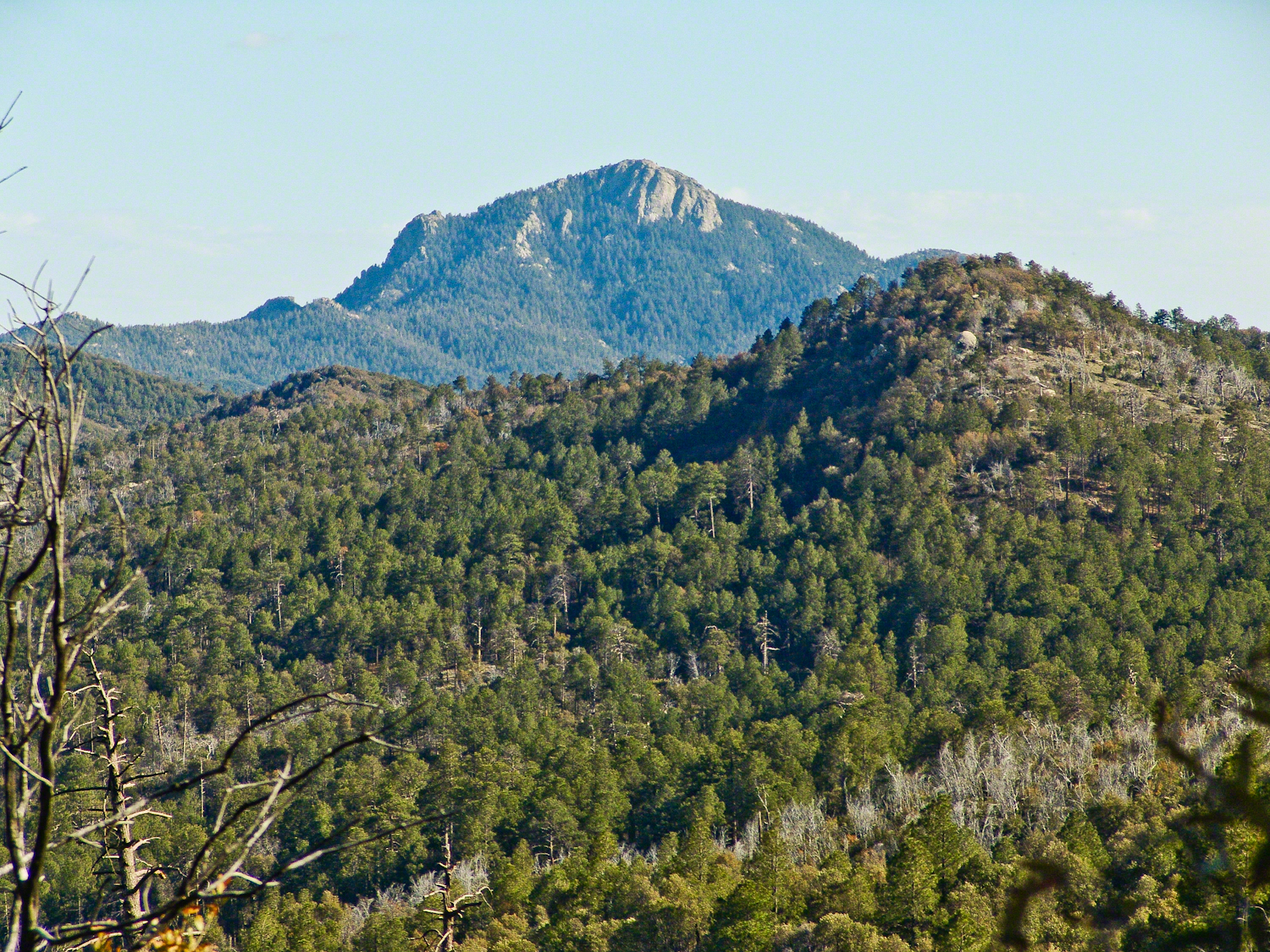
Deer Head Spring, at the top of Turkey Creek Trail was a moist spot with no accessible water when we reached it April 27, 2004. With the remains of a gallon of water each we needed to press ahead to Heartbreak Ridge and climb into Happy Valley Saddle were, thankfully, the creek was low and full of algae but usable. Here are my first views of Rincon Peak, looking across the aptly named Heartbreak Ridge and Happy Valley Saddle.
The view to south from Rincon Peak. The white rocks at lower right forms a Valley of the Moon wall. San Pedro River valley at the root, Mae West Peaks at left margin, Dragoon Mountains with Cochise Stronghold center. Taken around 12:30 on April 28, 2004 as a thunderstorm approached.
The Rincon Peak view looking south, southwest over the Valley of the Moon to the eastern Tucson Valley and the Sky Islands the Whetstone Mountains (Apache Peak), behind are the Santa Ritas. The works of man are overpowered by sky, rock, distance.
We made a hasty departure in front of the thunderstorm. It was a touch and go decision to attempt the peak that day, we made it with moments to spare.
April 29, 2004 the morning after reaching Rincon Peak I set up the tripod near our Happy Valley Saddle camp to capture Rincon Peak in early morning sunlight.
The day we descended to the X9 Ranch via the Rincon Creek trail. My guide’s grandfather had a homestead at the X9 and his access to the trailhead through private lands opened this route for us. This is a photograph of sunset on Rincon Peak from the X9 ranch. I am looking east from the Rincon (Spanish for corner) made by the massifs Rincon Peak, Mica Mountain and Tanque Verde ridge.
The evening of November 2, 2006 I climbed the Saguaro National Park, East, Tanque Verde trail for about 30 minutes to reach this view of Rincon Peak and waited until just before the sun set behind the Tucson Mountains for this shot. Then hiked back to the car in twilight. In my hurry, I tripped on a stepped turn and dove headfirst into a large prickly pear. It was a very painful experience and I regretted damaging the cactus and the loss of and good hiking shirt. There were large spines in my face and tiny, pesky spines covered my chest and back. The large spines are not barbed and come right out. I needed to visit a physician to remove them.
Copyright 2021 Michael Stephen Wills All Rights Reserved
Here is a postscript for my retrospective diary of the day I created my print “Ocotillo Sunset.” You can visit “Ocotillo Sunset” in my Online Gallery by clicking on any photograph .
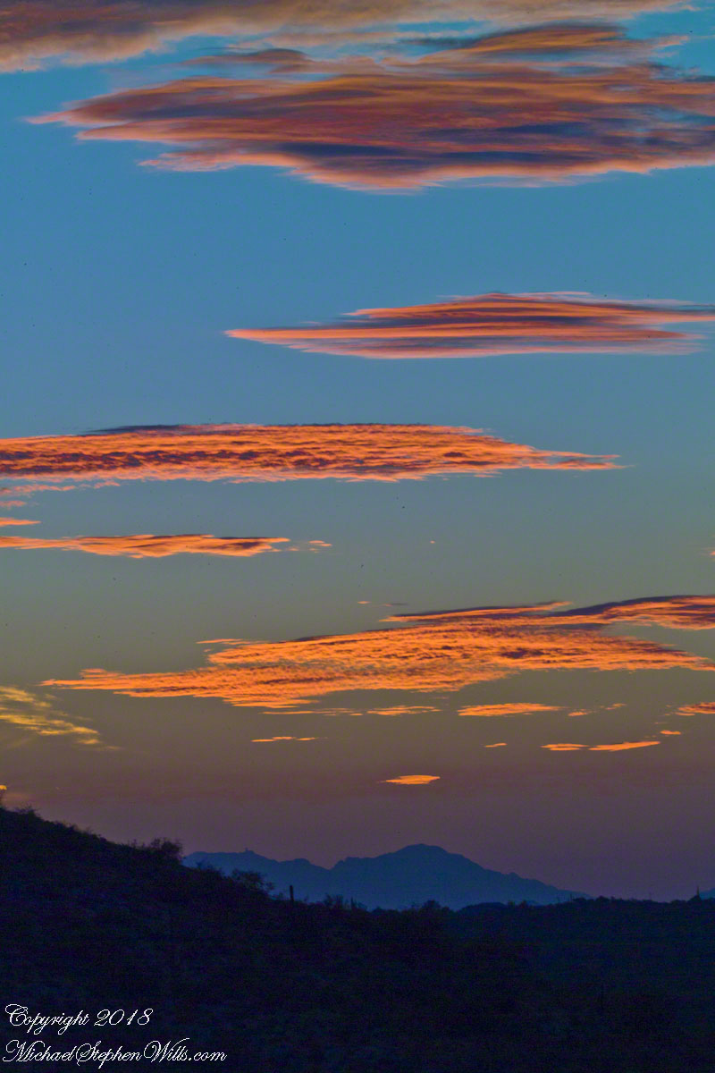
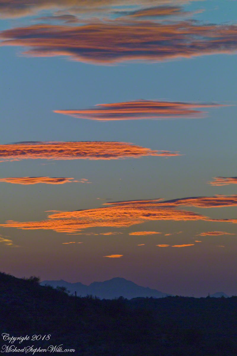
In near total darkness, the last sunlight only enough for the far western sky, these are the last shots of this series.
Click photograph to view Ocotillo Sunset in my Online Gallery
Afterglow I
Click photograph to view Ocotillo Sunset in my Online Gallery
Afterglow II
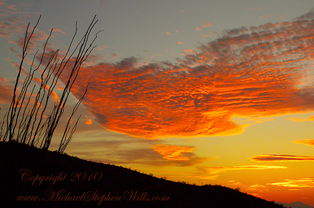
The final result of the day’s work, “Ocotillo Sunset.”
Click photograph to view Ocotillo Sunset in my Online Gallery
November is a special time for the ranges and basins of southern Arizona deserts. Climb a bajada of foothills, face west and wait for the sunset. That is what I did this day, November 3, 2005. East of Tucson the Saguaro National Monument at the foot of the Rincon Mountain Wilderness is where I parked, unpacked the photo gear and climbed the side of the Tanque Verde Ridge for a favorable view. Weather was pushing high level moisture from the west, clouds were developing.
You see here a shot from that session. In the distance, looking across Tanque Verde, are the Santa Catalina mountains. Months since the last rainfall, the giant Saguaros are using internal moisture reserves drawn up from a shallow root system, the flesh is less plump, the supporting structure of the ribs, always evident, are more pronounced. The last light catches these ribs in relief against a dramatic sky.