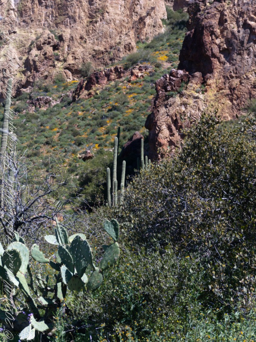
Step into the heart of the Sonoran Desert with me, where the saguaro cactus stands as a timeless giant, a symbol of resilience and beauty. This majestic sentinel of the Southwest is not just a plant; it’s a vibrant ecosystem and a cultural icon, embodying the spirit of endurance. Let’s explore its centuries-long journey, its role as a haven for desert wildlife, and its deep significance to the indigenous peoples. Join me in celebrating the saguaro’s enduring legacy, a narrative of survival and the profound beauty of life in the harshest conditions.
Ferns, ancient plants with unique reproduction strategies and ecological significance, adapt to diverse environments while contributing to overall biodiversity and human culture.
In the vast tapestry of the plant kingdom, ferns occupy a unique and enduring place. These ancient plants, often overlooked in favor of their flowering counterparts, have a fascinating and seemingly eternal existence that spans millions of years. Ferns, with their lush green fronds and distinctive reproductive mechanisms, offer us a glimpse into the enduring legacy of life on Earth and the remarkable adaptations that have allowed them to persist through the ages.
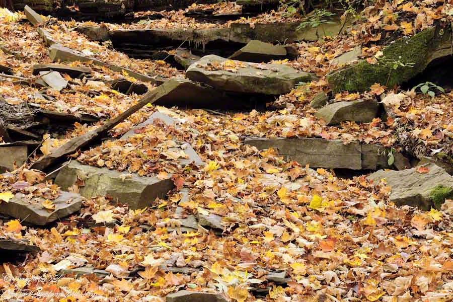
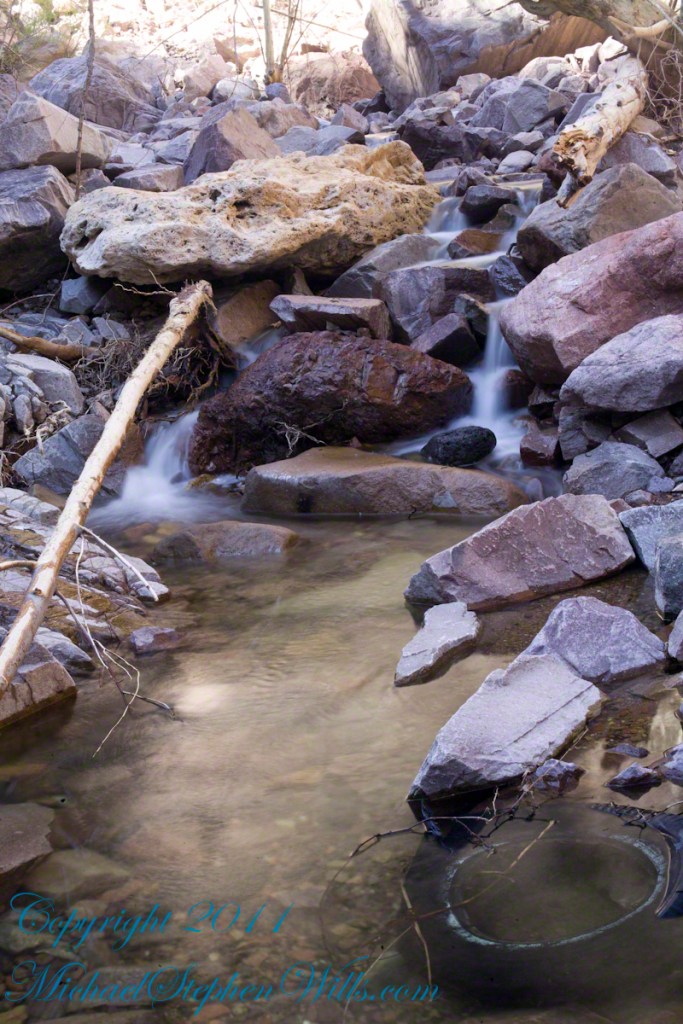
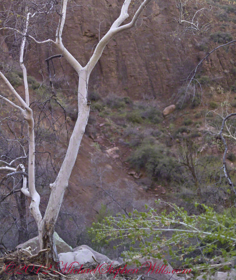
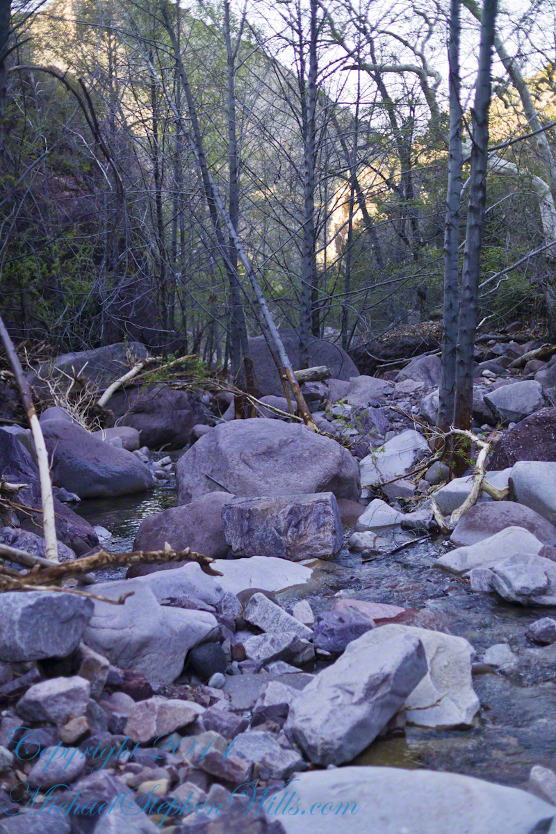
Walking Up A Leaf Strewn Dry Creek to find….
Ferns belong to the group of plants known as Pteridophytes, which evolved more than 360 million years ago during the late Devonian period. Their evolutionary history predates the appearance of flowering plants, making ferns some of the oldest living organisms on our planet. This remarkable longevity raises the question: how have ferns managed to survive and thrive for so long?
One key to the success of ferns lies in their unique reproductive strategy. Unlike flowering plants that produce seeds, ferns reproduce via spores. These small, dust-like structures contain the genetic material necessary for ferns to reproduce. When mature, ferns release spores into the environment, where they can be carried by the wind or water to new locations. Once a spore finds a suitable environment, it can germinate and develop into a new fern plant.
The spore-based reproduction of ferns is not only ancient but also highly efficient. It allows ferns to colonize diverse habitats, from moist, shaded forests to arid deserts. Additionally, ferns can form extensive networks of underground rhizomes, which are creeping stems that give rise to new fronds. This vegetative propagation further contributes to their resilience and adaptability.
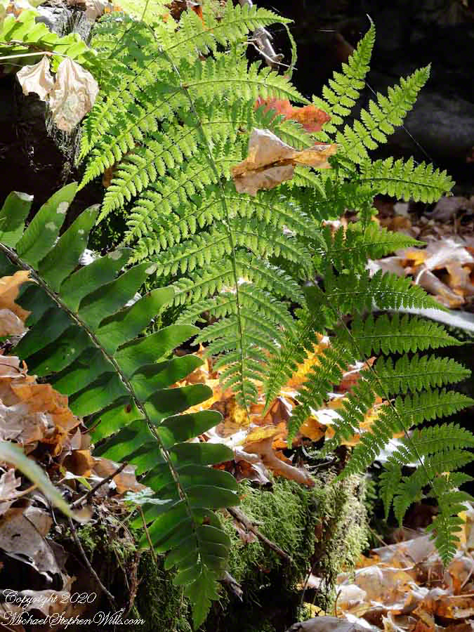
Ferns have also developed a range of adaptations that enable them to thrive in various environmental conditions. Some fern species, such as the resurrection fern (Pleopeltis polypodioides), can endure extreme desiccation. When conditions are dry, these ferns curl up and appear dead, but they can quickly revive and unfurl their fronds when moisture returns. Backpacking through mountainous Arizona wilderness I encountered small ferns growing in the shade of rock ledges, maybe this was Phillips Cliff Fern (Woodsia phillipsii). My guide called it “Ridgeline Fern” and claimed it was important for desert survival, could be eaten in extremis situations. This remarkable ability to withstand drought and promote human survival is a testament to the tenacity and usefulness of ferns.
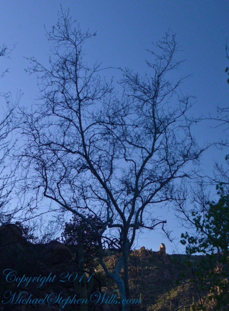
...a backlit fern frond.
Another intriguing aspect of ferns is their mutualistic relationship with mycorrhizal fungi. These fungi form symbiotic associations with fern roots, aiding in nutrient absorption and enhancing the fern’s ability to thrive in nutrient-poor soils. This partnership has likely contributed to the fern’s ability to colonize a wide range of habitats and compete with other plant species.
While ferns have proven to be resilient survivors, they have also played a crucial role in shaping Earth’s ecosystems. Ferns are often early colonizers in disturbed or newly formed habitats, and their presence can help stabilize soils and create conditions suitable for the establishment of other plant species. In this way, ferns contribute to the ecological succession and overall biodiversity of ecosystems.
Beyond their ecological significance, ferns have captured the human imagination for centuries. Their delicate and intricate fronds have inspired art, literature, and even garden design. Many garden enthusiasts cultivate ferns for their ornamental beauty and unique charm.
In conclusion, the eternal life of ferns is a testament to the remarkable adaptability and resilience of these ancient plants. Their longevity, dating back millions of years, serves as a reminder of the enduring nature of life on Earth. Ferns have evolved unique reproductive strategies, adaptations to various environments, and mutualistic relationships that have allowed them to persist and thrive. Whether they are serving as pioneers in newly formed habitats or gracing our gardens with their elegance, ferns continue to capture our fascination and enrich the natural world. Their legacy reminds us of the intricate and interconnected web of life that has persisted on our planet through the ages.
Copyright 2023 Michael Stephen Wills All Right Reserved MichaelStephenWills.com
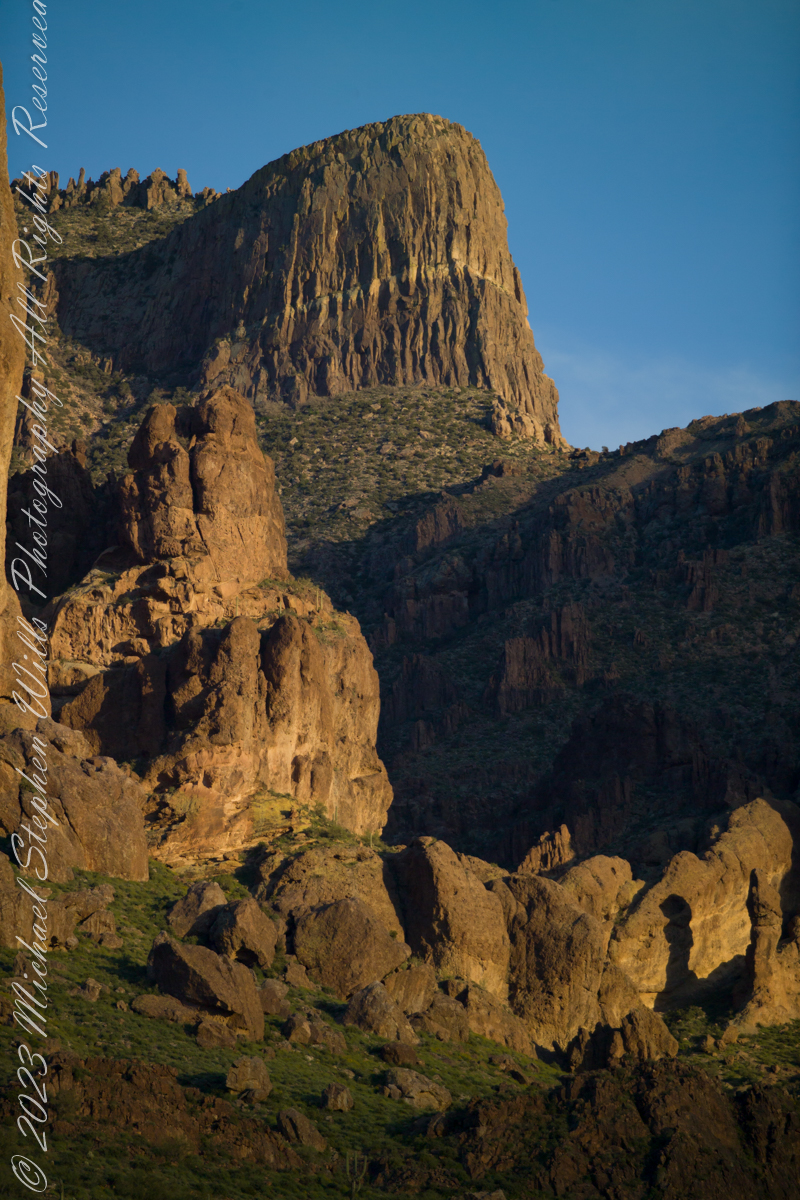
The mountain was formed by a series of volcanic eruptions between 20.5 and 18 million years ago. The west face of the mountain is composed of dacite lava and rhyolitic tuff. The overlying tuff was deposited during an eruption which created a collapse caldera bounded by faults. Dome resurgence reactivated these faults, causing uplift of the caldera floor which juxtaposed the softer tuff and more resistant dacite. Differential weathering caused the outer tuff to erode faster, leaving the dacite cliffs exposed and creating the prominent mountain visible today.
The Flatiron, the mesa-like projection above us in this view, is long solidified dacite lava. The word dacite comes from Dacia, a province of the Roman Empire which lay between the Danube River and Carpathian Mountains (now modern Romania and Moldova) where the rock was first described. Lost Dutchman State Park, Apache Junction, Maricopa County, Arizona
Reference: Wikipedia “Superstition Mountain” and “Dacite Lava.”
Copyright 2023 Michael Stephen Wills All Rights Reserved
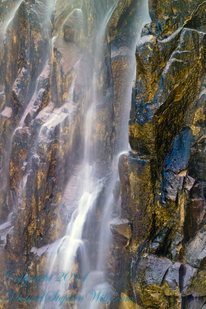
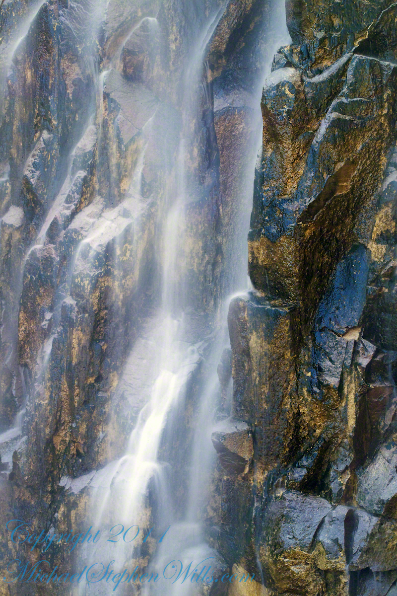
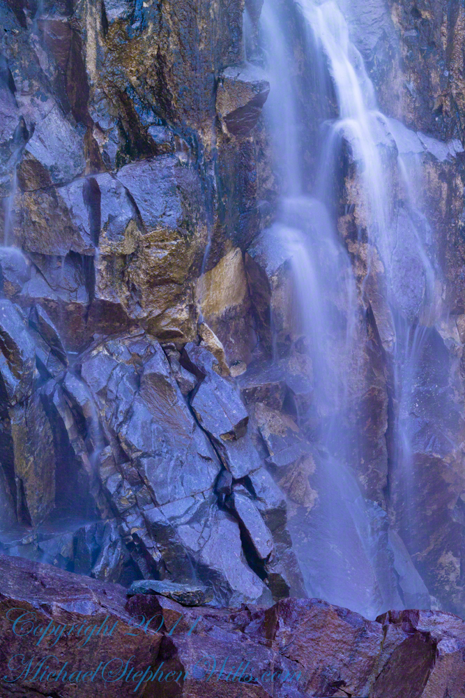
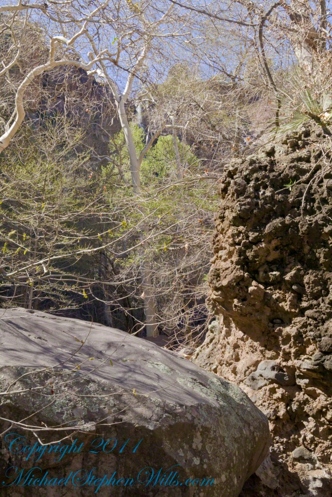
The canyon below 110 foot Reavis Falls is a wild place of transcendent beauty.
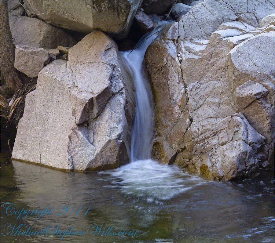
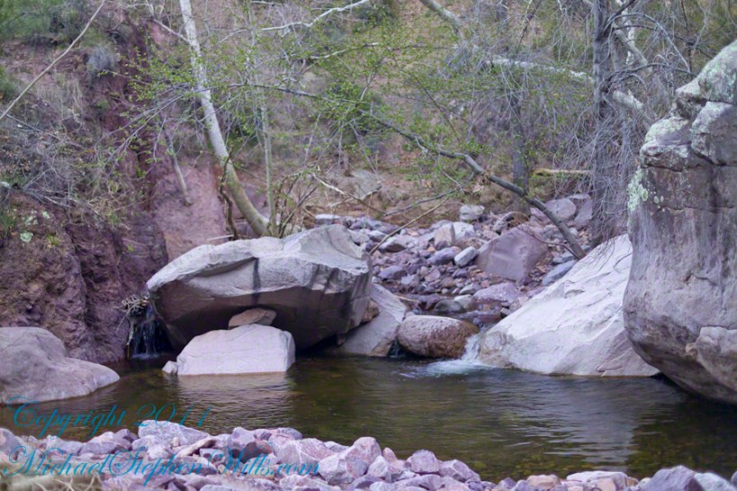
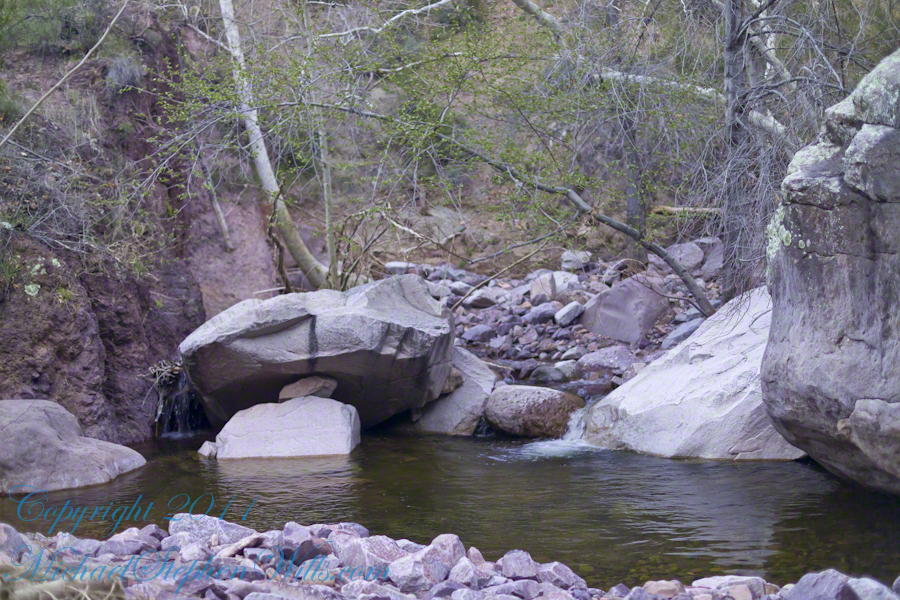
With the afternoon in front of me, the trip back to camp was a slow pleasure. On the way in, I noted several stopping points to capture photographs. Here a natural rock sluice offers a foot tall waterfall, mirroring Reavis Falls, bracketed by white igneous stone.
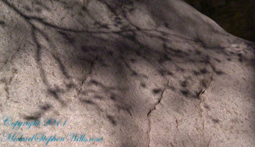
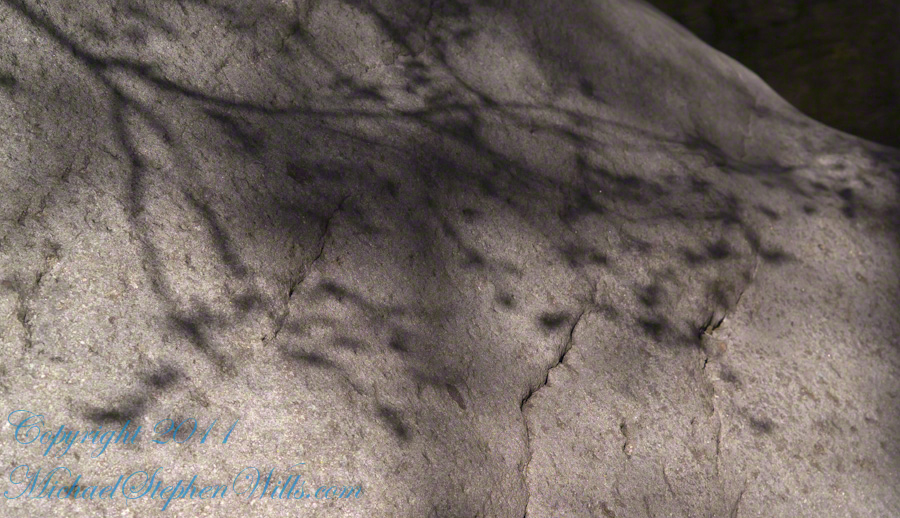
This same stone offers a screen, the bright spring sun throwing the sparse leaves into sharp relief.
Reaching Reavis Falls, once you find the canyon mouth, is three-fourths of a mile of boulder hopping and bushwacking over and around landslides, deep pools and fallen trees. Odds are you will be the only person in the canyon for weeks, if not months. Expect to be surprised. In this chapter you will (finally) visit the falls themselves.
A Camp in the Canyon
Click me for the chapter about the environment around the mouth of Reavis Canyon below the falls.
The Last Mile
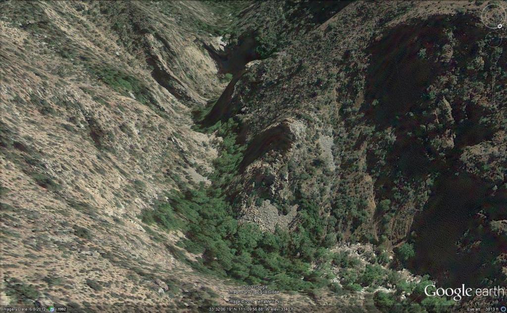
Here is an overview of the last third mile of Reavis Canyon. You can see the wall of the falls nestled in the folds of ridges towards the top, just off center.
On the lower right is a large landslide and, below there, it is complete chaos.
The vegetation grows shoulder to shoulder with interleaved branches. You will not get through there. The solution is to find a way around, usually over and around house-sized boulders.
The image was captured from Google Earth
After almost two hours of picking my way, there was a flicker of light. The fall waters were sparkling in the sunlight high above the cottonwood trees, in full Mach bloom, and the still leafless Arizona Sycamores.
This was my view of Reavis Falls from the canyon on a March day before the Arizona Sycamores have leaved. The falls are the tiny patch of white to the left of midline where the earth meets the sky. Jumbles of infallen boulders and thick growth of sycamores, oaks and fully leaved cottonwoods cloak the falls.
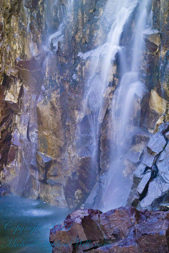
Another 30 minutes of canyoneering brought me to the foot of the falls.
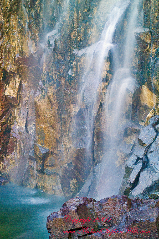
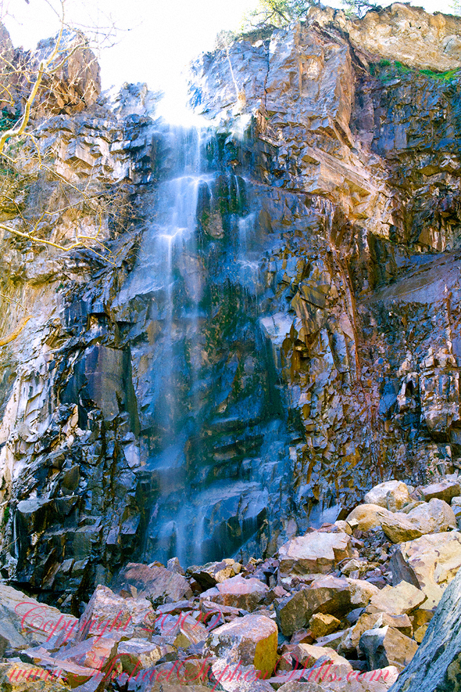
At the Foot of Reavis Falls
Looking up at Reavis Falls from a 20 foot tall mound of talus.
These are boulders washed down at flood time.
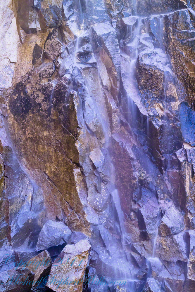
The rock wall is thick with microorganisms, fungi and mosses.
After clambering around the talus pile I found this angle….
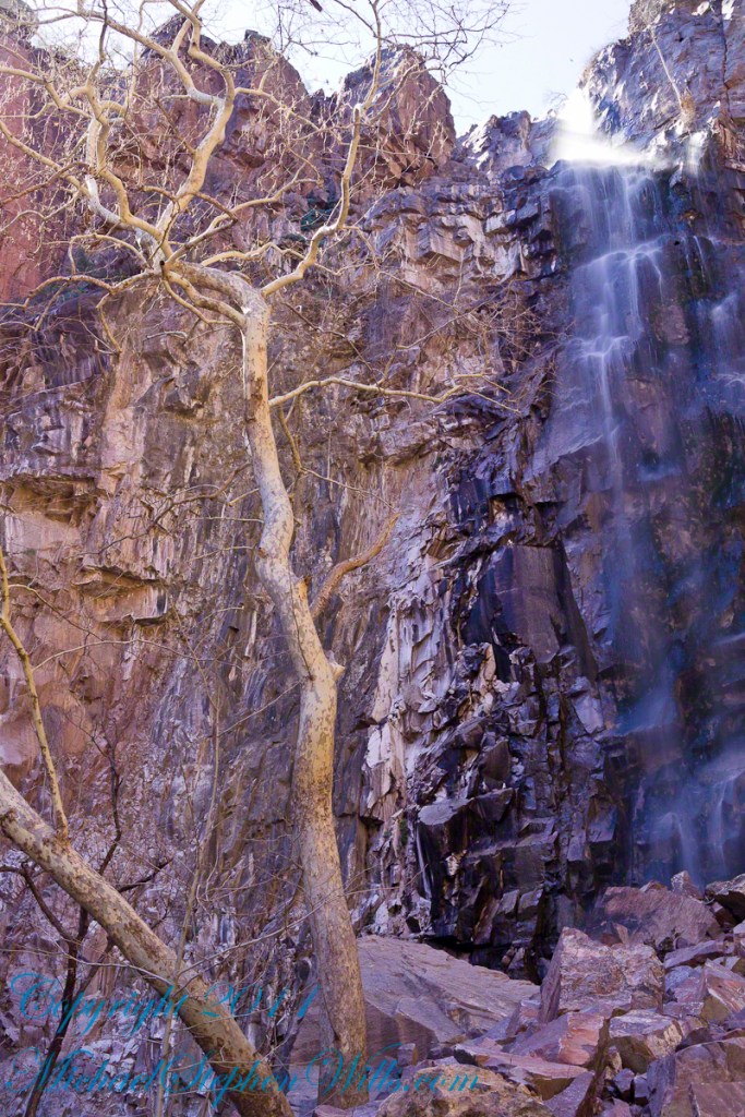
An Arizona Sycamore, before the spring leafing, at the Foot of Reavis Falls
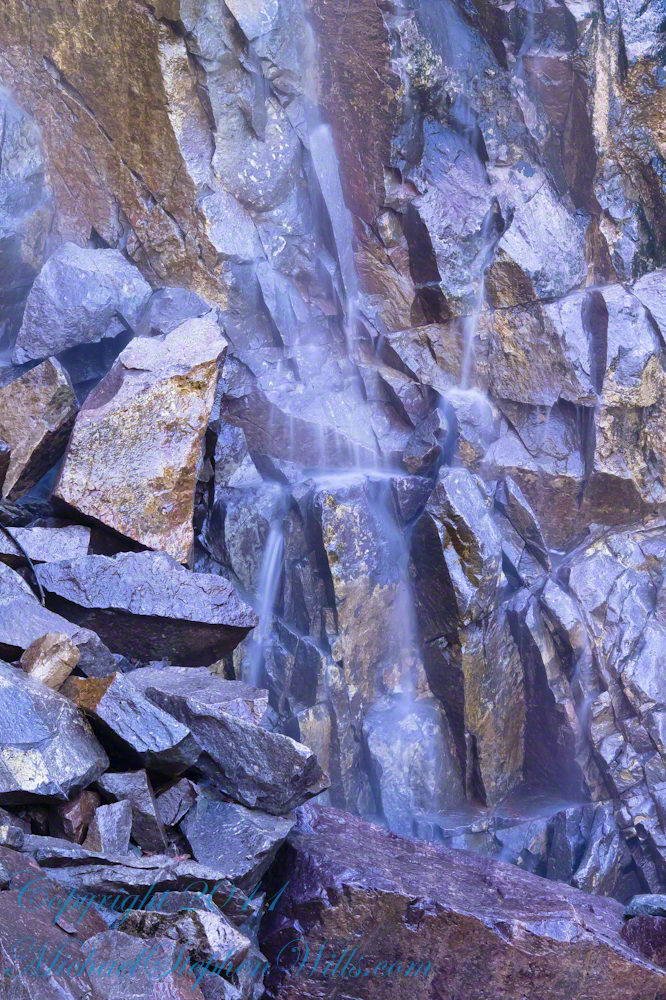
Talus at the Foot of Reavis Falls
The Reavis Falls talus is large boulders carried down Reavis Creek and washed over the falls at flood time as well as blocks fractured from the cliff face. You can see the base of the Sycamore from the previous photograph.
The falls are formed where Reavis Creek flows over a solid mass of rock. The talus is composed mostly of this red rock. From the edge of this cliff to the base, where the falls hit the canyon floor, is all of 140 feet. This is a far as you can proceed into the canyon without some serious climbing skills.
It is possible to climb around the canyon by climbing up the ridge from which I captured the Cedar Basin Hoodoos. See my posts below for this location (you need to work it our for yourself).
This is NOT the last post of the series. From here I will focus on the beauty of Reavis Falls and the canyon that holds them.
It was a four-day expedition so there are a few chapters covering the approach to the Falls:
The Superstition Wilderness was born from volcanic eruption and in some places (Peters Mesa) the earth still rumbles.
Here in Reavis Canyon it is the huge spring runoff that builds the environment, grinding and scouring the canyon. In my chapter The Mouth of Reavis Canyon is the story of this aspect of the canyon.
The history of this spot is written on these volcanic and igneous rocks and boulders, the uprooted tree roots and fresh water.
The tire must have washed down from Reavis Ranch.
A Canyon of Wonder and Beauty
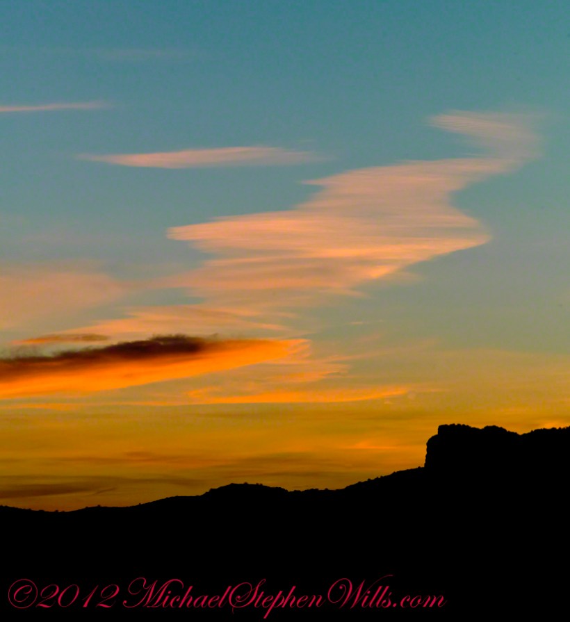
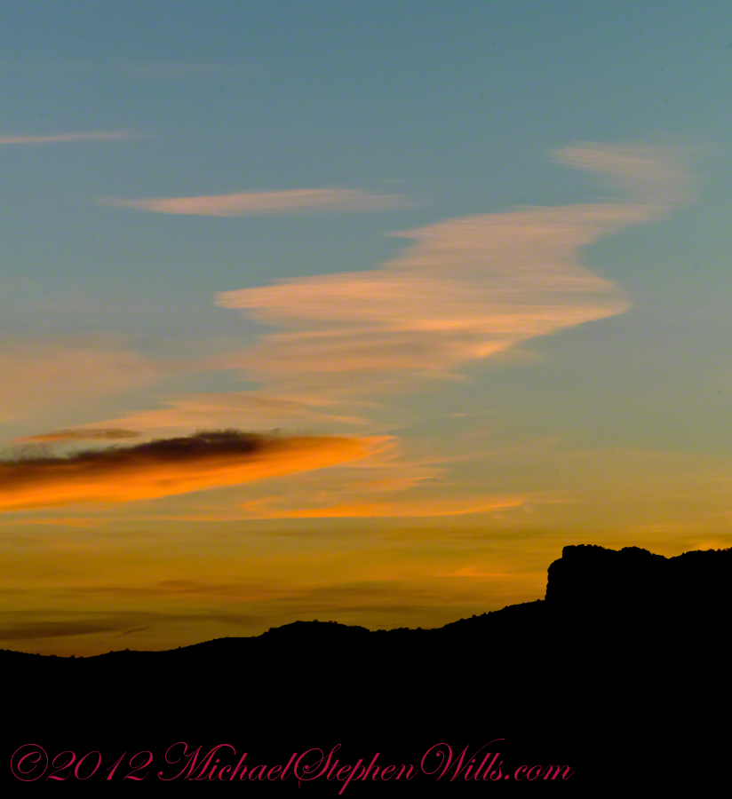
In this chapter I present, in the header, the lovely dawn sky of that day, and a tiny corner of a rock jumble in Reavis Creek. There is a large format version of the sky in my previous post, “The Mouth of Reavis Canyon.”
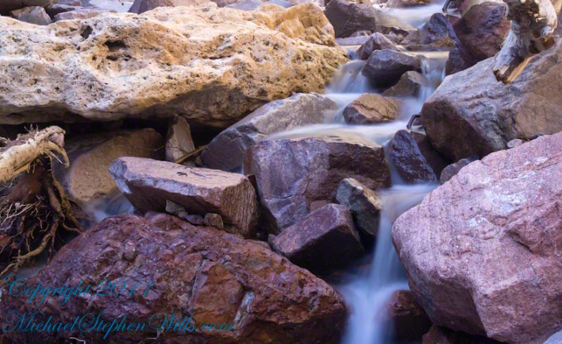
Rivulets and Rocks
Copyright 2023 Michael Stephen Wills All Rights Reserved
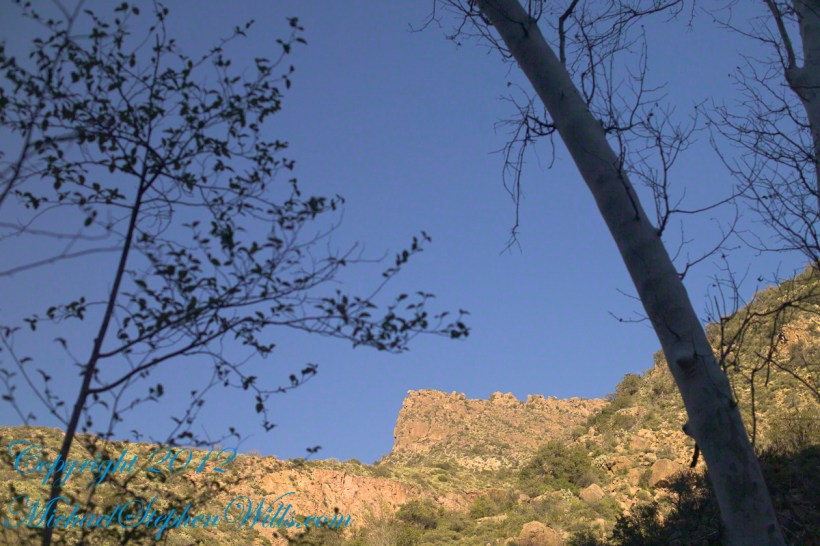
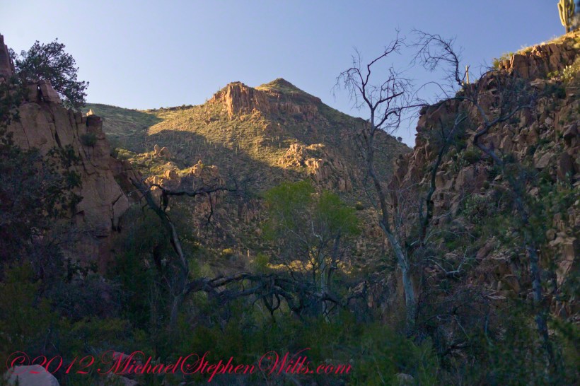
Here is the same view, in daylight. As I hiked toward the canyon mouth below Reavis Falls, looking up I saw this prominant cliff against the sky.
Here is the path I took toward the falls. The campsite is to the lower right, the falls are toward the center and left. My approach to the camp is on the right, moving toward the top. For another view of this location see Reavis Canyon Camp.
The mouth of Reavis Canyon below the falls is choked with vegetation and infallen rocks and boulders. The far slopes are thick with the poles of young saguaros. There are hoodoos, as well. In the photograph, below, one hoodoo is catching morning light. See the chapters Hoodoos on the Descent to Reavis Falls and Cedar Basin Hoodoos for more views of the hoodoos around Reavis Falls.
Hoodoos visible from the mouth of Reavis Canyon below the falls. Look toward the far slope.
Flood damage in Reavis Canyon below the falls. Note the scouring at the base of these trees and the broken limbs. This is NOT a place to be in spring thaw.
Massive spring flooding scours the canyon floor.
Flood damage in Reavis Canyon below the falls.
There is beauty to be found, as well. Freshly fallen rough rocks contrast with water smoothed boulders and the water surface.
Copyright 2023 Michael Stephen Wills All Rights Reserved
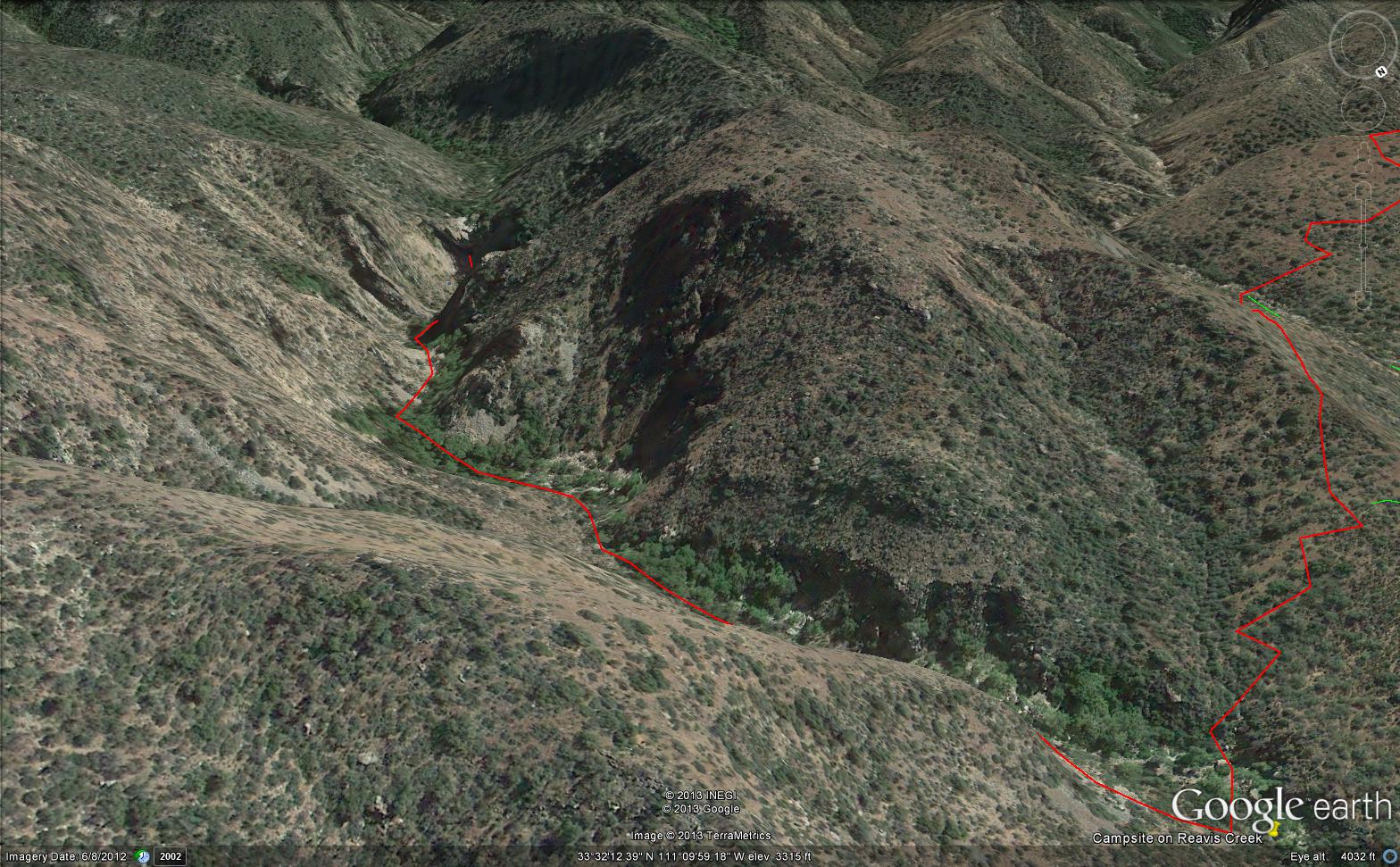
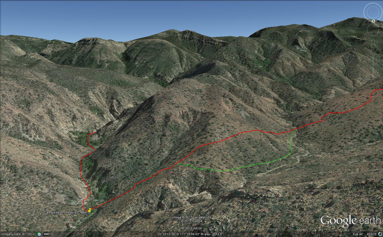
Here is an overview of my route through Cedar Basin on the way to Reavis Falls. There are two paths in the following image from Google Earth. The red path brings you into Cedar Basin and straight up a ridge and down to the campsite. The red path is incorrect in the approach to the ridge and, rather than repaint the path, I created the green path as the gradual and accurate description of how I climbed to the ridge point where I captured the photographs Hoodoos on the Descent to Reavis Falls.
No Path to Reavis Falls
You need to understand there is NO path through this terrain. It is necessary to follow a faint trail marked out by the footsteps of those before you and an occasional rock cairn placed at the most difficult points. The following image is misleading in that what looks like a road next to my green path is actually a creek bed from the Lime Mountain spring.
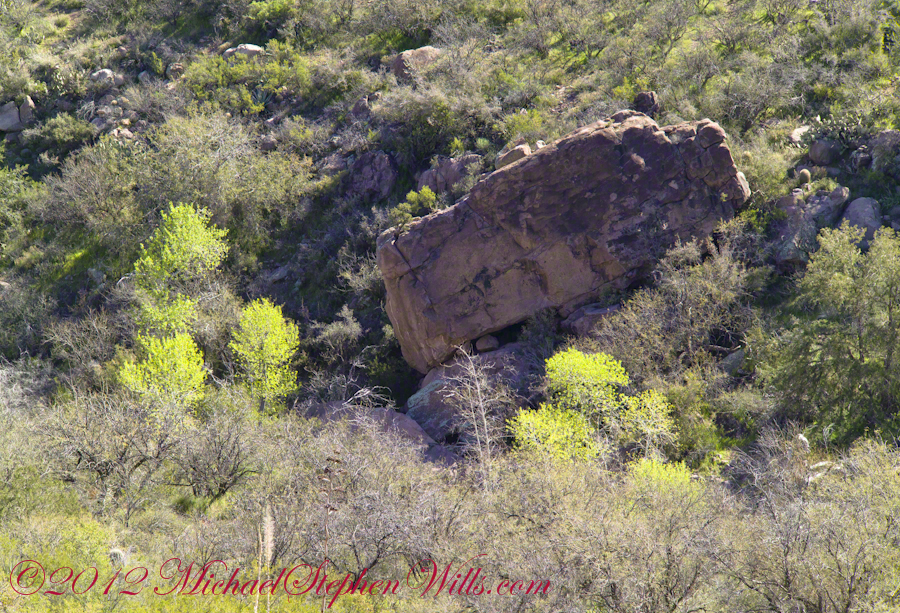
Huge Boulders
What looks like a road is the resting place of huge boulders fallen from the surrounding mountains. Since there is water, thick brush and trees grow everywhere in cracks and spaces between the boulders and rocks. Getting through the creek bed with an 80 pound pack and not getting lost is close to impossible. The solution is to hug the ridge slope, following the contours and navigate around boulders.
Reavis Canyon below the falls is filled with boulders of this size held in place by friction.
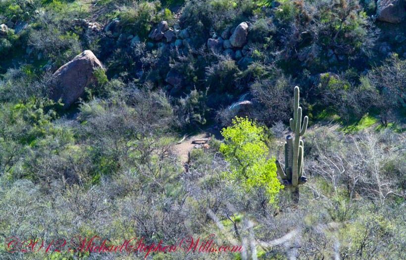
View of Reavis Canyon and Campsite
From the ridge small portions of Reavis Canyon were visible. I even spotted a campsite.
The mouth of Reavis Canyon below the falls opens into a sandy bottom. This camp, surronded by house-size boulders fallen from the slopes above, has a patch of grass bright green and fresh.
This camp, 1,636 feet below Lime Mountain peak, surrounded by house-size boulders fallen from the slopes above, has a patch of grass bright green and fresh to the right. In the center of the photograph is a tree trunk on rocks to serve as a bench next to a fireplace. With an 80 pound pack on my back, I was still an hour or so away from this spot. It was March, so sunset was around 6 pm, enough time to find a way down before darkness to overtook me.
Looking down from a ridge above the canyon that holds Reavis Creek and the falls.
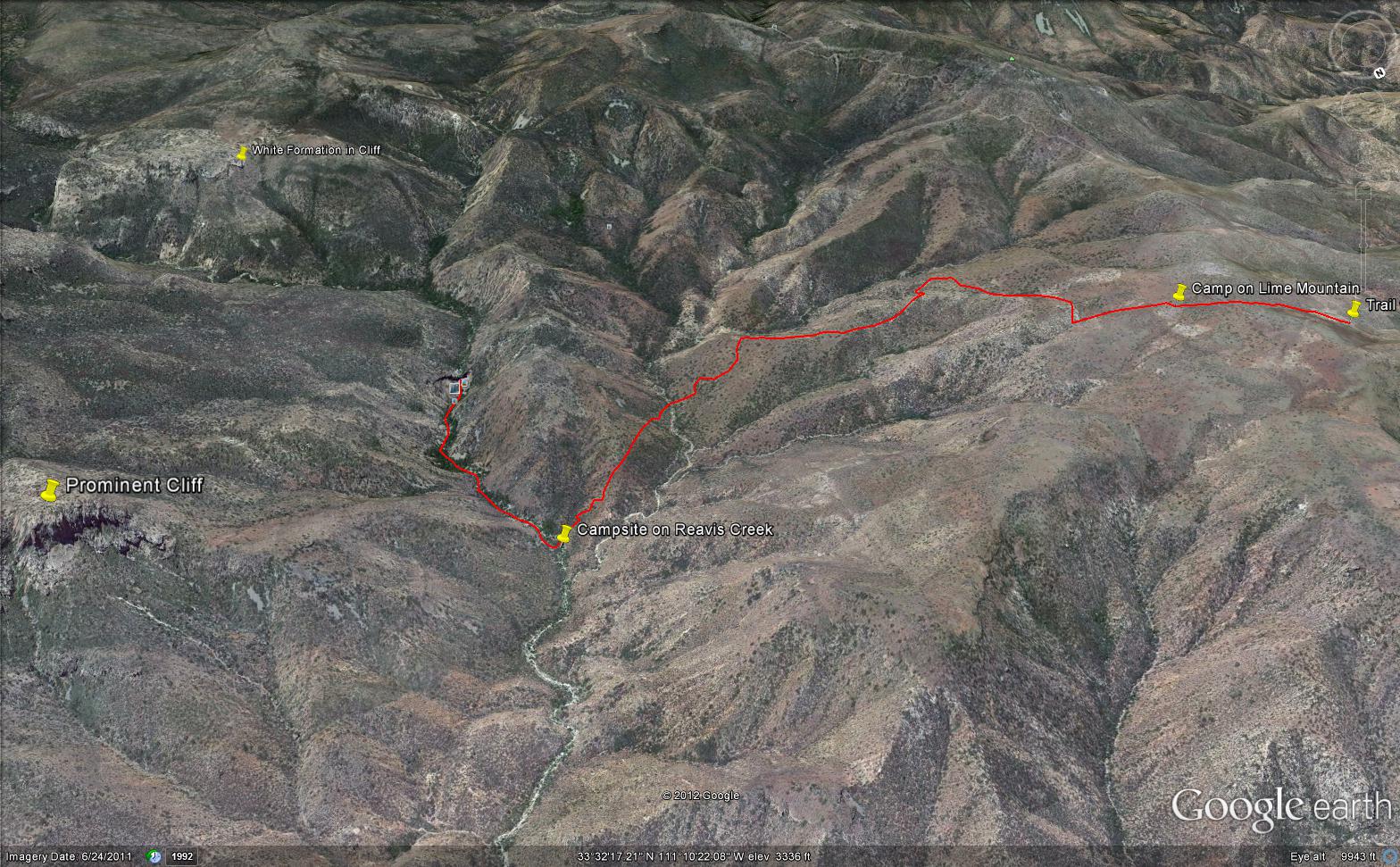
This is an overview of my progress, with the Lime Mountain and Reavis Canyon campsites marked. Landforms are marked on the left: the Prominent Cliff , in the background it says “White Formation on Cliff.”
Copyright 2023 Michael Stephen Wills All Rights Reserved