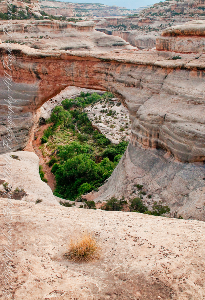
Sipapu is one of the largest natural bridges known.
Part of the Natural Bridges National Monument in Utah, a place inaccessible until the “uranium boom” of the 1950’s and the road was only paved in 1976.
We visited on a July day of thunderstorms, which you see building here. If you look closely at the base of the bridge, you can see the railings my wife and I used to climbed the steep sides of White Canyon.
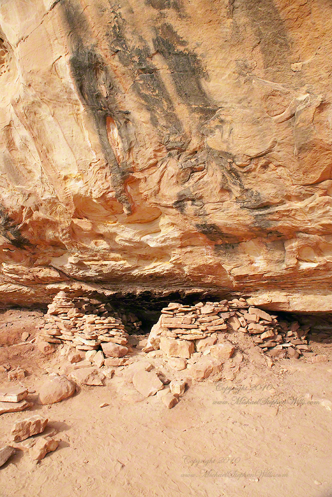
We hiked a few miles along an unmaintained trail. On the way we passed ancient cliff dwellings. The area is a maze of canyons throughout which these ruins are scattered.
Sipapu is a Hopi word for the small hole or indentation in the floor of kivas used by the Ancient Pueblo Peoples and modern-day Puebloans. It symbolizes the portal through which their ancient ancestors first emerged to enter the present world.
A natural bridge is formed through erosion by water flowing in the stream bed of the canyon.
Sipapu Bridge is 268 feet across and, standing in the stream bed, it is 220 feet above your head. That is white Permian sandstone, after which White Canyon is named.
Copyright 2023 Michael Stephen Wills All Rights Reserved
“From the fire tower on Bear Swamp Hill, in Washington Township, Burlington County, New Jersey, the view usually extends about twelve miles. To the north, forest land reaches to the horizon. The trees are mainly oaks and pines, and the pine predominate. Occasionally, there are long, dark, serrated stands of Atlantic white cedars, so tall and so closely set that they seem spread against the sky on the ridges of hills, when in fact they grow along streams that flow through the forest. To the east, the view is similar, and few people who are not native to the region can discern essential differences from the high cabin of the fire tower, even though one difference is that huge areas out in this direction are covered with dwarf forests, where a man can stand among the trees and see for miles over their uppermost branches. To the south, the view is twice broken slightly — by a lake and by a cranberry bog — both otherwise it, too, goes to the horizon in forest. To the west, pines, oaks, and cedars continue all the way, and the western horizon includes the summit of another hill — Apple Pie Hill — and the outline of another fire tower, from which the view three hundred and sixty degrees around is virtually the same as the view from Bear Swamp Hill, where, in a moment’s sweeping glance, a person can see hundreds of square miles of wilderness. The picture of New Jersey that most people hold in their minds is so different from this one that, considered beside it, the Pine Barrens, as they are called, become as incongruous as they are beautiful.” From The New Yorker magazine, November 26, 1967, “Profiles, The Pine Barrens I” creative non-fiction by the great John McPhee.
This quote captures the contours of a place, now known as “The Pinelands,” a corner of Burlington County, New Jersey my English, Irish, Scottish ancestors settled from 1677 until my grandfather, James Edward Wills, left for northern New Jersey, Asbury Park, in the first years of the twentieth century. This past decade, more so since retirement 2017, I’ve explored these two hundred and twenty (220) or so years beginning with amorphous asides over the years from my father and second hand through my sisters then through online research via Ancestry.com (Ancestry) and other searches.
From my father and sisters I knew to search southern New Jersey. The United States decennial census, “thank you Constitution,” listed a George and Margaret Wills with my grandfather among their children. Great Grandfather George Wills was listed as a 14 year old child of George and Mary Wills in the 1850 census. How could I be sure? DNA technology with internet based social interaction helped there. I was contacted by a Dellett descendant, identified by DNA as a fourth cousin, who claimed Mary Wills as a double great aunt, the daughter of James and Ann Dellett. Here is a screen capture of an Ancestry “ThruLines” analysis showing the six living ancestors of James and Ann in the database. I removed the names and photos of the other five to preserve privacy. The DNA fourth cousin relationship was an exact match to the family tree.
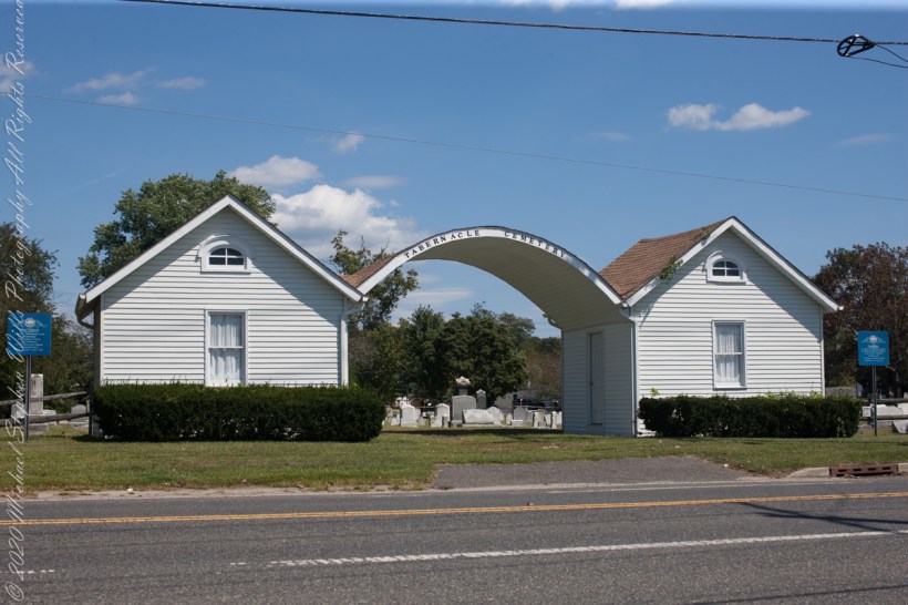
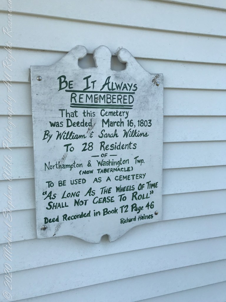
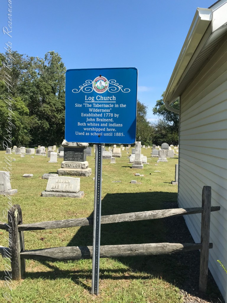
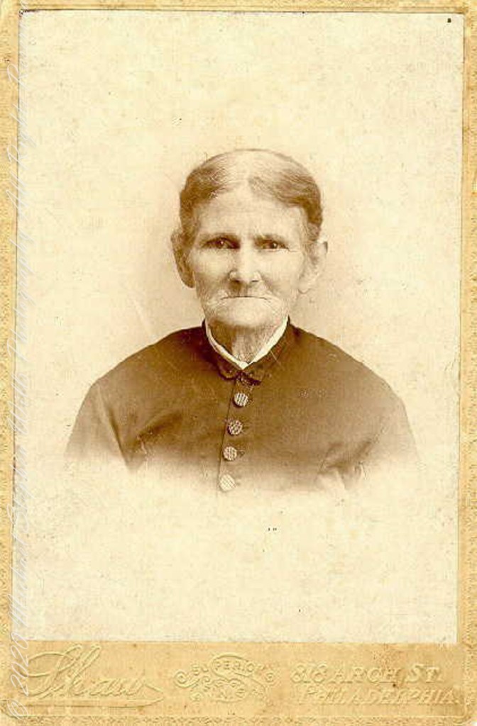
Cousin Delette provided antique photographs of George and Mary. I did a “FindAGrave” search, their final resting place is in a place named Tabernacle, Burlington County, New Jersey. September 2019 my wife Pam and I did a weekend tour with a bed and breakfast base in the city of Burlington, New Jersey. The rest of the photos in the following slideshow are from that weekend.
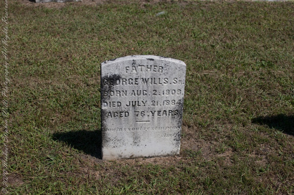
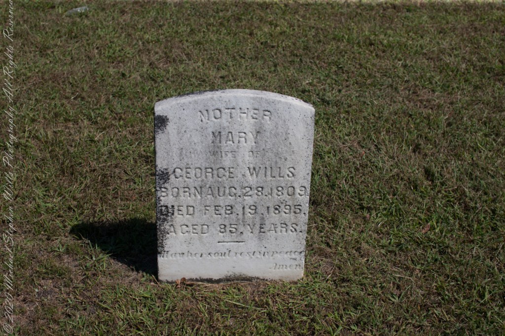
Resting place of double great Grandparents George and Mary WillsWooden Plaque on left sdie of entry pavilion. Sign to left of pavilionGeorge Wills, Hotel Keeper, around 1850Father, George Wills, Sr., Born August 2, 1809, Died July 21, 1884 Aged 76 years., May his soul rest in peace, AmenMary Dellett Wills, as widow after 1894Mother Mary wife of George Wills, Born August 28, 1809, Died February 18, 1895 Aged 85 years. May her soul rest in peace, Amen
Here is the same Ancestry “ThruLines” analysis with the immediate family links exploded. through my “first cousin 1 time removed” I was able to communicate with a “lost” niece of my father who shared reminiscences of him from the time he was just released from World War II Naval Service, before meeting Mom.
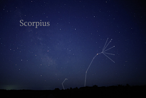
Twenty million years ago a then nonexistent earth-bound human civilization could recognize none of the prominent stars of the constellation Scorpius (The Scorpion) as these, compared to our 4.6 billion year old star, lit up less than 12 million years ago. The brightest star, Alpha Scorpii AKA Antares, is a red giant destined to burst into a supernova bright as the full moon within two million years. Will the human race be around to witness it?
Such as it is, The Scorpion was traced out by the Babylonian astronomers around 8 BCE following even more ancient Sumerian traditions naming Alpha Scorpii “The Heart of the Scorpion.”
I first became aware of Antares March 2009 during a stay on Cocoa Beach. Setting the room clock to a 5 am alarm to view the sunrise. As I sat listening to the surf, Antares glowed dark red in the south. It is the reddish tint star in the following illustration.
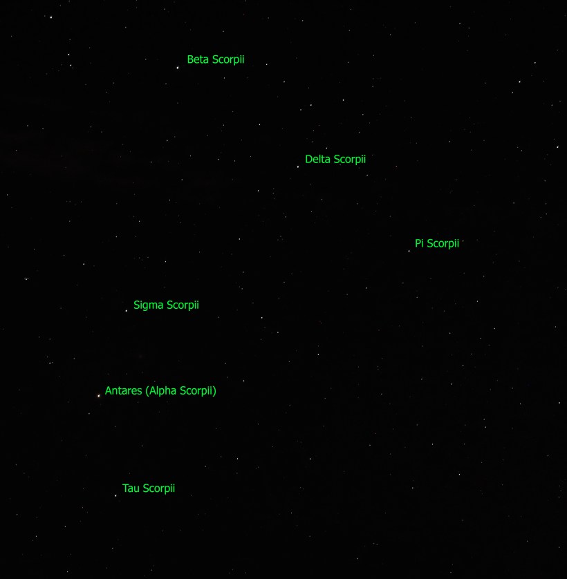
Here is a photograph of Antares, the reddish dot in center, along with the 6 of the 18 Scorpius bright stars. For this shot a Canon EOS 5D Mark IV dlsr had mounted a Canon lens EF 70-300 f4-5.6L IS USM set to 70 mm focal length, 1600 ISO. Exposure was “bulb,” meaning when the shutter button is pressed and held the shutter remains open: for this exposure this was for approximately 10 seconds. The equipment was held steady on a Manfrotto BeFree Carbon Fiber tripod. As the Earth continued to turn, the resulting star images are smeared a bit.
Bracketing Antares, the Scorpion Heart are “The Arteries” Theta and Tau. About those Greek letters, these designate relative brightness of each star respective of the others in the constellation. “Alpha” the first letter of the Greek alphabet is the brightest. Here are the other letters listed, with the alphabetic order in brackets Beta(2), Delta(4), Pi(16), Sigma(18), Tau(19). Ancient Greek built on the traditions of the Mesopotamians (Babylonian and Sumerian) and were in turn used for modern stellar nomenclature, including the tracings of sky images, the constellations.
The position of a relatively minor star, Tau, near Antares elevates it to the important function of an artery. The stars themselves run against their brightness hierarchy placement: The star Delta Scorpii, after having been a stable 2.3 magnitude star, flared in July 2000 to 1.9 in a matter of weeks. It has since become a variable star fluctuating between 2.0 and 1.6. This means that at its brightest it is the second brightest star in Scorpius.
Copyright 2023 Michael Stephen Wills All Rights Reserved
Theresa (2), Michael (5), Christine (4) in the livingroom of 107 Deepdale Parkway, Albertson, New York on Valentines Day 1959Chocolate Valentines Day cake by Pamela WillsPam and I aboard the Oceania Regatta sailing the Pacific Ocean off Chile. The following day we reached Puerto Montt.
Copyright 2025 Michael Stephen Wills All Rights Reserved
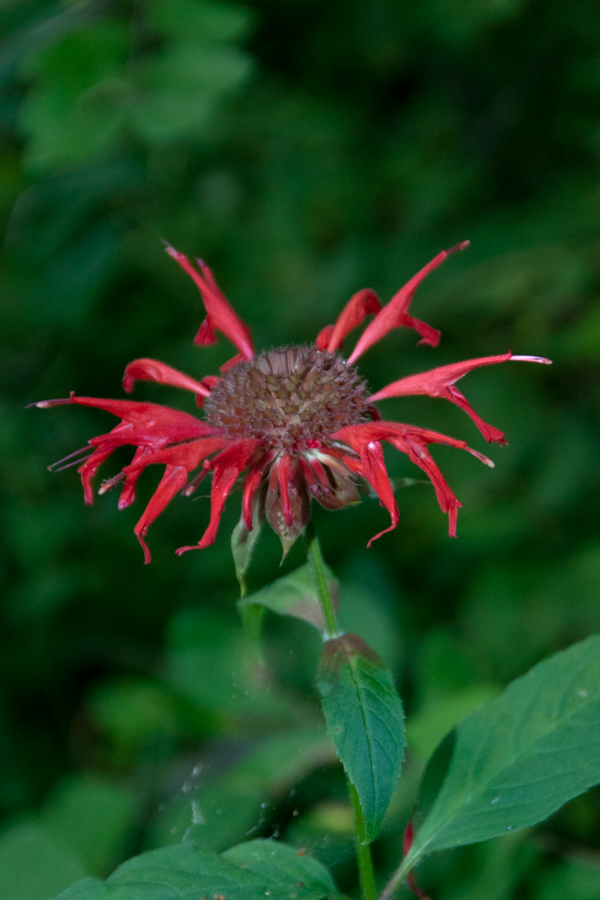
Monarda didyma is also known as crimson beebalm, scarlet beebalm, scarlet monarda, Eau-de-Cologne plant, Oswego tea, or bergamot. A wildflower native to the Finger Lakes, Crimson beebalm is extensively grown as an ornamental plant, both within and outside its native range; it is naturalized further west in the United States and also in parts of Europe and Asia.
It grows best in full sun, but tolerates light shade and thrives in any moist, but well-drained soil. As suggested by membership in the Lamiaceae (mint) family, Beebalm, as an aromatic herb, has a long history of use as a medicinal plant by many Native Americans, including the Blackfoot. The Blackfoot people recognized this plant’s strong antiseptic action and used poultices of the plant for skin infections and minor wounds.
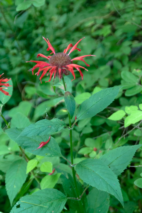
An herbal tea made from the plant was also used to treat mouth and throat infections caused by dental caries and gingivitis. Beebalm is a natural source of the antiseptic thymol, the primary active ingredient in modern commercial mouthwash formulas. The Winnebago used an herbal tea made from beebalm as a general stimulant. It was also used as a carminative herb by Native Americans to treat excessive flatulence. As a matter of local interest, Iroquois of Oswego, New York, made the leaves into a tea, giving the plant one of its common names.
It is 9:30 am on a July morning Robert H. Treman Park, Ithaca, Tompkins County, Ithaca, New York,
References
Wikipedia, “Monarda didyma”
“The Botanical Garden, Vol II” Roger Phillips and Martyn Rix, Firefly Books, 2002. Page 284
Copyright 2023 All Rights Reserved Michael Stephen Wills
Winter 2020 I posted “Winter People Watching” featuring the Sony F828 and candid street photography.
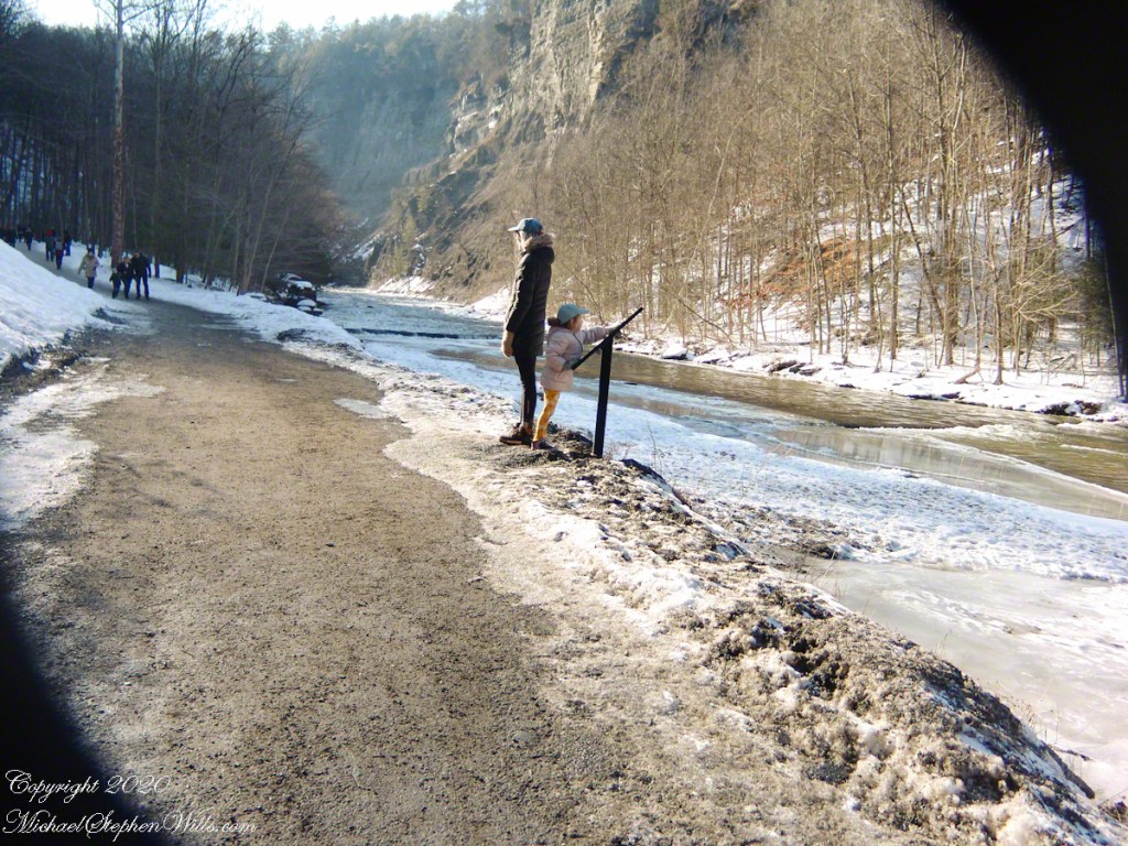
What I love about this place, a unique feature, is the size and different vantage points making it possible to view the same place from different angles. November 2019, readers were shown “The Bend,” a place with Taughannock gorge makes a 90 degree turn, changing from a southeastern to an eastern flow. Here are photographs from spot overlooked by that post.
Here the camera faces away from the sun, the graduated neutral density filter allowing me to capture the cloudless blue sky, a little milky the way it is here February with a hint of spring.
The gorge makes a 90 degree turn, changing from a southeastern to an eastern flow. Here is am in the creek bed facing east.
This little one is studying the information placard with rapt attention, learning how the African continent, pushing against North America, across the eaons, formed the right angle fractures mirrored by this dramatic change in Taughannock Gorge. For the Big Bend photographs I was standing behind them, along the stream bed.
Here is a broader slice of that sky.
The gorge makes a 90 degree turn, changing from a southeastern to an eastern flow. Here is am in the creek bed facing east.
Can you see the tiny figures of hikers, dwarfed by the frozen cliff?
The gorge makes a 90 degree turn, changing from a southeastern to an eastern flow. Here is am in the creek bed facing east.
Copyright 2023 All Rights Reserved Michael Stephen Wills
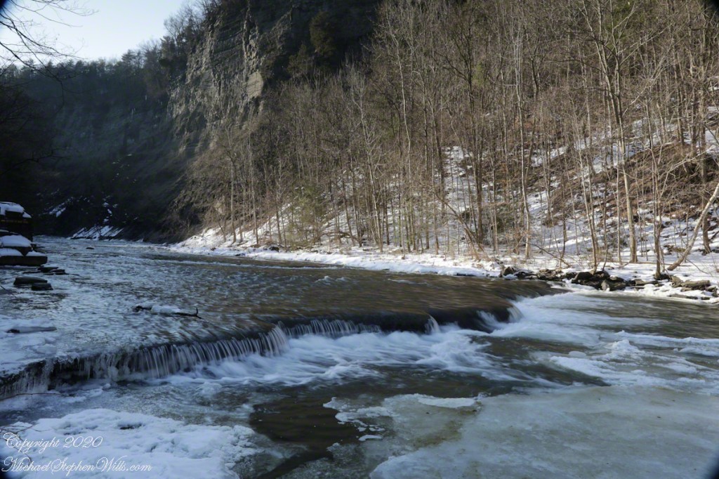
Purling of the water beneath this foot high waterfall was enhanced by reducing ISO to 100, tamping down the aperture to f/22 resulting in an shutter speed of 1/10th second. I set the graduated Neutral Density filter to shade the left side.
On the cliffs ahead is where the observation platform is cut into the rock. It has a great view of the waterfall, in some ways the experience of the falls is enhanced, compared to hiking the 3/4 mile path and standing below.
The Gorge Walls, hundreds of feet above the creek are very dangerous to stand below.
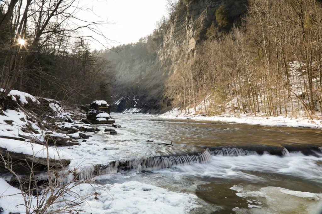
A marvelous forest grows on talus from the high gorge walls.
A sign on a disused pier warns waders to leave the creek bed. Ahead the gorge walls tower above the creek. Rocks dislodge and crash down unexpectedly, crushing foolish waders. It is appalling to see, in warmer months, people walking below those cliffs gathering the fallen rocks to make delicately balanced cairns.
Copyright 2023 All Rights Reserved Michael Stephen Wills
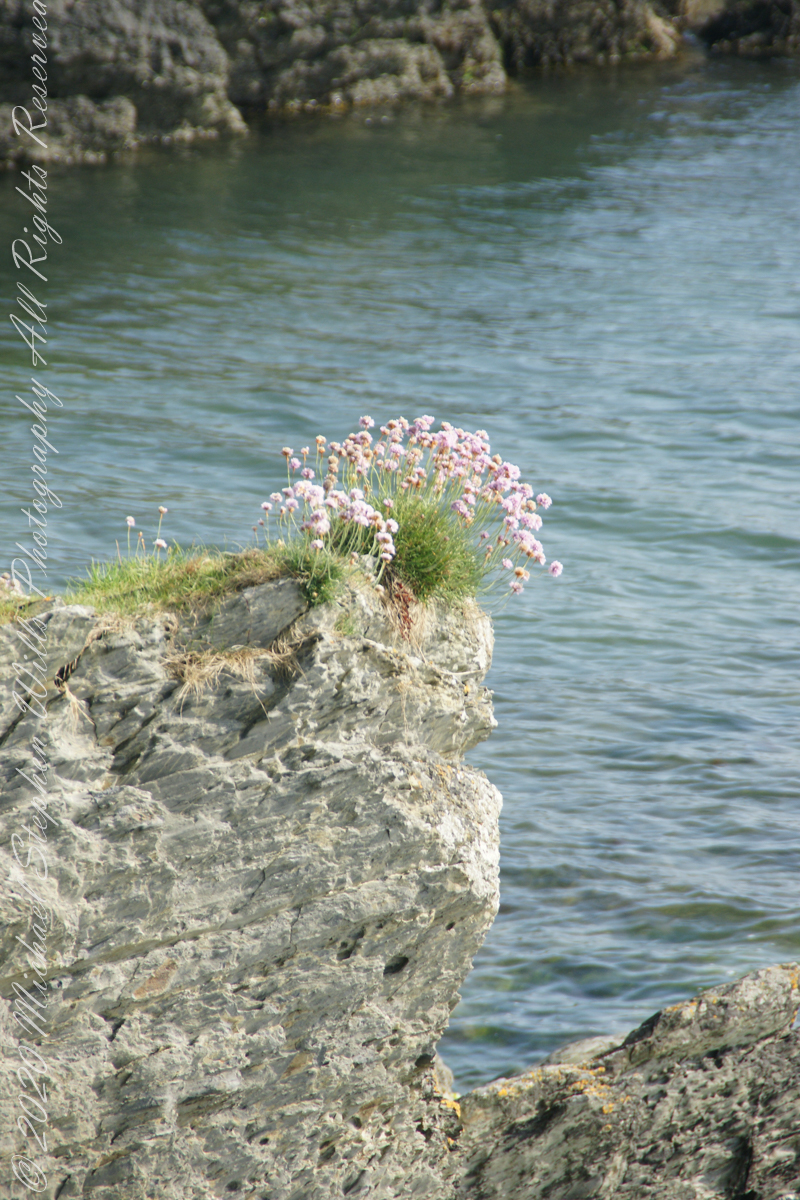
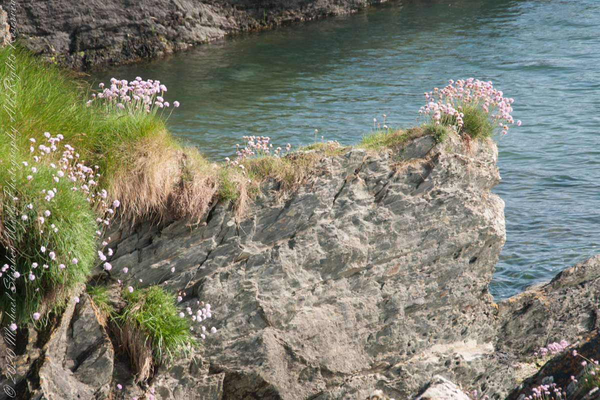
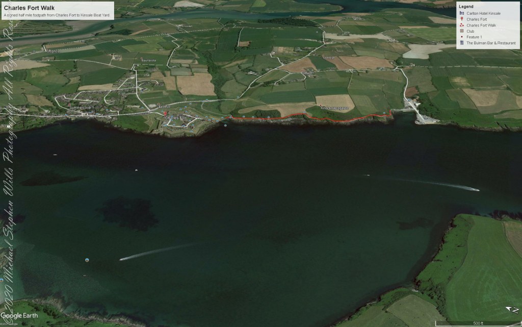
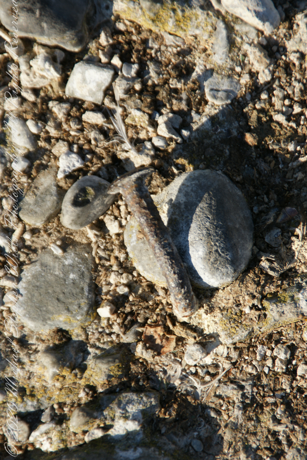
We continued down the half mile “Sallyport” footpath, marked in red on the Google Earth view provided at the end of this post, along shoreline cliffs to find these croppings of Sea Pink on jagged rocks.
Oddly, the jags being perfect places for Sea Pink to perch. Scientific name, Armeria maritima, and also known by Thrift or Sea Thrift, a reason these evergreen perennials are found on the obverse of the British Three Pence coin issued 1937 – 1952. Thrifty can mean to buy a lot for a little money — three pence is very little money.
Click any pic for a larger view, in a new tab, or a slide show. When using WordPress Reader, you need to open the post first.
Another sign informing hikers of the view.
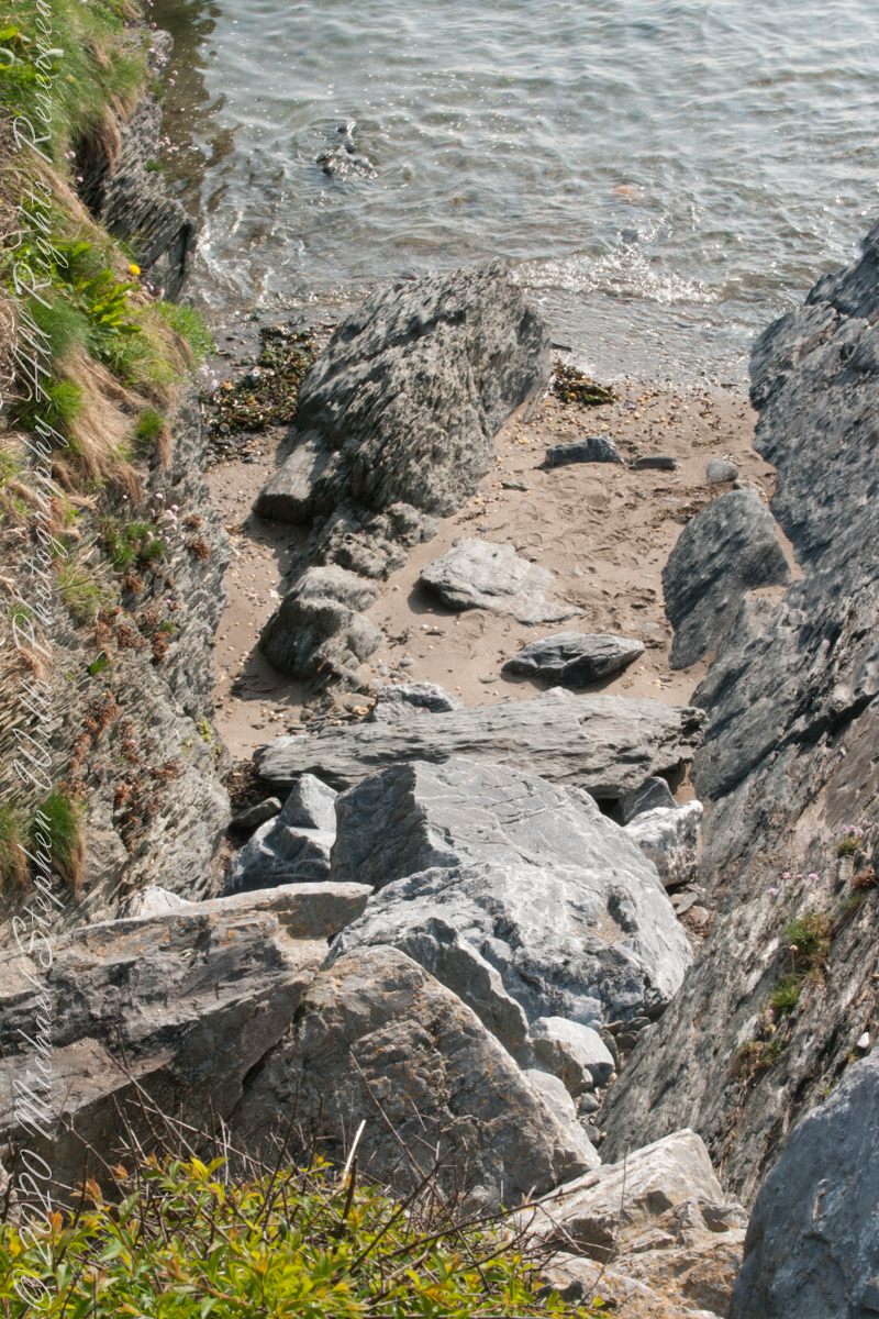
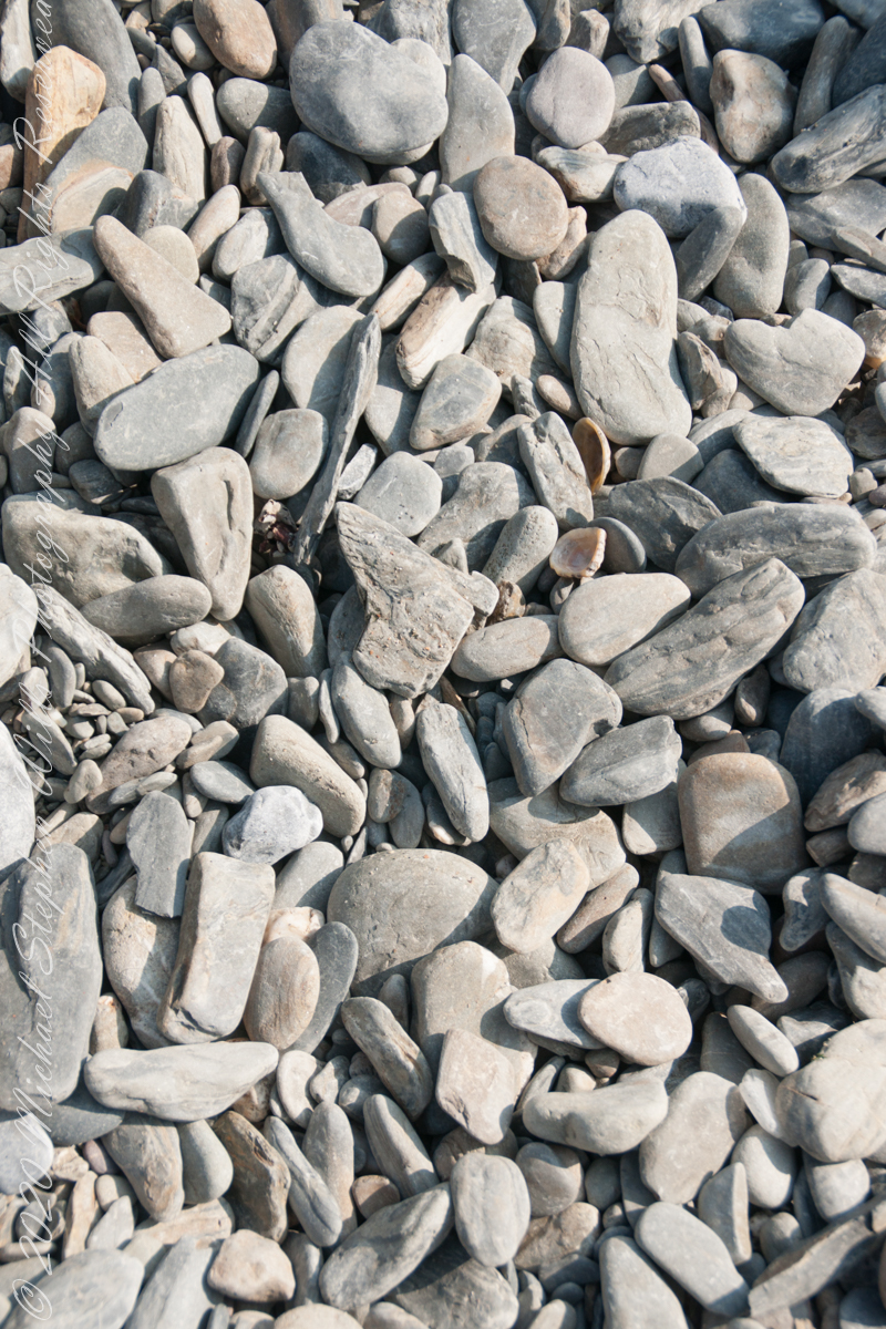
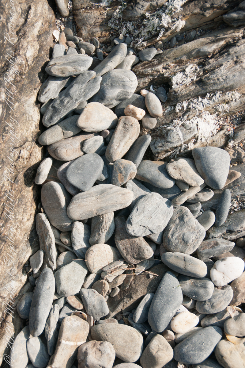
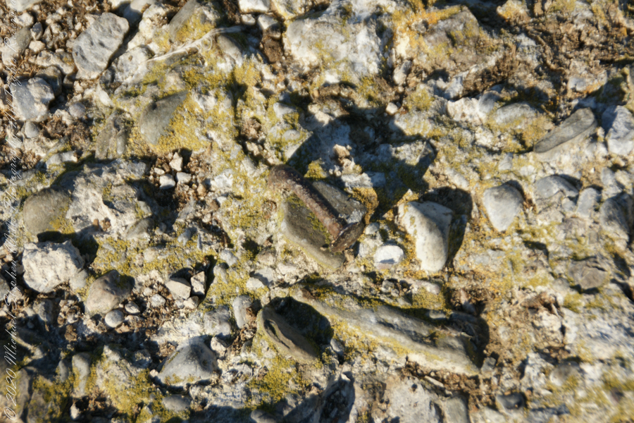
DeclivitySea SmoothedSmoothed over time by wave actionA half mile footpath, marked in red, leads from Charles fort along the shoreline cliffs, surmounted by working farmland.
Reference
“Armeria maritima” – wikipedia
Copyright 2023 Michael Stephen Wills All Rights Reserved
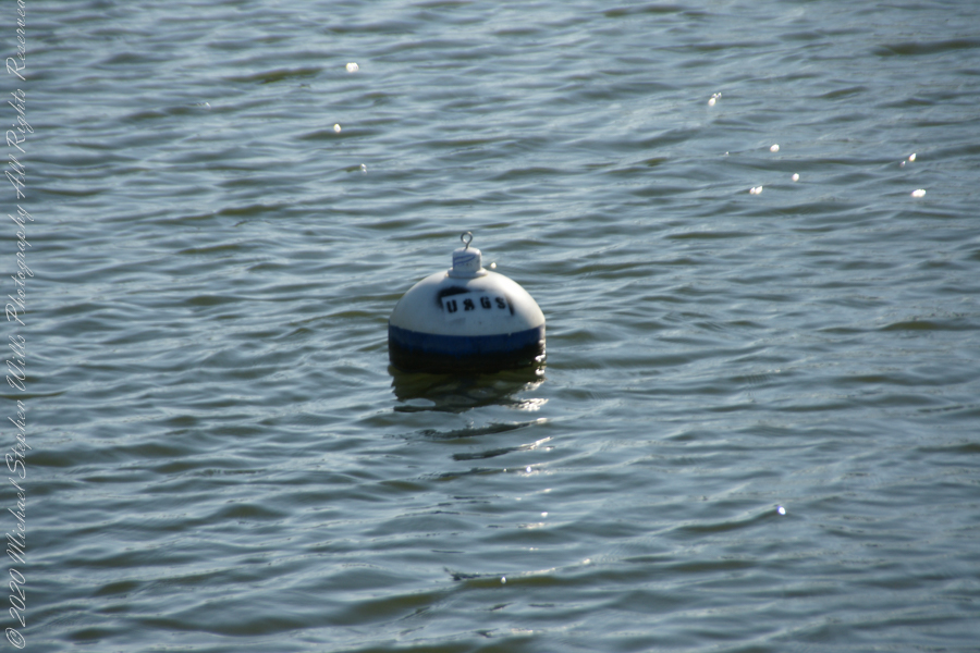
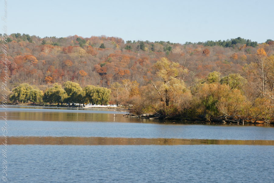
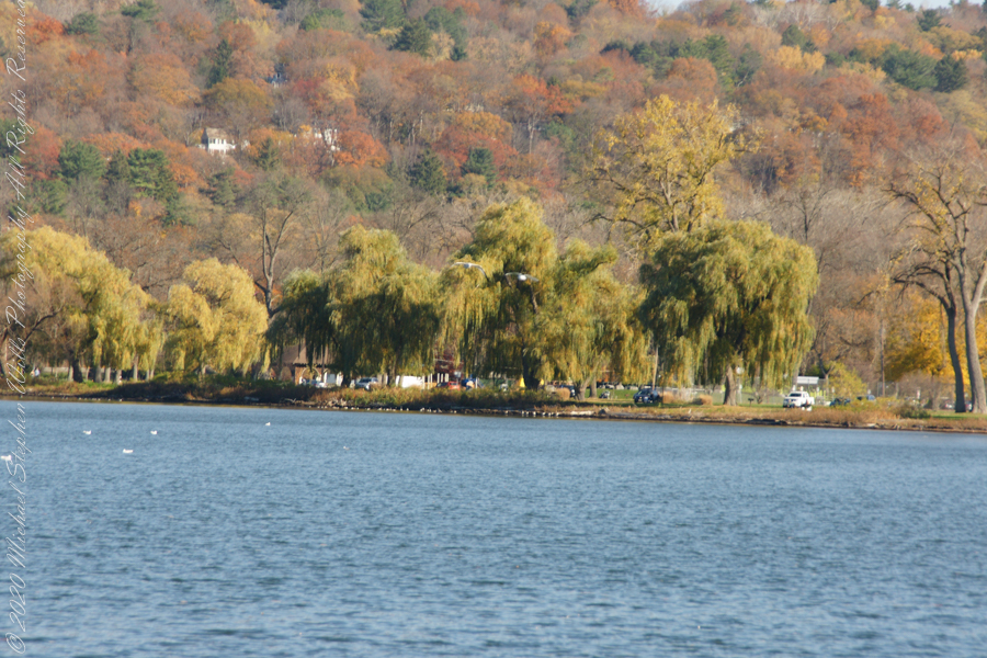
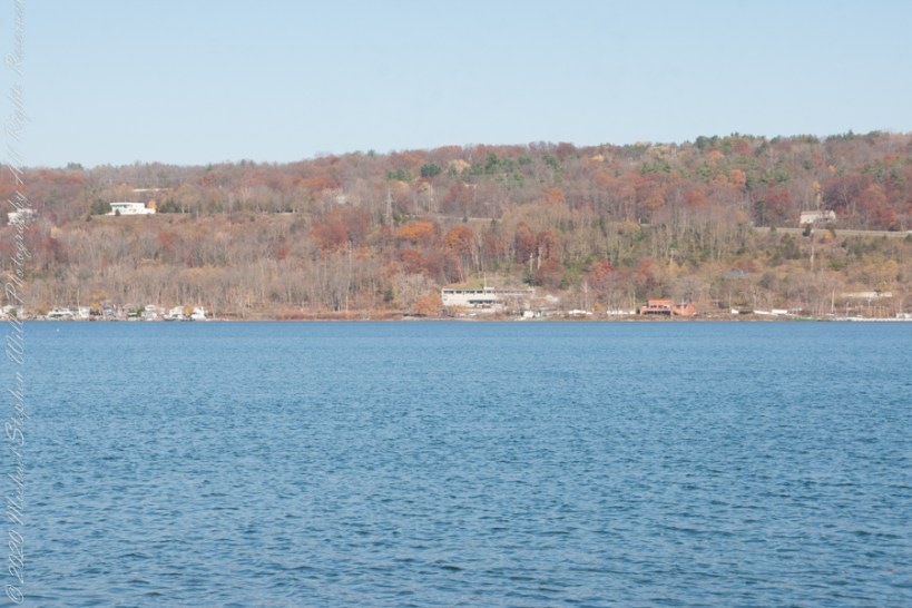
Here is the south end of Cayuga Lake on a bright November afternoon. Stewart Park is enjoyed by Ithacans year round.
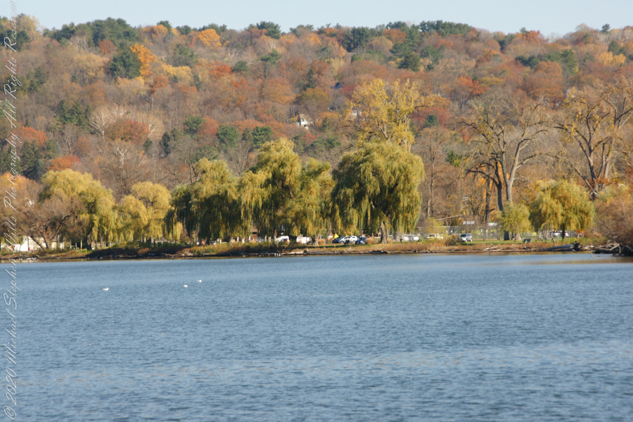
Everyone is a fan of the Willows framing the lake views.
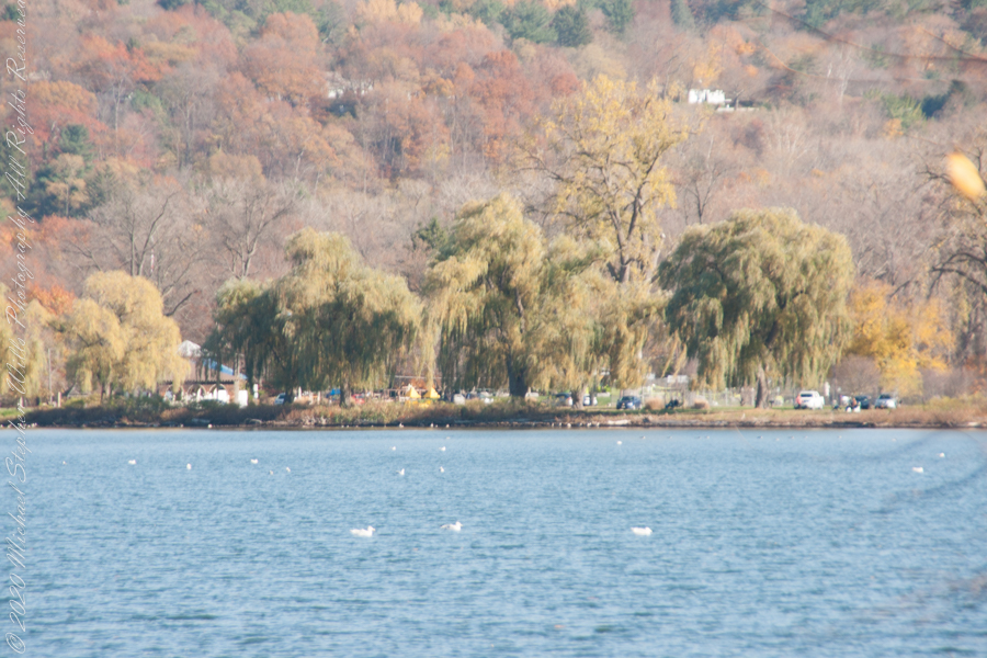
Can’t get enough of Stewart Park..
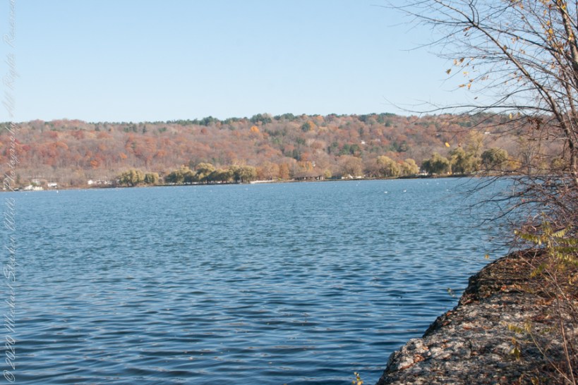
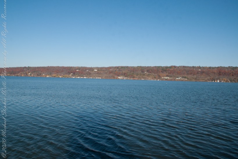
An unzoomed view, to give an idea of the distance across the water.
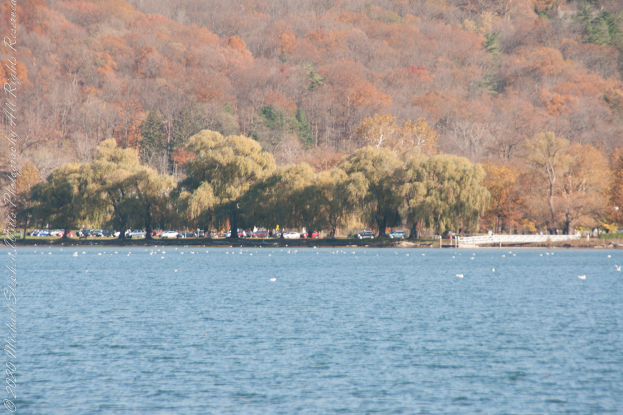
Pam and I have great memories of sailing this stretch from our years of membership in Cornell Family Sailing.
The east lake shore.
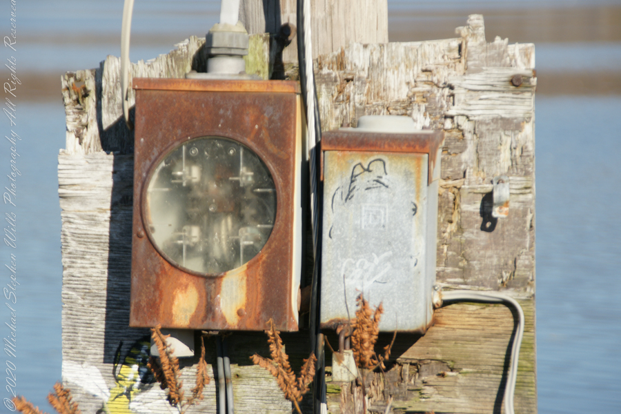
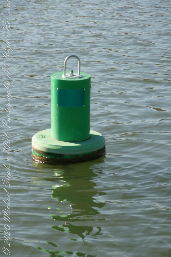
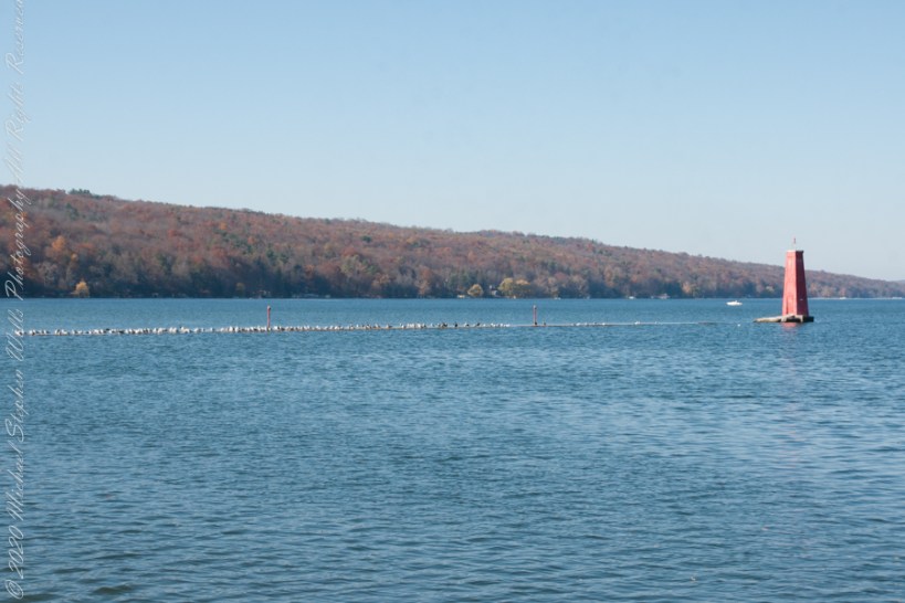
The West Lake Shore. This photograph captures the electric line that powers the Red Tower light. Seagulls enjoy that causeway…I’ve never seen humans walk it.
Copyright 2022 Michael Stephen Wills All Rights Reserved