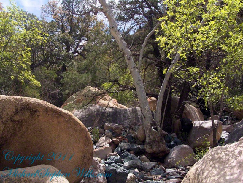
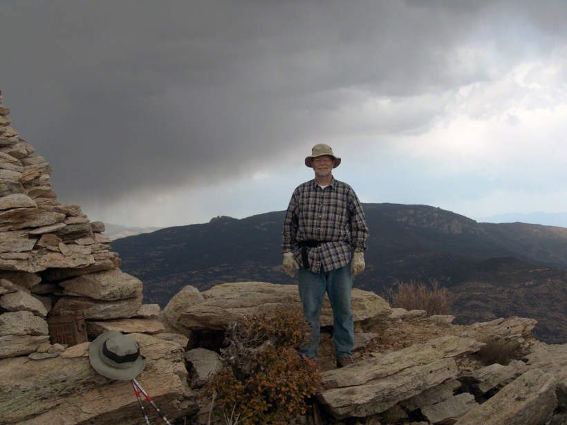
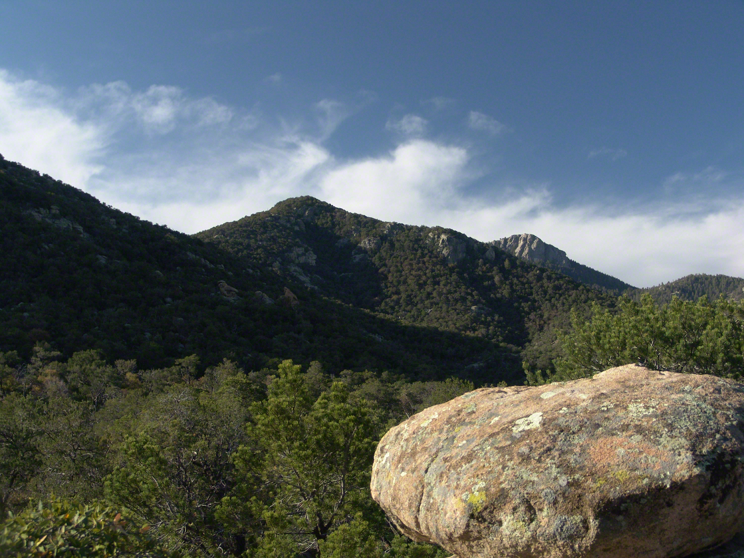
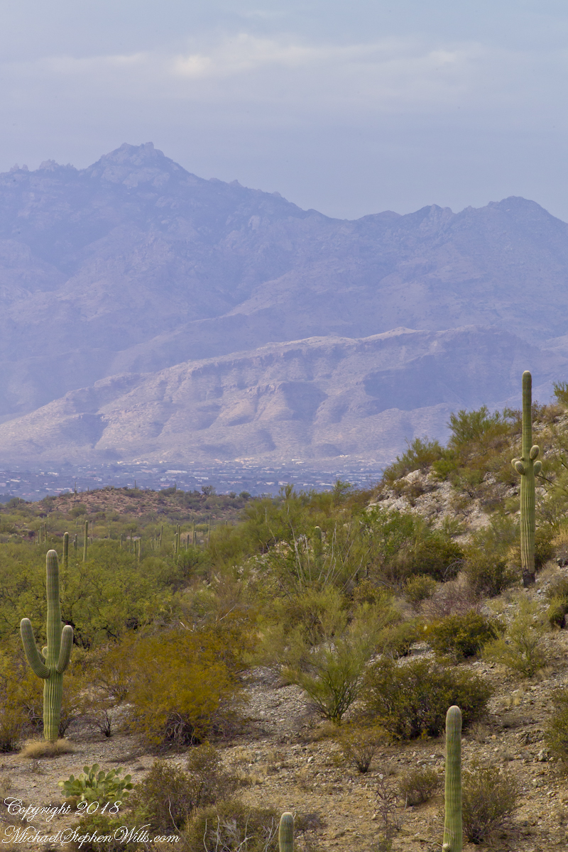
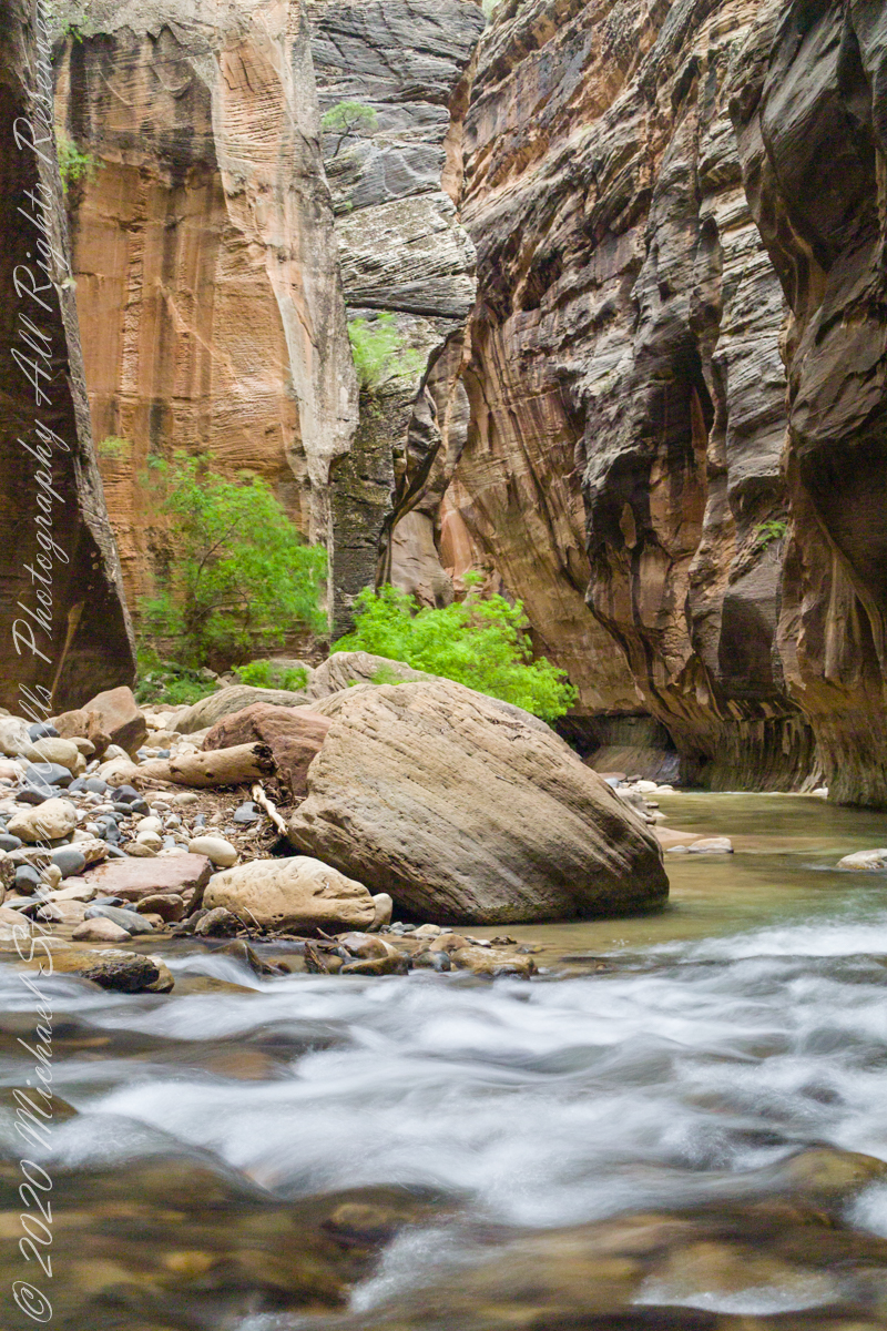
Sky islands are isolated mountains surrounded by radically different lowland environments. The term originally referred to those found near the southern borders of the U.S. states of Arizona and New Mexico with the northern borders of the Mexican States of Chihuahua and Sonora such as the Dragoon Mountains featured in this post. The isolation has significant implications for these natural habitats. The American Southwest region began warming up between ∼20,000–10,000 years before the present-day and atmospheric temperatures increased substantially, resulting in the formation of vast deserts that isolated the sky islands.
This sycamore tree survives life in this ephemeral stream of an Arizona “Sky Island” by allowing entire trunks to die off during extended dry spells. The tree is an Arizona Sycamore (Platanus wrightii).
Informative sign at campsite
Reference: wikipedia article “Sky Islands.”
Copyright 2022 Michael Stephen Wills All Rights Reserved
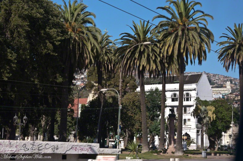
Ricardo left a blank between the French Memorial Column of the Parque Italia, seen above. He made of mention of Salvadore Allende Plaza. The above photograph includes a graffiti inscribed corner of the set of steps, a platform and the area in front, a plaza, dedicated to the memory of Allende and named “Plaza del Pueblo Salvador Allende Gossens” on the 100th anniversary of his birth, 2008. The structure was not new, it was called “The People’s Plaza”, the name change was pushed through by Alberto Neumann, communist councilor. So the suppression and torture (see “Valparaiso Connections V”) was not successful in wiping out the ideals, such as they are.
The accomplishments of the Allende Presidency are another matter. The Macroeconomic Populism policies he implemented left the economy in tatters. We have only to look at the current state of Venezuela to see the entirely expected results of this economic model: hyperinflation followed by stagflation and implosion. The reactionary military coup of 1973 was, in the essentials, a rational response and a rescue from economic and social disaster until the reaction itself descended into madness.
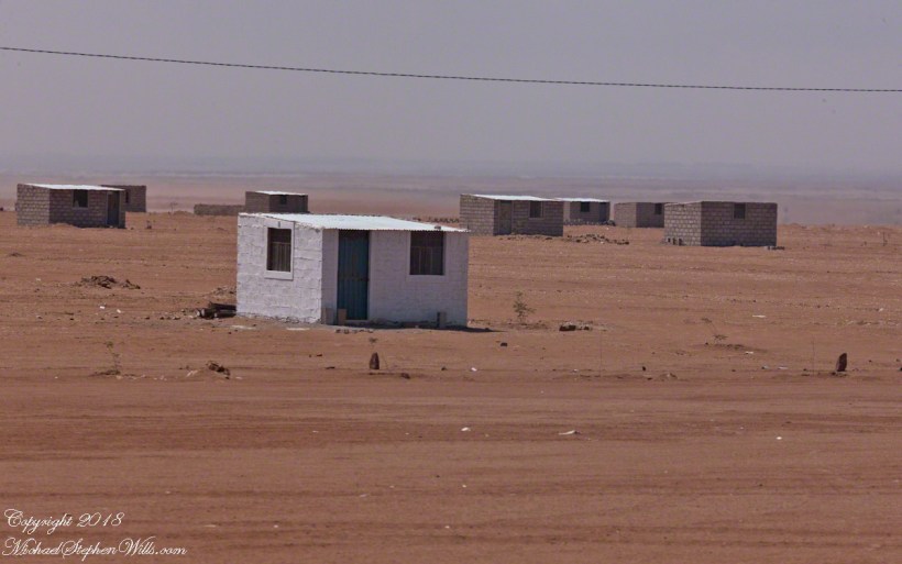
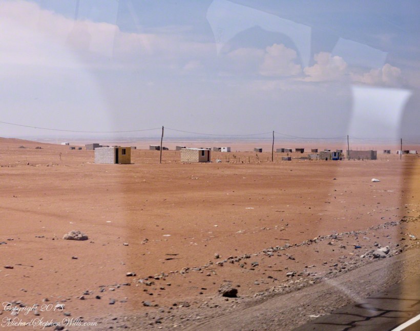
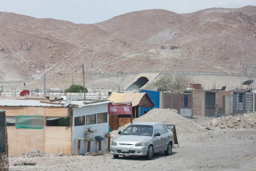
The following series of photographs are from a neighboring country, Peru, are an illustration of the pressures the political elites of Chile are negotiating. Taken from the road between the port of Mollendo and the city of Arequipa, on a vast, waterless plain.
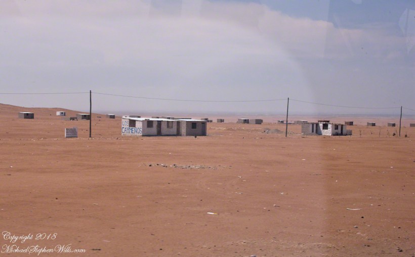
Migrants from the Titicaca Region formed a cooperative named “Asociacion Las Caymenos Agro Exportadores”. It is the named scrawled on the small cement brick wall.
Desperate people from rural areas migrate to cities, form associations or regional clubs based on a common origin, and grab land as a group.
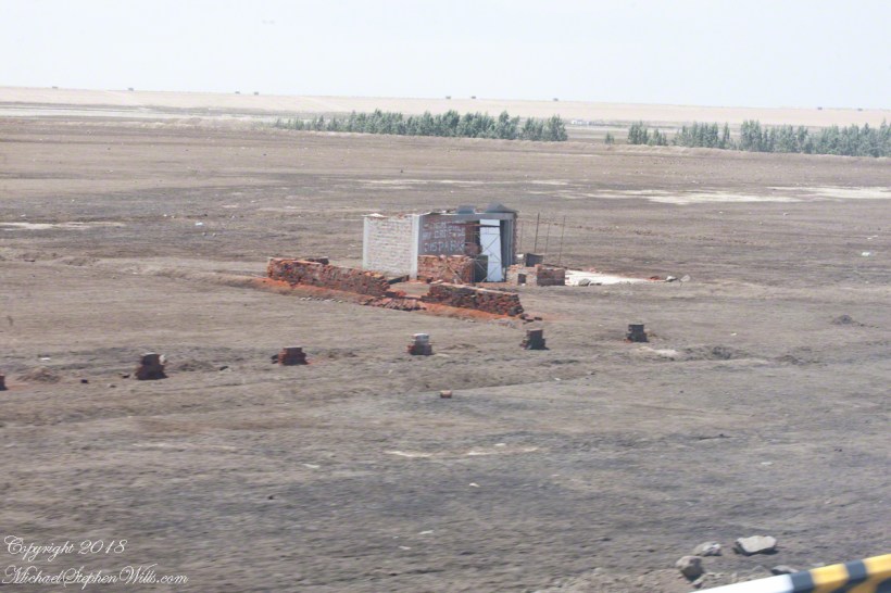
In this case, it is property useless for the named purpose, “agricultural export.” What they have is a dream. a dream of the government directing water to the area.
Towards this end, individuals of the group mark out plots using rocks and build structures from concrete brick and metal roofing.
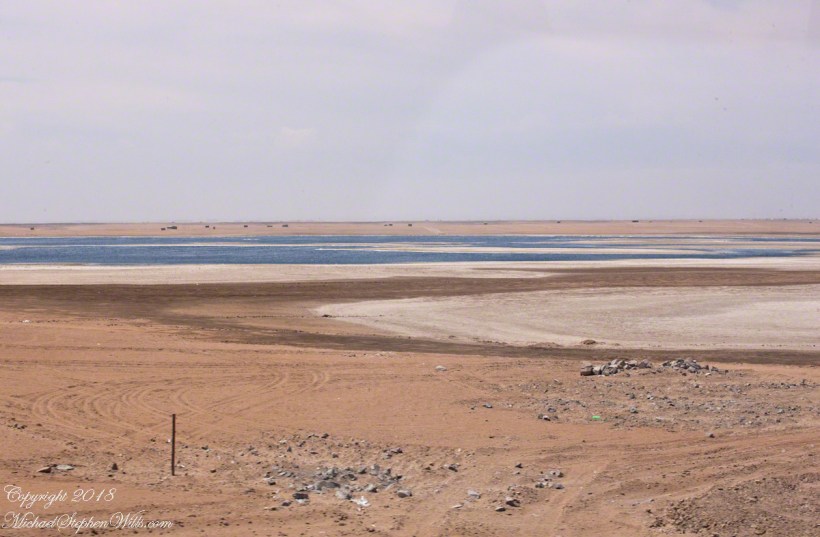
This small patch of water is the basis of their desperate hope.
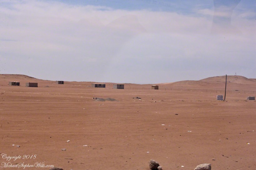
This is a more consolidate group of migrate squatters on the road called “1S” near the turnoff for Lima and a place named La Reparticion.
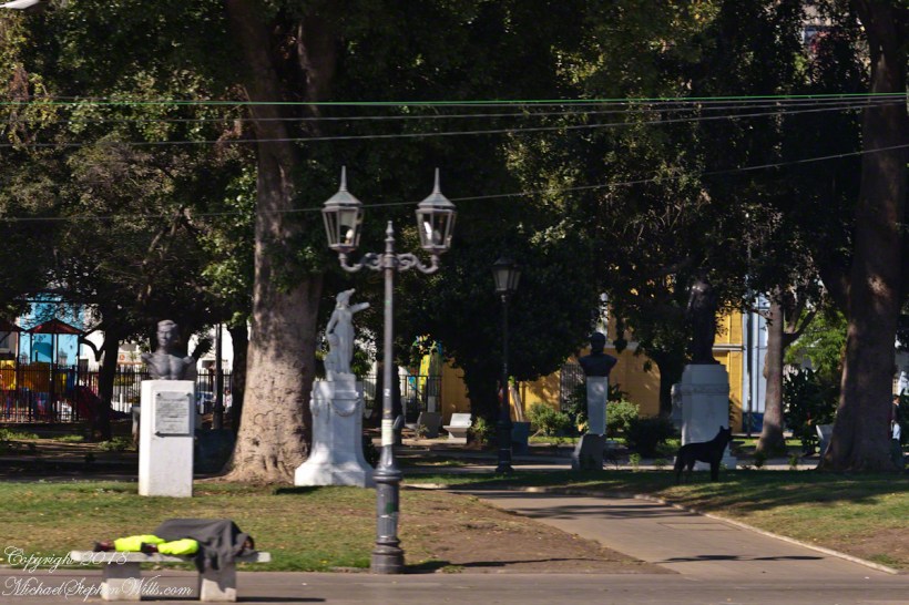
Dreams for a better life, offset by desperate circumstances bring us back to Valparaiso and the Parque Italia adjacent to Allende Plaza. The park is a small patch of green, some wonderful trees, with statuary and monuments dedicated to people of Italian heritage.
Beyond the sleeper are statues each on a plinth. The second from the right is a bust of Giovanni Battista Pastene, a gift from the city of Genoa dedicated October 12, 1961. Pastene was the first governor of Valparaiso (the region, not the city) in the 16th century. He came to Honduras in his own ship, enter the service of Pizzaro and, as master of the ship Conception, was a maritime explorer.
P
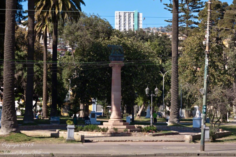
The Italian refugee collectivity of Valparaiso presented this column, in 1936, surmounted by a bronze sculpture of the Capitoline Wolf feeding the infant founders of Rome, Romulus and Remus. It is a copy of an ancient statue kept on Capitoline Hill, Rome, Italy.
The wife of Allende was of Italian heritage, Hortensia Bussi. The Fire Brigade Sesta Compagnia di Pompieri Cristoforo Colombo, operates today from Independence Avenue.
Here we have a gathering of friends, sharing the shade and beverages on this Saturday summer morning.
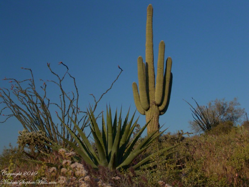
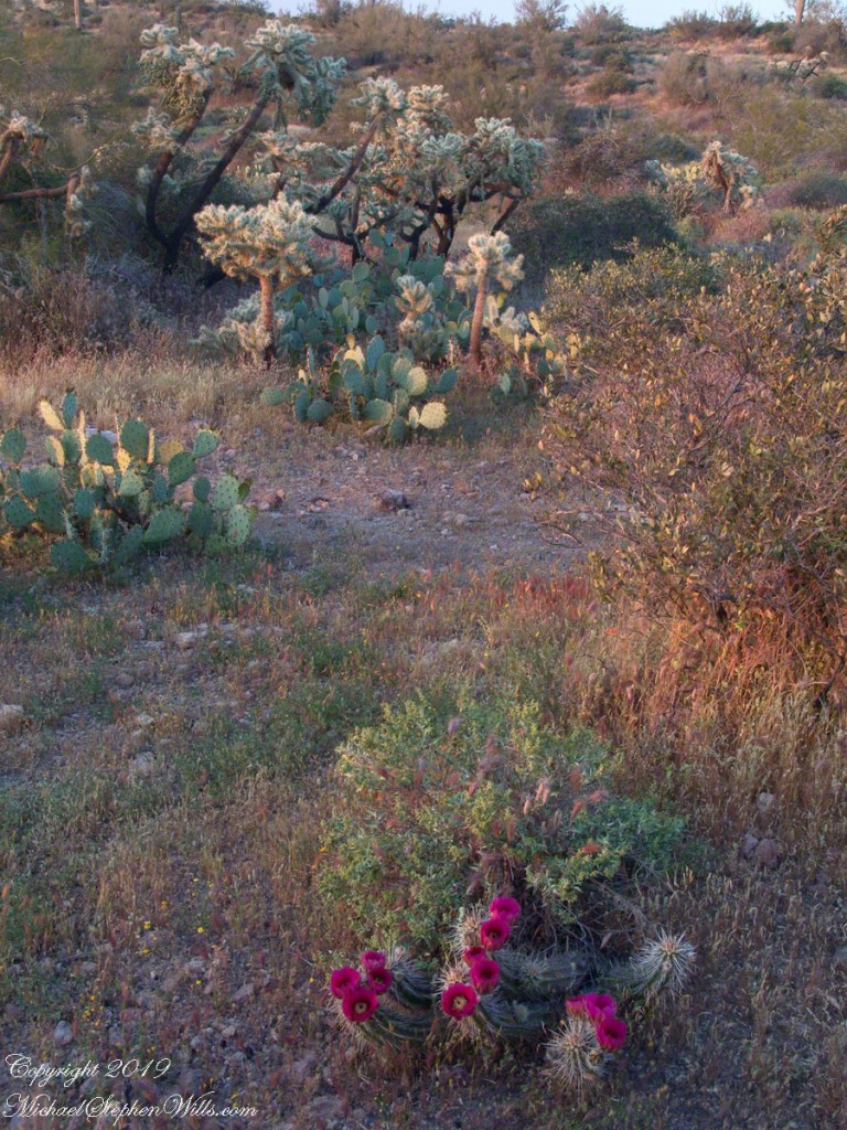
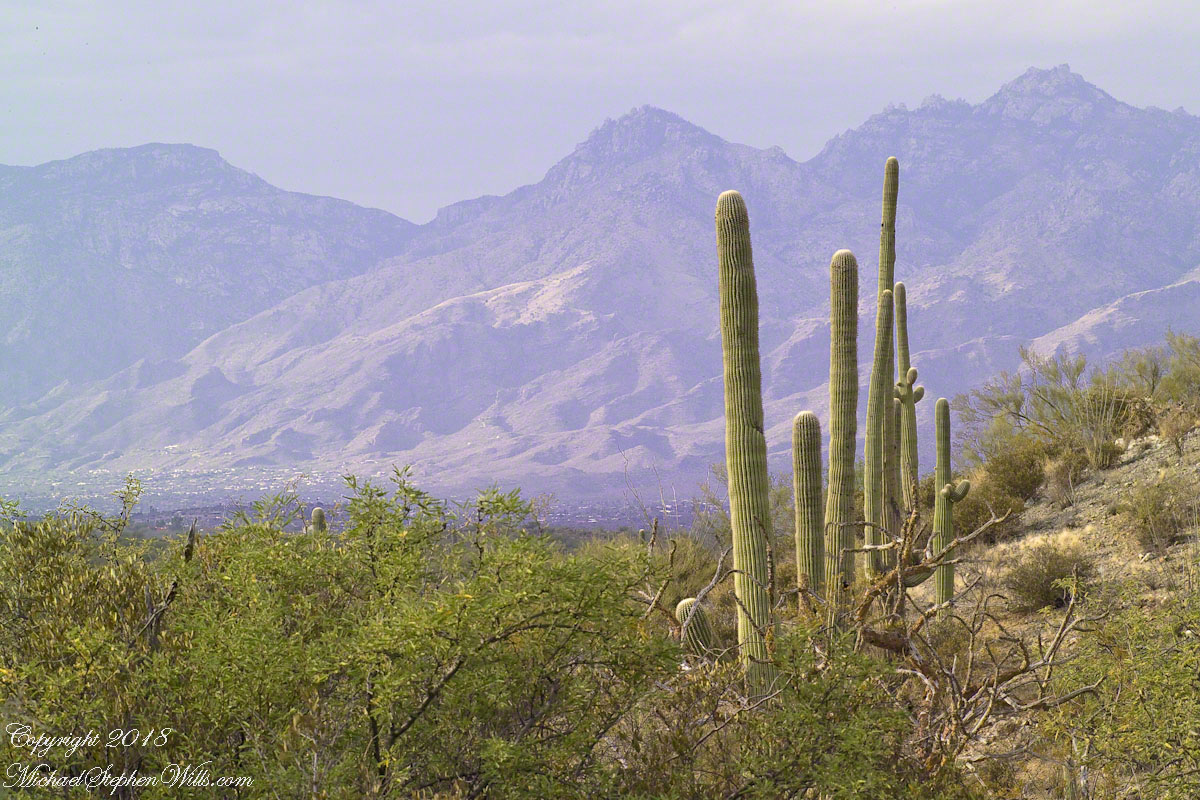
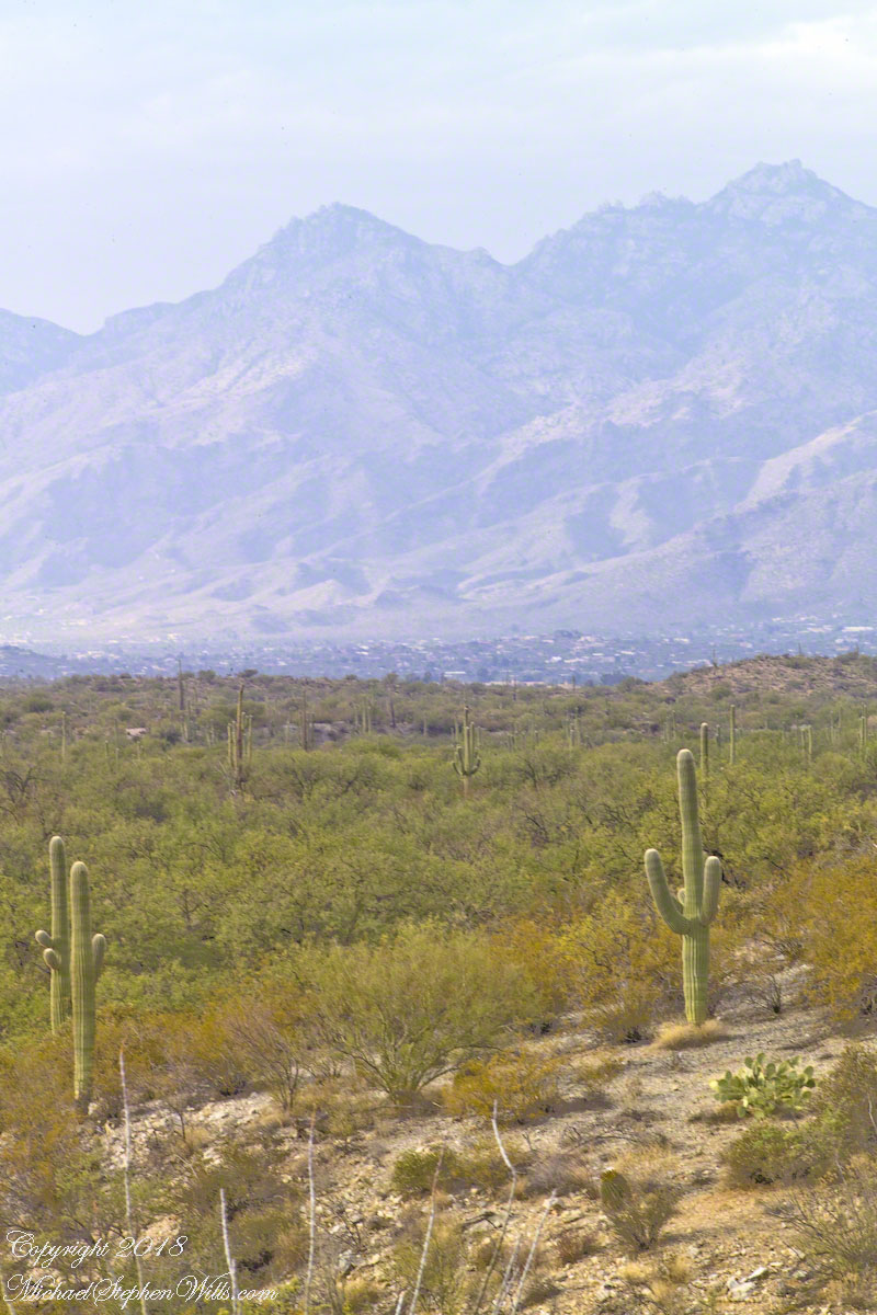
Notable Sonoran Desert Plants, all in the same frame. From the left, back row: staghorn cholla, ocotillo, saguaro. Front row: teddy bear cholla, yucca. I am not certain the greenery to the left of the yucca is brittle bush.
First Water trail head is the most used access point to the Superstition Wilderness, being the closest to Phoenix and its satellite cities and suburbs. For day hikers there are ample and interesting route choices as all foot trails of the west side terminate at First Water making for a variety of loops and incredible views. For horse people there are facilities to park huge trailers.
The ready access from Mesa, where my sister and husband had their home, was the primary reason I planned to finish my cross wilderness hike on the Dutchman Trail. Named for Jacob Waltz of the fabulous legend of the Lost Dutchman mine, the inspiration for The Searcher’s Superstition Wilderness expeditions and, ultimately, why he and I met and my change of plans.
On our ride over from Roosevelt he told of his difficulties building a home in Apache Junction, sleepless nights spent guarding building supplies from thieves. He looked forward to moving day.
This photographic record of five days in the wilderness would be much different without that meeting yet, there I was that afternoon with plenty of time for photography during the golden hours of late afternoon as I wandered the desert gardens until my sister arrived.
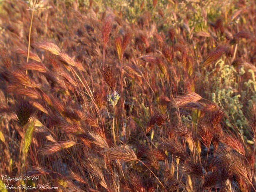
Wild Barley
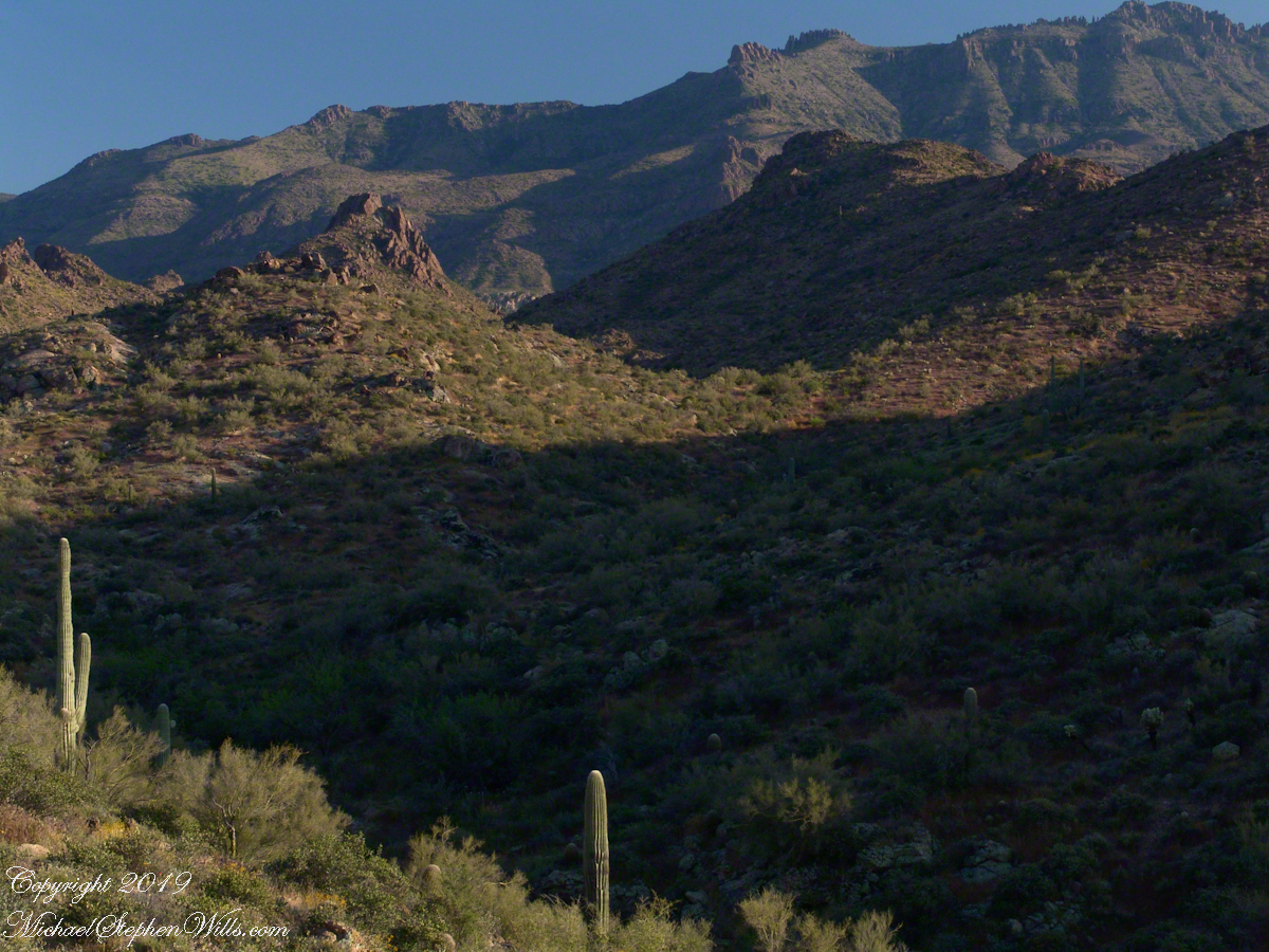
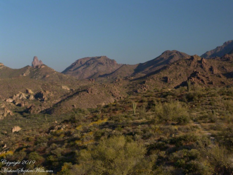
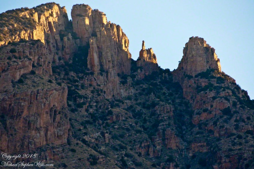
The long distant ridge beyond the rugged near hills is the backbone of the famed “Superstition Mountain.” On the far right are hoodoos, appearing as so many teeth on a jaw. Gorgeous saguaros in the foreground.
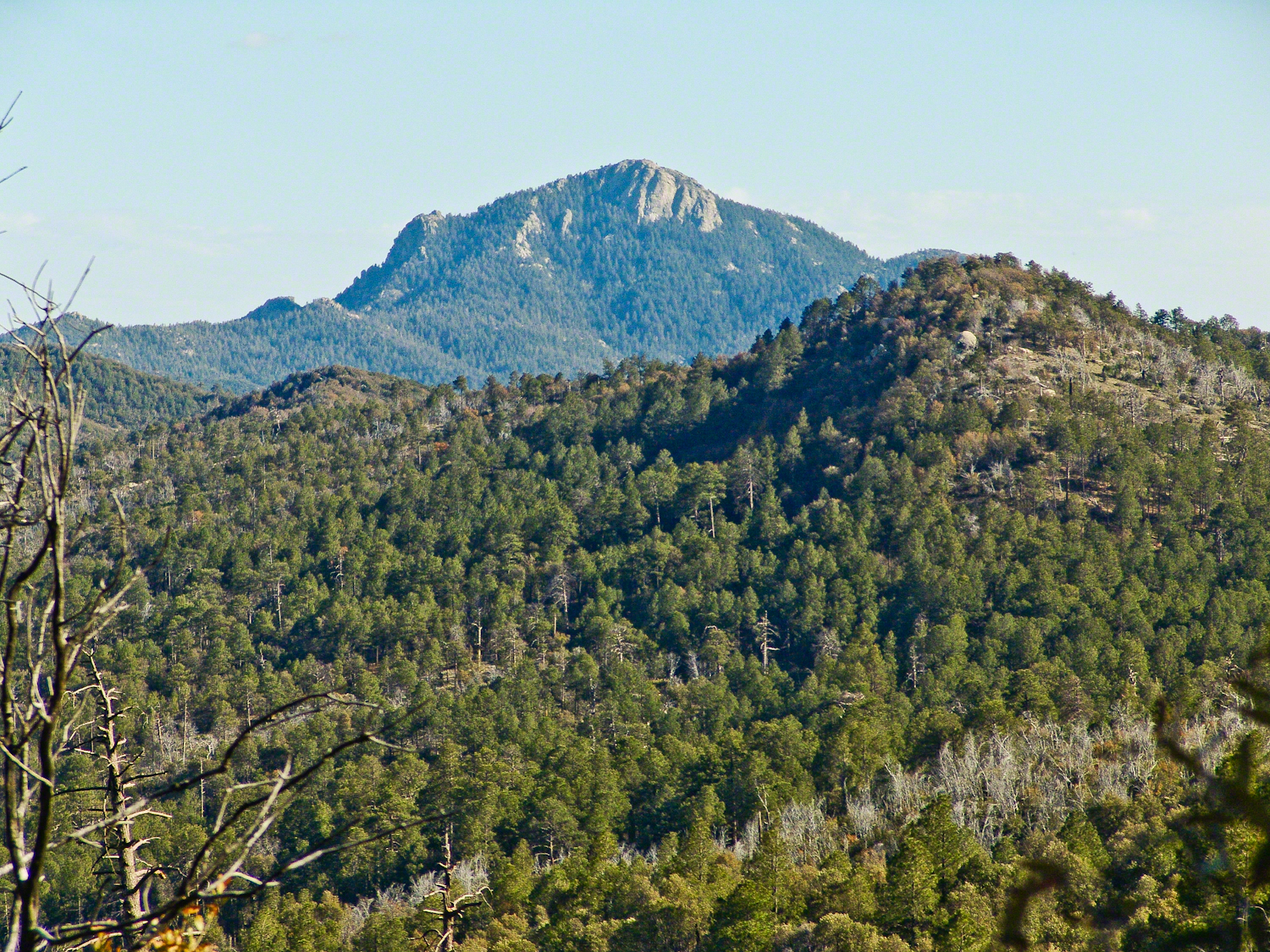
Weavers Needle is the distant peak, 5.5 dry miles away in this view to the west / southwest.
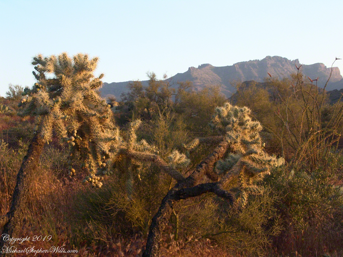
I’ve always been partial to how the dense spines of cactus catch the evening light. These staghorn chollas are in front of the same ridge of the Superstition Mountain. A famous formation, “The Flatiron” is visible on the far right.
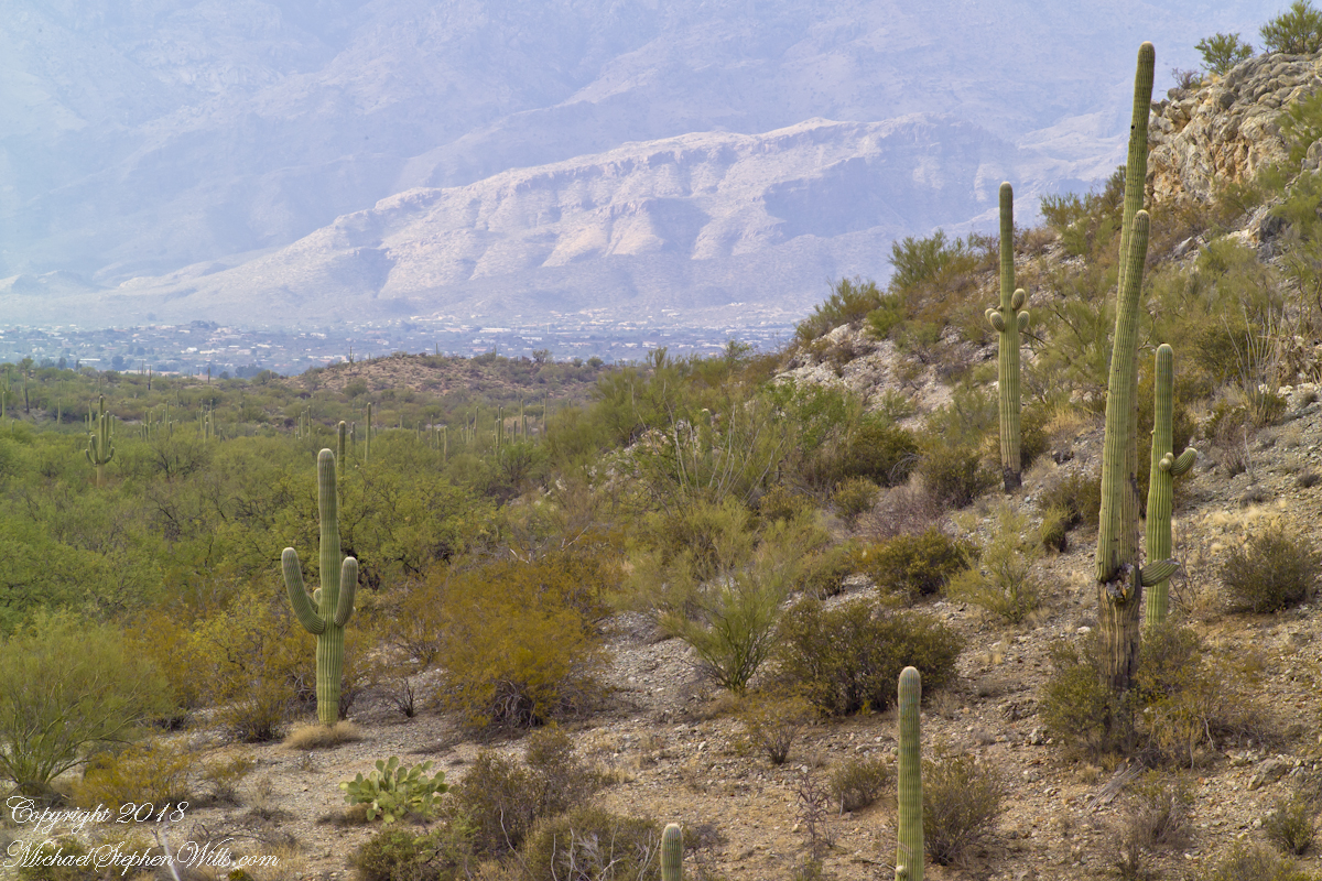
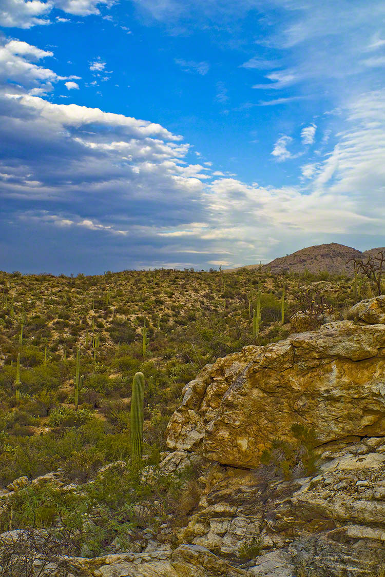
The road to the trail head, Service Road 78, winds through 2.6 miles of hills. Here is another overview of Sonoran desert life.
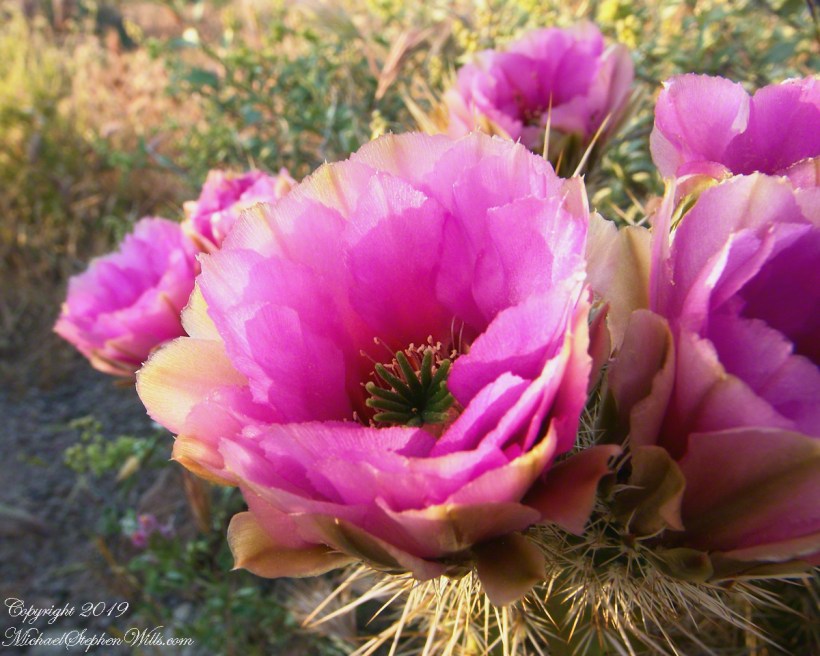
You might remember hedgehog cactus blossoms from my posting “A Dry Piece of Paradise”. The following are from the large hedgehog cactus in the foreground of the preceding photograph.
Future Plans
During the drive back with my sister, Diane, we talked of plans for returning to the Reavis Ranch together, as a backpack expedition. In coming days I met with The Searcher to explore possibilities for a horse expedition and, three years later, these plans came together for a trip kicked off from this same First Water trail head.
Hedgehog Cactus Blooms
Here is a gallery of the same photos. It is fun to flip back and forth with me disappearing from the scene.
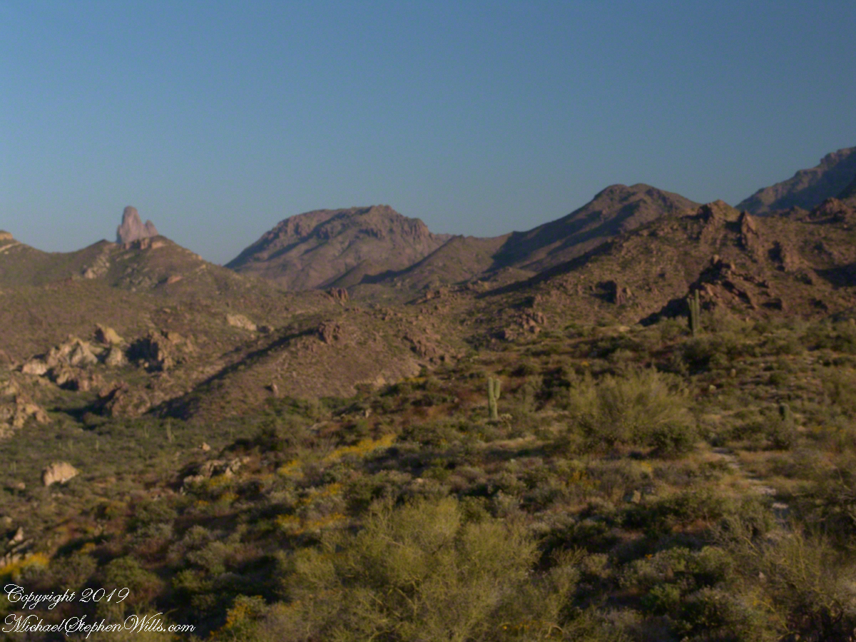
It is possible to walk the distant ridge starting from Lost Dutchman State Park. Hoodoos are visible on the right side.
Weaver’s Needle is visible above the near hills. the First Water trail traverses this desert.
Ocotillo, yucca and saguaro. Two types of cholla cactus are also visible.
Also known as Teddy Bear Cholla. Hoodoos are visible on the distant ridge.
The Searcher arrived after breakfast. My camp was bundled up to join the rest of The Searchers equipment and supplies on Colorado’s panniers that replaced the saddle where I sat, and was dumped from, yesterday. This fifth morning of the adventure, I was to have the experience of a light pack for the 4.7 mile trail from Pine Creek to Campaign Creek, past the Reavis Mountain School of Self Reliance.
First, there was the climb to the edge of Pine Creek canyon where we, for the last time, enjoyed the view to the north of the Arizona Trail and, in the distance, the Four Peaks Wilderness.
North from Reavis Gap
At Reavis Gap we took a rest before the 1500 descent to Campaign Creek on a trail rated as so difficult backpackers go miles out of the way to access Reavis Ranch.
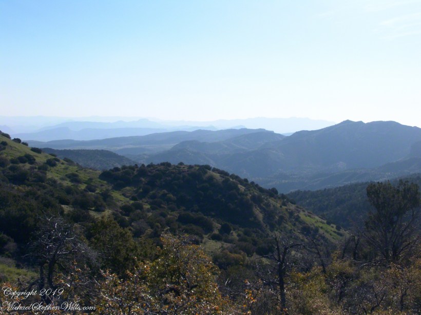
I split an energy bar and took a swig of water before setting up the tripod to capture the following view of our path. The ridge, hazy in the distance of 22 miles, is Apache Peaks, the near descending ridges an improbable green after a wet winter. In the previous photograph, “North from Reavis Gap” you can clearly see the transition from the desert to a grassland biome as the elevation increases.
Generations
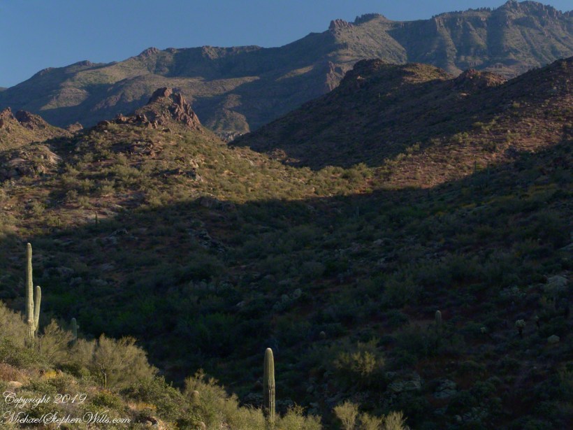
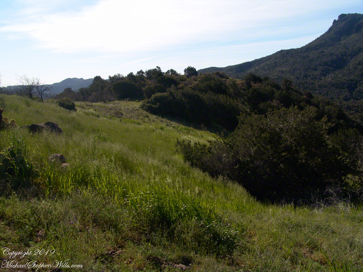
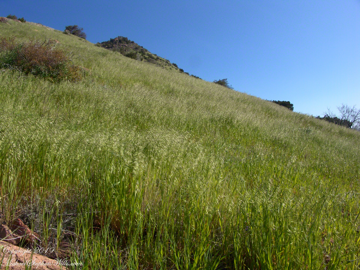
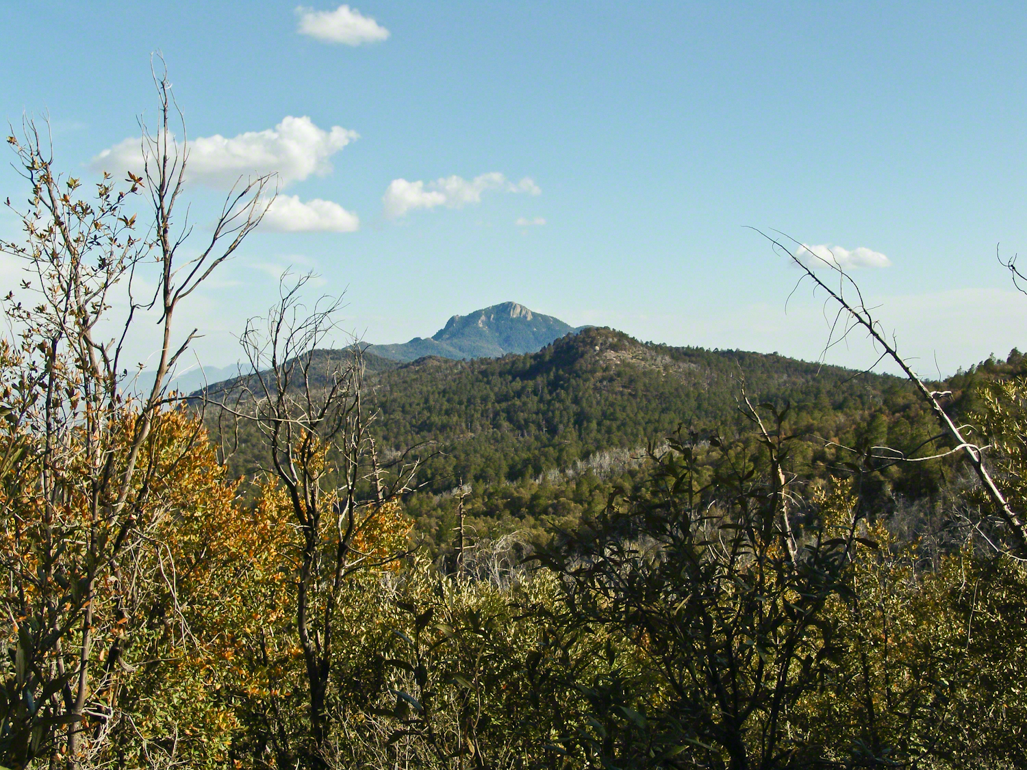
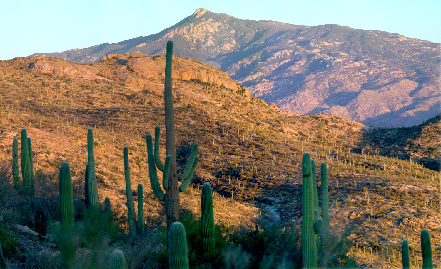
On this, the southern shoulder of Two Bar Mountain, we enjoyed desert grasslands almost the entire length, starting with this unlikely oat field. The higher, eastern Superstitions are the western and northern-most Sky Island of Southern Arizona: rising from the desert as isolated mountain systems, catchments for passing storms, with life zones progressing with altitude, the highest typical of Canada. As with oceanic islands, each is a haven for life with potential for evolution of unique species from the isolating effect of the surrounding desert.
These oats are domesticated grain spilled from a horse or donkey pack to thrive in the decades since, sprouting into this spread of light green after a wet winter, ripening, then turning gold with the summer, the grains falling to wait for the next opportunity. This green hue is my first impression of Reavis Gap, see my post “Two Meetings” for a video of the morning breezes rippling along the hillside.
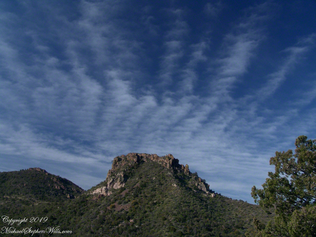
The camera sweeps 180 degrees for all the views from this spot, including prickly pear cactus among the grasses, a butte-like formation to the west, as in the following photograph.
Upper Horrell, the end of the beginning.
We passed the length of the Reavis Mountain School of Self Reliance, the Reavis Gap trail is 100 feet or so higher on the north side. The name “Upper Horrell” is attached to this location. Reavis Gap trail used to start at a ranch house, part of the “Upper Horrell Ranch.” Horrell is the family name of the former owners.
Upper Horrell is a fortunate location for the school, with the perennial Campaign Creek flowing parallel to their 13 acres on which is a large garden, many fruit trees, livestock and poultry. The school provides lodging and classes throughout the year.
The Searcher initiated his time in the Superstitions with wilderness survival classes and they allowed him to park is horse trailer and pickup outside the gates. We were loaded and out of there with a stop at Roosevelt, population 28, where we were the only customers for mesquite grilled hamburgers and french fries. We talked about the potential for future trips and I took him up on an offer to store my stuff until then. In the following years I did more Superstition Wilderness day trips, backpack expeditions, some with my sister Diane, and one horse expedition with The Searcher and a friend.
Here is a gallery of this post’s photographs, for you to flip through.
The Arizona Trail passes this spot in the remote eastern Superstition Wilderness. This is the view of my path up from Nameless Canyon. In the distance is the Four Peaks Wilderness Area.
The view down the canyon followed by the steep Reavis Gap trail from Campaign Creek.
The viaw back toward the Superstition Wilderness from the Reavis Gap trail on the approach to Reavis Gap.
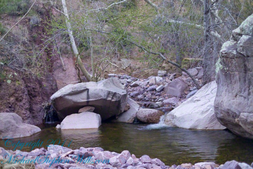
Two Nature Abstracts, macros of Reavis Creek below the falls
The light of a early spring desert afternoon on a broad rock shelves along the creek.
I spent a day hiking in, two days hiking out and a day of canyoneering to the foot of Reavis Falls. The featured (i.e. “header”) photograph is a view of the inner canyon, the raw material for these abstracts.
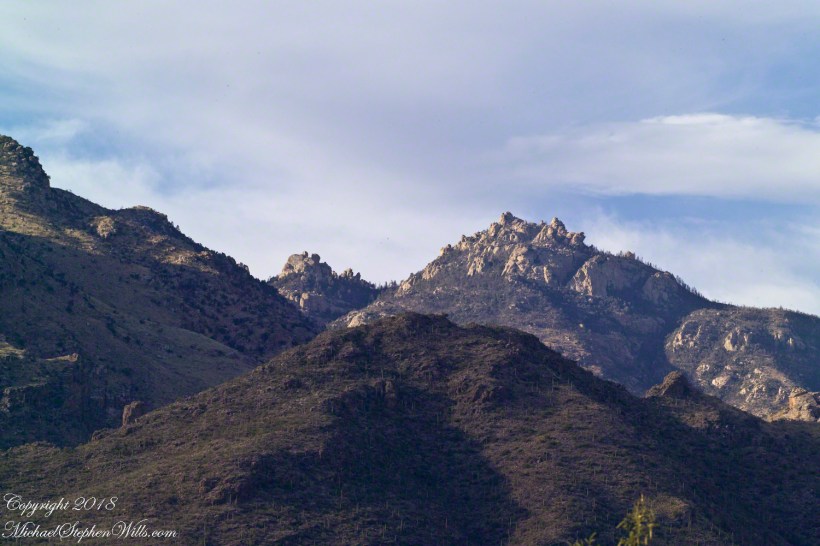
The Rincons are one of 42 Sky Mountain islands isolated from each other by the gradual warming and drying climate changes since the last ice age, 10,000 years ago. While this marvelous environment of oak and pine forests only accessible with much effort on foot, it is literally visible from every point of the Tucson valley and million human inhabitants.
Rincon is Spanish for corner, the mountains are called that from their shape enclosing a space on the west, northwest until recently used for ranching and is now falling into use for tract housing. The mountains themselves are reserved as wilderness, parts in the Saguaro National Park and the Coronado National Forest.
In the past 44 years I was lucky enough to visit the Rincon Wilderness interior three times, shouldering different style backpacks onto the mountain, walking different boots. The first, during college the 1970’s, a party of six left from the end of Speedway, up the Douglas Springs trail. The climb was an exercise in desert survival that several friendships did not survive, replace by new friends met on Mica Mountain. I have no photographs from that experience, only memories and the backpack.
Reconnecting with Arizona in 2004, thirty one years after that first experience, I took no chances. My first attempt on Rincon Peak was a success. Risk and effort were reduced, not eliminated by hiring a guide for the four day trip. We made it to Rincon Peak via the Turkey Creek Trail out of Happy Valley, climbing a mountain buttress, views ever widening and lengthening.
These are some photographs from that experience and a landscape photograph of the peak at sunset, taken the following year.
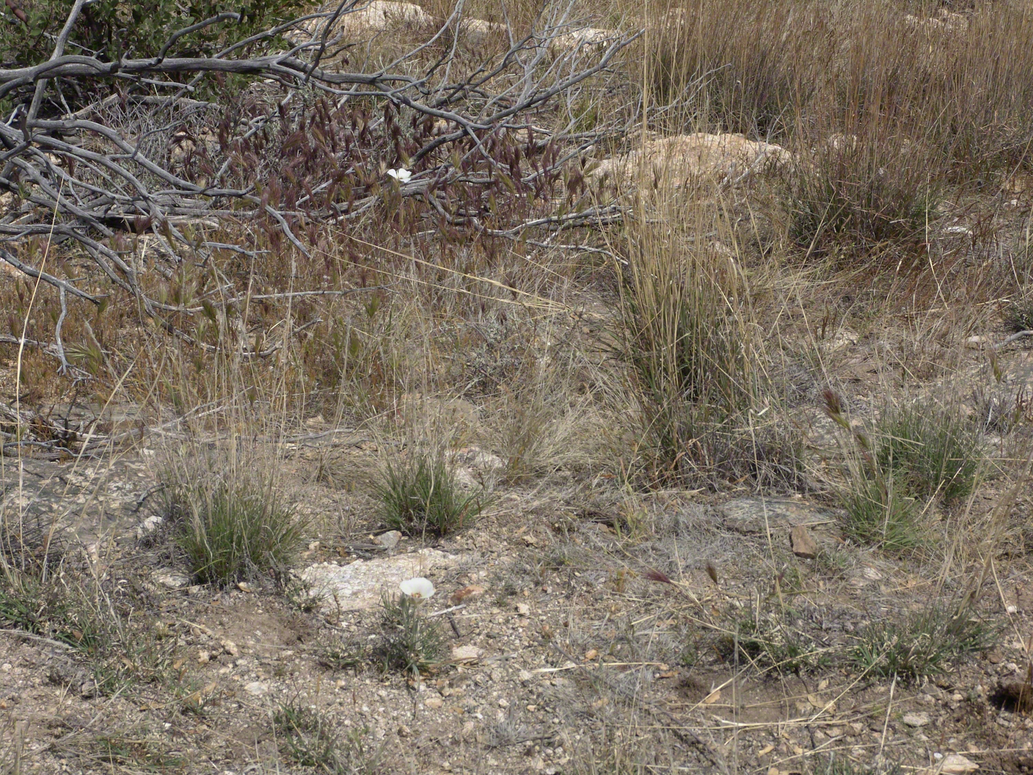
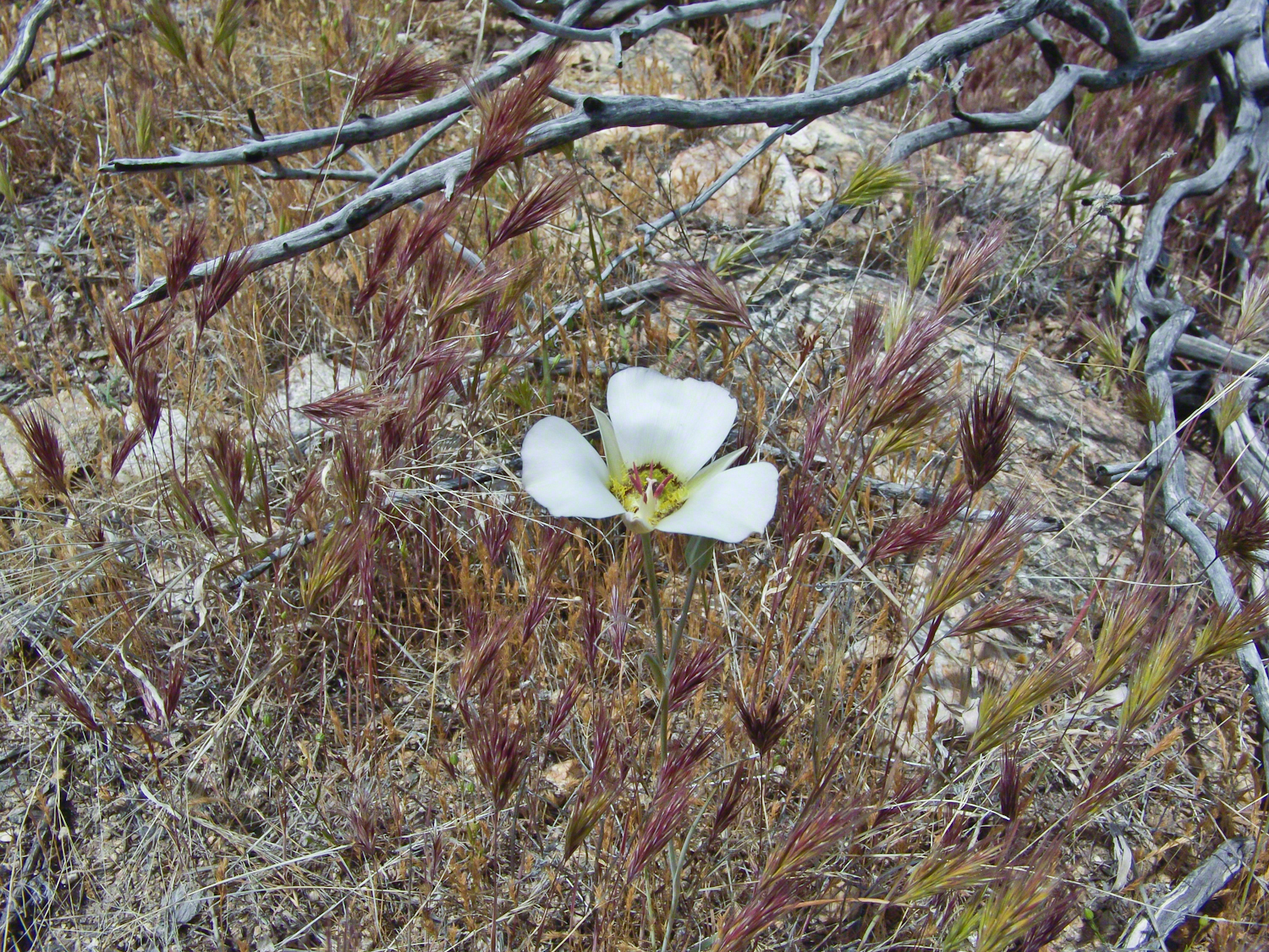
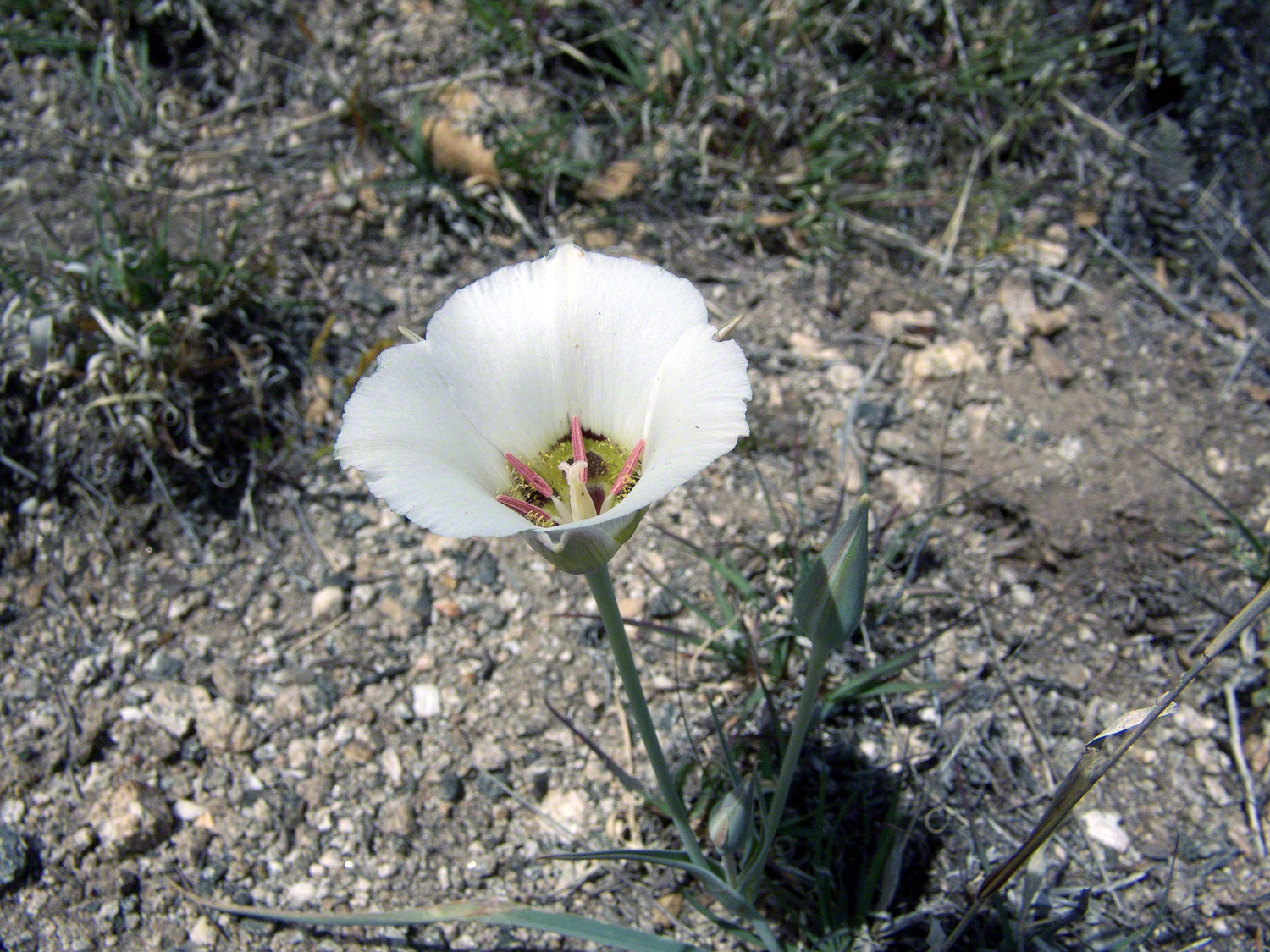
Sego Lilies bloom among a stricken oak and drying grasses on the Turkey Creek trail. This is an overview of the environment, it is the winter rains that trigger the bloom.
We paused while I unpacked my gear to capture Sego Lilies growing along the Turkey Creek Trail.
Deer Head Spring, at the top of Turkey Creek Trail was a moist spot with no accessible water when we reached it April 27, 2004. With the remains of a gallon of water each we needed to press ahead to Heartbreak Ridge and climb into Happy Valley Saddle were, thankfully, the creek was low and full of algae but usable. Here are my first views of Rincon Peak, looking across the aptly named Heartbreak Ridge and Happy Valley Saddle.
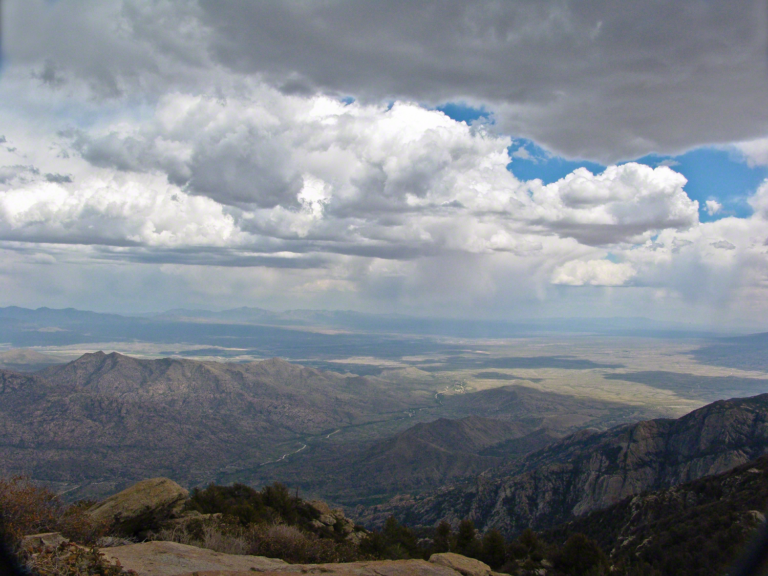
The view to south from Rincon Peak. The white rocks at lower right forms a Valley of the Moon wall. San Pedro River valley at the root, Mae West Peaks at left margin, Dragoon Mountains with Cochise Stronghold center. Taken around 12:30 on April 28, 2004 as a thunderstorm approached.
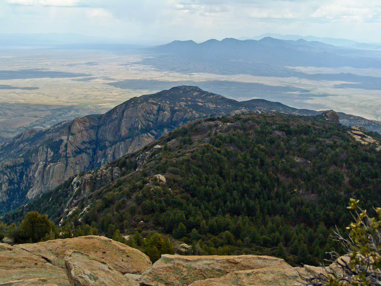
The Rincon Peak view looking south, southwest over the Valley of the Moon to the eastern Tucson Valley and the Sky Islands the Whetstone Mountains (Apache Peak), behind are the Santa Ritas. The works of man are overpowered by sky, rock, distance.
We made a hasty departure in front of the thunderstorm. It was a touch and go decision to attempt the peak that day, we made it with moments to spare.
April 29, 2004 the morning after reaching Rincon Peak I set up the tripod near our Happy Valley Saddle camp to capture Rincon Peak in early morning sunlight.
The day we descended to the X9 Ranch via the Rincon Creek trail. My guide’s grandfather had a homestead at the X9 and his access to the trailhead through private lands opened this route for us. This is a photograph of sunset on Rincon Peak from the X9 ranch. I am looking east from the Rincon (Spanish for corner) made by the massifs Rincon Peak, Mica Mountain and Tanque Verde ridge.
The evening of November 2, 2006 I climbed the Saguaro National Park, East, Tanque Verde trail for about 30 minutes to reach this view of Rincon Peak and waited until just before the sun set behind the Tucson Mountains for this shot. Then hiked back to the car in twilight. In my hurry, I tripped on a stepped turn and dove headfirst into a large prickly pear. It was a very painful experience and I regretted damaging the cactus and the loss of and good hiking shirt. There were large spines in my face and tiny, pesky spines covered my chest and back. The large spines are not barbed and come right out. I needed to visit a physician to remove them.
Copyright 2021 Michael Stephen Wills All Rights Reserved
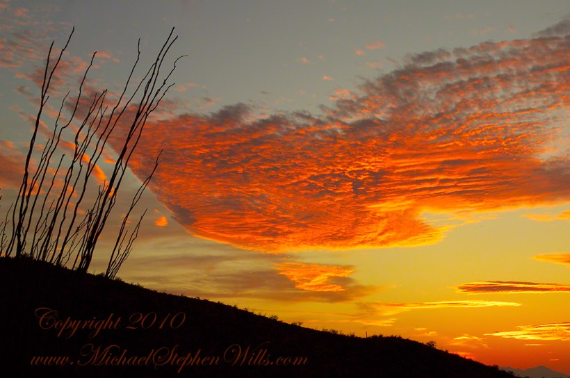
This is a retrospective diary of the day I created my print “Octillo Sunset.” You can visit “Octillo Sunset” on my online gallery by clicking on any of my blog photographs.
Choices of the Evening
Angled to the Sun
The following photograph of saguaros and distant Santa Catalina mountains is a similar view from Part 2 of this diary. Notice the saguaro on the right is also on the left in the Part 2 photo. What is happening is I turned the lens more toward the west and the sun. At this angle the lens hood offers less protection, especially as the sun is lower in the west and the time of day is passing to the best light from the lowering sun that rakes across the landscape. All this means I can bring the lens further to the west even though the lens hood is less effective.
Click any photograph to view Ocotillo Sunset
Finger Rock!!
One reason why I am offering it, is high on the Catalina mountains, in the distance, you can just see a formation called “Finger Rock”. This time of day, the lower angle of the sun brings out the canyon-shadows. Finger Rock canyon has a high western wall, you can see it as a high long shadow starting toward the very center of the picture and building up and to the right.
The following photograph is the view of Finger Rock from the floor of that canyon taken during a Spring 2011 Tucson visit. I started hiking in pre-dawn hours to catch the dawn rays on the finger.
Click any photograph to view Ocotillo Sunset
The Importance of Knowing Topography
Another aspect of this photograph is the landscape. There is a sloping bajada (alluvial fan) formed by water breaking up the mountain (in this case the Rincons) and washing it into the valley. It is the reason the saguaros appear to march into the distance. The same effect is used in movie theaters to allow the people in the rear to see over the head of people in the front.
This bajada and the higher elevation is the reason I moved from Sabino Canyon to here for a better position to view the sunset. Here is a nearly identical view, same 200 mm lens, in landscape format. The sloping land of the bajada is more visible.
Click any photograph to view Ocotillo Sunset
Changing the Lens/Sun Angle
Looking in the opposite direction, back over Lime Kiln Falls to the Rincon (mountain) foothills, the lens hood offers maximum protection. The sun is at my back and, even though it is low in the sky at the beginning of the Golden Hour, this aspect gives great color depth at the expense of loss of shadows losing some depth of field. Still, this is an interesting photograph.
On the ground in Sabino Canyon, I rethought my plans for the afternoon, given the potential of an incredible desert sunset, and decided to seek the high ground east of Tucson up against the Rincon Mountains in the Saguaro National Monument. There was still plenty of time to travel there and set up.
On arrival at the monument I took the scenic “loop” road that meandered around the desert. The Lime Kiln Falls trail makes some elevation, so I hiked that to the end. In the 1800’s the rocks in the area were exploited for their mineral content by heating them, on site, to high temperatures that released a highly caustic (chemically reactive) “quick lime” that was in high demand. All that’s left of this work is some ground discoloration.
The Dry Water Fall and former Mining Site
The “Falls” in question were a totally dry rock ledge that I climbed for these views. In the first photo, on the right in the distance, you can see the same mountain peaks I shared in Part One. I used the same 200 mm telephoto lens because that interesting stand of saguaros were over 100 feet away across a steep slope.
Young Saguaros
The saguaros are interesting, to me, because they are all so young and grouped together. As though s clutch of seeds from the same specimen landed together on the same spot. The saguaros are notable for their lack of arms which will form with the passing years.
A View of the Catalinas
Late afternoon is the perfect time to photograph the Catalinas in the distance and the high, thin gathering cloud cover made for dramatic shading of the peaks. I needed to wait for a perfect moment because the light and view changed, literally, second by second. If you look closely, the city of Tucson can be seen among the foothills, to the left.
Why the Distance Stands Out (high contrast)
The lens was fitted with a deep hood. Besides being black, the interior of the hood is surfaced with black felt, the same as used for large telescopes, to capture any stray light. Light falling across the lens surface causes reflections, which is what this hood prevents. The result is the amount of contrast I captured, using the appropriate exposure and other settings. For this photograph I used F14, 1/125 and ISO160.
Click any photograph to view Ocotillo Sunset
Another Catalina View
A bit further down the same trail, the desert view features an army of saguaros marching into Tucson.
Click any photograph to view Ocotillo Sunset
The Catalina Highway runs along the escarpment, in the distance, and to the top of Mount Lemmon, a 9157 foot peak. In season, you can ski in the morning, on the peak, and in an hour or so travel to the desert to sunbathe comfortably. From the trail to the top of the Rincon Mountains this view just keeps opening up farther and farther and farther. My wife, Pam, and I backpacked up there April 2011.
On a Tucson November 2005 afternoon, after my volunteer work for the University of Arizona, CALS college, alumni board of directors, in the mid-afternoon I headed for Sabino Canyon with my photography kit.
With a 25-pound pack on my back, walking from the parking lot I looked up at the incredible rock formations of the Santa Catalina mountains. It took some time to set up the tripod (at that time I was using a cheap swivel head on adjustable aluminum legs) with a 200mm telephoto lens (Canon L-series EF 200mm USM) I grabbed this shot of the hoodoo fringed peaks beyond the foothills (f16, 1/30, ISO160). The lower sun angle made the formations pop out.
Hoodoos in the Hills
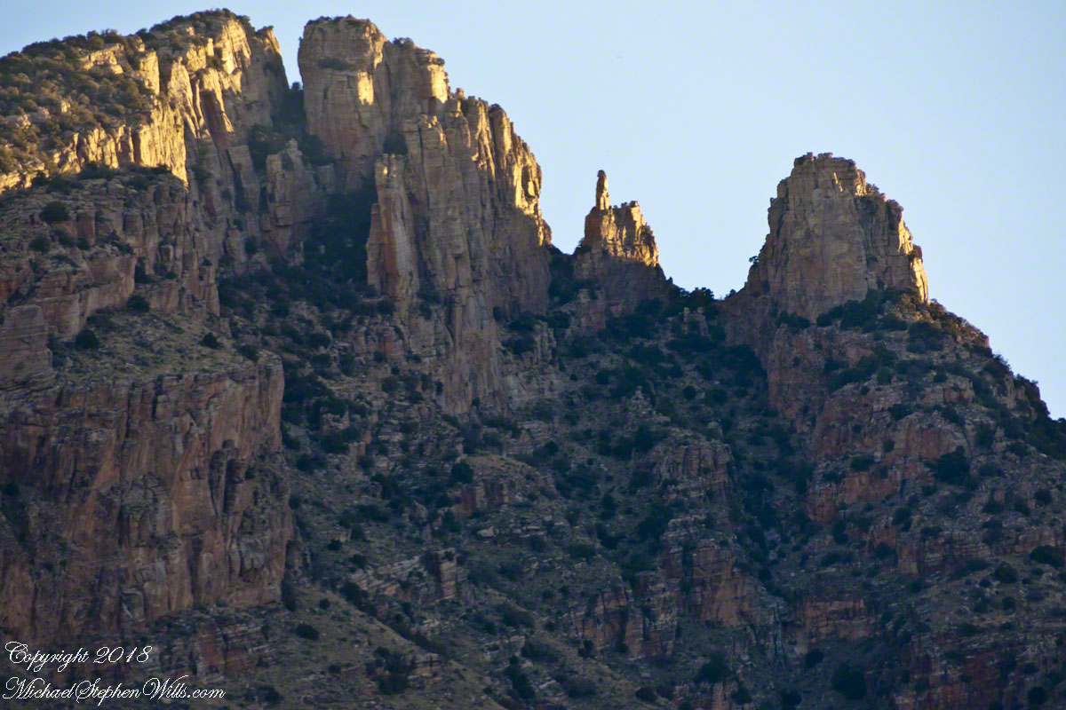
You call those strange formations of upright rocks “hoodoos. Some people believe the fantastic shapes were created by spirits, today the explanation is wind, water and time create hoodoos from rock of the right stuff. It is a wonderful experience to wander among hoodoos, though unsettling because some of these large rocks are seemingly in danger of falling over at any moment.
Moving On
I have a mental list of photographic “to do’s” and the gathering clouds, typical for a Tucson November day, reminded me an awesome desert sunset was on this list, so I packed up to head for the east side of Tucson for a shot looking toward the Tucson Mountains (on the west side).
Clouds gather at sunset above a ridge serrated by saguaros.
Click any photograph to view Ocotillo Sunset
Sabino Canyon House
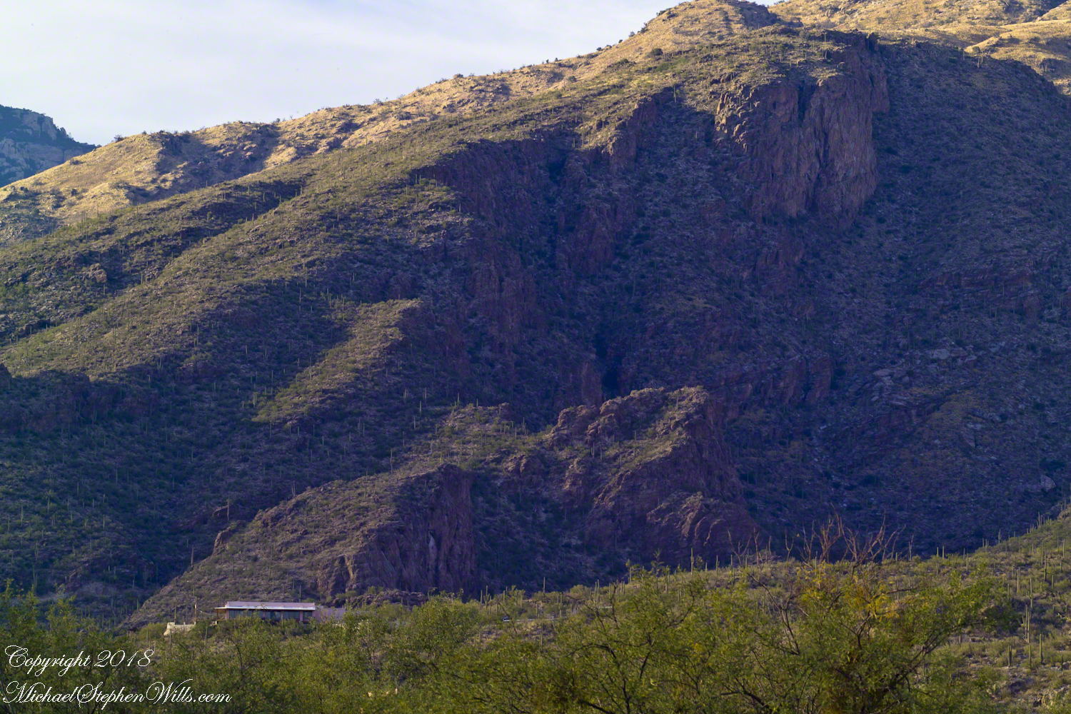
Before we move on, this is a fascinating image of a typical southern Arizona house perched on a ridge at the mouth of Sabino Canyon. In this image the viewer sympathizes because the telephoto lens gathers the majestic rocks around the tiny structure.
The house is perched on a Santa Catalina foothill ridge running east west, a wall of picture windows facing south with a view across the Tucson valley toward Mount Wrightson of the Santa Rita mountains, 42 miles distant. Summer thunderstorms gather on this peak, wreathing it with lightening. These times, evenings and night, the view pays for the inconvenience of this distant, hot ridge. Another time to be there is for sunsets.