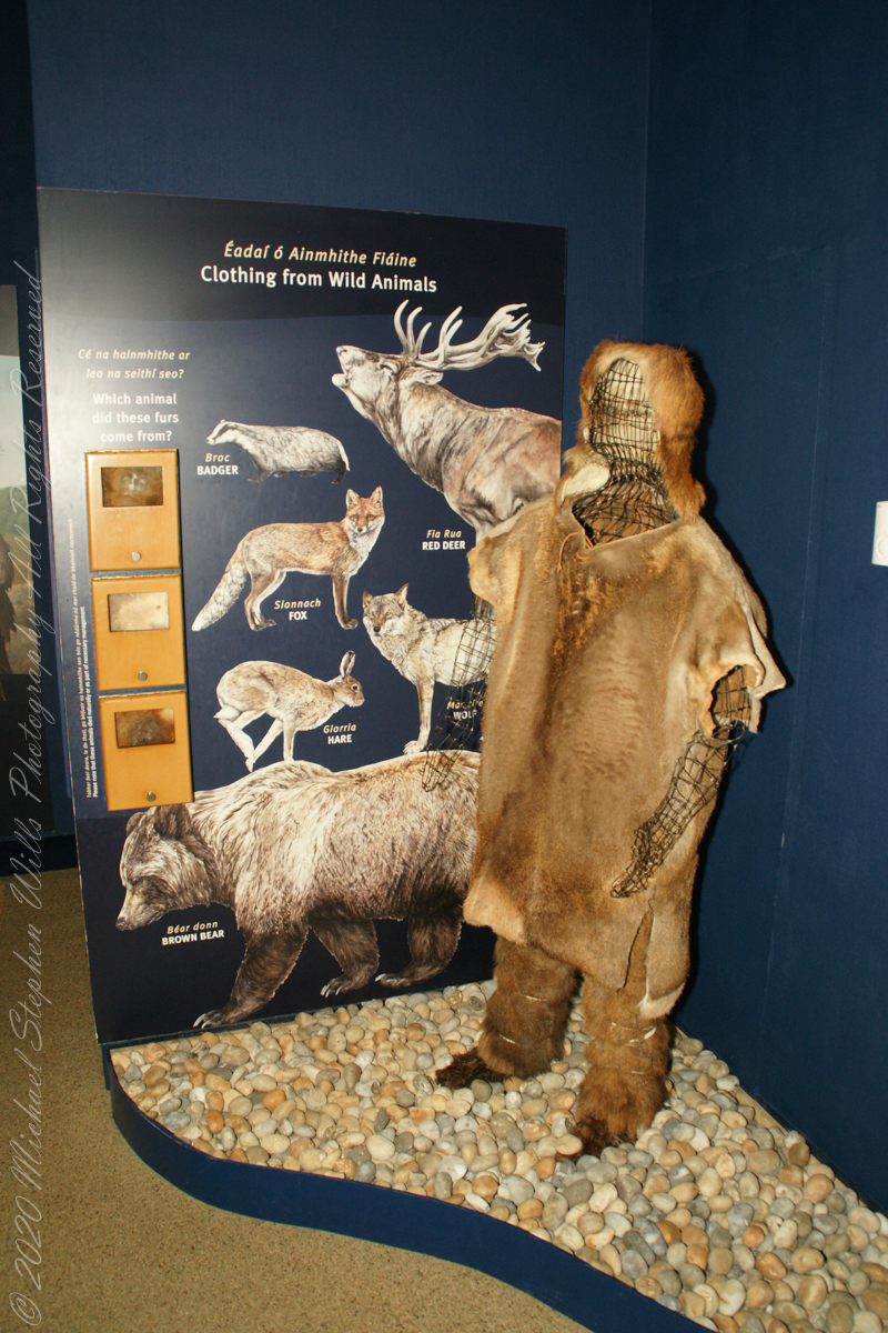
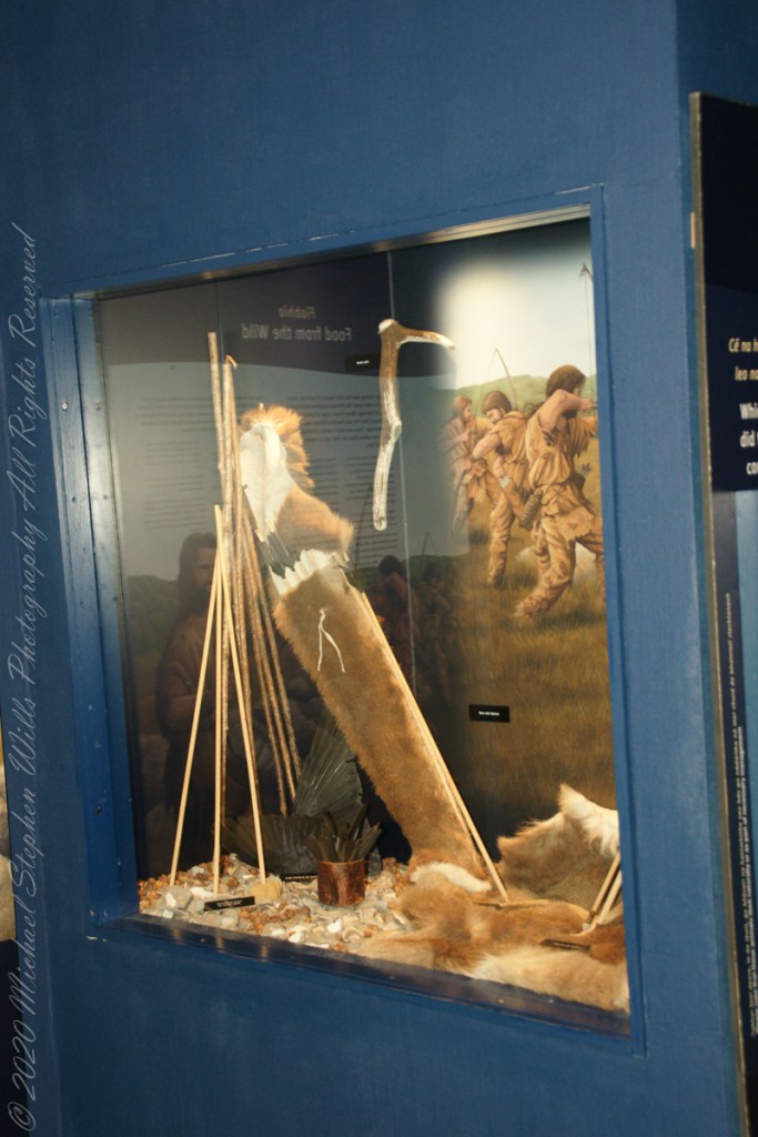
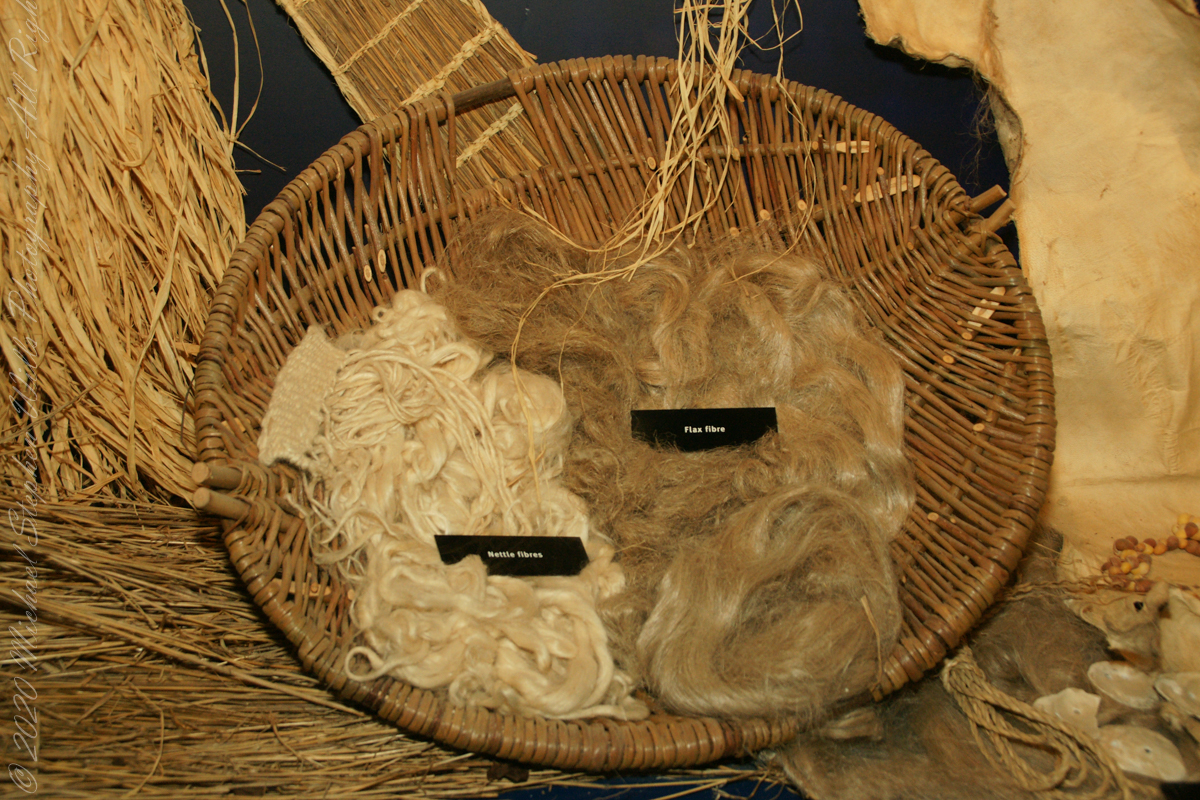
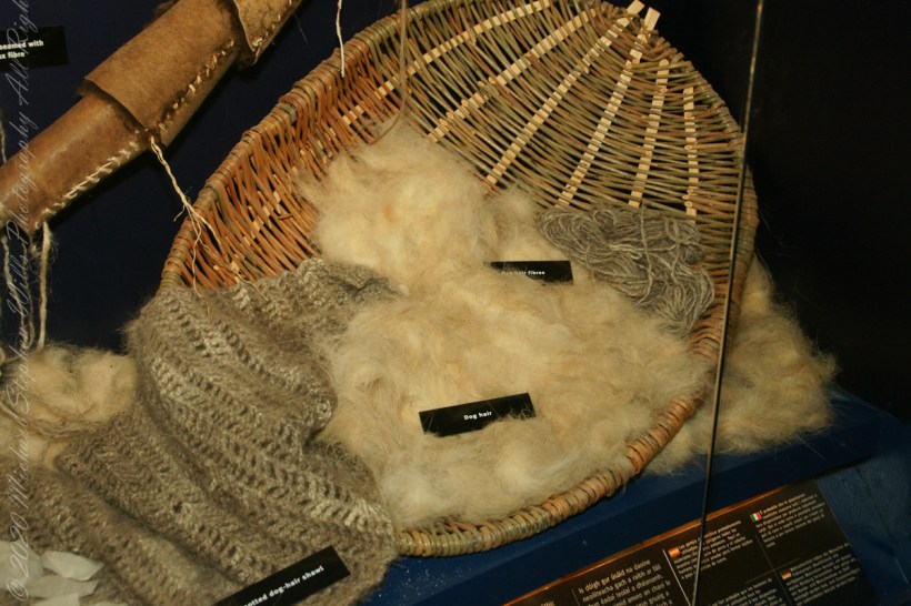
How the builders of Brú na Bóinne clothed themselves
Click Me for the first post of this series.

How the builders of Brú na Bóinne clothed themselves
Early Irish farmers introduced crops and domesticated animals, aided by milder climate.
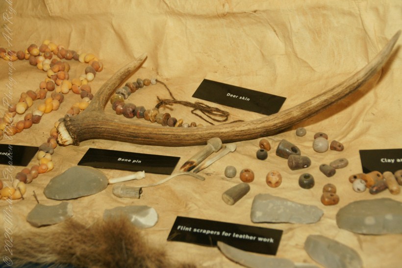
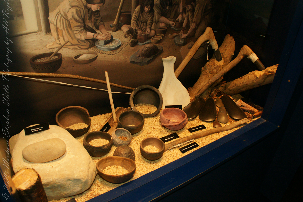
The people who built the passage tombs at Brú na Bóinne and elsewhere in Ireland were farmers, a way of life which by this time had become well established in Ireland. All the mainstays of early farming life — cereals such as wheat and barley, and domesticated animals such as cattle, pigs, sheep and goats — were introduced to Ireland by early farmers. T

he climate was warmer and drier than it is today which meant that the growing season was longer and winter was shorter and milder. The main crops grown appear to have been emmer wheat and naked barley. Flint knives and blades were used for cutting meat. Simple wooden ploughs with stone tips were probably used.

The cattle were Bos taurus longifrans, large animals with forward facing horns which were kept primarily for farm work and meat. Cattle may also have been important in a ceremonial sense; cattle bones were sometimes placed in a very deliberate way in the ground. Sheep were probably like Soay sheep today, without a woolly fleece and probably used mainly for their meat. Dog and pig bones have also been found.
For my 365th consecutive post: approaching an ancient passage tomb older than the Egyptian pyramids.
Thirty minutes headed up the M1 from Dublin Airport Pam and I arrived at Brú na Bóinne Visitor Center, gateway to Newgrange. Archaeologists classified Newgrange as a passage tomb, however Newgrange is now recognized to be much more than a passage tomb. Ancient Temple is a more fitting classification, a place of astrological, spiritual, religious and ceremonial importance, much as present day cathedrals are places of prestige and worship where dignitaries may be laid to rest.

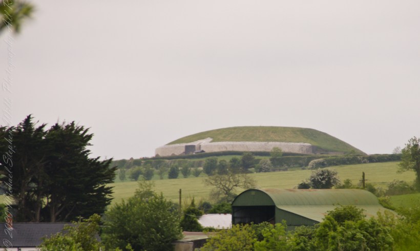
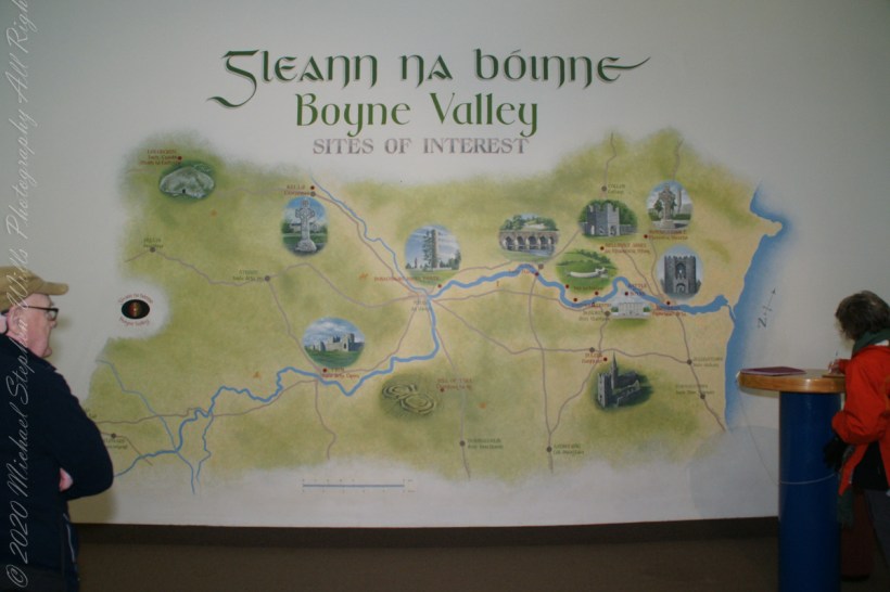
Bounded on the south by a bend in the River Boyne, the prehistoric site of Brú na Bóinne is dominated by the three great burial mounds of Knowth, Newgrange and Dowth. Surrounded by about forty satellite passage graves, they constitute a funerary landscape recognized as having great ritual significance, subsequently attracting later monuments of the Iron Age, early Christian and medieval periods.
Newgrange was built by Stone Age farmers, the mound is 85m (279ft) in diameter and 13m (43ft) high, an area of about 1 acre. Newgrange was constructed about 5,200 years ago (3,200 B.C.) which makes it older than Stonehenge and the Great Pyramids of Giza.

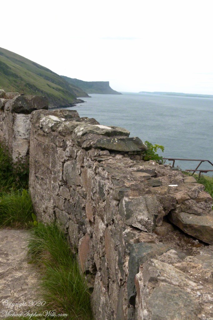
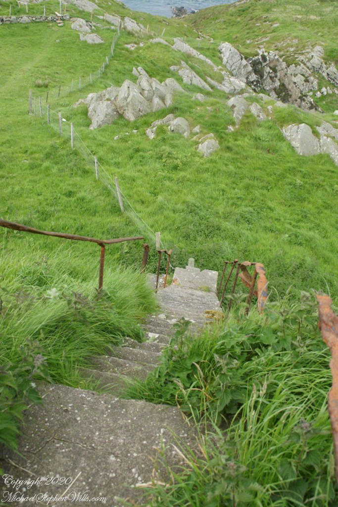
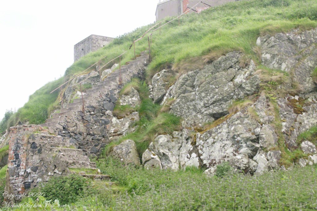
Down and Down
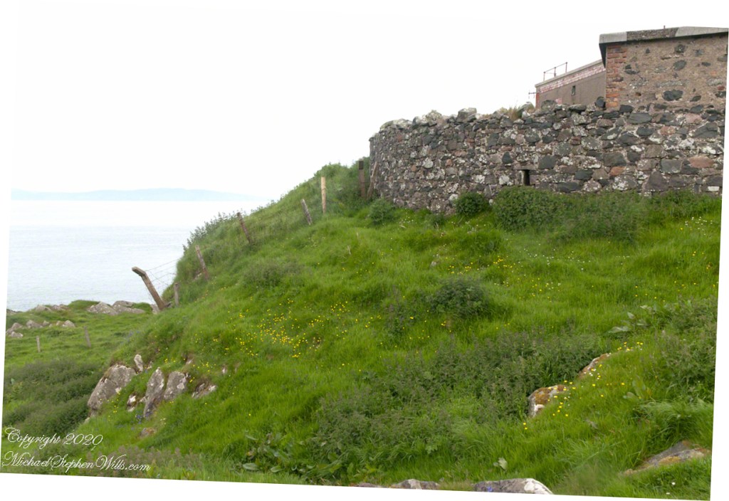
Weathered masonry at the height of Torr Head was there to serve the custom house and as support for a spotting station where ships transiting the Strait of Moyle (Irish Sruth na Maoile), the 12 miles of water to the Mull of Kintyre.
Lloyd’s of London, vitally interested in the appearance of ships’ progress crossing the oceans, had notice of passage via semaphore (and, later, Marconi’s “wireless”). Destination ports were copied in.
Explore my photography on Shutterstock for use with your blogs“
The Way South –
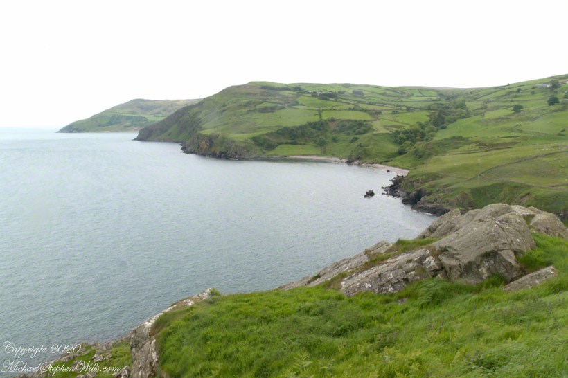
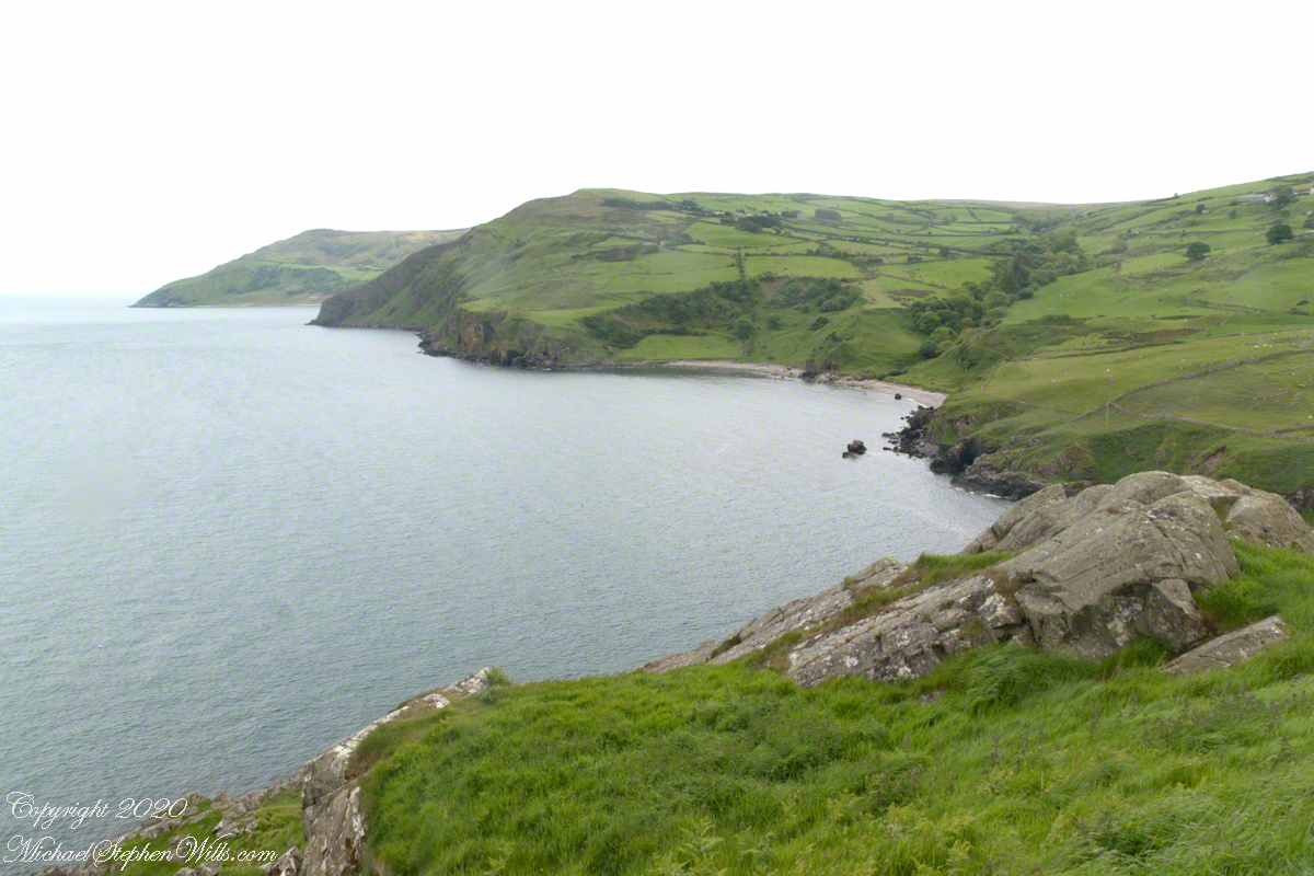
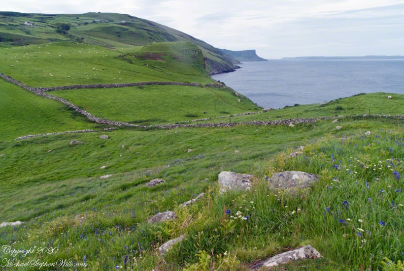
Scottish influences touched the landscape covered by yesterday’s post, today we continue on this subject with these south facing views from Torr Head. The far ridge of Torrcor marks Loughan Bay.
A townland on the other side of Torrcor hill (and townland) has an eponymous ruin, Altagore Cashel. Mores the pity we did not visit this site, a thick drystone enclosing wall from the 5th century (you can see photographs from another site at this link). Cashel is from the Irish Caiseal, a circular, defensive fort (“ring fort”).
Books such as “Antrim and Argyll: Some Aspects of the Connections” tell of connections over the millennia, clan associations between the islands and ring forts such as Altagore Cashel.
Explore my photography on Shutterstock for use with your blogs.
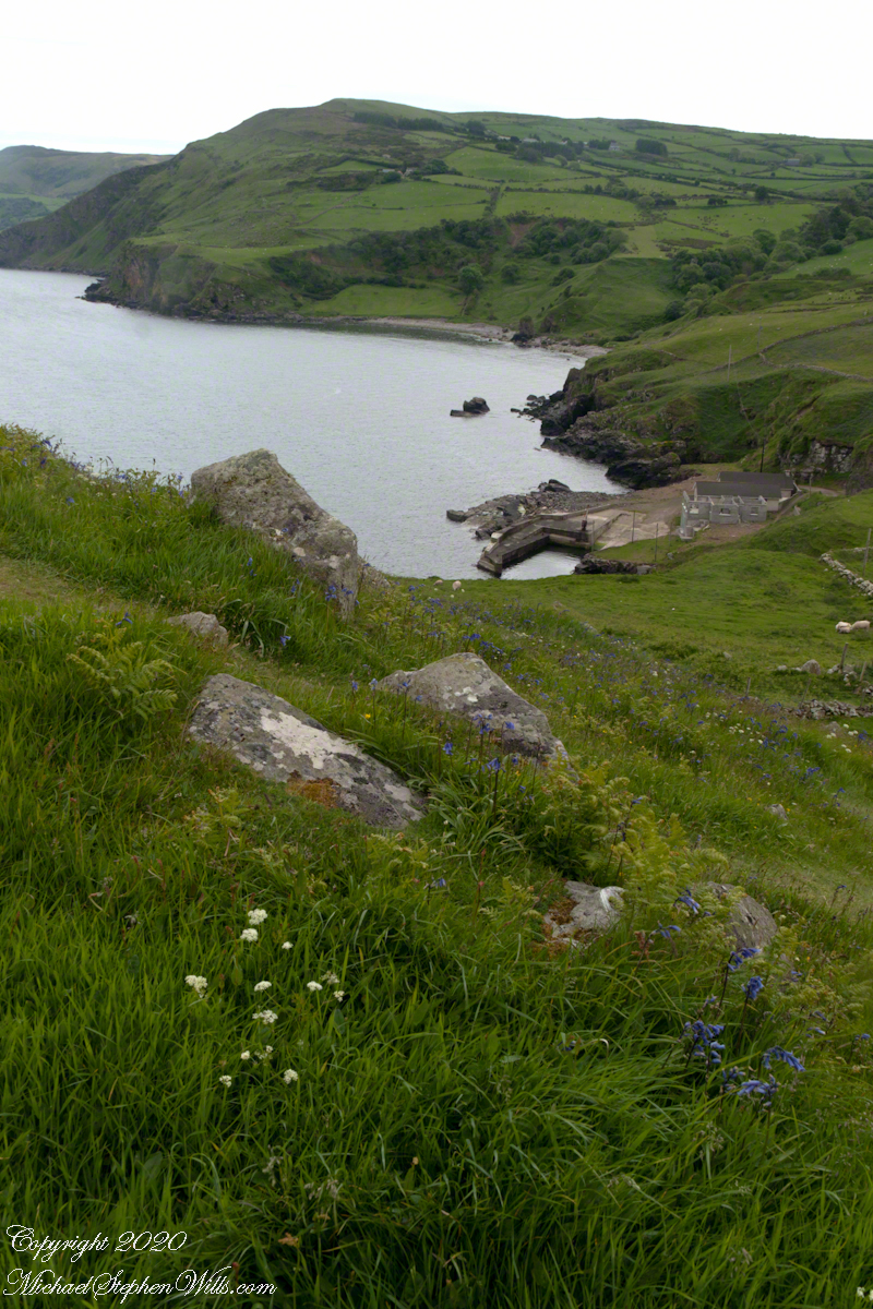
Salmon Run
Late spring and summer, weekdays, a net is stretched across the bay to catch salmon nosing up the coast, searching for their home spawning stream, here called Altmore Burn. “Burn” is a Scottish term for a fresh water source, evidence of the influence 12 miles across the north channel.
The small harbor seen here from Torr Head is for the salmon fishery. Small boats will seek shelter here from the wind and tides strong enough to roar in passing the Head, like a fast flowing river.

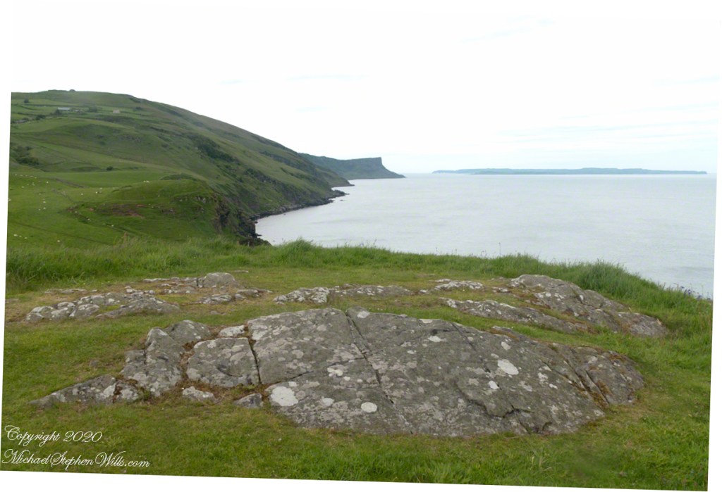
Neolithic Passage Tomb
Taking in a flower meadow, foreground, coaster sheep pastures, the photograph, below, looks north from Torr Head. The high hill, midground, is Greenanmore, notable for a the largest passage tomb of the Antrim Glens. Locally known as “Barrach’s Tomb,” for the Red Branch knight of the 1st Century AD fort on Torr Head, tree ring research of the mid-20th Century dates these tombs in the neolithic The hilltop passage tomb was an ancient relic when the mortar of Barrach’s Torr Head fort was drying.
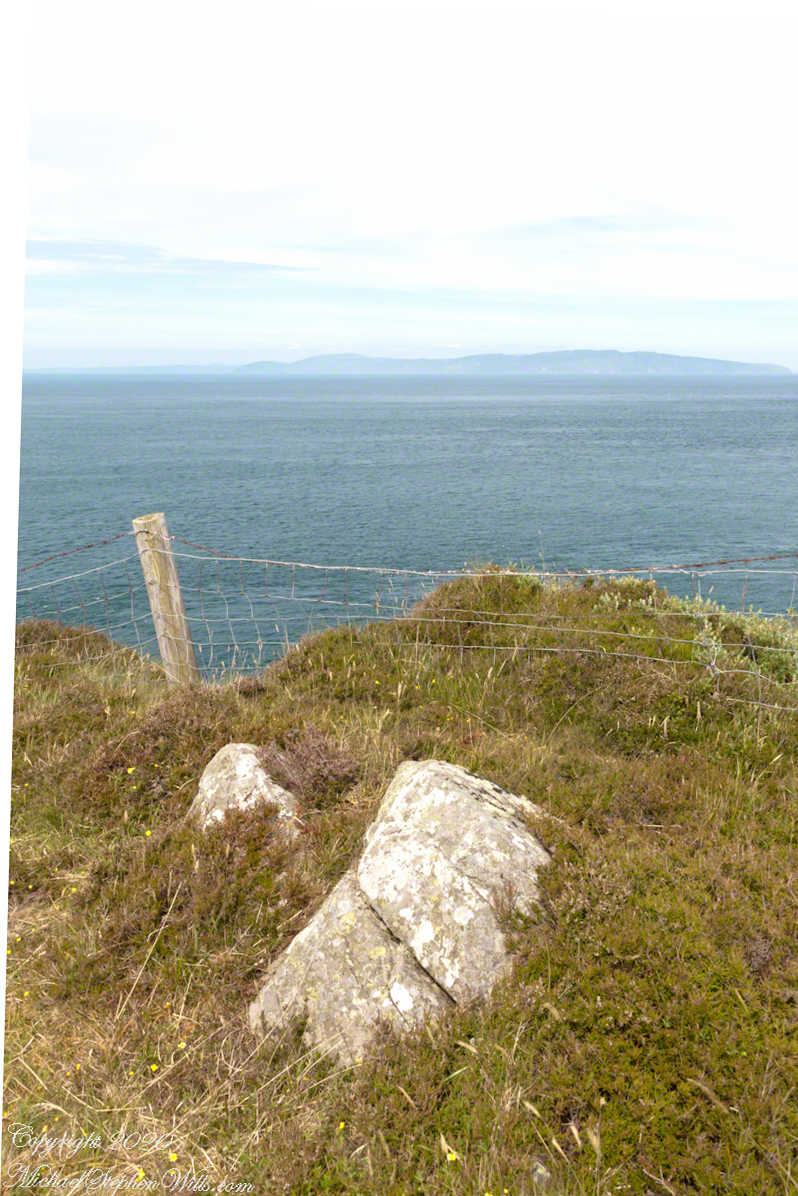
When I enlarge the original photograph, visible on the ridge is a decommissioned Cold War listening post, the tomb is near that. The distant land across the North Channel water is Rathlin Island.
Click photograph for a larger view. To do this from WordPress Reader, you need to first click the title of this post to open a new page.


part of the Irish landscape
A roadside shrine on Cottage Road, Inishmore. The faith brought by the saints has deep roots here.
A large crucifix set with wet stone walls with cut flowers. The walls are the native limestone.
It is a spring (early June) afternoon and there are fern and wildflowers. The white flowers are Greater Burnet saxifrage (Scientific Name: Pimpinella major).
The existing dry stone wall was interrupted by the shrine. In the distance are dry stone walls around fields, a stone shed, feeding horses and the sea, being Galway Bay, storm clouds with distant rain.
Aran Islands, County Galway, Ireland.


Flowers on the edge
From the commanding location of Dun Aonghasa, looking northeast across Inishmore island, we can understand why the ancient builders chose this location.
We also see the transition from exposed limestone to the fields built literally from the ground up (see my post “The How of Soil”). For a closer view of island houses see my posts “Settled In” and “Cottage Road Cottage.”
The field walls are described in my posts, “What is a rock, what is a stone?” and “Stone on Stone.”
Click the photograph for a larger view. Enjoy!!
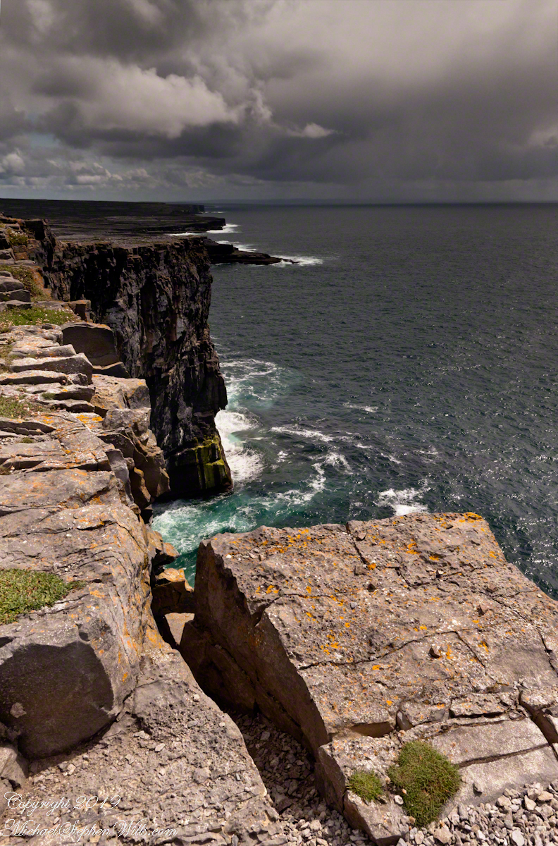
Breaking waves, turquoise sea below the dramatic cliffs of the ancient fort Dun Aonghasa (Dun Aengus),
in the distance the karst landscape of Inishmore with clouds of an approaching storm over Galway Bay.
Sea Campion (scientific name: Silene uniflora) (irish name: Coireán mara) clings to the edge.
Inishmore, Aran Islands, County Galway, Ireland.

Beware of falling rock
From the commanding location of Dun Aonghasa, looking northeast across Inishmore island, we can understand why the ancient builders chose this location.
We also see the transition from exposed limestone to the fields built literally from the ground up (see my post “The How of Soil”). For a closer view of island houses see my posts “Settled In” and “Cottage Road Cottage.”
The field walls are described in my posts, “What is a rock, what is a stone?” and “Stone on Stone.”
Click the photograph for a larger view. Enjoy!!
Breaking waves below the dramatic cliffs of the ancient fort Dun Aonghasa (Dun Aengus),
in the distance the karst landscape of Inishmore with clouds of an approaching storm over Galway Bay.
A crack in the limestone foretells the next cliff erosion, “don’t step there!!.”
Inishmore, Aran Islands, County Galway, Ireland.

