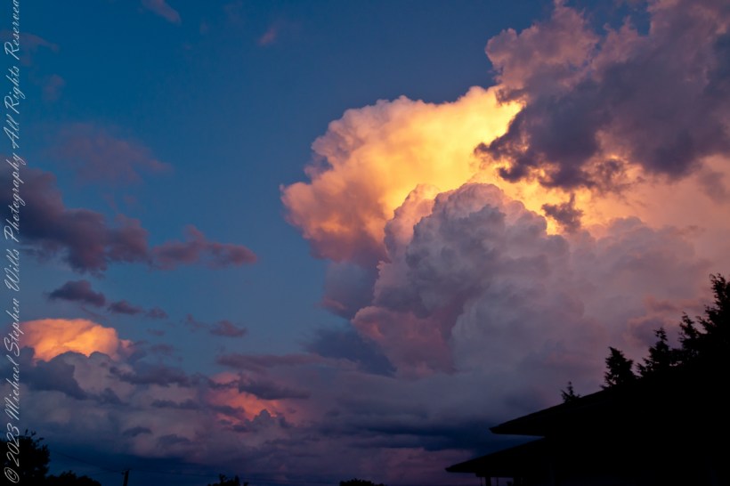
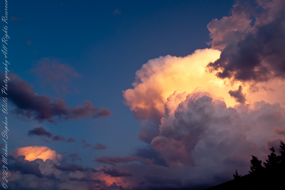
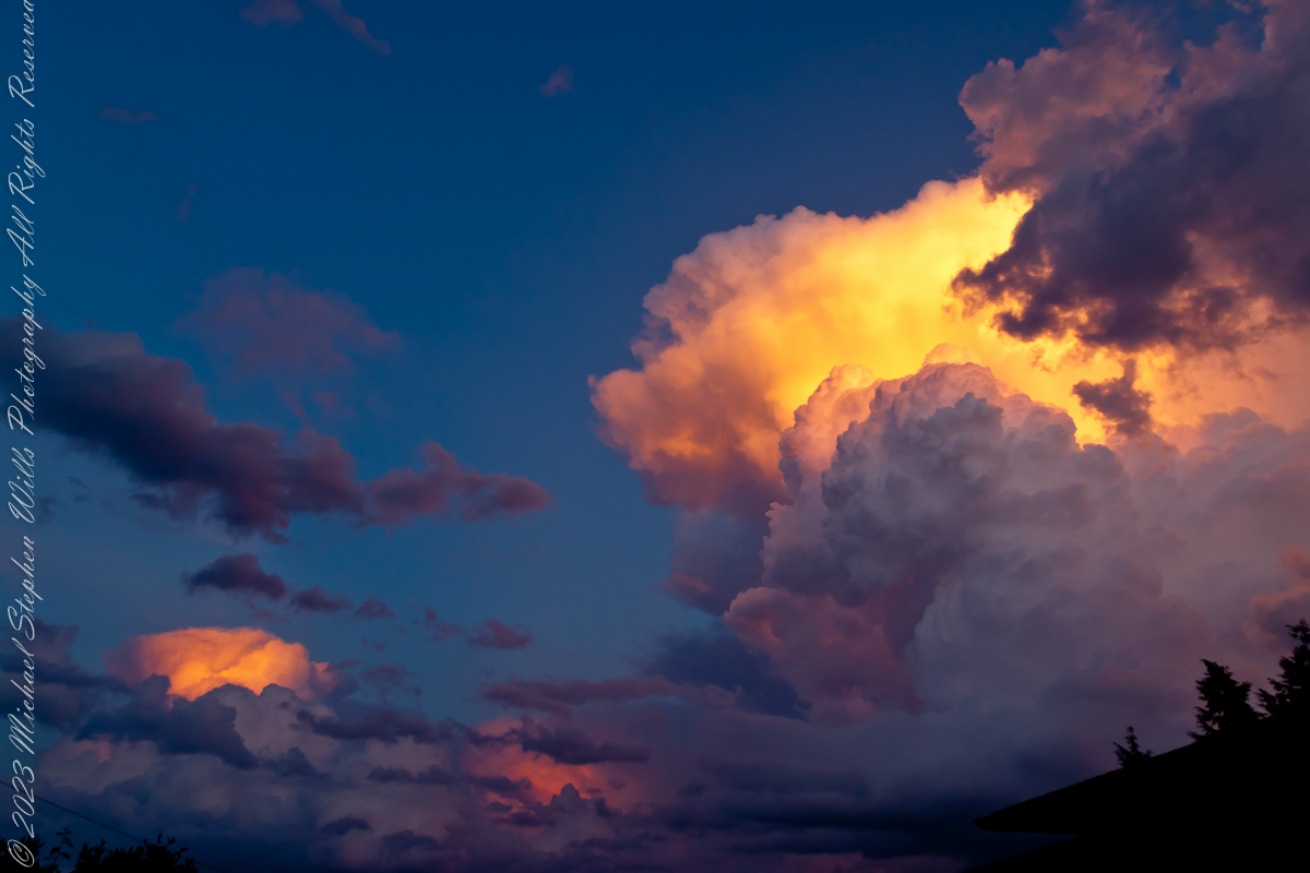
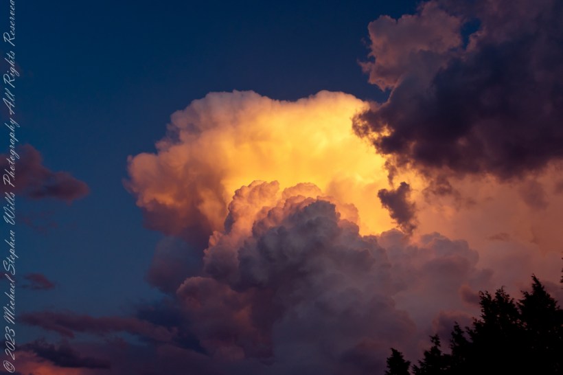
The combination of water vapor in all its forms and the sun dipping below the horizon combined to form these magical images.
Maxfield Parrish refined his art to duplicate these effects in oil.
Parrish’s art is characterized by vibrant colors; the color Parrish blue was named after him. He achieved such luminous color through glazing. This process involves applying layers of translucent paint and oil medium (glazes) over a base rendering. Parrish usually used a blue and white monochromatic underpainting.
His paintings/illustrations were unique in that they depicted a highly idealized fantasy world that was accessible to the public. Although you will rarely see a glimpse of that color in reality, he was and still is linked with a particularly bright shade of blue that coated the skies of his landscapes. And it was not an easy task for him to complete. He invented a time-consuming process that involved a cobalt blue base and white undercoating, which he then coated with a series of thin alternating coatings of oil and varnish. When exposed to ultraviolet light, the resins he employed, known as Damar, fluoresce a shade of yellow-green, giving the painted sky its distinctive turquoise tint.
Reference: “Maxfield Parrish” from Wikipedia
Copyright 2023 Michael Stephen Wills All Rights Reserved
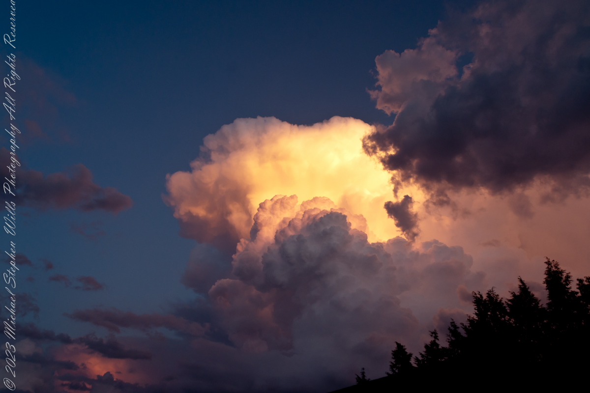
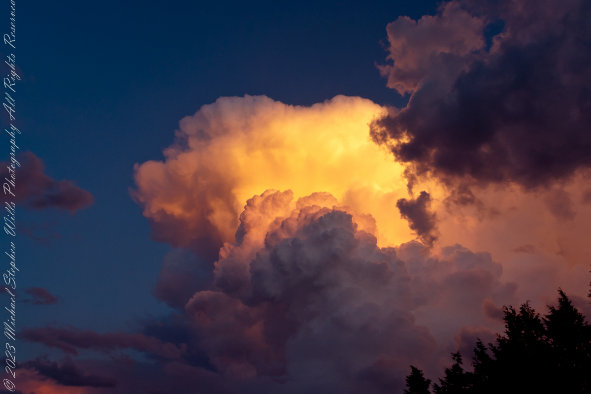
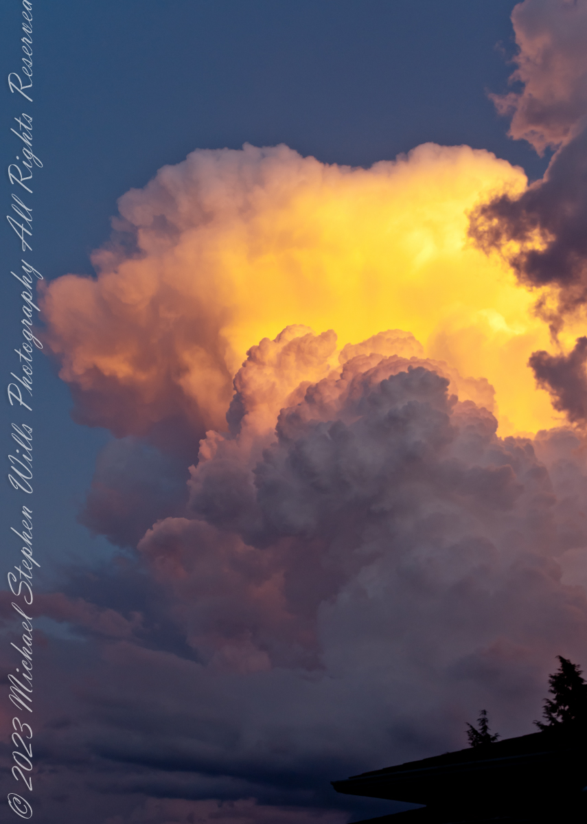
Cumulonimbus (from Latin cumulus ‘heaped’, and nimbus ‘rainstorm’) is a dense, towering vertical cloud, typically forming from water vapor condensing in the lower troposphere that builds upward carried by powerful buoyant air currents.
Above the lower portions of the cumulonimbus the water vapor becomes ice crystals, such as snow and graupel, the interaction of which can lead to hail and to lightning formation, respectively. When occurring as a thunderstorm these clouds may be referred to as thunderheads. Cumulonimbus can form alone, in clusters, or along squall lines.
Graupel also called soft hail, hominy snow, or snow pellets, is precipitation that forms when supercooled water droplets in air are collected and freeze on falling snowflakes, forming 2–5 mm (0.08–0.20 in) balls of crisp, opaque rime.
Graupel is distinct from hail and ice pellets in both formation and appearance. However, both hail and graupel are common in thunderstorms with cumulonimbus clouds, though graupel also falls in winter storms, and at higher elevations as well.
These clouds can produce lightning and other dangerous severe weather, such as tornadoes, hazardous winds, and large hailstones. Cumulonimbus progresses from overdeveloped cumulus congestus clouds and may further develop as part of a supercell. Cumulonimbus is abbreviated Cb.
Reference: “Cumulonumbus Cloud” and “Graupel” from Wikipedia
Copyright 2023 Michael Stephen Wills All Rights Reserved
I first learned about Circlestone from stories The Searcher told during my first backpack into the eastern Superstition Mountains, on the Tule trail, April 2005. I described this in “Riding from Pine Creek to the Reavis Valley” where the Searcher described a stone circle, overgrown with Alligator Juniper, on the slopes of Mound Mountain. He pointed south toward a peak and foothills that rose from the valley floor and said, “follow the fire trail east from the southern Reavis Ranch valley.” There were strange happenings associated with Circlestone (as he called it) and he’d never taken the time to go there. “There is a book full of stories.” I eventually sought out Circlestone on the web and in books, but after I found it on my own using only the Searcher’s directions and advice from friends met on the way.
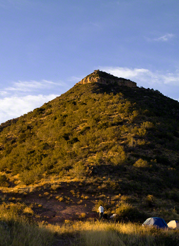
Sunset from Castle Dome
Backpacking with my sister
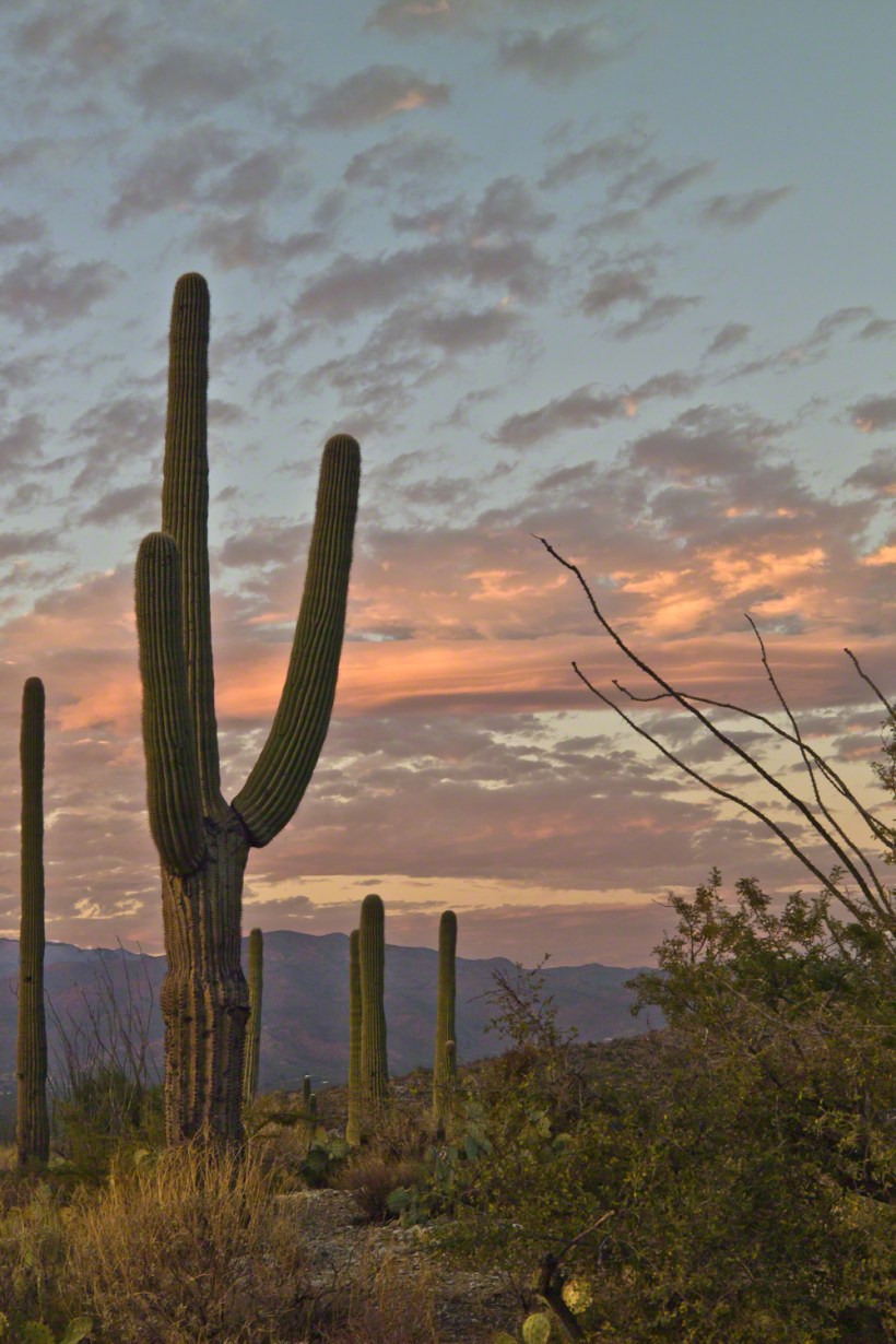
In 2006 I explored Circlestone twice along with my sister, Diane, who accompanied me. First for nine days early March 2006 using the Reavis Ranch trail from the north and the second for five days in November 2006, coming us the same trail from the south. Our first trip was Diane’s first “real” backpack adventure and we took it slow with a camp at Castle Dome where there are flat areas and exceptional views. Above, is the sunset from our second night (I camped the first night next to the car…we took it very, very sloooowwww).
Four Peaks Sunrise
Castle Dome
Then, there was morning of our third day. Here is the Four Peaks Wilderness in the first rays of dawn. These are green, rolling foothills of grass, low shrubs and a few juniper. If you know where to look, there’s an unmarked trail to Reavis Falls (the highest waterfall in Arizona). I found the trail and visited the falls on a later trip.
Castle Dome Sunrise
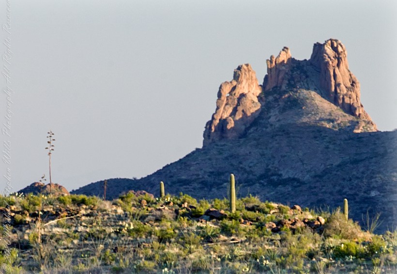
After enjoying the Four Peaks, you turn around and see Castle Dome in the morning light, as in this photograph. Remember the same of the “dome”, because it is visible from the ultimate view from Circlestone.
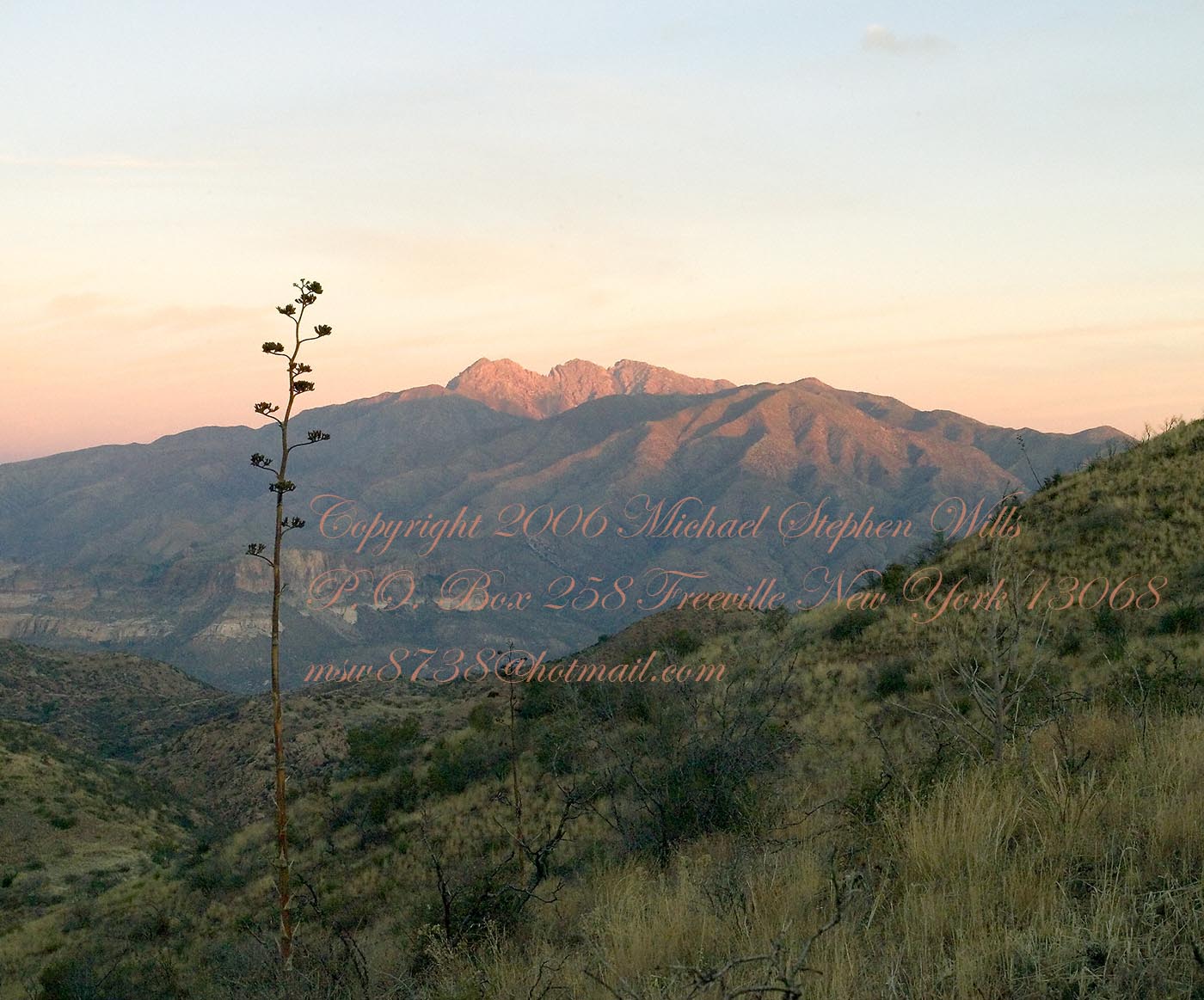
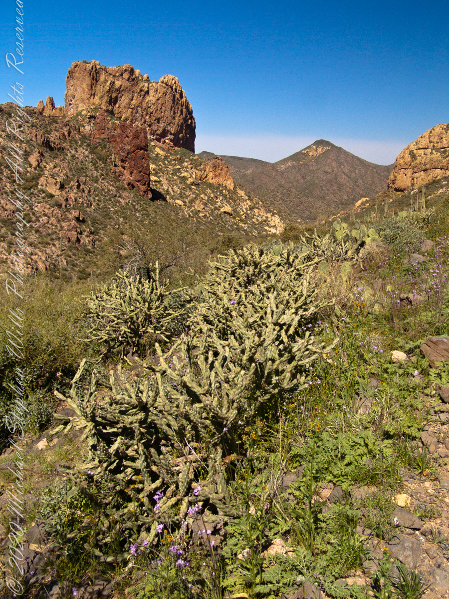
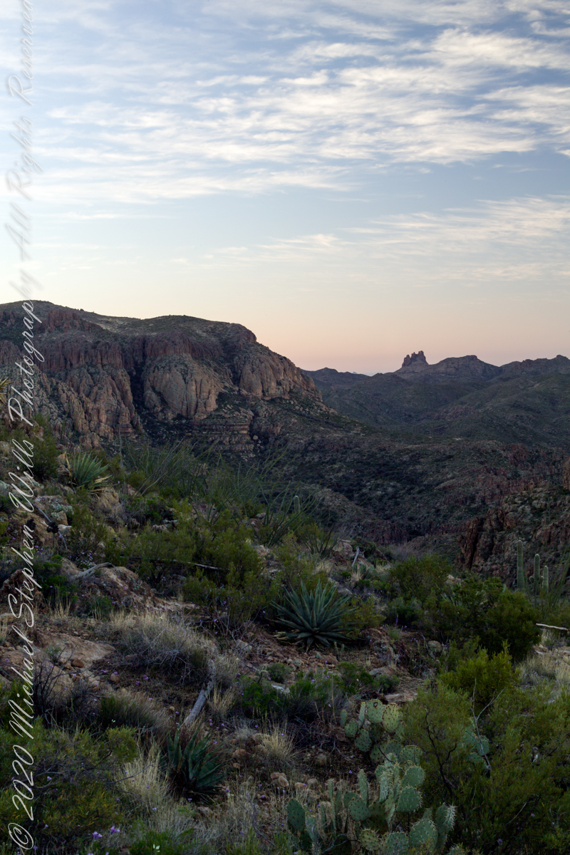
Reavis Valley and White Mountain from the trail to Circlestone
The Trail to Circlestone
Our camp was in the Reavis Valley, one of the first sites along the creek coming from the north. There were fantastic rock formations across the creek. Not far from there, the land falls away into steepness and then Reavis Falls. The Searcher told me about going that way, once. There is no trail down to the falls overlook and deep canyon carved by the water.
This photograph, above, is from a lovely forest of pinyon trees that grow along the trail to Circlestone (described by the Searcher as rising from the southern Reavis Valley). You can see the valley, just to the right, and a longer and steeper valley that rises from it up to White Mountain. That way is the southern legs of Reavis Trail. I have a movie clip from this same spot of the pinyons moving in the breeze and may post it at a later time.
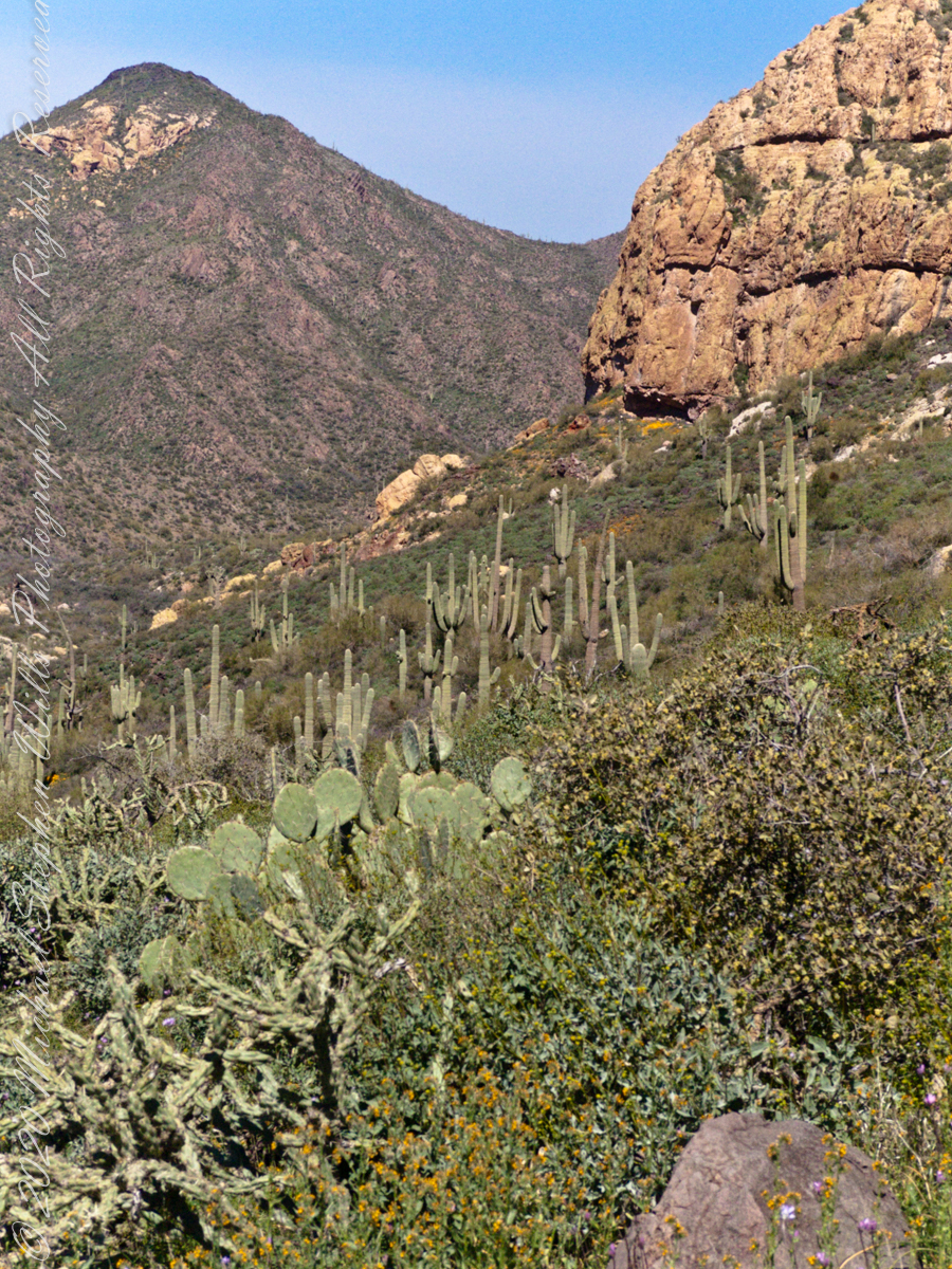
All of the trail to Circlestone is a climb. You pass over “Whiskey Spring”, named for a still kept there in the 1800’s and over a steep defile gouged from the rock. The trail is well marked and I am told that, sometimes, there is no cairn marking the trail to Circlestone. If you are desperate to get there, look-up some excellent hiking directions available on the web. I have even found the circle on GoogleEarth, since I know where to look. If you like a challenge and the adventure, go from the directions the Searcher gave me.
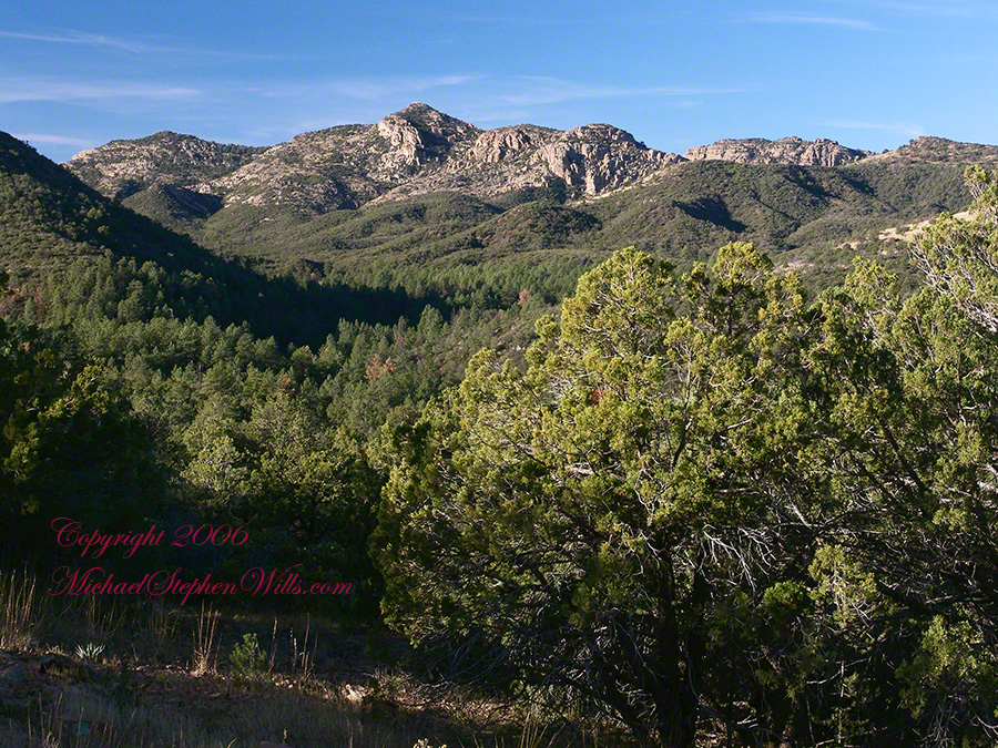
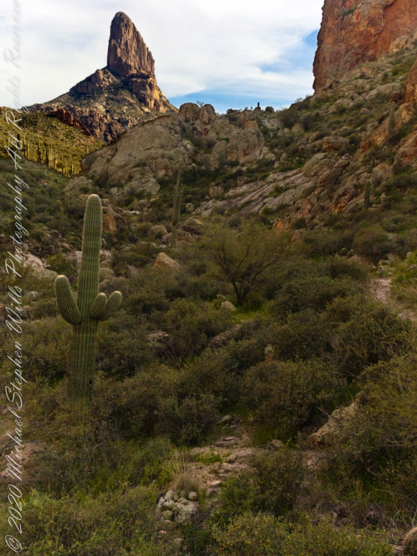
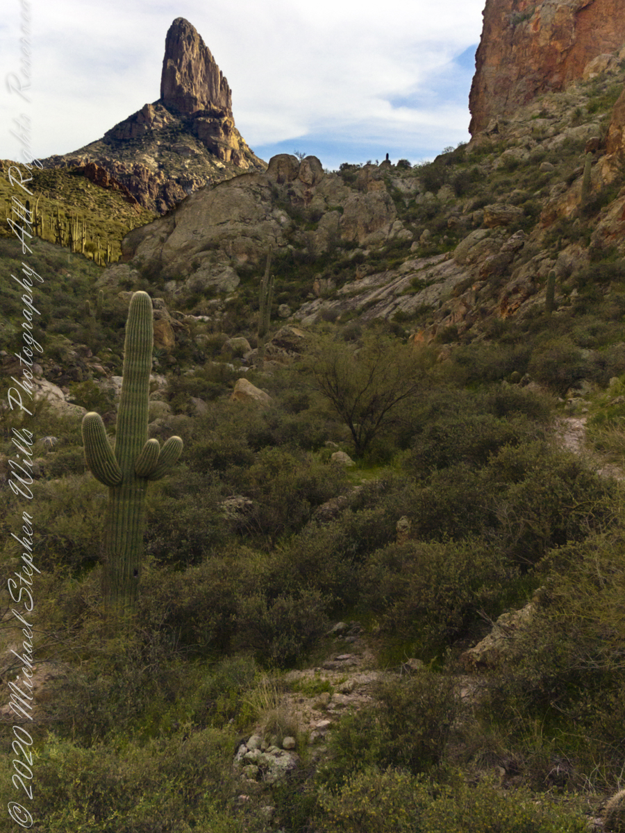
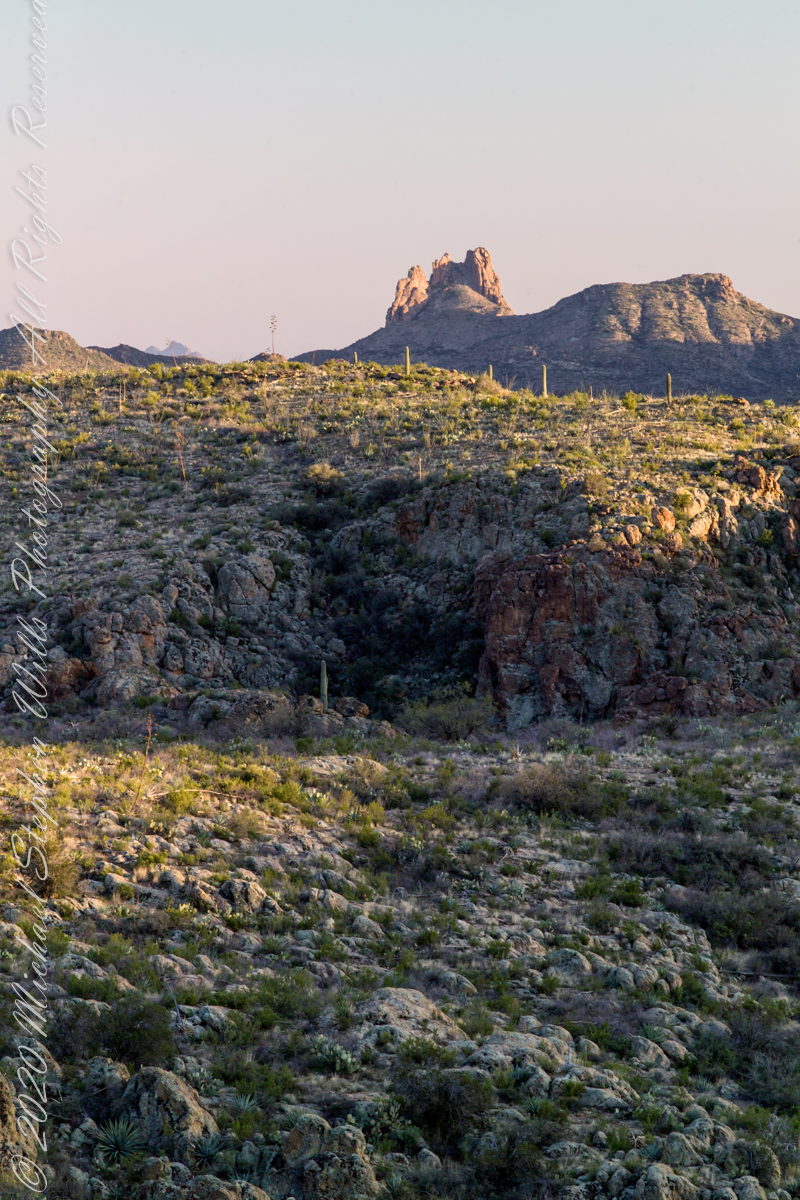
Four Peaks from Circlestone
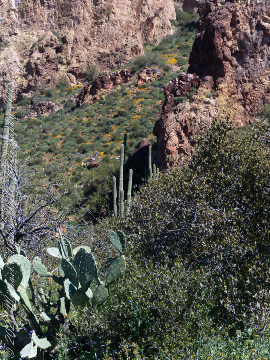
From the fire line trail, the unmarked branch to Circlestone climbs steeply and follows a ridge through Alligator juniper, punctuated by stalks of century plant, to a broad way that rises to Circlestone as though to a monument overgrown by the same juniper.
My Circlestone Mystery
There was an unusual experience on our first trip, on this portion of the trail. We were winding through the Juniper and, as it happened, Diane fell behind. After awhile I missed her and waited and, after a minute, went back to look for her. I found Diane sobbing uncontrollably, deep in grief over our father who passed away eleven years before. We talked about it until she felt better. She said it was as though a door opened and she could feel out father. What makes this exceptional is Diane is not given to anything like this and I ascribe her deep grief to the nature of the site. It is a mystery to this day.
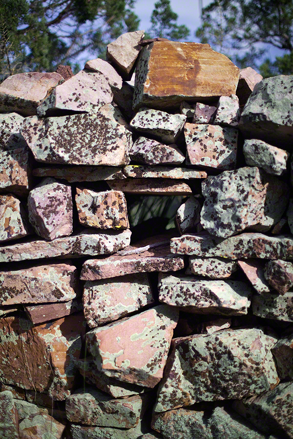
At Circlestone, that first trip, we explored and experienced the site. You cannot see the entire wall at any point and need to wander through and over it, being careful not to disturb anything. Here and there, in the outer wall, are openings like the one in this photograph.
Site-Hole in the Circlestone Wall
At Circlestone
I call it a site hole because, on your knees, it is possible to look through and see the distant view through the trees. As you can see, the stones are a striking red color with green lichen growing thick.
On the second trip in November, knowing the way and having great weather, I brought my cameras to capture the exceptional views, one of which is above. I’d dearly love to come back to camp just below the ruin and do some work in the evening and morning light. For now, I can enjoy those views from Castle Dome.
Three Horsemen and Castle Dome
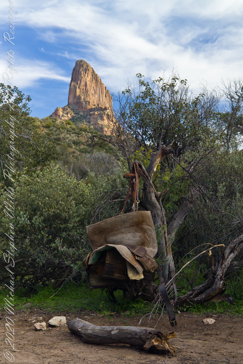
Can you see the dome in the middle distance. I did a portrait of three horsemen who road up to Circlestone in November. We came to know them pretty well, that afternoon and the following morning down in the valley.
Three Horsemen
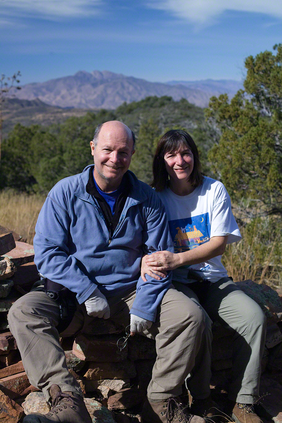
I carted up a tripod, so you can see Diane and I in the same spot.
Mike and Diane at Circlestone
Copyright 2023 Michael Stephen Wills, All Rights Reserved
November is a special time for the ranges and basins of southern Arizona deserts. Climb a bajada of foothills, face west and wait for the sunset. That is what I did this day, November 3, 2005. East of Tucson the Saguaro National Monument at the foot of the Rincon Mountain Wilderness is where I parked, unpacked the photo gear and climbed the side of the Tanque Verde Ridge for a favorable view. Weather was pushing high level moisture from the west, clouds were developing.
You see here a shot from that session. In the distance, looking across Tanque Verde, are the Santa Catalina mountains. Months since the last rainfall, the giant Saguaros are using internal moisture reserves drawn up from a shallow root system, the flesh is less plump, the supporting structure of the ribs, always evident, are more pronounced. The last light catches these ribs in relief against a dramatic sky.
Our second day began in East Boulder Canyon, in the following map it is at the foot of the “Z” of the orange line, the Dutchman Trail, lower left center. The shape is the signature of a switchback needed to negotiate a steep slope up to Upper Black Top Mesa pass. This day will see us traverse Dutchman Trail to the intersection with Peter’s Trail (yellow), another steep climb up Peter’s Mesa.
A topographic map including Yellow Peak with Dutchman Trail in orange. Upper Black Top Mesa Pass lower center.
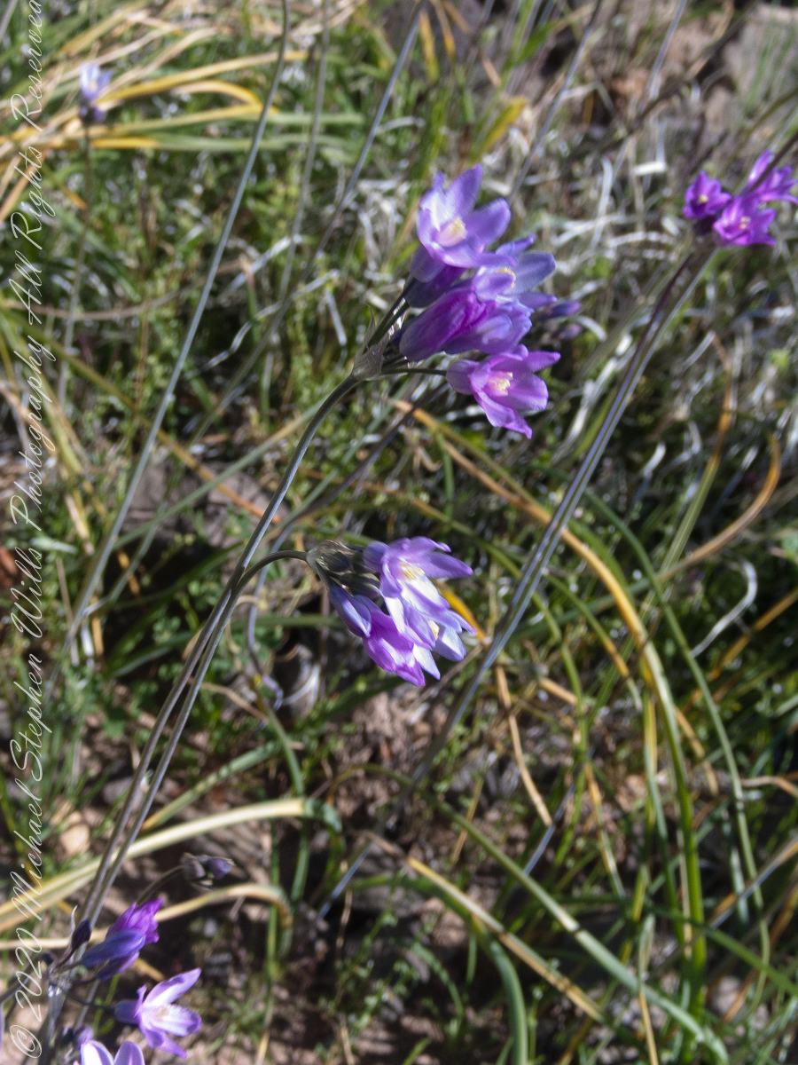
Today’s post features photographs of flourishing Sonoran Desert plants and landscape on the slopes of Black Top Mesa. Dipterostemon capitatus known by the common names blue dicks, purplehead and brodiaea is native to the Western United States (particularly Arizona, California, Oregon, Utah, New Mexico and northwest Mexico.
Dutchman Trail above East Boulder Canyon, Palamino Mountain left, Yellow Peak in distance. We are on the side of Black Top Mesa.
Here I used the “zoom” for a better view of distant Yellow Peak. In foreground is Brittlebush (Encelia farinosa) and Blue Dick. In the distance Saguaro Cactus. Below the cliff of Black Top Mesa, above East Boulder Canyon, is a patch of yellow, Mexican Poppy (Eschscholtzia californica).
Slope of Black Top Mesa above East Boulder Canyon with the distant Yellow Peak.
Here is camera, set to zoom, is swung toward the mesa cliffs. Prickly Pear and Brittlebush growing along the Upper Black Top Mesa Pass trail. I have not identified the shaggy shrub above the Brittlebush. In the distance Saguaro Cactus (Carnegiea gigantean) flourishes. Below the cliff are patches of “gold dust”, the Mexican Poppy.
PCliffs of Black Top Mesa
Heading southeast climbing out of East Boulder Canyon with a very young Saguaro Cactus (Carnegiea gigantean) just off trail on left, a large specimen silhouetted on ridge ahead. Windmill Pink (AKA Common Catchfly) (Silene gallica) foreground, lower left. Brittlebush (Encelia farinosa) on both sides.
Upper Black Top Mesa Pass
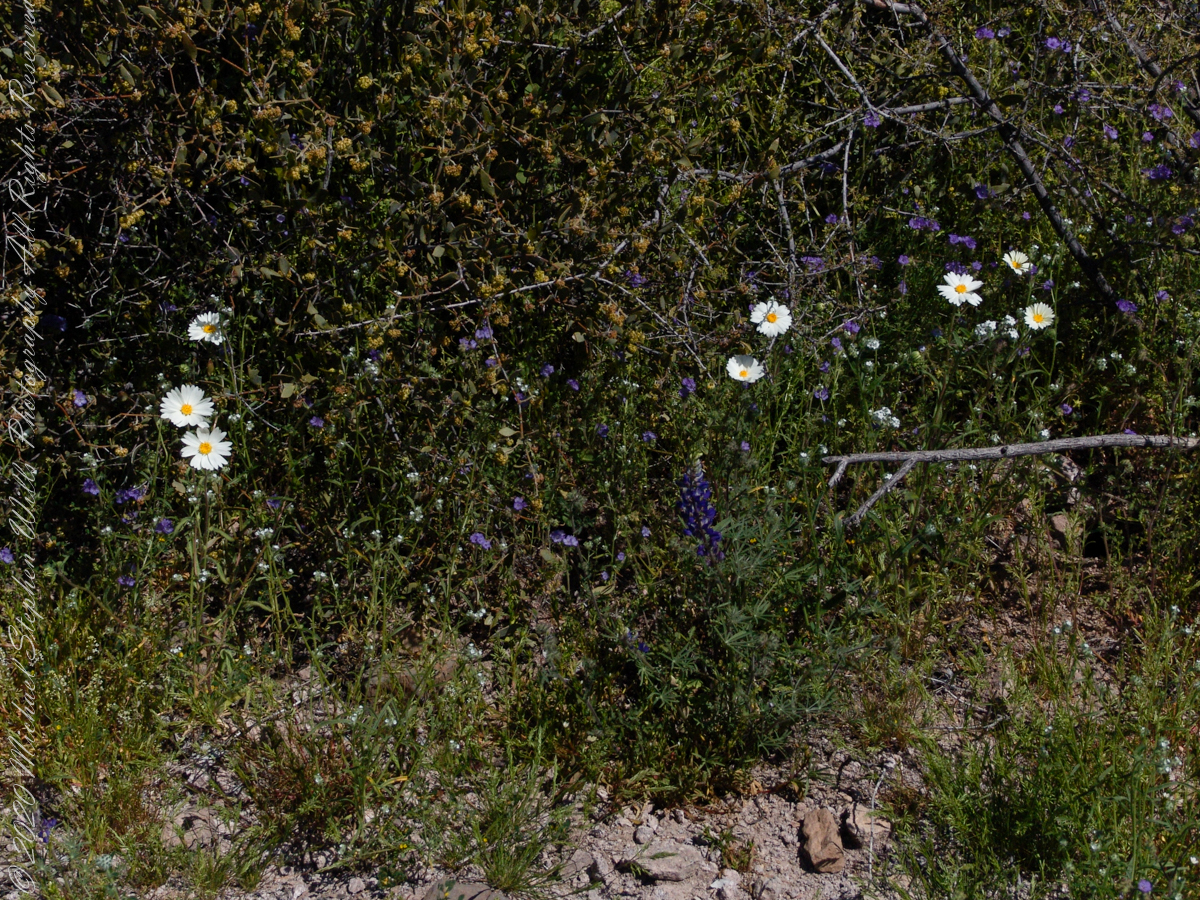
This post ends as it began, with wildflowers growing next to the trailon a March morning. Blue Dicks (AKA Purplehead) (Dipterostemon capitatus), Tidy Tips (Layia) — daisy like flower, Brittlebush flowers are yellow when not dried. The larger small white flowers are Desert Phlox (Phlox austromontana) — I have not identified the tiny white flowers sprinkled around.
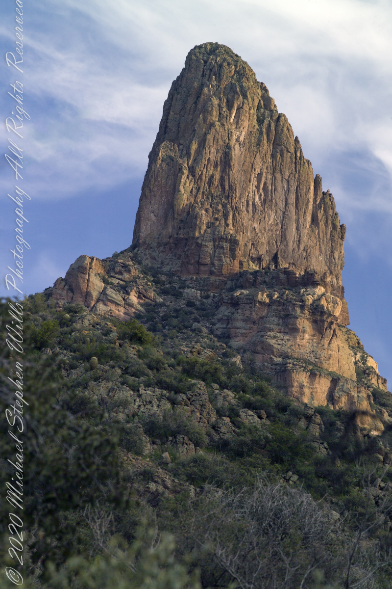
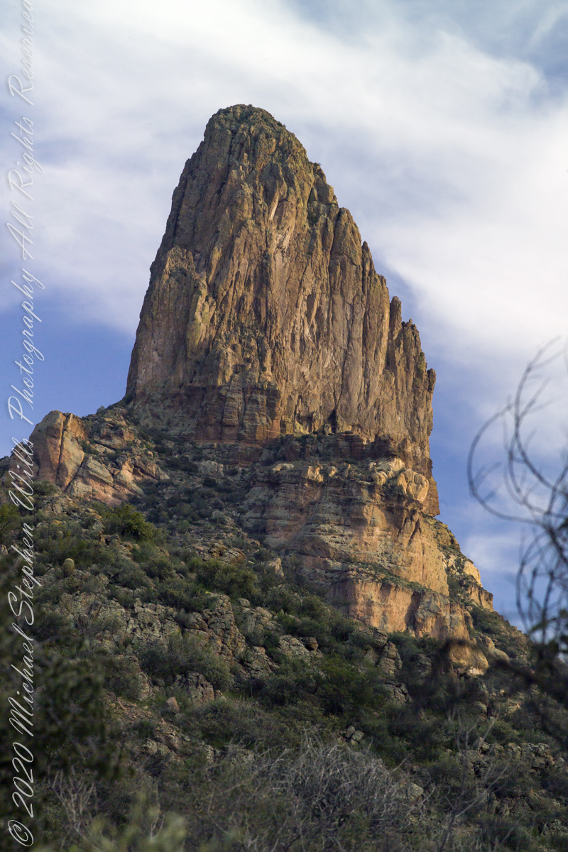
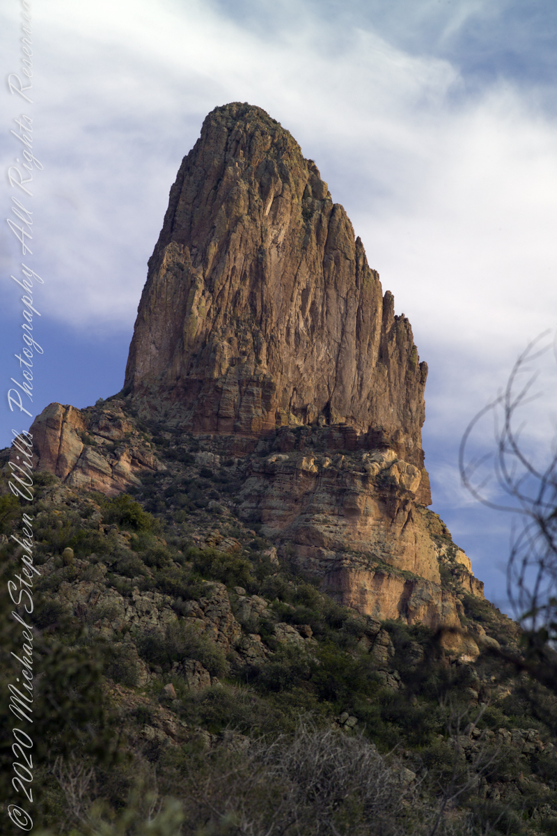
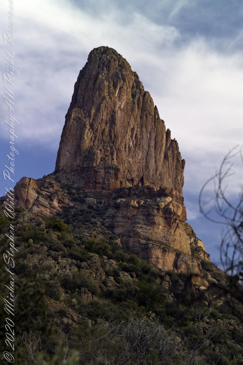
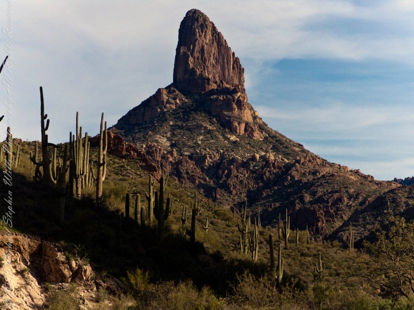
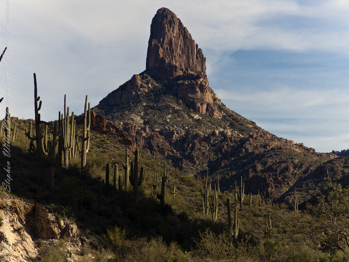
Close views of Weavers Needle from East Boulder Canyon near where Peralta Trail terminates at Dutchman Trail. Named for Paulino Weaver, a famed mountain man, scout, trapper and miner, Weavers Needle is a volcanic monolith that rises almost 1,300 feet from its base to an elevation of 4,553 feet. It’s the most recognizable landmark in the wilderness, and it’s also considered a marker for the legendary Peralta Mine. Superstition Wilderness, Tonto National Forest, Arizona
Copyright 2022 Michael Stephen Wills All Rights Reserved
It is ironical the word “legend,” from the Latin verb “to read,” is the word used to describe the ahistorical stories, rumors really, of the Superstition Wilderness anchored, concurrently undermined, with the hard facts of geology. “Named for Paulino Weaver, a famed mountain man, scout, trapper and miner, Weavers Needle is a volcanic monolith that rises almost 1,300 feet from its base to an elevation of 4,553 feet. It’s the most recognizable landmark in the wilderness, and it’s also considered a marker for the legendary Peralta Mine.” — Arizona Highways
Dutchmans Trail near the junction with Peralta Trail at the foot of Black Top Mesa with Weavers Needle in light of a setting sun.
“As the story goes, Don Miguel de Peralta and his family, who had come to the Superstition Mountains from Mexico, discovered gold, lots of gold, in the shadow of Weavers Needle. However, before cashing in, according to the story, they were killed by Apaches, who allegedly sealed off the mine. A few decades later, Jacob Waltz, better known as the “Lost Dutchman,” claimed to have found the old Peralta Mine, but he died before proving his claim. Since then, thousands of treasure hunters have gone looking, including Arthur Weber and the Dons of Phoenix, but no one has ever found the gold. And it’s unlikely anyone ever will — the volcanic rock out there isn’t conducive to producing precious metals. They’ll keep looking, though. Meantime, the real treasure is the trail. Especially in the springtime, when the ground is covered with gold. ” –Arizona Highways
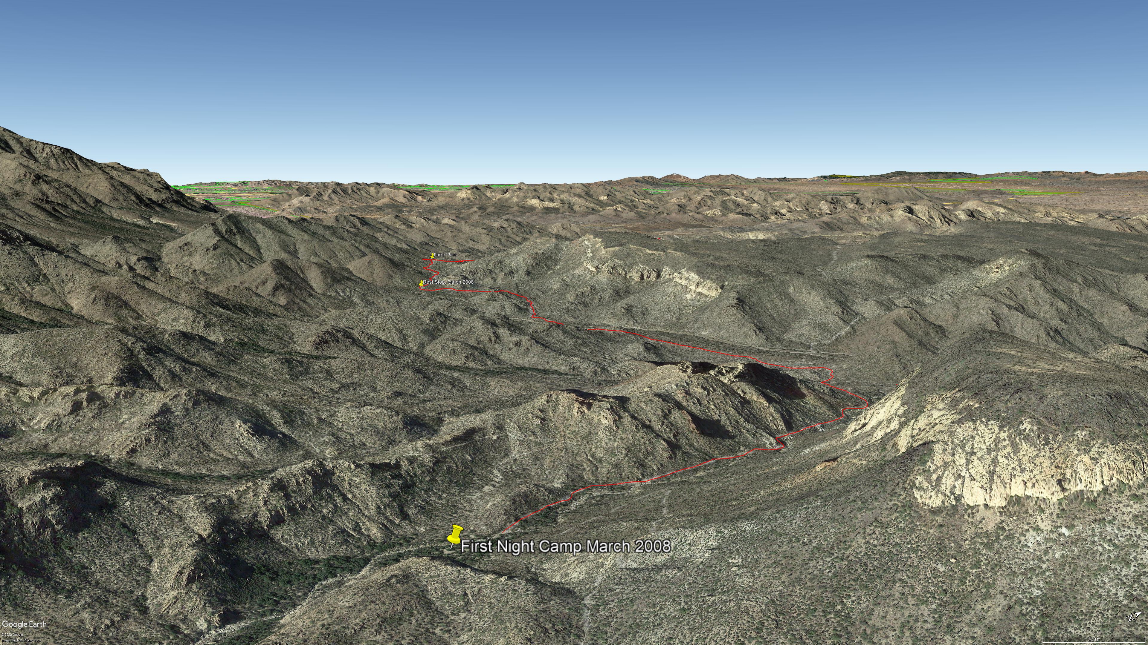
Here is a view of part of the day’s trail. We started at 1911 feet elevation, Apache Junction, topping 2693, Parker Pass, with 2512 our resting spot with many ups and downs in between: a combined descent of 1760. Our rest was well earned. Palamino Mountain is on the left, Black Top Mesa the right. Look carefully to see the Peralta Trail surmounting Palamino Mountain ridge, descending in a zigzag to Boulder Canyon where it terminates on Dutchman Trail.
Our eleven-mile trek from Apache Junction ended here between Black Top Mesa and Palamino Mountain. Peralta trail winds up the ridge to right with Weaver’s Needle beyond in the setting sun.
Deep shade combined with the distant sunlit needle made for a difficult photographic capture. In fact, this picture needed significant work in Photoshop. I wore the 8 megapixel Sony F828 to capture the handheld shots of this series. A few days later I dropped the camera while riding Colorado, rendering it inoperable. This was when I acquired my Sony Alpha 700 during downtime in Phoenix. Later, the F828 was repaired at Sony and is still operable.
Click me for more information about this camera.
Copyright 2022 Michael Stephen Wills All Rights Reserved
The end of a day trekking to East Boulder Canyon at the foot of Weaver’s Needle, Superstition Wilderness. I had a light pack with the camera equipment and supplies packed in on horseback.
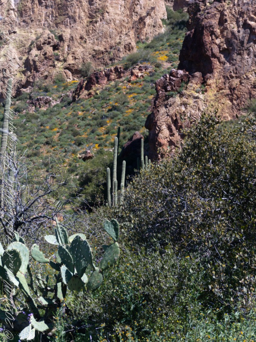
I was a member of an expedition to Peter’s Mesa March 2008, a place central to Superstition Wilderness treasure legends. This is a sunset view, looking south, southwest. Light raking across the desolation and Miner’s Needle creates a fascinating spectacle. Ancient volcanism, apparent throughout the Superstition Wilderness, is here seen in the texture, form and type of rock as well as the mineral deposits. Miner’s Needle, like Weaver’s Needle (not seen in this view), are eroded volcanic summits. Look closely for the “eye” of Miner’s Needle, easier seen in the cropped heading photograph. To this day, hopeful prospectors search for gold nuggets.
There is one form of volcanism present today as an eerie rumble or hiss, similar to an enormous distant jet engine heard now and then during our two days on the mesa, louder and closer than an overhead plane could produce. The view includes many notable Sonoran Desert plants. Many young Saguaro cactus are in the form of green poles. Catching the dramatic light, on the ridge is a tall single flower of an Agave, known as the “Century Plant” it flowers once in a long life and dies.
Peters Mesa is named after “Old Pete” Gottfried Petrasch, father of Hermann and Rhiney Petrasch. Old Pete worked for Jim Bark for awhile in the 1890s doing odd jobs. Irregular employment gave Pete and Sons time to s searched for the Lost Dutchman Mine in the years following the death of the source of the legend, the “Dutchman” Jacob Waltz. The Petrasches were one of the first groups to search for the mine, and gold in general. They covered almost the entire Superstition range in their combined searches.
Sunrise looking across Music and LaBarge Canyons to Miner’s Needle
On our first day on the mesa, we came across the remains of one of these camps, on the top of Squaw Canyon, a deplorable junk pile discarded by searchers, presumably disappointed, too lazy to cart it out. That March, we were lucky to find the remnants of winter rains in the form of a meager trickle at the bottom of a shallow draw off Peter’s Mesa trail up from La Barge canyon. We had a good time of it until the trip was cut short by a storm front and torrential rains. We were back in Apache Junction before they hit.