Racing the Sun

Through that afternoon the wind gusts hit me as a physical force like a cat playing with her next meal.

superstitionspring_copyright_640
Mexican Poppies bloomed in profusion throughout the Superstitions after the plentiful winter rains of 2008.
Want more? Click for my OnLine Gallery

The four mile climb up the 2,000 foot eastern Superstition Wilderness bajada and escarpment consumed the morning and much of the afternoon.  It was the 80 pound backpack that did it.  Ten days of supplies, tent, equipment and 3.5 gallons (28 pounds) of water; enough food for a trek across the Superstition Wilderness, water enough for two days.  One day in, one day out if the water could not be replenished.  Mine was a water commitment, enough water storage to allow two days to trekking to another source.

Two Bar Mountain
Two Bar Mountain from Tule Canyon trail with corral made from mesquite trunks and barbed wire. Yucca and prickly pear in foreground.

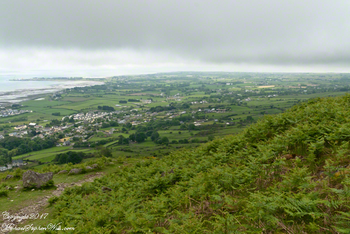
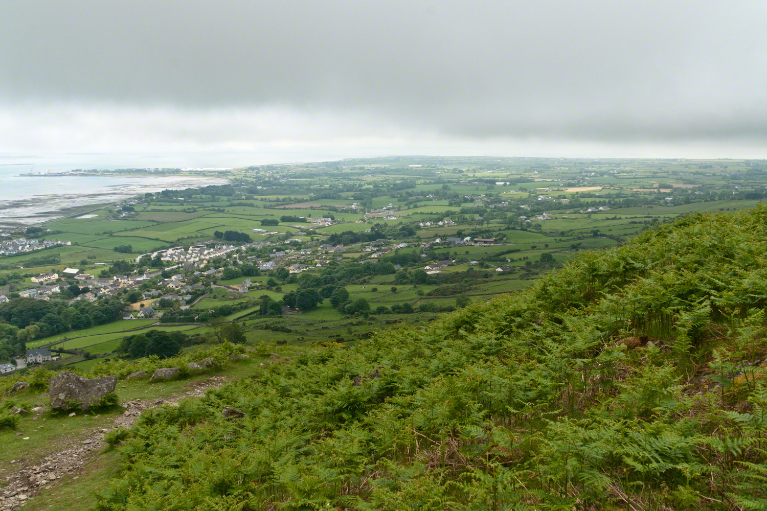
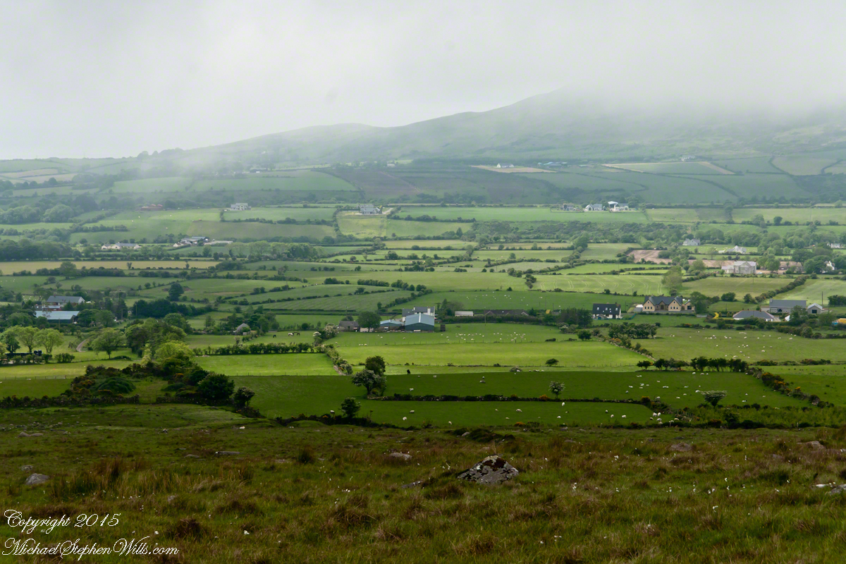
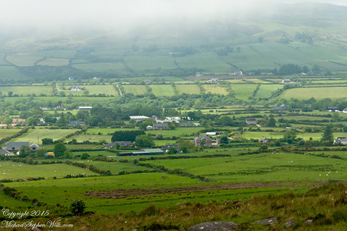
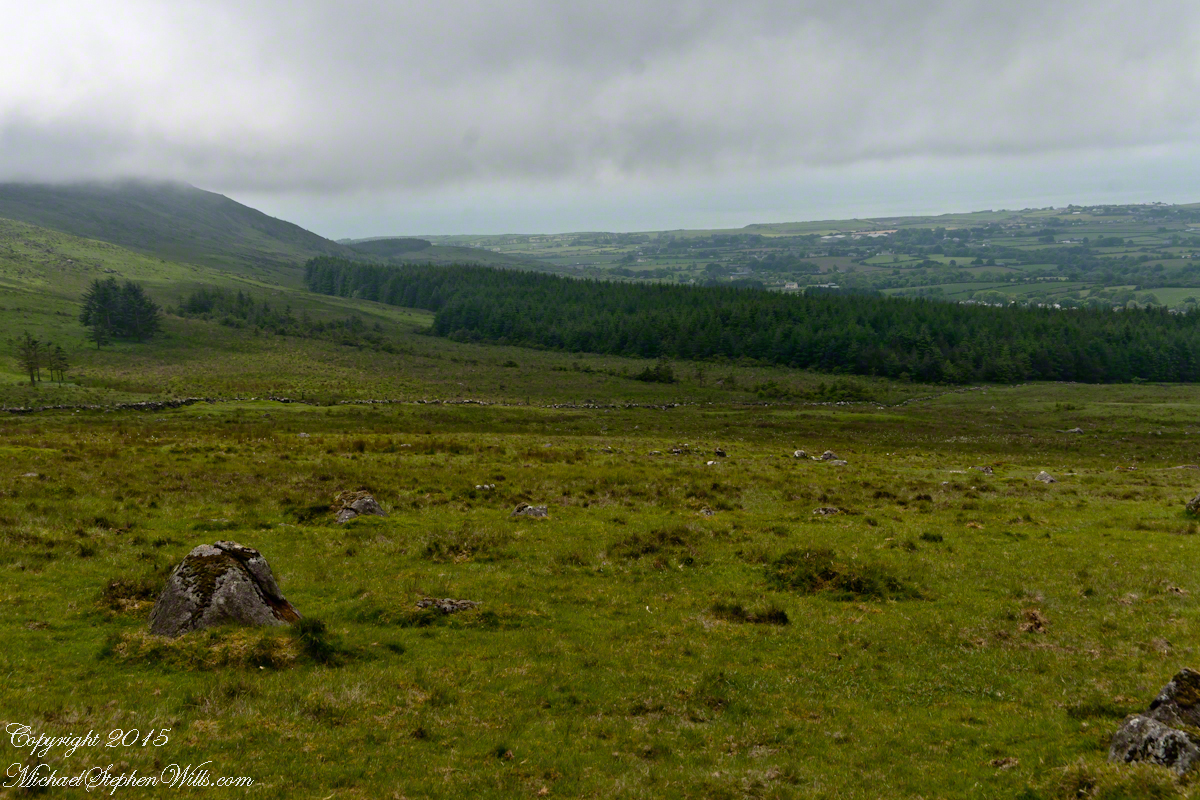
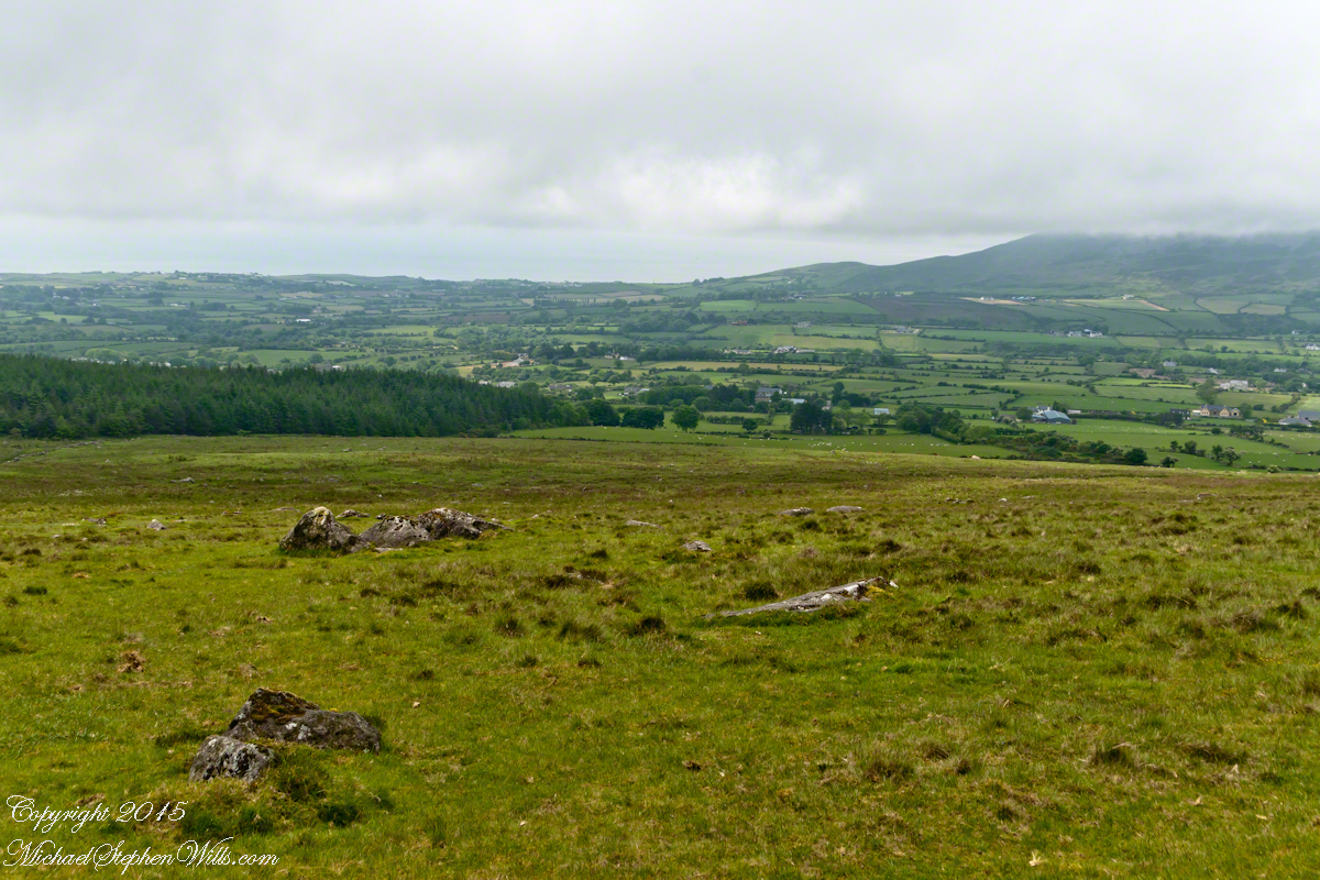
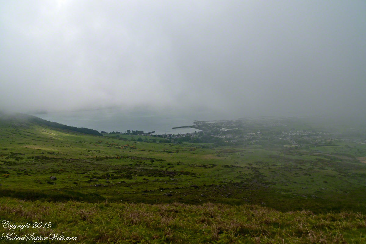
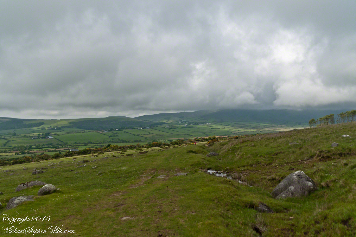
Here the canyon rim view from atop the escarpment…..

viewtoeasttrail122copyright
Here I found the huge mountain lion track in the dry mud from the spring rain, where water pooled and the cat drank.

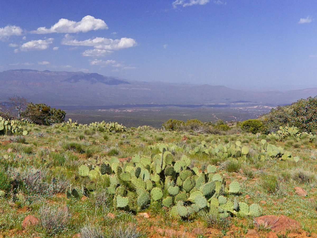
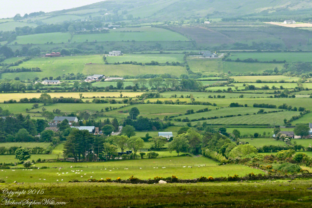
…over trail 122, the Tule Canyon Trail, looking out from the wilderness.  Tule Canyon trail is very lightly used and only present in the form of occasional cairns.  There is a red rock cairn in the midground.  Theodore Roosevelt Lake of the Salt river is in the distance, as is the dirt road to the trail head.  A settlement is visible, on the right.

A rancher formed a cattle watering hole by damming an ephemeral stream and that day the pool held some water. Shortly after a rain a large mountain lion had approach the pool for a drink, leaving a footprint in the now dry mud.

I knew a mountain lion attack was improbable: I ran more risk of being run down on a New York City sidewalk by a madman or, even more so, of having a heart attack.  Still, during my brief lunch I faced east, looking over Apache Lake for the possibility of a cat leaping up from the canyon.  On all other sides was an open area until, a quarter-mile uphill, there was a thick growth of Manzanita reaching to the ridge.

After that climb to the escarpment rim I was in a race to reach a safe campsite at an unknown location, the other side of Two Bar ridge, before sunset at 6:46 pm mountain time.  Yes, the time was exact to the minute.  If sunset found me on the mountain side or ridge, rapid fall of darkness would force me to set camp.

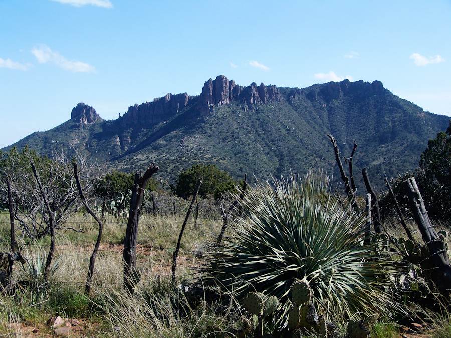
The following photograph was taken the winter of February 2006 from a campsite below Castle Dome on Reavis Ranch Trail.  A red line, starting to the left, is Trail 119, my path along Two Bar mountain ridge, beneath the mountain peaks, with switchbacks into a nameless canyon.

ff6h3323_twobarmountain_cropped_enhanced001_annotated_resized_copyright
Overview of my path to the nameless canyon behind Two Bar Mountain.

Ahead of me was a 400 foot ascent in a half mile to Two Bar Ridge, two miles along the glorious ridge providing endless views to the west and northwest.  An 800 foot descent to a nameless canyon below Two Bar Mountain.  This left no time for photography!!

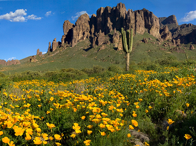
This photograph, taken 4 miles to the west and 10 months later, is similar to what I enjoyed, and dreaded, that day.  A flowering century plant stalk grows at the end of the plant’s long life, usually 10 – 30 years.  After death, the plant is reborn through suckers from its roots.

sunsetfromcastledomemarch2006copyright-3372
A Superstition Wilderness Sunset from a February 2006 backpack.

My hope was to find some flat terrain in that canyon, for a camp site. If only there was time enough to reach it. My progress was bedeviled by sudden gusts of wind, grabbing like a large cat, throwing off-balance.  

The west wind was whipping the bushes as I entered the Manzanita.  Here is a photo of the plant from a later backpack to the Rincon Mountain Wilderness.  Yes, the trunk is a dark, rich red.  “Manzana” is apple is spanish, the plan is named “Little Apple” for the small green fruits much loved by bears.

Manzanita.
A mature Manzanita growing along the Miller Trail of the Rincon Mountain Wilderness. There is an enlargement of the flowers, to the right.

Manzanita leaves were thick around me snapping in the wind, making it seem at all moments a large creature was moving. The trail was difficult and several times I needed to turn back to find it, all the while climbing continuously.

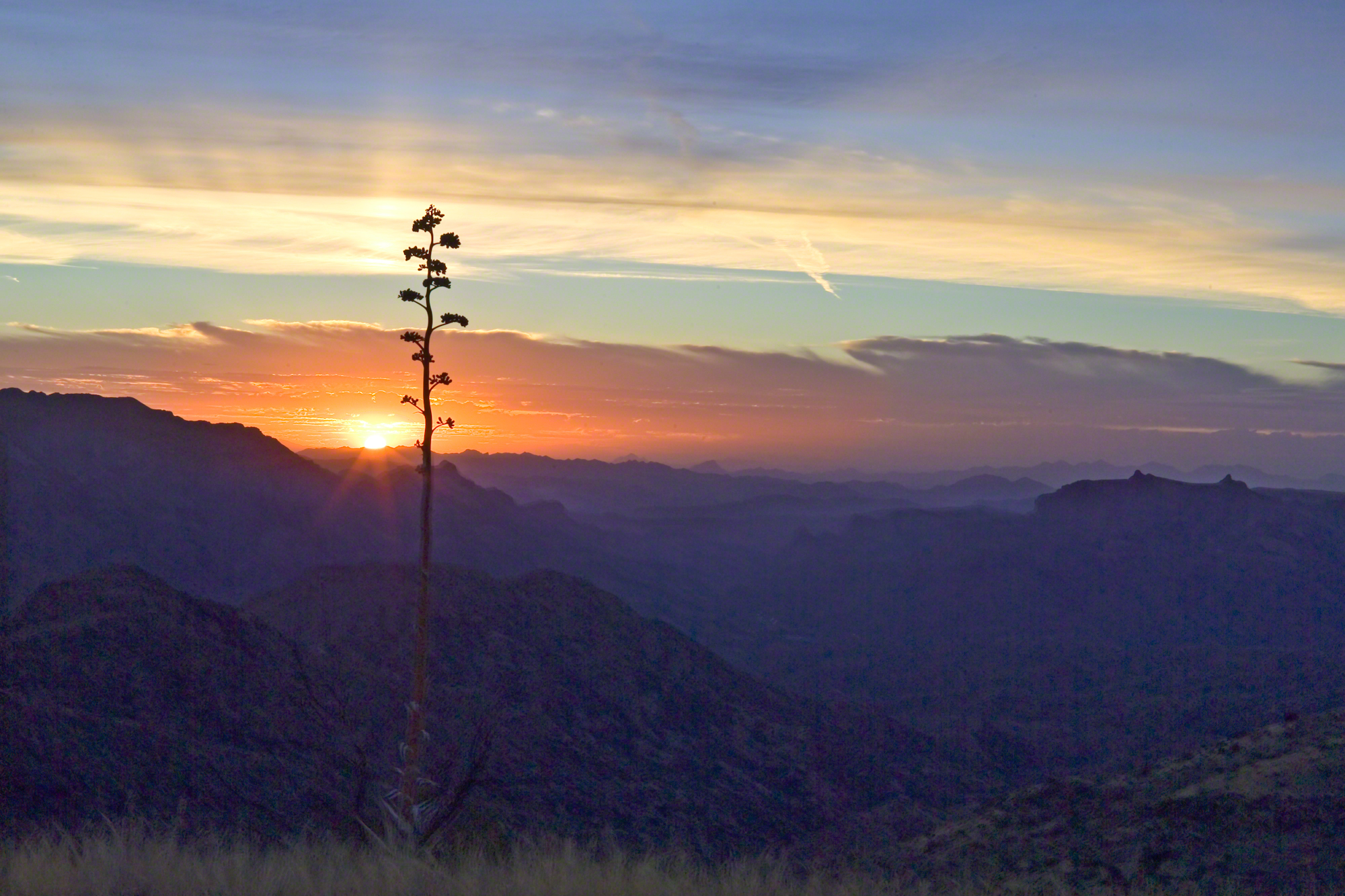
On ridge was the highest point for a hundred or more miles to the west, so the wind was free to run which it did in huge gusts.  You can get an idea of the openness from the Superstition sunset photo.  For awhile the Manzanita acted as protection, then I descended along the west face of the Two Bar Mountain ridge.

Evening from Lime Mountain to East with Risen Moon
Two Bar Mountain and Ridge from Lime Mountain with rising moon.

My hat tie-down were tested on that two miles of ridge, the brim was molded around the right side of my head. The backpack acted as a sail so that it was taken in the wind gusts, affecting my balance.

On mountain trails the path is full of stones of all sizes and,  aside from the occasional rattlesnakes, critter scat or, at lower elevations, Gila monsters, it is the rock that forces hikers to look four steps ahead, planning moves carefully to avoid falls.  The 80 pound backpack, wind, rocks, high perch and, not forgetting the prickly pear cactus and jumping cholla, all slowed me to less than a mile an hour.  I was jumpy walking through that Manzanita and this slowed me down more.

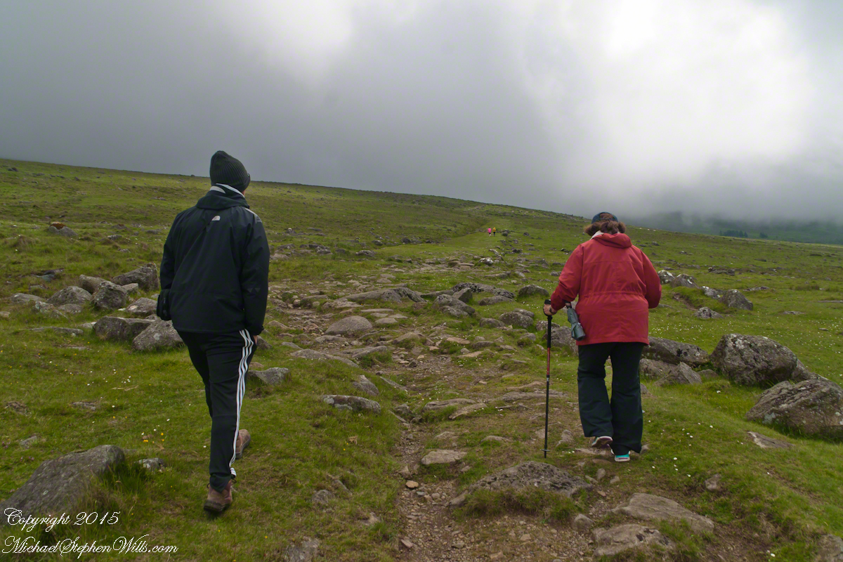
Trail 122 joins Trail 119 on Two Bar Ridge.  On the ridge a substantial barbed wire fence separates federal land from the working ranch.  Where the trails crosses, the fence has a break.  The hiker needs to wend through a simple maze impassable to cattle.

Of all the trail, this is the most clearly marked.  Fences have deep historical significance for the western United States.  Range wars were fought between men who had different beliefs about land use and ownership.  Many historians associate the building of barbed wire fences with the passing of the Old West.

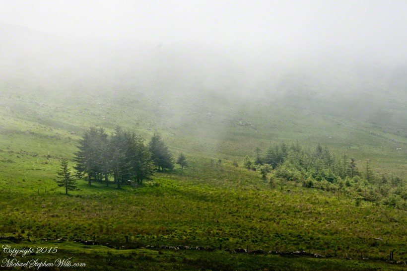
Up until the fence, cattle grazing visibly damaged the land and plants.  After the fence, the land was free to become as it was since the beginning of time.  Up here, there’s wonderful grass that was, in this season after heavier than normal winter rains, was lush and green.

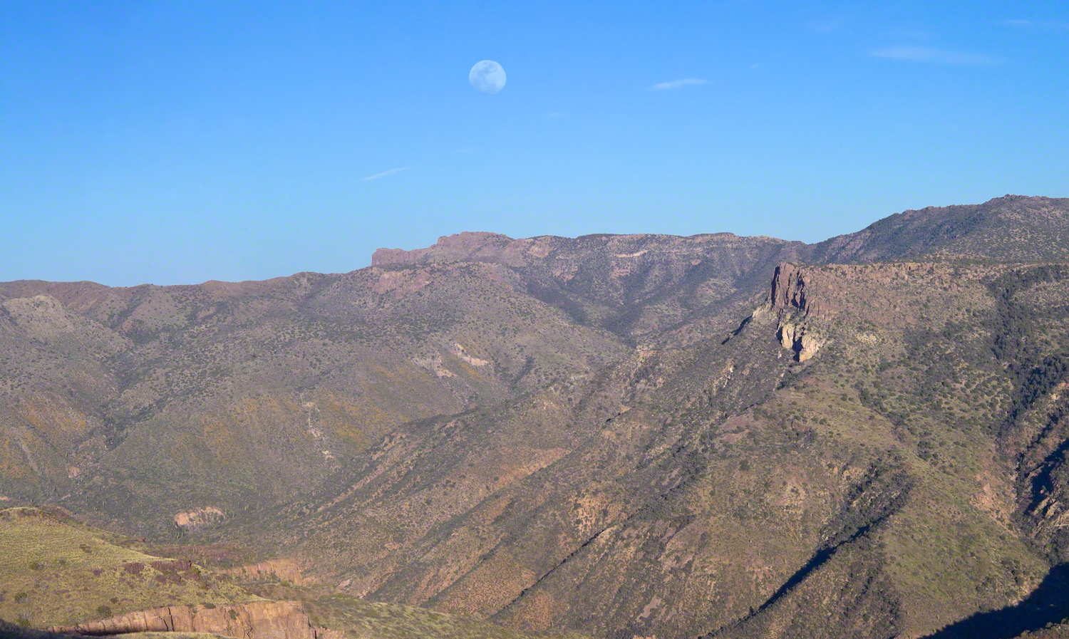
The trail followed the fence for a ways, then descends steeply into a fold of the land, leaving me in shade as the sun, low in a cloudless sky, raked over the mountainside with a brilliant golden light.  The Two Bar Mountain and Ridge with Moon photograph, above, gives an idea of the effect.

Below, the canyon floor seemed a mass of prickly pear cactus groves.  I decided the lower canyon wall was the best choice for camp…as unlikely as that sounds.

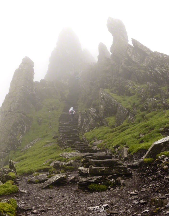
Here, the trail was anything but straight and almost invisible, descending in looping curves called switchbacks.

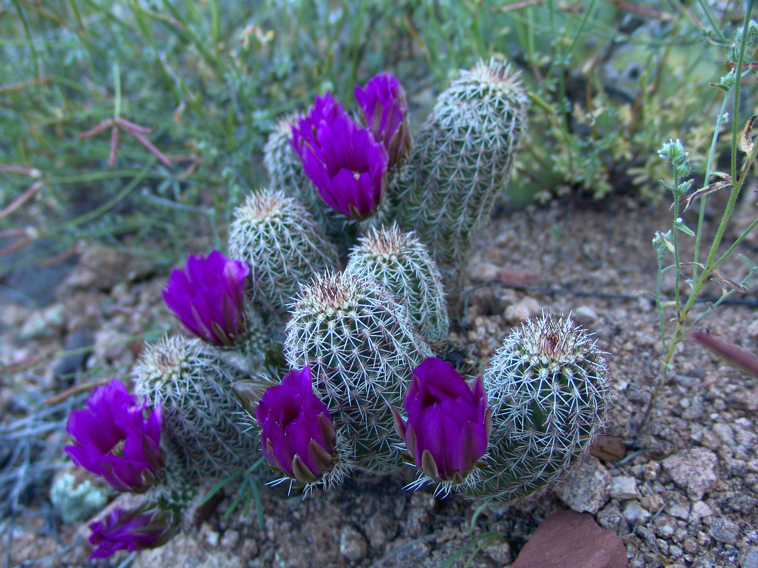
Here’s a photo from the following morning.  I found a small shelf on a ridge overlooking the canyon floor, amongst wonderful shrubby Juniper trees.  Tiny hedgehog cactuses were covered in lavender blooms.  There is a decrepit stalk of a Century (yucca) plant lying over the rock.

ontheslopesoftwobarmountaincopyrightmichaelstephenwills08
Morning view from my camp in a nameless canyon below Two Bar Mountain.

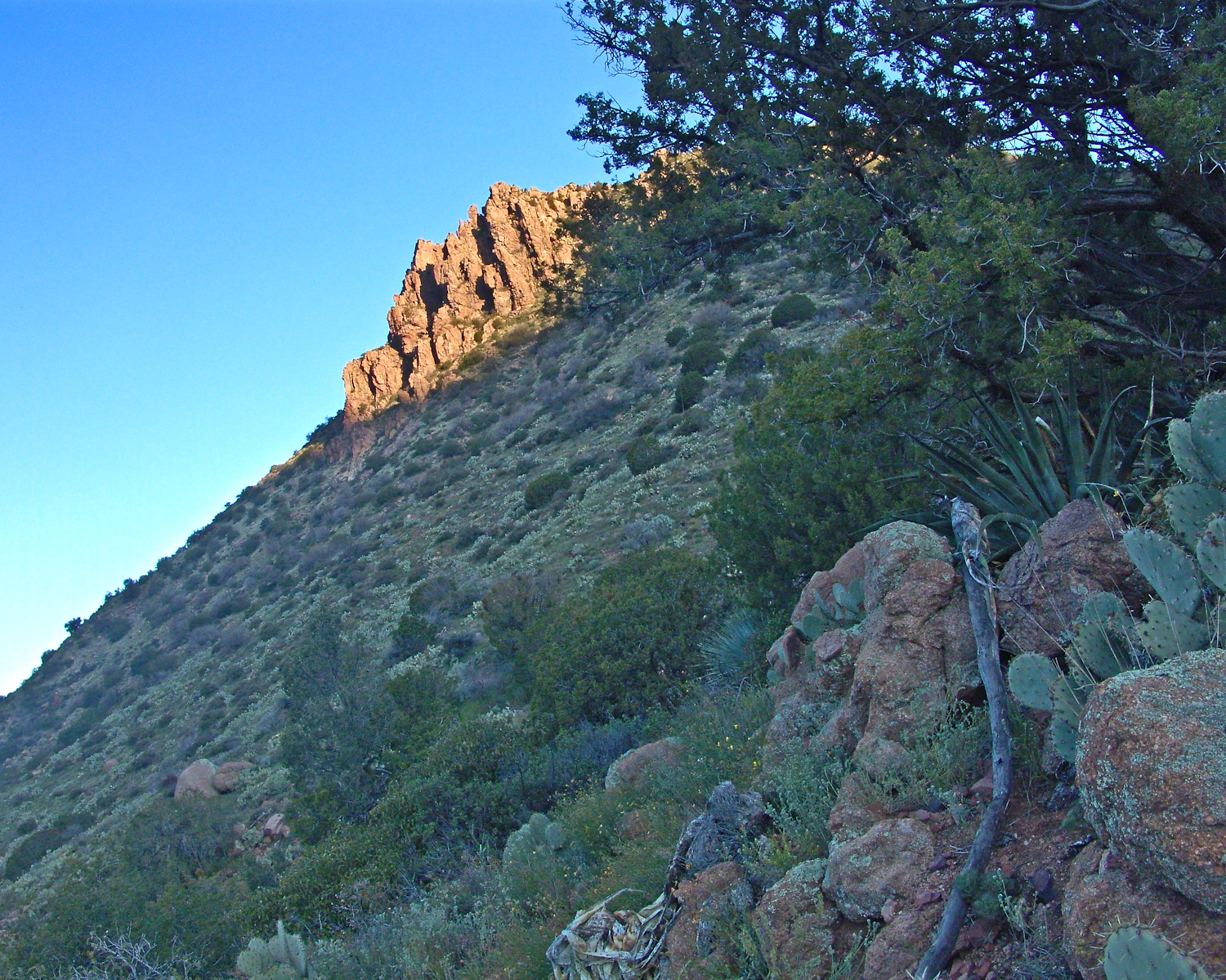
On approaching the shelf, the air turned suddenly cold as the sun fully set and the wind gained even more in strength flowing up the canyon and over Two Bar Mountain.  Stony ground made it impossible to stake the tent, instead I used small boulders to fix the corners and sides of the tent.  Once inside, I was grateful for an excellent mat to protect me from the small jagged stones at one with the ground.  The tent walls held back the wind.  I forgot to back an excellent sleeping bag for the trip.  Instead of buying one in Phoenix, my sister lent me a light waffle weave blanket.  “What was I thinking???”  It was a restless, cold night.  The sun was very welcome the following day.

Lavender Hedgehog Cactus Blooms
Lavender Hedgehog Cactus Blooms in pre-dawn light
Click me for the next episode, “Dry Piece of Paradise.”
Copyright 2021 Michael Stephen Wills All Rights Reserved

A Story Risen from the Mist

The Resurrection of Táin Bó Cúailnge

We did not climb so much as ascend, with effort, the flank of Slieve Foy, a peak of the Cooley Mountains, County Louth, Ireland. The group being cousin Sean, my wife, Pam, and myself.

The ridge of Golyin Pass loomed in the mist where the path dissolved in low cloud. Sean pointed above, to the right to Barnavave, also know as Maeve’s Gap for the queen who came from the west of Ireland to take Donn Cúailnge, the Brown Bull of Cooley, by force of arms with an army behind her.

My Online Gallery– CLICK ME!!!!
A modern rendering of Donn Cúailnge. See link at the bottom of this posting for more information.
Click this link or a photograph to visit my Online Gallery

When cousin Sean named Cú Chulainn, the champion of Maeve’s opponents, the Ulstermen, he recalled a story once lost, Táin Bó Cúailnge. A hospitable siege different from Maeve’s and mist are part of the story of the recovery of this tale.

A gathering of 150 poets, 100 pupils, and attendants strained the patience and wealth of Guaire Aidne mac Colmáin, King of Connacht, when it extended to a year and four months.

Southwest View from Hags Mountain– CLICK ME!!!!
Our first and only encounter with fellow hikers. In the distance two figures appear over the next ridge, a mother and young daughter. She greeted us and challenged Sean to his knowledge of the area. Sean acquitted himself well and we continued.

On that 16th month, the king challenged the leader of his guests to the telling of a tale. Guaire demanded Seanchan Torpest, the chief poet of Connacht, to recite the whole of Táin Bó Cúailnge, known in English as the Cattle Raid of Cooley or The Táin (Cattle Raid).

Click a gallery pic for a larger view.

In this way the king was relieved of his guests: the book of the Táin was lost before their lifetimes, rumored to be abroad. Abashed at his failure, Seanchan Torpest withdrew. Fellow poets and followers trailed out from the castle.

Seanchan Torpest regrouped the host (an opened question is who then supported them) in conference to construct Táin Bó Cúailnge. It was a false hope as the gathering discovered while each poet knew a part of the whole, most of the story was lost. His honor, reputation and self-esteem in tatters the Chief Poet of Connacht, set off with Murgen, his son, and second cousin Eimena to return the Táin to Ireland.

Into mists such as those Pam, Sean and I ascended, the travelers soon were lost and separated.

Magically, Murgen finds the grave of the Uncle of Cú Chulainn in the mists, there to meet the shade of that enormous man, Fergus mac Róich is his name. In the Táin, as related in whole by Fergus to Murgen, Fergus was led by circumstances to ally with Maeve, to guide her army against the Ulstermen. As a deposed king, traitor to Ulster and Uncle to the champion Cú Chulainn, Fergus knew the tale entire.

My Online Gallery– CLICK ME!!!!
View as we approached Goliyn Pass

It was from the mists that Murgen emerged, found his father and cousin, and returned together without the book, but with possession of the substance of the Táin.

Click this link or the above photograph to visit my Online Gallery

Views of Carlingford

Visit the opening chapter of our time on the Tain Way

Visit the next posting in this Ireland series, “Farmland Southeast of Carlingford”

A thank you to Wikipedia, my information source on the resurrection of the Táin.

Copyright 2021 Michael Stephen Wills All Rights Reserved

On the Tain Way

A place of myth and wonder on foot and approachable

On Monday, June 9, 2014, cousin John Mills dropped his son, Sean Mills, myself and Pam Wills off at the foot of the western slopes of Slieve Foy on the Tain Way.  Sean, Pam and I walked the way over the mountain and into Carlingford in the footsteps of epic Irish heroes.

Our guide, Sean Mills, proposed the walk and it fell on our last full day in Ireland. Sean’s father and our host for this visit, John Mills, transported the group including my wife Pam to the starting point at the foot of Slieve Foy.

Click this link to visit my Online Gallery

On the Tain Way– CLICK ME!!!!

Yes, if there is any part of the Tain Way the the mythic Irish heroes trod it is this one over Slieve Foy mountain. The saga, in Irish “Táin Bó Cúailnge” and “The Cattle Raid of Cooley” in English, features this bull, “Donn Cuailnge” “The Brown Bull of Cooley”, here as a statue erected 2011 by the Grange and District Residents Association.

Walking the Tain Trail to Carlingford

Donn Cuailnge raged over the very slopes we walked this day. The myths themselves fill a volume and I am unable to do them justice here.

On the way, John stopped at the Old Aghameen School he attended in the late 1930’s early 1940’s 70 years before and we pass through the country soon to grace our views.

Many thanks to the Glenmore Athletic Club, the Cooley Walking Forum and land owners who provide access to the Tain Way.

We had our leave taking with John, who planned to stay near the phone for our call from Carlingford, if all went according to plan. That same year Pam had the first of two total knee replacements. This was our longest hike in Ireland and Pam was not likely to miss it, regardless of any pain. Pam is always ready to smile.

Walking the Tain Trail to Carlingford

At start, the Tain Way is broad, green and welcoming.

Walking the Tain Trail to Carlingford

The western slopes of Slieve Foy hold views of a valley among the Cooley Mountains with Dundalk Bay of the Irish Sea to the south / southeast. It was not long before the view started to open and, then, opened and opened the entire walk to the top. We were graced with a lovely, cloudy, June day. Mist only, no rain. Plenty of wind, not strong.

Walking the Tain Trail to Carlingford

Farms are all about. Here a farmer attends to the flock. They know who he is.

Walking the Tain Trail to Carlingford 
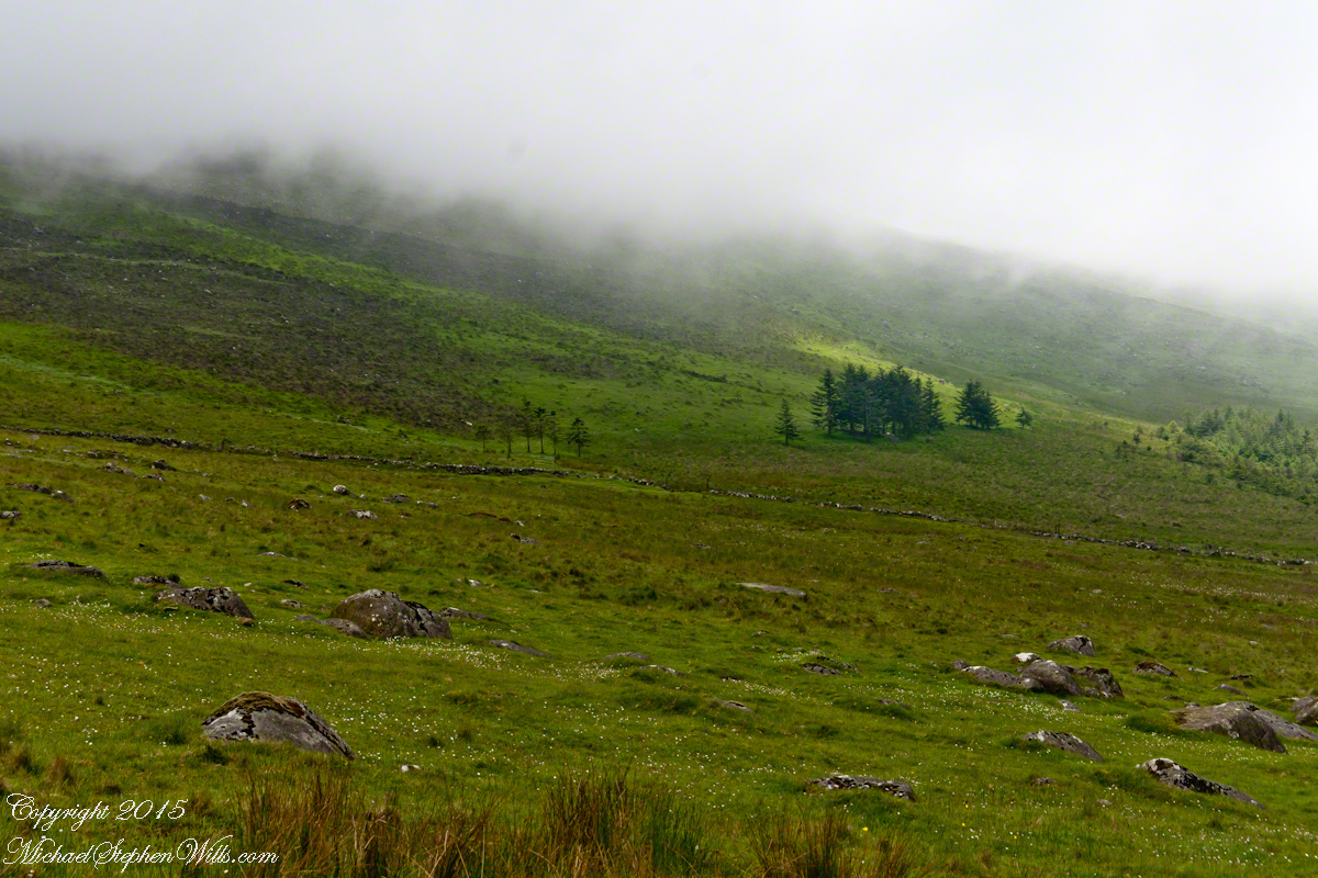
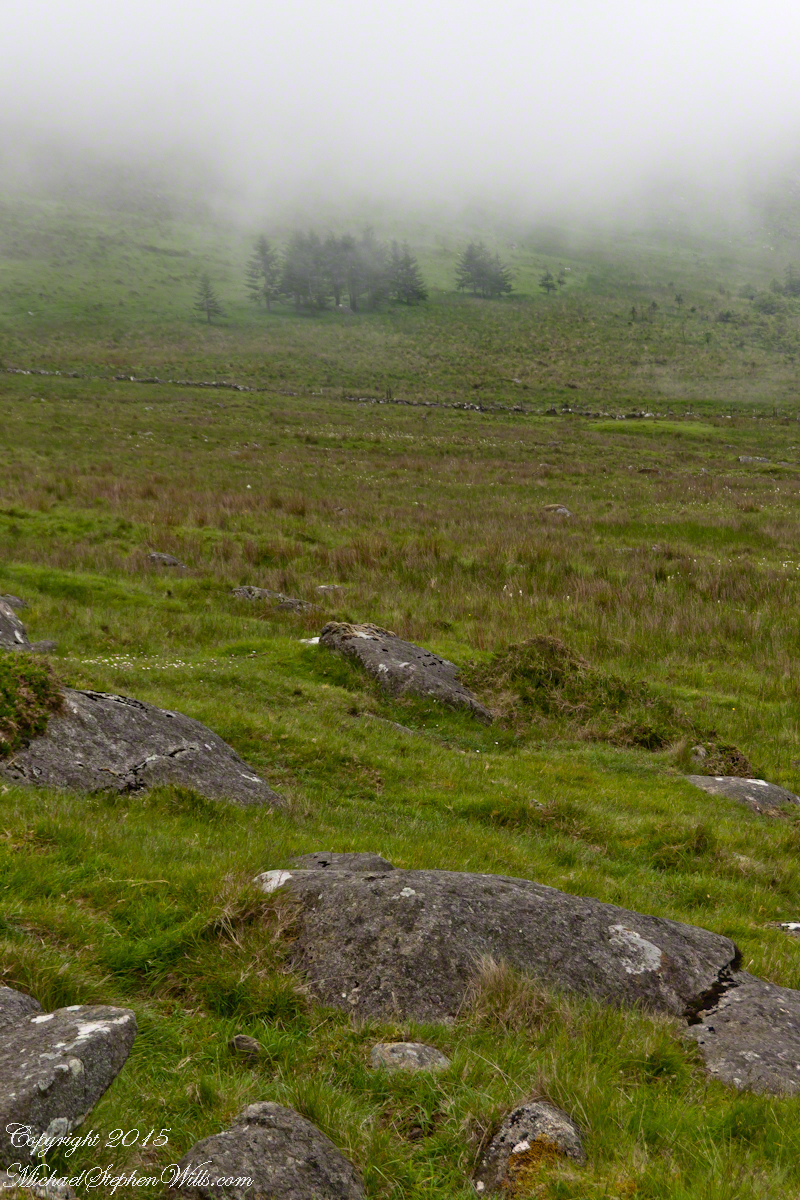
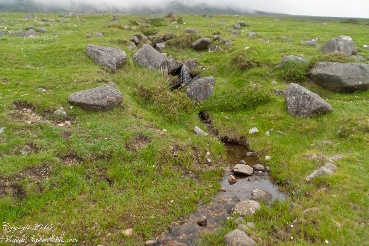
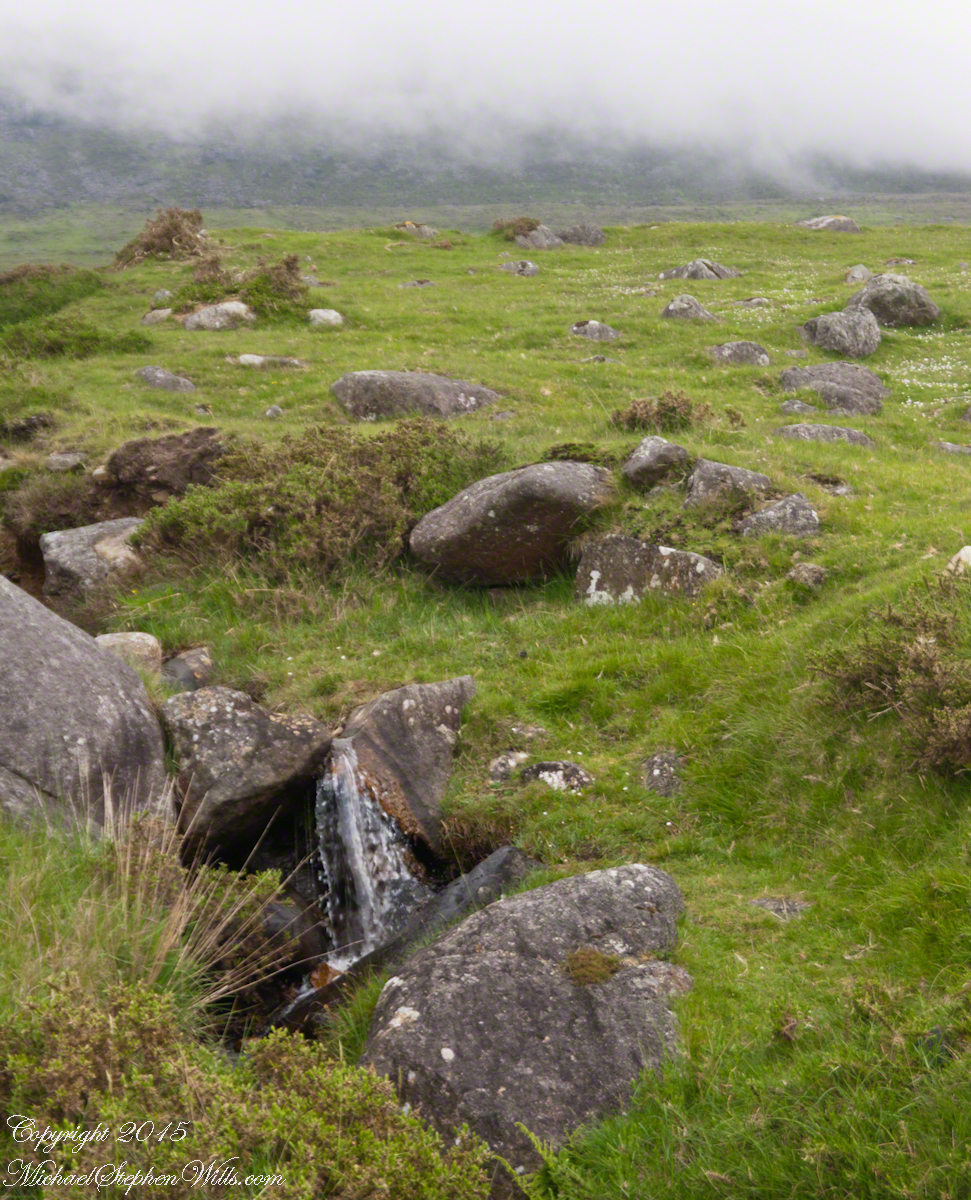
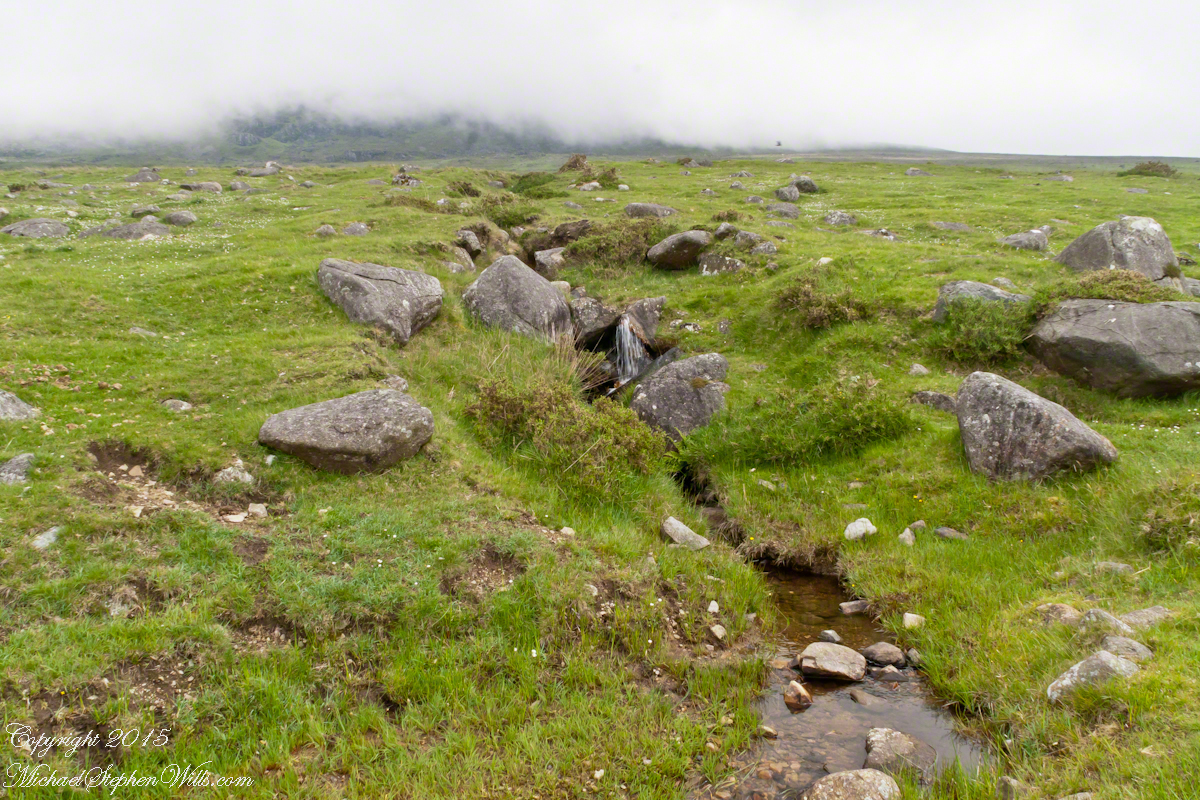
The lower slopes hold many small stream among granite stones. Walking the Tain Trail to Carlingford Walking the Tain Trail to Carlingford Walking the Tain Trail to Carlingford Walking the Tain Trail to Carlingford Walking the Tain Trail to Carlingford

I will continue with our walk on the Tain Way soon enough.

Click for the next chapter of our time on the Tain Way

Here’s a previous Ireland posting……

Copyright 2021 Michael Stephen Wills All Rights Reserved

Skellig Peek

A Trinity of Skellig Images

Now’s time to share a trinity of images from a morning spent about the Skellig Islands May 2014.

Pam and I have many stories from that day, a favorite is from the parking lot of Portmagee where we met the fast boat to the island. I prepared for the day by making a reservation for our ride. We traveled from Killarney, where an early morning breakfast feast spread by The Killarney Royal Hotel fortified us for the adventure. Throughout our tour, experiencing Ireland was like taking blinders off, this first experience on The Ring of Kerry was no exception, driving on a tight timeline to reach Portmagee with minutes to spare, every turn of the road presented a new delight.

Grateful to have made it to Portmagee, we quickly pulled our kit together. As I closed the bonnet, Pam exclaimed “our umbrellas.” At this point of the story we laugh together. Umbrellas indeed. I had a dim clue of what lay in store for us and insisted the umbrellas be left behind, a counter-intuitive decision for a rainy Irish day the Wild Atlantic Way. Regardless of the time, we needed a bathroom break as there will be no facilities on the fast boat or the World Heritage Site where there is no space for human waste products.

Click any photograph for my Online gallery.
Skelligs from Valentia Island
I was here perched on a cliff of Valentia Island across from Portmagee looking southwest across Valentia Sound.

The humor is in our welcome aboard the fast boat, like a fishing boat with a small cabin and small deck dominated by the engine hatch. We crowded on, handed a full set of fisherman slickers. This is a heavy coat with hood and pants, all waterproof. Our close timing guaranteed the worse seat, away from the cabin in the open. It was a new experience for us and we felt a sense of dread as the craft left the protection of Valentia Sound into the open Atlantic Ocean.

We faced a west wind, driving 12+ foot waves, as the boat breached each wave the crest went over the cabin in a waterfall of salt water. Up and down, up and down. Thankfully neither of us lost breakfast as some did. I do not have photographs of the trip out or the approach to the island, my equipment was safely packed away.

In the above photograph you see the entire course of our approach to the island, a bit more than 10 (land) miles from Portmagee. We toured Valentia Island that afternoon.

Click any photograph for my Online gallery.
Skellig Steps
Climbing the side of Skellig Michael, approach to the peak and monastery.

There is a fair climb to the top to view the former monastery buildings. The steps are uneven and, when wet as it was that day, slippery.  I wore a waterproof North Face shell with hood for the low threatening clouds.  There was no rain as such, a constant fog on the top kept all exposed surfaces wet.

From the point on, until the top, was the most exposed and uncomfortable (frightening, chilling…you get the idea).  Spare yourself the experience if you are afraid of open spaces and heights.  Here was a stiff wind blowing from the right, on the left the cliff falls away to the ocean.  Ahead, the path narrows to about 10 inches with a cliff wall on one side, the precipice on the other.  Then come the monastery entrance and rock wall safety.

Click any photograph for my Online gallery.
Monk Cell
Monk Cell, Grave and Cross

This single image gives a succinct impression of the monastery setting.  The bee hive shaped stone monk cell requires a stooped crawl to enter.  Inside, the space is small and, thankfully, dry.  The structure keeps out the rain and wind, a marvel of stone construction. This cell is off to the side, on a cliff balcony, over the wall an ocean precipice.

My closing advice is to plan your time wisely.  The ship boards in less than an hour, in that time you climb the 700 steps and explore.  There are people all over the place, in waves. To capture the structures without humans, you need to wait until the cohort become bored and leaves.  There will be a space before the next wave of tourists breaks. Leave enough time to descend the steps safely.  People have suffered fatal falls on the steps and cliffs, it is easy to do.  Make your personal safety a priority.

Click for another Ireland Posting, “On the River Cong.”

Copyright 2021 Michael Stephen Wills All Rights Reserves

Pinelands Connections III

A presence today

“Driving along a sand road between the vanished town of Calico and the vanished town of Munion Field, we passed a house that was so many miles from any other house that Fred said, with evident admiration, “He got well in away from everybody, didn’t he?” Fred made a similar remark every time we passed a house or cabin that was particularly deep and alone in the weeds. Getting — or staying — way from everybody is a criterion that apparently continues to mean as much to many of the people in the pines as it did to some of their forebears who first settled there. Tories, for example, fled into the pines during the American Revolution. People with names like Britton and Brower, loyal to the King, and sometimes covered with feather and tar, left their homes in colonial cities and took refuge in the Pine Barrens. Also, during the eighteenth century, when the farmlands of western New Jersey were heavily populated with Quakers, the Pine Barrens served as a catch basin for Quakers who could not live up to the standards of the Quaker code….” From The New Yorker magazine, November 26, 1967, “Profiles, The Pine Barrens I” creative non-fiction by John McPhee.

……continued from “Pinelands Connections II.

Vanished like the towns of Washington, Calico, Munion Field are the reasons that led to the union of the Quaker George Wills and Mary Dellett, daughter of James, emigrant from Northern Ireland. It is reasonable to surmise George, separated from the Quakers, sought refuge in the pines as a young man.

We can tease grief and loss from the records and landscape, When Joseph C. Clark visited George and Mary on August 24, 1850 to record the persons living there, if the U.S. Constitution prescribed the recording of the grief he experienced, the record would show Charles missing from the list. Follow the sand path, “Eagle Road” three miles north where he lays in the ground of the family cemetery, having passed just days before the 1850 census was taken.

The loss of a cherished presence can be inferred from the use of precious marble to mark his resting place. The heavy pine slabs of his companions long since vanished.

As with the Wills Hotel, the Wills Family Cemetery is best found through global coordinates: 39°45’49.7″N 74°34’01.4″W

Click me for Pinelands Connections IV

Copyright 2021 Michael Stephen Wills All Rights Reserved

Back To School, Uruguay

A late summer Friday evening

Since 1877 primary education in Uruguay is universal, compulsory and free. These days students receive free education through university, literacy is the highest in South America at 95%, equally for males and females.

These photographs are from a cruise around South American my wife, Pam, and I enjoyed February / March 2016 on the Oceania ship Regatta. This was the evening of February 26, 2016, a Friday, in the city Montevideo, Uruguay.

This image is the theme of this blog, “back to school”. On Avenue Gral Eugenio Garzon of the Colon neighborhood of Montevideo a mother and four daughters discuss a shop window featuring “back to school” clothing and necessaries. The children range in age from pre-school to teen. This is evidently a serious discussion about preparing for the school year which starts in March for Uruguay.

A government program launched in 2007 expands Information and Communication technologies in primary schools with these goals:
— To distribute technology,
— To promote knowledge,
— To generate social equity.

Called Ceibal, after a tree native to Uruguay, the program was a success. From 2009 – 2012 450,000 laptops, popularly named “”ceibalitas”, were delivered to children coordinate with teacher training and a monitoring and evaluation model for assessing the impact nationally. Ceibal is the acronym for “Conectividad Educativa de Informática Básica para el Aprendizaje en Línea” (Educational Connectivity/Basic Computing for Online Learning in English).

These photographs build on the theme of the positive influence education has on the lives of Uruguayans, many of whom live in poverty.

A family gathering in their yard on Avenue Gral Eugenio Garzon, enjoying a cool late summer evening.

Back To School -- CLICK ME!!!!

Traffic and a gas station. People were out and about, walking and conversing. There is a makeshift trailer attached to the motorcycle, behind is a large truck.

Back To School -- CLICK ME!!!!

Storefront with customer and man loitering on wall. A mini-Honda all terrain vehicle is on display.

Back To School -- CLICK ME!!!!

Mate is a beverage enjoyed throughout South America. Here companions enjoy a warm summer evening with a thermos of hot water and mate gourd behind a restaurant, their view across the train tracks and the Colon rail station is of a playground and playing fields.

Back To School -- CLICK ME!!!!

A family of very young soccer players coming from practice with teammates. The sponsors of lucky number 7 are the bank Banrisul and Tramontina, a kitchenware manufacturer.

Back To School -- CLICK ME!!!!

We waited to board an historic train and shared the station with Montevideans waiting for a passenger train. Here are two families: a mother and pre-teen daughter colorfully dressed, a grandmother and grandson. Behind them are the playing fields and playground.

Back To School -- CLICK ME!!!!

A passenger train heading north passed while we waited for our ride to begin. Curiosity shines from this child’s eyes.

Back To School -- CLICK ME!!!!

Happy families greeted us with waves and smiles during our trip to downtown Montevideo.

Some of the homes along the rail line. Pools such as that are popular in cities. We saw a great many on the streets in Lima, Peru.

Reaction to the historic train from a group of young men.

Back To School -- CLICK ME!!!!

Curious playmates gather at the end of the road.

Back To School -- CLICK ME!!!!

A well attended playground.

Back To School -- CLICK ME!!!!

Copyright 2021 Michael Stephen Wills All Rights Reserved

Farmland Southeast of Carlingford

Beauty of the Cooley Peninsula, County Louth, Ireland

I offer here a continuation of descriptions of a 2014 walk on the Tain Way, an appreciation of the lore and beauty of Ireland.

Descending the Tain Way from the ridge of Golyin Pass the sweep of Cooley Peninsula spread before us. Louth is the smallest of the Irish Republic counties, a peninsula which is mountainous where it is not farmland, one exception being Carlingford with the most people, population 1,405 in 2016.

Residential Carlingford continues along the Greenore Road, farmland adjoins then continues southeast along the Cooley Peninsula margin, the Irish Sea beyond. Greenore Town and deep water port on upper left.  These photographs are views from the Tain Way on the slopes of Slieve Foye, the highest mountain of County Louth.

Greenore Town and Deepwater Port
Click this link for my Ireland gallery of Fine Art Photography.

Wander through the place names: Chapel Hill, Liberties of Carlingford, Moneymore, Leminageh, Crossalaney, Mullatee, Millgrange, Ramparts, Muchgrange, Ballyamony, Mullabane, Petestown, Ballagane, Willville, Whites Town.


There is a deepwater port on Carlingford Lough adjacent to and part of Greenore Town. The port employed Cousin John Mills years ago, supplementing his farm income. Across the lough is Greenecastle, Newry in Northern Ireland.

Greenore Town and Deepwater Port

The Irish Sea opens on the far side of Greenore with the Isle of Man about 52 miles east and a little north.

Visit the opening chapter of our time on the Tain Way

Click link for the next posting of this series, “Leprechaun Rock along the Tain Way”

Copyright 2021 Michael Stephen Wills All Rights Reserved

Grosse Isle Quarantine Station, Quebec

during the Great HUNGER, from the Cobh Heritage Center

“Grosse Isle quarantine station was on an island near Quebec in what is now Canada. It was one of the principal arrival ports for emigrants.

Emigration peaked in 1847 when nearly 100,000 Irish landed at Grosse Isle, straining the resources to breaking poinit. Severe overcrowding and an outbreak of typhus caused enormous suffering the the result was a large number of deaths amongst both immigrants and doctors.

New stricter laws were passed to encure that the catastrophe of 1847 was not repeated. Irish emigrant traffic increasingly flowed towards the United State inthe post-Famine period”. From the exhibit (below), Cobh Heritage Center.

In that horrible year of 1847, strict quarantine could not be enforced and many passengers, some carrying disease, were taken directly to Montreal or Quebec city. At least 5,000 died on Grosse Isle in 1847 and thousands more in Quebec, Montreal and during the voyage across the Atlantic.

The unprecedented crisis made it difficult for accurate records to be kept. Some lists were compiled giving details of the possessions of those who died. These lists make sombre reading as they describe the personal belongings of Irish men and women whose hopes of a new life in North America were never fulfilled.

The objects in this showcase provide an representation of the possessions of famine emigrants. From the exhibit (below), Cobh Heritage Center.

Copyright 2021 Michael Stephen Wills All Rights Reserved

Assistance from America

during the Great HUNGER, from the Cobh Heritage Center

“The U.S.S Jamestown was the first ship to bring famine relief supplies to Ireland in 1847. Other vessels followed, notably the Macedonian which arrived in Cork July 1847. Captained by George C. DeKay of New Jersey, it carried supplies provided by the citizens of New York, Boston, Main and other parts of the United States. Captain DeKay was warmly welcomed in Cord and special events were held in his honor. Most of the cargo was distributed in Ireland, with some being brought to Scotland to relieve distress there. Other smaller supplies of famine relief goods were sent to Cork from the United States. In April the bark Tartar sailed to Cork with in late June the Reliance left Boston, also destined for Cork. Each carried nearly $30,000 worth of goods for famine relief. From the exhibit (below), Cobh Heritage Center.

United States frigate Constellation with relief stores for Irish distress off Haulbownline in Cork Harbor.

Copyright 2021 Michael Stephen Wills All Rights Reserved

Peel’s Brimstone

during the Great HUNGER, from the Cobh Heritage Center

“In November 1845 the British government set up a Relief Commission for Ireland which imported Indian corn and meal from the United States. This arrived in Cork early in 1846 and was distributed around the country where local food depots and relief committees were established. Indian corn (maize) was not grown in Ireland and was an unfamiliar food. It was difficult to grind and in some areas was known as “Peel’s brimstone,” after the Prime Minister Sir Robert Peel. Special leaflets were issued to describe how to cook maize.” From the exhibit (below), Cobh Heritage Center.

Instructions for how to cook maize. In the west of Ireland many people spoke Irish.

“On Saturday last, the Government Sales of Indian Corn commenced in Cork. Immediately on the depoys being opened, the crowds of poor persons who gathered round them were so turbulently inclined as to require the immediate interference of the police, who remained throughout the day.

Among the poor, who were of the humblest description, and needing charitable relief, the sales were but scanty. The occasion had become of necessity; for potatoes had risen to 11d. the market price for 14 pounds; and, some of the leading commercial men in Cork have made a calculation, which show that the Government can afford to sell the Indian Corn at a much cheaper rate.

We feel gratified to learn that a steamer has been dispatched from Cork to Dublin, laden with 600 sacks of Indian meal.

One half, by the orders, is to be dispatched by the Royal, and the other by the Grand Canal, to the interior. It must be acknowledged that her Majesty’s Government are executing their dury promptly and with energy. from the Illustrated London News, April 4, 1846″. ~ from the exhibit, Cobh Heritage Center.

Copyright 2021 Michael Stephen Wills All Rights Reserved