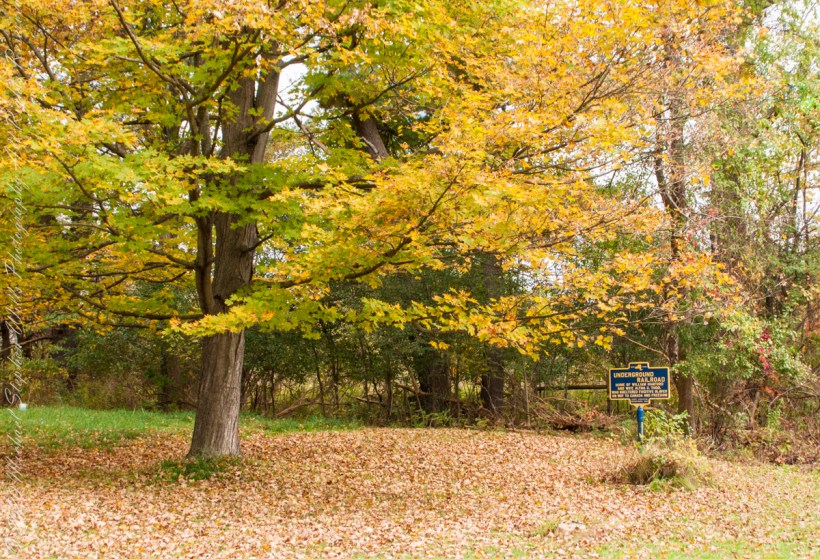
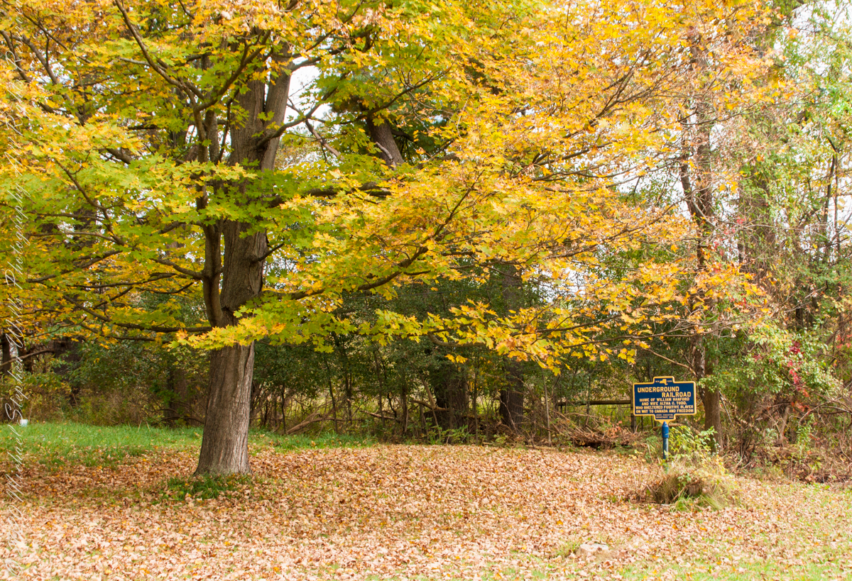
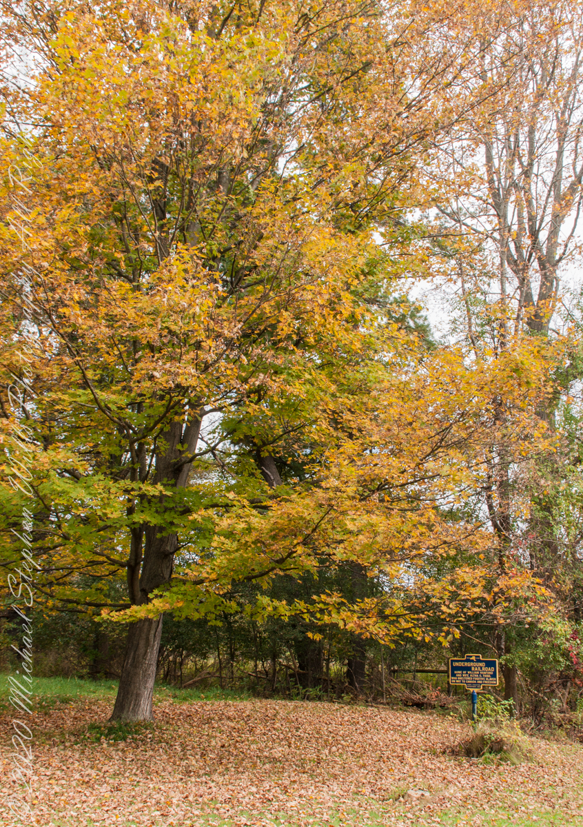
We have often travelled Lower Creek Road as an alternate route to visit my son and his family who live in Freeville, a village named for the activity of the Underground Railroad. After noticing this sign in passing for years, this week we stopped on a glorious autumn morning to capture it. I had packed the Sony Alpha 700 dslr for just such an opportunity.
Just off the road, under a maple tree in full autumn color (yellow), ground covered with fallen leaves (brown) on a fine early October morning, the sign reads, “New York, UNDERGROUND RAILROAD, HOME OF WILLIAM HANFORD AND WIFE ALTHA C. TODD, WHO SHELTERED FUGITIVE SLAVES ON THE WAY TO CANADA AND FREEDOM, STATE EDUCATION DEPARTMENT 1932”. These dark blue background, bright yellow letter signed are found throughout this region and much appreciated.
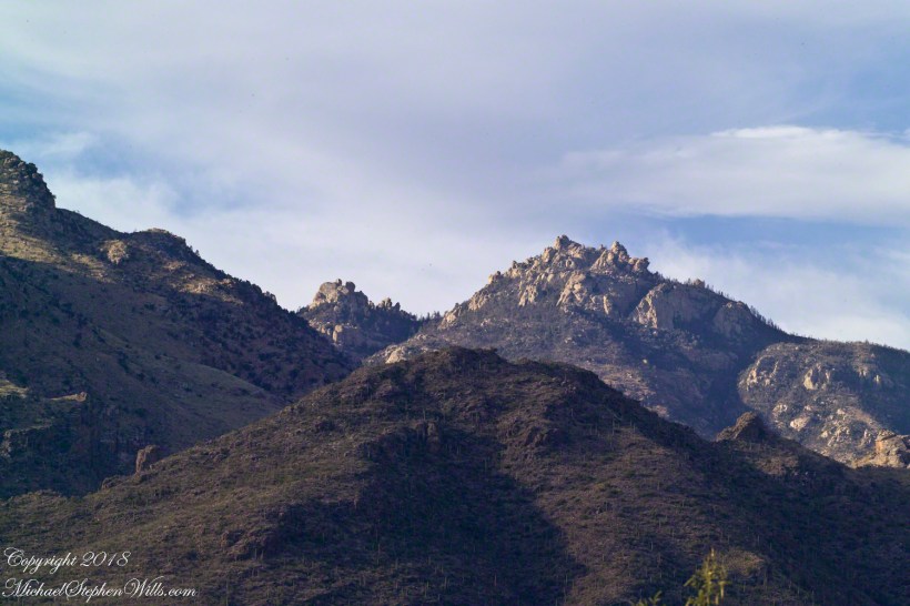
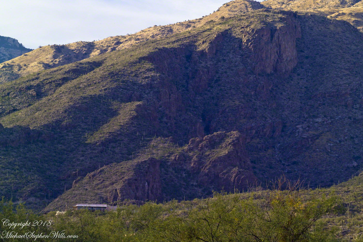
On a Tucson November 2005 afternoon, after my volunteer work for the University of Arizona, CALS college, alumni board of directors, in the mid-afternoon I headed for Sabino Canyon with my photography kit.
With a 25-pound pack on my back, walking from the parking lot I looked up at the incredible rock formations of the Santa Catalina mountains. It took some time to set up the tripod (at that time I was using a cheap swivel head on adjustable aluminum legs) with a 200mm telephoto lens (Canon L-series EF 200mm USM) I grabbed this shot of the hoodoo fringed peaks beyond the foothills (f16, 1/30, ISO160). The lower sun angle made the formations pop out.
Hoodoos in the Hills
You call those strange formations of upright rocks “hoodoos. Some people believe the fantastic shapes were created by spirits, today the explanation is wind, water and time create hoodoos from rock of the right stuff. It is a wonderful experience to wander among hoodoos, though unsettling because some of these large rocks are seemingly in danger of falling over at any moment.
Moving On
I have a mental list of photographic “to do’s” and the gathering clouds, typical for a Tucson November day, reminded me an awesome desert sunset was on this list, so I packed up to head for the east side of Tucson for a shot looking toward the Tucson Mountains (on the west side).
Clouds gather at sunset above a ridge serrated by saguaros.
Click any photograph to view Ocotillo Sunset
Sabino Canyon House
Before we move on, this is a fascinating image of a typical southern Arizona house perched on a ridge at the mouth of Sabino Canyon. In this image the viewer sympathizes because the telephoto lens gathers the majestic rocks around the tiny structure.
The house is perched on a Santa Catalina foothill ridge running east west, a wall of picture windows facing south with a view across the Tucson valley toward Mount Wrightson of the Santa Rita mountains, 42 miles distant. Summer thunderstorms gather on this peak, wreathing it with lightening. These times, evenings and night, the view pays for the inconvenience of this distant, hot ridge. Another time to be there is for sunsets.
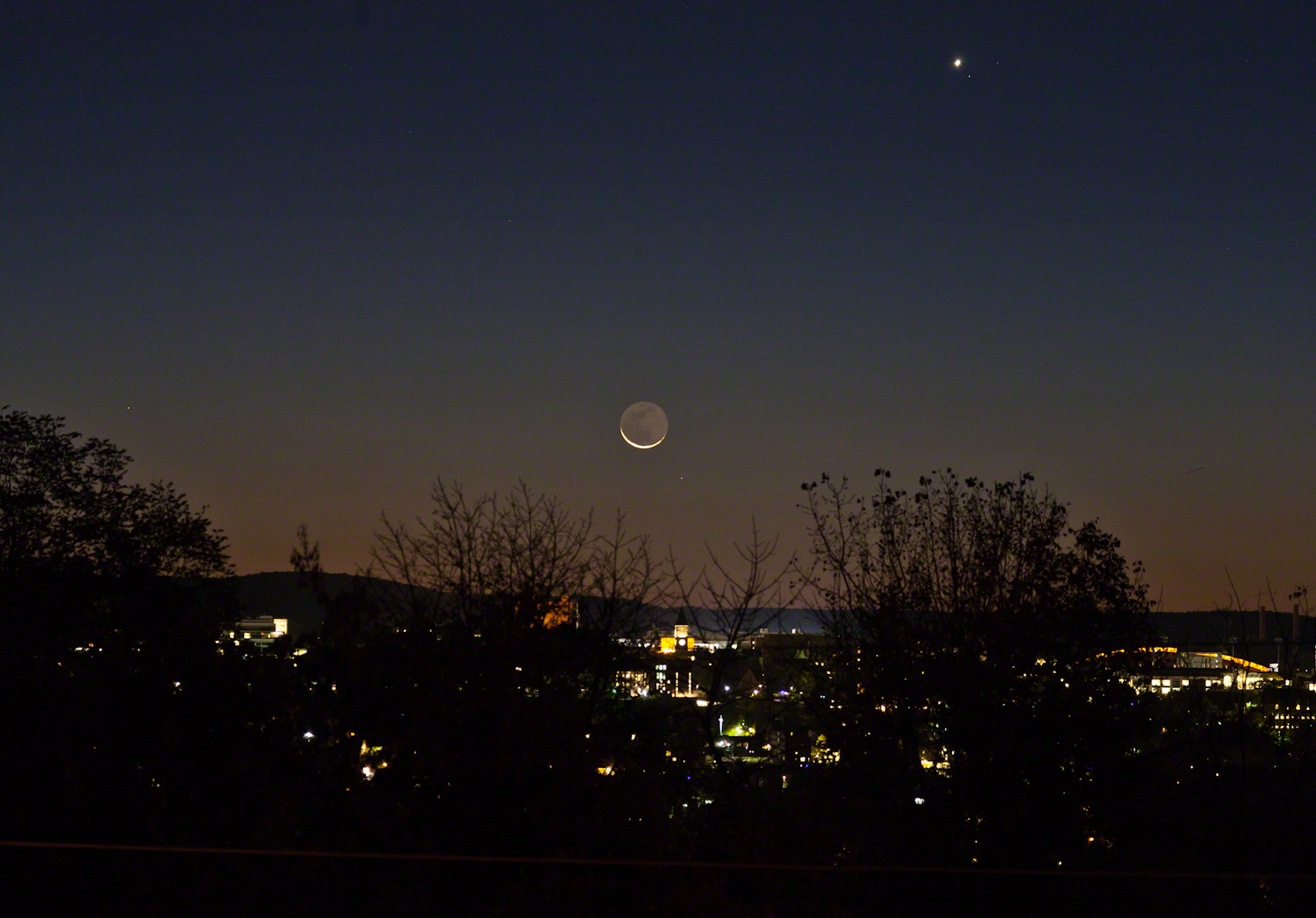
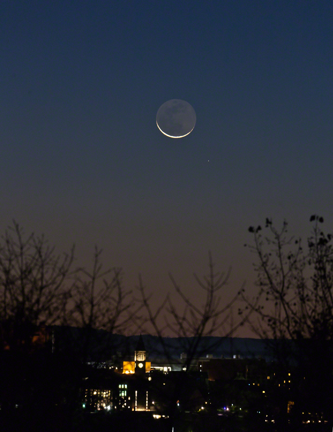
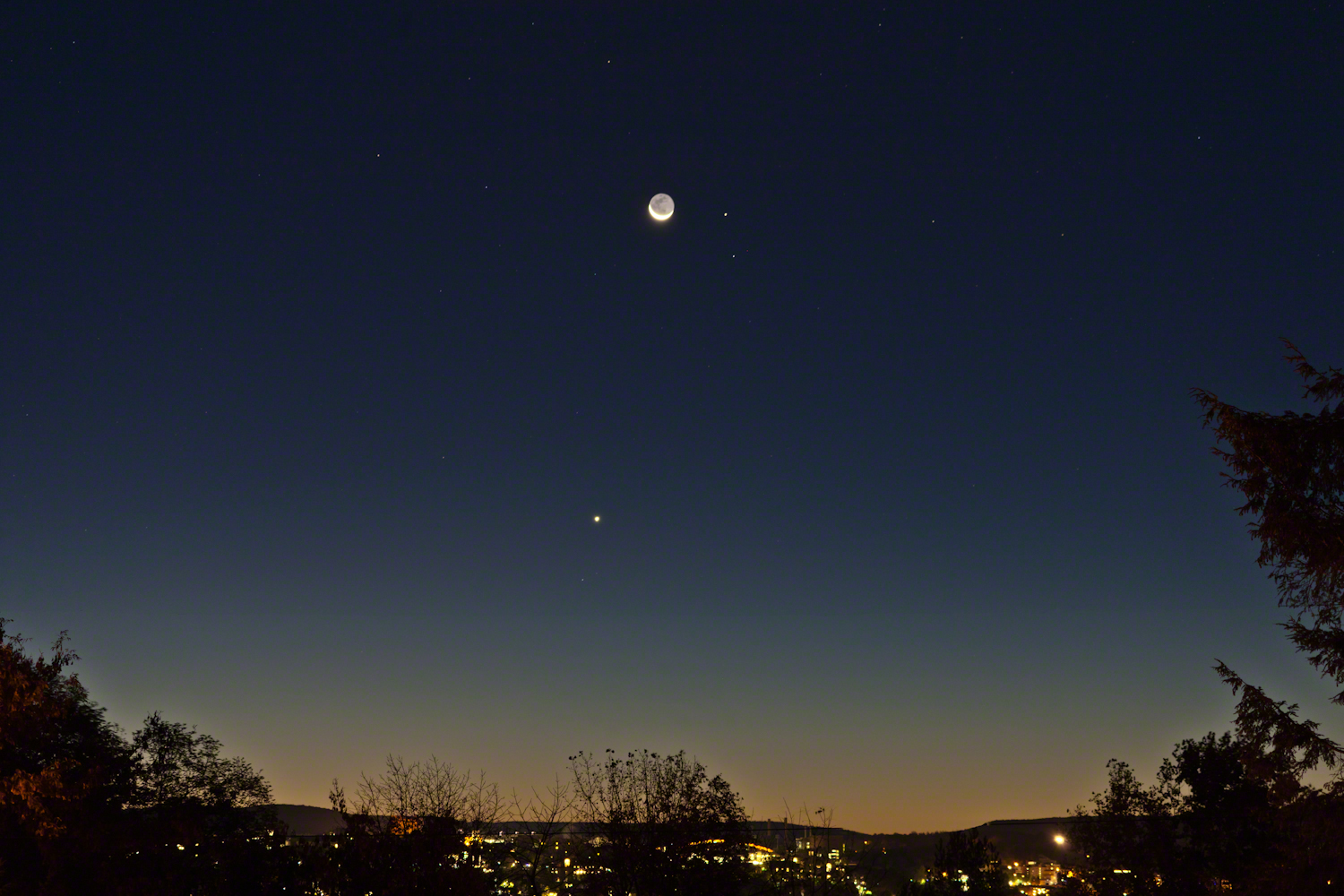
Here are two photographs taken about the same time, 6:30 am, October 18, 2017, companions to the photograph shared earlier this week.
The moon rises later each day, so these shots include a larger disk closer to Cornell University. Both components, the crescent and earth-glow, were dimmer this morning. In each photograph Jenny McGraw Tower is visible.
The star is Regulus, the brightest in the constellation Leo, close below the moon. I don’t know the star close to Venus.
Here the tower is slightly to the right of the crescent, the arch of Schoellkopf stadium further right. Among the trees on left, is the baleful red glow of Bradford Hall.
The tower is outlined by the lights of Uris library, presumably filled with early rising students.
The light of Regulus (“small king”), below and to the right, is a composite of four stars moving together through space. The position of Regulus on the path in the sky of the moon, planets and asteroids (called the ecliptic) leads to the occultation of the star by the disks of the moon and, less regularly, the planets and asteroids.
Copyright 2021 Michael Stephen Wills All Rights Reserved
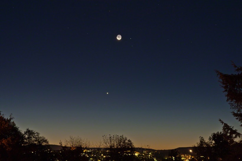
A thin crescent bowl filled with earthglow floating above the dawn attended by Venus, Mars, Virgo.
This was the view from Ithaca, New York at the start of dawn this morning of Tuesday, October 17, 2017. Mars is next to the moon, the stars of the constellation Virgo scattered around, Venus is the bright object below. We had a bright, clear sky not unusual for September and October.
In the city, an arch of Schoellkopf Stadium on the Cornell University campus. Cornell is on east hill. We live on west hill, across the valley. It is quiet on west hill, away from the students.
Earlier this week the crescent was in the constellation Leo where the bright limb occulted the bright star Regulus, to reappeared from behind the dark limb, a brilliant spectacle that happened after dawn for New York. It was cloudy, as usual, on October 14.
When I woke, the moon was shining through the trees, still full of just turning leaves. The crescent turned, cup like, above the horizon, to cradle the dark orb glowing from the reflected light of our earth. I did not recognize Mars, the disk was less red than usual. Research revealed the moon had two planets in seeming attendance. I also learned that, when the horns point right the moon is waning, moving toward a new, or un-illuminated, moon. When the phase moved from new it is also a crescent with horns pointing left.
This morning was a fortunate gift, I had never contemplated the moon in quite this form before.
Copyright 2021 Michael Stephen Wills All Rights Reserved
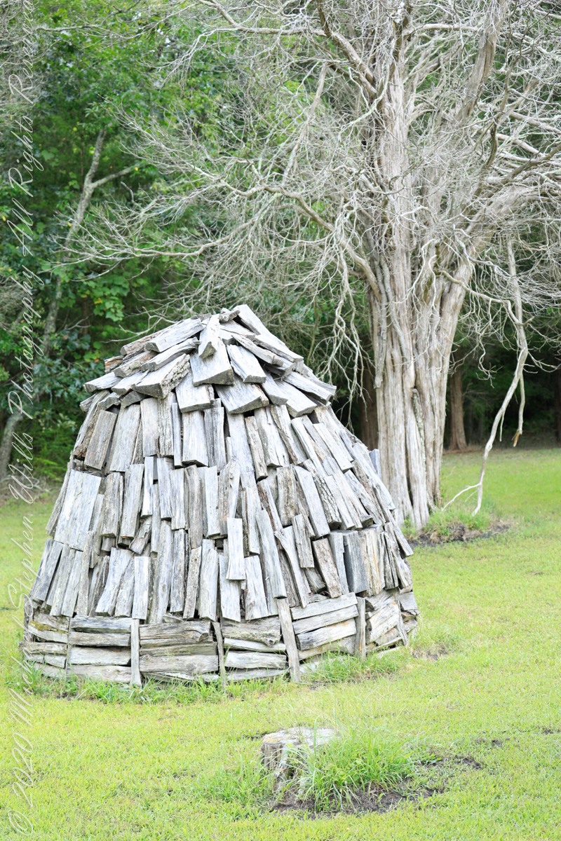
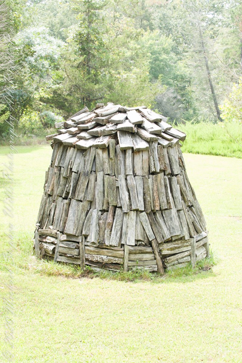
Here my exploration of Wharton State Forest, Pitch Pine Forest III, branches to the genealogical exploration of this landscape as my sister, Theresa and I, proceed along the humped, pitted sand road Goodwater through the wilderness to emerge in Batsto Village, a recreation of lives that touched my great great grandparents, James and Ann McCambridge among them. Ann saved money earned as a cook for Atsion furnace, the historical site at the start of the road to Quaker Bridge. Her husband James worked as a collier, supplying fuel for the iron furnaces at Atsion and Batsto, among other enterprises. During our Batsto Village visit we found these reproductions of charcoal clamps.
A charcoal clamp (a word derived from Dutch for “heap’) is build around a chimney formed from the wood and covered with materials such as earth to control air flow.One the burn was started, the process was watched closely. The person in charge was called a collier.
Since earliest times charcoal was used for cooking and heating. It was the best heat source for metal furnaces. Entire deforested regions are attributed to the demand for charcoal. Thomas Jefferson experimented with charcoal clamp designs, modifying air flow from the base.
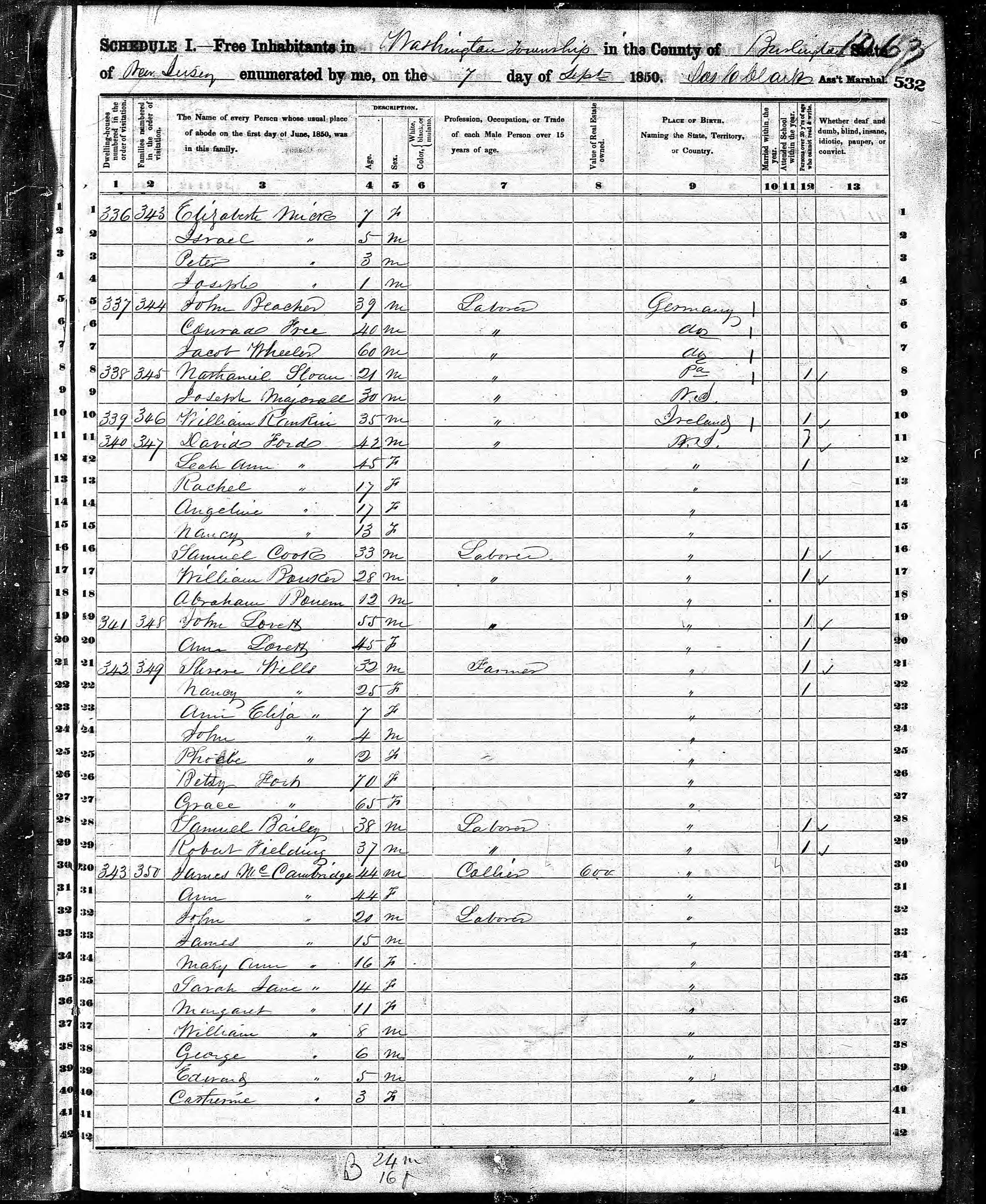
James and Ann lived on the land that provided a livelihood, enough to support themselves and nine (9) children. From September 7, 1850 is the US Census for this family of my second great grandparents. Great Grandmother Margaret was 11 years. James is listed as a Collier, the value of Real Estate owned was 6,000 (a fortune for the time).
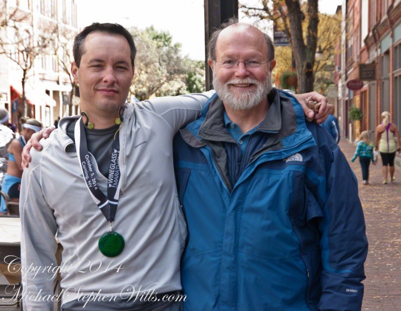
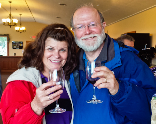
October 5, 2014 found Pam and I at Keuka Lake after my son completed the Wine Glass Marathon. Here we are at the finish line in Corning, home of the Corning Glass Factory. You may know it from your set of Correlle dinnerware.
Marathoner and his proud father
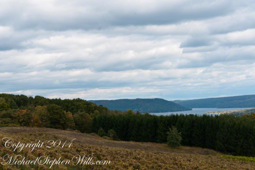
Afterwards, Pam and I made it up to the Dr. Frank Winery for a tasting followed by dinner at a local restaurant. Here is a photograph from the same viewpoint, using the “zoom” setting of my Sony DSLR A700. The view is more interesting than the winter shot of “Keuka Lake Winter I” from the autumn clouds and the burst of late day sun on the eastern lake shore.
This is the juncture of the “Y” shaped lake where the two arms joint the long foot. The pointed high headland is the point where the two arms meet. We are looking north here. The western arm, on the right, is unique in that the water is flowing down into the juncture. In Keuka Lake the water flows in two directions. The flow of lake foot and eastern arm is in the opposite direction, Keuka Lake empties at the top of the eastern arm, eventually reaching Lake Ontario.
North View from Overlook using “Zoom” lens
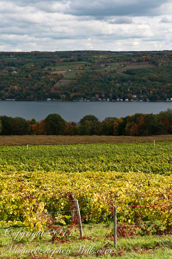
Here is the eastern view, from the overlook, looking over a vineyard ready for harvest, covered with fruit and leaves. Every once in awhile there is a loud “bang” from a noisemaker used to discourage birds from feasting on grapes. The buildings along the shore are summer cottages, Keuka is lined with them.
East View on an autumn afternoon
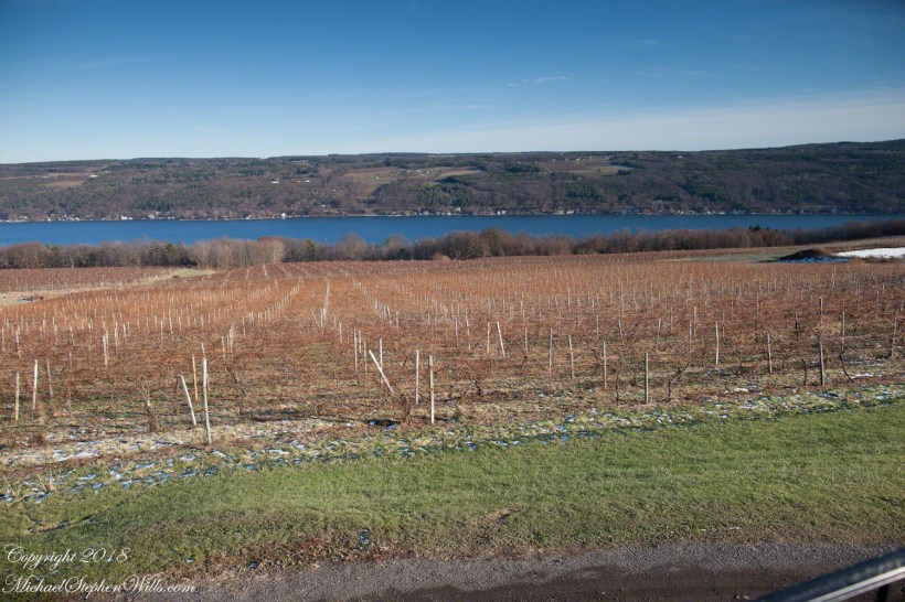
The same view, from our December 2018 visit. The vines are bare, the fallen leaves cleared, the vine roots covered under banked earth to protect them from the cold.
Pam and I, enjoying wine after the 2014 Wine Glass Marathon. Cheers!!
Leaving the jeep on the west side of Quaker Bridge, I walked over to inspect the structure and poke around the other side, carrying a Canon 5d Mark IV (camera body) / EF 70 – 300 mm f/4-5.6 L IMS (lens), shooting as I walked. My sister Theresa and Maxie, a little white dog, lagged behind taking in the surroundings. Here they are, in shadow, on the west side.
Click pic for larger view in a new browser tab. If you are in WordPress Reader, open the post to use this feature.
My work on the east side was shared in previous posts, “Pinelands Connections VIII,”I and II “Around Quaker Bridge,” and I and II “Pitch Pine Forest,” work interrupted by the sound of an approaching engine, a Humvee came into view. I waved my arm up and down, a sign to slow down, pulling alongside the driver looked up with dead eyes, no element of recognition of a fellow human, as I explained my sister was on the bridge. A stink of unfamiliar hydrocarbons, diesel fuel?, rose through the heat as they pulled forward with no acknowledgement of my request. Thankfully they slowed down as Theresa, Max in her arms, said, “hi.”
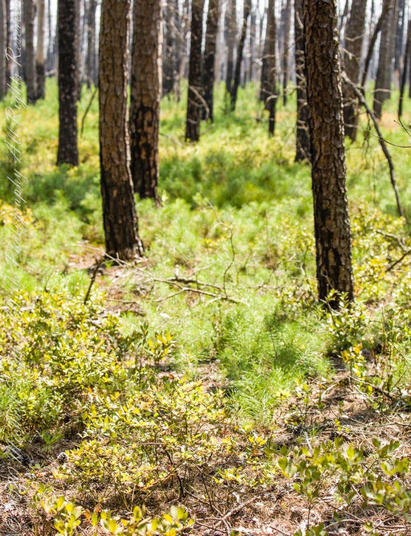
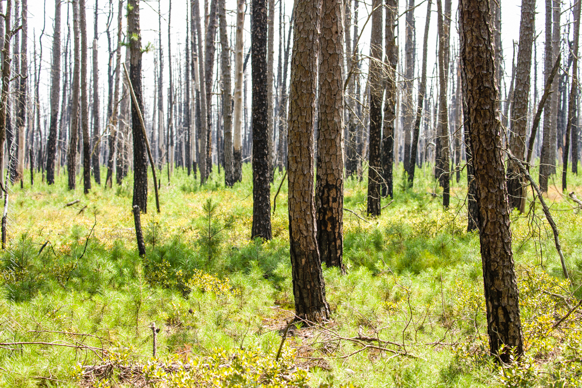
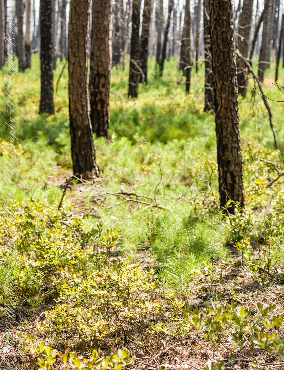
Multiple roads converge from all directions on Quaker Bridge, using GoogleMaps (surprising these unimproved, “jeep” sand roads were listed) I chose Goodwater Road as a route to Batsto Village, on the southern side of Wharton State Forest. The 6.1 mile road follows the east bank of Mullica River at a distance, a very rough passage through ancient Pitch Pine forest. Here are photographs of the enormous capacity of the pines to regrow after fire. Note a thick seeding growth among the mature pine trunks, lower portions fire blackened.
Copyright 2021 Michael Stephen Wills All Rights Reserved
In three, so far, postings on the cottage ruins at Loughan an Lochan (Loughan Bay) we explored a former community above the Irish Sea with a view of Scotland. For the third posting I shared some research on the last cottage people of that site with the intent of additional postings.
I wondered, “What motivates you to do this?” and remembered my mother’s Canadian passport in which, for place of birth “Proleek, Ireland” was written and my request to our cousin, John Mills, who invited us to stay with them after my mother passed away, June, 2013, the request being to visit the site of great grandfather James McCardle’s home, where grandfather Peter McCardle was raised, information since discovered from the Irish census.
On the morning of Sunday, May 25, John took us from mass on a tour of sites related to the family. One of these was the site of the McCardle home, Proleek Townland.
The ruins of the former home of Peter McArdle are on a corner of unnamed streets in Proleek, County Louth. This is a view of the southwest side.
There site is an anonymous corner on a unnamed street with no outlet. The street ends close to the Proleek Dolmen, an ancient passage tomb, after passing farms and fields.
The interior of the property. I see no evidence of great grandfather James McArdle’s home, It has returned to the earth.
The 1901 Irish Census provides these details from 116 years ago:
The walls were stone, brick or concrete.
The roof of thatch, wood or another perishable material.
Two rooms, with three windows facing the road.
Out buildings listed were:
cow house.
piggery.
Today, the site is another person’s property, it was not possible to explore further than when the camera lens reached when I leaned as far a possible into the brush. No sign of standing walls.
Across the road from the McArdle Plot is this ditch (stone wall) and a home. In the far distance, just visible across the plain, rising from it, is an unnamed land mark, a rounded hill 350 feet tall of the neighboring townland of Bellurgan.
Modern homes surround the corner, solid and prosperous.
The site is surrounded by homes on the west and south, farmland on the east and west.
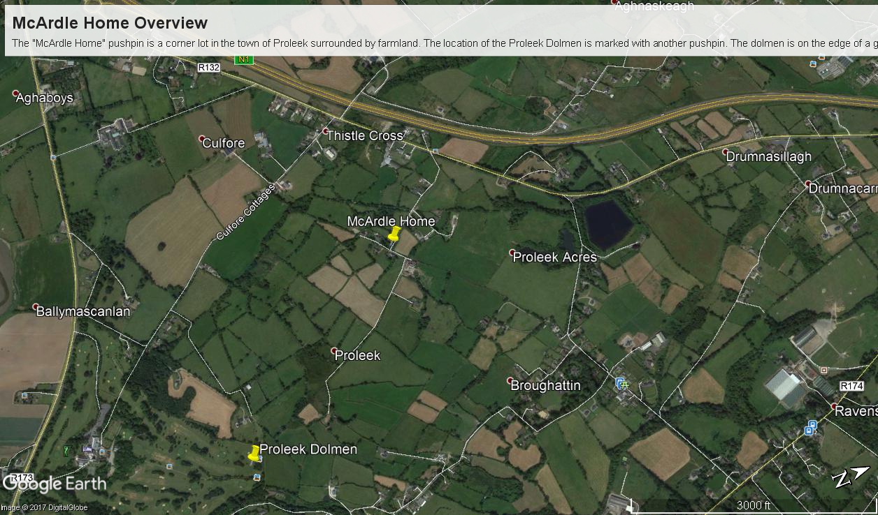
For this posting I collected the following images from Google Earth. The site is marked with a pushpin, “McCardle Home.” A “Proleek Dolmen” pushpin marks the passage tomb.
A closer view suggests, if we trespassed and poked around, some remains of the structure were concealed by the trees and brush.
Between May 2014 and this image, from 2015, the center of the plot was gouged out. The area corresponds to the corresponds to the remains indicated in the 2013 image. From this we can understand were the structures stood in relation to the road.
Using the polygon ruler tool the size of the site is 413 feet in circumference, 9,619 square feet, and the gouge, indicating the ruins, is 1,368 square feet.
But for John and Betty Mills, their kind invitation to stay and John’s guidance that day, the “Proleek” notation on my mother’s Canadian passport would still be a mystery today.
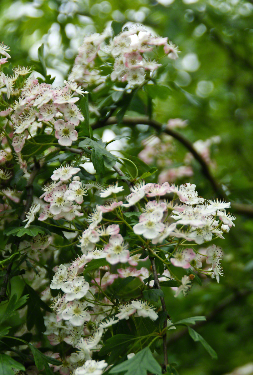
John Mills passed away the next year, September 26, 2015. Here are Hawthorne Blossoms from the corner of the former McCardle home in memory.