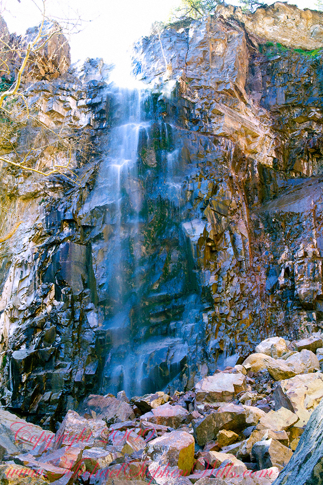
The canyon below 110 foot Reavis Falls is a wild place of transcendent beauty.
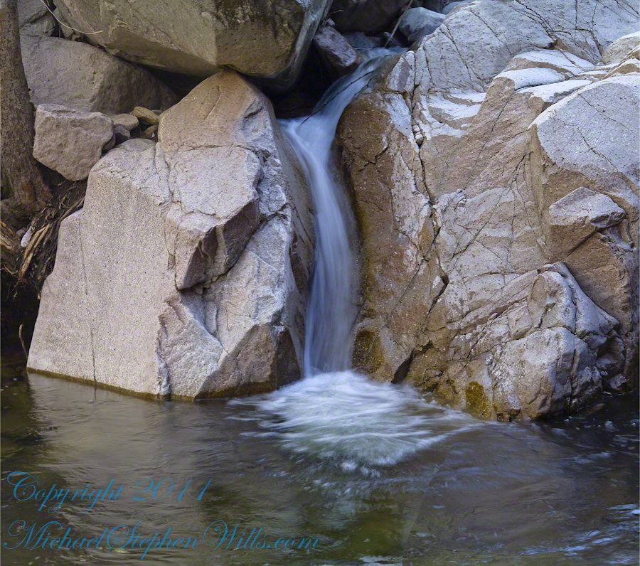
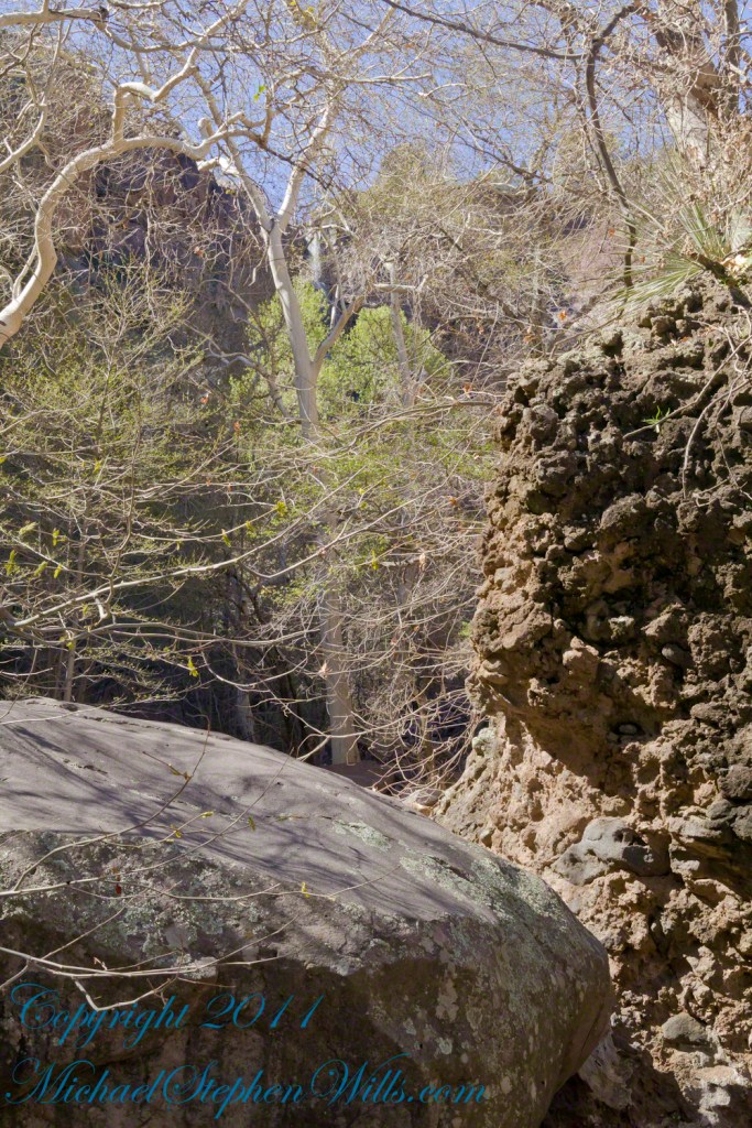
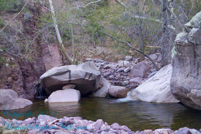
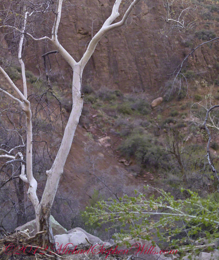
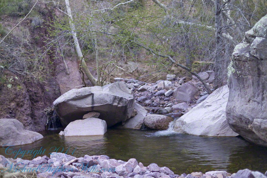
With the afternoon in front of me, the trip back to camp was a slow pleasure. On the way in, I noted several stopping points to capture photographs. Here a natural rock sluice offers a foot tall waterfall, mirroring Reavis Falls, bracketed by white igneous stone.
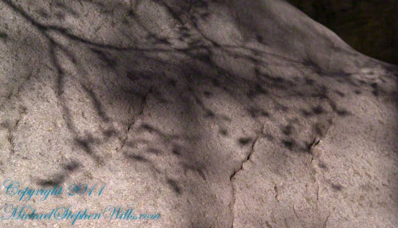
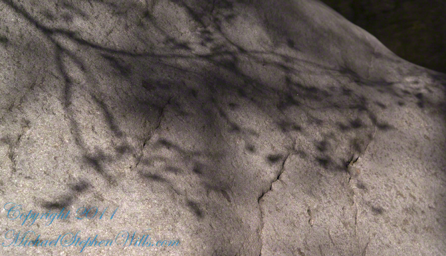
This same stone offers a screen, the bright spring sun throwing the sparse leaves into sharp relief.
Reaching Reavis Falls, once you find the canyon mouth, is three-fourths of a mile of boulder hopping and bushwacking over and around landslides, deep pools and fallen trees. Odds are you will be the only person in the canyon for weeks, if not months. Expect to be surprised. In this chapter you will (finally) visit the falls themselves.
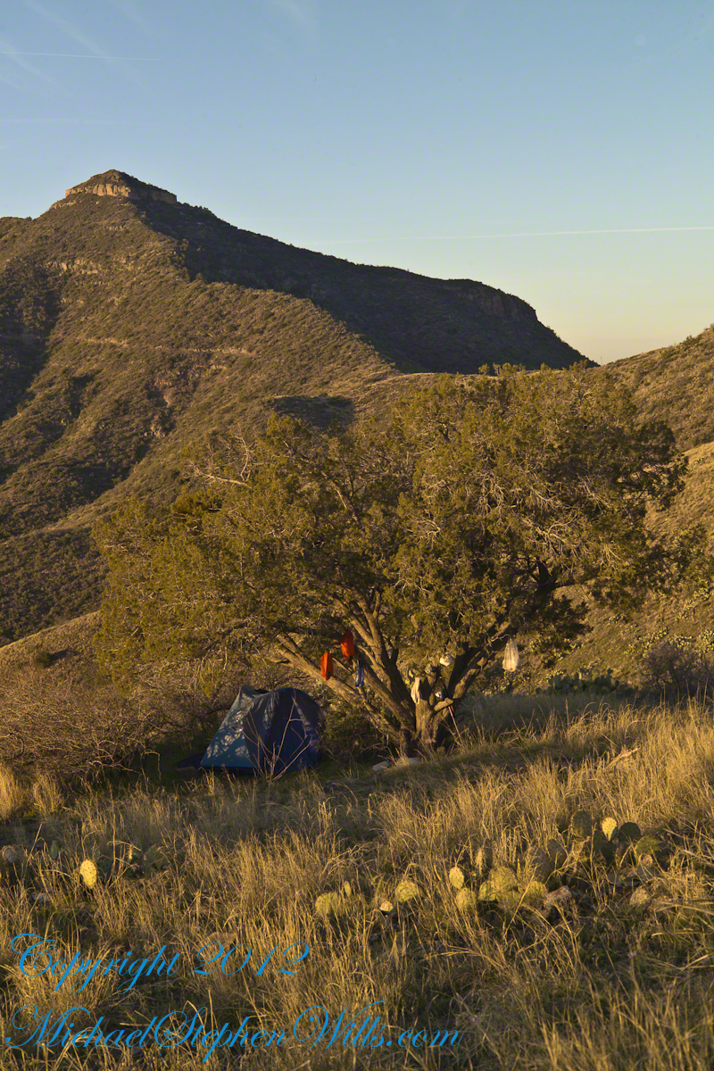
A Camp in the Canyon
Click me for the chapter about the environment around the mouth of Reavis Canyon below the falls.
The Last Mile
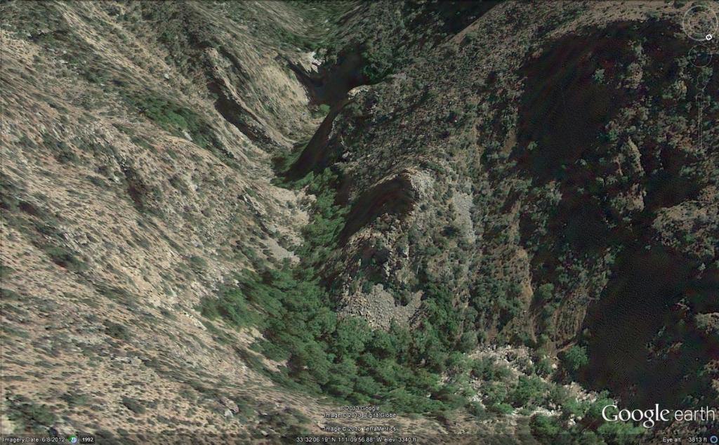
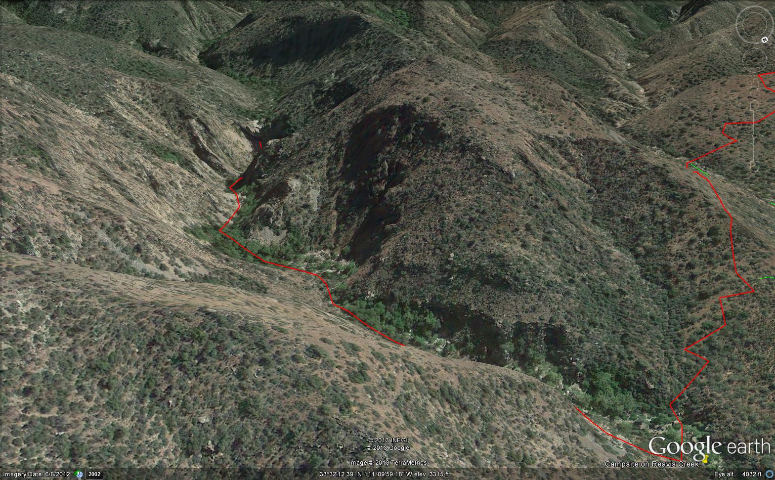
Here is an overview of the last third mile of Reavis Canyon. You can see the wall of the falls nestled in the folds of ridges towards the top, just off center.
On the lower right is a large landslide and, below there, it is complete chaos.
The vegetation grows shoulder to shoulder with interleaved branches. You will not get through there. The solution is to find a way around, usually over and around house-sized boulders.
The image was captured from Google Earth
After almost two hours of picking my way, there was a flicker of light. The fall waters were sparkling in the sunlight high above the cottonwood trees, in full Mach bloom, and the still leafless Arizona Sycamores.
This was my view of Reavis Falls from the canyon on a March day before the Arizona Sycamores have leaved. The falls are the tiny patch of white to the left of midline where the earth meets the sky. Jumbles of infallen boulders and thick growth of sycamores, oaks and fully leaved cottonwoods cloak the falls.
Another 30 minutes of canyoneering brought me to the foot of the falls.
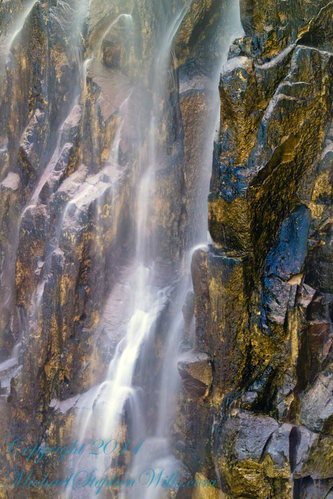
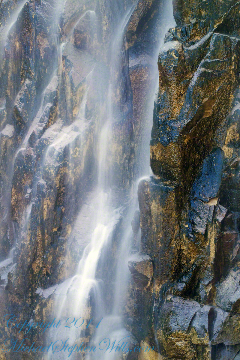
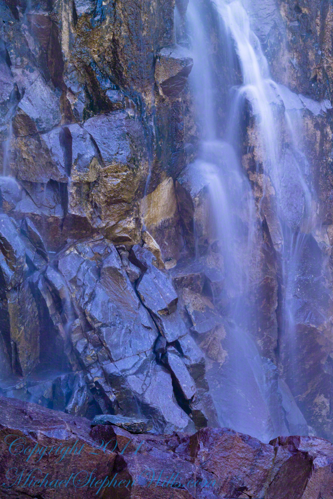
At the Foot of Reavis Falls
Looking up at Reavis Falls from a 20 foot tall mound of talus.
These are boulders washed down at flood time.
The rock wall is thick with microorganisms, fungi and mosses.
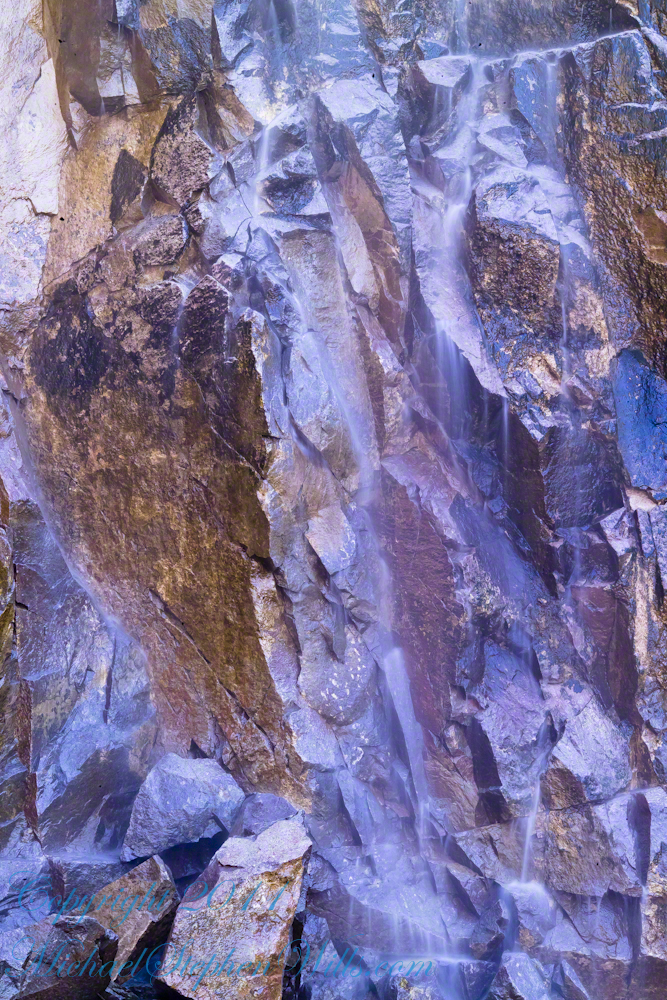
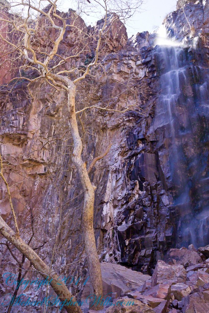
After clambering around the talus pile I found this angle….
An Arizona Sycamore, before the spring leafing, at the Foot of Reavis Falls
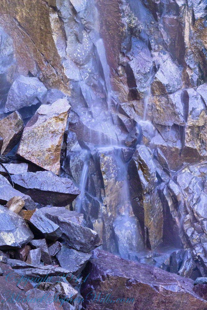
Talus at the Foot of Reavis Falls
The Reavis Falls talus is large boulders carried down Reavis Creek and washed over the falls at flood time as well as blocks fractured from the cliff face. You can see the base of the Sycamore from the previous photograph.
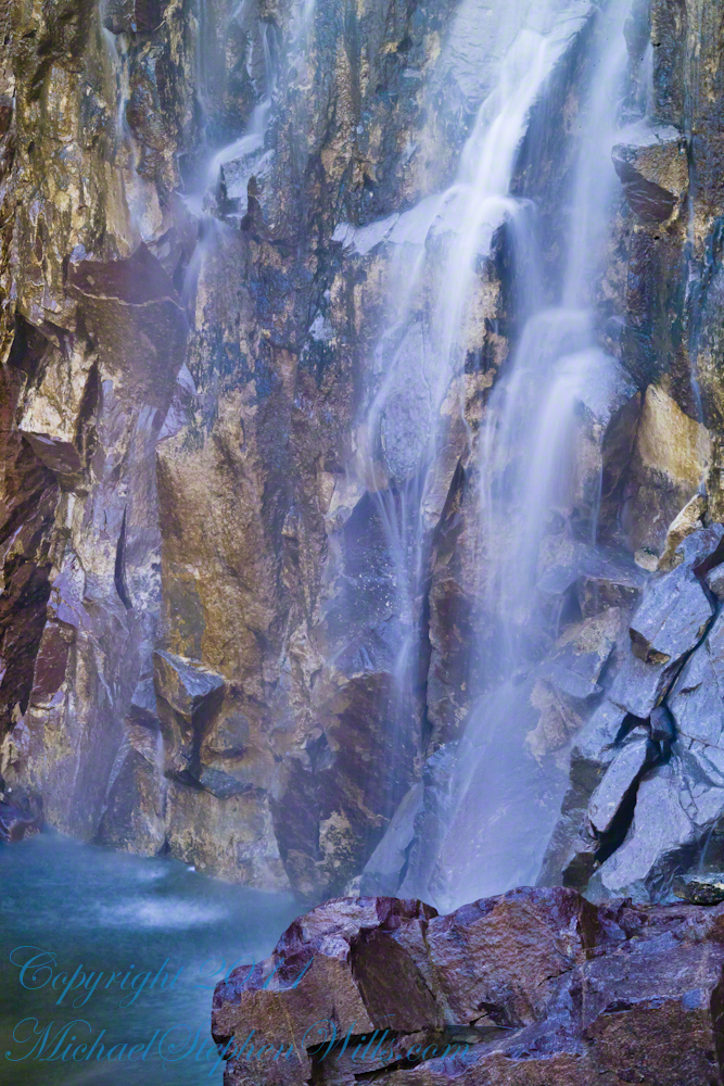
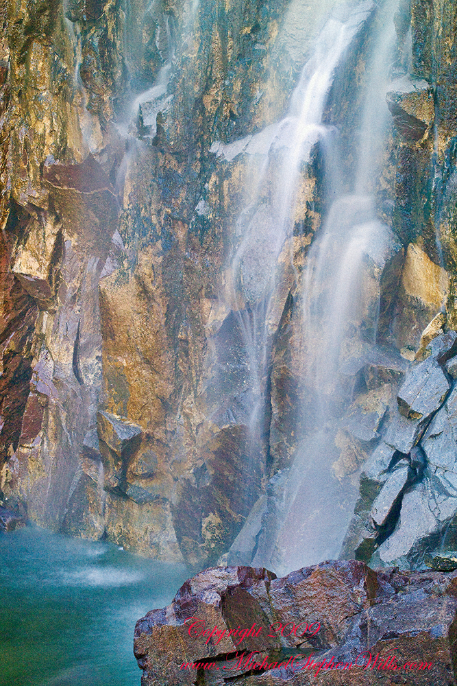
The falls are formed where Reavis Creek flows over a solid mass of rock. The talus is composed mostly of this red rock. From the edge of this cliff to the base, where the falls hit the canyon floor, is all of 140 feet. This is a far as you can proceed into the canyon without some serious climbing skills.
It is possible to climb around the canyon by climbing up the ridge from which I captured the Cedar Basin Hoodoos. See my posts below for this location (you need to work it our for yourself).
This is NOT the last post of the series. From here I will focus on the beauty of Reavis Falls and the canyon that holds them.
It was a four-day expedition so there are a few chapters covering the approach to the Falls:
The Superstition Wilderness was born from volcanic eruption and in some places (Peters Mesa) the earth still rumbles.
Here in Reavis Canyon it is the huge spring runoff that builds the environment, grinding and scouring the canyon. In my chapter The Mouth of Reavis Canyon is the story of this aspect of the canyon.
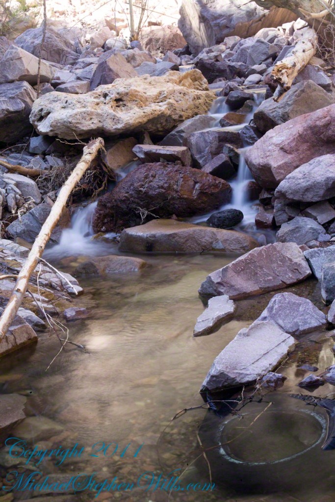
The history of this spot is written on these volcanic and igneous rocks and boulders, the uprooted tree roots and fresh water.
The tire must have washed down from Reavis Ranch.
A Canyon of Wonder and Beauty
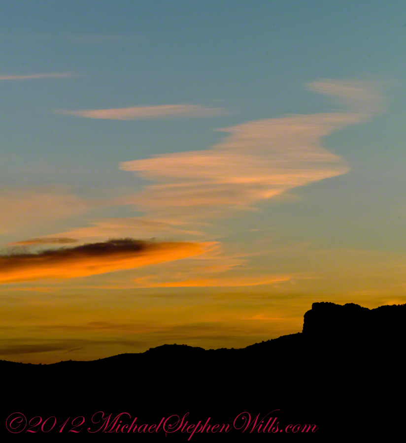
In this chapter I present, in the header, the lovely dawn sky of that day, and a tiny corner of a rock jumble in Reavis Creek. There is a large format version of the sky in my previous post, “The Mouth of Reavis Canyon.”
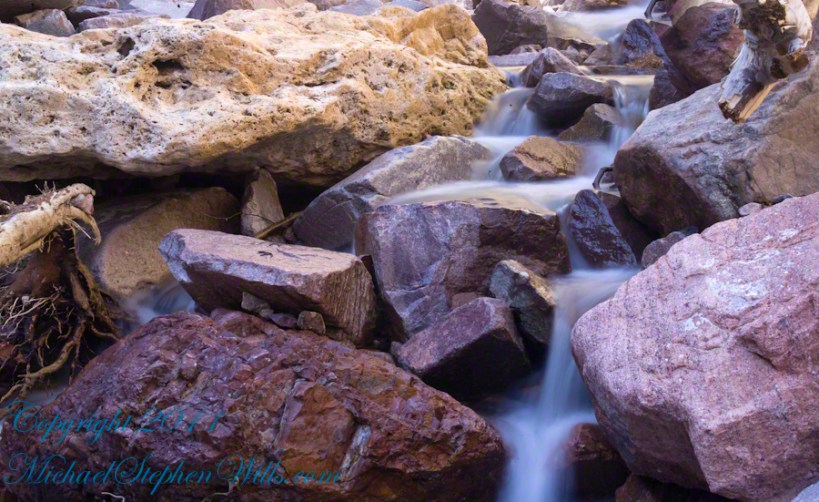
Rivulets and Rocks
Copyright 2023 Michael Stephen Wills All Rights Reserved
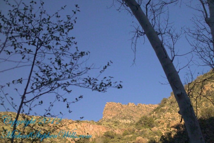
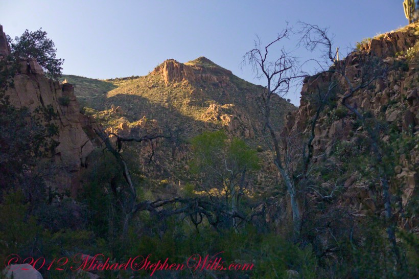
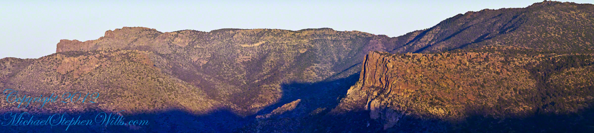
Here is the same view, in daylight. As I hiked toward the canyon mouth below Reavis Falls, looking up I saw this prominant cliff against the sky.
Here is the path I took toward the falls. The campsite is to the lower right, the falls are toward the center and left. My approach to the camp is on the right, moving toward the top. For another view of this location see Reavis Canyon Camp.
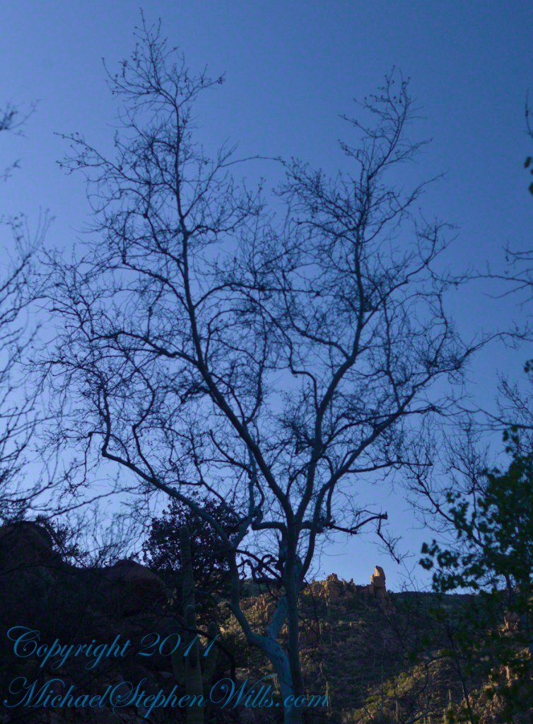
The mouth of Reavis Canyon below the falls is choked with vegetation and infallen rocks and boulders. The far slopes are thick with the poles of young saguaros. There are hoodoos, as well. In the photograph, below, one hoodoo is catching morning light. See the chapters Hoodoos on the Descent to Reavis Falls and Cedar Basin Hoodoos for more views of the hoodoos around Reavis Falls.
Hoodoos visible from the mouth of Reavis Canyon below the falls. Look toward the far slope.
Flood damage in Reavis Canyon below the falls. Note the scouring at the base of these trees and the broken limbs. This is NOT a place to be in spring thaw.
Massive spring flooding scours the canyon floor.
Flood damage in Reavis Canyon below the falls.
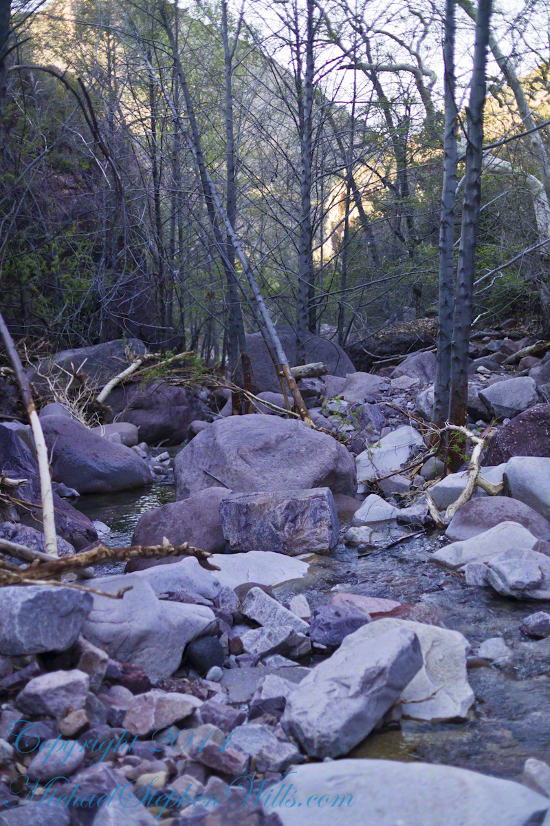
There is beauty to be found, as well. Freshly fallen rough rocks contrast with water smoothed boulders and the water surface.
Copyright 2023 Michael Stephen Wills All Rights Reserved
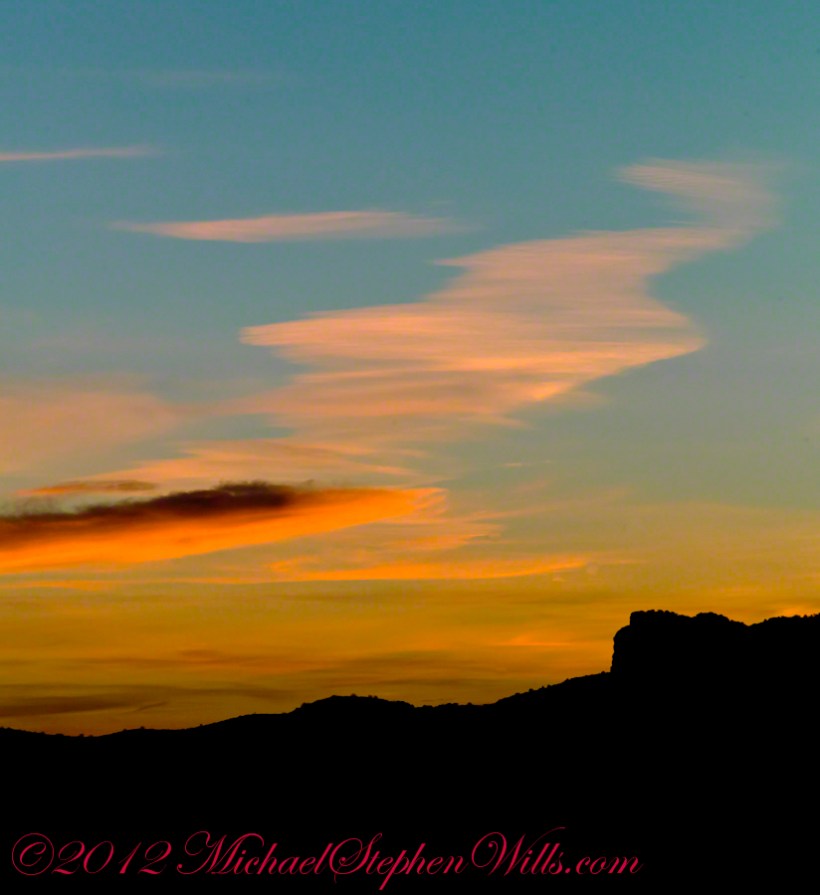
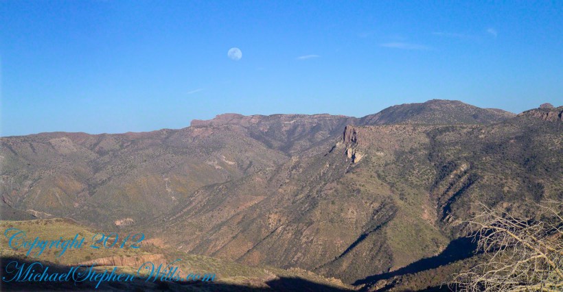
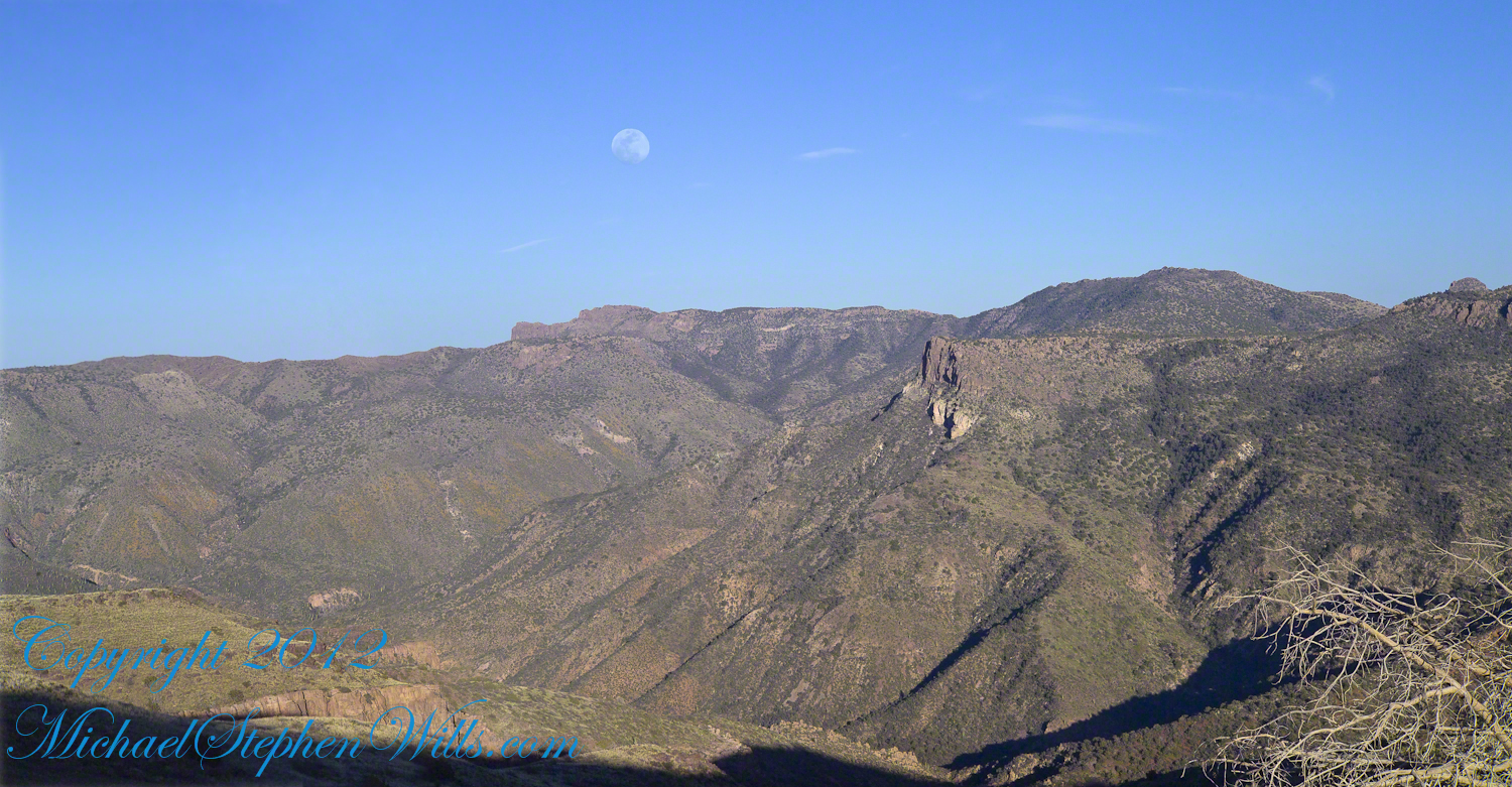
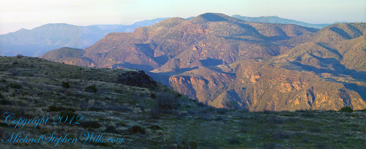
Two Bar Mountain is only part of this view taken the evening of Day Three, my solo expedition to Reavis Falls in the Superstition Wilderness of Arizona.
The view encompasses most of the four day expedition, being the climb into the lower Reavis Creek Canyon from which I camped. I spent one entire day walking up the valley to the falls.
The patches of yellow on the far slopes to the left and into Reavis Valley are Mexican Poppy (Eschscholtzia californica) blooms.
To find lower Reavis Creek Canyon, look for the prominent cliff formation in the very center of the image. Follow the end of the cliff down to a dark shadow. The western canyon wall creates the heavy shadow. As you move to the right, in the image, the shadow becomes wider because the canyon wall becomes higher.
The view also encompasses a 2005 solo expedition over Two Bar Mountain using the Tule and Two Bar Ridge trails into the Superstition Wilderness around Pine Creek. See my blog “Racing the Sun” for an image Two Bar Mountain with the path of (most of) two days of that expedition.
An interesting feature of the full size image (lost in the small-scale reproduction of this blog) is the host of enormous saguaro cactuses marching up the sides of the canyon to the left, thinning out and ending on the western walls of the canyon (the slope directly beneath my viewpoint). Our course, each cactus is perfectly still, casting a huge shadow, and seems very tiny. The nearest is a mile away. We are seeing in this thinning host the lower Sonoran in transition to the upper Sonoran life zone.
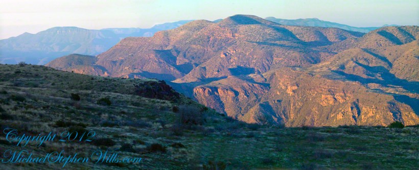
All of this in one view from Lime Mountain. Here is another, taken just as the sun set.
Copyright 2023 Michael Stephen Wills All Rights Reserved
This post features photographs from my solo expedition to Reavis Falls in a remote corner of the Superstition Wilderness of Arizona.
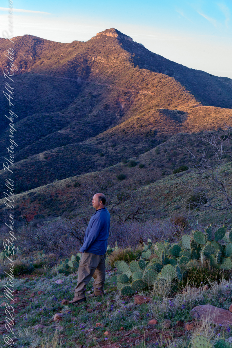
The morning of Day Four, my solo expedition to Reavis Falls in the Superstition Wilderness of Arizona. I camped on Lime Mountain, off the trail to Reavis Falls. That is Castle Dome behind me. The line sloping up the mountain is the Reavis Trail to Reavis Ranch.
My campsite.
Looking toward Pinyon Mountain and the Arizona Trail (not visible) that fine morning.
Copyright 2023 Michael Stephen Wills All Rights Reserved
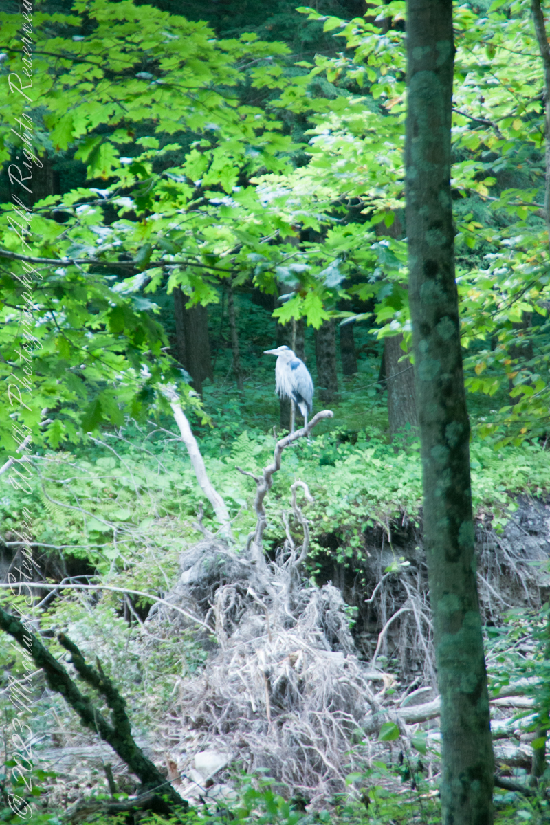
A Great Blue Heron spotted from Bear Trail during a family hike, perched on a splayed root of a tree undercut by flooding, fallen into Buttermilk Creek bed.
A heron recurves its long neck while perched. Adult herons have few natural predators and are rarely preyed upon due to their large size and sharp beak, but bald eagles (Haliaeetus leucocephalus) are known to attack great blue herons at every stage of their lifecycle from in the egg to adulthood.
Copyright 2023 Michael Stephen Wills All Rights Reserved
All photography using the IPhone 14 ProMax triple camera, raw format, edited on the phone.
We find boulders of crystalline rock, commonly derived from Adirondack sources, left behind on the surface of ablation moraine, in the Finger Lakes Region.
Cornell finds some and move them, maybe the case for this unremarked erratic found along the Allen Trail of FR Newman Arboretum.
Another enormous erratic, brought in from the Sixmile Creek valley, was carved into a seat as a memorial to Professor R.S. Tarr who deciphered much of the glacial history of the Finger Lakes Region. Find it at the southwest corner of McCraw Hall on the Cornell University Campus.
History (from wikipedia)
During the 18th century, erratics were deemed a major geological paradox. Geologists identify erratics by studying the rocks surrounding the position of the erratic and the rock of the erratic itself. Erratics were once considered evidence of a biblical flood, but in the 19th century scientists gradually came to accept that erratics pointed to an ice age in Earth’s past. Among others, the Swiss politician, jurist, theologian Bernhard Friedrich Kuhn [de] saw glaciers as a possible solution as early as 1788. However, the idea of ice ages and glaciation as a geological force took a while to be accepted. Ignaz Venetz (1788–1859), a Swiss engineer, naturalist and glaciologist was one of the first scientists to recognize glaciers as a major force in shaping the earth.
In the 19th century, many scientists came to favor erratics as evidence for the end of the Last Glacial Maximum (ice age) 10,000 years ago, rather than a flood. Geologists have suggested that landslides or rockfalls initially dropped the rocks on top of glacial ice. The glaciers continued to move, carrying the rocks with them. When the ice melted, the erratics were left in their present locations.
Charles Lyell’s Principles of Geology (v. 1, 1830) provided an early description of the erratic which is consistent with the modern understanding. Louis Agassiz was the first to scientifically propose that the Earth had been subject to a past ice age. In the same year, he was elected a foreign member of the Royal Swedish Academy of Sciences. Prior to this proposal, Goethe, de Saussure, Venetz, Jean de Charpentier, Karl Friedrich Schimper and others had made the glaciers of the Alps the subjects of special study, and Goethe,[15] Charpentier as well as Schimper had even arrived at the conclusion that the erratic blocks of alpine rocks scattered over the slopes and summits of the Jura Mountains had been moved there by glaciers.
Charles Darwin published extensively on geologic phenomena including the distribution of erratic boulders. In his accounts written during the voyage of HMS Beagle, Darwin observed several large erratic boulders of notable size south of the Strait of Magellan, Tierra del Fuego and attributed them to ice rafting from Antarctica. Recent research suggests that they are more likely the result of glacial ice flows carrying the boulders to their current locations.
References:
“The Finger Lakes Region: Its Origin and Nature,” O.D. von Engeln, Cornell University Press, 1961 page 106.
Wikipedia, “Glacial Erratics”
Copyright 2023 Michael Stephen Wills All Rights Reserved
All photography using the IPhone 14 ProMax triple camera, raw format, edited on the phone.
Acer rubrum is one of the most abundant and widespread trees in eastern North America. It can be found from the south of Newfoundland, through Nova Scotia, New Brunswick, and southern Quebec to the southwest west of Ontario, extreme southeastern Manitoba and northern Minnesota; southward through Wisconsin, Illinois, Missouri, eastern Oklahoma, and eastern Texas in its western range; and east to Florida. It has the largest continuous range along the North American Atlantic Coast of any tree that occurs in Florida. In total it ranges 2,600 km (1,600 mi) from north to south. The species is native to all regions of the United States east of the 95th meridian. The tree’s range ends where the −40 °C (−40 °F) mean minimum isotherm begins, namely in southeastern Canada. A. rubrum is not present in most of the Prairie Peninsula of the northern Midwest (although it is found in Ohio), the coastal prairie in southern Louisiana and southeastern Texas and the swamp prairie of the Florida Everglades. Red maple’s western range stops with the Great Plains where conditions become too dry for it. The absence of red maple from the Prairie Peninsula is most likely due to the tree’s poor tolerance of wildfires. Red maple is most abundant in the Northeastern US, the Upper Peninsula of Michigan, and northeastern Wisconsin, and is rare in the extreme west of its range and in the Southeastern US.
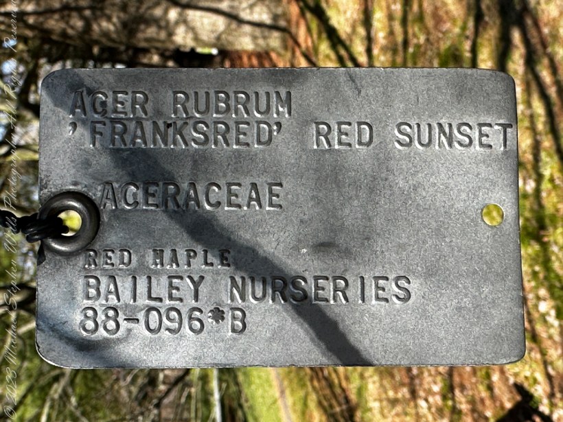
On the arboretum northeast side is a collection of native maples, this Red Maple is represented caught our eye.
These metal tags are excellent signposts hanging from the branches on coated wire. Red maple’s maximum lifespan is 150 years, but most live less than 100 years. The tree’s thin bark is easily damaged from ice and storms, animals, and when used in landscaping, being struck by flying debris from lawn mowers, allowing fungi to penetrate and cause heart rot.[8] Its ability to thrive in many habitats is largely due to its ability to produce roots to suit its site from a young age. In wet locations, red maple seedlings produce short taproots with long, well-developed lateral roots; while on dry sites, they develop long taproots with significantly shorter laterals. The roots are primarily horizontal, however, forming in the upper 25 cm (9.8 in) of the ground. Mature trees have woody roots up to 25 m (82 ft) long. They are very tolerant of flooding, with one study showing that 60 days of flooding caused no leaf damage. At the same time, they are tolerant of drought due to their ability to stop growing under dry conditions by then producing a second-growth flush when conditions later improve, even if growth has stopped for 2 weeks.
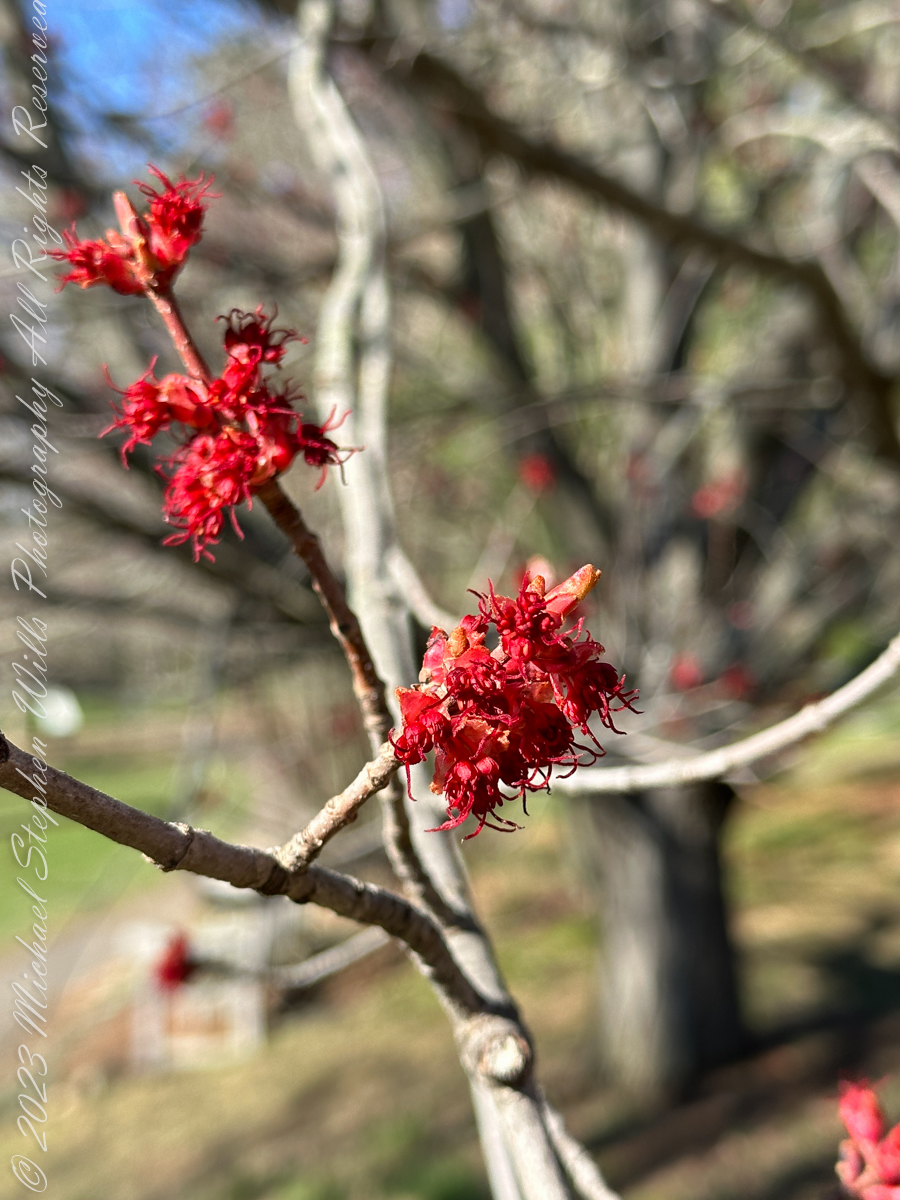
Acer rubrum is one of the first plants to flower in spring. A crop of seeds is generally produced every year with a bumper crop often occurring every second year. A single tree between 5 and 20 cm (2.0 and 7.9 in) in diameter can produce between 12,000 and 91,000 seeds in a season. A tree 30 cm (0.98 ft) in diameter was shown to produce nearly a million seeds. Red maple produces one of the smallest seeds of any of the maples. Fertilization has also been shown to significantly increase the seed yield for up to two years after application. The flowers are generally unisexual, with male and female flowers appearing in separate sessile clusters, though they are sometimes also bisexual. These pistillate (female) flowers have one pistil formed from two fused carpels with a glabrous superior ovary and two long styles that protrude beyond the perianth. These flowers were formed on the tree labeled “Frank’s Red.”
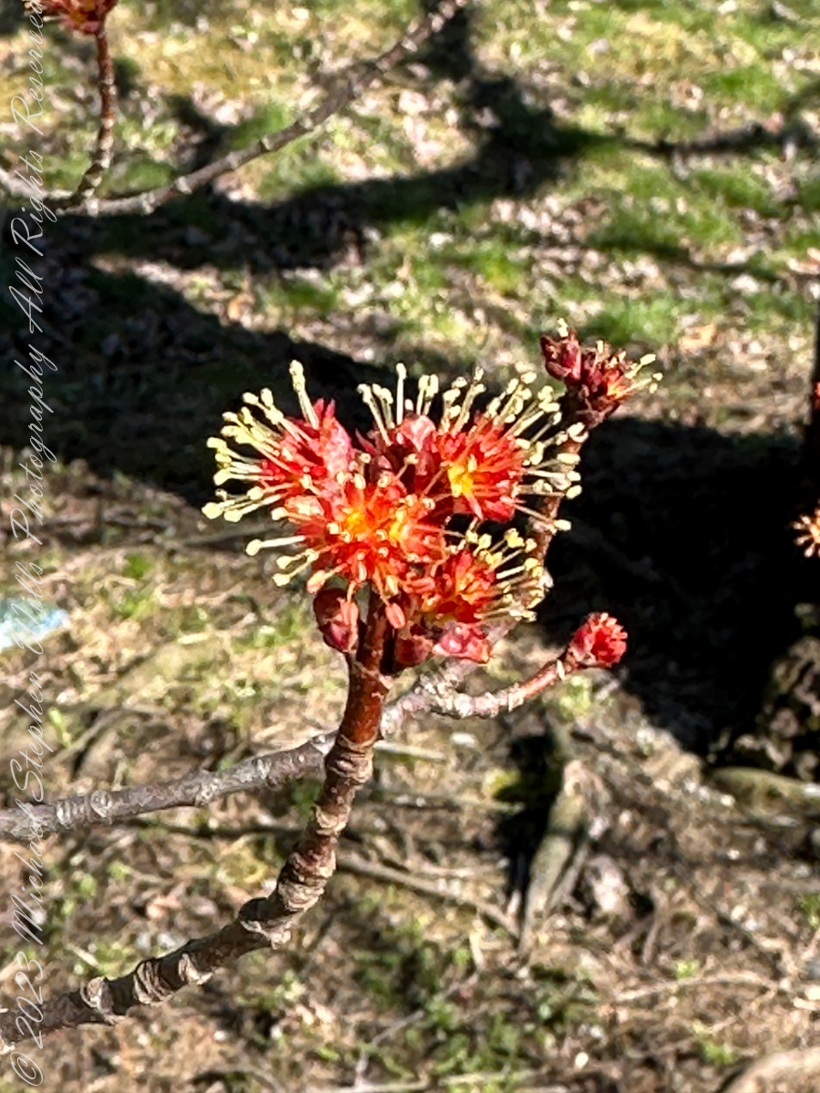
These staminate (male) flowers are sessile (grow direct from tip of branch without a stalk) containing between 4 and 12 stamens, often with 8. These seem to have 12 stamens.
The above flowers were formed on a “Schlesinger I” Red Maple Tree (see following lable).
Reference: “Red Maple” Wikipedia
Copyright 2023 Michael Stephen Wills All Rights Reserved