Hoodoos on the Descent to Reavis Falls

layers of stone weathered over eons by water, wind, sun and cold

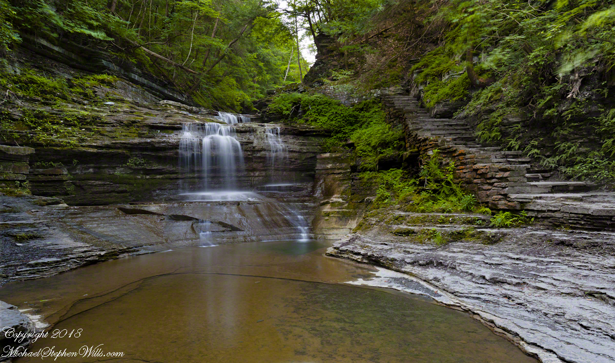
My previous post, “Dry Juniper Descent” had me above the ridge of the featured photograph.

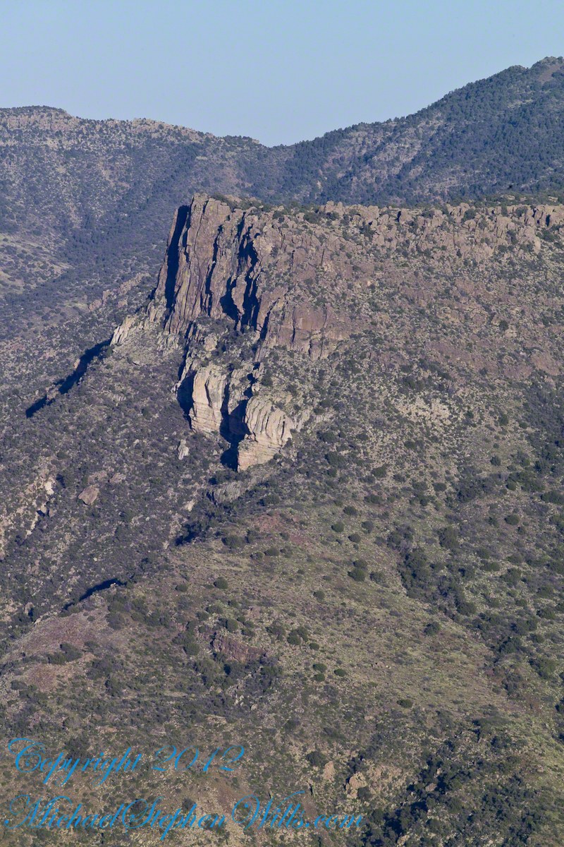
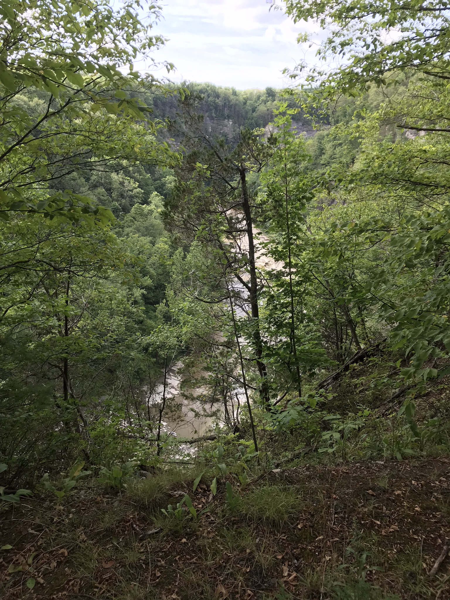
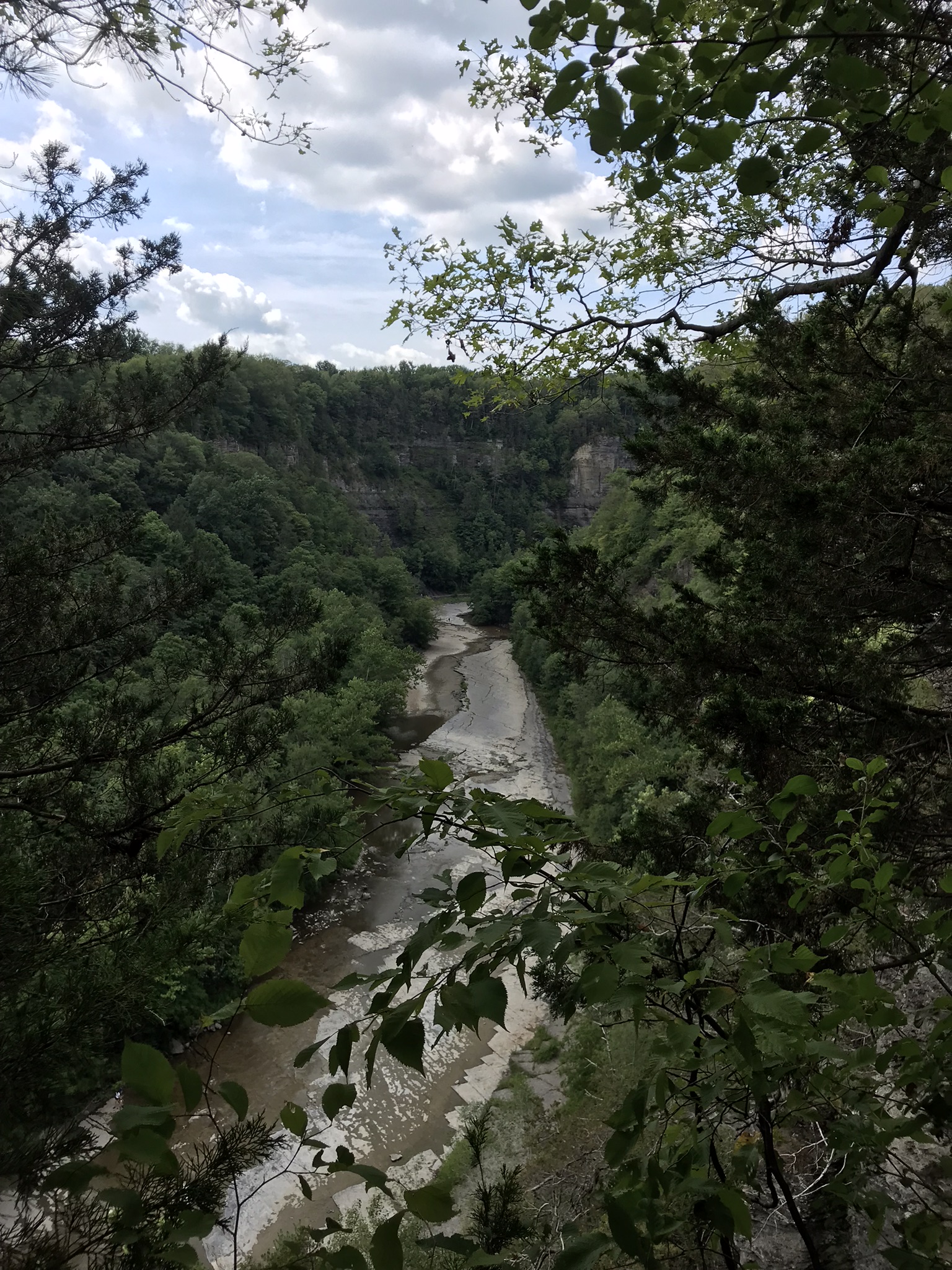
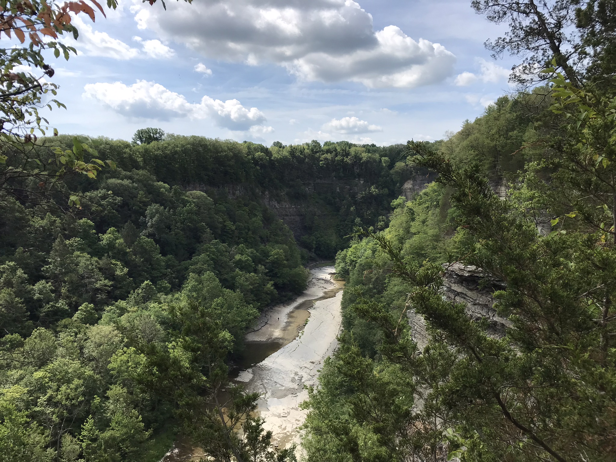
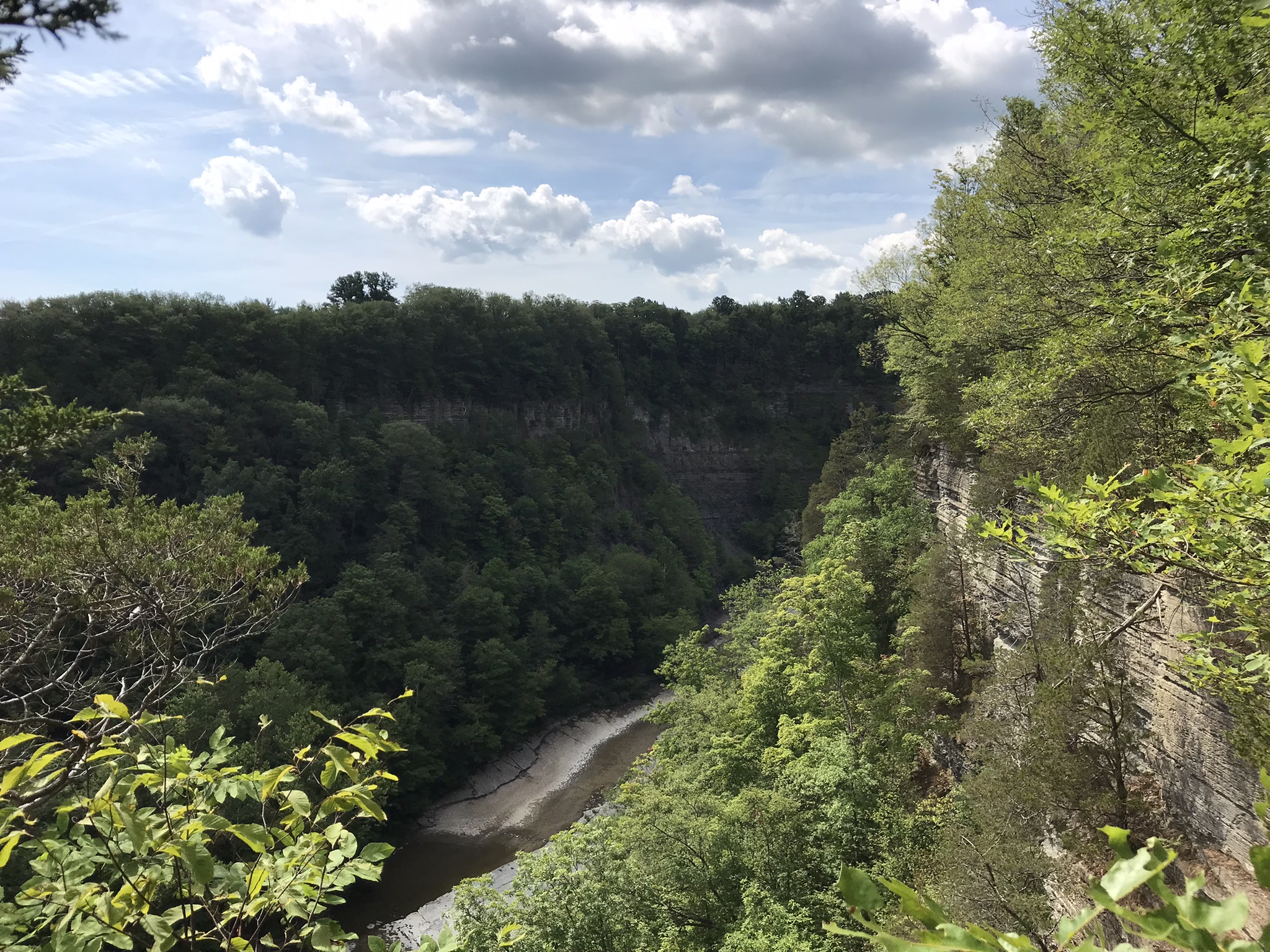
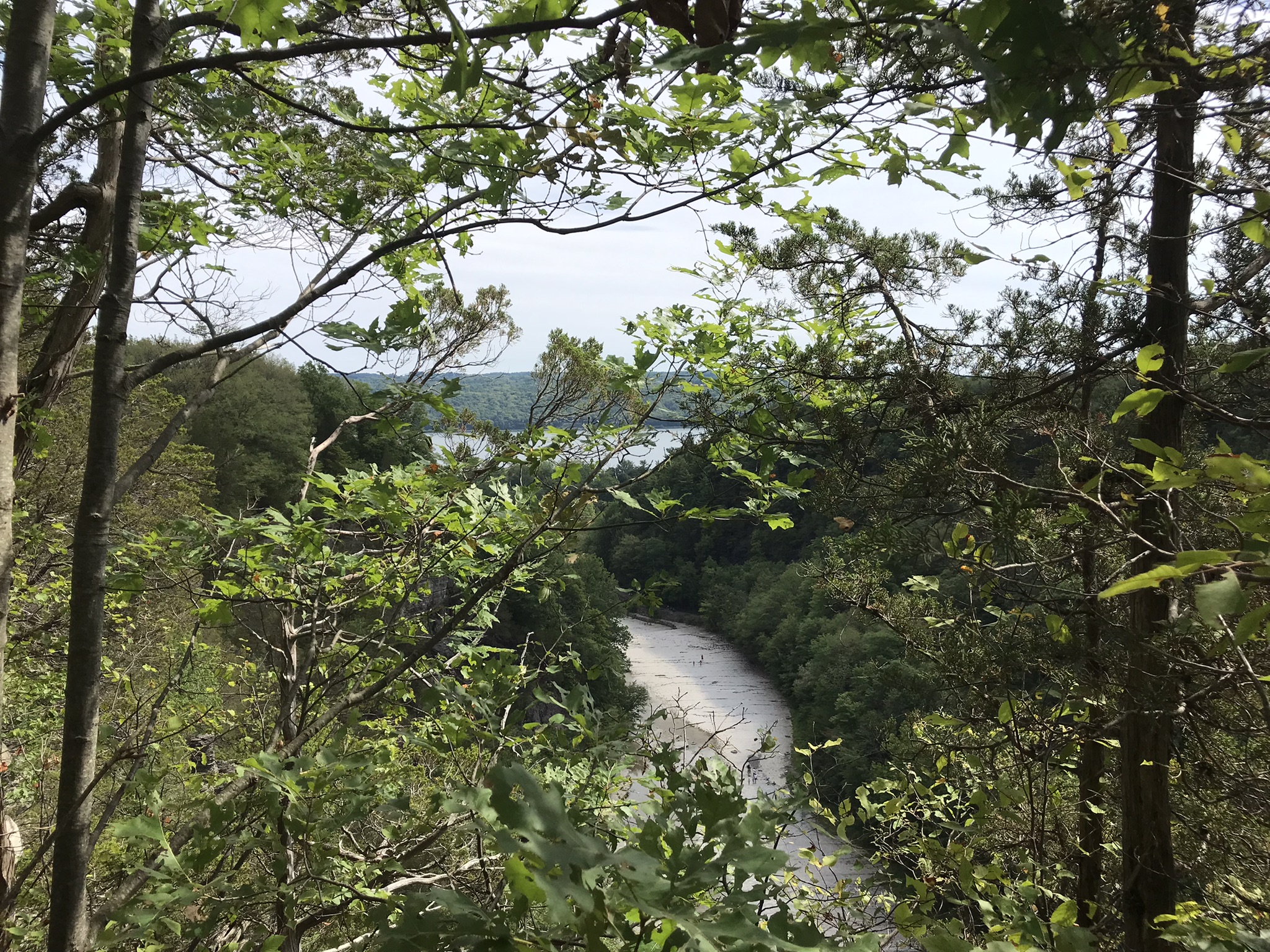
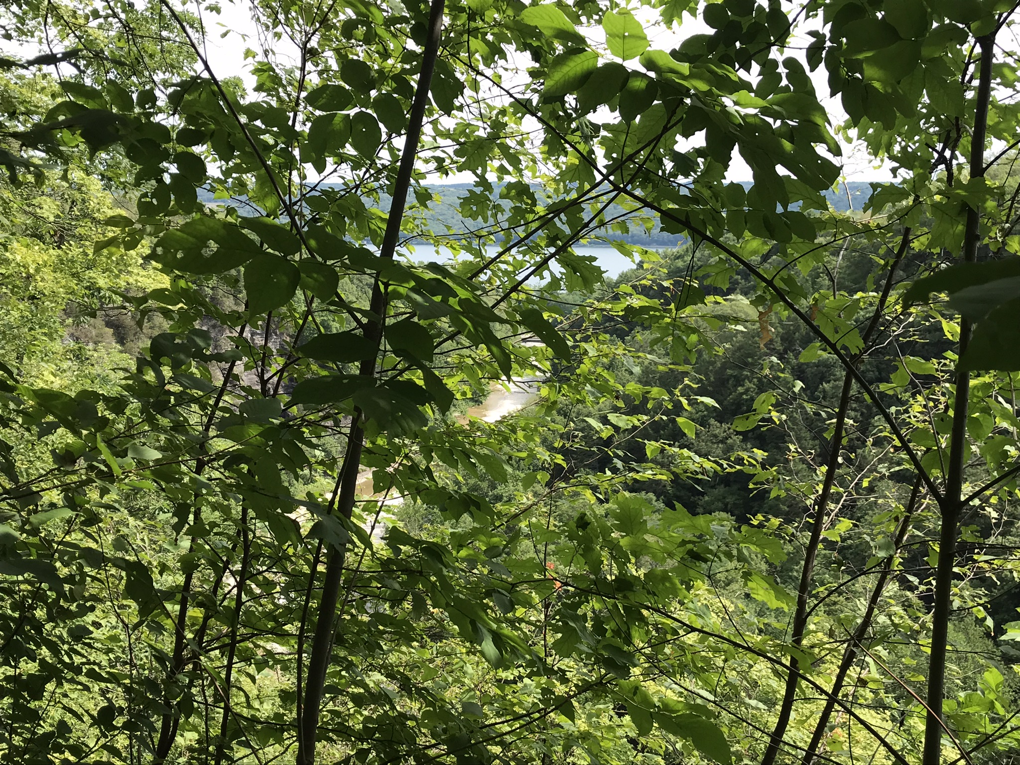
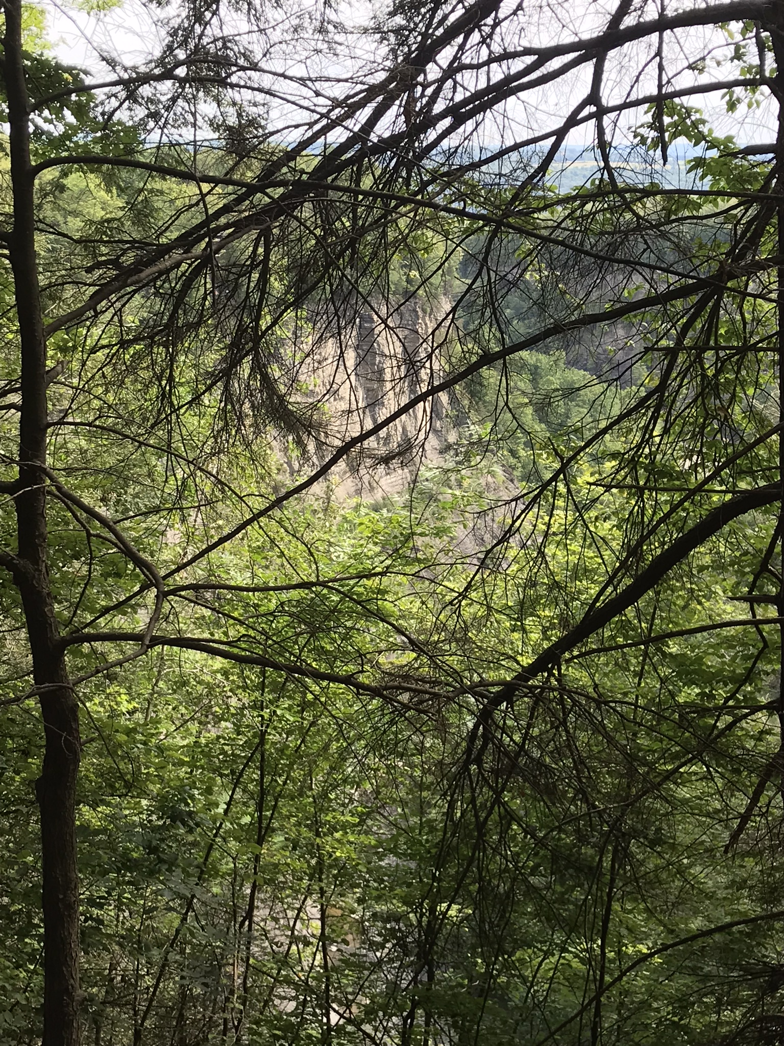
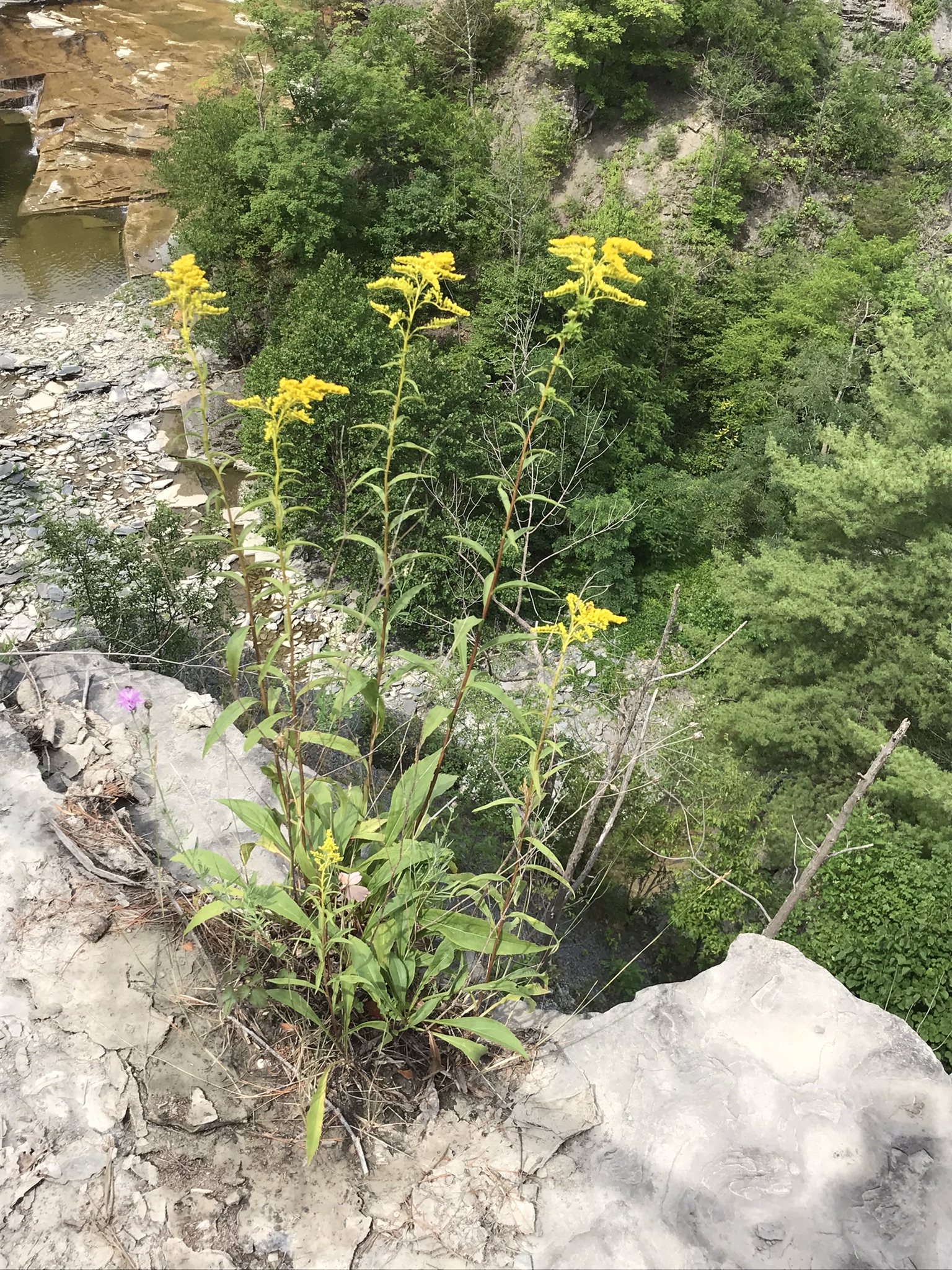
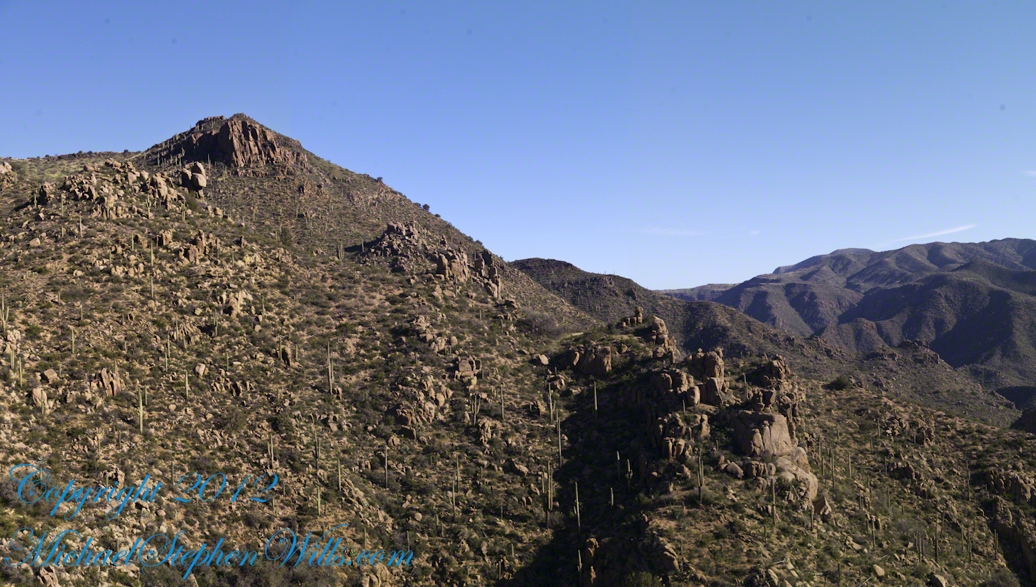
I interrupted my descent to Reavis Falls to stop on a ridge overlooking Reavis Creek, the same ridge that forms the western wall of the canyon.  By this time it was late afternoon on a March Day with the angle of the sun being perfect for capturing rock formations.  Notice the effect of the light on the distant mountains.

This is the North / Northeast view of the opposite ridge above a flow from multiple springs on Lime Mountain.

This photograph was created from multiple images using tripod-mounted Kodak DCS ProSlr/c with a 50mm, 1.4 Canon lens.

Cedar Basin hoodoos on the slopes of Lime Mountain
Click Me for my Online Gallery
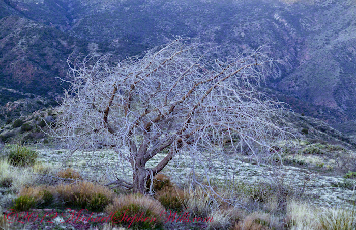
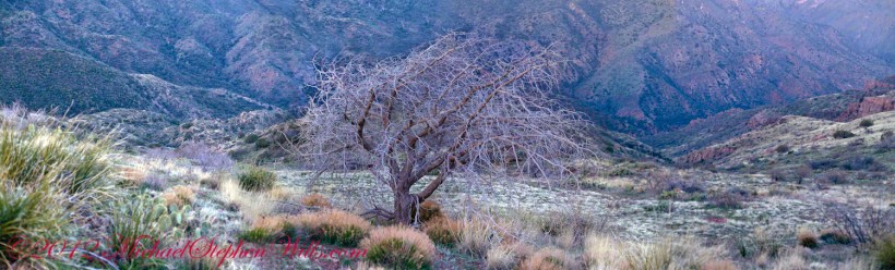
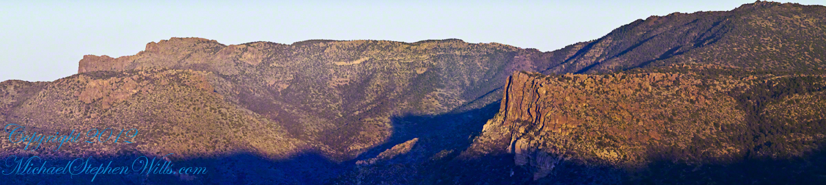
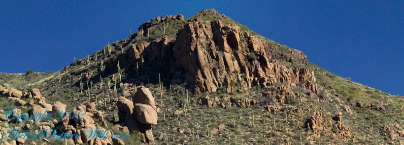
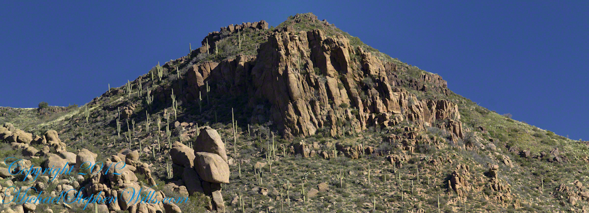
Hoodoos

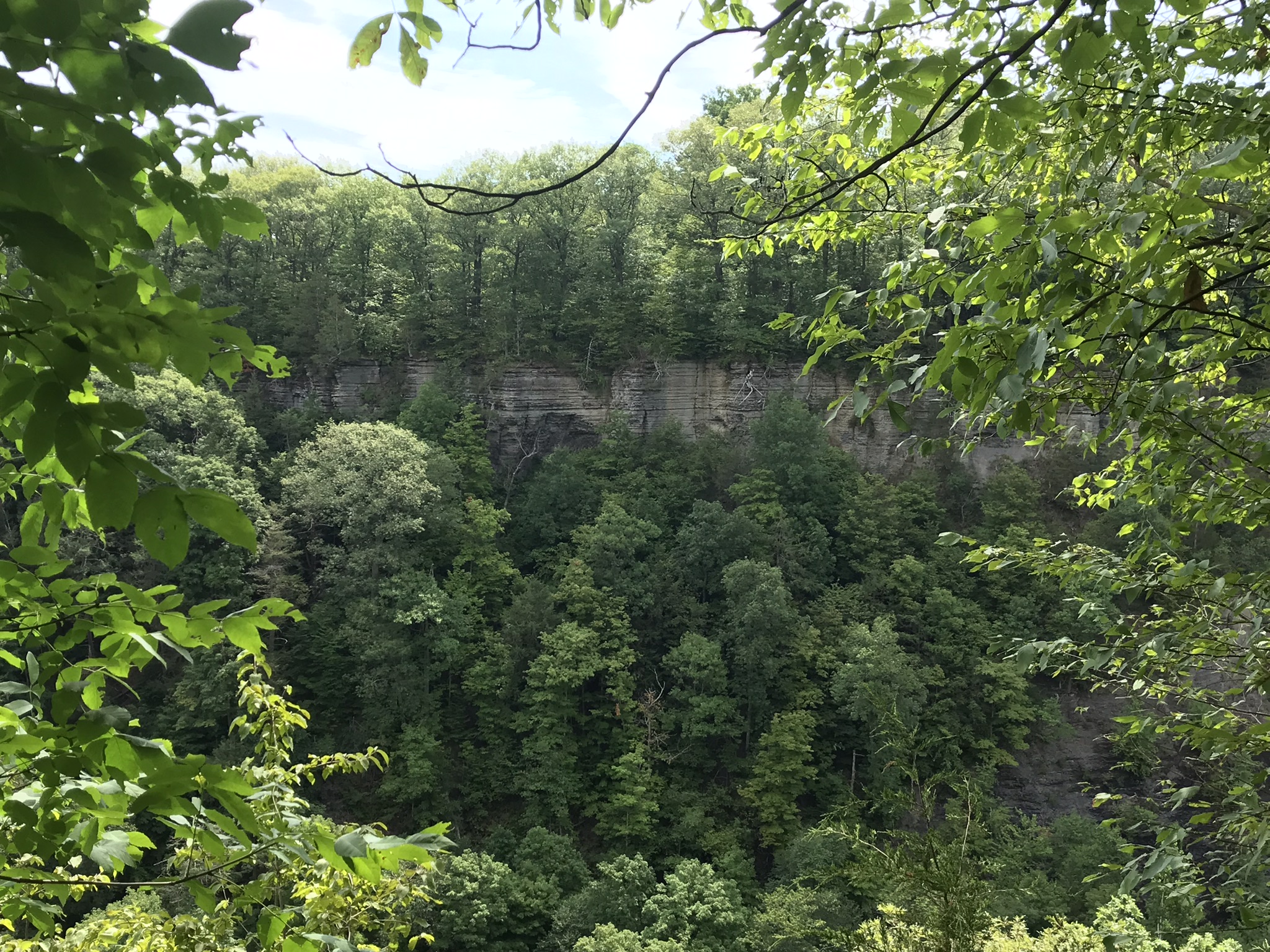
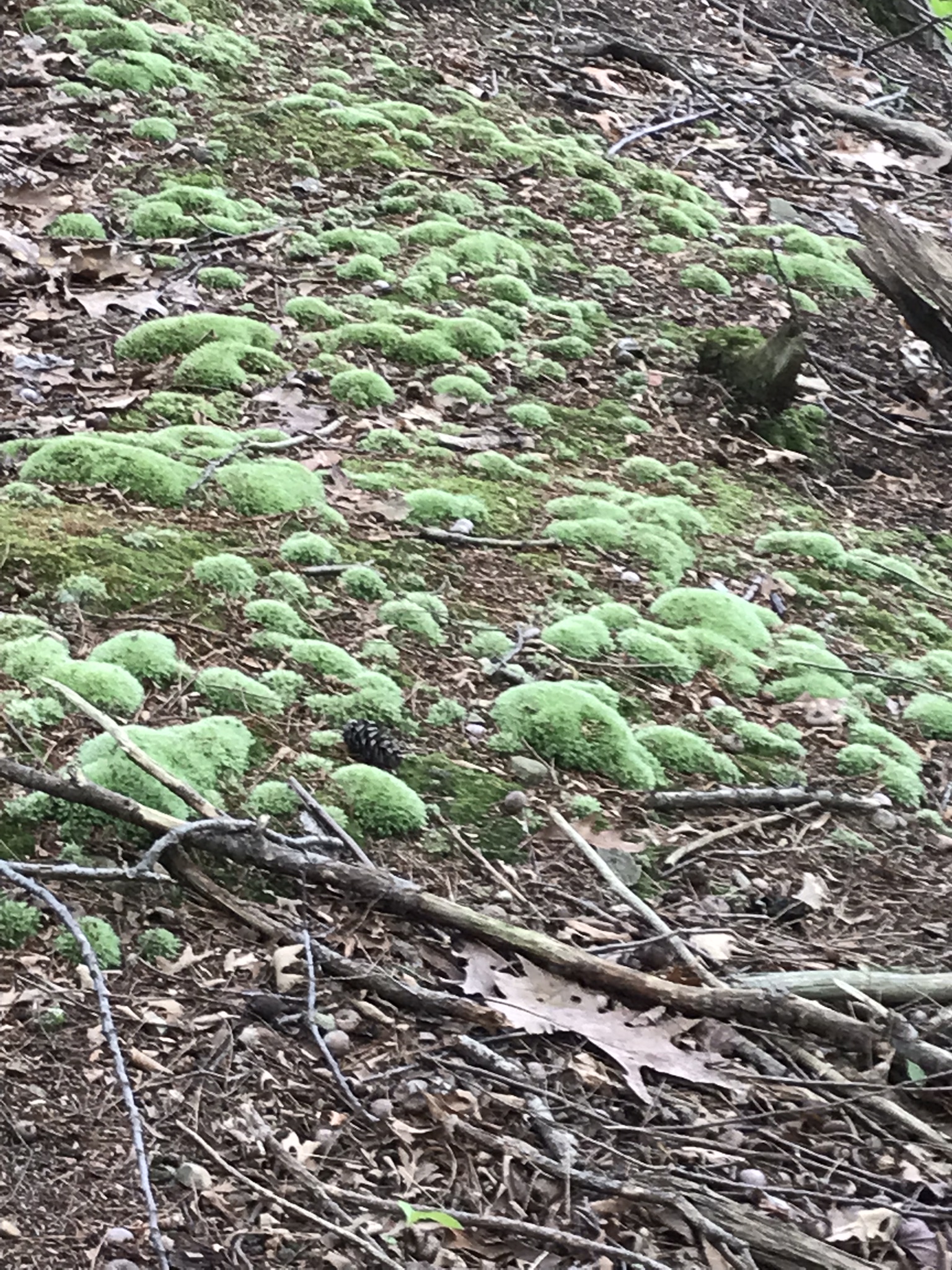
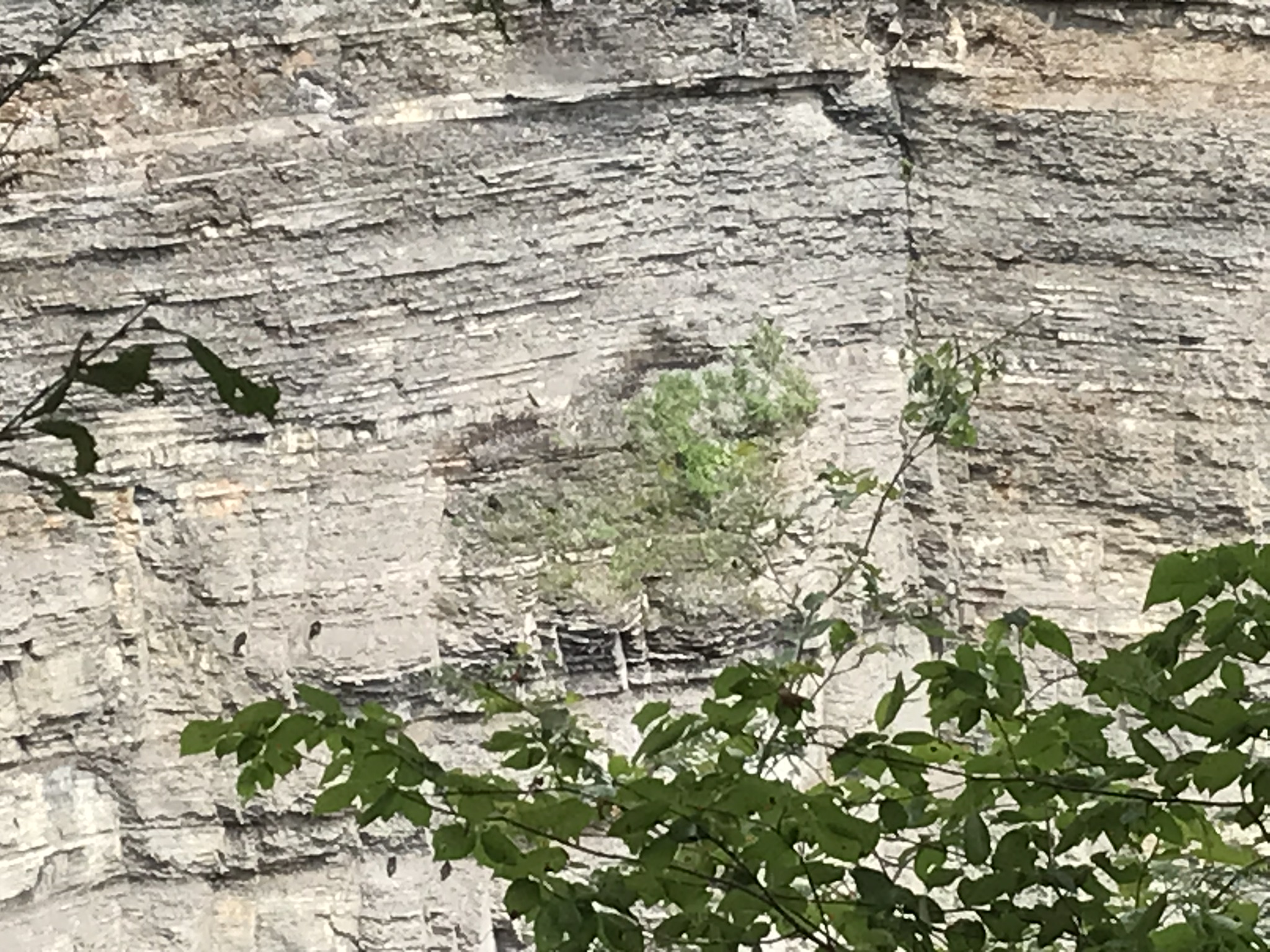
The ridge and slopes are covered with a rock formation named Hoodoos for the fantastic shapes taken on by layers of stone weathered over eons by water, wind, sun and cold.  These hoodoos are enormous, some precisely balanced and carved into elaborate shapes.  The word “Hoodoo” derives from the name of the practice of sorcery or folk magic.  You can image the effect on ancient people of coming upon these formations and believing them created by malevolent beings (djinns, goblins, demons) in their leisure time, when not causing problems, and worse, for humans.  These beings are especially active in desert places, such as this, which has the comforting name of Cedar Basin.

The hoodoos cast a spell on me.  I had never heard of Cedar Basin, but knew, as the sun was low in the west, I needed to unload my 70 pound pack, set up the tripod and camera to spend over an hour of precious time to capture the images of this blog.

Ancient Village

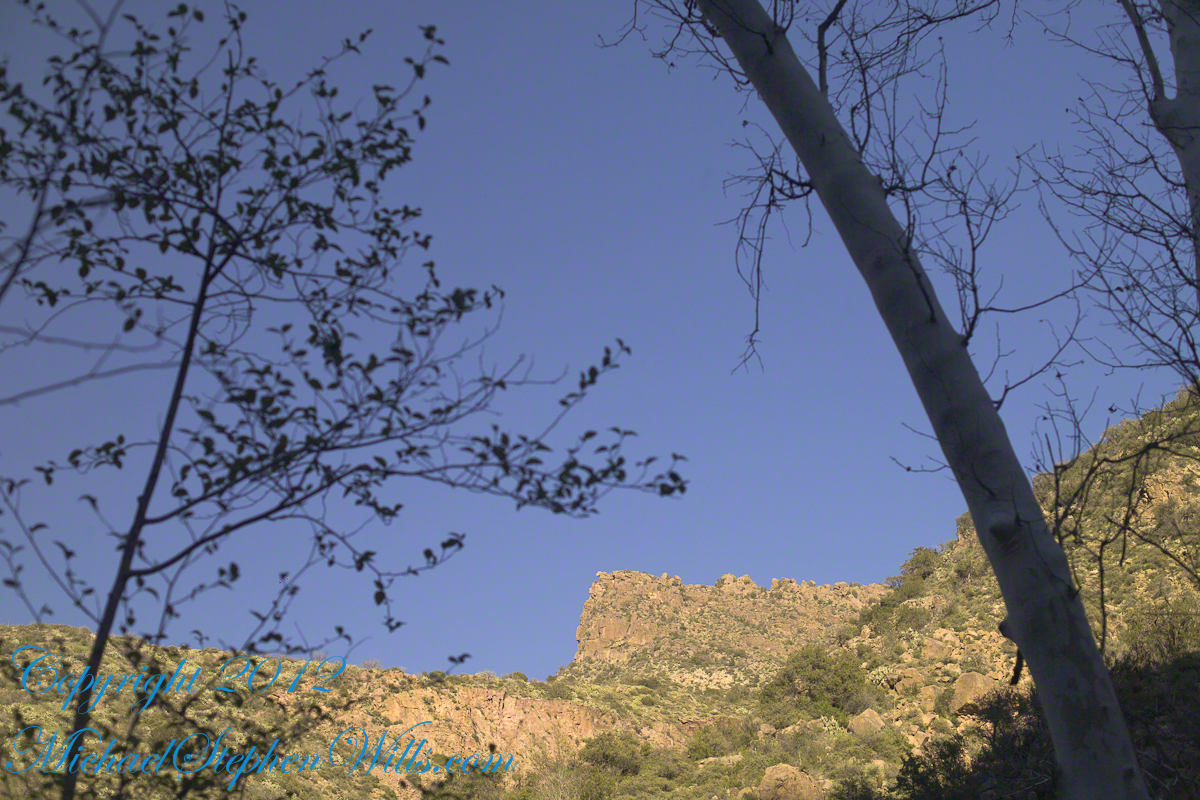
Cedar Basin forms on one side from the ridge of this photograph. On the other side of the ridge, the mountain slope levels out to a site settled by ancient people we call Sin Agua.  There is nothing but a few stones left of their village and way of life.
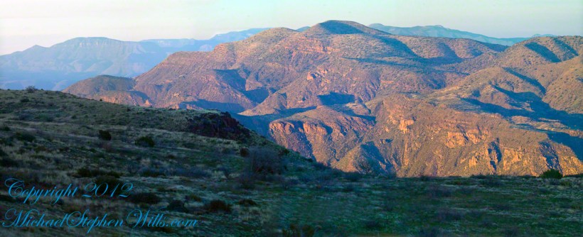
Cedar Basin

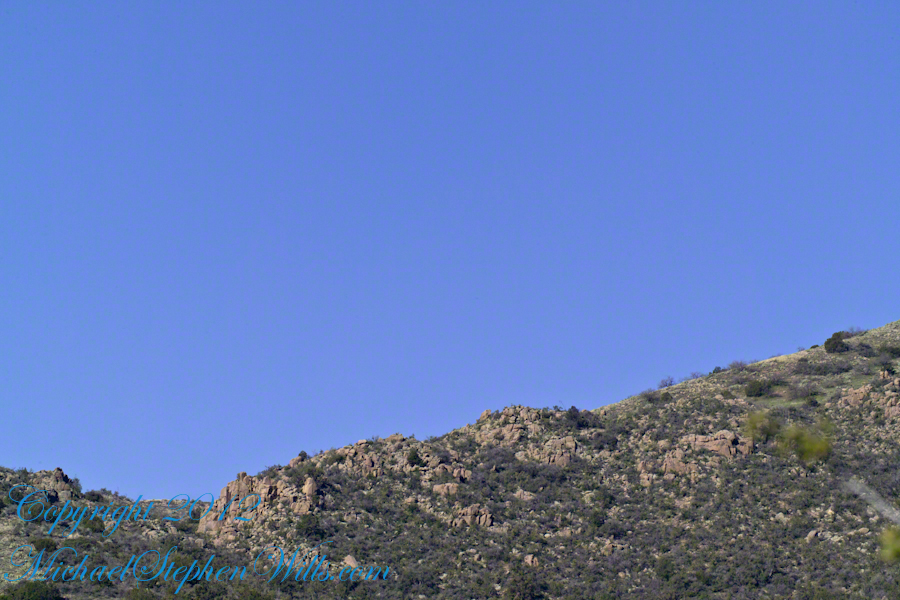
Looking to the left of the Hoodoo Panorama photograph and into Cedar Basin, you see more of that same rock type that formed the hoodoos to the right on this same ridge.  This is also the lower slopes of Lime Mountain, as you can see from the color of the upper ridge.

The Slopes of Cedar Basin

This and the following photographs were created using a tripod-mounted Kodak DCS ProSlr/c with a 200mm, 1.4 Canon L type lens.

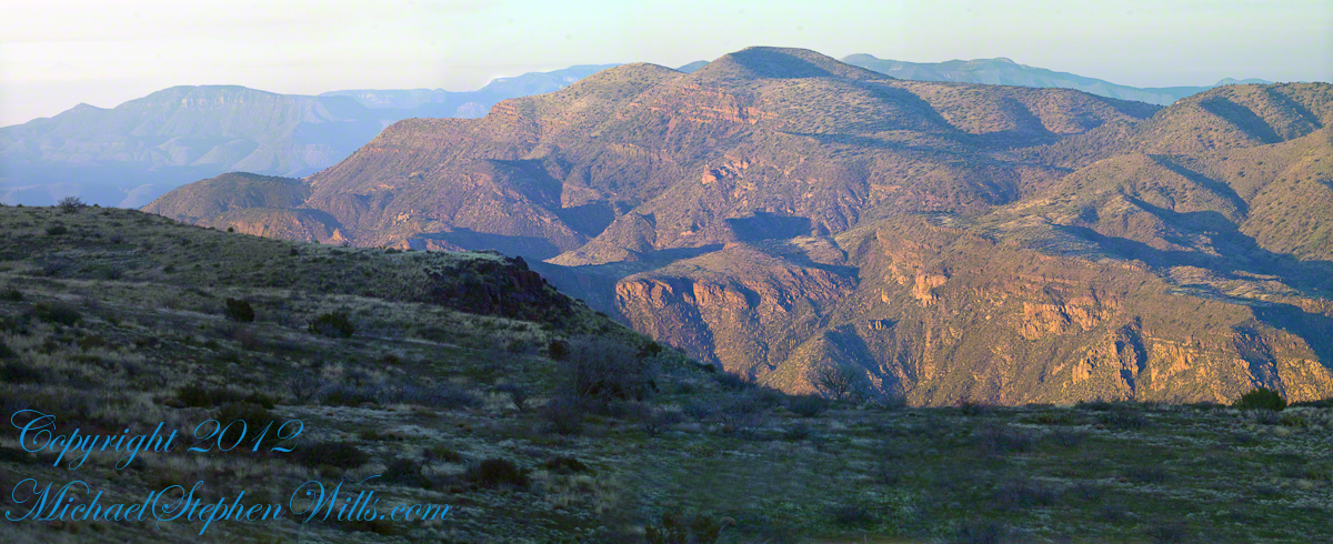
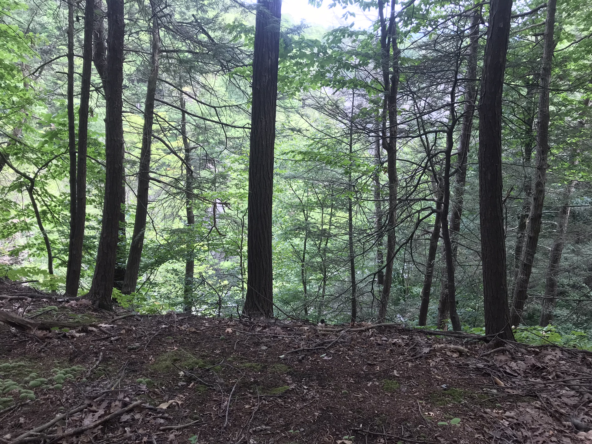
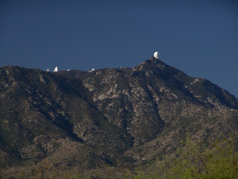
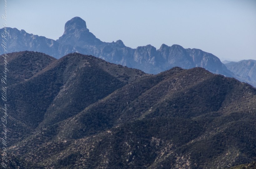
Another side of the basin is formed by the ridge I am on.  This side is across from the canyon of Reavis Creek and Falls.  The trail leads down switchbacks from the Dry Juniper of my previous post to a dry draw.  You can see the way I came in the following two photographs.  I captured Castle Dome, then panned to the right for the rest of the ridge.  You can see the trail to Reavis Ranch carved into the slopes of Castle Dome.

Castle Dome Ridge and Reavis Ranch Trail

Cedar Basin and Castle Dome

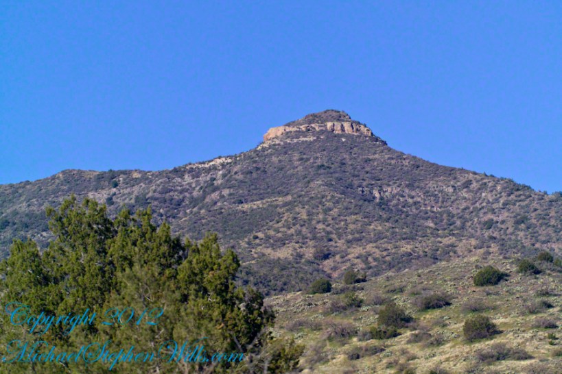
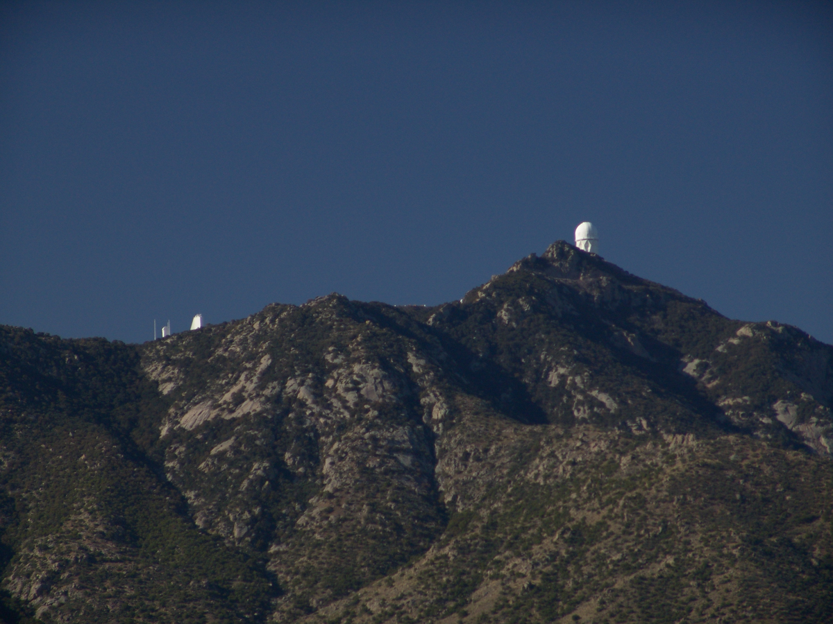
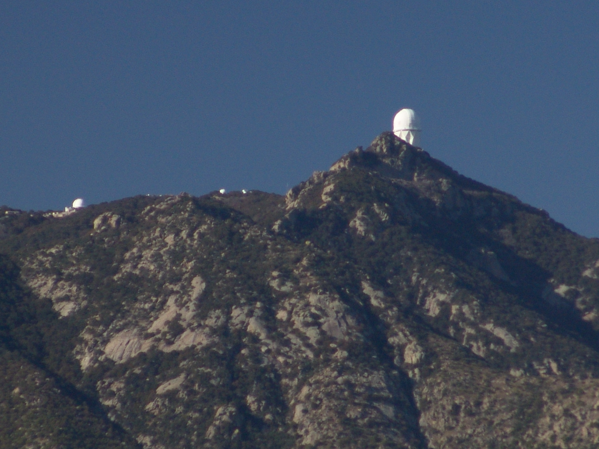
I then panned one more time to the right to capture the ridge above Cedar Basin and the start of the hoodoos.  It was an army spread across the entire ridge!!

Cedar Basin and Castle Dome

My next posting will feature close-up of the most interesting hoodoos from the panorama, using a 200 mm telephoto lens.

Copyright 2023 Michael Stephen Wills All Rights Reserved

Dry Juniper Descent

One-seed Juniper

On my fourth morning, after I awoke to am immense silence, my first photography subject was the lone dry juniper you see below.

Then the dawn lit up the far mountains.  You can view a larger image these mountains at dawn in my previous blog, “Superstition Wilderness Dawn.”

A Lone Dry Juniper

This is a photograph of that juniper tree, dryer than most, being dead.  I take it to be a One-seed Juniper from the thick growth of branches and the strong rounded aspect of the crown.  I captured this photograph from a tripod mount using a Kodak DCS slr/c with a Canon EF 50mm f/1.4 USM lens.

Looking into Reavis Creek Canyon from Lime Mountain

I used the tripod to bracket this shot on the left and right for the following panorama.

The Reavis Creek Canyon from Lime Mountain while still in shadow, morning

The Spirit of Elisha Reavis

From this vantage you can see my route into Reavis Creek Canyon and Reavis Falls taken on the first afternoon of the expedition.  That first morning I loaded up 65 pounds of food, supplies and photography equipment and headed out from the Reavis Trailhead on the Reavis Ranch Trail.  This was one of the trailed used by Elisha Reavis to ride a favorite burro and a string of 8 to 15 burros loaded with vegetables he sold to various communities throughout central Arizona.  See my blogs “A Ride to Reavis Ranch” and “Apple Orchard in the Wilderness“for views of the paradise (as of the early 21st century) where Elisha Reavis, lived and prospered in the latter part of the 19th century where he lived his 70’s.

This his mountain valley, using a perennial creek, Reavis cultivated and irrigated about fifteen acres of land by himself with chickens, turkeys, hogs, burros, two horses and several dogs.   The horses, teamed together, pulled a shear plow, disc and leveler.  On April 9, 1896 Reavis was preparing of another trip to Mesa, to buy seed potatoes, and was found by a friend a month later on what is now the Reavis Ranch trail, to the south and west of his valley, near what is now called Grave Canyon were friends buried him.

Past the Dry Juniper and Down

102 years later, I headed up the Reavis Ranch Trail, over the ridge of Lime Mountain and past this dry juniper in the same spirit as Elisha Reavis if for a different purpose.

Reference

An excellent article on Elisha Reavis by Tom Kollenborn, author of “Lost Dutchman Gold” and “Circlestone”.

Copyright 2023 Michael Stephen Wills All Rights Reserved

Superstition Wilderness Dawn

on the slopes of Lime Mountain

Pre-dawn on the fourth morning of my solo expedition to Reavis Falls, before the last posting “Among the Desert Wildflowers“, on the slopes of Lime Mountain, as the eastern sky became slightly less dark, I woke to an unusual sensation:  total silence.  The air was absolutely still, no insects trilled, the birds were still asleep.  Lying very still, the ringing of my ears announced the silence.

In that silence I set up for this panorama taken from a tripod-mounted Kodak DCS ProSLR/c mounted with a Canon EF 200mm f/2.8L II USM telephoto lens.  It is 5 image files combined.  The source file is about 300 MB.

That is Pinyon Mountain in the center distance.  The Arizona Trail traverses that terrain, though it is not visible from this distance (it is about 3 miles away).

Lime Mountain is truly a light green, as you can see from the foreground ledge.  From there, a cliff runs round where on a south-facing site there are cliff dwelling ruins.  The trail to Reavis Falls runs to the right, along a ridge broken by a narrow canyon with access to Cedar Basin, also at the foot of these cliffs.

Copyright 2023 Michael Stephen Wills All Rights Reserved

Evening on Two Bar Mountain

Shadows rising on the canyon walls

Another blog from my four day solo expedition to Reavis Falls in the remote eastern Superstition Wilderness. Here we will descend briefly to the canyon of Reavis Creek, below the Reavis Falls.

My previous blog Two Bar Mountain View featured this same landscape. 

Shadows rising on the canyon walls are from Lime Mountain and Castle Dome.  In the far canyon, below Two Bar Mountain, is a shadow from the notable cliff and prominence to the right, that rises above Reavis Falls, fall below and out of sight in the canyon.

Here is that prominence from that same day, late afternoon when the sun is just starting to be low enough to throw the cliff into relief. This is a single shot with a canon 200 mm lens. This day I had climbed out of Reavis Creek, up to to this point on the slopes of Lime Mountain. Here I enjoyed an afternoon, evening, night and early morning of the following day.

The second day of the solo expedition, I hiked into the canyon of Reavis Falls from a camp at the canyon mouth. Looking up from the creek this same cliff was prominant against the sky.

Copyright 2023 Michael Stephen Wills All Rights Reserved

Cochise Stronghold and Moon

at dawn

Interstate 10 between Benson and Wilcox ascends through a field of enormous, eroded granite boulders. Off to the west are the Dragoon Mountains, otherwise known as “Cochise Stronghold.” This rugged area served as a natural fortress and hideout for Apache Indians of the Chiricahua clan led by Cochise. He was born in this Dragoon Mountains about 1815. From 1869 to 1872 the Cochise band battled the U.S. Calvary because of the handling of an incident at Apache Pass about 30 miles east of here. It is believed that Cochise was buried somewhere in the Stronghold.

Click me for an Arizona Gallery of Fine Art prints by Michael Stephen Wills

Informative sign at campsite

One April morning, very early, on the road to Cochise Stronghold. We stopped everything for me to unload the equipment to capture a gibbous moon low in the west, grazing a hoodoo ridge of Cochise Stronghold of the Dragoon Mountains. Near Dragoon, Cochise County, Arizona

Copyright 2023 Michael Stephen Wills All Rights Reserved

Rambling Images

Three Summer Hikes

“Out in the meadow, I picked a wild sunflower, and as I looked into its golden heart, such a wave of homesickness came over me that I almost wept.  I wanted Mother, with her gentle voice and quiet firmness; I longed to hear Father’s jolly songs and to see his twinkling blue eyes; I was lonesome for the sister with whom I used to play in the meadow picking daisies and wild sunflowers.”

from “Laura Ingalls Wilder, Farm Journalist, Writings from the Ozarks” edited by Stephen W. Hines”

Click me for “Summer Dream, Buttermilk Falls” in my Fine Art Gallery

Cornell Plantations

Click photograph for a larger view.

Taughannock Falls

Buttermilk Falls, upper

A quiet moment……

Copyright 2022, Michael Stephen Wills All Rights Reserved

Ancient “Fracking”

a form revealed

Friday last Pam and I joined a “James Potorti Memorial Gorge Walk” through Buttermilk Falls State Park where we learned interesting facts connected to one of my most successful photographs, “Summer Dream: Buttermilk Falls.” This is the second post of this series.

Click me for “Summer Dream, Buttermilk Falls” in my Fine Art Gallery.

Many Right Angles, Why?

On a July morning 2018 I walked Buttermilk Creek from the scene of my “Summer Dream: Buttermilk Falls”, up the steps on the right of that photograph to where the water flows across a flat expanse of stone. This is a photograph of that expanse taken using a tripod mounted Canon EOS 1DS Mark III body with the Canon lens EF 24mm f/1.4L II USM w/a neutral density filter (0.6 as I recall).

Click photograph for a larger view.
“Summertime Cascades – 2018”

For a scene from nature there are many straight lines and, even, right angles in addition to the layering of the sedimentary rock from its origin as eroded material from the ancient Arcadia mountains collected on the floor of a warm shallow sea. We learned from Friday’s walking tour this sea was close to the equator at that time, riding on a tectonic plate that’s since drifted north. This North American Plate jostling with the others.

Beneath these rocks were older formations in which decomposed organic matter had transformed to methane gas. When the African plate and this pressed together, the stressed rocks weakened at right angles to the force, each stress point joining others in straight lines. The methane gas pressure from below forced the weak points to open a straight line fractures.

As the plates continued to move, orientation to the African plate transformed by ninety degrees and the two pressed together again. Methane gas pressure was present, causing straight line fractures at right angles to the others. Everywhere these rocks are exposed across the Finger Lakes region we see these right angle fractures.

In Memorium

James Potorti was a native of Ithaca who perished at 52 years of age in New York City on September 11, 2001 were he worked on the 96th floor of 1 World Trade Center.

Copyright 2022, Michael Stephen Wills All Rights Reserved

Finger Lakes Water Chemistry

Join us on a journey through Buttermilk Falls State Park, where we uncover fascinating geological facts that shape the gentle cascades of “Summer Dream: Buttermilk Falls.” Discover the hidden beauty of this serene landscape.

Early one Friday morning Pam and I joined a “James Potorti Memorial Gorge Walk” through Buttermilk Falls State Park where we learned interesting facts connected to one of my most successful photographs, “Summer Dream: Buttermilk Falls.”

Click me for “Summer Dream, Buttermilk Falls” in my Fine Art Gallery.

Low Flow

Presented here is the original photograph from July 2004 and an second version, produced July 2018. Both were produced at a low flow after many days without rainfall. The first learned fact is a significant water source for Buttermilk Creek and all the Finger Lakes gorge creeks, is ground water percolating through the sedimentary rocks cut through by the running water. The beautiful fall of water seen here is possible because the creeks flow through periods of drought, a lower flow creating these gentle cascades.

Click either photograph for a larger view.

“Summer Dream, Buttermilk Falls -2004”

pH

Secondly, because Finger Lakes sedimentary rock formed beneath warm, shallow seas 400 million years ago, water percolating trough the stone acquires soluble carbonate (calcium carbonate, Ca CO 3), an chemical imparting basic (as opposed to acidic) properties to the water. This characteristic buffers the water protecting us in the Finger Lakes from the effects of acid rain. When the pH of rainwater falling on the Finger Lakes is measured, it is acidic, falling below 5 on the scale. pH is a measure of reactive hydrogen in water, the more hydrogen the more acidic. Neutral pH is a 7. The water flowing in Buttermilk Creek is consistently around 8, in the basic side of the scale.


“Summer Dream, Buttermilk Falls – 2018”

James Potorti was a native of Ithaca who perished at 52 years of age in New York City on September 11, 2001 were he worked on the 96th floor of 1 World Trade Center.

Copyright 2022 Michael Stephen Wills All Rights Reserved

Kitt Peak from below

Rocks of a complex origin

“When George J. Roskruge created the official map of Pima County in 1893, he named the range after James Quinlin, who had opened a stagecoach station in the nearby town of Quinlin in 1884.” — Wikipedia article for “Quinlan Mountains.”

Kitt Peak is the highest point of the Quinlan Mountains, one of a series of ranges starting near the border with Mexico, the Baboquivari Mountains. Pan Tak pass separates Coyote Mountains from the Quinlans. Farther north there is even the Roskruge Mountains and a range named for a silver mine, the Silver Bells. Roskruge originally named “Kit’s Peak” for his sister, Phillippa, married to William F. Kitt. The peak was renamed to Kitt Peak William’s request.

Here we see a dramatic view of Quinlan Ridge with Kitt Peak observatories, taken from the access road Arizona Routh 386. The instruments I recognize are, from left to right, McMath-Pierce Solar Telescope (second in line) and, on the end, Mayall Telescope.

And more views as I progressed toward the top.

The dramatic peaks are hypothesized to be igneous intrusions into metamorphic rock, these are called “Sky Islands” for the environments supported on them, radically different from surrounding lowlands. Kitt Peak is known for the stands of Manzanita Bushes

Copyright 2022 Michael Stephen Wills All Rights Reserved

Baboquivari Peak

Approaching Kitt Peak

The Contreras fire threatening Kitt Peak last month brought to mind a spring visit of mine to the National Observatory.

From downtown Tucson get onto Interstate 10, heading “east” toward El Paso. East in quotations as the road only turns east after the fork for Interstate 19, headed south past San Xavier del Bac mission and Nogales at the Mexican border. A few miles down I19, well before the mission, a turnoff for Arizona route 86, a road you’ll follow the better part of 36 miles, passing the Tucson Mountains on the right. Most days, the Mayall Telescope of Kitt Peak shines bright white ahead, as it did the right after dawn on Wednesday, April 20, 2005.

At some point R86 enters the 4,453.307 square mile extent Tohono O’odham Nation Reservation, you pass the town Three Points where Arizona route 286 heads south to Sasabe and the Mexican border. The next turn south is the Kitt Peak access road, Arizona route 386. On that Wednesday I was so early the gate to the peak was locked, so I pulled off the road and waited. It is a lonely place on the route for migrants from Mexico. I wandered off the road, into a wash (dry, sandy stream bed), to relieve myself, where junk from migrants was scattered around. Back in the car a helicopter approached with a black SUV. A big guy got out, walking by into the wash: the border patrol.

Here is a photograph from that day of Baboquivari Peak taken from Kitt Peak’

Baboquivari Peak is the most sacred place to the Tohono O’odham people. It is the center of the Tohono O’odham cosmology and the home of the creator, I’itoi. According to tribal legend, he resides in a cave below the base of the mountain. This mountain is regarded by the O’odham nation as the navel of the world – a place where the earth opened, and the people emerged after the great flood. Baboquivari Peak is also sometimes referred to as I’Itoi Mountain. In the native O’odham language, it is referred to as Waw Kiwulik, meaning “narrow about the middle”. The O’odham people believe that he watches over their people to this day. — Wikipedia

Baboquivari Peak was mentioned in the journals of Jesuit missionary Padre Kino, who made many expeditions into this region of the Sonoran Desert, beginning in 1699, establishing Spanish Missions in the area. — Wikipedia

Kitt Peak is in the sacred precinct of Baboquivari, the land just below the peak is the “Gardens of the Sacred Tohono O’odham Spirit I’itoi.” The month of my visit, the O’odham nation brought legal suit against Kitt Peak to halt construction of new telescopes in the garden. The issue was settled out of court.

About the header photograph: From the bottom clockwise. Birds by Anmelia Juan of Geawuk (Kitt Peak 1972) – I purchased this from the Kitt Peak gift shop during my first visit; Turtle by Olvera and Simon Valenquela (Saguaro National Monument 2005); Stars by Simon Valenzuela for his daughter Pasquala Valenquela 16th Birthday (2018). Simon is of the Pascua Yaqui tribe who Learned basketmaking from his wife’s family.

Copyright 2022 Michael Stephen Wills All Rights Reserved