This is a perennial, commonly known simply as “hibiscus”, or less widely known as rose mallow. Other names include hardy hibiscus, rose of sharon, and tropical hibiscus.
The hibiscus flower is traditionally worn by Tahitian and Hawaiian girls. If the flower is worn behind the left ear, the woman is married or has a boyfriend. If the flower is worn on the right, she is single or openly available for a relationship.
Click photograph for larger view in new tab. From WordPress Reader you need to open the post to use this feature.
ISO 800, 1//8 sec at f / 32
Here are the three photographs of this bloom, all from the Canon 100 “macro” lens. Two with “sweat bees” and one without.
ISO 800, 1//8 sec at f / 32
ISO 800, 1//8 sec at f / 32
ISO 800, 1//8 sec at f / 32
References
Wikipedia – “hibiscus.”
Copyright 2021 Michael Stephen Wills All Rights Reserved
Yellow hibiscus, the state flower of Hawaii was recorded in ancient Greece. In the photograph is captured several unopened buds, behind the flower, and a bee in the flower throat, attracted by nectar there. It is a small bee, of the Halictidae family, that lives alone in a ground nest and also called a “sweat bee,” from being attracted to perspiration.
Click photograph for larger view in new tab. From WordPress Reader you need to open the post to use this feature.
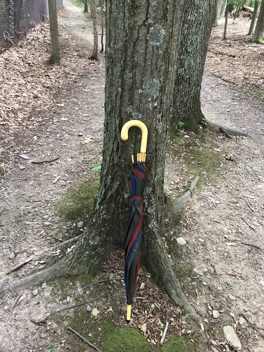
Constant winds from thunderstorm updrafts, I brought along an umbrella just in case.
Click photograph for slide show. To do this from WordPress Reader, you need to first click the title of this post to open a new page.
Maple Tree
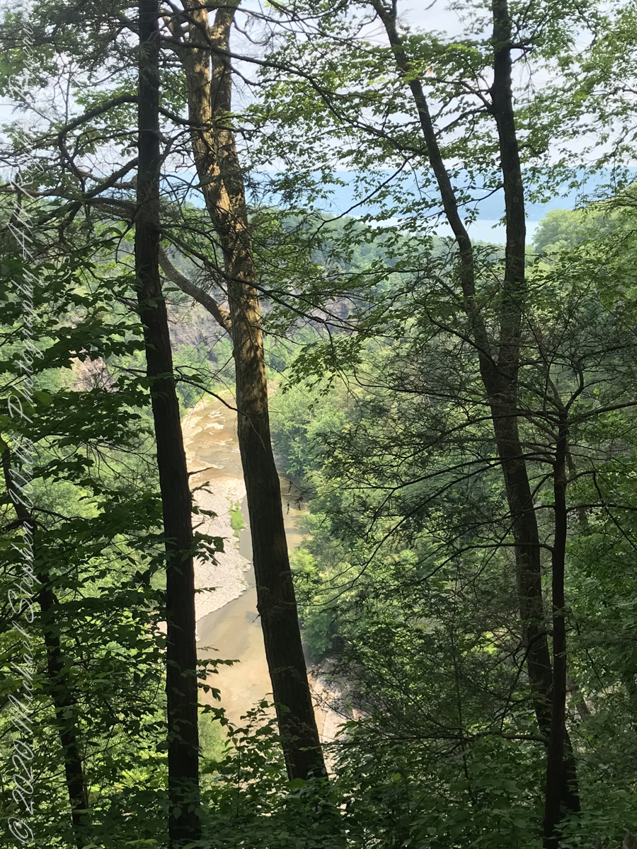
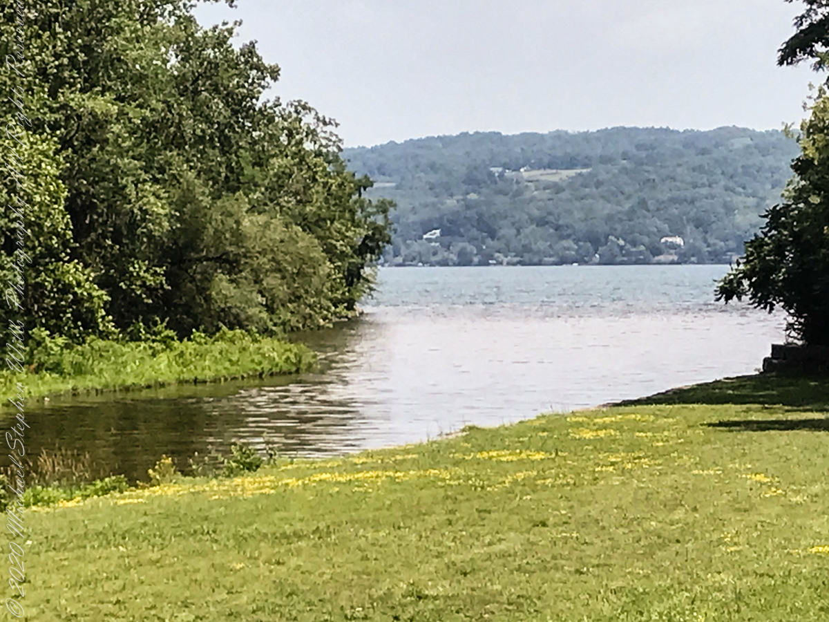
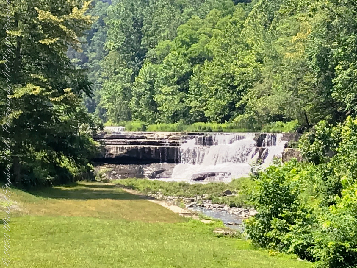
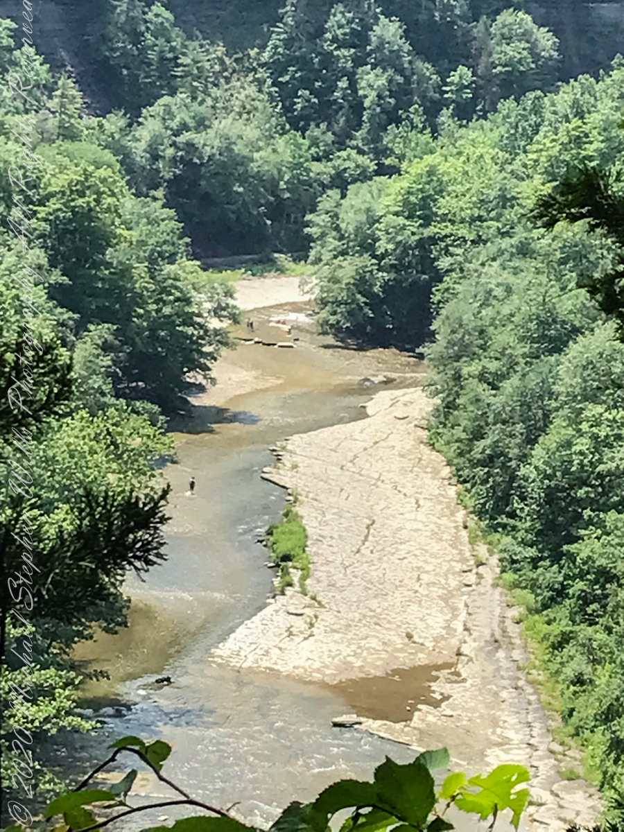
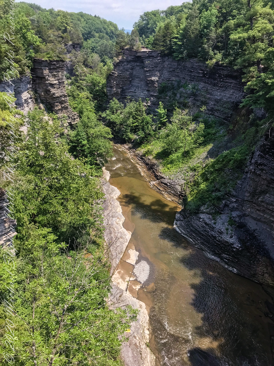
View from the South Rim Trail. The water flowing from Taughannock Falls to Cayuga Lake.
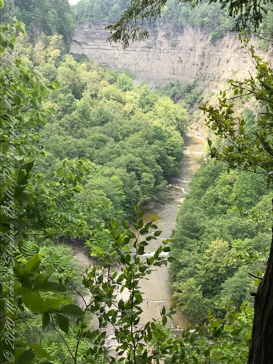
The steep, high gorge walls below the falls on a humid July morning.
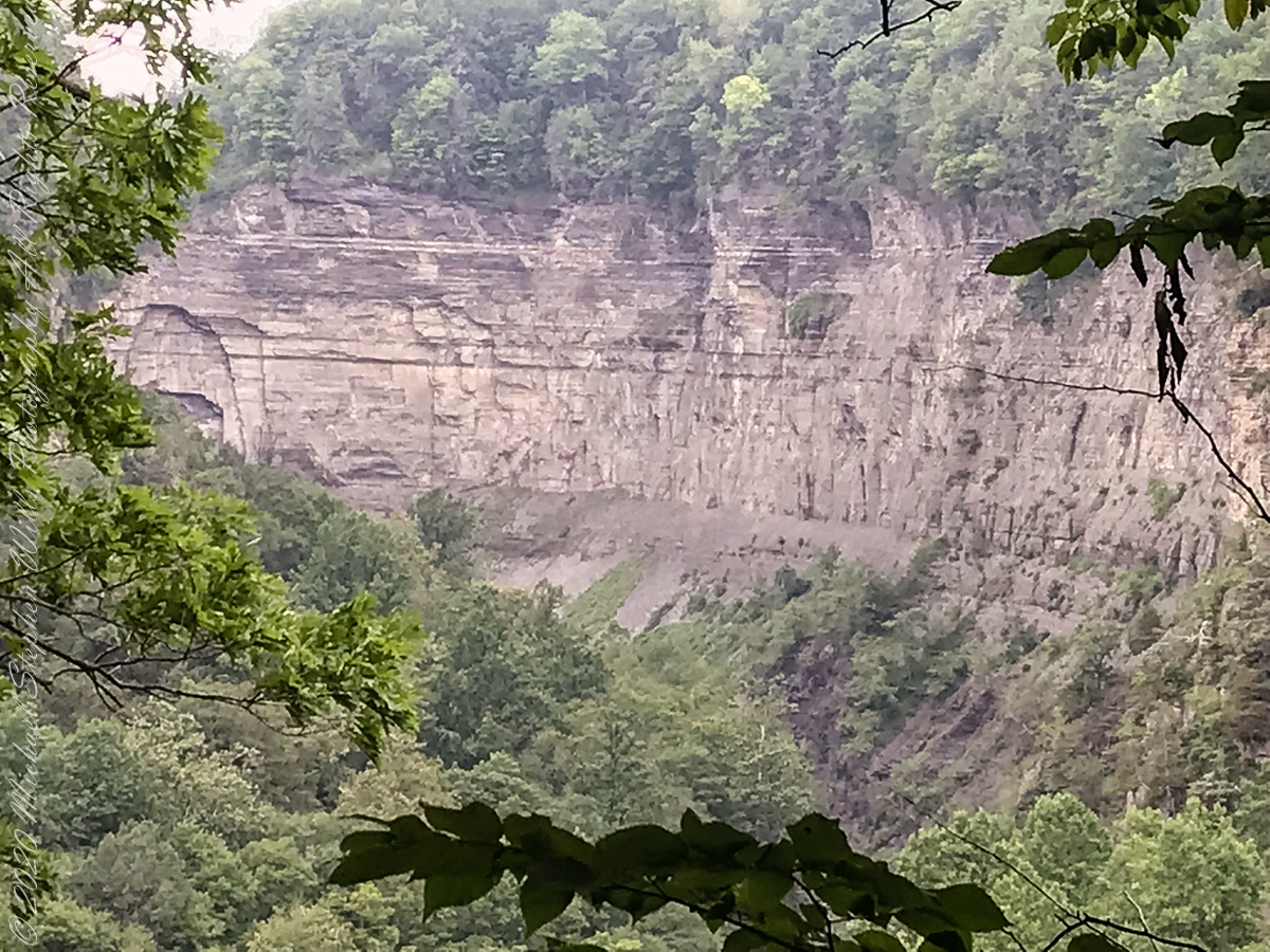
gorge walls
My umbrella
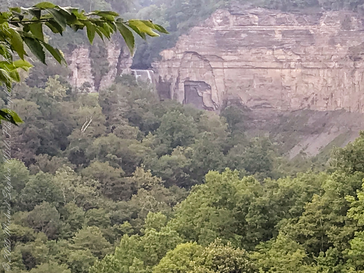
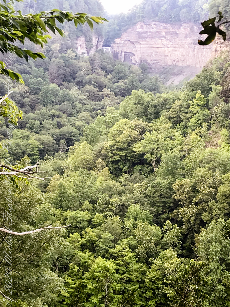
Taughannock falls in distance
Taughannock Falls in distance
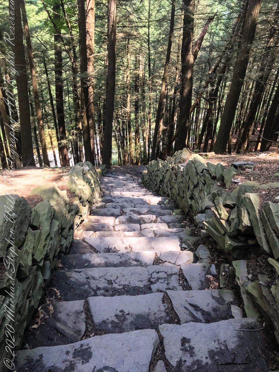
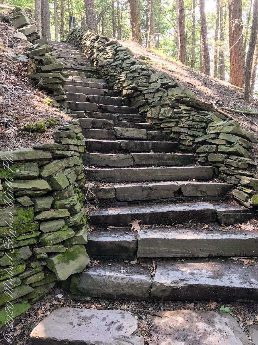
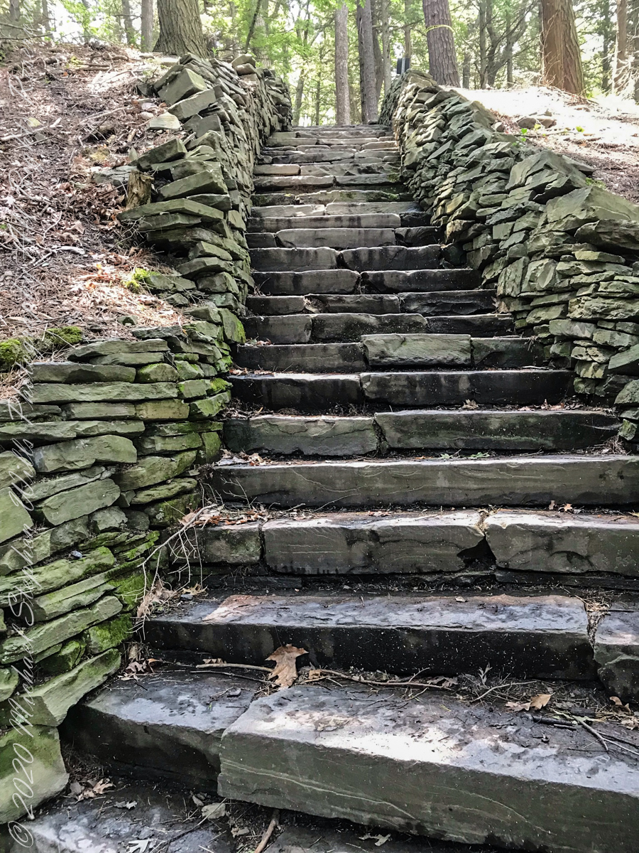
South Rim Stairs built by the Civilian Conservation Corps in the 1930’s
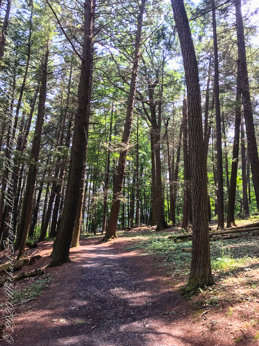
Pine Forest at foot of stairs
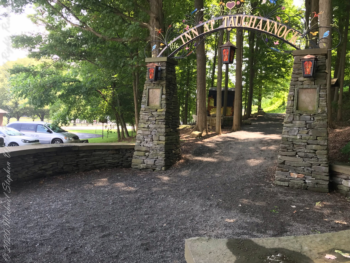
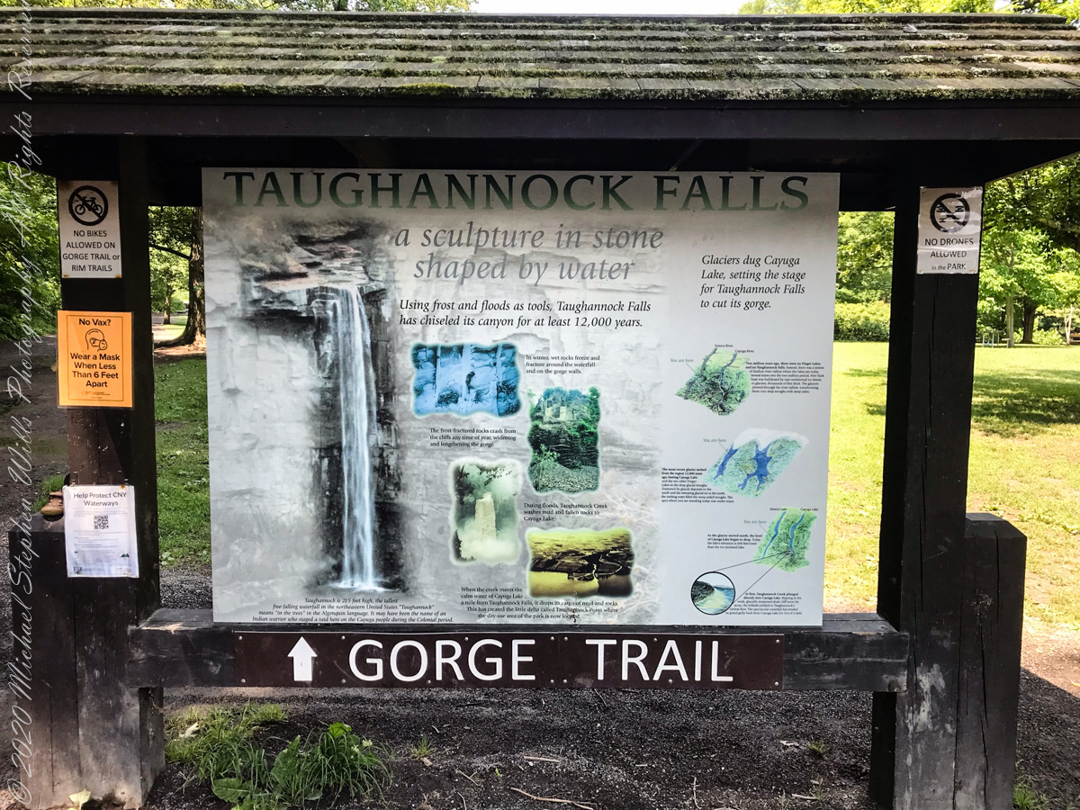
An interesting presentation at the Gorge entrance
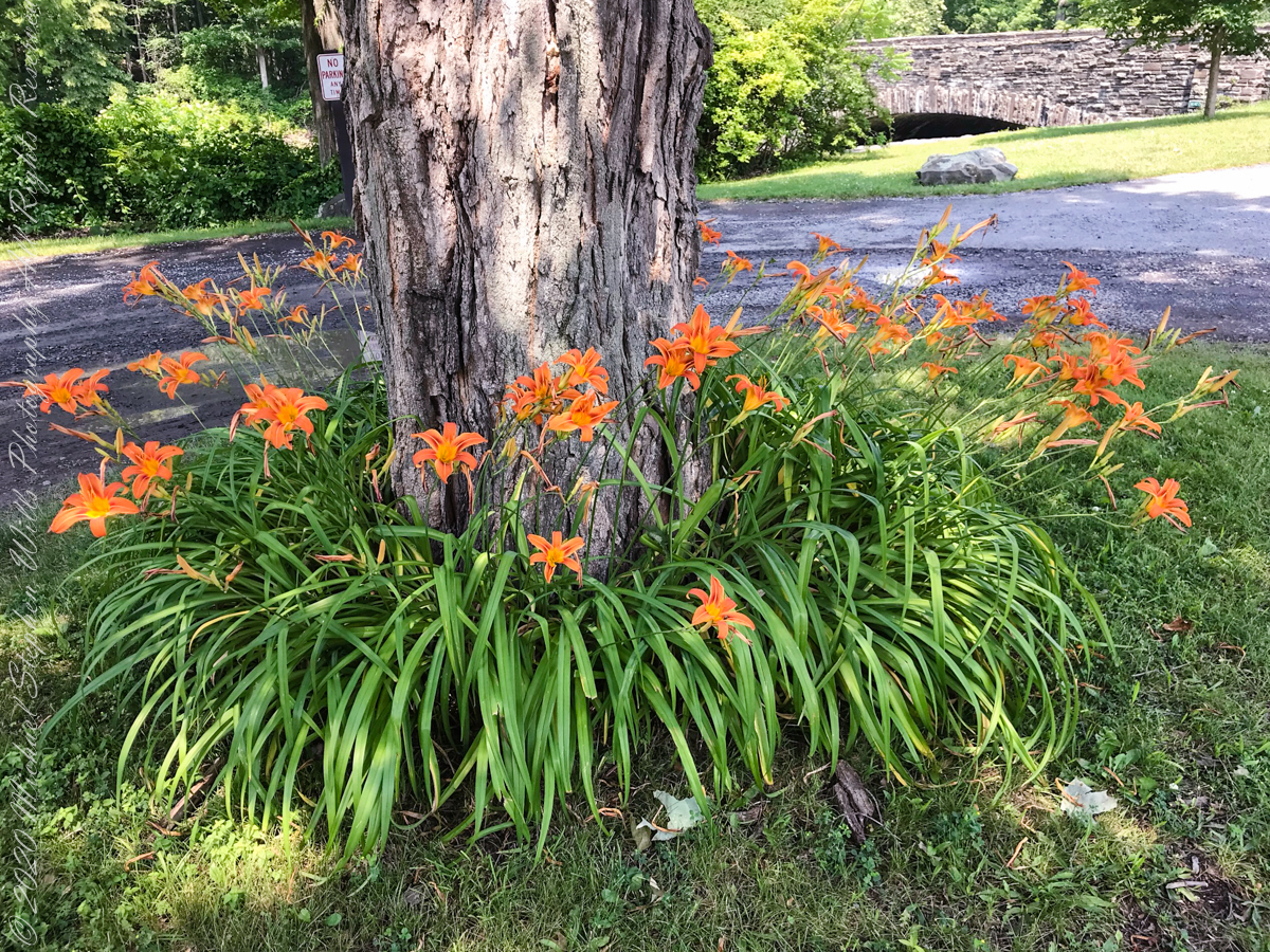
Tiger Lilies
brown creek water meets Cayuga Lake (900 feet deep)
Last waterfall of Taughannock Gorge
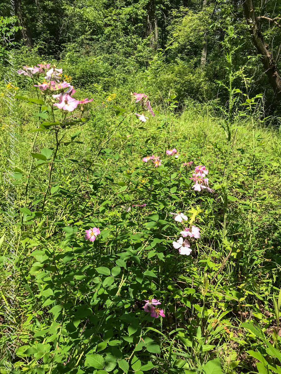
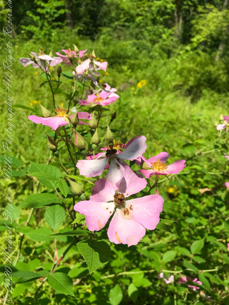
wild roses
Wild rose blooms
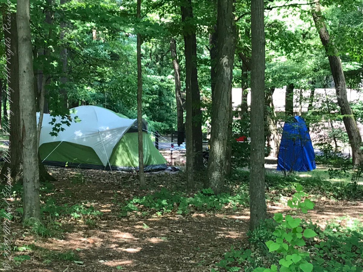
camping on North Rim
North Rim Gorge view
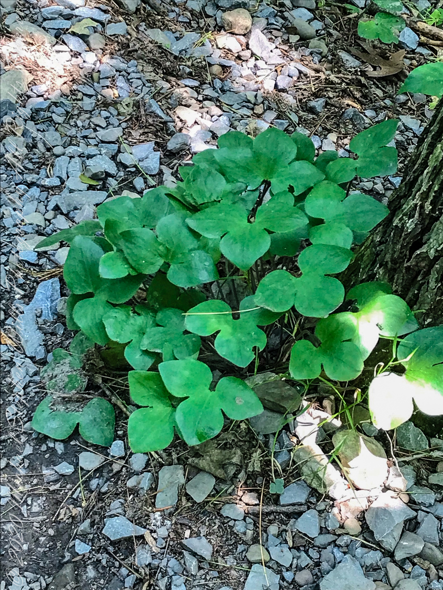
Lobe leaved Hepatica
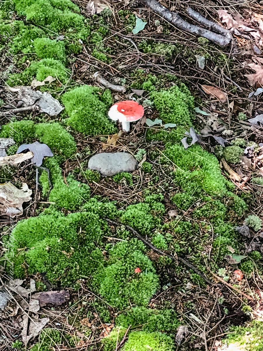
Mushroom and Moss on the “wetter” north rim
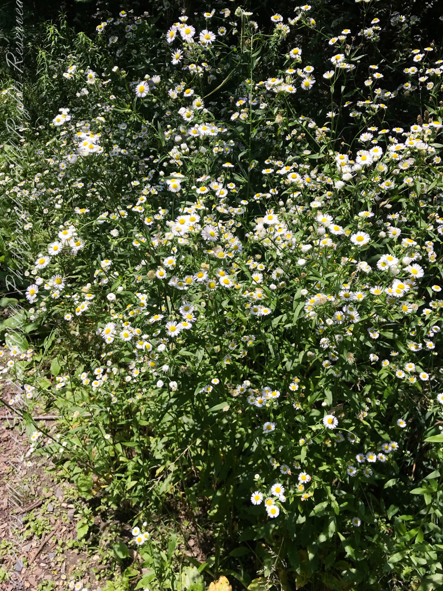
asters, an invasive species
The dramatic and virtually inaccessible gorge above Taughannock Falls
Click the “Watch on YouTube” for a larger format view and more information about each video.
Taughannock Falls Gorge on a humid summer morning
Hemlock Forest on South Rim Trail
Taughannock Falls Gorge from South Rim Trail
Taughannock Falls from South Rim trail
View of Taughannock Falls Gorge from the North Rim trail on a humid summer (July) morning. Turkey Vultures circle overhead…they are there most summer days.
View of the first waterfall of Taughannock Gorge from the railroad bridge linking the North and South Rim trails on a humid summer (July) morning. This large waterfall empties to the gorge above the 210+ foot Taughannock Falls.
Copyright 2021 All Rights Reserved Michael Stephen Wills
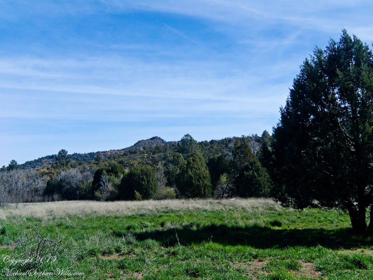
Imagine walking across the ranch house ruin towards where I described the former pond. Looking to the east and north from the elevation you see this sight.
In the near distance a grass pasture slopes into Reavis Creek. The creek has flowing water in all but the longest dry seasons. By the way, the trail from Pine Creek is on the slopes of that conical feature in the distance, to the left.
Click any photograph for a larger version.
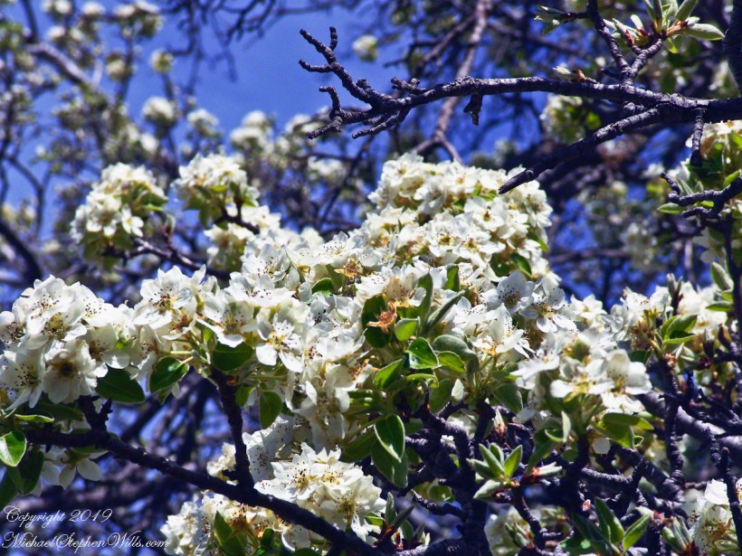
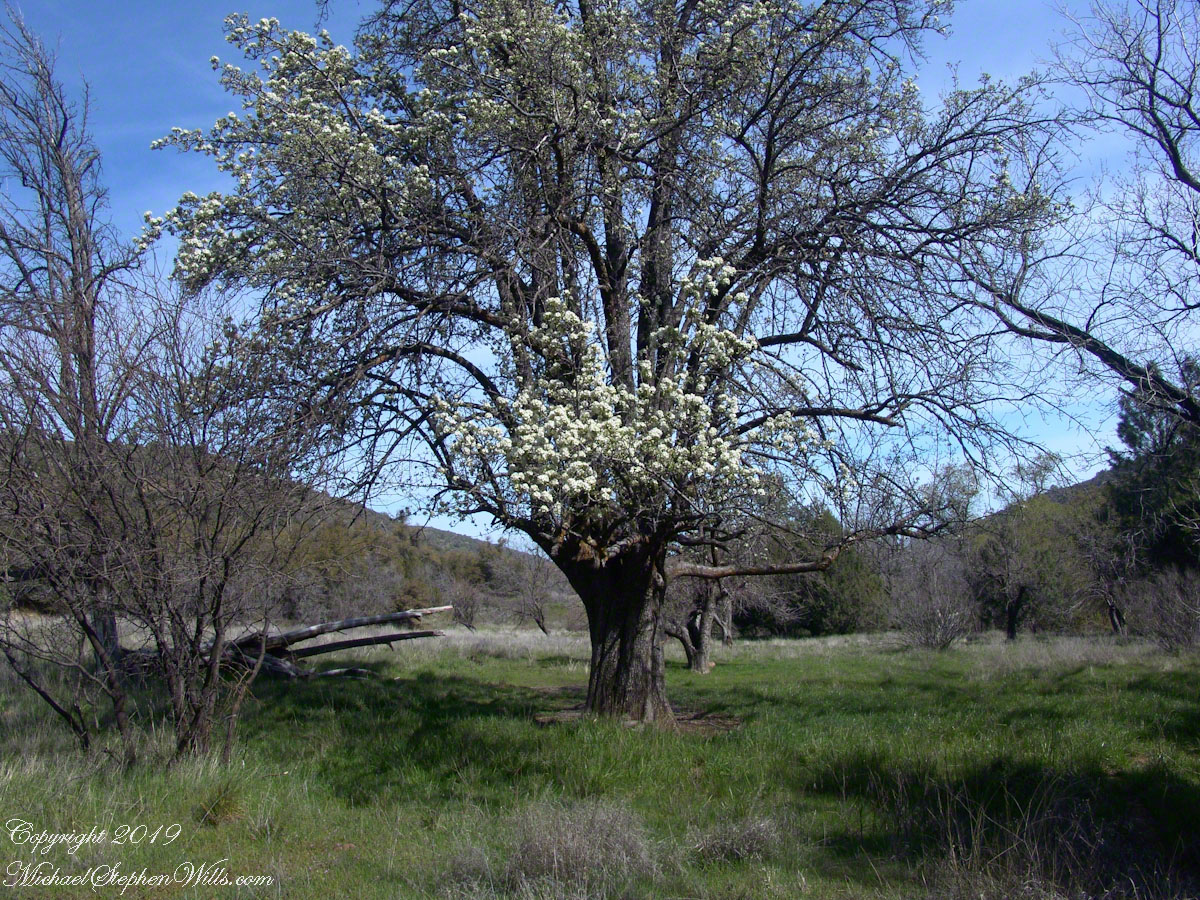
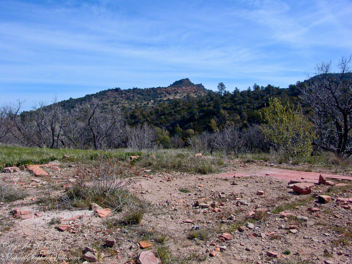
Looking from the former house site towards the Arizona Trail running beneath the distant red rock ridge. Not the fence rails on the left and apple trees in bloom.
From the ruin, walk down the Arizona Trail, south, for a few hundred feet and turn left into the fields to encounter the same apple tree, and a close up of pure white apple blossoms.
Portrait of a Blooming Apple Tree
At Rest and History
This tree is an outlier of a thick stand of several hundred trees to the north. The Searcher and I rode into the middle of the grove for a rest and chat. The horses were allowed to graze in the abundant new grass brought on by the winter rains.
The Searcher told me the story of the valley and that it was a man named Clemans who planted 600+ apple trees, trees in bloom all around us. The Reavis Valley was long a site of agriculture, starting in the 19th century with Elisha Reavis, who passed away in 1896 and is buried on the slopes of White Mountain, and continued with a series of ranchers and entrepreneurs in the 20th: John Fraser, William Clemans, who planted the trees, and John A. “Hoolie” Bacon, then Bacon’s son-in-law Floyd Stone who sold the land to the U.S. Department of Agriculture in 1967.
We talked about some earthwork I noticed, in the southern part of the valley. It was part of a water system that diverted Reavis creek flow at the head of the valley to the ranch house. We decided that strange hexogonal structure on the elevation above the house ruin was the site of water storage. At that location the structure would provide a pressure feed for the house and much else.
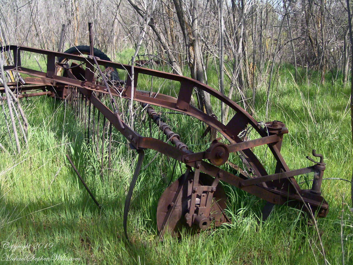
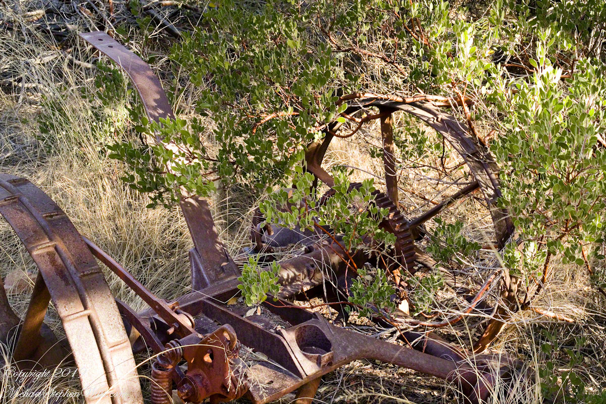
Abandoned Hay Rake
A mix of winter rains and fertile soil were exploited in the Reavis Valley for a handful of decades, the enterprise now is set aside. This abandoned hay rake and chassis, used to harvest grass in seasons past, is evidence of the work. The apple trees produce to this day without irrigation.
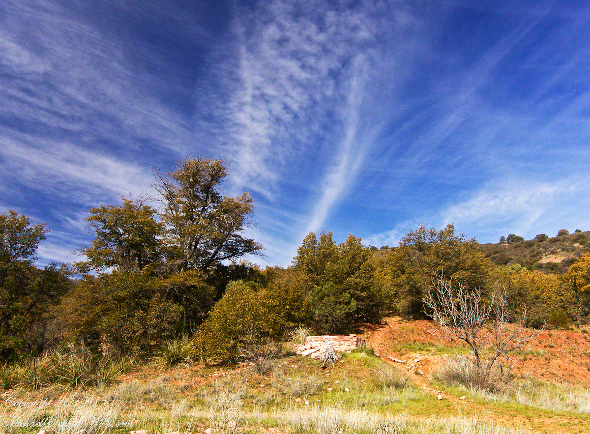
The Searcher touched upon the subject of the “Circlestone” ruin he mentioned on our morning ride. He had never been there, but mentioned some books on the subject. It is a wide circle of rough stone wall enclosing mysterious structures. At this point, I was hooked, and decided to check Circlestone on a later trip. Here are some photographs from one of those trips, in November 2006.
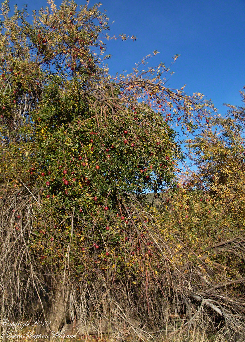
Reavis Ranch Apple Orchard Tree
Reavis Ranch Apples Yellow
Reavis Ranch Apples Red
In my next post The Searcher and I return to Pine Creek, Colorado gives me some trouble and we visit a stand of wild oats in the Reavis Gap.
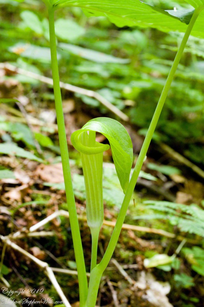
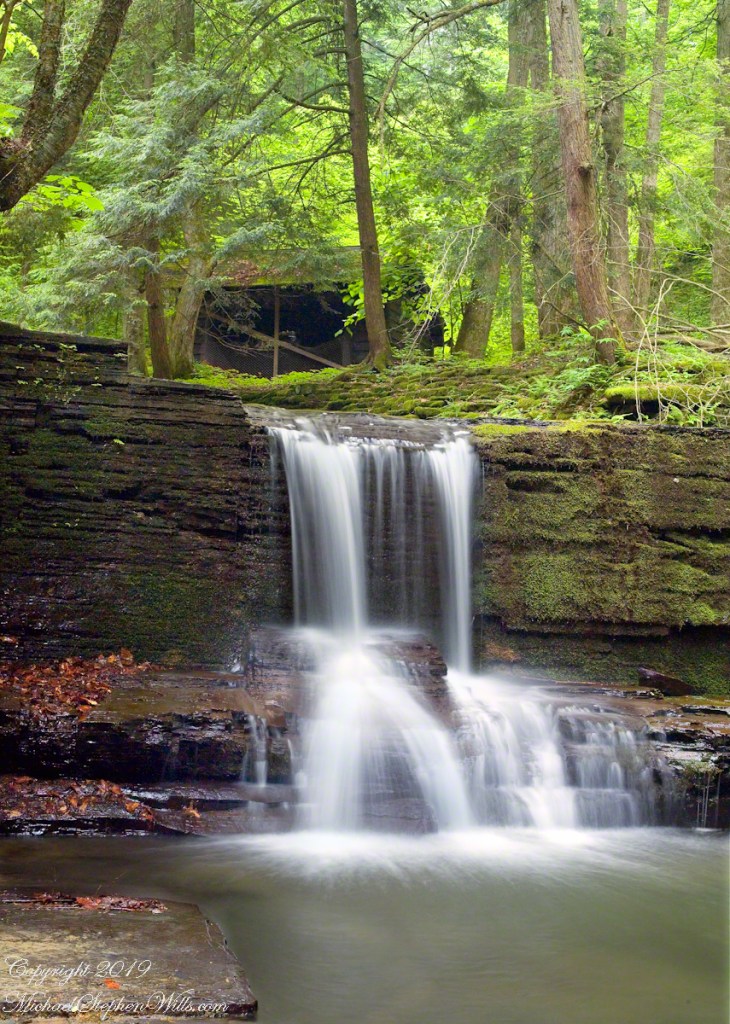
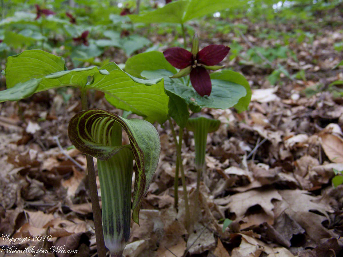
We can roam the woods and gorges this time of year to find these wildflowers camouflaged in their young, green foliage. Here are two images from a June 3rd afternoon in Fillmore Glen with a waterfall. Enjoy!!
I am happy to share a breakthrough in my family research of our time in Western New Jersey, 225 years for my branch from the 1677 landing of the Kent on Rancocas Creek until my grandfather left for Asbury Park.
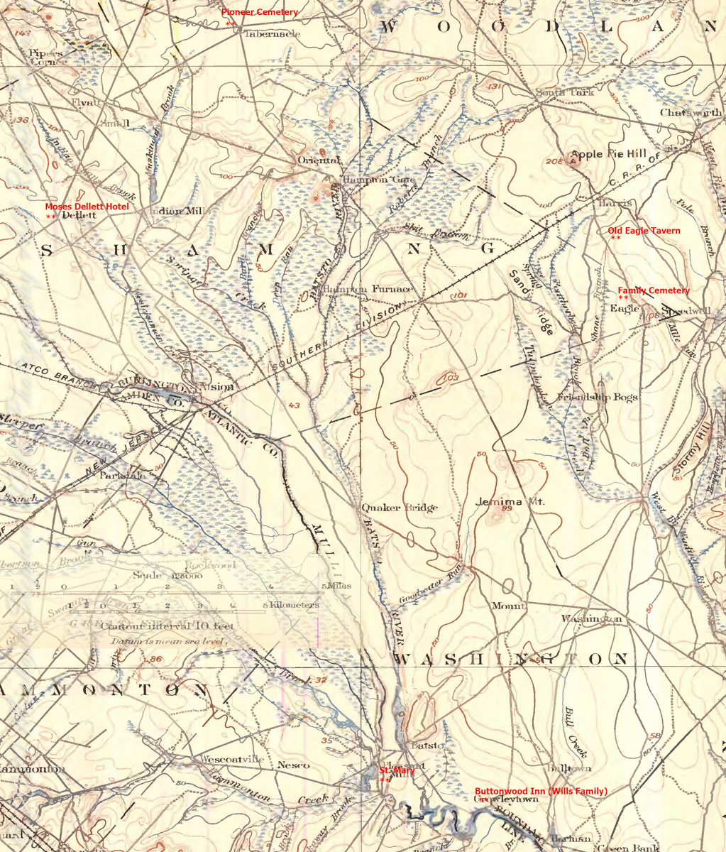
In this rectangle (10 miles by 15 miles) taken from the 1900 US Geological Survey, Rancocas Quadrangle, New Jersey topographic map is shown, upper right hand corner, Apple Pie Hill the starting point of this history where the author John McFee climbed the fire watchtower there, a view encompassing endless acres of pines. I learned an ancestor, third great-grandfather James McCambridge and his wife Mary owned the Old Eagle Tavern less than two miles south of there. The site is marked in red.
The Eagle Tavern existed for 28 years under various owners and names when James and Mary took over in 1926 serving a clientele, workers and visitors, from the struggling Speedwell Ironworks. Samuel Richards was a brother of Jessie Richards who owned the Batsto Ironworks and who provided the land for St. Mary of the Assumption (see my post Pineland Connections V). St. Mary’s is marked in red, bottom center. Samuel purchased Speedwell December 23, 1833 from Ann Randolph, made improvements and started operations without success before closing for good.
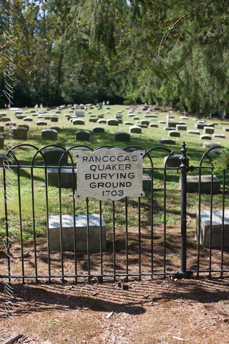
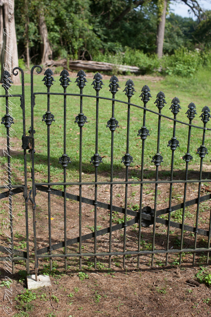
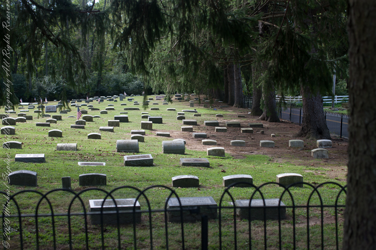
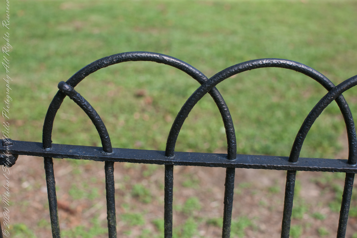
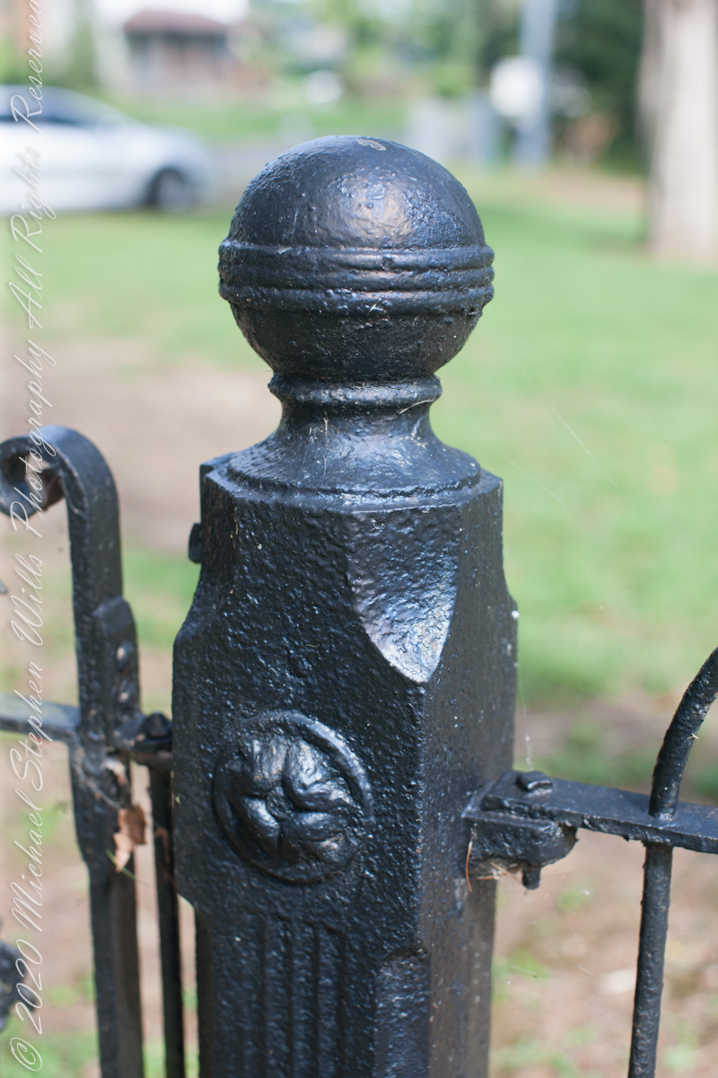
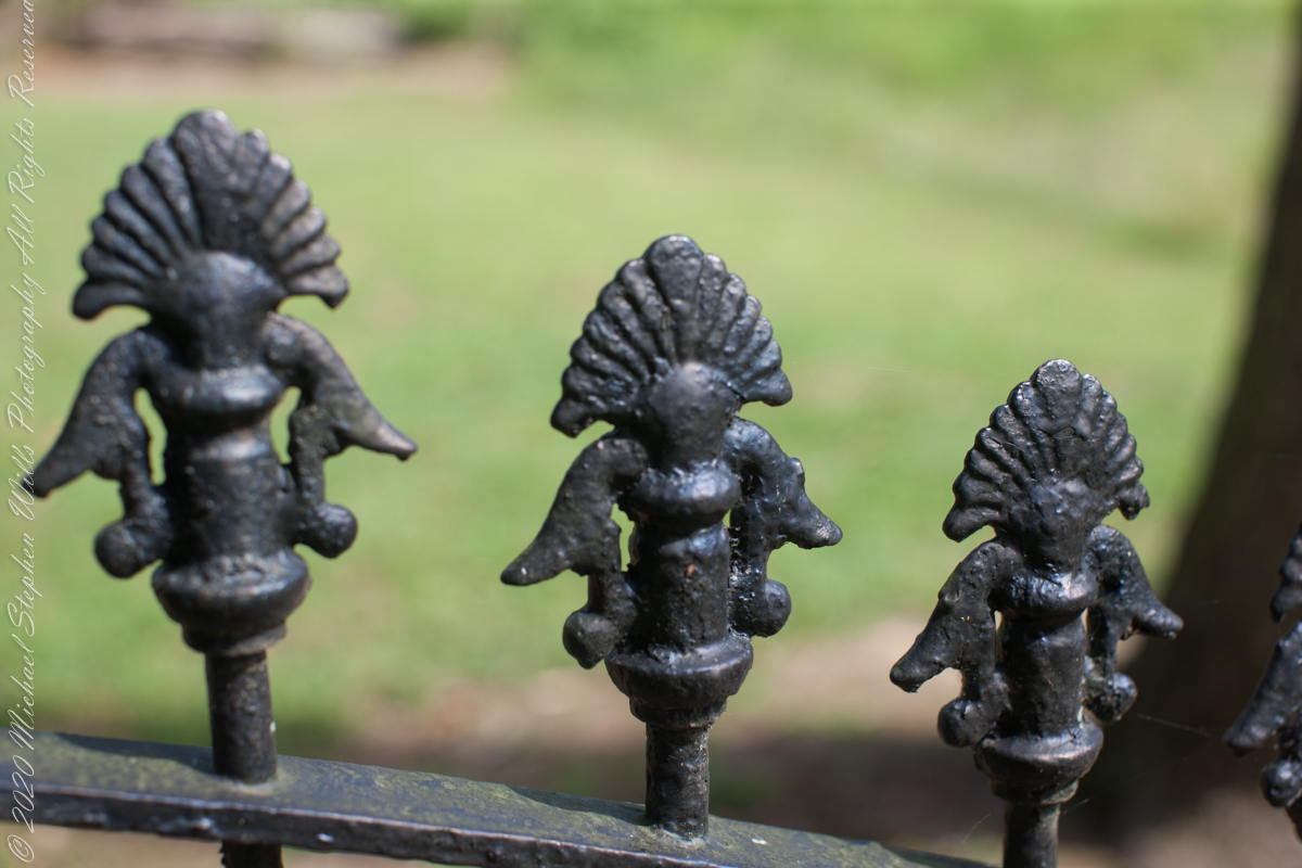
Entrance sign and overviewIron GateFence and burialsfilialIron fence postFilial of Iron Fence PostFilialThe Rancocas Quaker Burial Ground is surrounded by an iron fence, almost certainly of local origins. Here are my photographs of this exceptional ironwork.
On June 30, 1850, James McCambridge purchased Speedwell from the estate, eight years after Samuel’s passing, for $1,750. At this time he had accumulated over 2,000 acres. In this same year his son, James and wife Ann (Milley) (see my post Pineland connections VI) are listed on the US Census. The family lived either in the Eagle Hotel or close by raising nine (9) children: John (20), Mary Ann (16), James (15), Sarah Jane (14), my great grandmother Margaret (11), William (8), George (6), Edward (5) and Catherine (3). The younger James is employment was making charcoal for the ironworks, most likely for Atsion where Ann was employed. By the 1860 US Census Ann had passed away at the age of 50 and James (97) was living with the younger James and family.
Here is a land ownership map from 1876 on which I marked with red asterisks James McCambridge, Apple Pie Hill, and the Delletts, the family of the second greatgrandmother, Mary Dellett. Dellett landownership is also indicated on the rectangle topographic map.
Around the 1850 US census George and Mary Wills lost their two month old son, Charles (See my post Pineland Connections III) who is buried in a family cemetery, land owned by James McCambridge marked in red on the rectangle topographic map. Charles was my greatUncle.
George and Mary Wills, second greatgrandparents
Another breakthrough was identification of the Buttonwood Hill Tavern, Crowleytown as the hotel run by George Wills on the 1850 census. Marked in red on the rectangle topographic map. There was not yet a family union between McCambridge and Wills. That would come with great grandparents George Wills and Margaret McCambridge. The family connection at this time was their shared Roman Catholic faith and Saint Mary of the Assumption church.
I found this information in the book “Heart of the Pines, ghostly voices of the Pine Barrens” by John E. Pearce, Batsto Citizens Committee, 4110 Nesco Road, Hammonton, N.J. 08037-3814.
Copyright 2021 Michael Stephen Wills All Rights Reserved
Hitching the saddled buckskin and lightly packed pinto onto trees on the trail, The Searcher came up to my camp for a visit. I started water for tea and soon we were chatting. Right from the start The Searcher asked for privacy. Devoted to searching the Superstitions for the gold of the “Lost Dutchman Mine”, he assembles his expeditions from a staging point near Phoenix and spends about 60 days a year in the wilderness. Part of his preparation was a desert survival course provided by the Reavis Mountain School, conducted by Peter Bigfoot.
An Invitation from The Searcher
The Search described a place near Pine Creek, he called it “Circlestone,” a large almost perfect circle, of precisely constructed stone wall, on the slopes of Mound Mountain above the headwaters of Pine Creek. My sister, Diane, and I found Circlestone on backpack expeditions March and November 2006.
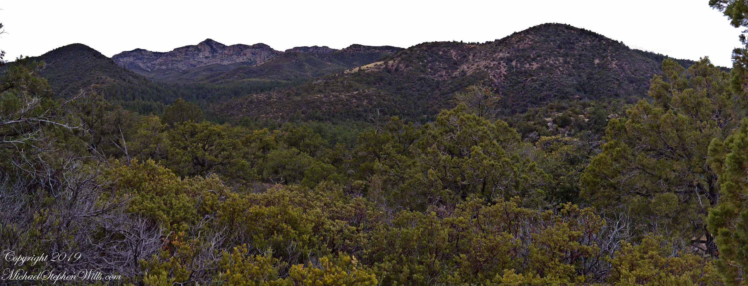
Here is a panorama from March 2006, southwest from the forests of juniper and pinion on the slopes of Mound Mountain.. The southern tip of Reavis Valley is to the right, from there Arizona Trail lead to White Mountain in the distance. It was taken on a later trip, in November of 2006 when my sister, Diane, and I visited Circlestone.
Click any photograph for a larger image.
The Searcher also told of Elisha Marcus Reavis, who settled the Valley west of Pine Creek in 1874. At one point, a band of Apaches planned to kill Reavis, but were respectful of his reputation as a rifle shot. They were waiting him out across from the his dugout, when Reavis stripped naked and with wild hair and a flaming red beard charge their camp, knives in both hands. The Apaches rode off, wary of his insane behavior, and never bothered him again.
We talked about my prospects and plans when The Searcher offered to take me to the Reavis Valley the next day, on horseback. There is a large apple orchard there and, this being April, we’d be treated to masses of apple blossoms. The day after Reavis Ranch, I could pack out with him down the Arizona Trail, past the Reavis Mountain School, over Campaign Creek and drive back to the Lost Dutchman Park. I readily agreed.
To Reavis Ranch on Horseback
The following morning dawn rose from colorless darkness, thin birdsong and brightening high clouds. When the Searcher arrived around 8 am he was leading the pinto, introduced as Colorado, equipped with a western saddle instead of a pack. As an absolute novice trail rider, the Search would hold Colorado’s lead. The reins were wrapped around the saddle horn, leaving me to hang on and “enjoy the view” and swishing tail of the buckskin, named Nugget.
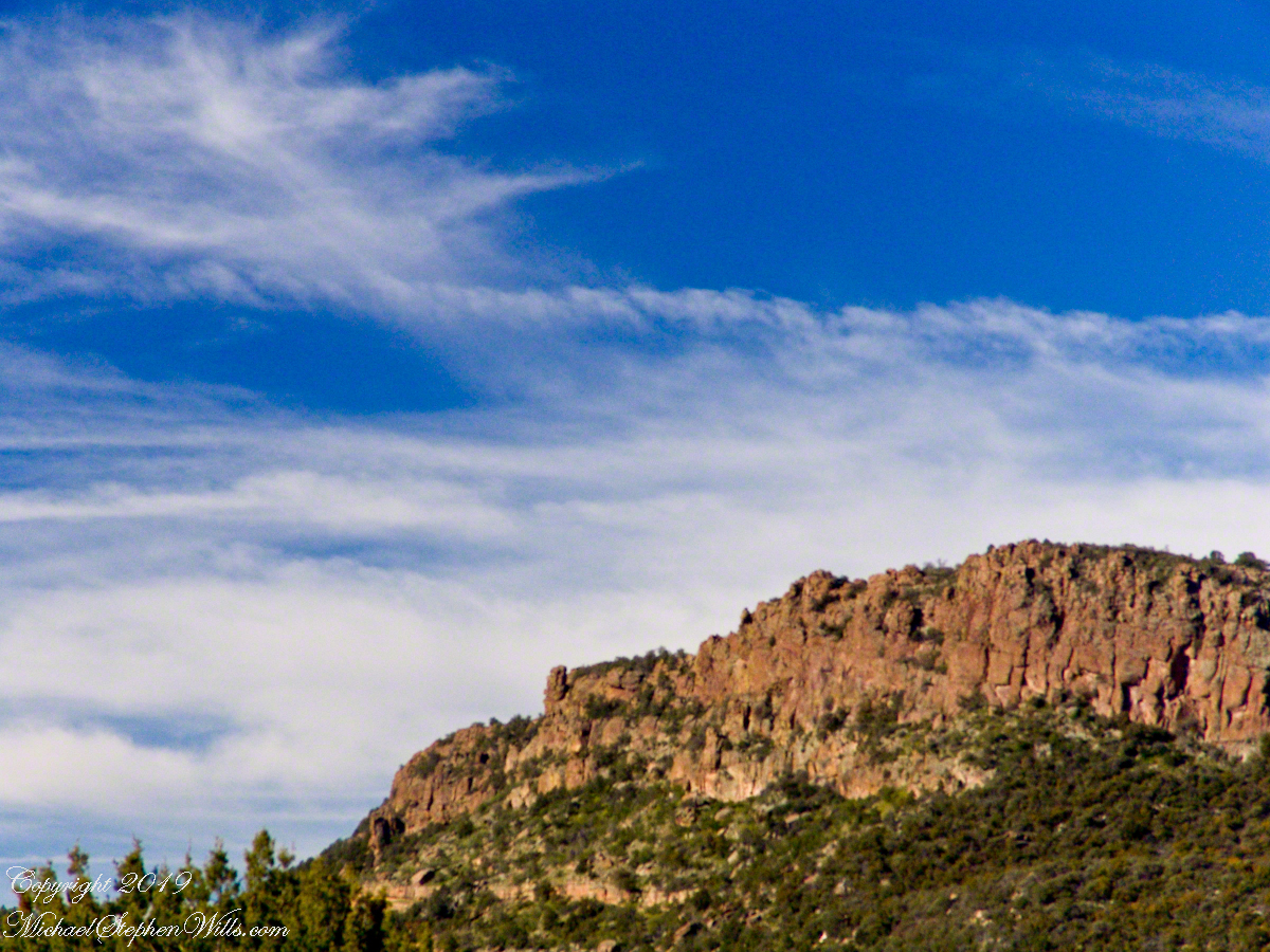
The 2.5 mile trail to Reavis from Pine Creek is typical of the eastern Superstitions, minimally improved, dramatically uneven with large and small boulders to navigate. From Pine Creek there’s a climb of a 631 feet to 5,278 foot elevation, where it meanders beneath a dramatic red cliff with a view of the pinyon/juniper forests on the slopes of Mound Mountain. As he picked our way, The Searcher pointed out the sights. “Circlestone is somewhere over there, a ring of stones overgrown with Alligator Juniper.” I was able to do little more than observe, photography was out of the question.
A cliff along the trail to Reavis Ranch offered cover and the flat perches preferred by cougars. It was not an issue for us in daytime and attacks against horses are very rare. The most either of us ever saw of the cat in all our time in Arizona was the tip of a tail slipping behind brush. This was a lush April after a “wet” winter, so small game was plentiful. Only a sick cat would be hungry. The worst case scenario is for a cougar to meet and become infected from a rabid animal at a water source and we did not linger on this thought.
Eventually, the cliff descended with the path, steeply, to Reavis Creek, the valley floor and the intersection with the Reavis Ranch trail. Heading south the Reavis Ranch trail passes the site of a long abandoned ranch. What’s left of the adobe and stone ranch house is on a level valley elevation overlooking what used to be the corral and a large open expanse.
Open field at near the juncture of the trail from Pine Creek with the Reavis Ranch trail.
Apple trees in bloom from the former site of the ranch house. There used to be a pond near this spot. With a little imagination, the trail from Pine Creek can be seen on the far ridge.
Reavis Ranch Trail, foreground, traverses the valley length north to south. The Arizona Trail from Pine Creek following below the red rock cliffs in the distance.
The US Forest Service razed the building after it “burned to the ground” around Thanksgiving 1991. I would not call what is left “a foundation,” it is a platform where the house stood. You can see for yourself in this photograph what was once was a homey tile floor. I’ve seen old photographs of the structure with a large pond to the left of this view, a door and simple porch face east and the pond used to hold irrigation water.
Turn around from this ruin and a platform comes into view. Built on the west valley slope, overlooking the ruined house is a hexagonal foundation of adobe bricks. We are looking here across the Reavis Ranch trail. My opinion about this structure rests on an examination of the land to the south, there is excavation of a shallow canal and this was the way water was captured from the upper Reavis Creek or tributary and directed to this catchment basin where it was then directed for storage or irrigation. The spot enjoys clear views of the central valley, an excellent place to enjoy the fall of evening.
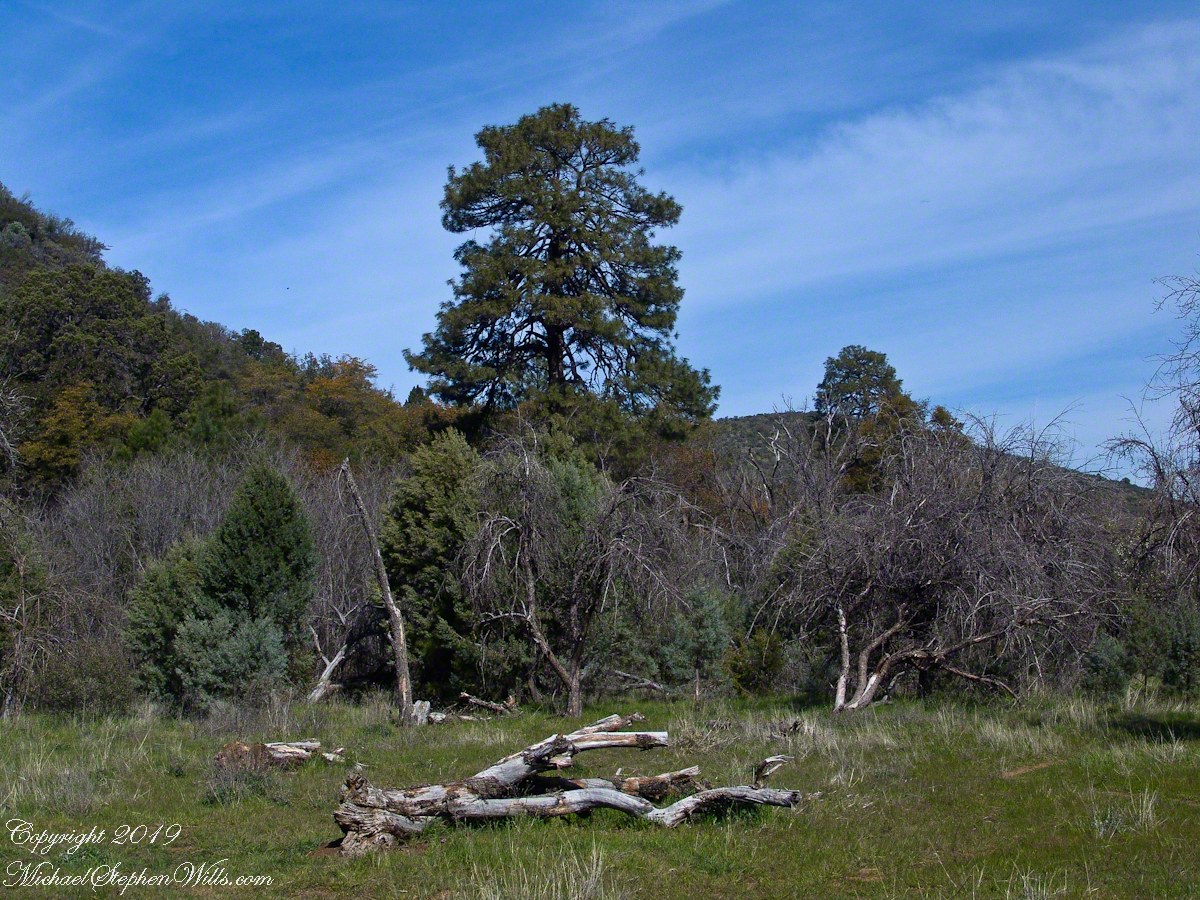
The Searcher led me to a place a few hundred yards south, in a narrowing of the valley, where he let Colorado and Nugget roam free. The horses appreciated the level, open spaces and I enjoyed the Ponderosa pines on the west valley slope. We sat on the smooth trunks of fallen trees, 4 feet in diameter, near Reavis Creek.
Colorado took this opportunity to bolt, headed south. We took off after him into and through a thicket of locust trees where The Searcher cornered Colorado to regain control. “He was abused by his previous owner and is difficult at times,” was how The Searcher put it.
We were close to the end of Reavis Valley where Reavis Creek originates from the drainage of White Mountain, to the west.
We headed north here, back to the ranch house site, to the lush new grass of the apple orchard.
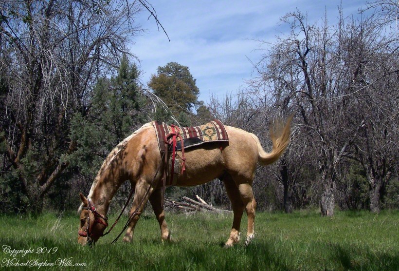
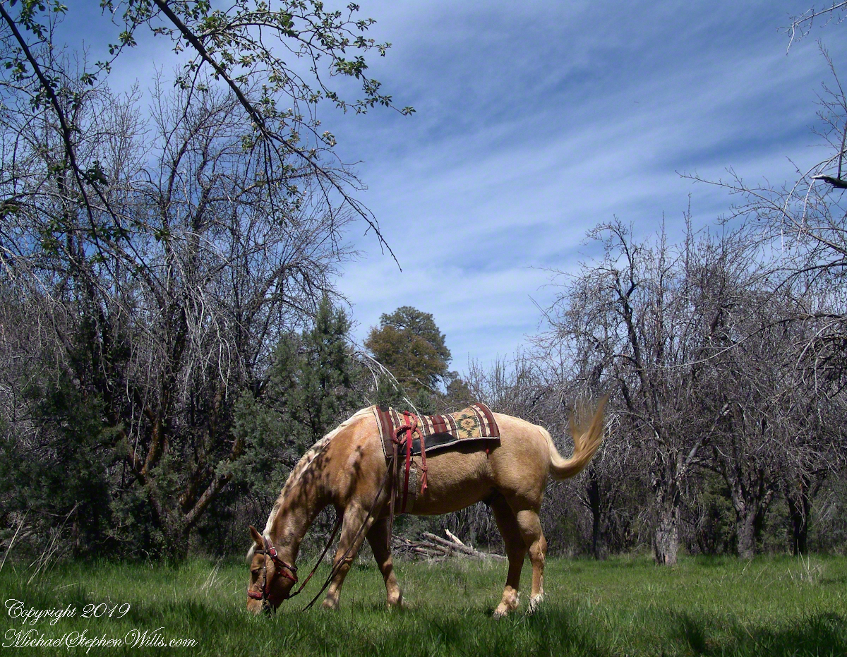
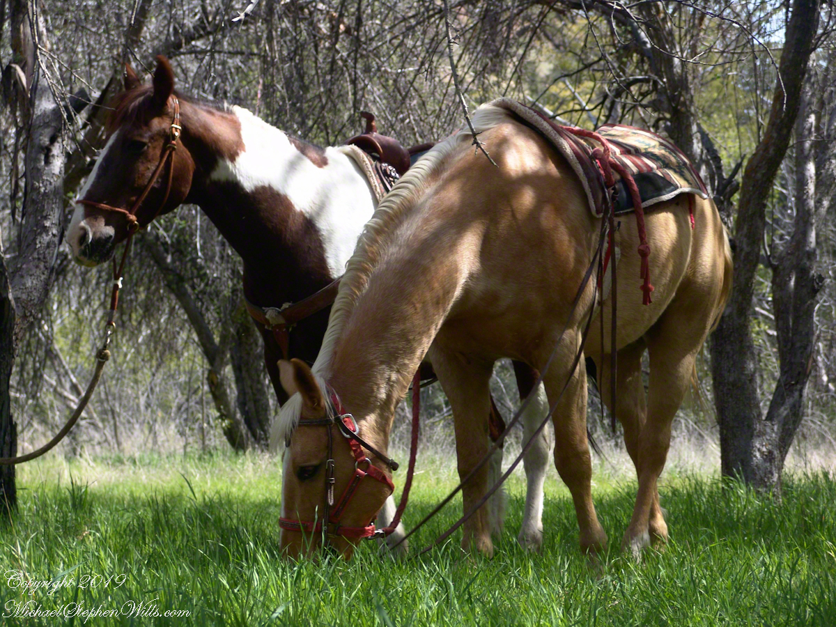
Nugget in Horse Heaven
Nugget grazed unfettered. Colorado was tethered with plenty of slack for grazing. This photograph of the pair shows their personalities, Colorado edgy, Nugget content to feast while the grass is available.
Colorado on the alert while Nugget grazes, typical of their personalities.
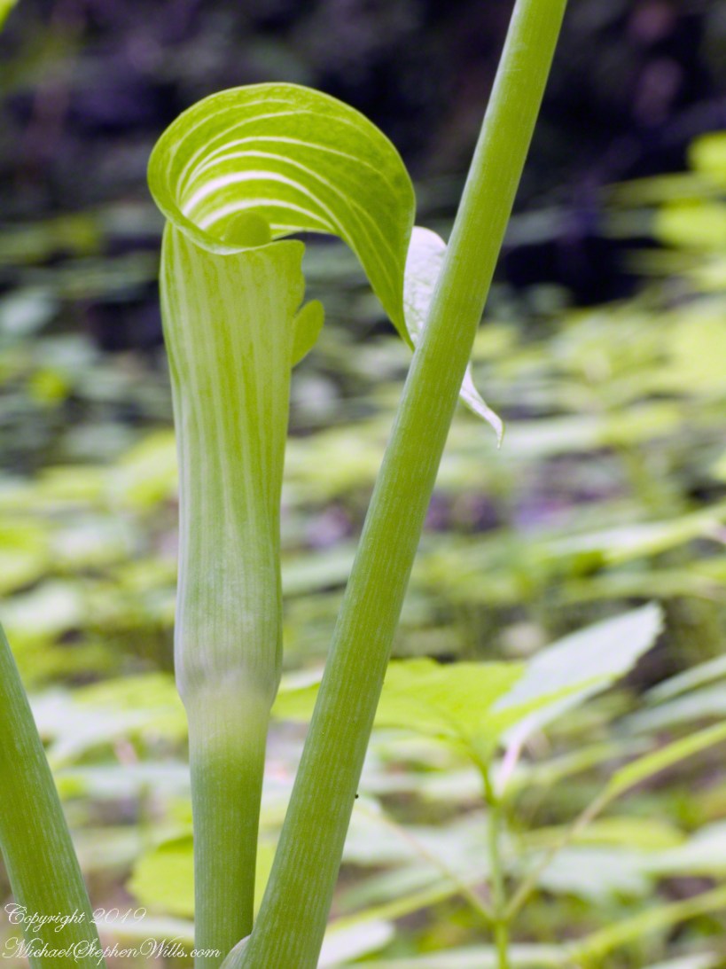
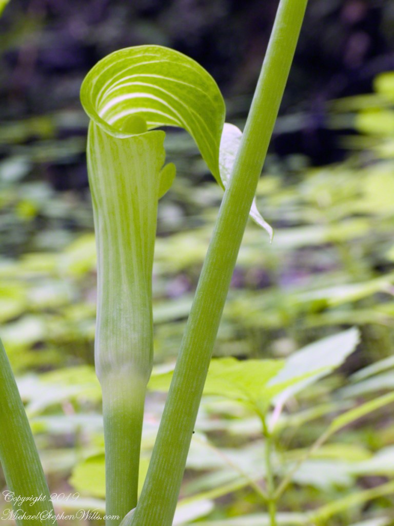
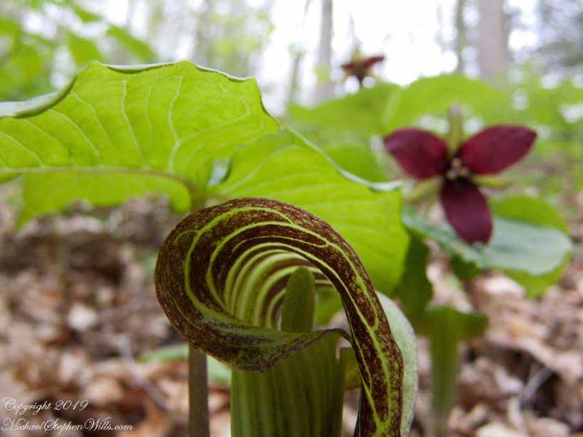
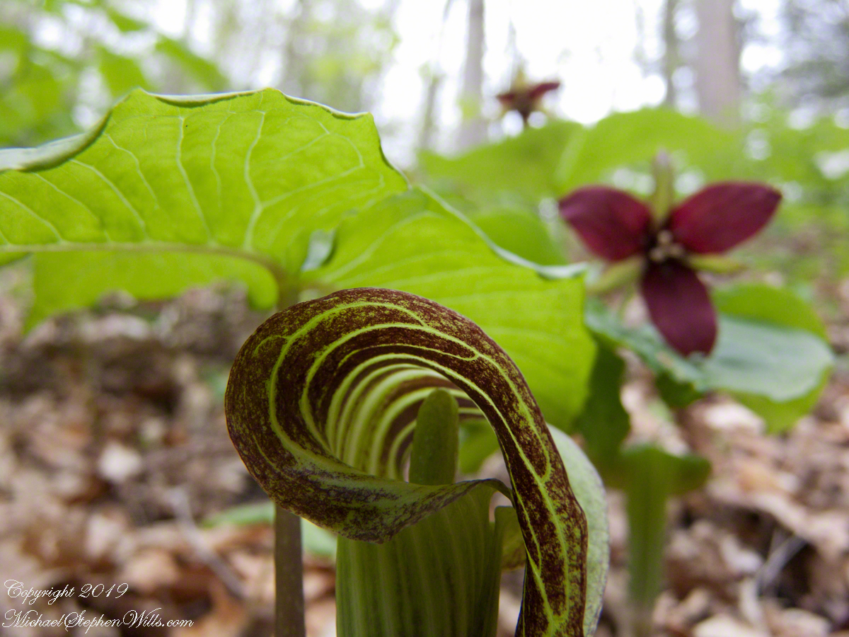
Brown dragon is an apt nickname for Jack-in-the-pulpit, captured here with Red Trillium on the forest floor of Fillmore Glen State Park. I was down in the mud for the closeup,
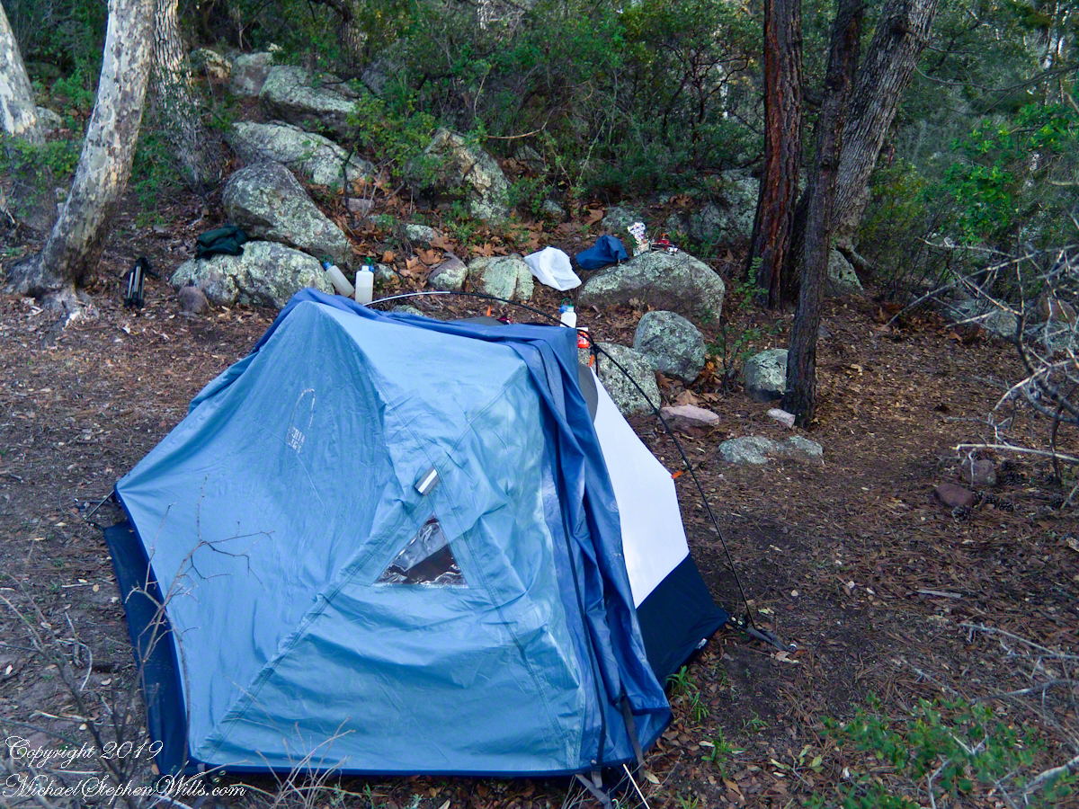
My third wilderness evening was unlike the others. I rested with an unhurried exploration of the camp area. Underfoot was a scatter of dry oak leaves, acorns on hardened desert soil not much softer than the numerous lichen encrusted boulders, all of which formed a bench above Pine Creek.
Pine Creek Camp Overview from a large lichen encrusted boulder
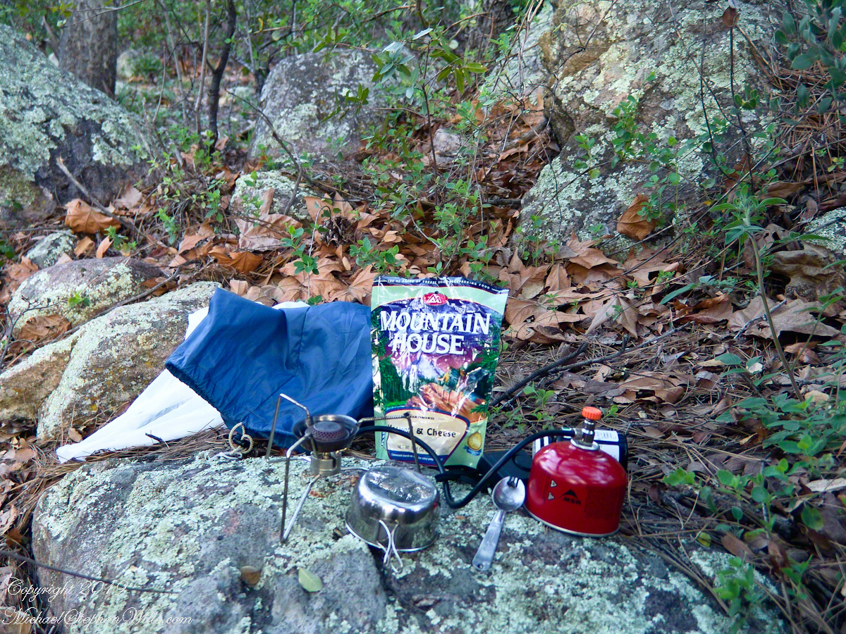
Pumping a gallon of drinking water though the ceramic filter takes more time than meal preparation. The four gallons I packed up were almost used and I enjoyed the luxury of pumping two days supply, 3 gallons in all and planned to down a quart or two of “gator aid” before dinner with the luxurious enjoyment of a flowing Pine Creek for company.
Pine Creek is the most common type for Arizona, recurring. To recur means to happen periodically or repeatedly and, for streams, this means for part of the year no water flows. For these days the flow was low, the water clear, what was left from the plentiful winter rains of 2004/2005.
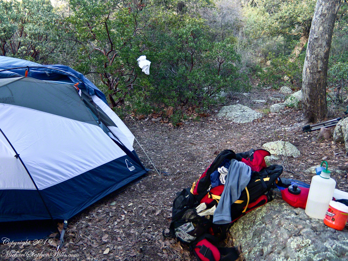
Looking east toward Manzanita thickets with the unpacked backpack foreground
The wind gently rustled the manzanita and the sun just above the western cliffs as I settled on a boulder to enjoy a quart of fluid. I mulled over my next steps.
The kitchen: a very light gas burner, spork, dehydrated food with cup for beverages
Initially, the plan was to walk across the Superstition Wilderness, starting on the remote eastern end and emerging on the populated west side, in the Lost Dutchman State Park. My sister expected me there on day 10, but today was the end of day three. I didn’t know at that time the climb on my second day was the steepest of the wilderness and the way forward was much, much easier.
Looking west toward pine creek, manzanita branch foreground and thickets all round, young Ponderosa Pine, Arizona Oak behind tent.
Before a decision could be reach, my thoughts were broken by a different sound from the manzanita: several horses approaching on the trail.
Here is a photographic recap of the previous Superstition Wilderness postings as a gallery. You can page through the photographs.
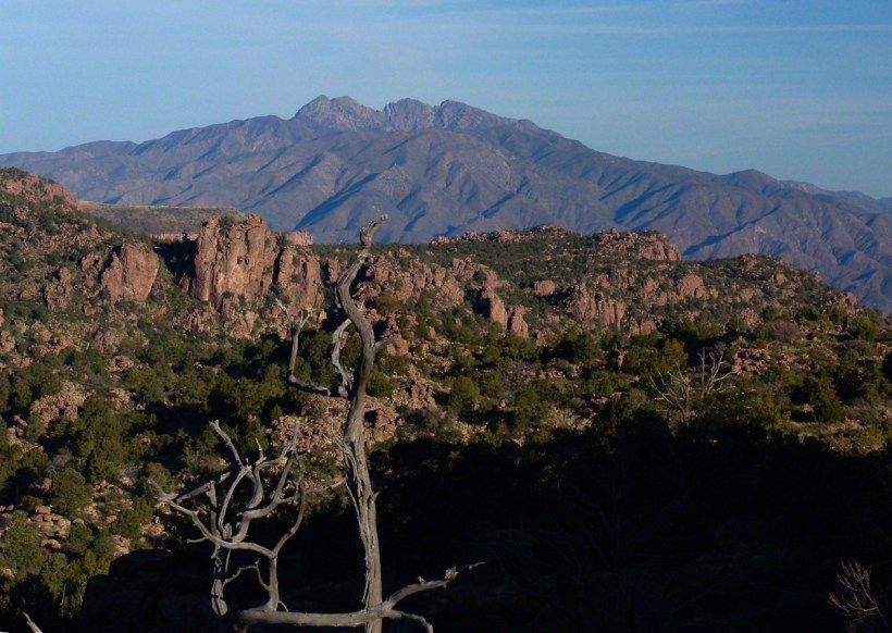
View to the southwest on the Arizona Trail above Pine Creek.
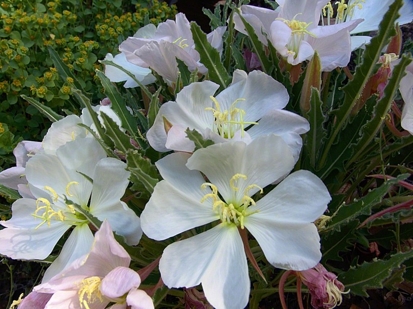
Pine Creek of the remote eastern Superstition Wilderness hosts this wild Tufted Evening Primrose.
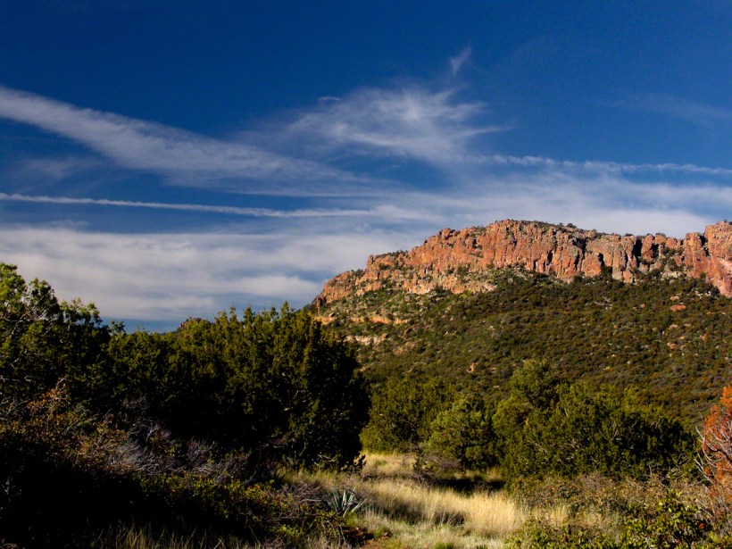
The Arizona Trail passes this spot in the remote eastern Superstition Wilderness. This is the view of my path up from Nameless Canyon. In the distance is the Four Peaks Wilderness Area.
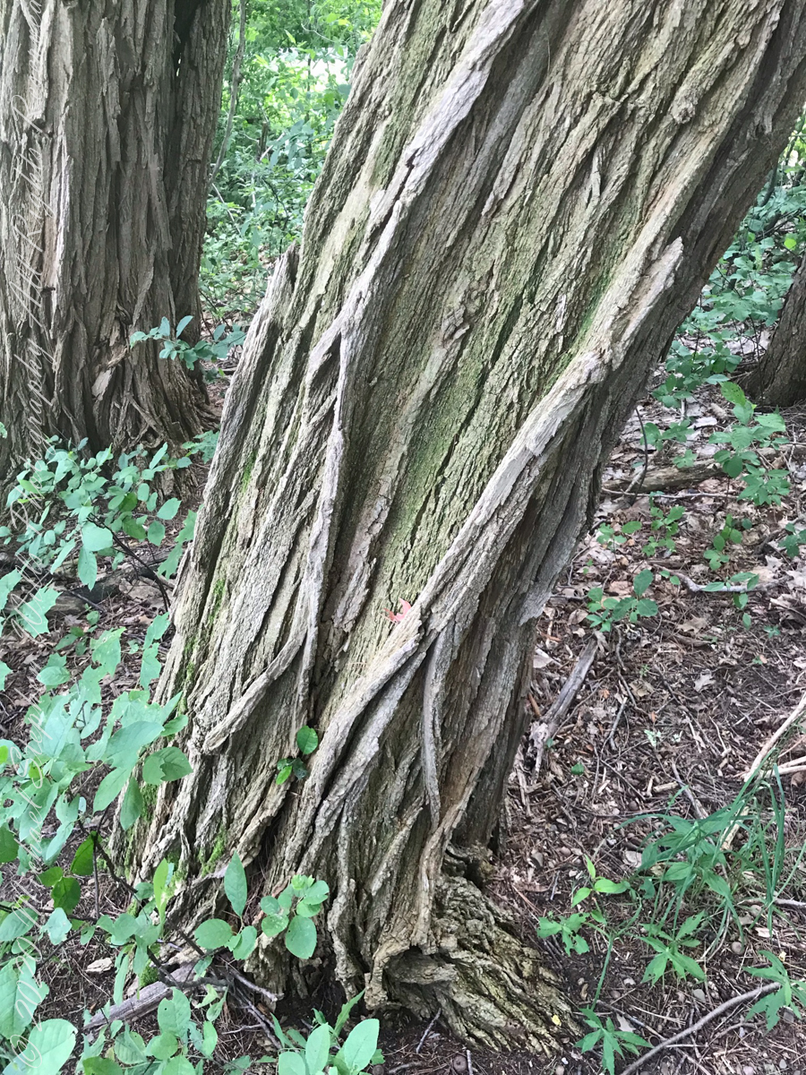
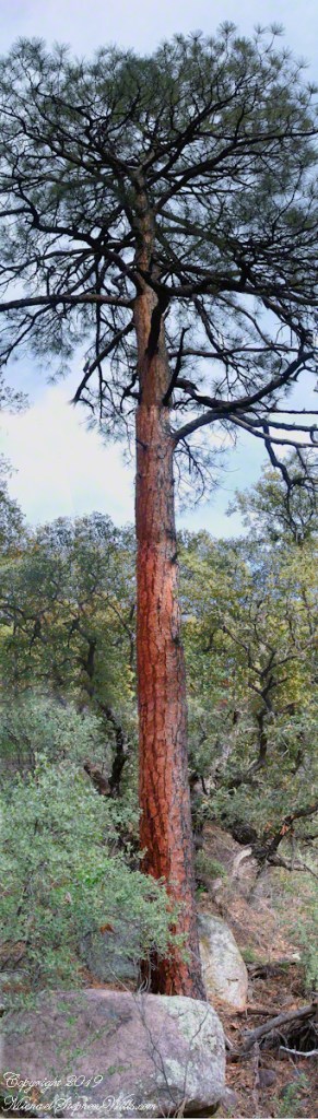
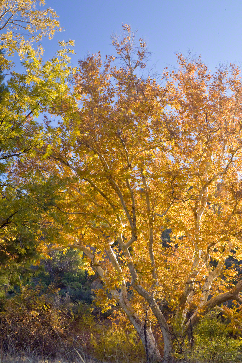
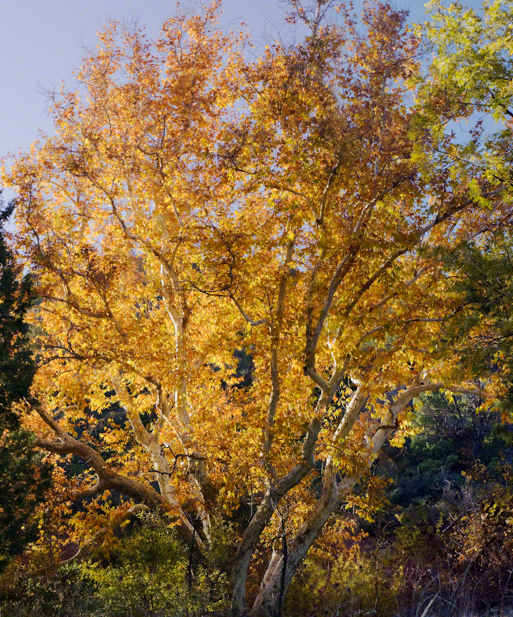
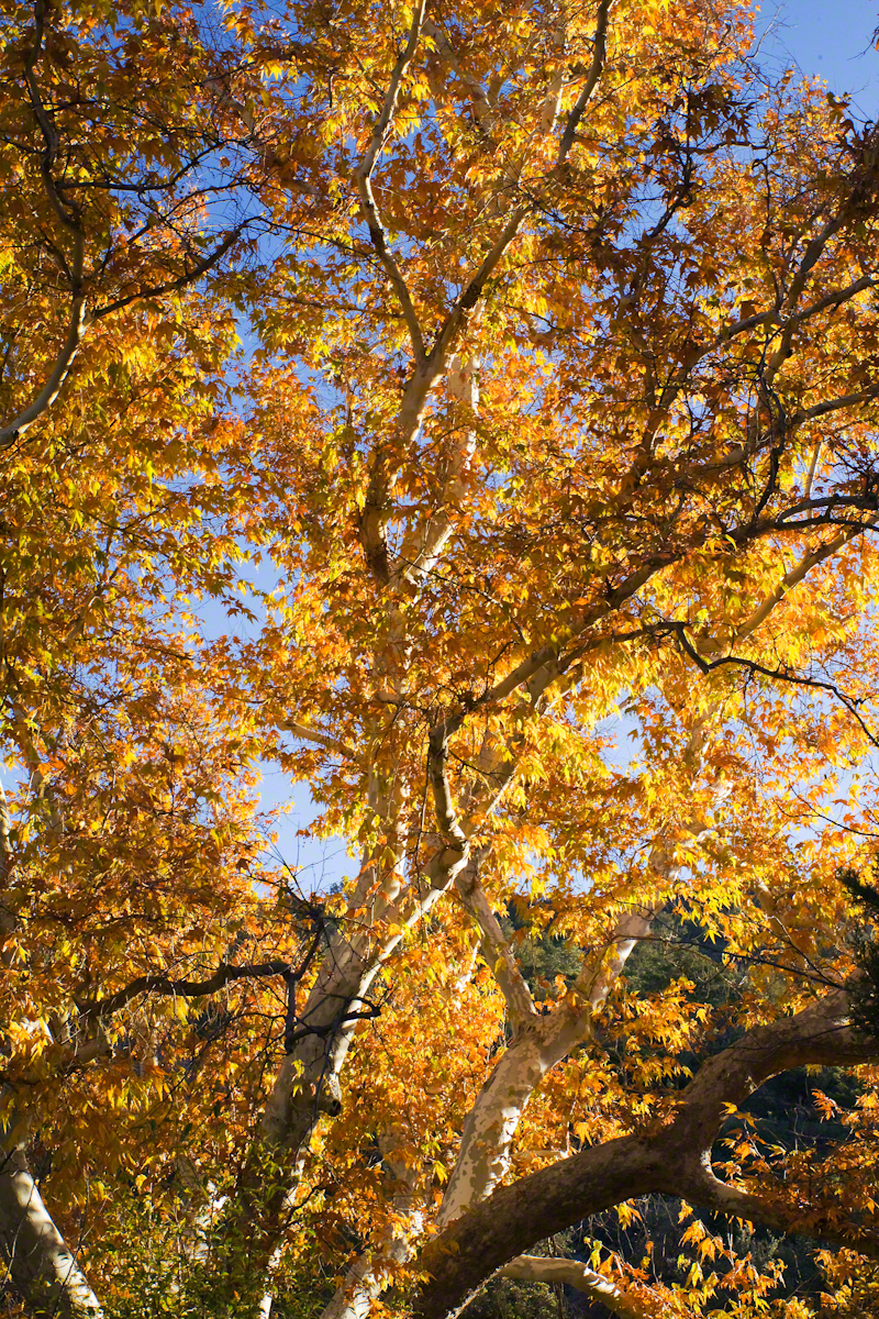
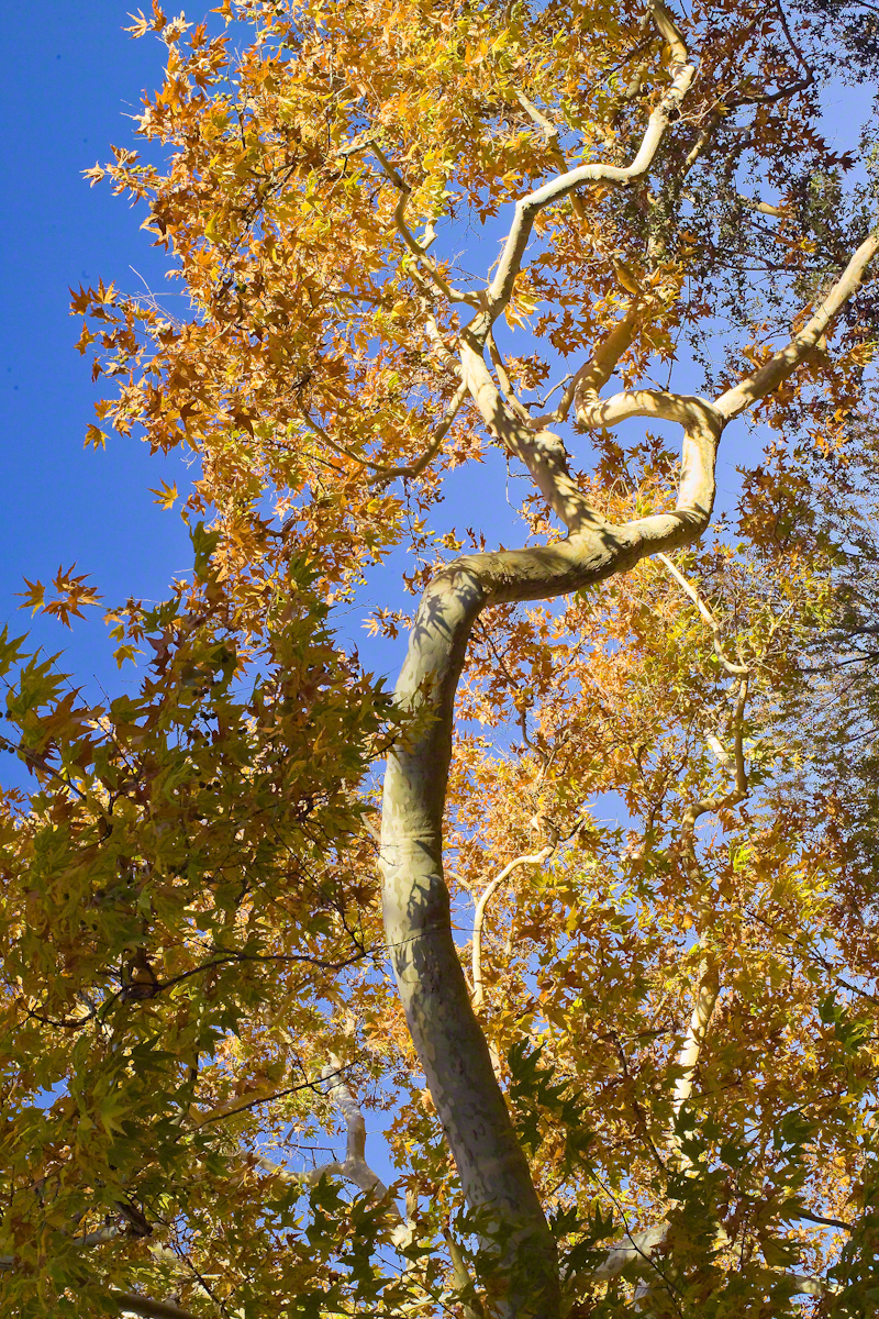
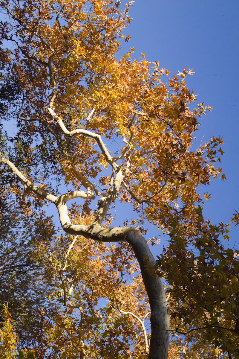
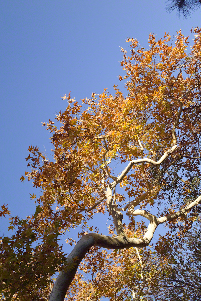
Compare these Arizona Sycamores with the struggling specimen from the last chapter, “A Peaceful Day at Pine Creek.” Many Sycamores such as this one flourish along Reavis Creek, a perennial stream of the eastern Superstition Wilderness. The drainage that feeds Pine Creek is far less acreage than that of Reavis Creek and, when the Pine Creek flow fades in the driest seasons, plants go into survival mode and halt growth and may even slough off limbs to conserve water.
These Sycamores grace a stream that seldom stops flowing, even in the driest of seasons. I had the good fortune to visit the Reavis valley of the Superstition Wilderness in November 2007, when these trees were at peak autumn foliage.
The tree requires a supply of water to thrive. This specimen demonstrates the species growth habit growing multiple trunks with a shape driven by water availability and the environmental context. The multiple trunks may be a desert survival mechanism. In dry periods a trunk or trunks are sloughed off to reduce moisture loss. This is why the Sycamore of “A Peaceful Day at Pine Creek” has a single trunk.”
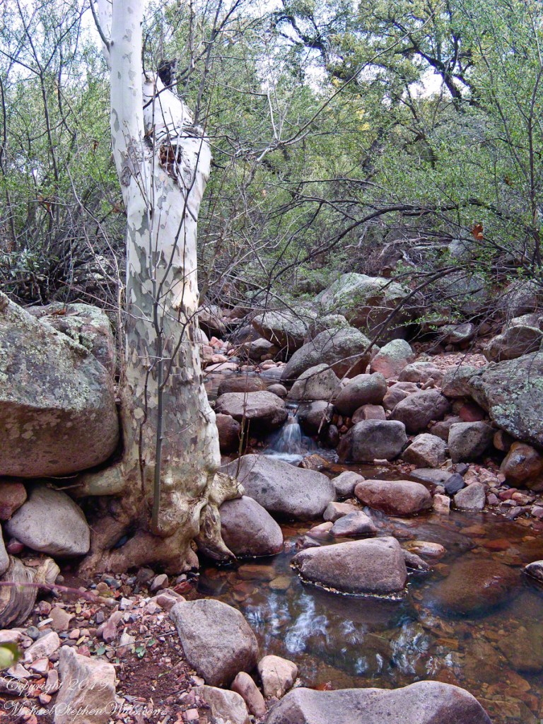
To encounter a riparian space of the Arizona desert is a revelation, to progress from Sonoran desert spaces assailed by the breath of dry wind, to see the first signs of water in the distance as a welcome fluttering of leaves, to feel a welcome odor of water.
Yes, the first effect of a riparian space on the senses is the smell of water. Let’s finish this post with limbs of the Reavis Creek Arizona Sycamore reaching for the sky.