Finding Circlestone

Ancient Ruins

The Searcher’s Tale

Click me for an Arizona Gallery of Fine Art prints by Michael Stephen Wills
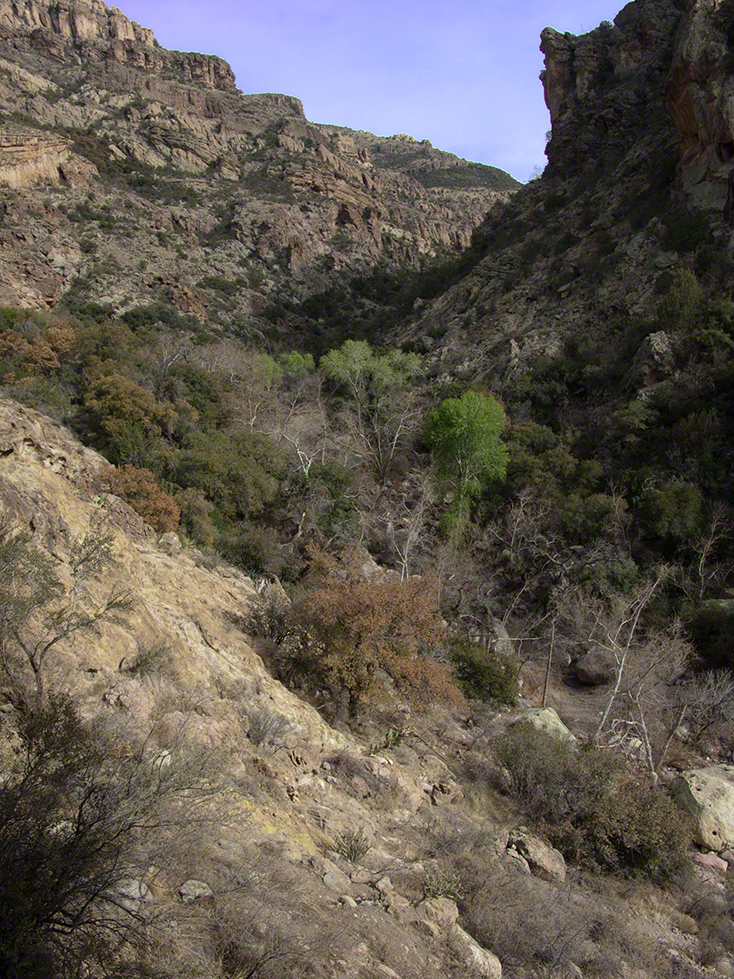
I first learned about Circlestone from stories The Searcher told during my first backpack into the eastern Superstition Mountains, on the Tule trail, April 2005.  I described this in “Riding from Pine Creek to the Reavis Valley” where the Searcher described a stone circle, overgrown with Alligator Juniper, on the slopes of Mound Mountain.  He pointed south toward a peak and foothills that rose from the valley floor and said, “follow the fire trail east from the southern Reavis Ranch valley.”  There were strange happenings associated with Circlestone (as he called it) and he’d never taken the time to go there.  “There is a book full of stories.”  I eventually sought out Circlestone on the web and in books, but after I found it on my own using only the Searcher’s directions and advice from friends met on the way.

Sunset from Castle Dome

Backpacking with my sister

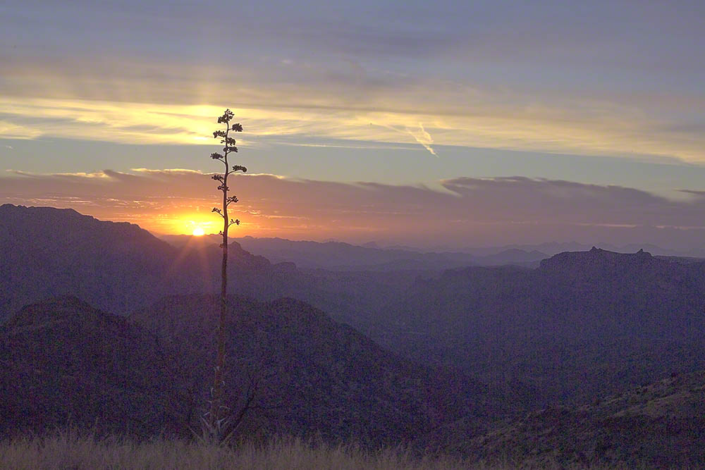
In 2006 I explored Circlestone twice along with my sister, Diane, who accompanied me.  First for nine days early March 2006 using the Reavis Ranch trail from the north and the second for five days in November 2006, coming us the same trail from the south.  Our first trip was Diane’s first “real” backpack adventure and we took it slow with a camp at Castle Dome where there are flat areas and exceptional views.  Above, is the sunset from our second night (I camped the first night next to the car…we took it very, very sloooowwww).

Four Peaks Sunrise

Castle Dome

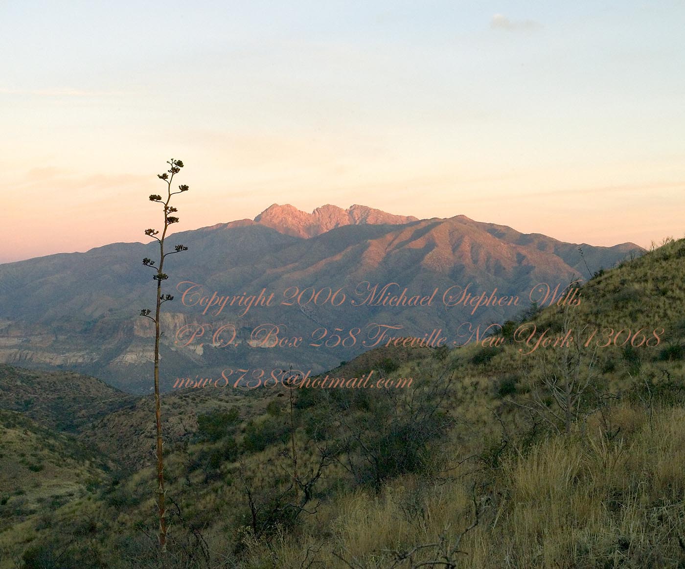
Then, there was morning of our third day.  Here is the Four Peaks Wilderness in the first rays of dawn.  These are green, rolling foothills of grass, low shrubs and a few juniper.  If you know where to look, there’s an unmarked trail to Reavis Falls (the highest waterfall in Arizona).  I found the trail and visited the falls on a later trip.

Castle Dome Sunrise

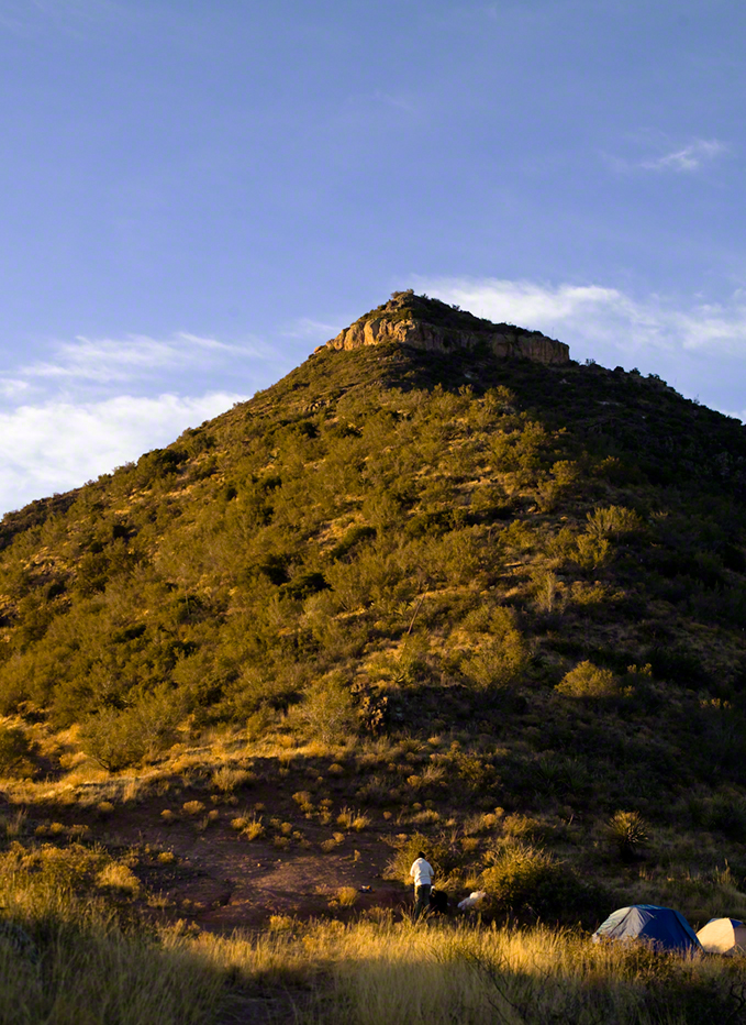
After enjoying the Four Peaks, you turn around and see Castle Dome in the morning light, as in this photograph.  Remember the same of the “dome”, because it is visible from the ultimate view from Circlestone.

Reavis Valley and White Mountain from the trail to Circlestone

The Trail to Circlestone

Our camp was in the Reavis Valley, one of the first sites along the creek coming from the north.  There were fantastic rock formations across the creek.  Not far from there, the land falls away into steepness and then Reavis Falls.   The Searcher told me about going that way, once.  There is no trail down to the falls overlook and deep canyon carved by the water.

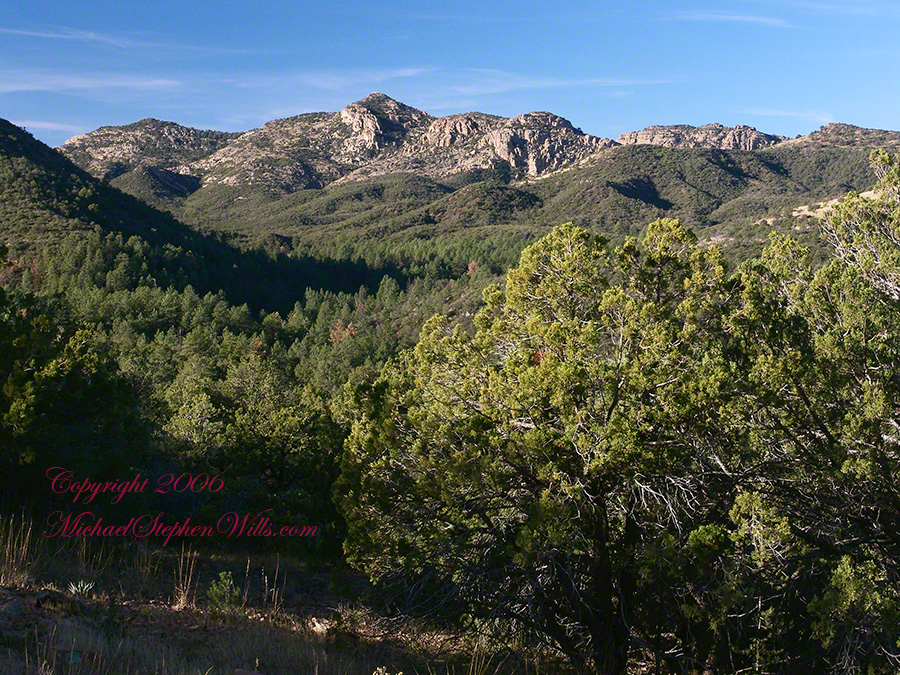
This photograph, above, is from a lovely forest of pinyon trees that grow along the trail to Circlestone (described by the Searcher as rising from the southern Reavis Valley).  You can see the valley, just to the right, and a longer and steeper valley that rises from it up to White Mountain.  That way is the southern legs of Reavis Trail.  I have a movie clip from this same spot of the pinyons moving in the breeze and may post it at a later time.
All of the trail to Circlestone is a climb.  You pass over “Whiskey Spring”, named for a still kept there in the 1800’s and over a steep defile gouged from the rock.  The trail is well marked and I am told that, sometimes, there is no cairn marking the trail to Circlestone.  If you are desperate to get there, look-up some excellent hiking directions available on the web.  I have even found the circle on GoogleEarth, since I know where to look.  If you like a challenge and the adventure,  go from the directions the Searcher gave me.

Four Peaks from Circlestone

From the fire line trail, the unmarked branch to Circlestone climbs steeply and follows a ridge through Alligator juniper, punctuated by stalks of century plant, to a broad way that rises to Circlestone as though to a monument overgrown by the same juniper.

My Circlestone Mystery

There was an unusual experience on our first trip, on this portion of the trail.  We were winding through the Juniper and, as it happened, Diane fell behind.  After awhile I missed her and waited and, after a minute, went back to look for her.  I found Diane sobbing uncontrollably, deep in grief over our father who passed away eleven years before.  We talked about it until she felt better.  She said it was as though a door opened and she could feel out father.  What makes this exceptional is Diane is not given to anything like this and I ascribe her deep grief to the nature of the site.  It is a mystery to this day.

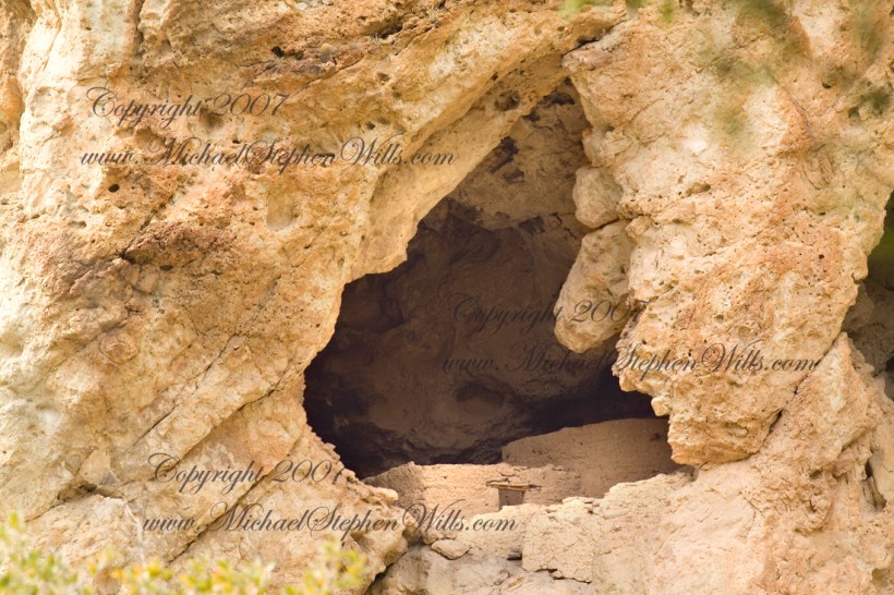
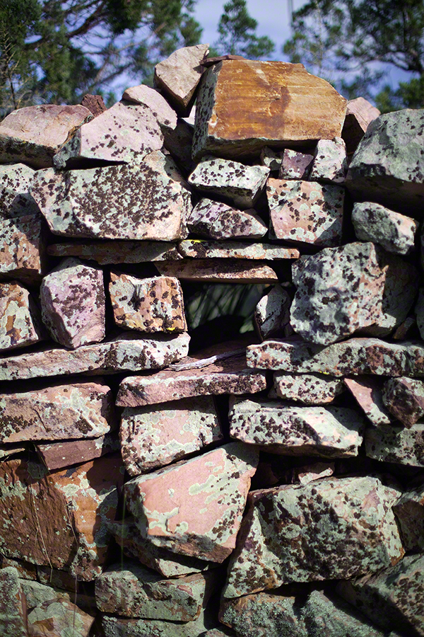
At Circlestone, that first trip, we explored and experienced the site.  You cannot see the entire wall at any point and need to wander through and over it, being careful not to disturb anything.  Here and there, in the outer wall, are openings like the one in this photograph.

Site-Hole in the Circlestone Wall

At Circlestone

I call it a site hole because, on your knees, it is possible to look through and see the distant view through the trees.  As you can see, the stones are a striking red color with green lichen growing thick.

On the second trip in November, knowing the way and having great weather, I brought my cameras to capture the exceptional views, one of which is above.  I’d dearly love to come back to camp just below the ruin and do some work in the evening and morning light.  For now, I can enjoy those views from Castle Dome.

Three Horsemen and Castle Dome

Can you see the dome in the middle distance.  I did a portrait of three horsemen who road up to Circlestone in November.  We came to know them pretty well, that afternoon and the following morning down in the valley.

Three Horsemen

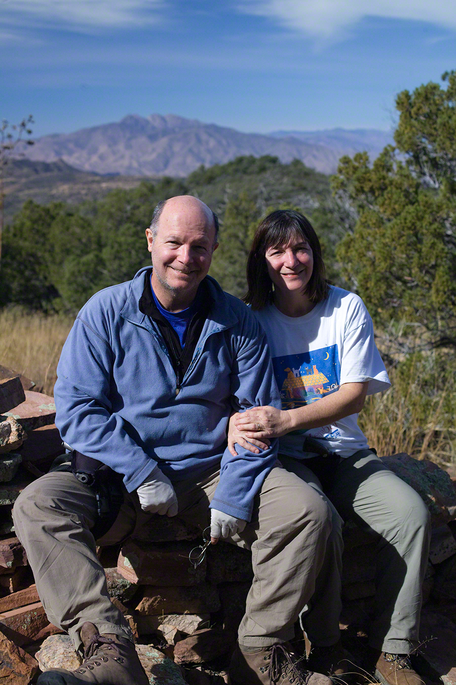
I carted up a tripod, so you can see Diane and I in the same spot.

Mike and Diane at Circlestone
Copyright 2023 Michael Stephen Wills, All Rights Reserved

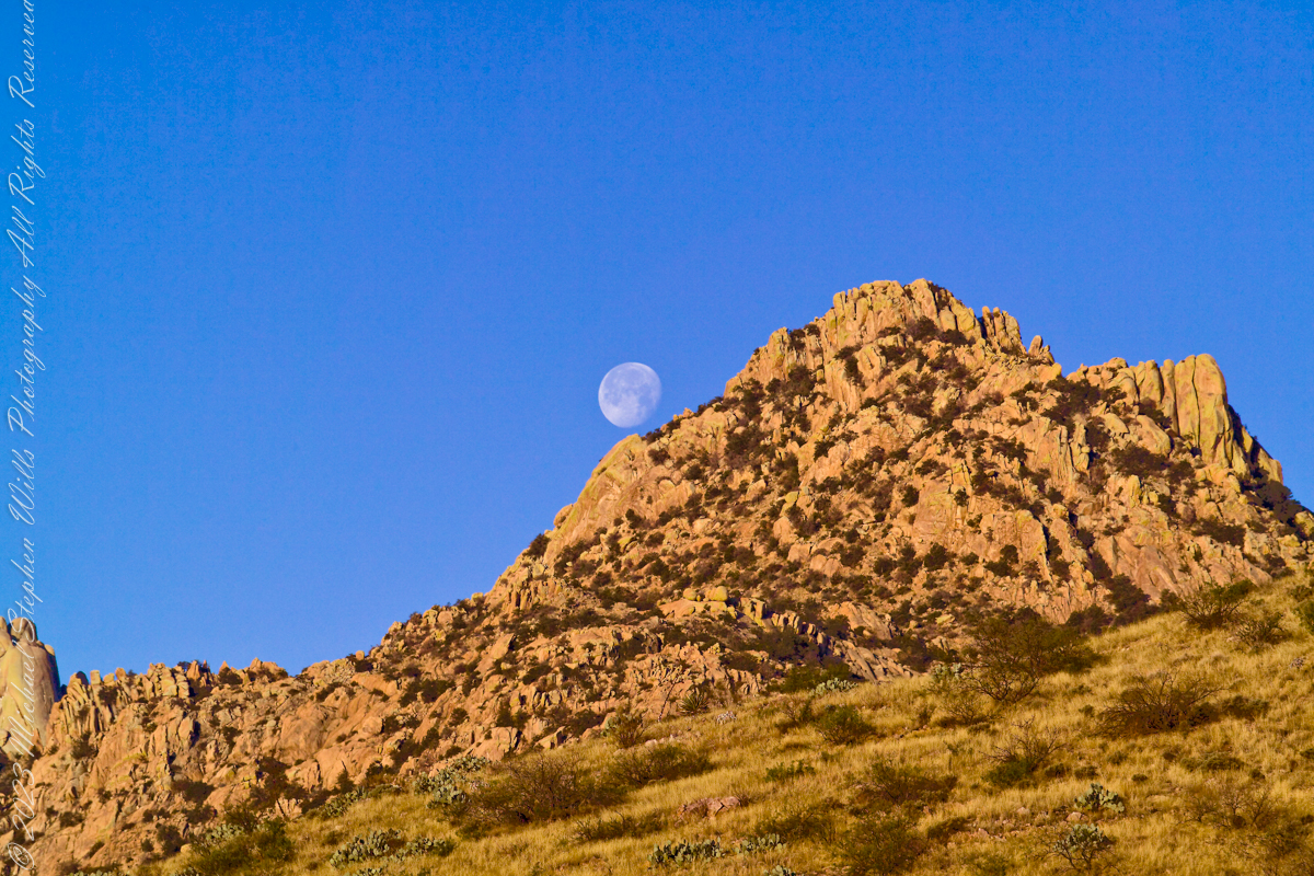
Cochise Stronghold and Moon

at dawn

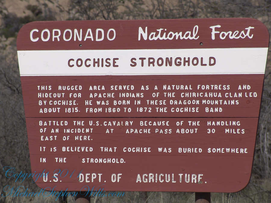
Interstate 10 between Benson and Wilcox ascends through a field of enormous, eroded granite boulders. Off to the west are the Dragoon Mountains, otherwise known as “Cochise Stronghold.” This rugged area served as a natural fortress and hideout for Apache Indians of the Chiricahua clan led by Cochise. He was born in this Dragoon Mountains about 1815. From 1869 to 1872 the Cochise band battled the U.S. Calvary because of the handling of an incident at Apache Pass about 30 miles east of here. It is believed that Cochise was buried somewhere in the Stronghold.

Click me for an Arizona Gallery of Fine Art prints by Michael Stephen Wills

Informative sign at campsite

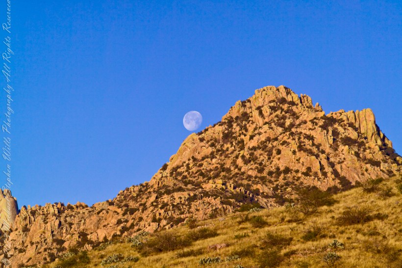
One April morning, very early, on the road to Cochise Stronghold. We stopped everything for me to unload the equipment to capture a gibbous moon low in the west, grazing a hoodoo ridge of Cochise Stronghold of the Dragoon Mountains. Near Dragoon, Cochise County, Arizona

Copyright 2023 Michael Stephen Wills All Rights Reserved

Anniversary Wildflower, crocus

The crocus has been known throughout recorded history, mainly as the source of saffron.

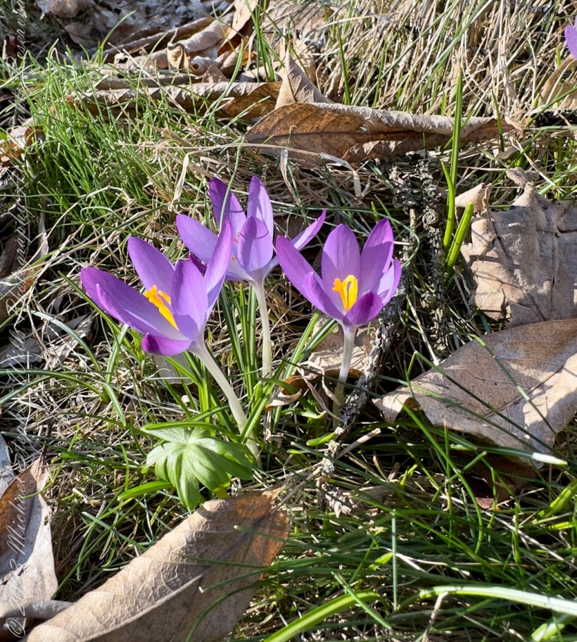
I found crocuses blooming beneath our magnolia tree on our 14th anniversary, Monday, March 20, 2023.

The following photograph is from the Apple IPhone 14 ProMax, raw format and perfected on the phone. The rest are from the Canon 5D Mark IV with the lens EF 100mm f/2.8 Macro USB.

Click Me for more photographic art from my OnLine Gallery, “Finger Lakes Memories.”

“Crocus is a genus of seasonal flowering plants in the family Iridaceae (iris family) comprising about 100 species of perennials growing from corms. They are low growing plants, whose flower stems remain underground, that bear relatively large white, yellow, orange or purple flowers and then become dormant after flowering. Many are cultivated for their flowers, appearing in autumn, winter, or spring. The flowers close at night and in overcast weather conditions.”

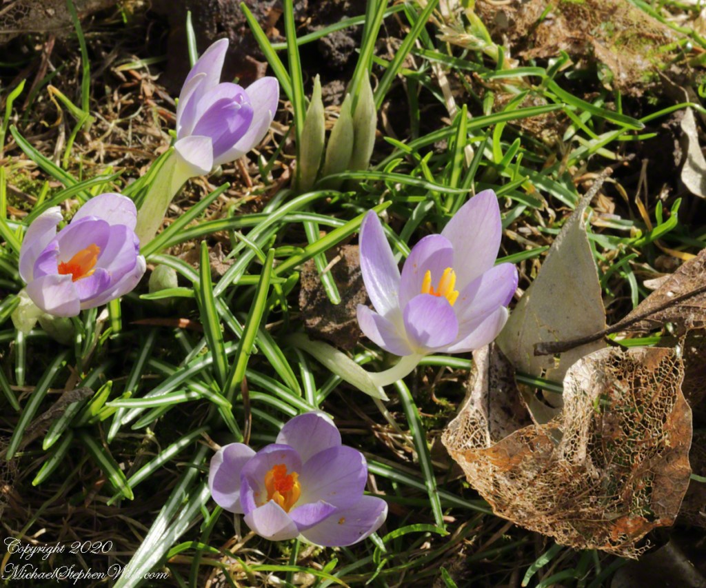
Here are partially closed blooms under the same magnolia tree on a very cold March 2020 afternoon.

“The crocus has been known throughout recorded history, mainly as the source of saffron. Saffron is obtained from the dried stigma of Crocus sativus, an autumn-blooming species. It is valued as a spice and dyestuff and is one of the most expensive spices in the world. Iran is the center of saffron production. Crocuses are native to woodland, scrub, and meadows from sea level to alpine tundra from the Mediterranean, through North Africa, central and southern Europe, the islands of the Aegean, the Middle East and across Central Asia to Xinjiang in western China. Crocuses may be propagated from seed or from daughter cormels formed on the corm, that eventually produce mature plants. They arrived in Europe from Turkey in the 16th century and became valued as an ornamental flowering plant.” Source: wikipedia “crocus”

Copyright 2023 All Rights Reserved Michael Stephen Wills

Pinelands Connections III a repost

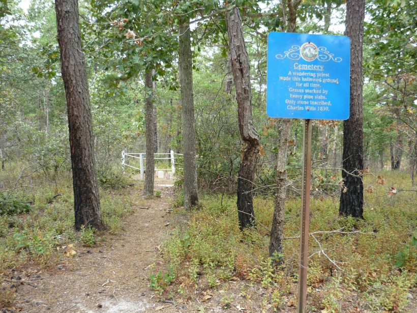
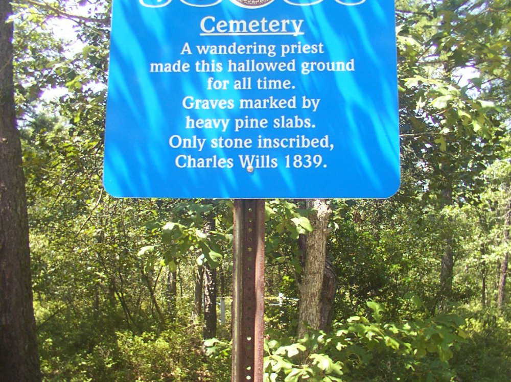
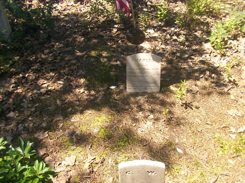
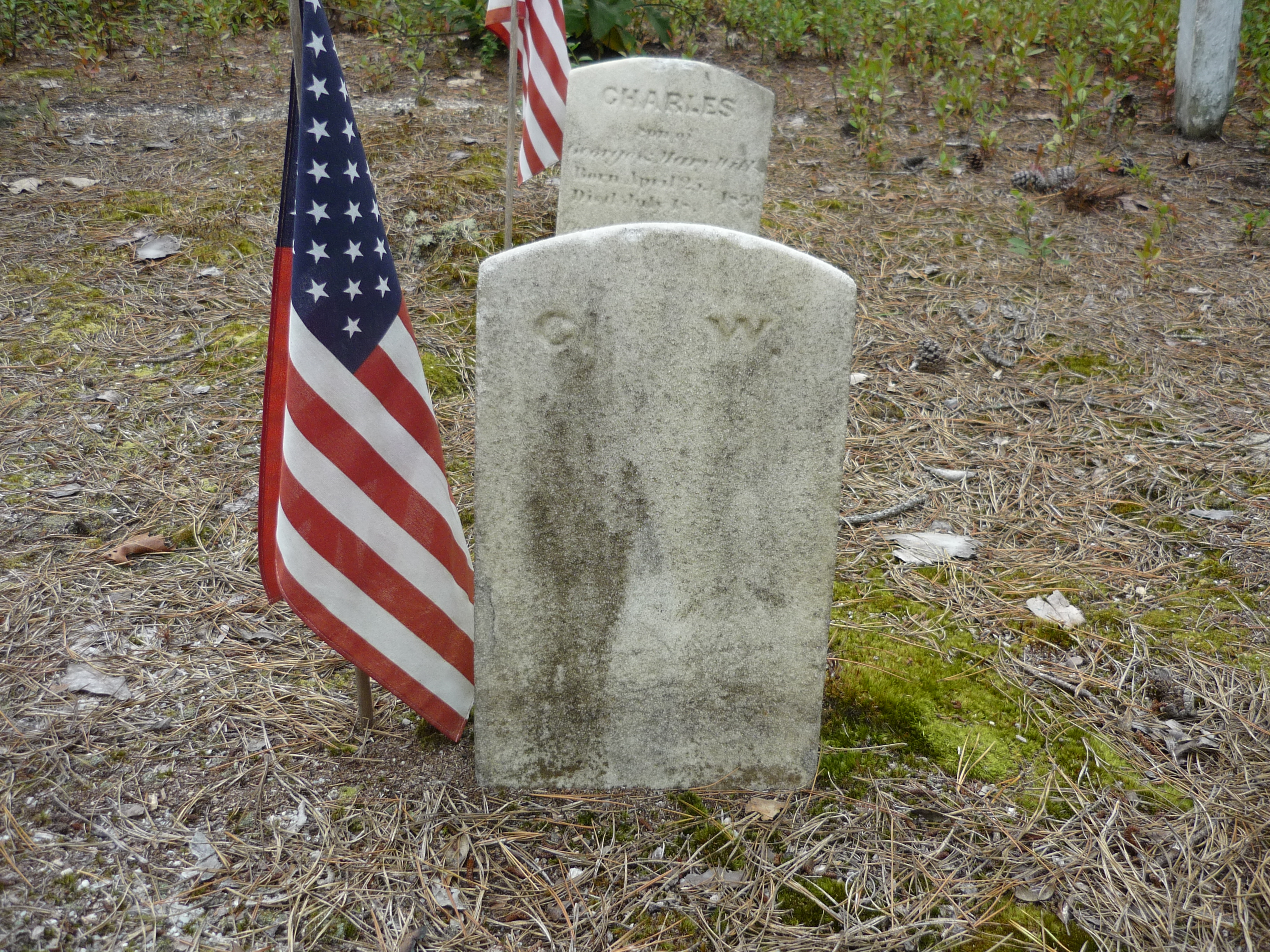
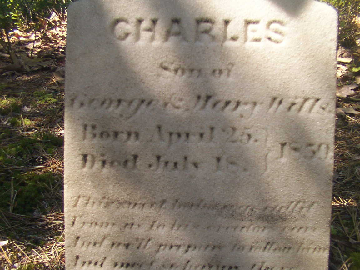
Great Uncle Charles Wills (repost)

Click Me for the complete story

Today I spiffed up the Google Maps entry for this spot. Click the link, above, for more of this story.

Copyright 2023 Michael Stephen Wills All Rights Reserved

Kiva, Sipapu, Omphalos

Place Sense

Discovery

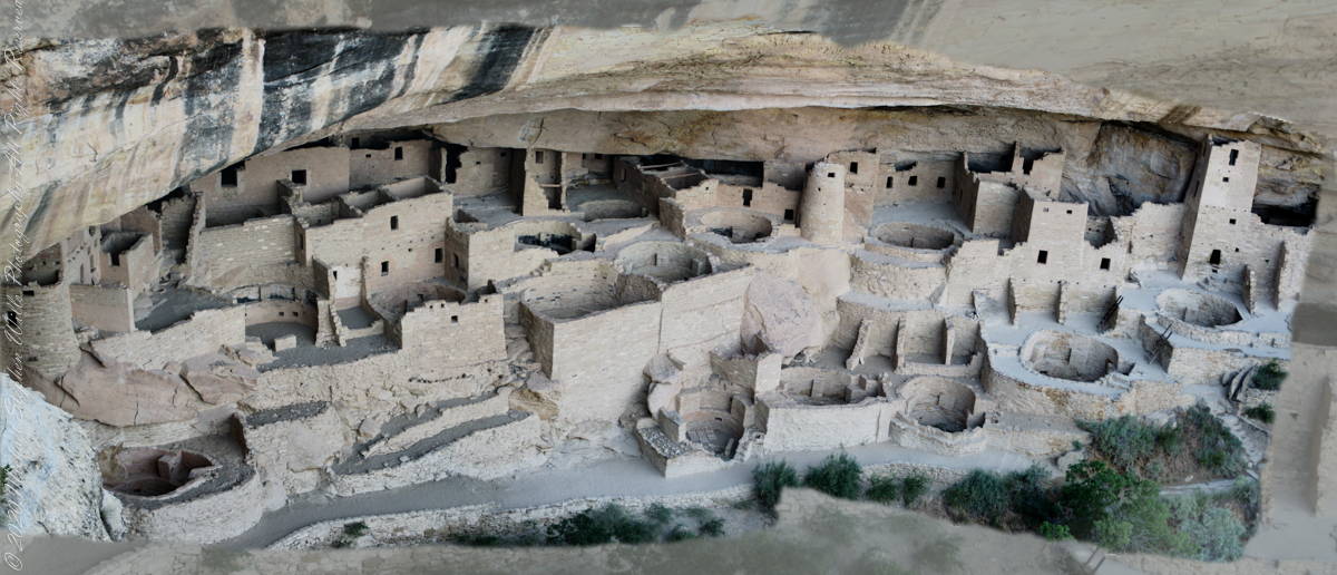
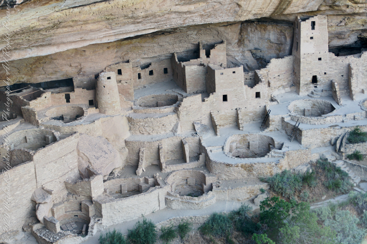
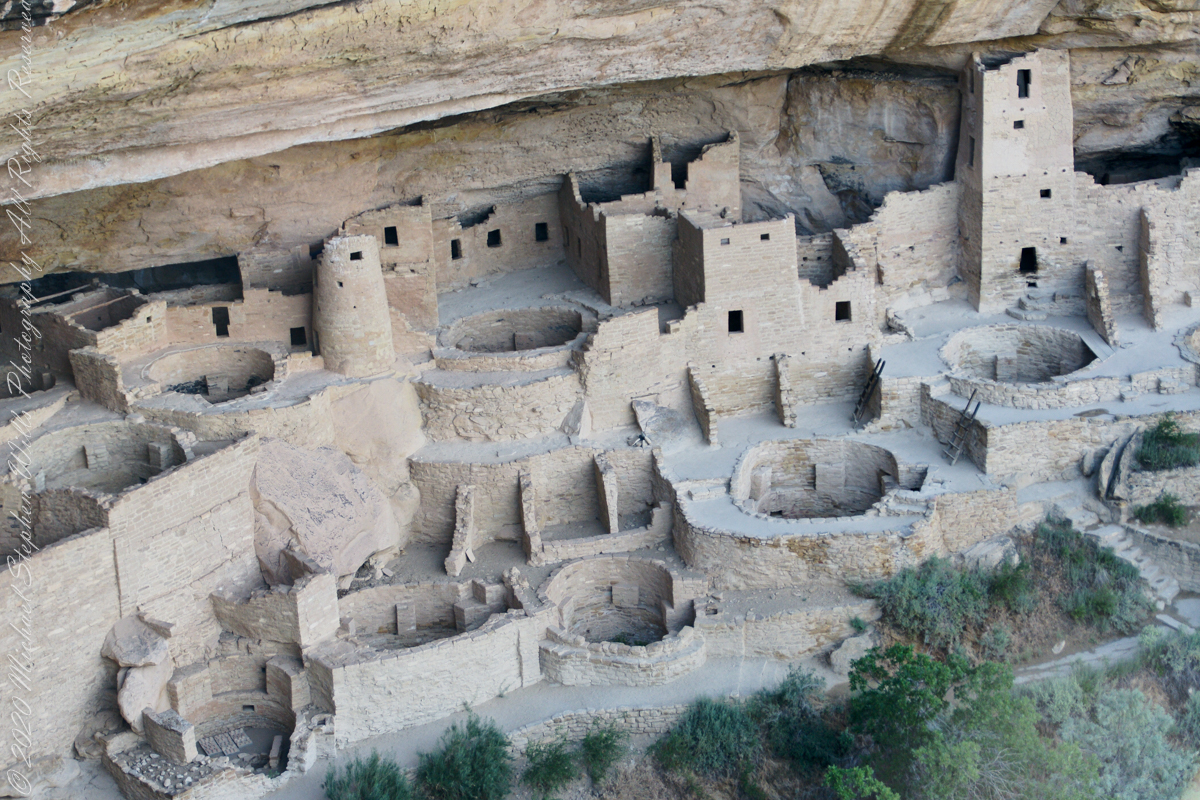
How many of the Mesa Verde 23 kivas can you identify in this panorama? You many need to read this post before answering.

Cliff Palace panorama from two images

Click me for more Mesa Verde works in my Fine Art Gallery

What is a Kiva?

A kiva is a space used by Puebloans for rites and political meetings, many of them associated with the kachina belief system. Among the modern Hopi and most other Pueblo peoples, “kiva” means a large room that is circular and underground and used for spiritual ceremonies.

The Square Tower with four Kivas

Similar subterranean rooms are found among ruins in the North American South-West, indicating uses by the ancient peoples of the region including the ancestral Puebloans, the Mogollon, and the Hohokam.

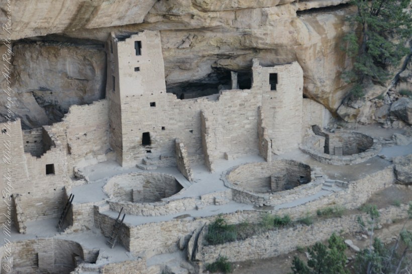
A portion of Cliff Palace including many Kivas, the round and square towers.

Those used by the ancient Pueblos of the Pueblo I Period and following, designated by the Pecos Classification system developed by archaeologists, were usually round and evolved from simpler pit-houses.

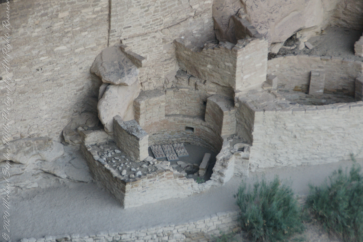
Two Kivas, one with broken wall.

For the Ancestral Puebloans, these rooms are believed to have had a variety of functions, including domestic residence along with social and ceremonial purposes.

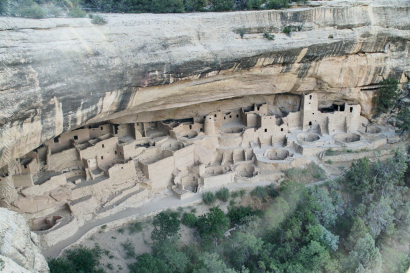
The entire Cliff Palace from the overlook, from a single wide-angle image.

During the late 8th century, Mesa Verdeans started building square pit structures that archeologists call protokivas. They were typically 3 or 4 feet (0.91 or 1.22 m) deep and 12 to 20 feet (3.7 to 6.1 m) in diameter. By the mid-10th and early 11th centuries, these had evolved into smaller circular structures called kivas, which were usually 12 to 15 feet (3.7 to 4.6 m) across.

Sipapu

Mesa Verde-style kivas included a feature from earlier times called a sipapu, which is a hole dug in the north of the chamber that is thought to represent the Ancestral Puebloans’ place of emergence from the underworld

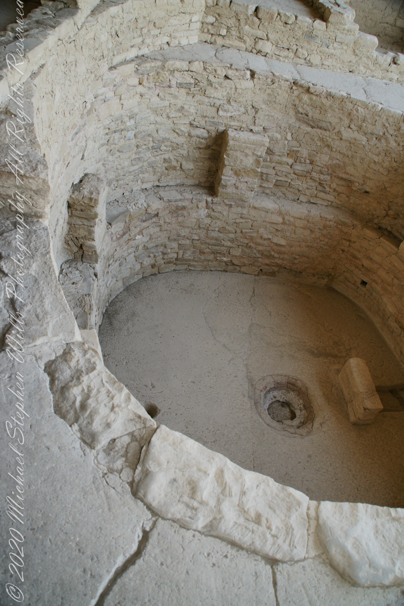
Here is a close-up of the kiva floor of the Balcony House. 

Balcony House Kiva

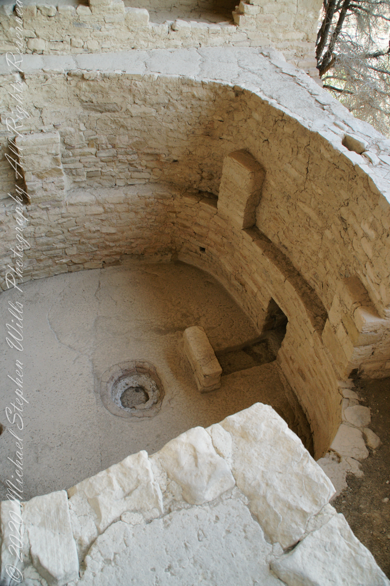
The sipapu is the smaller pit in the floor to the left (north side) and partially blocked by the kiva wall. The larger is a firepit. The small wall to the right is placed to deflect airflow from a floor vent.

Balcony House Kiva, to the right is the floor vent in wall and deflector stone. There is the firepit and a tiny portion of the sipapu at the left edge.
I count 14 Kivas in the Cliff Palace panorama, including some with broken walls.

What is the Connection, if any, between Omphalos and Sipapu?

The global coordinate system was known to ancient Greeks, in fact they are credited with the discovery a system to locate any place on earth, an insight contained in myths of how Zeus founded Delphi as the “center of the world,” the place from which divinity irrupts, by setting two eagles at opposing ends of the world to fly, starting at the same time, same speed, the central world point identified by where the eagles’ paths crossed.

Bronze Coin from the Ptolemaic Kingdom of Egypt, reign of Ptolemy VI 2nd Century BC with the head of Zeus on one side and double eagles riding a thunderbolt on the other

To signify Delphi as this center a religious stone artifact, called an omphalos, was placed.

Most accounts locate the Delphi omphalos in the adyton (sacred part of the temple) near the Pythia (oracle). The stone sculpture itself  (which may be a copy) is there to this day.  The surface is a carving of a knotted net, the center hollow and widening towards the base. The omphalos represents the stone which Rhea wrapped in swaddling clothes, pretending it was newborn Zeus, in order to deceive Cronus. (Cronus was the father who swallowed his children so as to prevent them from usurping him as he had deposed his own father, Uranus).

The omphalos stone was believed to allow direct communication with the gods.  Historians theorize the stone was hollow to allow intoxicating vapors breathed by the Oracle (priestess) to channel through it. However, understanding of the use of the omphalos is uncertain due to destruction of the site by Theodosius I and Arcadius in the 4th century CE.

That leaves us with the word, omphalos. In Greek the original meaning is navel, the anatomical reminder to humans of their source.

Comparing and contrasting these terms used by cultures separated widely by geography and time:

— sipapu is a religious symbol of the place ancestral peoples irrupted, born, into this world, emerging from the earth. From my readings, the word sipapu is a direct reference to the symbol. There are many sipapu, small holes in the floor of kivas (timetimes a hole in a wooden plank), representing a single place.

— omphalos is a religious symbol of where the divine irrupts into the world, from the earth, with direct linguistic natal (birth) associations. A single omphalos stone designates a single place.

Copyright 2023 Michael Stephen Wills All Rights Reserved

Chapin Valley Views

Northwest from the Mesa Verde Park Road

A pullover on the park road proves this, northwest morning view of the Mancos Valley. The lush grass in foreground is a reason the mesa is called “verde,” meaning green in the Spanish language.

The Mancos Valley has been settled since at least the 10th century AD, although various severe conditions in the mid to late 13th century saw the area and its multitude of small villages abandoned by the Ancient Pueblo People (Anasazi).

The Mancos area is dotted with inventoried and un-inventoried archeological sites, including both isolated houses and shelters and small village complexes. Mancos Valley residents were probably among those who withdrew to the cliff dwellings on Mesa Verde, perhaps for defensive purposes, due to climate change, or as part of concentration policy of possible invaders and occupiers of the region.

Control of the area was contested by nomadic Navajo and Ute people for centuries. Spanish friars and military passed through the area as part of the Old Spanish Trail connecting New Mexico and California in the 18th century. The name “Mancos” comes from the Domínguez–Escalante expedition of 1776, though the reason for the name remains unclear (see below). By some unverified accounts, the name Mancos refers to the crippled nature of the Spanish explorers’ horses after they crossed the San Juan Mountains. According to unverified lore, the horses were rejuvenated by the lush green grass in the Mancos Valley. Somewhere in the town is the point at which the expedition crossed the Rio Mancos on its way to California from Old Mexico. Mesa Verde National Park, Montezuma County, near Cortez, Colorado.

Reference

“Mancos, Colorado” Wikipedia

Click me for more Mesa Verde works in my Fine Art Gallery

Copyright 2023 Michael Stephen Wills, All Rights Reserved

Round Tower of the Cliff Place

Imagine

Overviews

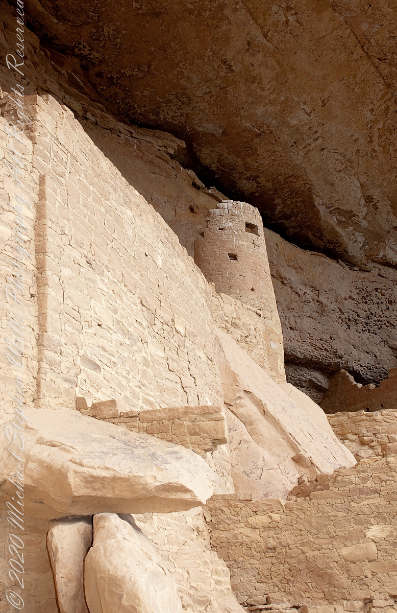
Looking over my photographs from Mesa Verde National Park I find the Cliff Palace Round Tower to be a unique structure. You can see it in this shot taken from the Cliff Palace Loop overlook…..

The Round Tower is on the upper left, between two kivas (appearing to be two round pits). The round shape of the tower is not readily apparent from this angle.

It is easier to see here from this photograph taken from the Cliff Palace footpath from the mesa top.

The Round Tower is on the left.

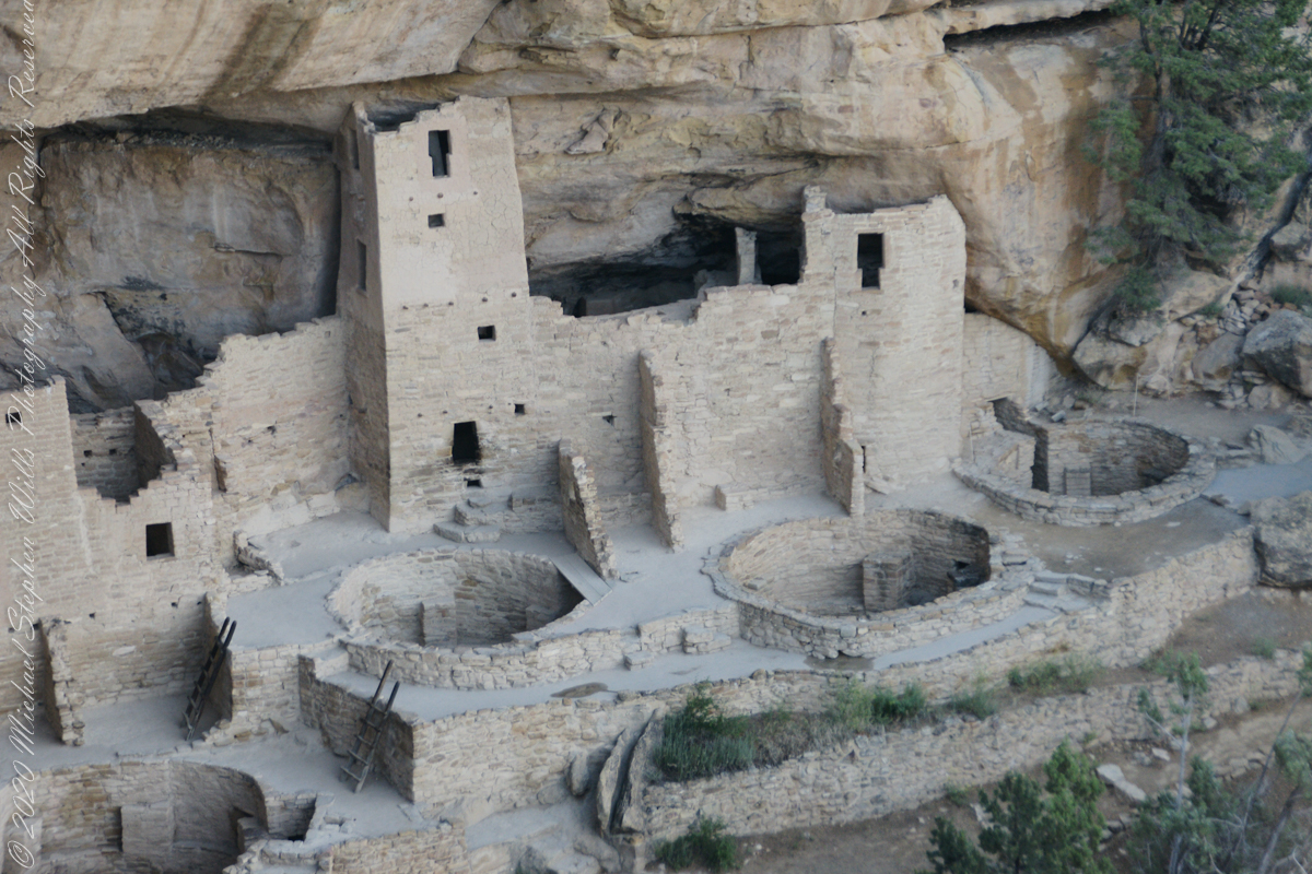
Here is a closer view, with surrounding structures for context.

Click me for more Mesa Verde works in my Fine Art Gallery

Inspiration and Influence

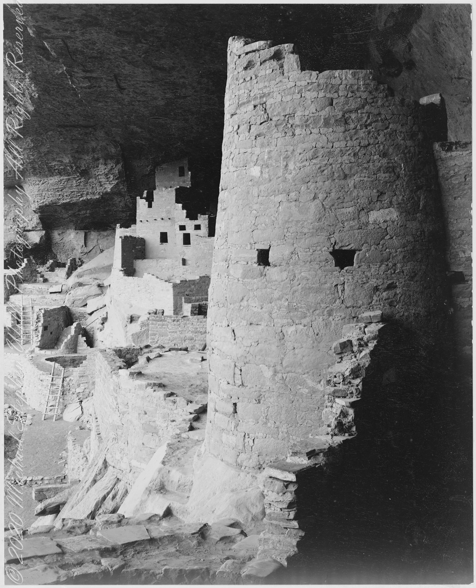
In 1941 the National Park Service commissioned noted photographer Ansel Adams to create a photo mural for the Department of the Interior Building in Washington, DC. The theme was to be nature as exemplified and protected in the U.S. National Parks. The project was halted because of World War II and never resumed.

The holdings of the National Archives Still Picture Branch include 226 photographs taken for this project, most of them signed and captioned by Adams (the following photograph had neither title or caption). Almost all are in the public domain, as is the following image. Adams was allowed free access to the ruins and had the luxury of time to stage perfect lighting.

The creator compiled or maintained the parent series, Ansel Adams Photographs of National Parks and Monuments, between 1941–1942. Ansel Adams provided no caption to this photograph; this information was compiled by Michael Stephen Wills from the United States National Archives Catalog “Series: Ansel Adams Photographs of National Parks and Monuments”.

Mary Elizabeth Jane Colter’s Desert View Watchtower (1932), on the Grand Canyon’s South Rim, was inspired in part by this round tower. She traveled throughout the southwest to find inspiration and authenticity for her buildings. The architecture of the ancestral Puebloan people of the Colorado Plateau served as her model. This particular tower was patterned after those found at Hovenweep and the Round Tower of Mesa Verde. Colter indicated that it was not a copy of any that she had seen, but rather modeled from several cliff dwellings.

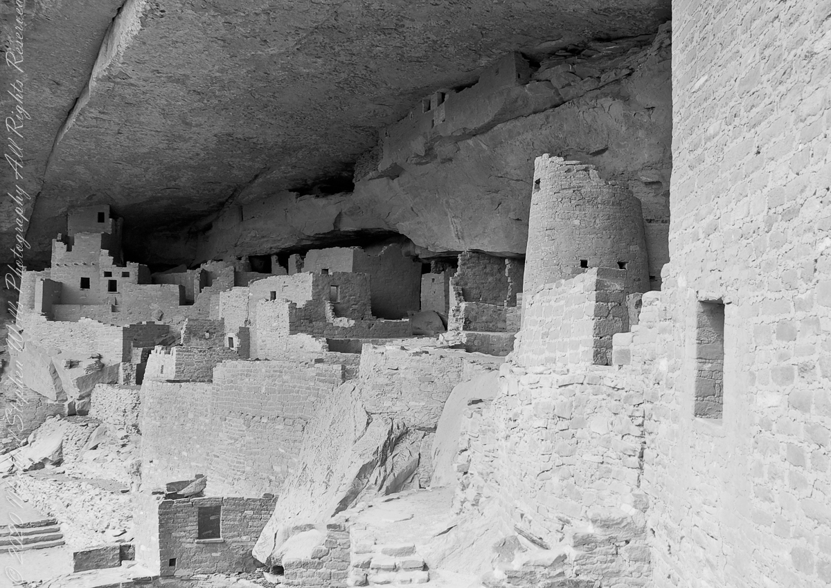
The following photographs are my closest approximation to Ansel Adams composition. Taken during a public Ranger guided tour of Cliff Palace, I was standing next to the Square Tower (see my post “Square Tower as Viewed from the Kiva.”

The same image produced as Black and White.

Extension

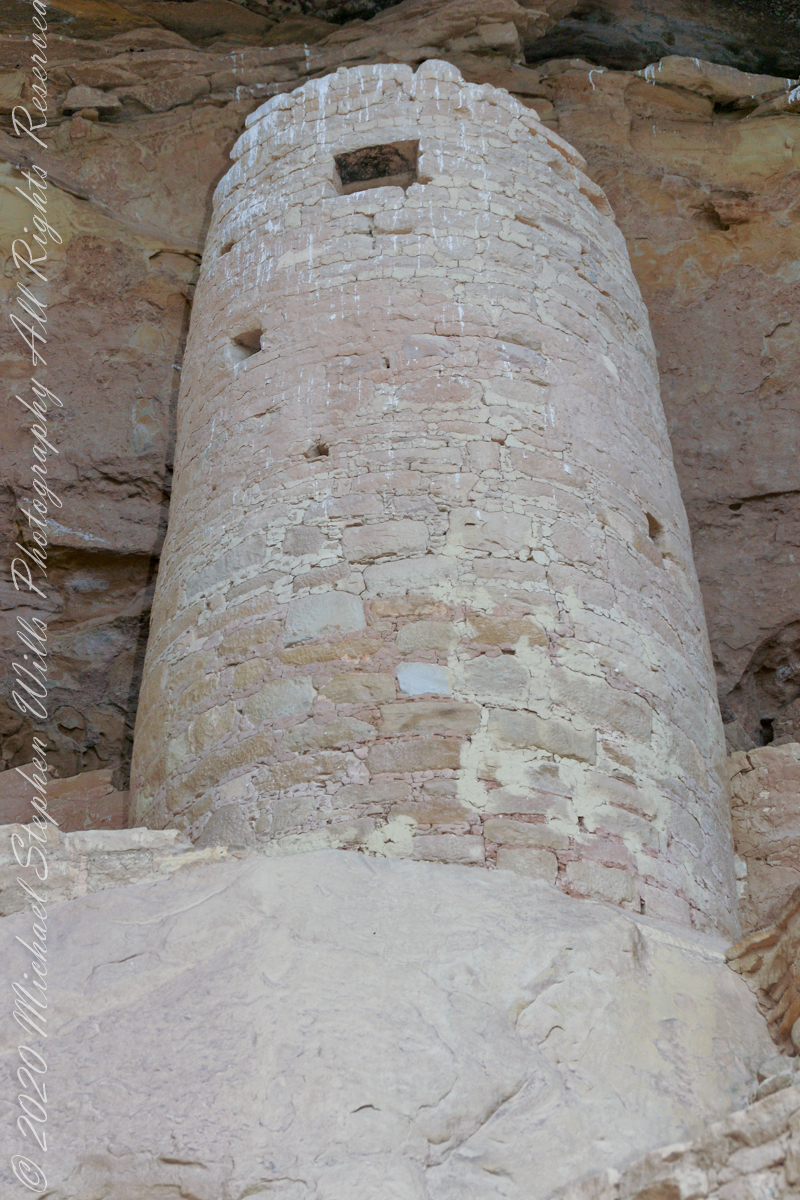
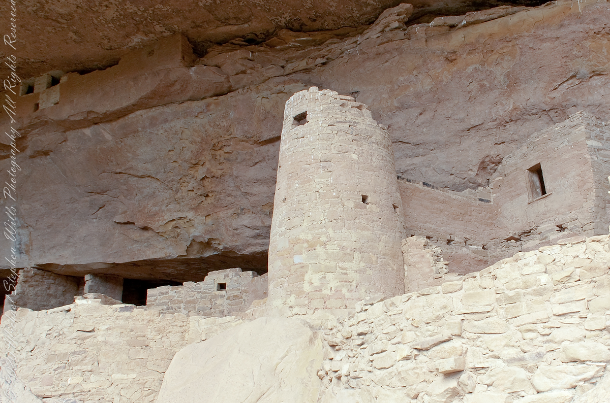
The Round Tower is more compelling when viewed from below, in the following photographs.

Looking through these images I challange you, the reader, to compare the Round Tower with the right angles, straight walls of the other above ground structures and, then, the round Kivas in the grounds, essentially the Round Tower is an extension of the round kiva and sipapu toward the heavens.

Click Me for more background on the discovery and excavation of the Cliff Palace

Copyright 2023 Michael Stephen Wills All Rights Reserved

Square Tower House

Viewed from Mesa Top Loop Road

Featuring the tallest standing structure in the park, an intact kiva roof, original plaster and paint, and plentiful rock art, Square Tower House is one of Mesa Verde’s most impressive cliff dwellings.

Click me for more Mesa Verde works in my Fine Art Gallery

Located off the Mesa Top Loop, at the head of Navajo Canyon, this cliff dwelling is only accessible on a ranger guided tour, for a fee. Tickets for the tour are limited, so get them before your arrive. There is a viewing point just off the loop road. Mesa Verde National Park, Montezuma County, near Cortez, Colorado.

The two rooms here are what seems to be a round wall, possibly a kiva ruin, on the left and a single story building, on the right, being the single wall with an opening for access. They probably blocked the opening in cold weather to conserve heat. It is possible this site had a special use and was occupied for a limited period of time each season/year.

Copyright 2023 Michael Stephen Wills All Rights Reserved

Around the Kiva

Imagine

Discovery

Imagine yourself as Richard Wetherill in December 1888 rounding up stray cattle on a mesa top, in a snow storm, riding through a very familiar pinyon and juniper forest.  You ride to the mesa edge overlooking a huge canyon and, in the distance and through the snow, see a this “magnificent city.”

Click me for more Mesa Verde works in my Fine Art Gallery

Today

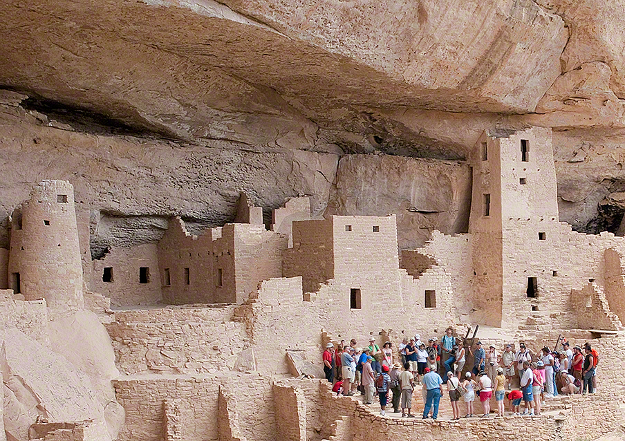
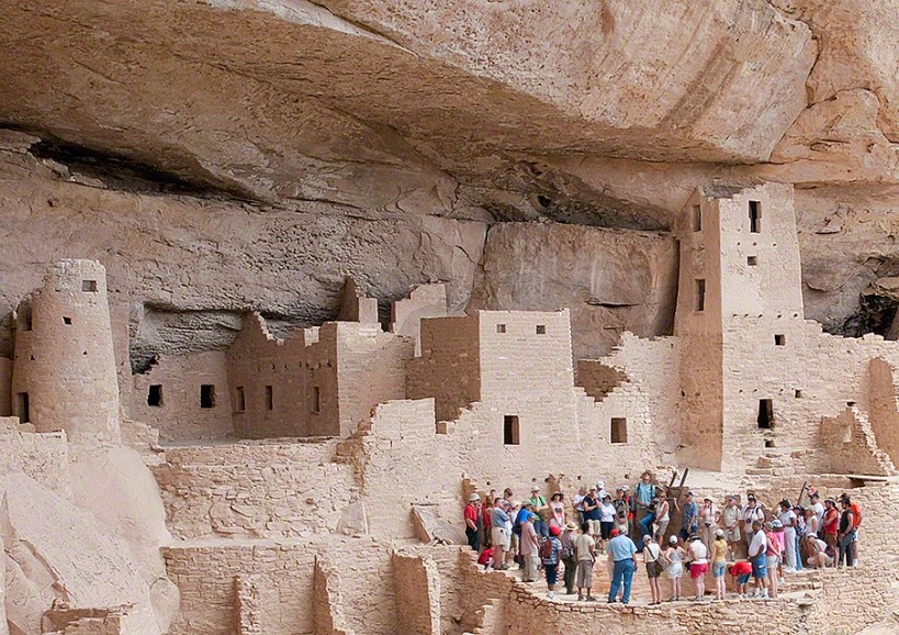
The site is protected and access restricted to these tour groups.  I skipped the lecture, as interesting as it was, to use the time to capture the images in these blogs.  Here is an overview of the northeastern Cliff Palace, including the square (see previous blog) and round towers with the tour group gathered around one of the Cliff Palace kivas.

Sipapu

Here is a close-up of the kiva floor of the Balcony House.  Sipapu is a Hopi word for the small hole or indentation in the floor of kivas used by the Ancient Pueblo Peoples and modern-day Puebloans. It symbolizes the portal through which their ancient ancestors first emerged to enter the present world.

The sipapu is the smaller pit in the floor to the left (north side) and partially blocked by the kiva wall. The larger is a firepit. The small wall to the right is placed to deflect airflow from a floor vent.

Click Me for more background on the discovery and excavation of the Cliff Palace

Copyright 2023 Michael Stephen Wills All Rights Reserved

Square Tower as viewed from the Kiva

Cliff Palace Access

Pam and I arrived at Mesa Verde early one summer morning in July and spent time understanding the landscape of the ruin sites and the lighting.  I made a mental visit plan and decided to arrive at the cliff palace mid-afternoon and it turned out, of the tour times available, this was the best.  It is possible to make special arrangements for access, to take photographs, and maybe I will give this a try in my next life.

Click me for more Mesa Verde works in my Fine Art Gallery

Four Stories

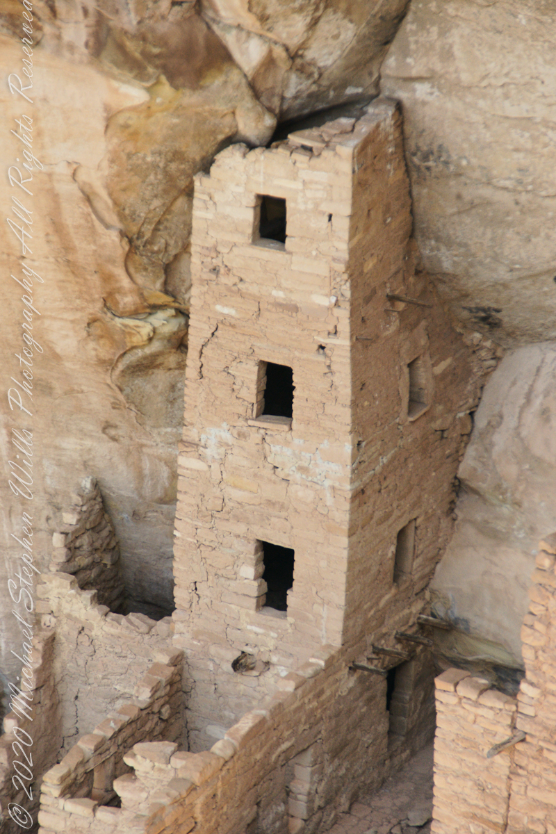
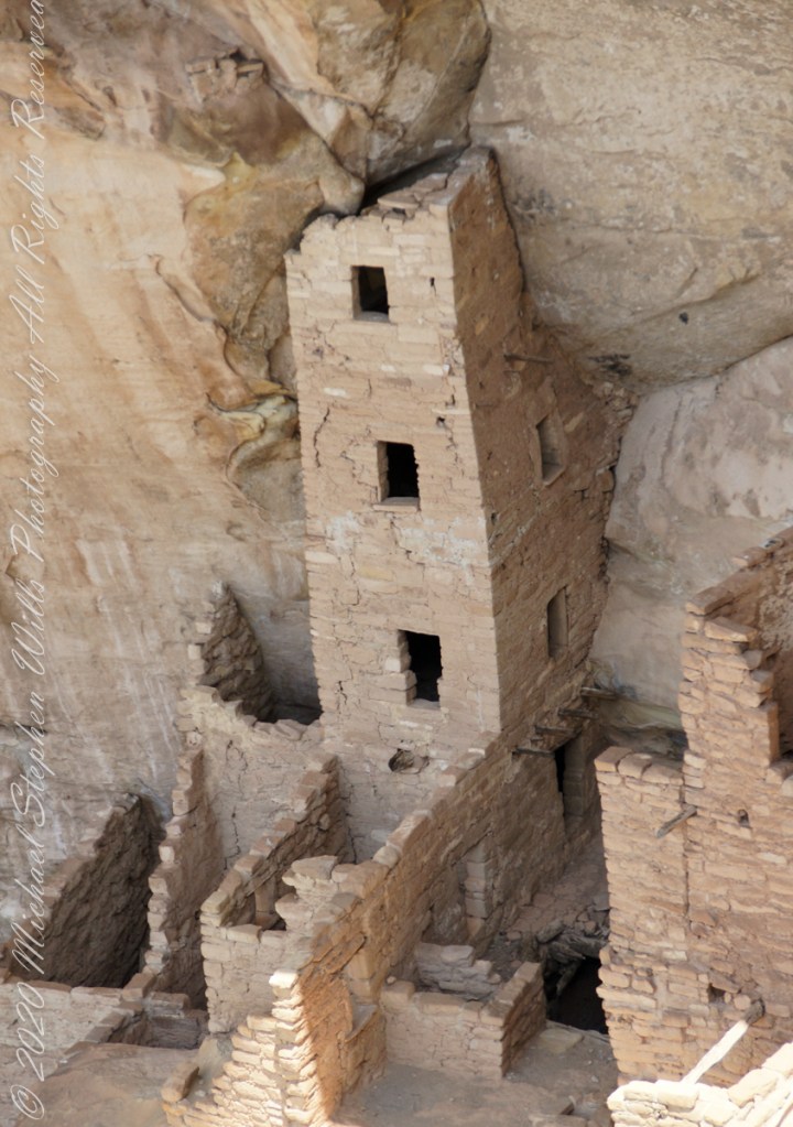
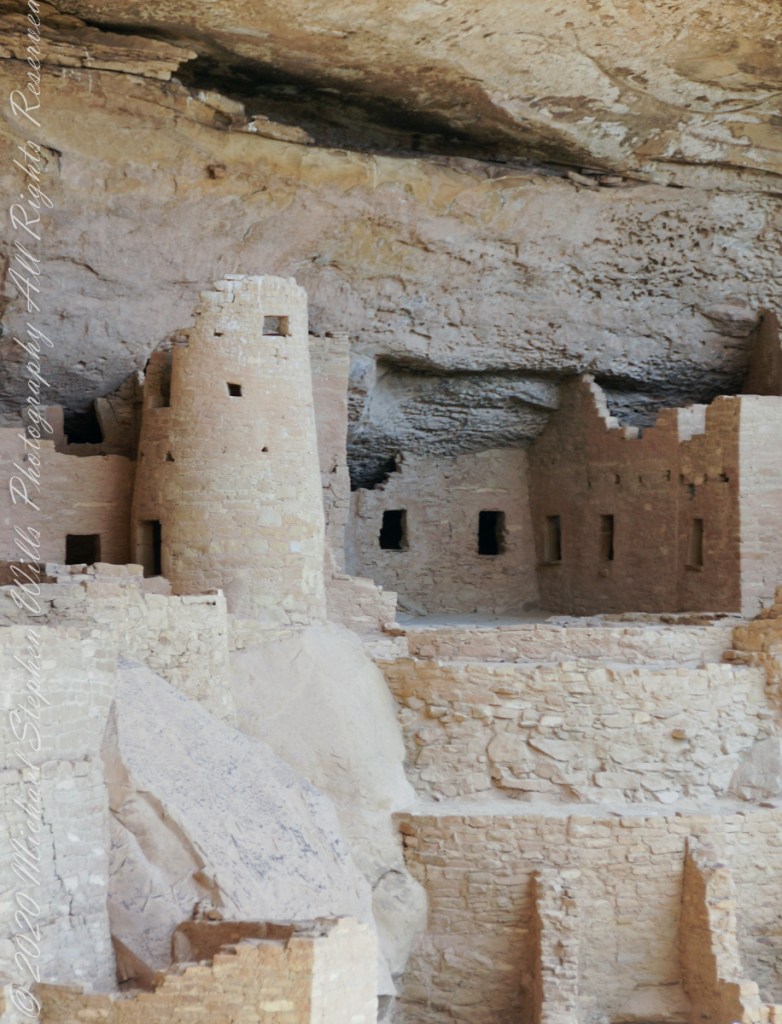
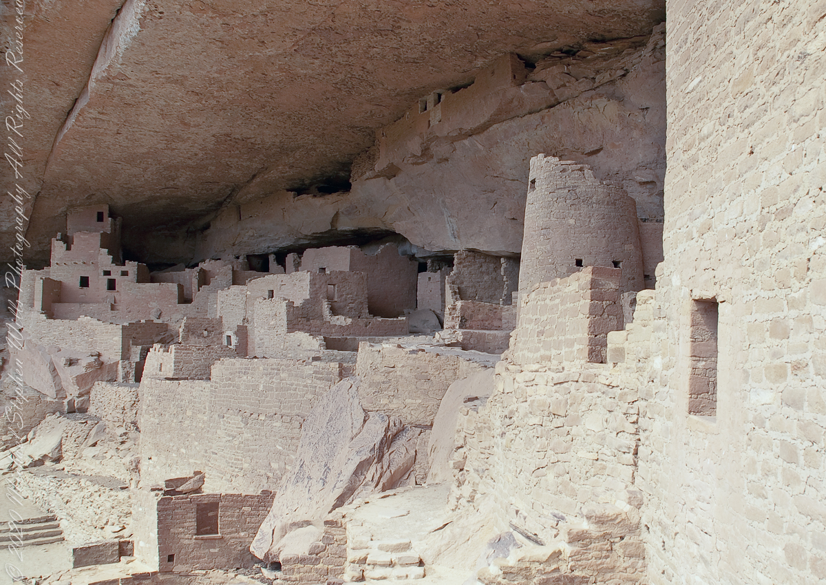
This four-story square tower, located at the south end of the alcove, at one time reached the ceiling. Access to the upper rooms was provided by hatchways in the lower room roofs.

What about that T-shaped door?

On the fourth floor, a T-shaped doorway suggests a balcony because that type of opening in the wall, designed to minimize the area, was used as a doorway.

Bend over Backwards

Inside the tower are well preserved wall paintings.  To view them, you side in that lower opening, facing outwards and, bending backwards, look up into the tower.  You need to hold onto the wall to do this and its the only time we were allowed to touch the ruin.
The Kiva

The modern wooden ladder rises from a kiva platform.  Notice the level of wear on the top of the ladder posts.  There are three kivas visible from the tower and at a later time I might post about these.
Copyright 2023 Michael Stephen Wills All Rights Reserved