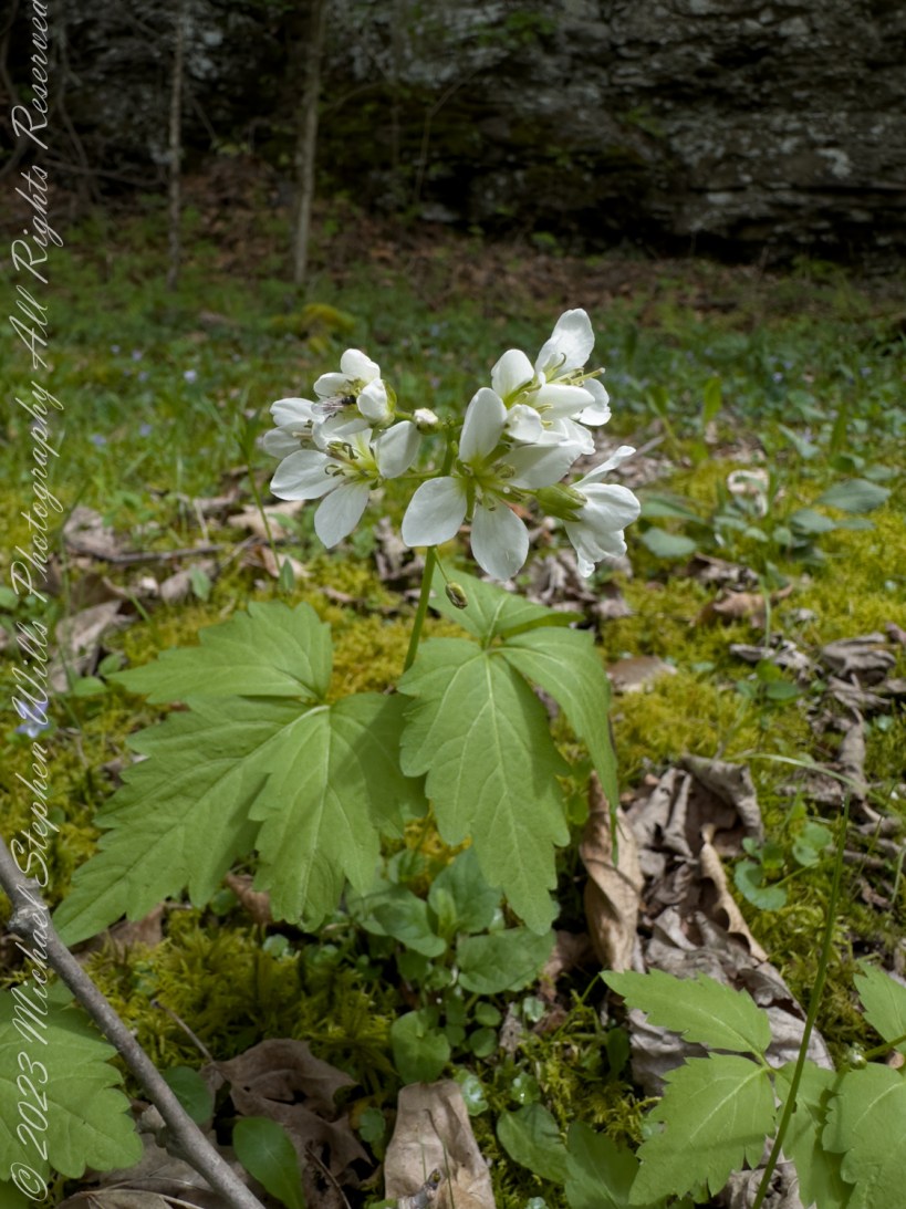
Step into the spring woods and discover the broadleaf toothwort, Cardamine diphylla. Marvel at its white blossoms and deep-lobed leaves, and uncover its vital role in both early pollination and traditional medicinal practices.
Broadleaf toothwort, Cardamine diphylla, plays a charming role in the ecosystem of deciduous forests, often carpeting the forest floor with its distinctive greenery and white blossoms during the spring. This plant is particularly noted for its broad, compound leaves that usually consist of two or three leaflets, each characterized by deep lobes and a somewhat wrinkled appearance, lending it the name “crinkle root.”
The flowers of the broadleaf toothwort are a notable feature, emerging in clusters atop slender, upright stems. Each bloom presents four white petals that form a delicate cross, a typical trait of the Brassicaceae family, to which it belongs. The flowering period spans early to mid-spring, making it one of the earlier blooms in woodland areas, which plays a critical role in the local ecology. These flowers are not just a visual treat but are also vital for early-season pollinators such as bees and butterflies, providing them with necessary nectar.
Moreover, Cardamine diphylla is more than just a visual and ecological gem. It has historical uses in traditional medicine and cuisine. Native American tribes utilized the peppery roots of the toothwort as a seasoning and as a medicinal herb to treat various ailments.
The presence of Cardamine diphylla is also an indicator of the health of the forest ecosystem. Thriving populations of this plant suggest a well-preserved habitat, which is crucial for biodiversity conservation.
In summary, Cardamine diphylla, with its ecological significance and historical uses, represents a small but vital part of North America’s natural heritage, highlighting the intricate connections within woodland ecosystems and the importance of preserving these natural environments.
Copyright 2024 Michael Stephen Wills All Rights Reserved
Here we discover and learn to admire the winterberry shrub, or Ilex verticillata, during a frosty February morning. Its crimson berries, which symbolize hope, sustenance, and life’s enduring cycle, are a stark contrast to the pall of winter.
Among the 7,000 year old remains found in Windover Bog was the skeleton of a boy crippled from spina bifida who had to be carried around and treated for the 16 years of his life.
I was born into a world that danced around me, a world I could only witness but never fully join. My legs, unlike those of the other children in our tribe, refused to carry me. I spent my days close to our hut, watching the life of our village unfold from my corner, shaded by the leafy arms of the great trees.
My mother was my bridge to the world. She carried me to the edge of the waters, where I would watch my friends play, their laughter a melody I cherished. She showed me the way the water held stories, the way the reeds whispered in the wind. She taught me to weave, my fingers nimble and quick, making up for my still legs.
As I grew, I found my place among my people. I became a keeper of stories, a weaver of tales, just as I wove reeds into baskets. My voice became my movement, my words a dance.
Then, illness found me. It crept into our hut, a shadow that no fire could dispel. My mother’s eyes, always so full of warmth, grew clouded with fear. She fought for me, her hands constantly working – crushing herbs, whispering prayers.
I saw her struggle; saw the toll it took. I wanted to ease her burden, tell her it would be alright, but my voice had begun to fail me. All I could do was squeeze her hand, a silent message of love and gratitude.
As my breaths grew shallower, I watched her. She was my world, her face the last thing I saw as I drifted away, her lullabies carrying me to a place of peace.
I am his mother, heartbroken and weary. My son, my joy, lies motionless, his chest barely rising. I had always carried him, but now, there’s a journey I cannot make with him.
I remember his laughter, bright and clear, despite his bound body. His spirit had wings, even if his legs did not. He was the light of our tribe, a storyteller, a dreamer.
When he leaves me, my heart shatters. The tribe gathers, offering comfort, but the void he leaves is too vast. We prepare him for his final journey, wrapping his body, laying beside him his favorite weaving tools, the small toys he cherished.
We take him to the bog, our sacred place. Gently, we lay him in the water, his final cradle. The waters close over him, holding him in an eternal embrace.
Years pass, but his memory remains, alive in the stories I tell by the fire.
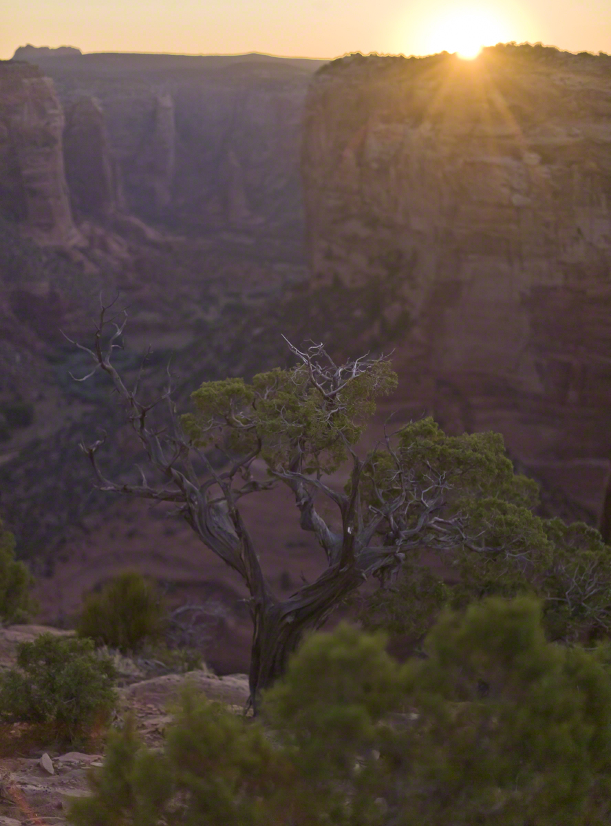
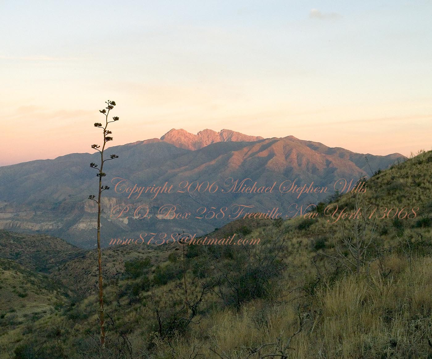
In this post we start the day of my posting “Family Trek“, July 19, 2008, when, well before the sun rose at 6:23 am Mountain Daylight Time (the Navajo Reservation observes daylight savings, the rest of Arizona does not), Pam and I were at the Spider Rock Overlook.
Most visitors to the canyon make use of a system of roads and parking lots next to strategic views. There is the White House Overlook we visited our first day, July 18, to hike from the trailhead into the canyon. There are also, on the south side of the canyon:
Tsegi Overlook, taken from a Navajo word that translates directly to “between the rocks” and usually refers to a deep canyon with steep cliffs.
Junction Overlook above the point where Canyon Del Muerto (see my posting “Sun and Shade, Canyon Del Muerto”, and Canyon De Chelly intersect. There is an Anasazi ruin in the south-facing cliff across the canyon.
Sliding House Overlook, another Anasazi run across the canyon.
Face Rock Overlook, to view the eponymous formation.
Spider Rock Overlook, the most stunning rock formation.
Click any photograph for my Online gallery.
Looking east from the Spider Rock overlook, Canyon De Chelly.
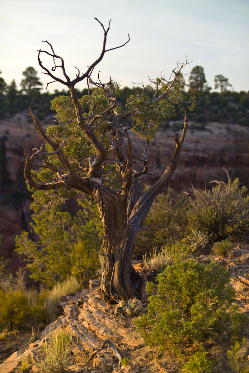
While getting ready I scoped out the location for interesting visual tropes. Utah Junipers are exceptionally hardy shrubs, stressed individual plants grow into compelling forms shaped by hardship. As the sun rose, this specimen emerged from the gloom and caught the first sun rays.
Click any photograph for my Online gallery.
A distressed Utah Juniper on the edge of Canyon De Chelly overlooking Needle Rock a few moments after sunrise.
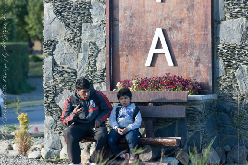
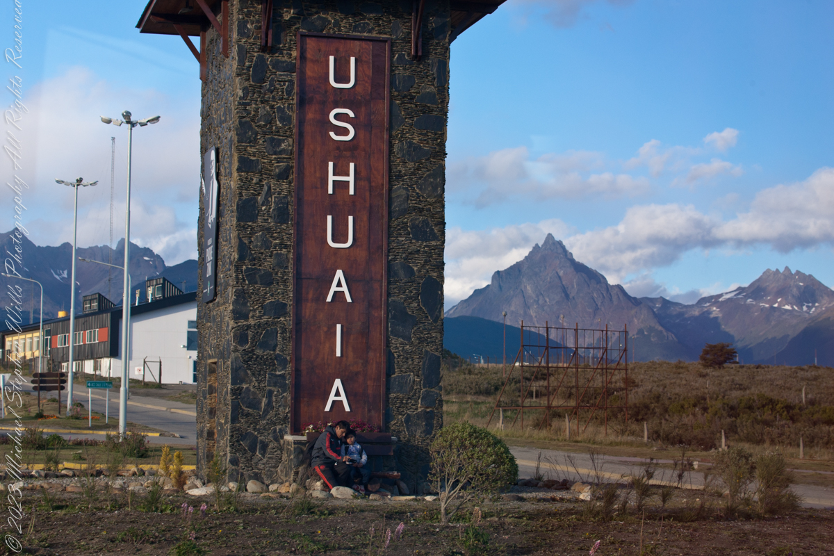
On our way back from “The Train at the End of the World” and sailing the Beagle Channel, these two young people came into view. Sitting at the foot of the a tower welcoming airport arrivals, who must transit this roundabout, is a pair of young people. In my imagination they were brothers waiting for a ride. In the first long wide shot the older is taking their selfie with the Ushuaia.
Here we at at the “center” of this city set spectacularly against the Fuegian Andes, the southern continuation of the Andes mountain range immediately south of the Strait of Magellan. with a West-East orientation. They occupy the mountainous and mountainous portion of the southern archipelago of Tierra del Fuego.
In this second, close photo, he is talking to the ride on his smart phone, after sending the selfie. The roundabout is named “Hipólito Yrigoyen” after an Argentine politician twice elected President.
Here is more information about the man:
Juan Hipólito del Sagrado Corazón de Jesús Yrigoyen (Spanish pronunciation: [iˈpolito iɾiˈɣoʝen]; 12 July 1852 – 3 July 1933) was an Argentine politician of the Radical Civic Union and two-time President of Argentina, who served his first term from 1916 to 1922 and his second term from 1928 to 1930. He was the first president elected democratically by means of the secret and mandatory male suffrage established by the Sáenz Peña Law of 1912. His activism was the prime impetus behind the passage of that law in Argentina.
Known as “the father of the poor”, Yrigoyen presided over a rise in the standard of living of Argentina’s working class together with the passage of a number of progressive social reforms, including improvements in factory conditions, regulation of working hours, compulsory pensions, and the introduction of a universally accessible public education system.
Yrigoyen was the first nationalist president, convinced that the country had to manage its own currency and, above all, it should have control of its transportation and its energy and oil exploitation networks.
Between the 1916 general election and the 1930 coup d’etat, political polarization was on the rise. Personalist radicalism was presented as the “authentic expression of the nation and the people” against the “oligarchic and conservative regime”. For the ruling party, the will of the majorities prevailed over the division of powers. The opposition, on the other hand, accused the Executive Branch of being arrogant and demanded greater participation from Congress, especially in matters such as the conflictive federal interventions.
Reference: Wikipedia “Andes fueguinos” and “Hipólito Yrigoyen.”
Copyright 2023 Michael Stephen Wills All Rights Reserved
About 700 years ago, when the expansion of the Mongol empire was under way, on the other side of the planet people discovered a series of caves, formed in tuff, with a favorable location in a south facing cliff near water. Tuff, a rock formed from volcanic ash, is hard, brittle and soluble in water. From these properties this series of caves formed. The southern exposure provided excellent climate control for people, like those we now call the Salado, who understood how to exploit the location.
They constructed from local materials (mud, plants and rock) rooms in the upper cave just far enough inside to be warmed by the winter sun and protected during the summer when the sun’s sky-path was higher. Who knows how long the Salado lived in what must have been this paradise or why they left.
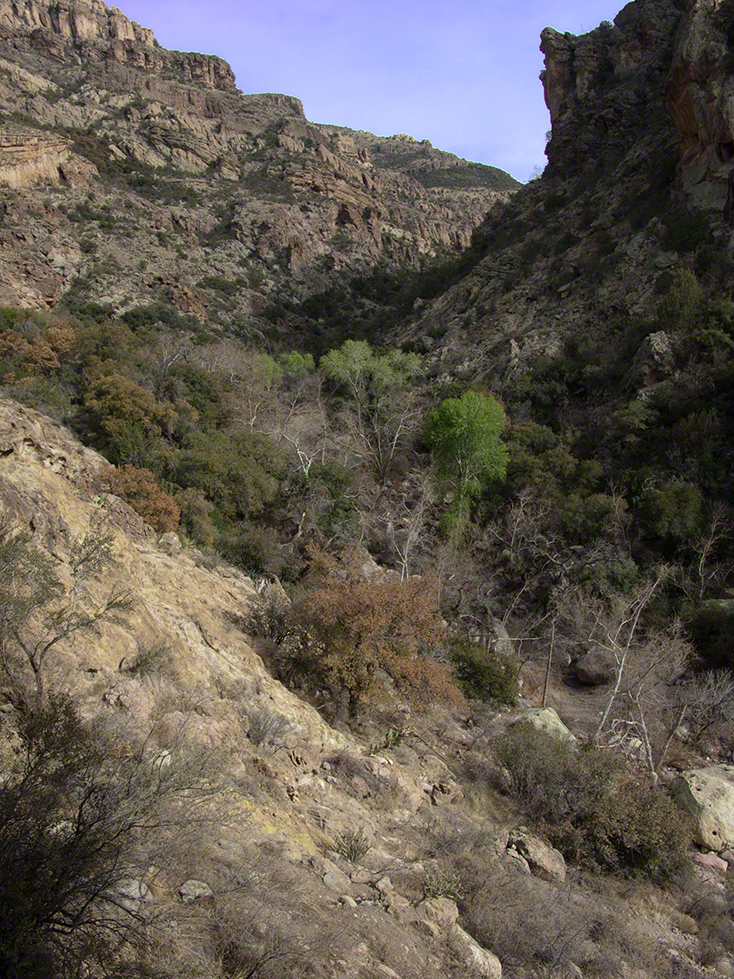
In March 2006, after returning from a nine-day backpack trip to the remote eastern Superstition Wilderness I used a four-wheel vehicle to reach the Roger’s Trough trailhead for a day trip to this site in Roger’s Canyon. The advantage of Roger’s Trough is the high elevation that leaves “just” about 1,100 feet of climbing (2,200 total) for the day. As it happens, it is downhill to the ruins though there is plenty of ups and downs plus scrambling over rocks.
I started late morning and a returning party met me on the way out and warned against leaving packs unattended. It seems they were victimized by pack rats. My timing was lucky and I had the site to myself.
First (refer to the “Roger Canyon” photograph, above) I climbed the cliff opposite from the ruins to set up a tripod an telephoto lens to shoot through the trees to capture the main building inside that very interesting looking tuff (see below). That central column (to the right) divides the cave opening and there are views from inside, up and across the canyon. In season, the cliffs are occupied by nesting birds and, higher up, there are fascinating caves in locations too high and steep to reach without the proper equipment.
As it is, climbing into the upper cave requires an exposed rock scramble. By “exposed” I mean the climber is exposed to falling. That is an intact wooden lintel of the visible structure opening and the larger structure, to the right, has curved walls.
Salado Cave Ruin
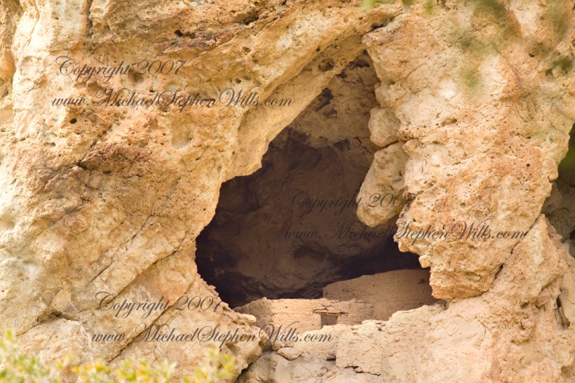
I then explored in and around the site. The location of a lower cave made it useful for storage, it was walled off and the sturdy structure still stands today. By the way, I inverted this view for artistic purposes.
Lower Storage Room
A lower cave is opened and accessible. Looking out, I felt the original inhabitants were with me and then a raven started calling over and over and over.
Lower Cave
I was so fascinated by the possibilities of the site that time got away from me until this incessant cawing of a raven made me notice the lengthening cliff shadows. Here is a view (see below) of my way home, back up Rogers Canyon. My last shot before packing up. It took just over two hours to get out, at a steady pace. It was twilight as I approached the Rogers Trough trail head.
By the way, my posting before this one (“Finding Circlestone”) includes a shot of White Mountain. In that view, these ruins are on the other side of White Mountain.
View up Rogers Canyon from the Ruins
Copyright 2023 Michael Stephen Wills All Rights Reserved
I first learned about Circlestone from stories The Searcher told during my first backpack into the eastern Superstition Mountains, on the Tule trail, April 2005. I described this in “Riding from Pine Creek to the Reavis Valley” where the Searcher described a stone circle, overgrown with Alligator Juniper, on the slopes of Mound Mountain. He pointed south toward a peak and foothills that rose from the valley floor and said, “follow the fire trail east from the southern Reavis Ranch valley.” There were strange happenings associated with Circlestone (as he called it) and he’d never taken the time to go there. “There is a book full of stories.” I eventually sought out Circlestone on the web and in books, but after I found it on my own using only the Searcher’s directions and advice from friends met on the way.
Sunset from Castle Dome
Backpacking with my sister
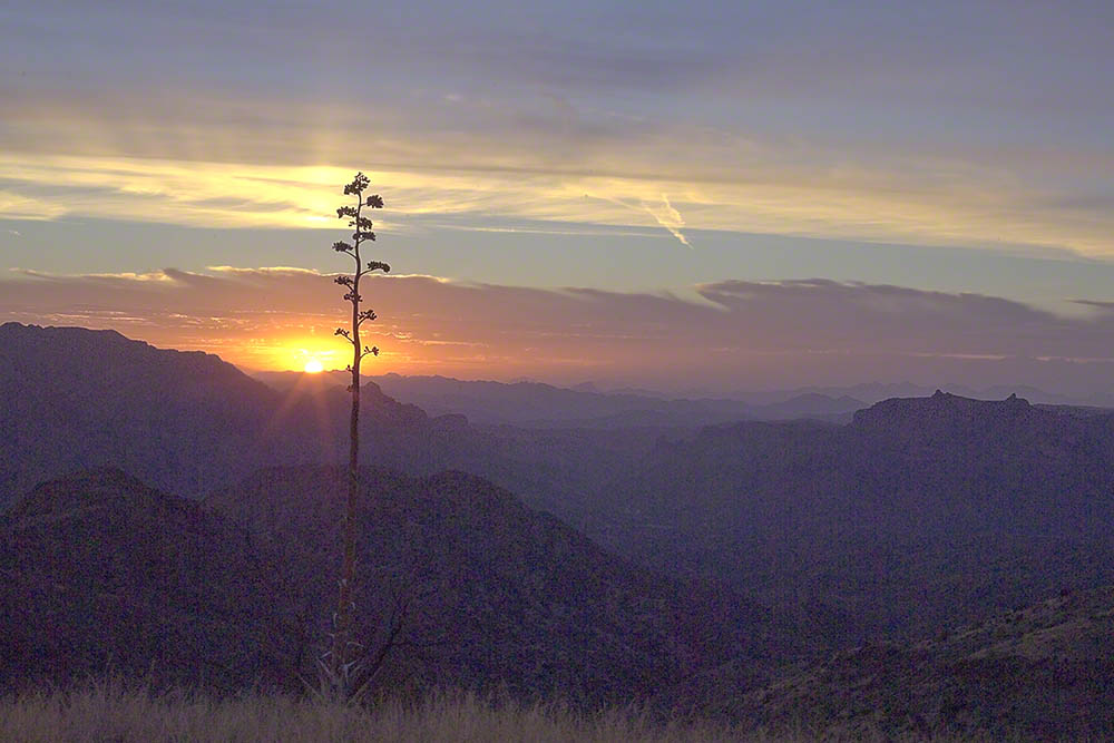
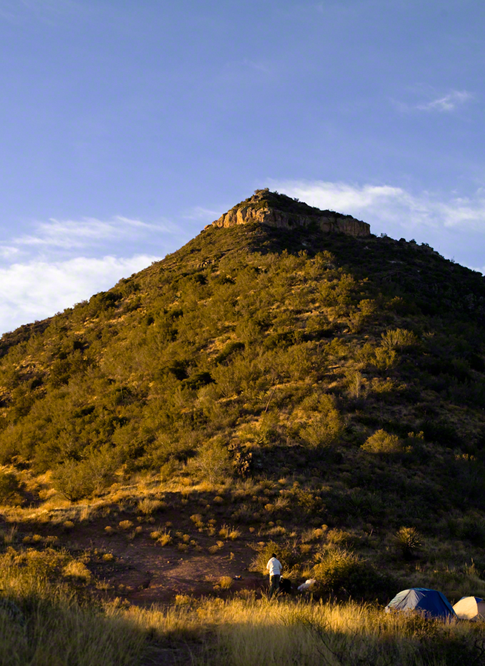
In 2006 I explored Circlestone twice along with my sister, Diane, who accompanied me. First for nine days early March 2006 using the Reavis Ranch trail from the north and the second for five days in November 2006, coming us the same trail from the south. Our first trip was Diane’s first “real” backpack adventure and we took it slow with a camp at Castle Dome where there are flat areas and exceptional views. Above, is the sunset from our second night (I camped the first night next to the car…we took it very, very sloooowwww).
Four Peaks Sunrise
Castle Dome
Then, there was morning of our third day. Here is the Four Peaks Wilderness in the first rays of dawn. These are green, rolling foothills of grass, low shrubs and a few juniper. If you know where to look, there’s an unmarked trail to Reavis Falls (the highest waterfall in Arizona). I found the trail and visited the falls on a later trip.
Castle Dome Sunrise
After enjoying the Four Peaks, you turn around and see Castle Dome in the morning light, as in this photograph. Remember the same of the “dome”, because it is visible from the ultimate view from Circlestone.
Reavis Valley and White Mountain from the trail to Circlestone
The Trail to Circlestone
Our camp was in the Reavis Valley, one of the first sites along the creek coming from the north. There were fantastic rock formations across the creek. Not far from there, the land falls away into steepness and then Reavis Falls. The Searcher told me about going that way, once. There is no trail down to the falls overlook and deep canyon carved by the water.
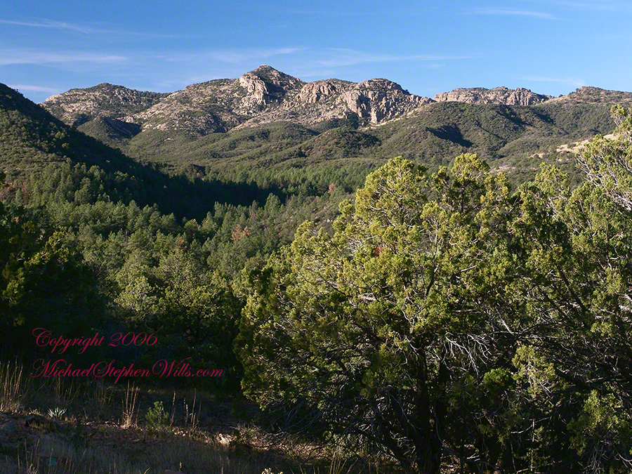
This photograph, above, is from a lovely forest of pinyon trees that grow along the trail to Circlestone (described by the Searcher as rising from the southern Reavis Valley). You can see the valley, just to the right, and a longer and steeper valley that rises from it up to White Mountain. That way is the southern legs of Reavis Trail. I have a movie clip from this same spot of the pinyons moving in the breeze and may post it at a later time.
All of the trail to Circlestone is a climb. You pass over “Whiskey Spring”, named for a still kept there in the 1800’s and over a steep defile gouged from the rock. The trail is well marked and I am told that, sometimes, there is no cairn marking the trail to Circlestone. If you are desperate to get there, look-up some excellent hiking directions available on the web. I have even found the circle on GoogleEarth, since I know where to look. If you like a challenge and the adventure, go from the directions the Searcher gave me.
Four Peaks from Circlestone
From the fire line trail, the unmarked branch to Circlestone climbs steeply and follows a ridge through Alligator juniper, punctuated by stalks of century plant, to a broad way that rises to Circlestone as though to a monument overgrown by the same juniper.
My Circlestone Mystery
There was an unusual experience on our first trip, on this portion of the trail. We were winding through the Juniper and, as it happened, Diane fell behind. After awhile I missed her and waited and, after a minute, went back to look for her. I found Diane sobbing uncontrollably, deep in grief over our father who passed away eleven years before. We talked about it until she felt better. She said it was as though a door opened and she could feel out father. What makes this exceptional is Diane is not given to anything like this and I ascribe her deep grief to the nature of the site. It is a mystery to this day.
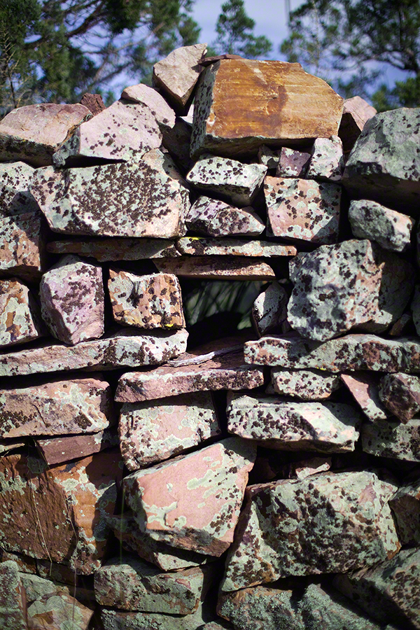
At Circlestone, that first trip, we explored and experienced the site. You cannot see the entire wall at any point and need to wander through and over it, being careful not to disturb anything. Here and there, in the outer wall, are openings like the one in this photograph.
Site-Hole in the Circlestone Wall
At Circlestone
I call it a site hole because, on your knees, it is possible to look through and see the distant view through the trees. As you can see, the stones are a striking red color with green lichen growing thick.
On the second trip in November, knowing the way and having great weather, I brought my cameras to capture the exceptional views, one of which is above. I’d dearly love to come back to camp just below the ruin and do some work in the evening and morning light. For now, I can enjoy those views from Castle Dome.
Three Horsemen and Castle Dome
Can you see the dome in the middle distance. I did a portrait of three horsemen who road up to Circlestone in November. We came to know them pretty well, that afternoon and the following morning down in the valley.
Three Horsemen
I carted up a tripod, so you can see Diane and I in the same spot.
Mike and Diane at Circlestone
Copyright 2023 Michael Stephen Wills, All Rights Reserved
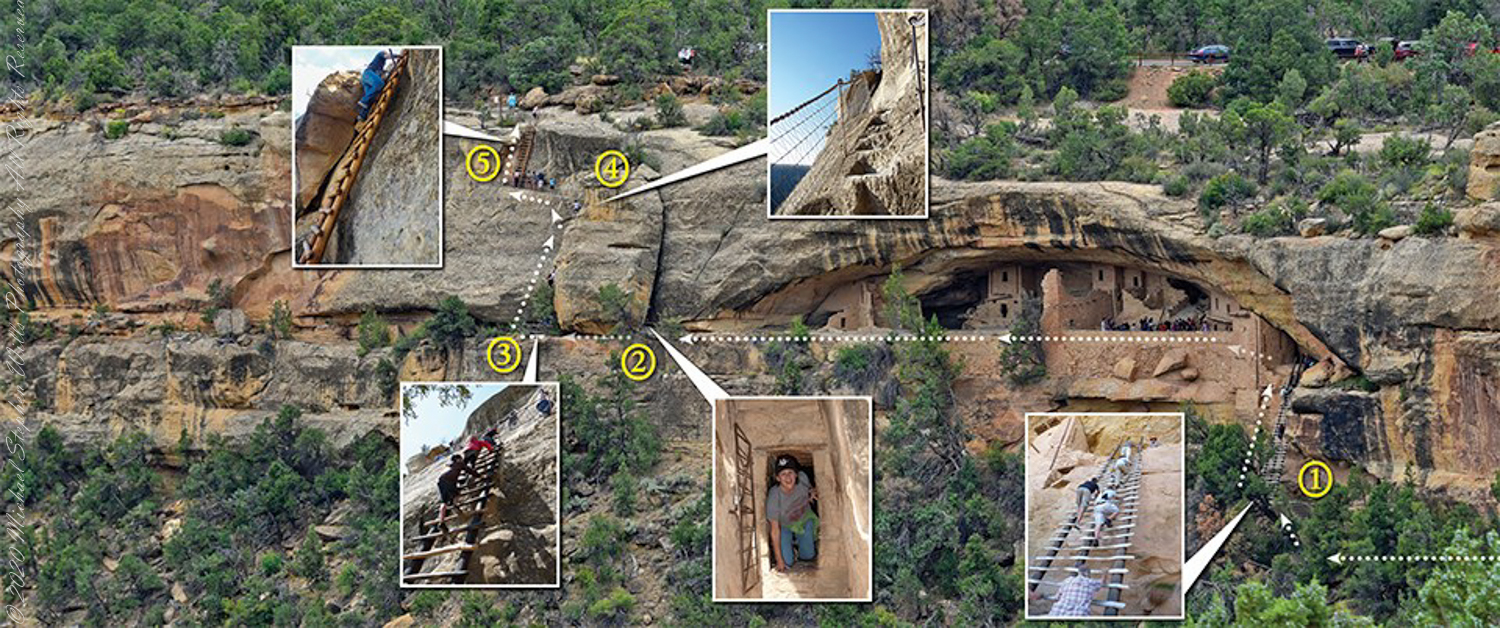
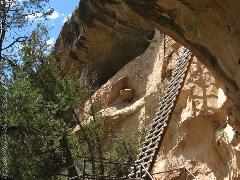
A visit to Balcony House is a 0.25-mile (0.4 km) hike. The tour requires walking down a 130-step metal staircase then, (1) climbing up one 32-foot (9.8 m) ladder to enter, two small ladders, and 12 uneven stone steps within the site.
(2) crawling through an 18-inch wide (46 cm) by 12-foot (3.7 m) long tunnel as you leave the site.
(3 – 5) ascending a 60-foot (18 m) open cliff face with uneven stone steps and two 17-foot (5 m) ladders to exit. Mesa Verde National Park, near Cortez, Montezuma County, Colorado.
Photograph and caption (above) is from the US Park Service, Mesa Verde, Balcony House tour web site
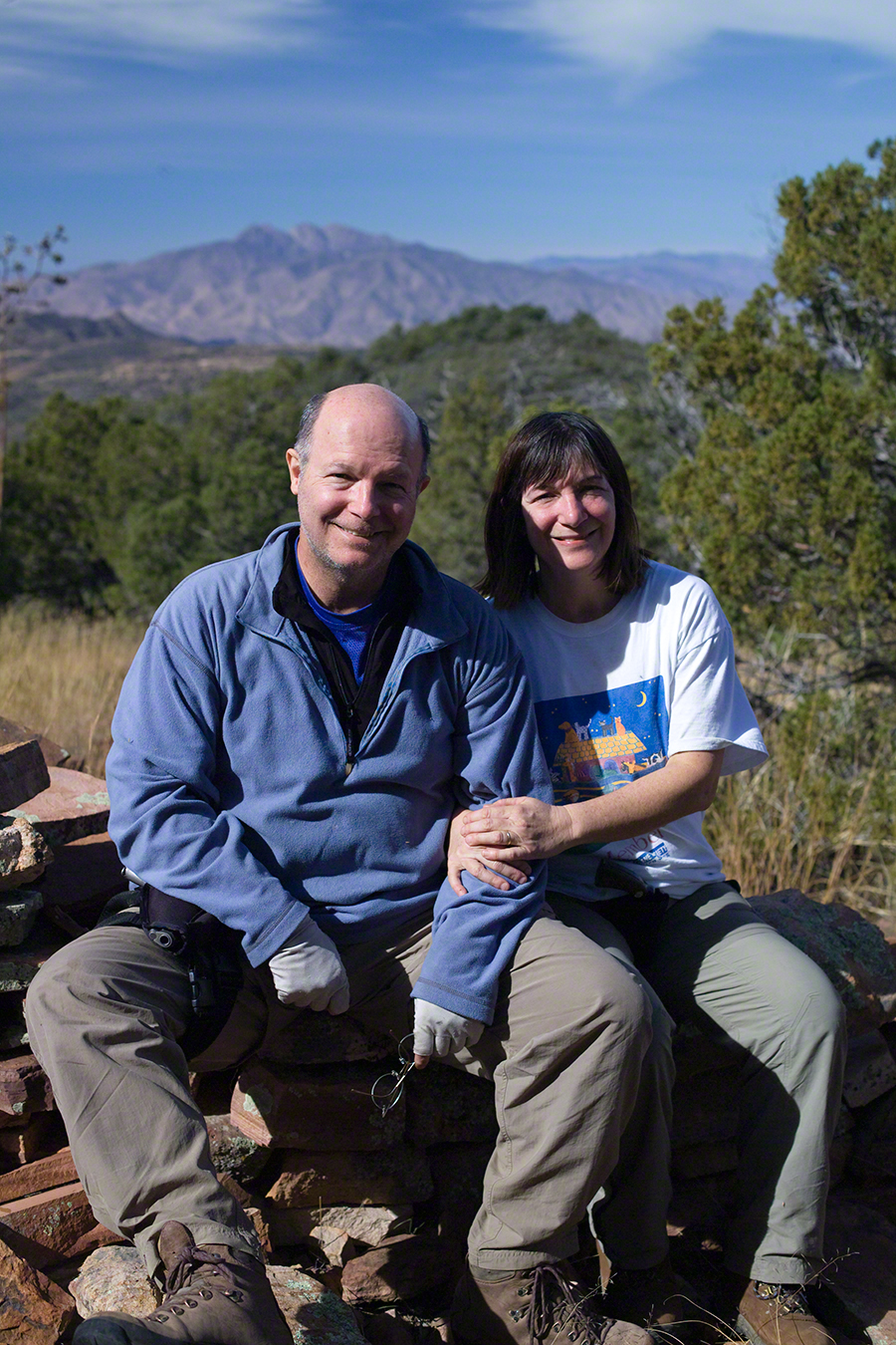
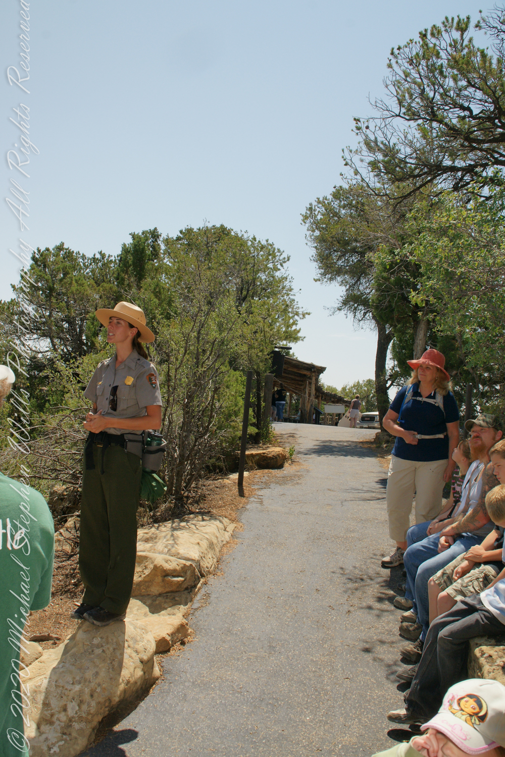
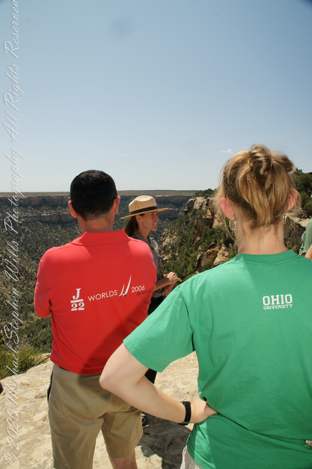
We purchased our timed tour ticket at the visitor center at the foot of the Mesa, essentially a flat top mountain rising dramatically from the surrounding plain. In the second photograph we are looking over the mesa rim overlooking Soda Canyon.
The tour is a small adventure, starting with a climb down into Soda Canyon and a climb up a 32 foot ladder. The ladder is solid and we had plenty of time to climb with one person ascending at a time. I was a bit overwhelmed by the experience and had my equipment tucked away for safety. I had to leave my sturdy tripod in the car. A more adventurous photographer captured the following ladder photograph.
Here we are looking back to the entrance, where visitors crawl on hands and knees to enter.
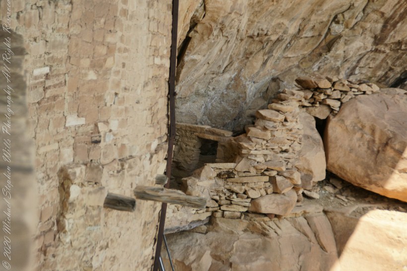
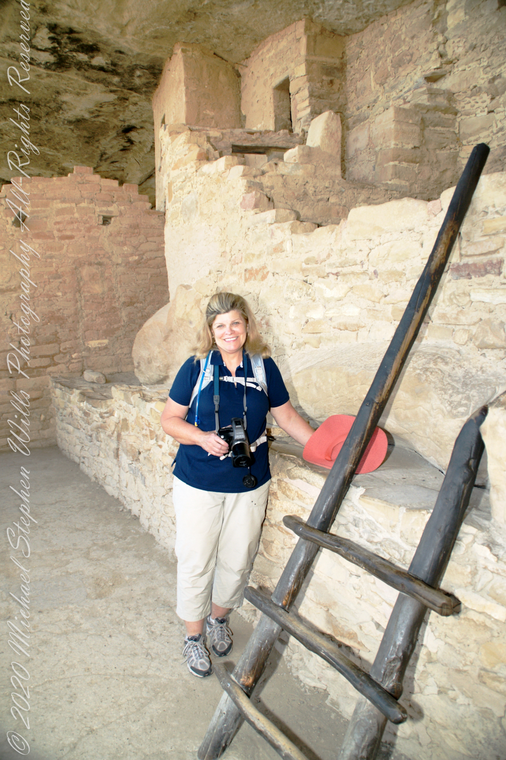
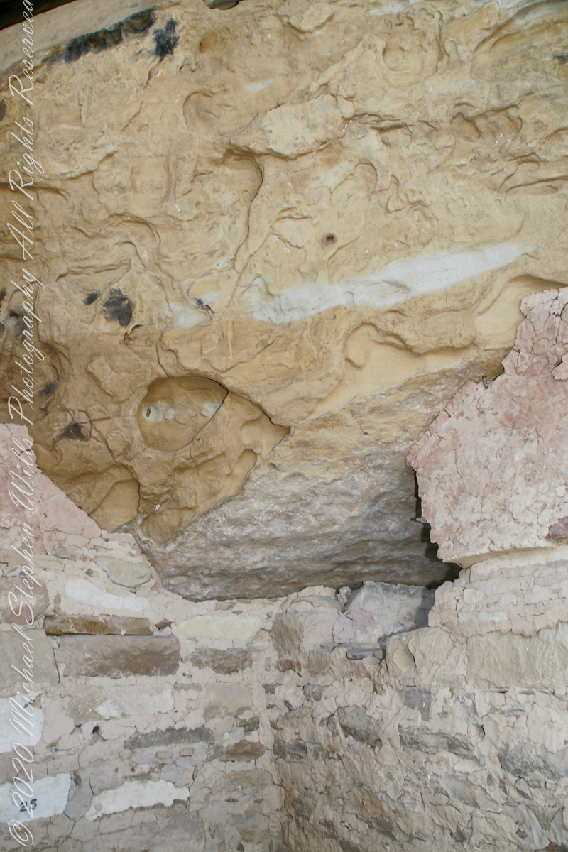
Here is Pam twenty two (22) minutes into the tour. The structures are build into a naturally occurring cleft in the mesa cliff, below the rock shelf of the mesa top. The rock shelf is the roof above Pam.
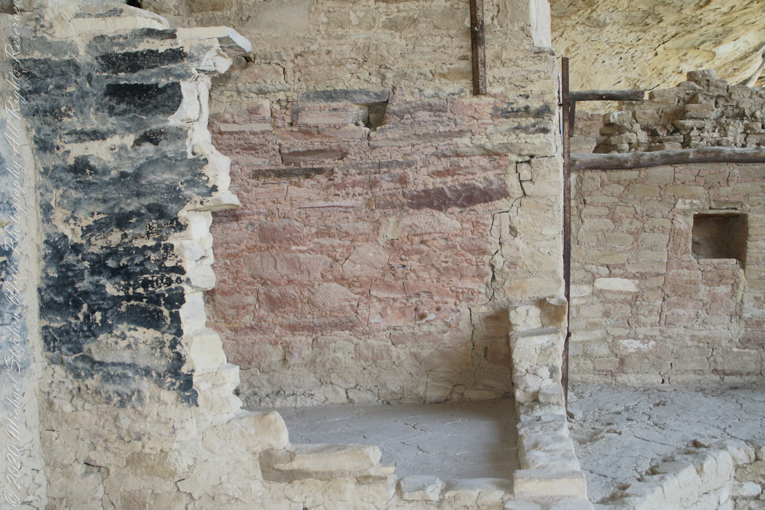
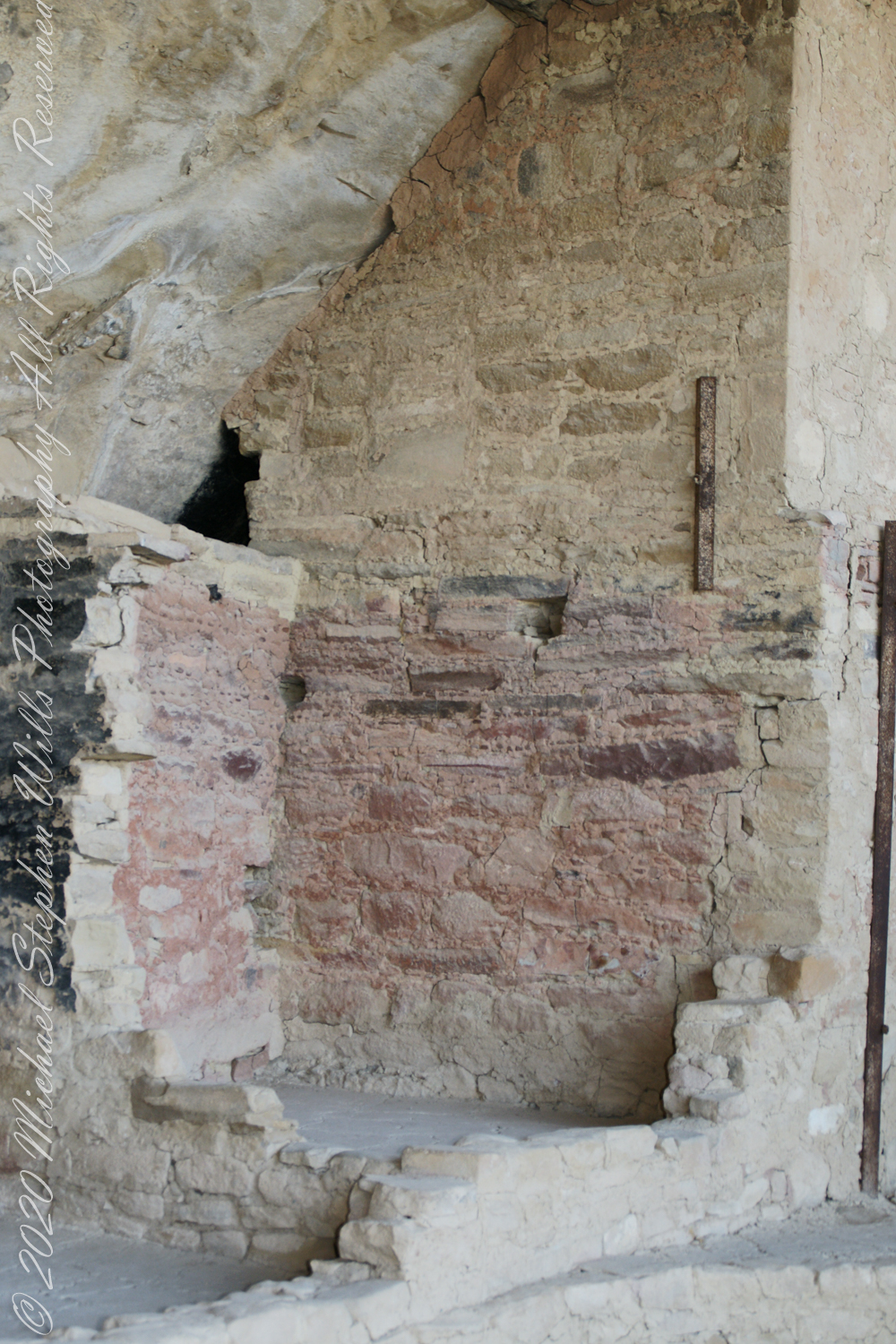
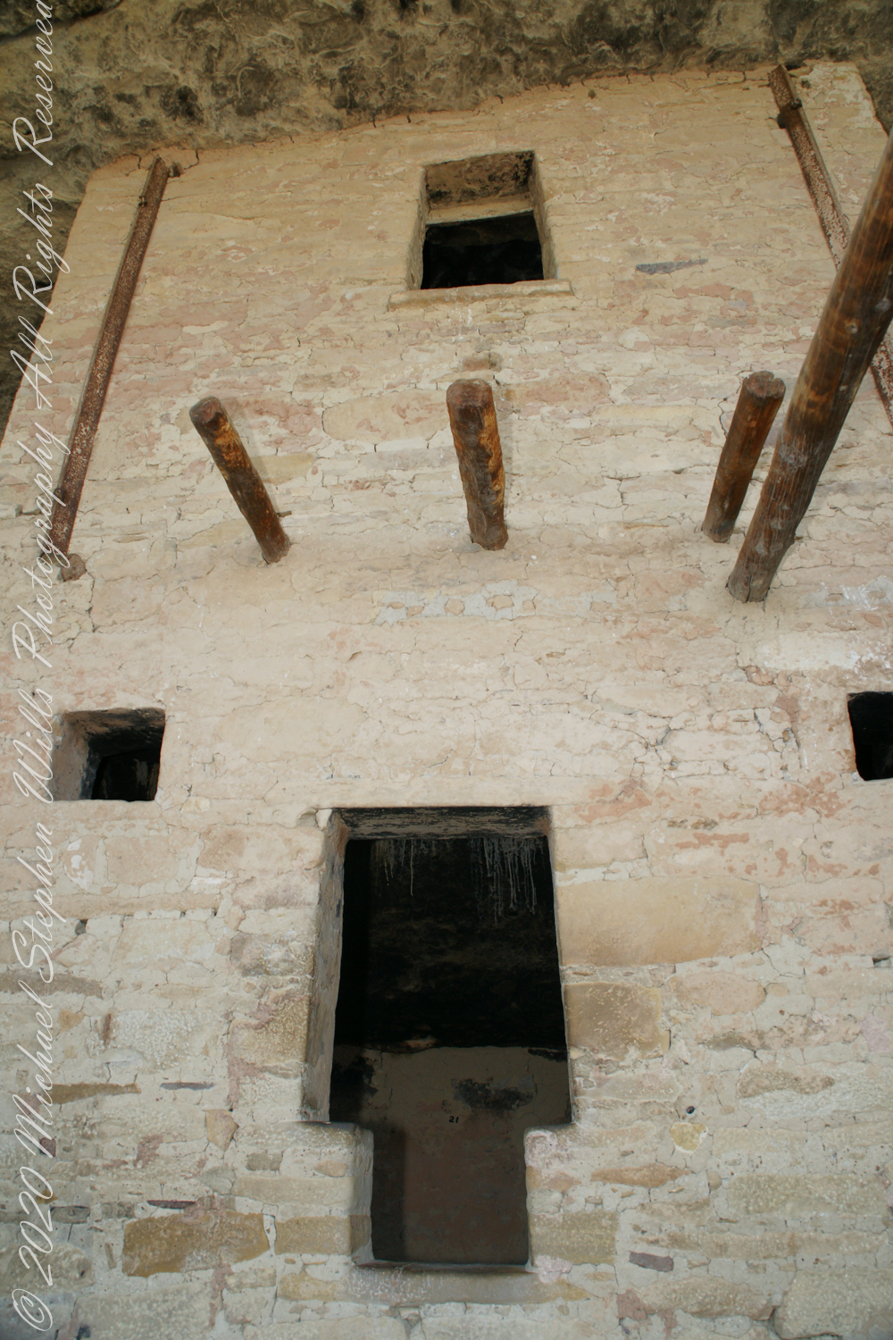
Looking up to the ceiling above a rock and mud wall. The structures have been carefully, lovingly, conserved since the rediscovery of Mesa Verde in 1884. The conservation work began 1910.
The 38 rooms and two kivas house up to 30 people. The cliff northeast facing cliff provided little warmth from the sun in winter. At 7,000 feet and 37 degrees latitude, the mesa is cold wintertime — the average low being 18 degrees Fahrenheit (minus 8 Celsius). As other locations offer a southern exposure, the warmest side for the northern hemisphere, why was this site chosen by the ancients? The answer is found in the two water seeps emerging from the ground at the juncture geological layers where the water gathers and finds a way from surface rainfalls. The high desert climate here was dry then and now.
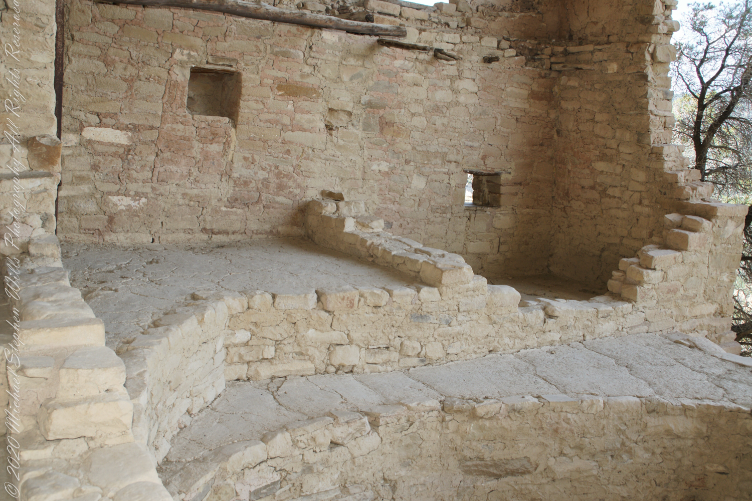
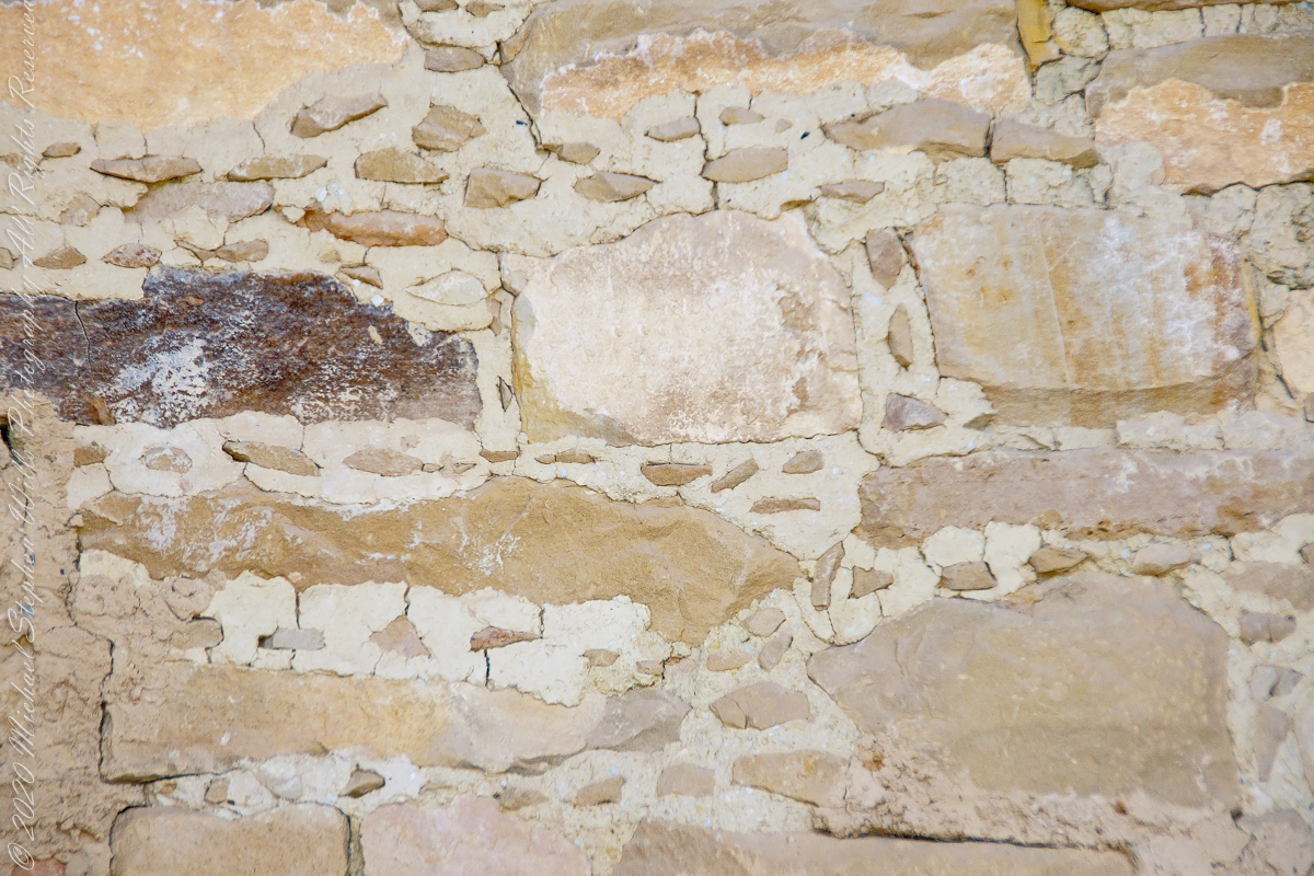
The walls demonstrate an enormous variety around basic patterns.
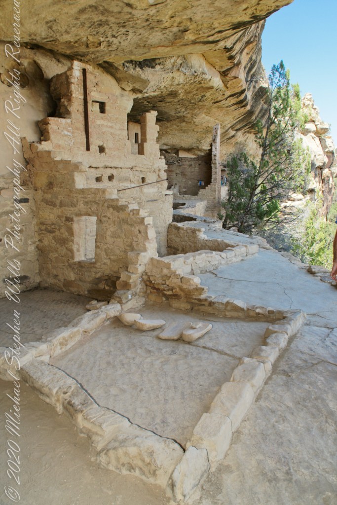
Plaza
I had enough time to capture these “fine art” views of Balcony House, looking back toward the entrance. The round, in-ground structures are kivas, ceremonial and communal gathering spaces.
Possibly the most adventurous and potentially frightening tour component was the end, crawling on hands and knees along an 18 inch wide (46 centimeters) 12 foot long (3.7 meters) tunnel followed by a climb up a 60 foot (20 meters) open (exposed to falling over) cliff face.
Copyright 2023 Michael Stephen Wills All Rights Reserved
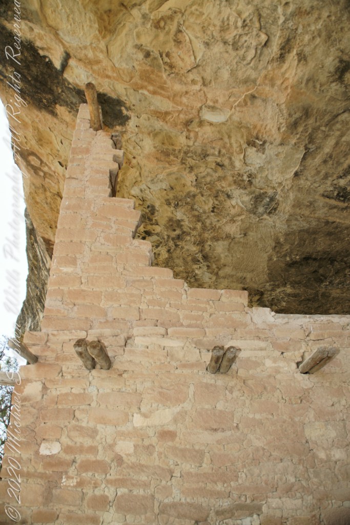
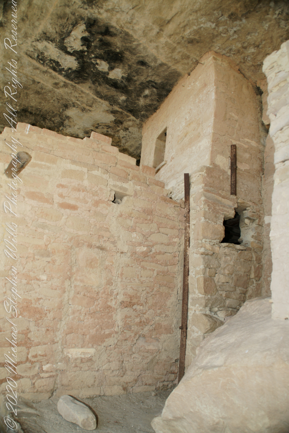
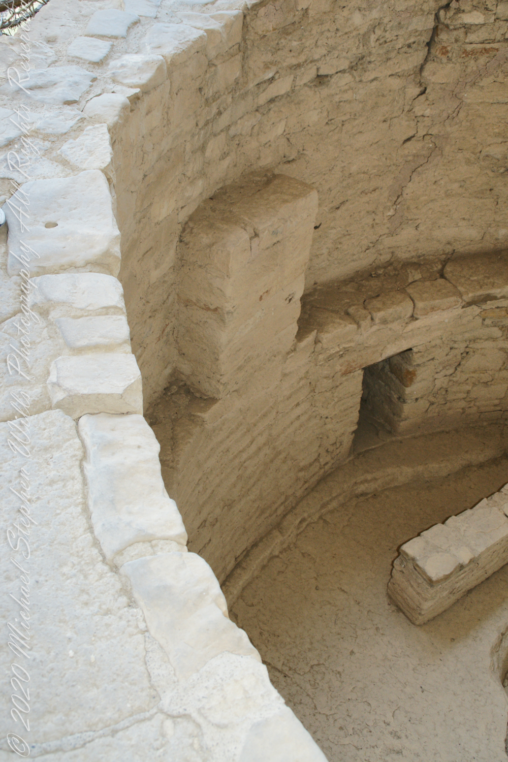
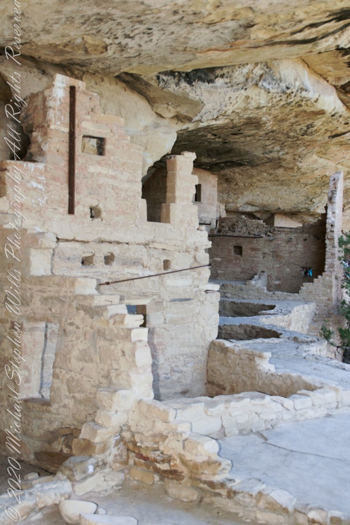
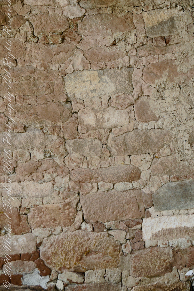
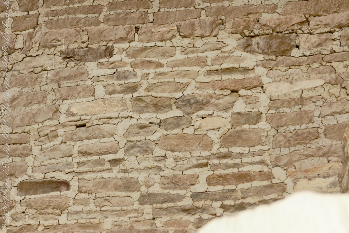
When the ancestral Puebloans moved from living next to their fields, in adobe structures, to these cliff dwellings, their building techniques were left behind.
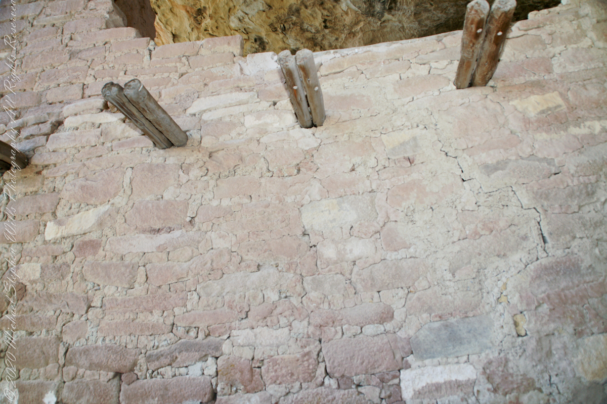
Stone and Mud Mortar with wood beams. Mesa Verde National Park, Montezuma County, near Cortez, Colorado.
Mud mortar was used to bind stones. Wood poles were used for to construct floors. These are walls captured during the Ranger guided tour of Balcony House.
..
This flat Kiva floor was achieved through clay, softened with water, formed and allowed to dry.
Clay Kiva Floor. Mesa Verde National Park, Montezuma County, near Cortez, Colorado.
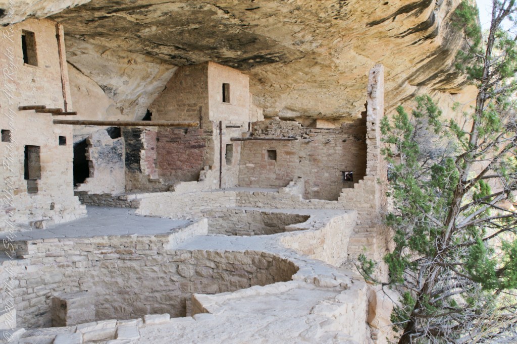
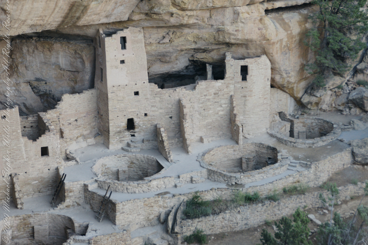
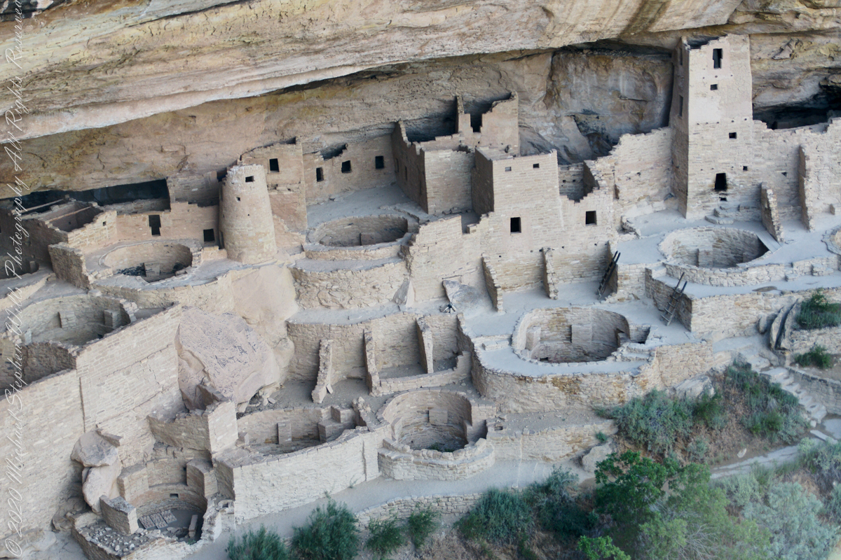
Cliff Palace
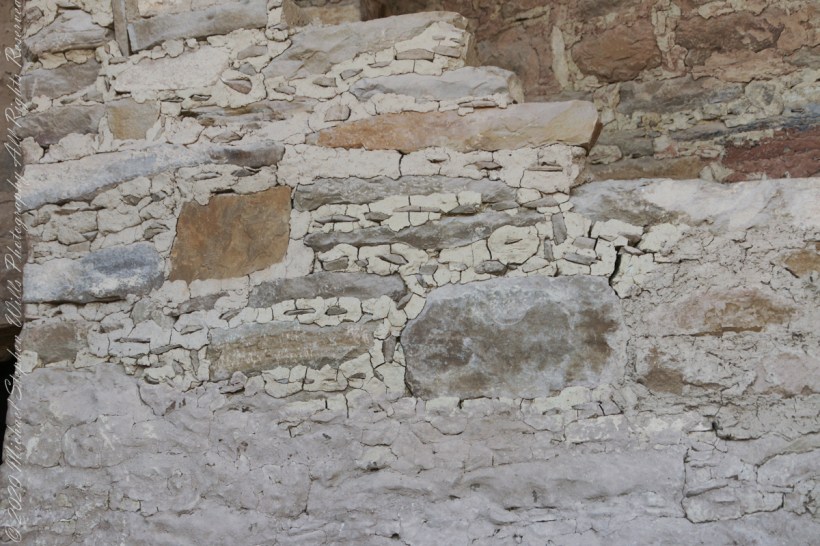
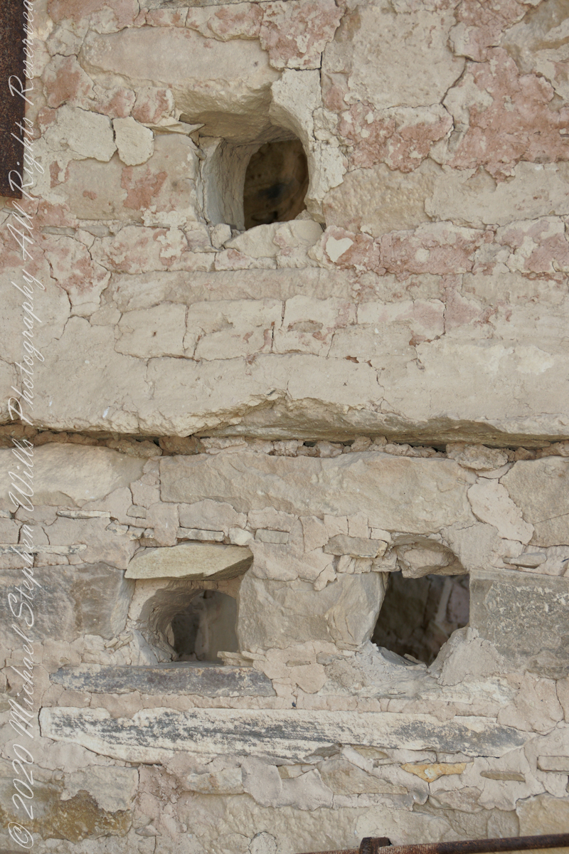
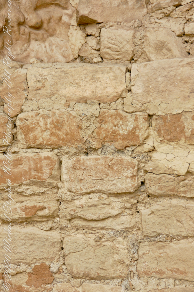
In this wall the poles rotted and crumbled, leaving behind these characteristic holes.
These architects excelled with adapting to the materials at hand.
.
The walls demonstrate an enormous variety around basic patterns.
Copyright 2023 Michael Stephen Wills All Rights Reserved
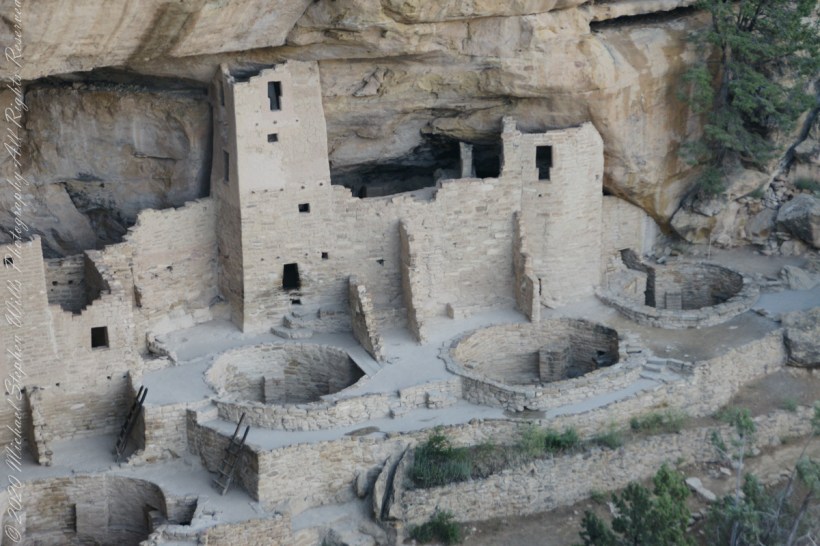
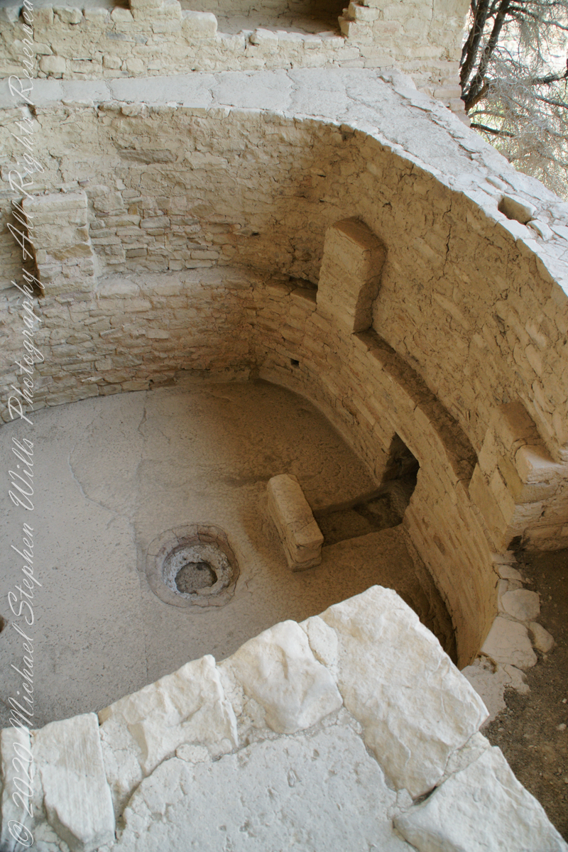
A kiva is a space used by Puebloans for rites and political meetings, many of them associated with the kachina belief system. Among the modern Hopi and most other Pueblo peoples, “kiva” means a large room that is circular and underground and used for spiritual ceremonies.
The Square Tower with four Kivas
Similar subterranean rooms are found among ruins in the North American South-West, indicating uses by the ancient peoples of the region including the ancestral Puebloans, the Mogollon, and the Hohokam.
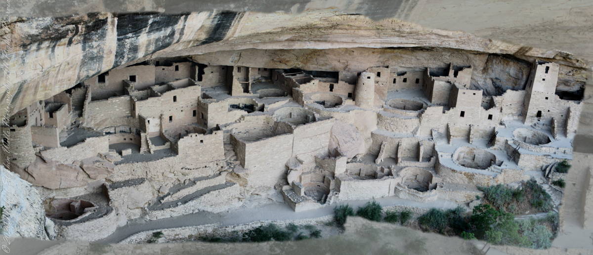
A portion of Cliff Palace including many Kivas, the round and square towers.
Those used by the ancient Pueblos of the Pueblo I Period and following, designated by the Pecos Classification system developed by archaeologists, were usually round and evolved from simpler pit-houses.
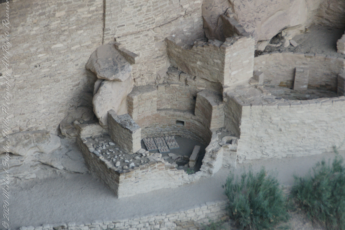
Two Kivas, one with broken wall.
For the Ancestral Puebloans, these rooms are believed to have had a variety of functions, including domestic residence along with social and ceremonial purposes.
The entire Cliff Palace from the overlook, from a single wide-angle image.
During the late 8th century, Mesa Verdeans started building square pit structures that archeologists call protokivas. They were typically 3 or 4 feet (0.91 or 1.22 m) deep and 12 to 20 feet (3.7 to 6.1 m) in diameter. By the mid-10th and early 11th centuries, these had evolved into smaller circular structures called kivas, which were usually 12 to 15 feet (3.7 to 4.6 m) across.
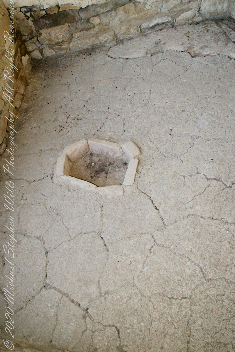
Sipapu
Mesa Verde-style kivas included a feature from earlier times called a sipapu, which is a hole dug in the north of the chamber that is thought to represent the Ancestral Puebloans’ place of emergence from the underworld
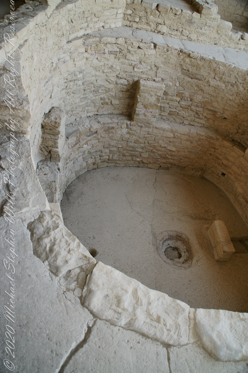
Here is a close-up of the kiva floor of the Balcony House.
Balcony House Kiva
The sipapu is the smaller pit in the floor to the left (north side) and partially blocked by the kiva wall. The larger is a firepit. The small wall to the right is placed to deflect airflow from a floor vent.
Balcony House Kiva, to the right is the floor vent in wall and deflector stone. There is the firepit and a tiny portion of the sipapu at the left edge.
I count 14 Kivas in the Cliff Palace panorama, including some with broken walls.
What is the Connection, if any, between Omphalos and Sipapu?
The global coordinate system was known to ancient Greeks, in fact they are credited with the discovery a system to locate any place on earth, an insight contained in myths of how Zeus founded Delphi as the “center of the world,” the place from which divinity irrupts, by setting two eagles at opposing ends of the world to fly, starting at the same time, same speed, the central world point identified by where the eagles’ paths crossed.
Bronze Coin from the Ptolemaic Kingdom of Egypt, reign of Ptolemy VI 2nd Century BC with the head of Zeus on one side and double eagles riding a thunderbolt on the other
To signify Delphi as this center a religious stone artifact, called an omphalos, was placed.
Most accounts locate the Delphi omphalos in the adyton (sacred part of the temple) near the Pythia (oracle). The stone sculpture itself (which may be a copy) is there to this day. The surface is a carving of a knotted net, the center hollow and widening towards the base. The omphalos represents the stone which Rhea wrapped in swaddling clothes, pretending it was newborn Zeus, in order to deceive Cronus. (Cronus was the father who swallowed his children so as to prevent them from usurping him as he had deposed his own father, Uranus).
The omphalos stone was believed to allow direct communication with the gods. Historians theorize the stone was hollow to allow intoxicating vapors breathed by the Oracle (priestess) to channel through it. However, understanding of the use of the omphalos is uncertain due to destruction of the site by Theodosius I and Arcadius in the 4th century CE.
That leaves us with the word, omphalos. In Greek the original meaning is navel, the anatomical reminder to humans of their source.
Comparing and contrasting these terms used by cultures separated widely by geography and time:
— sipapu is a religious symbol of the place ancestral peoples irrupted, born, into this world, emerging from the earth. From my readings, the word sipapu is a direct reference to the symbol. There are many sipapu, small holes in the floor of kivas (timetimes a hole in a wooden plank), representing a single place.
— omphalos is a religious symbol of where the divine irrupts into the world, from the earth, with direct linguistic natal (birth) associations. A single omphalos stone designates a single place.
Copyright 2023 Michael Stephen Wills All Rights Reserved