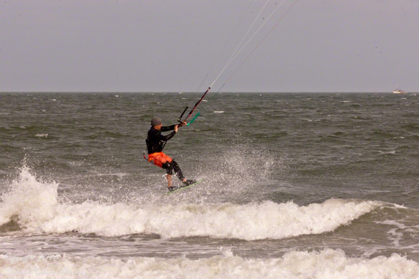
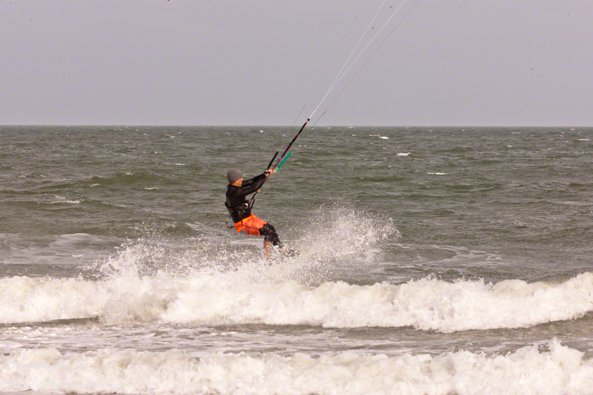
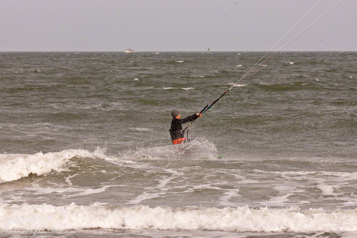
For a change of scene we visited Cape Canaveral, the beach at Cherie Down Park were an informal gathering of Kite Surfers was underway. Here is a series of action shots, one second elapsed from first to last.
Click any photograph for my Online Galleries
Conditions were excellent: good northerly wind, the sun overcast and, it being afternoon, in the west. Surfers stayed relatively close to shore, near their starting point. I had packed the “heavy gun” camera with a tripod.
Panning the scene (swiveling on the tripod), the camera in rapid exposure mode, I pressed the shutter release and held it down.
The surfer was captured mid-jump to landing.
Copyright 2022 All Rights Reserved Michael Stephen Wills
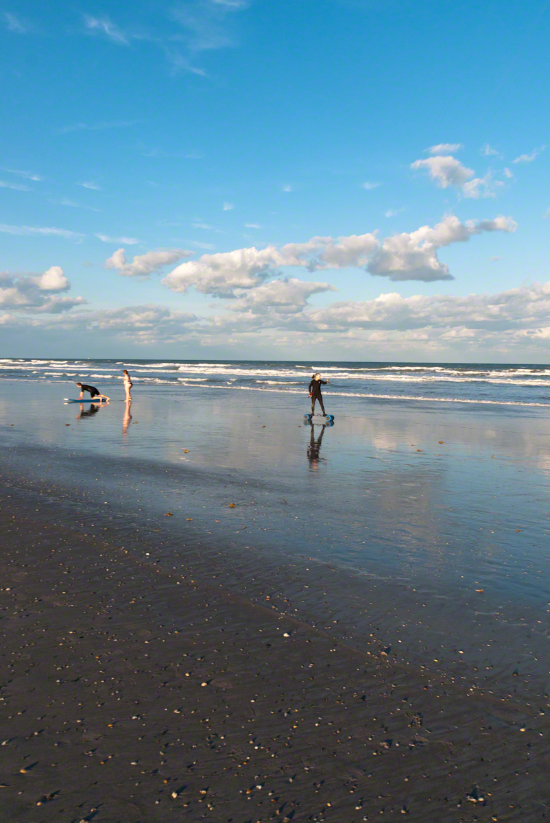
In the early morning hours of Sunday, September 10, 2017 as Hurricane Irma approached the Florida Keys, I cannot sleep, worried about family members north of Miami and in Daytona Beach. To pass the time, I returned to the golden hours of March 4, 2017 evening. On vacation, Pam and I walked Cocoa Beach starting from Lori Wilson Park, headed north.
The light was perfect when I decided to switch to Raw-Jpeg mode, feeling the extra space was worth it. I don’t know why I don’t shoot Raw 100% of the time, as always, in retrospect, I regret using jpeg only. The camera was the Sony Alpha 700 dslr with a DT 18-200mm f3.5-6.3 lens purchased 2008 after an expedition to the Superstition Wilderness.
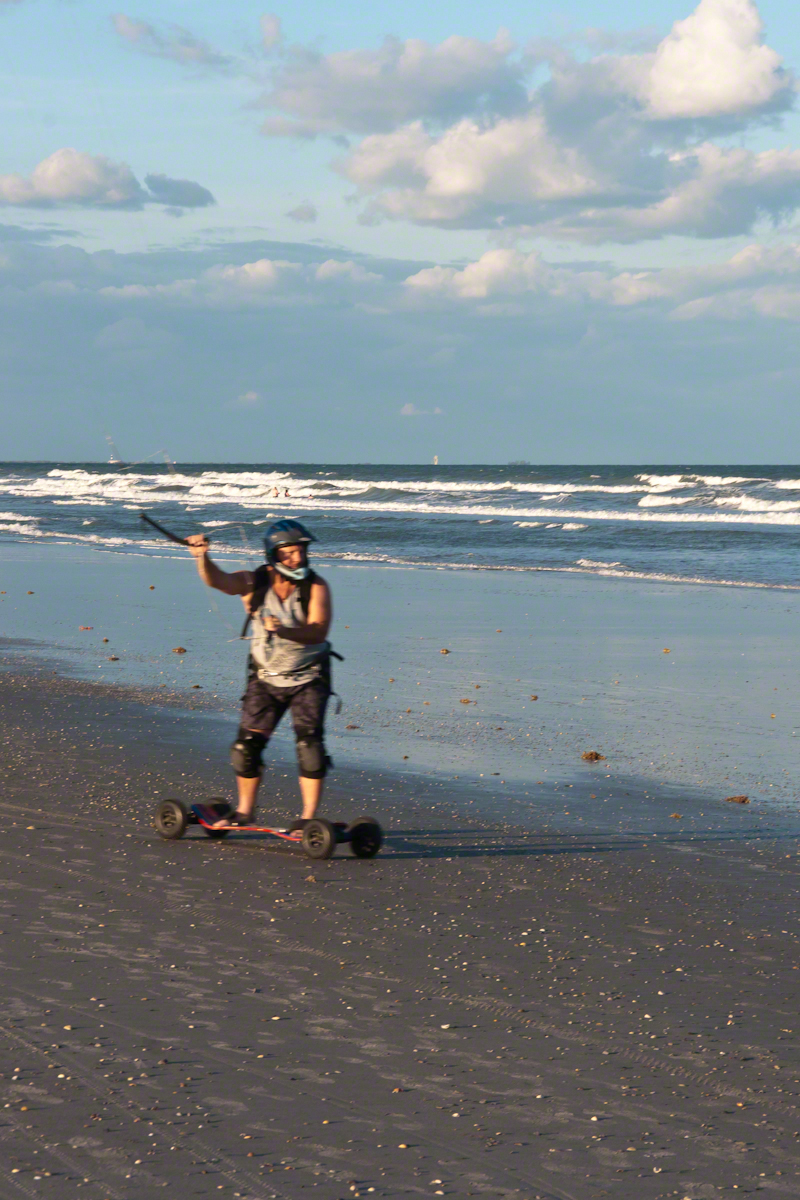
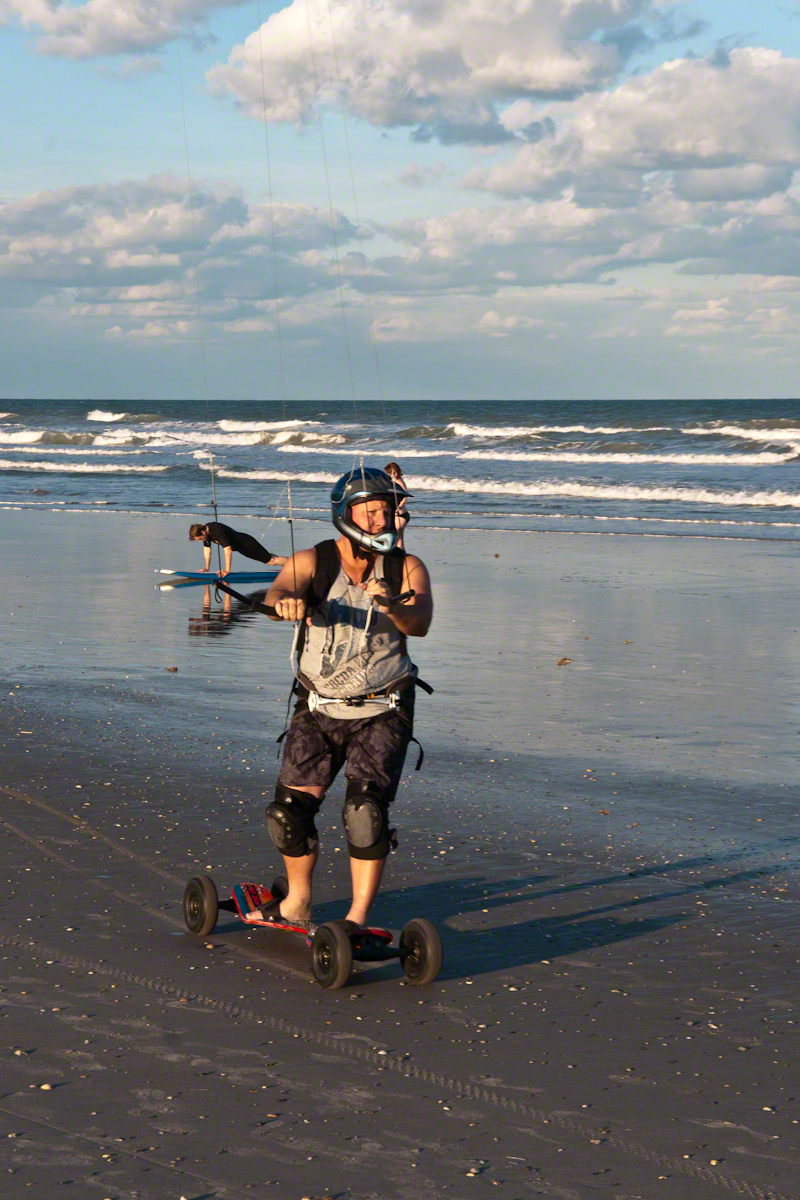
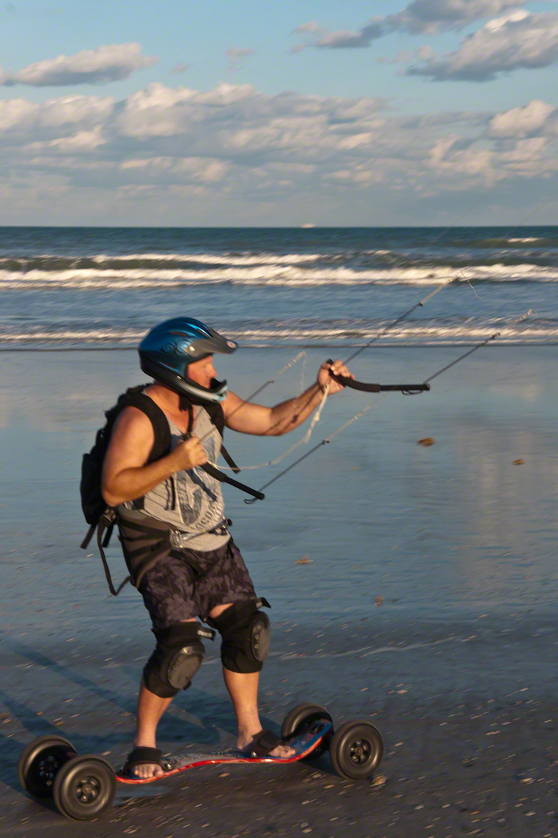
After capturing a wedding photo shoot and surfers there was this set of two Kite Skaters going at least 20 miles an hour. The Sony Alpha was quick enough to capture some of the action in raw mode, I am not satisfied with the sharpness of the images as the lens was not fast enough.
We had never watched kite skaters before and were prepared to understand the vision from watching distant kite surfers out beyond the breakers. North winds are the best for any type of kiting on Cocoa Beach and, that day, the wind was northeast. These riders zipped by in less than a minute. The sport is low key, it does not exist on Wikipedia. Image that. These two are having a fantastic time and stayed upright, going on and on and on down the miles long beach.
Sailskater Dreamview with Cruise Ship
1990 KiteSkate pioneers on the USA east coast experimented with four-line controllable parafoil kites powering in-line skates for exciting rides on asphalt surfaces.
Her partner approaches
The name “Wheels of Doom” suggest the danger of going this fast over a hard, rough surface.
He makes it look easy
These Cocoa Beach riders are outfitted for speed and safety: pads, helmets.
He maneuvers kite overhead to slow down.
Barefeet?? Unprotected skin? They must know how to dress, though maybe not. He has never fallen?
Full speed ahead with the kite positioned forward.
The beach within the tide line is solid, the pebbles, broken shells and such unforgiving as asphalt.
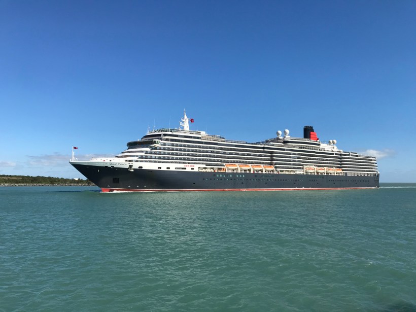
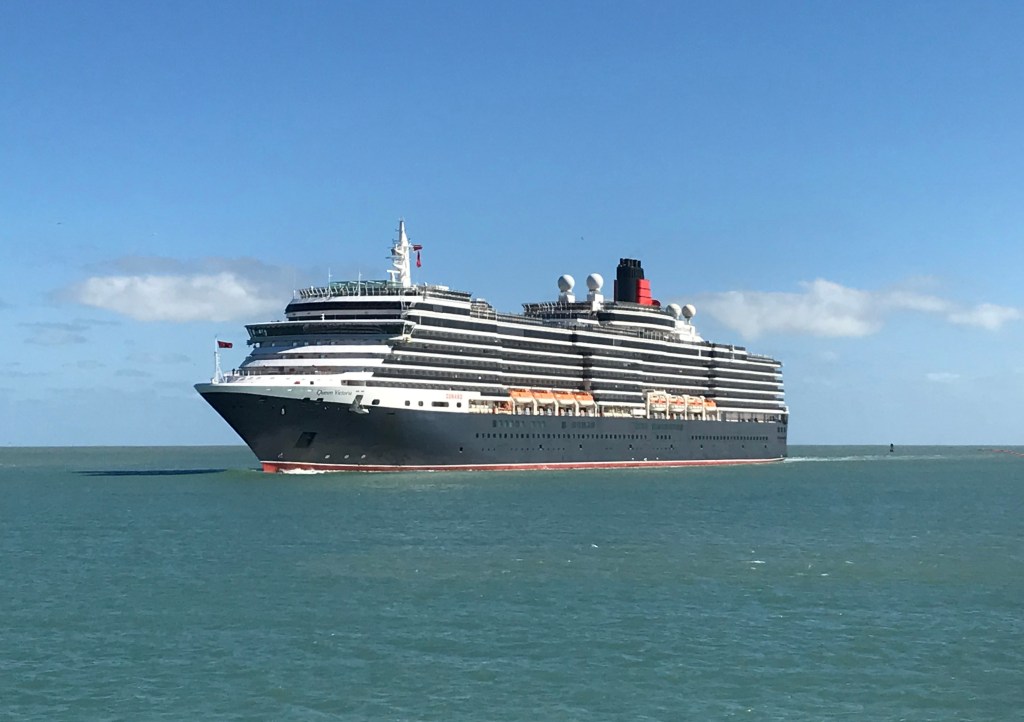
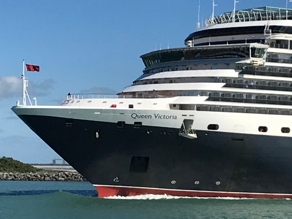
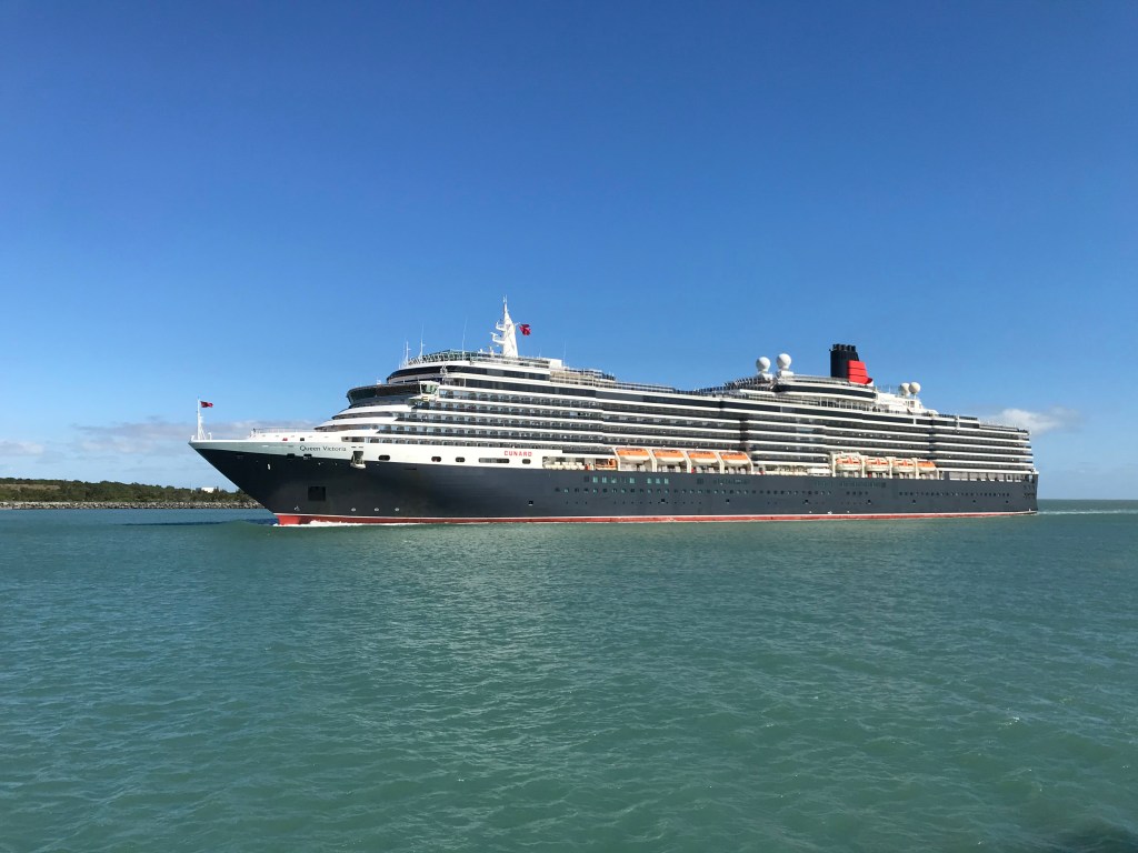
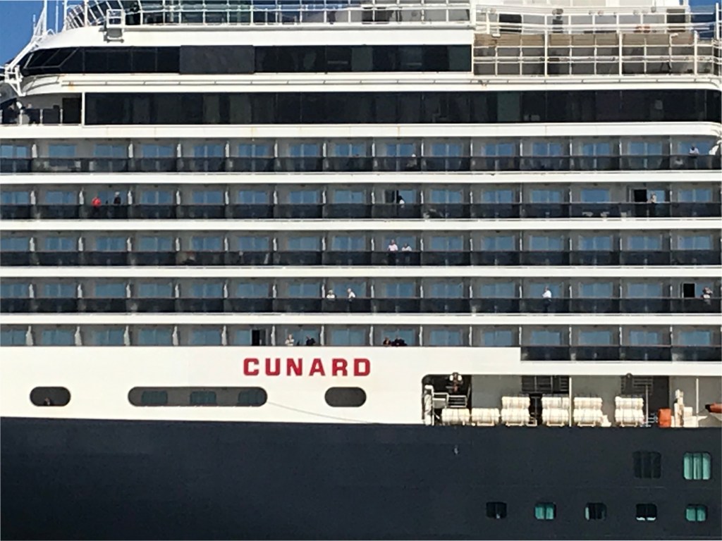
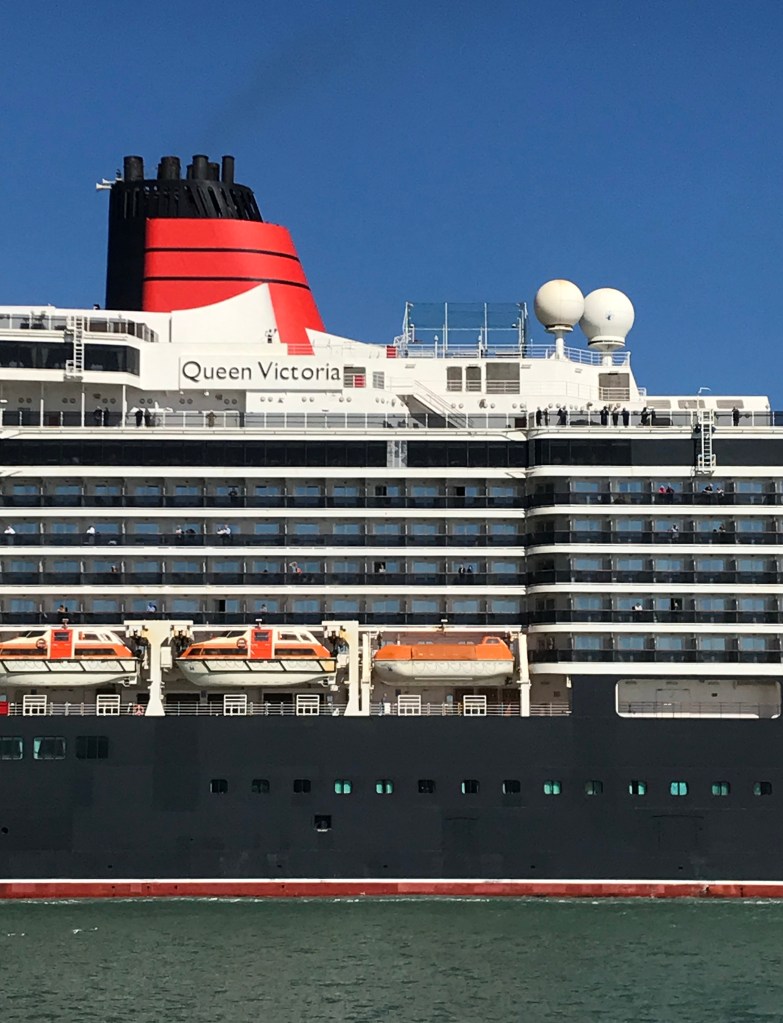
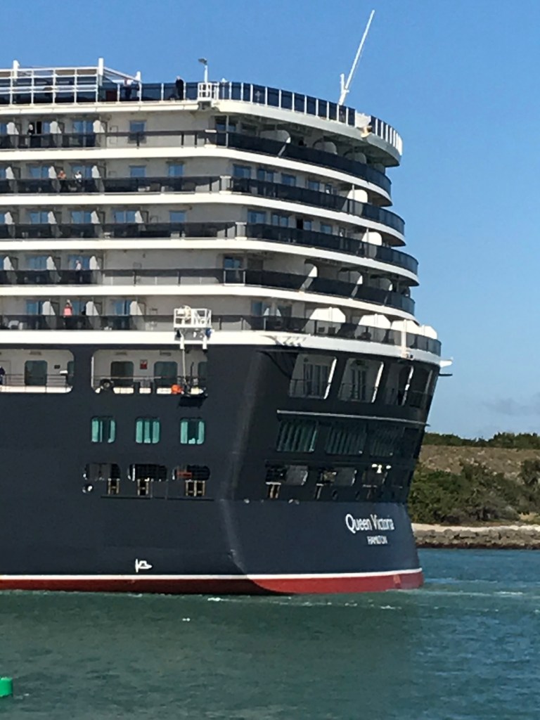
Pam and I walked from Cheri Down park this morning of February 2020 to Jetty Park where we were fortuitous witnesses to the arrival of the Cunard ship Queen Victoria on an 84-day cruise around South America.
Click video to start. To do this from WordPress Reader, for best results first click the title of this post to open a new page. Ditto for the photograph
I used my IPhone 7 to capture the event. Understanding the context of a ship’s arrival opens a whole new world. Standing on the pier I researched the voyage.
Here is the list of ports on the itinerary. These include the Caribbean, Central America and many of the same ports visited on the 2016 Oceania cruise Pam and I enjoyed from Lima, Peru to Buenos Aires, Argentina.
A roadside shrine on Cottage Road, Inishmore. The faith brought by the saints has deep roots here.
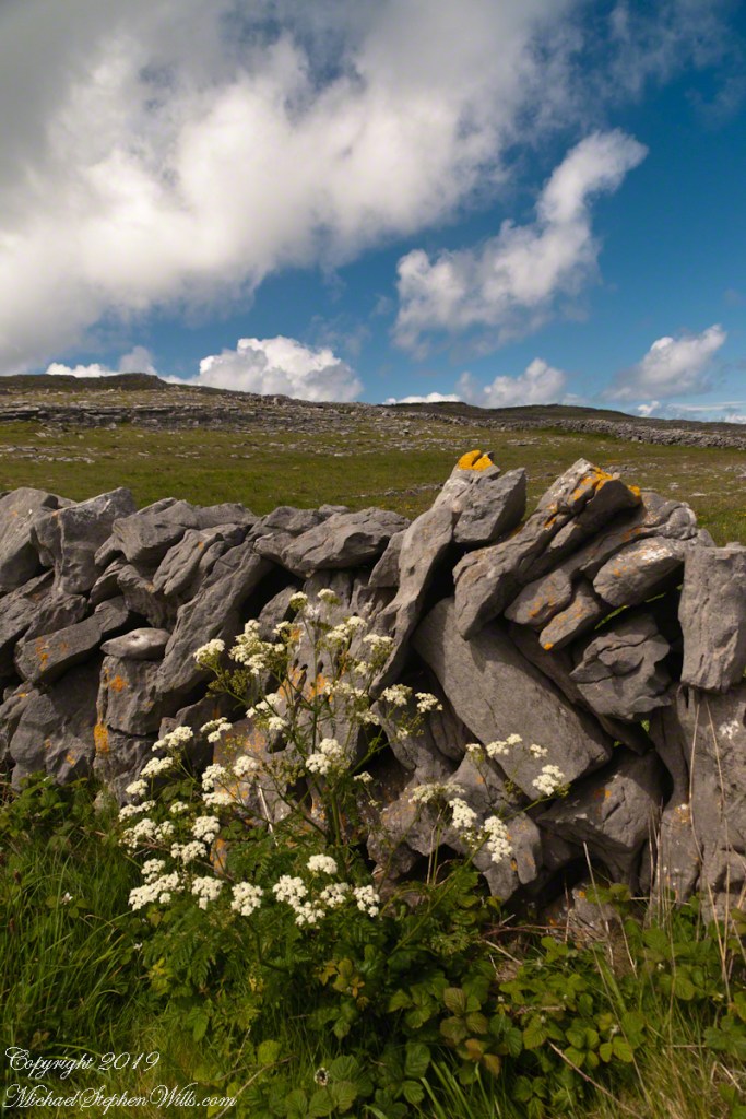
A large crucifix set with wet stone walls with cut flowers. The walls are the native limestone.
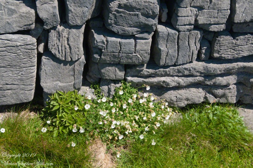
It is a spring (early June) afternoon and there are fern and wildflowers. The white flowers are Greater Burnet saxifrage (Scientific Name: Pimpinella major).
The existing dry stone wall was interrupted by the shrine. In the distance are dry stone walls around fields, a stone shed, feeding horses and the sea, being Galway Bay, storm clouds with distant rain.
Aran Islands, County Galway, Ireland.
Roadside Shrine and Island Landscape, Inishmore, Aran Islands, County Galway, Ireland
Imagine yourselves in an open cart exploring the island. Here are the photographs from my Inishmore exploration posts. Enjoy!!
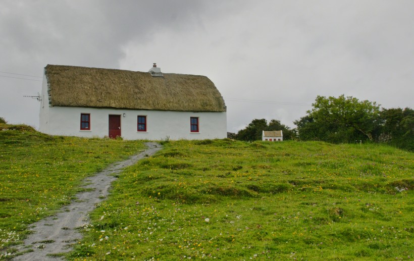
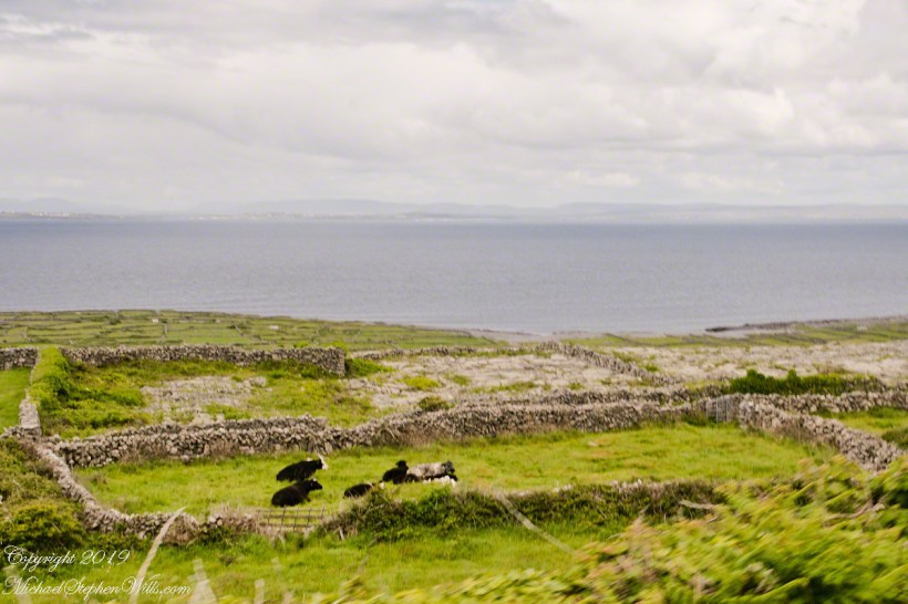
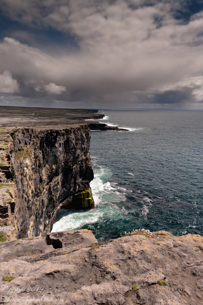
Kilronan bibycle hireView from a horse drawn trap headed down Cottage Road toward the village of Kilronan on a early June day, the island of Inishmore. On the right a stone ditch (wall), at the base the white flowers of Greater Burnet saxifrage (Scientific Name: Pimpinella saxifraga) (Irish Name: Ainís fhiáin). A steeple with bell and cross just visible. In the distance is the island of Inishmaan, the North Atlantic and Galway Bay. Aran islands, County Galway, Ireland.This ruined church is on the right side as you travel Cottage Road out of Kilronan Village, Inishmore, County Galway, Ireland. The distant highland is Inis Mann, across Galway Bay. A curious horse looks over a wrought metal gate set in a dry stacked limestone wall.Riding a horse and trap on Cottage Road from Kilronan village, Inishmore, Aran Islands, Country Galway, irelandThose bicyclists could have been us.This thatched cottage with matching child’s playhouse is on Cottage Road out of Kilronan Village on the Aran island, Inishmore, County Galway, Ireland.Roadside daisies on Cottage Road out of Kilronan village, Inishmore, Aran Islands, County Galway, IrelandNorth view from Cottage Road overlooks walled fields, karstNorth view from Cottage Road overlooks walled fields, karstAn island cottage among fields along the Galway Bay coast, the twelve pins of Connemara beyond.An island cottage among fields along the Galway Bay coast, the twelve pins of Connemara beyond.We stopped for lunch and a present for my son, a sweather purchased from the woman who knitted it.SONY DSCThe view is looking southwest from the path leading to Dun Aonghasa in springtime. We see here dry stone wall of limestone laid in a pattern suggestive of herringbone, splotches of orange lichen mark the stones. Against the wall is growing a variety of plants. The prominent white flowers are Greater Burnet saxifrage (Scientific Name: Pimpinella major) (Irish Name: Coll an dromáin). Beneath are leaves of Wild Strawberry (Scientific Name: Fragaria vesca) (Irish Name: Sú talún fiáin) as well as fern and grass. Beyond the wall is karst landscape rising to the ridge. Above the ridge, storm clouds gather. Inishmore, Aran Islands, County Galway, Ireland.This defensive structure called a Cheval de fries field surrounds Dun Aonghasa (Dun Aengus). This northwest view looks across the field and surrounding defensive walls. It is an early June day and, in the foreground, are colorful wildflowers among the limestone shards and blocks. Inishmore, Aran Islands, County Galway, Ireland.Looking North, Northwest across the slopes below Dun Aonghasa (Dun Aengus), InishmoreWalled Path to Dun Aonghasa (Dun Aengus) with Island Landscape, InishmoreKarst landscape with Green Field and Clouds, InishmoreInishmore LandscapeKarst Landscape with Interior Walls of Dun AonghasaDetail of Dun Aonghasa Dry Stone Wall with White Flowers of SeaAncient Fort Entrance, Dun Aonghasa (Dun Aengus)Ancient fort wall with tourists and Cliff Edge of Dun Aonghasa (Dun Aengus)View east, southeast from the Cliff Edge of the Ancient fort walView east, southeast from the Cliff Edge of the Ancient fort walRoadside Shrine and Island Landscape, Inishmore, Aran Islands, County Galway, Ireland
Copyright 2019 All Rights Reserved Michael Stephen Wills
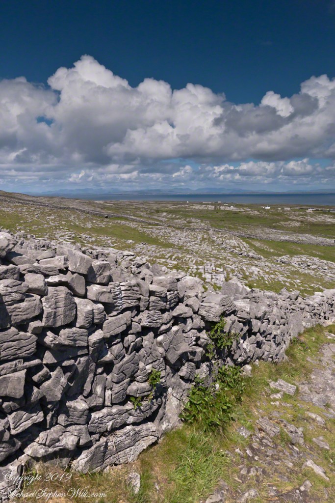
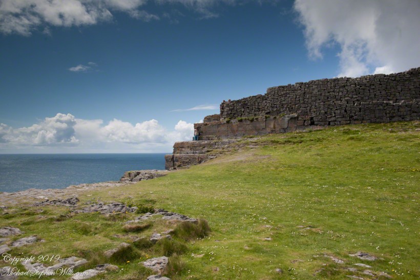
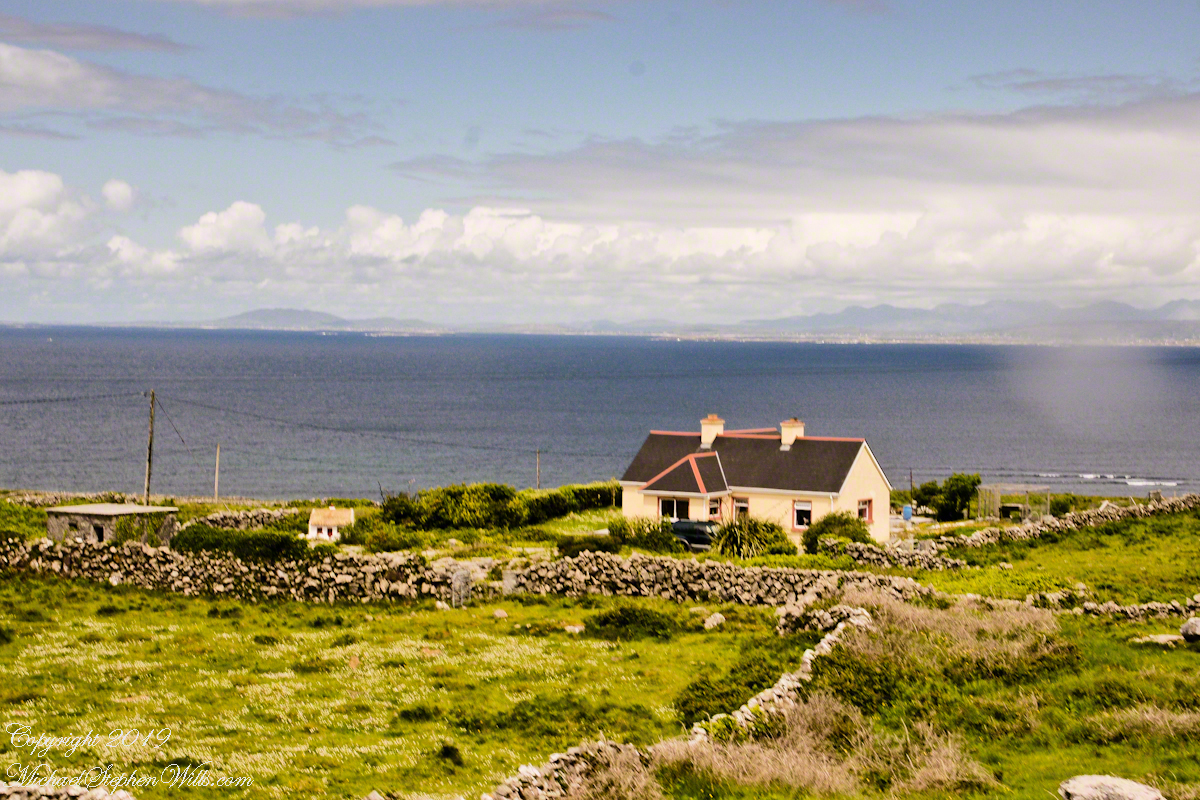
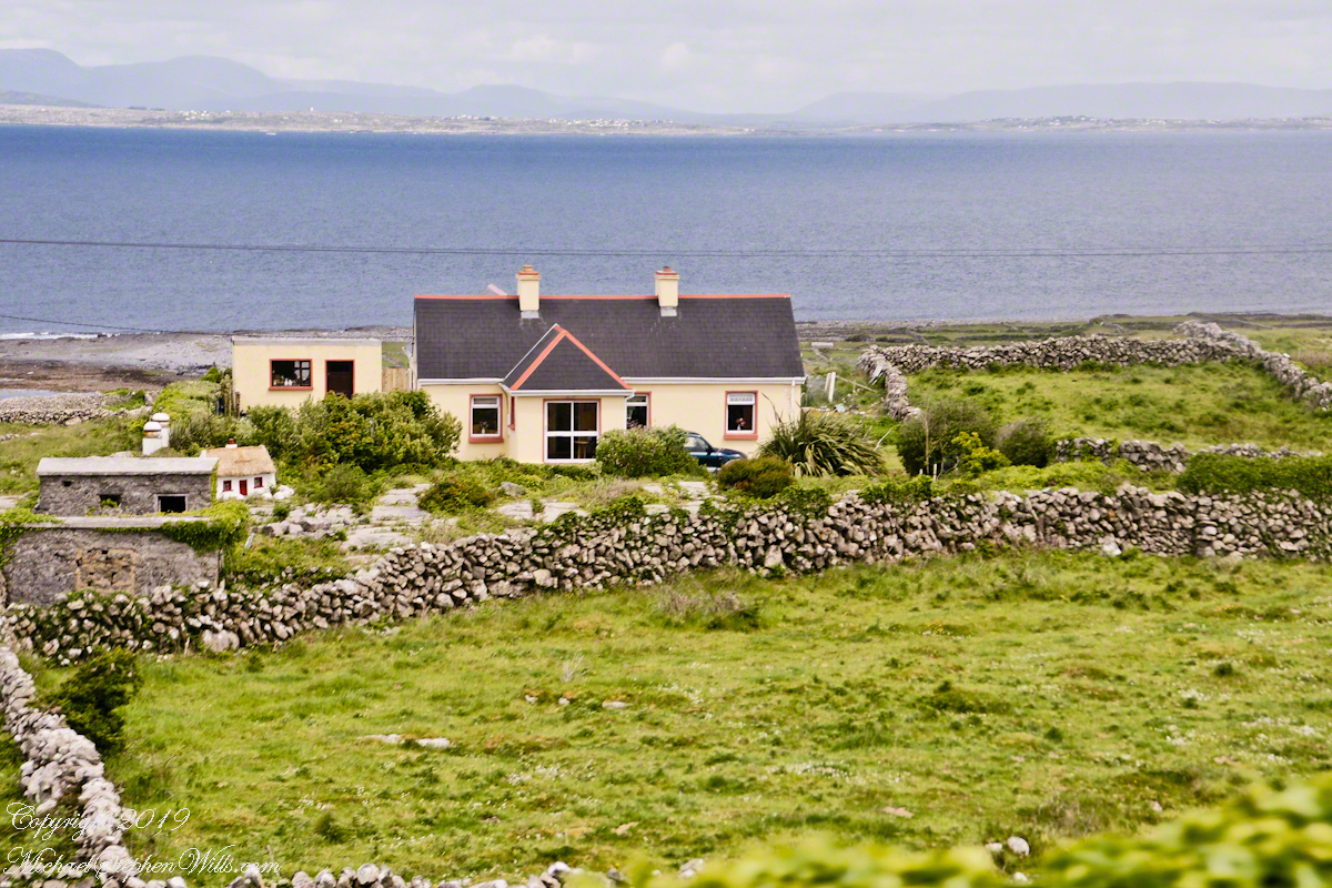
From the commanding location of Dun Aonghasa, looking northeast across Inishmore island, we can understand why the ancient builders chose this location.
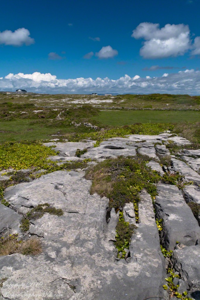
We also see the transition from exposed limestone to the fields built literally from the ground up (see my post “The How of Soil”). For a closer view of island houses see my posts “Settled In” and “Cottage Road Cottage.”
Enjoying travel on a horse trap, a type of carriage, on Inishmore (Inis Mór), the largest Aran Island in Galway Bay we headed up Cottage Road from Kilronan, the main island settlement. It was there we embarked from the Doolin ferry, hired the driver, his horse drawn trap. Our destination an iron age fort, Dun Aengus (Dún Aonghasa, the Irish language name) and the sights along the way.
The feeling of this blurry photograph is too good to let lie. I just kept snapping away from the moving carriage, here we are descending a hill and moving a bit faster, the elevation provides this view of Galway Bay, Connemara and the Twelve Pins beyond.
There’s a gate in the cow field, though some fields with cows were gateless. There is a simple answer to the mystery. At one point our driver stopped by his field and and demonstrated how the wall is pulled down to make an opening, the rocks stacked to make this easy. When the cows are in, the rocks go back up, a matter of 10 minutes or so to make a cow-width passage.
From the commanding location of Dun Aonghasa, looking northeast across Inishmore island, we can understand why the ancient builders chose this location.
We also see the transition from exposed limestone to the fields built literally from the ground up (see my post “The How of Soil”). For a closer view of island houses see my posts “Settled In” and “Cottage Road Cottage.”
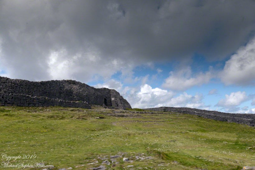
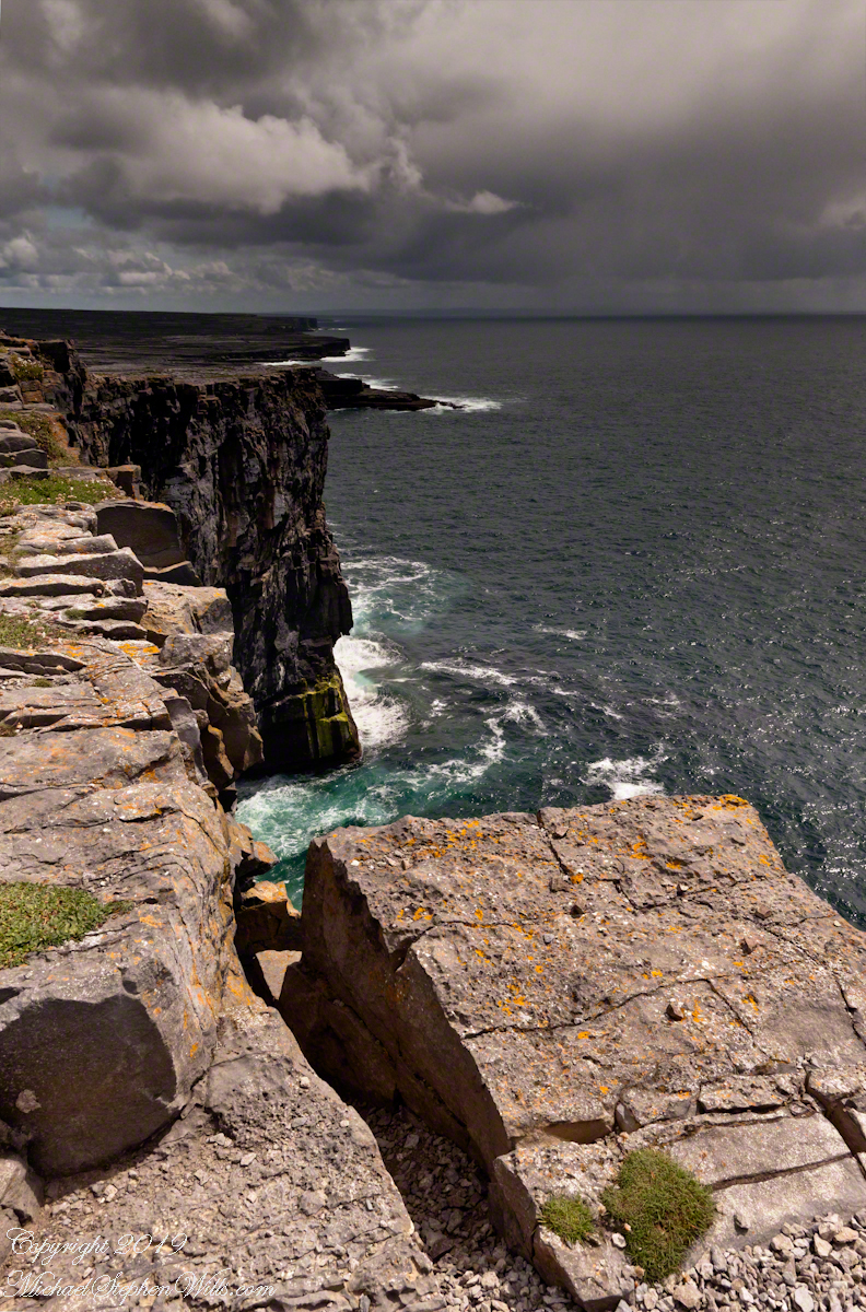
In a previous post, “Inner Ring, at last” we passed over the entrance to the inner enclosure.
A long path through fields, karst landscapes and outer walls leads to this entrance to the inner ring of Dun Aonghasa (Dun Aengus) of Inishmore, Aran Islands, County Galway, Ireland. The image composition is as a dramatic landscape with the surrounding walls and the cloudscape of an approaching storm.