Reaching Reavis Falls, once you find the canyon mouth, is three-fourths of a mile of boulder hopping and bushwacking over and around landslides, deep pools and fallen trees. Odds are you will be the only person in the canyon for weeks, if not months. Expect to be surprised. In this chapter you will (finally) visit the falls themselves.
A Camp in the Canyon
Click me for the chapter about the environment around the mouth of Reavis Canyon below the falls.
The Last Mile
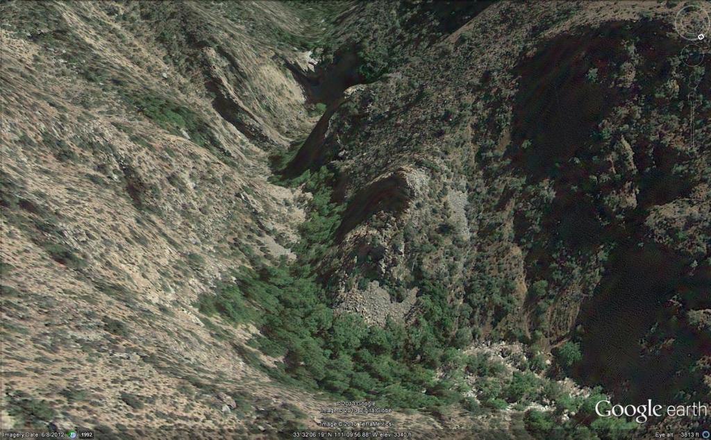
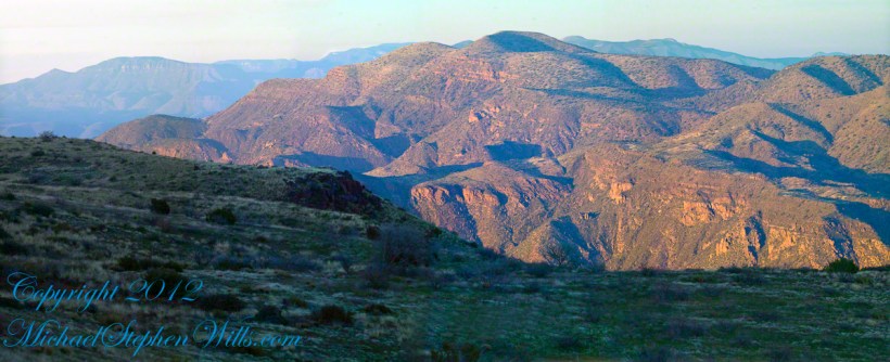
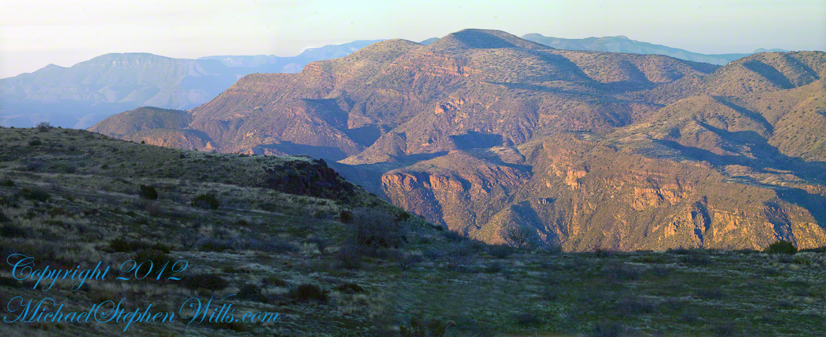
Here is an overview of the last third mile of Reavis Canyon. You can see the wall of the falls nestled in the folds of ridges towards the top, just off center.
On the lower right is a large landslide and, below there, it is complete chaos.
The vegetation grows shoulder to shoulder with interleaved branches. You will not get through there. The solution is to find a way around, usually over and around house-sized boulders.
The image was captured from Google Earth
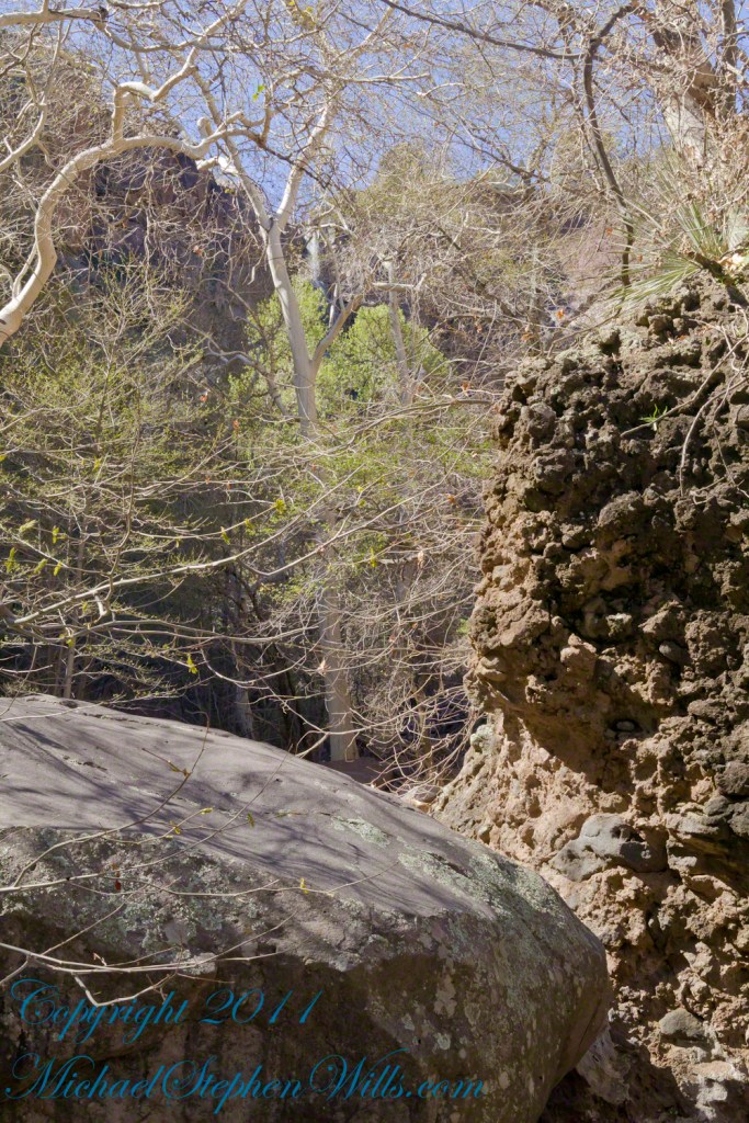
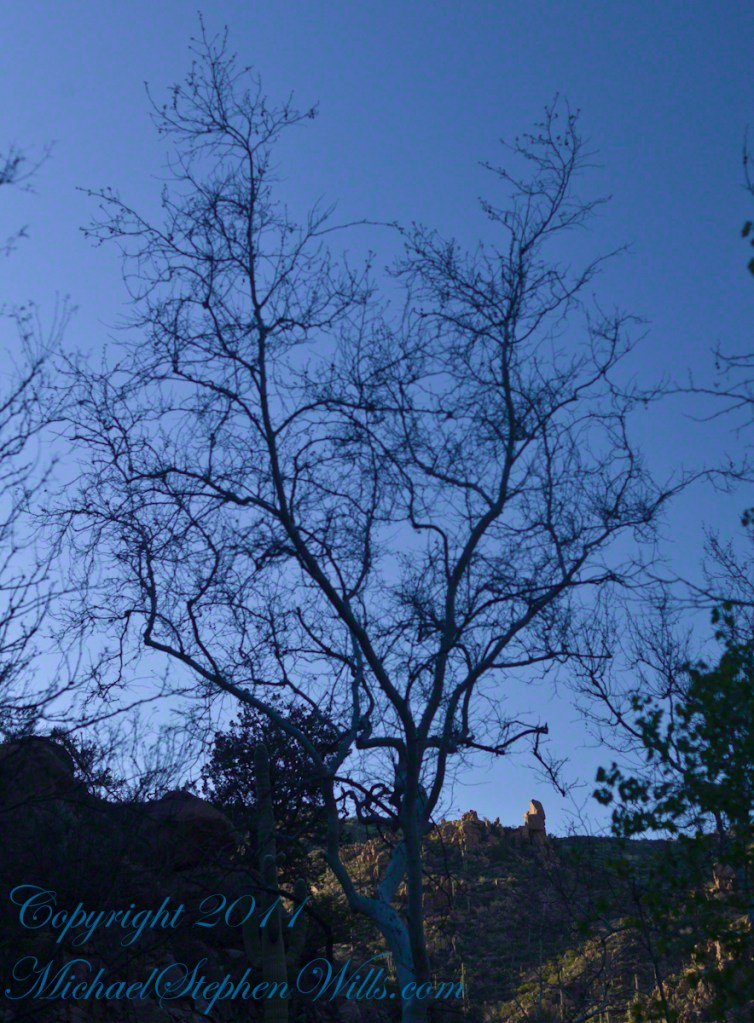
After almost two hours of picking my way, there was a flicker of light. The fall waters were sparkling in the sunlight high above the cottonwood trees, in full Mach bloom, and the still leafless Arizona Sycamores.
This was my view of Reavis Falls from the canyon on a March day before the Arizona Sycamores have leaved. The falls are the tiny patch of white to the left of midline where the earth meets the sky. Jumbles of infallen boulders and thick growth of sycamores, oaks and fully leaved cottonwoods cloak the falls.
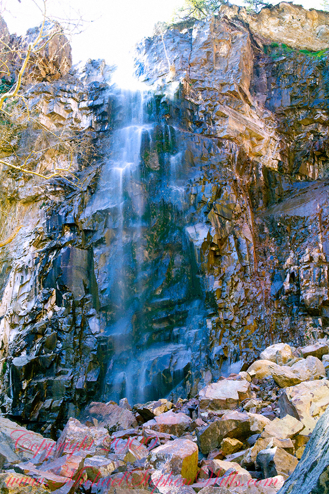
Another 30 minutes of canyoneering brought me to the foot of the falls.
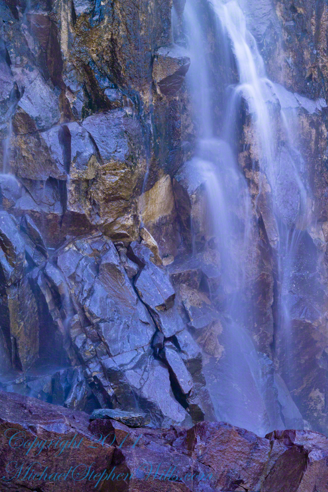
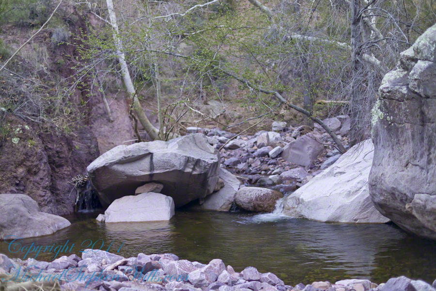
At the Foot of Reavis Falls
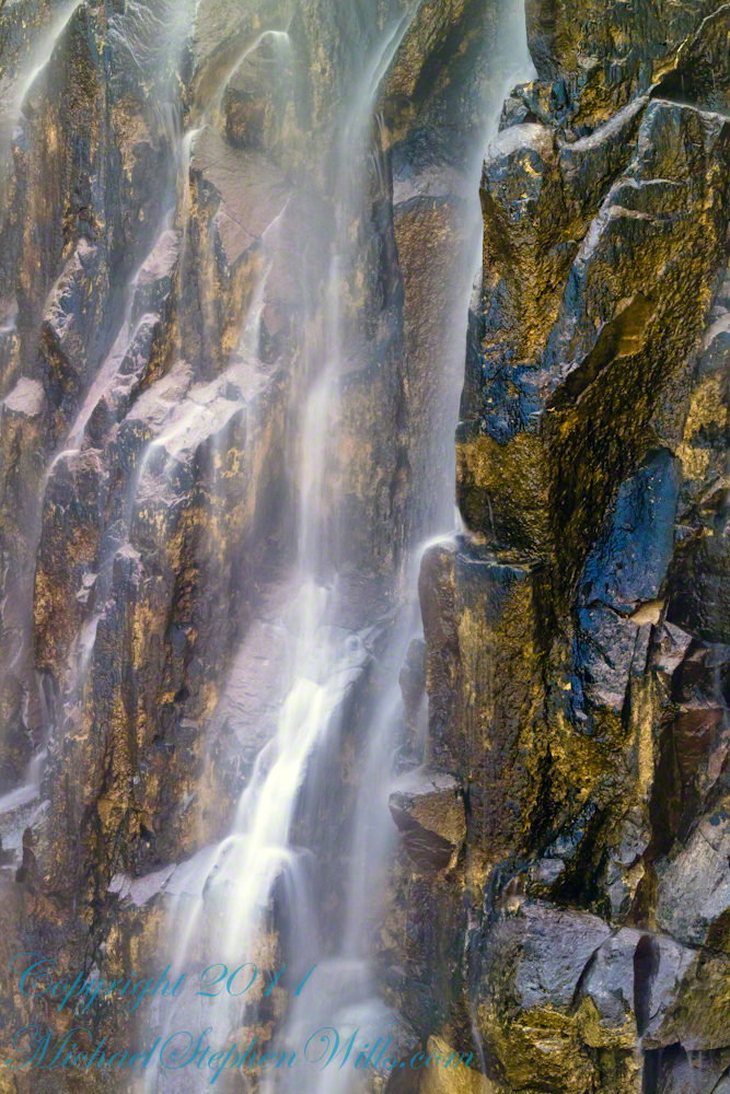
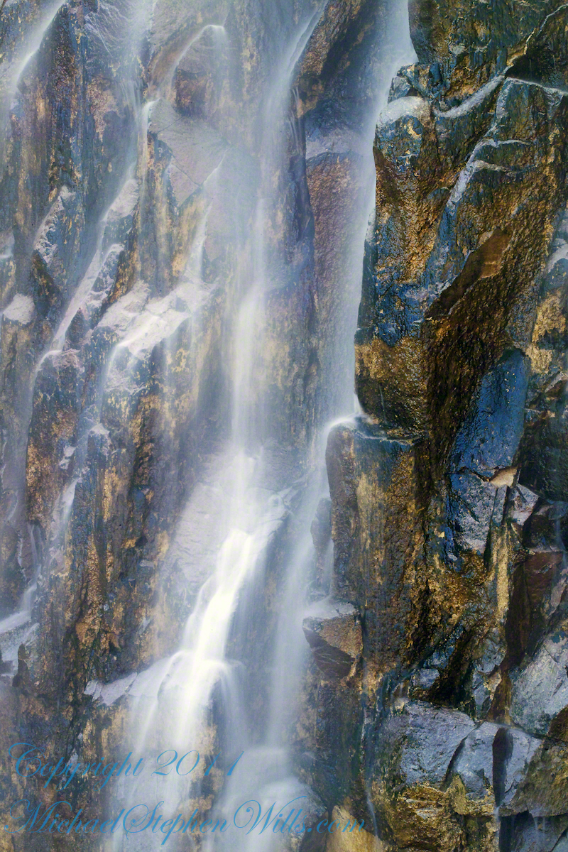
Looking up at Reavis Falls from a 20 foot tall mound of talus.
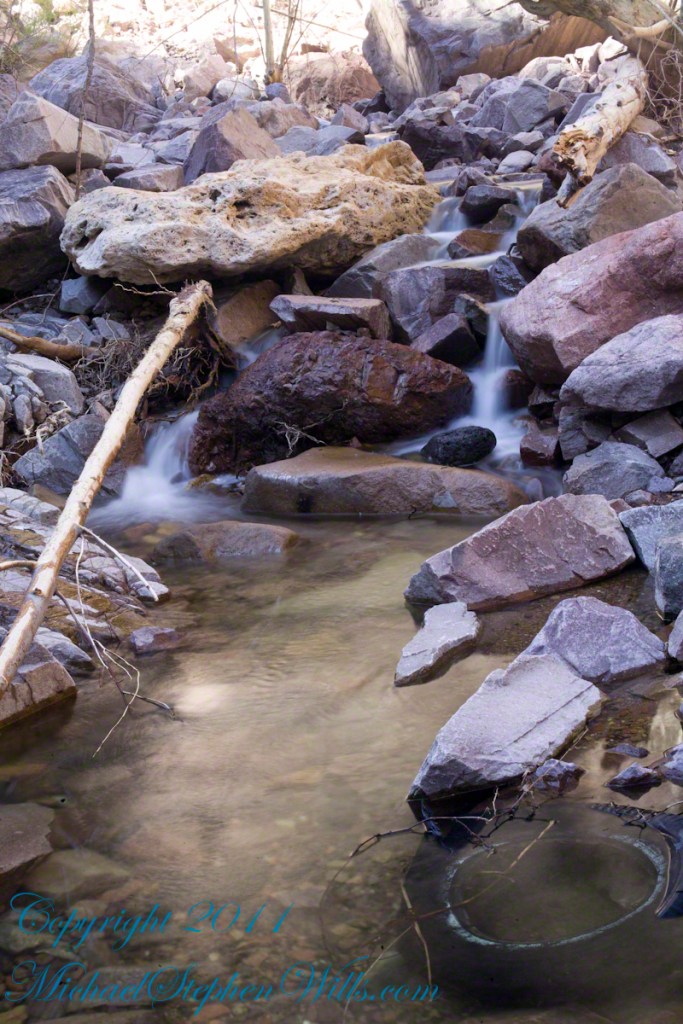
These are boulders washed down at flood time.
The rock wall is thick with microorganisms, fungi and mosses.
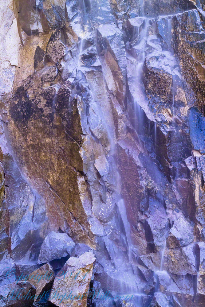
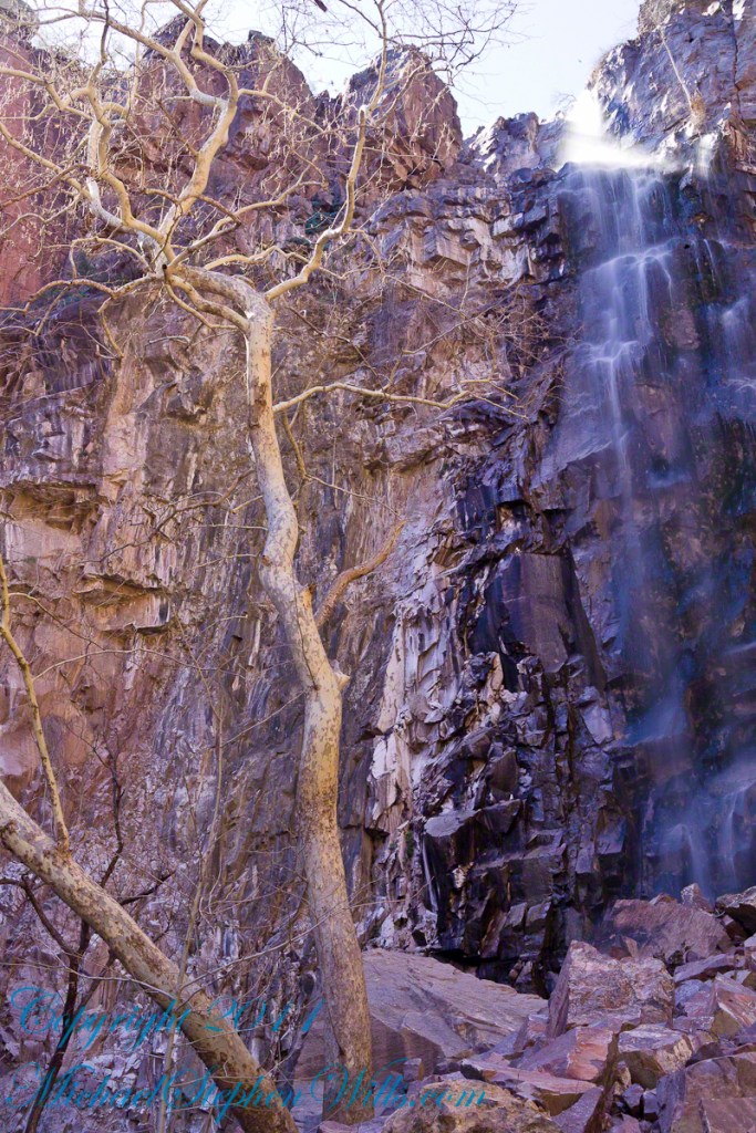
After clambering around the talus pile I found this angle….
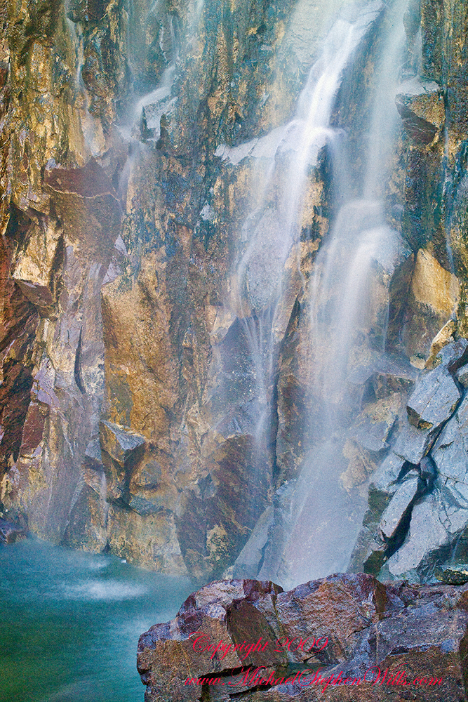
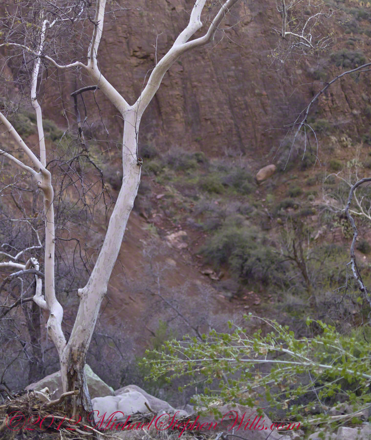
An Arizona Sycamore, before the spring leafing, at the Foot of Reavis Falls
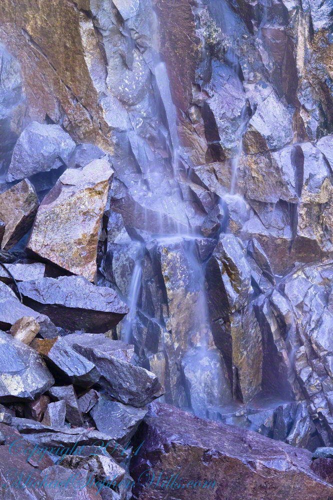
Talus at the Foot of Reavis Falls
The Reavis Falls talus is large boulders carried down Reavis Creek and washed over the falls at flood time as well as blocks fractured from the cliff face. You can see the base of the Sycamore from the previous photograph.
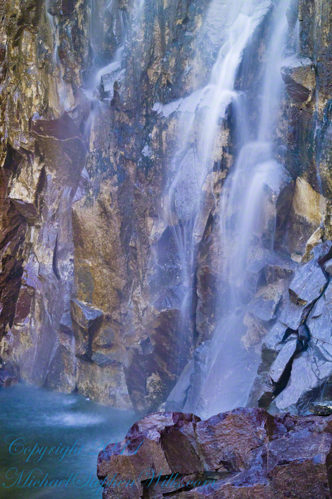
The falls are formed where Reavis Creek flows over a solid mass of rock. The talus is composed mostly of this red rock. From the edge of this cliff to the base, where the falls hit the canyon floor, is all of 140 feet. This is a far as you can proceed into the canyon without some serious climbing skills.
It is possible to climb around the canyon by climbing up the ridge from which I captured the Cedar Basin Hoodoos. See my posts below for this location (you need to work it our for yourself).
This is NOT the last post of the series. From here I will focus on the beauty of Reavis Falls and the canyon that holds them.
It was a four-day expedition so there are a few chapters covering the approach to the Falls:
The Superstition Wilderness was born from volcanic eruption and in some places (Peters Mesa) the earth still rumbles.
Here in Reavis Canyon it is the huge spring runoff that builds the environment, grinding and scouring the canyon. In my chapter The Mouth of Reavis Canyon is the story of this aspect of the canyon.
The history of this spot is written on these volcanic and igneous rocks and boulders, the uprooted tree roots and fresh water.
The tire must have washed down from Reavis Ranch.
A Canyon of Wonder and Beauty
In this chapter I present, in the header, the lovely dawn sky of that day, and a tiny corner of a rock jumble in Reavis Creek. There is a large format version of the sky in my previous post, “The Mouth of Reavis Canyon.”
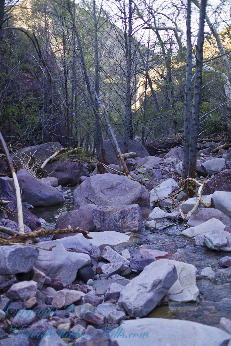
Rivulets and Rocks
Copyright 2023 Michael Stephen Wills All Rights Reserved
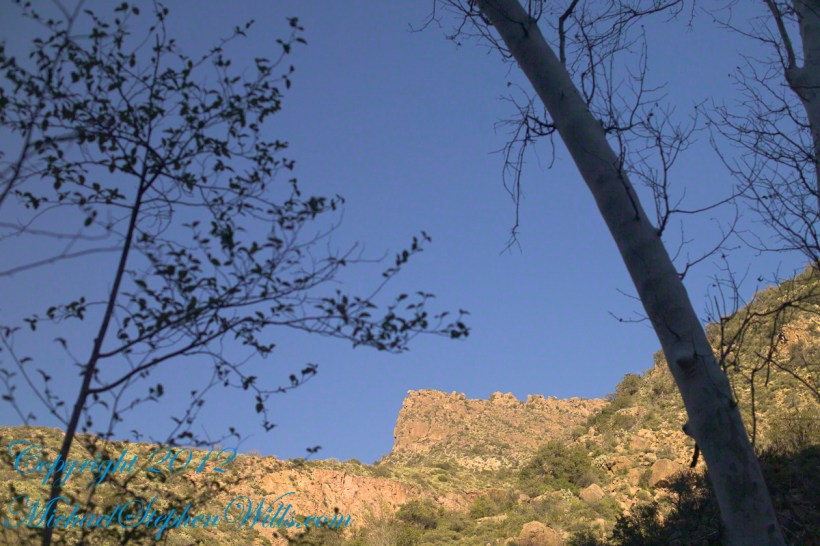
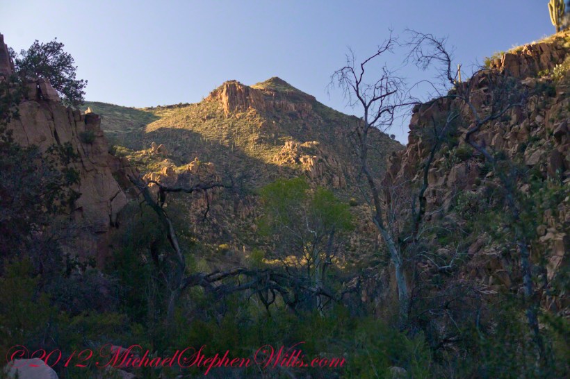
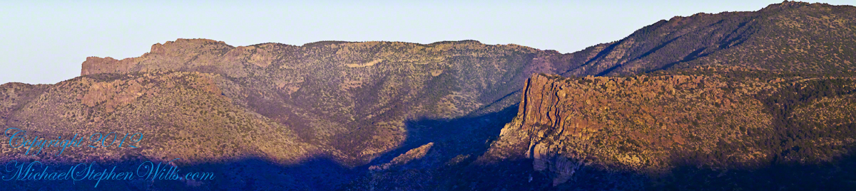
Here is the same view, in daylight. As I hiked toward the canyon mouth below Reavis Falls, looking up I saw this prominant cliff against the sky.
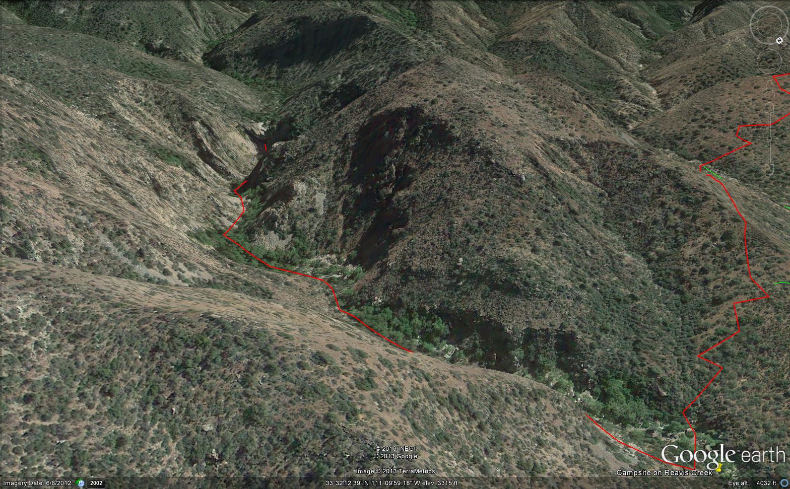
Here is the path I took toward the falls. The campsite is to the lower right, the falls are toward the center and left. My approach to the camp is on the right, moving toward the top. For another view of this location see Reavis Canyon Camp.
The mouth of Reavis Canyon below the falls is choked with vegetation and infallen rocks and boulders. The far slopes are thick with the poles of young saguaros. There are hoodoos, as well. In the photograph, below, one hoodoo is catching morning light. See the chapters Hoodoos on the Descent to Reavis Falls and Cedar Basin Hoodoos for more views of the hoodoos around Reavis Falls.
Hoodoos visible from the mouth of Reavis Canyon below the falls. Look toward the far slope.
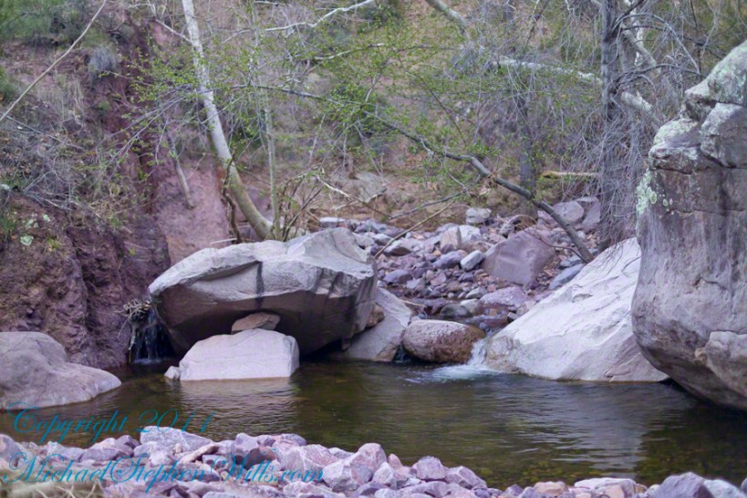
Flood damage in Reavis Canyon below the falls. Note the scouring at the base of these trees and the broken limbs. This is NOT a place to be in spring thaw.
Massive spring flooding scours the canyon floor.
Flood damage in Reavis Canyon below the falls.
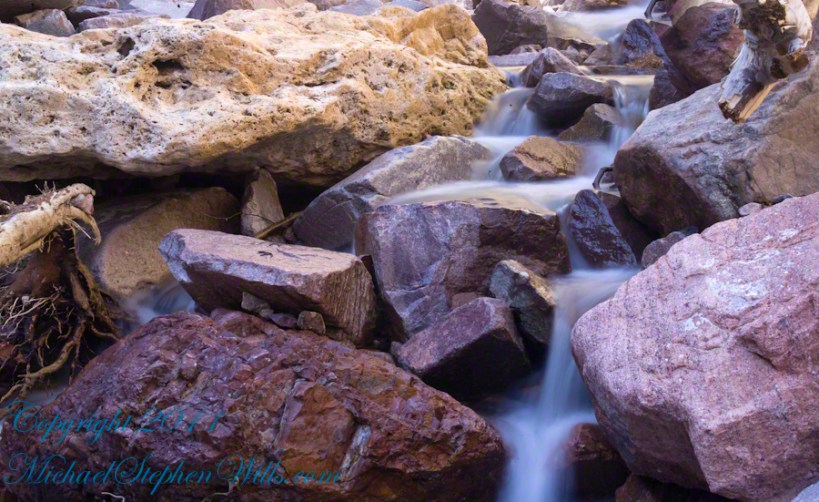
There is beauty to be found, as well. Freshly fallen rough rocks contrast with water smoothed boulders and the water surface.
Copyright 2023 Michael Stephen Wills All Rights Reserved
See Evening on Two Bar Mountain for another chapter of my four-day solo expedition to Reavis Falls in the remote eastern Superstition Wilderness.
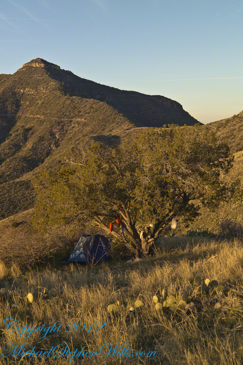
Campsite at Morning
On the late-morning of day three I climbed out of the Reavis Creek valley to camp on the slopes of Lime Mountain. There I watched the afternoon progress to evening, a full moon rise in a bright sky and other events featured in this blog. All around my campsite under a lone juniper the mountain side was blooming.
Grasses, Cacti and Flowers
Among the grasses, cacti and lichen-covered rocks were many small wildflowers. I was careful to avoid damaging them and otherwise enjoyed their beauty and plentiful blooms my entire stay. I capture some of them in the early morning light and spent some time identifying them for you.
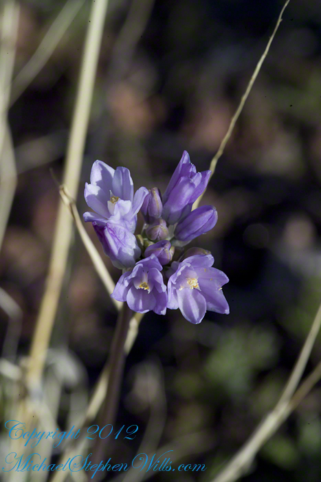
Desert Hyacinth is a perennial lilly (Liliaceae).
It grows from an onion-like bulb used for food by pioneers and Native Americans. This lilly propagates through this bulb and, also, from seed that forms from these flowers.
The umbel-shaped flowers grow in clusters at the end of long, leafless stalks. Each blossom is an inch across and has six segments that are like petals.
Also called Blue Dicks, bluedicks, Papago lily, purplehead, grassnuts, covena, coveria.
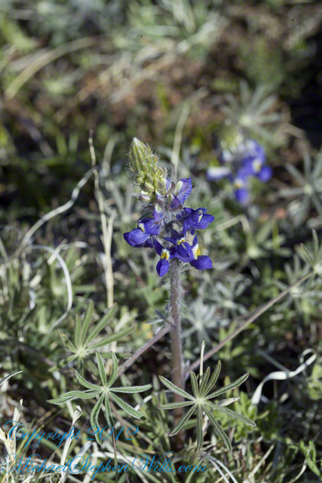
Lupine is a pea, a perennial herb and a favorite of bees. Like other lupines, it improves the soil. Their root nodules, with the aid of certain bacteria, allow lupines and other legumes to absorb free nitrogen from the air.
A member of the Phlox family (Polemonium), this five (5) petal flower bloomed in small groups on erect stalks with sparse leaves. The stamen heads are notable for a bright blue color.
Copyright 2023 Michael Stephen Wills All Rights Reserved
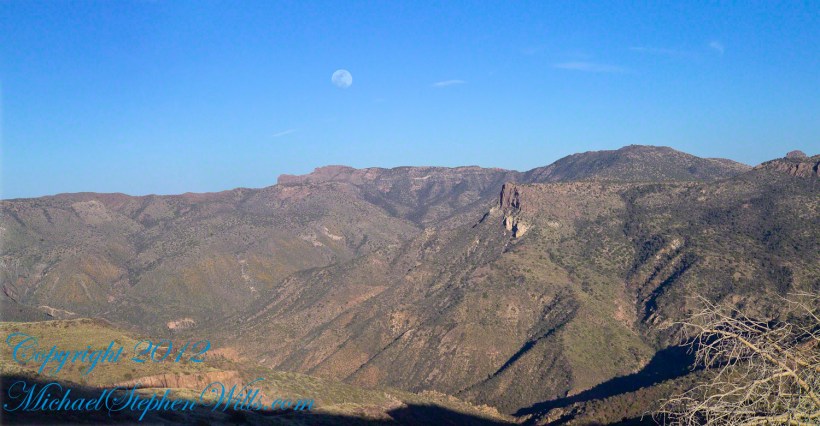
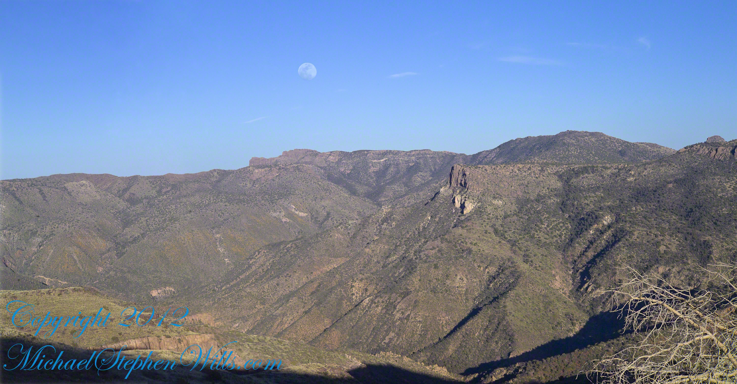
Two Bar Mountain is only part of this view taken the evening of Day Three, my solo expedition to Reavis Falls in the Superstition Wilderness of Arizona.
The view encompasses most of the four day expedition, being the climb into the lower Reavis Creek Canyon from which I camped. I spent one entire day walking up the valley to the falls.
The patches of yellow on the far slopes to the left and into Reavis Valley are Mexican Poppy (Eschscholtzia californica) blooms.
To find lower Reavis Creek Canyon, look for the prominent cliff formation in the very center of the image. Follow the end of the cliff down to a dark shadow. The western canyon wall creates the heavy shadow. As you move to the right, in the image, the shadow becomes wider because the canyon wall becomes higher.
The view also encompasses a 2005 solo expedition over Two Bar Mountain using the Tule and Two Bar Ridge trails into the Superstition Wilderness around Pine Creek. See my blog “Racing the Sun” for an image Two Bar Mountain with the path of (most of) two days of that expedition.
An interesting feature of the full size image (lost in the small-scale reproduction of this blog) is the host of enormous saguaro cactuses marching up the sides of the canyon to the left, thinning out and ending on the western walls of the canyon (the slope directly beneath my viewpoint). Our course, each cactus is perfectly still, casting a huge shadow, and seems very tiny. The nearest is a mile away. We are seeing in this thinning host the lower Sonoran in transition to the upper Sonoran life zone.
All of this in one view from Lime Mountain. Here is another, taken just as the sun set.
Copyright 2023 Michael Stephen Wills All Rights Reserved
This post features photographs from my solo expedition to Reavis Falls in a remote corner of the Superstition Wilderness of Arizona.
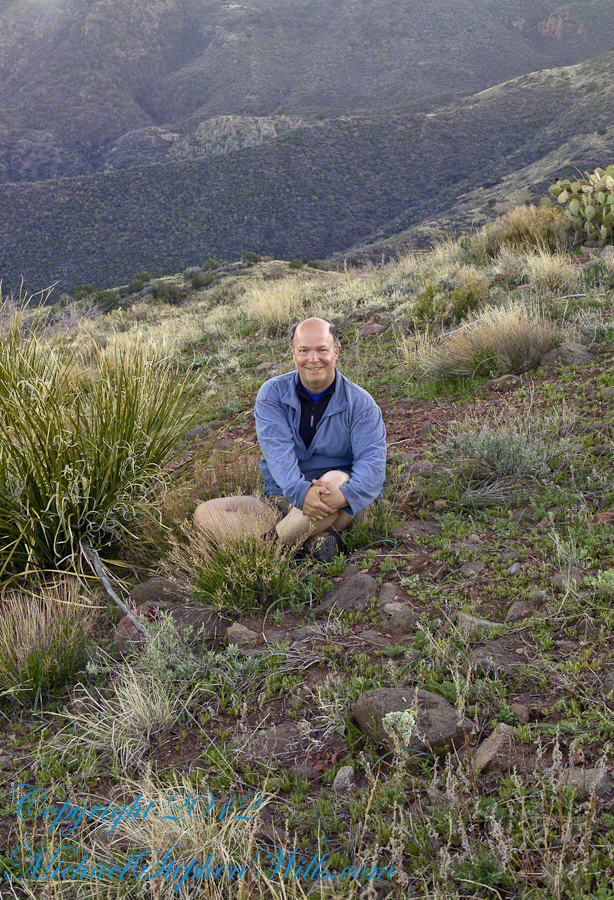
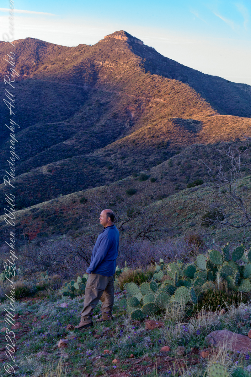
The morning of Day Four, my solo expedition to Reavis Falls in the Superstition Wilderness of Arizona. I camped on Lime Mountain, off the trail to Reavis Falls. That is Castle Dome behind me. The line sloping up the mountain is the Reavis Trail to Reavis Ranch.
My campsite.
Looking toward Pinyon Mountain and the Arizona Trail (not visible) that fine morning.
Copyright 2023 Michael Stephen Wills All Rights Reserved
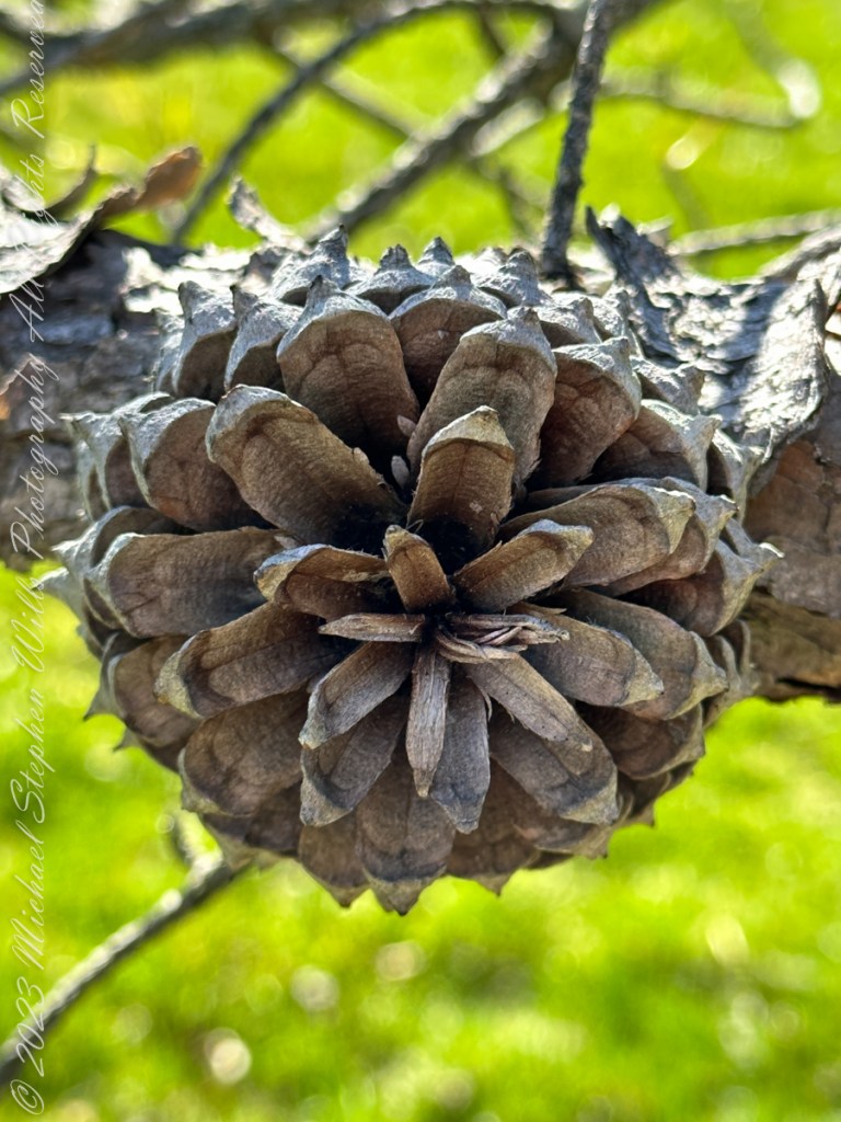
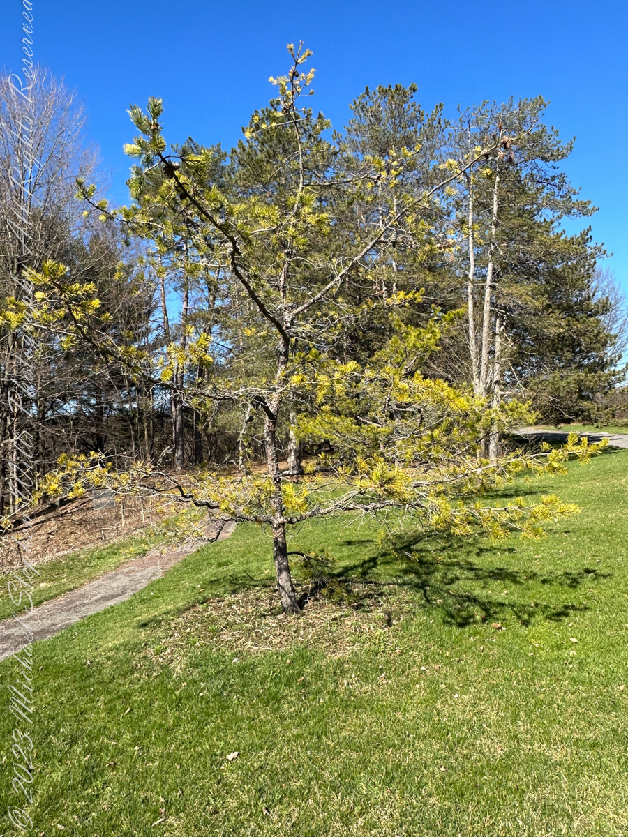
Pam and I ambled around the Arboretum for our Easter 2023 outing. Found here growing outside native range, being the Appalachian Mountains from Georgia to southern Pennsylvania, the Table Mountain Pine is named after the landform, not a particular mountain.
All photography using the IPhone 14 ProMax triple camera, raw format, edited on the phone.
Its pinecones drew me to this scraggly, ungainly, poorly formed tree. All general mankind finds useful in the, scientific name, Pinus pungens, otherwise known as Hickory Pine, Prickly Pine and Mountain Pine, is to grind it up for pulp or chop it for tinder.
Last of the Mohicans
That said, the final scene of the 1992 film The Last of the Mohicans takes place in a nice Pinus pungens stand on a rocky mountaintop in North Carolina.
Personality
The tree has personality. Pinus pungens is the Lonesome Pine of the 1908 novel The Trail of the Lonesome Pine by John Fox, and popularized in the Laurel and Hardy film Way out West: “On the Blue Ridge Mountains of Virginia On the Trail of the Lonesome Pine” Several “Lonesome Pine” hiking trails have been waymarked in the Blue Ridge Mountains and elsewhere in the Appalachians.
Pinecone Bud
Pinus pungens prefers dry conditions and is mostly found on rocky slopes, favoring higher elevations, from 300–1,760 meters (980–5,770 ft) altitude. It commonly grows as single scattered trees or small groves, not in large forests like most other pines, and needs periodic disturbances for seedling establishment. The three tallest known ones are in Paris Mountain State Park, South Carolina; they are 26.85 to 29.96 meters (88 ft 1 in to 98 ft 4 in) tall.
Reference: “Pinus pungens” Wikipedia.
Copyright 2023 Michael Stephen Wills All Rights Reserved
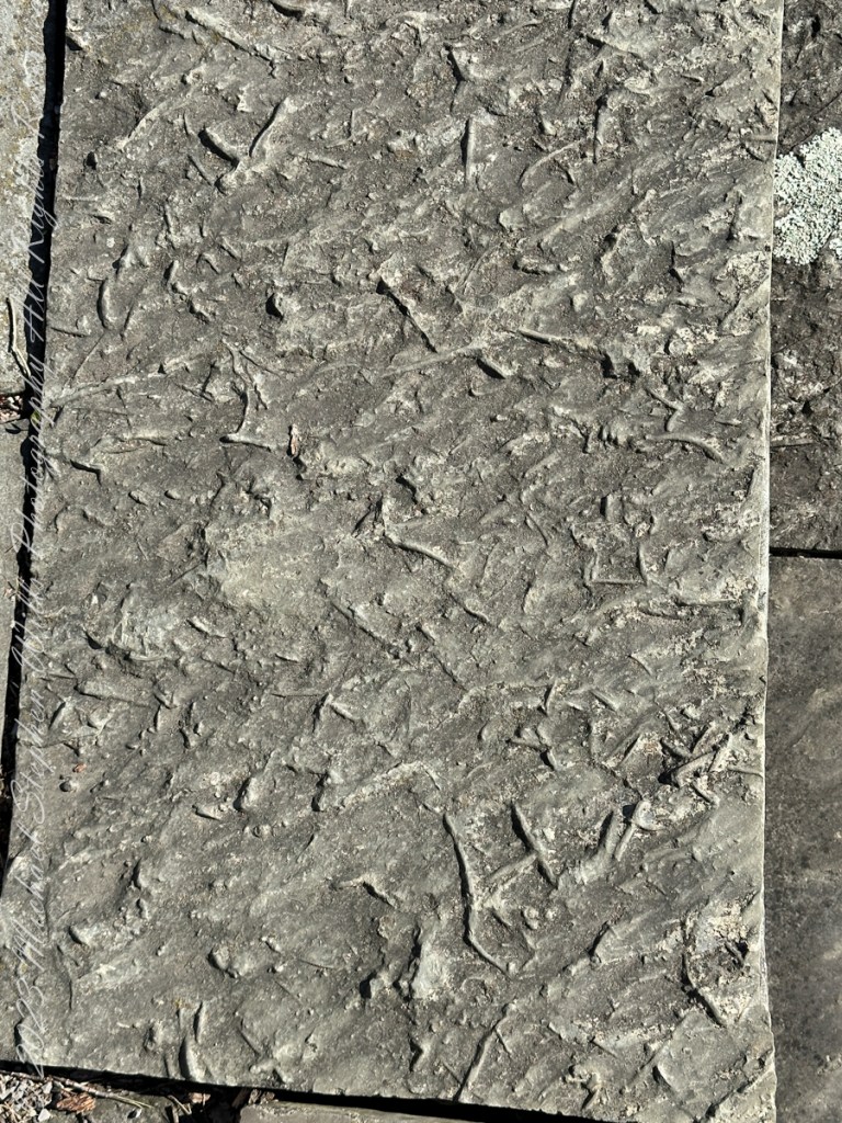
Pam and I ambled around the Arboretum for our Easter 2023 outing. A type of sandstone popular with Cornell monument builders, called “Lenroc” after a mansion build by Cornell’s founder, was used for these benches built into the hillside of the FR Newman Arboretum. The views are more interesting than the bench, the arch of stone in midground in one photo.
All photography using the IPhone 14 ProMax triple camera, raw format, edited on the phone.
The stone is mined locally from surrounding hills. Calling it “Lenroc” (Cornell spelled backward) is a misnomer as the stone is mined widely throughout the region.
Feldspathic Greywacke
“Bluestone from Pennsylvania and New York is a sandstone defined as feldspathic greywacke. The sand-sized grains from which bluestone is constituted were deposited in the Catskill Delta during the Middle to Upper Devonian Period of the Paleozoic Era, approximately 370 to 345 million years ago…..
Glacial Landscape on an early spring day, Easter 2023
Textures
…The Catskill Delta was created from runoff from the Acadian Mountains (“Ancestral Appalachians”). This delta ran in a narrow band from southwest to northeast and today provides the bluestone quarried from the Catskill Mountains and Northeastern Pennsylvania. The term “bluestone” is derived from a deep-blue-colored sandstone first found in Ulster County, New York.”
You can feel the origin of this bluestone from these macros of two pavers from a monument bench.
Reference: “Bluestone” Wikipedia.
Copyright 2023 Michael Stephen Wills All Rights Reserved
In more recent centuries Loughcrew became the seat of a branch of the Norman-Irish Plunkett family, whose most famous member became the martyred St Oliver Plunkett. The family church stands in the grounds of Loughcrew Gardens. With its barren isolated location, Sliabh na Caillí became a critical meeting point throughout the Penal Laws for Roman Catholics. Even though the woods are now gone an excellent example of a Mass Rock can still be seen on the top of Sliabh na Caillí today. The Plunketts were involved in running the Irish Confederacy of the 1640s and were dispossessed in the Cromwellian Settlement of 1652. Their estate at Loughcrew was assigned by Sir William Petty to the Napier Family c.1655. The Napiers are descended from Sir Robert Napier who was Chief Baron of the Exchequer of Ireland in 1593.