Here is a repost for those who missed the video. Please click on video, below and share your responses via comments. Thank You
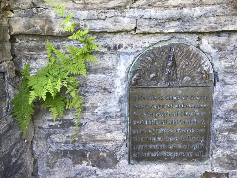
The Finger Lakes Trail joins Robert H. Treman New York State Park, running along the south rim along the park border.
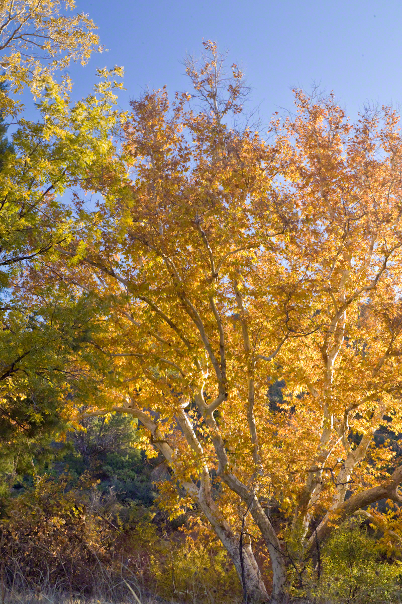
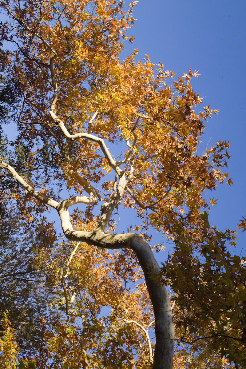
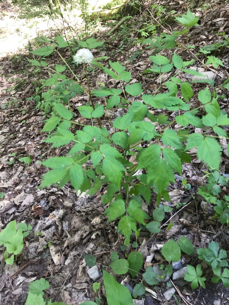
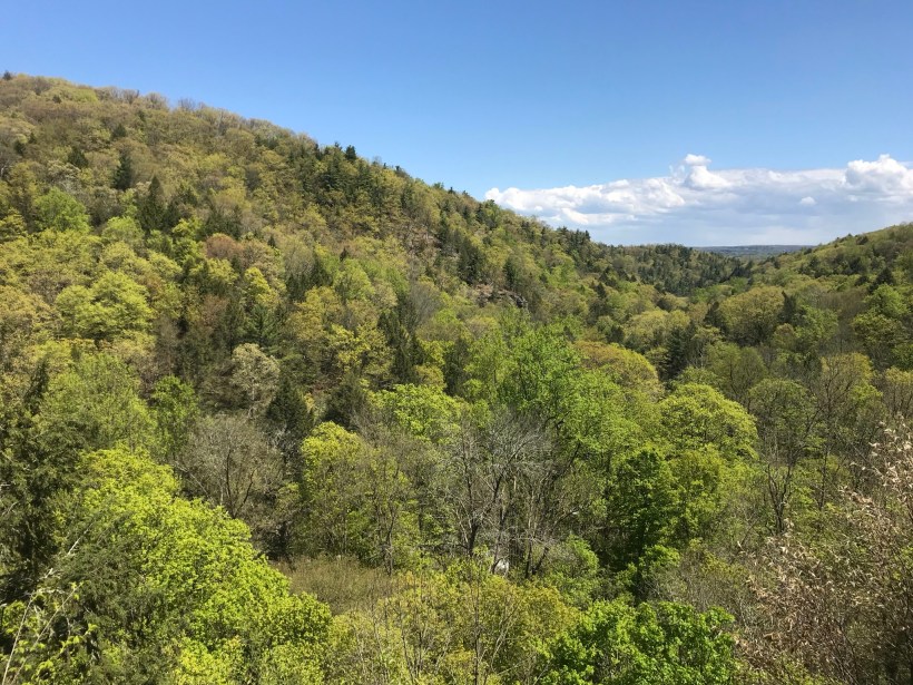
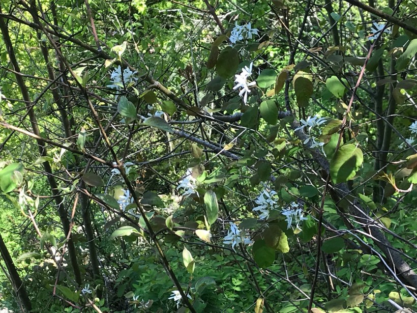
Today, I started from the stairs next to the Mill of the upper park, walking along Fish Kill Creek, a brief visit to the CCC plaque, over the new footbridge and a steep climb up to the ridge to a marvelous view over the way we just walked. That is a millipede resting on a wooden trail stake.
A word on the creek name. The Dutch word for creek is “Kill”, the anglicisation of the original name retained the Dutch making it, in effect, “Fish Creek Creek,” not a memorization of fish massacre.
There’s one shot of the damage done to tree leaves by hoards of caterpillars…I found chewed-up leaves at my feet throughout the hike.
Then, I re-join the State Park South Rim trail, down the Cliff Staircase to wander the gorge floor below Lucifer Falls.
Up the Gorge Trail with many shots of these wonders including Lucifer Falls, Devil’s Kitchen Waterfall, and the Gallery.
Close with a shot of early Tiger Lily blooms on the south facing bank of Enfield Creek.
I used a new format with this post, with all media in one You Tube video. Enjoy!!
Imagine walking across the ranch house ruin towards where I described the former pond. Looking to the east and north from the elevation you see this sight.
In the near distance a grass pasture slopes into Reavis Creek. The creek has flowing water in all but the longest dry seasons. By the way, the trail from Pine Creek is on the slopes of that conical feature in the distance, to the left.
Click any photograph for a larger version.
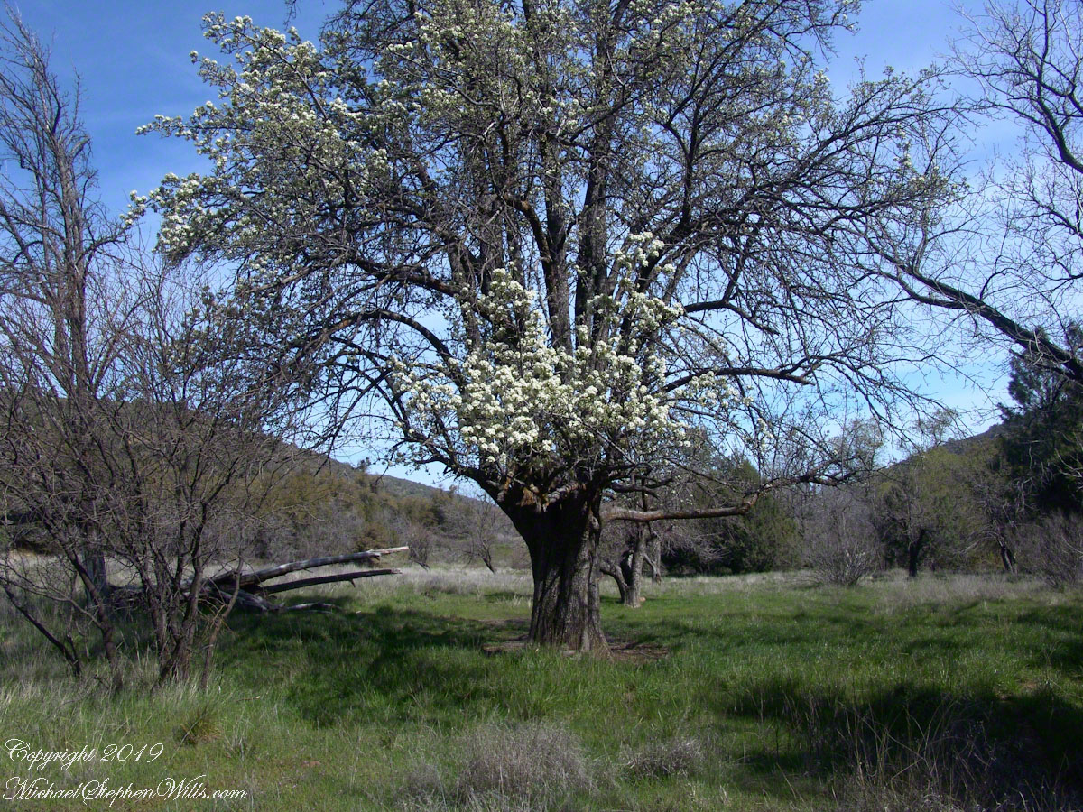
Looking from the former house site towards the Arizona Trail running beneath the distant red rock ridge. Not the fence rails on the left and apple trees in bloom.
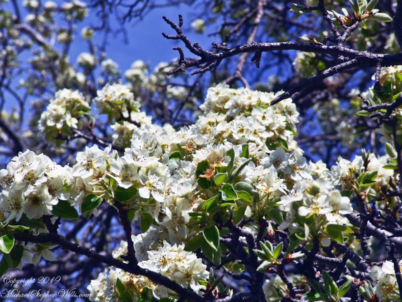
From the ruin, walk down the Arizona Trail, south, for a few hundred feet and turn left into the fields to encounter the same apple tree, and a close up of pure white apple blossoms.
Portrait of a Blooming Apple Tree
At Rest and History
This tree is an outlier of a thick stand of several hundred trees to the north. The Searcher and I rode into the middle of the grove for a rest and chat. The horses were allowed to graze in the abundant new grass brought on by the winter rains.
The Searcher told me the story of the valley and that it was a man named Clemans who planted 600+ apple trees, trees in bloom all around us. The Reavis Valley was long a site of agriculture, starting in the 19th century with Elisha Reavis, who passed away in 1896 and is buried on the slopes of White Mountain, and continued with a series of ranchers and entrepreneurs in the 20th: John Fraser, William Clemans, who planted the trees, and John A. “Hoolie” Bacon, then Bacon’s son-in-law Floyd Stone who sold the land to the U.S. Department of Agriculture in 1967.
We talked about some earthwork I noticed, in the southern part of the valley. It was part of a water system that diverted Reavis creek flow at the head of the valley to the ranch house. We decided that strange hexogonal structure on the elevation above the house ruin was the site of water storage. At that location the structure would provide a pressure feed for the house and much else.
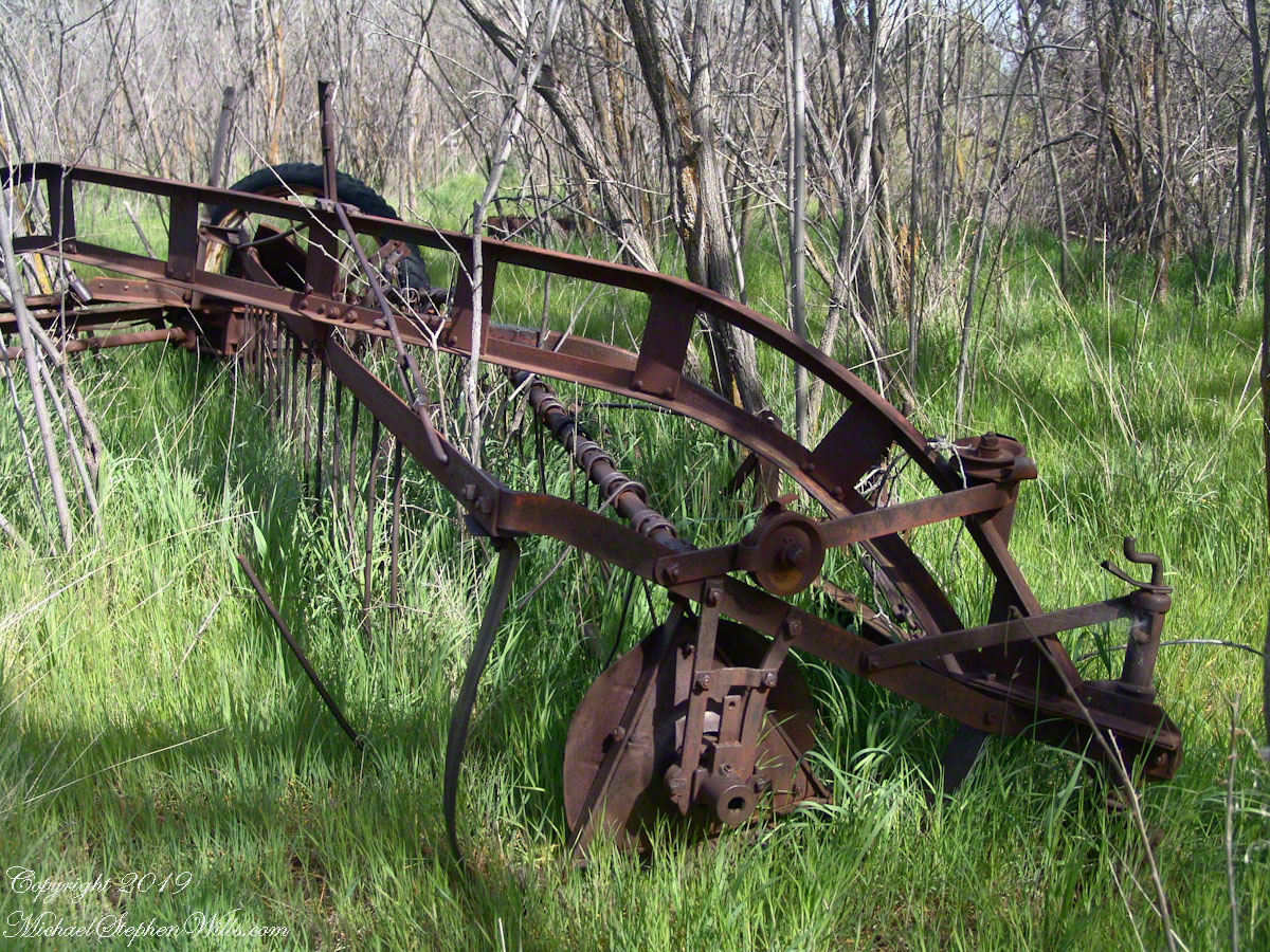
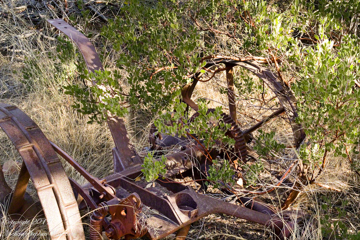
Abandoned Hay Rake
A mix of winter rains and fertile soil were exploited in the Reavis Valley for a handful of decades, the enterprise now is set aside. This abandoned hay rake and chassis, used to harvest grass in seasons past, is evidence of the work. The apple trees produce to this day without irrigation.
The Searcher touched upon the subject of the “Circlestone” ruin he mentioned on our morning ride. He had never been there, but mentioned some books on the subject. It is a wide circle of rough stone wall enclosing mysterious structures. At this point, I was hooked, and decided to check Circlestone on a later trip. Here are some photographs from one of those trips, in November 2006.
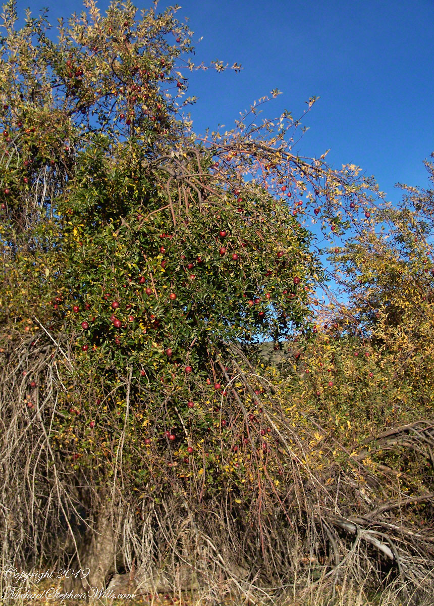
Reavis Ranch Apple Orchard Tree
Reavis Ranch Apples Yellow
Reavis Ranch Apples Red
In my next post The Searcher and I return to Pine Creek, Colorado gives me some trouble and we visit a stand of wild oats in the Reavis Gap.
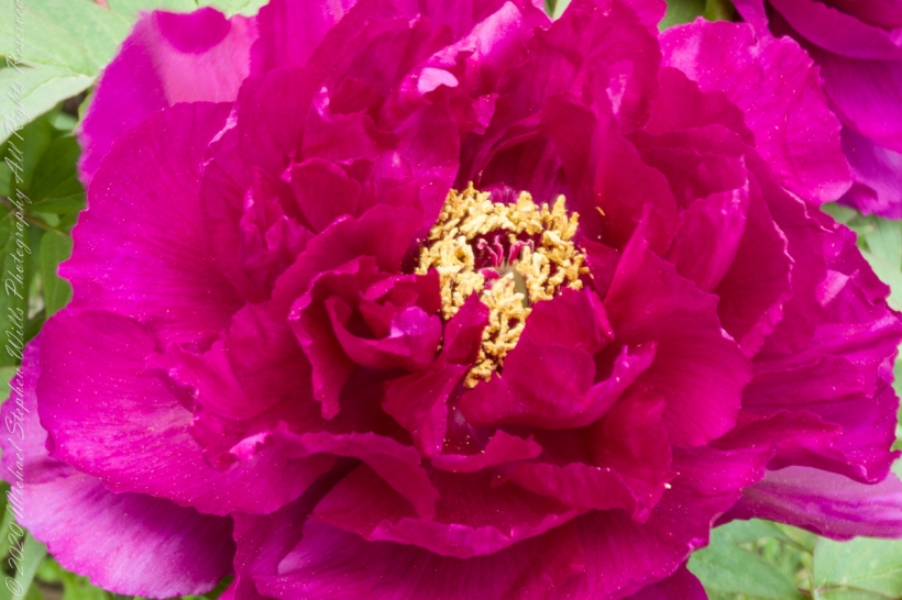
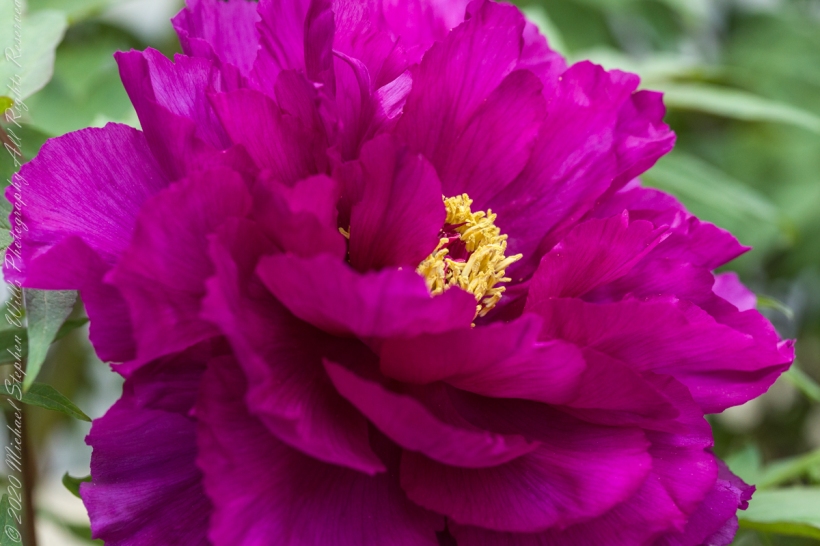
See my May Woody Peony postings for background on this peony variety.
These photographs were taken with a Canon EOS 5D Mark IV dslr and the Canon EF 100mm f/2.8 Macro USM lens stabilized with the Manfrotto BeFree Carbon Fiber tripod with ball head.
The morning breezes of May caused me to “up” ISO to 1600 for a faster shutter speed at higher f-stop.
ISO 1600 f32 1/6 sec
Taking full advantage of the macro lens, the higher ISO helped to maintain sharper focus on the highlighted feature, in this case the stamens.
ISO 1600 f5.6 1/400 sec
A gallery of macros with various settings and aspects of the bloom.
ISO 1600 f32 1/6 sec
ISO 100 f32. 1/6 sec
ISO 1600 f5.6 1/320 sec
ISO 1600 f5.6 1/400 sec
Copyright 2021 All Rights Reserved Michael Stephen Wills
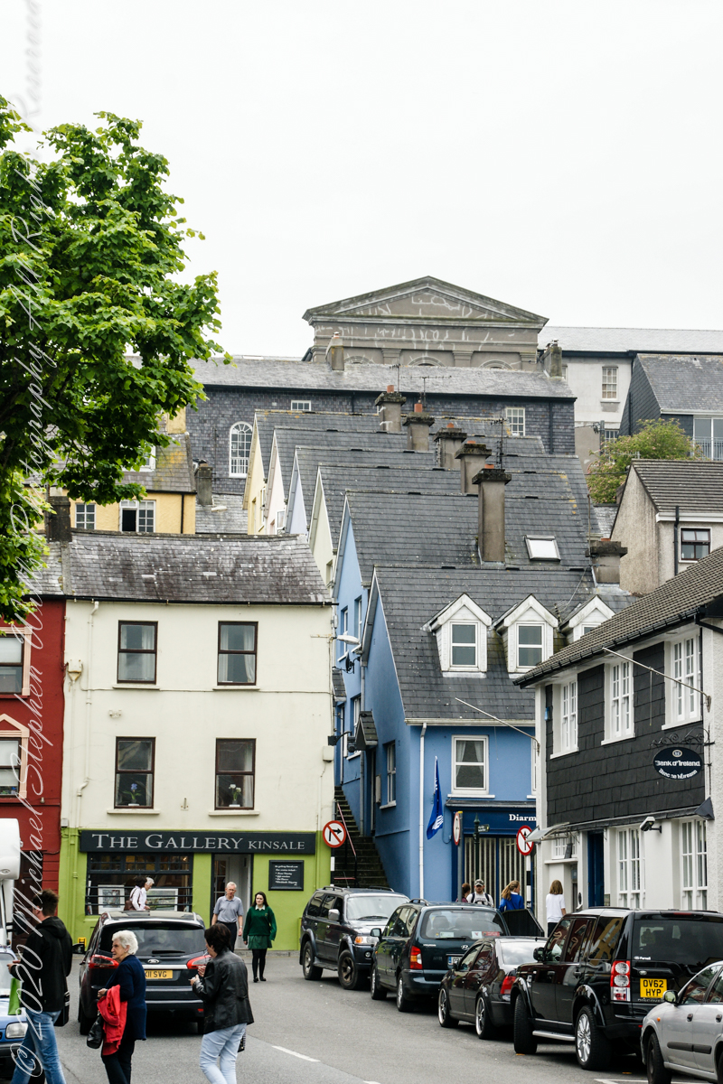
Kinsale, a historic seaport in County Cork, showcases unique architecture and geography, with its streets and houses built on steep inclines near the river Bandon.
The first of a series of idiosyncratic posts from a 2014 walking tour of Kinsale.
Text from an poster behind glass accessible to all and sundry. Directory 1846 Munster, Kinsale with the villages of Cove and Scilly. Kinsale is a seaport, parliamentary borough and market town in the parishes of Saint Multose and Ringcurran barony of Kinsale, County of Cork, 172 miles s.w. from Dublin, 121/2 s and 11 e.s.e. from Bandon; eligibly situated near the mouth of the river Bandon or Glasson, (as it was formerly called), which here forms a capacious and square harbor, accessible in nearly all weathers, and navigable for vessels of any tonnage. the origin of this place, from its great antiquity, is but imperfectly known, and the derivation of its name is compassed by doubt. Cean Taile (Cionn tSáile), signifying in Irish “Headland in the Sea” is said to be its ancient appellation. (see more in the photograph).
An informative poster behind glass accessible to all and sundry. Text: Directory 1846 Munster, Kinsale with the villiages of Cove and Scilly. Kindale is a sea-0ort, parlimentary borough and market town i the parishes of Saint Multose and Ringcurran barony of Kinsale, County of Cork, 172 miles s.w. from Dublin, 121/2 s and 11 e.s.e. from Bandon; elibibly situated near the mouth of the river Bandon or Glasson, (as it was formerly called), which here forms a capacious and square harbour, accessible in nearly all weathers, and navigable for vessels of any tonnage. the originn of this place, from its great antiquity, is but imperfectly known, and the derivaltion of its name is compassed by doubt. Cean Taile, signifying in Irish “Headland in the Sea” is said to be its anceient appellation. (see more in the photograph)./
Here we are on Emmet Place. There is a row of houses built along a steep alley named “The Stoney Steps.” At top is the aptly named Higher O’Connell Street.
The Gallery Kinsale
13 Main Street
Kinsale
West Cork
Ireland. From an informative poster…The streets rise in a singular and in regular manner of acclivity of an eminence called Compass Hill, the house ranging tier above tier, many of them on sites excavated in the solid rock, while other are perched on the level of some projecting crag: the descent is exceedingly precipitous, and the dwelling are inaccessible to carriages, except from the summit of the hill or from Main street, which takes a circuitous course along the shore of the harbor.
From the informative poster…The streets rise in a singular and in regular manner of acclivity of an eminence called Compass Hill, the house ranging tier above tier, many of them on sites excavated in the solid rock, while other are perched on the level of some projecting crag: the descent is exceedingly precipitous, and the dwelling are inaccessible to carriages, except from the summit of the hill or from Main street, which takes a circuitous course along the shore of the harbor.
“It is difficult / to get the news from poems / yet men die miserably every day / for lack / of what is found there.” Asphodel that Greeny Flower WC Williams
Here is a Sunny Sunday reader assignment. Which handling of this woody peony blossom do you prefer? Please leave your preferences in the comments section with details of your reasoning. Thank you!!
These photographs were taken with a Canon EOS 5D Mark IV dslr, new for me as of 2020, and the Canon EF 50 mm f/1.2L USM lens stabilized with the Manfrotto BeFree Carbon Fiber tripod with ball head. This setup allowed me to fiddle with camera settings, here you see a variation in the width of the shutter diaphragm opening, or F-stop. The smaller the opening (higher F-stop) less light is let through to the image sensor, longer exposure time (allowing the subject to move, as in the morning breeze) offset by greater depth of field, more of which provides sharp focus as the subject elements are further from the lens.
In this first photograph, the F-stop is moderately high. The entire blossom and plant are in focus, the background moderately blurred though still recognizable.
ISO 200 1/6 sec f/16
For the second photograph F-stop is low, opening up the shutter diaphragm, allowing more light in for a faster shutter release, less time for the morning breeze to rise up and ruin the shot. The beautiful background blurring, bokeh, is a feature of this 50 mm lens. At the same time, at F/4.0 the shutter diaphragm is not wide open. The blossom is entirely in focus, many plant leaves and the other blossom, to left, are out of focus. This places emphasis on the primary subject of the photograph while providing a feel for the surroundings.
ISO 200 1/100 sec F/4.0
Here are the same photographs, click on one to open a gallery for you to flip back and forth to compare.
ISO 200 1/6 sec f/16
ISO 200 1/100 sec F/4.0
Copyright 2021 All Rights Reserved Michael Stephen Wills
This yellow woody (also called tree) peony blooms later than our red varieties. The first set of three were photographed May 26, 2021 have unopened buds. Yet, these are early compared to those photographed June 6, 2019 used in the last still life.
These first photographs were taken with a Canon EOS 5D Mark IV dslr, new for me as of 2020, fitted with a 600EX-RT Speedlite (flash) and the Canon EF 70-300 mm (variable) f/4-5.6L USM lens stabilized with the Manfrotto BeFree Carbon Fiber tripod with ball head.
Our Itoh yellow tree peony has flowers on stalks too slender to hold the heavy blooms upright. The flowers open hidden among thick leaves. Here they are a still life of cut blossoms and leaves. The cultivars of Paeonia, the mouton, or hua wang, king of flowers, are ofe of the classic ornamental genera of China. By the 11th and 12th centuries the center off cultivation was in Sichuan, and there yellow-flowered varieties appeared.
Canon EF 70 – 300 mm USM, ISO 400, 146 mm, 0.3 sec at f/6.3
Click the pic for a larger view
Crossbreeding of yellow-flowered P. delavayi with traditional double-flowered P. suffruticosa cultivars by Victor Lemoine in Nancy, France has led to the introduction of the color yellow into the cultivated double-flowered tree-peonies. These hybrids are known as the Paeonia × lemoinei group. In 1948 horticultulturist Toichi Itoh from Tokyo used pollen from ‘Alice Harding’ to fertilize the herbaceous P. lactiflora ‘Katoden’, which resulted in a new category of peonies, the Itoh or intersectional cultivars. These are herbaceous, have leaves like tree peonies, with many large flowers from late spring to early autumn, and good peony wilt resistance. I am guessing our Yellow Wooden Peony is a type of this hybrid because the long stems are more herbaceous than woody, the heavy flowers droop so the best form to capture them is the still life.
Canon EF 70 – 300 mm USM, ISO 400, 70 mm, 1/5 sec at f/5.0
Canon EF 70 – 300 mm USM, ISO 400, 70 mm, 1 sec at f/11
Click the pics to flip back and forth.
Compare the above two exposures to appreciate the effect of the f-stop and excellent bokeh of the Canon “L” lens.
This still life from the 2019 bloom was taken with a Canon EOS-1Ds Mark III dslr and the Canon EF 50 mm f/1.2L USM lens used above. Stabilization provided by a Manfrotto 3036 (studio) tripod with the 468MG hydrostatic ball head. That room is bright from large, east-facing windows. Late afternoon light is soaked up by the black velvet backdrop leaving the lemon yellow leaves to shine.
Canon EF 50mm f/1.2L USM, daylight, 1/8 sec at f/7.1
Click the pic to over a larger view
Copyright 2021 All Rights Reserved Michael Stephen Wills
References
Wikipedia “Paeonia × suffruticosa“
Roger Philips and Martyn Rix, “The Botanical Garden, Vol 1, Trees and Shrubs” p 133
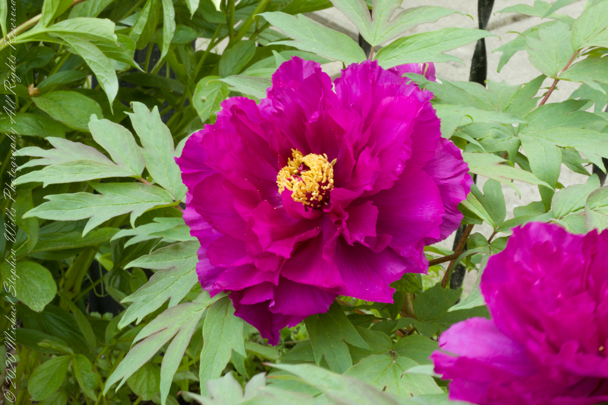
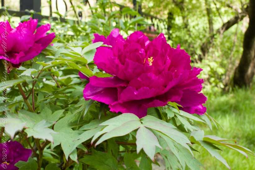
Spring 2021, though cold, is early. As I write this the peony blooms presented here, photographed May 20, 2021 are seeding, the gorgeous purple magenta petals strewn beneath the woody stems. In my last posting, from Memorial Day 2019, the plant is in full bloom the end of May.
These photographs were taken with a Canon EOS 5D Mark IV dslr, new for me as of 2020, and the Canon EF 50 mm f/1.2L USM lens stabilized with the Manfrotto BeFree Carbon Fiber tripod with ball head. Color results from the Canon dslr are impressive, the first time the unique purple magenta is accurately represented here. I found a slight under exposure captured the plum – fine burgundy wine nature of this Japanese cultivar, “Shimadaijin,” planted in the 1970’s or 1980’s.
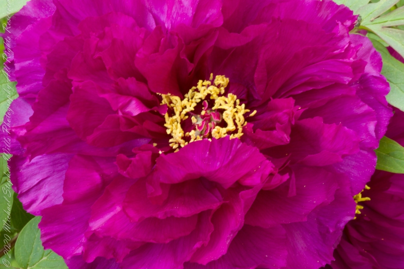
Here is the last unopened bud of this season, enclosed by a calyx of 5 green sepals with reddish highlights . In the wild, woody (also called tree) peonies favored cliffs and scrub of western and central China, eastern Himalayas (southeastern Tibet).
Lens Canon EF 50mm f/1.2L USM. ISO 200 f5.0
The bud is toward the back, slightly out of focus, of this overview. The woody stems hold the profusion of large flowers each one erect. “Tree” is a misnomer as this plant is a shrub growing mid-thigh high. One of the classic ornamental genera of China, known there as moutan or hua wang “King of Flowers.”
Lens Canon EF 50mm f/1.2L USM. ISO 200 f5.0.
Cultivation in China began in Chekiang in the early 4th century AD. By the early Tang period (circa 700 AD) hundreds of varieties were grown.
Lens Canon EF 50mm f/1.2L USM. ISO 200 f16
Copyright 2021 All Rights Reserved Michael Stephen Wills
References
Wikipedia “Magenta” color
Roger Philips and Martyn Rix, “The Botanical Garden, Vol 1, Trees and Shrubs” p 133
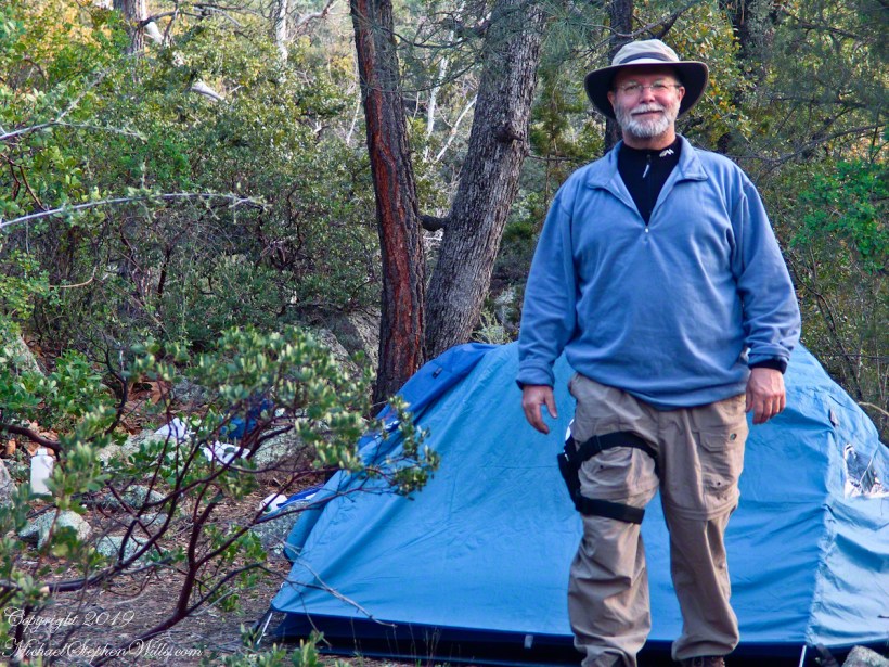
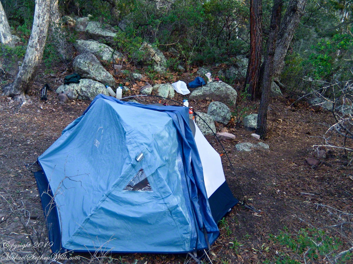
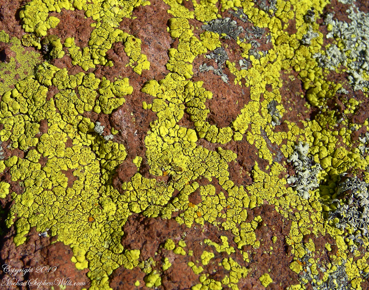
My third wilderness evening was unlike the others. I rested with an unhurried exploration of the camp area. Underfoot was a scatter of dry oak leaves, acorns on hardened desert soil not much softer than the numerous lichen encrusted boulders, all of which formed a bench above Pine Creek.
Pine Creek Camp Overview from a large lichen encrusted boulder
Pumping a gallon of drinking water though the ceramic filter takes more time than meal preparation. The four gallons I packed up were almost used and I enjoyed the luxury of pumping two days supply, 3 gallons in all and planned to down a quart or two of “gator aid” before dinner with the luxurious enjoyment of a flowing Pine Creek for company.
Pine Creek is the most common type for Arizona, recurring. To recur means to happen periodically or repeatedly and, for streams, this means for part of the year no water flows. For these days the flow was low, the water clear, what was left from the plentiful winter rains of 2004/2005.
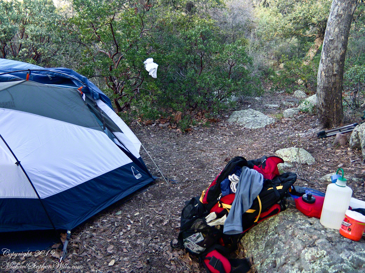
Looking east toward Manzanita thickets with the unpacked backpack foreground
The wind gently rustled the manzanita and the sun just above the western cliffs as I settled on a boulder to enjoy a quart of fluid. I mulled over my next steps.
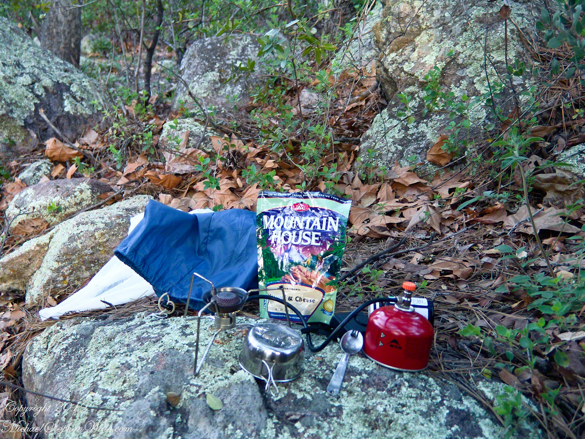
The kitchen: a very light gas burner, spork, dehydrated food with cup for beverages
Initially, the plan was to walk across the Superstition Wilderness, starting on the remote eastern end and emerging on the populated west side, in the Lost Dutchman State Park. My sister expected me there on day 10, but today was the end of day three. I didn’t know at that time the climb on my second day was the steepest of the wilderness and the way forward was much, much easier.
Looking west toward pine creek, manzanita branch foreground and thickets all round, young Ponderosa Pine, Arizona Oak behind tent.
Before a decision could be reach, my thoughts were broken by a different sound from the manzanita: several horses approaching on the trail.
Here is a photographic recap of the previous Superstition Wilderness postings as a gallery. You can page through the photographs.
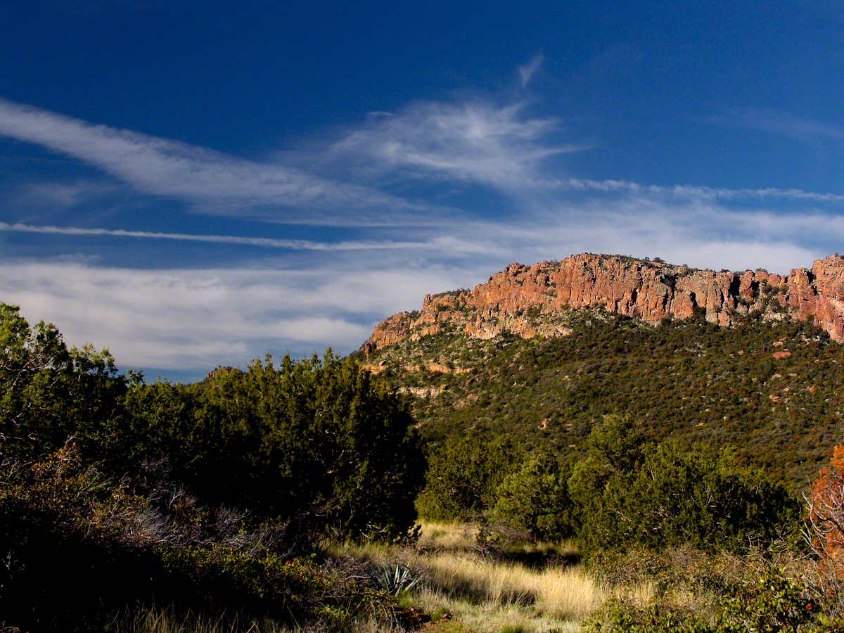
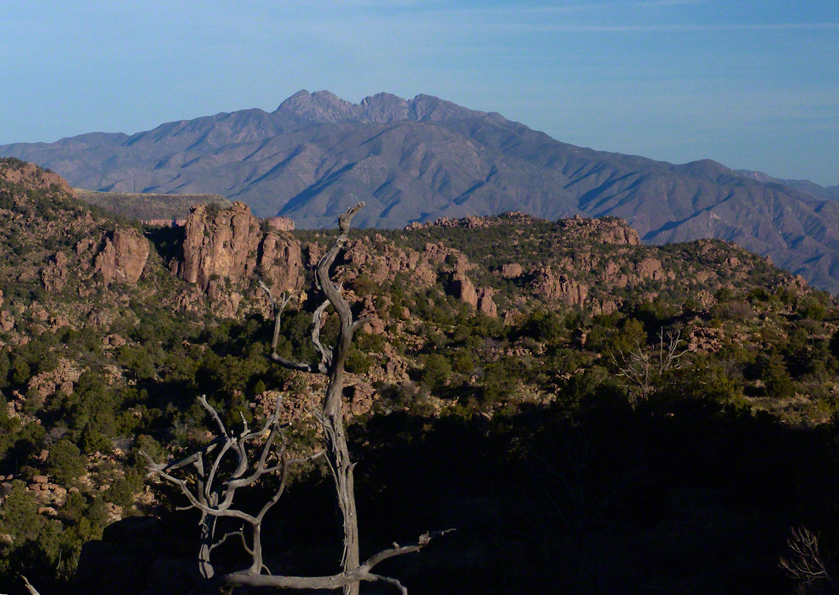
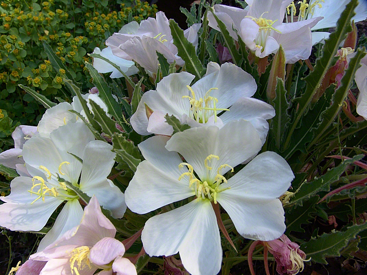
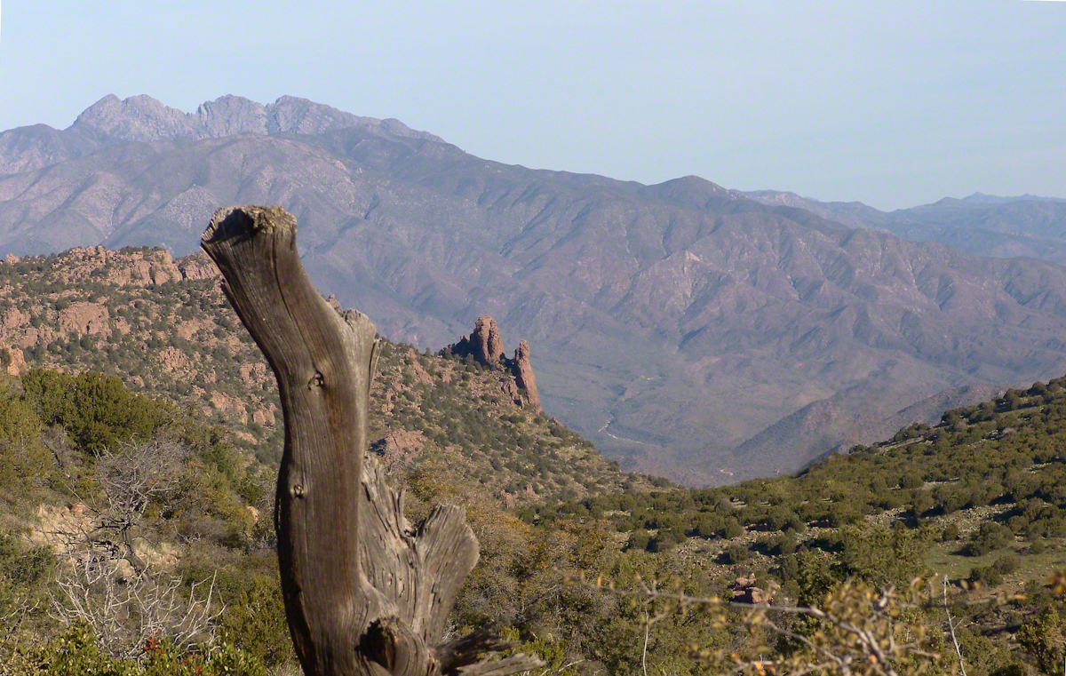
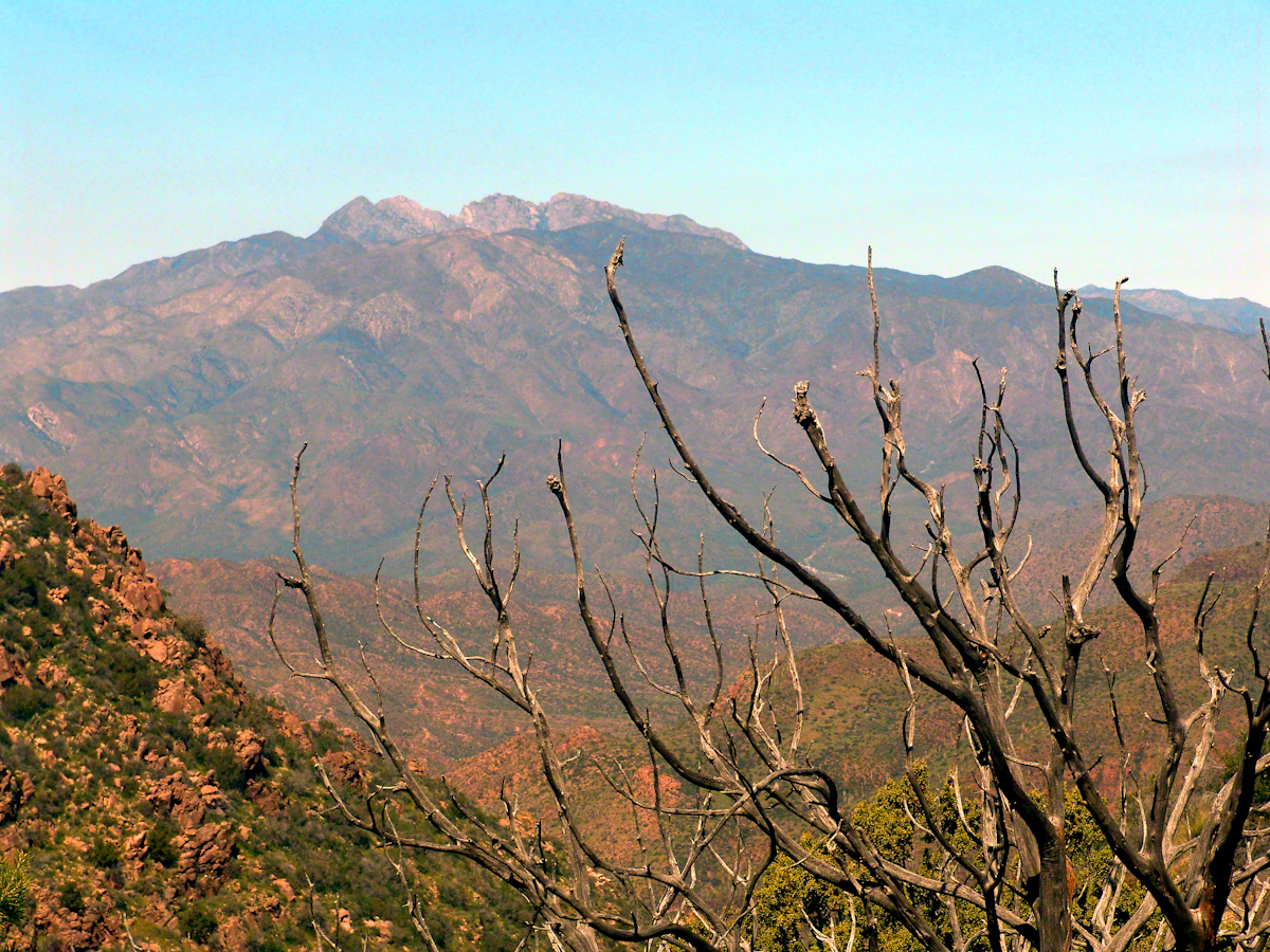
View to the southwest on the Arizona Trail above Pine Creek.Pine Creek of the remote eastern Superstition Wilderness hosts this wild Tufted Evening Primrose.The Arizona Trail passes this spot in the remote eastern Superstition Wilderness. This is the view of my path up from Nameless Canyon. In the distance is the Four Peaks Wilderness Area.Superstition Wilderness, Arizona
Yesterday, I simultaneously published nine photographs on my ImageKind Ireland Gallery and Getty IStock (click the links to visit): nine views taken from the slopes of Slieve Gullion.
Sunday, May 25, 2014 was a happy day for Pam and I. It was the first full day of an eighteen (18) we filled with Ireland, travelling in a loop of the island following the coast from, naming the counties where we spent time on the ground, Louth, Armagh, Dublin, Meath, Wicklow, Cork, Kerry, Claire, Mayo, Antrim, Down and back to Louth. The counties of Northern Ireland are in italics. Indeed, at this time the politics allowed us to travel freely between the Republic and the North. That day, our morning was spent in Louth attending mass, enjoying our first meeting with the family over a substantial mid-day meal (click the link for my Facebook album of the meeting). We split off that afternoon to visit the home of my cousin, Mary and her husband Joseph in County Armagh, just over the border. When Joseph offered to drive us over to Slieve Gullion it was totally new to us, we had no conception of the place or what to expect.
It was such a gift, we are grateful to Joseph for this experience. Only in 2018 when, at 64 years of age and retired”, was I able to research the place and spend time developing the photographs for publication. Two of the photographs illustrate this posting, to view the others in my online gallery, click either photograph.
Slieve is the Irish language word for “mountain.” Slieve Gullion is a lone eminence, one remnant of volcanic eruptions about 60 million years ago during the rifting of continents that produced the Atlantic Ocean. Around the mountain is the Ring of Gullion, a string of hills, 26 miles by 11 miles, surrounding the mountain and formed from the ancient collapse of a volcanic caldera. The technical name for it is a Ring Dyke and it was the first of its kind to be recognized and mapped, well before the nature of the formation was understood of be volcanic. The name Gullion is derived, in one formulation, from the name of the metalsmith, Culann. In Irish Myth, Culann’s home and workshop was on the slope of Slieve Gullion. A wealthy and respected personage, Culann invited Conchobhar mac_Neasa, king of Ulster to feast. During his approach to the mountain, passing through the surrounding plain, the king stopped to watch boys play hurling. Among them was the future hero of Ulster, the young Sétanta. Impressed with Sétanta athletic abilities, the king invited him to join in the feasting at Culann and the boy promised to follow after the game. Later, while climbing the mountain to fulfill his promise Sétanta was attacked by the guard dog of Culann. The myth says the dog was killed by Sétanta in self-defense. Never the less, in compensation to Culann, Sétanta committed to rearing a replacement and to act as guard dog in the meantime. In this way he became known as Cu Culann, “the dog of Culann.” Click for more about Cu Culann.
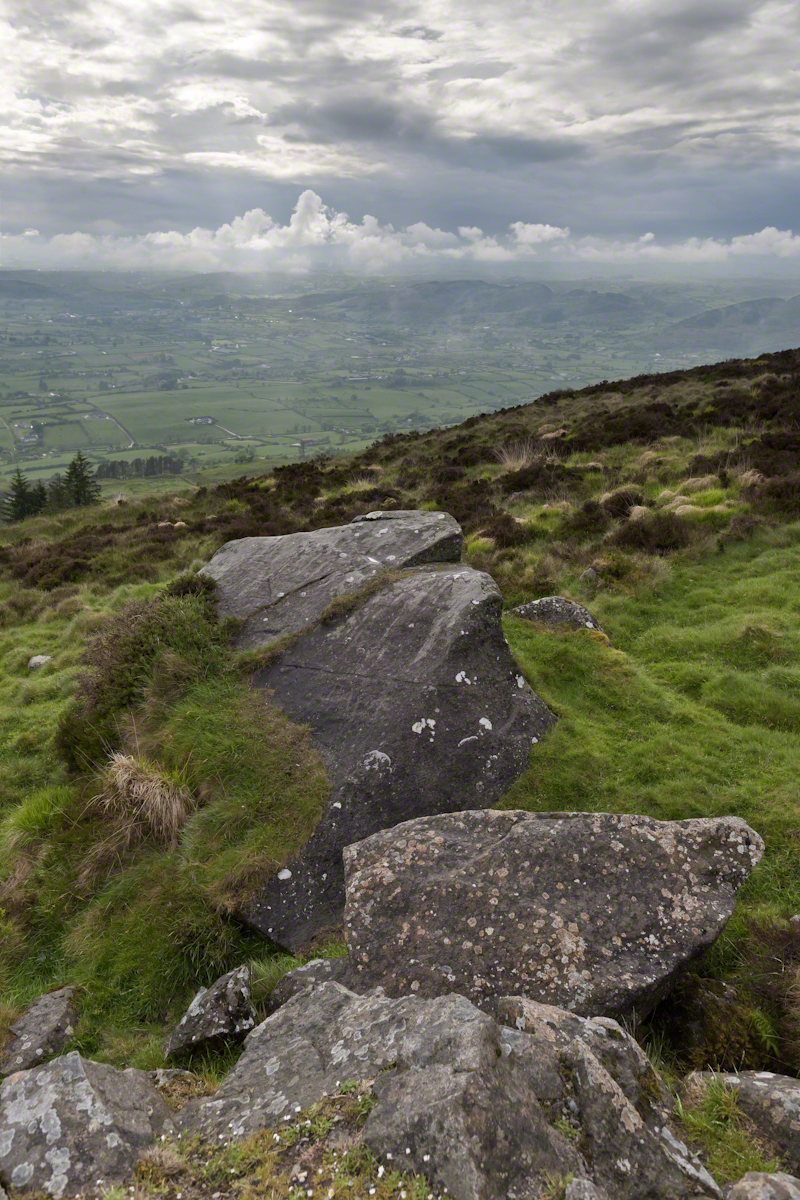
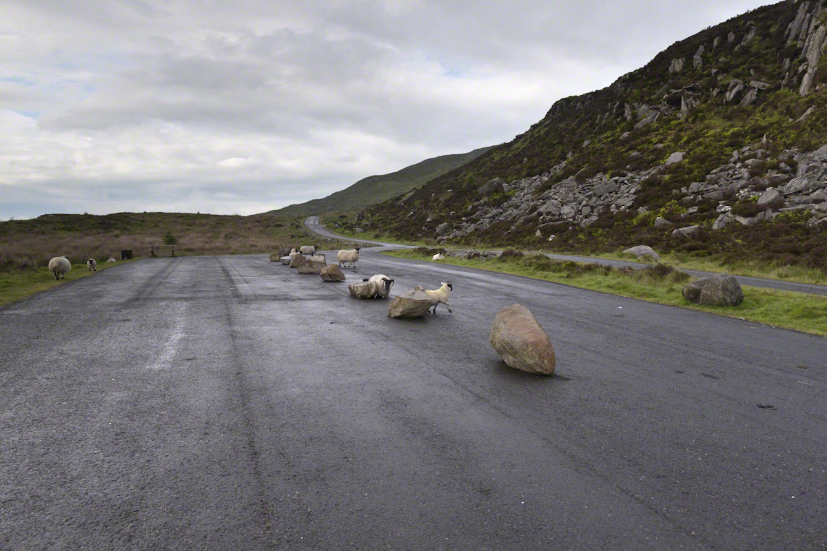
On the summit two cairns north and south of a small lake, tangible proofs of ancient peoples and beliefs. The north cairn is a more ancient passage grave, 90 feet wide, 16 feet high, the opening aligned with the setting sun on the winter solstice. The cairn north of the lake is less ancient containing two cist burials. For our visit Joseph drove us along the 8 mile drive. The following is an image of a viewing platform and the road. Just beyond, on the right, where the ridge meets the road, is the trail to the 1,880 foot summit of Slieve Gullion. Our arrival disturbed sheep resting on the asphalt. I’d have loved to spent a day climbing the summit, but it was not to be this trip.
The way is part of the Slieve Gullion Forest Park. Throughout are turnoffs to admire the view. It was during our frequent stops I pulled out the photography gear to grab the views. Here is one, looking southwest. For the other views, click either photograph to visit my Online Gallery of Ireland.
Copyright 2021 Michael Stephen Wills All Rights Reserved
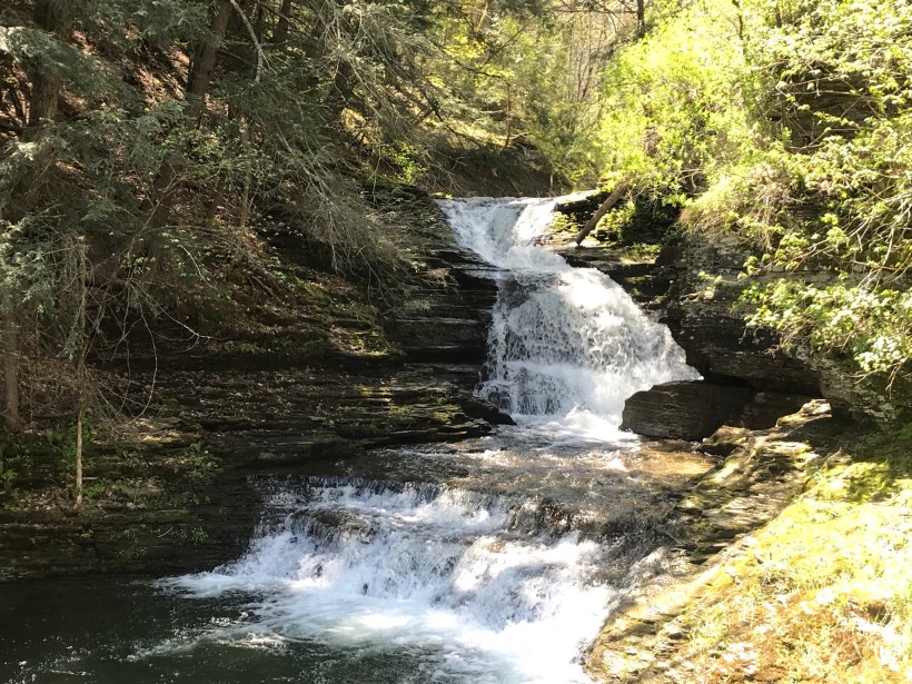
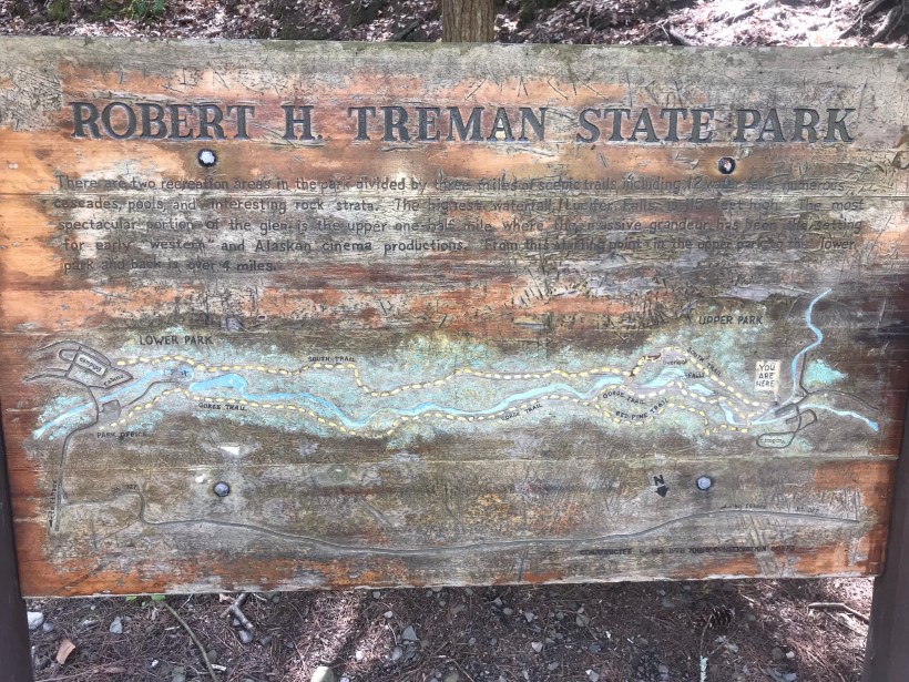
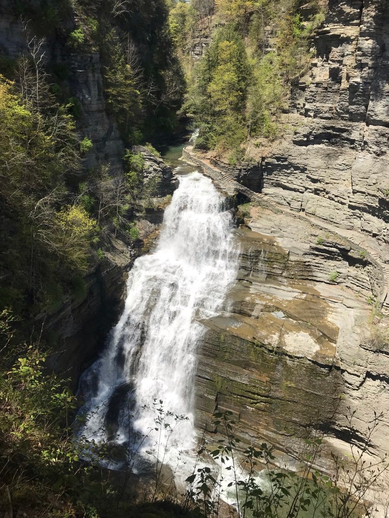
Pam and I headed out to Treman Park for a walk to the Lucifer Falls overlook. The Gorge Trail is not yet open due to the danger of rock falling from the gorge walls — the park maintenance staff needs to survey winter damage and knock down material in danger of falling.
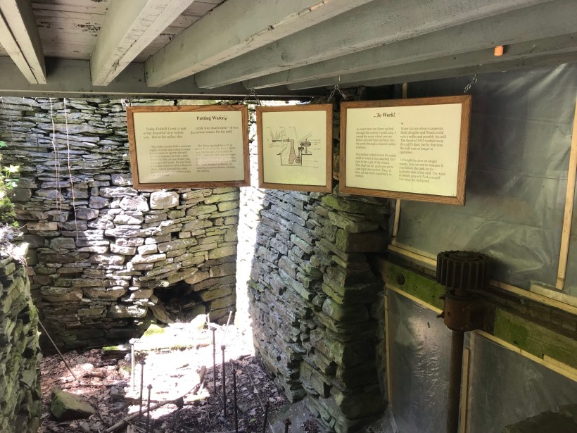
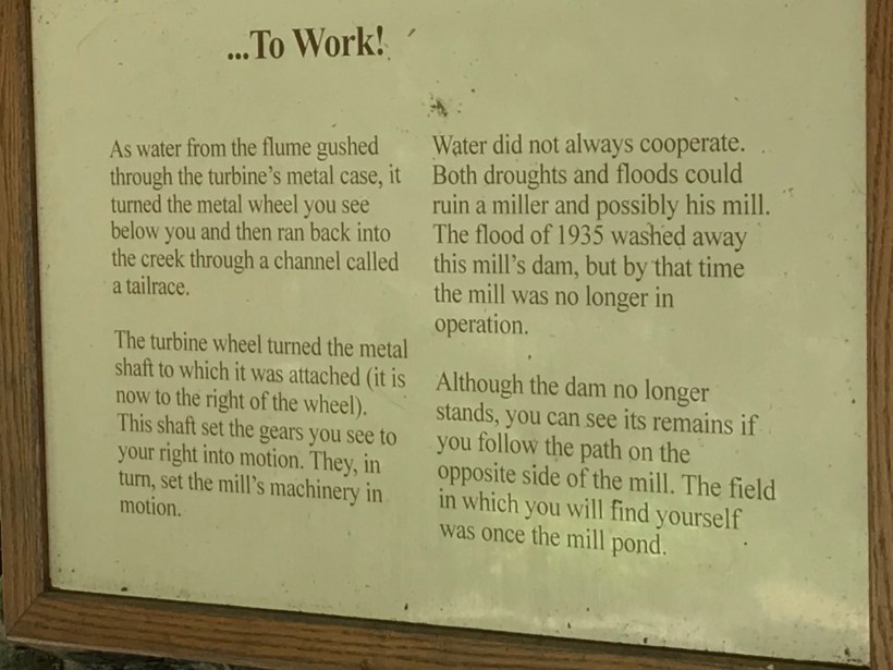
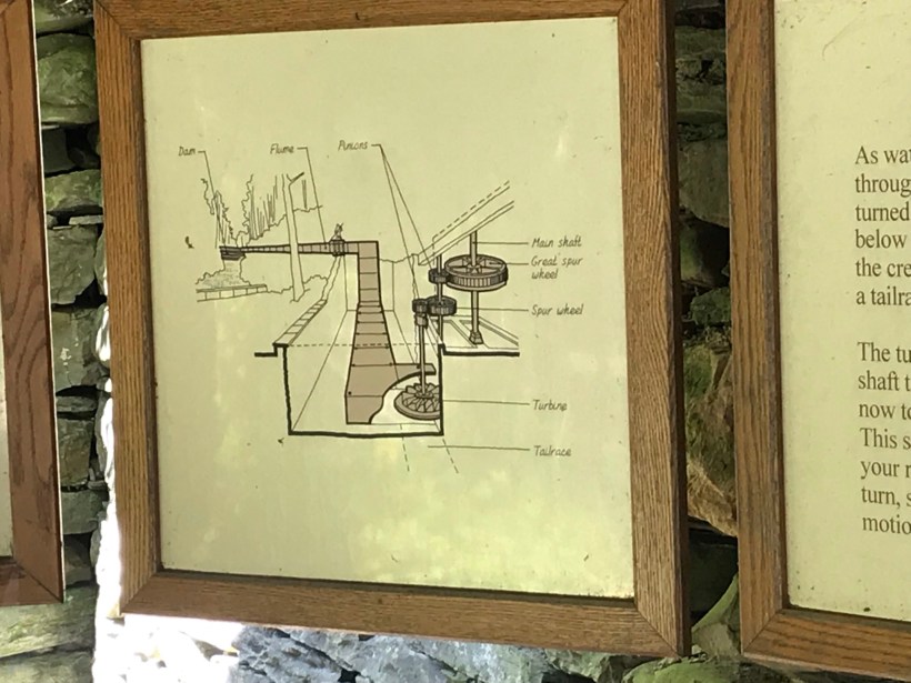
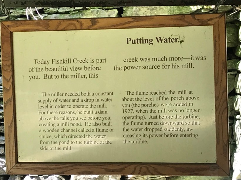
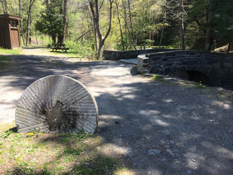
Our first stop was the mill waterfall. This was was directed to the mill stream to power the mill where grain was ground to order.
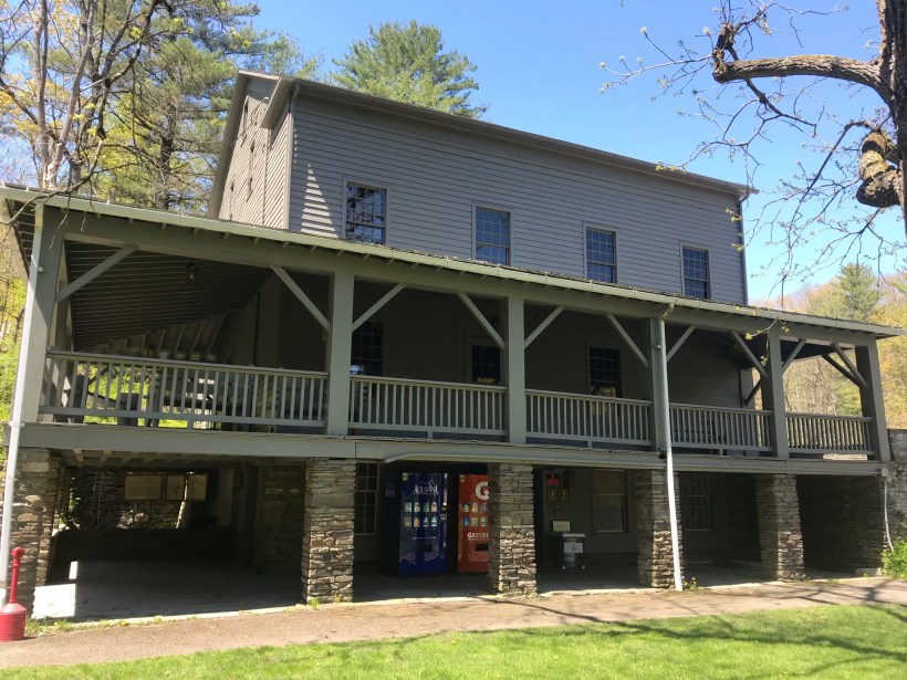
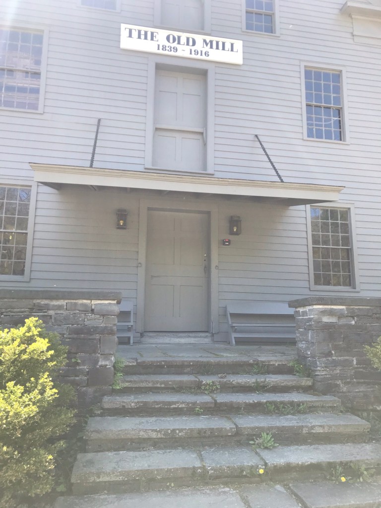
Here is an overview of the Mill, now a museum not yet opened post-Covid. The millstone stands at the start of the foot trails. All media on this post is from my IPhone 7, lightweight equipment for this hike. The automatic upload to ICloud is convenient.
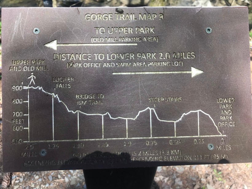
Round trip is four-plus miles, with several hundred feet elevation change. Pam and I discussed a car caravan for our next visit, to support a one-way downhill hike (still plenty of uphill hiking). We need to work up to the round trip after our winter inactivity.
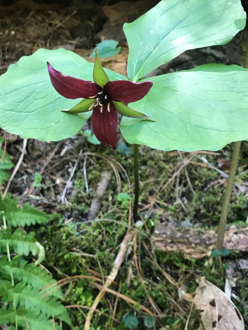
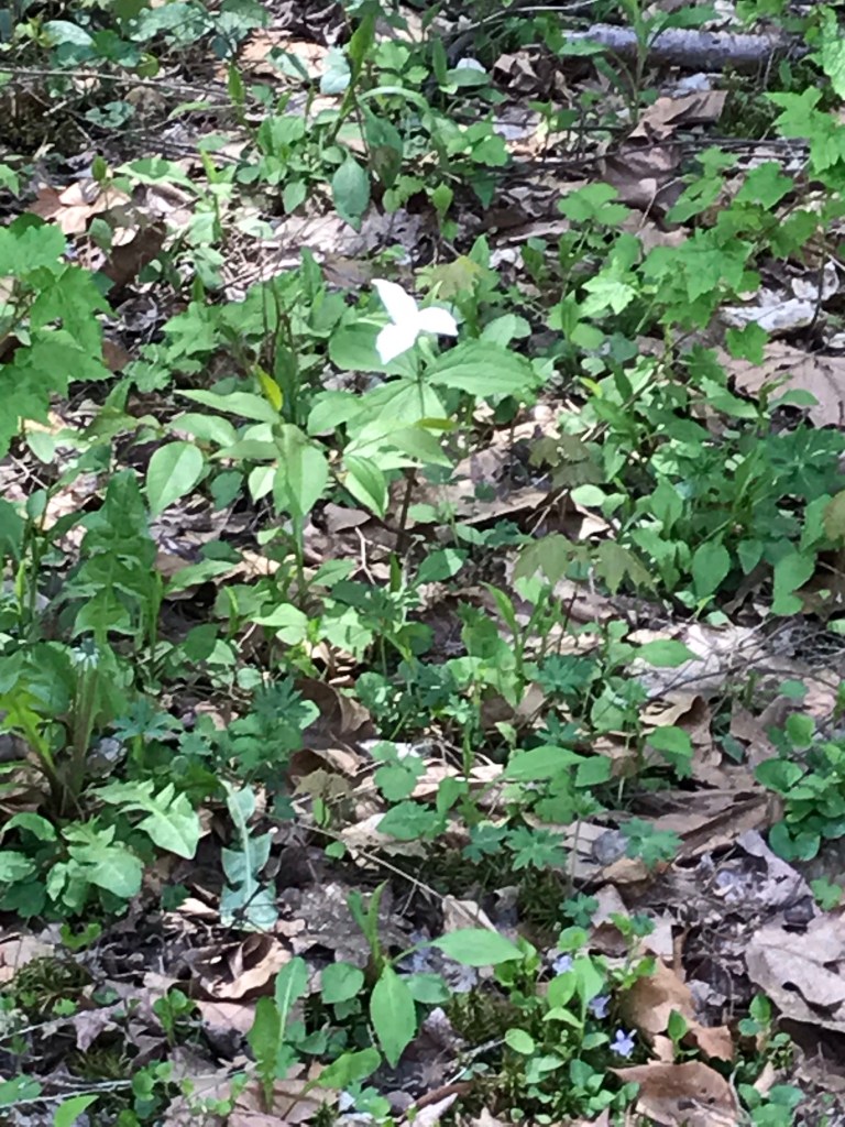
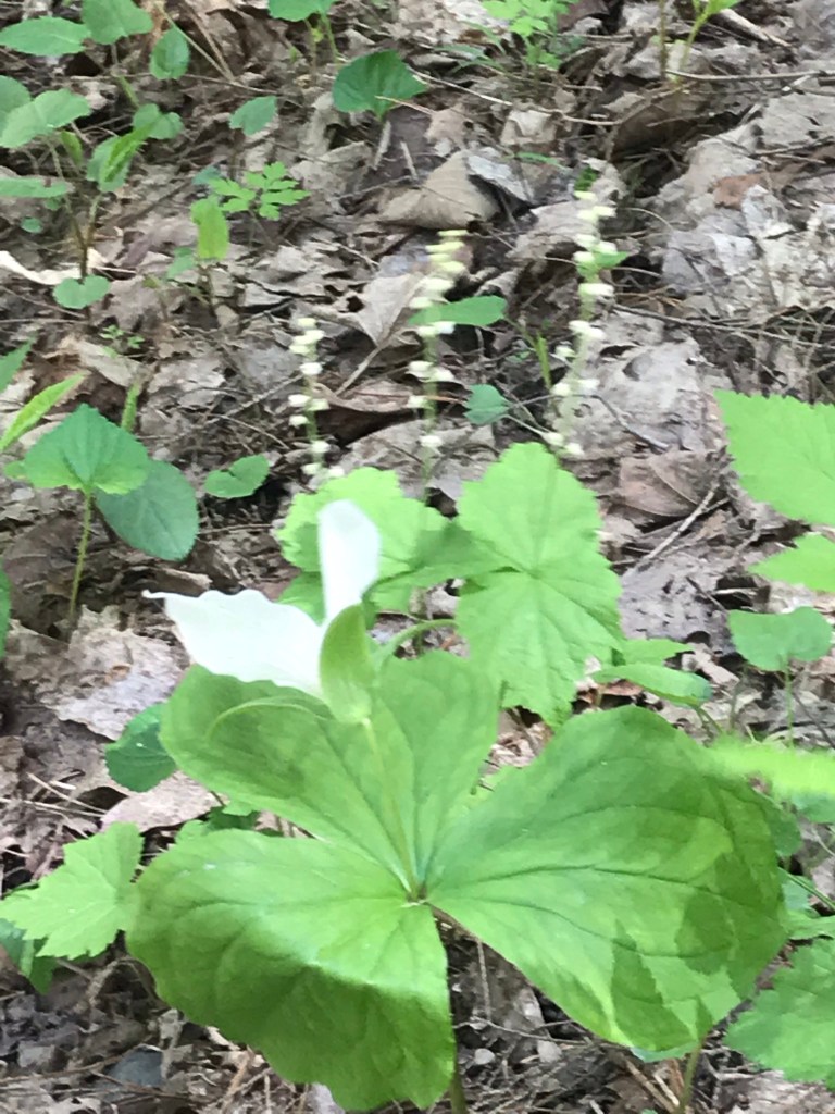
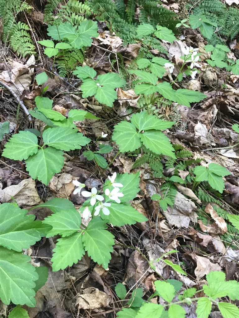
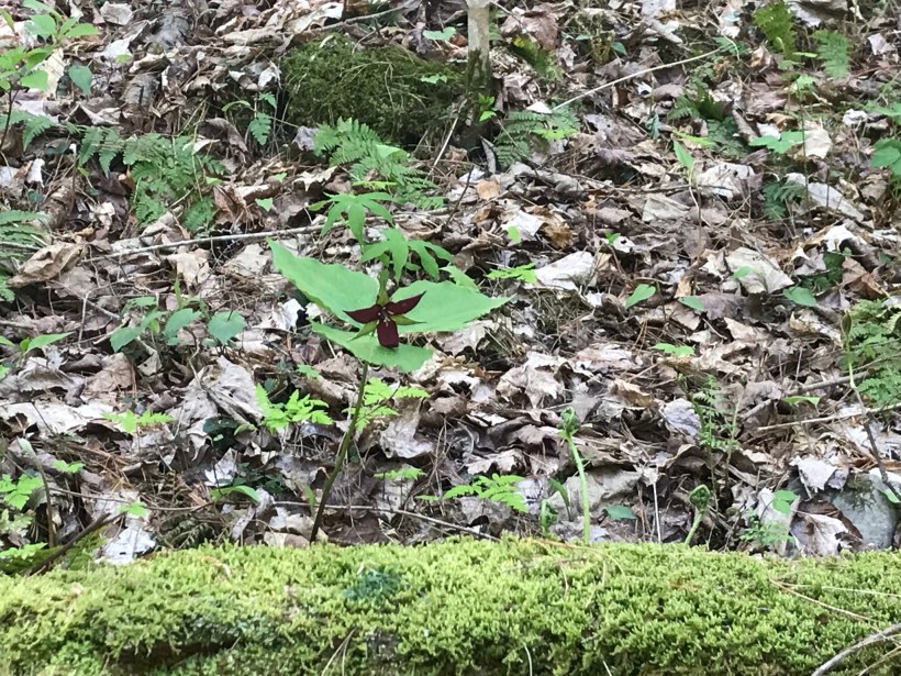
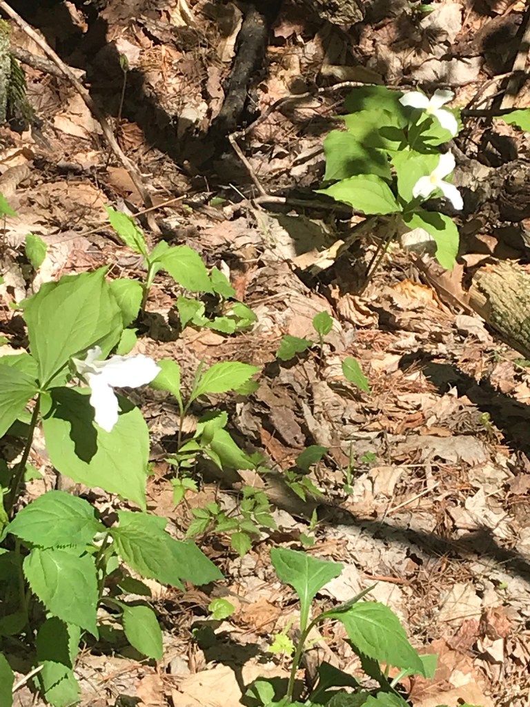
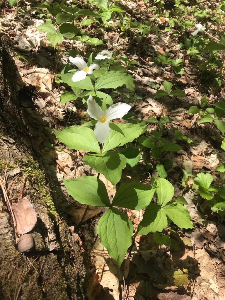
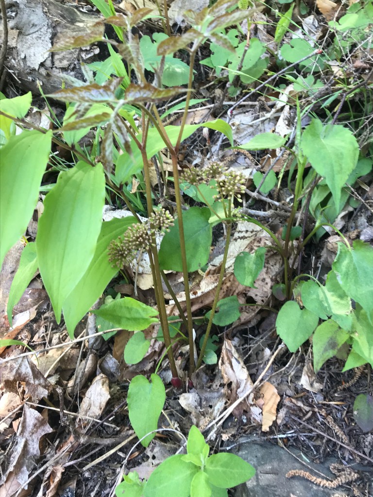
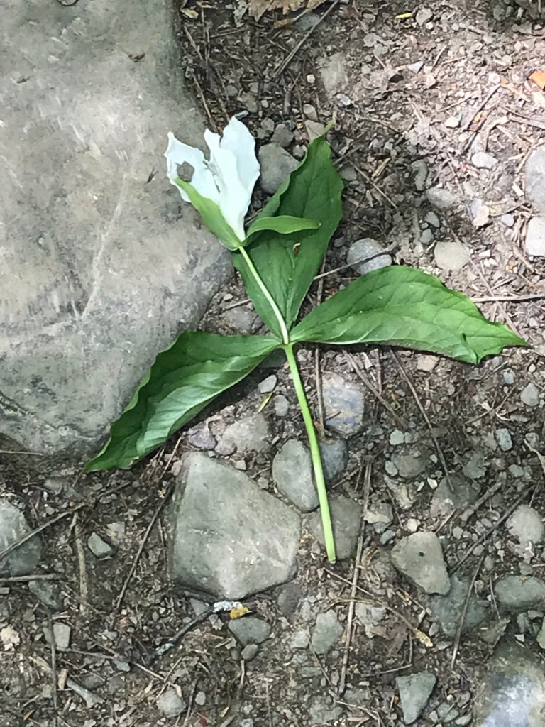
Trillium are in bloom!!
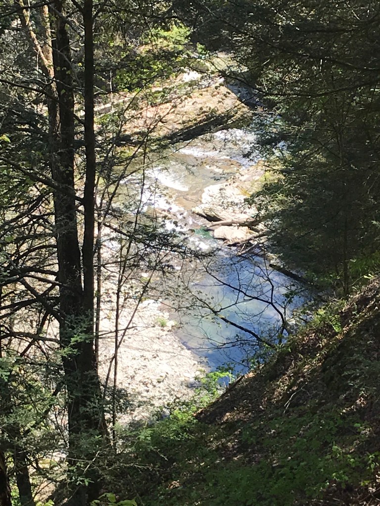
Multiple overlooks into the gorge grace this trail.
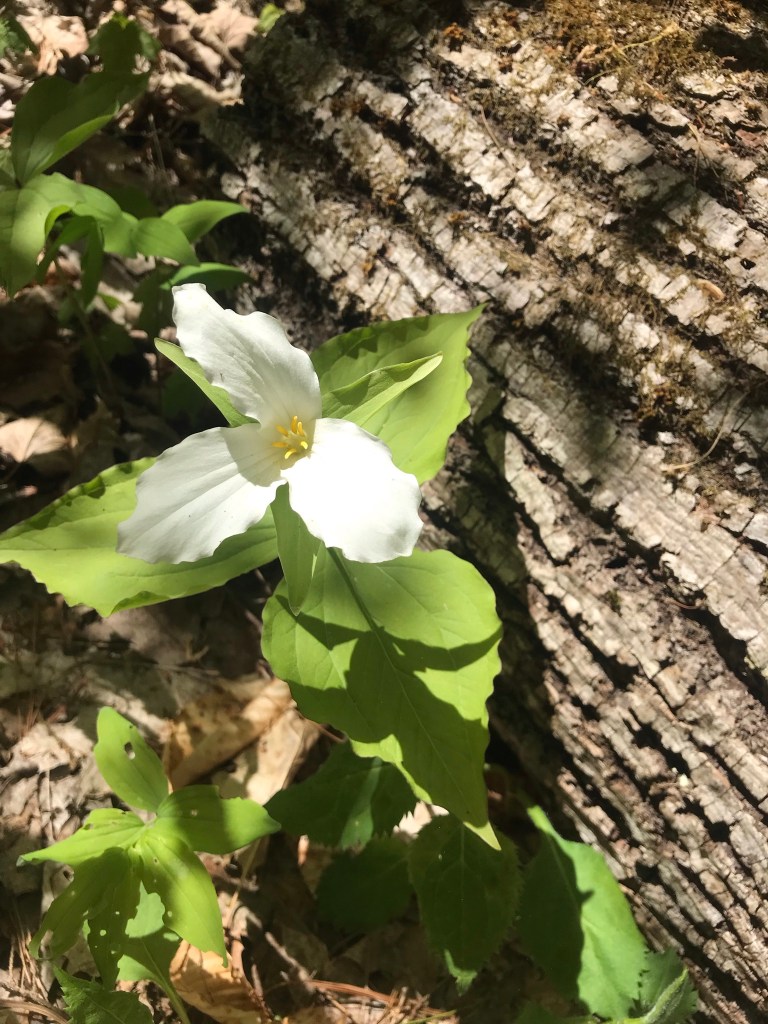
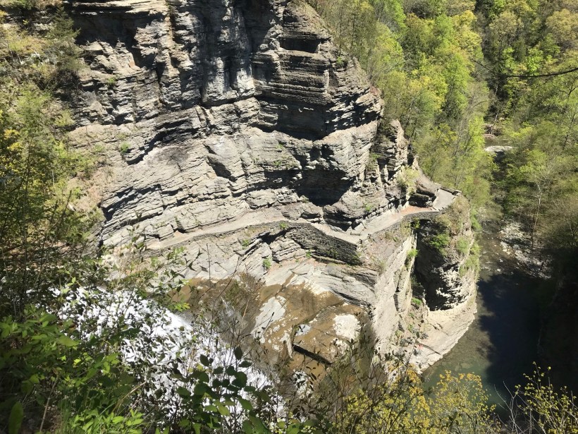
More trillium before we reached the overlook. Lucifer falls and the incredible path etched into the cliff by the Civilian Conservation Corps (Roosevelt’s Tree Army during the Depression).
After the Lucifer Falls overlook is this stupendous view from the top of the Cliff Stairs, 224 steps continue to link to the Gorge and South Rim trails.
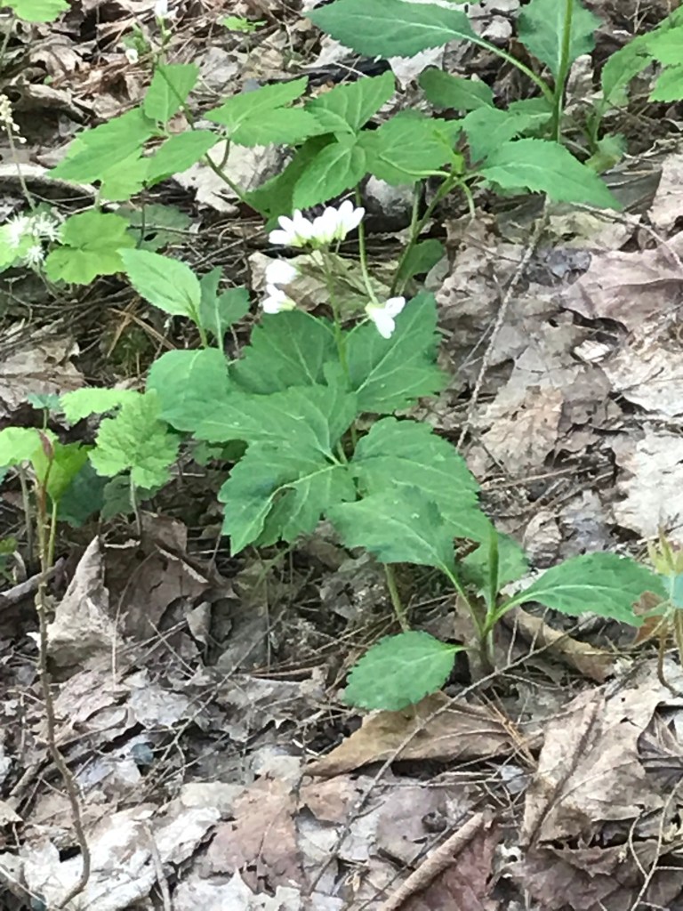
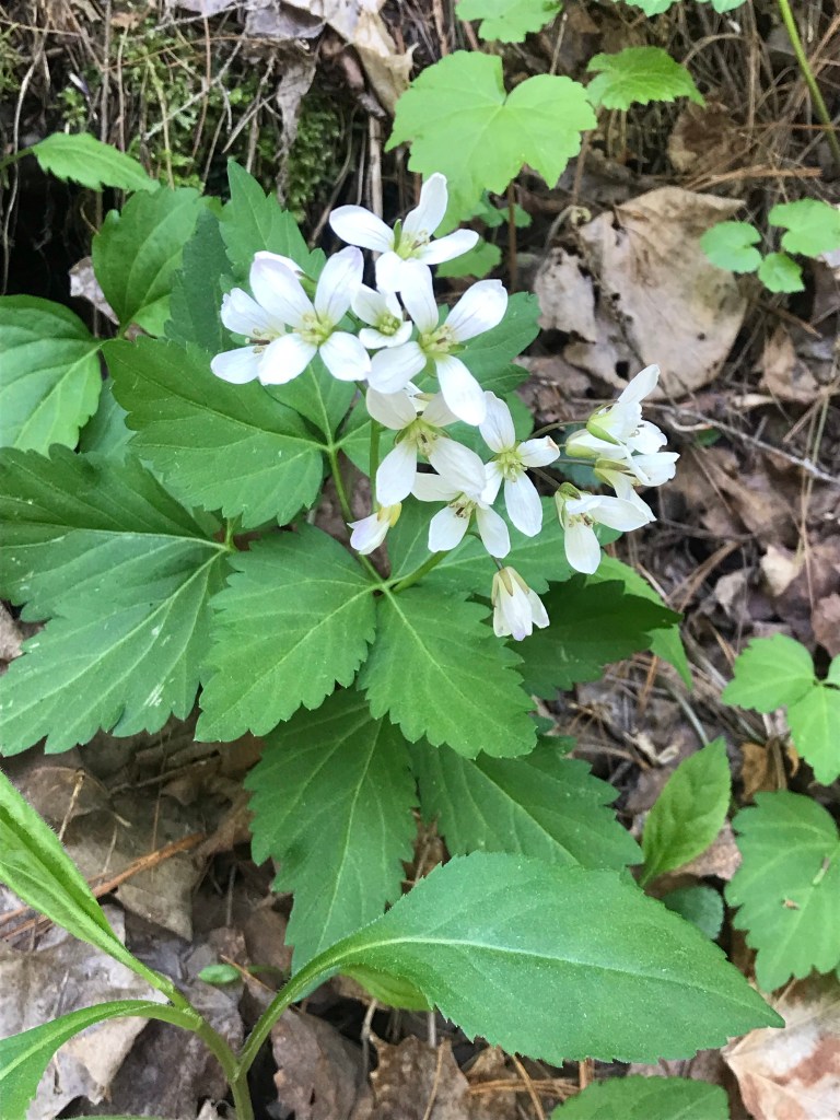
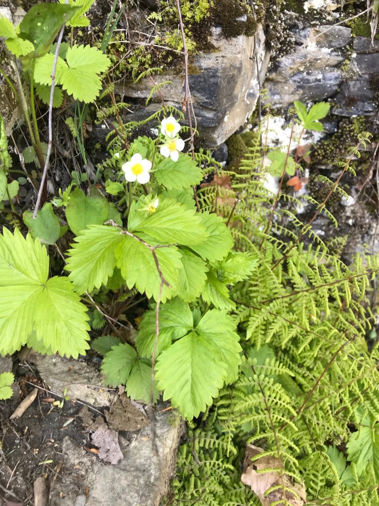
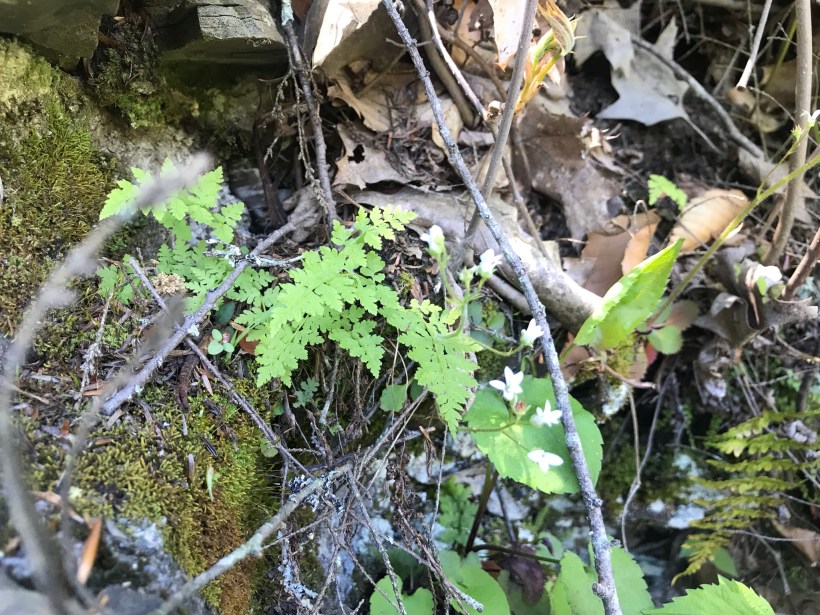
As we lingered on the top steps the flowering plants slowly revealed themselves.
I captured this tragic image on the return trip….a trillium discarded on the trail. Stiff fines await anyone caught doing this.
Copyright 2021 Michael Stephen Wills All Rights Reserved