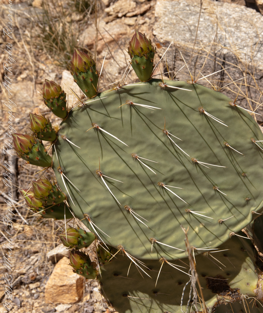
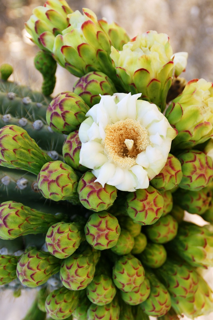
Here are 8 flower bud growing from one cladode (pad). There is a 9th bud on a second cladode. What is interesting about these pads are the needle shadows. Although thin, each provides some protection from the sun.
Cactus Closeup
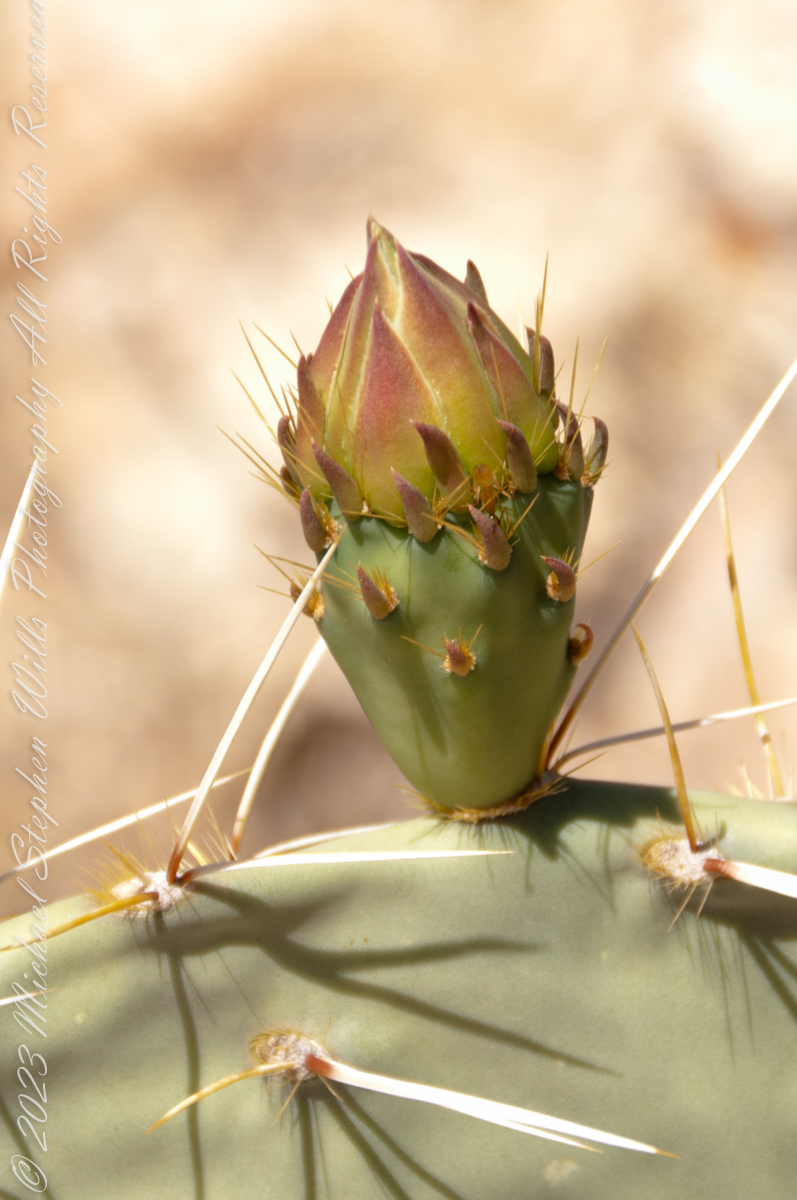
This delicate bud will develop into a flower and, then, into a cactus fruit (in spanish, tuna). The fruit retains those tiny spines, called glochids, which detach on the smallest contact. The pads are also covered with them.
Prickly pears are known for growing into thickets. The Cuban government created a “cactus curtain” of prickly pears around the Guantanamo naval base in the 1960’s, to prevent Cubans from escaping to refuge in the United States.
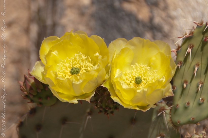
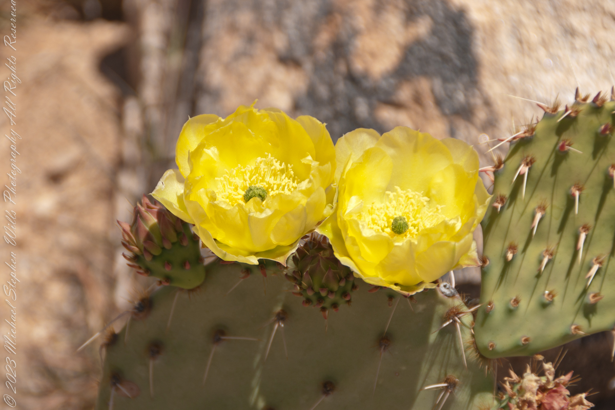
Cactus Flowers
Look closely at the anthers of these flowers. Each curls over when touched, depositing its pollen. The habit of prickly pears to grow together in thickets mean there are clusters of blossoms in springtime.
My visit to Finger Rock Canyon of the Santa Catalina Mountains filled two mornings. On the first morning, the subject was the lower canyon as morning light filtered over the eastern ridge.
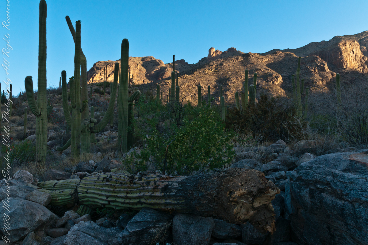
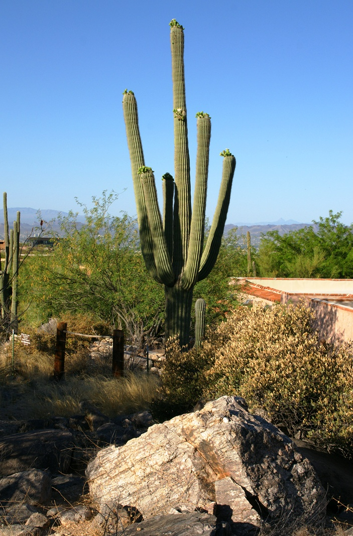
Early morning to the north / northwest looking over a 20-foot fallen Saguaro Cactus (Carnegiea gigantean), toward lower ridges of the Santa Catalina Mountains. The saguaro is among a stand of healthy fellows, some with new growth and flowers on the tips of arms and main columns. This giant must have grown over rock through 60 years. It was brought down when the roots weakened. Specimens that are more reliably rooted can live to 200 years.
A clump of brittlebush shrub (Encelia farinosa) grows from the same rock.
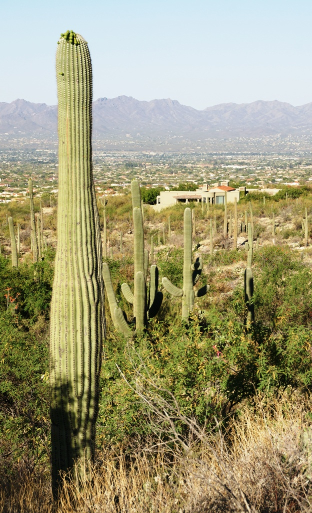
Pima Canyon is the next over, behind that near ridge which provides similar shade. Unlike Finger Rock Canyon, the Pima Canyon trail follows the western cliff and loses the shade much sooner. During our three-week trip, my wife, Pam, and I visited Pima in our first week.
These photos were taken between 6:20 and 7:00 am.
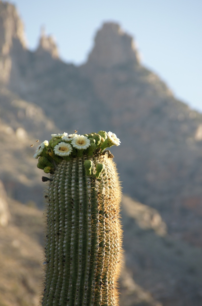
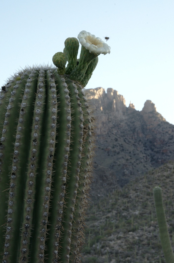
Along the trail I noticed a multitude of buds on the tip of selected saguaro arms. In a previous blog, there’s a photo of this same saguaro in the shade. The following series captures the one blossoming top just as the sun passes over the eastern, shadowing, ridge.
The same saguaro, two minutes later…….
Here is a portion of the saguaro forest, around 7 am with the lower canyon filled with light. There are a few foothill homes with west and southwest Tucson. The Tucson Mountains are in the distance.
These photographs are a continuation of blogs from two days’ exploration of Finger Rock Canyon of the Santa Catalina Mountains, southern Arizona. Here we explore the nature of the Saguaro blossom.
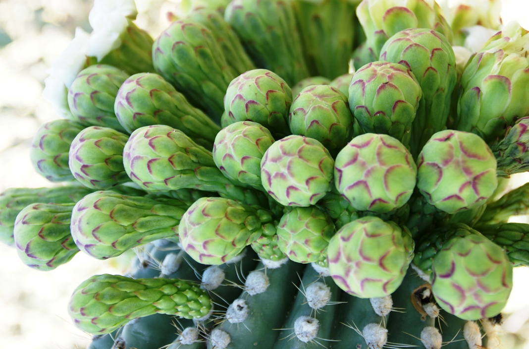
Saguaro flowers start as buds on the tip of the cactus body or arm. The specimen in the photograph below, growing in the yard of a foothills home on the border of federal land, is over 30 feet tall and, at the end of April 2011, buds are sprouting from every tip. Look closely for opening buds and full saguaro blossoms.
Flower buds grow only from some tips and around the center, along the sides, not from the point at the very end of the tip, from which the limb grows.
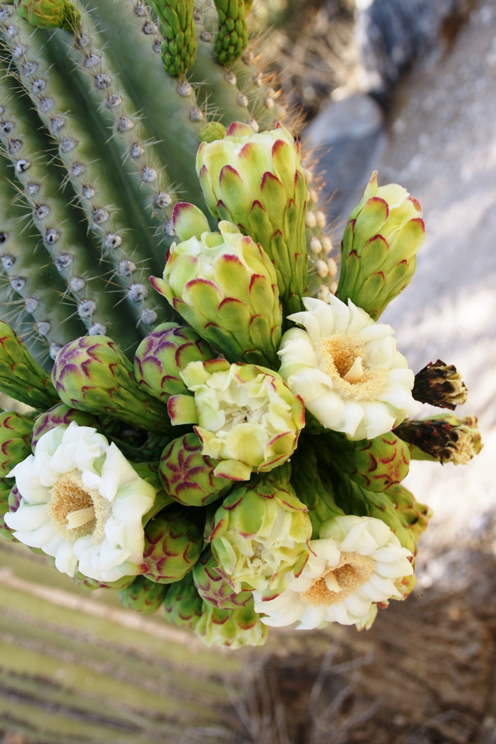
These buds first appeared mid-April and are here shown in the latter stages of maturity, prior to opening. Sometimes, the base of an arm weakens and the arm lowers close to the ground while remaining healthy. While descending the canyon I noticed this had happened to the arm of a particularly large specimen, an arm in full flower. This and the following photographs are from that arm.
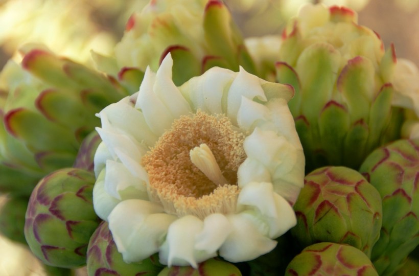
I have read that each flower opens in the cool of the night and lasts only until the following afternoon. Here is a fully blossomed flower with a pair of opening buds.
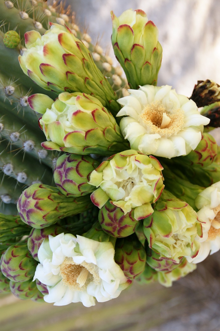
And more, from a different view of the same arm.
A saguaro flower in full bloom, having opened the previous night. This flower will last a single day. It will wilt in the heat of a single afternoon and close. In this brief time, flying animals will pollinate it. You can see numerous honey bees on the flowers, in a previous blog, “Saguaro Flowers in Finger Rock Canyon.”
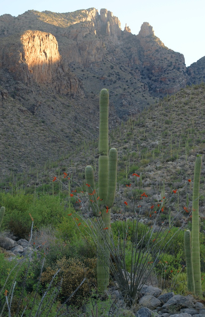
The perfection of April in Tucson is nowhere better than mornings spent in Finger Rock Canyon of the Catalina Mountains. Oriented on a north/south axis, the eastern cliffs shed a long shadow well past 9:30 am. For early risers such as me, this means no hat and cool hiking to the canyon head: the trail hugs the eastern cliffs.
These three shots were taken 5:30 – 6:00 am mountain time (Arizona does not follow daylight savings time except on the Navajo Reservation).
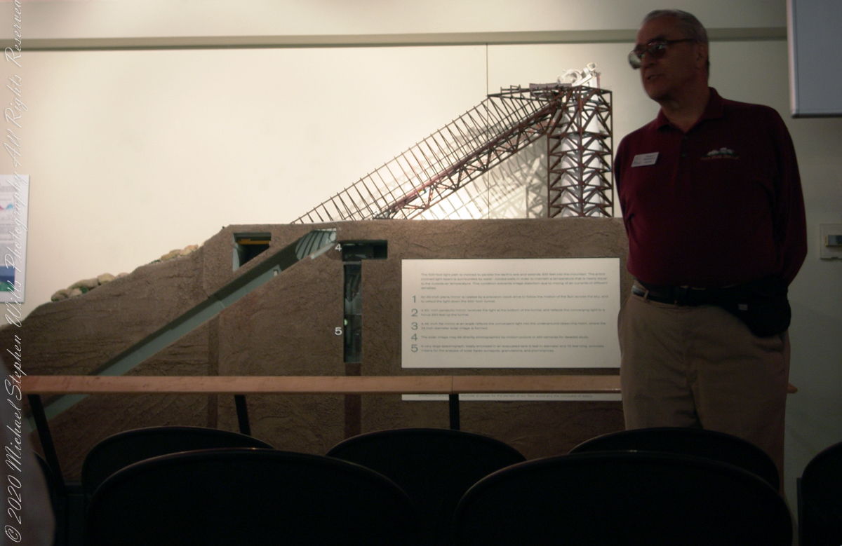
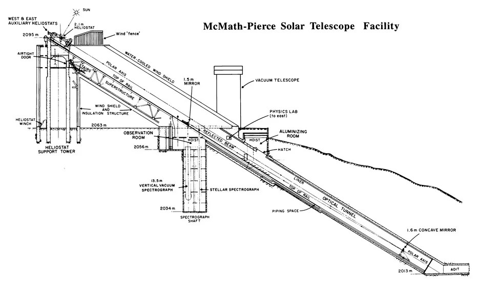
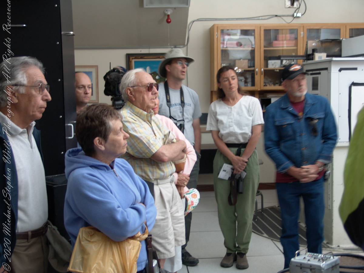
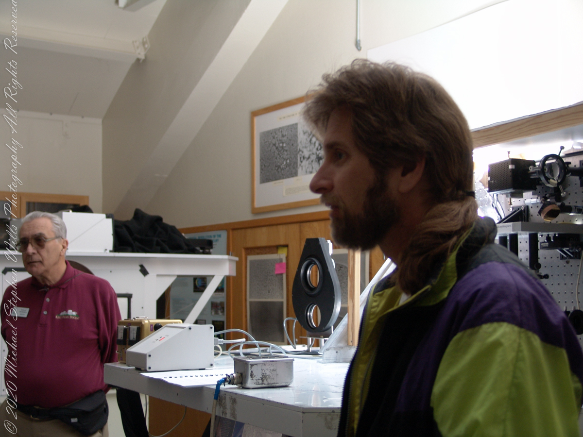
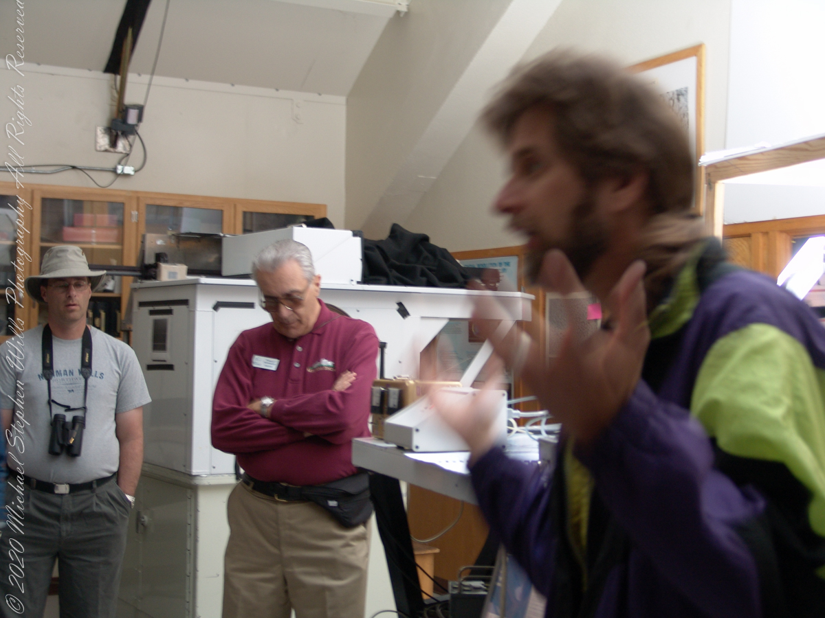
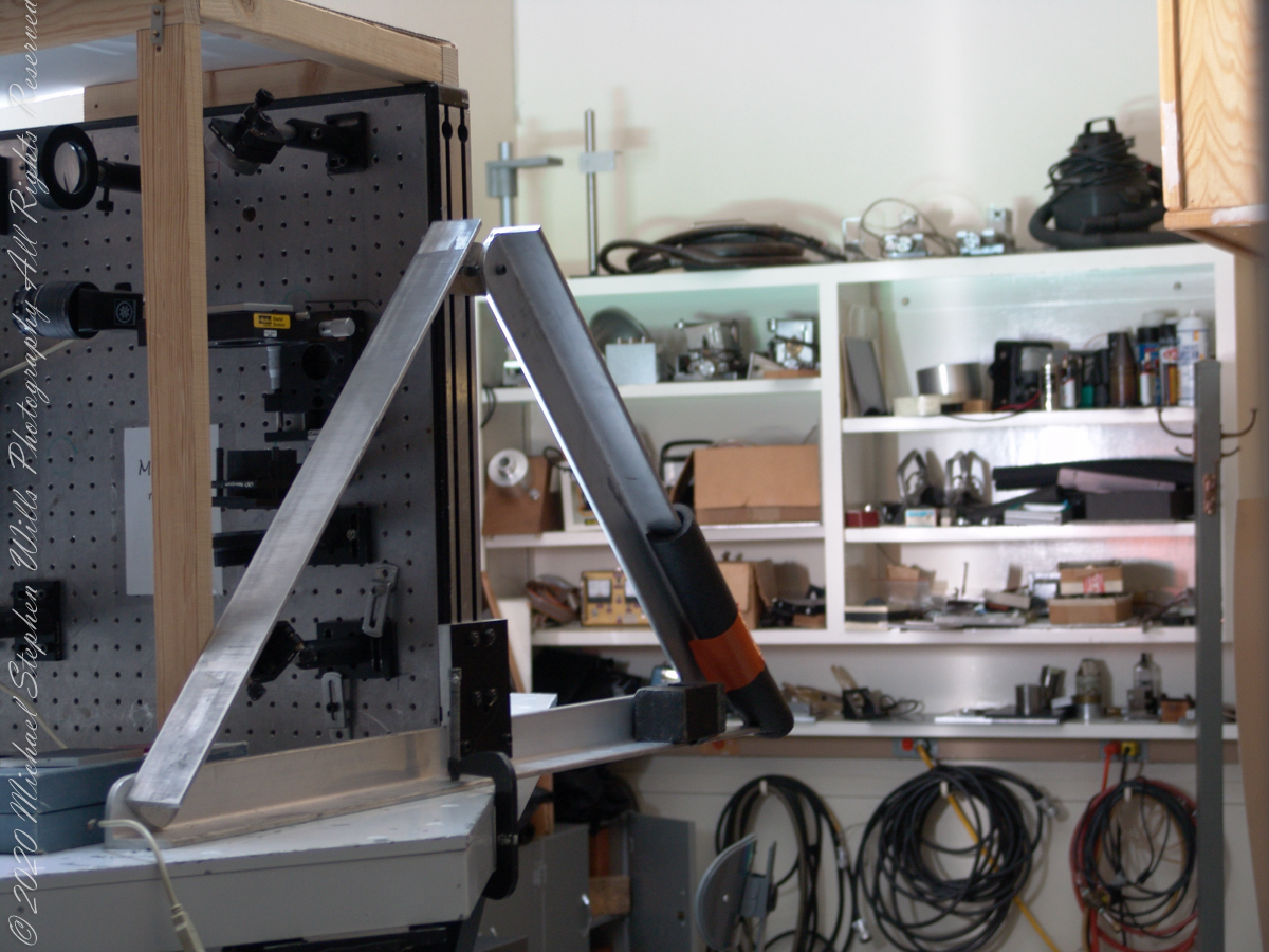
These views within the McMath–Pierce solar telescope enclosure were captured during a guided tour of the instrument, April 20, 2005. By way of orientation, the observation room we visited is near the location labeled “4” on the model of the following photograph or the “Observation Room” of the drawing.
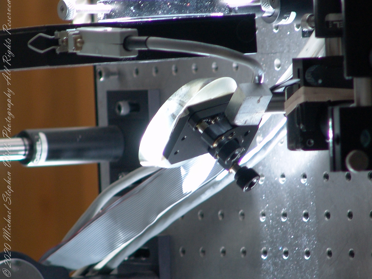
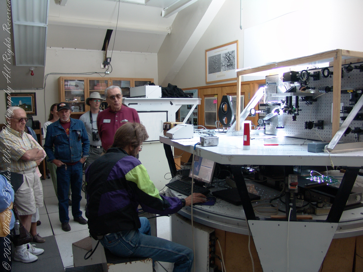
We learned each of the sets of mirrors is considered a separate telescope. The first step in designing the new solar telescope was to determine the optimal image scale. Working on the spectra of the solar granules, on the physical structure of the sunspots and their associated magnetic fields, requires a considerable image size. Past experience has shown that the optimal image of the sun should be approximately 0.91 meters. The highlight of our visit to the Main Observation room was meeting with the technician operating the recently developed low-cost adaptive optics system.
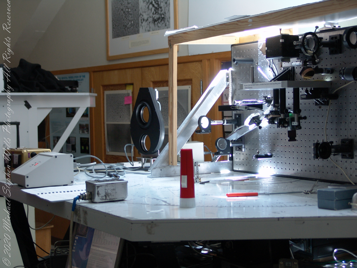
Tip-tilt correction and low order wavefront correction is available with a number of portable optical benches. These are primarily used with the Main spectrograph and the Solar Stellar spectrograph on the Main telescope, but due to their compact mounting they could be used with other telescopes and instruments in the facility.
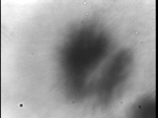
This configuration uses a rapidly deformable mirror to correct distortions introduced by the turbulent atmosphere. Using sensors to measure the degree of image distortion, the adaptive optics system adjusts the shape of the mirror accordingly and converts a blurred image into a clear one. The following image demonstrates the correction. “Low-cost” = $25,000 in 2003 US dollars. Under references is a link to a full description of the device by the creator.
Christopher Keller, Public domain, via Wikimedia Commons
A main area of study in the observatory is the structure of sunspots, which are relatively cold, dark spots on the surface of the Sun created by intense magnetic activity.
Some of the most important discoveries made at McMath-Pierce include the detection of water vapor in the Sun, the measurement of kilogauss magnetic fields (thousands of times stronger than those on Earth) outside sunspots and the detection of a natural maser (like a laser, but with a microwave instead of visible light) in the Martian atmosphere.
Over the years and technological advances, the National Solar Observatory has moved its headquarters from Tucson to Boulder, Colorado. The organization abandoned its solar telescopes at Kitt Peak and in New Mexico for a larger instrument in Hawaii, the Daniel K. Inouye Solar Telescope on the island of Maui, which began operating in 1919.
These views within the McMath–Pierce solar telescope enclosure were captured during a guided tour of the instrument, April 20, 2005. By way of orientation, think of yourself at the location labeled “4” on this model. This is the only large telescope where humans can view the interior and visually experience the light paths “bouncing” between the mirrors.
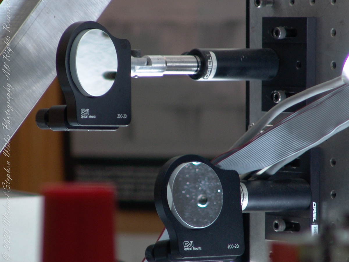
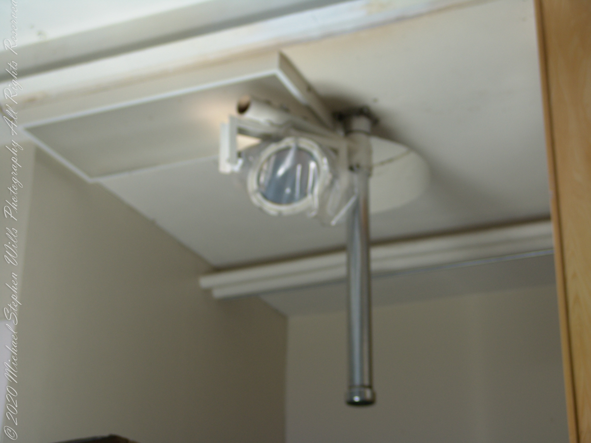
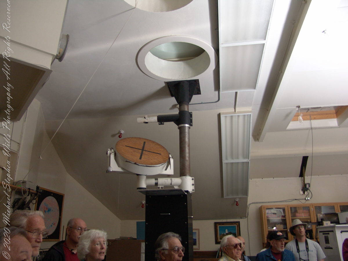
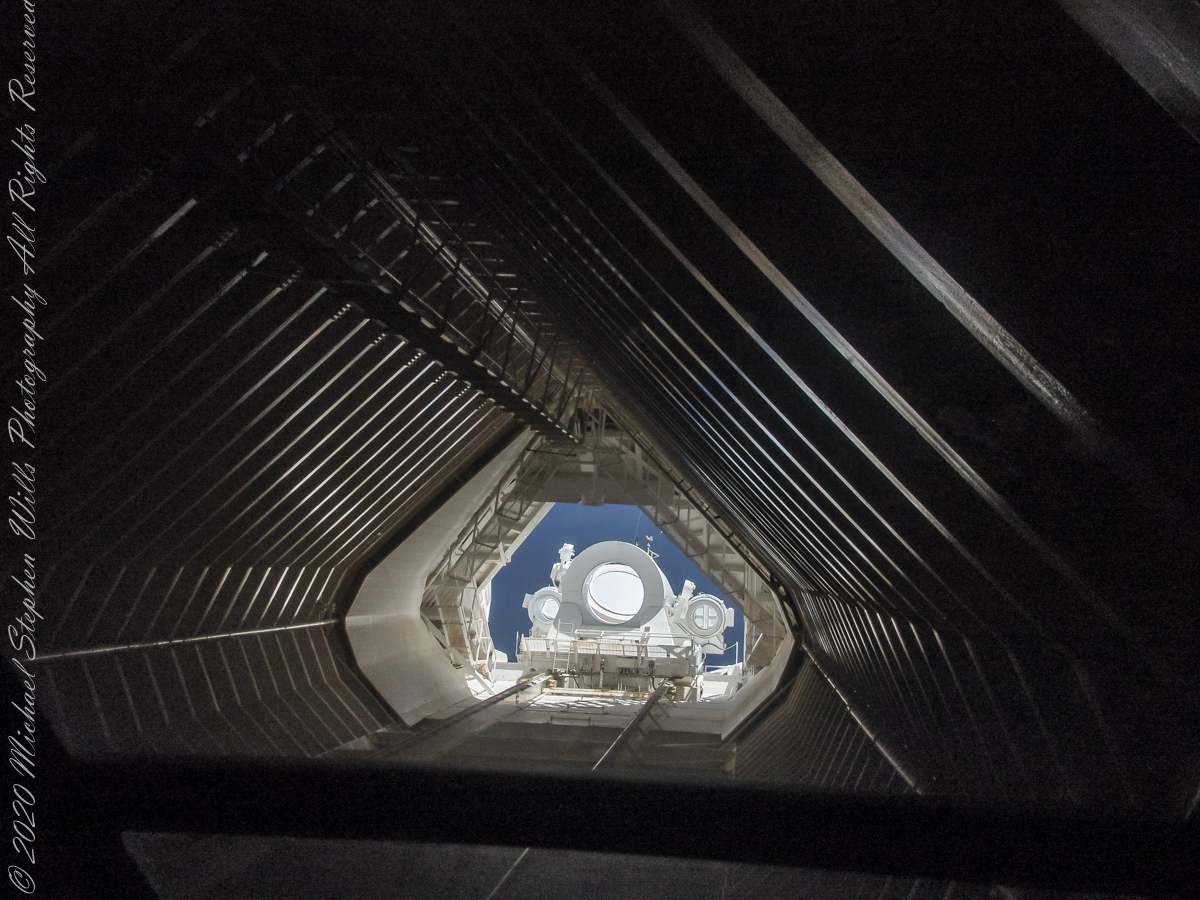
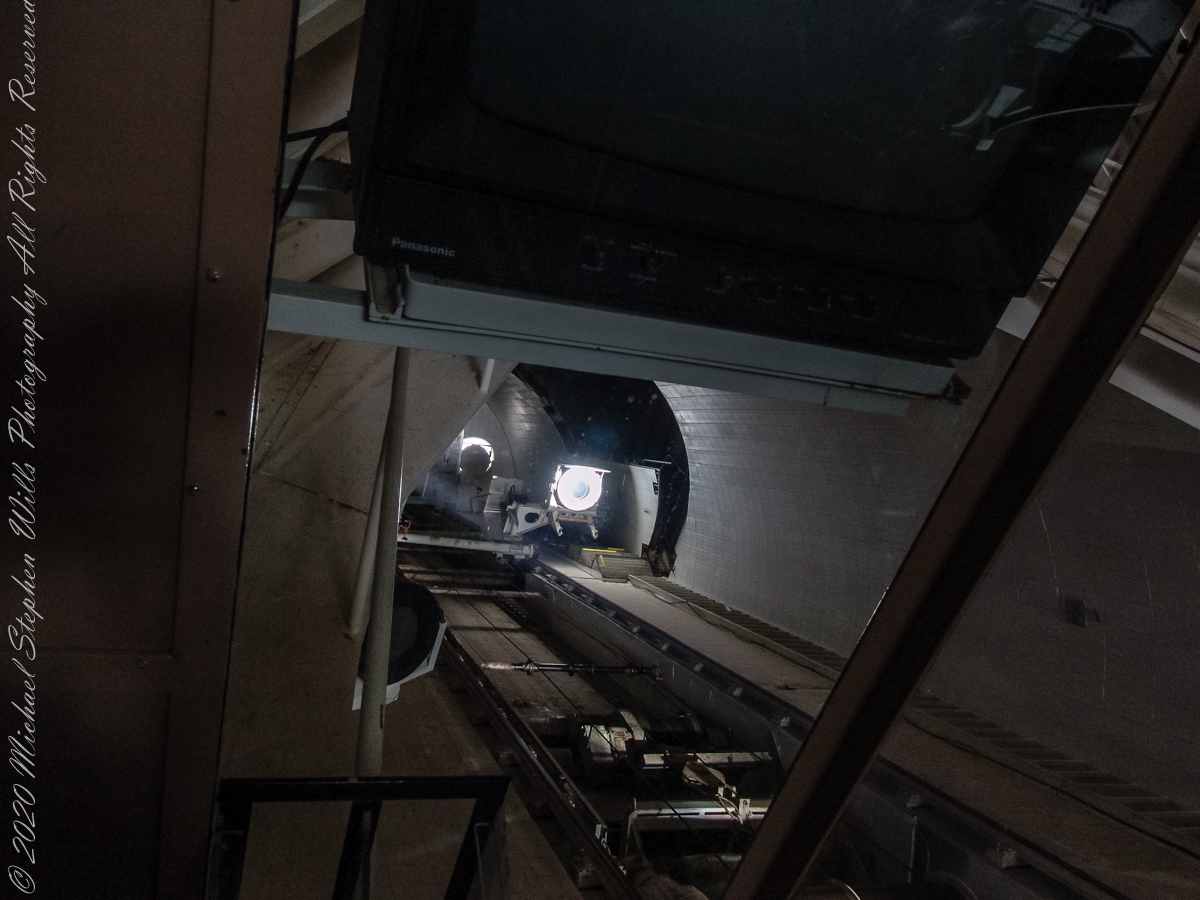
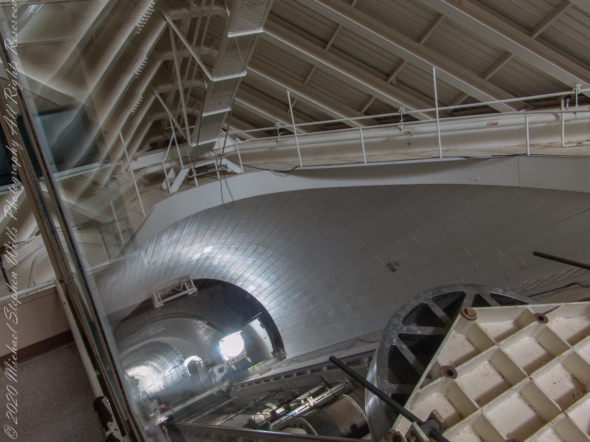
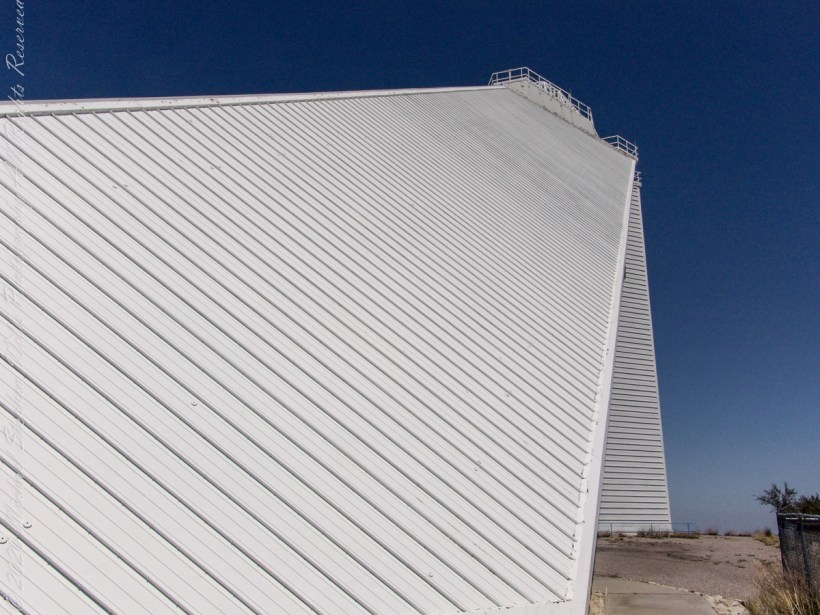
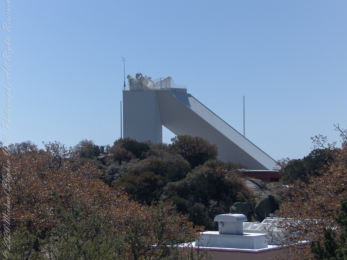
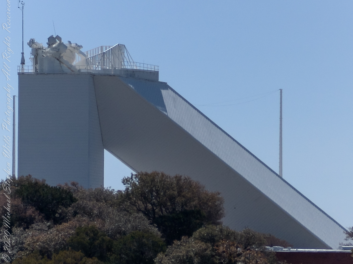
McMath–Pierce solar telescope has three heliostats mounted on a 110-foot tower adjacent to a slanted enclosure. The 2.03-meter heliostat feeds a 1.61-meter primary mirror, there are 1.07-meter and 0.91-meter primary mirrors fed by a pair of 0.81-meter heliostats. Here we are inside the slanted enclosure, looking up the shaft to the tower mounted heliostats, readily identified as the three circles, the largest at center (3.51 feet in diameter). The smaller (2.66 feet) heliostats named “East” (on left) and “West.”
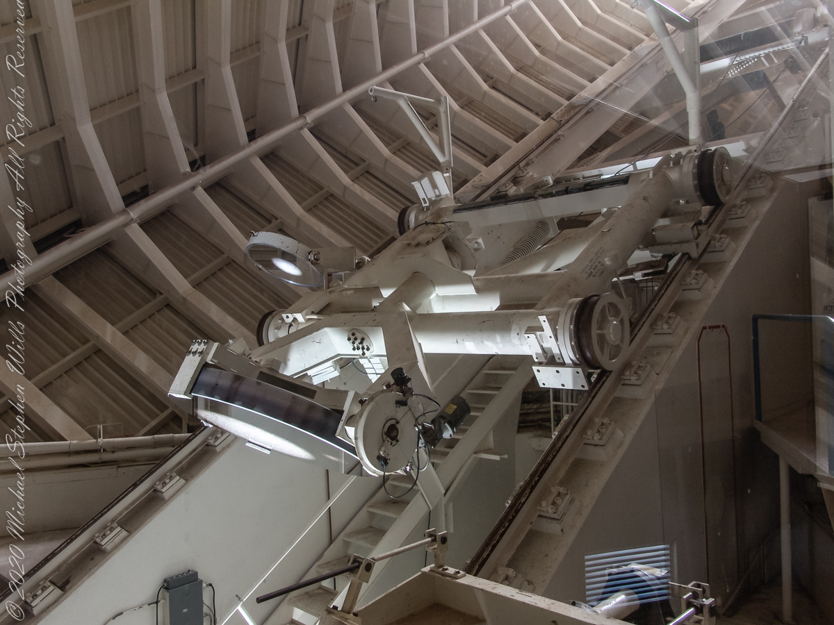
Built in 1962, the building was designed by American architect Myron Goldsmith and Bangladeshi-American structural engineer Fazlur Rahman Khan. It was the largest solar telescope and the largest unobstructed aperture telescope in the world. It is named after the astronomers Robert Raynolds McMath and Keith Pierce. Painted white to reflect sunlight to reduce heat accumulation, the enclosure is water cooled to prevent convection currents through the column of air within the slanted enclosure, keeping the air as still as possible along the light path between the mirrors.
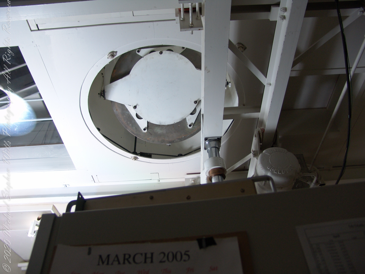
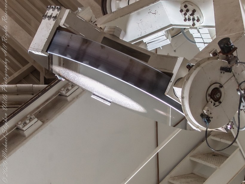
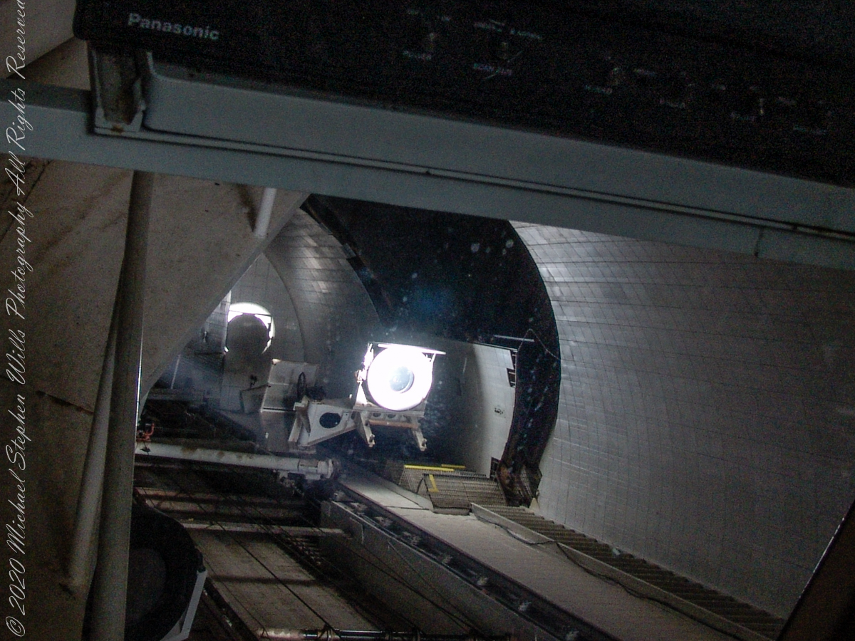
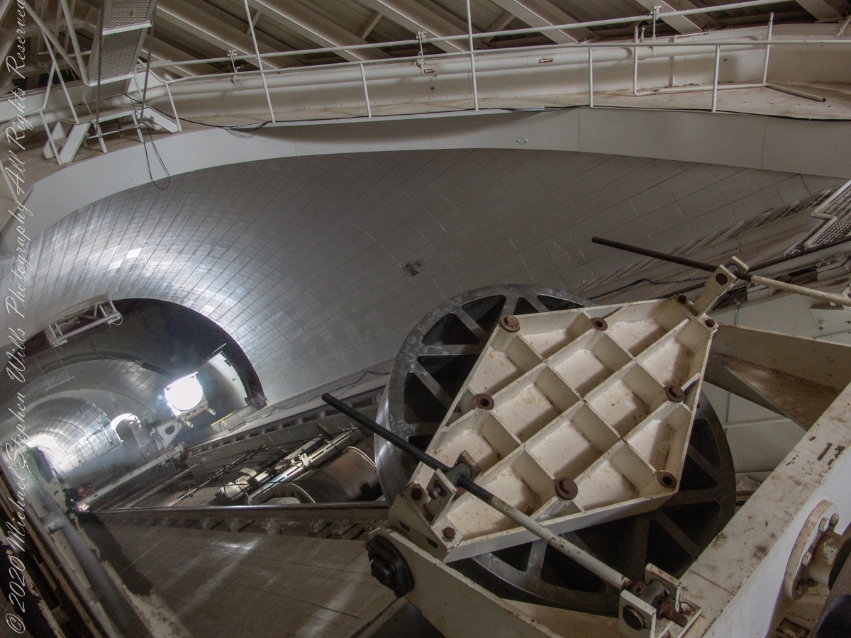
In the three photographs following, we face the underground portion of the slanted shaft and (what looks to be) the 0.91 meter (2.99 feet) primary concave mirror. I say that because in some of the photographs a beam of light, to the left of the mirror, can be seen travelling further underground, presumably to the largest primary mirror. As there is only one such light beam, I conclude the west heliostat is inactive.
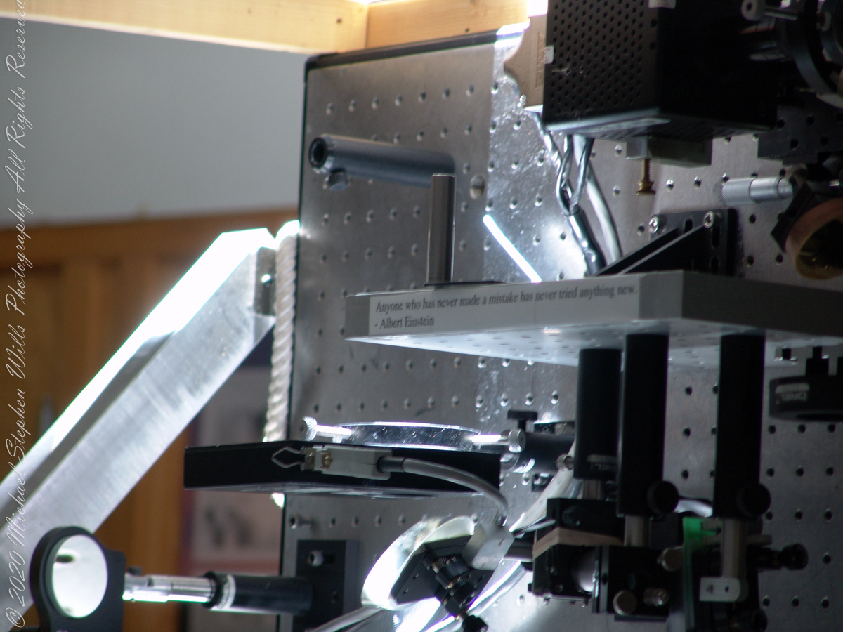
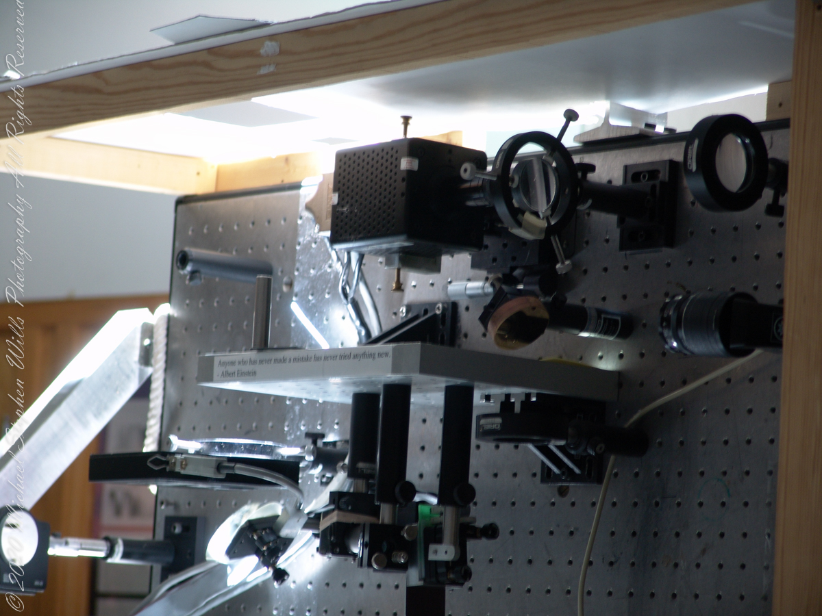
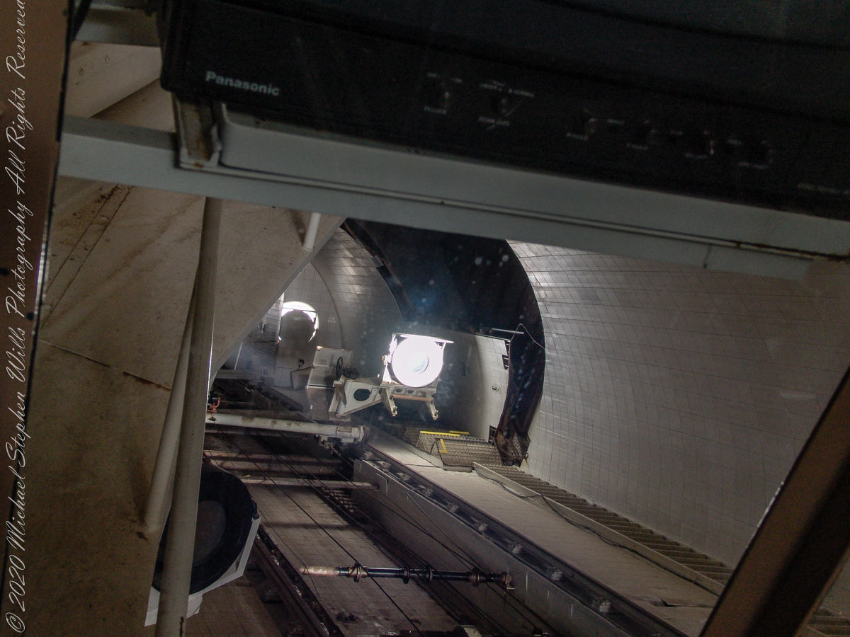
Here we looking up the slanted enclosure. Look carefully at the first photograph, below, to see reflections on the glass partition. The observation platform was separated from the light paths to maintain the stillness of the air column. The two mirrors of the first photograph are the third mirror, reflecting concentrated sunlight from the 0.91 and 1.61-meter primary mirrors into the observatory rooms. The mirror for the 1.07-meter primary is out of sight in foreground, I believe this set of three mirrors (West heliostats, primary and third) was out of service.
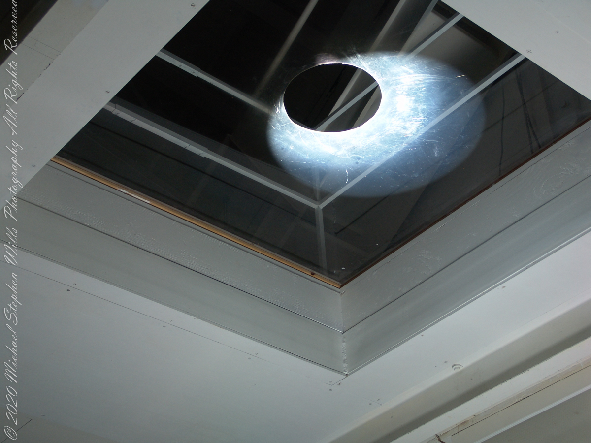
The second photograph, on right, is a close up of the third mirror for the largest primary. A foreshortened, perfectly round light disk is clearly visible.
Here we are inside the slanted enclosure, facing the underground portion of the slanted shaft and (what looks to be) the 0.91-meter primary concave mirror. In the lower right corner is the reverse side of the third mirror for the largest primary mirror, the 1.61-meter.
Reference: Wikipedia “McMath–Pierce solar telescope”
Copyright 2022 Michael Stephen Wills All Rights Reserved
These views of the McMath–Pierce solar telescope enclosure are the preliminary to a guided tour of the instrument, April 20, 2005.
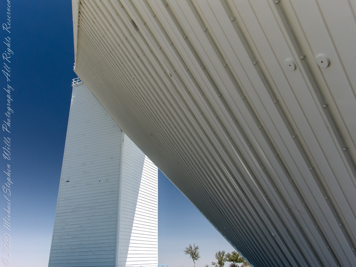
On the tower are three heliostats, plane (flat) mirrors mounted on computer-controlled platforms to follow the sun across the sky to direct sunlight to primary mirrors underground, beneath the base of the slanted shaft
Built in 1962, the building was designed by American architect Myron Goldsmith and Bangladeshi-American structural engineer Fazlur Rahman Khan. It was the largest solar telescope and the largest unobstructed aperture telescope in the world. It is named after the astronomers Robert Raynolds McMath and Keith Pierce.
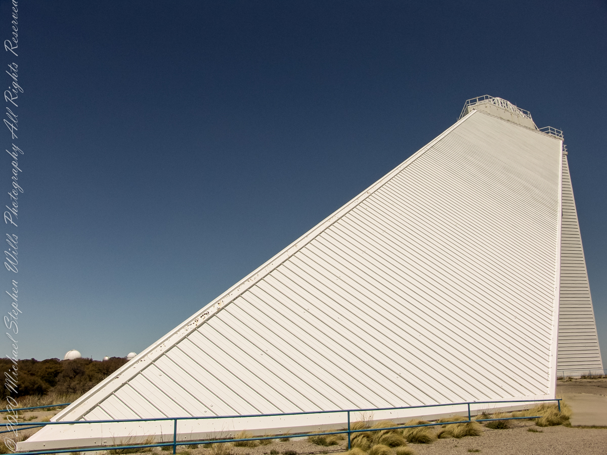
The slanted shaft, looking toward the tower.View of the slanted shaft, looking toward the tower.View from underneath the slanted shaft, looking toward the tower.
Inside the McMath–Pierce solar telescope is this keyed model of the observatory. Our docent for the morning tour stands alongside.
Reference: Wikipedia “McMath–Pierce solar telescope”
Copyright 2022 Michael Stephen Wills All Rights Reserved
“When George J. Roskruge created the official map of Pima County in 1893, he named the range after James Quinlin, who had opened a stagecoach station in the nearby town of Quinlin in 1884.” — Wikipedia article for “Quinlan Mountains.”
Kitt Peak is the highest point of the Quinlan Mountains, one of a series of ranges starting near the border with Mexico, the Baboquivari Mountains. Pan Tak pass separates Coyote Mountains from the Quinlans. Farther north there is even the Roskruge Mountains and a range named for a silver mine, the Silver Bells. Roskruge originally named “Kit’s Peak” for his sister, Phillippa, married to William F. Kitt. The peak was renamed to Kitt Peak William’s request.
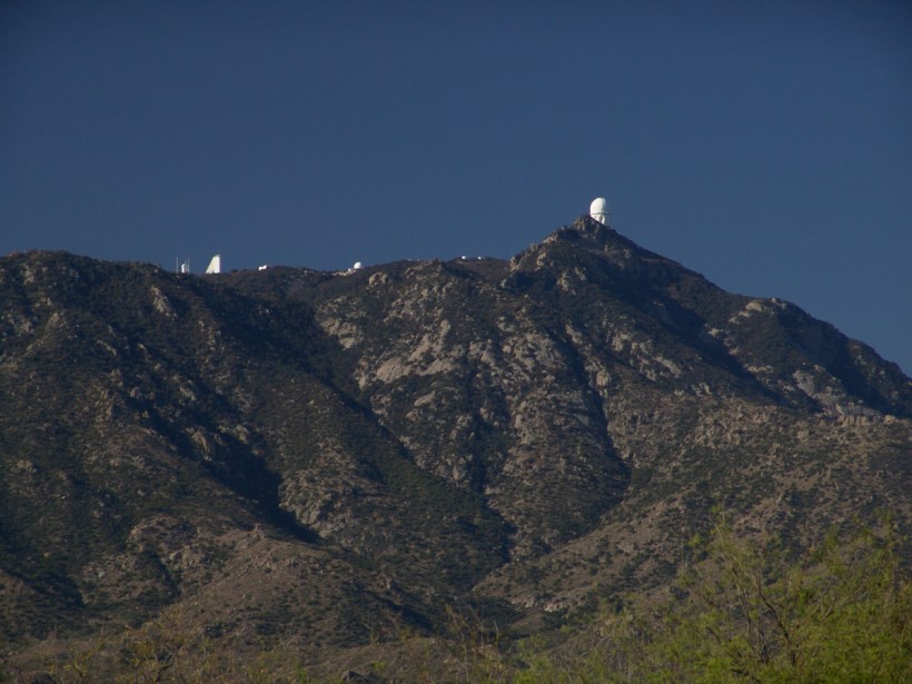
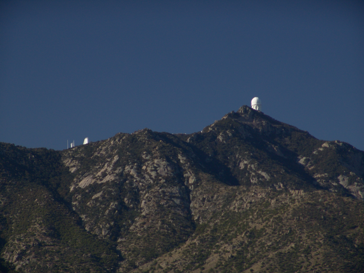
Here we see a dramatic view of Quinlan Ridge with Kitt Peak observatories, taken from the access road Arizona Routh 386. The instruments I recognize are, from left to right, McMath-Pierce Solar Telescope (second in line) and, on the end, Mayall Telescope.
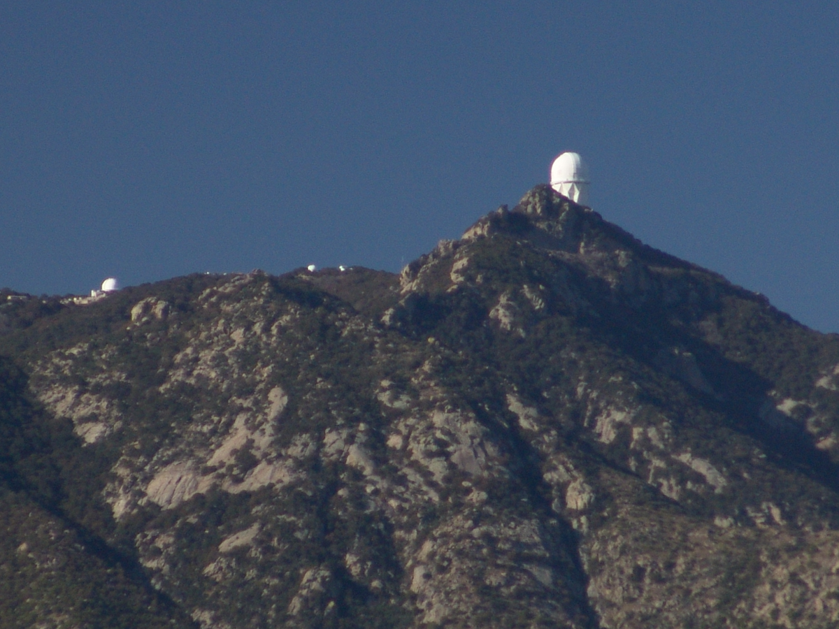
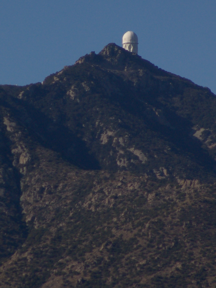
And more views as I progressed toward the top.
.
The dramatic peaks are hypothesized to be igneous intrusions into metamorphic rock, these are called “Sky Islands” for the environments supported on them, radically different from surrounding lowlands. Kitt Peak is known for the stands of Manzanita Bushes
A mature Manzanita growing along the Miller Trail of the Rincon Mountain Wilderness. There is an enlargement of the flowers, to the right.
Copyright 2022 Michael Stephen Wills All Rights Reserved
The Contreras fire threatening Kitt Peak last month brought to mind a spring visit of mine to the National Observatory.
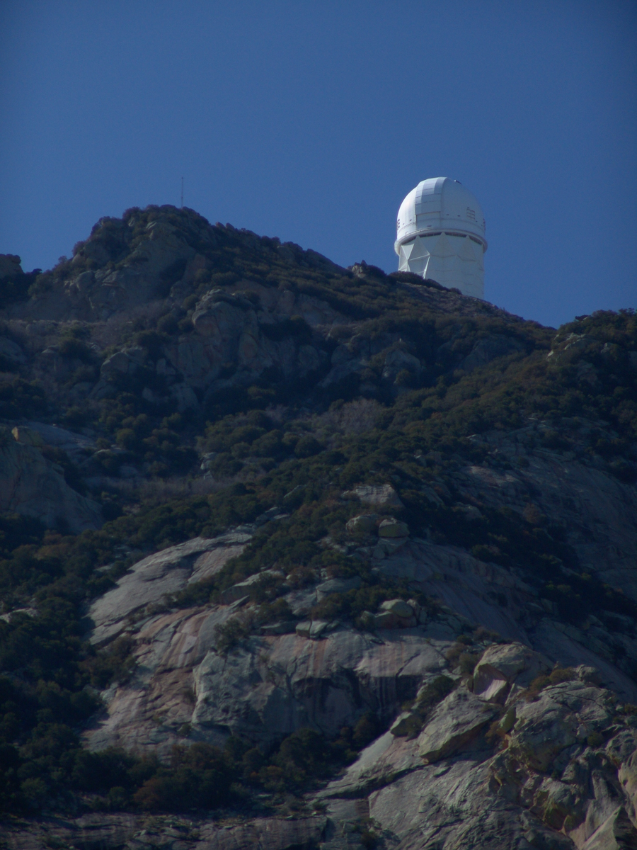
From downtown Tucson get onto Interstate 10, heading “east” toward El Paso. East in quotations as the road only turns east after the fork for Interstate 19, headed south past San Xavier del Bac mission and Nogales at the Mexican border. A few miles down I19, well before the mission, a turnoff for Arizona route 86, a road you’ll follow the better part of 36 miles, passing the Tucson Mountains on the right. Most days, the Mayall Telescope of Kitt Peak shines bright white ahead, as it did the right after dawn on Wednesday, April 20, 2005.
At some point R86 enters the 4,453.307 square mile extent Tohono O’odham Nation Reservation, you pass the town Three Points where Arizona route 286 heads south to Sasabe and the Mexican border. The next turn south is the Kitt Peak access road, Arizona route 386. On that Wednesday I was so early the gate to the peak was locked, so I pulled off the road and waited. It is a lonely place on the route for migrants from Mexico. I wandered off the road, into a wash (dry, sandy stream bed), to relieve myself, where junk from migrants was scattered around. Back in the car a helicopter approached with a black SUV. A big guy got out, walking by into the wash: the border patrol.
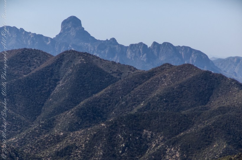
Here is a photograph from that day of Baboquivari Peak taken from Kitt Peak’
Baboquivari Peak is the most sacred place to the Tohono O’odham people. It is the center of the Tohono O’odham cosmology and the home of the creator, I’itoi. According to tribal legend, he resides in a cave below the base of the mountain. This mountain is regarded by the O’odham nation as the navel of the world – a place where the earth opened, and the people emerged after the great flood. Baboquivari Peak is also sometimes referred to as I’Itoi Mountain. In the native O’odham language, it is referred to as Waw Kiwulik, meaning “narrow about the middle”. The O’odham people believe that he watches over their people to this day. — Wikipedia
Baboquivari Peak was mentioned in the journals of Jesuit missionary Padre Kino, who made many expeditions into this region of the Sonoran Desert, beginning in 1699, establishing Spanish Missions in the area. — Wikipedia
Kitt Peak is in the sacred precinct of Baboquivari, the land just below the peak is the “Gardens of the Sacred Tohono O’odham Spirit I’itoi.” The month of my visit, the O’odham nation brought legal suit against Kitt Peak to halt construction of new telescopes in the garden. The issue was settled out of court.
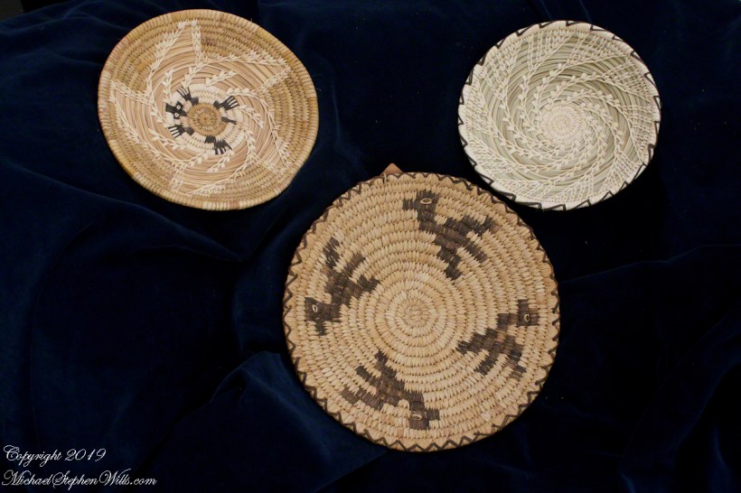
About the header photograph: From the bottom clockwise. Birds by Anmelia Juan of Geawuk (Kitt Peak 1972) – I purchased this from the Kitt Peak gift shop during my first visit; Turtle by Olvera and Simon Valenquela (Saguaro National Monument 2005); Stars by Simon Valenzuela for his daughter Pasquala Valenquela 16th Birthday (2018). Simon is of the Pascua Yaqui tribe who Learned basketmaking from his wife’s family.
Copyright 2022 Michael Stephen Wills All Rights Reserved