Ocotillo Sunset from Saguaro National Park, a diary Part 5

High Altitude Clouds

This is a retrospective diary of the day I created my print “Ocotillo Sunset.” 

Choices of the Evening

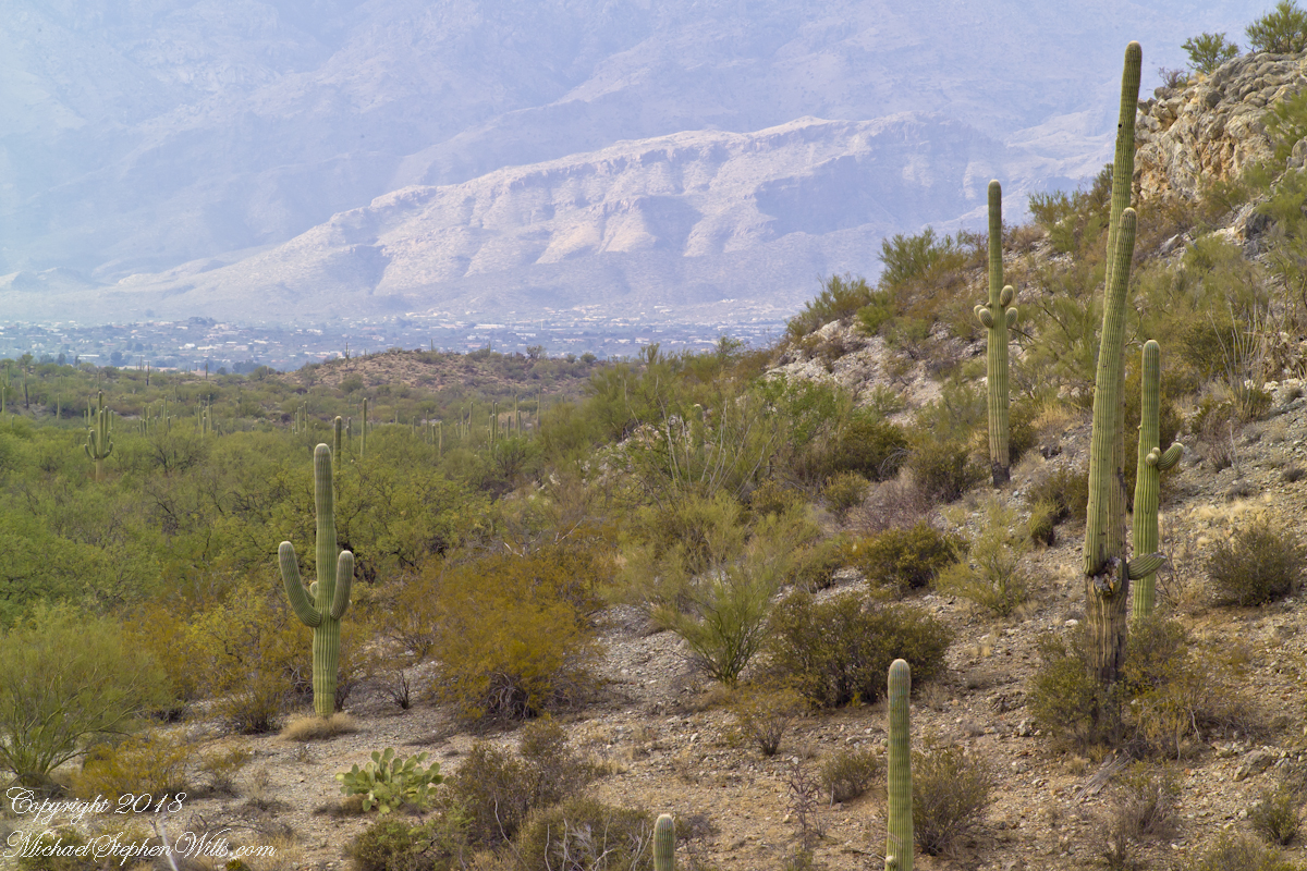
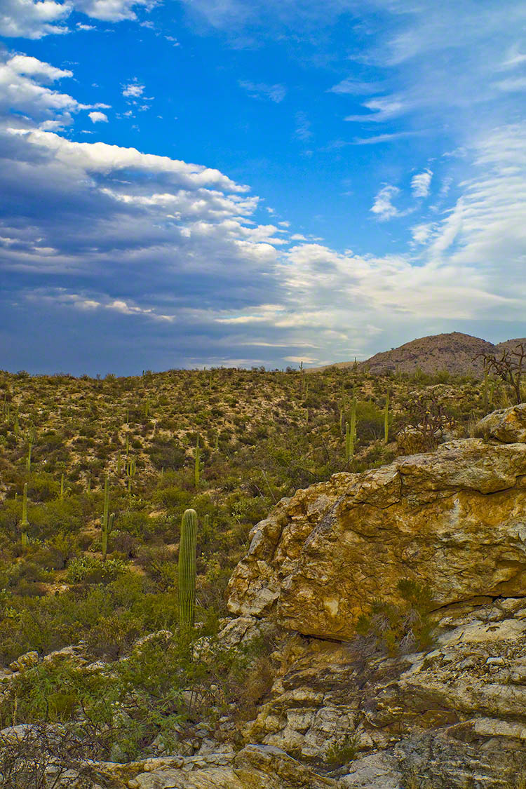
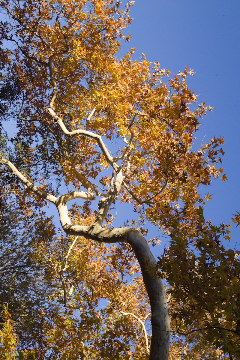
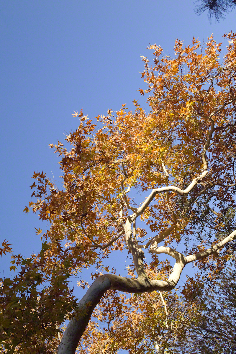
The next few blogs are a set of photographs from the developing sunset of that November evening. Once set up, my practice is to stay in place until there is nothing left of capture; all the while evaluating the results and adapting the camera settings, framing and lenses to the environment.

Happening in the Twilight

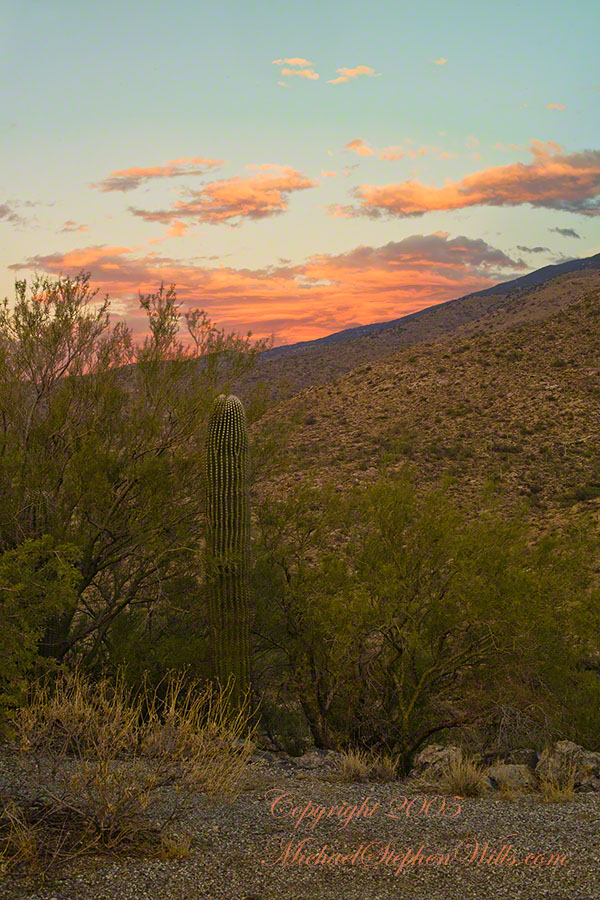
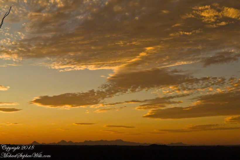
By this point, twilight is over and only the sky is lit. According to file metadata posted at capture, thirteen minutes passed from the following photograph till the last. I mounted my camera on a simple tripod, purchased from a mall chain store, with the standard controls. I prefer to specify ISO and set it at 160 (the lowest value) throughout. The sky was calm and, with the tripod, I used the aperture setting with higher values. This was f13 / 1/60.

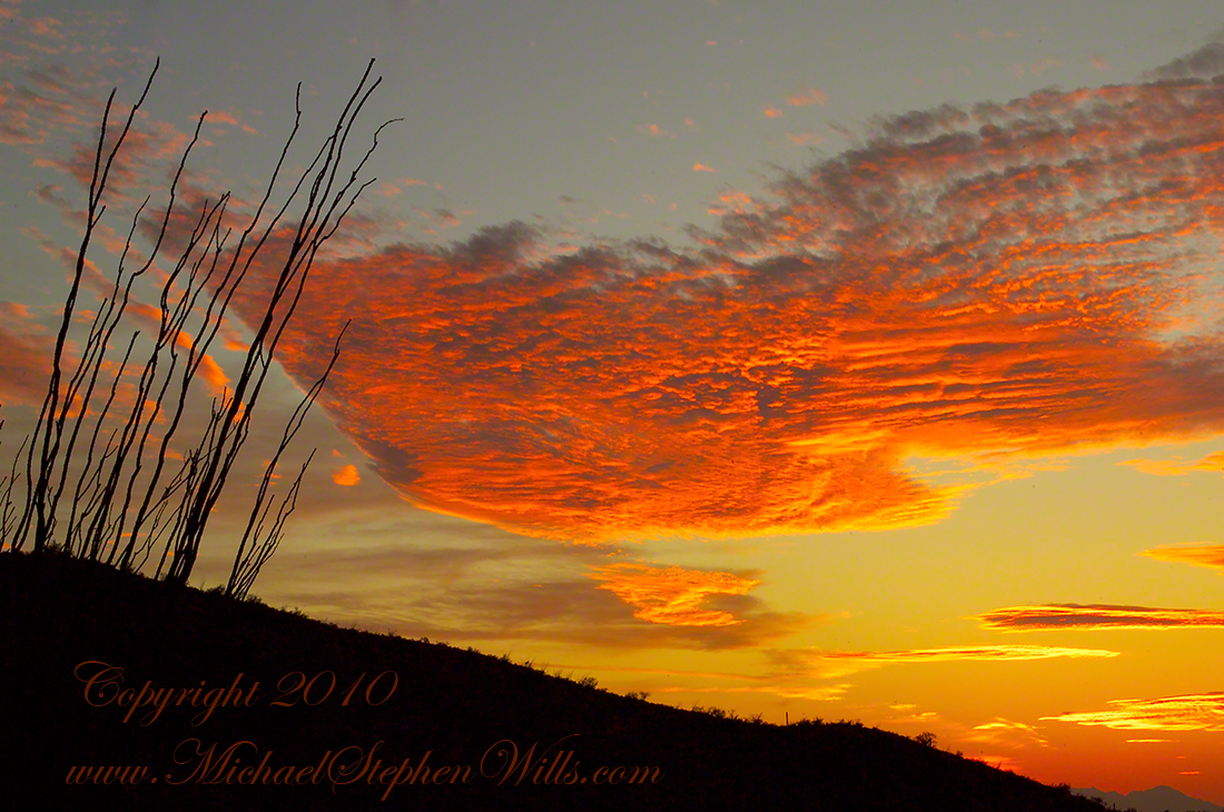
Click photograph to view Ocotillo Sunset Saguaro Sunset – CLICK ME to view Ocotillo Sunset.

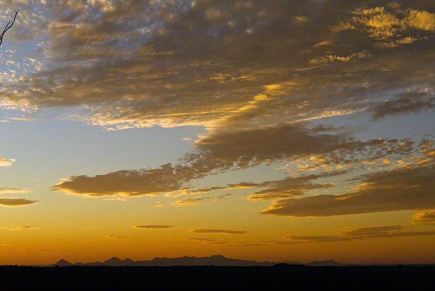
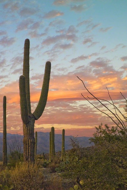
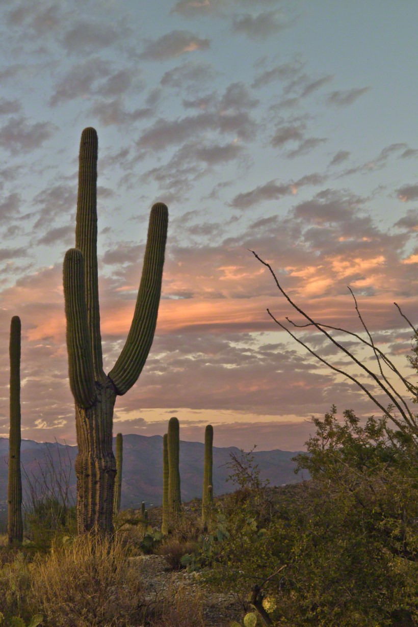
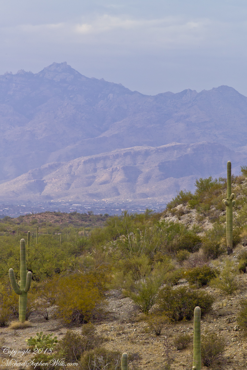
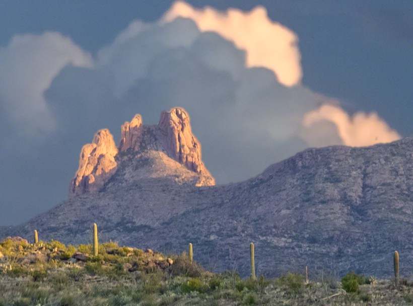
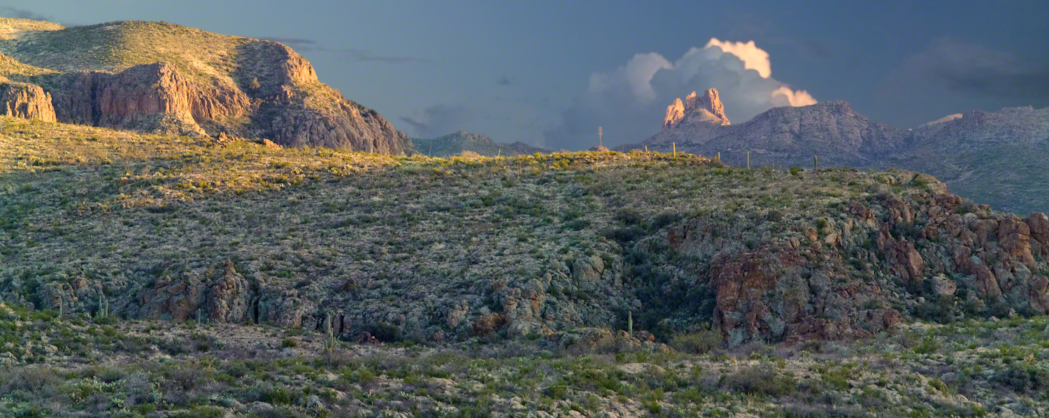
The clouds are forming up.  I need some foreground.  Vastness on vastness is a bit much. Those are the Tucson Mountains in the distance. If you look closely, on the right the Tucson Mountains dip down, revealing Kitt Peak, at least 60 miles distant. It is the defined peak on the left of that range. In early morning light, the Mayall 4 meter telescope building gleams white on that point.

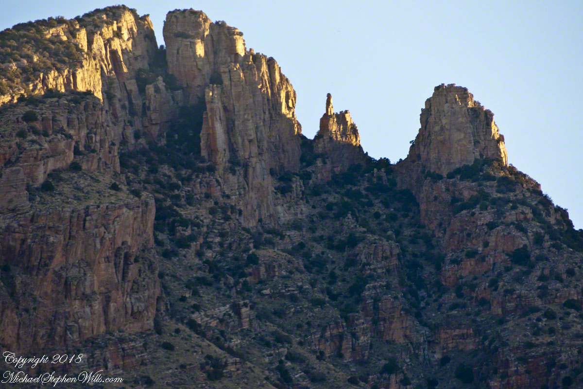
The sun illuminates different levels of clouds as the earth turns toward night. These are altostratus cloud types, at 6,500 to 20,000 feet, formed by strong winds.

The elements of my print “Ocotillo Sunset” are coming together.  Do you recognize them from this image of my print?

FF6H3057_OctilloSunset_Copyright4Site

Click Me for the next post in this series.

Click Me for the first post in this series.

Copyright 2021 Michael Stephen Wills All Rights Reserved

Ocotillo Sunset from Saguaro National Park, a diary Part 4

The Nursed Saguaro

This is a retrospective diary of the day I created my print “Ocotillo Sunset.” 

Choices of the Evening

As the Golden Hour approached I had a choice to make.

My perch on Lime Kiln Falls was not safe. As the sunset developed, while I focused on the work, the trail would be lost in the gathering darkness and, even with a headlamp, I decided to avoid picking a way down a 1+ mile pitch dark deserted desert trail. Choosing not to stay, for the second time I packed up and was on the move.

That time of day wildlife is also moving and, in a short time, a rattlesnake, javalina (wild pig of the desert) and jack-rabbit crossed my path. Part of my photography kit is a Sony digital camera with a variable lens carried across the front in a readily accessible “fanny pack.” That day, I walked with the camera out and ready. I needed to be in place for an increasingly promising sunset and so spent a minimum of time with wildlife photography.

Saguaro Sky

I was only half way to the car at the time when the sun was a few degrees above the western horizon and sunlight raked across the desert. The northeast sky lit up. In these perfect moments I captured this personable saguaro on Lime Kiln ridge with a tripod mounted Kodak SLR body with an excellent 50 mm (“portrait”) lens (EF 50mm f/1.2L USM) fitted with a flexible hood. ISO 160, f13 with auto settings choosing 1/5 second.

The ocotillo branches, to the right, caught my eye. “A nice effect”, I thought. There were some high level winds shaping the clouds that evening. The Santa Catalinas are in the distance.

Click any photograph to view Ocotillo Sunset
Saguaro Sky

Nurse Tree

I set up back against the Tanque Verde ridge, the highest point of the road, on the western shoulder.

Front and center was this “adolescent” saguaro still growing in the shelter of a “nurse” Palo Verde tree. This saguaro benefited from the shade and protection of the tree as a seedling and juvenile. It has grown beyond the need for this protection. Eventually, the requirements of the larger cactus will starve the tree and it will be left alone, as you see it in the previous photograph. That is the shoulder of the Rincon Mountains in the distance. The direction if between northeast and east.

I am using the same camera and lens, ISO 160, f13 and auto exposure choosing .6 second. It is twilight.

Click any photograph to view Ocotillo Sunset
Nursed Saguaro and Sunset

Click Me for the next post in this series.

Click Me for the first post in this series.

Copyright 2021 Michael Stephen Wills All Rights Reserved

Saguaro Sky

dramatic skies from Saguaro National Park

November is a special time for the ranges and basins of southern Arizona deserts.  Climb a bajada of foothills, face west and wait for the sunset.  That is what I did this day, November 3, 2005.  East of Tucson the Saguaro National Monument at the foot of the Rincon Mountain Wilderness is where I parked, unpacked the photo gear and climbed the side of the Tanque Verde Ridge for a favorable view.  Weather was pushing high level moisture from the west, clouds were developing.

You see here a shot from that session.  In the distance, looking across Tanque Verde, are the Santa Catalina mountains.  Months since the last rainfall, the giant Saguaros are using internal moisture reserves drawn up from a shallow root system, the flesh is less plump, the supporting structure of the ribs, always evident, are more pronounced.  The last light catches these ribs in relief against a dramatic sky.

Click this link or the photograph for my Online gallery of this offering
Saguaro Sunset -- CLICK ME!!!!

Click me for another Arizona sunset post.

Copyright 2021 Michael Stephen Wills All Rights Reserved

Ocotillo Sunset from Saguaro National Park, a diary Part 3

View from the bajada


SaguaroEast20051104-4

This is a retrospective diary of the day I created my print “Octillo Sunset.” You can visit “Octillo Sunset” on my online gallery by clicking on any of my blog photographs.

Choices of the Evening

Angled to the Sun

The following photograph of saguaros and distant Santa Catalina mountains is a similar view from Part 2 of this diary.  Notice the saguaro on the right is also on the left in the Part 2 photo. What is happening is I turned the lens more toward the west and the sun. At this angle the lens hood offers less protection, especially as the sun is lower in the west and the time of day is passing to the best light from the lowering sun that rakes across the landscape.  All this means I can bring the lens further to the west even though the lens hood is less effective.

Click any photograph to view Ocotillo Sunset Catalinas, Finger Rock, and Saguaros – CLICK ME to view Ocotillo Sunset.

Finger Rock!!

One reason why I am offering it, is high on the Catalina mountains, in the distance, you can just see a formation called “Finger Rock”.
This time of day, the lower angle of the sun brings out the canyon-shadows.  Finger Rock canyon has a high western wall, you can see it as a high long shadow starting toward the very center of the picture and building up and to the right.

The following photograph is the view of Finger Rock from the floor of that canyon taken during a Spring 2011 Tucson visit. I started hiking in pre-dawn hours to catch the dawn rays on the finger.

Click any photograph to view Ocotillo Sunset Catalinas, Finger Rock, and Saguaros – CLICK ME to view Ocotillo Sunset.

The Importance of Knowing Topography

Another aspect of this photograph is the landscape. There is a sloping bajada (alluvial fan) formed by water breaking up the mountain (in this case the Rincons) and washing it into the valley. It is the reason the saguaros appear to march into the distance. The same effect is used in movie theaters to allow the people in the rear to see over the head of people in the front.

This bajada and the higher elevation is the reason I moved from Sabino Canyon to here for a better position to view the sunset. Here is a nearly identical view, same 200 mm lens, in landscape format. The sloping land of the bajada is more visible.

Click any photograph to view Ocotillo Sunset Catalinas, Finger Rock, and Saguaros – CLICK ME to view Ocotillo Sunset.

Changing the Lens/Sun Angle

Looking in the opposite direction, back over Lime Kiln Falls to the Rincon (mountain) foothills, the lens hood offers maximum protection. The sun is at my back and, even though it is low in the sky at the beginning of the Golden Hour, this aspect gives great color depth at the expense of loss of shadows losing some depth of field.  Still, this is an interesting photograph.

Click any photograph to view Ocotillo Sunset NortheastFromLimeKilnsCopyrightSmall – CLICK ME to view Ocotillo Sunset.

Click me for the next post in this series.

Click me for the first post in this series.

Copyright 2021 Michael Stephen Wills All Rights Reserved

Sycamores and Riparian Space

a Preview of Reavis Ranch

….continued from the chapter “A Peaceful Day at Pine Creek.”

Compare these Arizona Sycamores with the struggling specimen from the last chapter, “A Peaceful Day at Pine Creek.” Many Sycamores such as this one flourish along Reavis Creek, a perennial stream of the eastern Superstition Wilderness. The drainage that feeds Pine Creek is far less acreage than that of Reavis Creek and, when the Pine Creek flow fades in the driest seasons, plants go into survival mode and halt growth and may even slough off limbs to conserve water.

These Sycamores grace a stream that seldom stops flowing, even in the driest of seasons. I had the good fortune to visit the Reavis valley of the Superstition Wilderness in November 2007, when these trees were at peak autumn foliage.

The tree requires a supply of water to thrive. This specimen demonstrates the species growth habit growing multiple trunks with a shape driven by water availability and the environmental context. The multiple trunks may be a desert survival mechanism. In dry periods a trunk or trunks are sloughed off to reduce moisture loss. This is why the Sycamore of “A Peaceful Day at Pine Creek” has a single trunk.”

To encounter a riparian space of the Arizona desert is a revelation, to progress from Sonoran desert spaces assailed by the breath of dry wind, to see the first signs of water in the distance as a welcome fluttering of leaves, to feel a welcome odor of water.

Yes, the first effect of a riparian space on the senses is the smell of water. Let’s finish this post with limbs of the Reavis Creek Arizona Sycamore reaching for the sky.

Click me for the next episode, “Desert Luxuries.”

Click me to visit Michael Stephen Wills Online Arizona Gallery.

Copyright 2021 All Rights Reserved Michael Stephen Wills

Peter’s Mesa Sunset

Can You Find the Eye of the Needle?

Peter’s mesa is at the center of Superstition Wilderness treasure legends. I was a member of an expedition to the top of the Mesa March 2008. This is a sunset view, looking south, southwest. Light raking across the desolation and an approaching storm behind Miner’s Needle create a fascinating spectacle. Ancient volcanism, apparent throughout the Superstition Wilderness, is here seen in the texture, form and type of rock as well as the mineral deposits. Miner’s Needle, like Weaver’s Needle (no seen in this view), are eroded volcanic summits. Look closely for the “eye” of Miner’s Needle, backlit by the storm cloud itself lit by the setting sun. To this day, hopeful prospectors search for gold nuggets around the Needle. There is one form of volcanism present today as an eerie rumble or hiss, similar to an enormous distant jet engine. We heard now and then during our two days on the mesa, louder and closer than a overhead plane could produce. The view includes many notable Sonoran desert plants. Many young Saguaro cactus are in the form of green poles and, on the rim of the ravine running left to right below the closer ridge, an excellent specimen with multiple arms. Catching the dramatic light, on the ridge is a tall single flower of an Agave, known as the “Century Plant” it flowers once in a long life and dies.

Click this link or the photograph for my Online Gallery
Peter's Mesa -- CLICK ME!!!!

Peters Mesa is named after “Old Pete” Gottfried Petrasch, father of Hermann and Rhiney Petrasch. Old Pete worked for Jim Bark for awhile in the 1890s doing odd jobs. Irregular employment gave Pete and Sons time to s searched for the Lost Dutchman Mine in the years following the death of the source of the legend, the “Dutchman” Jacob Waltz. The Petrasches were one of the first groups to search for the mine, and gold in general. They covered almost the entire Superstition range in their combined searches.

On our first day on the Mesa we came across the remains of one of these camp, on the top of Squaw Canyon. This was only deplorable junk a presumably disappointed bunch of searchers were too lazy to cart out. That March, we were lucky to find the remants of winter rains in the form of a meager trickle at the bottom of a shallow draw off Peter’s Mesa trail up from La Barge canyon. We had a good time of it until the trip was cut short by a storm front and torrential rains. We were back in Apache Junction before they hit.
This panorama is from our last evening on the Mesa. As the sun set I put the Kodak DSLR with a 50 MM lens on a Manfrotto tripod and hiked a mile higher onto the mesa for a view of Miner’s Needle. I quit only after the last light was extinguished by the approaching front. My reward for persistence was this dramatic light ennobling a craggy desolation. This is a composite of several images, combined using Photoshop. I have since invested in a Canon 24 mm wide angle lens.

Here is another Superstition Wilderness Episode

Copyright 2017 Michael Stephen Wills All Rights Reserved

Slievenaglog Slideshow

A May Morning, Early

Every photograph from my recent posting were accepted by Getty IStock. Click this link to visit the photographs on IStock.

Here is a slideshow of my Slievenaglog photography. To visit from WordPress Reader, you need to first click the title of this post to open a new page.
Copyright 2020 All Rights Reserved Michael Stephen Wills

50 vs 24 mm focal length

A Cooley Peninsula Valley on a May Morning

On the northeast slope of Slievenaglogh peak (Irish: Sliabh na gCloch) on the road from Mullaghattin Townland to Riverstown. This day I swapped lenses and took in the same general direction for each. This is the first and last of a series using the Canon EF 50mm f/1.4 USM lens and I pulled in the shots from the Canon 24mm f1.4 L II USM lens, published in previous posts.

Click photograph for a larger view. To do this from WordPress Reader, you need to first click the title of this post to open a new page.

Here we look northeast from the Slievenaglogh Townland over the valley between Slievenaglogh and Slieve Foy peaks. Slieve Foy is the far ridge lost in clouds.

This is the first and last of a series using the Canon EF 50mm f/1.4 USM lens.

The view includes Little River, Castletown River, Ballycoly and Glenmore Townlands. Adjacent is a sheep pasture with a farm ruin behind the yellow flowered gorse (Whin bush, scientific name Ulex).

Early morning, late May 2014.

Here is a slideshow of the 50mm and 24mm images of this post.

Click for another interesting Ireland post and story

Copyright 2020 All Rights Reserved Michael Stephen Wills

Frame

green pastures framed by Whin Bush and Hawthorn windbreak

The road runs high on the shoulder of Slievenaglog peak, the 200 mm lens peers into the next townland over, Ballycoly (or Ballygoley), the valley floor broad, pastured.

Click photograph for a larger view. To do this from WordPress Reader, you need to first click the title of this post to open a new page.

This is the seventh and last of a series using the Canon EF 200mm f/2.8L USM lens.

Here is a recap of recent posts with the 200 and 24 mm lens. Can you tell the difference?

Click for another interesting Ireland post and story

Copyright 2020 All Rights Reserved Michael Stephen Wills

Abandoned II

So much depended on this wagon

Quickly moving sheep pass the hay wagon on May morning, early. A great start to this week.

Click photograph for a larger view. To do this from WordPress Reader, you need to first click the title of this post to open a new page.

This mountainside pasture is grazed by a flock of sheep alongside a long unused farm wagon. Slievenaglogh Townland, Cooley Peninsula, County Louth, Ireland.

This is the fifth of a series using the Canon EF 200mm f/2.8L USM lens.

Here is a recap of recent posts with the 200 and 24 mm lens. Can you tell the difference?

Click for another interesting Ireland post and story

Copyright 2020 All Rights Reserved Michael Stephen Wills