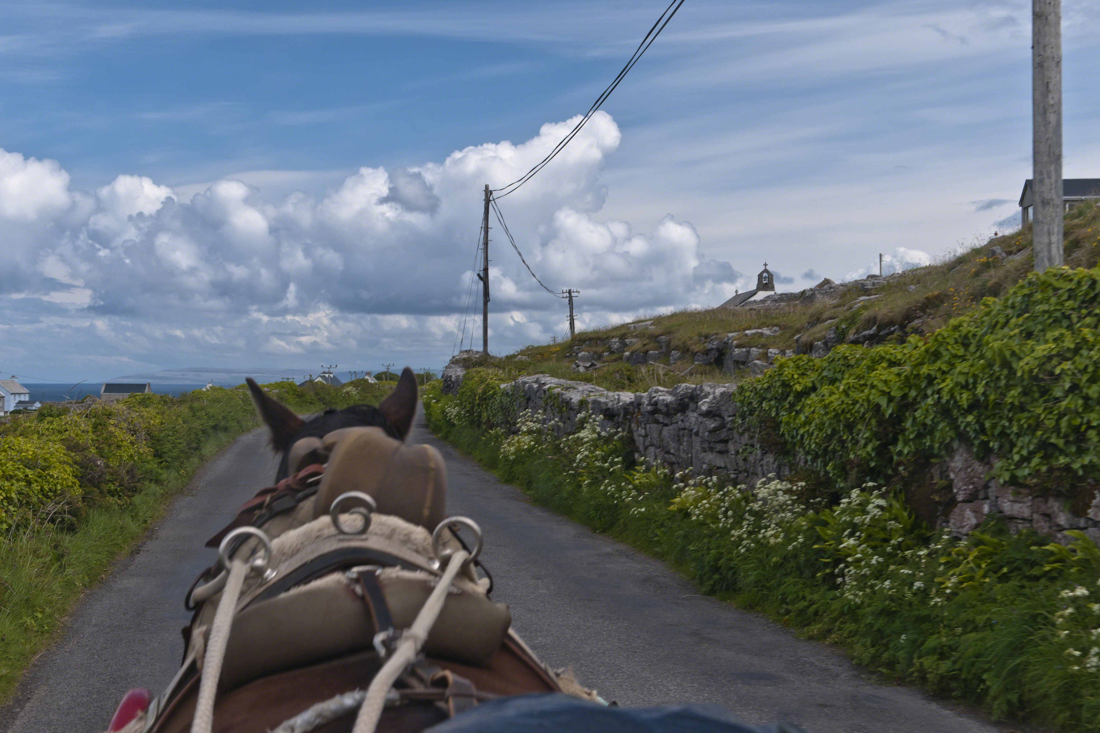
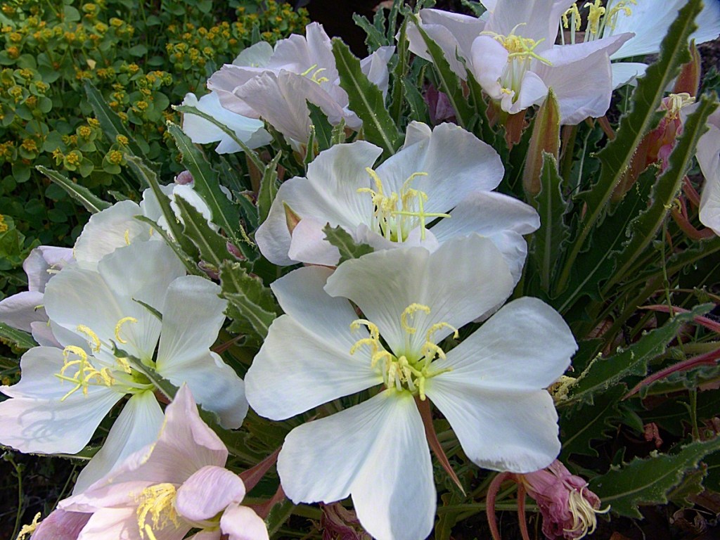
Enjoying travel on a horse trap, a type of carriage, on Inishmore (Inis Mór), the largest Aran Island in Galway Bay.
Click the link for my Getty IStock photography of the Aran Islands
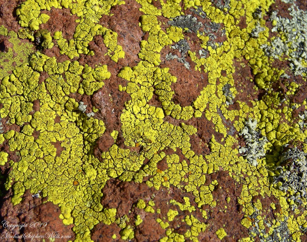
Copyright 2019 All Rights Reserved Michael Stephen Wills

Travel at its best
Enjoying travel on a horse trap, a type of carriage, on Inishmore (Inis Mór), the largest Aran Island in Galway Bay.
Copyright 2019 All Rights Reserved Michael Stephen Wills

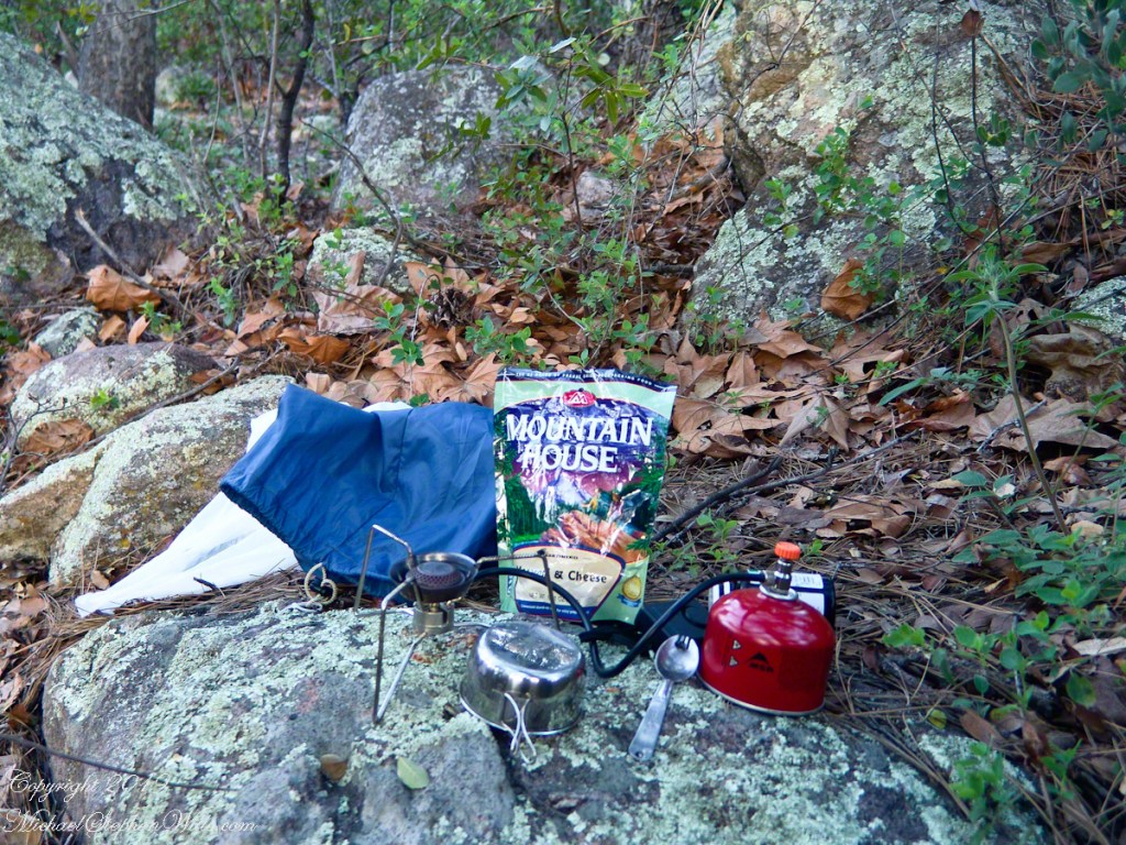
What is a Collier?
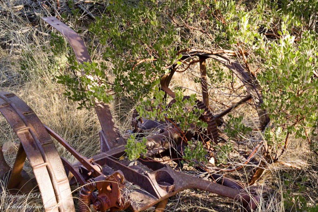
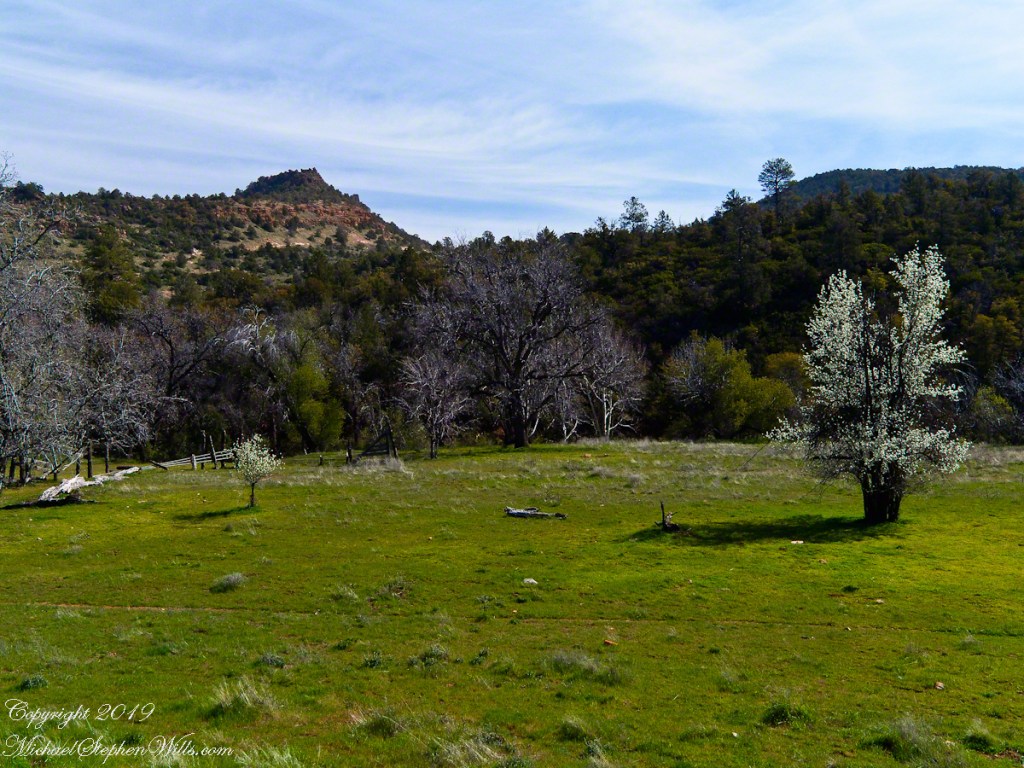
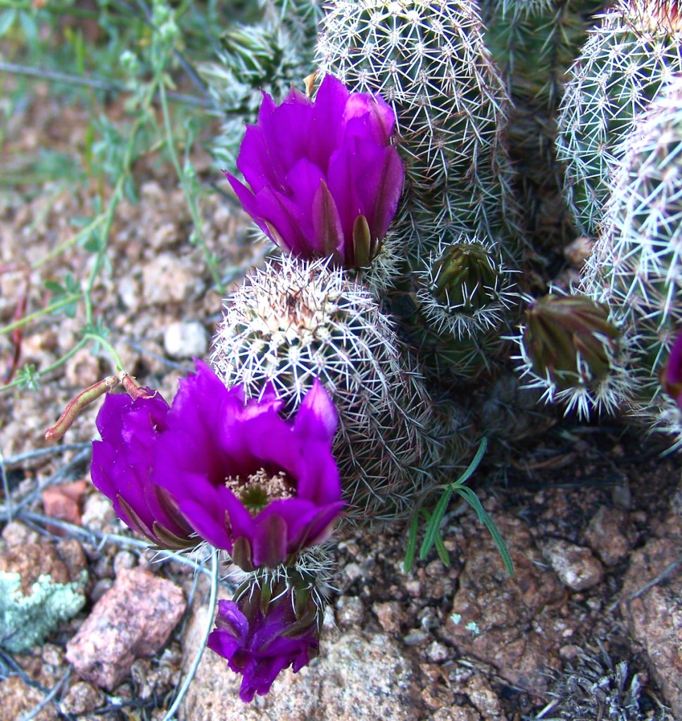
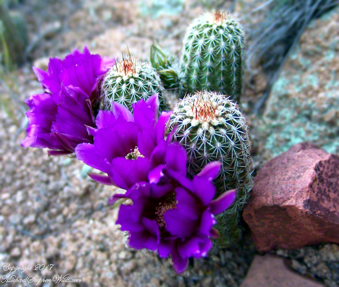
Here my exploration of Wharton State Forest, Pitch Pine Forest III, branches to the genealogical exploration of this landscape as my sister, Theresa and I, proceed along the humped, pitted sand road Goodwater through the wilderness to emerge in Batsto Village, a recreation of lives that touched my great great grandparents, James and Ann McCambridge among them. Ann saved money earned as a cook for Atsion furnace, the historical site at the start of the road to Quaker Bridge. Her husband James worked as a collier, supplying fuel for the iron furnaces at Atsion and Batsto, among other enterprises. During our Batsto Village visit we found these reproductions of charcoal clamps.
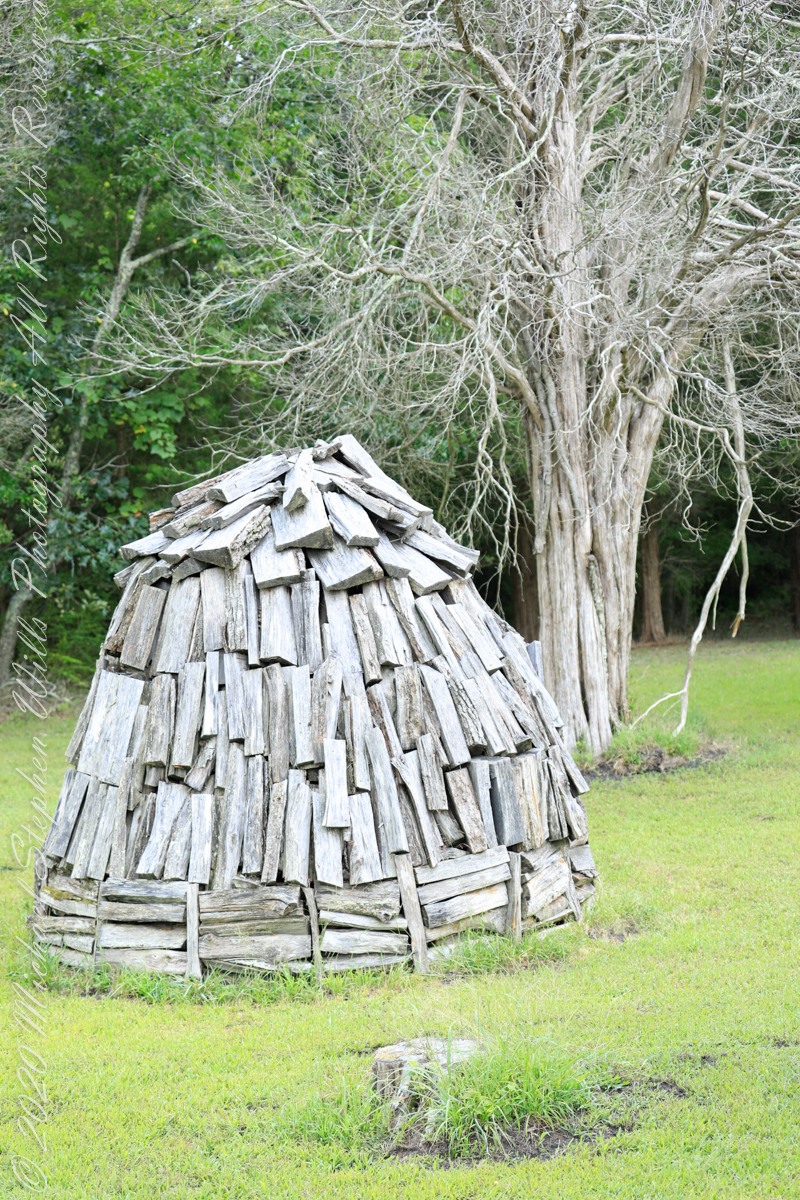
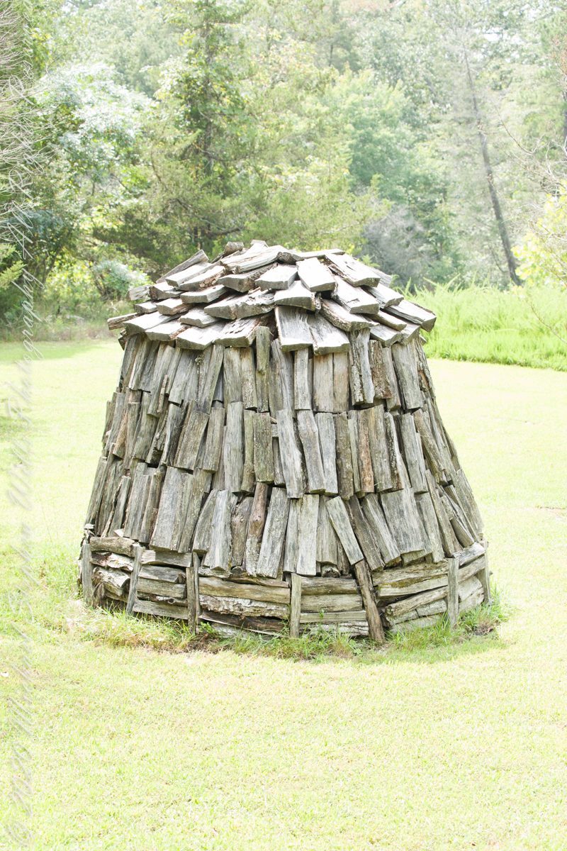
Since earliest times charcoal was used for cooking and heating. It was the best heat source for metal furnaces. Entire deforested regions are attributed to the demand for charcoal. Thomas Jefferson experimented with charcoal clamp designs, modifying air flow from the base.
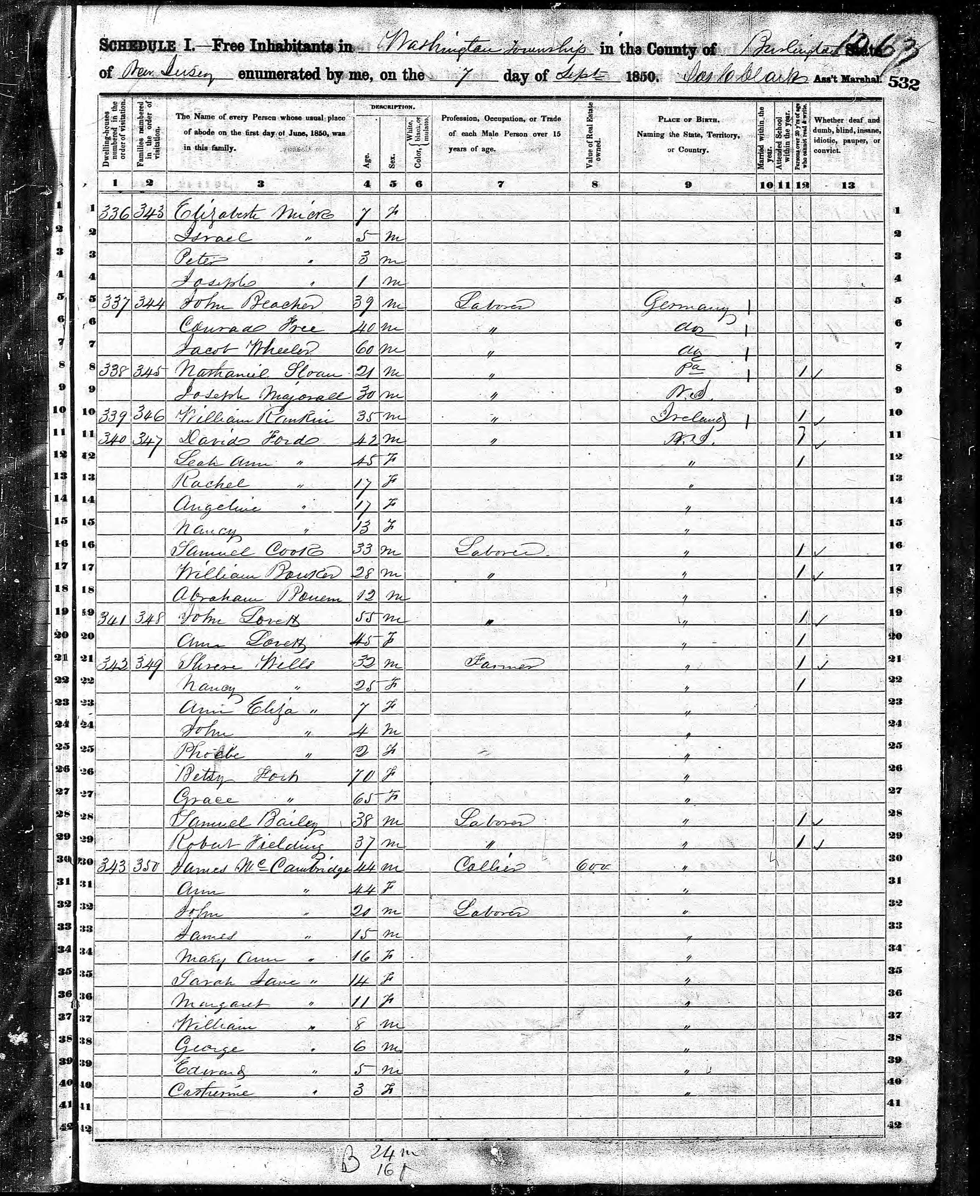
James and Ann lived on the land that provided a livelihood, enough to support themselves and nine (9) children. From September 7, 1850 is the US Census for this family of my second great grandparents. Great Grandmother Margaret was 11 years. James is listed as a Collier, the value of Real Estate owned was 6,000 (a fortune for the time).
Like his wife Ann, James had a savings account…..

Copyright 2021 Michael Stephen Wills All Rights Reserved
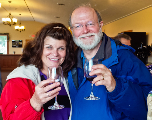
October 5, 2014 found Pam and I at Keuka Lake after my son completed the Wine Glass Marathon. Here we are at the finish line in Corning, home of the Corning Glass Factory. You may know it from your set of Correlle dinnerware.

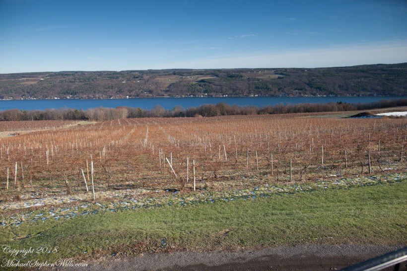
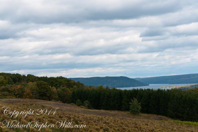
Afterwards, Pam and I made it up to the Dr. Frank Winery for a tasting followed by dinner at a local restaurant. Here is a photograph from the same viewpoint, using the “zoom” setting of my Sony DSLR A700. The view is more interesting than the winter shot of “Keuka Lake Winter I” from the autumn clouds and the burst of late day sun on the eastern lake shore.
This is the juncture of the “Y” shaped lake where the two arms joint the long foot. The pointed high headland is the point where the two arms meet. We are looking north here. The western arm, on the right, is unique in that the water is flowing down into the juncture. In Keuka Lake the water flows in two directions. The flow of lake foot and eastern arm is in the opposite direction, Keuka Lake empties at the top of the eastern arm, eventually reaching Lake Ontario.
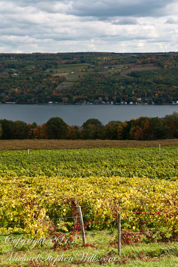
Here is the eastern view, from the overlook, looking over a vineyard ready for harvest, covered with fruit and leaves. Every once in awhile there is a loud “bang” from a noisemaker used to discourage birds from feasting on grapes. The buildings along the shore are summer cottages, Keuka is lined with them.
The same view, from our December 2018 visit. The vines are bare, the fallen leaves cleared, the vine roots covered under banked earth to protect them from the cold.
Pam and I, enjoying wine after the 2014 Wine Glass Marathon. Cheers!!
Click this link for my Fine Art Photography Gallery.
Copyright 2018 All Rights Reserved Michael Stephen Wills
Road to Batsto
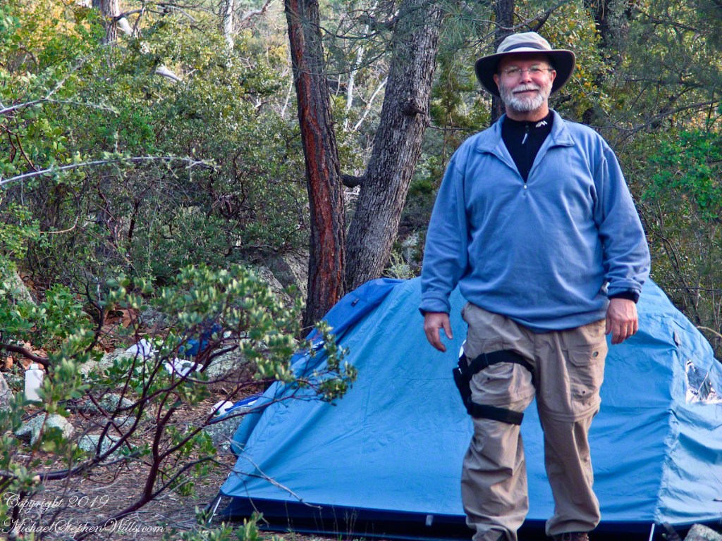
Leaving the jeep on the west side of Quaker Bridge, I walked over to inspect the structure and poke around the other side, carrying a Canon 5d Mark IV (camera body) / EF 70 – 300 mm f/4-5.6 L IMS (lens), shooting as I walked. My sister Theresa and Maxie, a little white dog, lagged behind taking in the surroundings. Here they are, in shadow, on the west side.

My work on the east side was shared in previous posts, “Pinelands Connections VIII,” I and II “Around Quaker Bridge,” and I and II “Pitch Pine Forest,” work interrupted by the sound of an approaching engine, a Humvee came into view. I waved my arm up and down, a sign to slow down, pulling alongside the driver looked up with dead eyes, no element of recognition of a fellow human, as I explained my sister was on the bridge. A stink of unfamiliar hydrocarbons, diesel fuel?, rose through the heat as they pulled forward with no acknowledgement of my request. Thankfully they slowed down as Theresa, Max in her arms, said, “hi.”
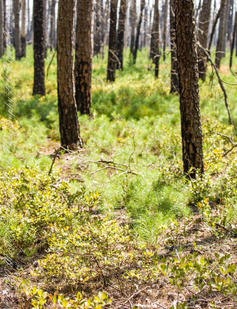
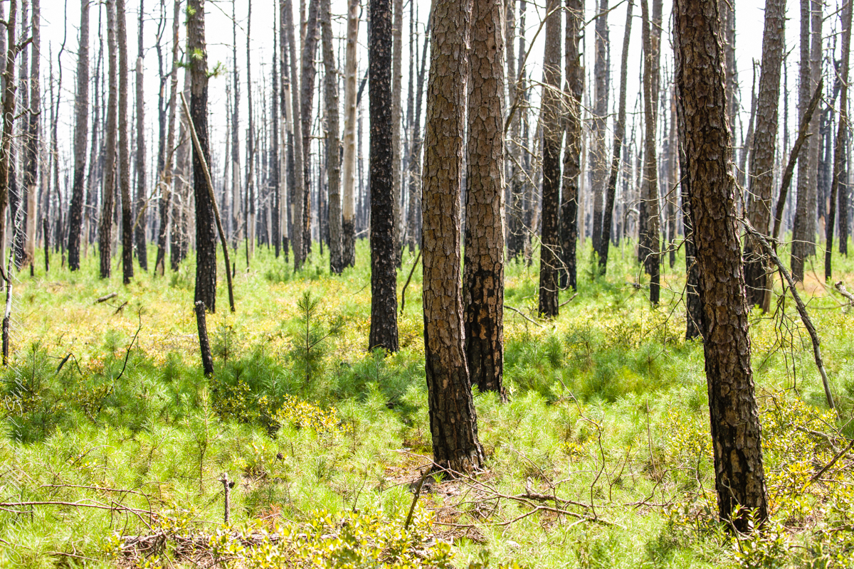
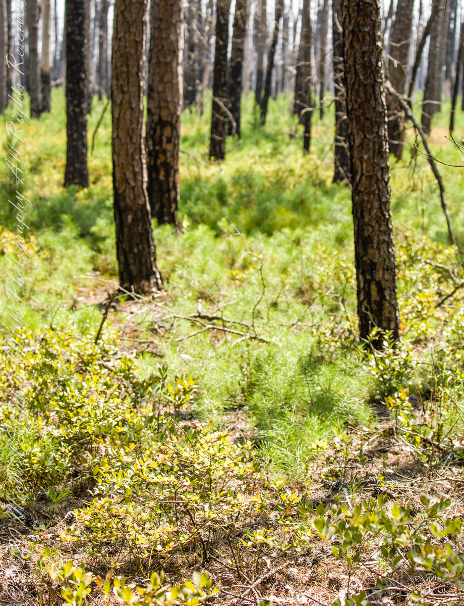
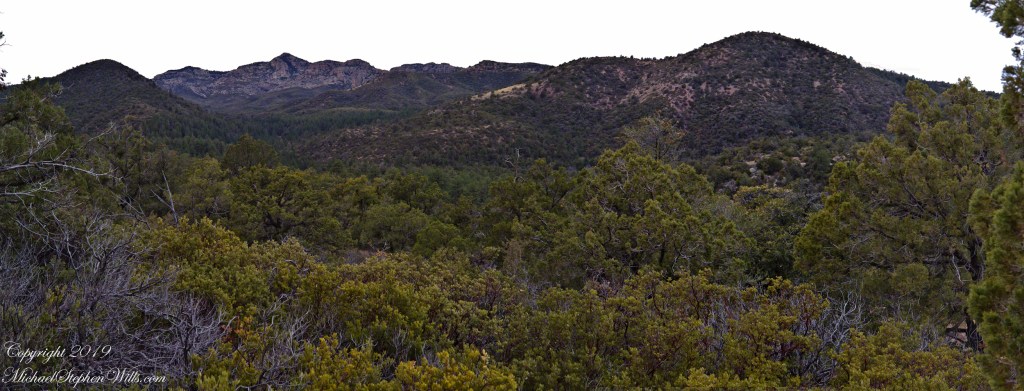
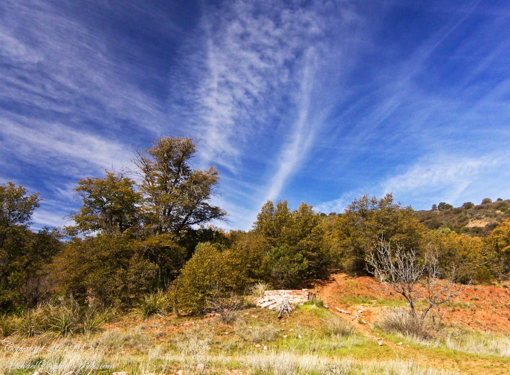
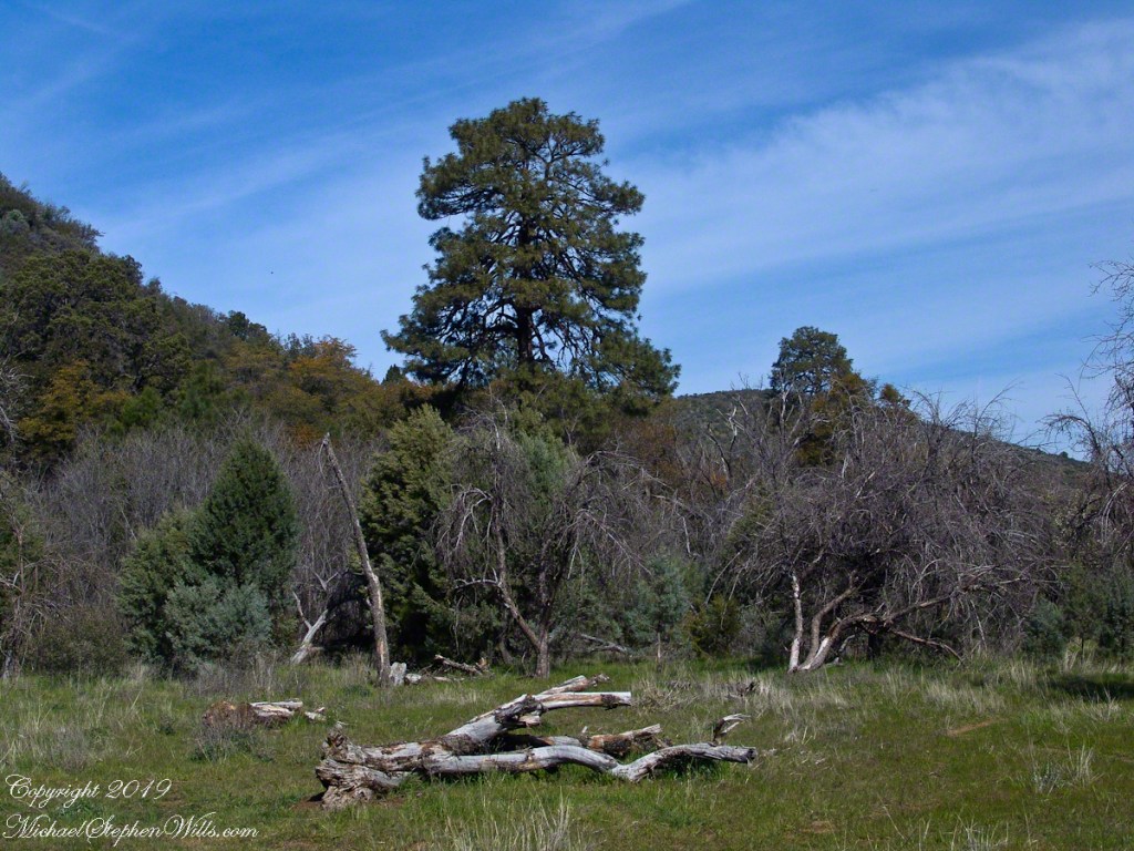
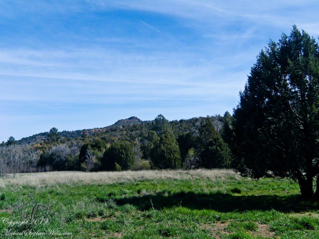
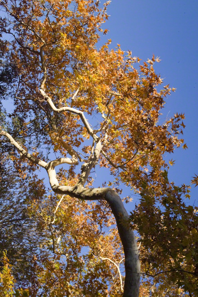
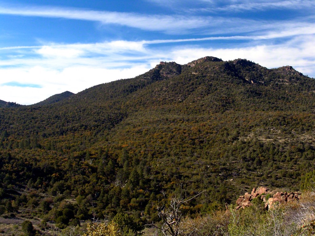
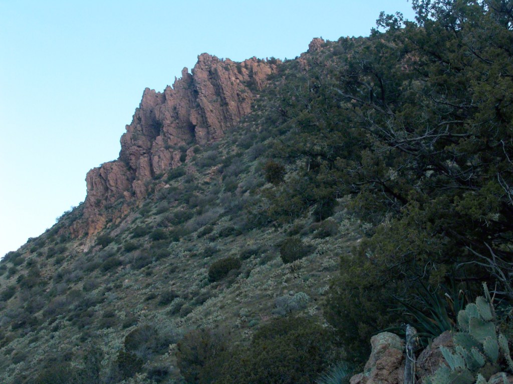
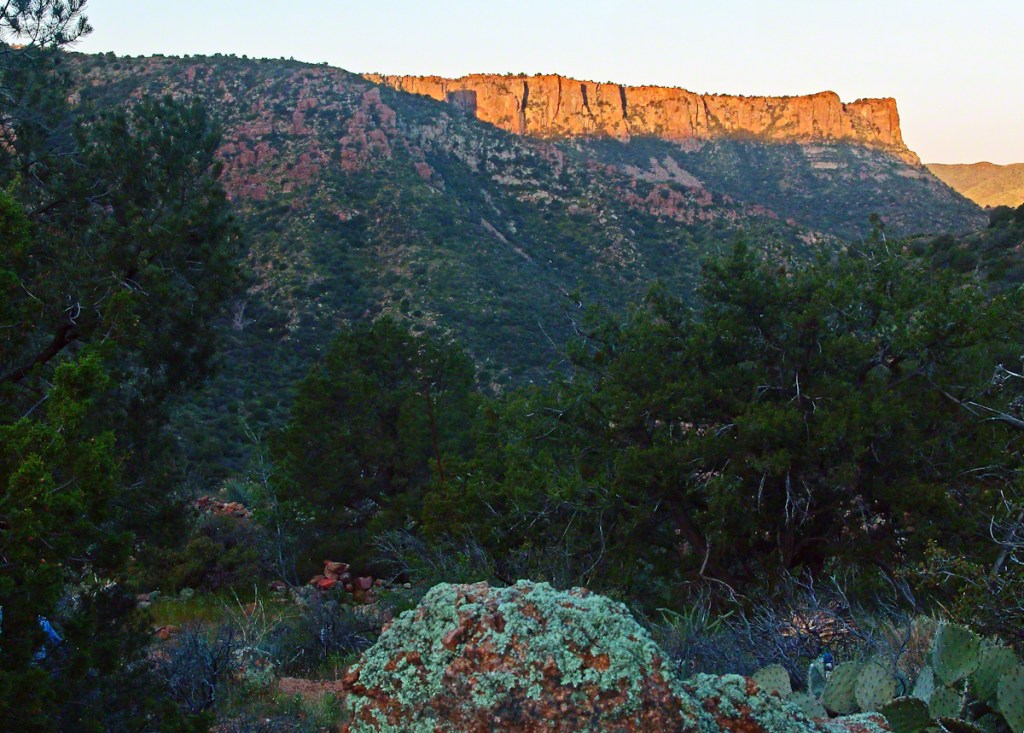
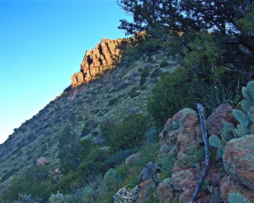
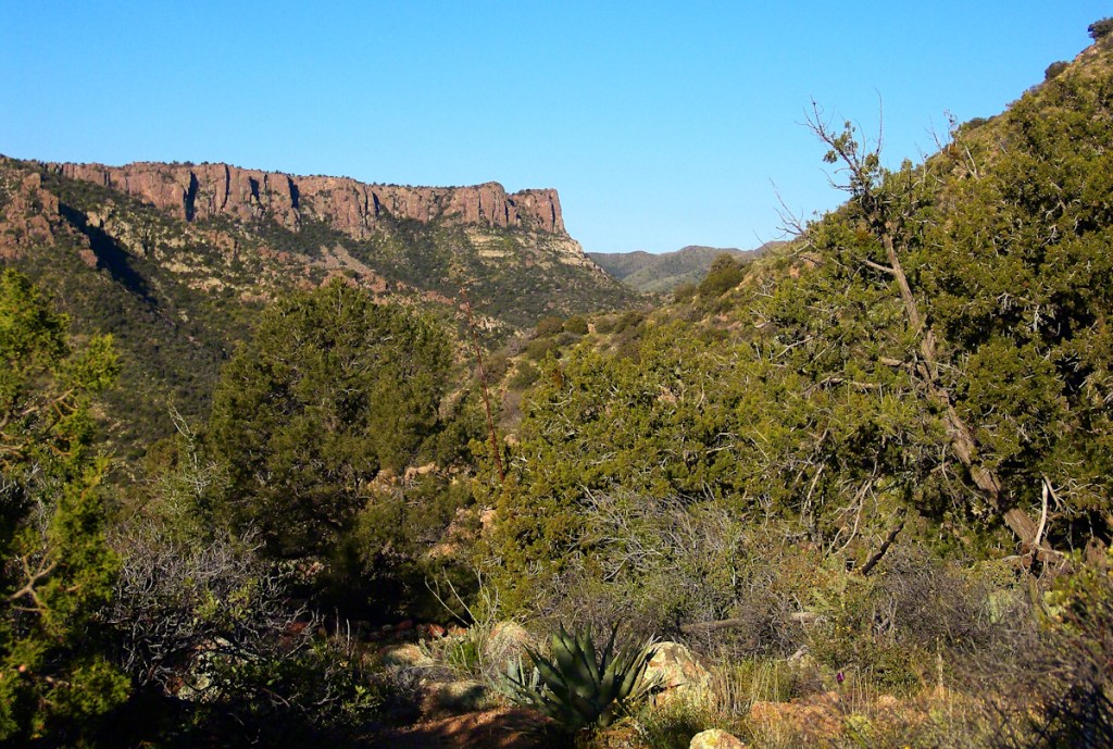
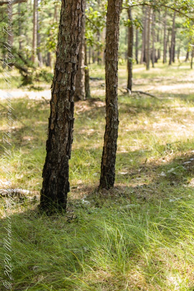
Multiple roads converge from all directions on Quaker Bridge, using GoogleMaps (surprising these unimproved, “jeep” sand roads were listed) I chose Goodwater Road as a route to Batsto Village, on the southern side of Wharton State Forest. The 6.1 mile road follows the east bank of Mullica River at a distance, a very rough passage through ancient Pitch Pine forest. Here are photographs of the enormous capacity of the pines to regrow after fire. Note a thick seeding growth among the mature pine trunks, lower portions fire blackened.
Copyright 2021 Michael Stephen Wills All Rights Reserved

Romance of Ruins
In three, so far, postings on the cottage ruins at Loughan an Lochan (Loughan Bay) we explored a former community above the Irish Sea with a view of Scotland. For the third posting I shared some research on the last cottage people of that site with the intent of additional postings.
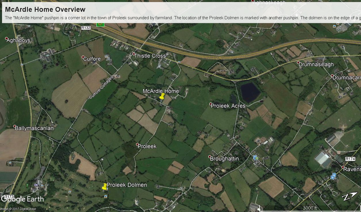
I wondered, “What motivates you to do this?” and remembered my mother’s Canadian passport in which, for place of birth “Proleek, Ireland” was written and my request to our cousin, John Mills, who invited us to stay with them after my mother passed away, June, 2013, the request being to visit the site of great grandfather James McCardle’s home, where grandfather Peter McCardle was raised, information since discovered from the Irish census.
On the morning of Sunday, May 25, John took us from mass on a tour of sites related to the family. One of these was the site of the McCardle home, Proleek Townland.

There site is an anonymous corner on a unnamed street with no outlet. The street ends close to the Proleek Dolmen, an ancient passage tomb, after passing farms and fields.

The 1901 Irish Census provides these details from 116 years ago:
Today, the site is another person’s property, it was not possible to explore further than when the camera lens reached when I leaned as far a possible into the brush. No sign of standing walls.

Modern homes surround the corner, solid and prosperous.

For this posting I collected the following images from Google Earth. The site is marked with a pushpin, “McCardle Home.” A “Proleek Dolmen” pushpin marks the passage tomb.
A closer view suggests, if we trespassed and poked around, some remains of the structure were concealed by the trees and brush.

Between May 2014 and this image, from 2015, the center of the plot was gouged out. The area corresponds to the corresponds to the remains indicated in the 2013 image. From this we can understand were the structures stood in relation to the road.
Using the polygon ruler tool the size of the site is 413 feet in circumference, 9,619 square feet, and the gouge, indicating the ruins, is 1,368 square feet.

But for John and Betty Mills, their kind invitation to stay and John’s guidance that day, the “Proleek” notation on my mother’s Canadian passport would still be a mystery today.
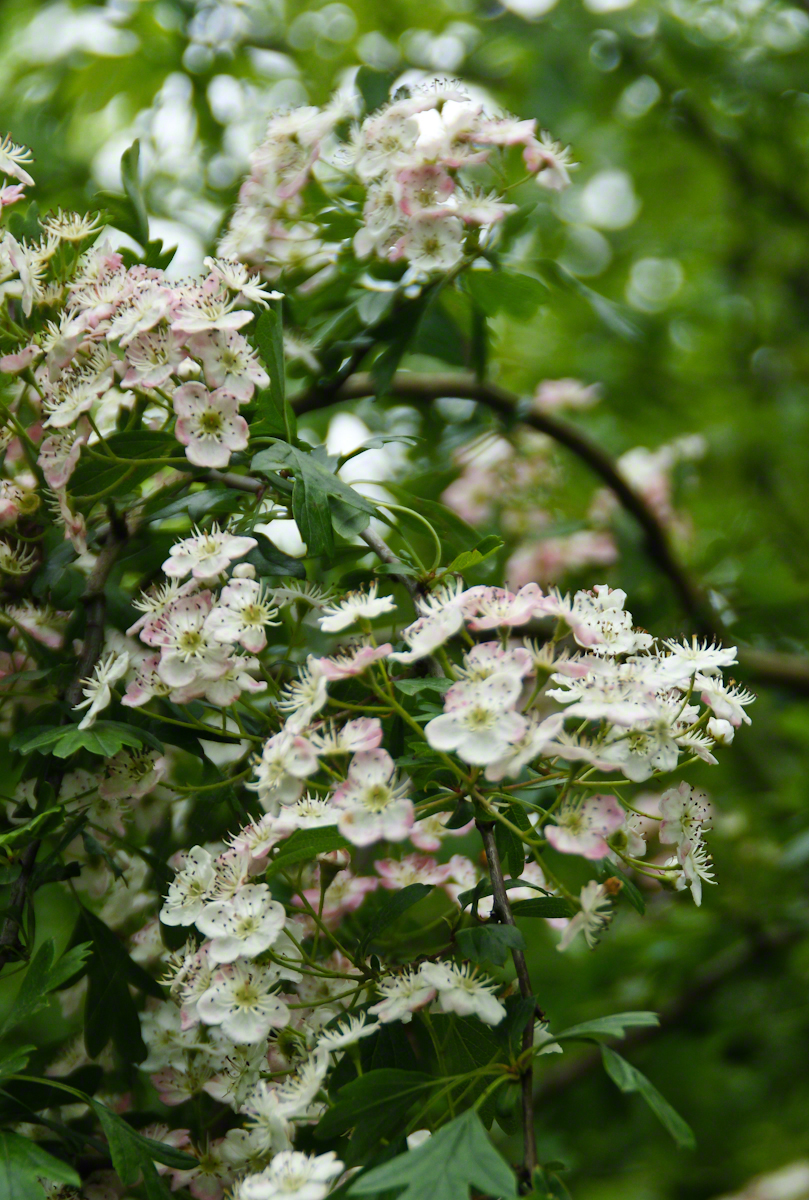
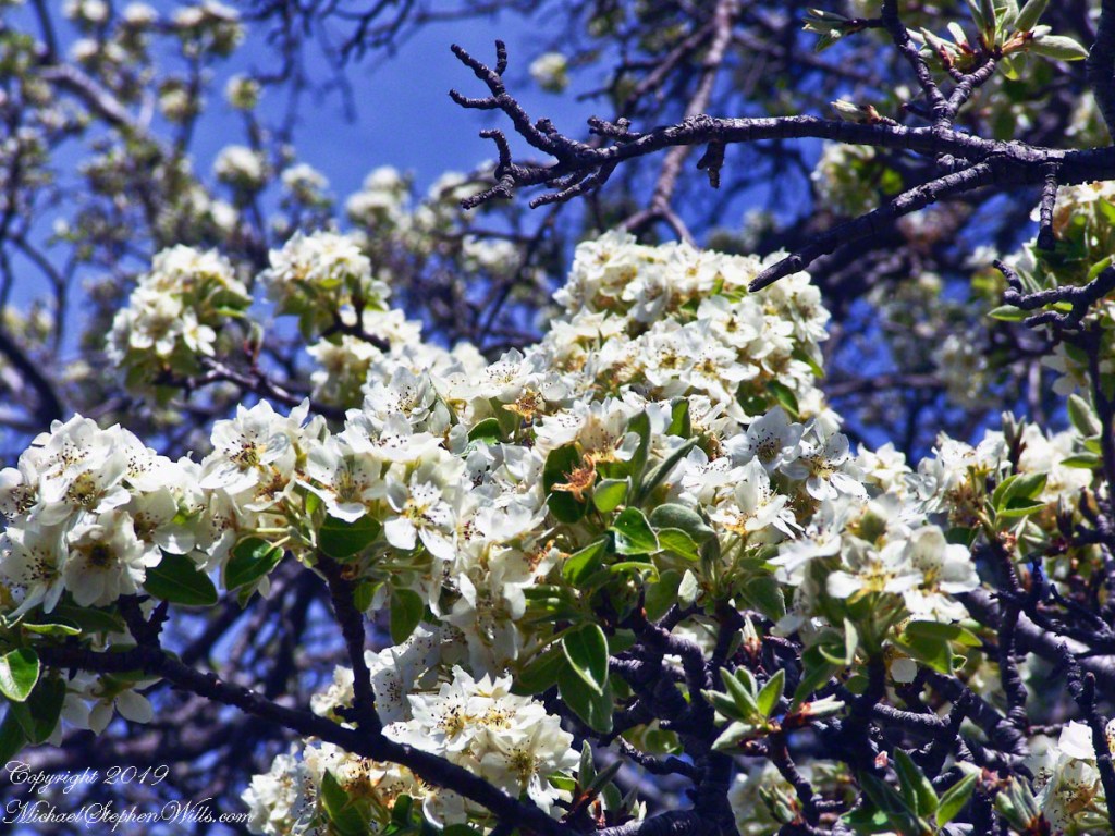
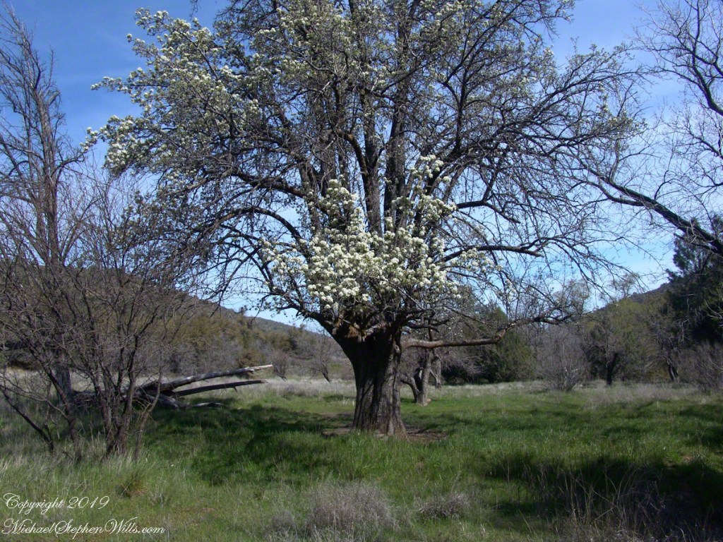
John Mills passed away the next year, September 26, 2015. Here are Hawthorne Blossoms from the corner of the former McCardle home in memory.
Here is some follow-up to my story in the posting “A Visit to Proleek Dolmen.”
A peaceful wilderness evening

The following year my sister Diane and I did two expeditions into the Superstitions, March and November 2006.
“A This video is from the November backpack, taken from the hill above the Ranch Ruin (Click me for “A Ride to Reavis Ranch”) you will experience the peace of this wilderness valley.

Multiple Lives
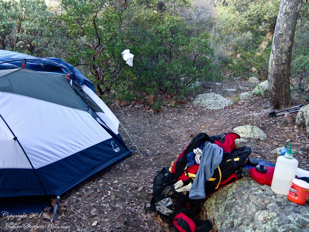
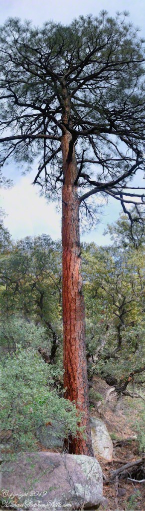
These photographs were taken deep in the wilderness of Wharton State forest, near where Quaker Bridge spans the Mullica River.
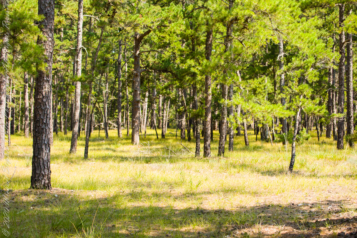
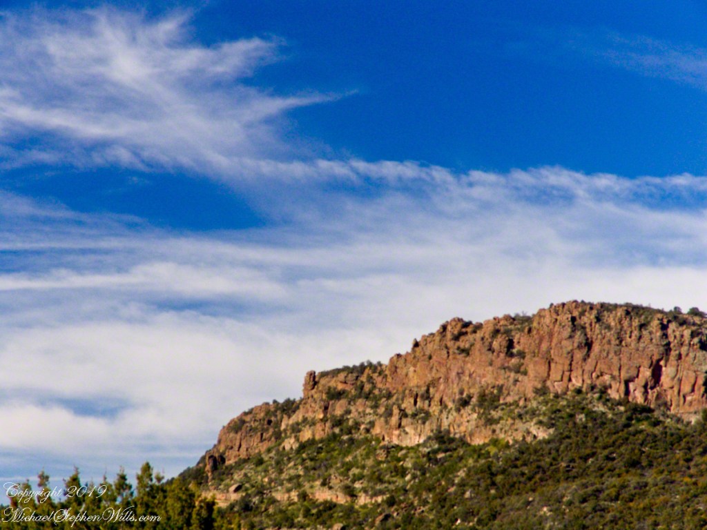
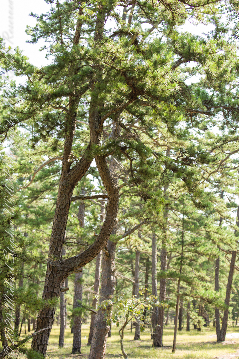
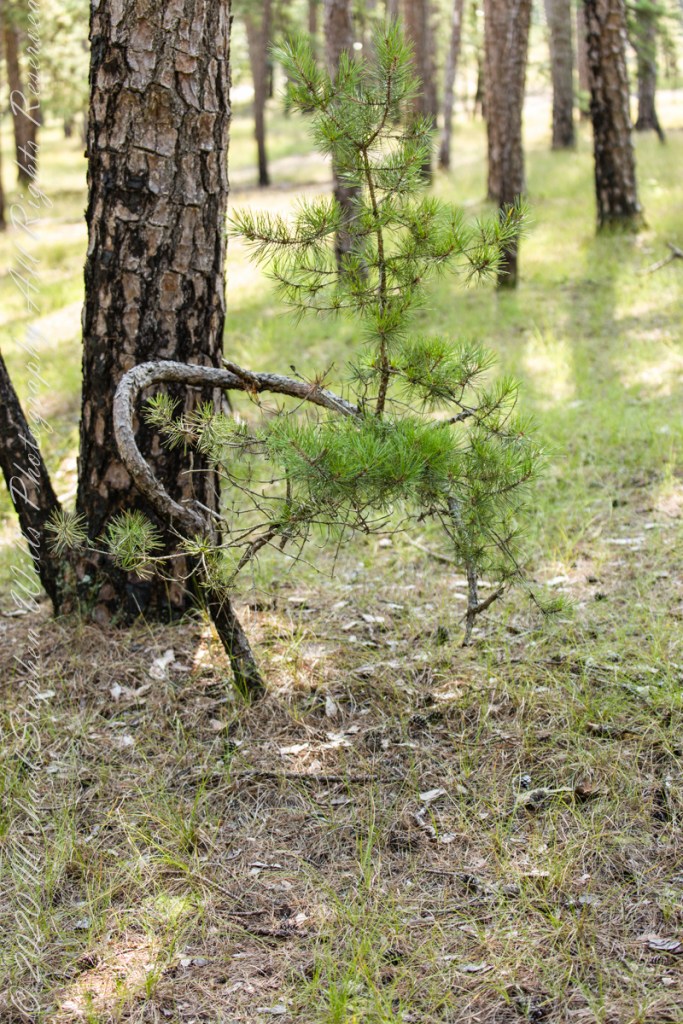
The pitch pine is irregular in shape, in these forests a mature tree typically lives through multiple cycles of fire and regrowth.
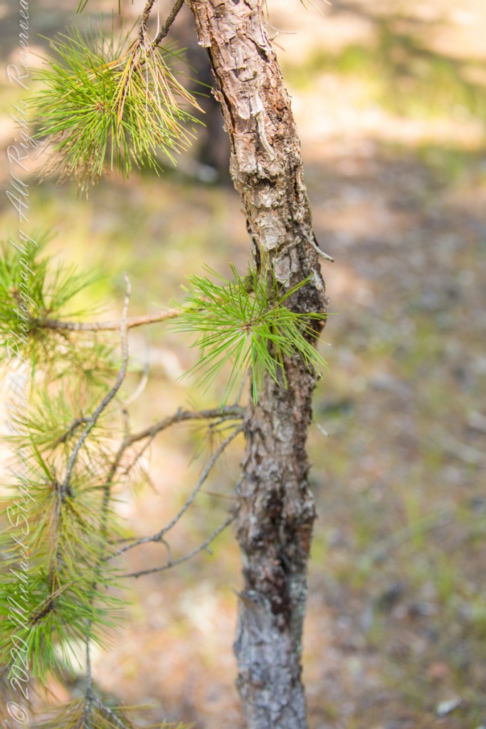
Burnt pitch pines often form stunted, twisted trees with multiple trunks as a result of resprouting. Bonsai artists exploit this characteristic for their creations.

Copyright 2021 Michael Stephen Wills All Rights Reserved

Romance of Ruins
In this multi-part blog series:
Part 02: the scene was set, the townland of Loughan named and visualized.
In this Part 03, some contemporaneous people are introduced, more information on the environment provided, some previous residents named and imagined.
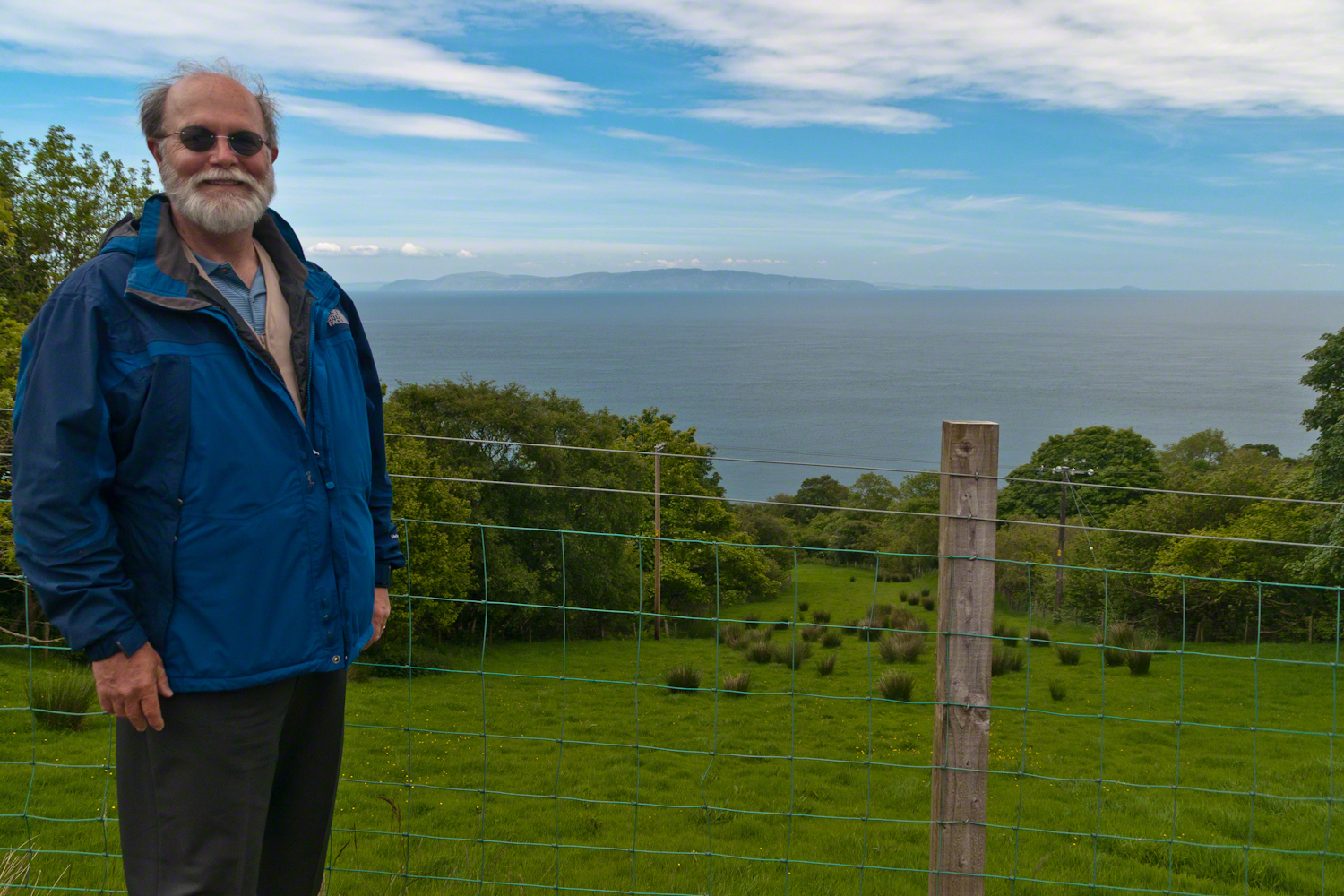
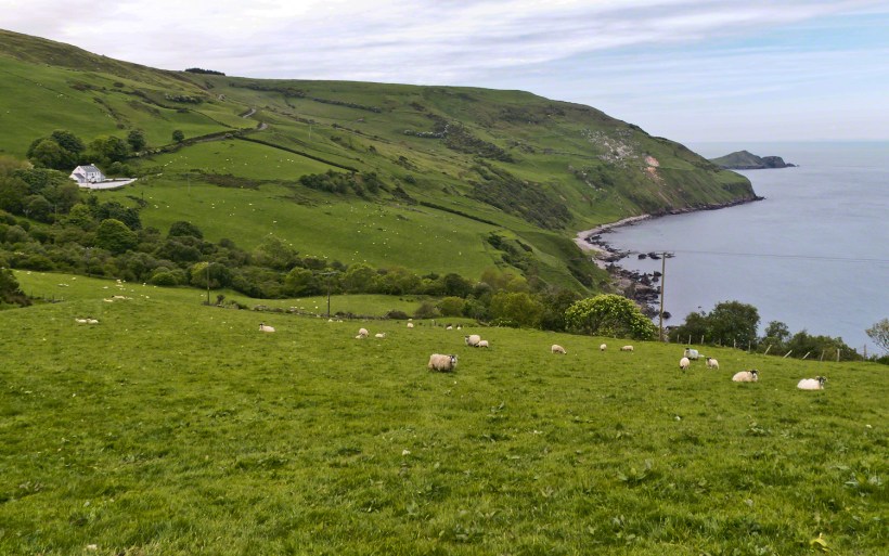
To understand the full beauty of a place, it is necessary to live it, to experience the seasons, approach the land from different aspects; pass the same place many time, noticing overlooked features, enjoying old favorites. We did our best in this single day and took the exploration of this Antrim County coast slow, savoring all the views we noticed as this is a once in a lifetime experience. Imagine our amazement to find Scotland so close at hand. In the past, on a fine day the trip across the North Channel, up eastern Kintyre peninsula shores to Campbeltown at the head of Campbeltown Loch, was easier than a land crossing to a closer town.
I picked Campbeltown because my great great grandfather, a sea captain, emigrated from Scotland to County Louth where my great grandmother, Anne Campbell, married John Mills. In this way Captain Campbell escaped persecution for his Roman Catholic faith.
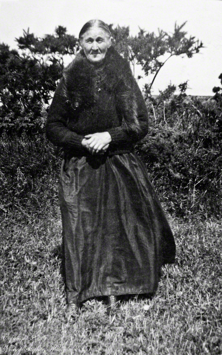
Late in her life, Anne Mills posed for this portrait. I can tell great grandmother Mills is facing north from these clues:
— the press of the eternal east wind on her dress, against her left left and flowing away from the right.
— the sun shadow on her cheek. It was around noon. With the sun, at this latitude, in the south the shadow from her right cheekbone is darker than the left.
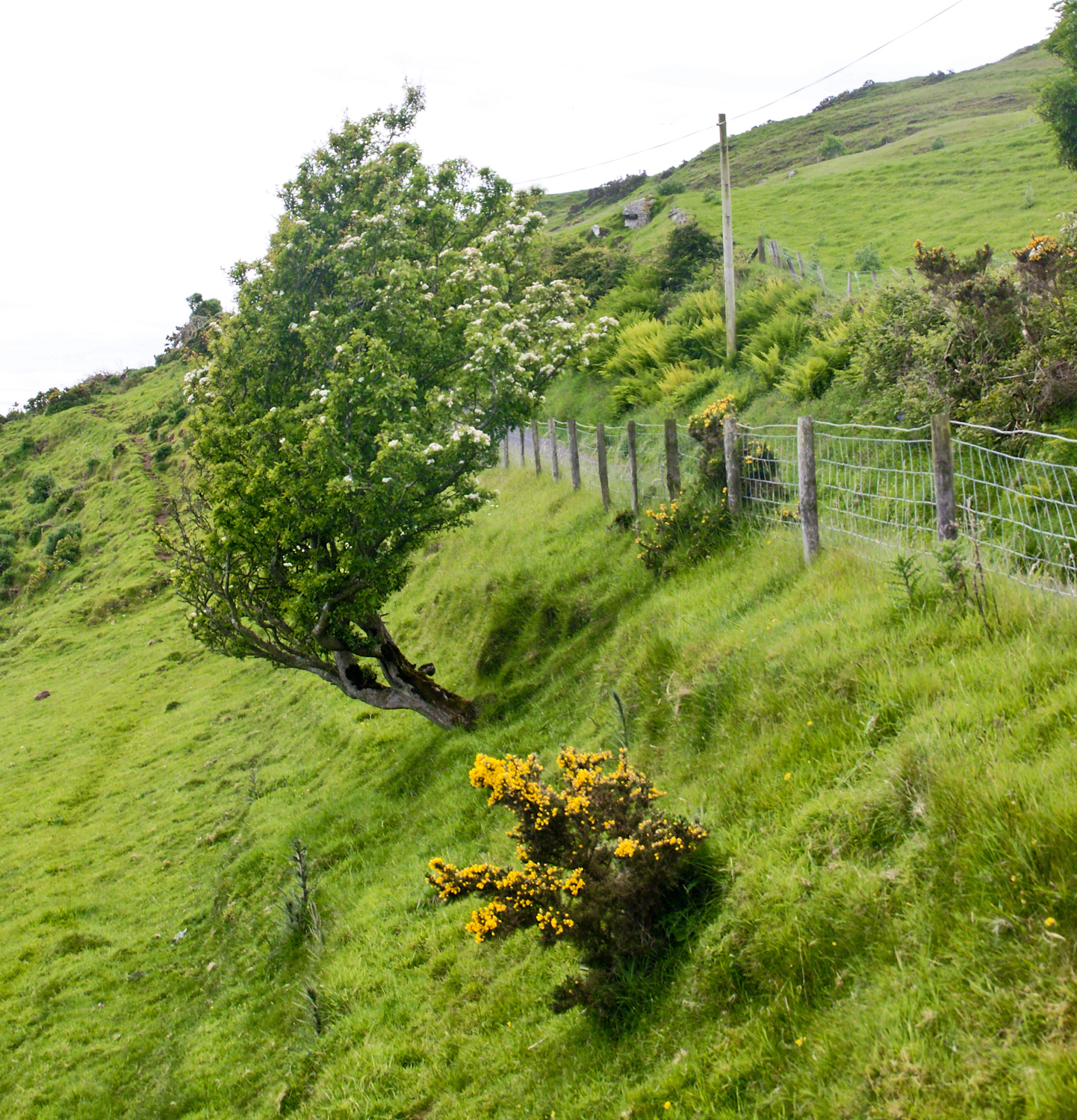
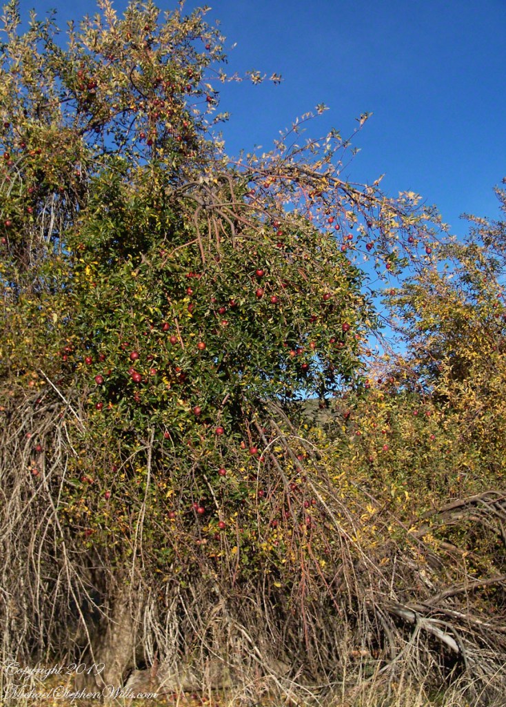
A few miles before Loughan Bay, at Coolranny, are informative placards describing the area. I thought the white flowering trees, or shrubs, on the slopes were Hawthorn. On revisiting my capture of the placards I learned these are a different plant named Rowan Tree, aka Mountain-ash. This wind stressed specimen is an typical example of Rowans on this coast, stunted and little more than a bush. This individual is slanted westward from a constant and stiff east wind, as with Anne Mills’ portrait. Residents, past and present, of this coast know this damp, persistent wind well. Note the lack of blossoms on the east side, blossoms that ripen to small dark red fruit called poms (also called rowans). The leaves turn red in the fall. More time, for the fruit to form and leaves to turn, was necessary for me to be certain my identification of this, as a Rowan, is correct.
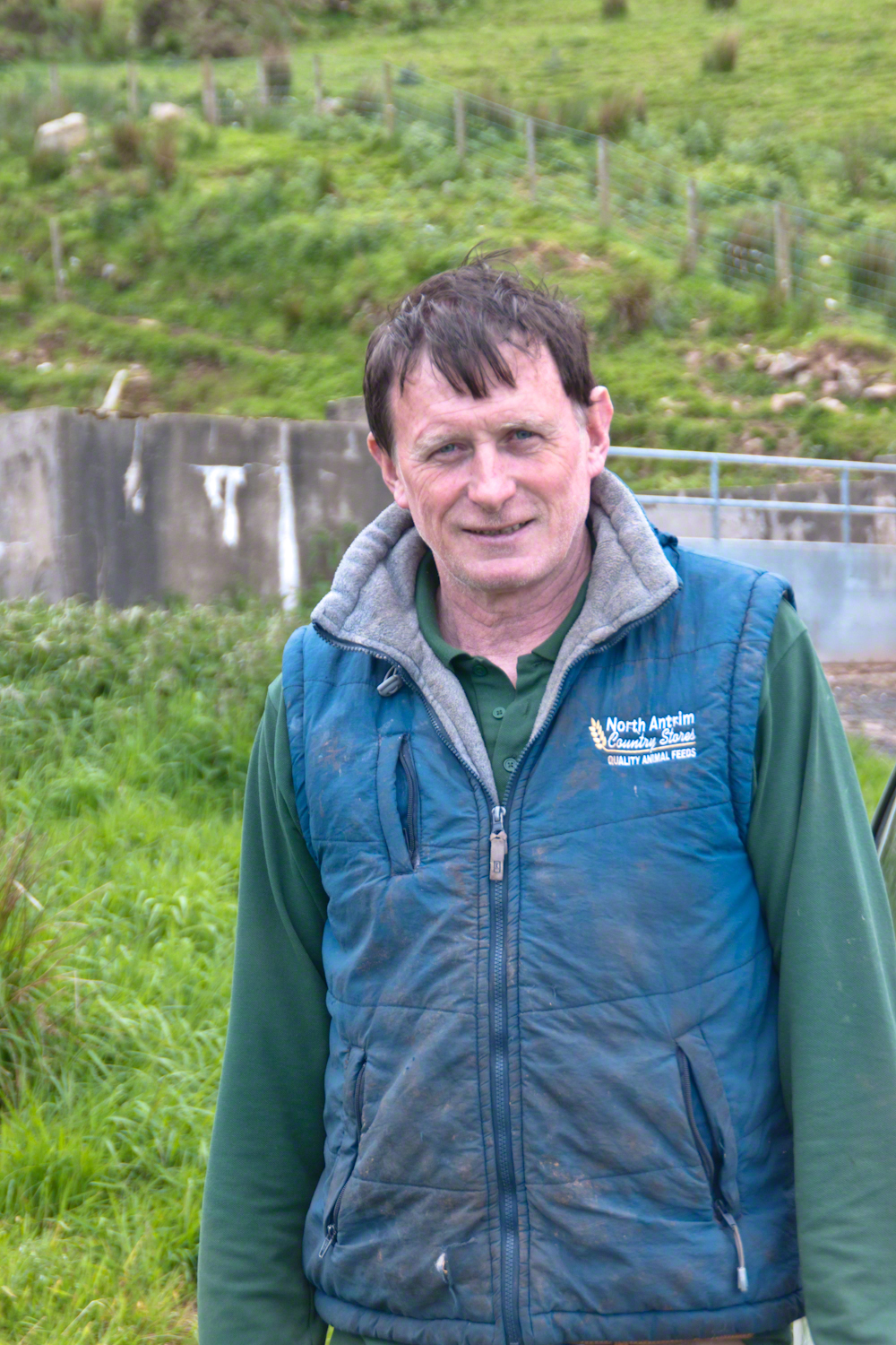
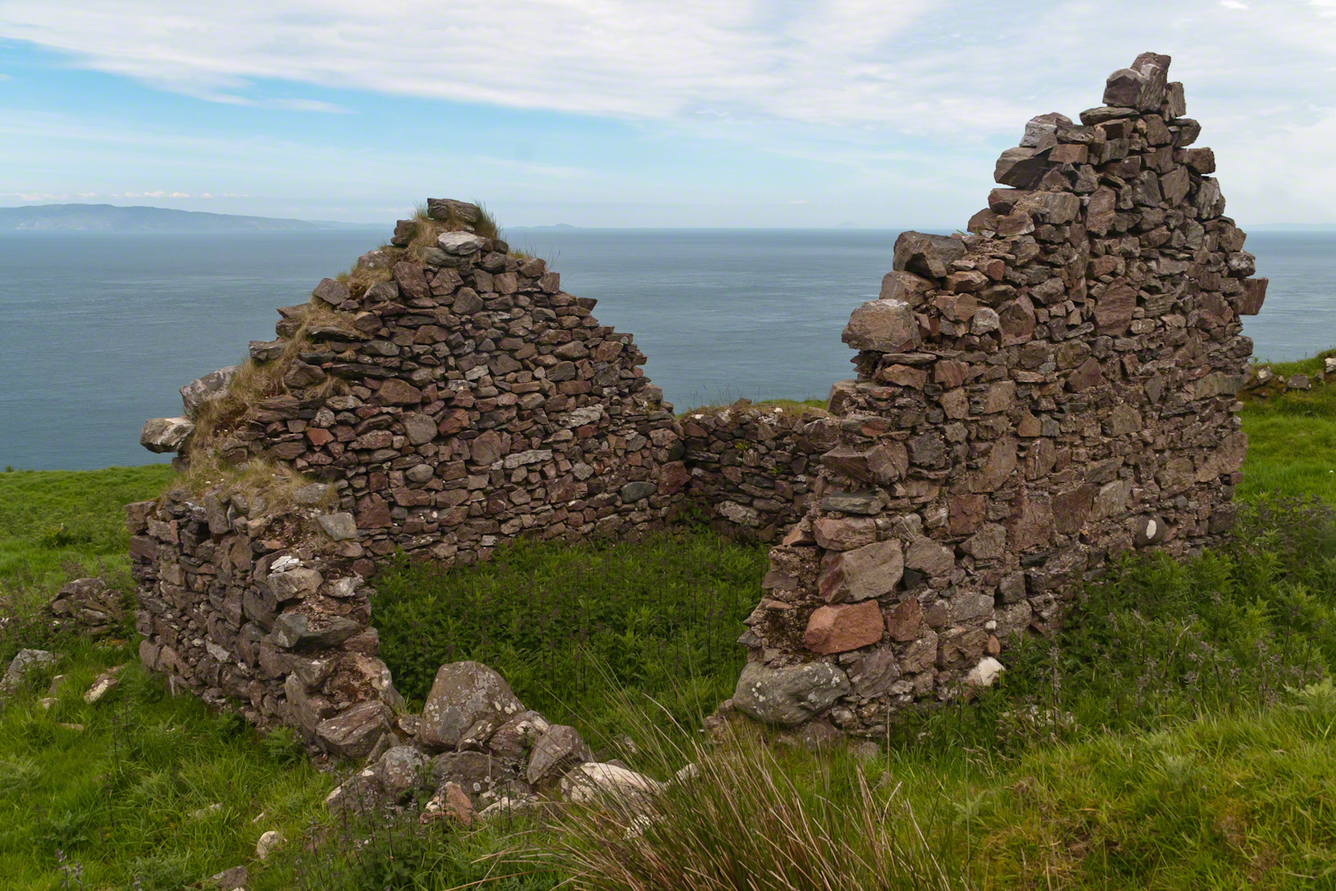
On this day, Friday, June 6, 2014 I did two rounds of shooting the cottages. The first, handheld, with a Sony Alpha 700. Upon returning to the car for the Canon, Pam was talking to a friendly sheep farmer who pulled up in a large tractor pulling a tank. It turned out we parked below the turnout for his sheep enclosure built on the hill west of Torr Road. His flocks grazed the surrounding land. He and I talked, too briefly, about the hard lives of the people who lived here.
The Coolraney placard, up the road, claimed the cottages were deserted in the 19th century. I found evidence, in the 1901 Irish Census, of three Roman Catholic families, 19 men, women, children, living on Loughan Townland. In Part 02 of this series, setting the stage, Loughan is sized at 112 acres, a single photograph captures Loughan entire. These families had nowhere else to live, in Loughan, other than the cottages.
The smallest, and poorest, the poorest of the poor, family was 32 year old Mary Corbit and her two children, 10 year old Mary and Robert, 2 years. The Corbit family lived in a one room, stone walled, house with a wood or thatch roof. Unlike the other families they had no outbuildings, structures to house livestock or to support a farm operation. The house owner was Marj Delargy.
Here is a single room house among the ruins, four low walls, the east/west with intact gables, the stones collected from the hillside. The west wall higher up the slope, the floor now thick with fern.
Little Mary most certainly took care of Robert for part of the day. Did Mary, with Robert along, gather rowans, and other forage?
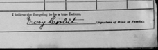
Mary Corbit: head of household, occupation laborer. There is a footnote to Mary’s “Marriage” entry as Married, “husband at sea.” The “C” of her census signature exactly like my mother signed her name Catherine.
Mary Corbit and her children were not listed in Loughan Townland for the 1911 Census.

A peaceful wilderness evening

The following year my sister Diane and I did two expeditions into the Superstitions, March and November 2006.
“A This video is from the November backpack, taken from the hill above the Ranch Ruin (Click me for “A Ride to Reavis Ranch”) you will experience the peace of this wilderness valley.
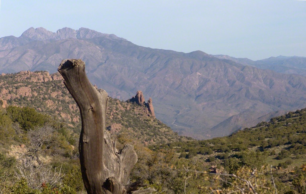
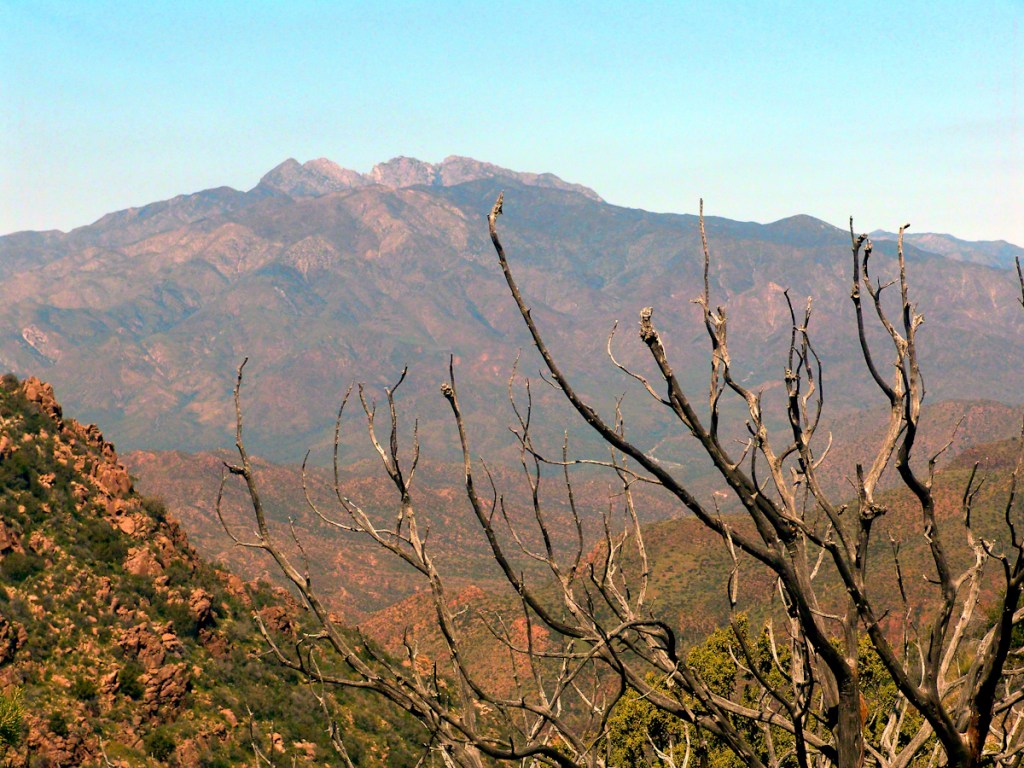
About that mysterious stone structure featured in this video. Over the years I have pieced together its purpose. When the ranch was active, a canal followed the contours from upper Reavis Creek to fill a pond down the hill from the house — I was shown the canal and walked it 2005. The structure was razed in the 1990’s, all that remains is the concrete foundation slab and, when I was there 2005 – 2008, scattered remains of the tile flooring. I am sure the pedestal above the house supported a water tank for a gravity water feed (“indoor plumbing”). Here is a link to more info about that site. The article does not discuss the water system.
Romance of Ruins
For me, the romance of a place is settled in exact knowledge as much as a feeling. Starting with a recollection of the ruined cottages making such an impression we found a parking place and hiked into them loaded with photography equipment, three years later returning to use the photographs, bringing back a rush of memories and feelings, it is a matter of using the set of photographs from that day to build the location.
This much I knew, going in: we were touring Antrim Glens entering at Cushendall, after visiting Glenariff Forest Park, proceeding up the coast through Cushendun to Torr Head. A fortuitous encounter with a village of abandoned farm cottages (“ruins”) happened somewhere in between.
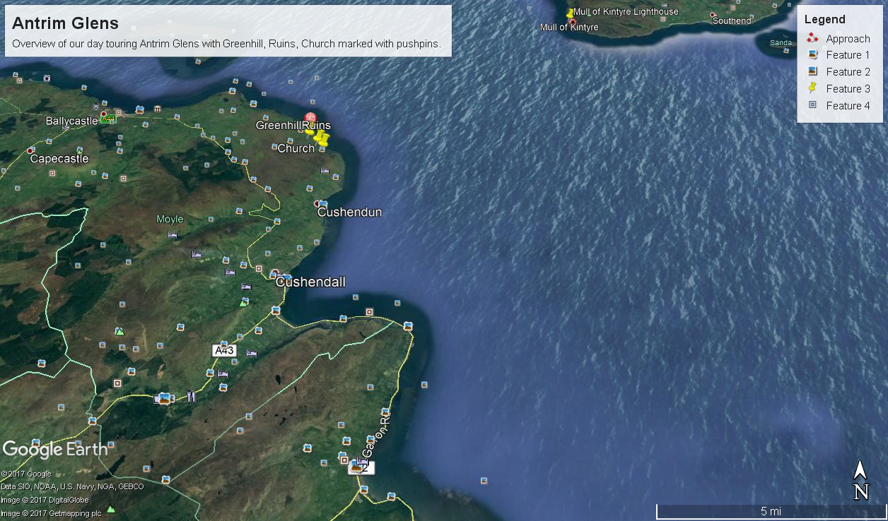
There was a photograph of a notable church prior to the ruins and a fine view, from a place named Greenhill, afterwards.
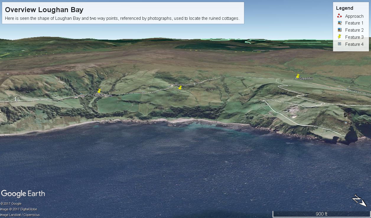
Here is a picture of the terrain with the three pushpins:
For reasons to be explained later, it is important to know the name of the ruin townland. The place name sign presented in post 1 was a clue (“Loughan an Lochan” — or Loughan Bay), as well at the web site (see link below) listing Irish townlands. The web site map names “Loughan Bay.”
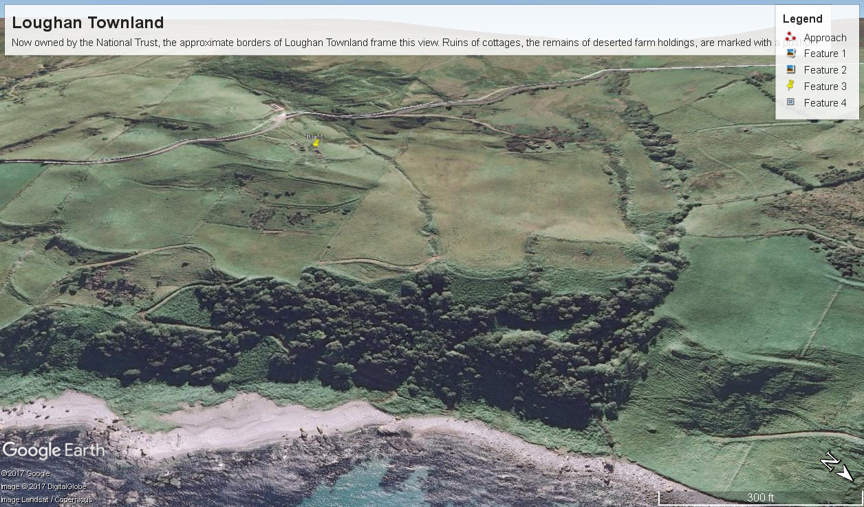
Click for a site providing the exact boundaries of Loughan townland
With this information I was able to peruse Google Earth, found the turnoff and the ruins!
See the above Google Map image sized to approximate the Loughan townland boundaries.
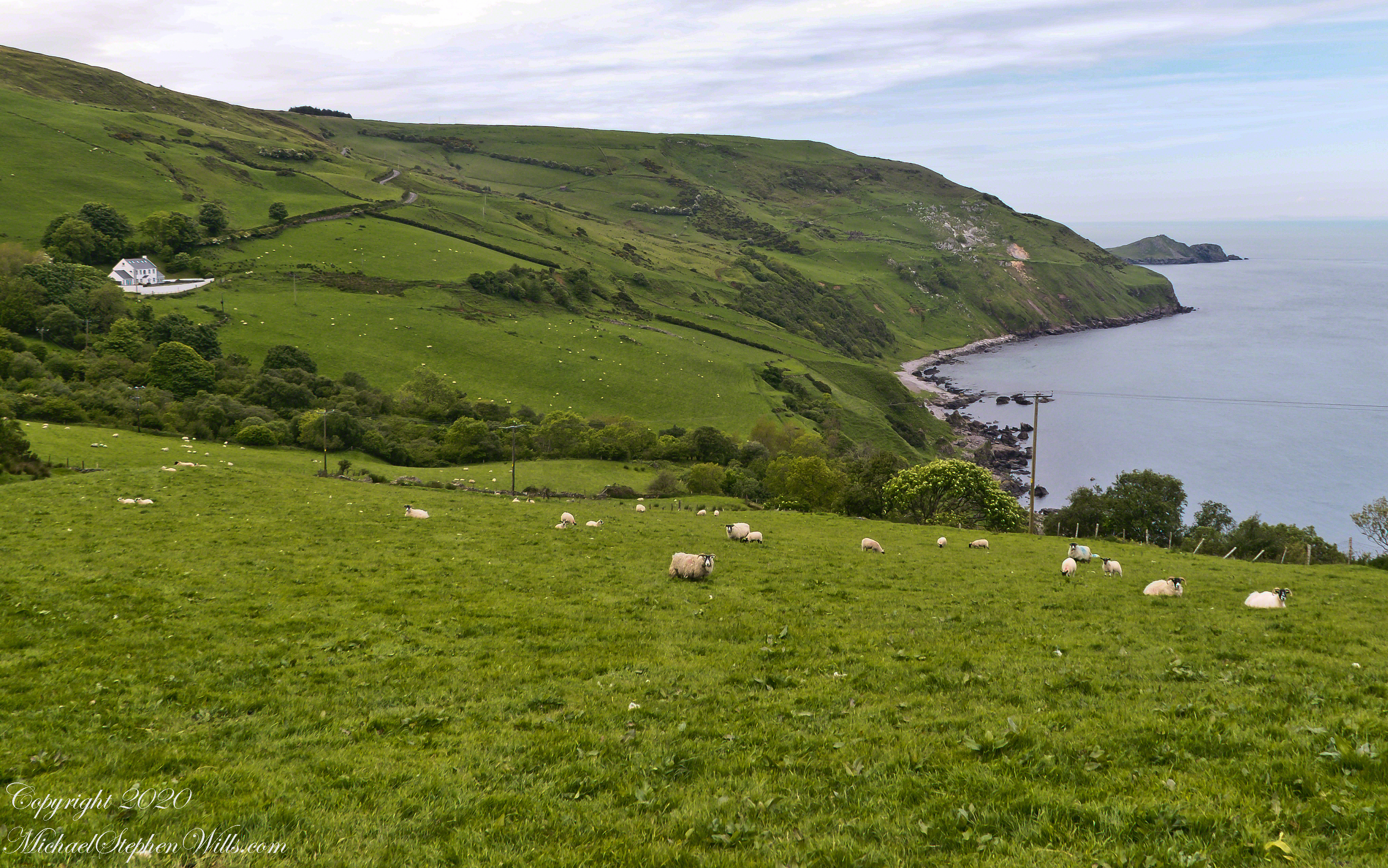
The scenery was jaw dropping lovely the entire time, so I captured view and view. Here are two landscapes time stamped just prior to the church, views including Coolranny and Loughan townlands with Torr Head in the distance.
That is Torr Road….
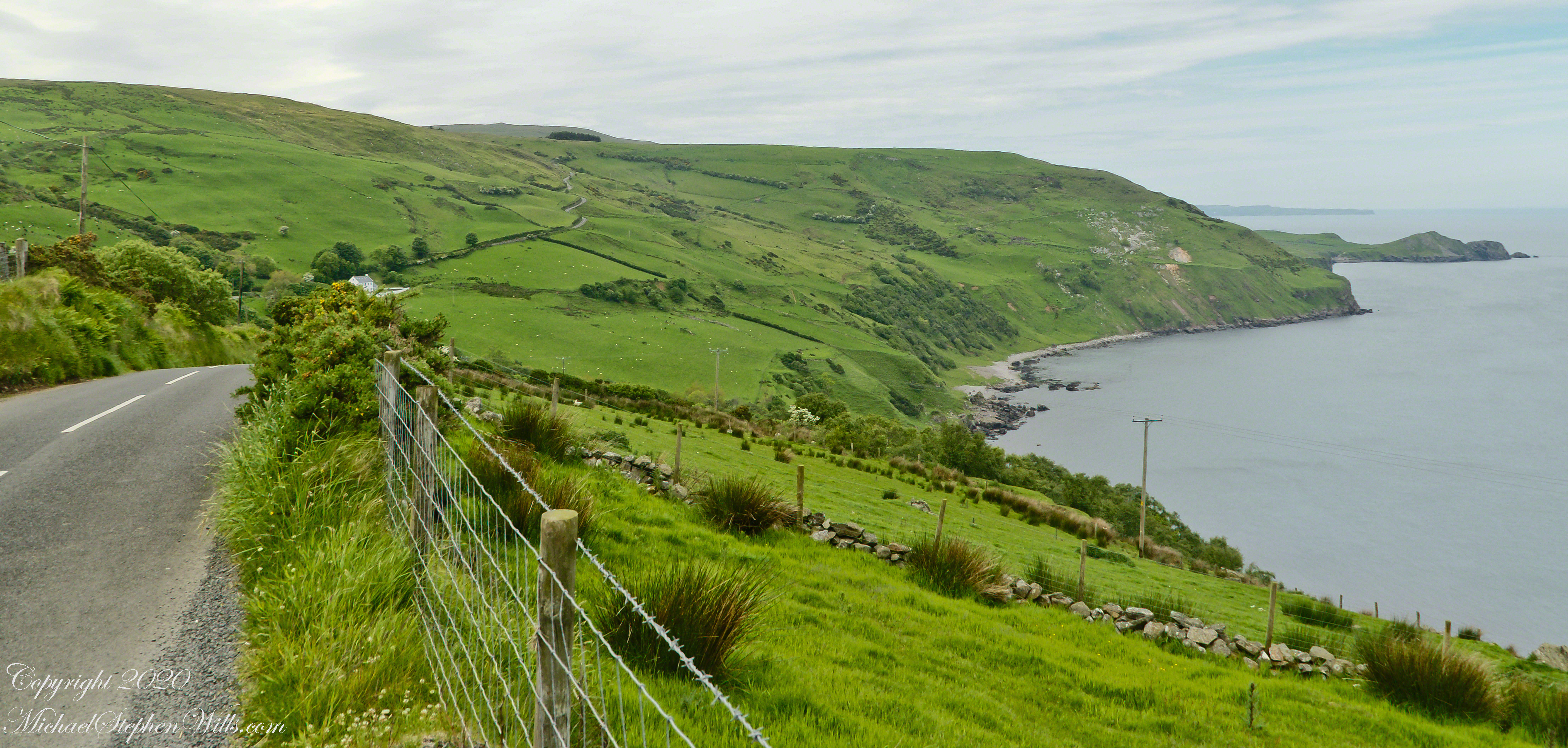
……a bit further along. It is possible to locate the ruin site from the Google Earth picture. There is a signature grove of bushes on the slope below the ruin site, sandy beach along shore. In the landscapes, Loughan Bay is cradled in a curve of coast.
Imagine the effect of this environment on the inhabitants, the love of it grows with time.
