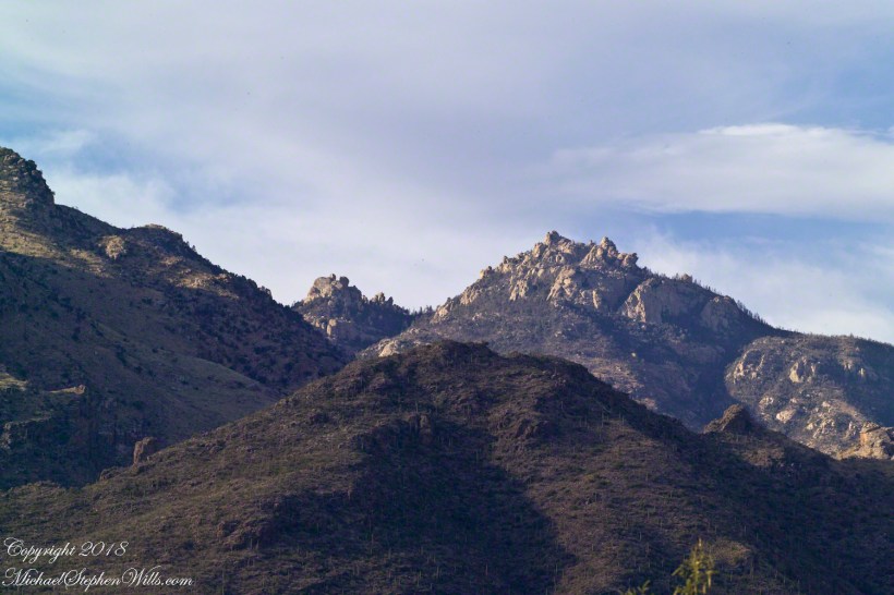
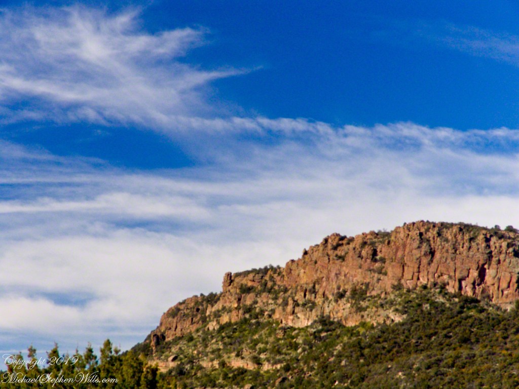
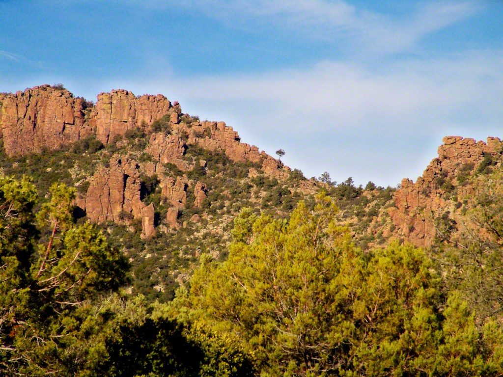
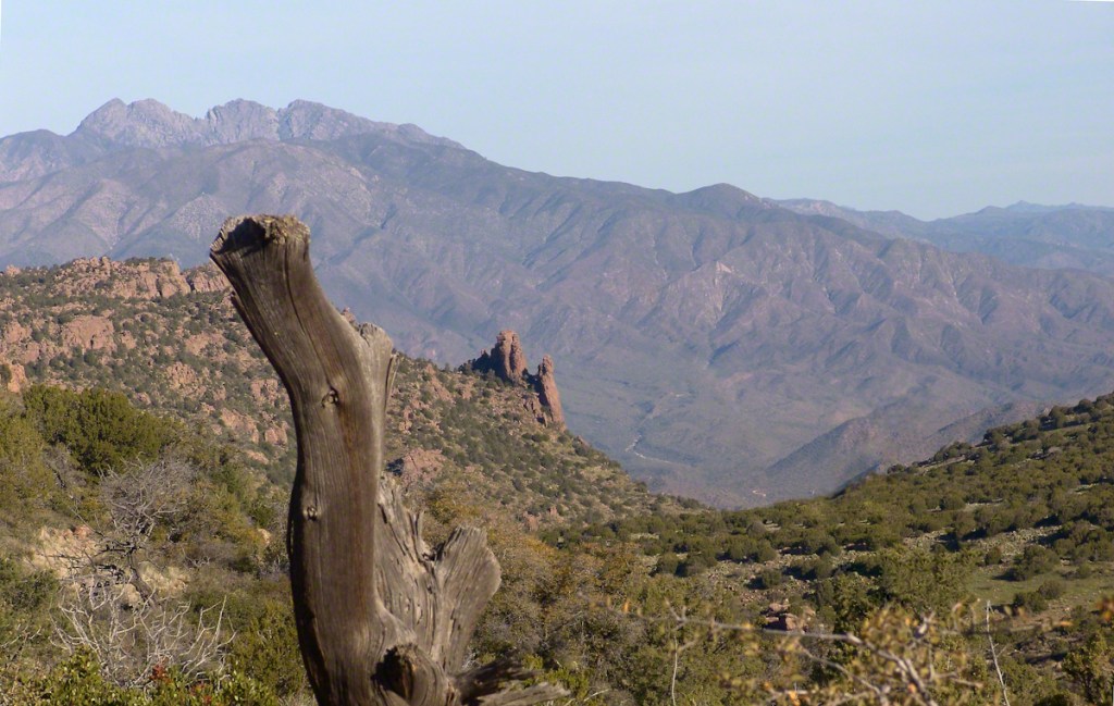
On a Tucson November 2005 afternoon, after my volunteer work for the University of Arizona, CALS college, alumni board of directors, in the mid-afternoon I headed for Sabino Canyon with my photography kit.
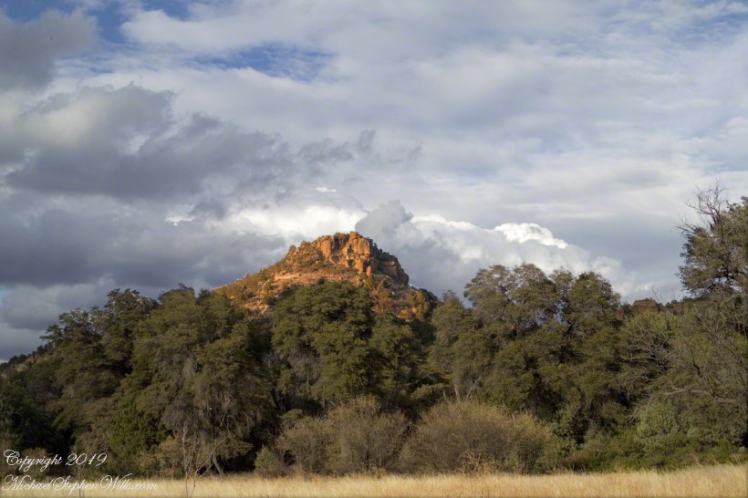
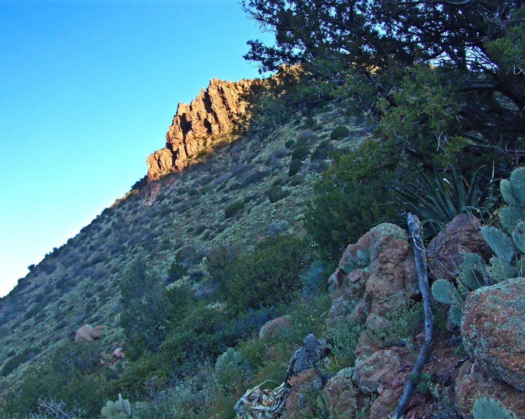
With a 25-pound pack on my back, walking from the parking lot I looked up at the incredible rock formations of the Santa Catalina mountains. It took some time to set up the tripod (at that time I was using a cheap swivel head on adjustable aluminum legs) with a 200mm telephoto lens (Canon L-series EF 200mm USM) I grabbed this shot of the hoodoo fringed peaks beyond the foothills (f16, 1/30, ISO160). The lower sun angle made the formations pop out.
Hoodoos in the Hills
You call those strange formations of upright rocks “hoodoos. Some people believe the fantastic shapes were created by spirits, today the explanation is wind, water and time create hoodoos from rock of the right stuff. It is a wonderful experience to wander among hoodoos, though unsettling because some of these large rocks are seemingly in danger of falling over at any moment.
Moving On
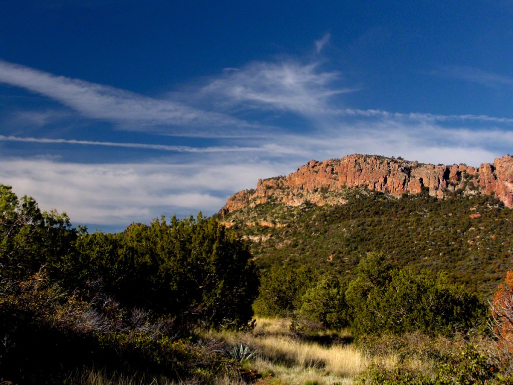
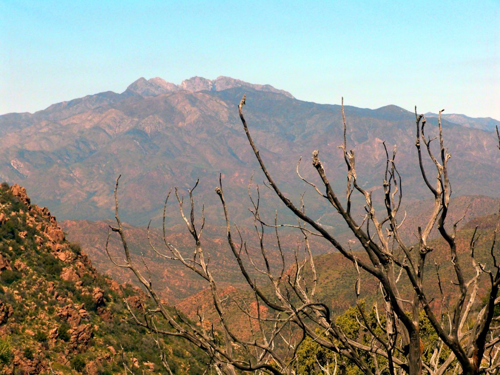
I have a mental list of photographic “to do’s” and the gathering clouds, typical for a Tucson November day, reminded me an awesome desert sunset was on this list, so I packed up to head for the east side of Tucson for a shot looking toward the Tucson Mountains (on the west side).
Clouds gather at sunset above a ridge serrated by saguaros.
Click any photograph to view Ocotillo Sunset
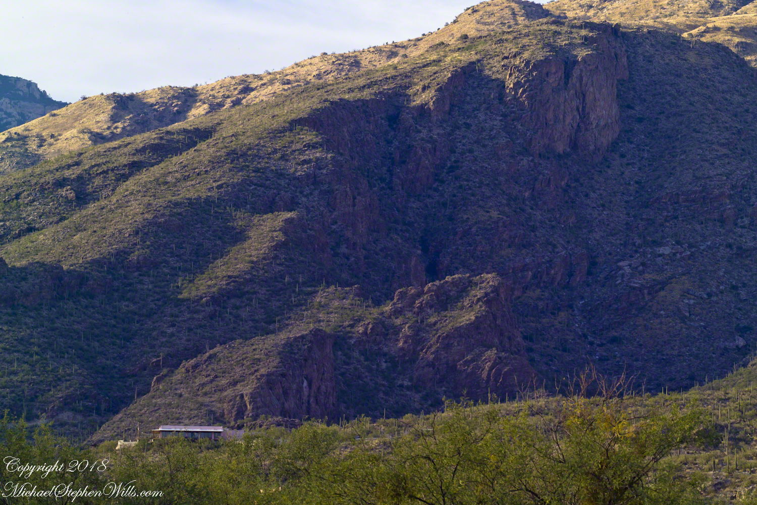
Sabino Canyon House
Before we move on, this is a fascinating image of a typical southern Arizona house perched on a ridge at the mouth of Sabino Canyon. In this image the viewer sympathizes because the telephoto lens gathers the majestic rocks around the tiny structure.
The house is perched on a Santa Catalina foothill ridge running east west, a wall of picture windows facing south with a view across the Tucson valley toward Mount Wrightson of the Santa Rita mountains, 42 miles distant. Summer thunderstorms gather on this peak, wreathing it with lightening. These times, evenings and night, the view pays for the inconvenience of this distant, hot ridge. Another time to be there is for sunsets.
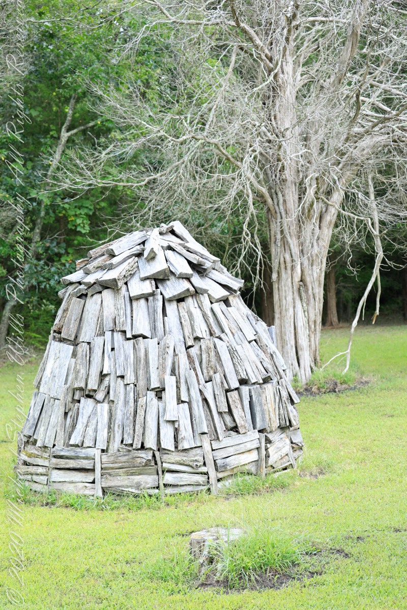
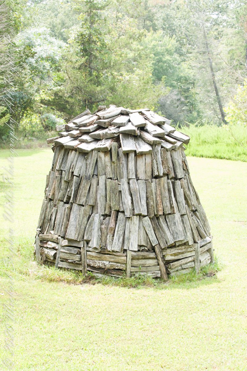
Here my exploration of Wharton State Forest, Pitch Pine Forest III, branches to the genealogical exploration of this landscape as my sister, Theresa and I, proceed along the humped, pitted sand road Goodwater through the wilderness to emerge in Batsto Village, a recreation of lives that touched my great great grandparents, James and Ann McCambridge among them. Ann saved money earned as a cook for Atsion furnace, the historical site at the start of the road to Quaker Bridge. Her husband James worked as a collier, supplying fuel for the iron furnaces at Atsion and Batsto, among other enterprises. During our Batsto Village visit we found these reproductions of charcoal clamps.
A charcoal clamp (a word derived from Dutch for “heap’) is build around a chimney formed from the wood and covered with materials such as earth to control air flow.One the burn was started, the process was watched closely. The person in charge was called a collier.
Since earliest times charcoal was used for cooking and heating. It was the best heat source for metal furnaces. Entire deforested regions are attributed to the demand for charcoal. Thomas Jefferson experimented with charcoal clamp designs, modifying air flow from the base.
James and Ann lived on the land that provided a livelihood, enough to support themselves and nine (9) children. From September 7, 1850 is the US Census for this family of my second great grandparents. Great Grandmother Margaret was 11 years. James is listed as a Collier, the value of Real Estate owned was 6,000 (a fortune for the time).
Leaving the jeep on the west side of Quaker Bridge, I walked over to inspect the structure and poke around the other side, carrying a Canon 5d Mark IV (camera body) / EF 70 – 300 mm f/4-5.6 L IMS (lens), shooting as I walked. My sister Theresa and Maxie, a little white dog, lagged behind taking in the surroundings. Here they are, in shadow, on the west side.
Click pic for larger view in a new browser tab. If you are in WordPress Reader, open the post to use this feature.
My work on the east side was shared in previous posts, “Pinelands Connections VIII,”I and II “Around Quaker Bridge,” and I and II “Pitch Pine Forest,” work interrupted by the sound of an approaching engine, a Humvee came into view. I waved my arm up and down, a sign to slow down, pulling alongside the driver looked up with dead eyes, no element of recognition of a fellow human, as I explained my sister was on the bridge. A stink of unfamiliar hydrocarbons, diesel fuel?, rose through the heat as they pulled forward with no acknowledgement of my request. Thankfully they slowed down as Theresa, Max in her arms, said, “hi.”
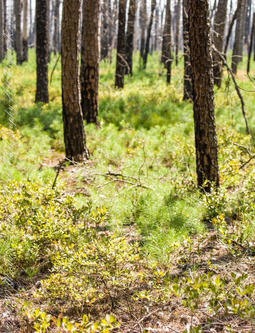
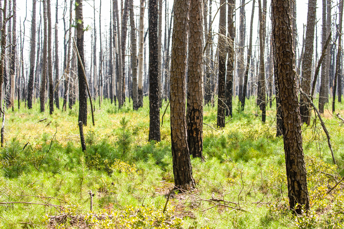
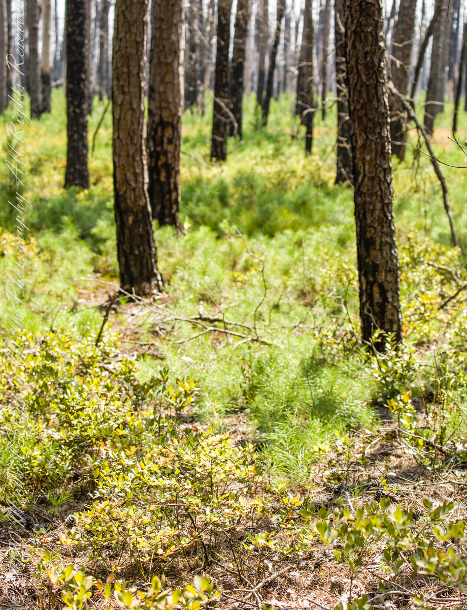
Multiple roads converge from all directions on Quaker Bridge, using GoogleMaps (surprising these unimproved, “jeep” sand roads were listed) I chose Goodwater Road as a route to Batsto Village, on the southern side of Wharton State Forest. The 6.1 mile road follows the east bank of Mullica River at a distance, a very rough passage through ancient Pitch Pine forest. Here are photographs of the enormous capacity of the pines to regrow after fire. Note a thick seeding growth among the mature pine trunks, lower portions fire blackened.
Copyright 2021 Michael Stephen Wills All Rights Reserved
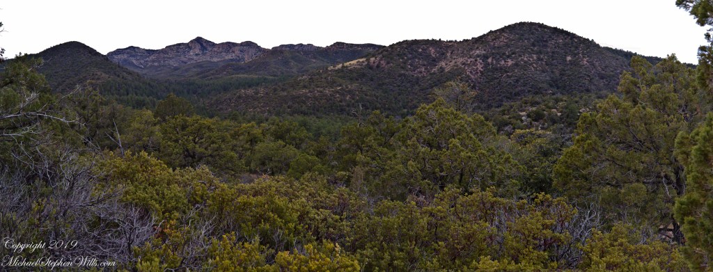
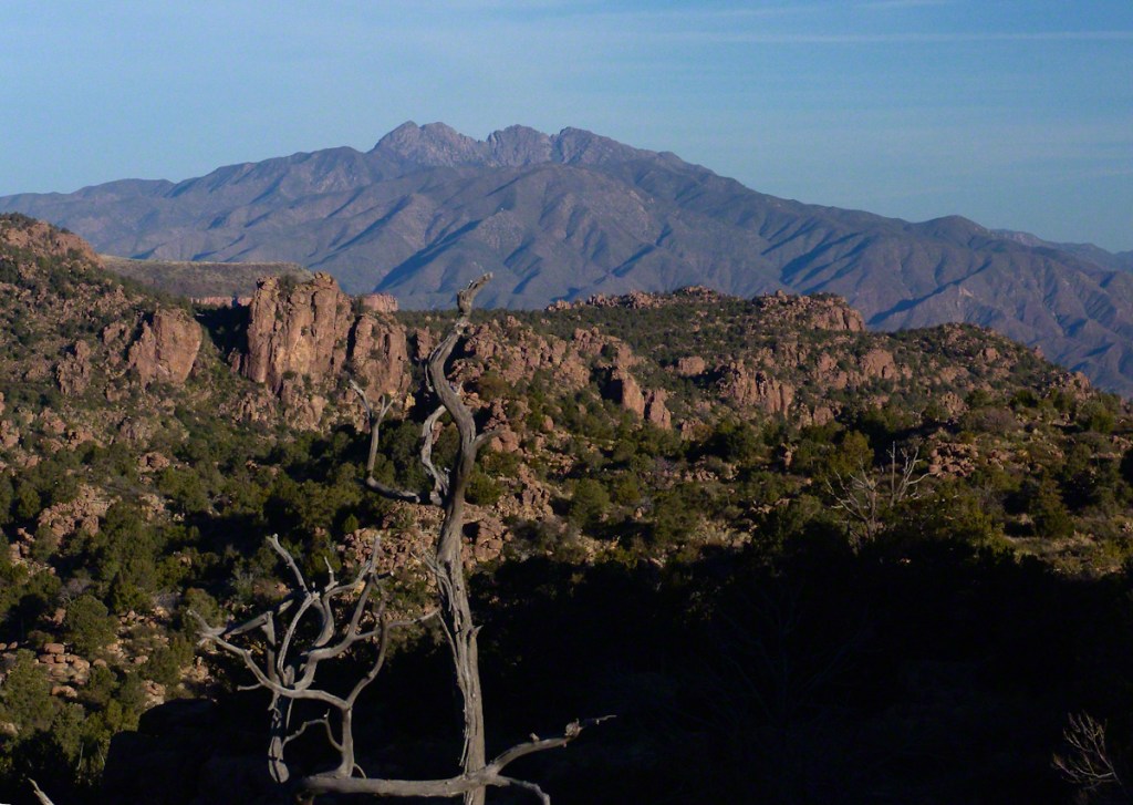
These are photographs from my Superstition Wilderness postings.
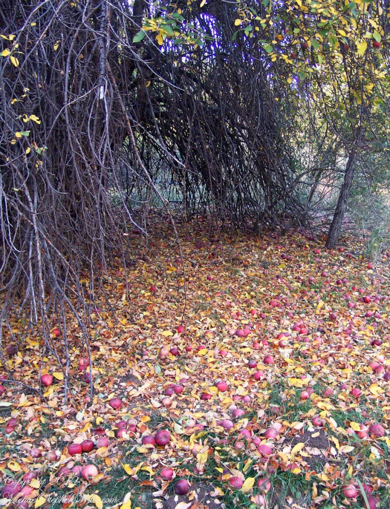
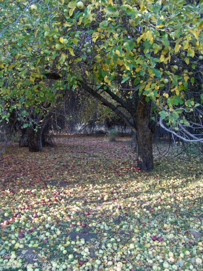
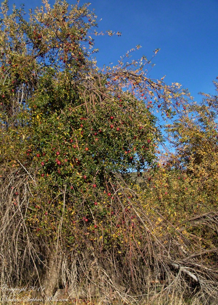
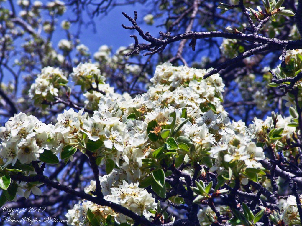
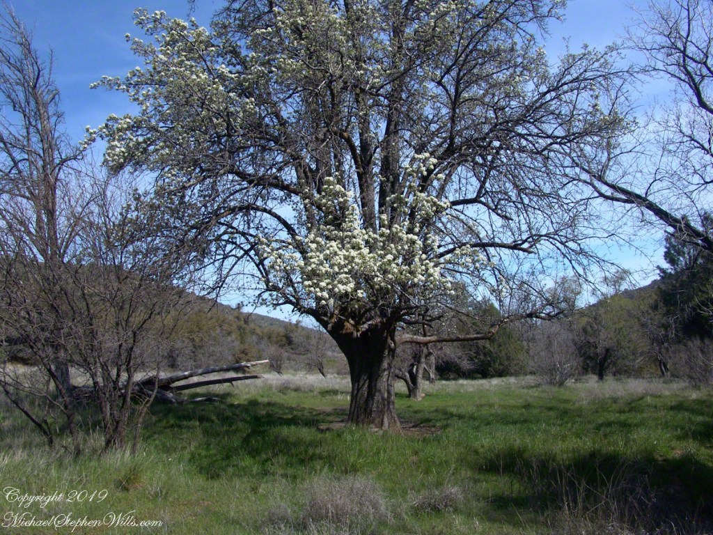
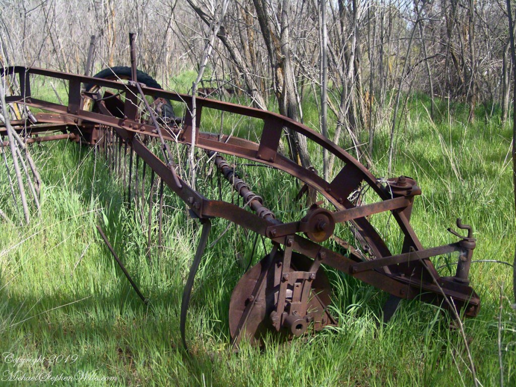
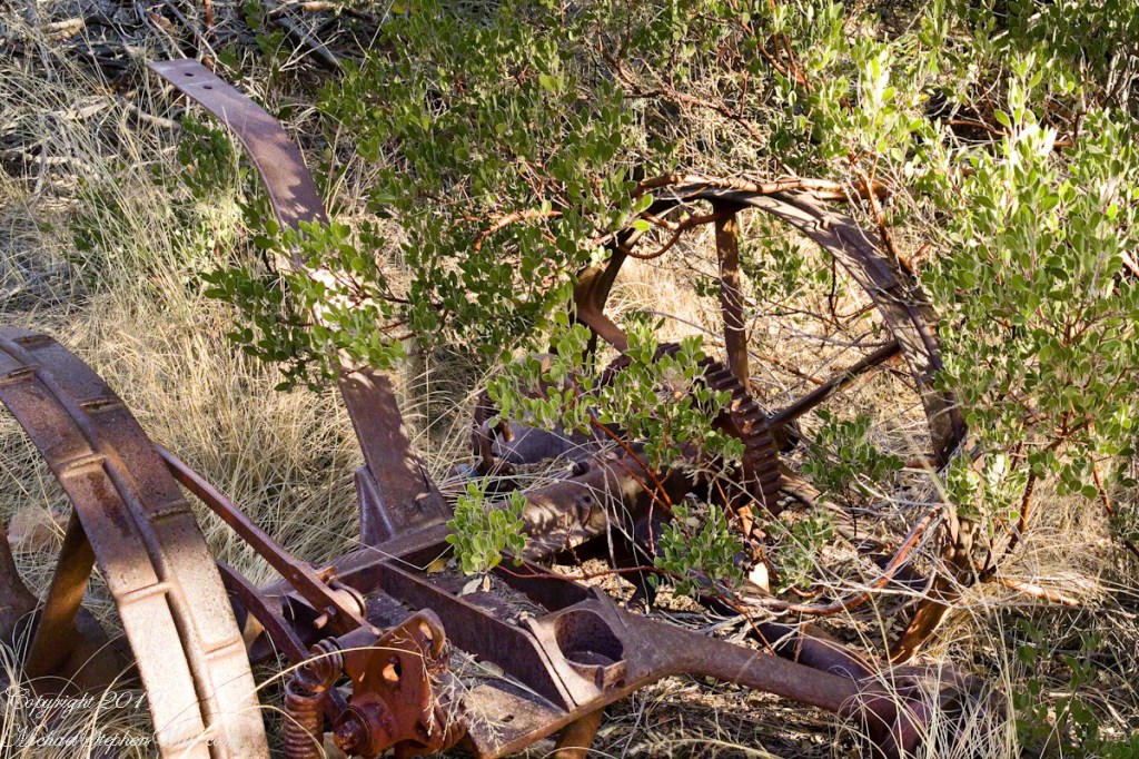
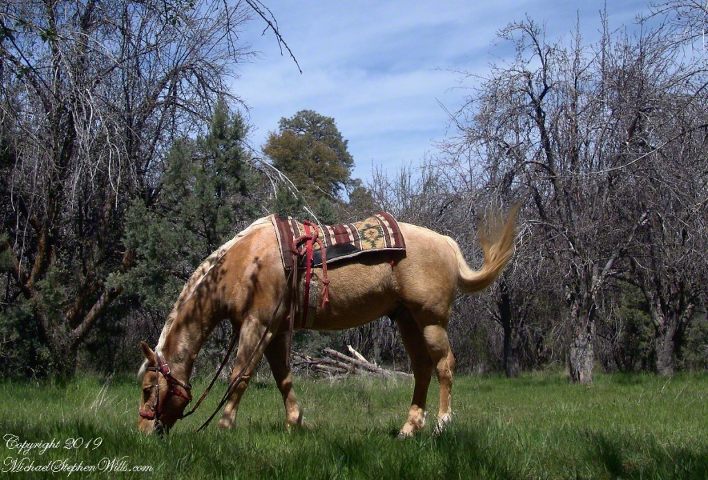
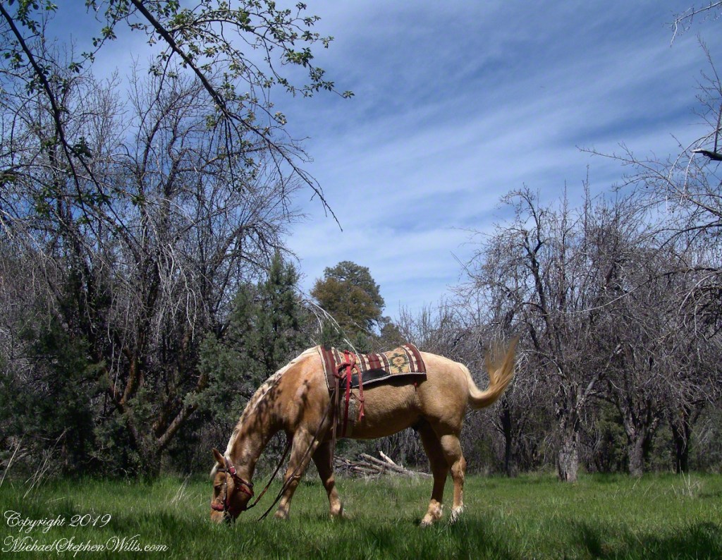
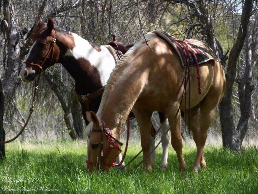
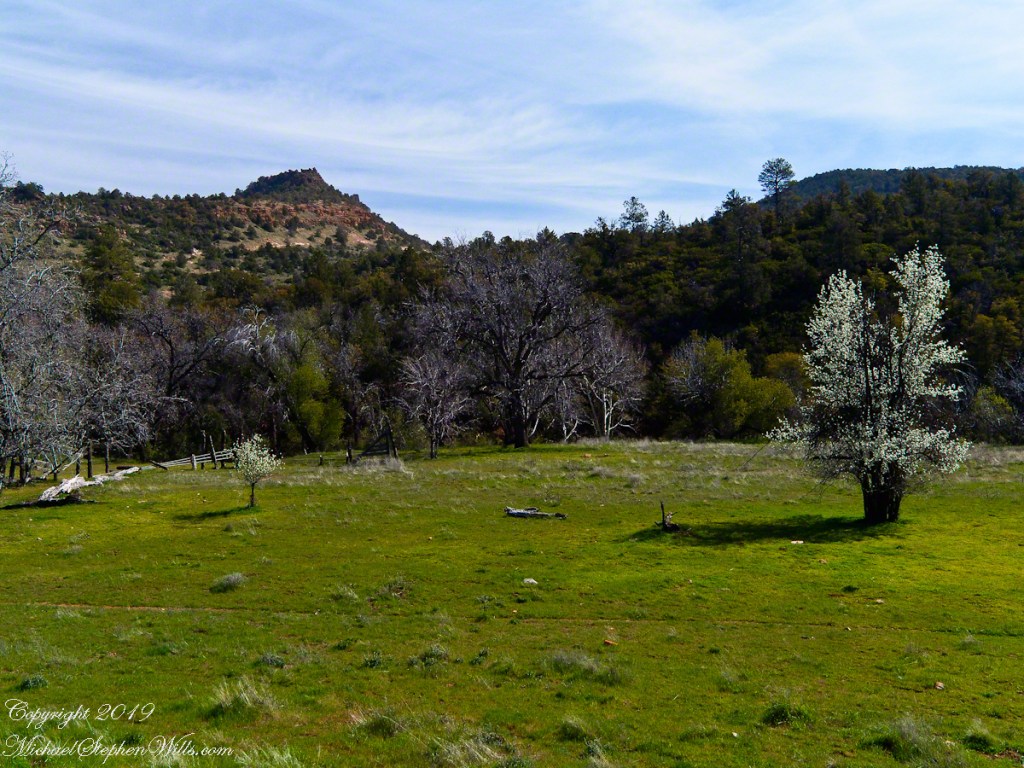
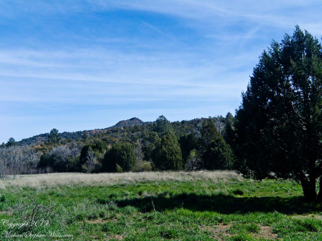
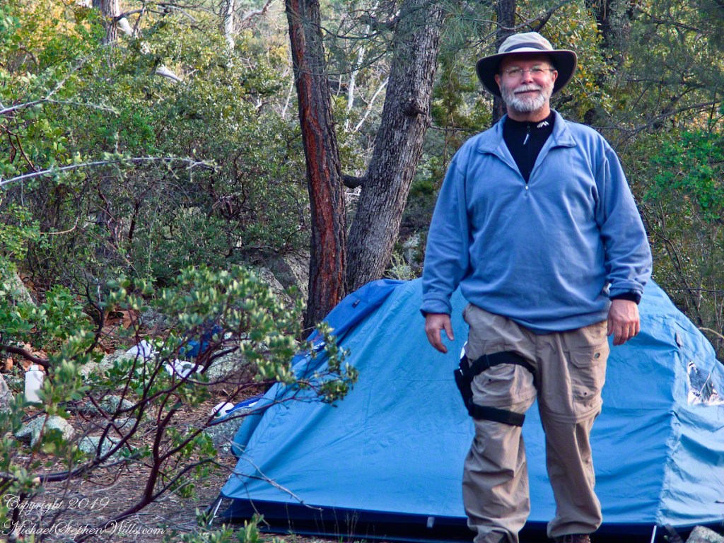
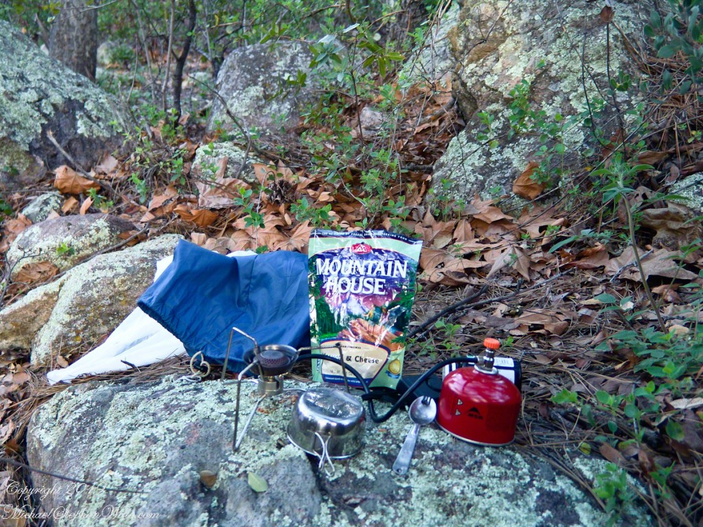
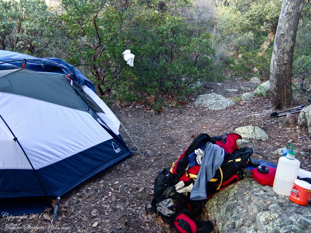
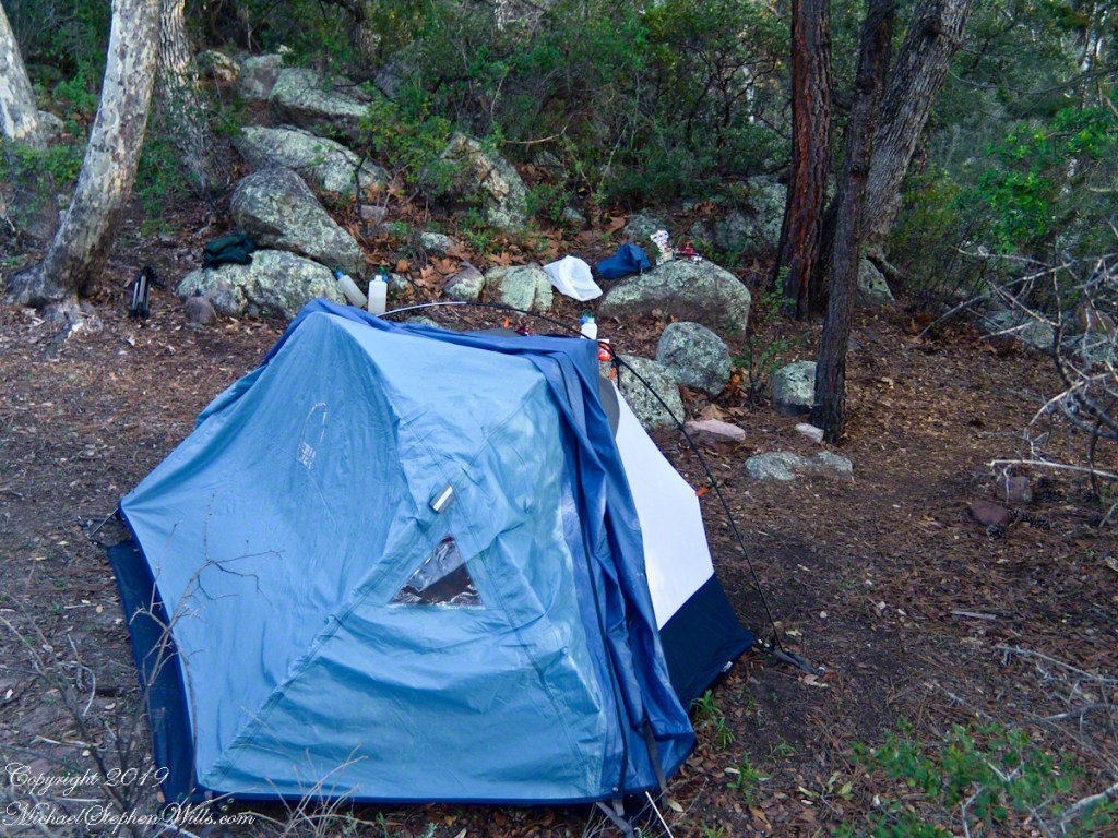
Taken early April, Reavis Ranch, Superstition Wilderness.Remnant of a twentieth century orchard, a dream husbanded using a perennial water source.Disused hayrake, Reavis Ranch, Superstition WildernessSuperstition Wilderness, Reavis Ranch, February, 2006From the slopes of Mound Mountain in the remote eastern Superstition Wilderness. View West-Northwest across the southern Reavis Valley (Reavis Ranch). Pinion Pine and Manzanite in the foreground.“The Searcher’s” horse, Nugget feating on early spring grass among the apple trees of Reavis Ranch.Northeast view across the site and the Reavis Valley.“The Searcher’s” horse, Nugget feating on early spring grass among the apple trees of Reavis Ranch.Colorado on the alert while Nugget grazes, typical of their personalities.Looking from the former house site towards the Arizona Trail running beneath the distant red rock ridge. Not the fence rails on the left and apple trees in bloom.Mike Wills at his Pine Creek Camp, April 2005.the kitchen: can of fuel, a light burner and dehydrated food. A metal cup and a spork.Looking east toward backpack, center, with unpacked supplies and tent. Tripod at rear.I climbed a large, lichen encrusted boulder for this view of the tent and equipment. Looking south.
The following year my sister Diane and I did two expeditions into the Superstitions, March and November 2006.
View of a saddle of the ridge to the west over Pine Creek. It is possible to climb over this ridge for a view of Reavis Falls. It is a day-trip bushwack from Pine Creek.View to the southwest on the Arizona Trail above Pine Creek.Pine Creek of the remote eastern Superstition Wilderness hosts this wild Tufted Evening Primrose.From a vantage point overlooking Reavis Gap tot he north. This is the view of Pine Creek, to the south.The Arizona Trail passes this spot in the remote eastern Superstition Wilderness. This is the view of my path up from Nameless Canyon. In the distance is the Four Peaks Wilderness Area.Superstition Wilderness, Arizona
“A This video is from the November backpack, taken from the hill above the Ranch Ruin (Click me for “A Ride to Reavis Ranch”) you will experience the peace of this wilderness valley.
Although cold, the still dry air felt marvelous and even distant objects appeared absolutely clear. In this environment the spread of sun with its rising is a ritual. Here’s a photograph of the canyon walls a few minutes before the sun reached them.. Superstition Wilderness, ArizonaView from the western slope of Two Bar Mountain looking west toward Reavis Ranch Trail. Reavis Falls is in canyon on the far side of this ridge.Although cold, the still dry air felt marvelous and even distant objects appeared absolutely clear. In this environment the spread of sun with its rising is a ritual. Here’s a photograph of the canyon walls a few minutes after the sun reached them.. Superstition Wilderness, ArizonaSuperstition Wilderness, ArizonaView from the western slope of Two Bar Mountain looking west toward Reavis Ranch Trail. Castle Dome is behind the ridge on right.Fully mature agave surrounded by years of dried leaves against ddawn light in Pine Creen Canyon, Superstition Wilderness, Arizona.
These photographs were taken deep in the wilderness of Wharton State forest, near where Quaker Bridge spans the Mullica River.
Click pic for larger view in a new browser tab. If you are in WordPress Reader, open the post to use this feature.
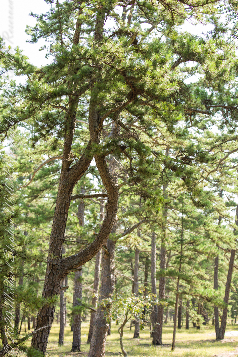
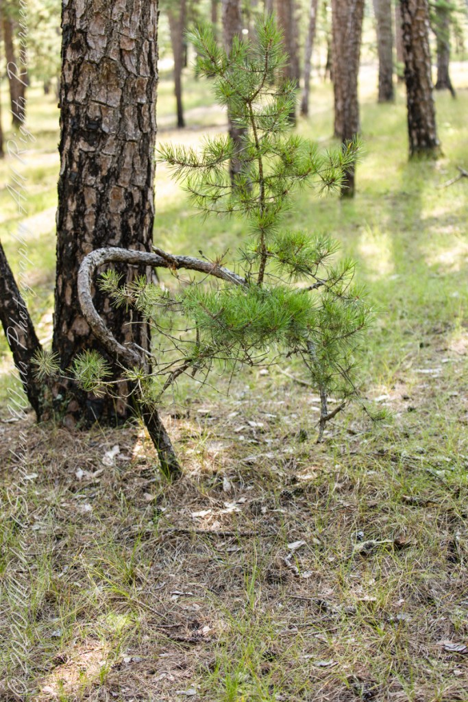
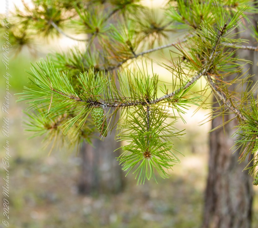
The pitch pine is irregular in shape, in these forests a mature tree typically lives through multiple cycles of fire and regrowth.
Burnt pitch pines often form stunted, twisted trees with multiple trunks as a result of resprouting. Bonsai artists exploit this characteristic for their creations.
Copyright 2021 Michael Stephen Wills All Rights Reserved
In this Part 03, some contemporaneous people are introduced, more information on the environment provided, some previous residents named and imagined.
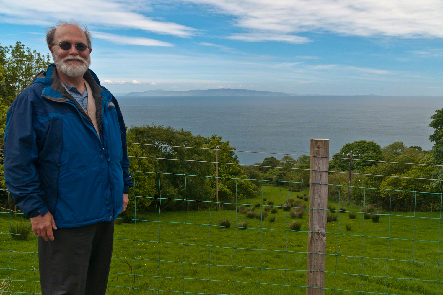
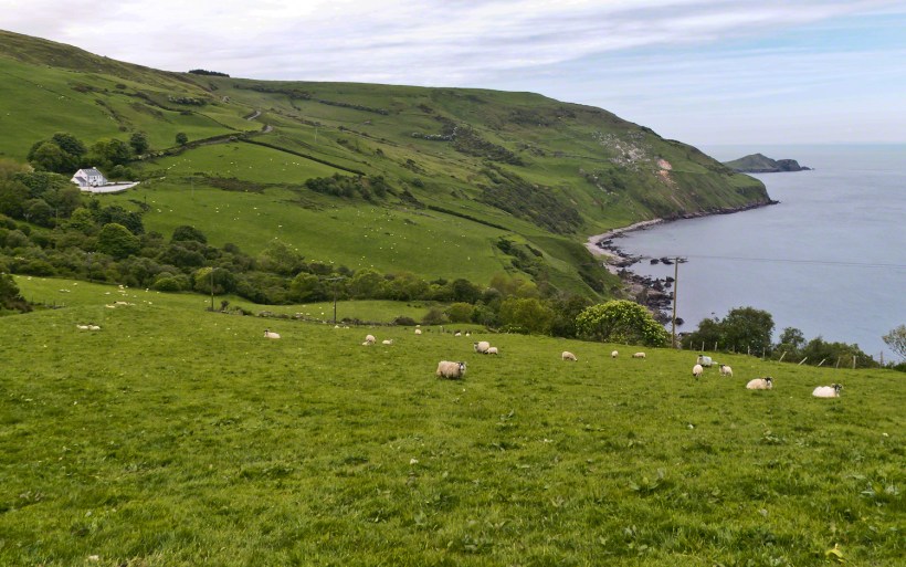
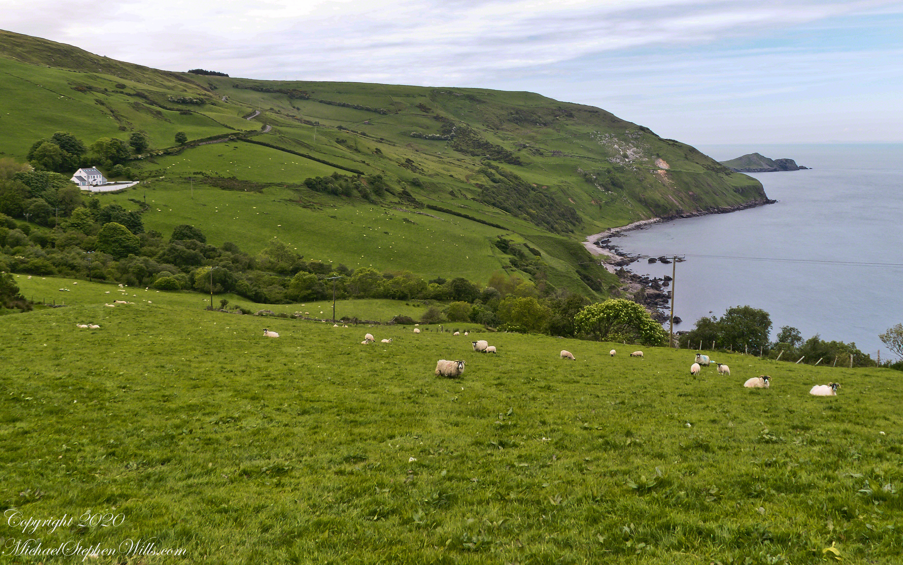
On the way to Torr Head we stopped at this spot in Coolranny Townland to take in this view of the Irish Sea. The land overlooks Loughan Bay toward the Mull of Kintyre and Sanda Island, Scotland. County Antrim, Northern Ireland. Coolranny borders Loughan Townland on the east.
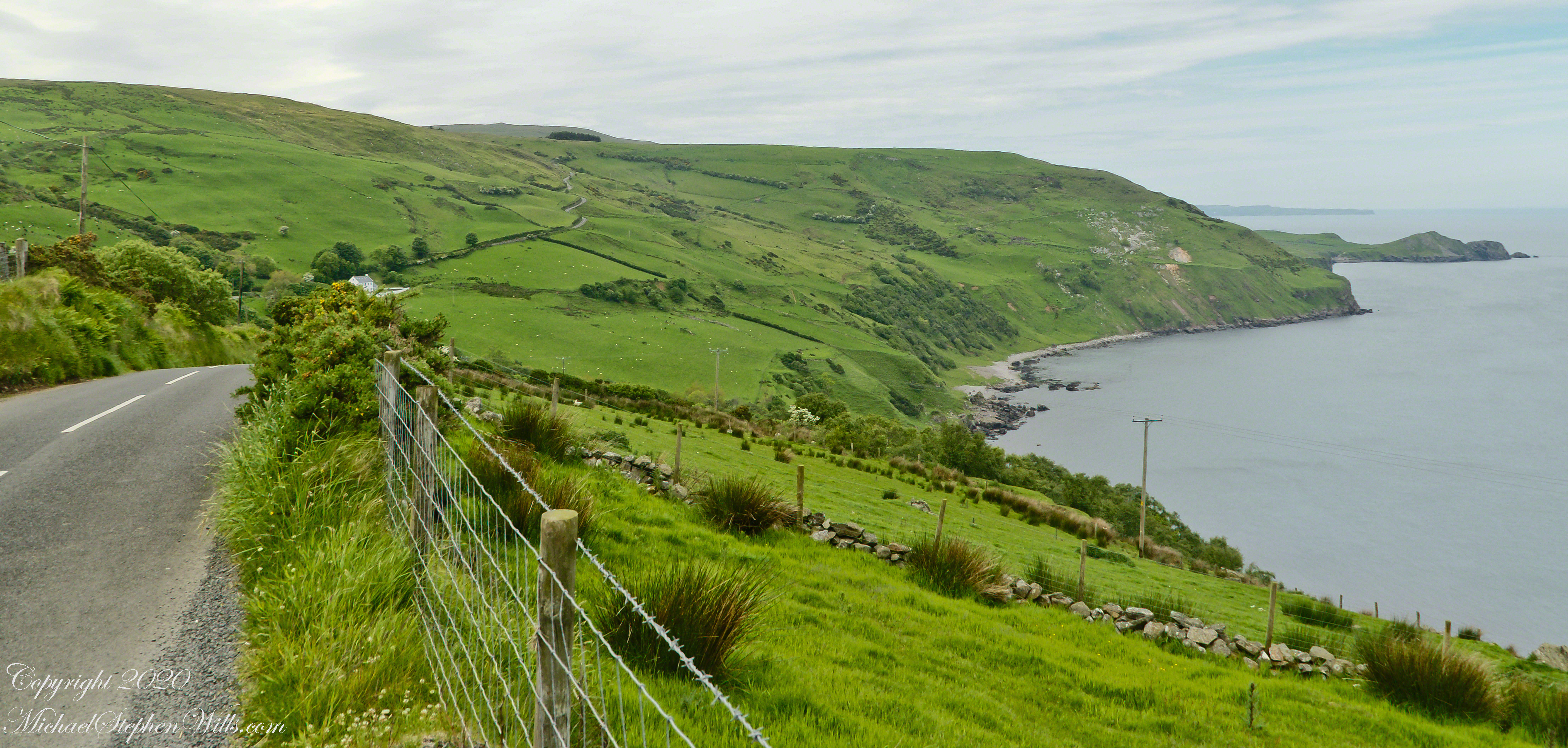
To understand the full beauty of a place, it is necessary to live it, to experience the seasons, approach the land from different aspects; pass the same place many time, noticing overlooked features, enjoying old favorites. We did our best in this single day and took the exploration of this Antrim County coast slow, savoring all the views we noticed as this is a once in a lifetime experience. Imagine our amazement to find Scotland so close at hand. In the past, on a fine day the trip across the North Channel, up eastern Kintyre peninsula shores to Campbeltown at the head of Campbeltown Loch, was easier than a land crossing to a closer town.
I picked Campbeltown because my great great grandfather, a sea captain, emigrated from Scotland to County Louth where my great grandmother, Anne Campbell, married John Mills. In this way Captain Campbell escaped persecution for his Roman Catholic faith.
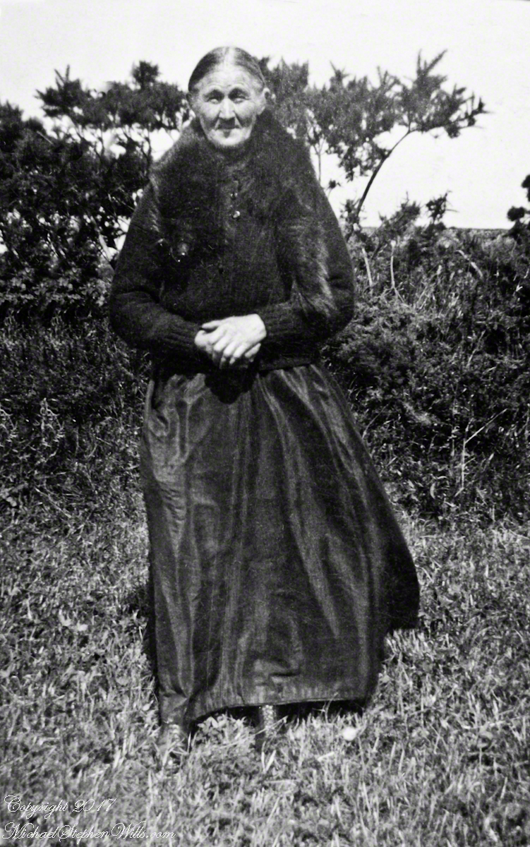
Late in her life, Anne Mills posed for this portrait. I can tell great grandmother Mills is facing north from these clues:
— the press of the eternal east wind on her dress, against her left left and flowing away from the right.
— the sun shadow on her cheek. It was around noon. With the sun, at this latitude, in the south the shadow from her right cheekbone is darker than the left.
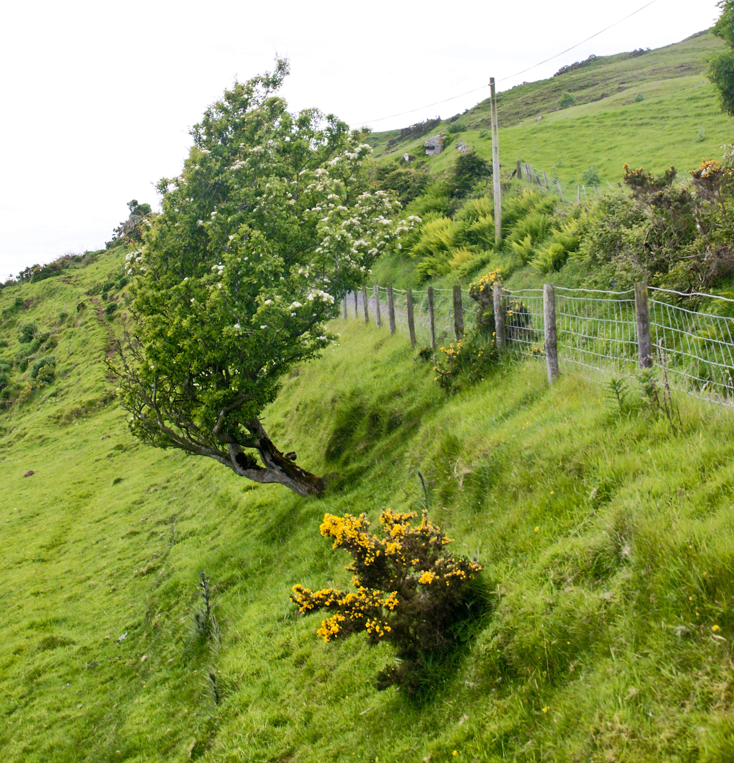
Rowan Tree directional growth from a constant east wind, County Antrim on the Torr Road nort of Cushenden.
A few miles before Loughan Bay, at Coolranny, are informative placards describing the area. I thought the white flowering trees, or shrubs, on the slopes were Hawthorn. On revisiting my capture of the placards I learned these are a different plant named Rowan Tree, aka Mountain-ash. This wind stressed specimen is an typical example of Rowans on this coast, stunted and little more than a bush. This individual is slanted westward from a constant and stiff east wind, as with Anne Mills’ portrait. Residents, past and present, of this coast know this damp, persistent wind well. Note the lack of blossoms on the east side, blossoms that ripen to small dark red fruit called poms (also called rowans). The leaves turn red in the fall. More time, for the fruit to form and leaves to turn, was necessary for me to be certain my identification of this, as a Rowan, is correct.
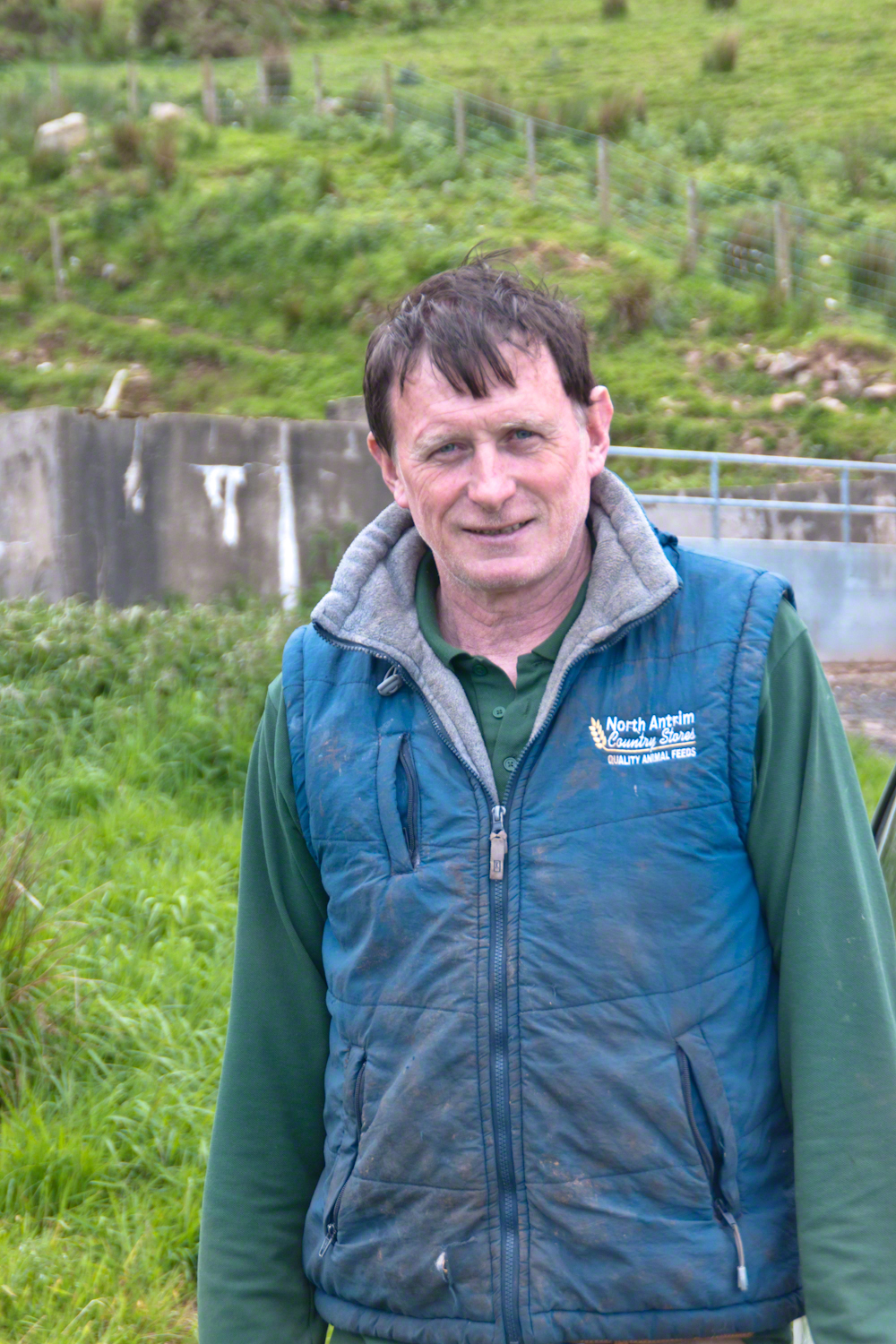
We parked on a turnout above the Loughan Cottages, near this farmer’s sheep pen. He drove up in a huge tractor and conversed with Pam while I was below shooting the cottages. He made a good impression.
On this day, Friday, June 6, 2014 I did two rounds of shooting the cottages. The first, handheld, with a Sony Alpha 700. Upon returning to the car for the Canon, Pam was talking to a friendly sheep farmer who pulled up in a large tractor pulling a tank. It turned out we parked below the turnout for his sheep enclosure built on the hill west of Torr Road. His flocks grazed the surrounding land. He and I talked, too briefly, about the hard lives of the people who lived here.
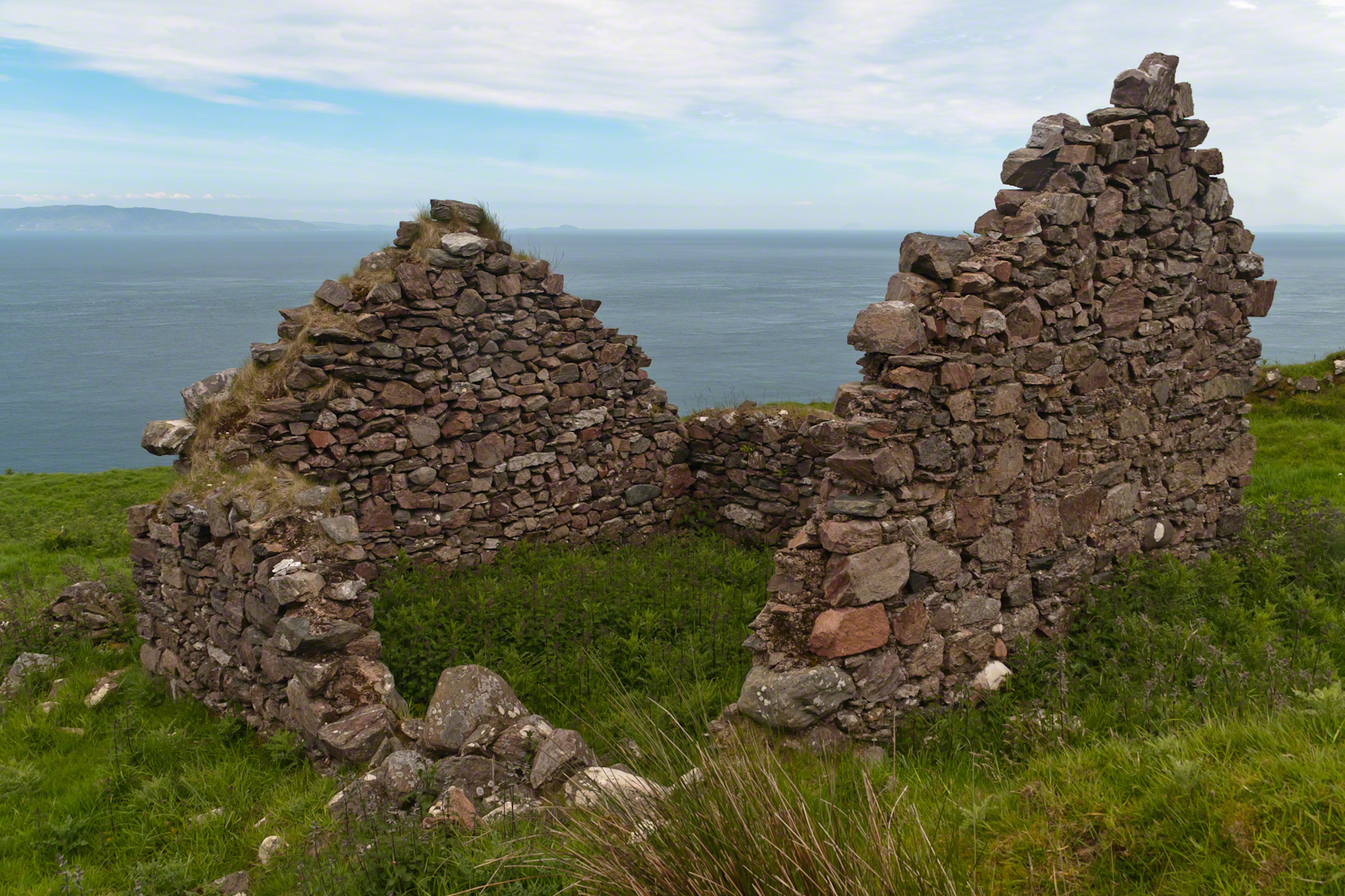
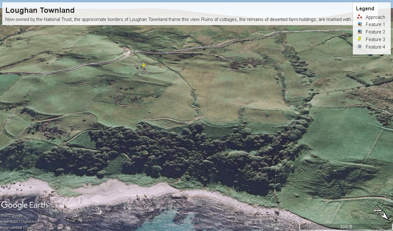
The Coolraney placard, up the road, claimed the cottages were deserted in the 19th century. I found evidence, in the 1901 Irish Census, of three Roman Catholic families, 19 men, women, children, living on Loughan Townland. In Part 02 of this series, setting the stage, Loughan is sized at 112 acres, a single photograph captures Loughan entire. These families had nowhere else to live, in Loughan, other than the cottages.
The smallest, and poorest, the poorest of the poor, family was 32 year old Mary Corbit and her two children, 10 year old Mary and Robert, 2 years. The Corbit family lived in a one room, stone walled, house with a wood or thatch roof. Unlike the other families they had no outbuildings, structures to house livestock or to support a farm operation. The house owner was Marj Delargy.
Here is a single room house among the ruins, four low walls, the east/west with intact gables, the stones collected from the hillside. The west wall higher up the slope, the floor now thick with fern.
Little Mary most certainly took care of Robert for part of the day. Did Mary, with Robert along, gather rowans, and other forage?
A thick growth of ferns, grass on the gable was once a home with a view of Scotland’s Mull of Kintyre 12 miles across the Irish Sea. The Isle of Sanda just visible on the right of the far gable. Alisa Crag just visible in the distance, to the left of the nearest gable.
Mary Corbit: head of household, occupation laborer. There is a footnote to Mary’s “Marriage” entry as Married, “husband at sea.” The “C” of her census signature exactly like my mother signed her name Catherine.
Mary Corbit and her children were not listed in Loughan Townland for the 1911 Census.
The following year my sister Diane and I did two expeditions into the Superstitions, March and November 2006.
“A This video is from the November backpack, taken from the hill above the Ranch Ruin (Click me for “A Ride to Reavis Ranch”) you will experience the peace of this wilderness valley.
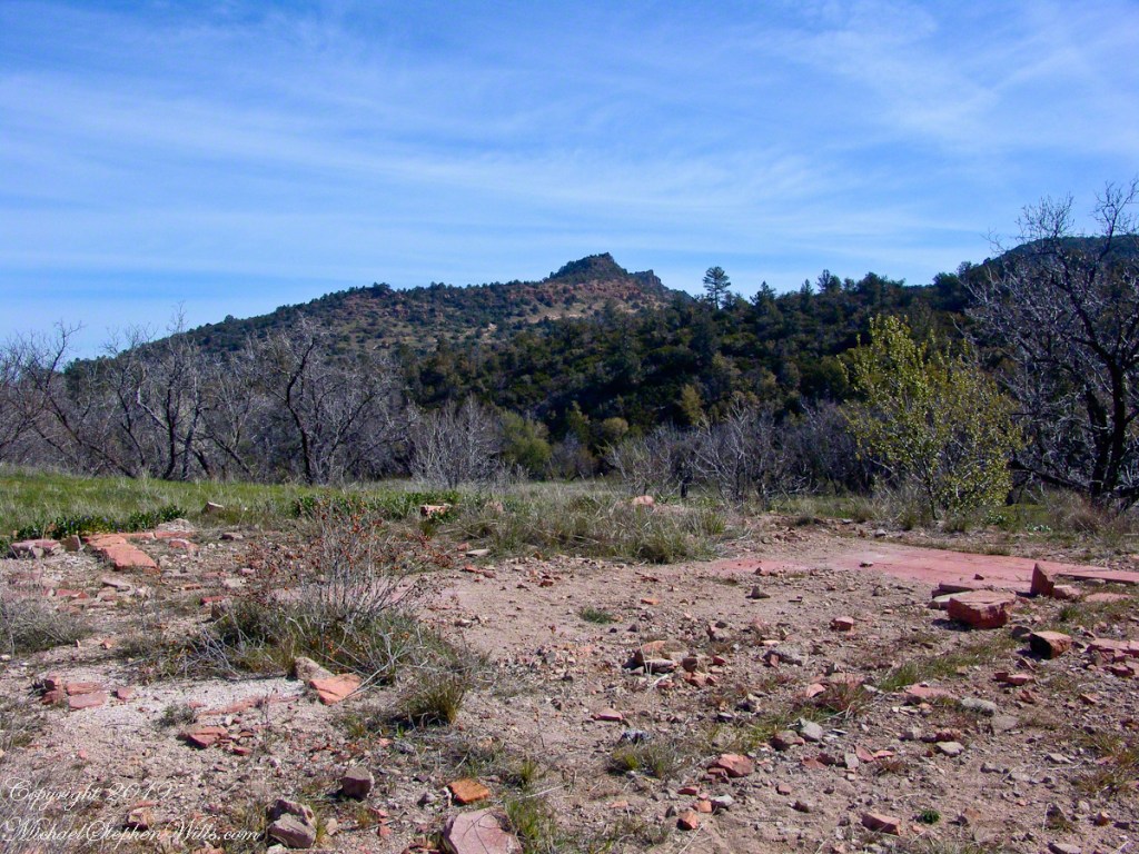
About that mysterious stone structure featured in this video. Over the years I have pieced together its purpose. When the ranch was active, a canal followed the contours from upper Reavis Creek to fill a pond down the hill from the house — I was shown the canal and walked it 2005. The structure was razed in the 1990’s, all that remains is the concrete foundation slab and, when I was there 2005 – 2008, scattered remains of the tile flooring. I am sure the pedestal above the house supported a water tank for a gravity water feed (“indoor plumbing”). Here is a link to more info about that site. The article does not discuss the water system.
For me, the romance of a place is settled in exact knowledge as much as a feeling. Starting with a recollection of the ruined cottages making such an impression we found a parking place and hiked into them loaded with photography equipment, three years later returning to use the photographs, bringing back a rush of memories and feelings, it is a matter of using the set of photographs from that day to build the location.
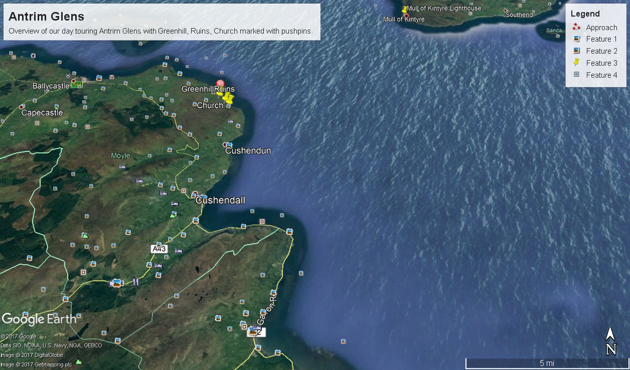
This much I knew, going in: we were touring Antrim Glens entering at Cushendall, after visiting Glenariff Forest Park, proceeding up the coast through Cushendun to Torr Head. A fortuitous encounter with a village of abandoned farm cottages (“ruins”) happened somewhere in between.
Click any image for larger view in a new browser tab. If you are in WordPress Reader, open the post to use this feature.
There was a photograph of a notable church prior to the ruins and a fine view, from a place named Greenhill, afterwards.
Here is a picture of the terrain with the three pushpins:
A fine church just off Torr Road, to the west. I found the location in Google Maps, marked as “church”. Google earth showed buildings at the location, this set the “church” pushpin. Associated with the church, using the date/time stamp, were images of signage naming Coolranny townland.
A sign identifying a location as “Greenhill” was after. Neither Google Maps or Earth lists this as a place. It took hours searching web sites of Irish townlands before I found the reference. Greenhill is not a townland; it was listed as a place on one of the maps. Just above the notation was Torr Road, two unique bends in the road. I used these bends to identify the turnoff where I photographed the “Greenhill” sign.
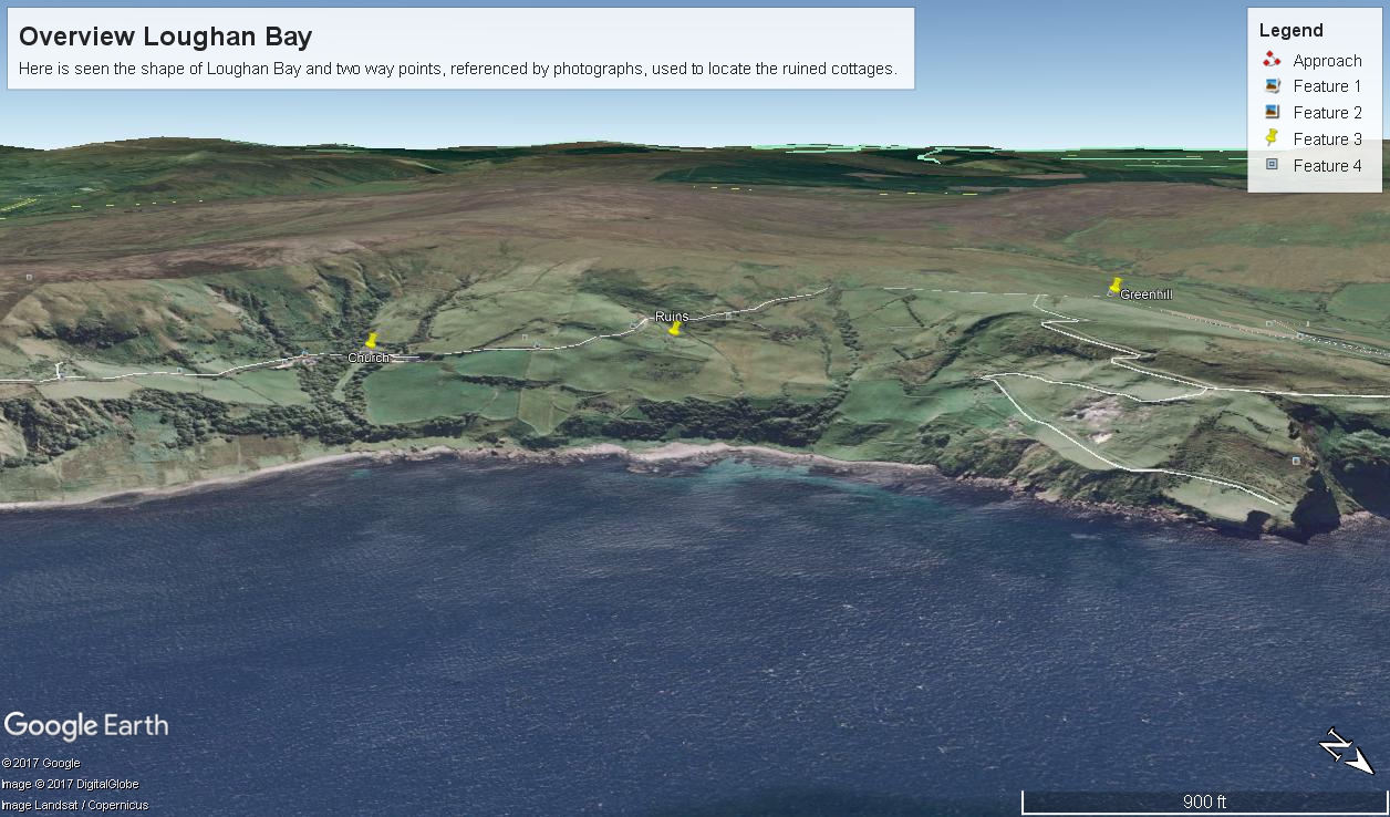
For reasons to be explained later, it is important to know the name of the ruin townland. The place name sign presented in post 1 was a clue (“Loughan an Lochan” — or Loughan Bay), as well at the web site (see link below) listing Irish townlands. The web site map names “Loughan Bay.”
With this information I was able to peruse Google Earth, found the turnoff and the ruins!
See the above Google Map image sized to approximate the Loughan townland boundaries.
The scenery was jaw dropping lovely the entire time, so I captured view and view. Here are two landscapes time stamped just prior to the church, views including Coolranny and Loughan townlands with Torr Head in the distance.
That is Torr Road….
T
……a bit further along. It is possible to locate the ruin site from the Google Earth picture. There is a signature grove of bushes on the slope below the ruin site, sandy beach along shore. In the landscapes, Loughan Bay is cradled in a curve of coast.
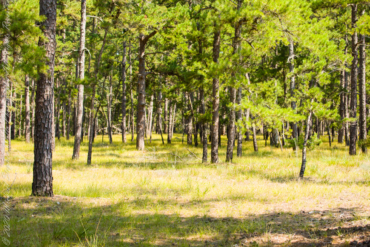
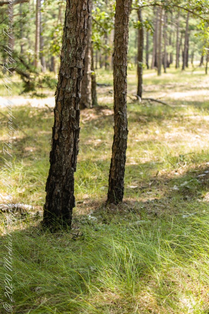
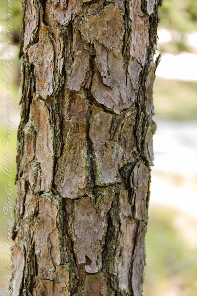
The 115,000 acres of Wharton State Forest are predomenantly Pitch Pine, scientific name Pinus Rigida, and AKA Black Pine and Hard Pine. Climb the fire tower of Apple Pie Hill, in all directions will be a sea of these trees interspersed here and there with occasional oaks. Cedars mark water courses. These photographs, unless otherwise identified, were taken deep in the forest, near where Quaker Bridge spans the Mullica River.
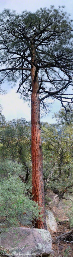
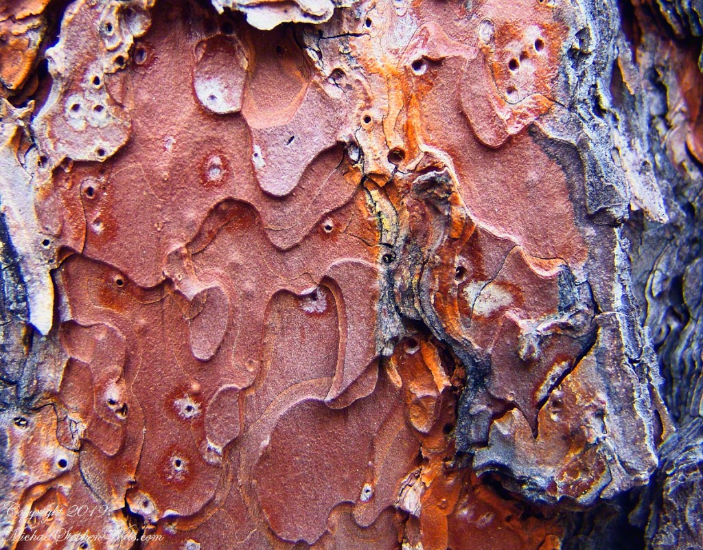
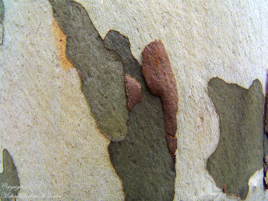
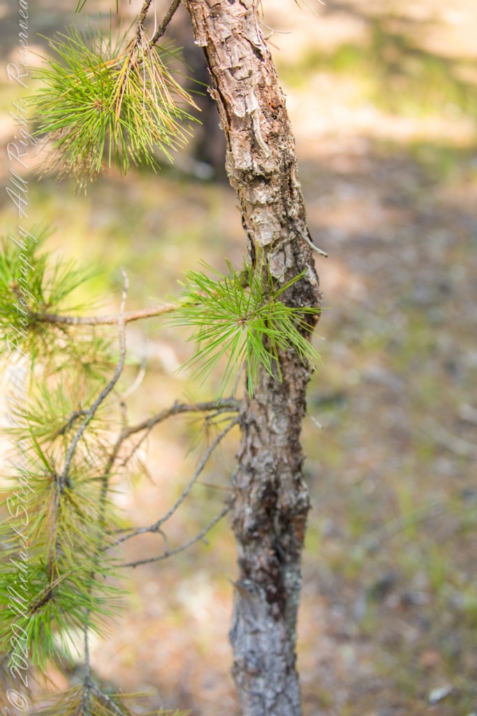
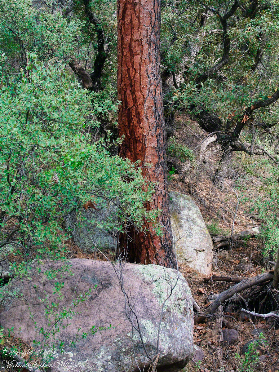
A mature Pitch Pine has bark of large, thick, irregular plates, adapted to survive forest first, similar to another member of the Pinus genera, the Ponderosa Pine.
Click pic for larger view in a new browser tab. If you are in WordPress Reader, open the post to use this feature.
Trunk of a mature pitch pine
Trunk of Ponderosa Pine, Superstition Wilderness
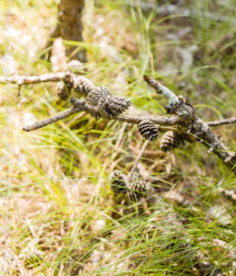
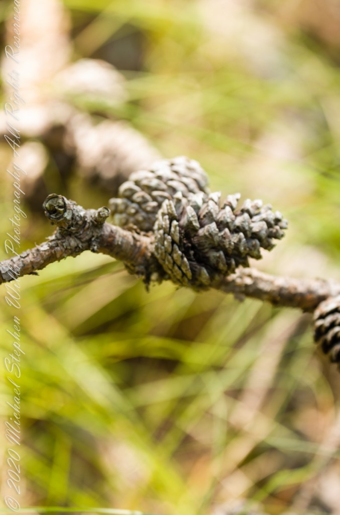
Open-growth trees begin bearing cones in as little as three years, with shade-inhabiting pines taking a few years longer. The cones are 4–7 cm (1+1⁄2–2+3⁄4 in) long and oval, with prickles on the scales. Cones take two years to mature. Seed dispersal occurs over the fall and winter.
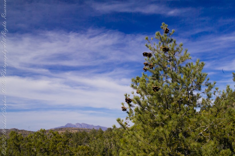
Unlike the another member of genus Pinus, the Pinyon Pine, the seeds released by Pitch Pine cones are not sought out for human consumption.
Large Pinyon Pine with mature cones on the slopes of Mound Mountain above Reavis Valley. Superstition Wilderness, Arizona. Four Peaks Wilderness is in the distance.
Copyright 2021 Michael Stephen Wills All Rights Reserved