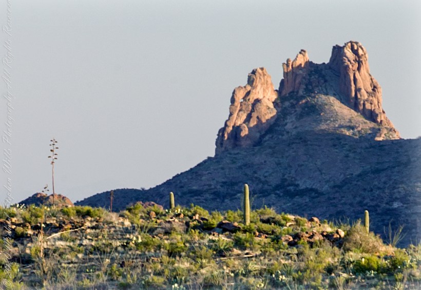
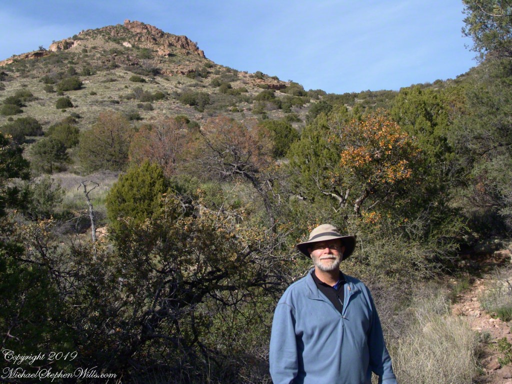
I was a member of an expedition to Peter’s Mesa March 2008, a place central to Superstition Wilderness treasure legends. This is a sunset view, looking south, southwest. Light raking across the desolation and Miner’s Needle creates a fascinating spectacle. Ancient volcanism, apparent throughout the Superstition Wilderness, is here seen in the texture, form and type of rock as well as the mineral deposits. Miner’s Needle, like Weaver’s Needle (not seen in this view), are eroded volcanic summits. Look closely for the “eye” of Miner’s Needle, easier seen in the cropped heading photograph. To this day, hopeful prospectors search for gold nuggets.
There is one form of volcanism present today as an eerie rumble or hiss, similar to an enormous distant jet engine heard now and then during our two days on the mesa, louder and closer than an overhead plane could produce. The view includes many notable Sonoran Desert plants. Many young Saguaro cactus are in the form of green poles. Catching the dramatic light, on the ridge is a tall single flower of an Agave, known as the “Century Plant” it flowers once in a long life and dies.
Peters Mesa is named after “Old Pete” Gottfried Petrasch, father of Hermann and Rhiney Petrasch. Old Pete worked for Jim Bark for awhile in the 1890s doing odd jobs. Irregular employment gave Pete and Sons time to s searched for the Lost Dutchman Mine in the years following the death of the source of the legend, the “Dutchman” Jacob Waltz. The Petrasches were one of the first groups to search for the mine, and gold in general. They covered almost the entire Superstition range in their combined searches.
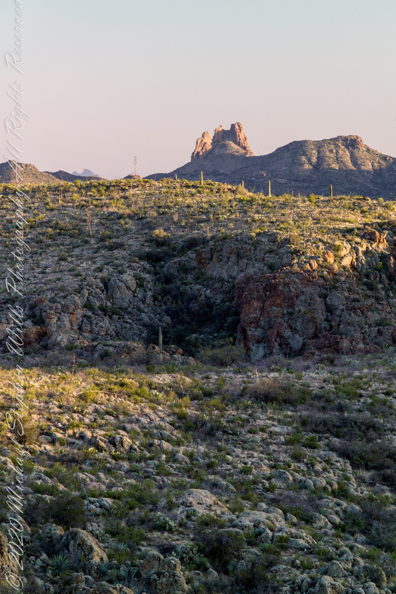
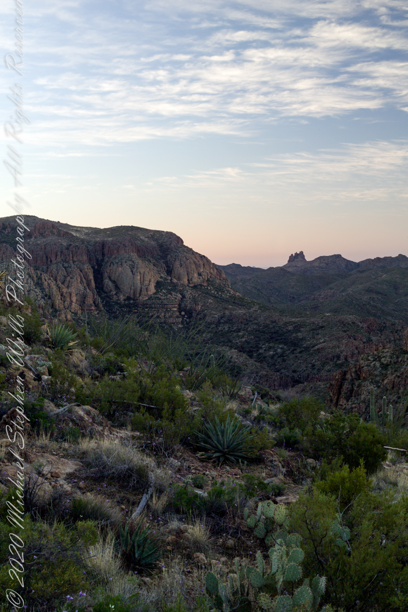
Sunrise looking across Music and LaBarge Canyons to Miner’s Needle
On our first day on the mesa, we came across the remains of one of these camps, on the top of Squaw Canyon, a deplorable junk pile discarded by searchers, presumably disappointed, too lazy to cart it out. That March, we were lucky to find the remnants of winter rains in the form of a meager trickle at the bottom of a shallow draw off Peter’s Mesa trail up from La Barge canyon. We had a good time of it until the trip was cut short by a storm front and torrential rains. We were back in Apache Junction before they hit.
Nugget and Colorado had eaten their fill of the rich early spring grass of the apple orchard, The Searcher pulled together the pair for the return to Pine Creek. Perched on Colorado, the lead held by The Searcher, I listened as he shared survival facts remembered from Peter Bigfoot’s desert survival course. The Reavis Mountain School of Self Reliance, founded 1979, is along same Reavis Gap Trail (#117) we traversed. After descending to Pine Creek and up to Reavis Gap (where I first met The Searcher), it descends to meet Campaign Creek where the survival school is located.
He pointed out on the many flowering Century Plant stalks along the trail. “These are great to roast when young, just as the stalk starts to bud from the center, before it starts to lengthen.” By the time the stalk flowers, as in the following photograph, it is quite tough.
Agave flower spike against the dawn in the nameless canyon west of Two Bar Mountain, Superstition Wilderness, Arizona.
At the base of boulders, shaded from the sun, the ridgeline fern takes hold. Surviving on seasonal water seepage, it dries out during dry spells to later revive and reproduce via spores. As I recall, the dry or fresh form is useful as an analgesic.
An absolute necessity for bushwacking (walking off the path), a pair of rattlesnake proof boots were worn on every expedition. These rose to mid-calf with a layer of lexan, the same as used for bullet proof glass.
Swept from the Saddle
We passed the time in this way, me holding on to the saddle horn bouncing and shifting as Colorado negotiated the rough and steep path down to Pine Creek where the vegetation changed from very sparse to the thick growth you saw in my post “A Peaceful Day at Pine Creek”. On the east side of Pine Creek a trail, unmarked on the maps, follows the creek bed uphill north towards Mound Mountain. In 50 feet or so we passed the side trail to my campsite, our destination was The Searcher’s campsite. I was not paying near enough attention to the surroundings when I looked up to see an Arizona Oak limb headed to my chest. With no time or space to negotiate the obstacle I was left to grab hold and hang on to be swept from the saddle. The branch held my bulk for, at most, a second before giving way.
In bending flexibly before breaking the live Oak wood and centuries of soil underneath the trees softened my fall enough so I was badly shaken and unhurt. Falling a foot or so in any direction would have resulted in serious injury or instant death. Colorado stopped, looking briefly back as I slowly came to my feet. After taking account and letting the circumstance wash over me, I got up and proceeded slowly while we both contemplated my miraculous survival.
Bear Shelter
I now took up the rear as in a few hundred yards the valley wall rose on both sides of the Creek to form a short, narrow pass. The walls fell away just as quickly, the valley floor leveled out and we came to The Searcher’s camp. The bear shelter stood out right away. This was a ten foot high teepee of 4 – 6 inch diameter tree trunks tied with rope, within was a hammock . The three foot wide opening left only one unprotected side while he slept, offering some protection from the all too common roaming bears, most commonly from September to November when mazanita fruit ripens.
Well stocked in every respect, for a wilderness camp. In the following years of roaming the wilderness the camps of other horse people were similar in this way: stoves, comfortable cots, radios, pots and pans all fit into panniers. As a noun pannier is seldom used in the singular because there are always two, one on each side of the horse for balance. I sat on the wide top of one enjoying a cold beer pulled from a bed of ice.
We discussed the benefits and drawback of horses for exploration. I required a gallon and a half of water daily and in the desert wilderness provided for storage of three days, 4 and a half gallons. At 8 pounds each, that is 36 pounds!! Starting out, my pack weighted 90 pounds with a camera and tripod.
There are benefits to having a mode of transport that thinks for itself and drawbacks. Each individual has its own personality and horses do try to get away with what they can. It is wise to limit your dependence on a horse until you know each other well. In retrospect, I was “out on a limb” riding Colorado modified by being led by someone the horse knew well.
It was soon time for me to head back to camp. We set the agenda for the next day, an early start for the hike out. Colorado was to be fully loaded so my riding was not an option, just as well. It was possible to lighten my pack to almost nothing and I looked forward to that.
I took some time before dinner to set up the tripod for a self-portrait on my last full day in Pine Creek. The view is northeast from the Arizona Trail near my camp, the ridge overlooks Reavis Gap. I did a version of the view with and without me.
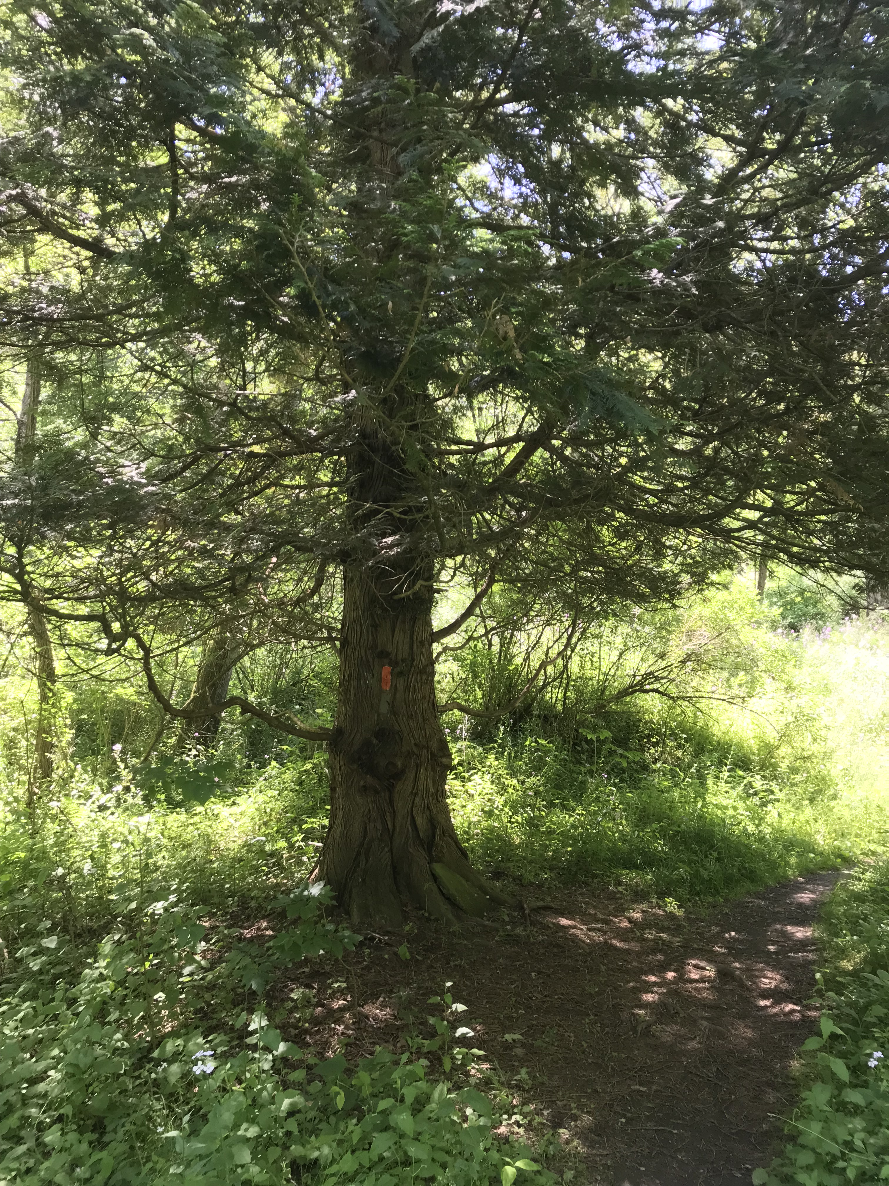
Wednesday, June 15th, we were on a turn to heat and humidity with this day of light breeze, temperature in the 70s making hiking around Tremen Park a joy.
These snapshots, taken on the fly with an IPhone 7, are the high points.
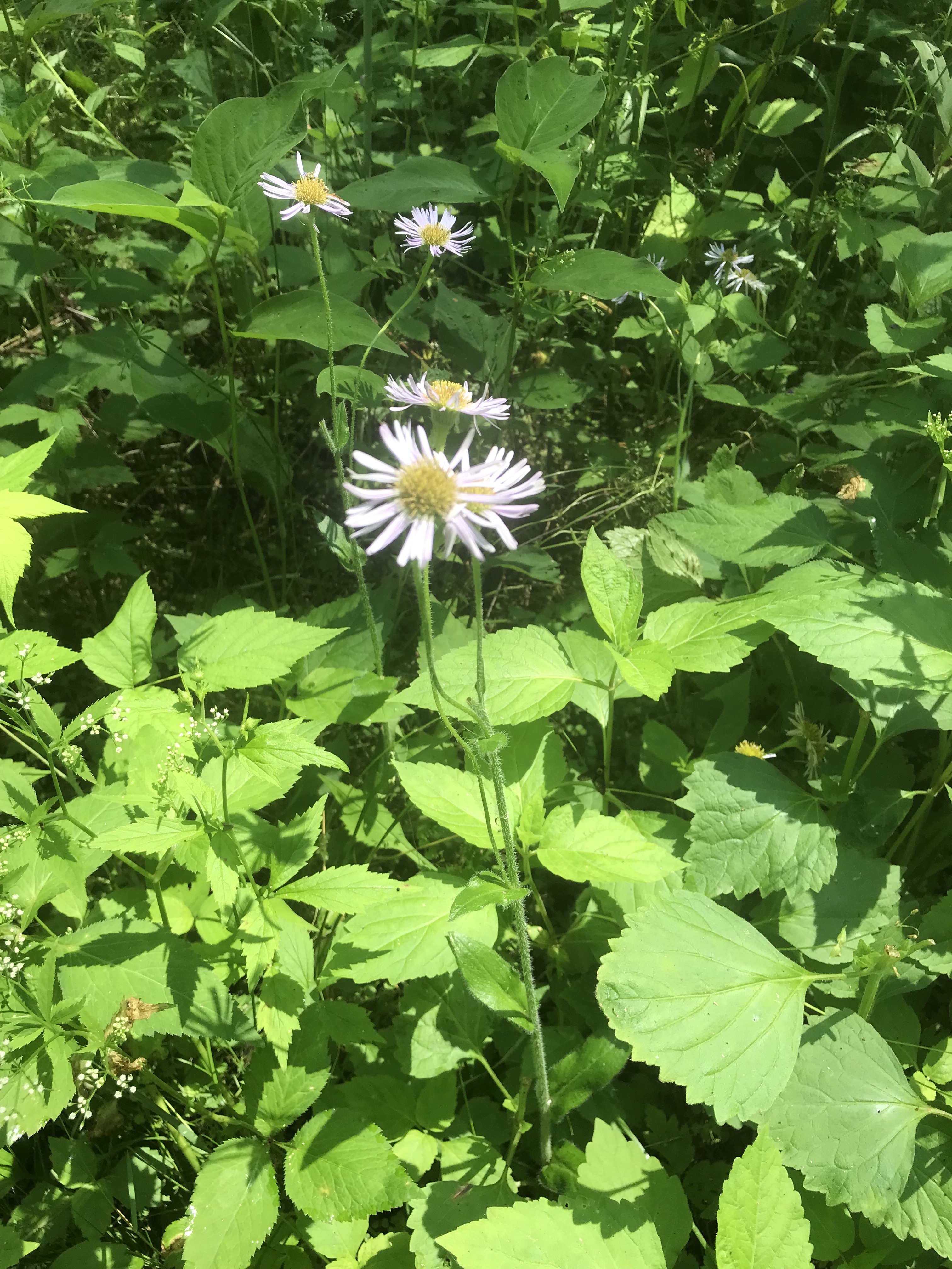
The first is a dandelion look alike with yellow flowers, petals shaped like teeth, though on a long hard stem and multiple flowers on a stalk. Known as meadow hawkweed, yellow hawkweed, field hawkweed, king devil, yellow paintbrush, devil’s paintbrush, yellow devil, yellow fox-and-cubs, and yellow king-devil with two scientific names: Pilosella caespitosa and Hieracium caespitosum.
Click photograph for a larger view. To do this from WordPress Reader, you need to first click the title of this post to open a new page.
Pilosella caespitosa
Click for slideshow.
Copyright 2022 All Rights Reserved Michael Stephen Wills
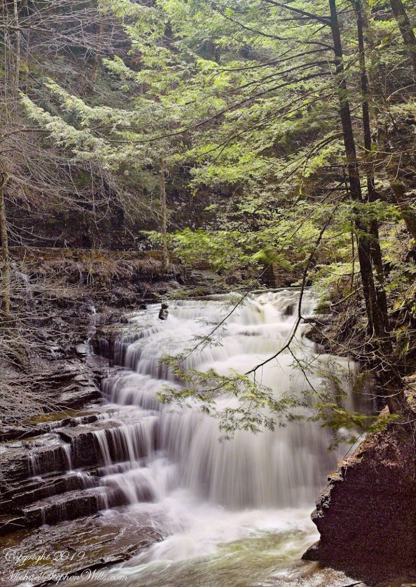
Walking around Taughannock Falls New York State Park on the solstice of 2019 starting from the Black Diamond trail head on Jackson Road, down the South Rim trail, up the North Rim Trail. We had a great deal of rain this week and the water filled the falls the full channel width.
The header photograph is a waterfall of Fillmore Glen, also in the Finger Lakes.
For a full screen view, click on the UTube icon, lower right of the video panel. The resolution is not very good so I also posted the source videos.
The movie is from the following videos and photos from my IPhone. The quality is better than the compilation video. I uploaded the following videos directly to WordPress. I was not able to get the “full view” icon to work on my browser. Enjoy
View of the upper gorge, above the falls, from the South Rim
View into the gorge from the South Rim
Distant view of Taughannock Falls from the South Rim
Click on any of the photographs for a larger view.
The stair down from the gorge South RimView of the forest of the South RimThe stairs up to the North Rim of the gorge
View of the forest of the North Rim
A turkey vulture soars by towards the end of the following.
View of gorge from the North RimView into the gorge from the North Rim
Taughannock Falls and “Ant People” from the overlook
Taughannock Falls from the North Rim
Copyright 2019 All Rights Reserved Michael Stephen Wills
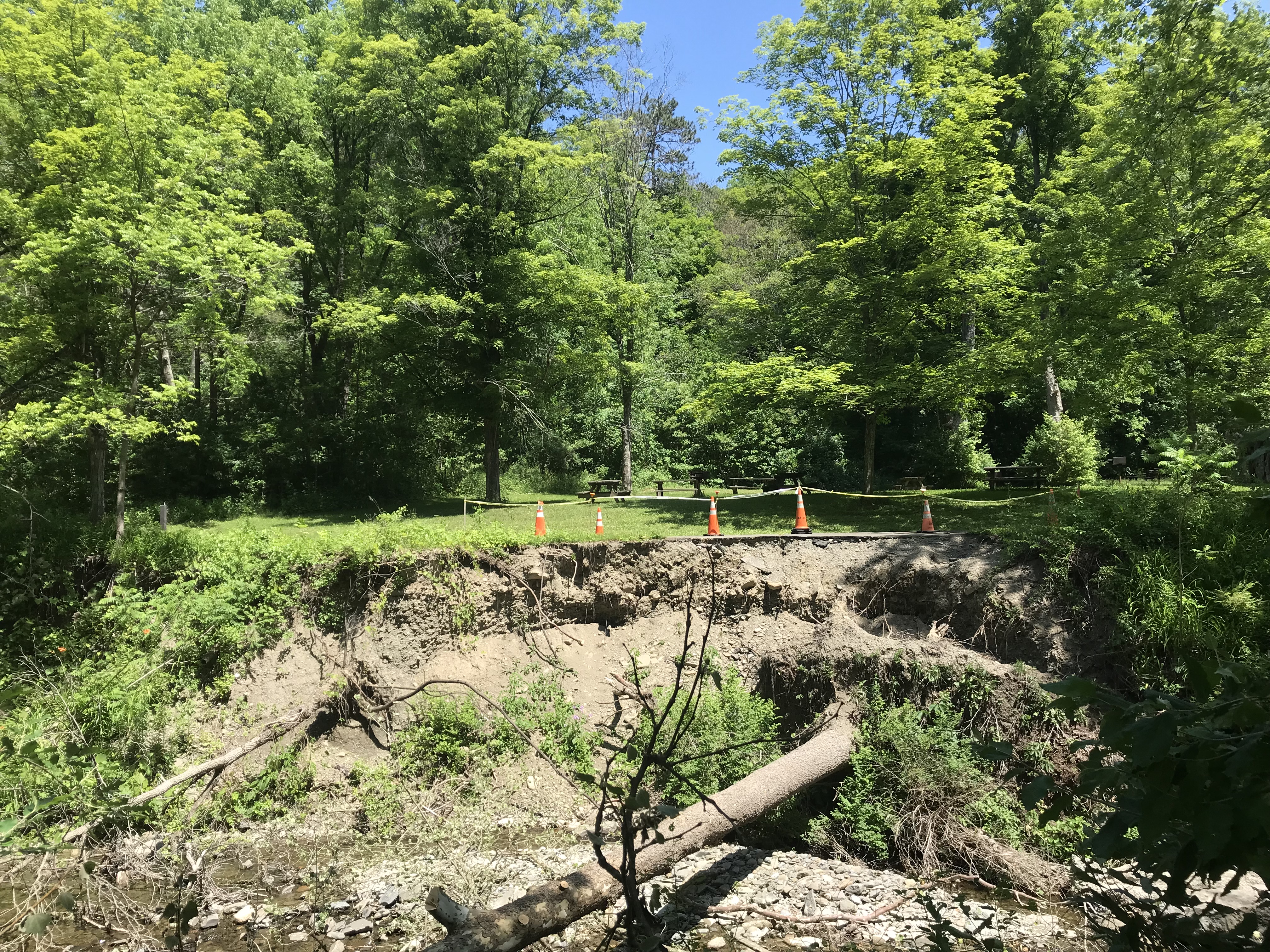
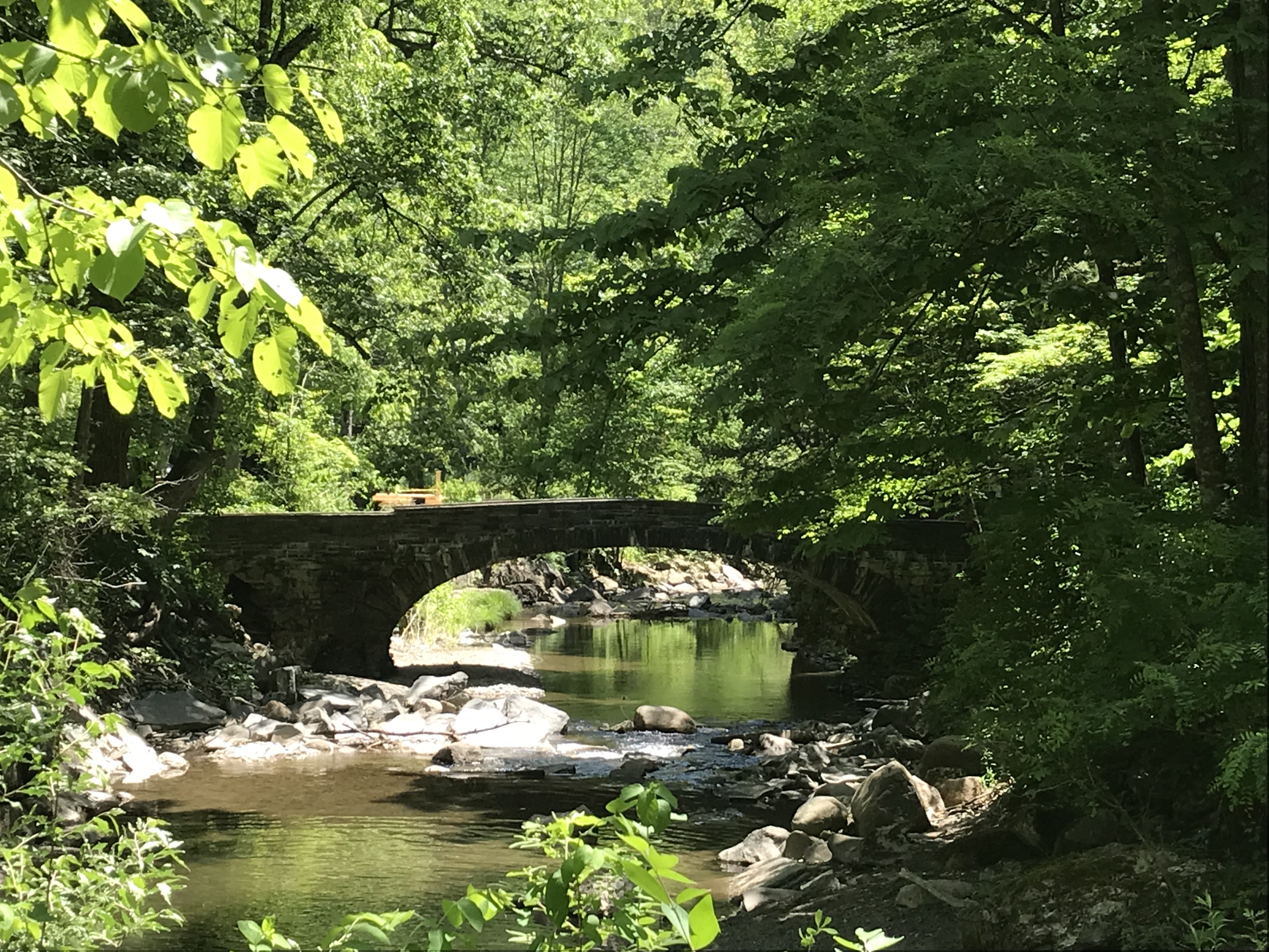
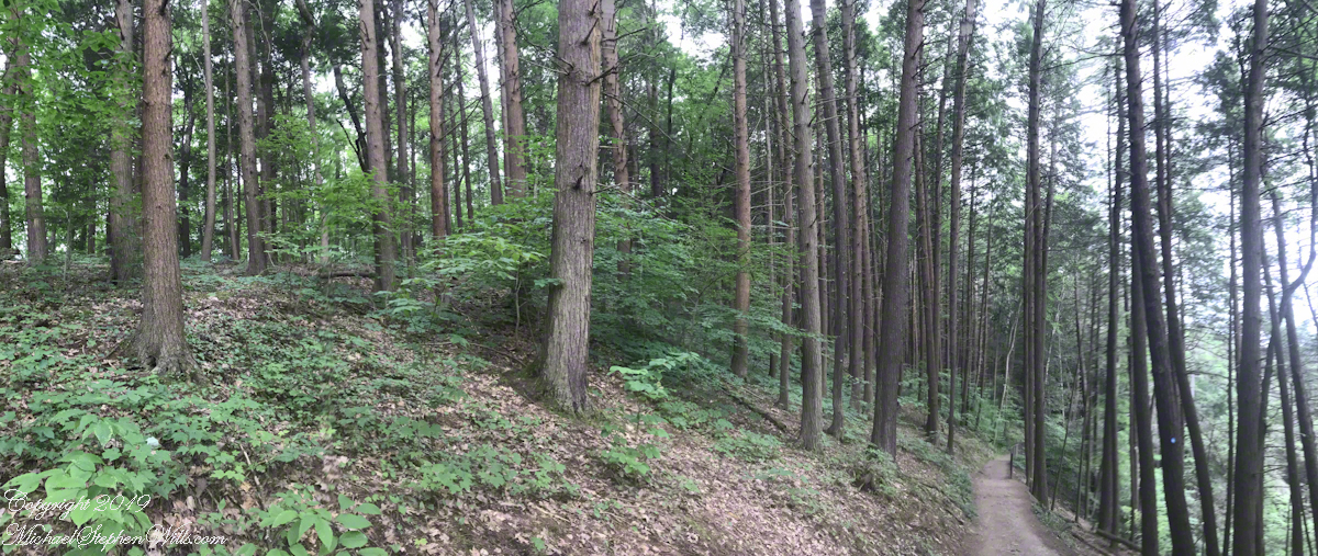
Travelling light, using the IPhone 7during a 4 mile walk on the Gorge and South Rim Trails of Robert H. Treman New York State Park, Finger Lakes Region near Ithaca, New York. A few waterfalls and sights along the way. Distance is from the “Health” app on my phone.
A pool is formed beneath this waterfall by a dam, removed each fall and yet to be placed. Summertime, the water is deliciously cool. It is great fun swimming to the waterfall base and inching along under the spray. This view is the reward for the first climb up from the gorge floor, the South Rim Trail.
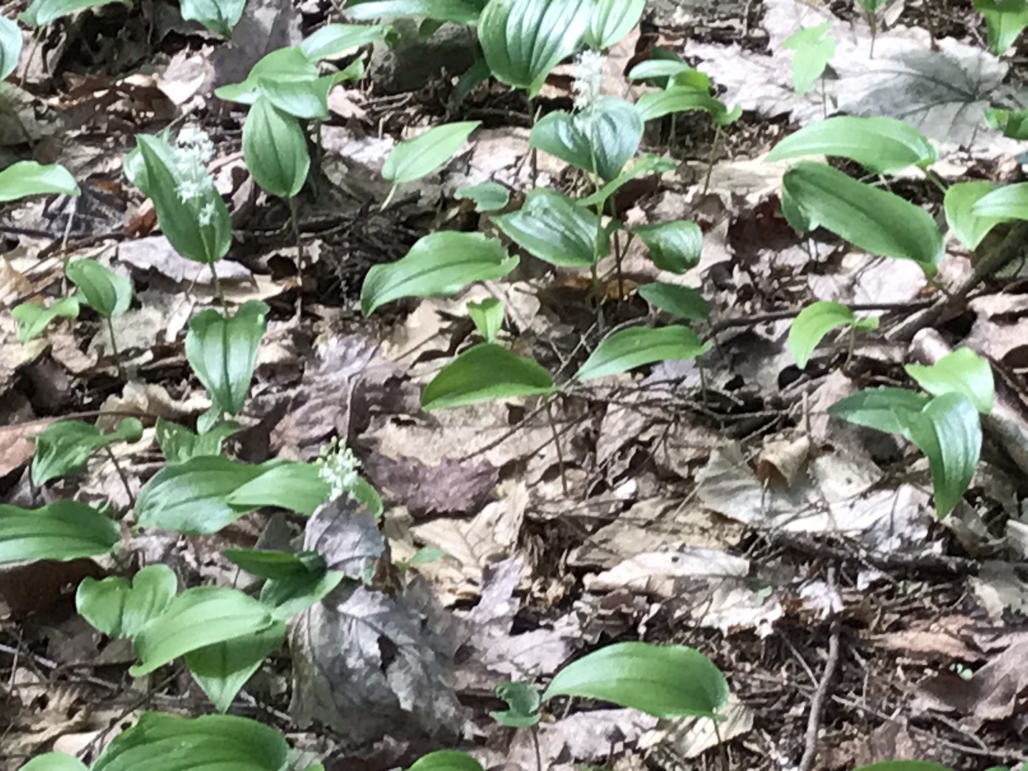
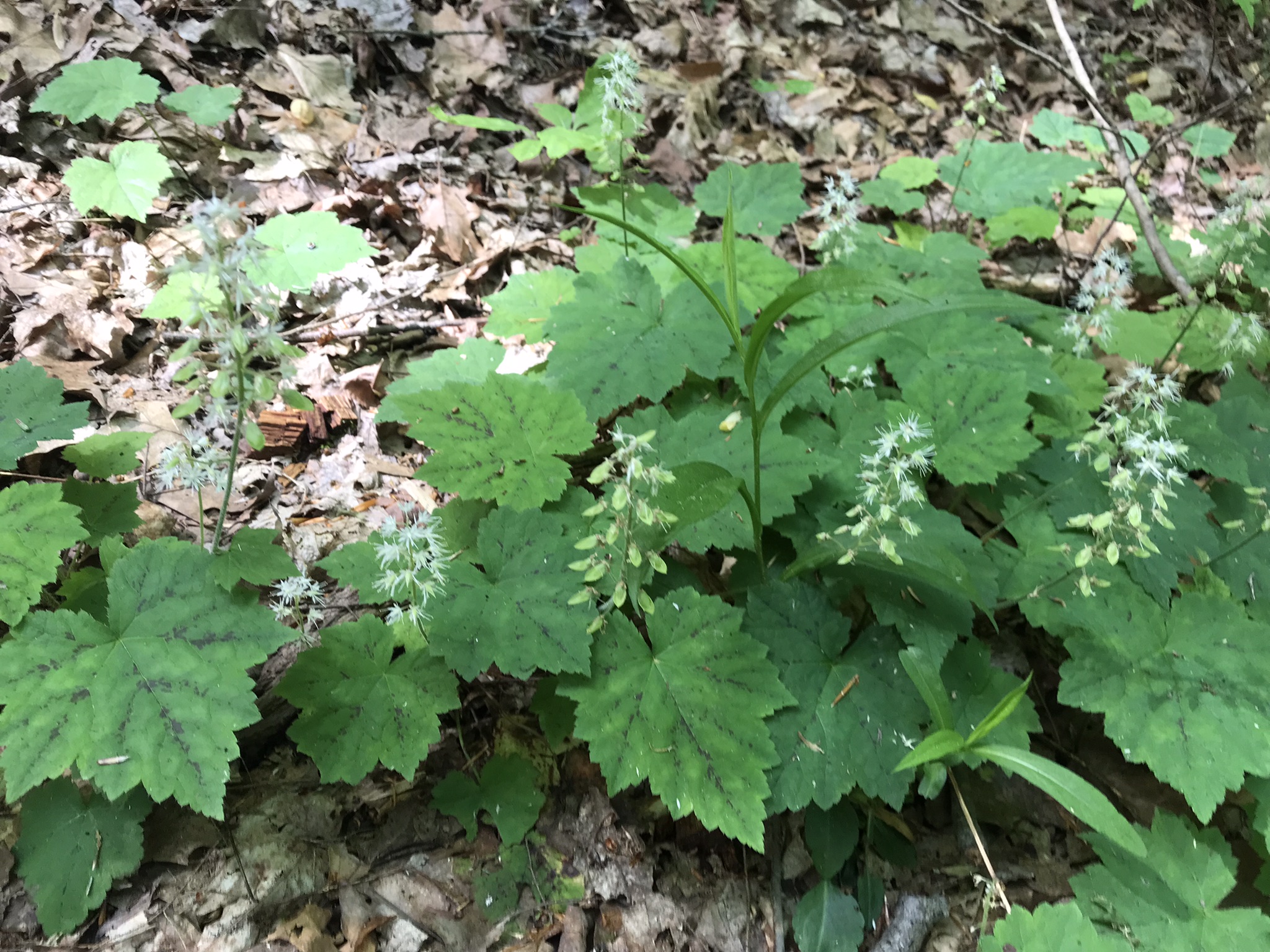
The first Foam Flower…..
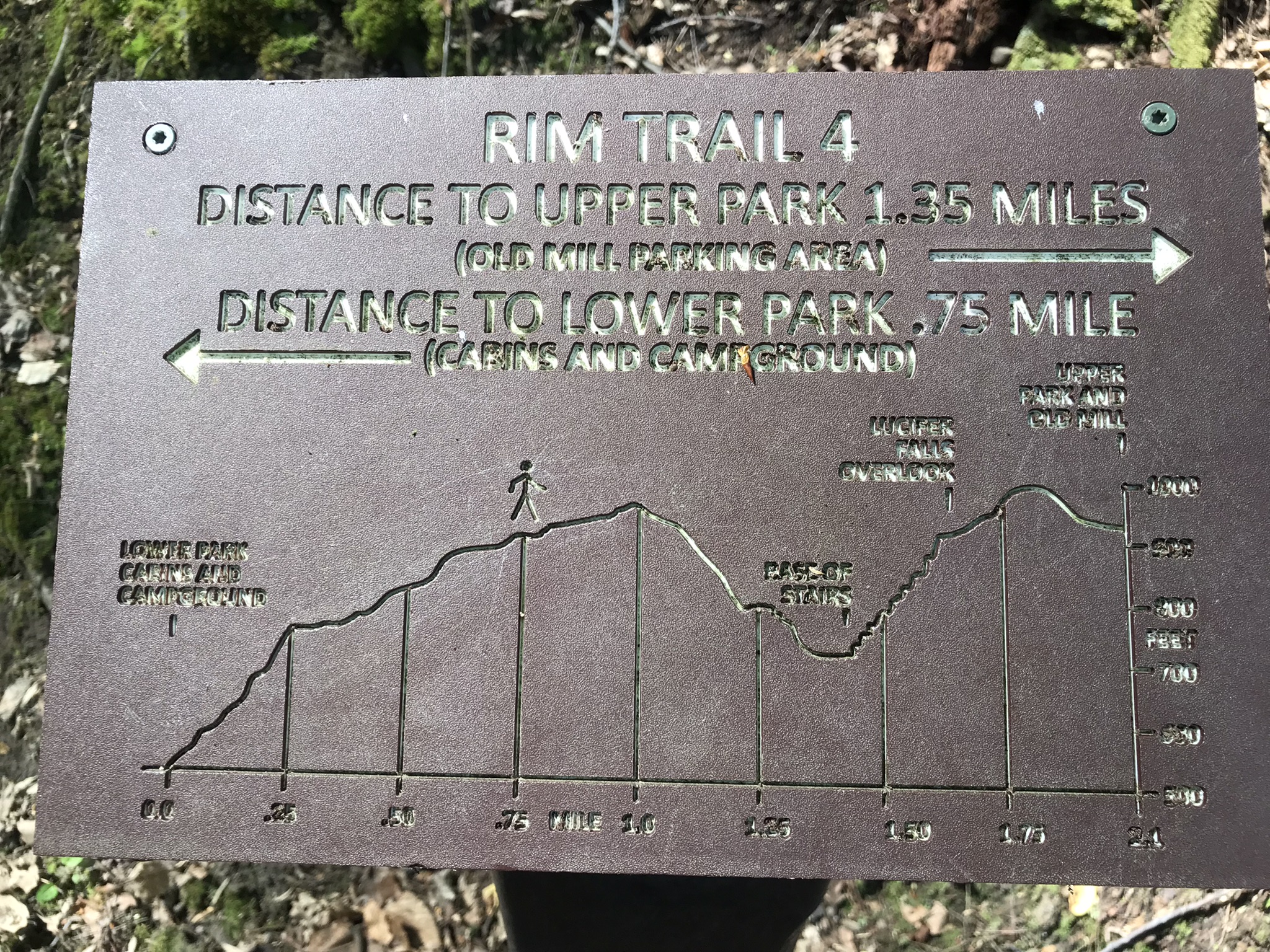
Rim Trail Panorama
This flower grew just off this section of the trail.
A few hundred feet further along, the Foam Flowers were crowded in clumps. The scientific name, Tiarella cordifolia, is from the heart shaped leaves (cordifolia). Each flower forms a crown like seed, thus “tiarella” from the French.
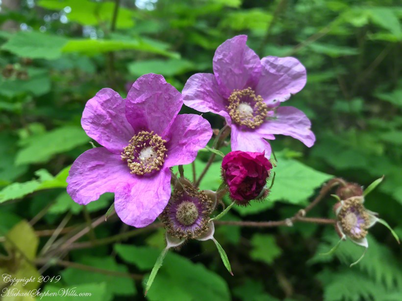
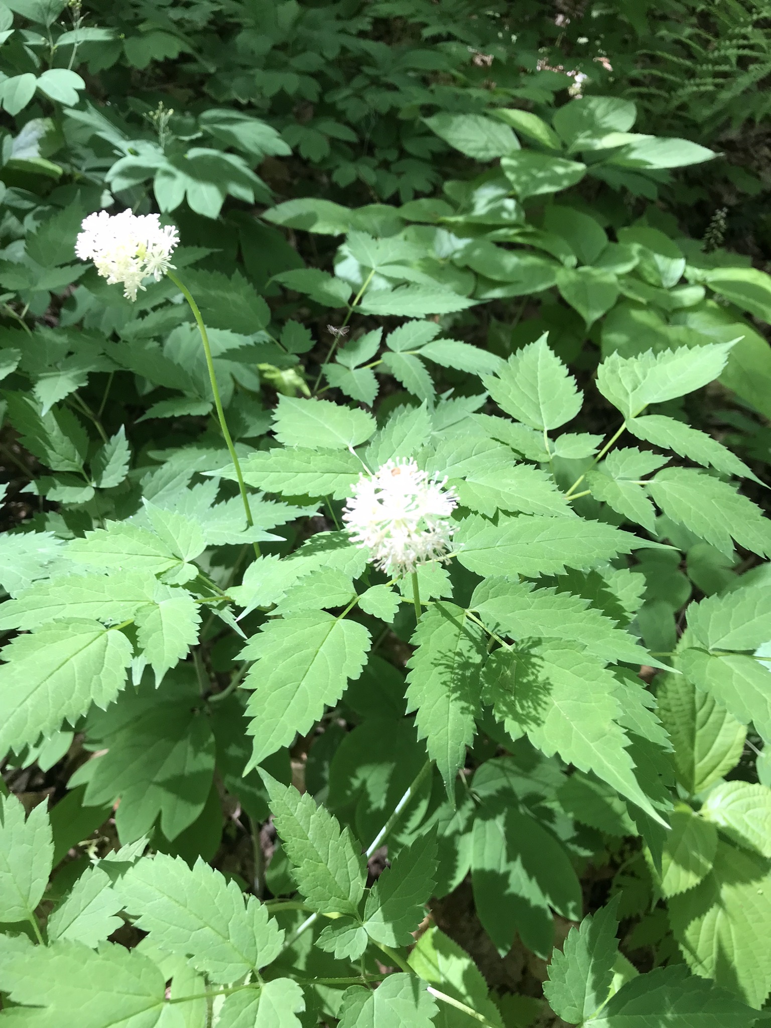
Here I approached the high point of this section of the South Rim Trail. I look forward to summer and Purple Flowering Raspberry, the featured photograph (header) of this post.
Sky islands are isolated mountains surrounded by radically different lowland environments. The term originally referred to those found near the southern borders of the U.S. states of Arizona and New Mexico with the northern borders of the Mexican States of Chihuahua and Sonora such as the Dragoon Mountains featured in this post. The isolation has significant implications for these natural habitats. The American Southwest region began warming up between ∼20,000–10,000 years before the present-day and atmospheric temperatures increased substantially, resulting in the formation of vast deserts that isolated the sky islands.
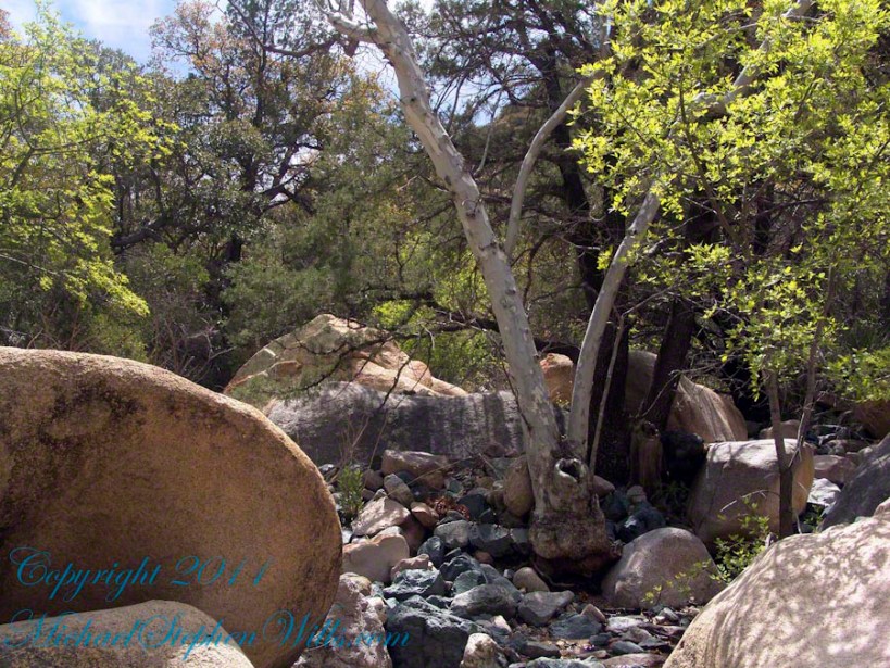
This sycamore tree survives life in this ephemeral stream of an Arizona “Sky Island” by allowing entire trunks to die off during extended dry spells. The tree is an Arizona Sycamore (Platanus wrightii).
Informative sign at campsite
Reference: wikipedia article “Sky Islands.”
Copyright 2022 Michael Stephen Wills All Rights Reserved
Capturing photographs and videos on the fly using an Iphone, we visited Fillmore Glen State Park, Moravia, New York with our granddaughter, Nia. This is the seventh post of this series. Click me for another springtime post.
Click any photograph for a larger view.
Growing up on Long Island provided limited exposure to the great variety of animal and plant life on planet earth. I remember Canesteo, a town just off the western edge of the Finger Lakes in Steuben County, after moving there in the 1980’s, had a marvelous abundance of different plants in the lawn. It was a welcoming feeling to notice this before the term “monoculture” was circulated.
These days the exuberant variety of ferns and mosses in the Finger Lakes are still alien in the sense noticing the small differences between species is still beyond me; or, rather, I have yet to know well all the later arrivals on the scene, the flowering plants and these command my attention.
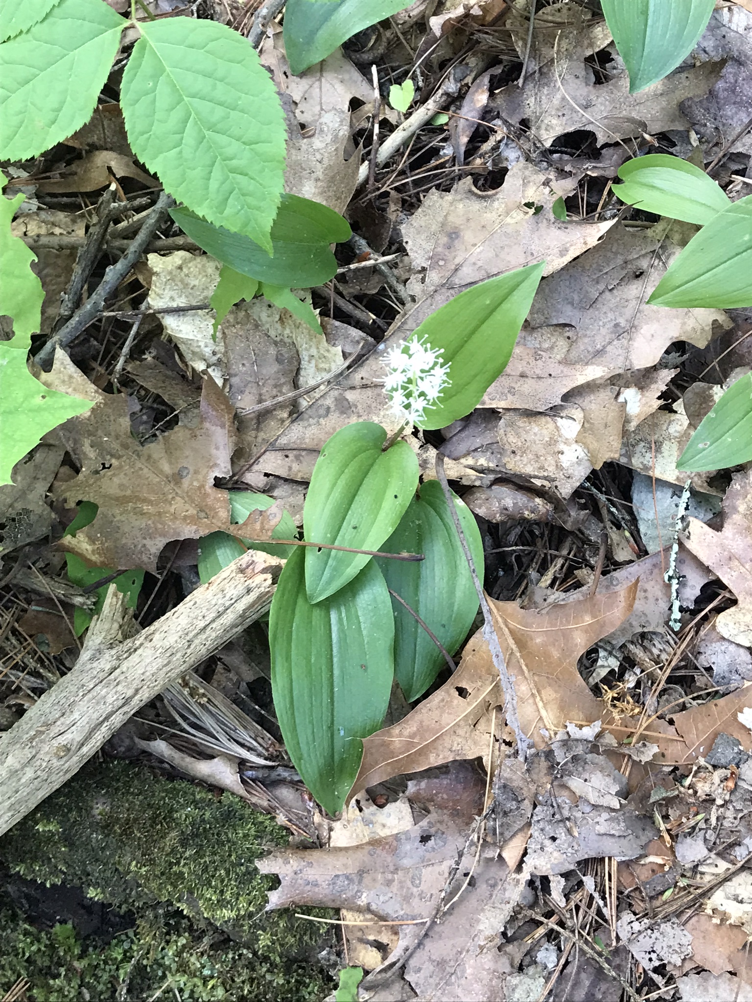
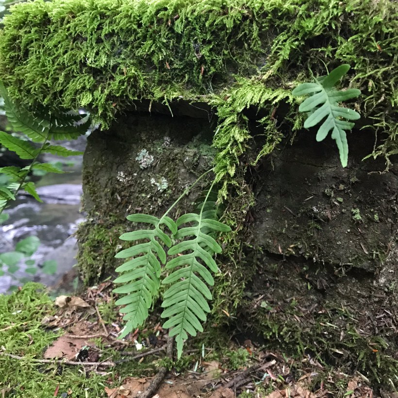
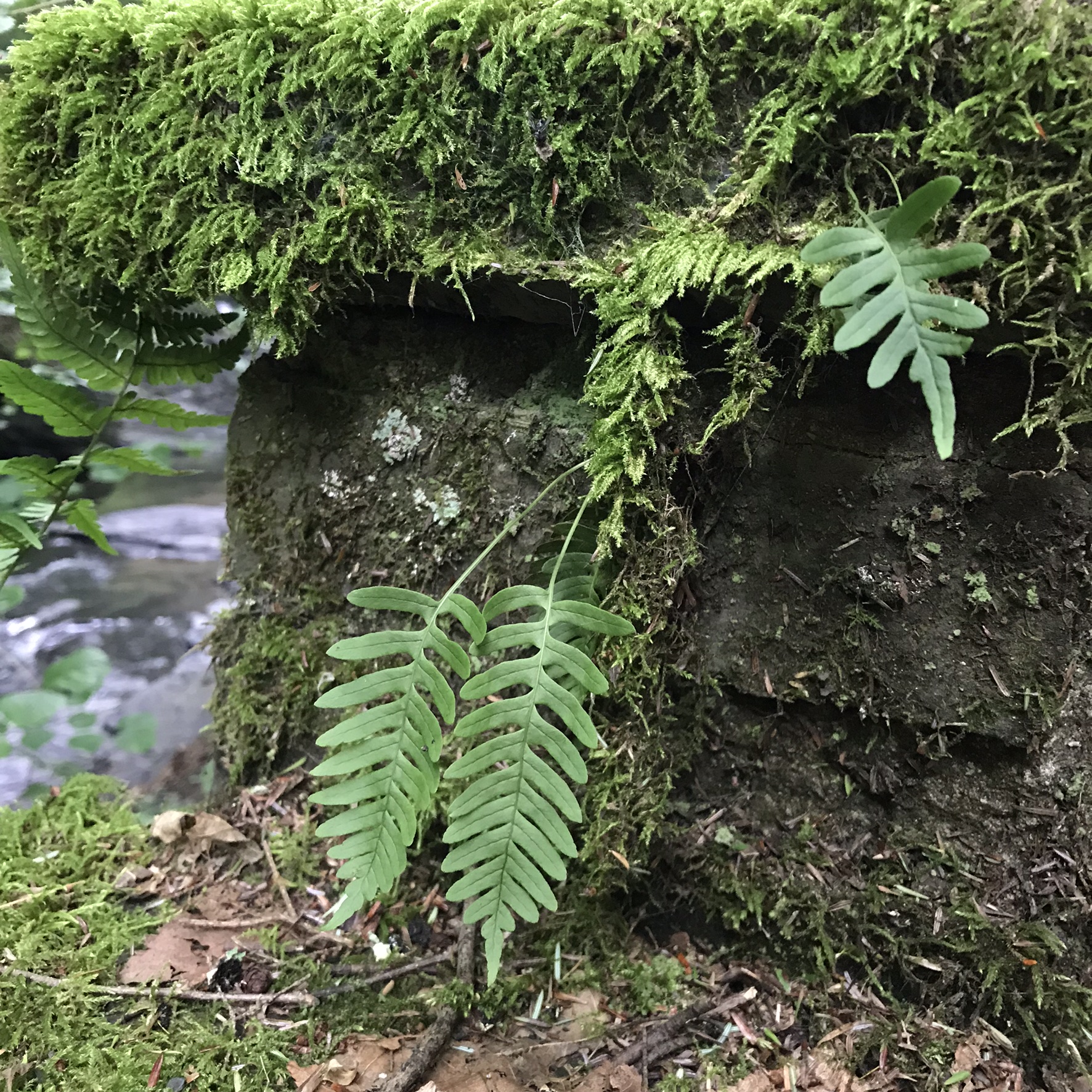
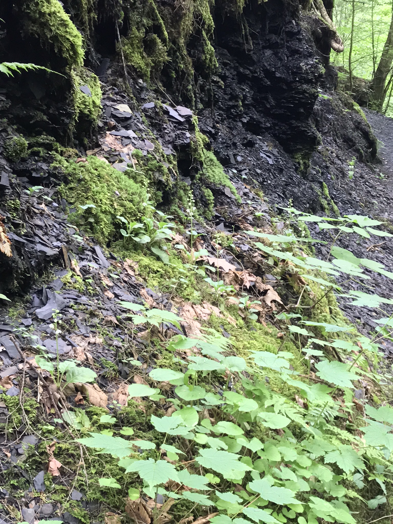
Close by the Sorrell of my post “Glen Shadows” is this inconspicuous flower, common name Shinleaf, seen here growing in spite of the the wet rip rap of shale at the base of the glen wall on the footpath. Much of the characterization of this plant is from the inconspicuous basal leaves from which the raceme of flowers springs.
Evergreen Pears
Moss and Shinleaf are associated in these groupings, I could conclude the moss provided a place for the tiny seeds of the plant to lodge and take root. The plant is a perennial and stays green throughout the winter, leading to another conclusion: there is a substance in the leaf cells that resists freezing. The latin meaning of the (scientific name) genus Pyrola means “Pear”, the shape of the leaf.
Look closely at the flowers to see the small flowers, the style extending beyond the petals like a bell clapper.
The common name, Shinleaf, is from England where the plant is credited with providing relief for minor injury. I am unclear on the grouping of this plant as a wintergreen. Shinleaf might be included as a wintergreen, and possibly attributed with healing properties, because “wintergreen” in the past was a synonym for “evergreen.”
There are species of wintergreens, in a different family, with leaves containing methyl salicilate that metabolizes (changed in our bodies) to a substance related to aspirin and more potent. I am reconsidering my identification of “cranberry” in the previous post “Red” to be a type of wintergreen high in methyl salicilate and growth close to the Shinleaf.
This abundance of life variety must be cherished and preserved, it can be a source of survival for the human species.
Copyright 2022 Michael Stephen Wills All Rights Reserved
Pam and I were drawn outside the day after Valentine’s a bit of sun, an unreliable warm breeze, a promise of exercise. Our expectations were disappointed for all but the last at the foot of the Taughannock Falls gorge trail.
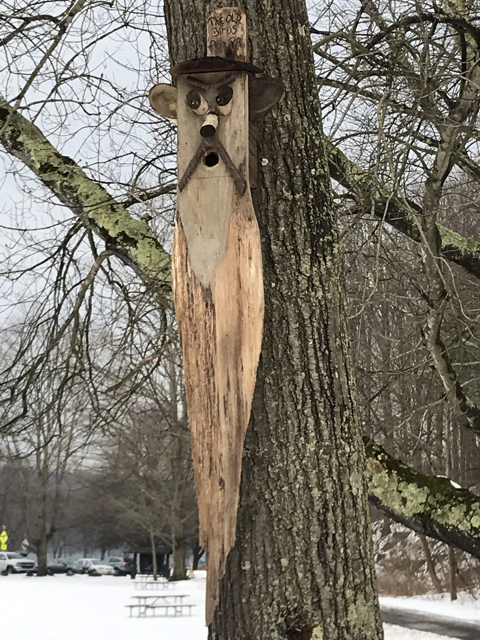
We had a reminder mid-February marks the start of avian mating behavior with this addition to the view from Taughannock Creek, the first large waterfall. For the cold, drizzly excursion I chose the IPhone, in a waterproof case, for the images. The fanicful birdhouse inscription reads “The Old Birds from Pa.”
Click the photograph for my “Finger Lakes Memories” Online gallery.
The winding gorge takes a general east, southeasterly direction. Where the sun cannot reach the snow was reduced to a treacherous slushy ice mix more nasty than dangerous.
View from the Overlook on the way to the trail. This is the endpoint of our hike, viewed from the gorge rim.
Of all the area hiking experiences, Taughannock Gorge Trail is the only one available year round. The gorge is wide with enough room for the footpath to avoid the cliff edge. Today, there were places were ice formations were throwing large ice chunks down the slope. The park ranges place tree trunks along the cliff base, with warning signs to stay away. Still, there are visitors who stray too close with fatal outcomes reported by local news.
Pam was fascinated by the appearance of snow and ice accumulated on the talus, here seen from the Taughannock Falls viewing bridge.
Click photograph for my “Finger Lakes Memories” online gallery. Photo by Pam.
You can just pick out the viewing bridge in the Falls Overlook video.
Click photograph for my “Finger Lakes Memories” Online Gallery. Photo by Pam.
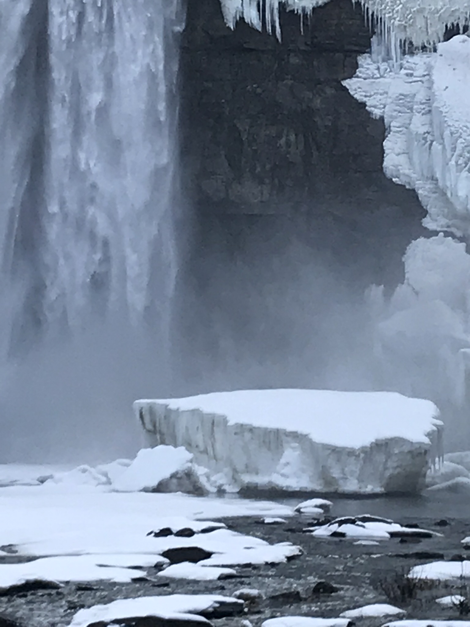
Taughannock Falls bound by ice is a most dramatic sight. I need to post photographs from a 2005 visit during an especially frigid February. Here, the falls have thrown off the ice, leaving this house-size chunk.
Click photograph for my “Finger Lakes Memories” Online Gallery
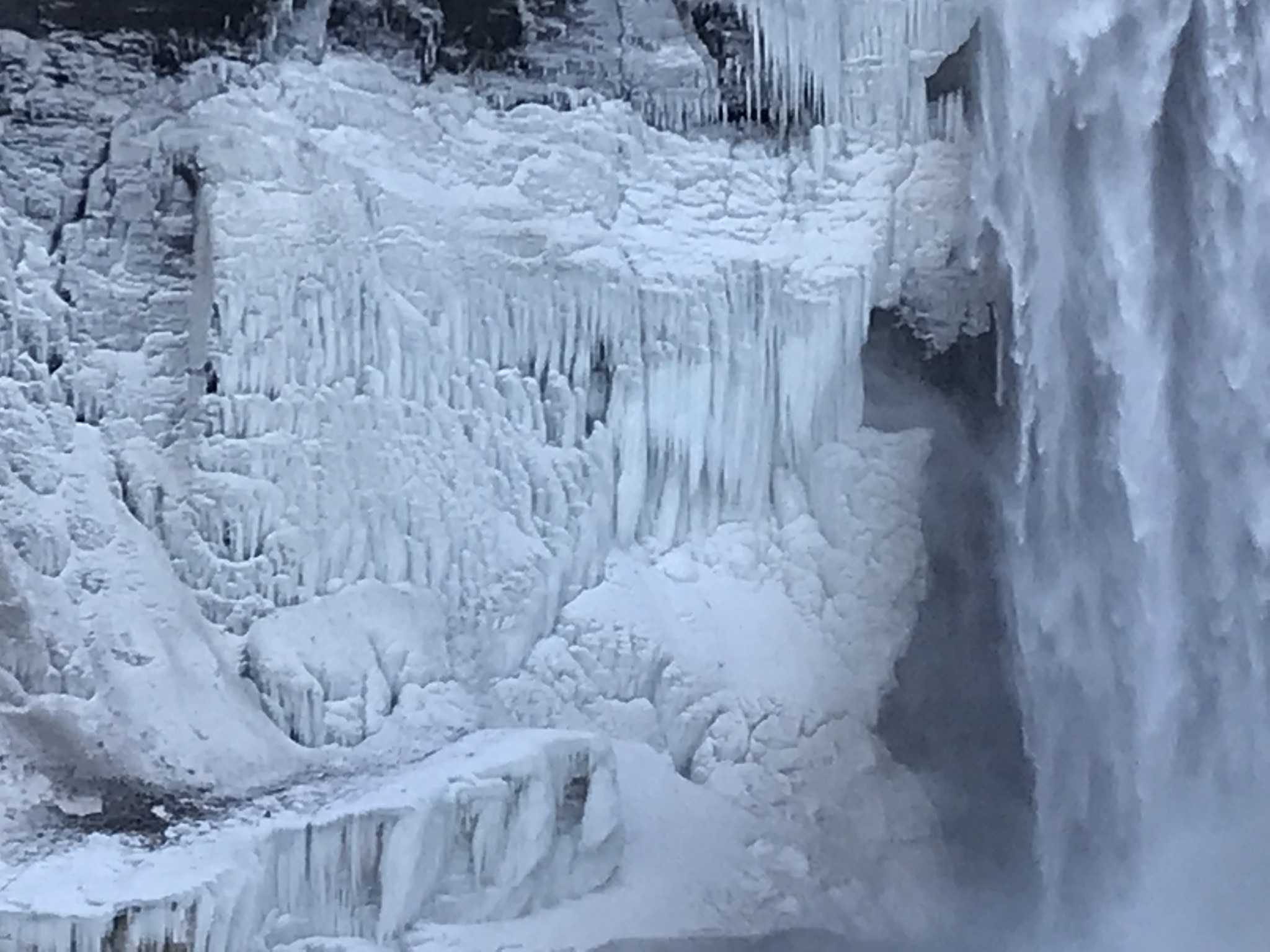
The surrounding gorge walls are continually frost coated by the mist.
Click the photograph for my “Finger Lakes Memories” Online Gallery
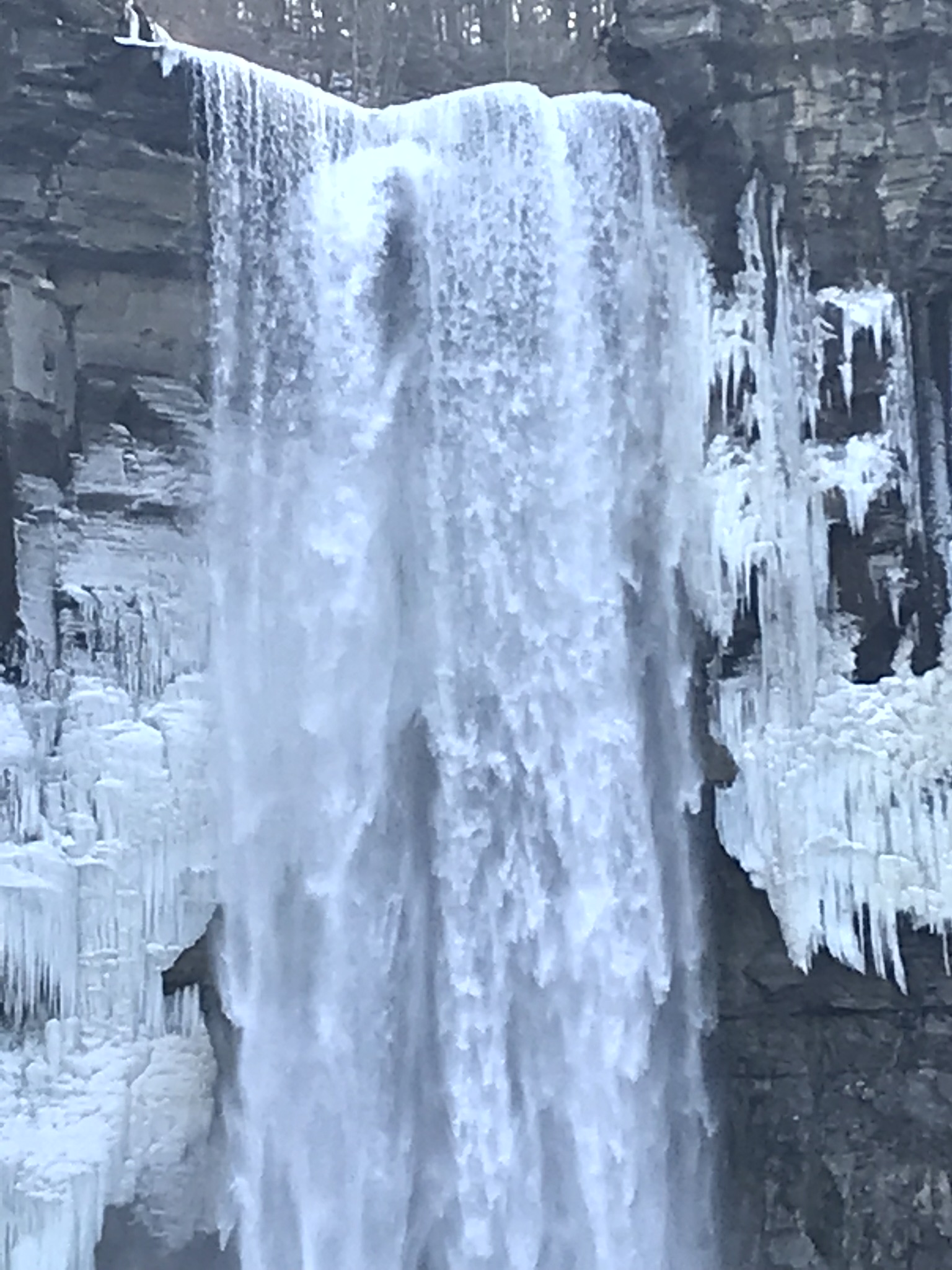
210 foot Taughannock Falls from the viewing bridge.
In more clement seasons the Gorge Trail ends much closer to the falls. Today, it was closed as, during winter and especially thaws, blocks of the sandstone cap break away to fall with great force across that part of the trail. This viewing area is visible in the Falls Overlook video.
Copyright 2019 All Rights Reserved Michael Stephen Wills
Yesterday afternoon was bright, sunny enough for me to break out of the winter exercise routine for a walk around Taughannock Falls, a New York State Park 7.5 miles from the front door through farmland and small villages with views of Cayuga Lake.
The route around the gorge, following the North and South Rim trails with a side trip to the edge of Cayuga Lake is 3 miles with a modest elevation change of about 500 feet.
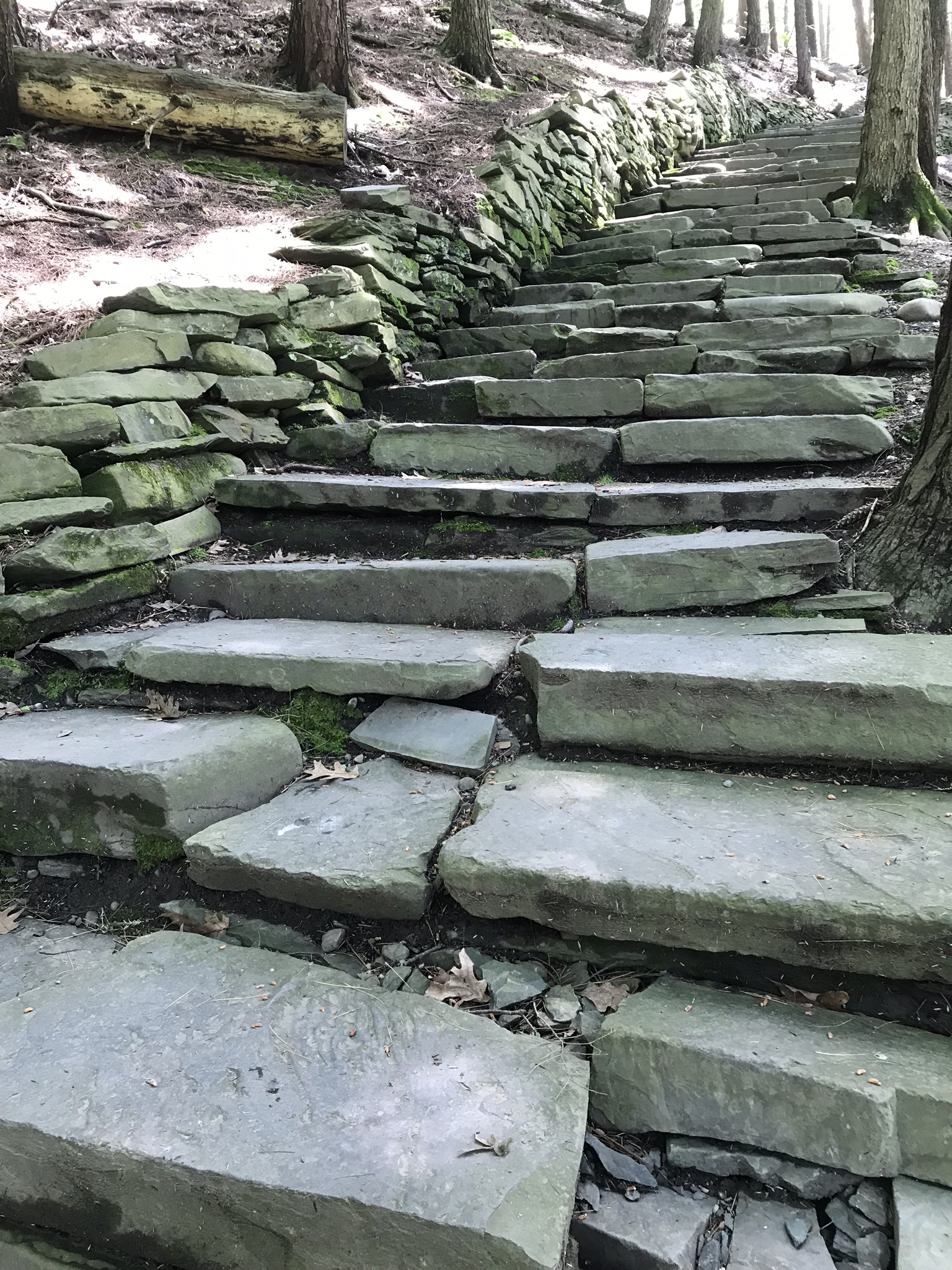
My route began at the top with a cell phone, from the Falls Overlook, there is a gradual slope, until the end where flights of steep stone steps end at the gorge floor. The steps were free of ice and snow.
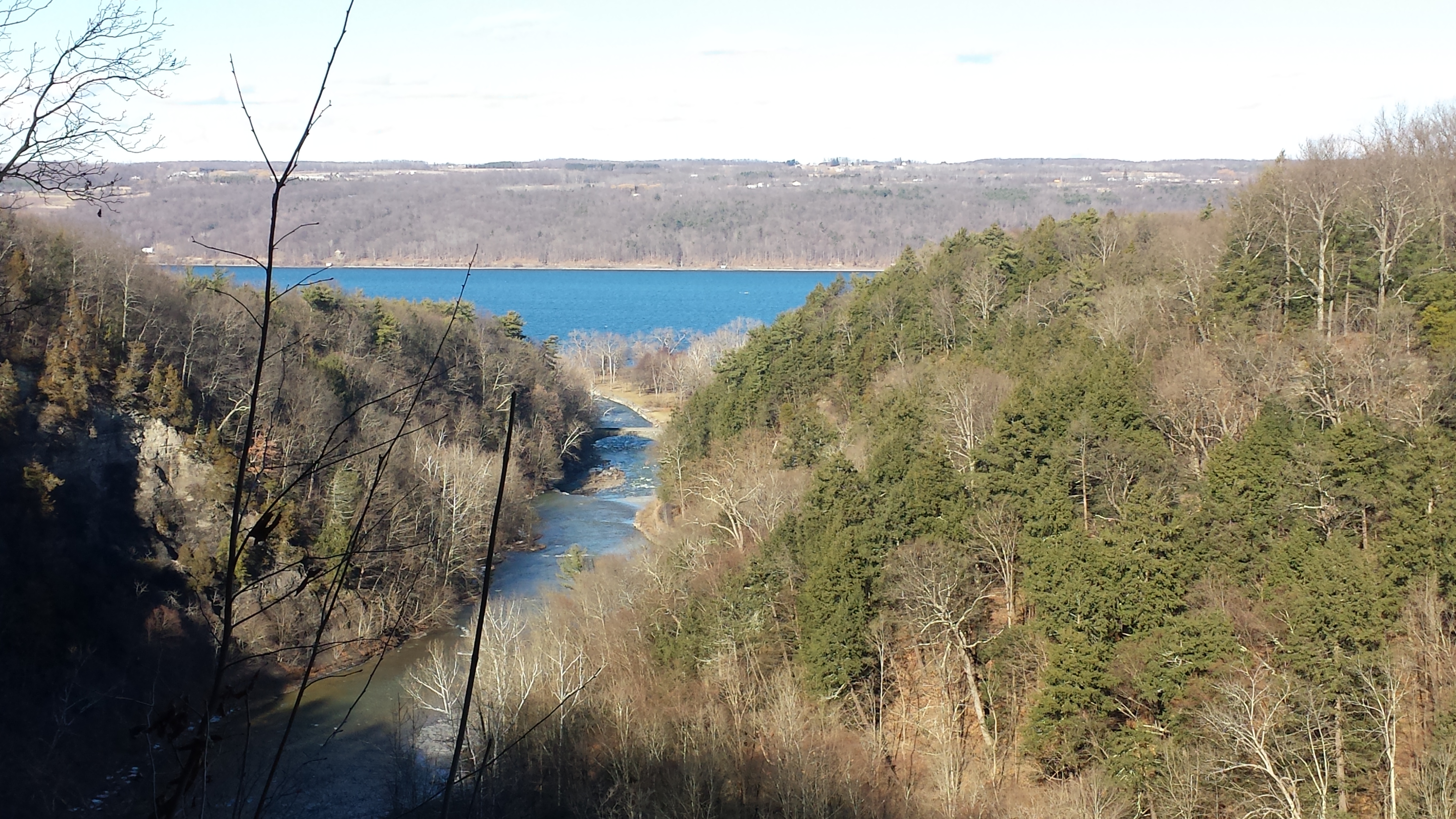
These photographs are from the cell phone. Here is the lake and a portion of the gorge. Yes, the lake is a dark blue on sunny days and is ice free this year. Another trail follows the gorge floor to below the falls, I opted out of the additional 1.5 miles today in the interest of finishing well before sunset.
Click any photograph to visit my Fine Art version of Taughannock Falls.
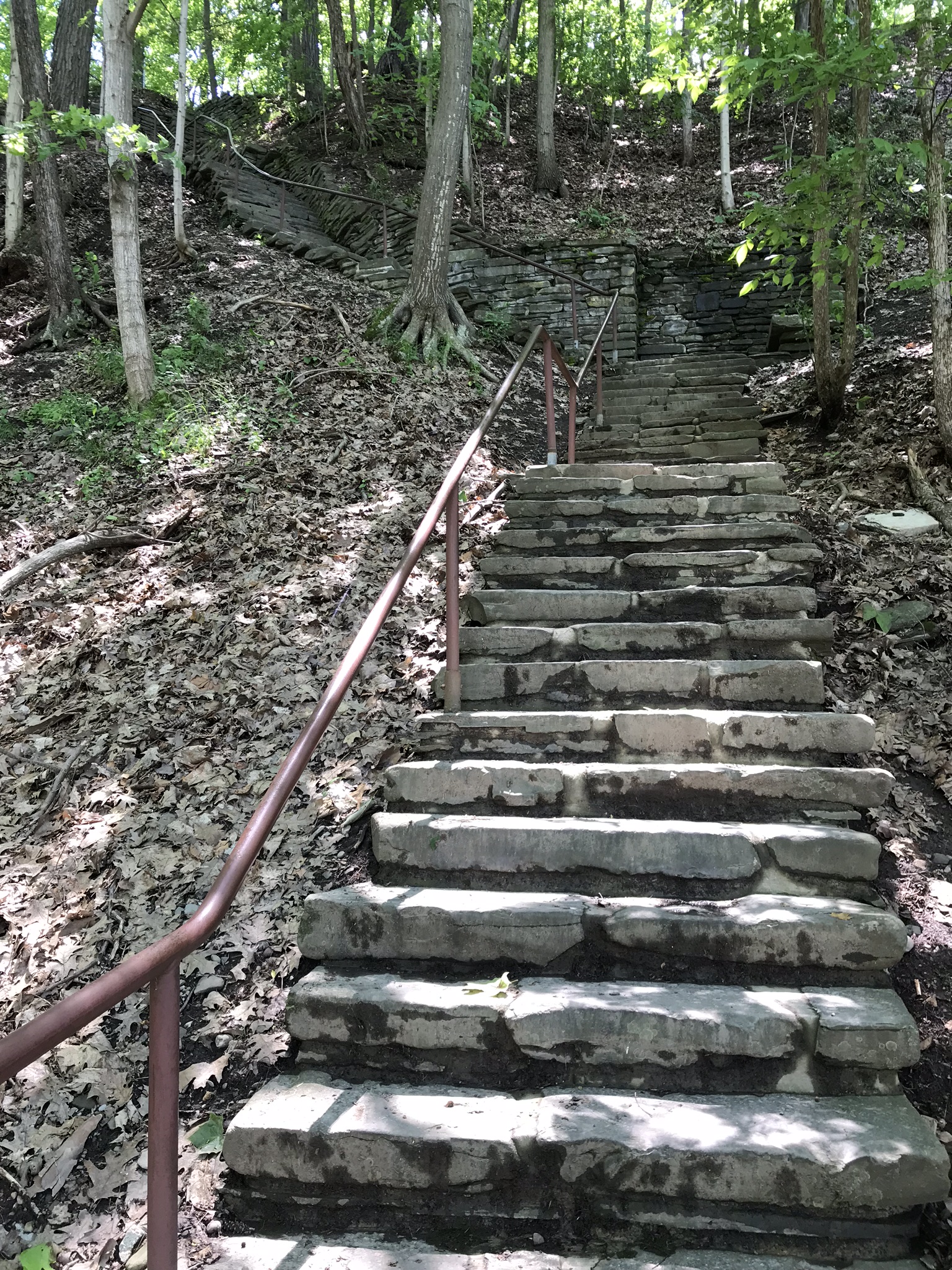
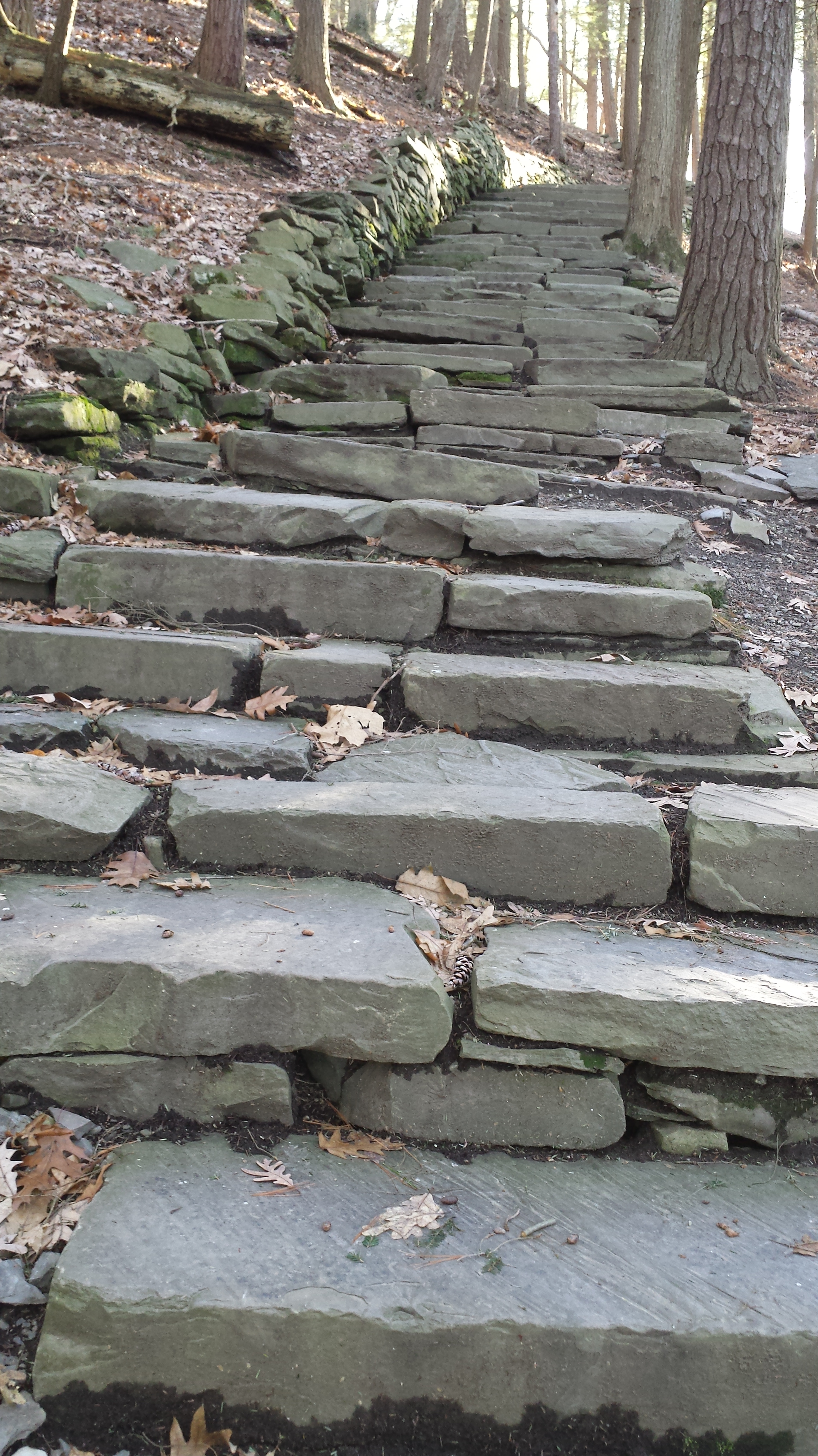
I have a few versions of these South Rim Trail stone steps taken at this perfect time of day, the low sun through the trees. Built in the 1930s by Roosevelt’s Civilian Conservation Corp, the steps and the entire trail are a work of art.
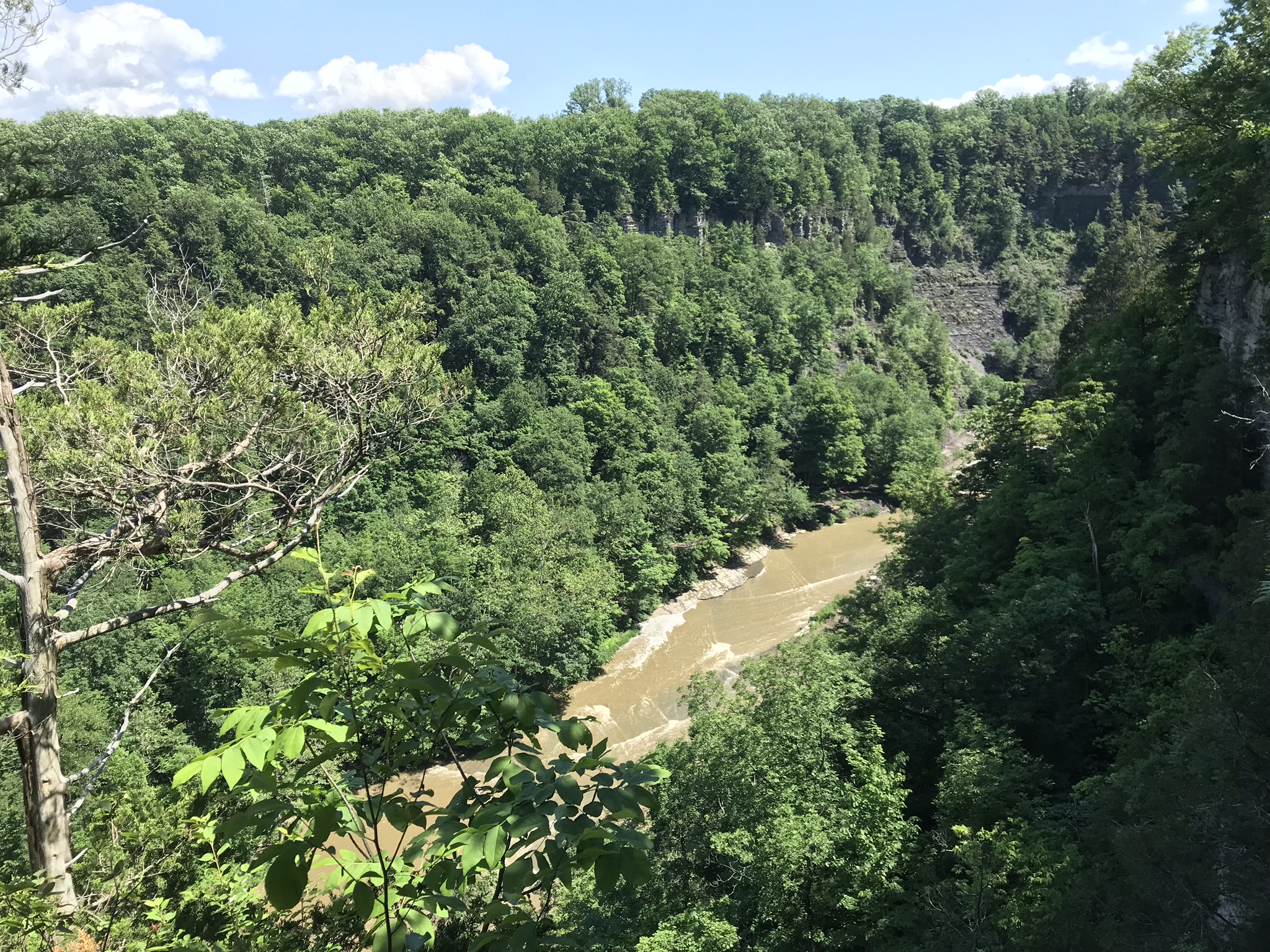
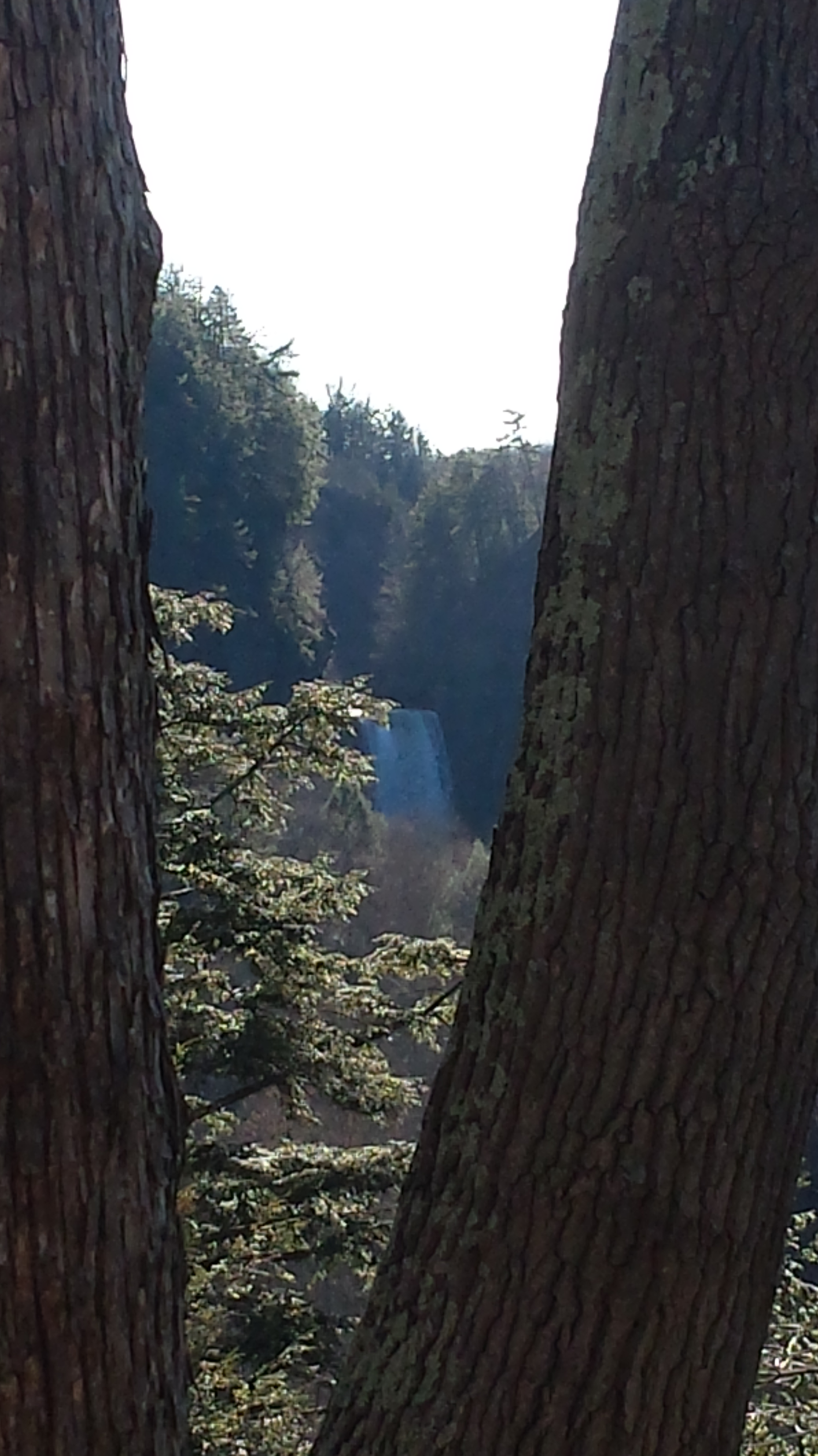
The far view of Taughannock Falls always fascinated me. I’ve never done it justice. There are several view points from the South Rim, overlooking the gorge were it bends to the south with only the upper third of the falls visible. The flow today was photogenic. I used the cell phone zoom to catch the view between the trunks of two trees.
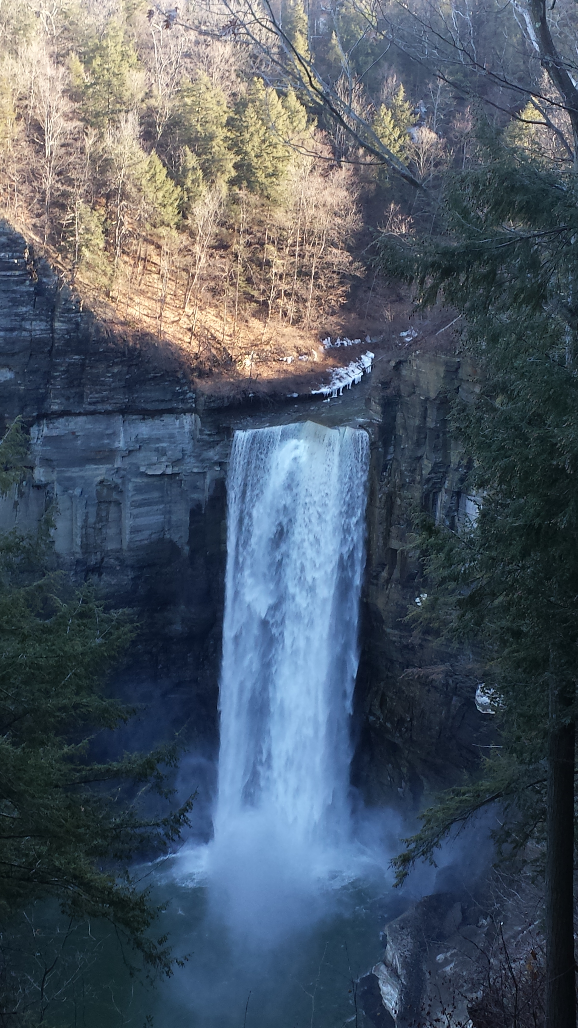
The top of the south rim was the only ice. It is there through April some years. Here is the closest, full view of Taughannock Falls from the North Rim. It is the same view you will find in my Fine Art version of the falls.
And a cell phone video of the falls for the full effect.
Enjoy!!
Copyright 2022 Michael Stephen Wills All Rights Reserved
The Whitehouse Ruin of Canyon de Chelly is just visible at left in the far cliff, in the notch of the near cliff. The ruin trail is visible on the canyon floor. Notice the road following the canyon and the plantings with house on the right.
The landscapes I capture, like the face of a missing friend, fade gently from memory. My piece “Moon Fin Canyon de Chelly” became a mysterious vision. I remembered the context, the canyon topology was lost until I constructed the panorama, above, from three shots taken one evening, July 2008, from a cliff near the White House Overlook. Five years after my visit with Sean Wills, Pam and I returned to Canyon de Chelly to walk the same path.
At that time, a 50 mm lens was my widest angle, so I would take multiple images in sequence and use Photoshop later to construct a panorama. This past Sunday afternoon I spent stitching together my work from 2008. In doing so I see “my fin”, in the center, bordered by the canyon road, is attached to the White House Ruin cliff via a thin ridge.
During that session a photogenic thunderhead, lit by the evening, hovered behind the fin as the gibbous moon did that long ago evening.