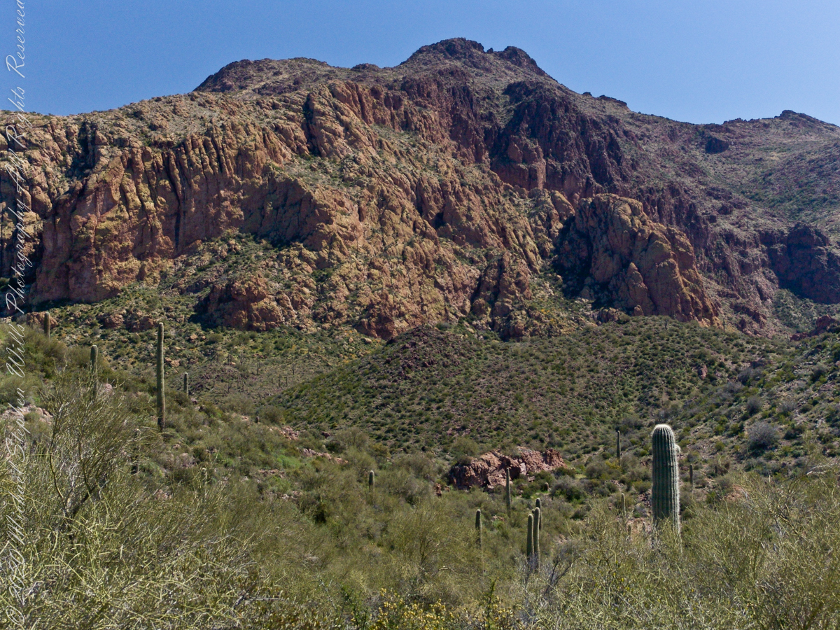
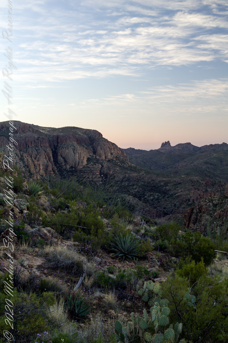
As we descended Upper Black Top Mesa Pass into Bluff Spring Mountain canyon we found, foreground, Palo Verde and brittle bush, and, midground, Saguaro. The presence of Palo Verde reveals water flows through this area intermittently though not enough to sustain a large tree. Palo Verde is in the pea family (Fabaceae), as evidenced by production of seeds in pods.
Calling it “Buff Mountain” some say the mountain is named for these buff-colored cliffs. Others, calling it “Bluff Spring Mountain” name it for the cliffs and the spring within a canyon on top.
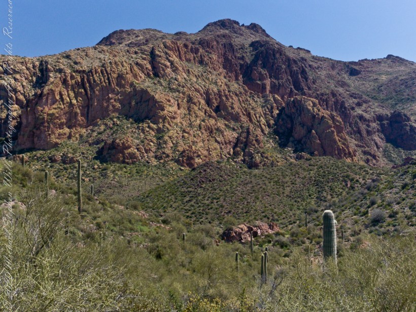
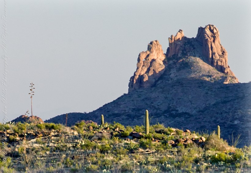
Bluff Spring Mountain from the slopes of Black Top Mesa
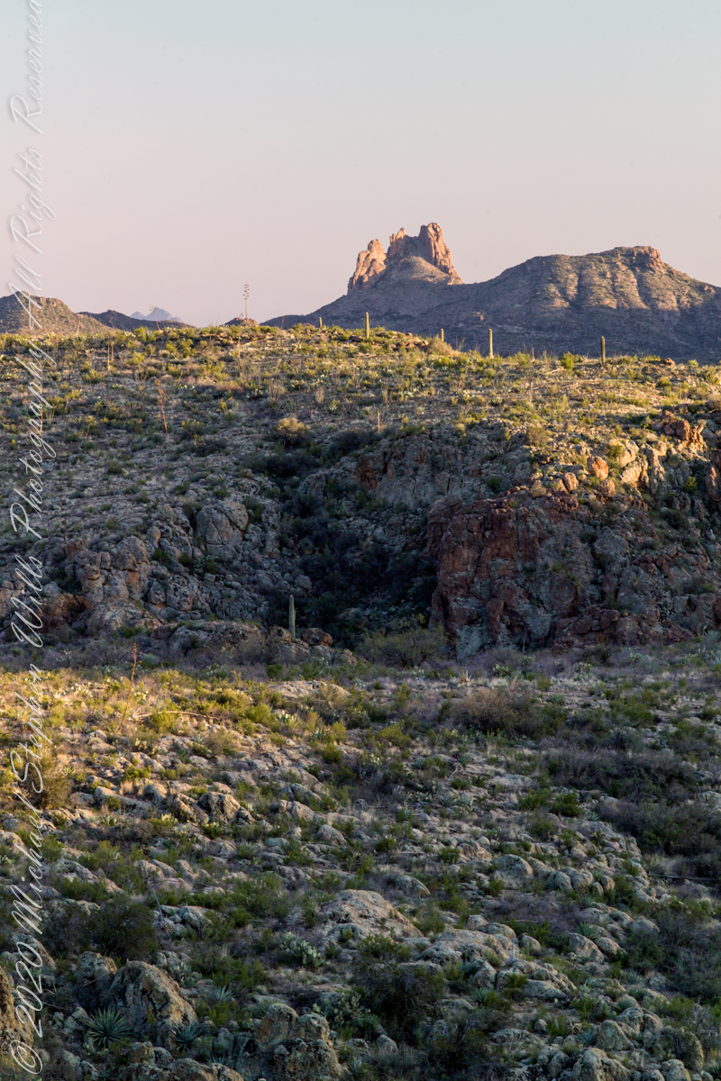
Closer to the junction with Terrapin Trail this Bluff Spring Mountain ridge rose above us. A fine specimen of mature Saguaro cactus is in midground.
This the fifth and final of a series of landscape photographs taken from this position.
Click photograph for a larger view. To do this from WordPress Reader, you need to first click the title of this post to open a new page.
Slievenaglogh View with road, east
The peak is named, in the English language, Slievenaglogh. It is so strange as it’s not English, being instead a transliteration of the Irish name “Sliabh na gCloch.” This is “Rock Mountain” translated literally. Slievenaglogh is carried to the townland, a long thin swath of land being the peak and associated ridge-line.
The rocks up there are called “gabbro,” a type of magma slowly cooled under ground. Slievenaglog, Slieve Foy across the valley, and the Morne mountains all formed within volcano magma chamber(s) of the Paleocene, 66 million years ago, a time associated with extensive volcanism and the Cretaceous–Paleogene extinction event that gave rise to the current age.
Our younger cousin has been up there, optimistically we left it for a later trip.
Slievenaglogh View, northeastSlievenaglogh View, east northeastSlievenaglogh View, east northeastSlievenaglogh View, north northeastSlievenaglogh View with road, east
This the fourth of a series of landscape photographs taken from this position.
Click photograph for a larger view. To do this from WordPress Reader, you need to first click the title of this post to open a new page.
Slievenaglogh View, north northeast
The distant ridge, Slieve Foy, is the site of a mythic battle from the epic “The Cattle Raid of Cooley” (Irish: Táin Bó Cúailnge).
Pam and I did a circuit of the island, returning to the home of my Mom’s first cousin. Our last full day on Ireland a cousin took us on the Tain Trail, over Maeve’s Gap of Slieve Foy and into Carlingford town.
Our route is partly visible to the right of the ridge, hidden in low clouds.
These are the second and third of a series of landscape photographs taken from this position. See the previous post for the first.
Click photograph for a larger view. To do this from WordPress Reader, you need to first click the title of this post to open a new page.
Slievenaglogh View, east northeastSlievenaglogh View, east northeast
I visited here early morning of the Monday Pam and I embarked on a trip around the island of Ireland.
Arrived the previous Saturday when, after some sites between Dublin airport and the Cooley Peninsula, we met my Mom’s first cousin who had invited us for a visit. We had a grand time meeting them.
The ruin in this view is on the slopes of the peak. Some of these ruins are former homes with the replacement nearby. This appears to be an abandoned farm.
Slievenaglogh is the name of a peak on the Cooley Peninsula of County Louth, Ireland near to the birthplace of my Mom, Proleek, a few townlands to the west.
Click photograph for a larger view. To do this from WordPress Reader, you need to first click the title of this post to open a new page.
Slievenaglogh View, northeast
On the northeast slope of Slievenaglogh peak (Irish: Sliabh na gCloch) on the road from Mullaghattin Townland to Riverstown.
Here we look northeast from the Slievenaglogh Townland, the valley between Slieve Foy and Slievenaglogh peaks.
The view includes Little River, Ballycoly Townland and Castletown River.
Adjacent is a sheep pasture with a farm ruin behind the yellow flowered gorse (whin bush, scientific name Ulex).
Slieve Foy is the far ridge lost in clouds. Early morning, late May 2014.
Our second day began in East Boulder Canyon, in the following map it is at the foot of the “Z” of the orange line, the Dutchman Trail, lower left center. The shape is the signature of a switchback needed to negotiate a steep slope up to Upper Black Top Mesa pass. This day will see us traverse Dutchman Trail to the intersection with Peter’s Trail (yellow), another steep climb up Peter’s Mesa.
A topographic map including Yellow Peak with Dutchman Trail in orange. Upper Black Top Mesa Pass lower center.
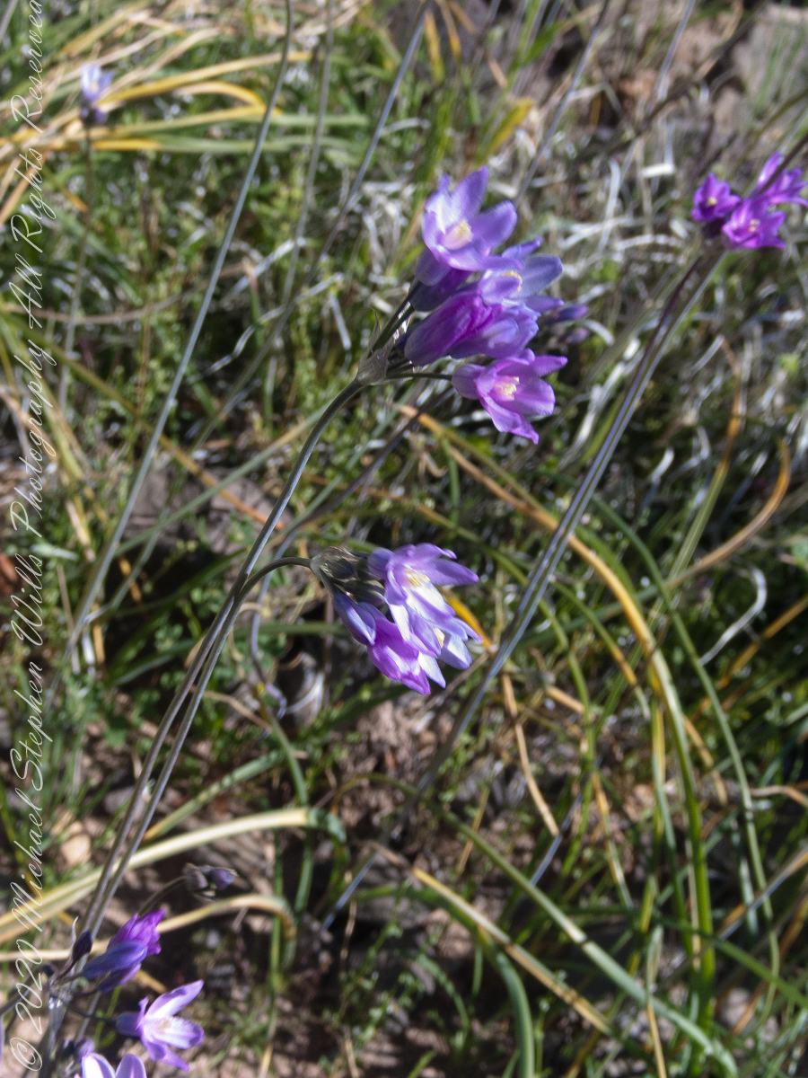
Today’s post features photographs of flourishing Sonoran Desert plants and landscape on the slopes of Black Top Mesa. Dipterostemon capitatus known by the common names blue dicks, purplehead and brodiaea is native to the Western United States (particularly Arizona, California, Oregon, Utah, New Mexico and northwest Mexico.
Dutchman Trail above East Boulder Canyon, Palamino Mountain left, Yellow Peak in distance. We are on the side of Black Top Mesa.
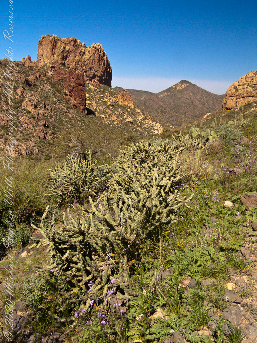
Here I used the “zoom” for a better view of distant Yellow Peak. In foreground is Brittlebush (Encelia farinosa) and Blue Dick. In the distance Saguaro Cactus. Below the cliff of Black Top Mesa, above East Boulder Canyon, is a patch of yellow, Mexican Poppy (Eschscholtzia californica).
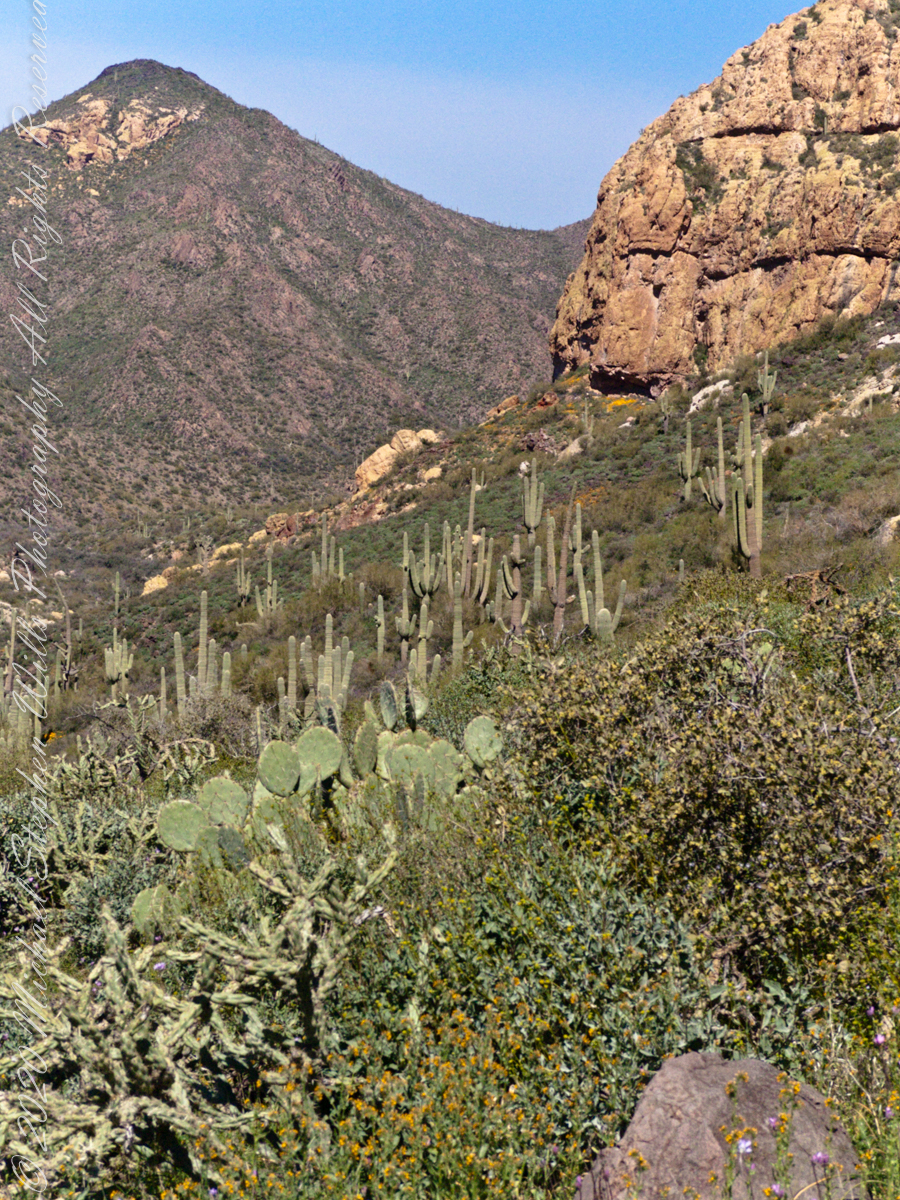
Slope of Black Top Mesa above East Boulder Canyon with the distant Yellow Peak.
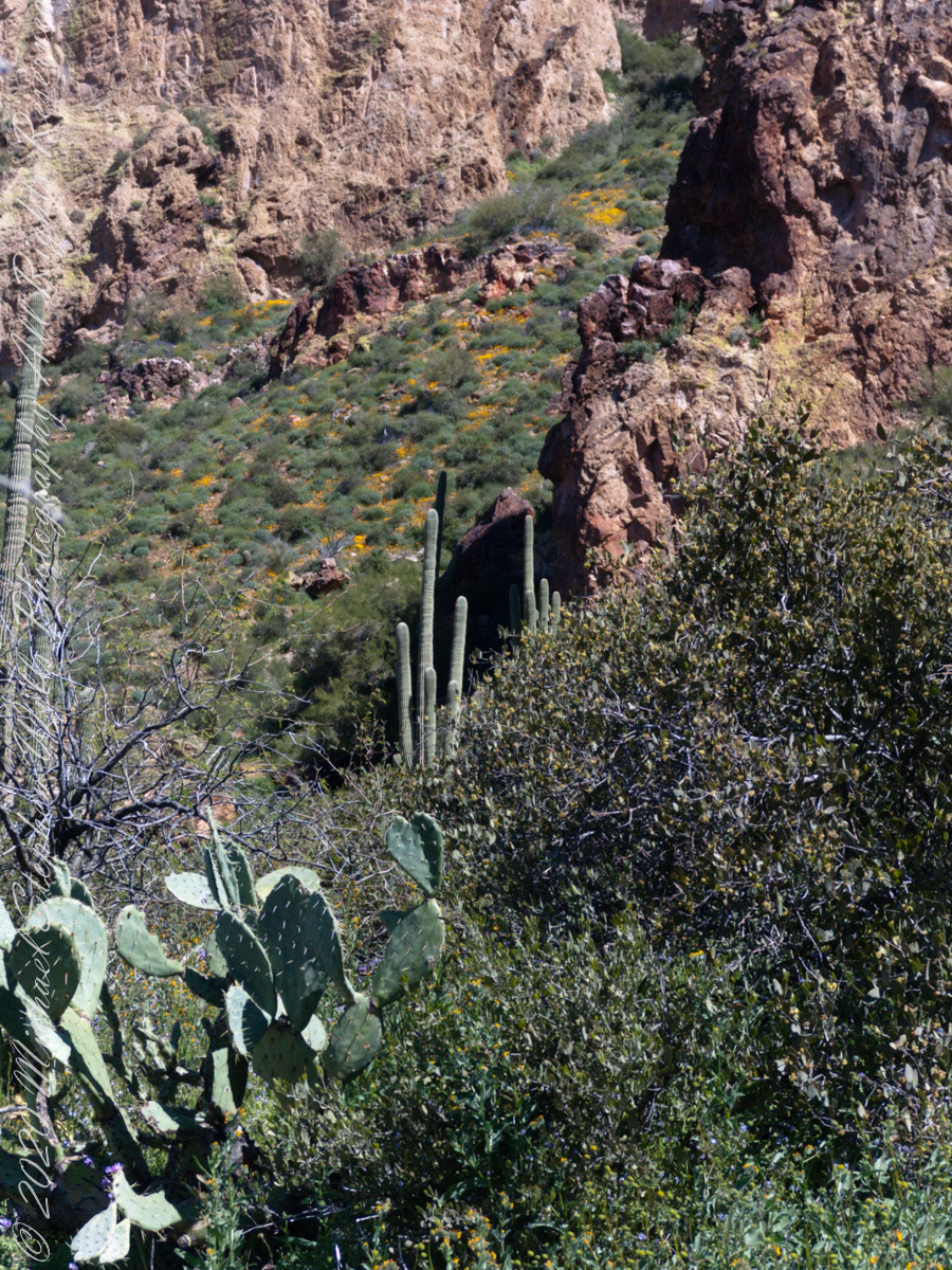
Here is camera, set to zoom, is swung toward the mesa cliffs. Prickly Pear and Brittlebush growing along the Upper Black Top Mesa Pass trail. I have not identified the shaggy shrub above the Brittlebush. In the distance Saguaro Cactus (Carnegiea gigantean) flourishes. Below the cliff are patches of “gold dust”, the Mexican Poppy.
PCliffs of Black Top Mesa
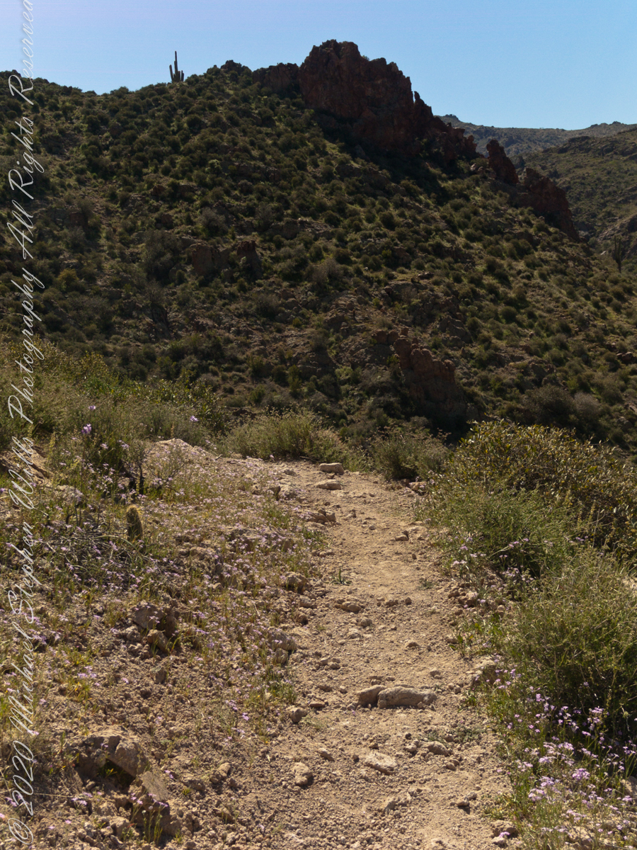
Heading southeast climbing out of East Boulder Canyon with a very young Saguaro Cactus (Carnegiea gigantean) just off trail on left, a large specimen silhouetted on ridge ahead. Windmill Pink (AKA Common Catchfly) (Silene gallica) foreground, lower left. Brittlebush (Encelia farinosa) on both sides.
Upper Black Top Mesa Pass
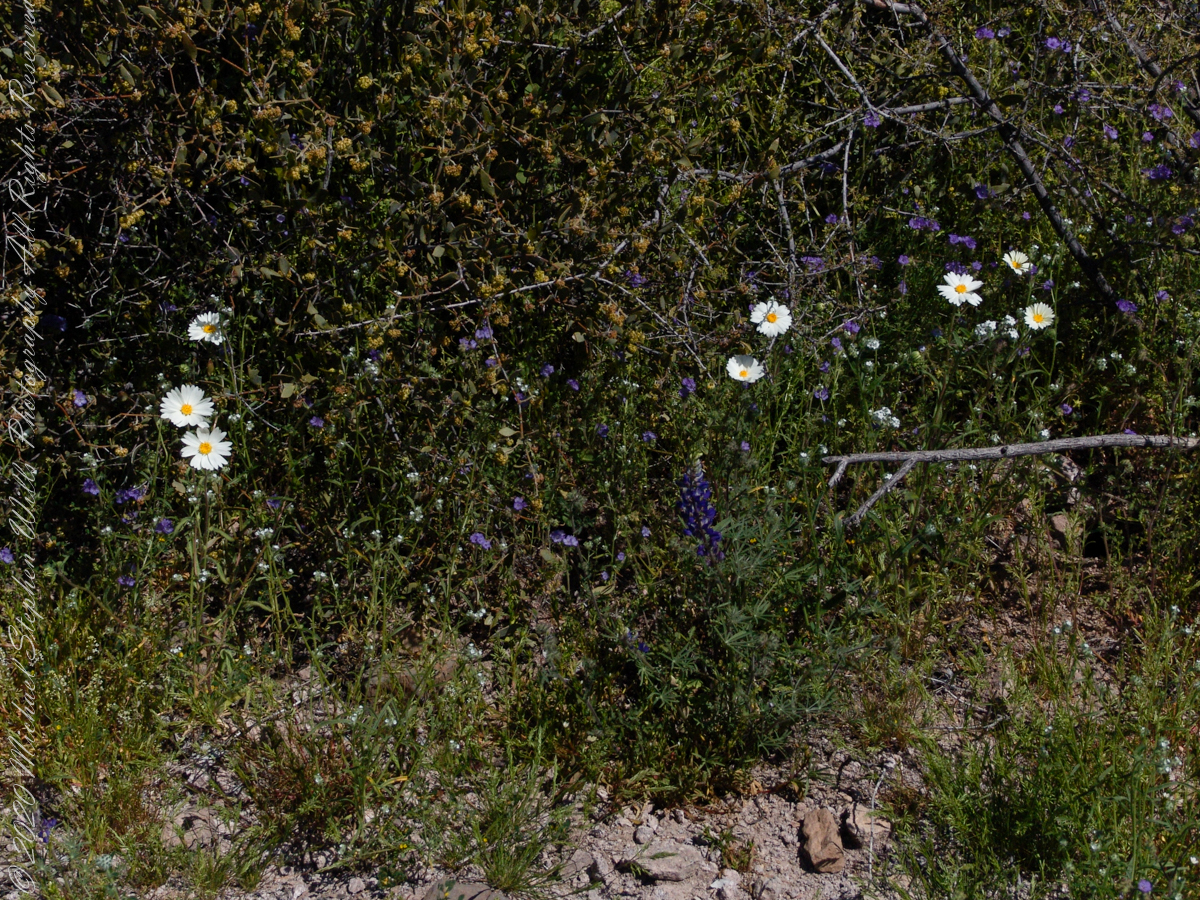
This post ends as it began, with wildflowers growing next to the trailon a March morning. Blue Dicks (AKA Purplehead) (Dipterostemon capitatus), Tidy Tips (Layia) — daisy like flower, Brittlebush flowers are yellow when not dried. The larger small white flowers are Desert Phlox (Phlox austromontana) — I have not identified the tiny white flowers sprinkled around.
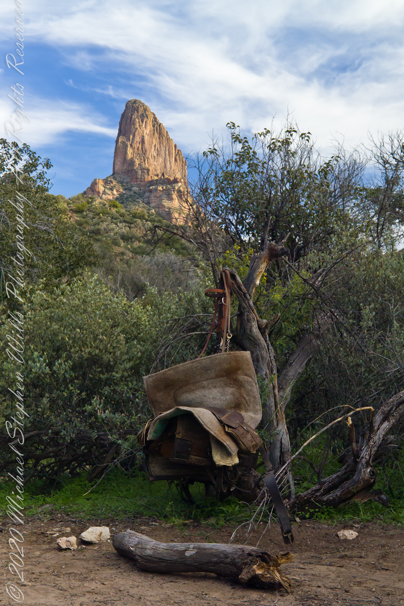
The end of a day trekking to East Boulder Canyon at the foot of Weaver’s Needle, Superstition Wilderness. I had a light pack with the camera equipment and supplies packed in on horseback.
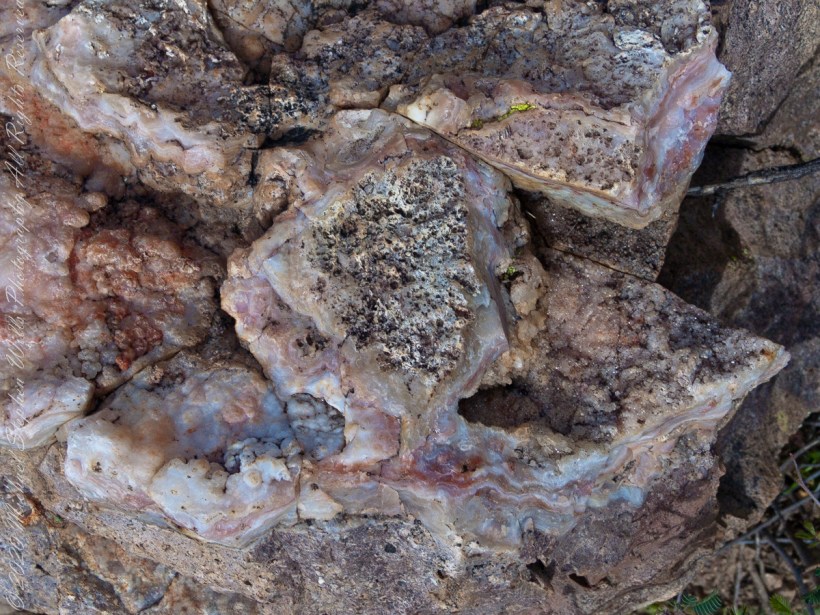
Marled and rose quartz outcroppings such as this appear throughout the Superstitions. The stories are of soldiers and prospectors who return from the wilderness with hoards of gold nuggets picked from quartz.
Marled and rose quartz outcroppings such as this appear throughout the Superstitions. The stories are of soldiers and prospectors who return from the wilderness with hoards of gold nuggets picked from quartz.
I was a member of an expedition to Peter’s Mesa March 2008, a place central to Superstition Wilderness treasure legends. This is a sunset view, looking south, southwest. Light raking across the desolation and Miner’s Needle creates a fascinating spectacle. Ancient volcanism, apparent throughout the Superstition Wilderness, is here seen in the texture, form and type of rock as well as the mineral deposits. Miner’s Needle, like Weaver’s Needle (not seen in this view), are eroded volcanic summits. Look closely for the “eye” of Miner’s Needle, easier seen in the cropped heading photograph. To this day, hopeful prospectors search for gold nuggets.
There is one form of volcanism present today as an eerie rumble or hiss, similar to an enormous distant jet engine heard now and then during our two days on the mesa, louder and closer than an overhead plane could produce. The view includes many notable Sonoran Desert plants. Many young Saguaro cactus are in the form of green poles. Catching the dramatic light, on the ridge is a tall single flower of an Agave, known as the “Century Plant” it flowers once in a long life and dies.
Peters Mesa is named after “Old Pete” Gottfried Petrasch, father of Hermann and Rhiney Petrasch. Old Pete worked for Jim Bark for awhile in the 1890s doing odd jobs. Irregular employment gave Pete and Sons time to s searched for the Lost Dutchman Mine in the years following the death of the source of the legend, the “Dutchman” Jacob Waltz. The Petrasches were one of the first groups to search for the mine, and gold in general. They covered almost the entire Superstition range in their combined searches.
Sunrise looking across Music and LaBarge Canyons to Miner’s Needle
On our first day on the mesa, we came across the remains of one of these camps, on the top of Squaw Canyon, a deplorable junk pile discarded by searchers, presumably disappointed, too lazy to cart it out. That March, we were lucky to find the remnants of winter rains in the form of a meager trickle at the bottom of a shallow draw off Peter’s Mesa trail up from La Barge canyon. We had a good time of it until the trip was cut short by a storm front and torrential rains. We were back in Apache Junction before they hit.
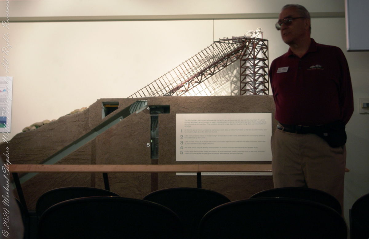
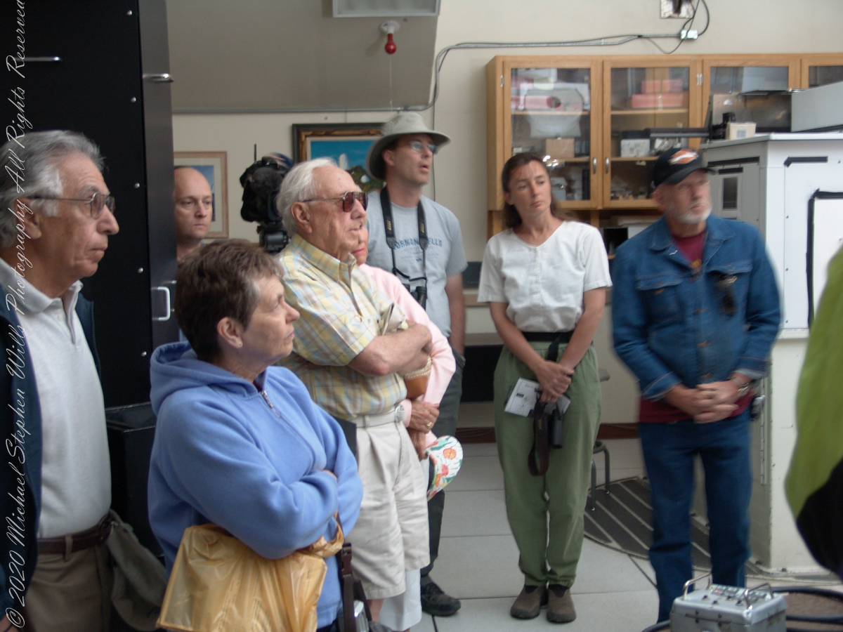
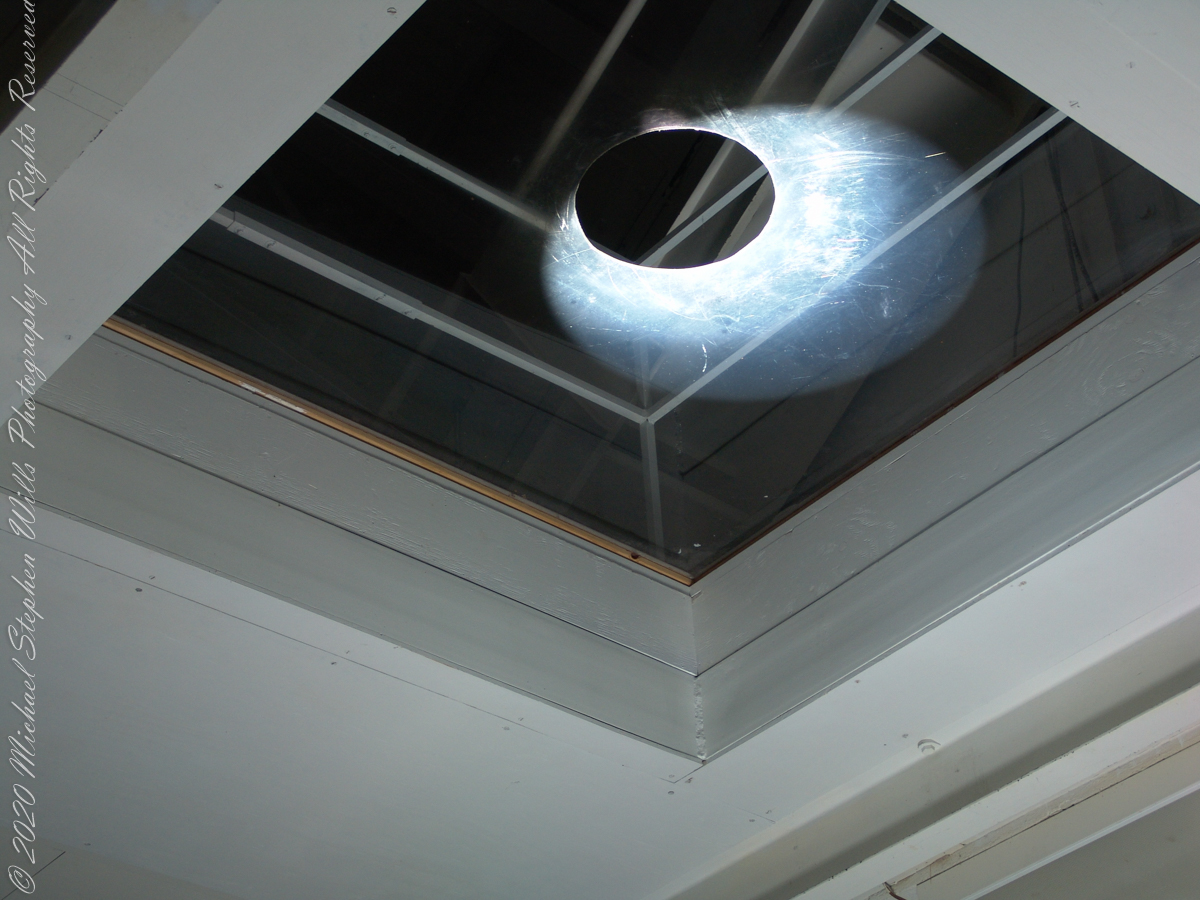
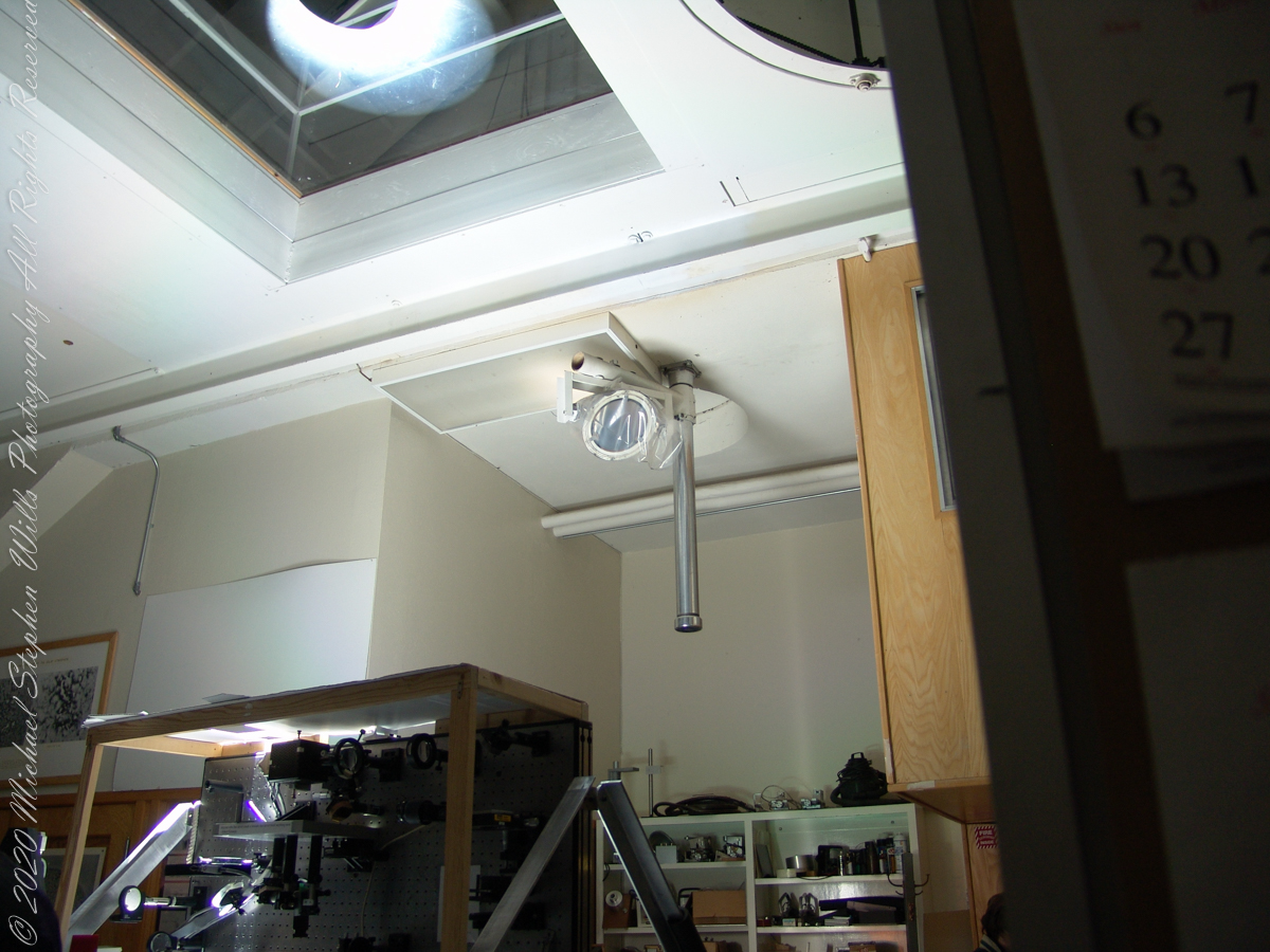
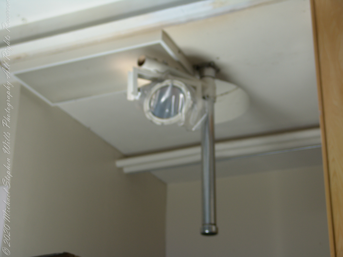
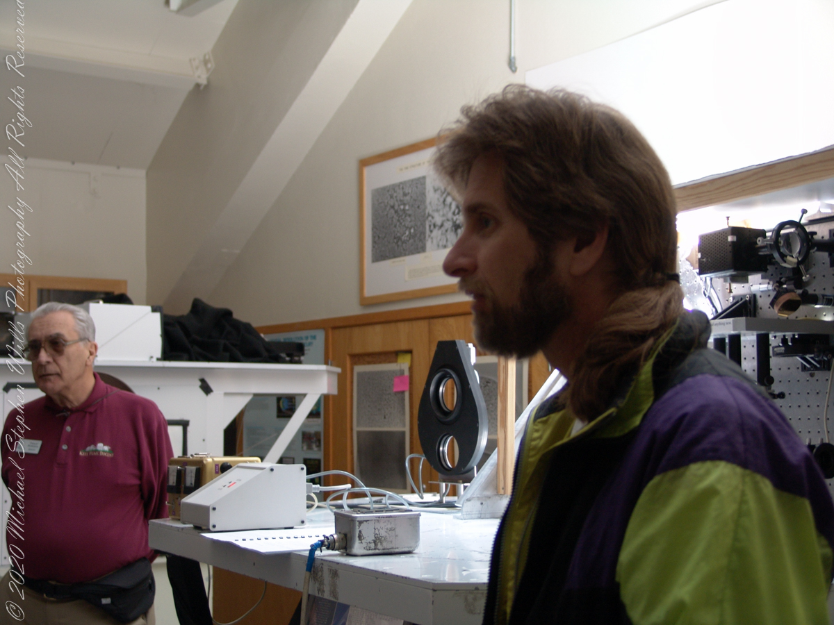
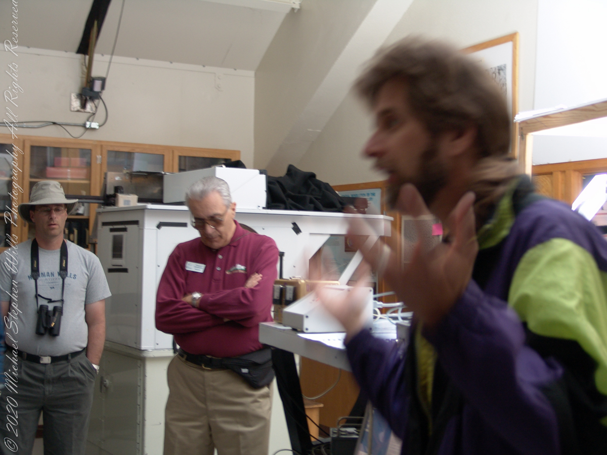
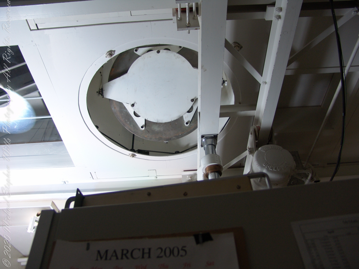
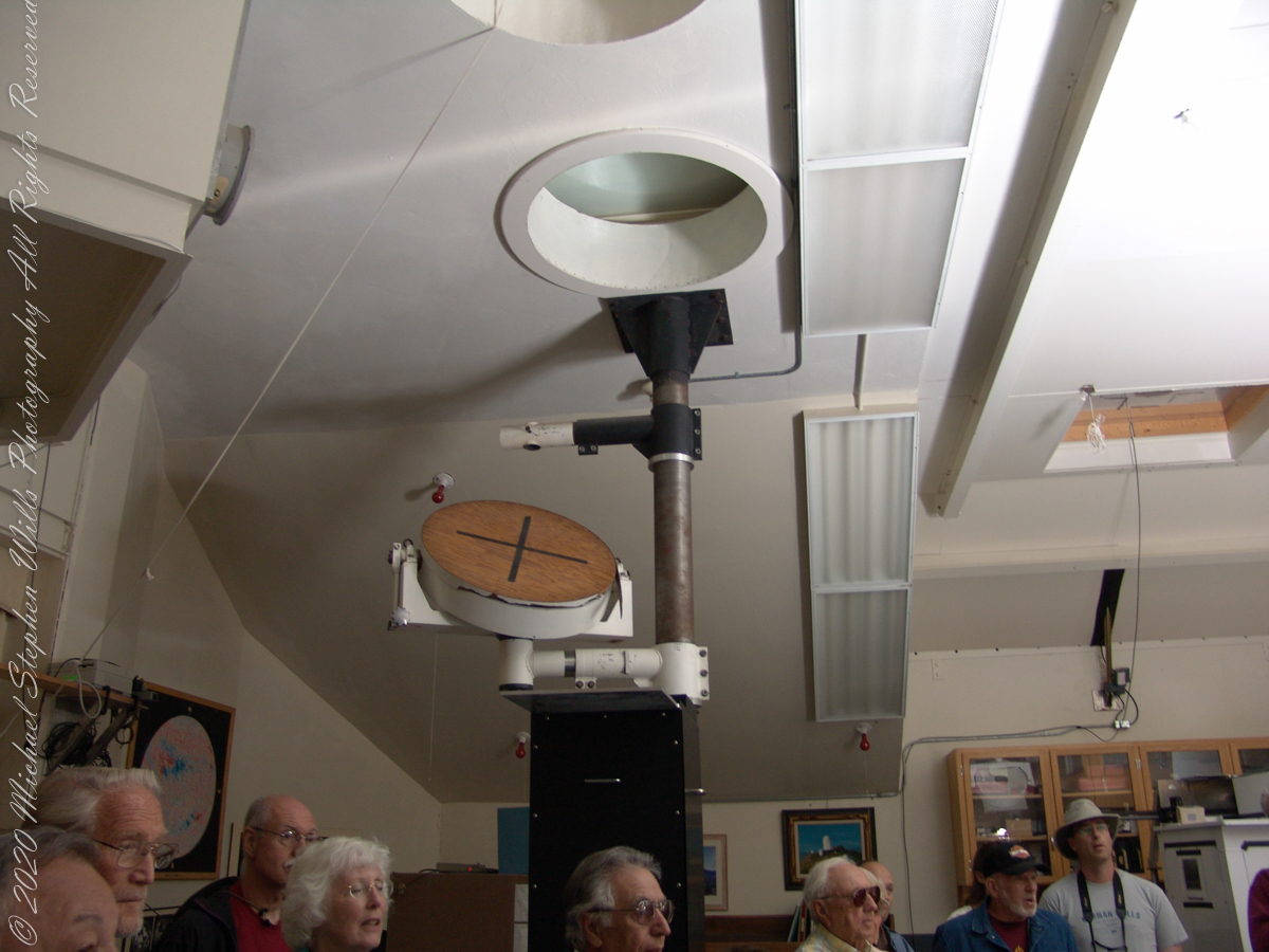
These views within the McMath–Pierce solar telescope enclosure were captured during a guided tour of the instrument, April 20, 2005. By way of orientation, the observation room we visited is near the location labeled “4” on the model of the following photograph or the “Observation Room” of the drawing.
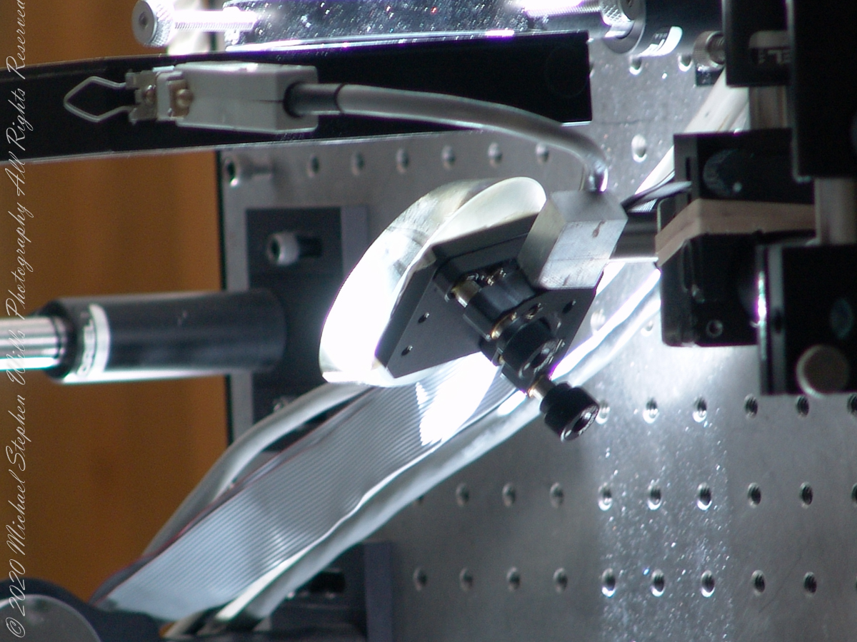
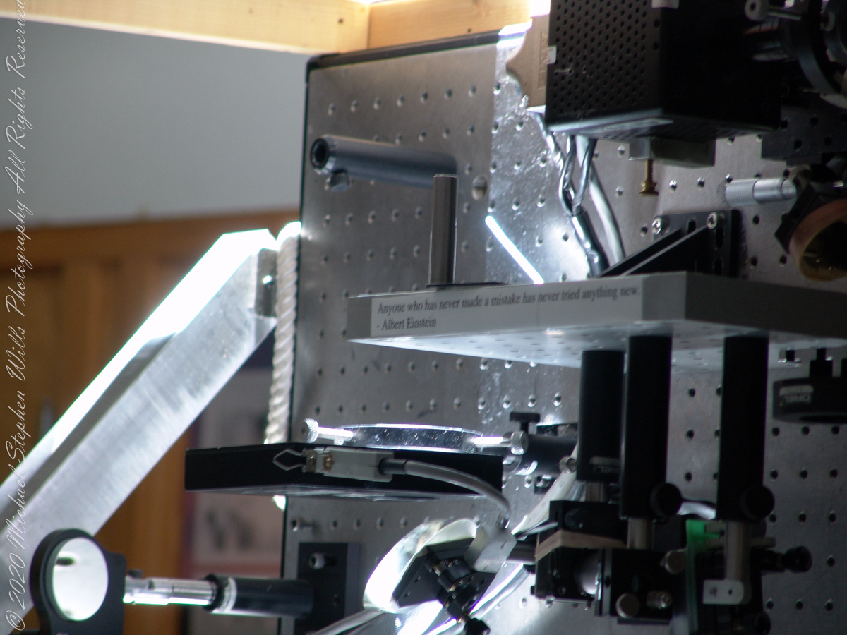
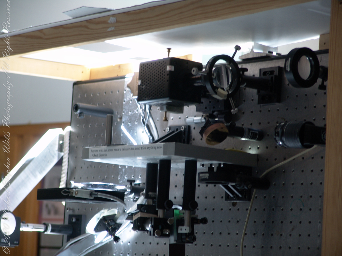
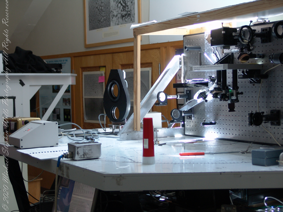
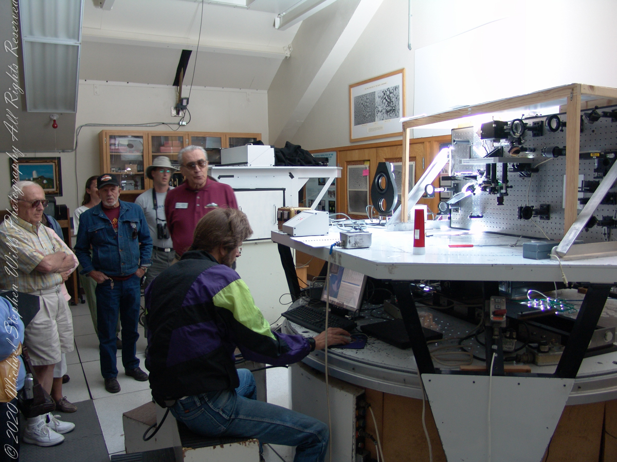
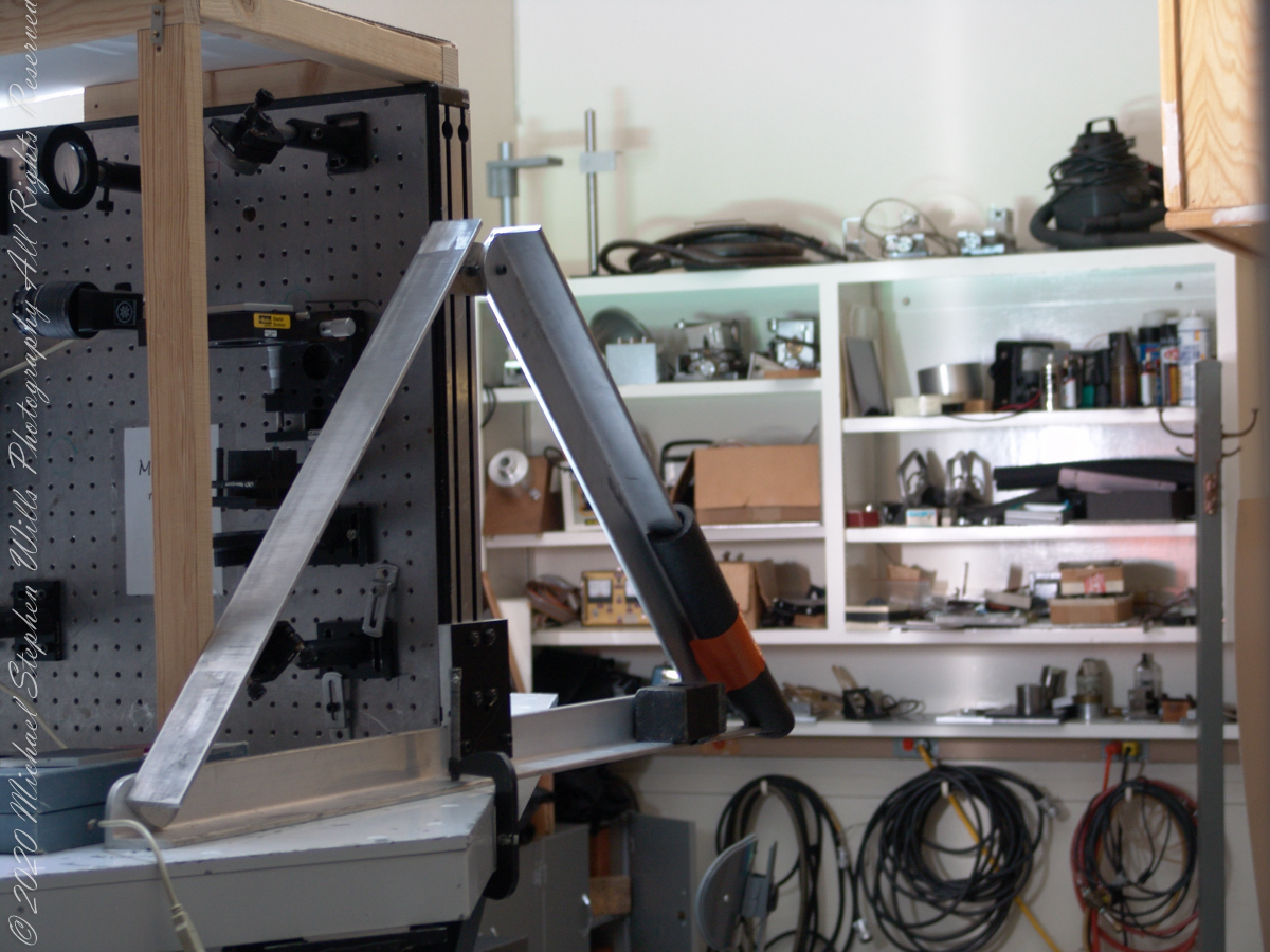
We learned each of the sets of mirrors is considered a separate telescope. The first step in designing the new solar telescope was to determine the optimal image scale. Working on the spectra of the solar granules, on the physical structure of the sunspots and their associated magnetic fields, requires a considerable image size. Past experience has shown that the optimal image of the sun should be approximately 0.91 meters. The highlight of our visit to the Main Observation room was meeting with the technician operating the recently developed low-cost adaptive optics system.
Tip-tilt correction and low order wavefront correction is available with a number of portable optical benches. These are primarily used with the Main spectrograph and the Solar Stellar spectrograph on the Main telescope, but due to their compact mounting they could be used with other telescopes and instruments in the facility.
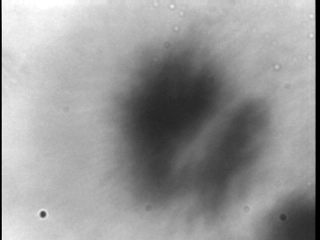
This configuration uses a rapidly deformable mirror to correct distortions introduced by the turbulent atmosphere. Using sensors to measure the degree of image distortion, the adaptive optics system adjusts the shape of the mirror accordingly and converts a blurred image into a clear one. The following image demonstrates the correction. “Low-cost” = $25,000 in 2003 US dollars. Under references is a link to a full description of the device by the creator.
Christopher Keller, Public domain, via Wikimedia Commons
A main area of study in the observatory is the structure of sunspots, which are relatively cold, dark spots on the surface of the Sun created by intense magnetic activity.
Some of the most important discoveries made at McMath-Pierce include the detection of water vapor in the Sun, the measurement of kilogauss magnetic fields (thousands of times stronger than those on Earth) outside sunspots and the detection of a natural maser (like a laser, but with a microwave instead of visible light) in the Martian atmosphere.
Over the years and technological advances, the National Solar Observatory has moved its headquarters from Tucson to Boulder, Colorado. The organization abandoned its solar telescopes at Kitt Peak and in New Mexico for a larger instrument in Hawaii, the Daniel K. Inouye Solar Telescope on the island of Maui, which began operating in 1919.