In my previous posting “Hoodoos on the Descent to Reavis Falls” I describe how I came to find these strange rock formations during a solo expedition to Reavis Falls in the remote eastern Superstition Wilderness.
Here I present several photographs captured from my tripod mounted Kodak DCS pro slr/c and a Canon EF 200 mm f2.8 L telephoto lens. These provide a better understanding of the strange, wonderful and possibly frightening impressions these formations make when discovered in a deserted location such as Cedar Basin.
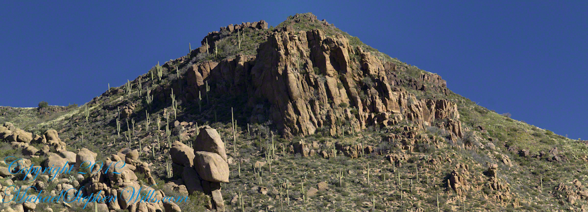
Here is the highest point of the ridge….
Hoodoo Ridge
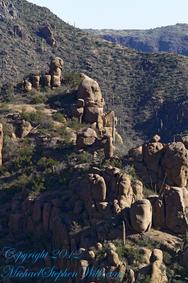
…..and from a portion of the ridge that projects closer to my observation point above the canyon mouth of Reavis Falls. The numerous green poles are young Saguaro cactus. In the distance are mature Saguaros with lateral arms.
Hoodoos of Cedar Basin
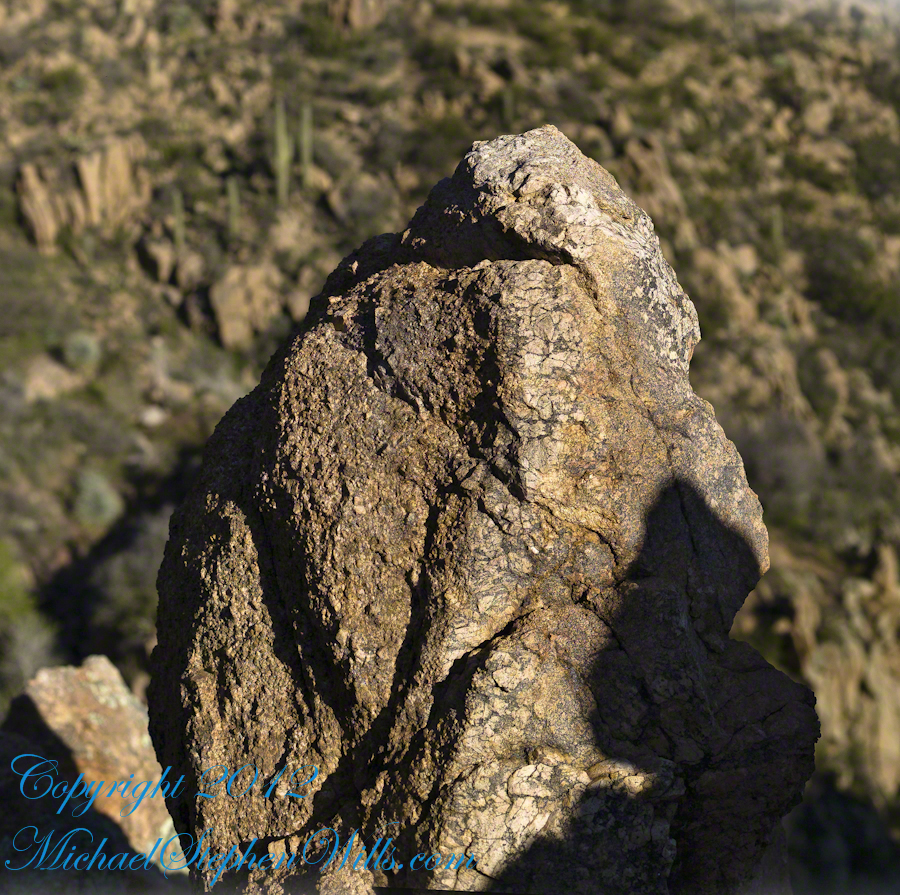
..and even closer than this were the rocks standing around me. This specimen I captured with the 50 mm 1.4 Canon lens. I believe it is a different rock type than the above, rounded, hoodoos. Those look like rock from ash of a volcanic eruption. This rock seems to be igneous, formed deep inside the earth.
Cedar Basin Rock Closeup
My next posting will describe the surroundings of the campsite from which I explored the canyon and Reavis Falls.
Copyright 2023 Michael Stephen Wills All Rights Reserved
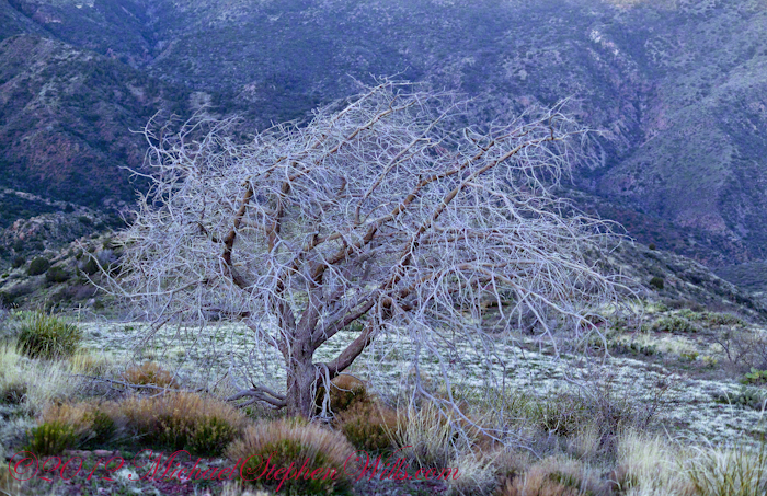
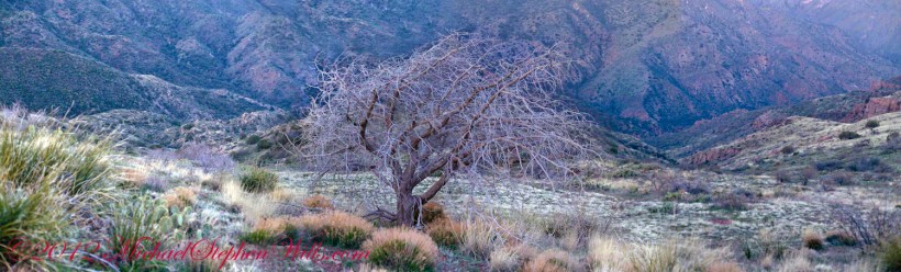
On my fourth morning, after I awoke to am immense silence, my first photography subject was the lone dry juniper you see below.
Then the dawn lit up the far mountains. You can view a larger image these mountains at dawn in my previous blog, “Superstition Wilderness Dawn.”
A Lone Dry Juniper
This is a photograph of that juniper tree, dryer than most, being dead. I take it to be a One-seed Juniper from the thick growth of branches and the strong rounded aspect of the crown. I captured this photograph from a tripod mount using a Kodak DCS slr/c with a Canon EF 50mm f/1.4 USM lens.
Looking into Reavis Creek Canyon from Lime Mountain
I used the tripod to bracket this shot on the left and right for the following panorama.
The Reavis Creek Canyon from Lime Mountain while still in shadow, morning
The Spirit of Elisha Reavis
From this vantage you can see my route into Reavis Creek Canyon and Reavis Falls taken on the first afternoon of the expedition. That first morning I loaded up 65 pounds of food, supplies and photography equipment and headed out from the Reavis Trailhead on the Reavis Ranch Trail. This was one of the trailed used by Elisha Reavis to ride a favorite burro and a string of 8 to 15 burros loaded with vegetables he sold to various communities throughout central Arizona. See my blogs “A Ride to Reavis Ranch” and “Apple Orchard in the Wilderness“for views of the paradise (as of the early 21st century) where Elisha Reavis, lived and prospered in the latter part of the 19th century where he lived his 70’s.
This his mountain valley, using a perennial creek, Reavis cultivated and irrigated about fifteen acres of land by himself with chickens, turkeys, hogs, burros, two horses and several dogs. The horses, teamed together, pulled a shear plow, disc and leveler. On April 9, 1896 Reavis was preparing of another trip to Mesa, to buy seed potatoes, and was found by a friend a month later on what is now the Reavis Ranch trail, to the south and west of his valley, near what is now called Grave Canyon were friends buried him.
Past the Dry Juniper and Down
102 years later, I headed up the Reavis Ranch Trail, over the ridge of Lime Mountain and past this dry juniper in the same spirit as Elisha Reavis if for a different purpose.
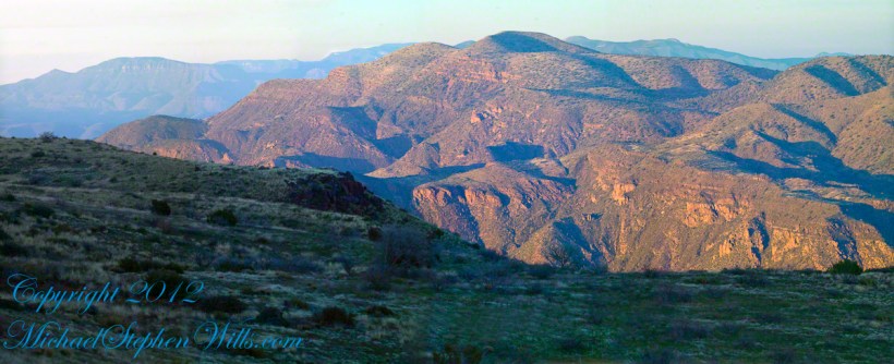
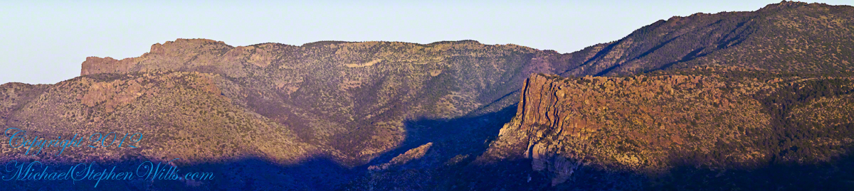
Pre-dawn on the fourth morning of my solo expedition to Reavis Falls, before the last posting “Among the Desert Wildflowers“, on the slopes of Lime Mountain, as the eastern sky became slightly less dark, I woke to an unusual sensation: total silence. The air was absolutely still, no insects trilled, the birds were still asleep. Lying very still, the ringing of my ears announced the silence.
In that silence I set up for this panorama taken from a tripod-mounted Kodak DCS ProSLR/c mounted with a Canon EF 200mm f/2.8L II USM telephoto lens. It is 5 image files combined. The source file is about 300 MB.
That is Pinyon Mountain in the center distance. The Arizona Trail traverses that terrain, though it is not visible from this distance (it is about 3 miles away).
Lime Mountain is truly a light green, as you can see from the foreground ledge. From there, a cliff runs round where on a south-facing site there are cliff dwelling ruins. The trail to Reavis Falls runs to the right, along a ridge broken by a narrow canyon with access to Cedar Basin, also at the foot of these cliffs.
Copyright 2023 Michael Stephen Wills All Rights Reserved
Another blog from my four day solo expedition to Reavis Falls in the remote eastern Superstition Wilderness. Here we will descend briefly to the canyon of Reavis Creek, below the Reavis Falls.
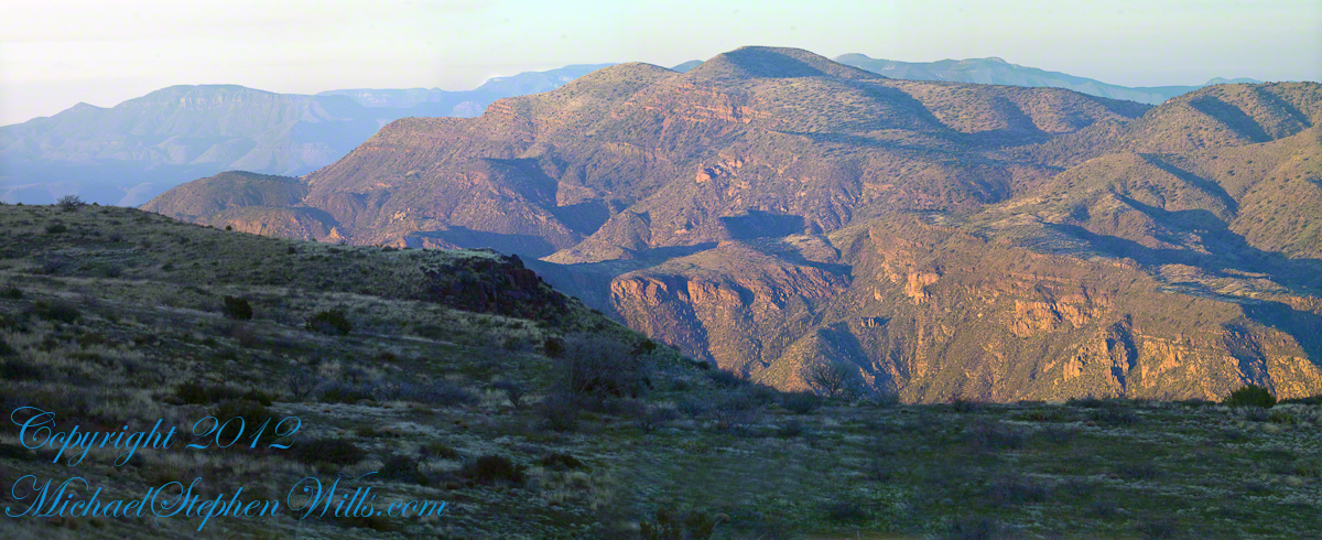
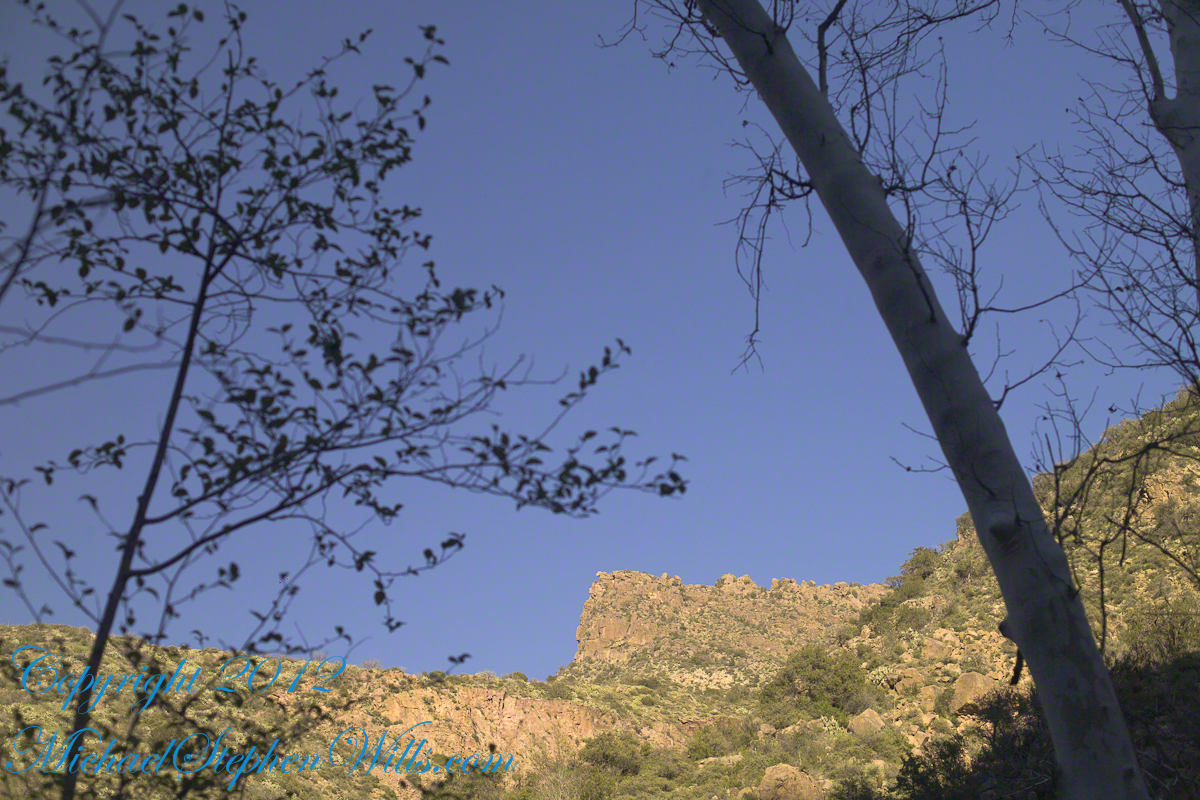
Shadows rising on the canyon walls are from Lime Mountain and Castle Dome. In the far canyon, below Two Bar Mountain, is a shadow from the notable cliff and prominence to the right, that rises above Reavis Falls, fall below and out of sight in the canyon.
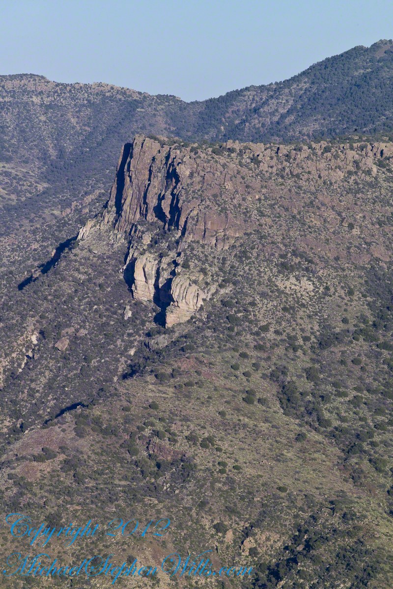
Here is that prominence from that same day, late afternoon when the sun is just starting to be low enough to throw the cliff into relief. This is a single shot with a canon 200 mm lens. This day I had climbed out of Reavis Creek, up to to this point on the slopes of Lime Mountain. Here I enjoyed an afternoon, evening, night and early morning of the following day.
The second day of the solo expedition, I hiked into the canyon of Reavis Falls from a camp at the canyon mouth. Looking up from the creek this same cliff was prominant against the sky.
Copyright 2023 Michael Stephen Wills All Rights Reserved
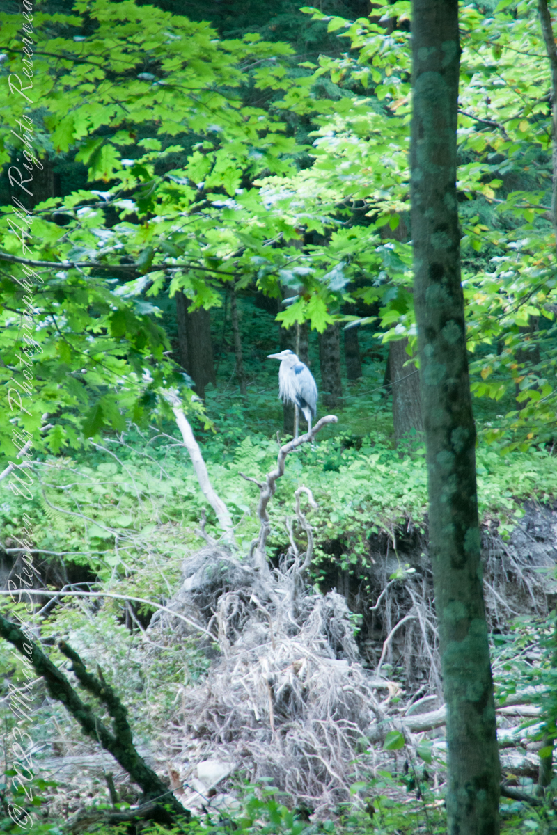
A Great Blue Heron spotted from Bear Trail during a family hike, perched on a splayed root of a tree undercut by flooding, fallen into Buttermilk Creek bed.
A heron recurves its long neck while perched. Adult herons have few natural predators and are rarely preyed upon due to their large size and sharp beak, but bald eagles (Haliaeetus leucocephalus) are known to attack great blue herons at every stage of their lifecycle from in the egg to adulthood.
Copyright 2023 Michael Stephen Wills All Rights Reserved
Treman lake is formed by a dam on Buttermilk Creek, the trail around the lake is less frequented and popular with the locals, climbing up and down the glacially formed hills. Some popular resorts maintain trails that feed into the park.
A footbridge framed by hemlock trees traverses Buttermilk Creek where the East and West Treman Lake Trails meet. This season, 2019, this bridge was overwhelmed by driftwood piled up by spring flooding, impassable. We pick our way across the creek bed and over the water. Little ones needed a carry. An adult fisherman, to right of driftwood, provides perspective.
August 20129, Buttermilk Falls New York State Park, Ithaca, Tompkins County, New York.
Copyright 2023 Michael Stephen Wills All Rights Reserved
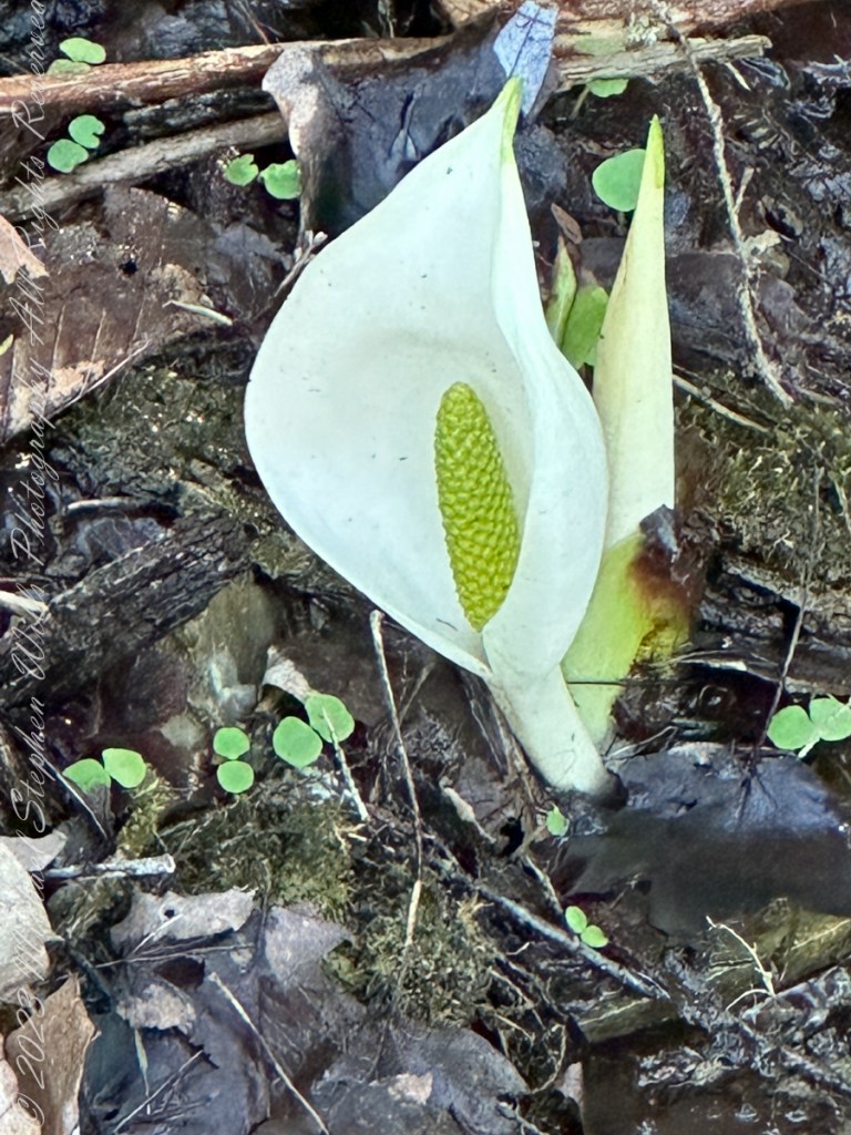
Pam and I ambled around the Arboretum for our Easter 2023 outing. We discovered this seeming lily growing from the muck along the Treman Woodland Walk. Scientific Name: Lysichiton camtschatcensis. Common names: Asian skunk cabbage, white skunk cabbage, Far Eastern swamp lantern or Japanese swamp lantern.
This is a plant found in swamps and wet woods, along streams and in other wet areas of the Kamchatka Peninsula, the Kuril Islands, Sakhalin and northern Japan. The common name “skunk cabbage” is used for the genus Lysichiton, which includes Lysichiton americanus, the western skunk cabbage, noted for its unpleasant smell. The Asian skunk cabbage is more variable: plants have been reported in different cases to smell disgusting, not at all, and sweet.
All photography using the IPhone 14 ProMax triple camera, raw format, edited on the phone.
In Japanese it is known as mizubashō (lit. “water-banana”) from a supposed similarity to the Japanese banana, a name with poetic rather than malodorous associations. It is not closely related to the true cabbage.
Copyright 2023 Michael Stephen Wills All Rights Reserved
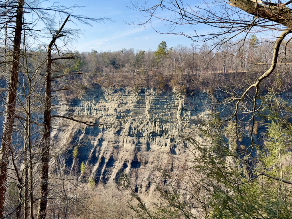
Thank You for exploring with me the South Rim trail of Taughannock Falls State Park on this first day of Spring 2023.
Photographs with video from this walk, with nature sounds and music in 4K HD
Click photograph for a larger view. To do this from WordPress Reader, you need to first click the title of this post to open a new page.
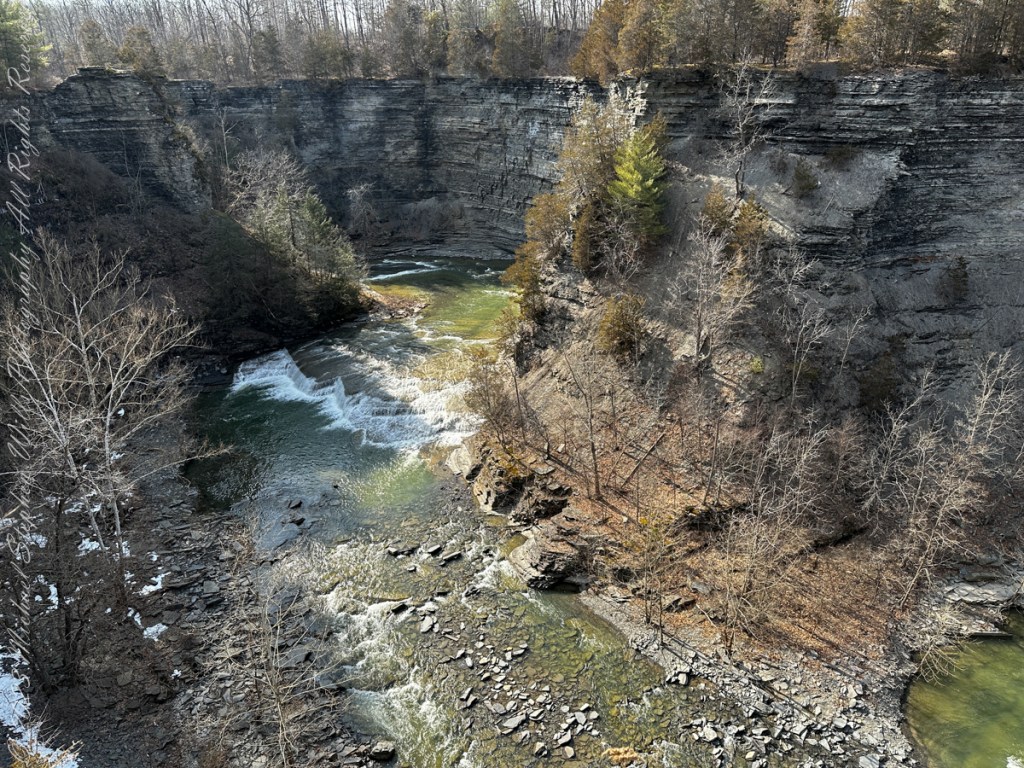
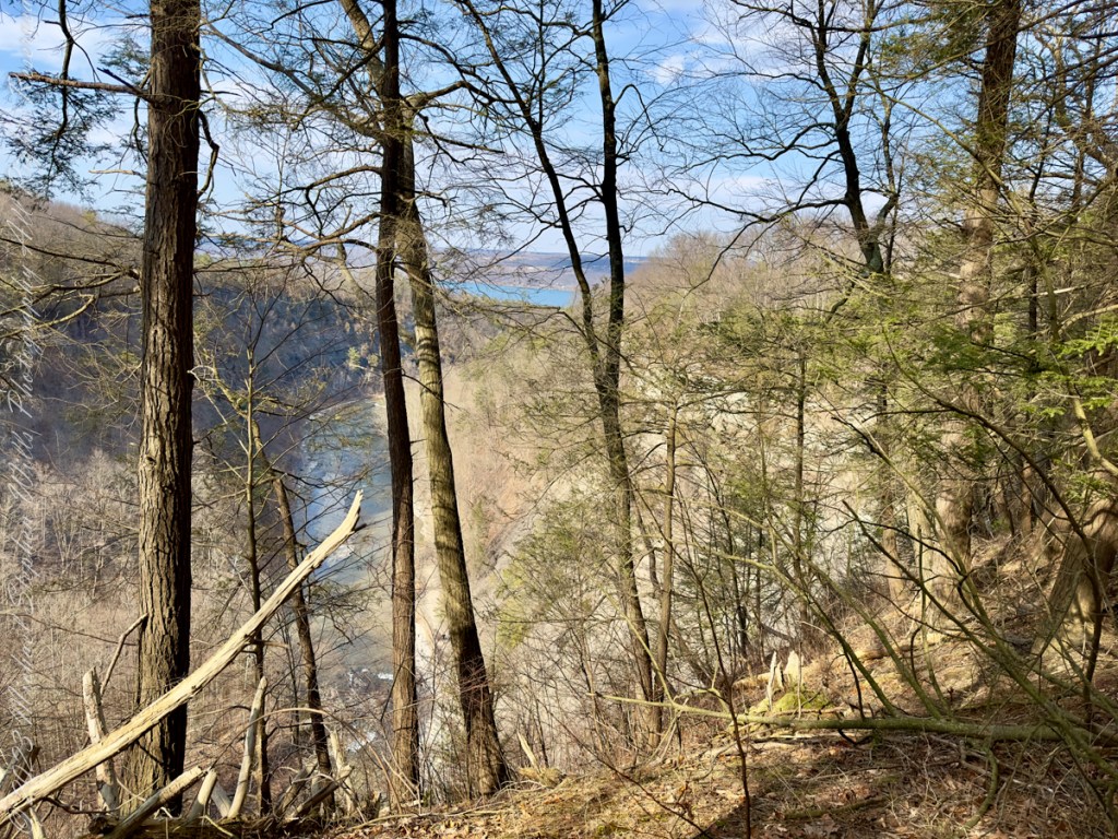
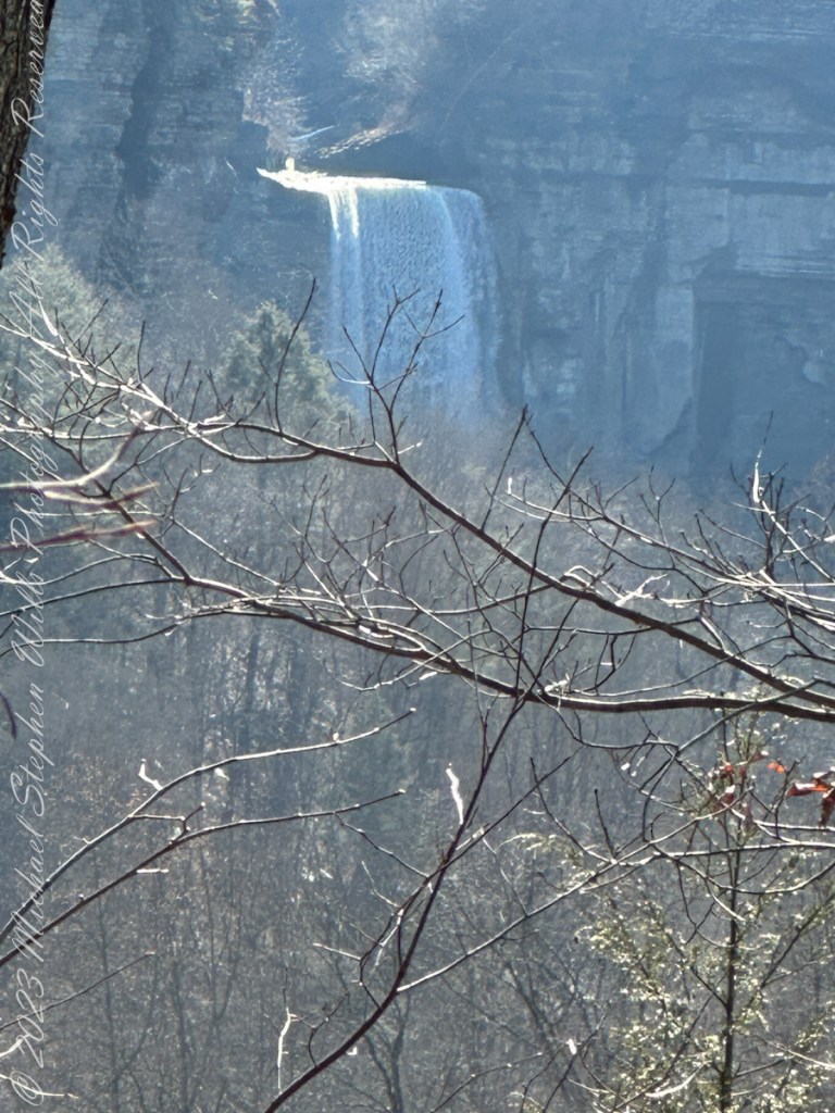
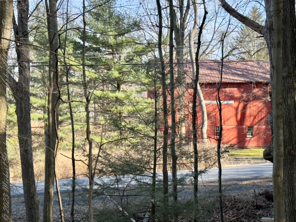
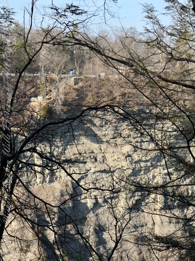
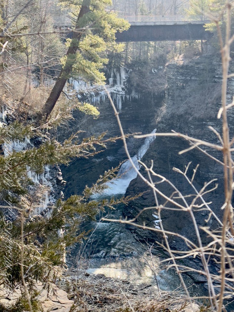
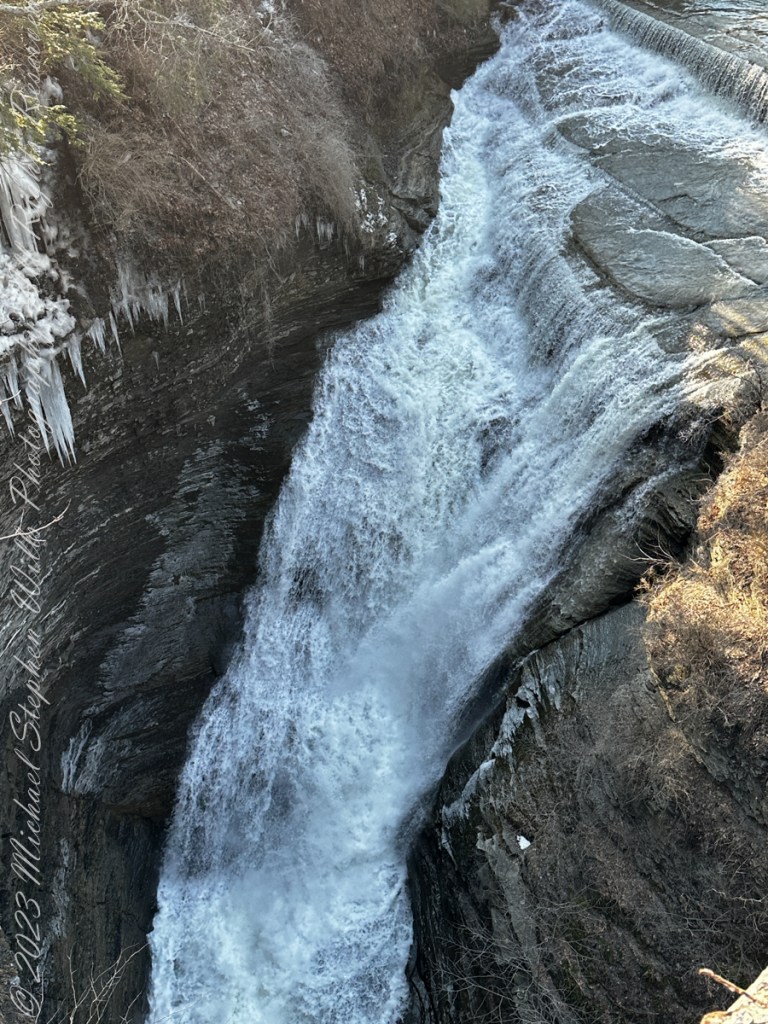
Here, before the epynmous creek flows over the falls, glacial outflow carved this deep canyon through relatively soft sedimentary rock. Distant Lake ViewThe place for rest and wonderLooking into the gorgeSouth Rim view of fallsTaughannock creek below the fallsRed Barn on Gorge Road, off South Rim rial.Perched on the north rim of the gorge, the Visitor Center for the Falls Overlook is visible before trees leaf out.On spring’s first day Taughannock Creek is full beneath the old railroad bridge, now a connector between South and North Rim Trails.The creek here plunges into the chasm below a former railroad bridge. Gorge from Railroad Bridge Walkway
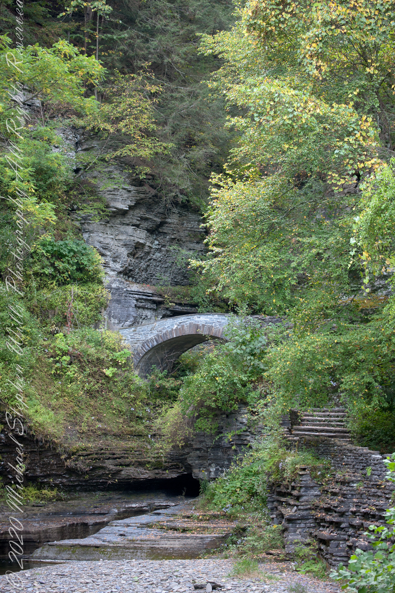
Looking back after crossing the Gallery Footbridge we are rewarded with this view, providing a better understanding of the site. It is evening on a mid-September evening, Robert H. Treman Park, Ithaca, Tompkins County, New York Copyright 2023 All Rights Reserved Michael Stephen Wills
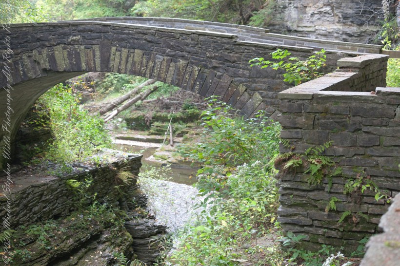
Here we are on the Gorge Trail of Treman State Park. My readers have seen this marvelous stone bridge from a distance. Here it is on the west side, facing east/northeast and looking down into the gorge. It is evening on a mid-September evening, Robert H. Treman Park, Ithaca, Tompkins County, New York Copyright 2023 […]
Here we are on the Gorge Trail of Treman State Park. My readers have seen this marvelous stone bridge from a distance. Here it is on the west side, facing east/northeast and looking down into the gorge.
Spanning the eastern side of the gallery entrance of the gorge.
It is evening on a mid-September evening, Robert H. Treman Park, Ithaca, Tompkins County, New York
Copyright 2023 All Rights Reserved Michael Stephen Wills