Fens, Bogs, and Flowing Water of Malloryville Preserve of Freeville, New York

Discover Malloryville Preserve in Freeville, New York—a hidden Finger Lakes wetland of fens, bogs, and flowing water where glacial history and rare plants meet.

Water defines the O.D. von Engeln Preserve at Malloryville long before we see or hear it. At first, it is only a dampness in the air, a coolness at ankle level, a dark sheen between sedge tussocks. In the space of a half-hour walk, we pass through fen, bog, marsh, and swamp, each distinct, yet bound together by the same slow, persistent flow.

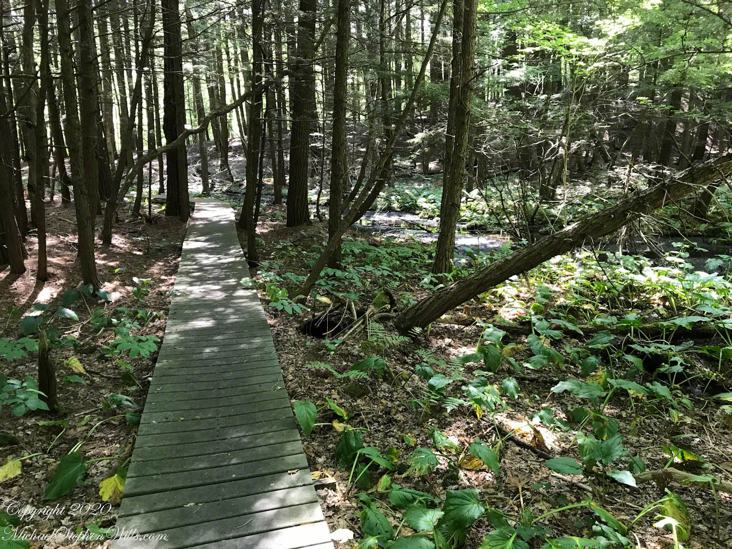
Here we are traversing a swamp, our steps buoyed along on planking made from recycled plastic. The boardwalk floats visually above pools the color of tea, edged with moss and skunk cabbage. It’s easy to imagine what this crossing would have been like before the planks were laid—boots sinking, knees splashed, delicate plants crushed. The modern walkway is a quiet compromise: we may enter this saturated world without trampling it, a human gesture that matches the preserve’s ethos of protection and restraint.

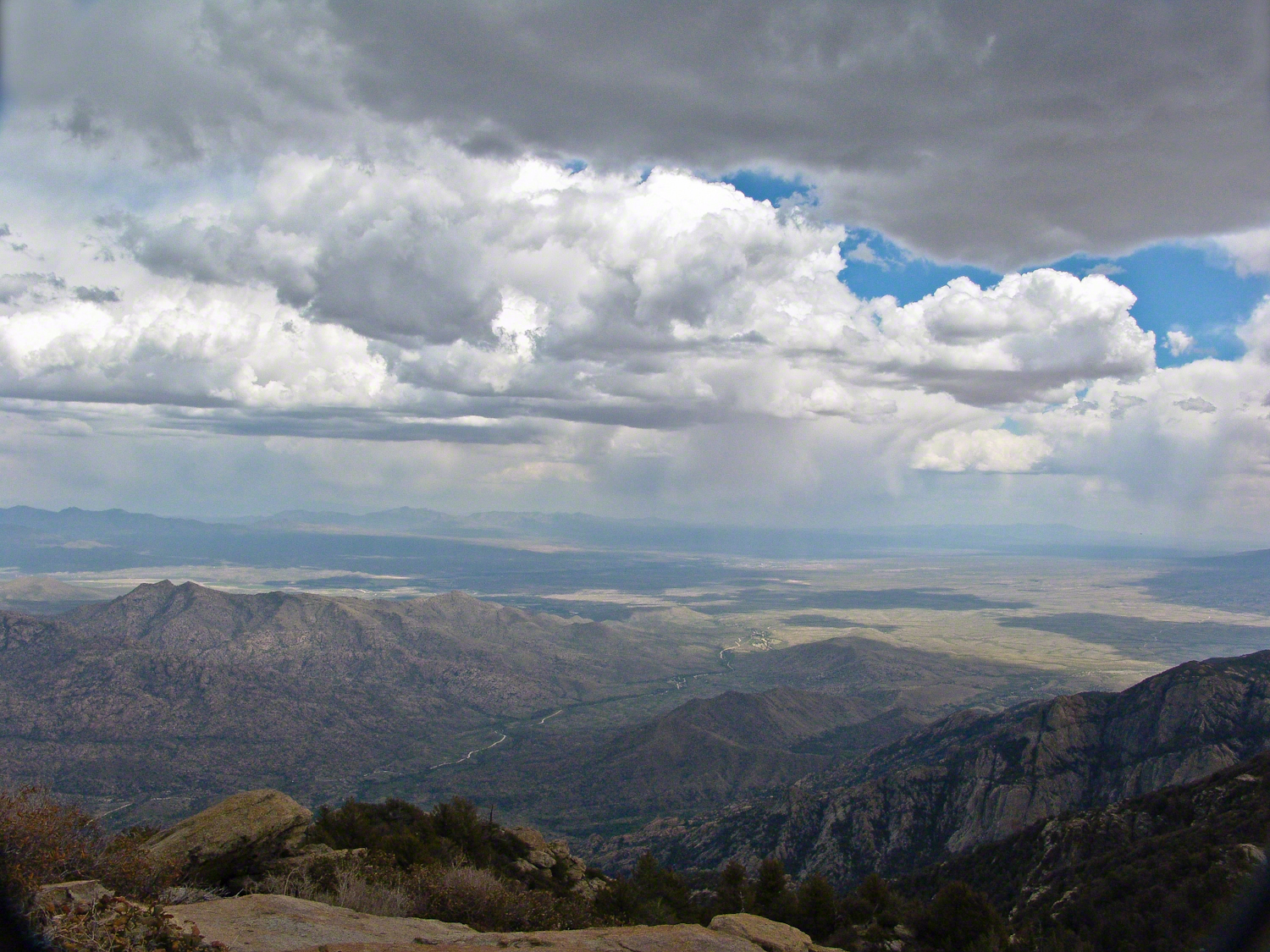
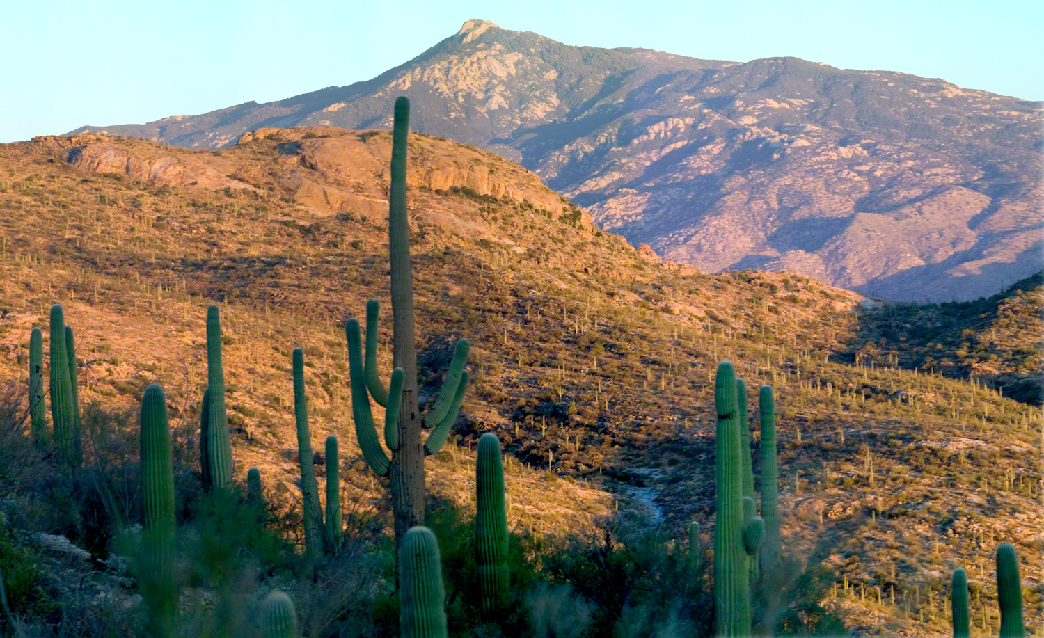
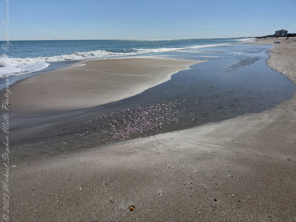
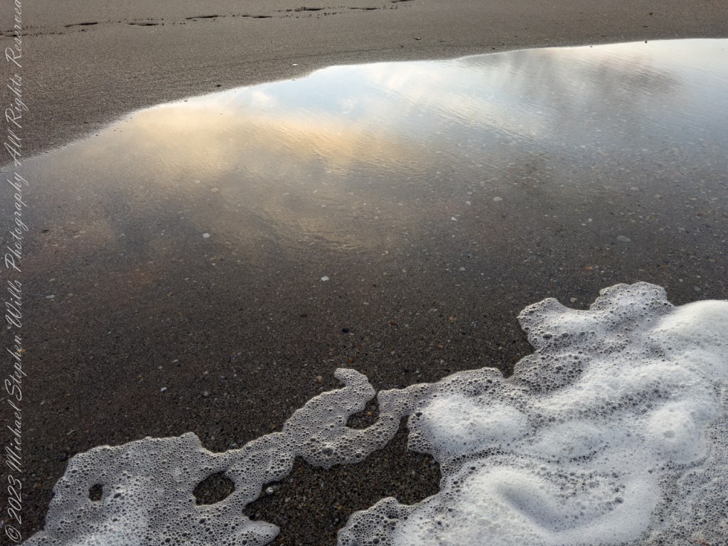
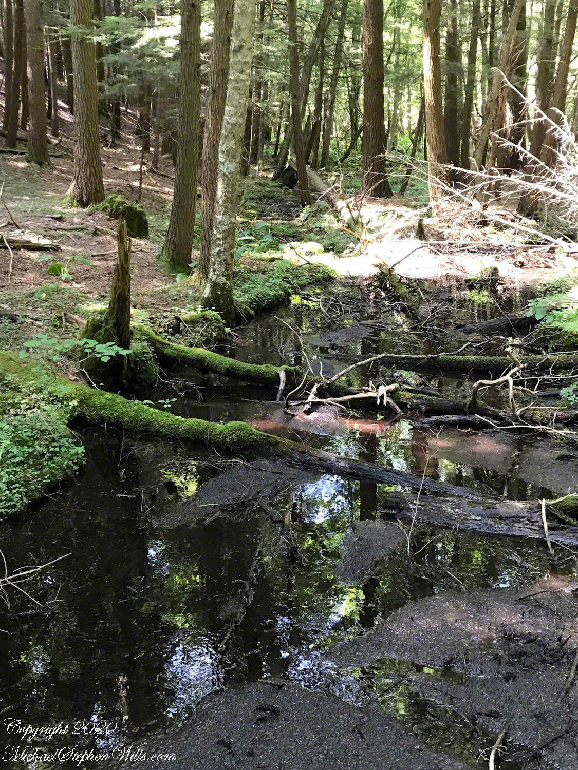
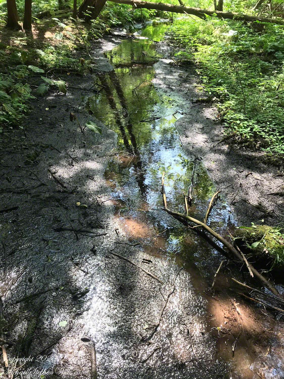
The Malloryville wetlands lie in a low pocket along Fall Creek, a landscape shaped by the last ice age. As the glacier that once covered this region melted, torrents of water tunneled through the ice, depositing braided ridges of sand and gravel known as eskers. Today, more than a mile of these ancient riverbeds winds through the preserve, narrow wooded spines rising above the surrounding wetlands. From an esker crest, the pattern of water reveals itself: dark channels of open flow, pale pools rimmed with sedge, patches of sphagnum floating like cushions, and, farther off, the straight silver of Fall Creek.

But the story of Malloryville’s water begins far from these pools. Rain falls on the uplands as cool, slightly acidic water. It sinks through glacial till—a jumble left by the ice—and begins a long, blind journey underground. As it moves, the water reacts with the minerals it encounters. Where it brushes limestone or other carbonate-rich layers, it is slowly neutralized and picks up dissolved calcium and magnesium. By the time it resurfaces in low spots, it may be transformed from sour, soft rain to mineral-rich groundwater.

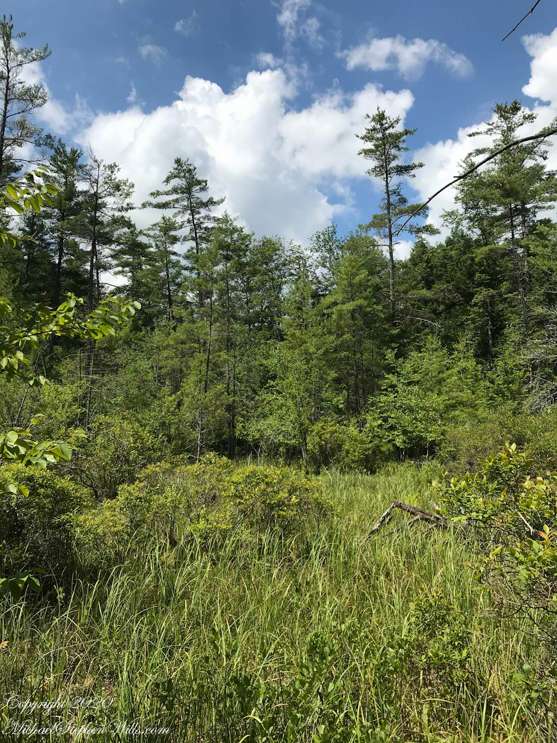
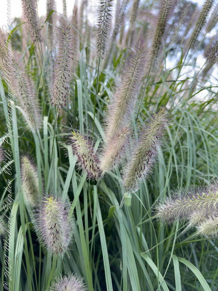
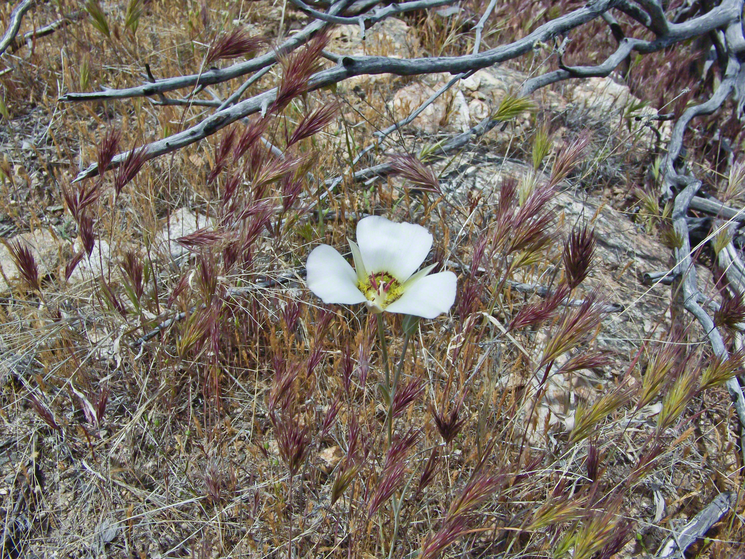
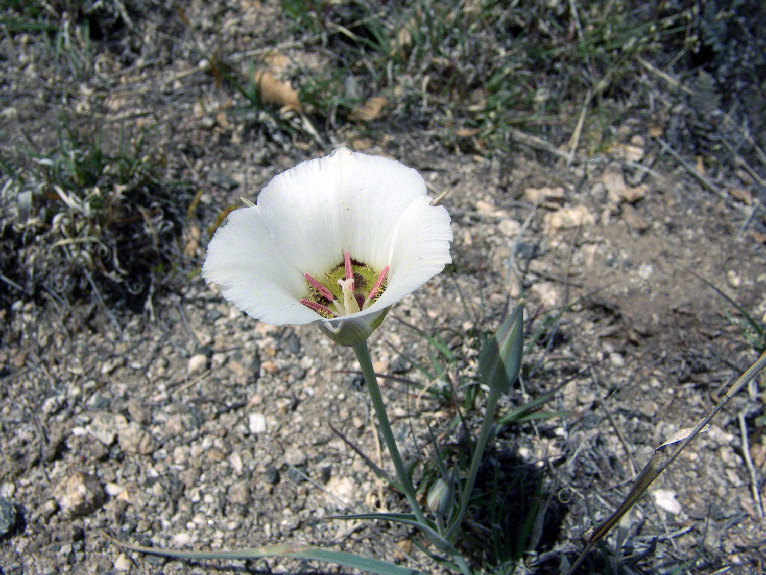
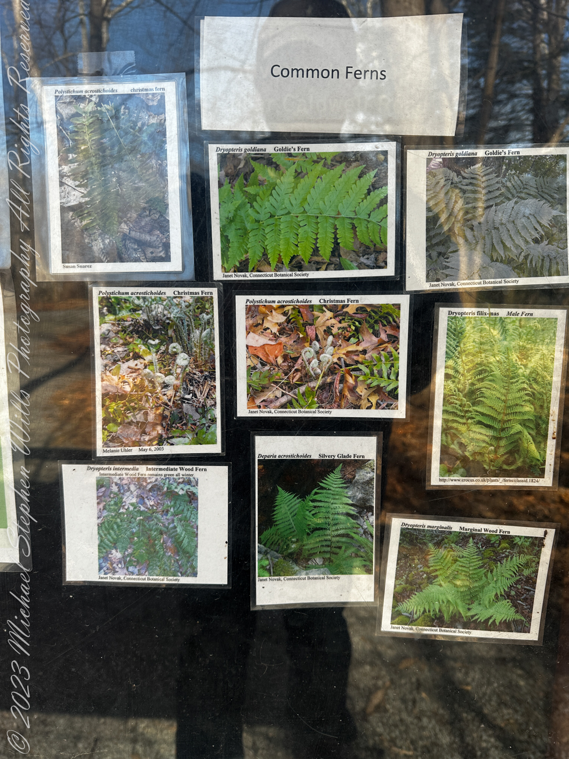
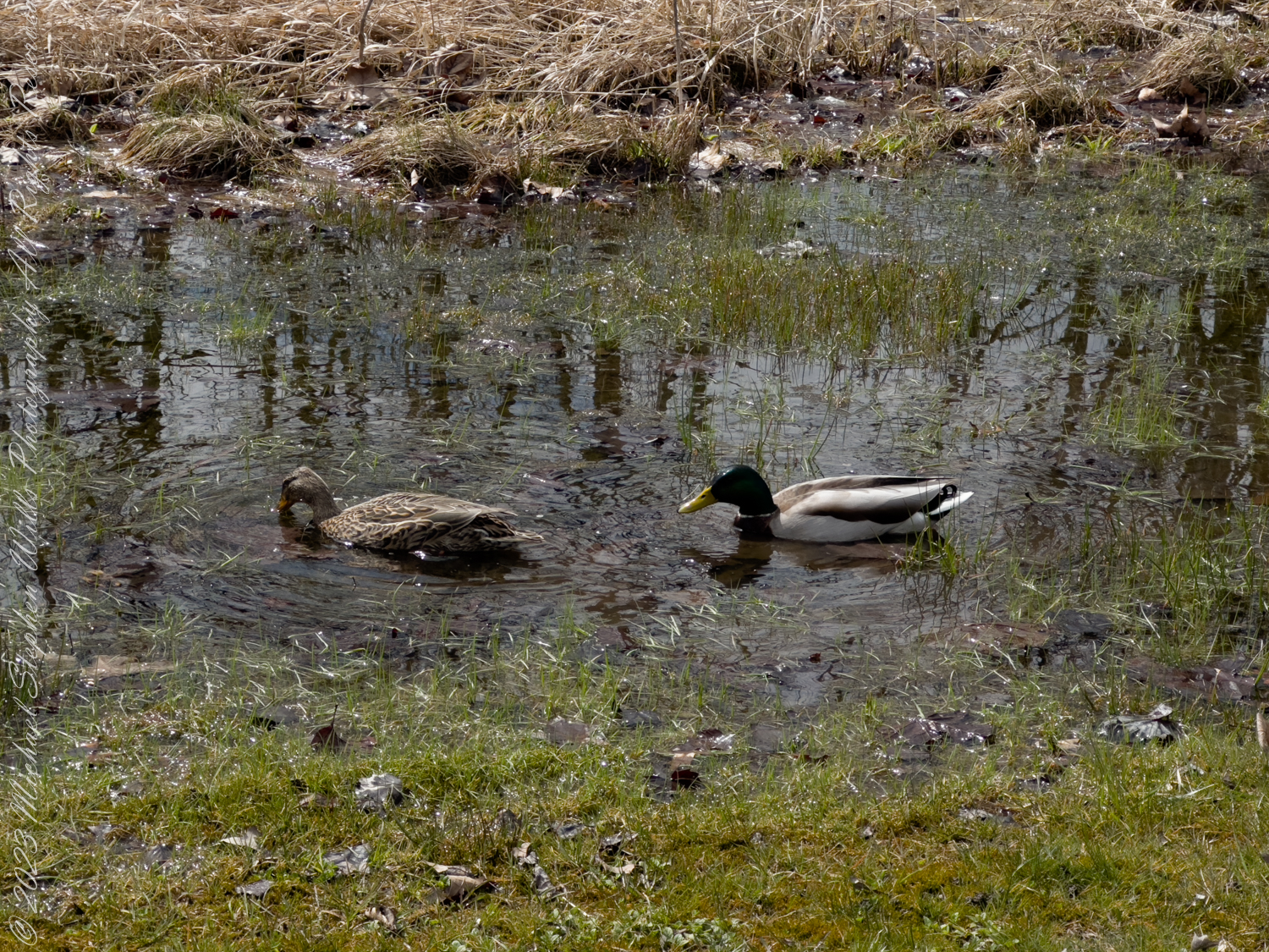
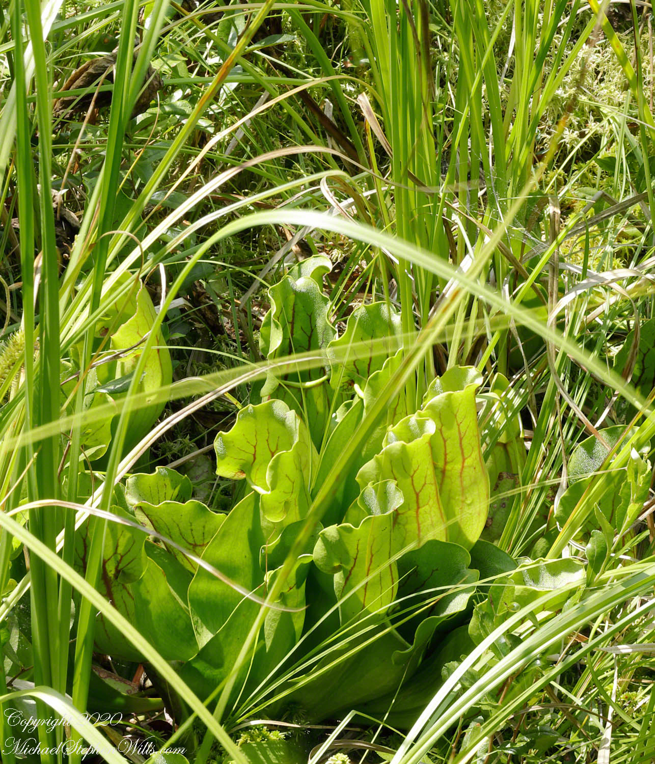
Those subtle chemical shifts are written onto the land. In some hollows, where water still mainly reflects its origin as rain, the environment becomes a bog—cold, acidic, nutrient-poor. Here, sphagnum moss knits a floating carpet, and only specialists such as leatherleaf and cranberries can endure. In other pockets, where groundwater welling up from below brings minerals, we find fens: lush, lime-touched wetlands offering niches for orchids, sedges, and the carnivorous pitcher plant. Marshes and swamps round out the spectrum, their standing water and wooded shade forming still more microhabitats.

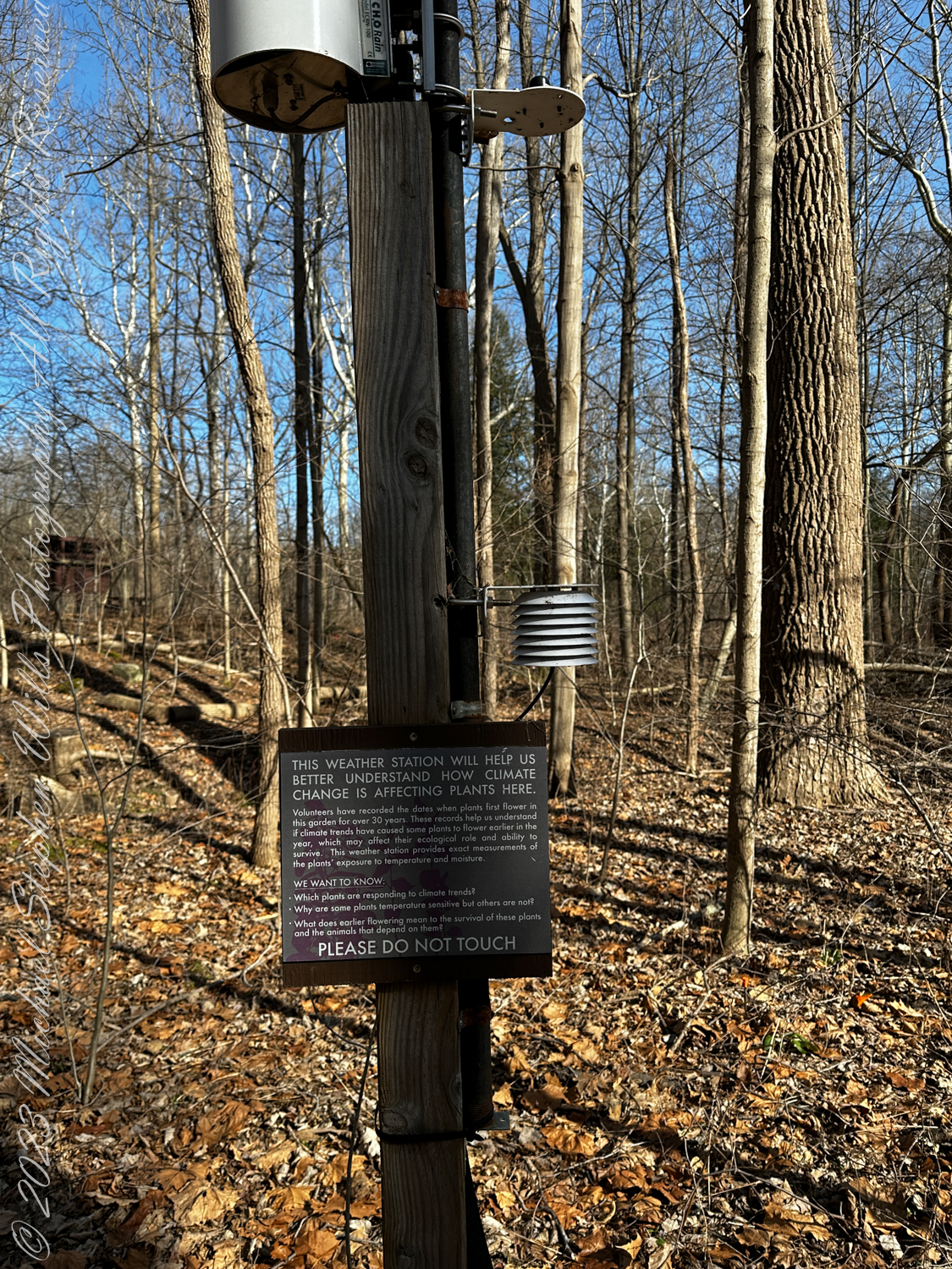
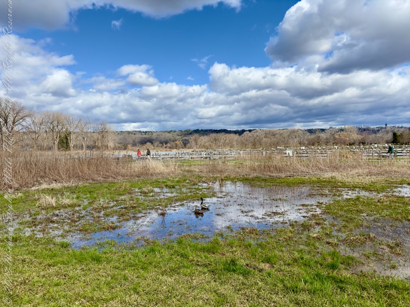
In this small preserve, all these wetland types coexist side by side, threaded by water that often moves so slowly it appears not to move at all. The stillness is deceptive. A slight difference in elevation—barely the height of your boot—can determine whether water spreads and stagnates, seeps outward in a fan, or concentrates into a narrow, unseen channel. Hydrologists studying the area have shown that a water-table mound of only a few inches can redirect the underground flow and, over time, steer the evolution from open fen to peat-filled bog.

Human history here is entwined with that quiet power. The founders of the preserve, themselves from a dairy farming family, came to understand that the springs, seeps, and wetlands feeding Fall Creek were vulnerable. Gravel pits on nearby land had already bitten into the valley; another such excavation on this side would have severed the veins of water that sustain the fen and bog. Their years-long effort to protect the property culminated in a Nature Conservancy preserve whose very purpose is to safeguard water and the uncommon communities it supports.

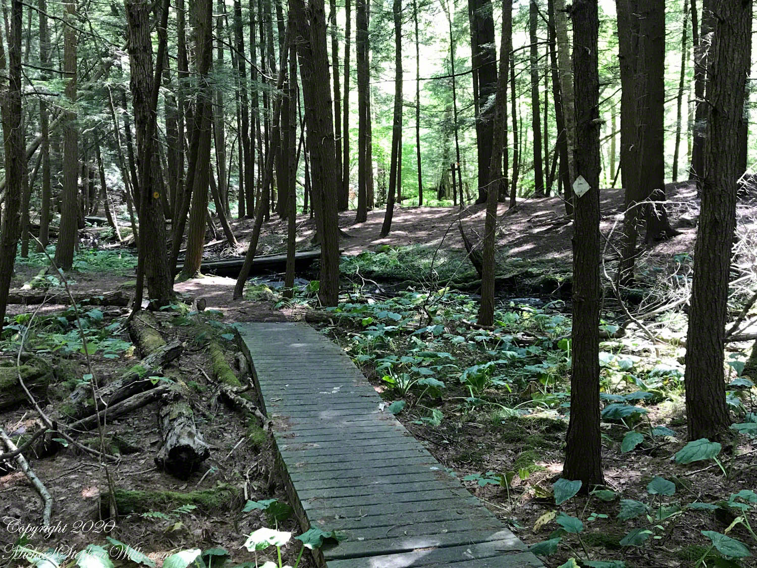
The boardwalk under our feet is part of that story. Its recycled-plastic planks do not rot in constant dampness, and their smooth, slightly hollow sound reminds us with each step that we are guests in a place where soil never truly dries. At the edges of the walkway, tamarack and red maple lift their trunks from hummocks, their roots anchored in peat built grain by grain from centuries of water-logged plant remains. In the open patches, we can seek out pitcher plants, their flaring, water-filled leaves digesting unwary insects to make up for the nutrient-poor conditions.

Everywhere, water moves almost invisibly. It rises as a cold trickle at the base of the esker, fans through the moss as a thin sheet, and gathers again in dark, tannin-stained channels. It rarely speaks aloud; only in spring flood or after hard rain does it murmur against roots or tap lightly at the plastic planks. Yet its influence is written in every texture and color—emerald moss, rusty sedge, the silvery bark of birch leaning over a pool.

To walk in Malloryville is to learn to read this subtle handwriting. We begin by noticing the obvious: the wetness, the boardwalk, the glimpses of standing water. By the end of the walk, we are tracing gradients—how the plants shift with elevation, how the ground feels underfoot, how the air cools or warms by a degree or two. We sense the long journey of water from sky to stone to peatland to creek, and onward to Cayuga Lake and the wider world beyond.

Water, flowing quietly, almost soundlessly, with powerful effect: Malloryville Preserve, that power is persistence. It is the power to carve a valley, to build a peatland one stem at a time, to sustain rare communities of plants and animals in a modest corner of New York. To honor such water is to move carefully, speak softly, and remember that our presence, like our boardwalk, should allow the flow beneath to continue its ancient work.

Enter your email to receive notification of future postings. I will not sell or share your email address.

Monarch Chrysalis: A Symbol of Nature’s Resilience

On a September day, a Monarch chrysalis symbolizes resilience amidst environmental threats, prompting reflection on stewardship and hopeful change.

On a warm September afternoon, 2024, Pam and I passed a planting of shimmering grasses along the Cayuga Lake shore, the tips of their feathery plumes swaying in a gentle breeze. Amidst the verdant tapestry, my eyes caught a flash of delicate green—a Monarch chrysalis, hanging like a precious jewel beneath one of the seed heads. It was an unexpected encounter, a moment of grace that felt almost otherworldly. The chrysalis, pale jade with gold accents, looked like something born of magic rather than biology. For a moment, time paused.

The only Monarch chrysalis we found in 2024, notable for the absence of caterpillars around our home. Tompkins Park, Ithaca, New York, Finger Lakes Region

I knelt carefully, mindful not to disturb the fragile life suspended before me. As I leaned in closer, I marveled at the perfection of its design. The intricate gold dots along its casing seemed impossibly precise, as though a divine hand had painted them there. Yet, this chrysalis was also a paradox: it was a shield of stillness, promising the coming transformation of a creature known for motion and migration.

The significance of this discovery didn’t escape me. Just two years ago, the International Union for Conservation of Nature officially classified the Monarch butterfly as “endangered.” Habitat destruction, pesticide use, and climate change have decimated their numbers. Monarchs, once so plentiful they seemed a seasonal certainty, now teeter on the edge of disappearance. To find this chrysalis was to witness a quiet rebellion against those odds, a solitary emblem of resilience in a world fraught with loss.

I thought of their epic journey—a migration that spans thousands of miles, linking Canada to the forests of central Mexico. For generations, these butterflies have followed ancestral paths with unerring precision, defying every obstacle in their way. How can something so small carry the weight of such immense journeys? And how, in a world that seems to grow harsher each year, do they still persist?

This chrysalis, tucked in the grasses of Stewart Park, felt like an answer to those questions. It was a reminder of the resilience of life, the determination of nature to continue despite all that works against it. And yet, it also felt like a fragile promise. The Monarch’s survival is no longer assured; its future, like the butterfly within this chrysalis, hangs by a thread.

As I rose and continued our walk, I carried the image of the chrysalis with me, letting its quiet beauty settle in my mind. I thought of the interconnectedness of all things: the milkweed plants that sustain Monarch caterpillars, the winds that guide their migrations, and the people whose choices shape the landscapes they traverse. Stewardship is not just a responsibility; it is a privilege—an opportunity to ensure that these miraculous creatures continue to grace our skies.

By the time I left the park, the sun had sunk toward the west, its light no longer graced the grasses. I looked back one last time, hoping that this chrysalis would complete its transformation safely. In its stillness, I saw not just hope, but a call to action. The Monarch’s story is not just about survival; it’s about the courage to evolve and adapt, even when the odds seem insurmountable. And perhaps, in witnessing this moment of metamorphosis, we too are reminded of our capacity to change—to become better stewards of the world we share.

Enter your email to receive notification of future postings. I will not sell or share your email address.

Ginkgo and Sycamore: Nature’s Beauty Amid Climate Change

On Thanksgiving 2023, I reflected on climate change’s impact while observing contrasting ginkgo and sycamore leaves during the Turkey Trot.

The air was soddenly warm that Thanksgiving morning in 2023, carrying a foreboding of climate change. Standing on the grounds of Ithaca High School, I couldn’t help but feel the incongruity of the unseasonable warmth. The annual “Turkey Trot” was unfolding around me, an event filled with cheerful camaraderie, yet beneath the surface of this tradition, the world itself seemed to whisper a warning. My attention drifted from the runners to the ground, where fallen leaves painted a story that echoed this uneasy tension.

The ginkgo leaves, their vibrant golden hues glowing against the damp grass, seemed almost out of place in the humid air. Ginkgos are ancient survivors, trees that have witnessed millennia of change, yet even they now face a future shaped by the rapid pace of human disruption. Their fan-like shapes, so delicate and timeless, carried an irony—symbols of endurance scattered on a landscape where the seasons no longer held the predictability they once did. That morning, their luminous beauty felt like a quiet plea, a reminder of nature’s fragility in the face of human indifference.

As a spectator of the 2023 “Turkey Trot” on Thanksgiving Day I found these Ginko and Sycamore leaves at Ithaca High School, Ithaca, Tompkins County New York. Finger Lakes Region

Among them, the sycamore leaves lay darker and more rugged, their broader forms curled and weathered by the elements. The sycamore is a resilient tree, often thriving in difficult conditions, yet its leaves bore a somber note against the warmth of the day. Together, the ginkgo and sycamore leaves formed a poignant tableau—a meeting of strength and delicacy, both subject to the same unrelenting forces of change. As I stood there, the leaves seemed to whisper their own story, a testament to survival amidst an increasingly uncertain world.

Ginko Leaves and Honey Locust Pods, Stewart Park on a December 2023 afternoon

The Turkey Trot unfolded with its usual energy—children dashed ahead with gleeful abandon, adults paced themselves in cheerful determination, and older participants moved with quiet dignity. The warmth seemed to amplify the human vibrancy of the event, yet it also cast a shadow of dissonance. This race, this celebration of resilience and community, was happening against the backdrop of a world in flux. The warmth of the morning was a reminder that even cherished traditions like this might one day feel the strain of climate shifts.

I crouched to capture the leaves in a photograph, drawn by their interplay of color and form. The ginkgo leaves glimmered like gold coins scattered across the ground, while the sycamore leaves added a depth and weight that anchored the scene. Together, they reminded me of the cyclical nature of life, the beauty and decay that coexist within the same space. Yet this year, the warmth in the air added an unsettling layer to the story. These leaves, so central to the rhythm of seasons, were now falling in a world where those rhythms seemed increasingly disrupted.

Bare Ginko tree with leaf pattern, Stewart Park on a December afternoon 2023

As the sunlight broke through the clouds, it illuminated the edges of the ginkgo leaves, making them shimmer with an almost otherworldly light. I lingered in that moment, feeling the weight of its quiet truth: life is fleeting, but its beauty endures in the connections we foster and the memories we hold. That Thanksgiving, the humid warmth of the air reminded me that we live in a time of profound change, yet even amid uncertainty, there is still wonder to be found beneath our feet. It is a wonder worth preserving.

Enter your email to receive notification of future postings. I will not sell or share your email address.

Exploring Rincon Peak: Hiking Adventures in Arizona

As we stood atop Rincon Peak, the sky darkened with the approach of a sudden thunderstorm. Below us, the San Pedro River valley sprawled, with the Mae West Peaks to the left and the legendary Dragoon Mountains straight ahead. This photograph captures that exhilarating moment—standing on the summit with the world at our feet and the wild Arizona sky closing in. Curious about how we got there and our race against nature’s fury? Join me on the blog to delve into the full adventure and explore more stunning images from the heart of the Rincon Wilderness.

The Rincons are one of 42 Sky Island mountains isolated from each other due to gradual warming and drying climate changes since the last ice age, 10,000 years ago. While this marvelous environment of oak and pine forests is accessible only on foot and with significant effort, it is visible from every point of the Tucson valley, home to a million inhabitants.

The name ‘Rincon,’ Spanish for ‘corner,’ reflects the mountains’ shape as they enclose a space on the west and northwest. This area, formerly used for ranching, is now being developed for tract housing. In contrast, the mountains themselves are preserved as wilderness, with parts designated within the Saguaro National Park and the Coronado National Forest.

In the past 51 years, I have been lucky enough to visit the Rincon Wilderness interior four times, shouldering different style backpacks onto the mountain and walking in different boots. My first trip was during college in the 1970s, when a party of six of us left from the end of Speedway, heading up the Douglas Springs trail. The climb was an exercise in desert survival that several friendships did not survive, replaced by new friends met on Mica Mountain. I have no photographs from that experience, only memories and the backpack.

Decades later, reconnecting with Arizona in 2004—thirty-one years after that first experience—I took no chances. This time, my attempt on Rincon Peak was a success. I reduced risk and effort, though not eliminating them, by hiring a guide for the four-day trip. We reached Rincon Peak via the Turkey Creek Trail out of Happy Valley, climbing a mountain buttress with views that widened and lengthened with every step.

Capturing these moments, I took several photographs during that experience. Two years later I added a landscape of the peak at sunset.

Along the Turkey Creek trail, Sego Lilies bloomed among a stricken oak and drying grasses, offering a vivid glimpse into the region’s delicate ecosystem. It is the winter rains that trigger such a bloom.

Sego Lilies -- CLICK ME!!!!

Enthralled by their beauty, we paused while I unpacked my gear to photograph the Sego Lilies growing along the trail.

Sego Lilies -- CLICK ME!!!!

When we reached Deer Head Spring at the top of Turkey Creek Trail on April 27, 2004, it was a moist spot with no accessible water. With only about a gallon of water each remaining, we pressed ahead to Heartbreak Ridge and climbed into Happy Valley Saddle, where, thankfully, the creek—though low and full of algae—was usable. It was here that I caught my first glimpses of Rincon Peak, looking across the aptly named Heartbreak Ridge and Happy Valley Saddle.

Distant View of Rincon Peak-- CLICK ME!!!!
Telephoto view of Rincon Peak -- CLICK ME!!!!

From Rincon Peak, the view to the south was breathtaking. The white rocks at the lower right formed the Valley of the Moon wall. Below lay the San Pedro River valley, with the Mae West Peaks at the left margin and the Dragoon Mountains with Cochise Stronghold at the center. I took this photograph around 12:30 PM on April 28, 2004, just as a thunderstorm was approaching.

View from Rincon Peak -- CLICK ME!!!!

Rotating the camera to the south-southwest, the view stretched over the Valley of the Moon to the eastern Tucson Valley and the Sky Islands of the Whetstone Mountains (Apache Peak), with the Santa Ritas behind them. In this vast landscape, the works of man are overpowered by sky, rock, and distance.

View from Rincon Peak -- CLICK ME!!!!

We made a hasty departure ahead of the thunderstorm. Attempting the peak that day had been a touch-and-go decision, but we reached the summit with moments to spare.

On the morning of April 29, 2004, the day after reaching Rincon Peak, I set up my tripod near our Happy Valley Saddle camp. In the serene early morning sunlight, I captured images of Rincon Peak, reflecting on the previous day’s ascent.

Rincon Peak from Happy Valley Saddle, dawn -- CLICK ME!!!!

On the day we descended to the X9 Ranch via the Rincon Creek trail, we were granted a unique opportunity. My guide’s grandfather had a homestead at the X9, and his access to the trailhead through private lands opened this ro ute for us. That evening, I took a photograph of the sunset on Rincon Peak from the X9 Ranch, looking east from the ‘Rincon’—the corner formed by the massifs of Rincon Peak, Mica Mountain, and Tanque Verde Ridge.

The X9 ranch sits in the Rincon (spanish for corner) made by the massifs Rincon Peak, Mica Mountain and Tanque Verde ridge.

Two years later, on the evening of November 2, 2006, I climbed the Tanque Verde trail in Saguaro National Park East for about 30 minutes to reach a vantage point of Rincon Peak. Intending to capture the peak bathed in golden light, I waited until just before the sun set behind the Tucson Mountain. Afterwards, I raced the sun hiked back to the car. In my hurry, I tripped on a stepped turn and dove headfirst into a large prickly pear cactus. It was a very painful experience. Large spines pierced my face, while tiny, pesky spines covered my chest and back. The large spines, not being barbed, came out easily, but I needed to visit a physician to remove the rest.

Click me for a framed version of this photograph
Rincon Peak from the X9 Ranch-- CLICK ME!!!!

Enter your email to receive notification of future postings. I will not sell or share your email address.

A Late Winter Walk Through Cornell University Campus

Explore a late winter walk through Cornell University’s scenic campus, discovering blooming snowdrops, historic landmarks, and the striking “Magna Dancer” sculpture. Uncover the beauty and heritage captured in each step of this serene journey.


On the late winter afternoon of March 1, 2024, I decided to take a long walk starting from Cascadilla Park Road, making my way up through the Cornell University campus, and ending at Fall Creek near the Mundy Wildflower Garden before returning to my starting point. The sun was shining brightly, casting long shadows, and the crisp air was filled with a hint of spring. Carrying an Apple IPhone 14 Pro Max smartphone, I set off to capture the beauty and essence of this serene day.

Starting Point: Cascadilla Park Road

The walk began on Cascadilla Park Road, where I was greeted by a delightful patch of snowdrops (Galanthus nivalis) nestled among the glossy green leaves of periwinkle (Vinca minor). These delicate white flowers, blooming despite the chill, were a hopeful sign of the approaching spring. Their pristine petals contrasted beautifully with the dark, shiny leaves, creating a picturesque start to my journey.

These flowers were found in a garden on Cascadilla Park Road, Ithaca, March 1, 2024. Snowdrops (Galanthus nivalis) are among the first flowers to bloom in late winter and early spring, often pushing up through the snow. These plants are known for their nodding, white, bell-shaped flowers and are a common sight in gardens during this time of year. The glossy green leaves belong to a plant known as Periwinkle (Vinca minor). Periwinkle is a popular ground cover plant, often found in gardens due to its ability to spread quickly and form a dense mat of evergreen foliage. It typically has glossy, dark green leaves and produces small, blue or purple star-shaped flowers in the spring.

Climbing the Steps to Steps to Myron Taylor Hall

My path led me up flights of granite steps toward Myron Taylor Hall. As I climbed, I could feel the history and tradition of Cornell University enveloping me. The McGraw Tower bells chimed softly, adding a melodic backdrop to my ascent.

Steep steps leading from a parking lot off West Avenue to the Cornell Law School (Myron Taylor Hall).

Discovering “Magna Dancer”

Reaching the top of the steps, I encountered, at the entrance to Hughes Hall museum, the striking “Magna Dancer” sculpture by Arline Peartree. Its bold red forms stood out vividly against the backdrop of the historic stone buildings. The plaque at the base provided a glimpse into its significance, commemorating the contributions of Cornell alumni. The sculpture’s dynamic lines and vibrant color injected a sense of modernity into the historic setting.

“Magna Dancer” steel and enamel sculpture, 1992 by Arline Peartree. Plaque on the sculpture plinth located outside Hughes Hall (behind Myron Taylor Hall – Cornell Law School), 241 Campus Road

Winter Buds and the Robinson Herb Garden

Here, I passed through the Robinson Herb Garden, where the late winter buds of a Cornelian Cherry Dogwood (Cornus mas) were beginning to unfurl. These bright yellow clusters heralded the arrival of spring, standing out against the bare branches and muted tones of the garden. It was a reminder of the cyclical nature of life and the resilience of the natural world.

The tree in the photograph with the yellow buds is a Cornelian Cherry Dogwood (Cornus mas). It is one of the first trees to bloom in late winter to early spring, producing clusters of small, bright yellow flowers before the leaves emerge. Cornelian Cherry Dogwood is often used in landscapes and gardens for its early bloom and attractive appearance. This tree grown in the Robinson Herb Garden, Cornell University

Mundy Wildflower Garden and Fall Creek

At Mundy Wildflower Garden, a hidden gem nestled beside Fall Creek, the landscape transformed into a tranquil haven, with the gentle sound of water flowing nearby. Though it was still early in the season, the promise of blooming wildflowers lingered in the air. The garden’s carefully maintained paths and rustic benches invited quiet contemplation.

These steps lead from the Robison New York State Herb Garden to Judd Falls Road and the Mundy Wildflower Garden

Exploring the Common Ferns Display

As I ventured further, I came across a display showcasing common ferns. The display included photographs and names of various ferns, such as the Christmas Fern (Polystichum acrostichoides) and Goldie’s Fern (Dryopteris goldiana). This educational exhibit was both informative and visually appealing, highlighting the diverse flora found on the campus.

Displayed on a display in the Mundy Wildflower Garden, part of Cornell (University) Botanical Gardens.

Observing the Weather Station

Nearby, a weather station stood tall, equipped with various sensors to monitor climate conditions. A sign explained its purpose: to help understand how climate change is affecting plants in the area. The data collected here would provide valuable insights into the phenological changes occurring within the garden.

Traversing the Slope to Olin Library

Returning, I made my way toward Olin Library. The path took me along a steep incline, “Lib Hill,” where I could see the stark branches of deciduous trees reaching toward the sky. The steps seemed to stretch endlessly upward, mirroring the journey of knowledge that students undertake within the library’s walls. The modern architecture of the library contrasted sharply with the surrounding natural landscape, symbolizing the intersection of nature and human achievement.

Approaching McGraw Tower

As I neared the heart of the campus, the McGraw Tower stood tall and prominent, albeit encased in scaffolding for restoration work. The historic building, with its distinctive clock face, was an emblem of Cornell’s rich heritage. Despite the scaffolding, the tower retained its majestic presence, a testament to the ongoing efforts to preserve its legacy.

This view is from Central Avenue. Morrill Hall is on the left. The tower is part of Uris Library. Cornell University, Ithaca, Tompkins County, New York State

Returning to Cascadilla Park Road

As descended the hill, following Cascadilla Creek, reflecting on the six mile journey, I felt a profound connection to the enduring beauty and resilience of both nature and human creativity. The walk had taken me through time and space, from historic landmarks to natural wonders, each step revealing a new facet of the Cornell University campus.

Reflecting on History

My walk took me past a plaque commemorating the site of the first settlers’ log cabin in Tompkins County, built in 1788. The plaque, erected by the Cayuga Chapter D.A.R. in 1927, was a poignant reminder of the area’s deep-rooted history and the pioneering spirit that shaped it.

This plaque on the corner of University Avenue and Cascadilla Park Road Road, “Near this spot in 1788 a log cabin was built by the first settlers of Tompkins County — Peter Hinepaw, Isaac Dumond, Jacob Yaples. Erected by Cayuga Chapter Daughters of the American Revolution 1927

This late winter walk, captured through my lens, was a celebration of the quiet splendor of the season and the enduring spirit of a place that thrives on discovery and growth.

Copyright 2024 Michael Stephen Wills All Rights Reserved

Observations of Beach Erosion at Cocoa Beach, January 2024

Nature’s artistry unfolds on the shores of Cocoa Beach, where the ever-changing tides leave intricate patterns in the sand. This captivating display of erosion hints at a fragile coastline, urging us to act for its preservation.

Initial Observations

Standing on the sandy shore of Cocoa Beach in January 2024, I observe firsthand the effects of erosion along this stretch of Florida’s coastline. The scenes captured in my photographs show significant changes to the beach’s contours and composition. The shimmering foam, soft sand ripples, and exposed shells are testament to the relentless activity of the sea. Each wave carves away at the beach, leaving patterns in the sand that tell the story of erosion.

Erosion Patterns and Sea-Level Rise

The photographs vividly display the intricate, almost artistic designs formed by erosion. In one, the ripples in the sand reflect the movement of the water, indicating the direction and flow of the tides. The sea has steadily eaten away at the shoreline, pulling the sand away with each ebb and flow.

Studies show that Florida’s Atlantic coast is particularly susceptible to rising sea levels due to its low-lying nature. The Florida Climate Center notes that sea levels have been rising at an average rate of about 1 inch per decade, with projections estimating further acceleration. April 27, 2024 The Washington Post published, “Where Seas are Rising with Alarming Speed,” showing a map with Cape Canaveral / Cocoa Beach showing a 6 – 9 inch sea rise since 2010. This rise compounds the effects of erosion, causing beaches like Cocoa Beach to recede.

Impact on the Beach

I notice shelves of beach sand formerly above the tide now washed over by high tide. New channels forming, cutting across the sand with each tidal cycle. The erosion reveals underlying shell beds and deposits, hinting at the rapid loss of the finer, upper layers of sand. This accelerated erosion poses a significant risk to the stability of the coastal area.

The erosion is not just cosmetic. It impacts local ecosystems and property lines, potentially leading to habitat loss and increased vulnerability to storm surges. Coastal development also exacerbates the problem by interfering with natural sediment replenishment.

Reflections and Future Prospects

The view across the horizon, where the deep blue sea meets the sky, is a stark reminder of nature’s power and the urgent need for mitigation. As Florida’s beaches face the twin challenges of rising seas and intensifying storms, the communities here must find ways to adapt. Cocoa Beach is a vivid reminder of the coastal fragility and the importance of sustainable management practices.

From a personal perspective, seeing this change compels a deeper reflection on our relationship with nature. The beaches we walk on today may not be here for future generations unless we act decisively to combat climate change. Efforts to build resilience into coastal infrastructure and adopt environmentally friendly practices will play a critical role in preserving this natural beauty.

Conclusion

In summary, Cocoa Beach’s erosion is a direct consequence of rising sea levels and changing environmental conditions. The patterns etched in the sand speak of nature’s resilience and power, while also sounding an alarm about the future. As stewards of the coast, it is our responsibility to take meaningful actions that preserve these shores for generations to come.

References

“Florida’s Sea-Level Rise: The Science and the Solutions,” Florida Climate Center.

“Where seas are rising with alarming speed”, Washington Post, April 29, 2024.”

Copyright 2024 Michael Stephen Wills All Rights Reserved

The Mallard Ducks of Early Spring

Discover the secret world of mallards in Ithaca’s Cass Park: a drake and hen dance upon the water’s surface, inviting you into the fleeting magic of a vernal pool. Join their springtime sojourn.

Introduction to Vernal Pools and Mallard Ducks


The image provided offers a tranquil glimpse into the natural world, capturing two mallard ducks—a drake and a hen—as they forage for food in a vernal pool. Vernal pools are temporary bodies of water that provide critical habitat for a variety of wildlife during the early spring. Mallards (Anas platyrhynchos), with their iconic coloration and widespread presence across the globe, are among the most recognizable and adaptable of waterfowl, making use of these ephemeral waterscapes.

Birding Trail near Cass Park, a pair of Mallard ducks in breeding plumage feed in a vernal pool the inlet of Cayuga Lake in the background.

Significance of Vernal Pools


Vernal pools are unique wetlands that usually form in the spring from melting snow and spring rainfall. These pools are crucial for the breeding of certain species of amphibians, insects, and provide essential resources for birds like mallards. In the image, the ducks take advantage of the abundance of food such as aquatic invertebrates that thrive in these undisturbed waters, showcasing the importance of these habitats in supporting biodiversity.

A Closer Look at the Mallards’ Habitat

A male and female mallard (Anas platyrhynchos) feeding in a vernal pool along the Cayuga Waterfront Trail near Union Fields.


The photo depicts the ducks in a natural setting that speaks volumes about their environment. The surrounding dry grasses indicate a transition from the dormancy of winter to the burgeoning life of spring. The reflection of leafless trees in the water hints at an ecosystem on the cusp of renewal. This setting is not only a feeding ground for the ducks but also a haven that provides shelter and protection from predators.

The Mallards’ Spring Behavior


Mallards are known for their migratory patterns, often traveling to warmer climates during the winter and returning to their breeding grounds in the spring. The ducks in the photo are likely partaking in a crucial phase of their life cycle—feeding and preparing for the breeding season ahead. Their presence in the vernal pool is a testament to their resilience and adaptability as they utilize a wide range of habitats to meet their needs.

Conservation and the Future


While mallard ducks are not currently endangered, the conservation of their habitats, like vernal pools, is vital for the continued health of their populations and the greater ecosystem. Such habitats are under threat from urban development, pollution, and climate change. It’s imperative that we recognize the importance of preserving these natural resources, not only for mallards but for all species that depend on them.

Conclusion: Reflections on Nature’s Cycles


The photo invites reflection on the cycles of nature and the interconnectedness of species and their environments. It serves as a reminder that the arrival of mallards at a vernal pool is not just a sign of spring, but a marker of the health of our natural world. As the seasons change, so too do the opportunities for life to thrive, guided by the rhythms of the Earth and the behaviors of its inhabitants. The mallards, in their simple act of feeding, become symbols of continuity and the delicate balance of ecosystems.

Copyright 2024 Michael Stephen Wills All Rights Reserved