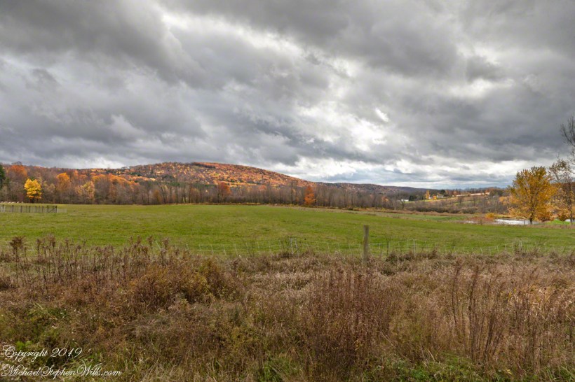
Connecticut Hill from Harvey Hill Road on a late October afternoon. Newfield of the Finger Lakes Region of New York State.

dramatic sky
Connecticut Hill from Harvey Hill Road on a late October afternoon. Newfield of the Finger Lakes Region of New York State.
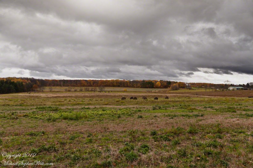
Hay Bales!!
The land opens up on the slopes of Connecticut Hill, Newfield of the Finger Lakes Region of New York State.

Anything but devilish
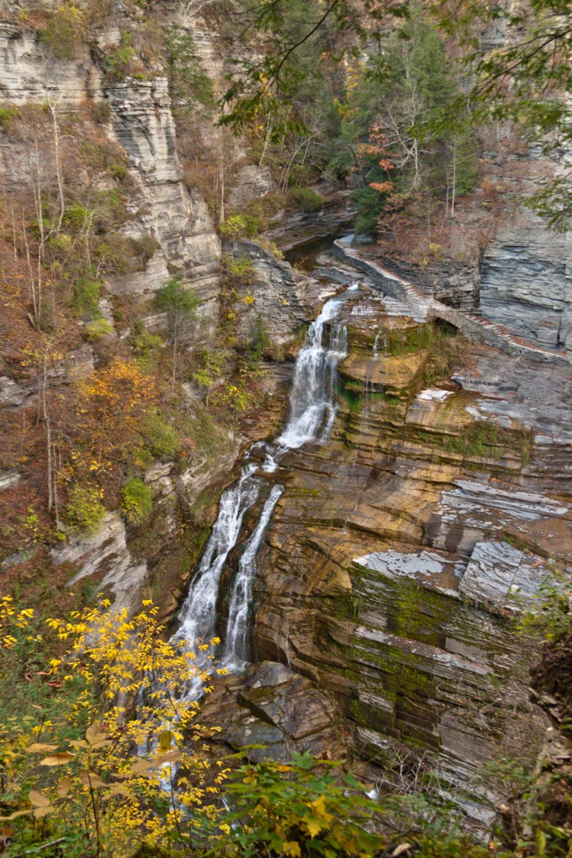
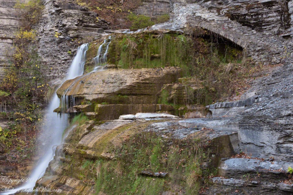
A full sweep of Lucifer Falls on an autumn evening, the sun hidden behind the gorge walls. Here the Gorge Trail emerges from the shelter of the gorge, emerging into a dizzying view.

Look Around
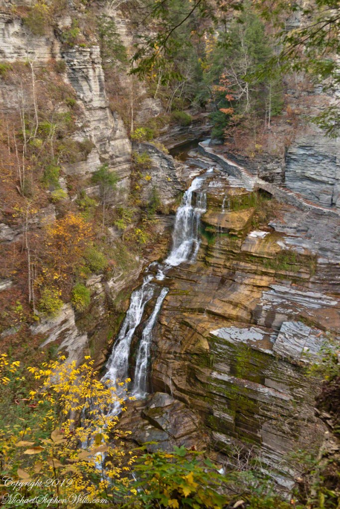
Standing on the trail alongside Lucifer Falls, crane your neck, up and up to the cliff top. Look closely to see the protective rock wall of the overlook.
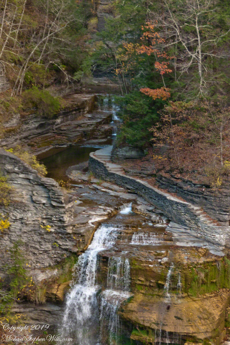
The Rim Trail includes this overlook of Lucifer Falls with, upstream, the Devil’s Kitchen waterfall, the path of the Gorge Trail in between.
The full sweep of Lucifer Falls on an autumn evening, the sun hidden behind the gorge walls. Here the Gorge Trail emerges from the shelter of the gorge, emerging into a dizzying view.

On the way to “Devil’s Kitchen”
This trail, built into the slate/sandstone gorge wall, follows the descent of Lucifer Falls. Here we view the brink and the path alongside. Follow this trail to Devil’s Kitchen, up and around the corner.

A visit to a wilderness horse camp
Nugget and Colorado had eaten their fill of the rich early spring grass of the apple orchard, The Searcher pulled together the pair for the return to Pine Creek. Perched on Colorado, the lead held by The Searcher, I listened as he shared survival facts remembered from Peter Bigfoot’s desert survival course. The Reavis Mountain School of Self Reliance, founded 1979, is along same Reavis Gap Trail (#117) we traversed. After descending to Pine Creek and up to Reavis Gap (where I first met The Searcher), it descends to meet Campaign Creek where the survival school is located.
He pointed out on the many flowering Century Plant stalks along the trail. “These are great to roast when young, just as the stalk starts to bud from the center, before it starts to lengthen.” By the time the stalk flowers, as in the following photograph, it is quite tough.

At the base of boulders, shaded from the sun, the ridgeline fern takes hold. Surviving on seasonal water seepage, it dries out during dry spells to later revive and reproduce via spores. As I recall, the dry or fresh form is useful as an analgesic.
An absolute necessity for bushwacking (walking off the path), a pair of rattlesnake proof boots were worn on every expedition. These rose to mid-calf with a layer of lexan, the same as used for bullet proof glass.
We passed the time in this way, me holding on to the saddle horn bouncing and shifting as Colorado negotiated the rough and steep path down to Pine Creek where the vegetation changed from very sparse to the thick growth you saw in my post “A Peaceful Day at Pine Creek”.
On the east side of Pine Creek a trail, unmarked on the maps, follows the creek bed uphill north towards Mound Mountain. In 50 feet or so we passed the side trail to my campsite, our destination was The Searcher’s campsite. I was not paying near enough attention to the surroundings when I looked up to see an Arizona Oak limb headed to my chest. With no time or space to negotiate the obstacle I was left to grab hold and hang on to be swept from the saddle. The branch held my bulk for, at most, a second before giving way.
In bending flexibly before breaking the live Oak wood and centuries of soil underneath the trees softened my fall enough so I was badly shaken and unhurt. Falling a foot or so in any direction would have resulted in serious injury or instant death. Colorado stopped, looking briefly back as I slowly came to my feet. After taking account and letting the circumstance wash over me, I got up and proceeded slowly while we both contemplated my miraculous survival.
I now took up the rear as in a few hundred yards the valley wall rose on both sides of the Creek to form a short, narrow pass. The walls fell away just as quickly, the valley floor leveled out and we came to The Searcher’s camp. The bear shelter stood out right away. This was a ten foot high teepee of 4 – 6 inch diameter tree trunks tied with rope, within was a hammock . The three foot wide opening left only one unprotected side while he slept, offering some protection from the all too common roaming bears, most commonly from September to November when mazanita fruit ripens.
Well stocked in every respect, for a wilderness camp. In the following years of roaming the wilderness the camps of other horse people were similar in this way: stoves, comfortable cots, radios, pots and pans all fit into panniers. As a noun pannier is seldom used in the singular because there are always two, one on each side of the horse for balance. I sat on the wide top of one enjoying a cold beer pulled from a bed of ice.
We discussed the benefits and drawback of horses for exploration. I required a gallon and a half of water daily and in the desert wilderness provided for storage of three days, 4 and a half gallons. At 8 pounds each, that is 36 pounds!! Starting out, my pack weighted 90 pounds with a camera and tripod.
There are benefits to having a mode of transport that thinks for itself and drawbacks. Each individual has its own personality and horses do try to get away with what they can. It is wise to limit your dependence on a horse until you know each other well. In retrospect, I was “out on a limb” riding Colorado modified by being led by someone the horse knew well.
It was soon time for me to head back to camp. We set the agenda for the next day, an early start for the hike out. Colorado was to be fully loaded so my riding was not an option, just as well. It was possible to lighten my pack to almost nothing and I looked forward to that.
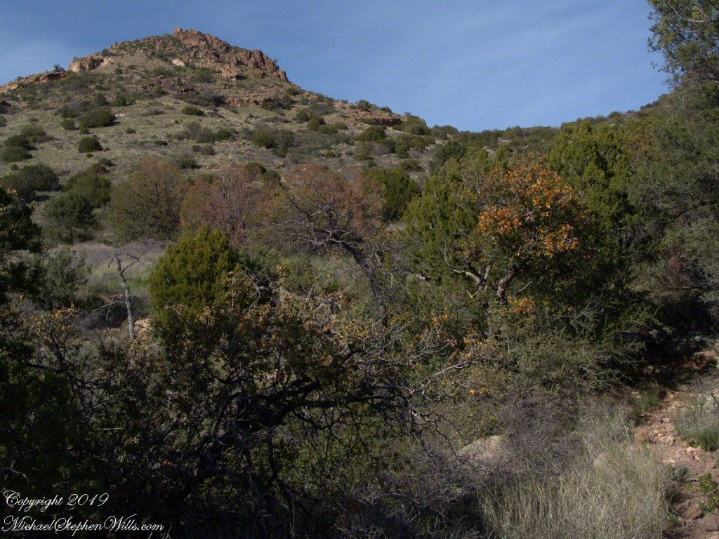
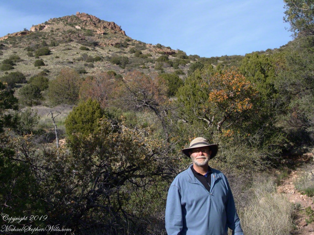
I took some time before dinner to set up the tripod for a self-portrait on my last full day in Pine Creek. The view is northeast from the Arizona Trail near my camp, the ridge overlooks Reavis Gap. I did a version of the view with and without me.


Here is a gallery of the same photos. It is fun to flip back and forth with me disappearing from the scene.
Hosting Astronaut ZZZZZZZ’s and much more
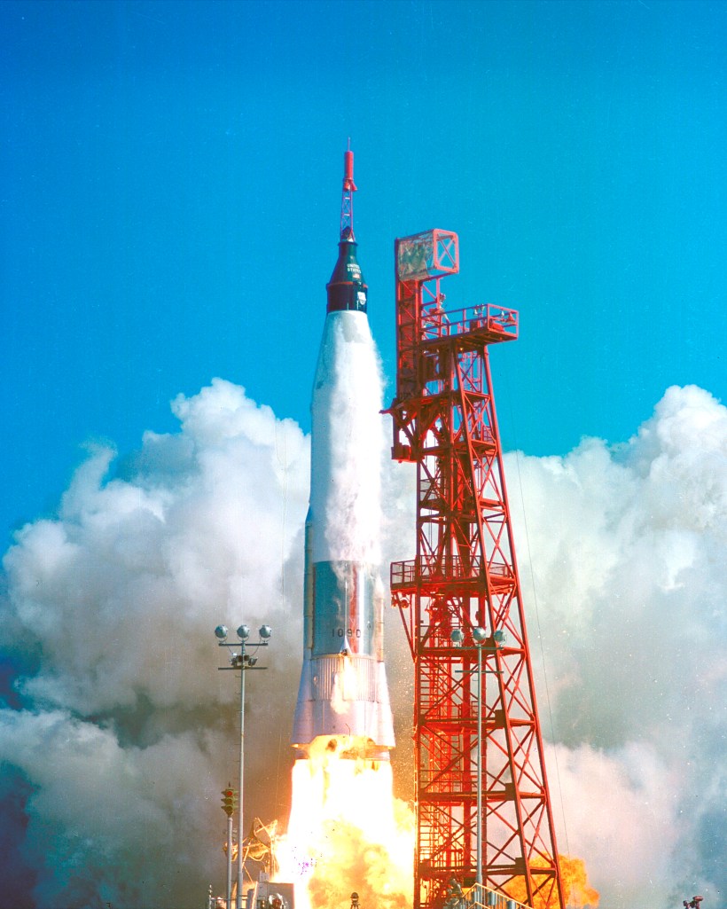
Here is the sixth in a series of photographs centered on the early history of space flight on Cape Canaveral mostly taken during a tour organized by the Cape Canaveral Lighthouse Foundation. “Google” the foundation for details of future tours. Here we explore pre-launch support for the Mercury program, including the first USA Orbital Launch of John Glenn from Launch Complexe 14 (LC 14).
Leaving LC 1 – 4 (see “Post WWII Launch Complexes”), our bus turned onto Central Control Road passing construction on Launch Complex 36 (LC36). In 2015 Blue Origin (Amazon money) leased LC36 where it planned to launch the “New Glenn” vehicle after 2020. I snapped the churned-up sand and construction equipment, not interesting at all IMHO.
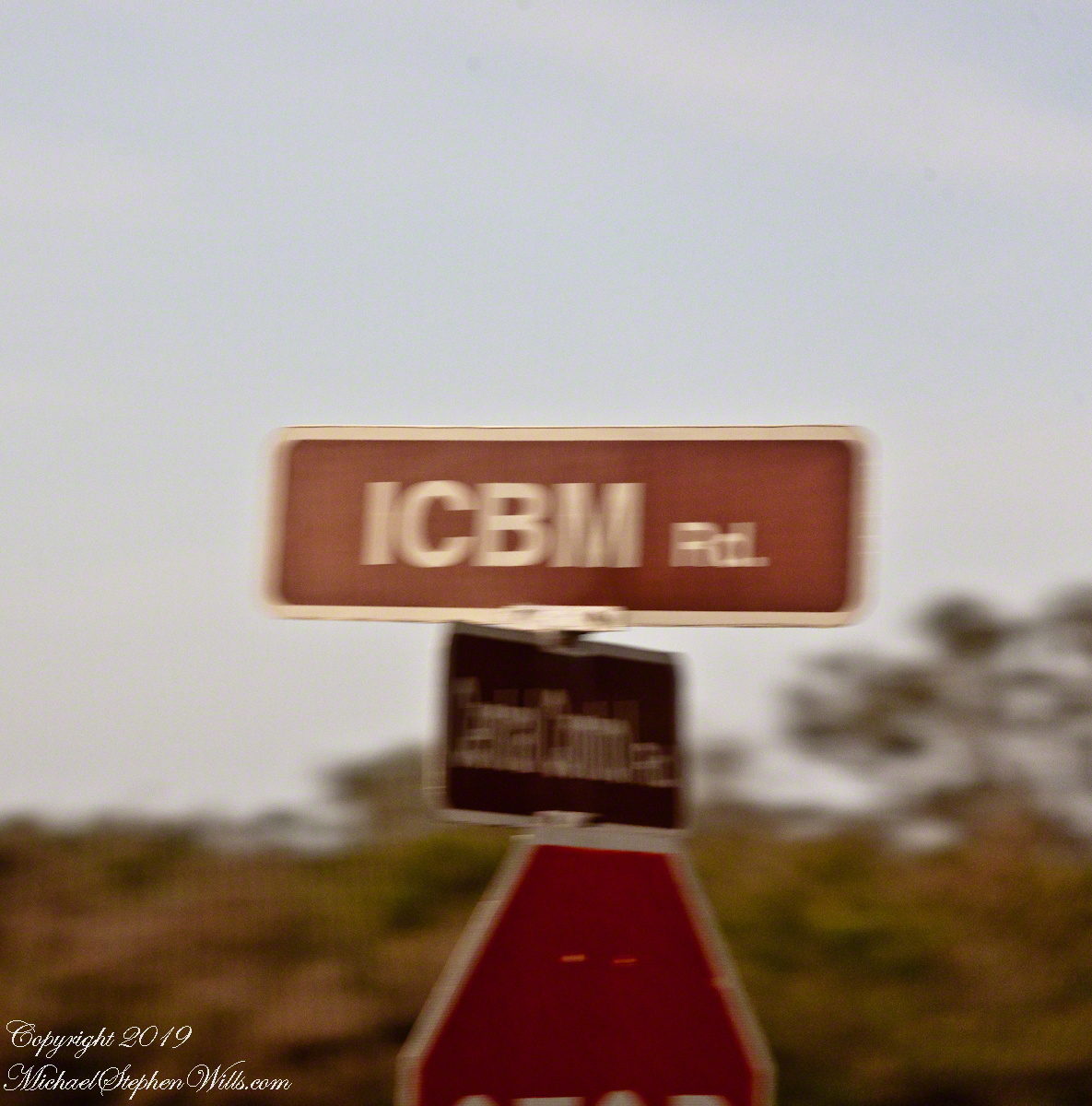
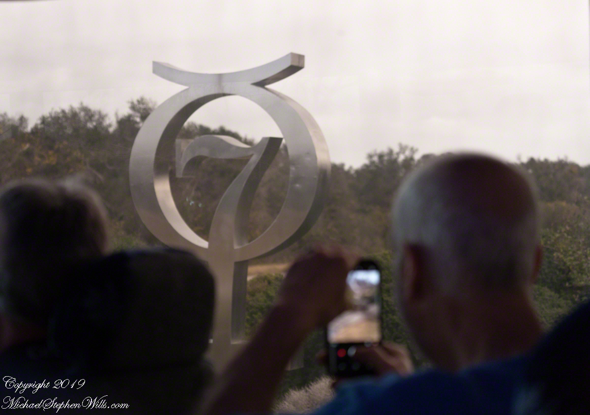
The “New Glenn” was named in homage to John Glenn, the first American to orbit the earth in 1962. We turned right onto to ICBM Road, headed generally north, following a string of launch complexes along the Altantic shore toward Launch Complex 14 (LC14). A dissapointment was not stopping to walk the Mercury 7 Memorial at the corner of ICBM Road and LC14. Our bus stopped briefly enough for the following snap. It is a memorial because John Glenn, the surviving member of Mercury 7, passed away December 8, 2016 at the age of 95.
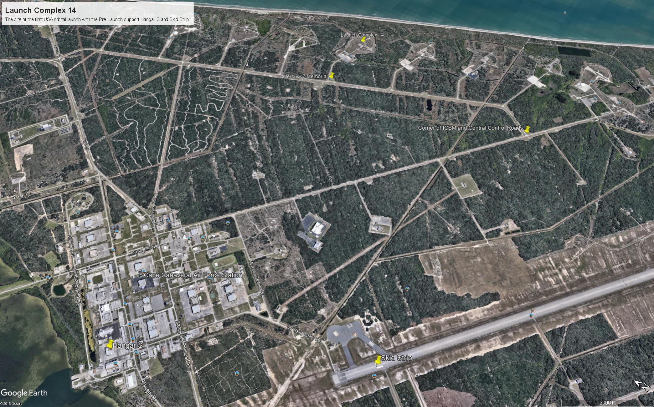
I will cover at length the Mercury-Atlas vehicle that powered John Glenn into orbit February 20, 1962. The tie-in between ICBM road and this series of launch complexes is the early space missions were on re-purposed Intercontinental Ballistic Missles (thus, ICBM). “Atlas” is the name of the ICBM used for Colonel Glenn’s 1962 flight. Click on the following image to find labled pushpins for the corner of Central Control and ICBM Roads (upper right), the road to LC14 and Mercury 7 Memorial.
You will also find a pushpin for the Skid Strip, bottom just to right of center. The earliest cruise missle tests (see “Cruise Missles” and “Post WWII Launch Complexes” ) included navigation to a landing on non-wheeled “skids.” The strip was maintained in support of the manned and later missions when cargo planes delivered the early space capsules, landing, not skidding hopefully, for transfer to a Pre-Launch facility, Hangar S.
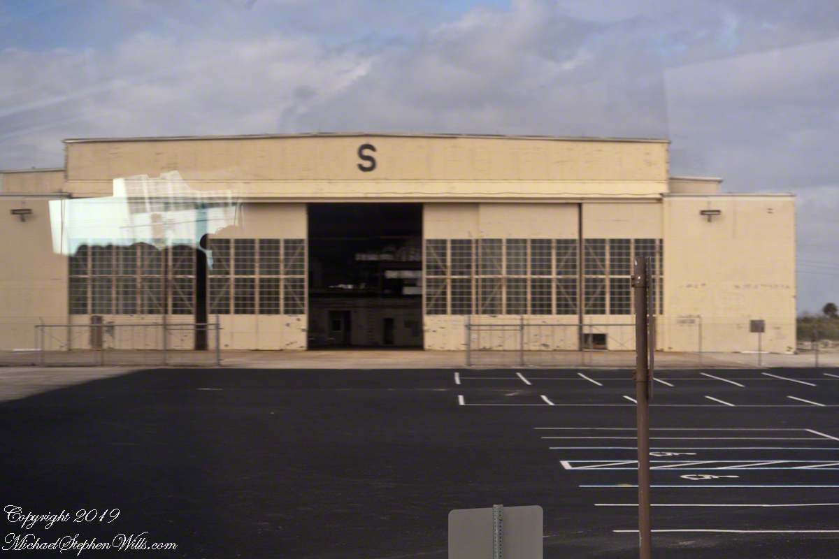
Hangar S is seen below as we passed later in the tour. Built 1957 by the military the 61,300 square feet were acquired by NASA in 1959. The early space capsules were tested here in an vacume chamber to ensure the vehicle supported an breathable atmosphere for the occupants.
The first American space voyager was Ham, a chimpanzee. Ham lived in a residential area on the second floor of Hangar S. For a period of time the Mercury 7 shared the spartan second floor quarters. “The Right Stuff” (a 1984 film from a Tom Wolfe book) included scenes from this episode of the program.
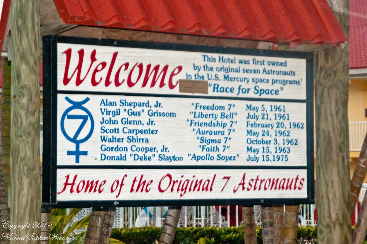
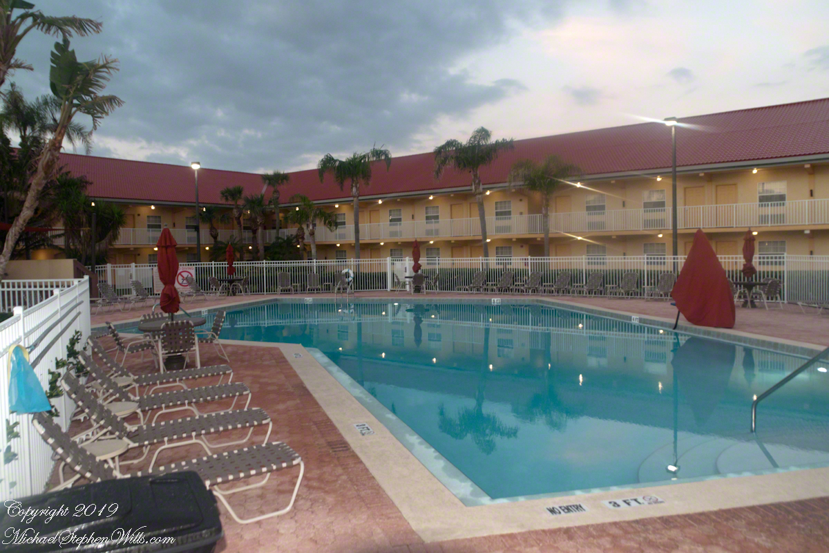
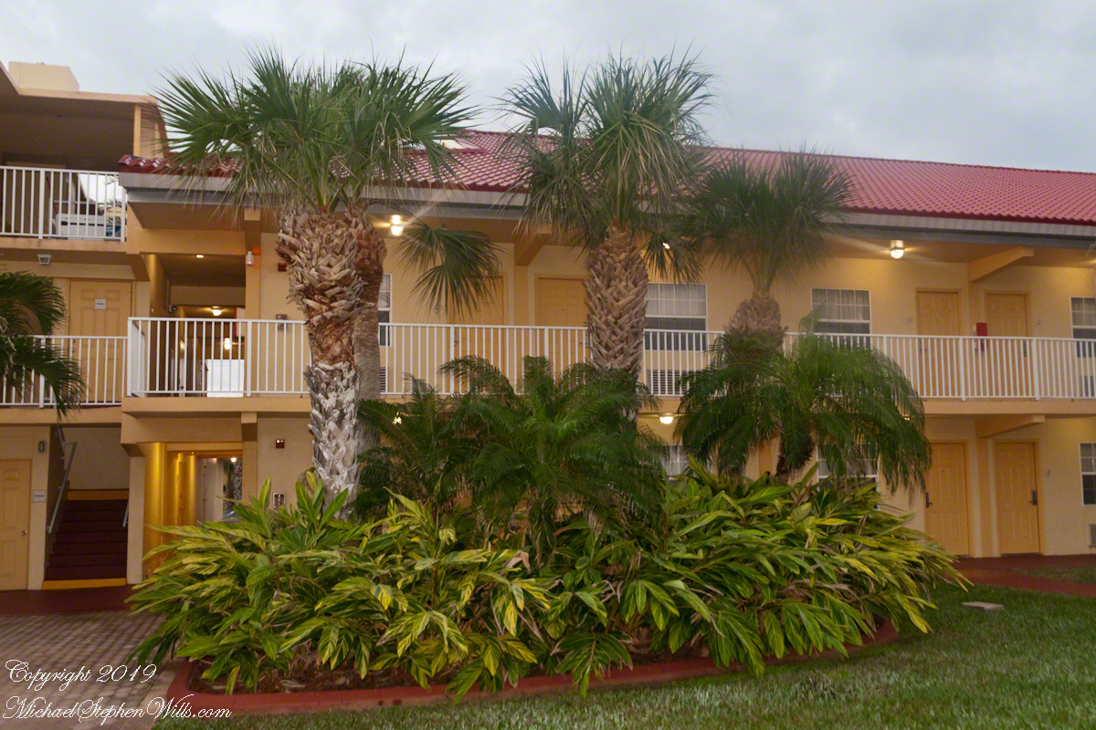
In short order arrangements were made for more comfortable quarters, just off the ocean in Cocoa Beach. It was a new hotel given over entirely to the Mercury 7. Pam and I stayed there in 2018 while taking this tour, it is the La Quinta across from the International Palms. We recommend it a clean, comfortable, reasonably price and a great story to share afterwards. The Atlantic Ocean is a five minute walk.
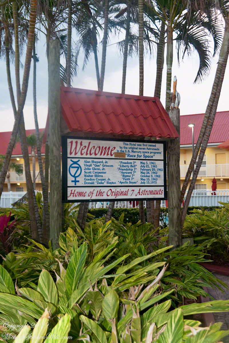
I learned from the tour how the hotel was donated to the Mercury 7 by a private individual. They owned the hotel. Here is a very informative sign just off the La Quinta lobby with their names. Each first mission, as named by the astronaut, is listed.
Next post will feature images of LC14 from 2018.
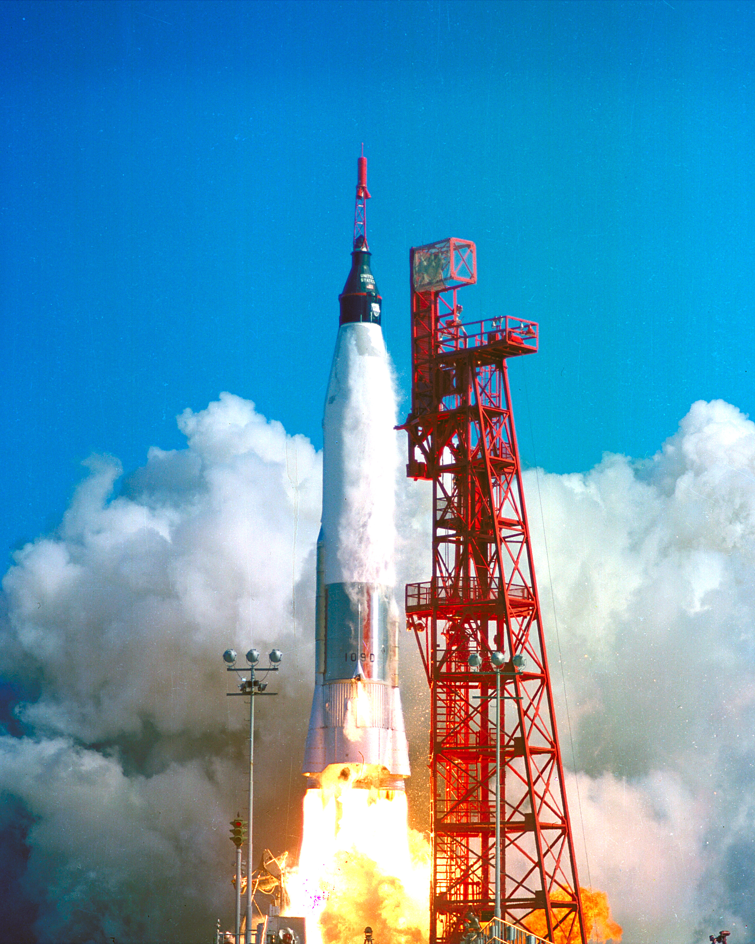
Sources of information for this post: I used information from the Wikipedia site for the key words John Glenn, Launch Complex 14, Mercury-Atlas, Launch Complex 36. Plus a “google” on “Hangar S History” that found an excellent page hosted on the NASA site. Cover photo of Friendship 7 Launch my be found on Flickr in “NASA on the Commons” photostream.
Nine videos taken the same morning, February 5, 2022
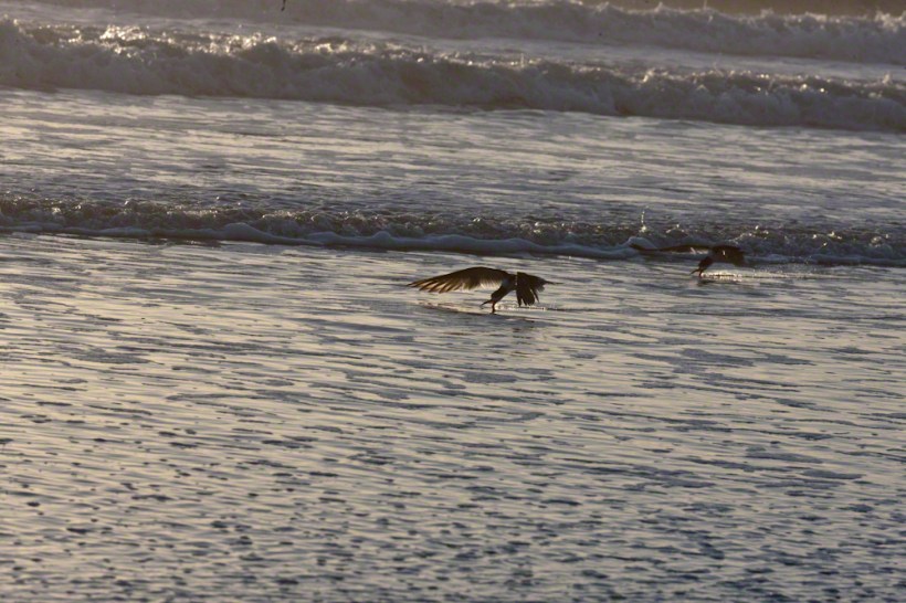
A multi-day hatch of small fry around the time of a new moon triggered this Black Skimmers (scientific name: Rynchops niger) feeding behavior surf off Cocoa Beach, Brevard County on Florida’s Atlantic Coast.
Around Cocoa Beach
Sights and Sounds

Right Whales in February
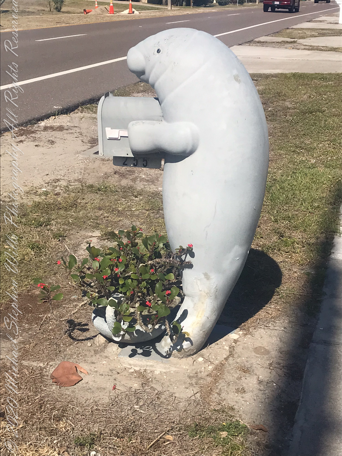
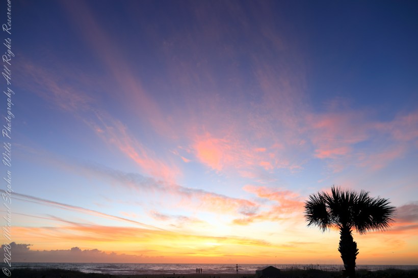
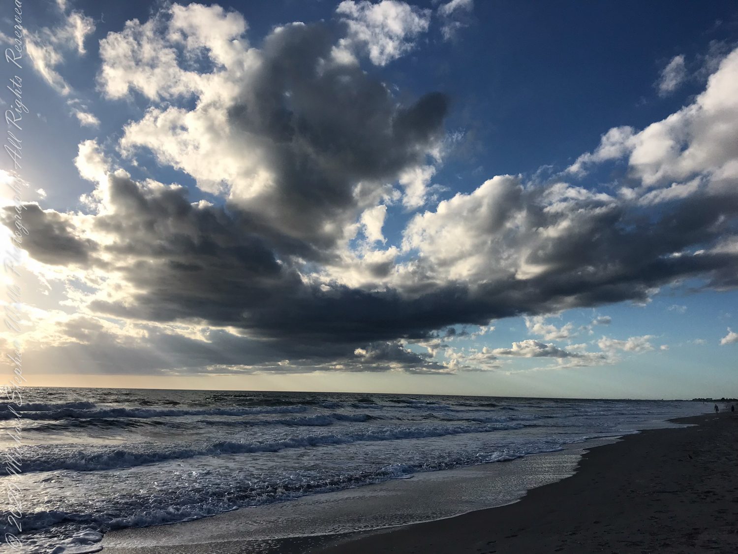
No, the Manatee mailbox on Atlantic Avenue is NOT the whale sighted….more of that later. February 3rd 2022 dawned with scattered clouds to fracture sunbeams.
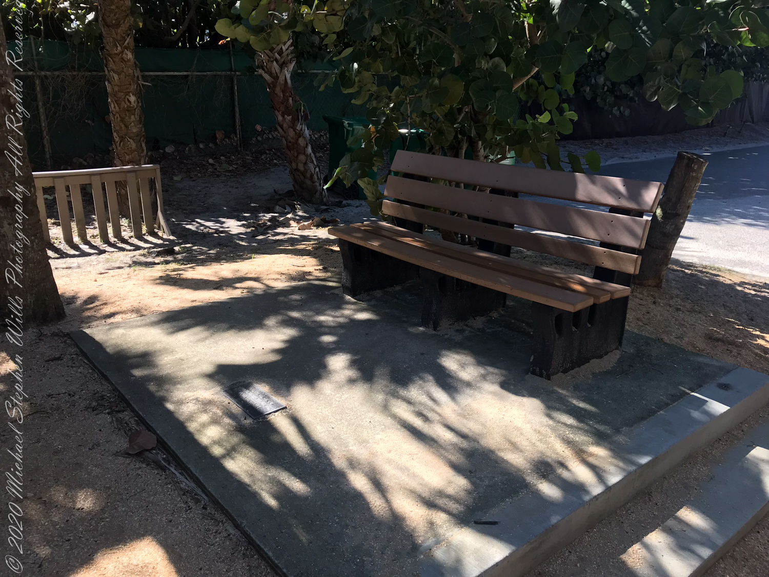
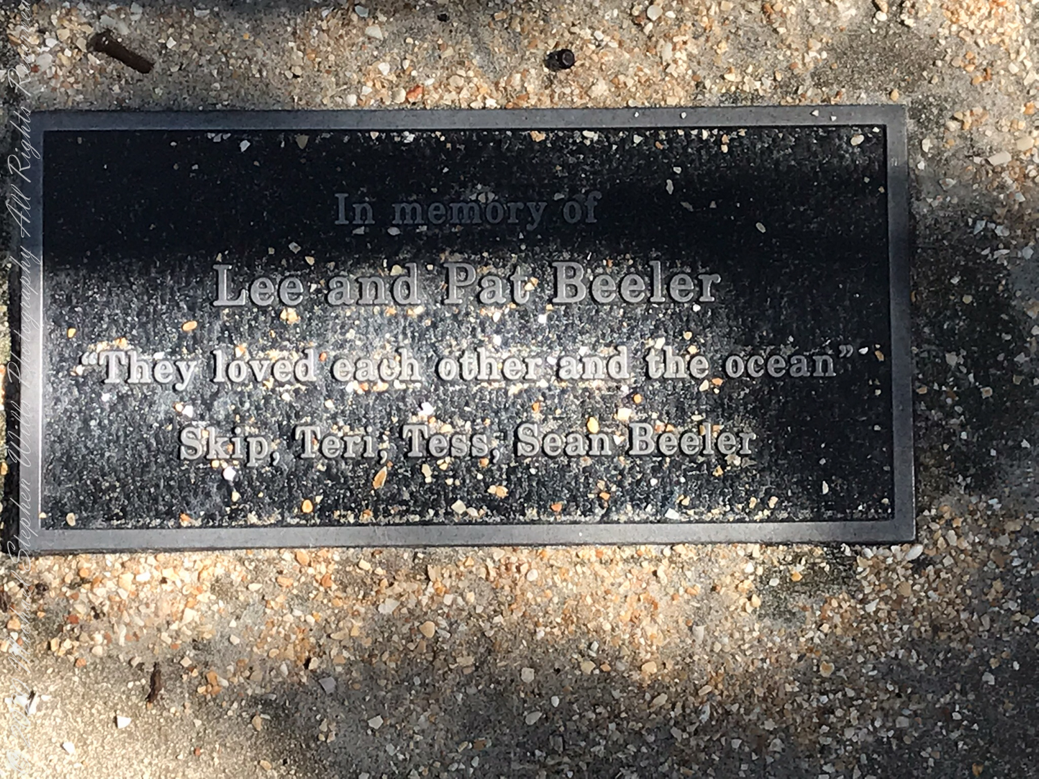
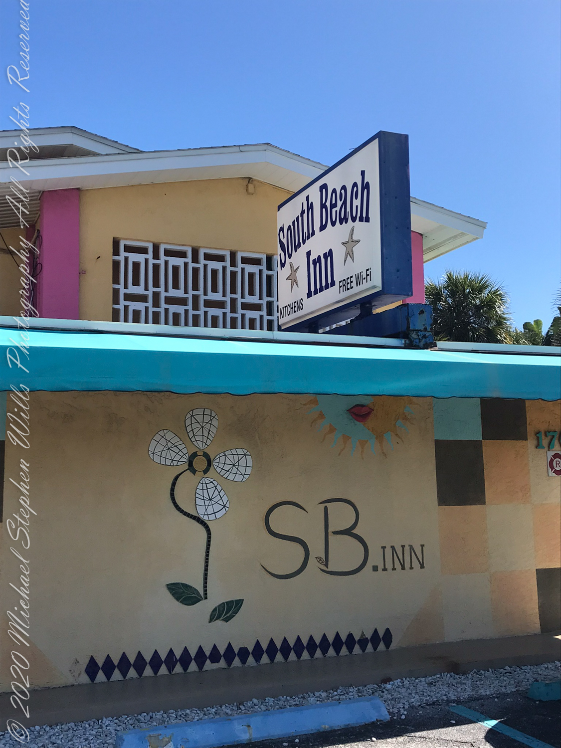
Walking south I made the 2+ mile point where, up from the beach on South Atlantic Avenue, is a memorable facade.
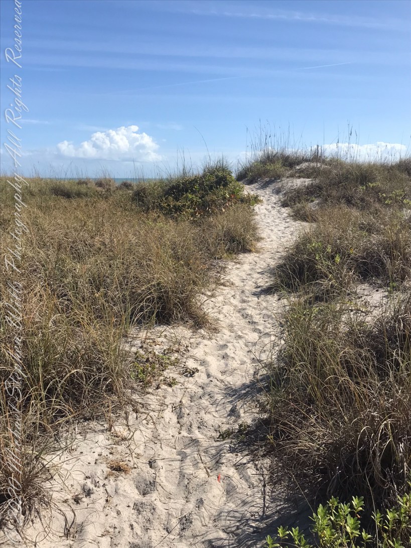
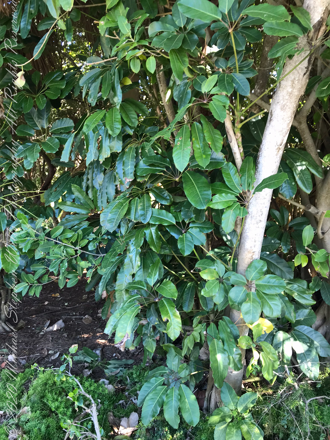
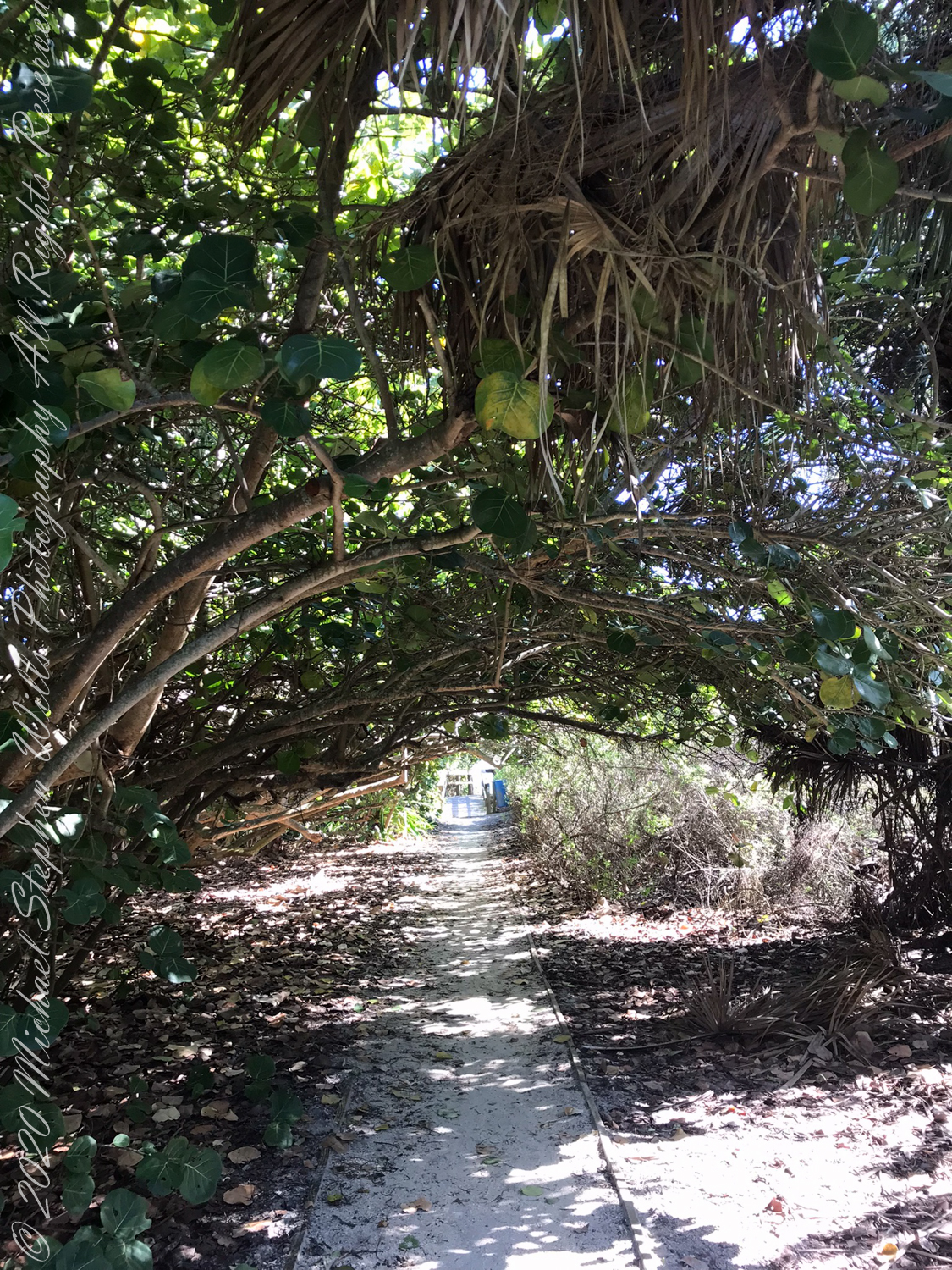
Also exotic schefflera, paths to the beach through Sea Grapes.
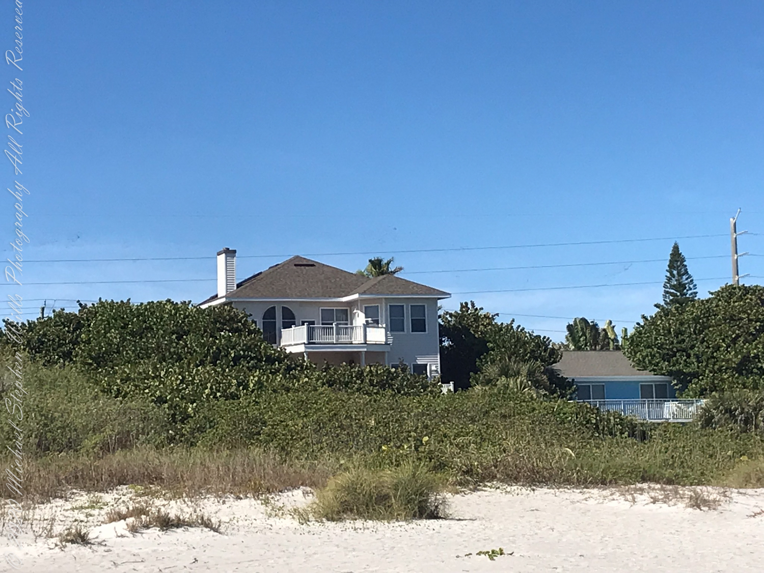
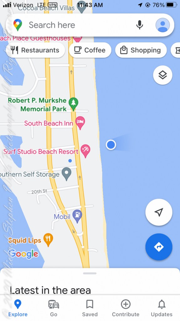
February is the time for Right Whale sightings on the Florida Atlantic Coast. On the beach, near the blue dot on the following map, were lines of people facing the ocean, some with binoculars and cameras with long lenses.
About 500 feet out, beyond where the wave roll begins, a person sat on a paddle board looking to my right. In the following IPhone videos an occasional black hump, roiling water, a flipper and the signature spout are visible. It is too far for identification, I call it a Right Whale from their reputation for visiting these shores in late January/February.
An hour later, I left the beach at South 4th Street to capture the following local color.