Unidentified wildflower growing on limestone ledge with mosses on aporil afternoon. Fillmore Glen New York State Park, Moravia, Cayuga County, New York
Click for my “Finger Lakes Memories” Fine Art Photography Gallery.

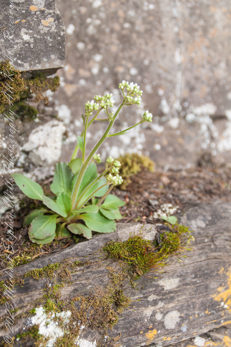
wildflower among mosses
Unidentified wildflower growing on limestone ledge with mosses on aporil afternoon. Fillmore Glen New York State Park, Moravia, Cayuga County, New York
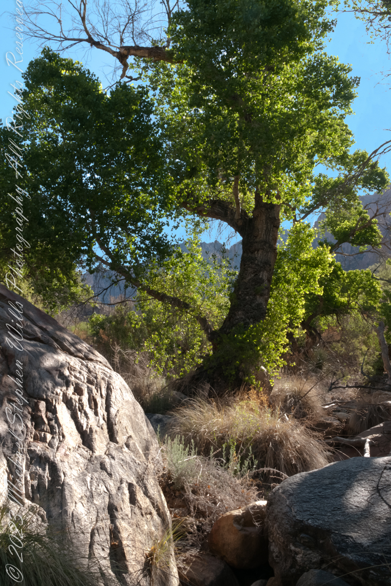
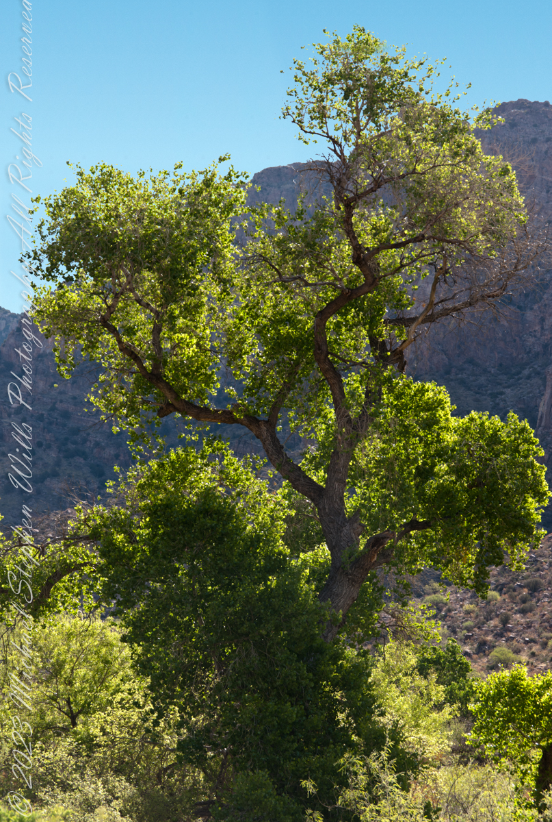
The cottonwood’s deep roots draw water from a mountain stream.
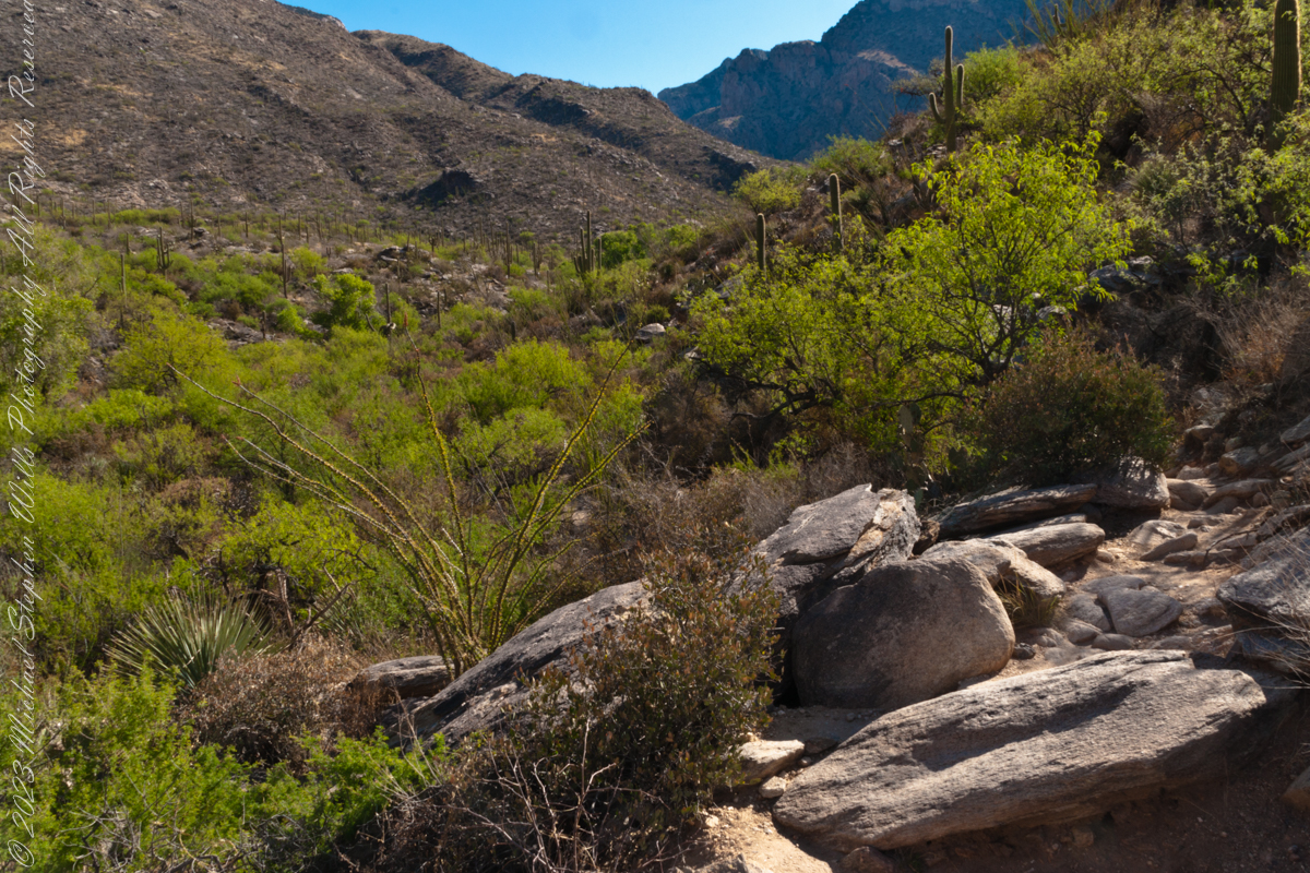
Looking back down Pima Canyon on a spring morning plenty of green under the unrelenting sun.
A large Fremont’s Cottonwood Offers shade and protection along the Pima Canyon Trail.

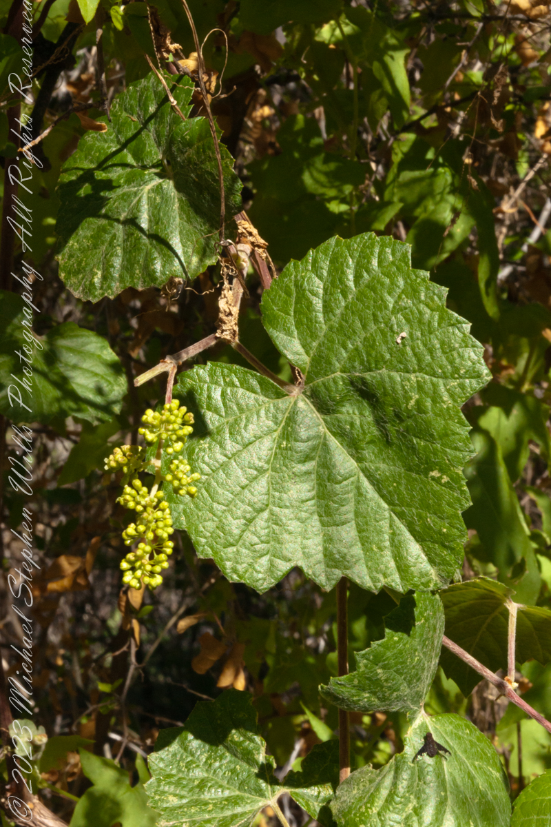
In the shade, a grapevine, offers a vain promise of grapes.
The cottonwood’s deep roots draw water from a mountain stream.
Native Americans in the Western United States and Mexico used parts of Frémont’s cottonwood variously for a medicine, in basket weaving, for tool making, and for musical instruments. The inner bark of Frémont’s cottonwood contains vitamin C and was chewed as an antiscorbutic – treatment for vitamin C deficiency. The bark and leaves could be used to make poultices to reduce inflammation or to treat wounds.
The Pima people of southern Arizona and northern Mexico lived along Sonoran Desert watercourses and used twigs from the tree in the fine and intricate baskets they wove. The Cahuilla people of southern California used the tree’s wood for tool making, the Pueblo peoples for drums, and the Lower Colorado River Quechan people in ritual cremations. The Hopi of Northeastern Arizona carve the root of the cottonwood to create kachina dolls.
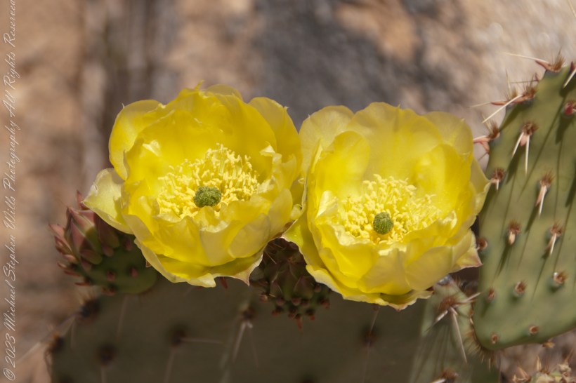
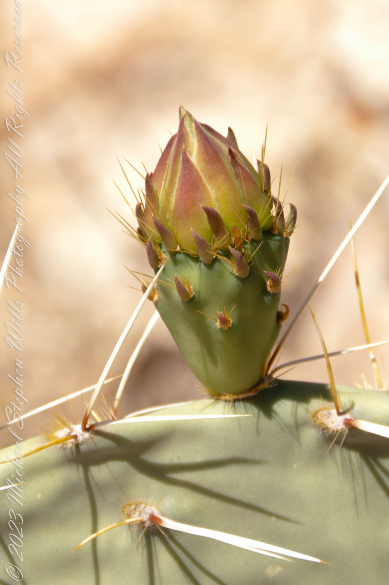
Delicate buds develop into a flower, and then, into a cactus tuna
A set of photographs of buds and blossoms of the Prickly Pear Cactus taken in Pima Canyon of the Pusch Ridge Wilderness of the Catalina Mountains.
Here are 8 flower bud growing from one cladode (pad). There is a 9th bud on a second cladode. What is interesting about these pads are the needle shadows. Although thin, each provides some protection from the sun.
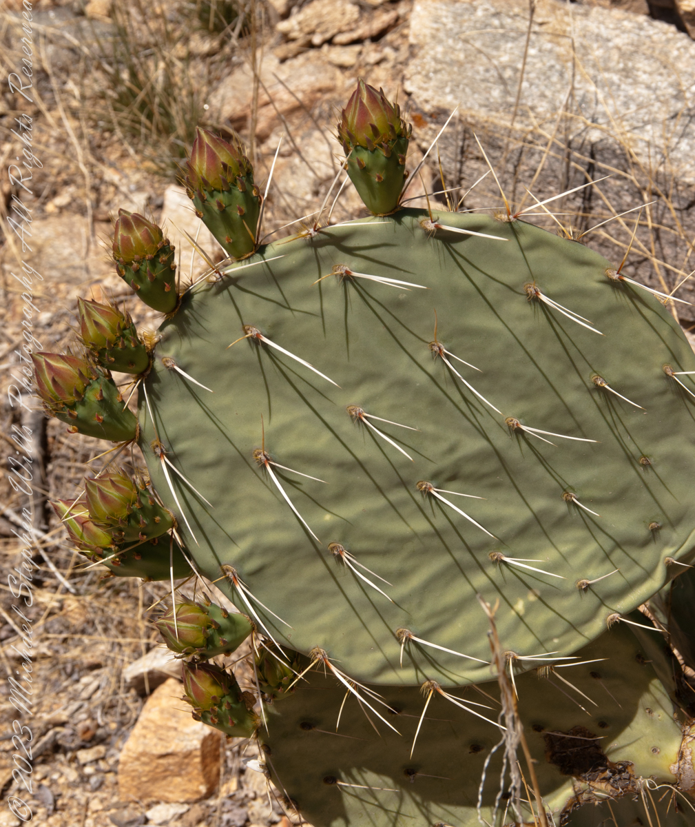
This delicate bud will develop into a flower and, then, into a cactus fruit (in spanish, tuna). The fruit retains those tiny spines, called glochids, which detach on the smallest contact. The pads are also covered with them.
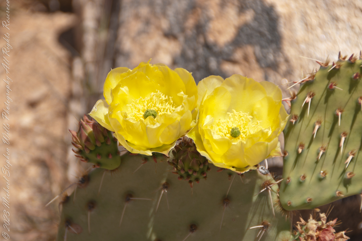
Prickly pears are known for growing into thickets. The Cuban government created a “cactus curtain” of prickly pears around the Guantanamo naval base in the 1960’s, to prevent Cubans from escaping to refuge in the United States.
Look closely at the anthers of these flowers. Each curls over when touched, depositing its pollen. The habit of prickly pears to grow together in thickets mean there are clusters of blossoms in springtime.

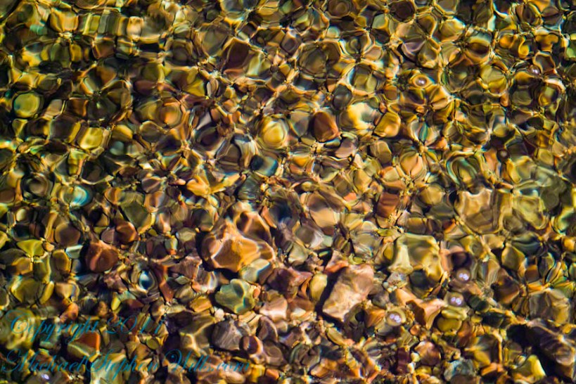
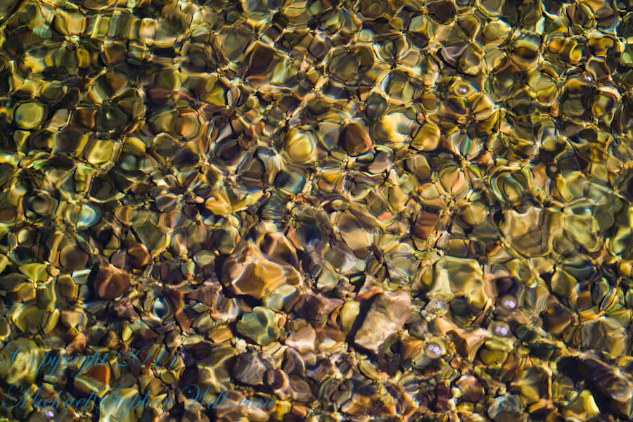
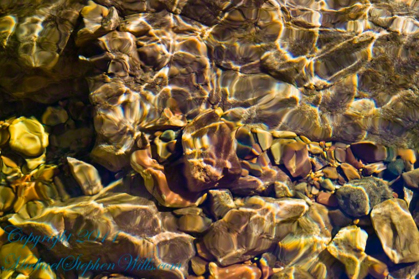
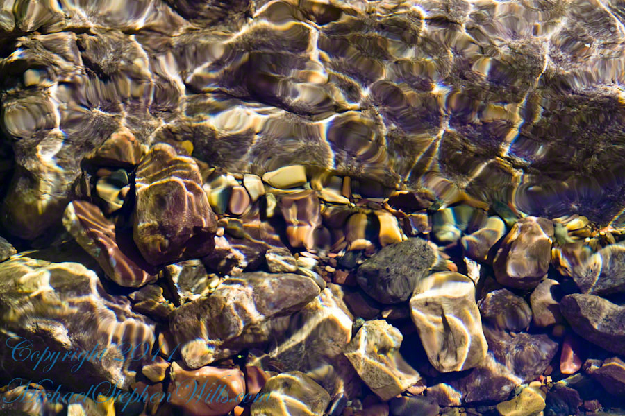
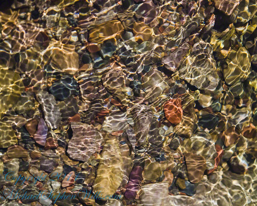
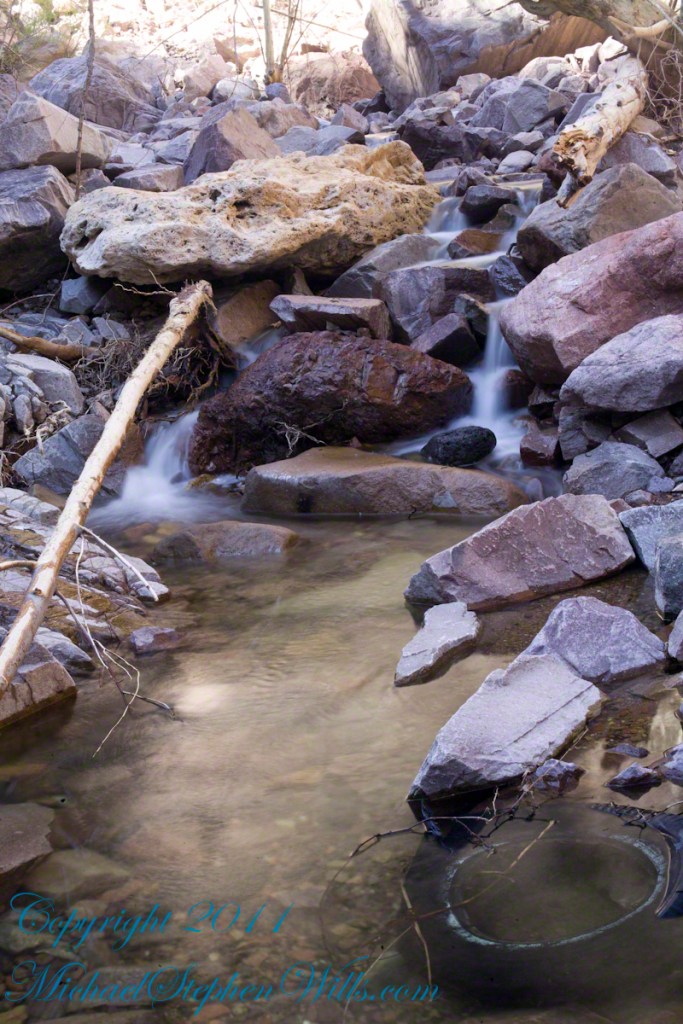
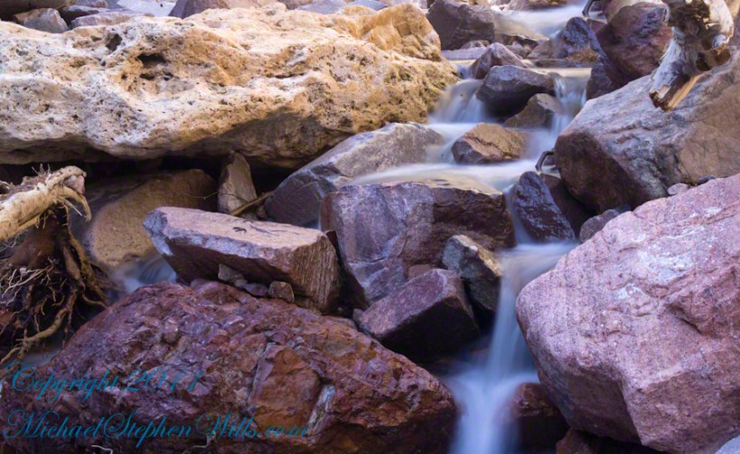
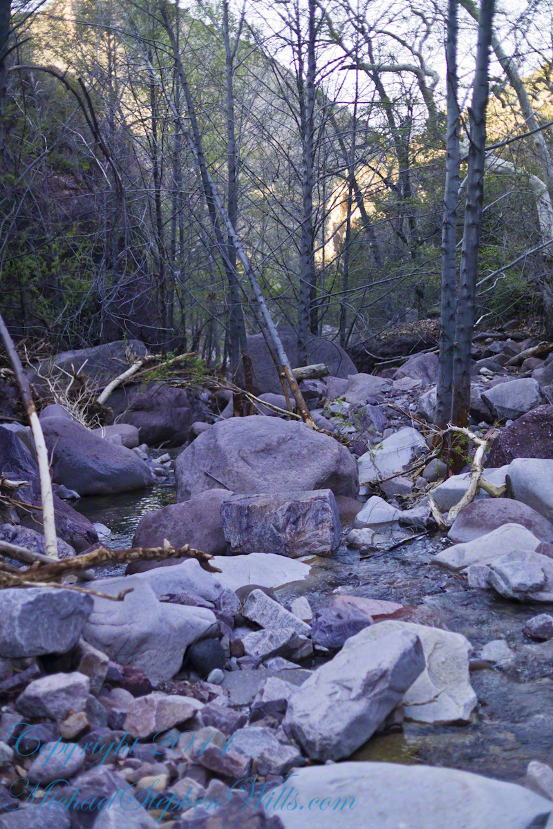
A Series of Nature Abstracts, macros of Reavis Creek below the falls
These four shots are of afternoon desert light playing on limpid water flowing over colorful rocks.
All are macro shots of the falls taken with a Canon 100mm f/2.8L lens.
From my solo expedition to this location in the remote eastern Superstition Wilderness of Arizona.
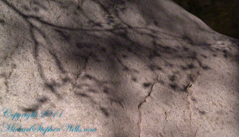
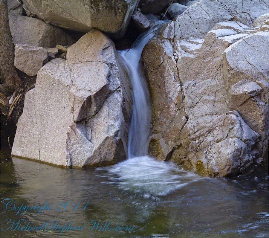
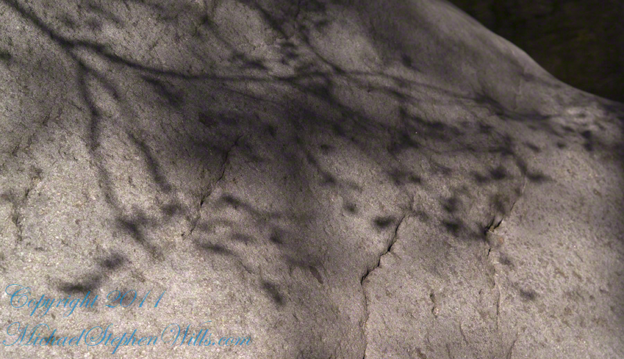
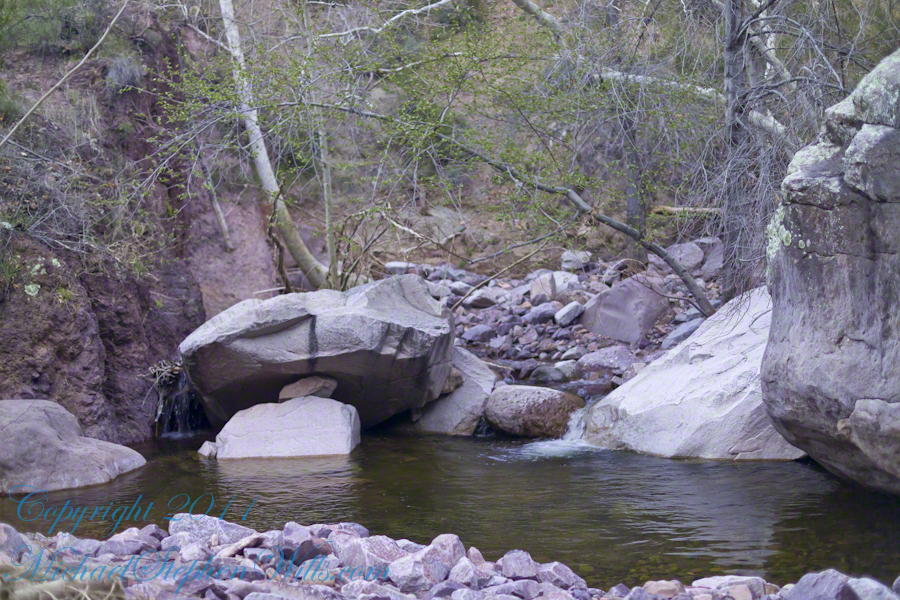
Water and Shadows
With the afternoon in front of me, the trip back to camp was a slow pleasure. On the way in, I noted several stopping points to capture photographs. Here a natural rock sluice offers a foot tall waterfall, mirroring Reavis Falls, bracketed by white igneous stone.
This same stone offers a screen, the bright spring sun throwing the sparse leaves into sharp relief.

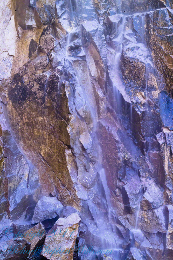
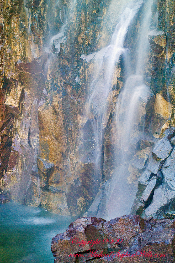
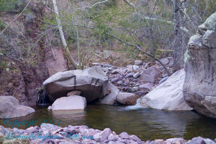
Basalt and Water
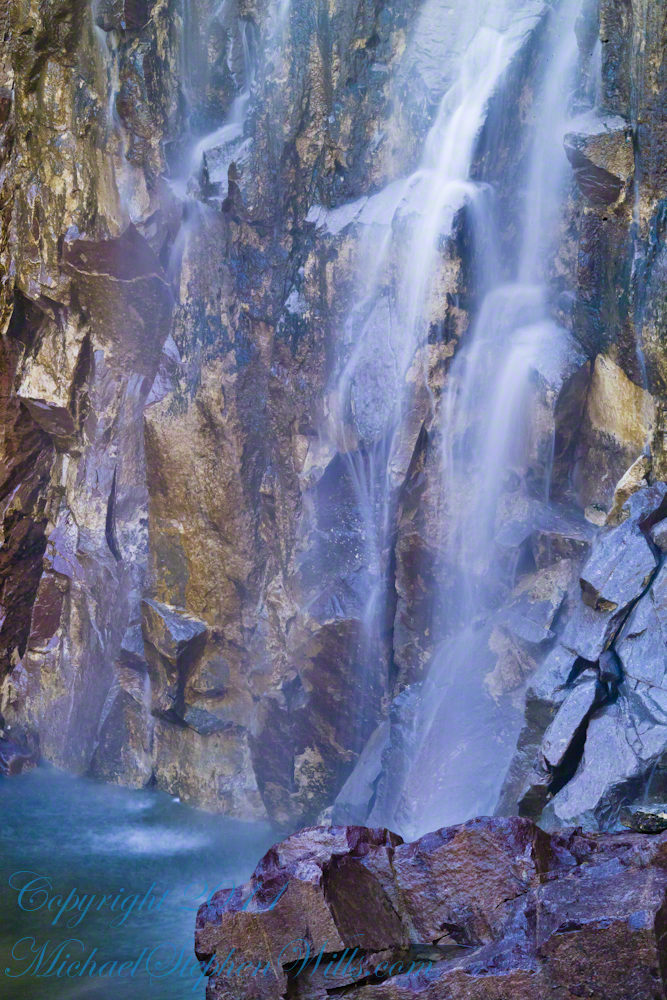
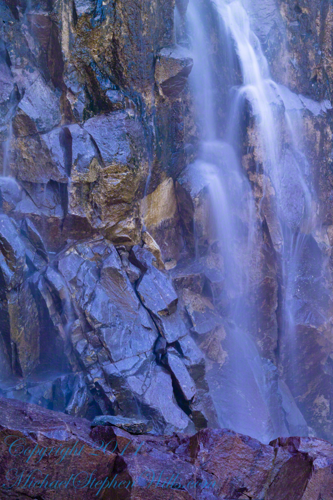
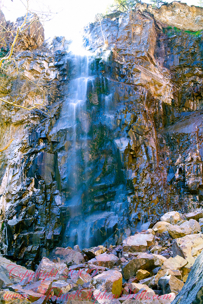
These are six shots of Reavis Falls from my solo expedition to this location in the remote eastern Superstition Wilderness of Arizona.
All are macro shots of the falls taken with a Canon 100mm f/2.8L lens.
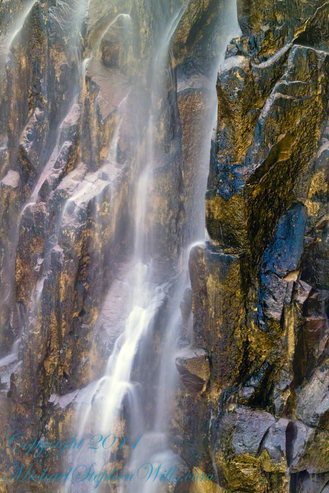
I took these while perched on a pile of talus beneath the falls.
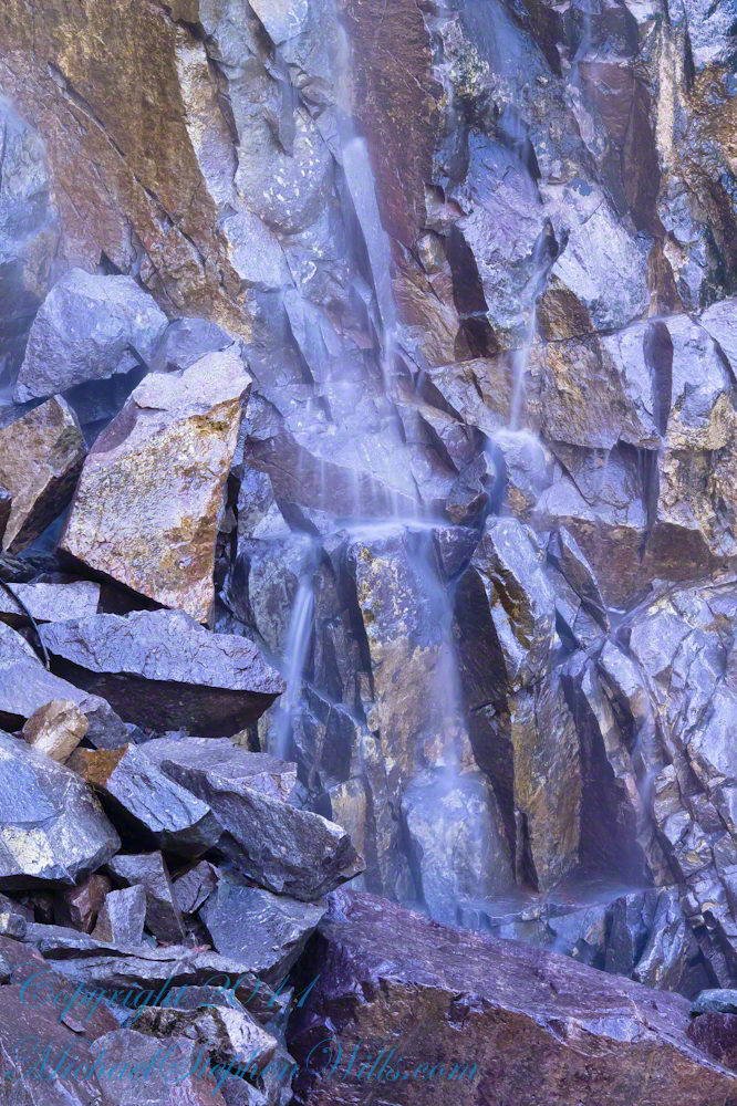
Reavis Falls are 114 feet high in a canyon hidden in the folds of mountain ridges in the remote eastern Superstition Wilderness of Arizona.
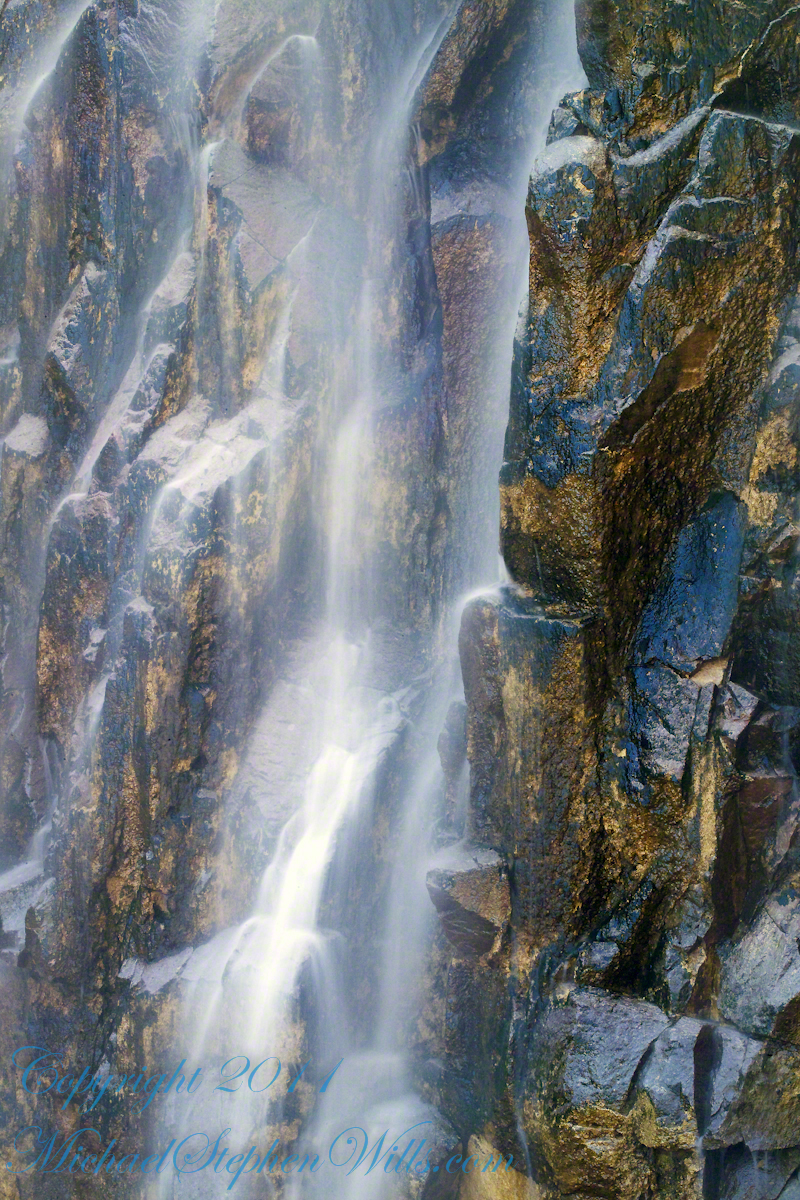
Reavis Creek falls from a sheer basalt cliff, remnants of a volcanic eruption, cool a million years ago, a little colder today by this running water.
No signposts in the wilderness
Reaching Reavis Falls, once you find the canyon mouth, is three-fourths of a mile of boulder hopping and bushwacking over and around landslides, deep pools and fallen trees. Odds are you will be the only person in the canyon for weeks, if not months. Expect to be surprised. In this chapter you will (finally) visit the falls themselves.
Click me for the chapter about the environment around the mouth of Reavis Canyon below the falls.
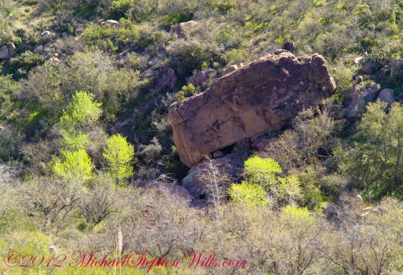
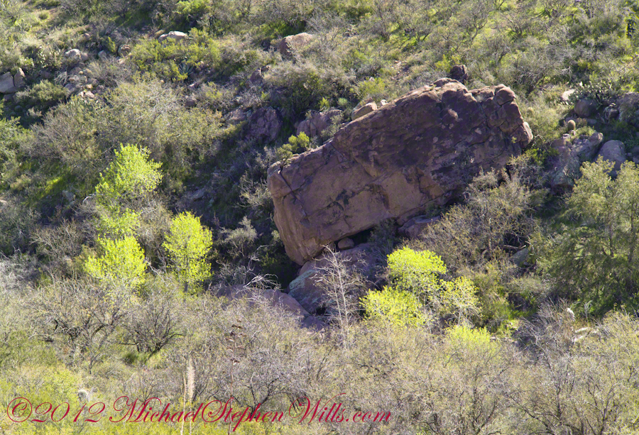
Here is an overview of the last third mile of Reavis Canyon. You can see the wall of the falls nestled in the folds of ridges towards the top, just off center.
On the lower right is a large landslide and, below there, it is complete chaos.
The vegetation grows shoulder to shoulder with interleaved branches. You will not get through there. The solution is to find a way around, usually over and around house-sized boulders.
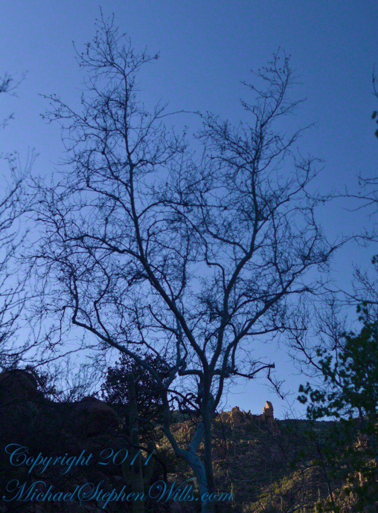
After almost two hours of picking my way, there was a flicker of light. The fall waters were sparkling in the sunlight high above the cottonwood trees, in full Mach bloom, and the still leafless Arizona Sycamores.
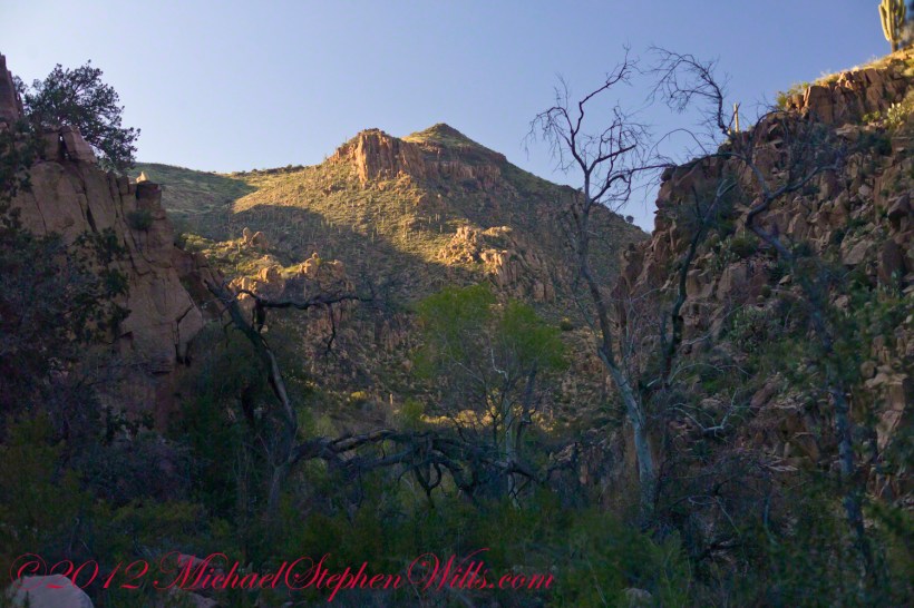
This was my view of Reavis Falls from the canyon on a March day before the Arizona Sycamores have leaved. The falls are the tiny patch of white to the left of midline where the earth meets the sky. Jumbles of infallen boulders and thick growth of sycamores, oaks and fully leaved cottonwoods cloak the falls.
Another 30 minutes of canyoneering brought me to the foot of the falls.
Looking up at Reavis Falls from a 20 foot tall mound of talus.
These are boulders washed down at flood time.
The rock wall is thick with microorganisms, fungi and mosses.
After clambering around the talus pile I found this angle….
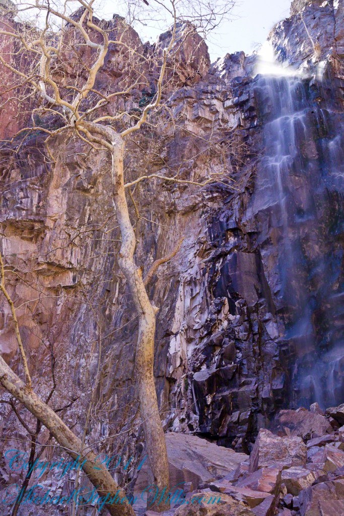

The Reavis Falls talus is large boulders carried down Reavis Creek and washed over the falls at flood time as well as blocks fractured from the cliff face. You can see the base of the Sycamore from the previous photograph.
The falls are formed where Reavis Creek flows over a solid mass of rock. The talus is composed mostly of this red rock. From the edge of this cliff to the base, where the falls hit the canyon floor, is all of 140 feet. This is a far as you can proceed into the canyon without some serious climbing skills.
It is possible to climb around the canyon by climbing up the ridge from which I captured the Cedar Basin Hoodoos. See my posts below for this location (you need to work it our for yourself).
This is NOT the last post of the series. From here I will focus on the beauty of Reavis Falls and the canyon that holds them.
It was a four-day expedition so there are a few chapters covering the approach to the Falls:
Hoodoos on the Descent to Reavis Falls
Reavis Canyon Rivulets and Rocks
Canyon of Wonder and Beauty
The Superstition Wilderness was born from volcanic eruption and in some places (Peters Mesa) the earth still rumbles.
Here in Reavis Canyon it is the huge spring runoff that builds the environment, grinding and scouring the canyon. In my chapter The Mouth of Reavis Canyon is the story of this aspect of the canyon.
The history of this spot is written on these volcanic and igneous rocks and boulders, the uprooted tree roots and fresh water.
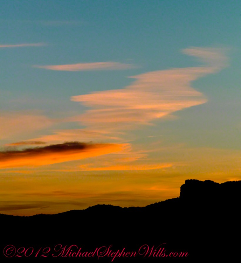
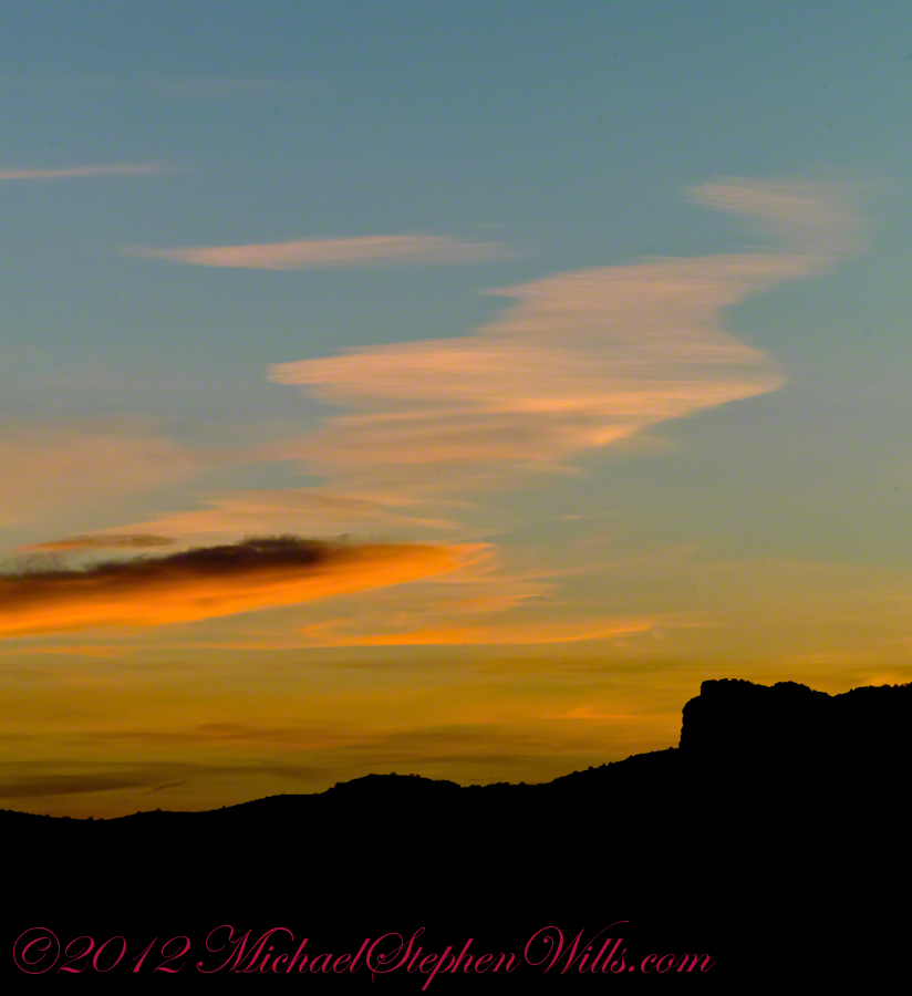
In this chapter I present, in the header, the lovely dawn sky of that day, and a tiny corner of a rock jumble in Reavis Creek. There is a large format version of the sky in my previous post, “The Mouth of Reavis Canyon.”
Canyon Hazards and Beauty
In this chapter we enter the Mouth of Reavis Canyon below Reavis Falls and examine the beauty and danger of this remote canyon.
See Reavis Canyon Camp for more of my expedition to Reavis Falls.
Dawn on the day I entered Reavis Canyon
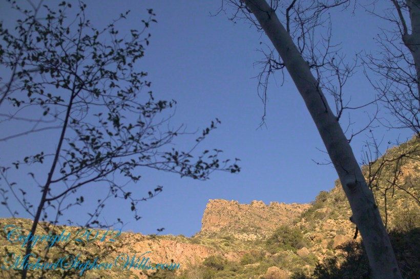
You might recognize the outline of this cliff from the chapter Two Bar Mountain View or Evening on Two Bar Mountain.
Here is the same view, in daylight. As I hiked toward the canyon mouth below Reavis Falls, looking up I saw this prominant cliff against the sky.
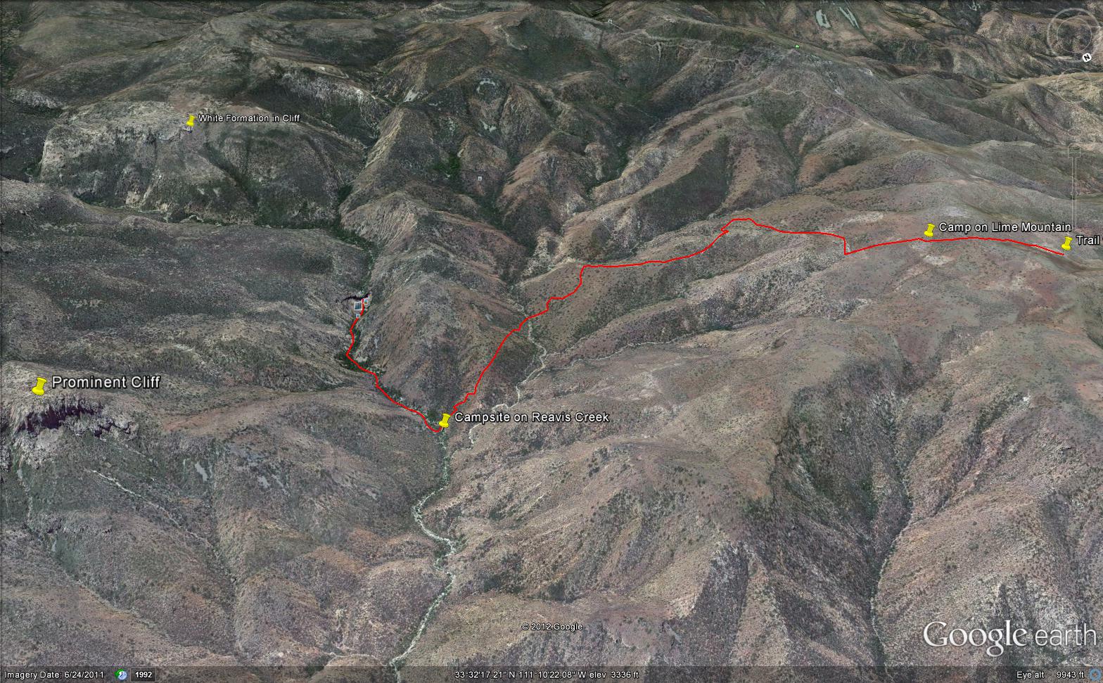
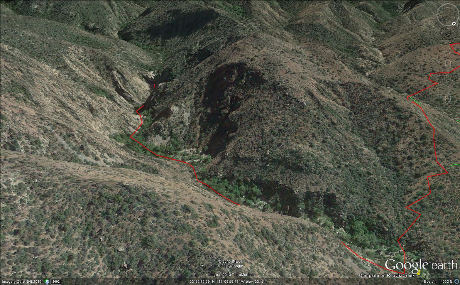
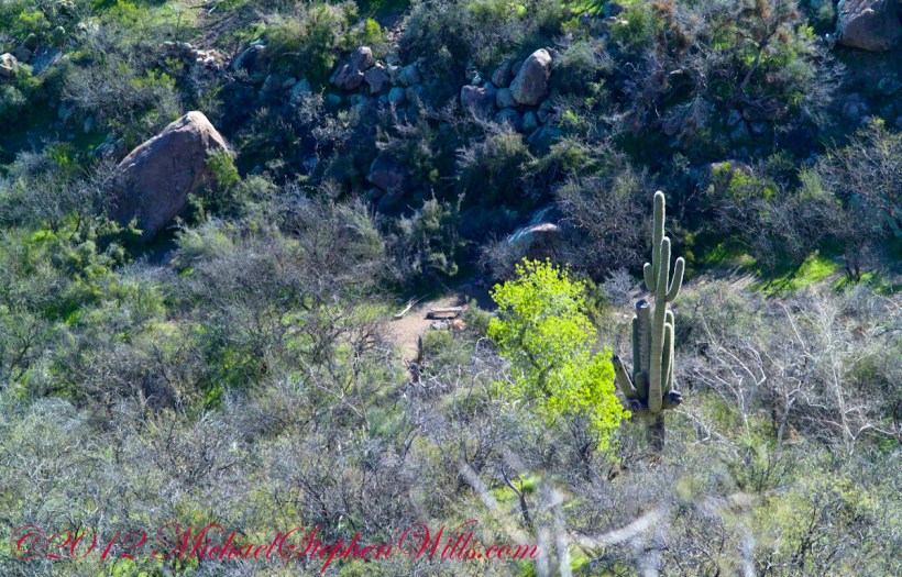
Here is the path I took toward the falls. The campsite is to the lower right, the falls are toward the center and left. My approach to the camp is on the right, moving toward the top. For another view of this location see Reavis Canyon Camp.
The mouth of Reavis Canyon below the falls is choked with vegetation and infallen rocks and boulders. The far slopes are thick with the poles of young saguaros. There are hoodoos, as well. In the photograph, below, one hoodoo is catching morning light. See the chapters Hoodoos on the Descent to Reavis Falls and Cedar Basin Hoodoos for more views of the hoodoos around Reavis Falls.
Flood damage in Reavis Canyon below the falls. Note the scouring at the base of these trees and the broken limbs. This is NOT a place to be in spring thaw.
There is beauty to be found, as well. Freshly fallen rough rocks contrast with water smoothed boulders and the water surface.
below the Falls
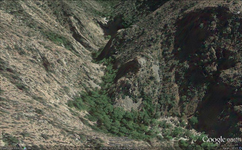
Here is an overview of my route through Cedar Basin on the way to Reavis Falls. There are two paths in the following image from Google Earth. The red path brings you into Cedar Basin and straight up a ridge and down to the campsite. The red path is incorrect in the approach to the ridge and, rather than repaint the path, I created the green path as the gradual and accurate description of how I climbed to the ridge point where I captured the photographs Hoodoos on the Descent to Reavis Falls.
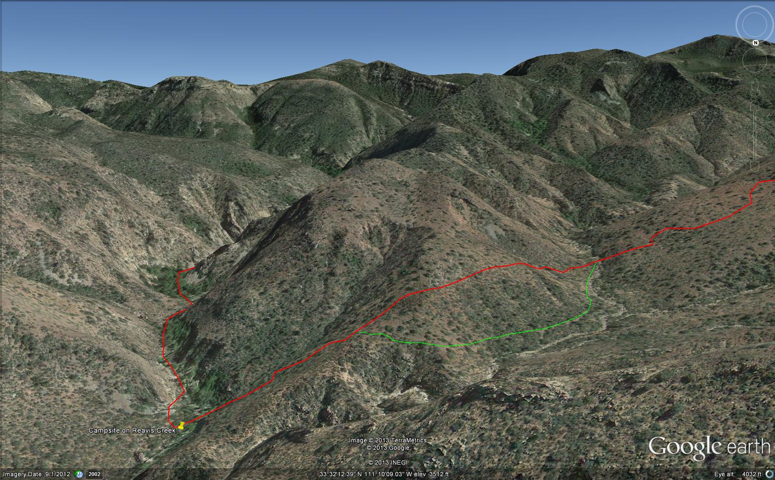
You need to understand there is NO path through this terrain. It is necessary to follow a faint trail marked out by the footsteps of those before you and an occasional rock cairn placed at the most difficult points. The following image is misleading in that what looks like a road next to my green path is actually a creek bed from the Lime Mountain spring.
What looks like a road is the resting place of huge boulders fallen from the surrounding mountains. Since there is water, thick brush and trees grow everywhere in cracks and spaces between the boulders and rocks. Getting through the creek bed with an 80 pound pack and not getting lost is close to impossible. The solution is to hug the ridge slope, following the contours and navigate around boulders.
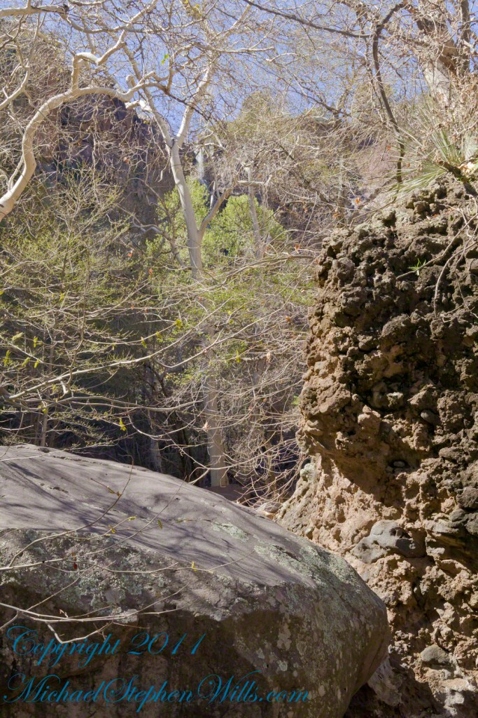
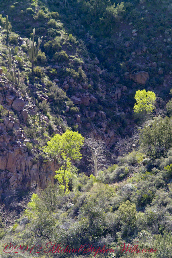
From the ridge small portions of Reavis Canyon were visible. I even spotted a campsite.
This camp, 1,636 feet below Lime Mountain peak, surrounded by house-size boulders fallen from the slopes above, has a patch of grass bright green and fresh to the right. In the center of the photograph is a tree trunk on rocks to serve as a bench next to a fireplace. With an 80 pound pack on my back, I was still an hour or so away from this spot. It was March, so sunset was around 6 pm, enough time to find a way down before darkness to overtook me.
This is an overview of my progress, with the Lime Mountain and Reavis Canyon campsites marked. Landforms are marked on the left: the Prominent Cliff , in the background it says “White Formation on Cliff.”