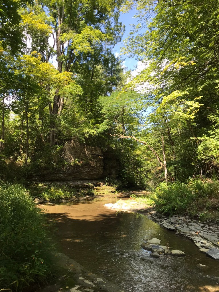
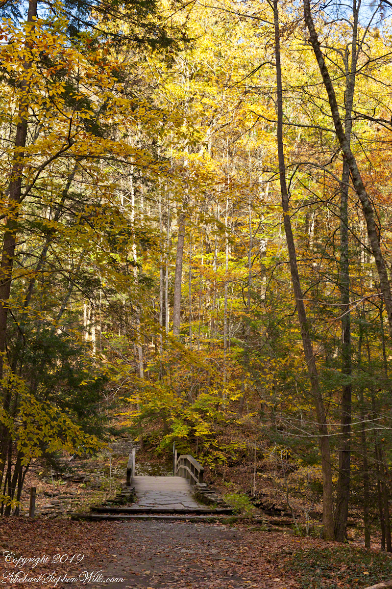
A place for quiet contemplation within the Treman Gorge, only accessible via a 15 minute hike. Robert H. Treman New York State Park on a late October afternoon.
Click photograph for a larger view. To do this from WordPress Reader, you need to first click the title of this post to open a new page.
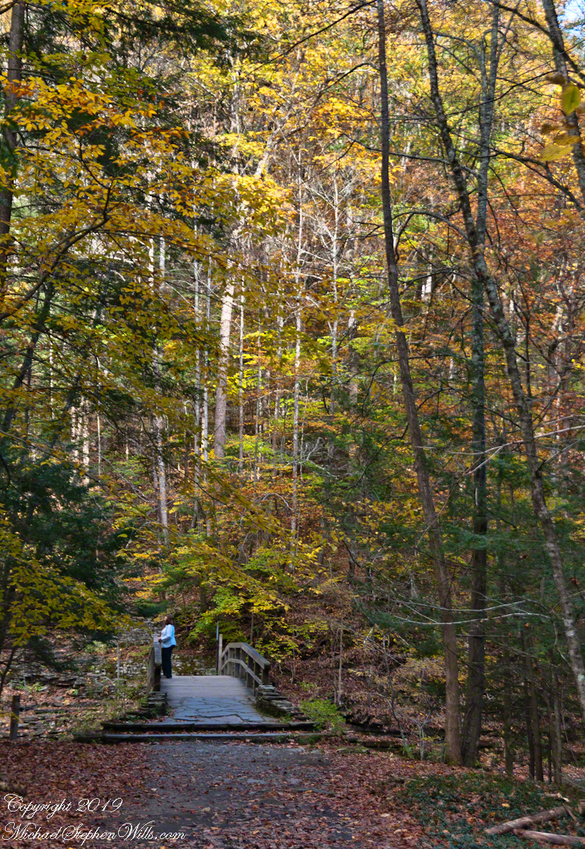
Autumn foot Bridge
Click for a slideshow of this sequence of Lucifer Falls view from the overlook.
Lucifer Falls from Rim Trail OverlookLucifer Falls from Rim Trail Overlook
Copyright 2022 All Rights Reserved Michael Stephen Wills
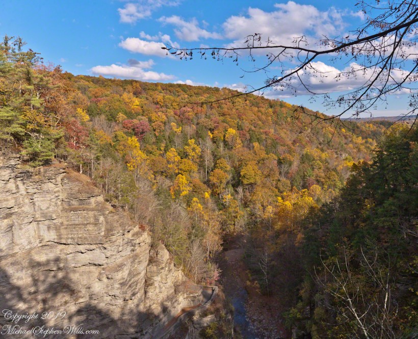
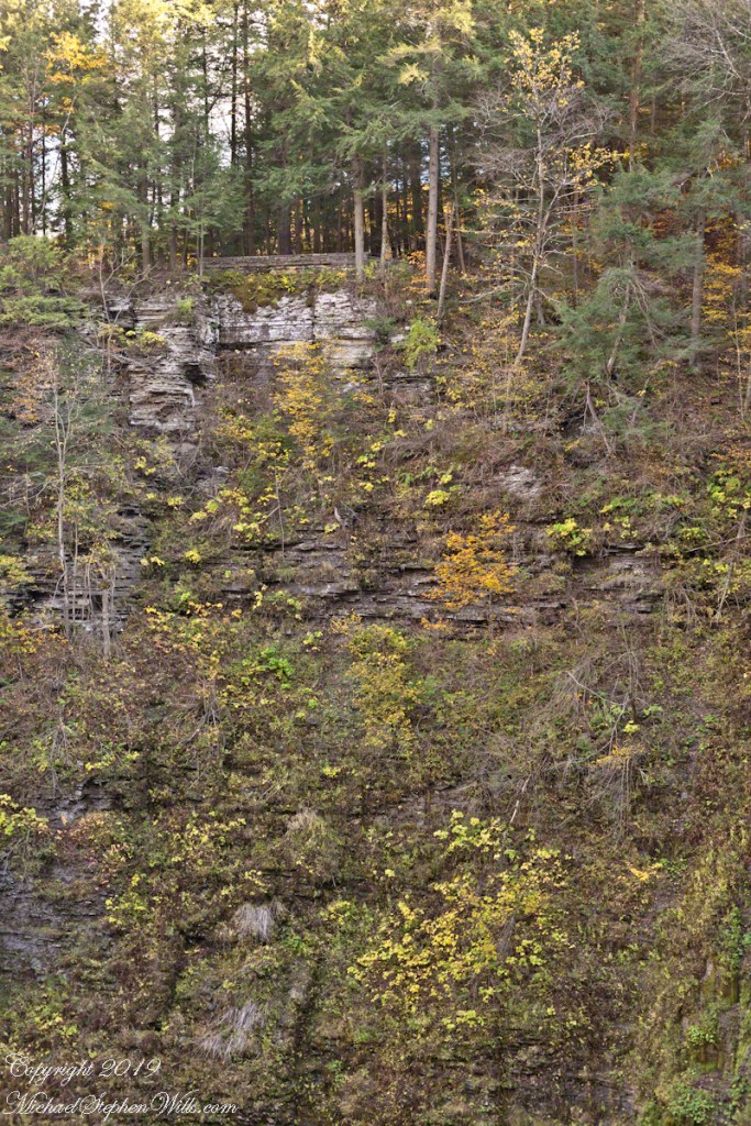
Standing on Enfield Gorge rim above Lucifer Falls on a clear October afternoon, the slopes of the far gorge cloaked in shades of green, yellow and red.
Below, the Gorge Trail runs below a sedimentary rock cliff.
Click photographs for a larger view. To do this from WordPress Reader, you need to first click the title of this post to open a new page.
Luficer Falls Overlook, northeast
Click for a slideshow of this sequence of Lucifer Falls view from the overlook.
Luficer Falls Overlook, northeastLucifer Falls from Rim Trail OverlookLucifer Falls from Rim Trail Overlook
Copyright 2022 All Rights Reserved Michael Stephen Wills
This the fifth and final of a series of landscape photographs taken from this position.
Click photograph for a larger view. To do this from WordPress Reader, you need to first click the title of this post to open a new page.
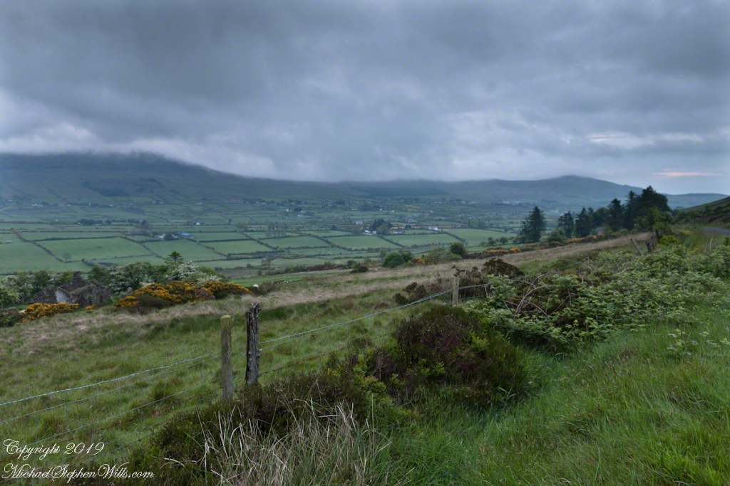
Slievenaglogh View with road, east
The peak is named, in the English language, Slievenaglogh. It is so strange as it’s not English, being instead a transliteration of the Irish name “Sliabh na gCloch.” This is “Rock Mountain” translated literally. Slievenaglogh is carried to the townland, a long thin swath of land being the peak and associated ridge-line.
The rocks up there are called “gabbro,” a type of magma slowly cooled under ground. Slievenaglog, Slieve Foy across the valley, and the Morne mountains all formed within volcano magma chamber(s) of the Paleocene, 66 million years ago, a time associated with extensive volcanism and the Cretaceous–Paleogene extinction event that gave rise to the current age.
Our younger cousin has been up there, optimistically we left it for a later trip.
Slievenaglogh View, northeastSlievenaglogh View, east northeastSlievenaglogh View, east northeastSlievenaglogh View, north northeastSlievenaglogh View with road, east
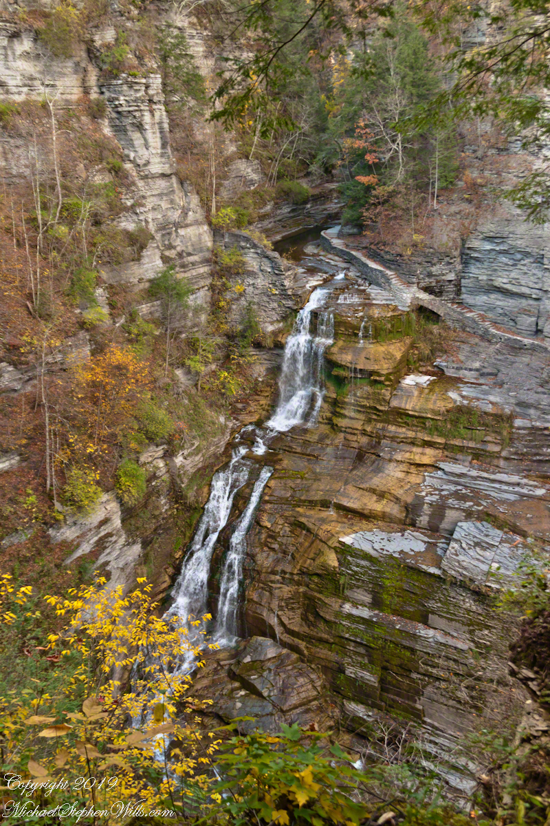
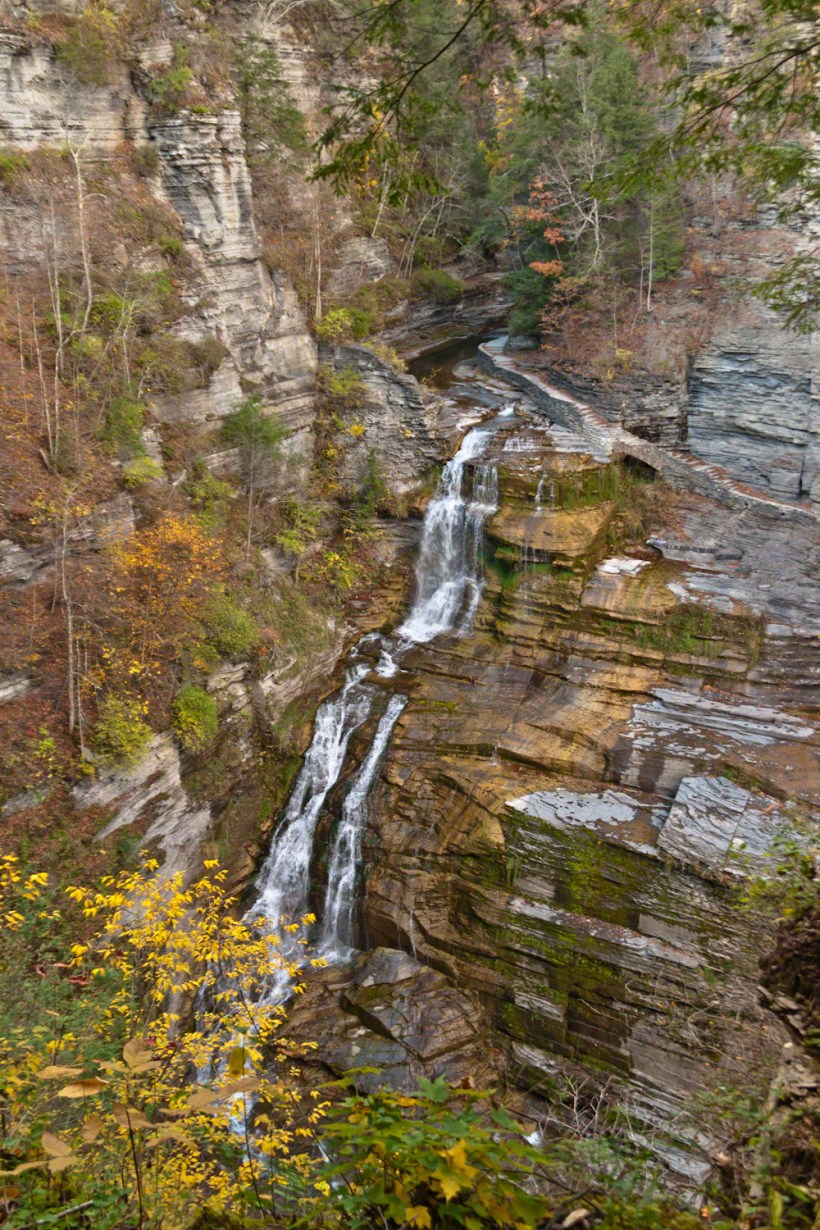
A full sweep of Lucifer Falls on an autumn evening, the sun hidden behind the gorge walls. Here the Gorge Trail emerges from the shelter of the gorge, emerging into a dizzying view.
Click photographs for a larger view
Lucifer Falls from Rim Trail Overlook
Click for a slideshow of this sequence of Lucifer Falls view from the overlook.
Lucifer Falls from Rim Trail OverlookLucifer Falls from Rim Trail Overlook
Copyright 2019 All Rights Reserved Michael Stephen Wills
Standing on the trail alongside Lucifer Falls, crane your neck, up and up to the cliff top. Look closely to see the protective rock wall of the overlook.
Click photograph for a slideshow. To do this from WordPress Reader, you need to first click the title of this post to open the page on my site.
Lucifer Falls Overlook from the Gorge Trail
The Rim Trail includes this overlook of Lucifer Falls with, upstream, the Devil’s Kitchen waterfall, the path of the Gorge Trail in between.
Lucifer Falls from Rim Trail Overlook
The full sweep of Lucifer Falls on an autumn evening, the sun hidden behind the gorge walls. Here the Gorge Trail emerges from the shelter of the gorge, emerging into a dizzying view.
Lucifer Falls from Rim Trail Overlook
Brink of Lucifer Falls
Lucifer Falls Overlook from the Gorge Trail
Lucifer Falls from Rim Trail Overlook
Lucifer Falls from Rim Trail Overlook
Copyright 2022 All Rights Reserved Michael Stephen Wills
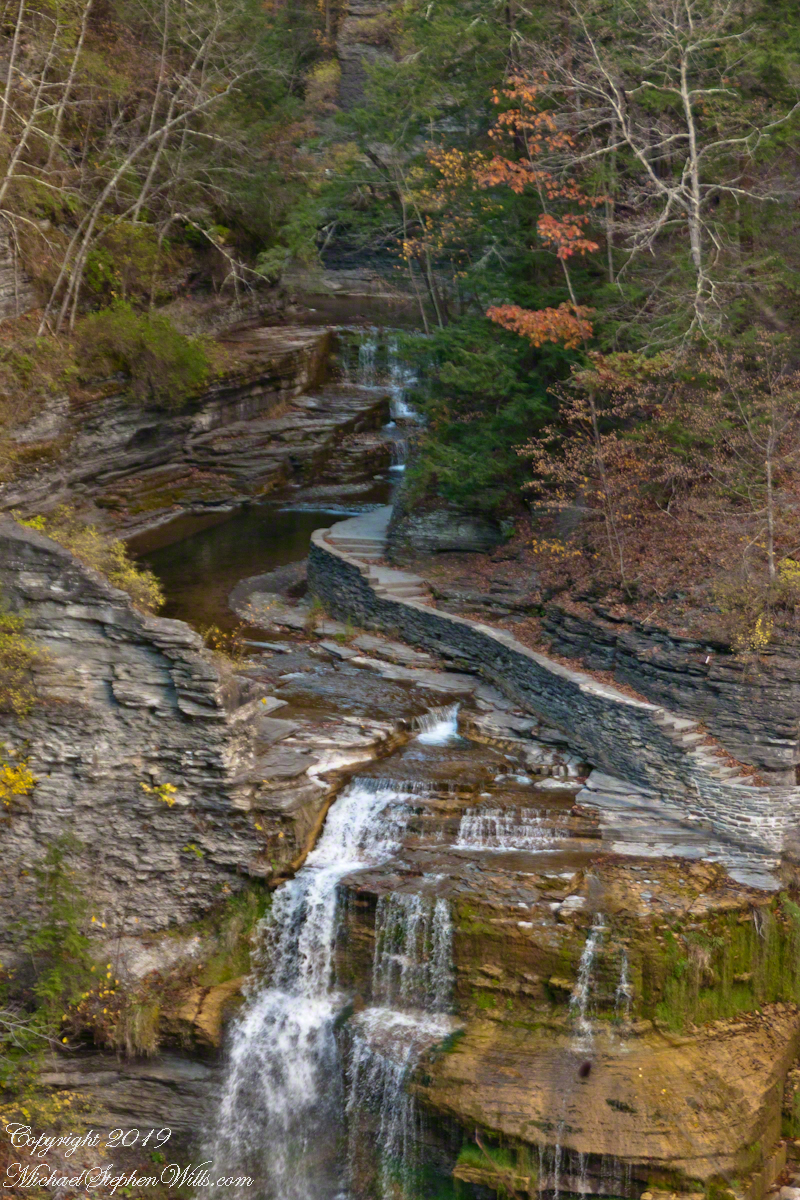
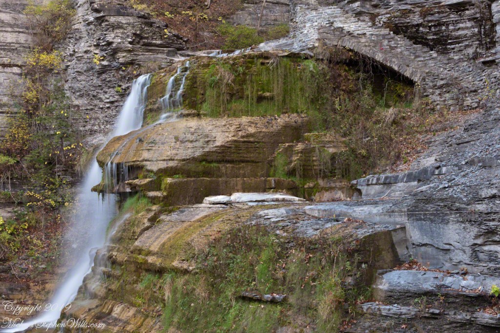
This trail, built into the slate/sandstone gorge wall, follows the descent of Lucifer Falls. Here we view the brink and the path alongside. Follow this trail to Devil’s Kitchen, up and around the corner.
Click photograph for a larger view
Brink of Lucifer Falls
Copyright 2022 All Rights Reserved Michael Stephen Wills
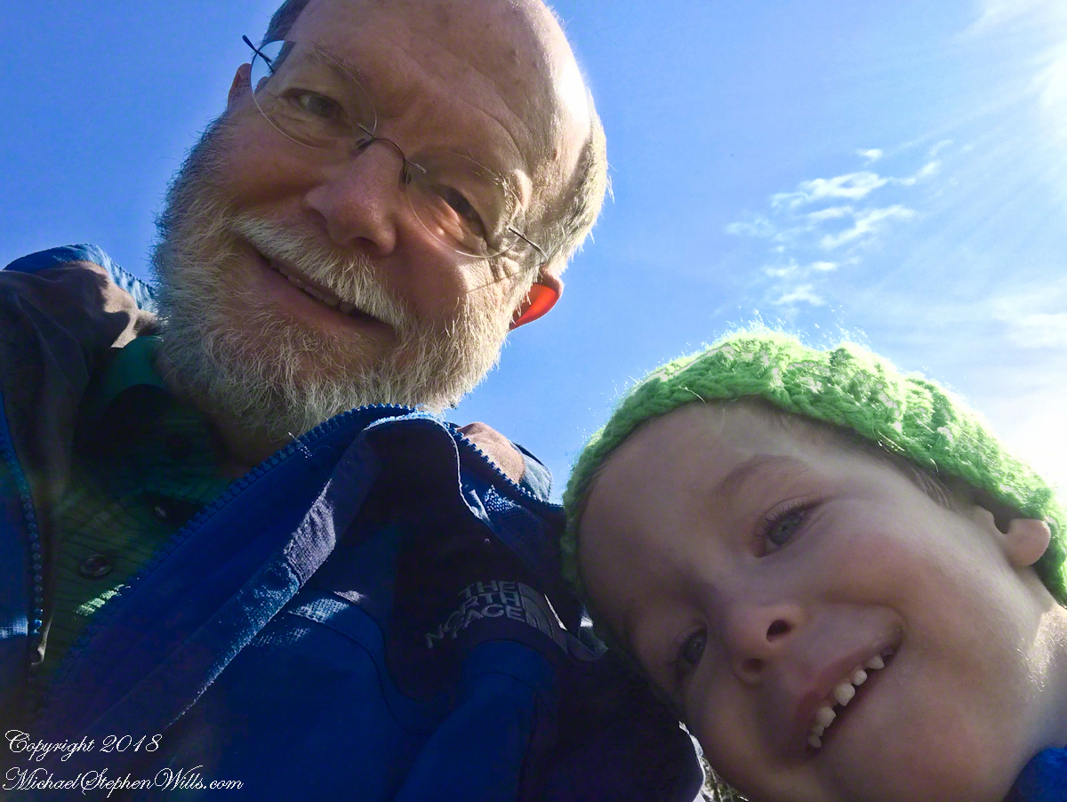
On a sunny autumn morning we set out, my soon to be three grandson Sam and I, to the Lime Hollow Nature Center near Cortland for an adventure. For the first time I brought a newly purchased iPhone 7 instead of the usual slr camera. The phone can be carried in a pocket and is simpler to us, to allow me to give full attention to Sam.
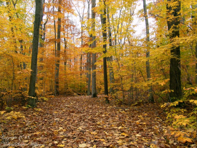
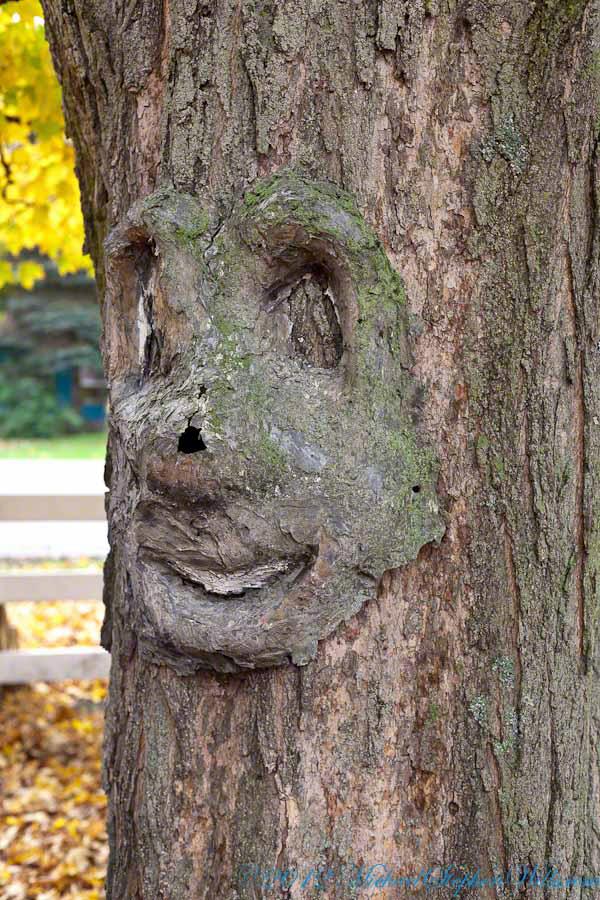
At the start is a large, today sunlit, field with an “art trail.” There are various anthropomorphic transformations on the trees and a very large sculpture of a blue face. Here is a tree from another place near here, to give you an idea.
I do not point out the tree faces to Sam. His Mom likes to say he enjoys being frightened and, when the blue face came into view, he turned back and said, “home.” Sam was mildly anxious, so I carried him and tried to turn him up the trail away from the face. He turned to keep an eye on it while I assured him it could not move. This and a climb up a 230 foot hill were the only times he didn’t walk the half mile to a open grassy knoll with a bench.
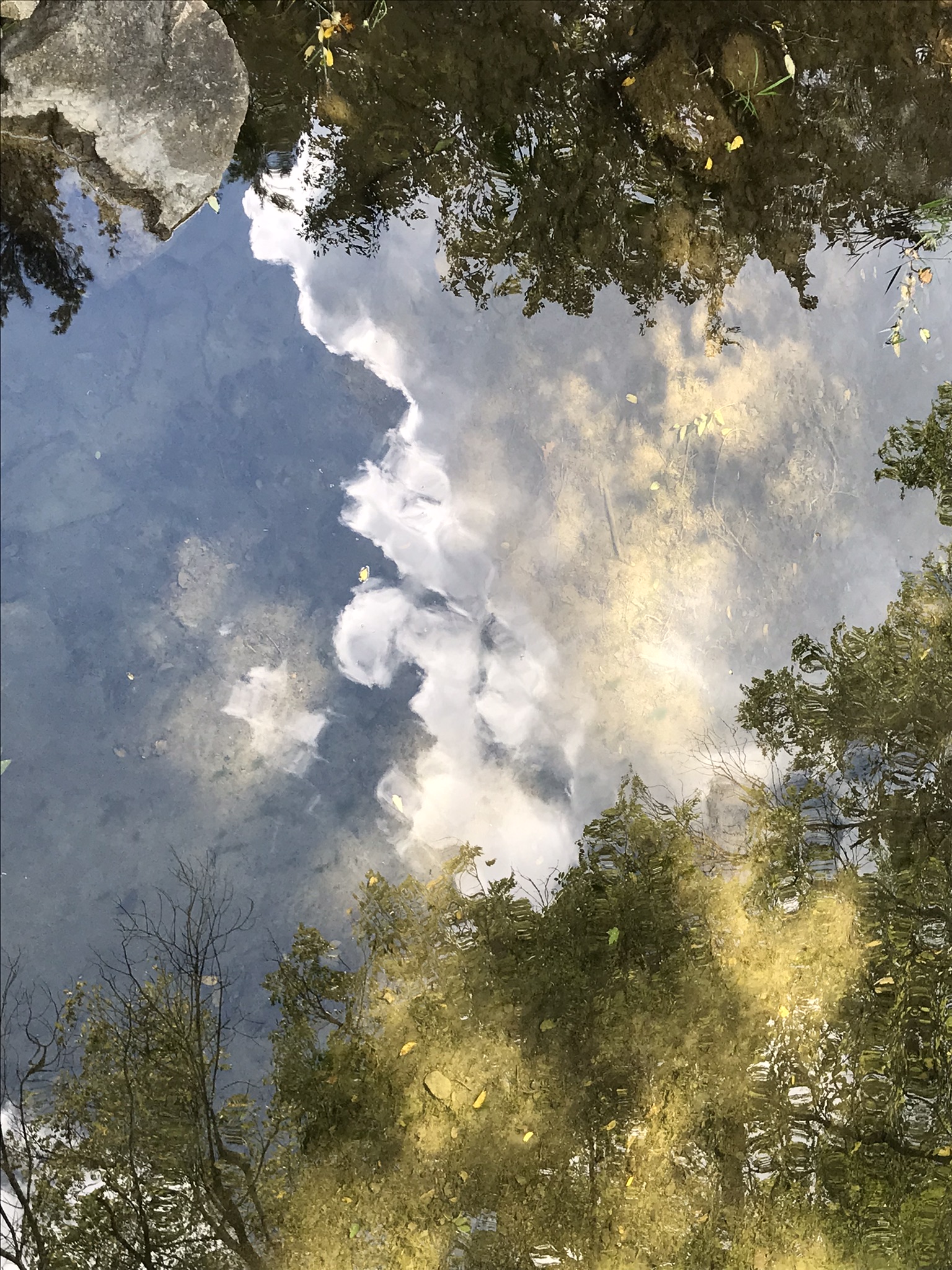
There we sat for 30 minutes, still and watching, Sam and I talked about our sightings: 1. The sunlit sky of clouds, from a milky blue towards the north to, overhead, a bright robins egg blue. 2. A circling hawk, shadow crossing over us. 3. One blue jay in a maple turning red, loudly calling over and over. 4. A little while after a second jay, landing in a tree turned yellow, drawn in and giving answer. 5. A monarch butterfly’s steady progress south. Such a strong gliding path. 6. A yellow butterfly who did not leave us, fluttering round and round. 7. Four honking Canadian geese flying north east, turned to check out a nearby pond, the returned to the original heading. 8. The sound of wind through the trees, listening to the sound made by each tree. 9. The late season golden rod, now dried gray. 10. A distant chittering red squirrel. 11. Distant peeper frogs in the swamps at the foot of the hill.
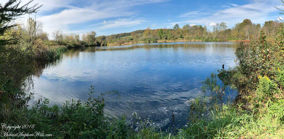
Sam did not want to leave the bench, eventually we headed on to the pond the geese checked out.
I used the “panoramic” feature of the iPhone 7 for this shot. On the hill we were sheltered by trees and bushes from the steady northeast wind. Here, on a bench by the pond, that direction was open to the wind. The sun kept us warm. It was clear why the geese did not land, the water surface was deserted, filled only by rippling wind driven waves.
On our walk back we sat on a bench on the edge of the art trail field, the blue face out of sight. A woman, the only other person encountered, emerged from one of the trails cut from the brush, camera in hand. She was collecting images for a Cortland Historical Society publication and asked to take our photograph. “OK,”, I said and gave the story of living here for 25 years in the house on Fall Creek where my son’s family lives now. She replied, “My daughter is in San Francisco. We don’t know who will have our house when we are gone.”
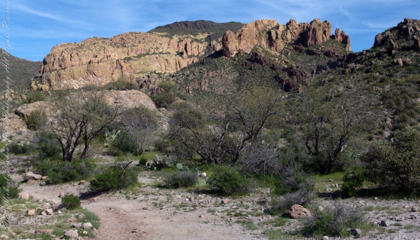
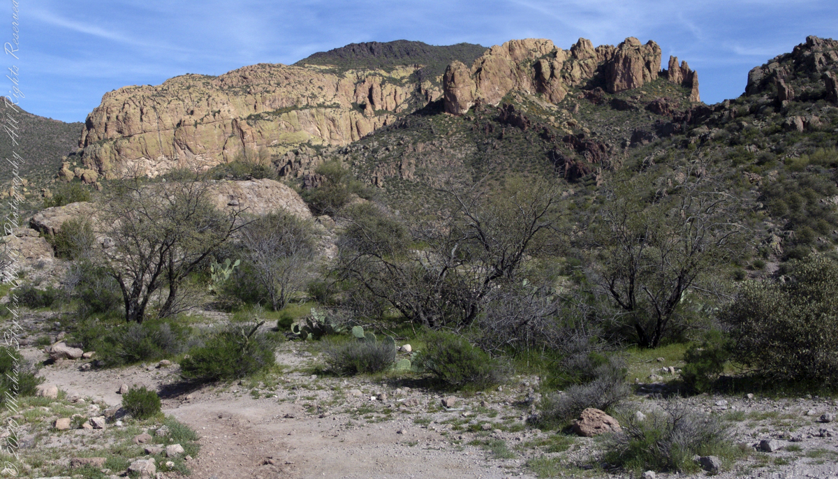
Dutchman Trail turns right up ahead to proceed between Palamino Mountain and Black Top Mesa, both shown in this photograph. The ridge of the mountain reminds some of a horse and there is an arch, Aylor Arch, on the southern side: here was approach the north side. Aylor is the family name of gold prospectors who set up camp on that south side close to where we will spend the night below Weavers Needle.
View of Palamino Mountain and Black Top Mesa from Dutchman’s trail.
Black Top Mesa is named for a layer of black basalt. Look closely to see the crags on the mesa (the flat-topped mountain) are black. Gold prospectors who combed Black Top Mesa over the years found not one speck of gold.