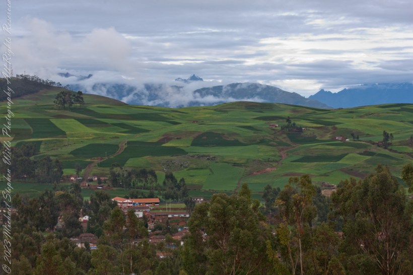
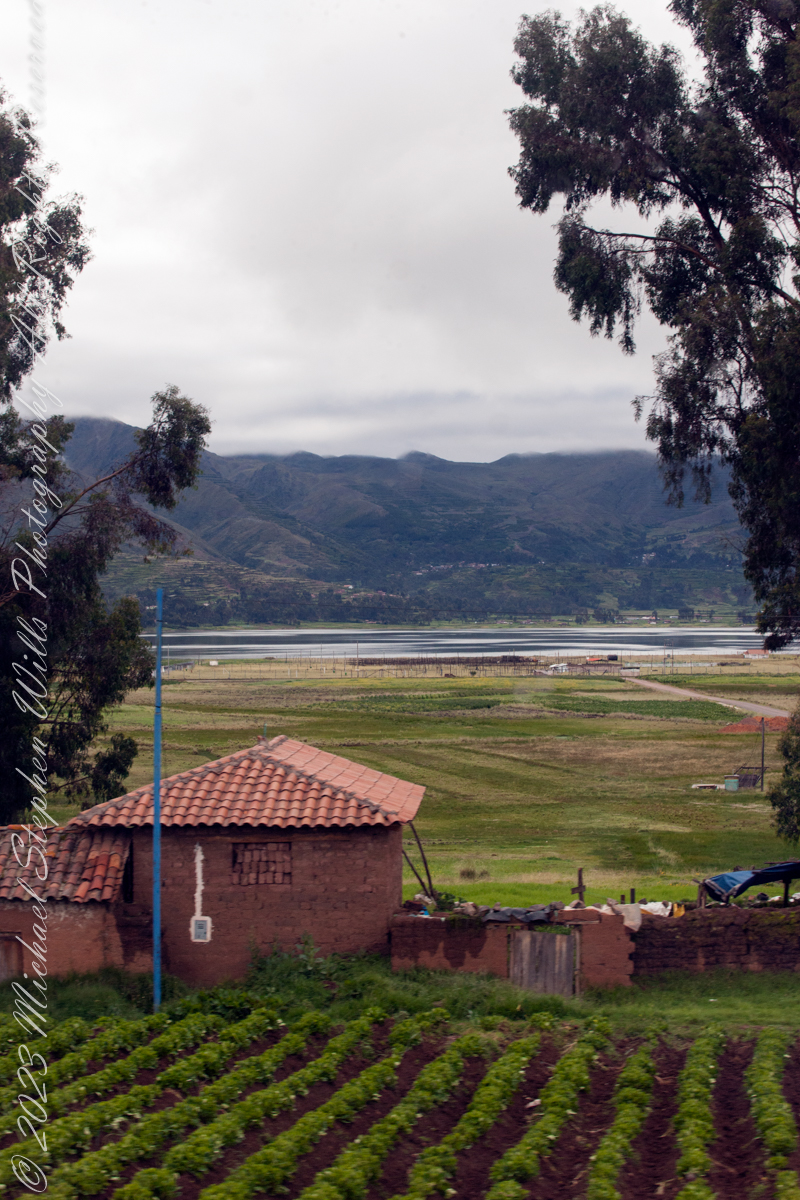
We overlook Raqch’i village and rich farmland to the distant Andean peaks, down below, out of view, is the Urubamba River that created the valley. The prominent, sharp distant peak is Pumahuanca of the Urubamba Mountain Range, at 17,448 feet (3.3 miles) altitude it is “only” the 179th highest of the Andes. Cusco Region, Urubamba Province, Huayllabamba District.
Copyright 2023 Michael Stephen Wills All Rights Reserved
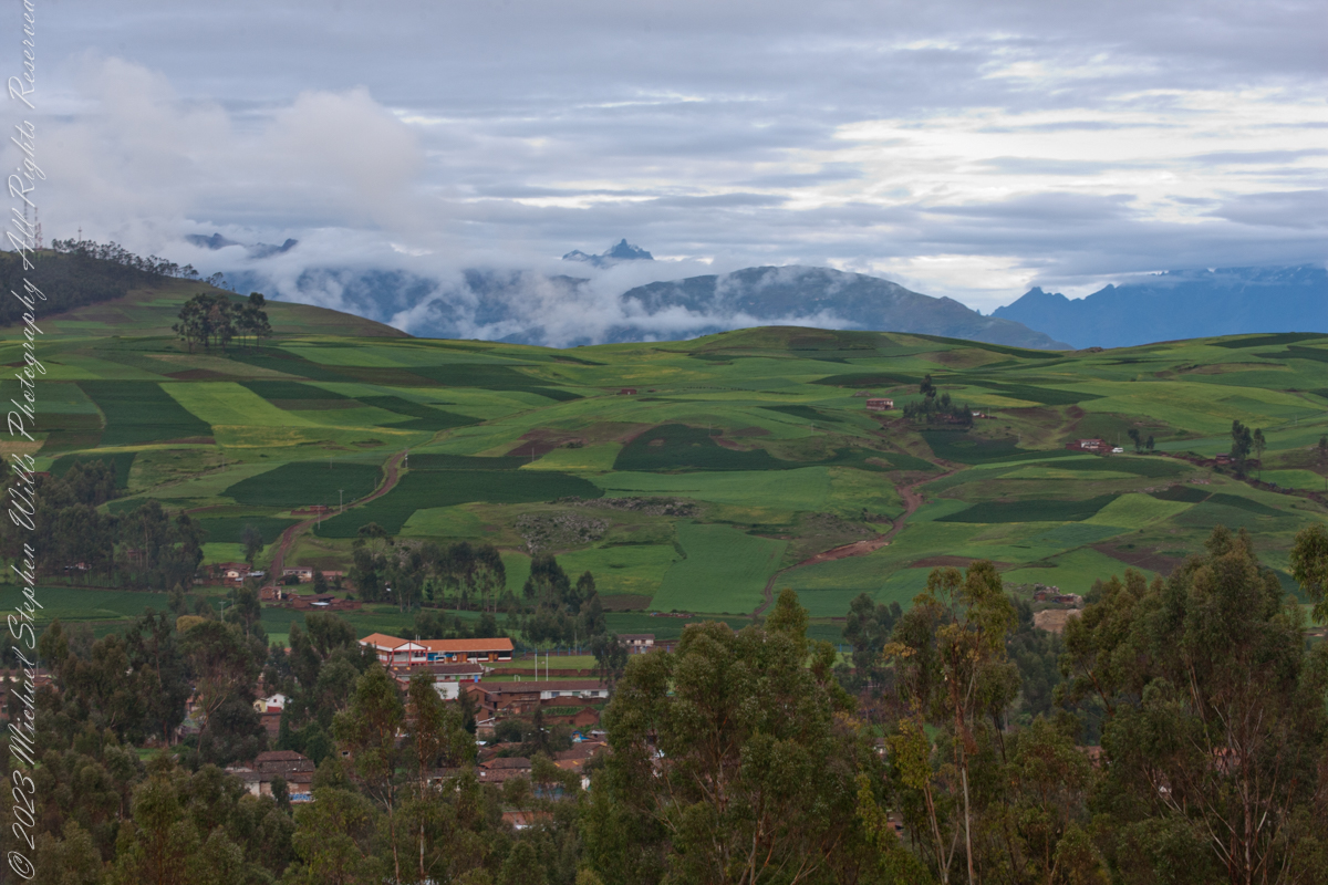
On our travel to Urubamba we traversed Chinchero District is one of seven districts of the Urubamba Province in Peru of which this eponymous town is the largest. It is the location for the proposed Chinchero International Airport, which would serve travelers to the Cusco Region. The people that live in the district are mainly indigenous citizens of Quechua descent. Quechua is the language which the majority of the population (81.49%) learnt to speak in childhood, 17.95% of the residents started speaking using the Spanish language (2007 Peru Census). One of the highest peaks of the district is Hatun Luychu at approximately 4,400 m (14,400 ft). Other mountains in this district include: Ichhu Kancha, Kunka Kunka, K’usi Qaqa, Pata Kancha, Quri Qucha Punta, Quri Qucha Qaqa, Sinqa, Wallata Wachana, Wanakawri (Anta-Urubamba), Yuthu Pukyu.
Now and then I shot out the front window to capture road signs as orientation.
Puray comes from an ancient legend narrated by the settlers, where, the Sun god asked Manco Capac that his twin sons accompany him in his sunset and when the time came, they discovered that the son who walked farther had become the Huaypo (Huaypo) Lagoon (9 miles west) and the daughter in the Piuray (Puray) Lagoon.
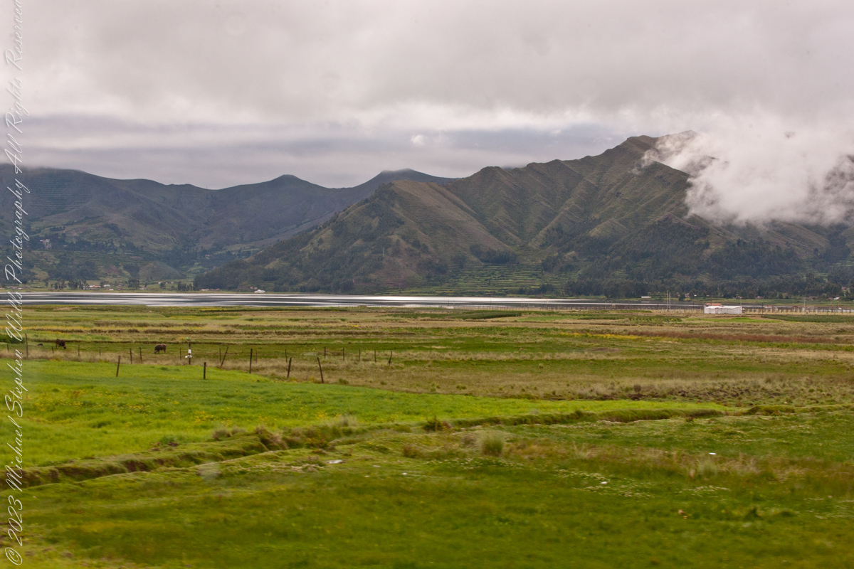
In this photograph, distant cattle graze against backdrop of the lagoon and andean foothills.
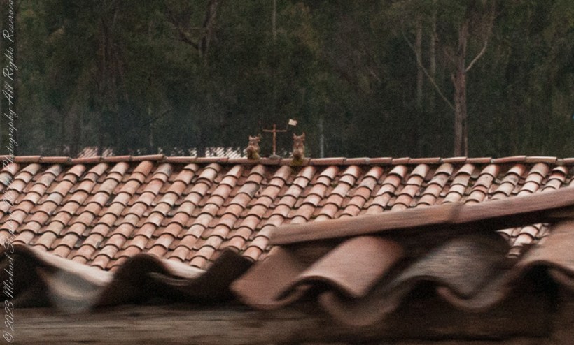
You can just make out the Bulls and Cross in the center of this photograph. A detail is provided, below. The words on the facade is a political statement – a presidential election was then underway.
A couple of ceramic Bulls stand on the middle of most rooftops in Cuzco where they stand as if on a hilltop looking out on the rolling, downward-sloping pastures of orange tiles. This powerful image is one of good fortune and protection for the house and the families that inhabit it.
This tradition comes from the time of the Incas. They relied on images of alpacas that they called illas. These alpacas had a hole in their loin where one could put alpaca fat and then bury them in the Earth to obtain protection for their agriculture as well as a good harvest. They also used illas to protect their flocks of alpacas and llamas, as well as to guarantee their reproduction. Illas in the form of houses were also used to protect buildings so that they would be safe and last.
Illas have been found Cusco. We can see them in the Cusco Museo Inca, the Inca Museum, of the National University of San Antonio Abad.
With the coming of the Spanish, the people of Cuzco made a change in the form of the illas. They added to the three mentioned above the bulls of Pucará. The name Pucará comes from the place where the bulls were first raised, on the broad grasslands of the altiplano, the high plateau, of Puno, as it approaches the pass of La Raya from which a highway drops to Cuzco. The area of Pucará is famous for its herds of cattle, sheep, and especially the native llamas and alpacas.
The high grasslands have always had symbolic importance for the people of Cuzco because from them came the herders of camelids (llamas and alpacas) as well as many of the freeze dried potatoes, the chuño and moraya, that were important food stocks.
From the also came, according to one of the two versions of the origin story of the Incas, the founding couple Manco Capac and Mama Ocllo. The story relates how they journeyed from Lake Titicaca which is in the center of those grasslands, and which was also the center of one of the most important Pre-Inca civilizations, that of Tiwanaku.
Pucará was an important site where the northern form of the Tiwanaku civilization developed. This may also play a role in the value people give to the toritos, or bulls, from Pucará.
This grassland and lake area is also important for a Pre-Inca set of stories about the hero Thunupa, who is also related to the lightning and is assimilated sometimes to the great god Viracocha and sometimes to Illapa the god of thunder and lightning. Pucará became an important center for the making of pottery which was widely distributed. Intriguingly a center of pottery making closer to Cuzco, Raqchi, is also associated with Thunupa, Viracocha, and Illapa. It was the site of the great temple to Viracocha built by the Incas.
As seen from Avenue del EjércitoIts near Chinchero, Peru. Lagoon waters lap the distant, terraced andean foothills, look closely to see fish drying racks on the near shore, 11,270 feet altitude. Here, water boils at 191 degrees Fahrenheit, not 212.
Puray comes from an ancient legend narrated by the settlers, where, the Sun god asked Manco Capac that his twin sons accompany him in his sunset and when the time came, they discovered that the son who walked farther had become the Huaypo (Huaypo) Lagoon (9 miles west) and the daughter in the Piuray (Puray) Lagoon.
In this photograph, distant cattle graze against backdrop of the lagoon and andean foothills.
Puray lagoon is located in the upper part of the Sacred Valley of the Incas, southeast of Chinchero and 19 miles northwest of Cusco. The Piuray (Puray) Lagoon is a source of water of surface origin. It is one of the most important sources of the city of Cusco, as it supplies 42% of drinking water in the city as well as the Sacred Valley of the Incas and other provinces of the region. It was the Incas who carried Piuray (Puray) Lagoon water to the imperial city (Cusco) through underground aqueducts. Quechua natural region, Peru
Copyright 2023 Michael Stephen Wills All Rights Reserved
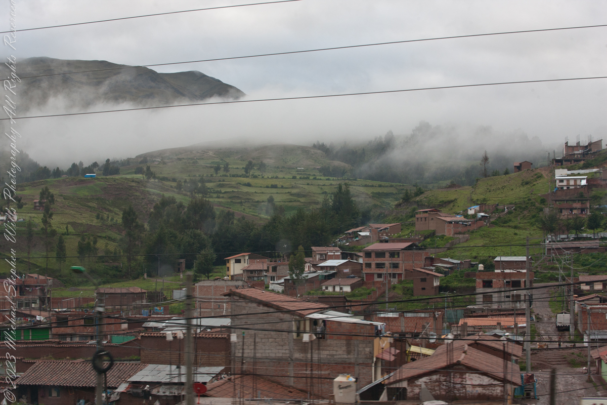
Here we are, passing the outskirts in the hills surrounding Cusco, Peru. Route 3S, going under various names. Highland Road (North) (Longitudinal de la Sierra Norte)Highway, climbs out of Cusco in broad switchbacks.
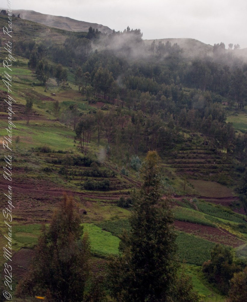
View of terraced fields from route 3S through the hills above Cusco, Peru. “In the South American Andes, farmers have used terraces, known as andenes, for over a thousand years to farm potatoes, maize, and other native crops.“
“Terraced farming was developed by the Wari culture and other peoples of the south-central Andes before 1000 AD, centuries before they were used by the Inca, who adopted them. The terraces were built to make the most efficient use of shallow soil and to enable irrigation of crops by allowing runoff to occur through the outlet. The Inca people built on these, developing a system of canals, aqueducts, and puquios to direct water through dry land and increase fertility levels and growth. These terraced farms are found wherever mountain villages have existed in the Andes. They provided the food necessary to support the populations of great Inca cities and religious centers such as Machu Picchu.“
Reference: “Terrace (earthworks)” Wikipedia
Copyright 2023 Michael Stephen Wills All Rights Reserved
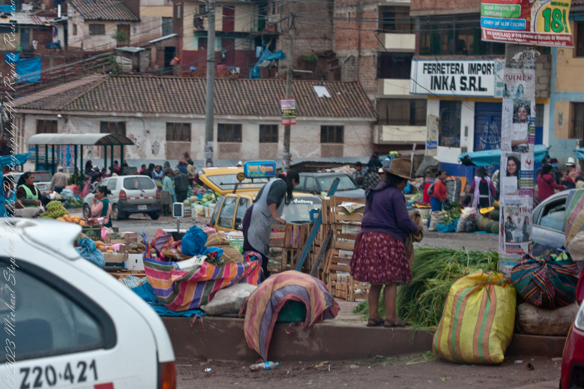
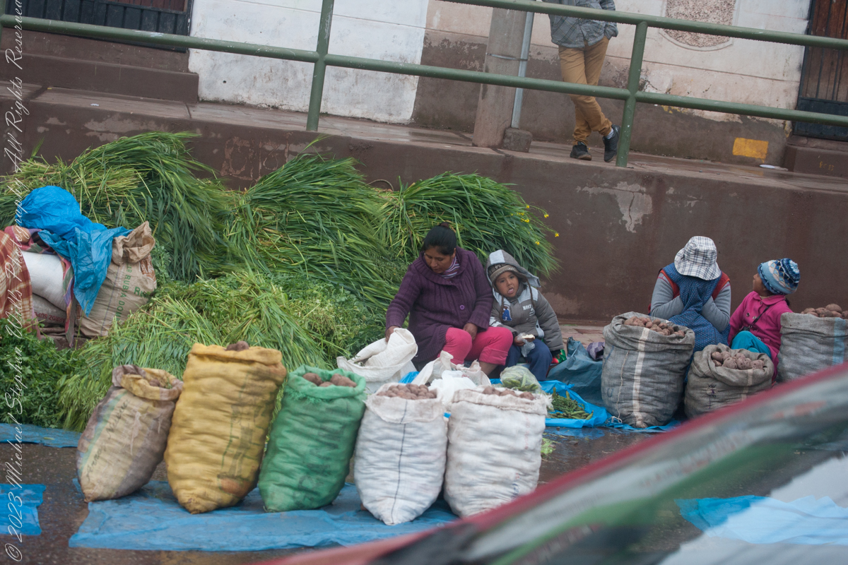
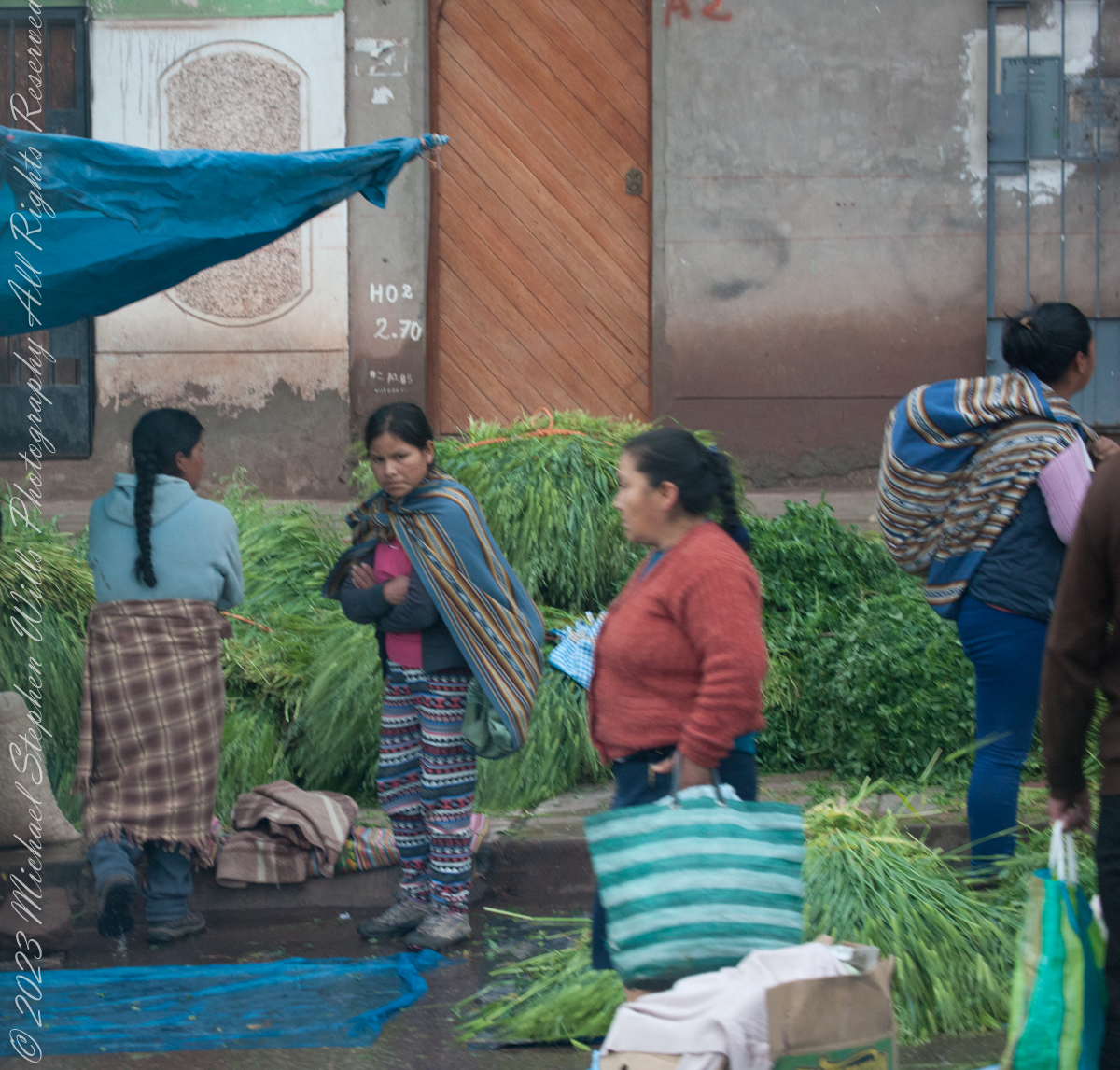
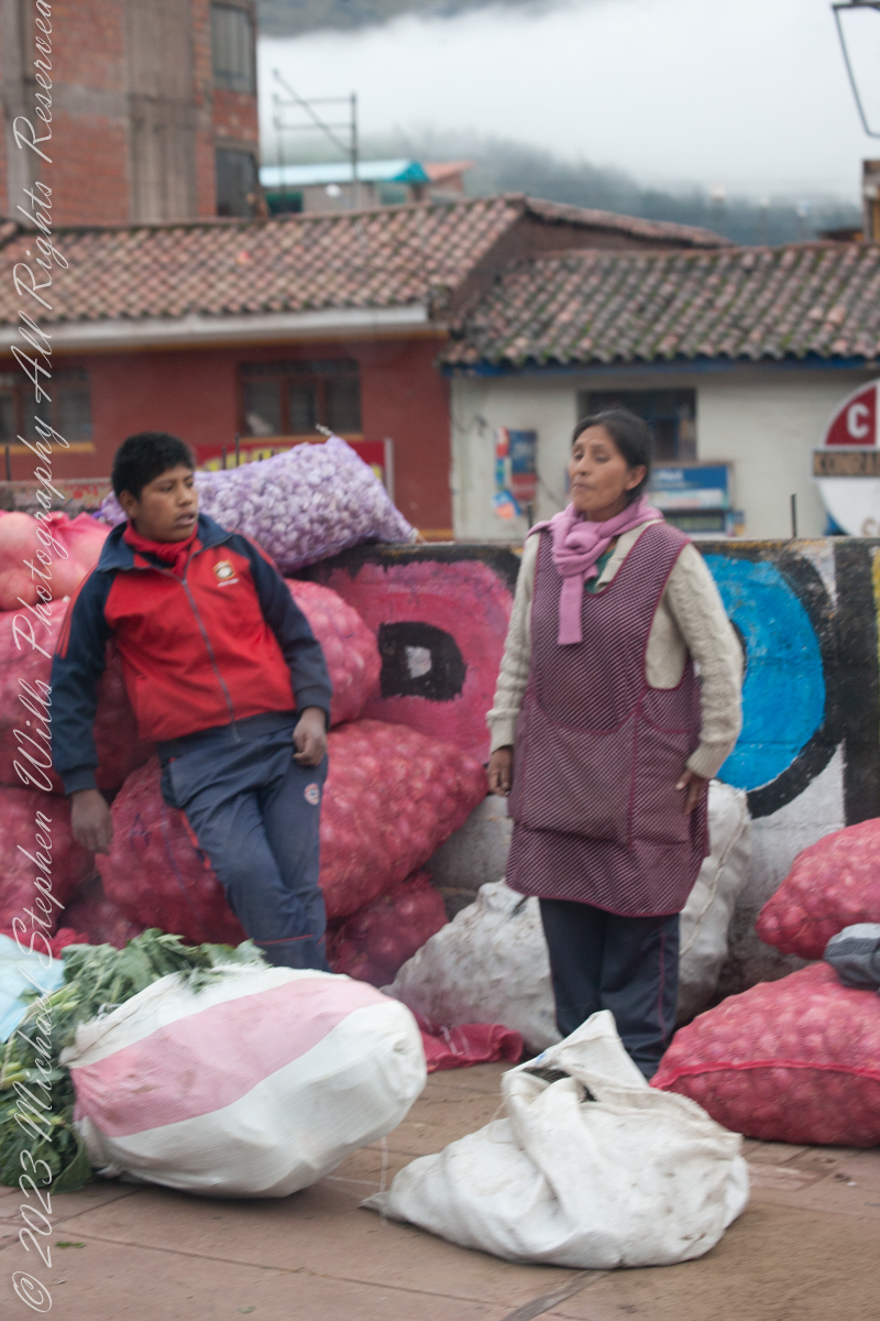
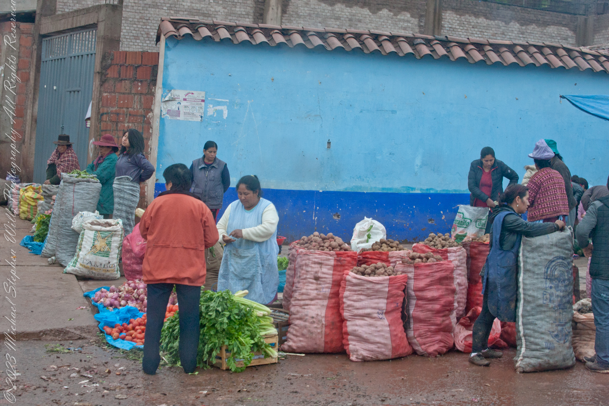
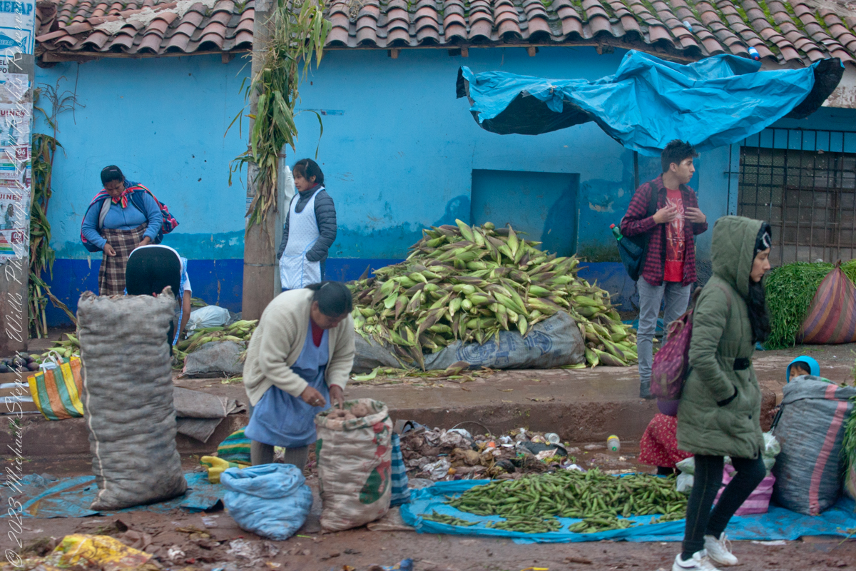
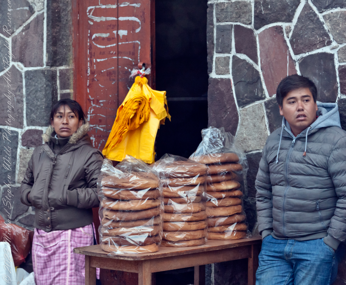
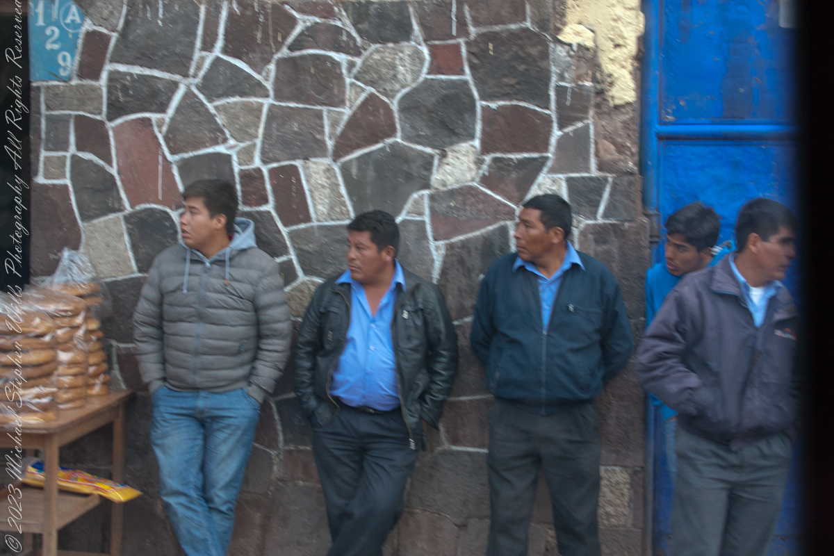
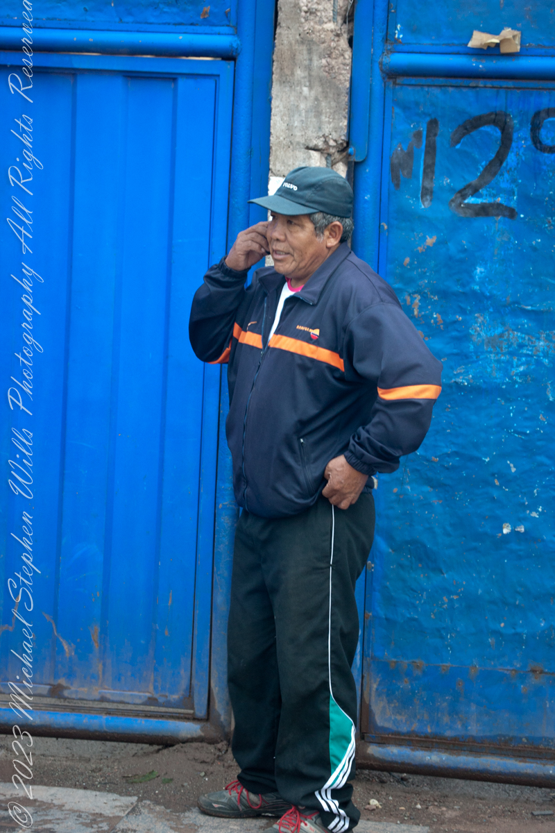
The scenes at Cusco’s Saturday Market were fascinating. The shooting was through a clean bus window using a handheld Canon EF 70-300 f/4-5.6 L IS USM lens mounted on the Canon dslr 1DS Mark III.
“Inka S.R.L.” is a agriculture company full name INDUSTRIA DE ALIMENTOS E INVERSIONES PERU INKA SRL specialized in ELAB OF OTHER PROD. FOOD.. It was created and founded on February 2, 2002.
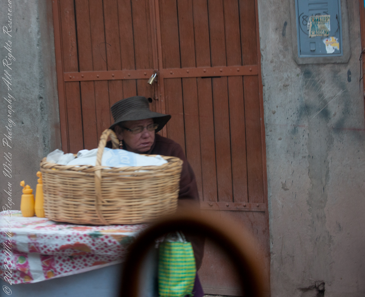
Very early for these children…
Quechua people or Quichua people, may refer to any of the aboriginal people of South America who speak the Quechua languages, which originated among the Indigenous people of Peru. Although most Quechua speakers are native to Peru, there are some significant populations in Ecuador, Bolivia, Chile, Colombia, and Argentina. The woman center left sports traditional fabrics of her pants and shawl.
Onions and garlic, potatoes? Wild potato species can be found from the southern United States to southern Chile. The potato was originally believed to have been domesticated by Native Americans independently in multiple locations, but later genetic studies traced a single origin, in the area of present-day southern Peru and extreme northwestern Bolivia. Potatoes were domesticated there approximately 7,000–10,000 years ago, from a species in the Solanum brevicaule complex. In the Andes region of South America, where the species is indigenous, some close relatives of the potato are cultivated.
Potatoes!!
Maize, also known as corn in North American and Australian English, is a cereal grain first domesticated by indigenous peoples in southern Mexico about 10,000 years ago.
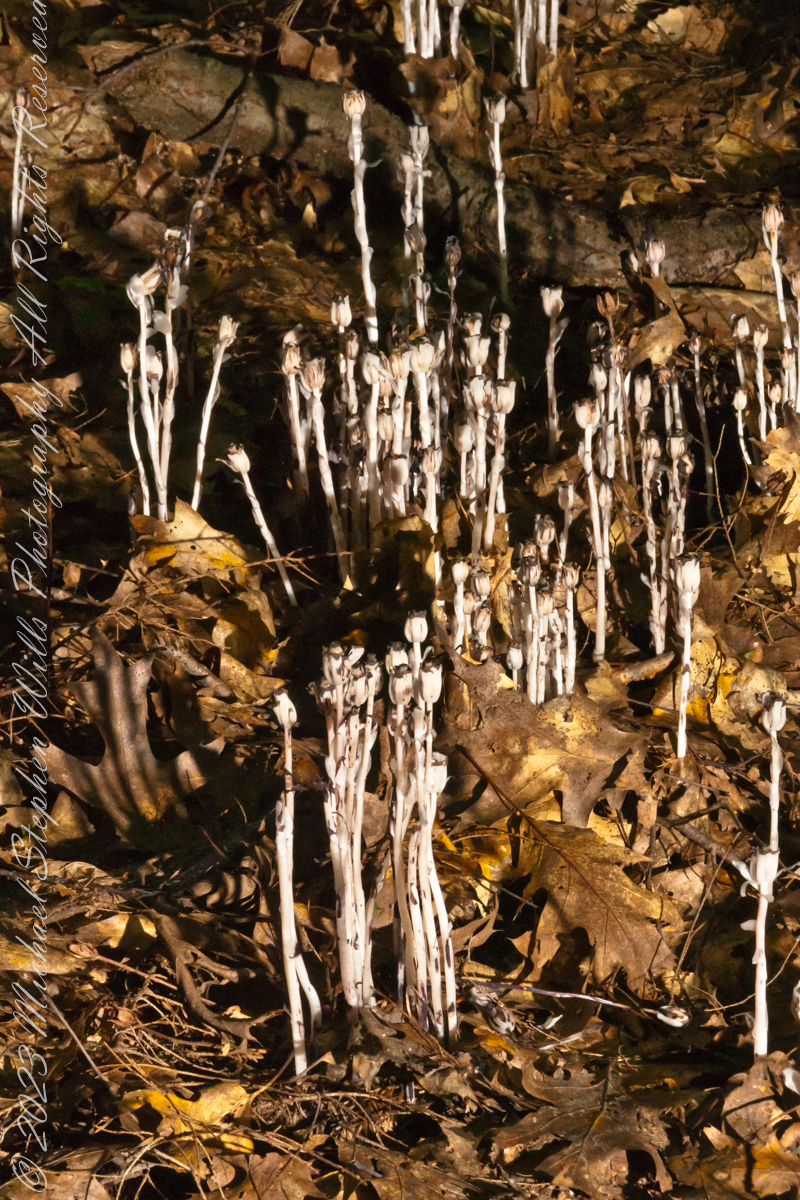
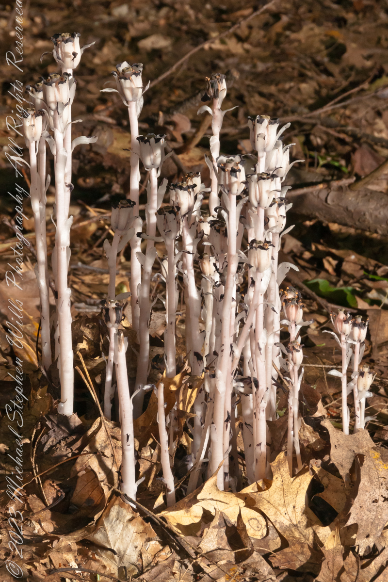
I found these popping up from leaf litter, a mixture of last year’s maple and elm, on an August morning. The dappled light, varied from bright to very dark, exceeded the dynamic range of my equipment, so I set up the Sony dslr Alpha700 with the Sony lens DT 18-200mm f3.5-6.3 on a tripod and, using the remote feature, placed the flash at an optimal angle.
“Monotropa uniflora, also known as ghost plant, ghost pipe, or Indian pipe, is an herbaceous perennial plant native to temperate regions of Asia, North America, and northern South America, but with large gaps between areas. The plant is sometimes completely waxy white, but often has black flecks or pale pink coloration. Rare variants may have a deep red color. The name “Monotropa” is Greek for “one turn” and “uniflora” is Latin for “one flowered” as there is one sharply curved stem for each single flower. It flowers from early summer to early autumn, often a few days after rainfall. The fruit, an oval capsule-like structure, enlarges and becomes upright when the seeds mature, at this point stem and capsule looking desiccated and dark brown or black. The seeds of Monotropa uniflora are small, ranging between 0.6–0.8 mm (3⁄128–1⁄32 in) in length.“
“Unlike most plants, it is white and does not contain chlorophyll. Instead of generating food using the energy from sunlight, it is parasitic, and more specifically a mycoheterotroph. Its hosts are certain fungi that are mycorrhizal with trees, meaning it ultimately gets its food from photosynthetic trees. Since it is not dependent on sunlight to grow, it can grow in very dark environments as in the understory of dense forest. The complex relationship that allows this plant to grow also makes propagation difficult.“
“The flowers of Monotropa uniflora are visited by various bee and fly species, most commonly bumblebees. Bumblebees are an important pollen dispersal agent for the plant.“
“Like most mycoheterotrophic plants, Monotropa uniflora associates with a small range of fungal hosts, all of them members of Russulaceae.“
“It is often associated with beech trees.“
“The plant contains glycosides and may be toxic to humans.“
“In addition to various reported medical uses, the plant has been used as an anxiolytic in herbal medicine since the late 19th century.“
Reference: in italics is from “Monotropa uniflora,” Wikipedia
Copyright 2023 Michael Stephen Wills All Rights Reserved
I caught these participants of the Cusco, Peru, Saturday Market as our bus progressed toward Machu Picchu during our daytrip to that ruin. The shooting was through a clean bus window using a handheld Canon EF 70-300 f/4-5.6 L IS USM lens mounted on the Canon dslr 1DS Mark III.
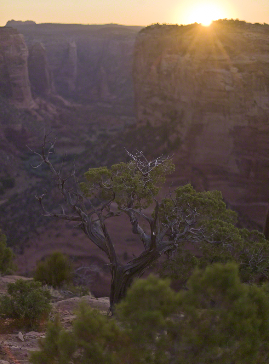
In this post we start the day of my posting “Family Trek“, July 19, 2008, when, well before the sun rose at 6:23 am Mountain Daylight Time (the Navajo Reservation observes daylight savings, the rest of Arizona does not), Pam and I were at the Spider Rock Overlook.
Most visitors to the canyon make use of a system of roads and parking lots next to strategic views. There is the White House Overlook we visited our first day, July 18, to hike from the trailhead into the canyon. There are also, on the south side of the canyon:
Tsegi Overlook, taken from a Navajo word that translates directly to “between the rocks” and usually refers to a deep canyon with steep cliffs.
Junction Overlook above the point where Canyon Del Muerto (see my posting “Sun and Shade, Canyon Del Muerto”, and Canyon De Chelly intersect. There is an Anasazi ruin in the south-facing cliff across the canyon.
Sliding House Overlook, another Anasazi run across the canyon.
Face Rock Overlook, to view the eponymous formation.
Spider Rock Overlook, the most stunning rock formation.
Click any photograph for my Online gallery.
Looking east from the Spider Rock overlook, Canyon De Chelly.
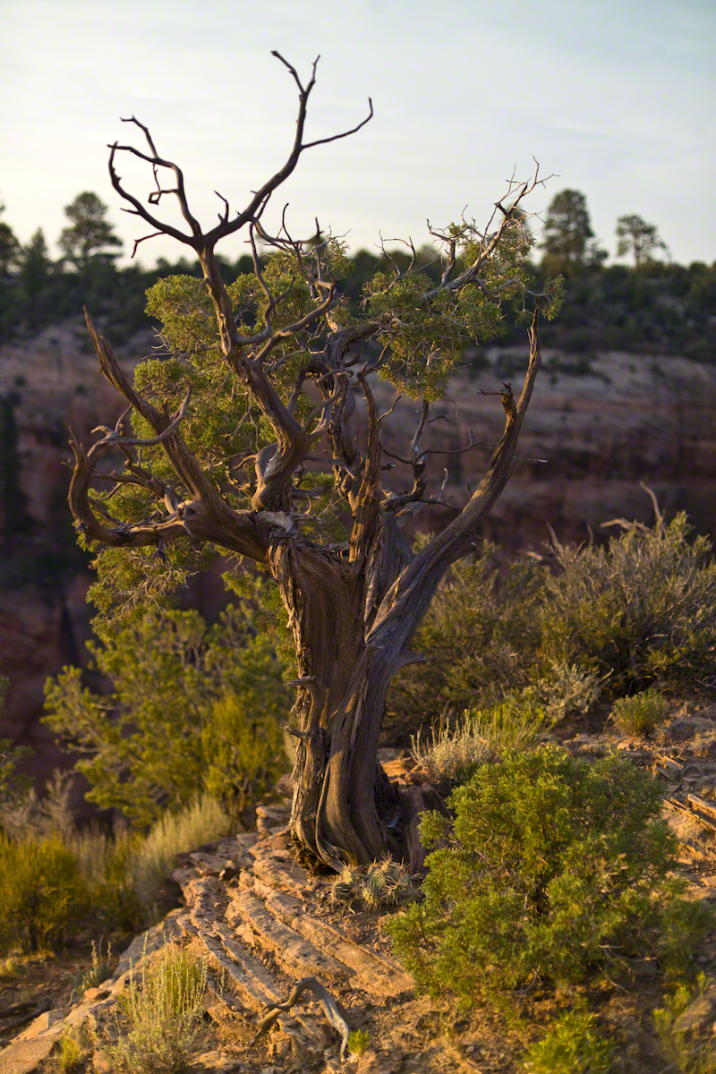
While getting ready I scoped out the location for interesting visual tropes. Utah Junipers are exceptionally hardy shrubs, stressed individual plants grow into compelling forms shaped by hardship. As the sun rose, this specimen emerged from the gloom and caught the first sun rays.
Click any photograph for my Online gallery.
A distressed Utah Juniper on the edge of Canyon De Chelly overlooking Needle Rock a few moments after sunrise.
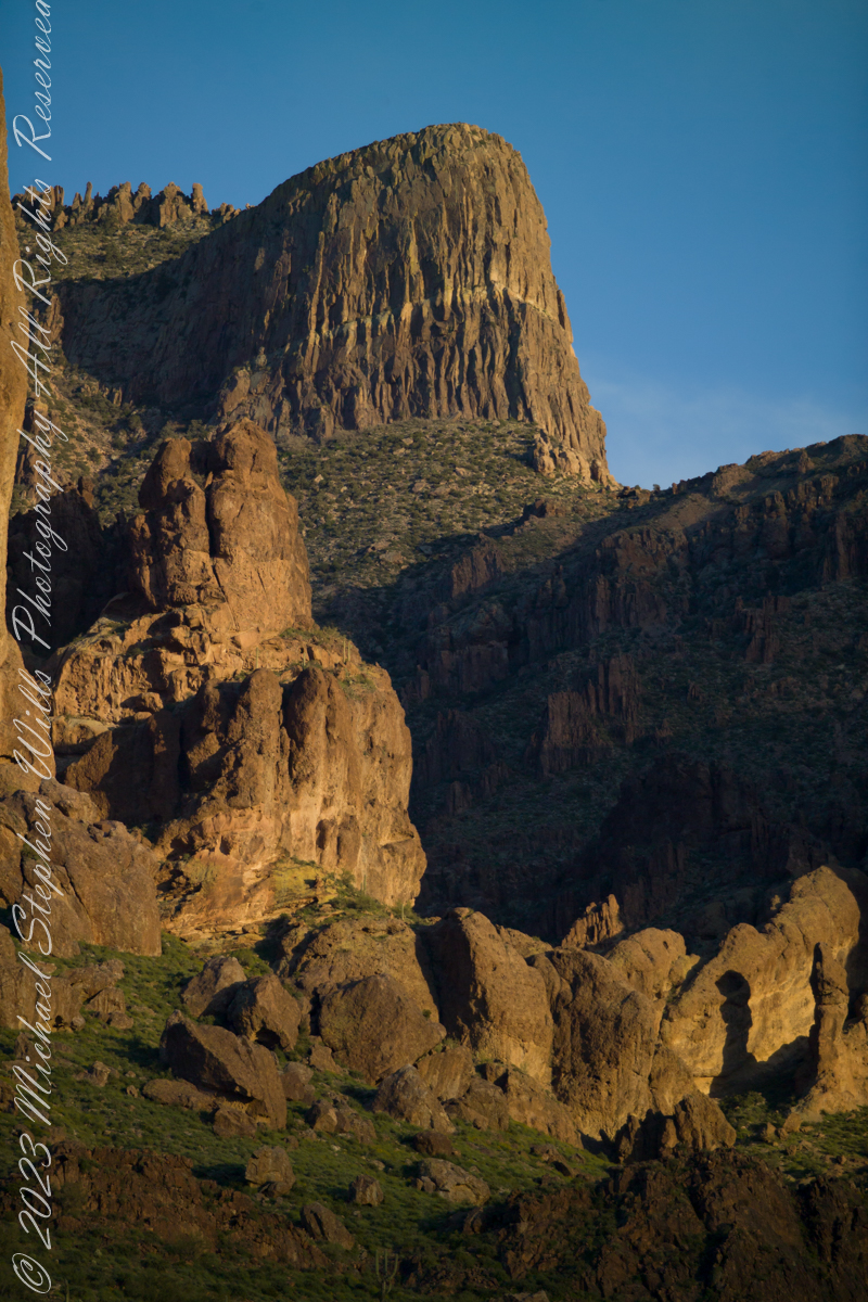
The mountain was formed by a series of volcanic eruptions between 20.5 and 18 million years ago. The west face of the mountain is composed of dacite lava and rhyolitic tuff. The overlying tuff was deposited during an eruption which created a collapse caldera bounded by faults. Dome resurgence reactivated these faults, causing uplift of the caldera floor which juxtaposed the softer tuff and more resistant dacite. Differential weathering caused the outer tuff to erode faster, leaving the dacite cliffs exposed and creating the prominent mountain visible today.
The Flatiron, the mesa-like projection above us in this view, is long solidified dacite lava. The word dacite comes from Dacia, a province of the Roman Empire which lay between the Danube River and Carpathian Mountains (now modern Romania and Moldova) where the rock was first described. Lost Dutchman State Park, Apache Junction, Maricopa County, Arizona
Reference: Wikipedia “Superstition Mountain” and “Dacite Lava.”
Copyright 2023 Michael Stephen Wills All Rights Reserved
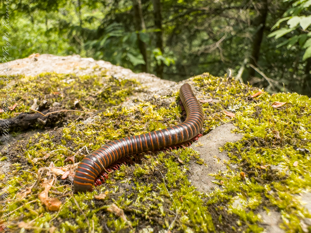
Visitors to Robert H. Treman park think nothing of crushing millipedes on the trail, it is concerning to encounter evidence of such disrespectful and boorish behavior. Here is an intact millipede I found last week. Millipedes are a group of arthropods that are characterized by having two pairs of jointed legs on most body segments; […]
Visitors to Robert H. Treman park think nothing of crushing millipedes on the trail, it is concerning to encounter evidence of such disrespectful and boorish behavior. Here is an intact millipede I found last week.
Millipedes are a group of arthropods that are characterized by having two pairs of jointed legs on most body segments; they are known scientifically as the class Diplopoda, the name derived from this feature. Each double-legged segment is a result of two single segments fused together. Most millipedes have very elongated cylindrical or flattened bodies with more than 20 segments, while pill millipedes are shorter and can roll into a tight ball. Although the name “millipede” derives from Latin for “thousand feet”, no species was known to have 1,000 or more until the discovery of Eumillipes persephone, which can have over 1,300 legs.
There are approximately 12,000 named species classified into 16 orders and around 140 families, making Diplopoda the largest class of myriapods, an arthropod group which also includes centipedes and other multi-legged creatures. Most millipedes are slow-moving detritivores, eating decaying leaves and other dead plant matter. Some eat fungi or drink plant fluids, and a small number are predatory.
Millipedes are generally harmless to humans, although some can become household or garden pests. Millipedes can be an unwanted nuisance particularly in greenhouses where they can potentially cause severe damage to emergent seedlings. Most millipedes defend themselves with a variety of chemicals secreted from pores along the body, although the tiny bristle millipedes are covered with tufts of detachable bristles. Its primary defense mechanism is to curl into a tight coil, thereby protecting its legs and other vital delicate areas on the body behind a hard exoskeleton. Reproduction in most species is carried out by modified male legs called gonopods, which transfer packets of sperm to females.
Millipedes are among the first animals to have colonized land during the Silurian period. Early forms probably ate mosses and primitive vascular plants. Millipedes also exhibit the earliest evidence of chemical defense, as some Devonian fossils have defensive gland openings called ozopores. Millipedes, centipedes, and other terrestrial arthropods attained very large sizes in comparison to modern species in the oxygen-rich environments of the Devonian and Carboniferous periods, and some could grow larger than one meter. As oxygen levels lowered through time, arthropods became smaller.
Most millipedes are detritivores and feed on decomposing vegetation, feces, or organic matter mixed with soil. They often play important roles in the breakdown and decomposition of plant litter: estimates of consumption rates for individual species range from 1 to 11 percent of all leaf litter, depending on species and region, and collectively millipedes may consume nearly all the leaf litter in a region. The leaf litter is fragmented in the millipede gut and excreted as pellets of leaf fragments, algae, fungi, and bacteria, which facilitates decomposition by the microorganisms.
Reference: “Millipede” Wikipedia
Copyright 2023 All Rights Reserved Michael Stephen Wills