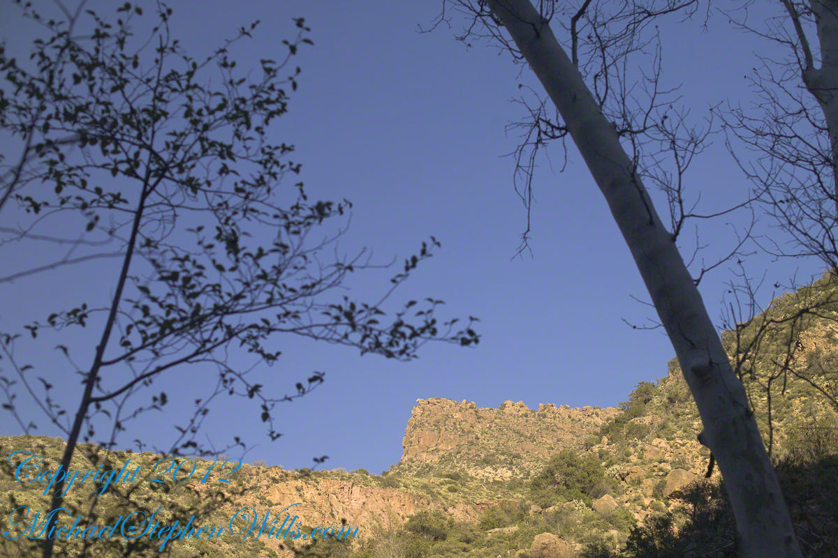
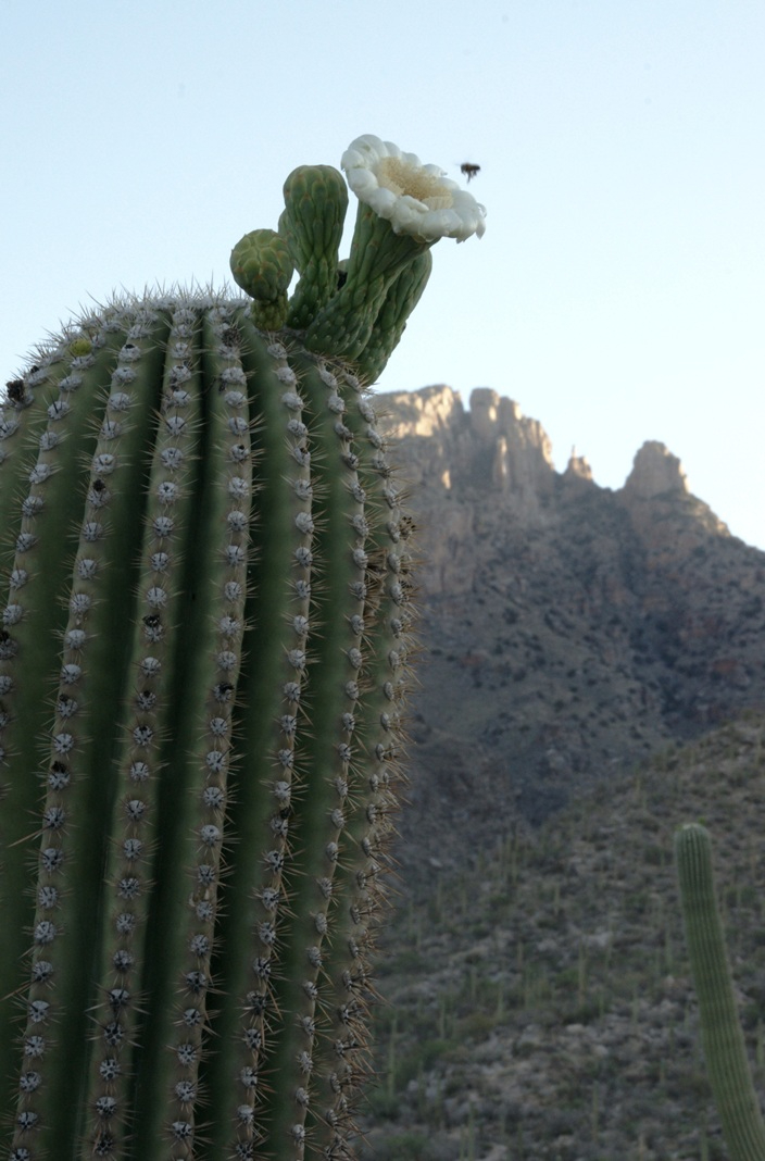
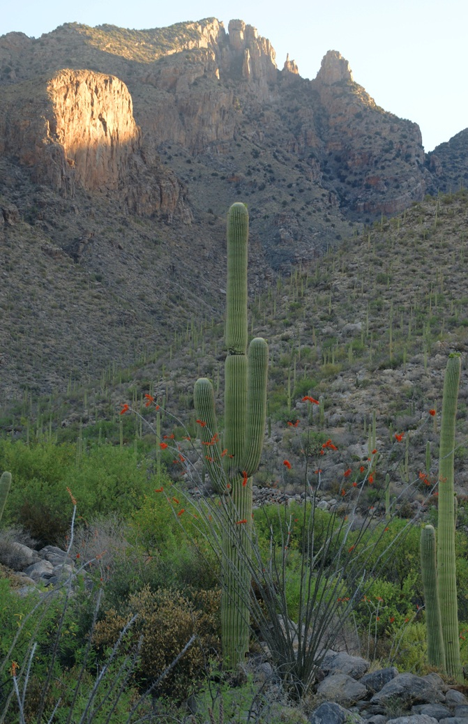
Another blog from my four day solo expedition to Reavis Falls in the remote eastern Superstition Wilderness. Here we will descend briefly to the canyon of Reavis Creek, below the Reavis Falls.
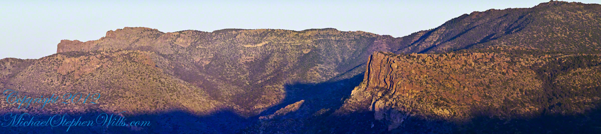
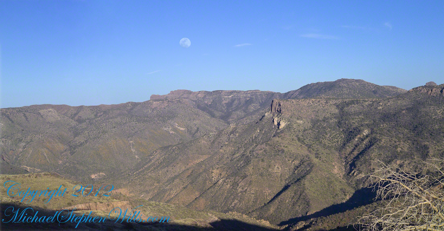
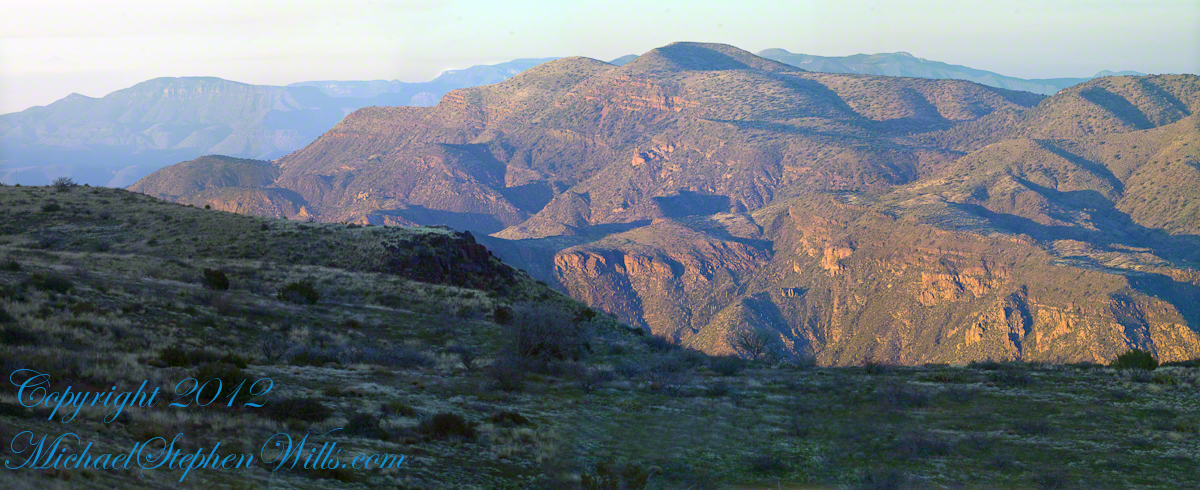
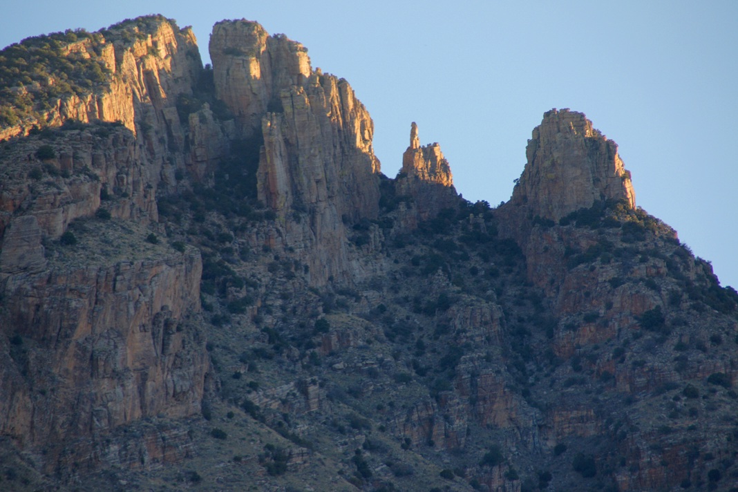
Shadows rising on the canyon walls are from Lime Mountain and Castle Dome. In the far canyon, below Two Bar Mountain, is a shadow from the notable cliff and prominence to the right, that rises above Reavis Falls, fall below and out of sight in the canyon.
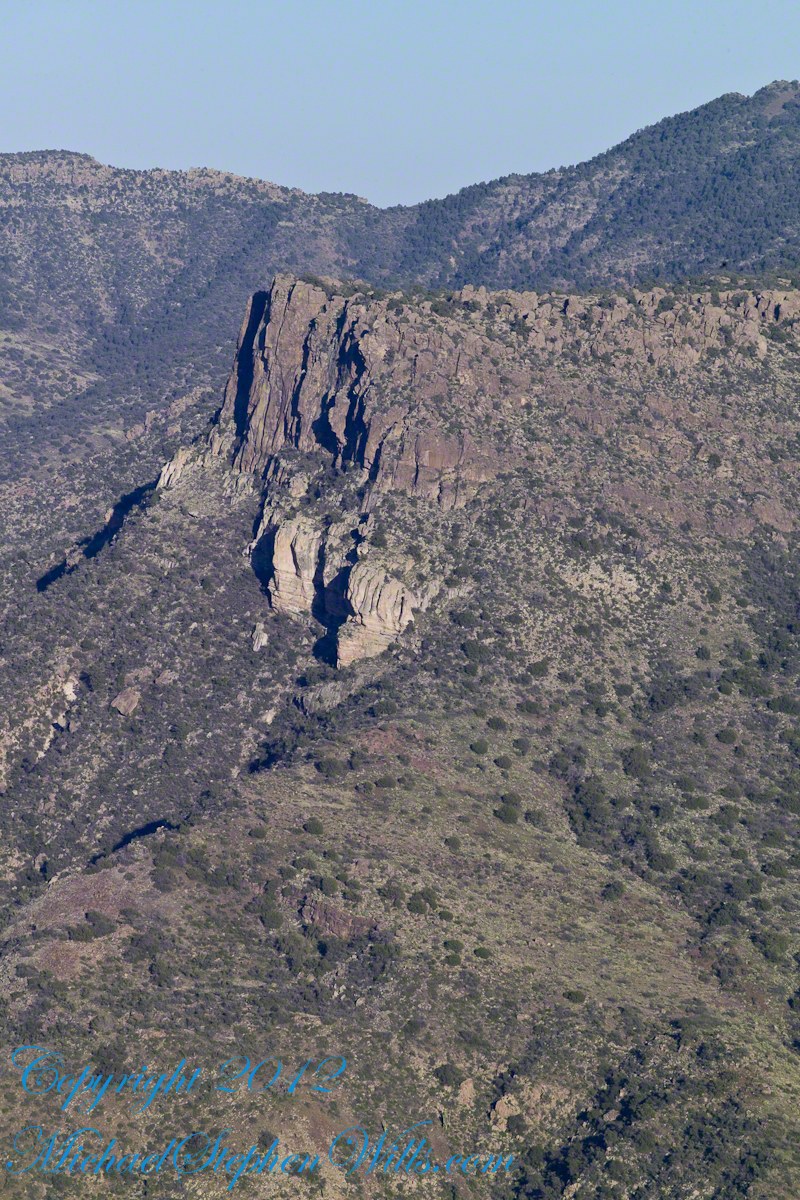
Here is that prominence from that same day, late afternoon when the sun is just starting to be low enough to throw the cliff into relief. This is a single shot with a canon 200 mm lens. This day I had climbed out of Reavis Creek, up to to this point on the slopes of Lime Mountain. Here I enjoyed an afternoon, evening, night and early morning of the following day.
The second day of the solo expedition, I hiked into the canyon of Reavis Falls from a camp at the canyon mouth. Looking up from the creek this same cliff was prominant against the sky.
Copyright 2023 Michael Stephen Wills All Rights Reserved
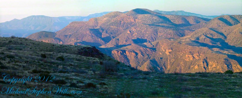
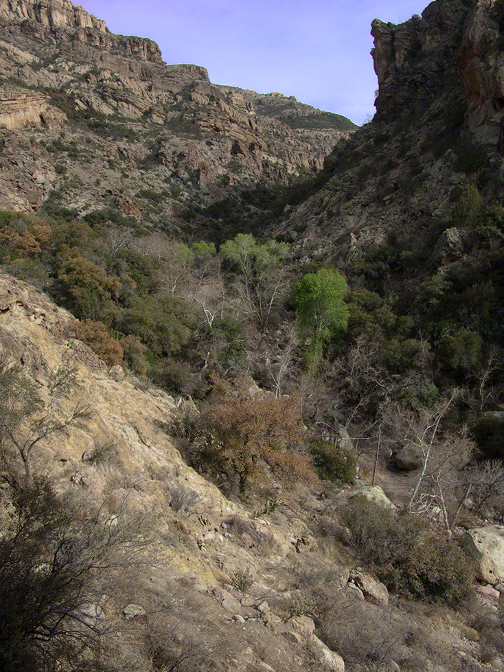
Two Bar Mountain is only part of this view taken the evening of Day Three, my solo expedition to Reavis Falls in the Superstition Wilderness of Arizona.
The view encompasses most of the four day expedition, being the climb into the lower Reavis Creek Canyon from which I camped. I spent one entire day walking up the valley to the falls.
The patches of yellow on the far slopes to the left and into Reavis Valley are Mexican Poppy (Eschscholtzia californica) blooms.
To find lower Reavis Creek Canyon, look for the prominent cliff formation in the very center of the image. Follow the end of the cliff down to a dark shadow. The western canyon wall creates the heavy shadow. As you move to the right, in the image, the shadow becomes wider because the canyon wall becomes higher.
The view also encompasses a 2005 solo expedition over Two Bar Mountain using the Tule and Two Bar Ridge trails into the Superstition Wilderness around Pine Creek. See my blog “Racing the Sun” for an image Two Bar Mountain with the path of (most of) two days of that expedition.
An interesting feature of the full size image (lost in the small-scale reproduction of this blog) is the host of enormous saguaro cactuses marching up the sides of the canyon to the left, thinning out and ending on the western walls of the canyon (the slope directly beneath my viewpoint). Our course, each cactus is perfectly still, casting a huge shadow, and seems very tiny. The nearest is a mile away. We are seeing in this thinning host the lower Sonoran in transition to the upper Sonoran life zone.
All of this in one view from Lime Mountain. Here is another, taken just as the sun set.
Copyright 2023 Michael Stephen Wills All Rights Reserved
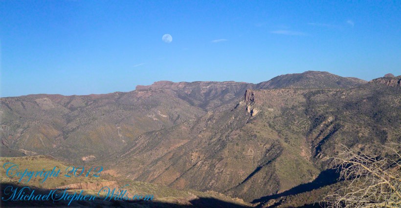
This post features photographs from my solo expedition to Reavis Falls in a remote corner of the Superstition Wilderness of Arizona.
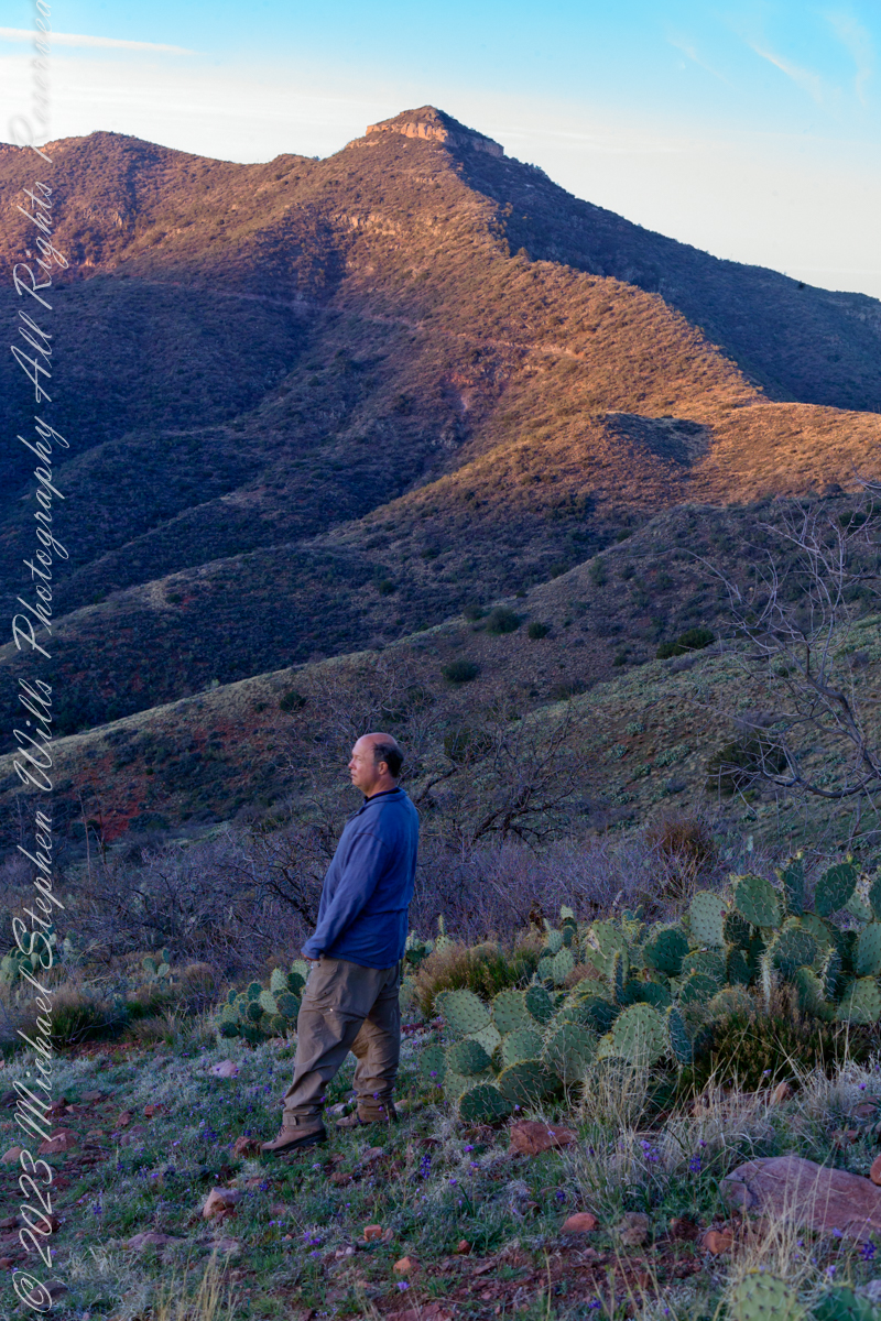
The morning of Day Four, my solo expedition to Reavis Falls in the Superstition Wilderness of Arizona. I camped on Lime Mountain, off the trail to Reavis Falls. That is Castle Dome behind me. The line sloping up the mountain is the Reavis Trail to Reavis Ranch.
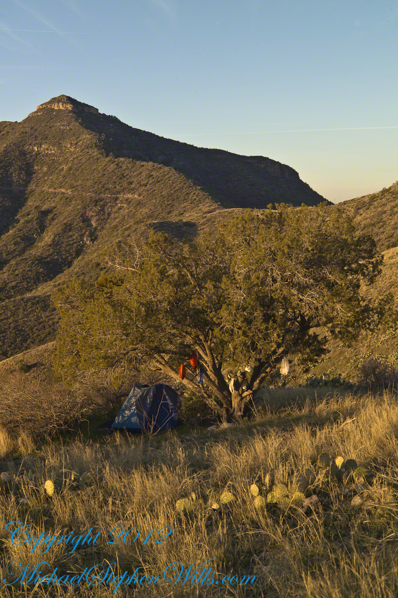
My campsite.
Looking toward Pinyon Mountain and the Arizona Trail (not visible) that fine morning.
Copyright 2023 Michael Stephen Wills All Rights Reserved
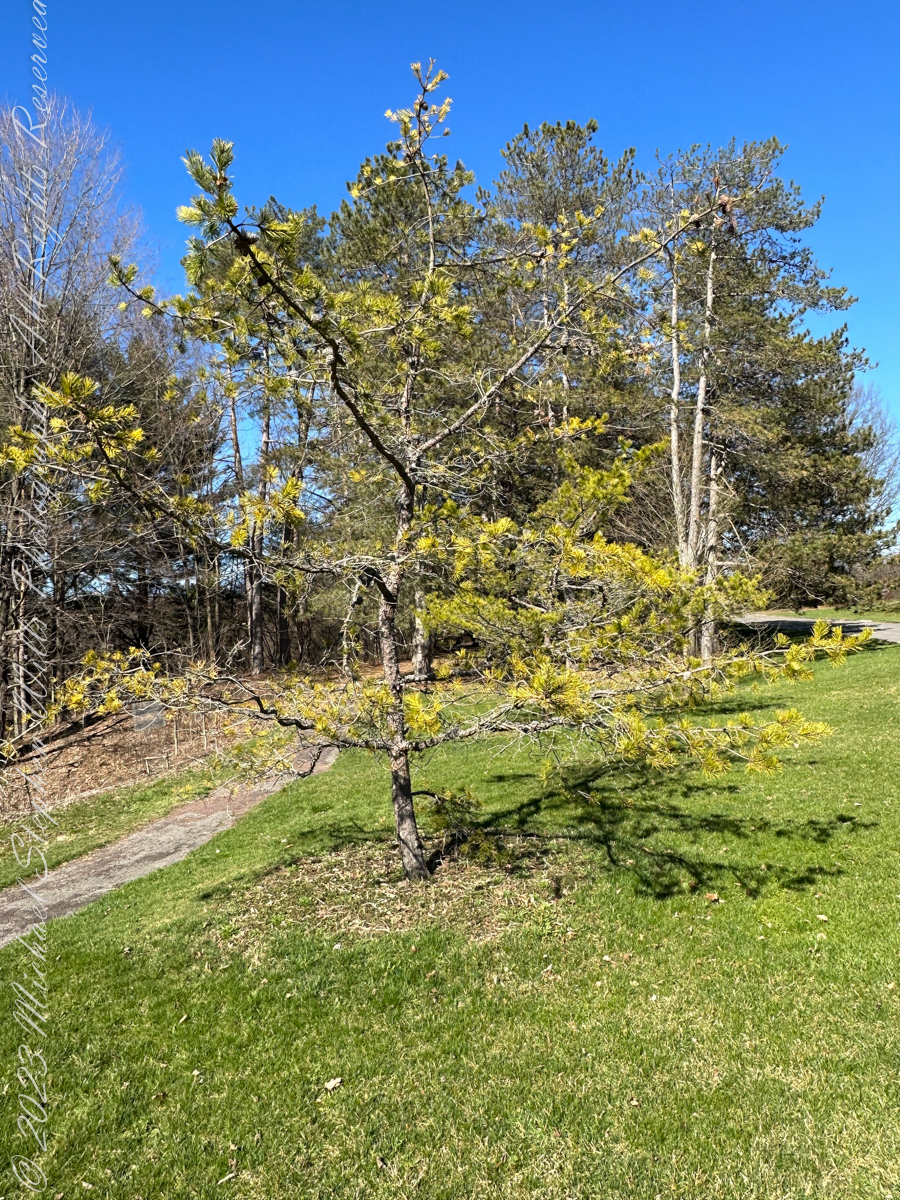
Pam and I ambled around the Arboretum for our Easter 2023 outing. Found here growing outside native range, being the Appalachian Mountains from Georgia to southern Pennsylvania, the Table Mountain Pine is named after the landform, not a particular mountain.
All photography using the IPhone 14 ProMax triple camera, raw format, edited on the phone.
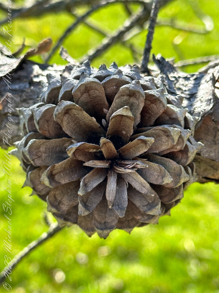
Its pinecones drew me to this scraggly, ungainly, poorly formed tree. All general mankind finds useful in the, scientific name, Pinus pungens, otherwise known as Hickory Pine, Prickly Pine and Mountain Pine, is to grind it up for pulp or chop it for tinder.
Last of the Mohicans
That said, the final scene of the 1992 film The Last of the Mohicans takes place in a nice Pinus pungens stand on a rocky mountaintop in North Carolina.
Personality
The tree has personality. Pinus pungens is the Lonesome Pine of the 1908 novel The Trail of the Lonesome Pine by John Fox, and popularized in the Laurel and Hardy film Way out West: “On the Blue Ridge Mountains of Virginia On the Trail of the Lonesome Pine” Several “Lonesome Pine” hiking trails have been waymarked in the Blue Ridge Mountains and elsewhere in the Appalachians.
Pinecone Bud
Pinus pungens prefers dry conditions and is mostly found on rocky slopes, favoring higher elevations, from 300–1,760 meters (980–5,770 ft) altitude. It commonly grows as single scattered trees or small groves, not in large forests like most other pines, and needs periodic disturbances for seedling establishment. The three tallest known ones are in Paris Mountain State Park, South Carolina; they are 26.85 to 29.96 meters (88 ft 1 in to 98 ft 4 in) tall.
Reference: “Pinus pungens” Wikipedia.
Copyright 2023 Michael Stephen Wills All Rights Reserved
Pam and I ambled around the Arboretum for our Easter 2023 outing. A type of sandstone popular with Cornell monument builders, called “Lenroc” after a mansion build by Cornell’s founder, was used for these benches built into the hillside of the FR Newman Arboretum. The views are more interesting than the bench, the arch of stone in midground in one photo.
All photography using the IPhone 14 ProMax triple camera, raw format, edited on the phone.
The stone is mined locally from surrounding hills. Calling it “Lenroc” (Cornell spelled backward) is a misnomer as the stone is mined widely throughout the region.
Feldspathic Greywacke
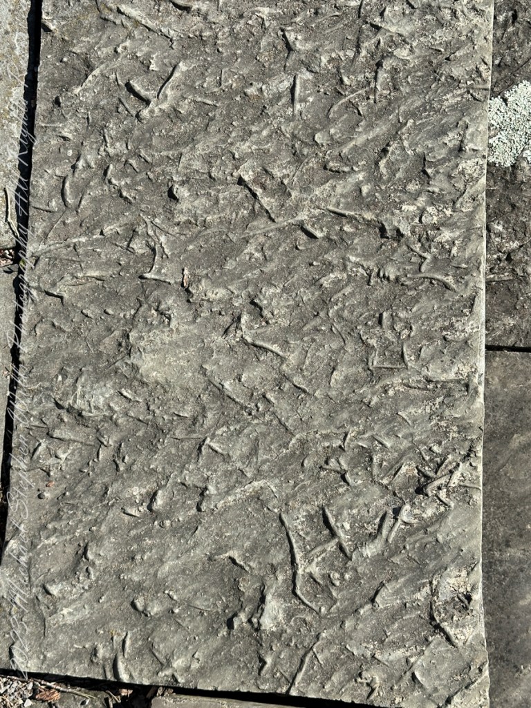
“Bluestone from Pennsylvania and New York is a sandstone defined as feldspathic greywacke. The sand-sized grains from which bluestone is constituted were deposited in the Catskill Delta during the Middle to Upper Devonian Period of the Paleozoic Era, approximately 370 to 345 million years ago…..
Glacial Landscape on an early spring day, Easter 2023
Textures
…The Catskill Delta was created from runoff from the Acadian Mountains (“Ancestral Appalachians”). This delta ran in a narrow band from southwest to northeast and today provides the bluestone quarried from the Catskill Mountains and Northeastern Pennsylvania. The term “bluestone” is derived from a deep-blue-colored sandstone first found in Ulster County, New York.”
You can feel the origin of this bluestone from these macros of two pavers from a monument bench.
Reference: “Bluestone” Wikipedia.
Copyright 2023 Michael Stephen Wills All Rights Reserved
The perfection of April in Tucson is nowhere better than mornings spent in Finger Rock Canyon of the Catalina Mountains. Oriented on a north/south axis, the eastern cliffs shed a long shadow well past 9:30 am. For early risers such as me, this means no hat and cool hiking to the canyon head: the trail hugs the eastern cliffs.
These three shots were taken 5:30 – 6:00 am mountain time (Arizona does not follow daylight savings time except on the Navajo Reservation).
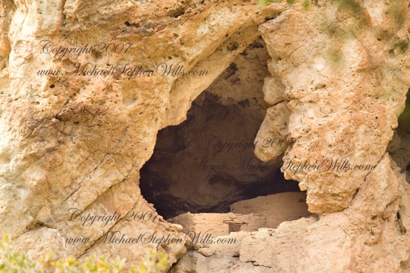
About 700 years ago, when the expansion of the Mongol empire was under way, on the other side of the planet people discovered a series of caves, formed in tuff, with a favorable location in a south facing cliff near water. Tuff, a rock formed from volcanic ash, is hard, brittle and soluble in water. From these properties this series of caves formed. The southern exposure provided excellent climate control for people, like those we now call the Salado, who understood how to exploit the location.
They constructed from local materials (mud, plants and rock) rooms in the upper cave just far enough inside to be warmed by the winter sun and protected during the summer when the sun’s sky-path was higher. Who knows how long the Salado lived in what must have been this paradise or why they left.
In March 2006, after returning from a nine-day backpack trip to the remote eastern Superstition Wilderness I used a four-wheel vehicle to reach the Roger’s Trough trailhead for a day trip to this site in Roger’s Canyon. The advantage of Roger’s Trough is the high elevation that leaves “just” about 1,100 feet of climbing (2,200 total) for the day. As it happens, it is downhill to the ruins though there is plenty of ups and downs plus scrambling over rocks.
I started late morning and a returning party met me on the way out and warned against leaving packs unattended. It seems they were victimized by pack rats. My timing was lucky and I had the site to myself.
First (refer to the “Roger Canyon” photograph, above) I climbed the cliff opposite from the ruins to set up a tripod an telephoto lens to shoot through the trees to capture the main building inside that very interesting looking tuff (see below). That central column (to the right) divides the cave opening and there are views from inside, up and across the canyon. In season, the cliffs are occupied by nesting birds and, higher up, there are fascinating caves in locations too high and steep to reach without the proper equipment.
As it is, climbing into the upper cave requires an exposed rock scramble. By “exposed” I mean the climber is exposed to falling. That is an intact wooden lintel of the visible structure opening and the larger structure, to the right, has curved walls.
Salado Cave Ruin
I then explored in and around the site. The location of a lower cave made it useful for storage, it was walled off and the sturdy structure still stands today. By the way, I inverted this view for artistic purposes.
Lower Storage Room
A lower cave is opened and accessible. Looking out, I felt the original inhabitants were with me and then a raven started calling over and over and over.
Lower Cave
I was so fascinated by the possibilities of the site that time got away from me until this incessant cawing of a raven made me notice the lengthening cliff shadows. Here is a view (see below) of my way home, back up Rogers Canyon. My last shot before packing up. It took just over two hours to get out, at a steady pace. It was twilight as I approached the Rogers Trough trail head.
By the way, my posting before this one (“Finding Circlestone”) includes a shot of White Mountain. In that view, these ruins are on the other side of White Mountain.
View up Rogers Canyon from the Ruins
Copyright 2023 Michael Stephen Wills All Rights Reserved
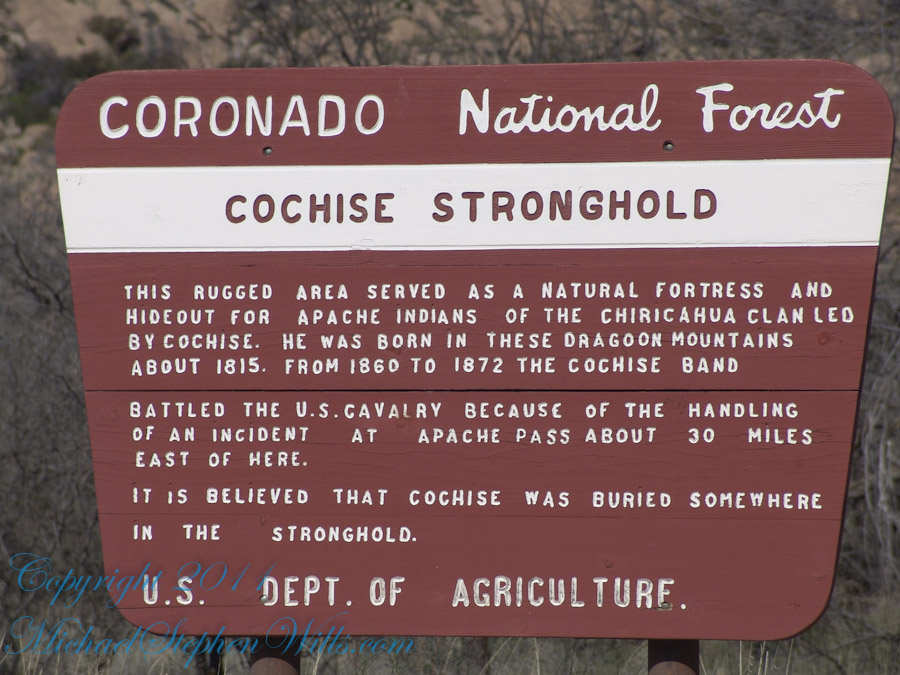
Interstate 10 between Benson and Wilcox ascends through a field of enormous, eroded granite boulders. Off to the west are the Dragoon Mountains, otherwise known as “Cochise Stronghold.” This rugged area served as a natural fortress and hideout for Apache Indians of the Chiricahua clan led by Cochise. He was born in this Dragoon Mountains about 1815. From 1869 to 1872 the Cochise band battled the U.S. Calvary because of the handling of an incident at Apache Pass about 30 miles east of here. It is believed that Cochise was buried somewhere in the Stronghold.
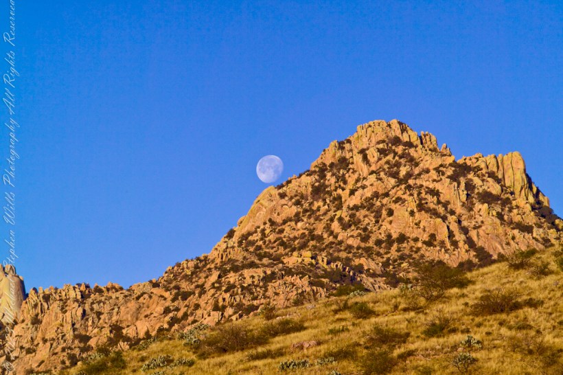
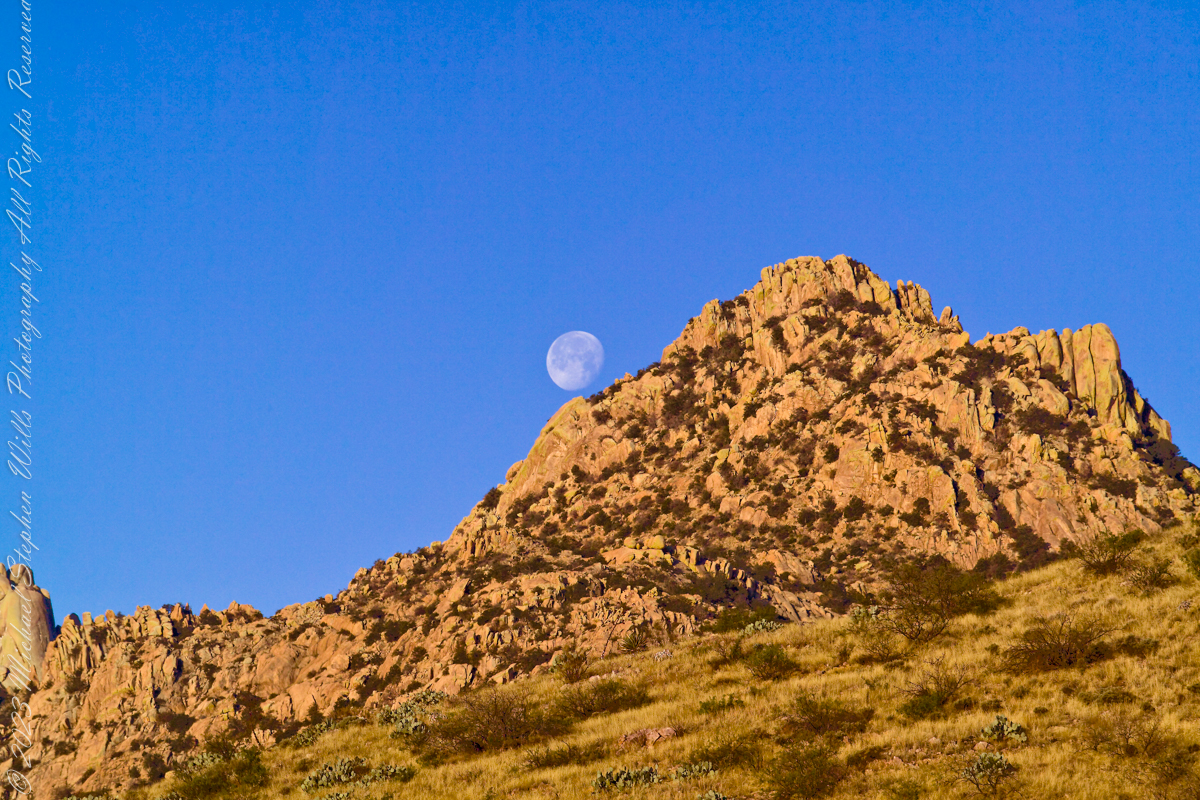
One April morning, very early, on the road to Cochise Stronghold. We stopped everything for me to unload the equipment to capture a gibbous moon low in the west, grazing a hoodoo ridge of Cochise Stronghold of the Dragoon Mountains. Near Dragoon, Cochise County, Arizona
Copyright 2023 Michael Stephen Wills All Rights Reserved
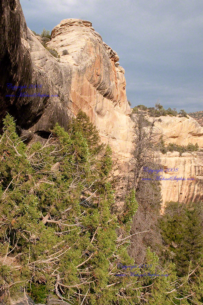
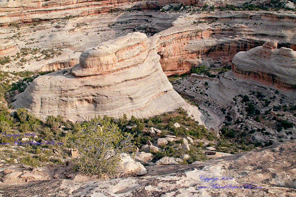
I created a series of fine art prints from a visit my wife Pam and I made to Natural Bridges National Monument in Utah. Here are a few of these prints which grace fine homes around the world. Click any of the photographs to visit the gallery.
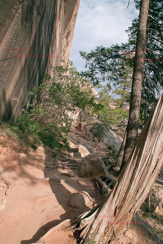
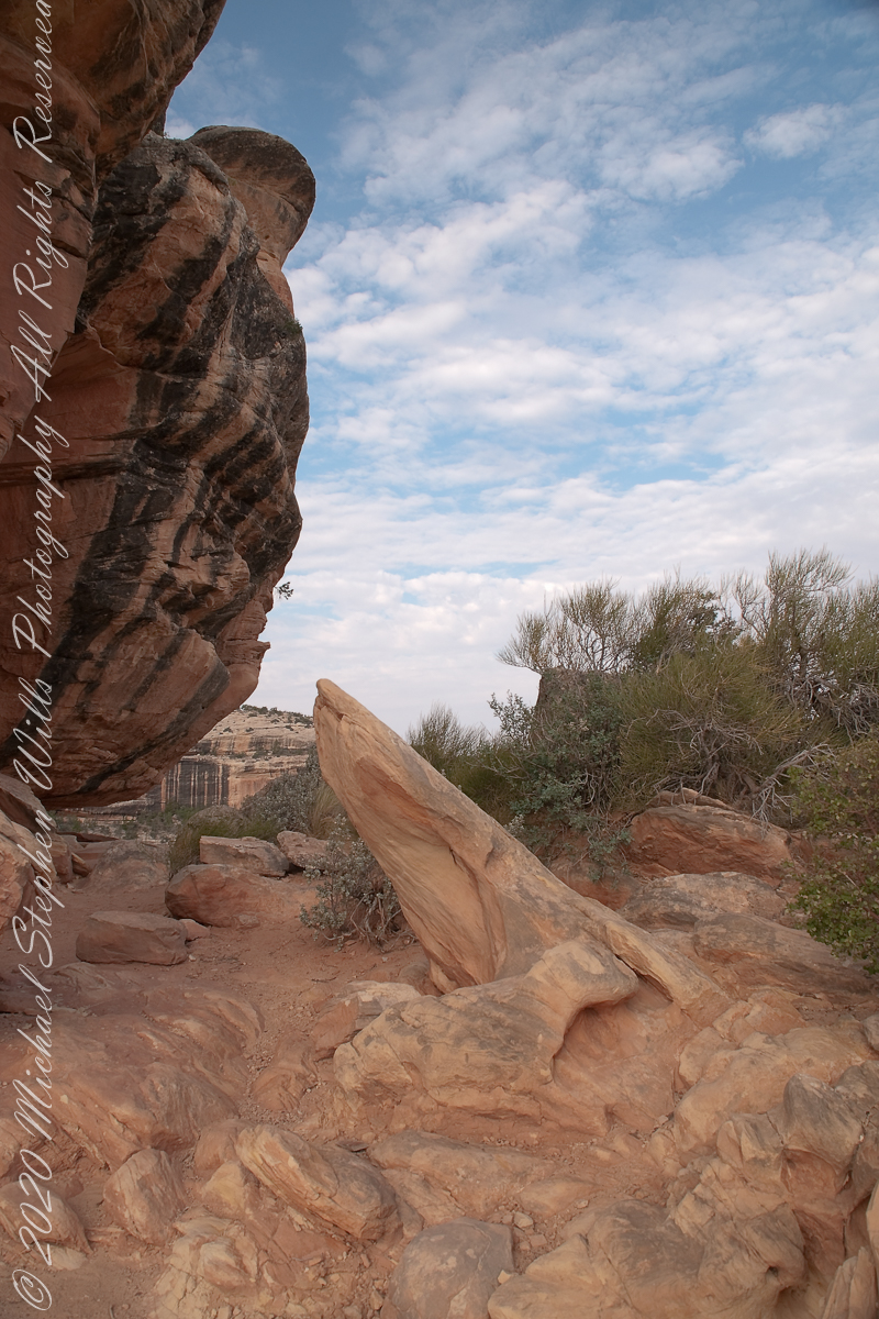
We walked a narrow cliff patch climbed a series of weathered pine ladders to achieve these views of Sipapu Bridges National Monument.
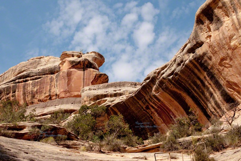
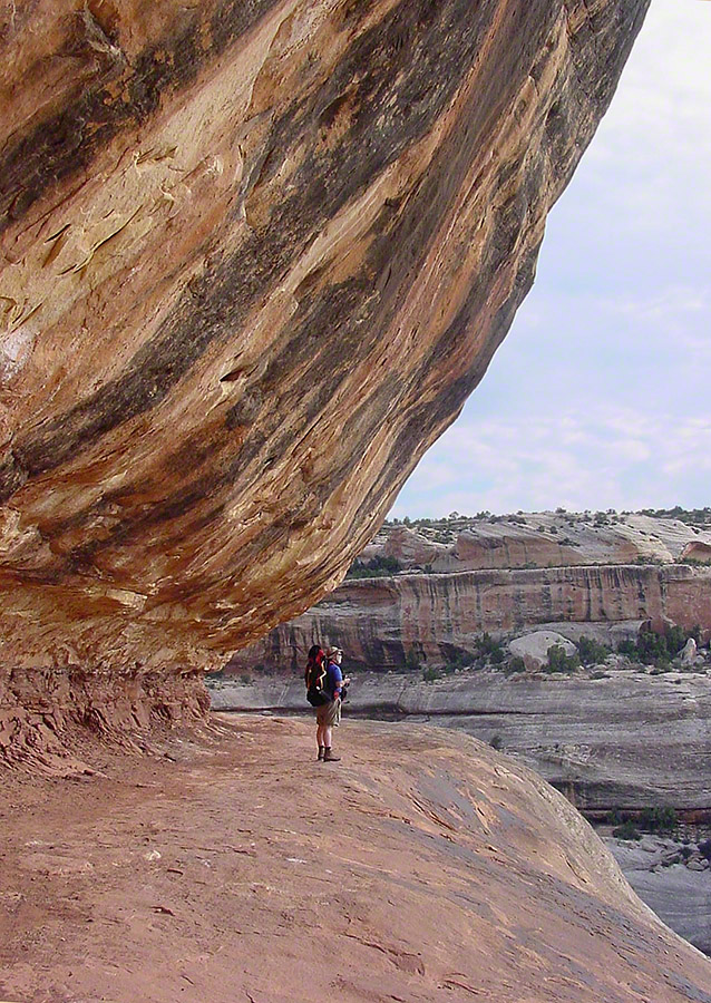
While the sky is unchanged, below the canyon rim is another world. The black stripes of the cliffs is desert varnish, a thin deposit of clay, iron and manganese oxides. The rock supporting the varnish is resistant to wear and protected from direct precipitation (in this case by the overhanging cliff).
Eventually we came to a ledge with a view of Sipapu Bridge. Pam took the opportunity to capture this amazing experience.
Mike at Sipapu BridgeSONY DSC
A Utah Juniper (Juniperus osteosperma). Historically, across the west, Native Americans used the wood in building their houses. They ate the berries; smoked the bark; made shoes, clothing, and rope from it.
Sipapu is a Hopi word for the small hole or indentation in the floor of kivas used by the Ancient Pueblo Peoples and modern-day Puebloans. It symbolizes the portal through which their ancient ancestors first emerged to enter the present world. A natural bridge is formed through erosion by water flowing in the stream bed of the canyon. Sipapu Bridge is 268 feet across and, standing in the stream bed, it is 220 feet above your head.
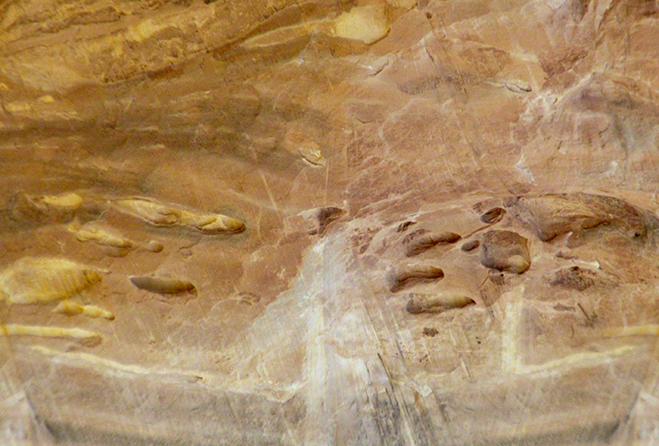
Here is a close up of the white Permian sandstone of the bridge arch. The entire canyon is carved from this stone and named after it.