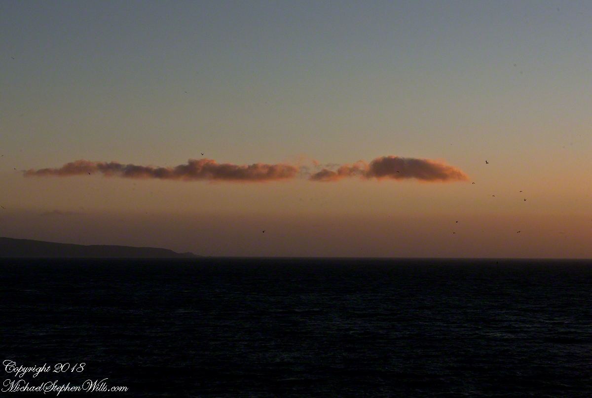
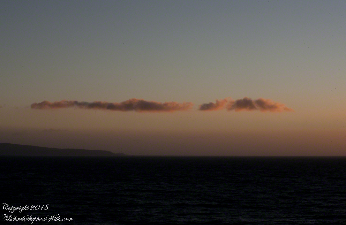
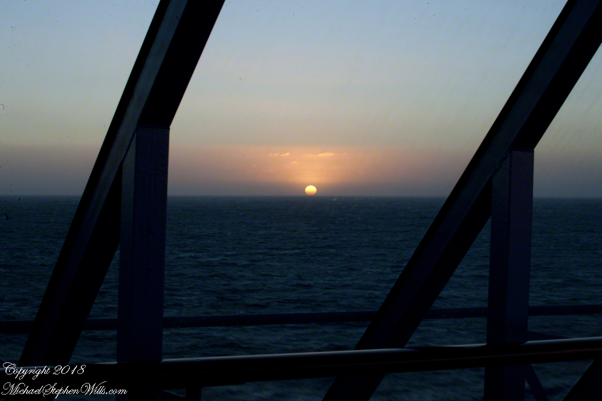
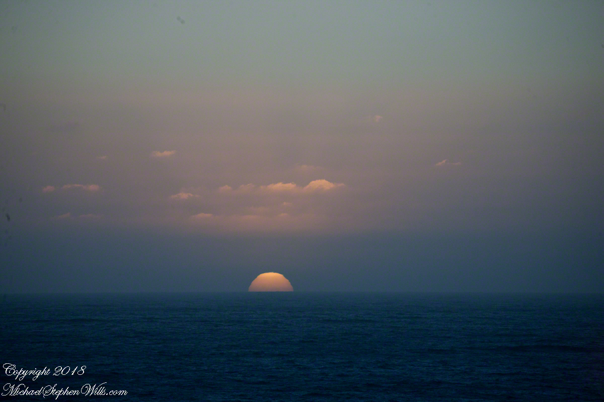
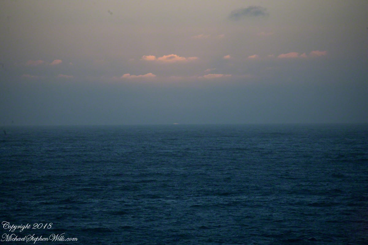
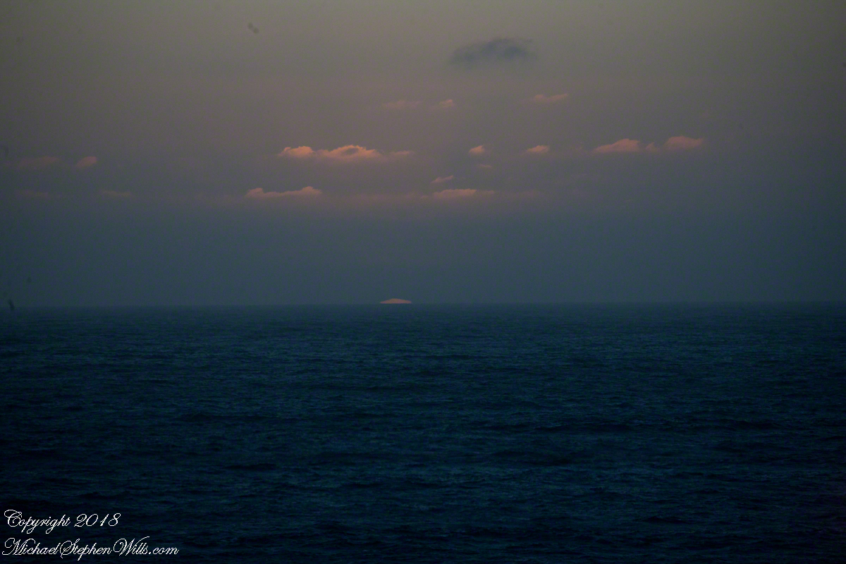
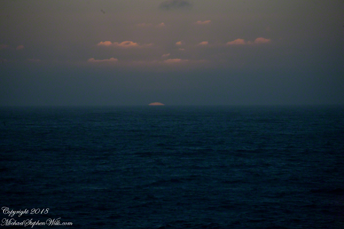
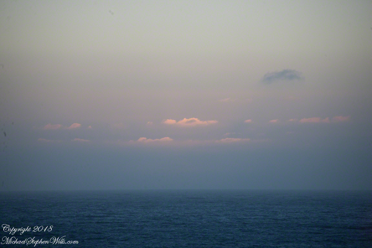
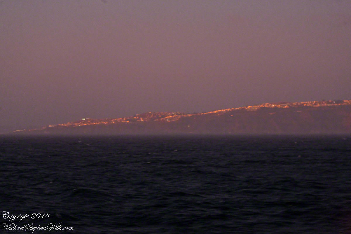
Two minutes after capturing the last light on Concon Point, see “Valparaiso Departure II”, turning the camera 180 degrees, to the south, looking along the Chilean coast, to capture birds on the wing headed toward shore at day’s end. Remembering other times,
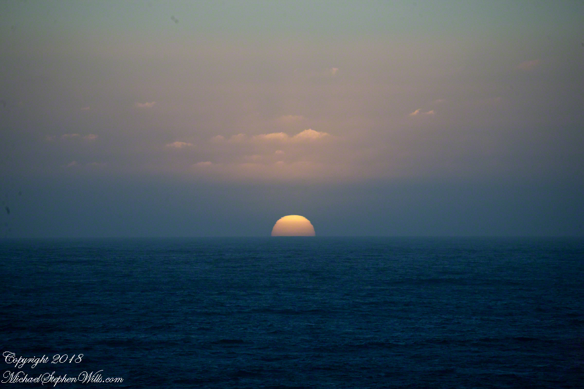
waiting for darkness
with a sky map, studying it to make sense of the stars.
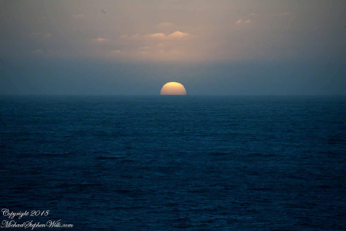
How far? How large?
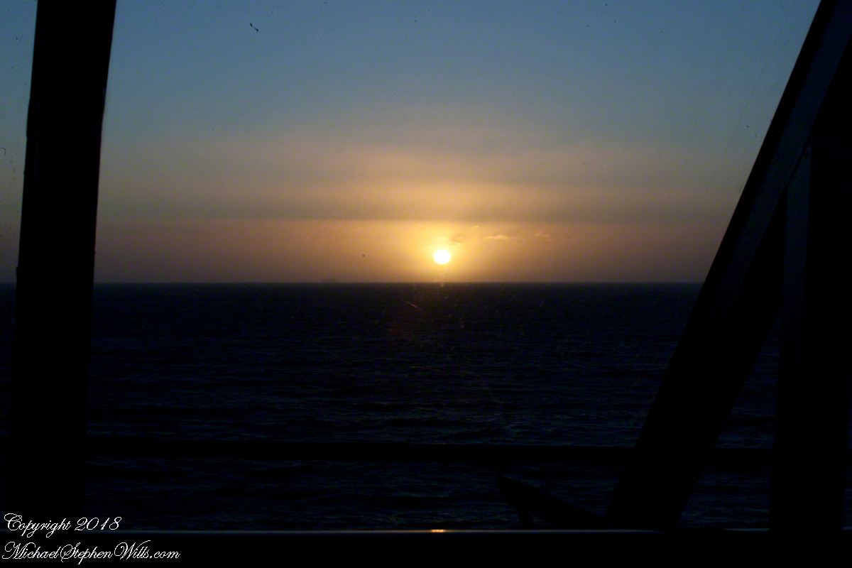
Light from our star, eight minutes old,
grazed the earth’s rim the breath of a moth wing ago.
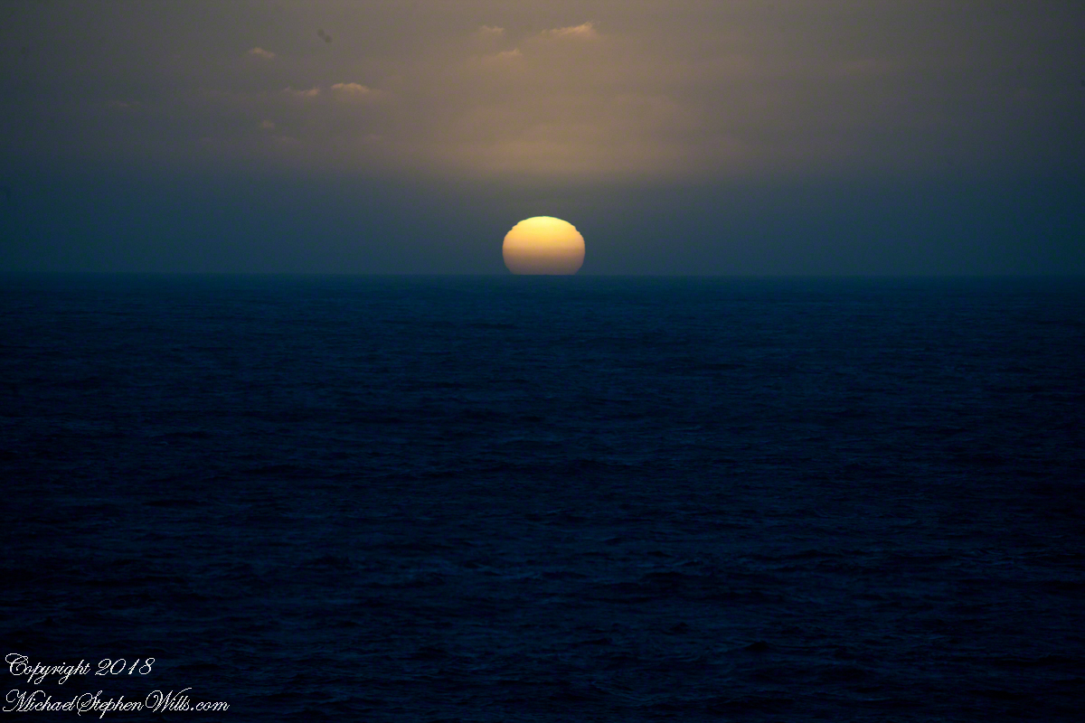
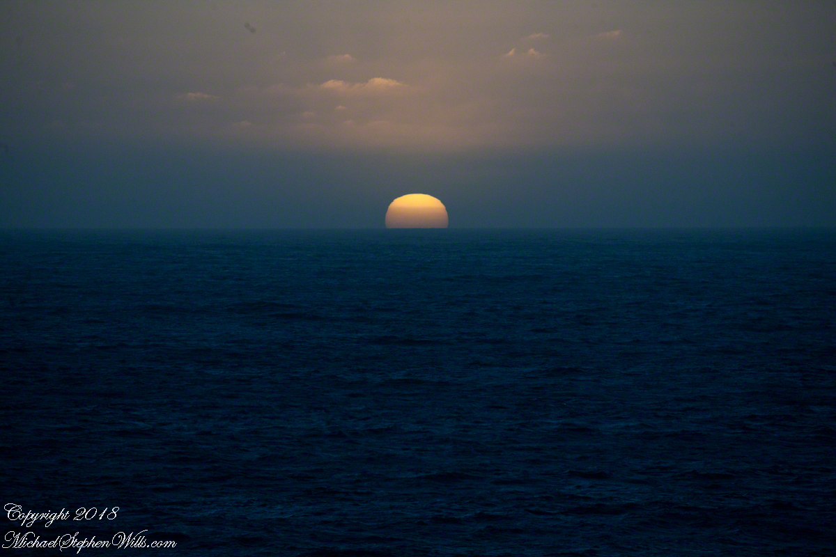
Connect the dots, stories of heroes, monsters.
Our star, as we know it now
Singular, alone,
Progress, an illusion to be understood
No less mysterious for that
Look back to the sheltering headland of Valparaiso, glowing.
Copyright 2022 Michael Stephen Wills All Rights Reserved
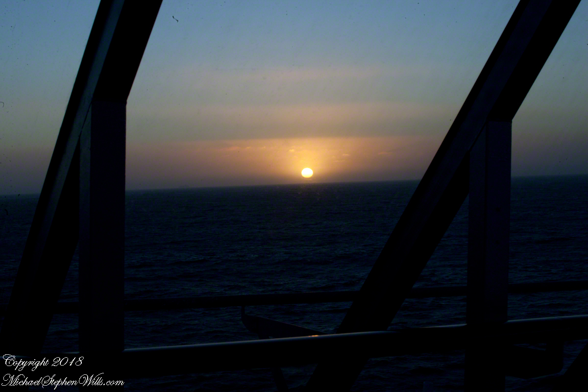
After the Ocean Princess sailed off toward its destiny in my last posting, “Valparaiso Departure I,” Pam and I left the deck for dinner to return two hours later for the Regatta’s departure in the magic sunset hour.
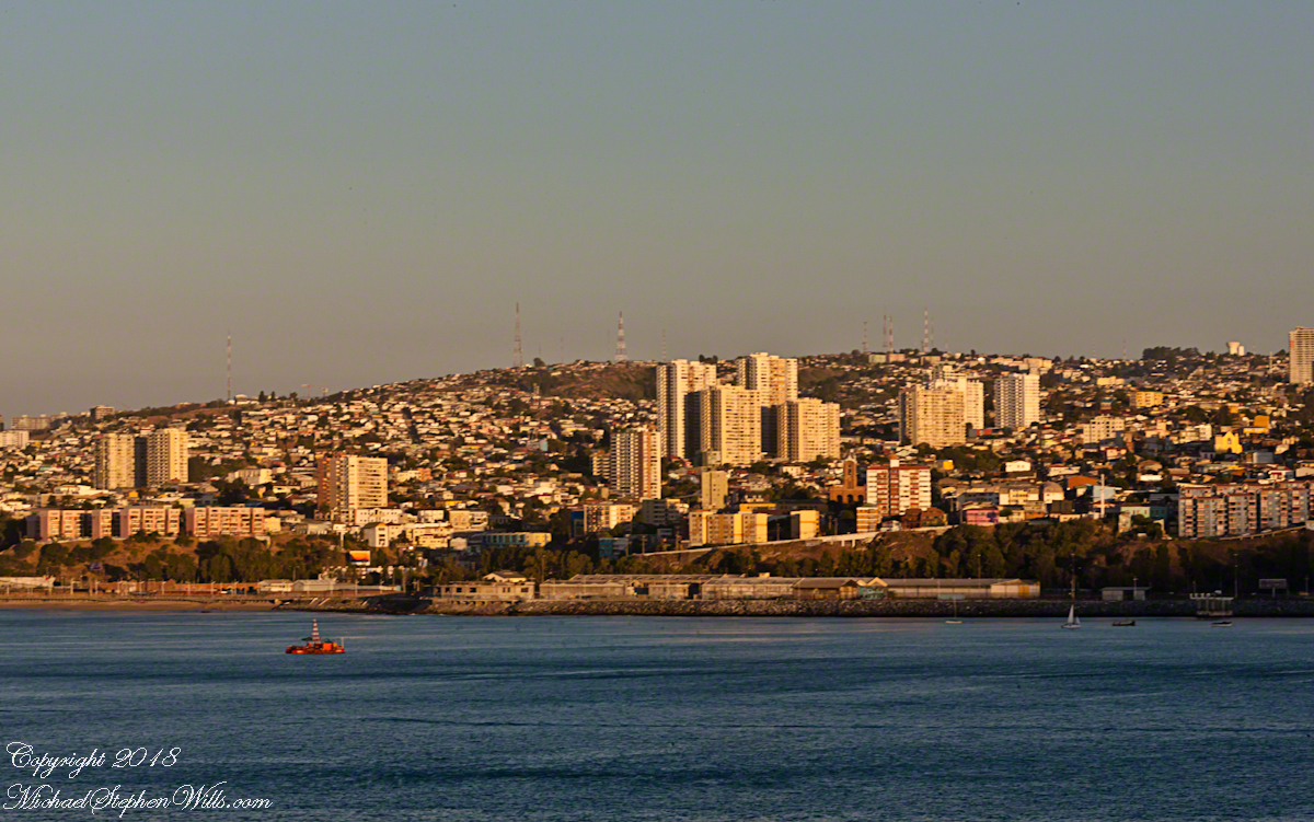
This first photograph is 22 minutes before sunset as the ship swung into a course along the northern shore of Valparaiso Bay. The city grew along the bay shore, starting from the city center in the southern cup and into the north. We are looking southeast across a lighthouse named “Club de Yates”, identified from the red fiberglass tower, a triangular daymark, toward the north end of Valparaiso.
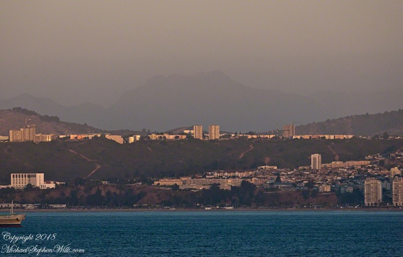
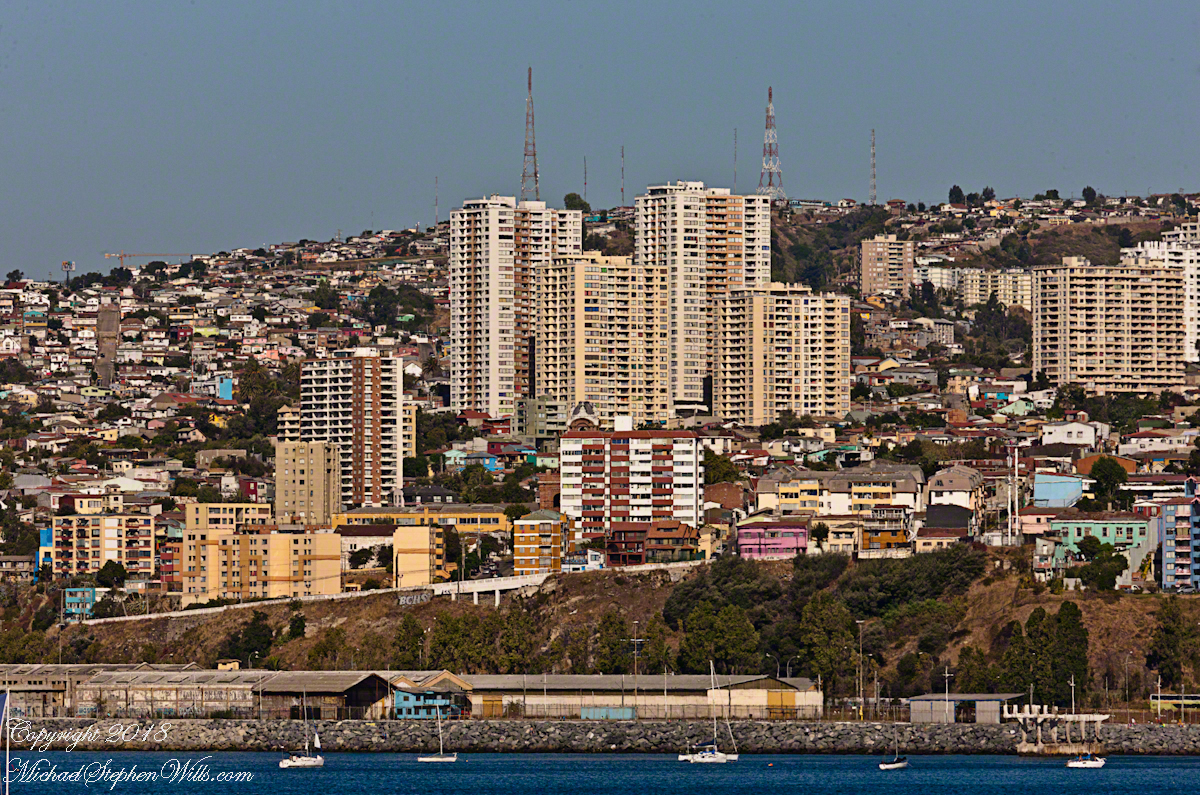
Here we see a different city altogether, the fourth largest of Chile and also within the Valparaiso Region and the Greater Valparaiso Area, named Vina Del Mar (Vineyard of the Sea). The view is almost due east and, from here, it is difficult to discern why it is also called “La Ciudad Jardin” (Garden City), it is do densely populated. North Valparaiso ends with a ridge with Vina Del Mar the next valley. Look carefully along the shore to find the Punta Gruesa lighthouse with a red band on a white metal tower daymark. By way of scale the tower is 56 feet high. Follow Punta Gruesa to the right for the ridge separating Vina Del Mar (the taller apartment buildings, from Valparaiso.
The distant mountain is huge, visible from 95 miles away. More about it later.
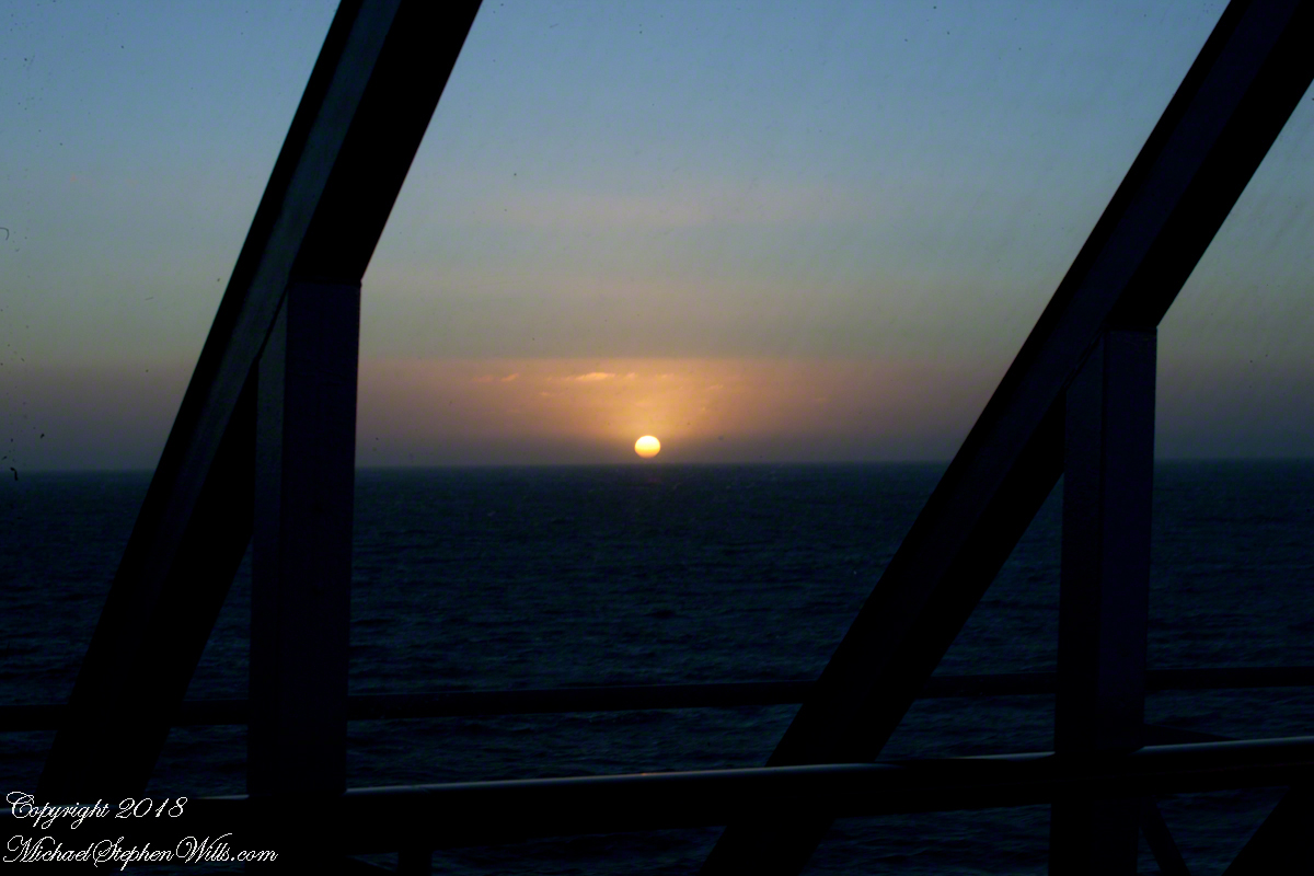
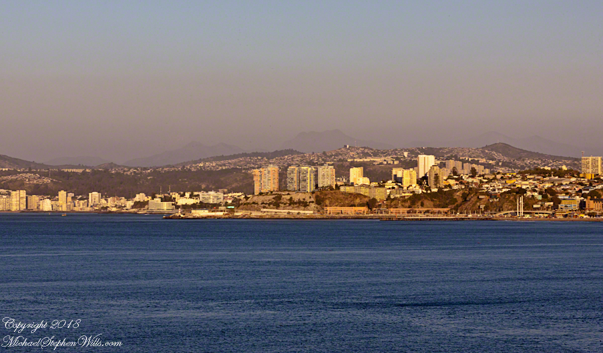
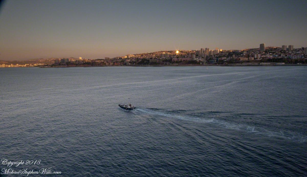
The previous photographs were using a tripod mounted Canon EOS-1Ds Mark III with the Canon 70 – 300 mm f4-5.6 L IS USM lens set to 108 mm focal length, taken 15 seconds apart. I then swapped the EF 24 mm f 1.4 L USM lens for the following photograph of the pilot boat heading to a rendezvous with the Regatta, having dropped off “our” harbor pilot. It will wait beyond the harbor to bring the pilot back home. The photograph is 7 minutes after the previous. Punta Gruesa and the lighthouse and the Vina Del Mar apartment towers are just visible, having lost the sun.
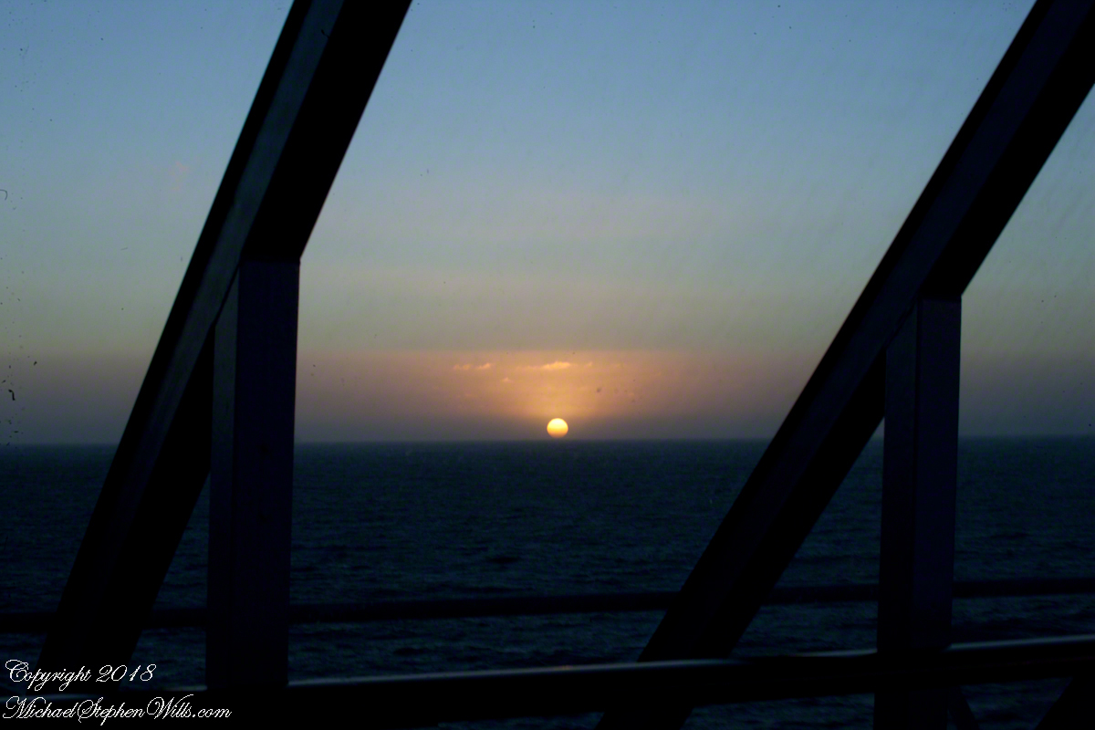
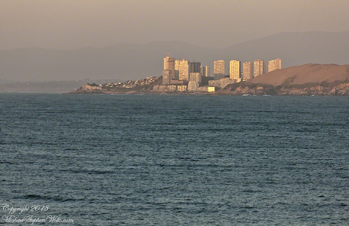
On the northern tip of Valparaiso Bay Punta Concon, the City of Concon and tall sand dunes also called Concon reflect the sun’s light 10 minutes before sunset. The city is the fastest growing in Chile, 106% between 1992 and 2010 (28,157 to 50,000). The Regatta is now well underway and I returned to the “long” lens here set to the 3oo mm focal length maximum.
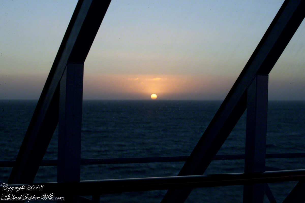
On the other side of Punta Concon (Concon Point) the Aconcagua River flows into the Pacific. Although the river has the same name as Aconcagua Mountain, the head waters are in Chile, 12 miles from the slopes of the mountain in Argentina.
A swivel of the camera brings Aconcagua Mountain into view. This former volcano, dead now for 8 – 10 million years is the highest mountain in North and South America. The next highest peak is in the Hindu Kush, 10,000 miles to the northeast. That said, Aconcagua is less challenging than Denali of Alaska and so many people attempt it each year human excrement is a major pollutant there. We are looking here over the Vina Del Mar Valley 95 miles to Aconcagua Mountain in Argentina.
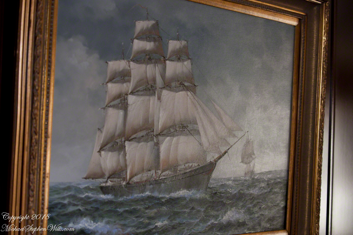
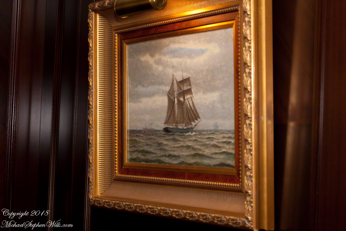
Late afternoon of our departure from the Chilean port city Valparaiso, Pam and I enjoyed entertainments on the Regatta. This painting of a ship under sail brings to mind the history of Valparaiso, as a place only reachable by ship, clinging to a narrow ledge on the Andes, barely existing for centuries, repeatedly destroyed by earthquakes until the 19th century brought sailing vessels such as this, growth and prosperity. Major earthquakes hit the years 1730, 1822, 1839, 1873, 1906, 1907. After 1907, the city was rebuilt anew in the modern form. The inhabitants must enjoy spot, naming it “Vale of Paradise.”
While, in the 21st century the city enjoys a refreshment of an influx of artists and visitors such as the Regatta, the danger of the next massive quake is ever present and unpredictable.
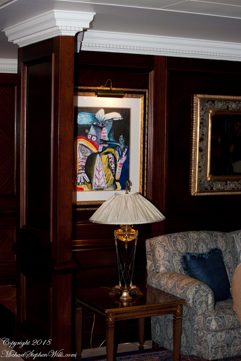
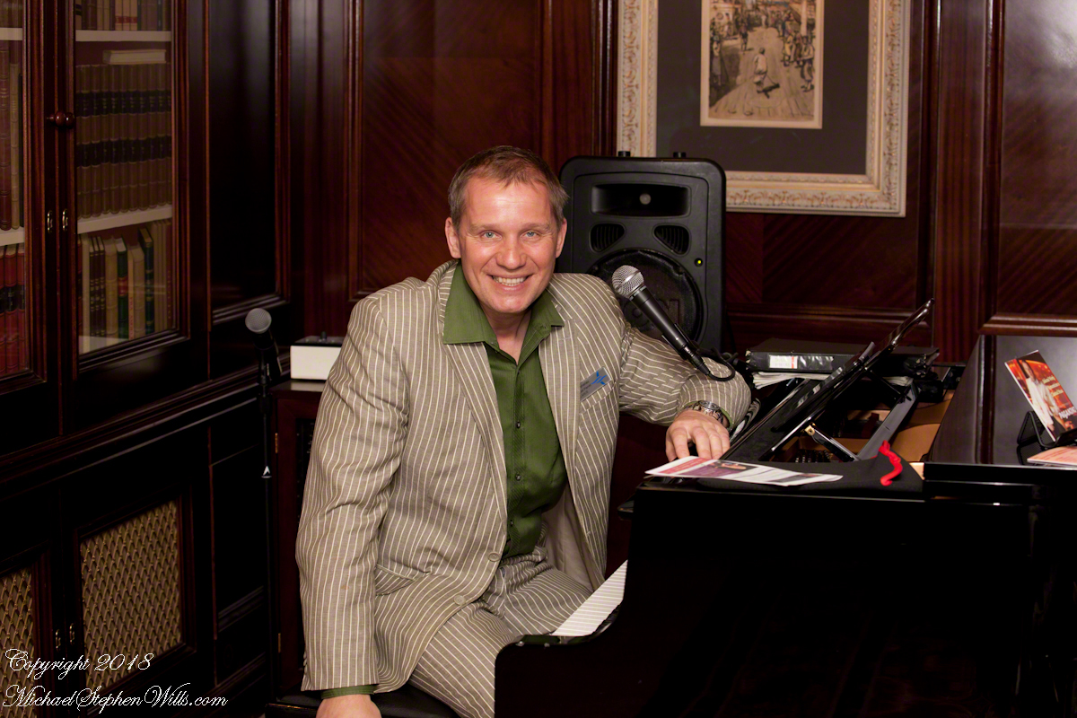
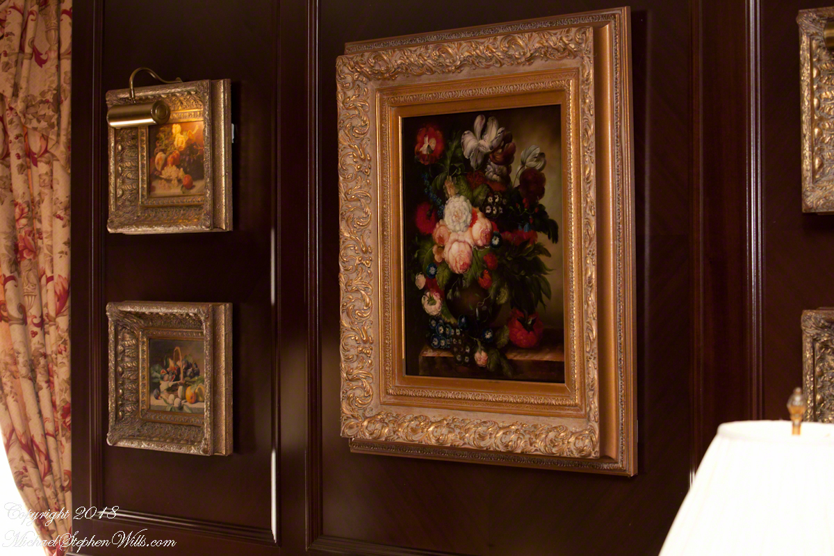
As we enjoyed the artwork….
….a pianist entertained us.
As usual, I was carting photography equipment to capture the moments as the afternoon moved towards…
….the scheduled departure among still life painting in the style of the Dutch masters.
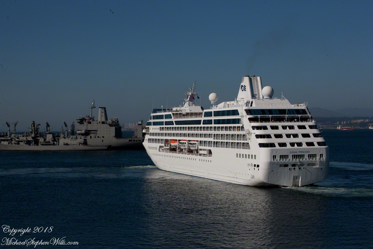
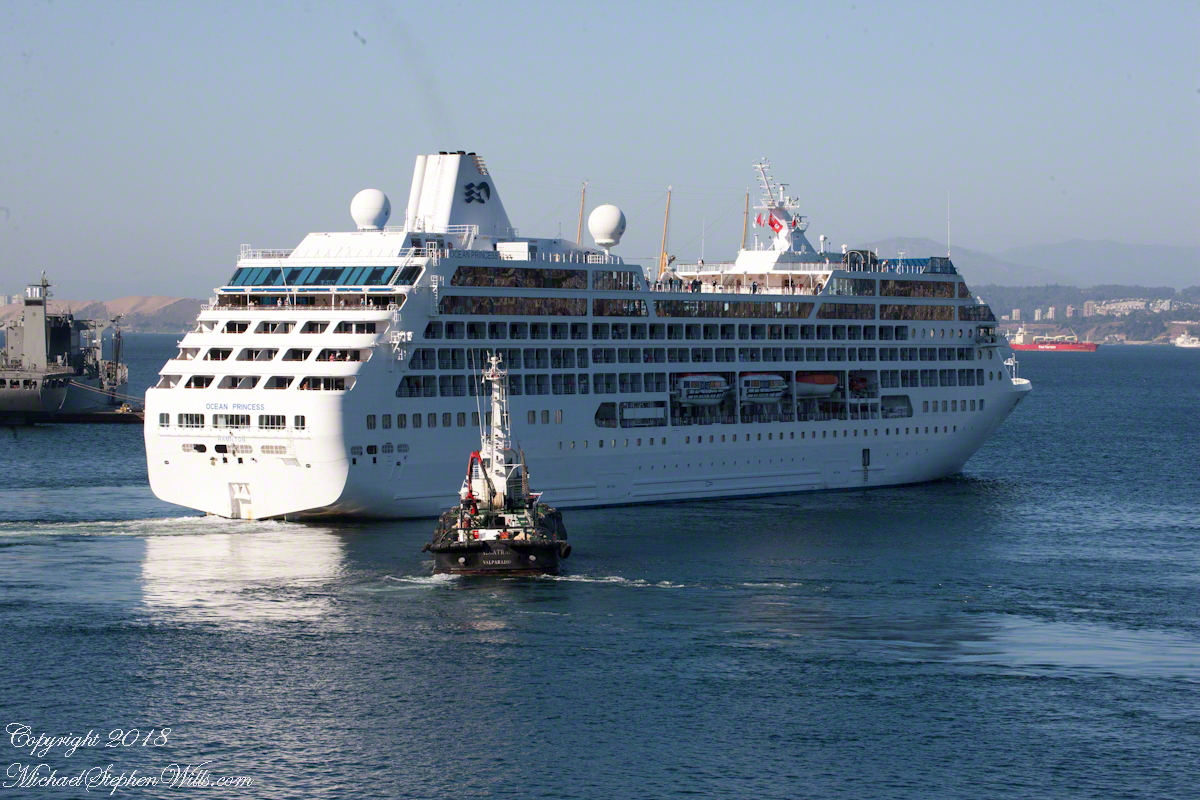
That day I chose the upper decks as the best vantage point. From there, Pam and I viewed the departure of a similar ship to the Regatta, the “Ocean Princess.” It must have been the last voyage of the Princess under that name as, the same year, it was acquired by the Oceania line, refurbished, relaunched as the “Sirena”.
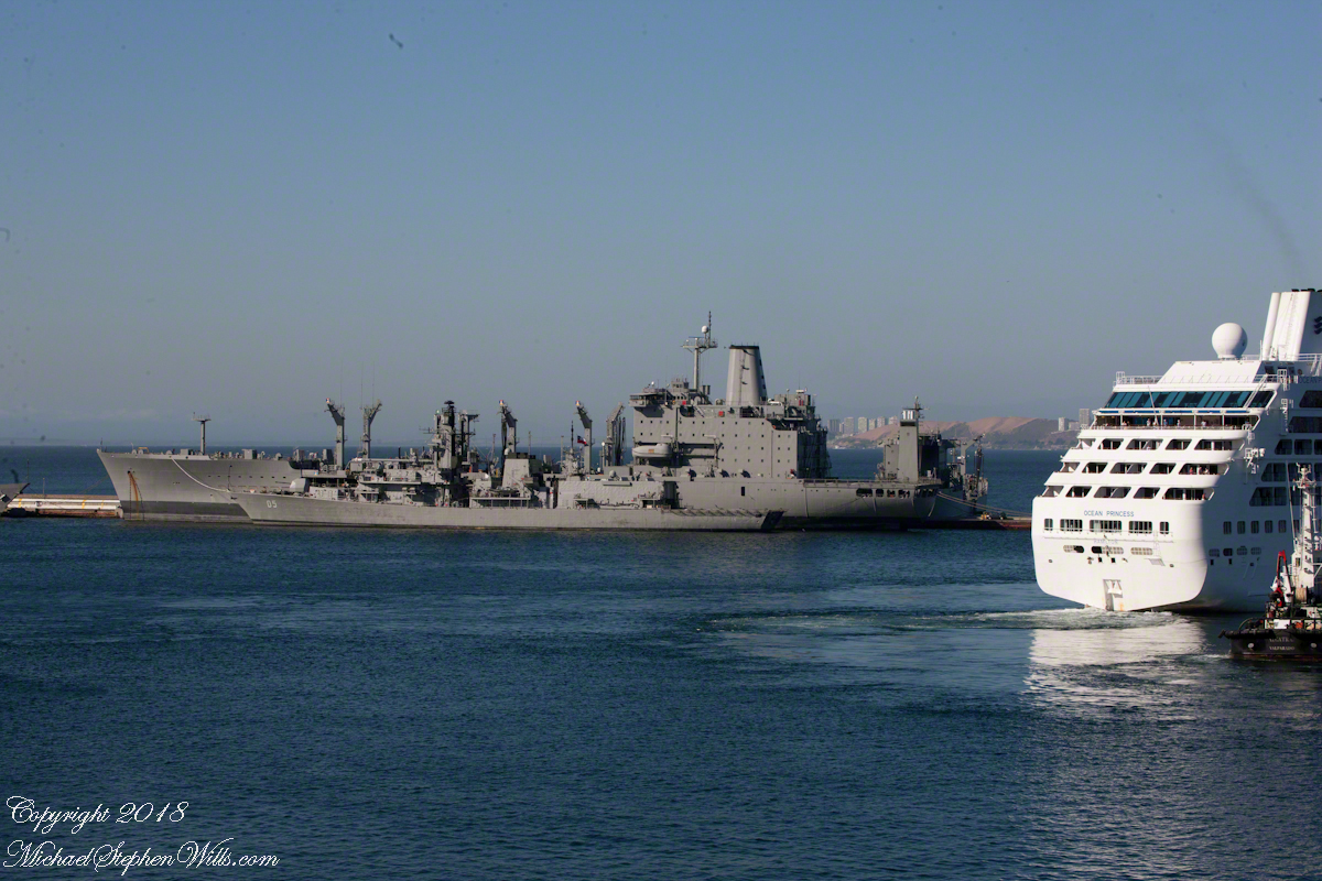
The Chilean navy base and Naval Academy is there. The Ocean Princess navigated around this docked destroyer…..
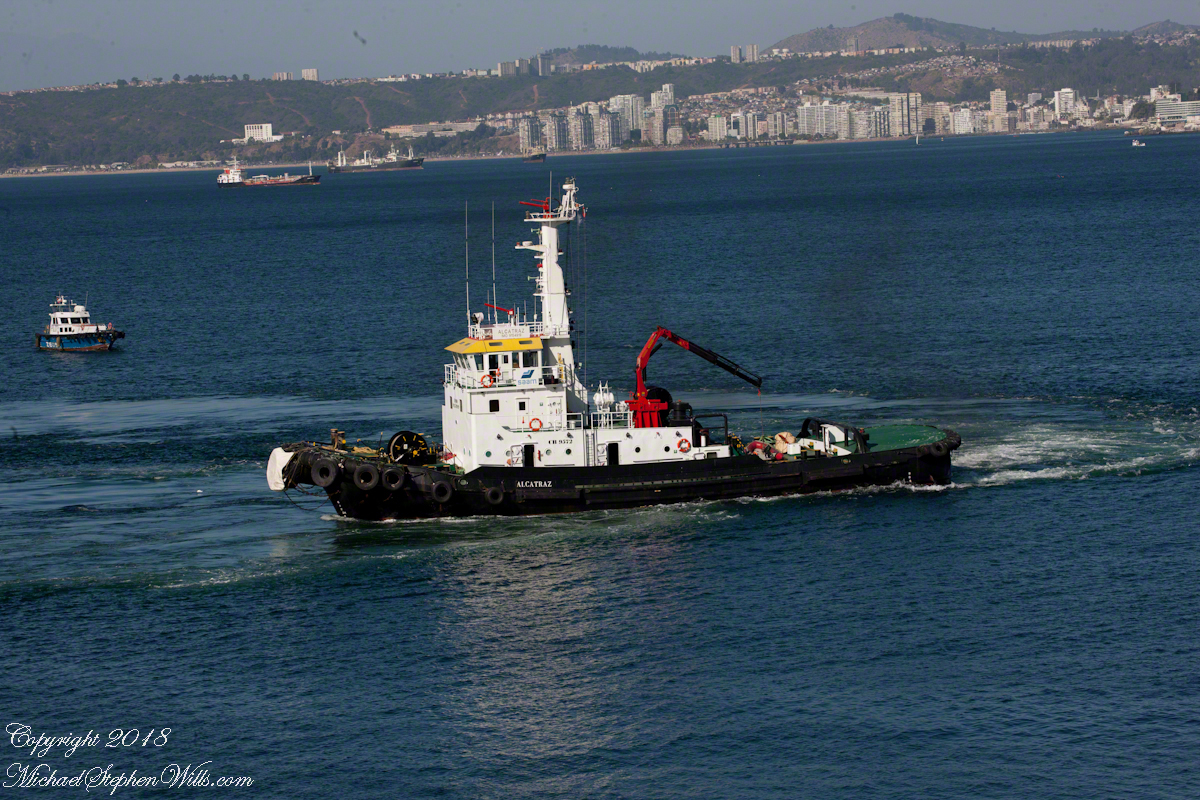
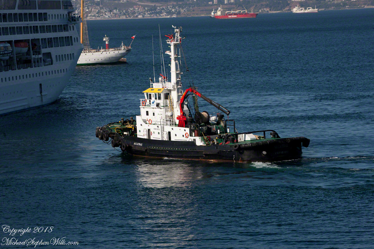
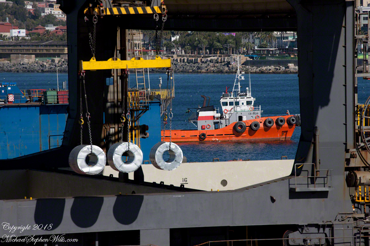
…with the assistance of the tugboat Alcatraz, a name derived from the Spanish word for pelican as in “La Isla de los Alcatraces” (Island of the Pelicans) where the former Alcatraz prison was built in San Francisco Harbor. Spanish speakers think of birds when viewing the tub boat. Americans think of prisoners (escaping) and San Francisco. Unlike San Francisco Harbor, Valparaiso Bay is a semi-circle open to the ocean, the harbor is on the southern, north facing (away from the ocean) shore, protected by a long (3,000 foot) breakwater along which the Chilean war ships dock. We are viewing the Alcatraz after most of the work for the Ocean Princess departure was done.
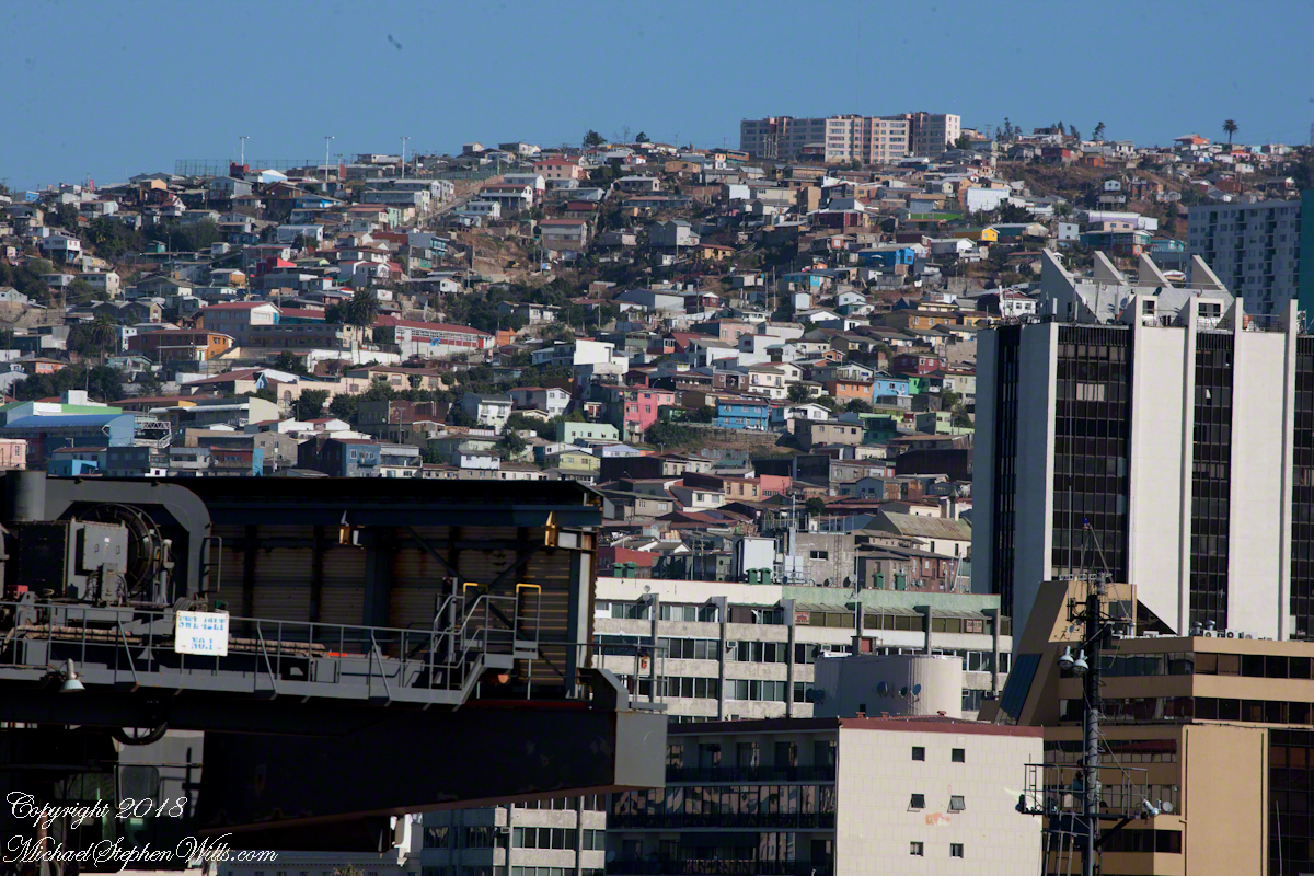
The north end of the bay is residential, behind the towers are homes arrayed on the hillside, the only land available.
Much of the harbor and city business district, in the foreground (below), on the south side is on land reclaimed from the sea.
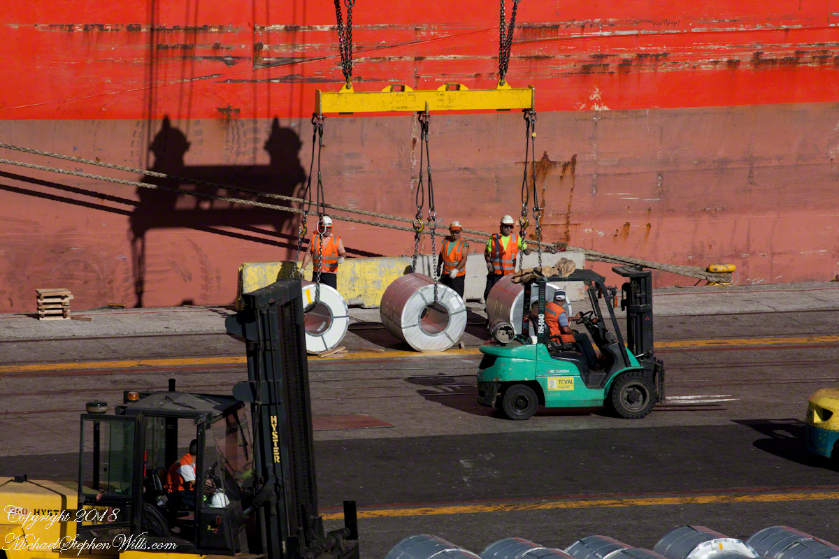
All around the Regatta was a working port. Here rolls of cable (wire?) are prepared for hoisting onto a cargo ship. Note the hawsers, taught under the strain, between the workmen and the ship hull.
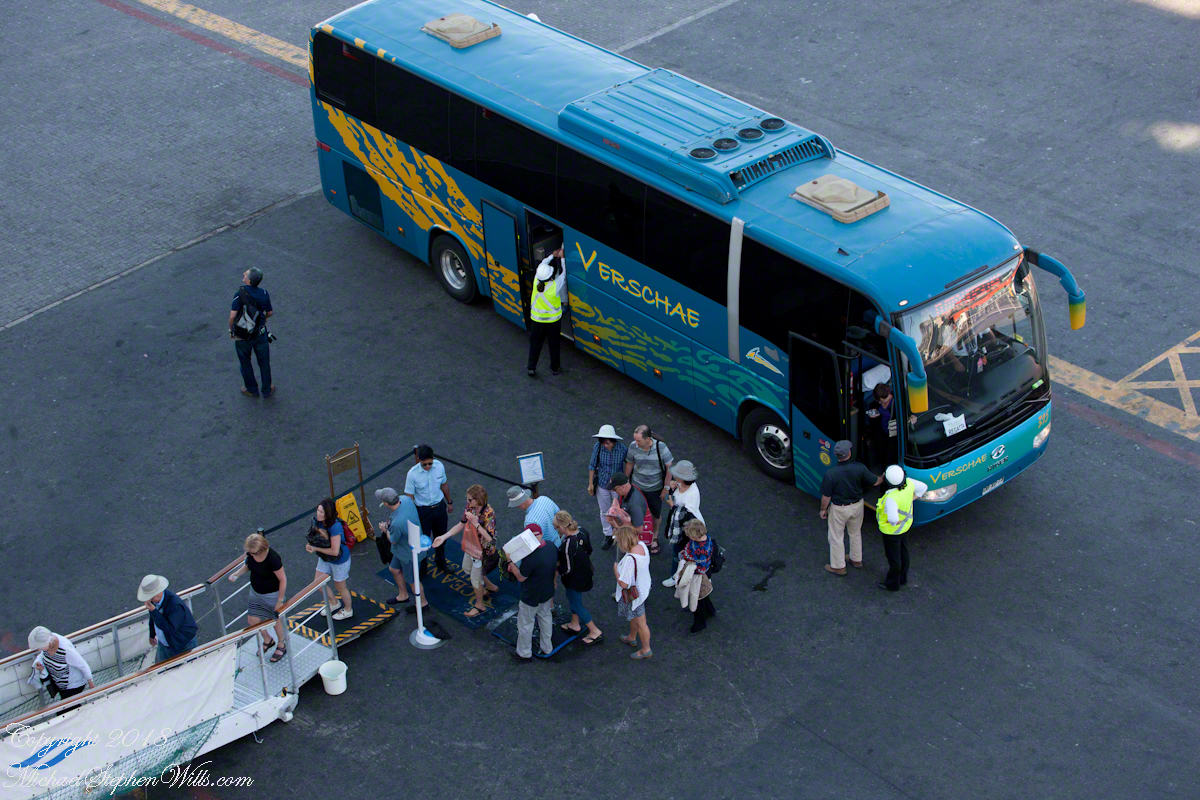
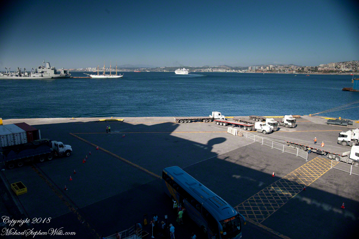
Passengers board the Regatta from the last tours. I expect this is the trip to Santiago. Most of the dockings the Regatta was surrounded by the port, the only way to access the city was on a tour bus as the port activity made walking too dangerous.
I can only guess the role the Alcatraz is playing here…..
…. probably it is positioned to give the Ocean Princess a nudge if the harbor pilot misjudges the turn around the breakwater and warships. In a harbor, a ship’s crew passes control to a harbor pilot who knows the navigation challenges much better than is possible for them.
Today, as 99.9% of all days, the pilot makes the turn safely. Here is a better view of the warship.
Looking back toward the harbor, the crane is hoisting those rolls, the tug boat “Lauca” framed by the superstructure of (I think) the crane.
The Ocean Princess is will under way, as shown by the long wake. As luck will have it, When the Regatta follows the sun will be much lower, the light better for photography. At the stern of the warship, the masted vessel is a training ship for the Chilean Naval Academy.
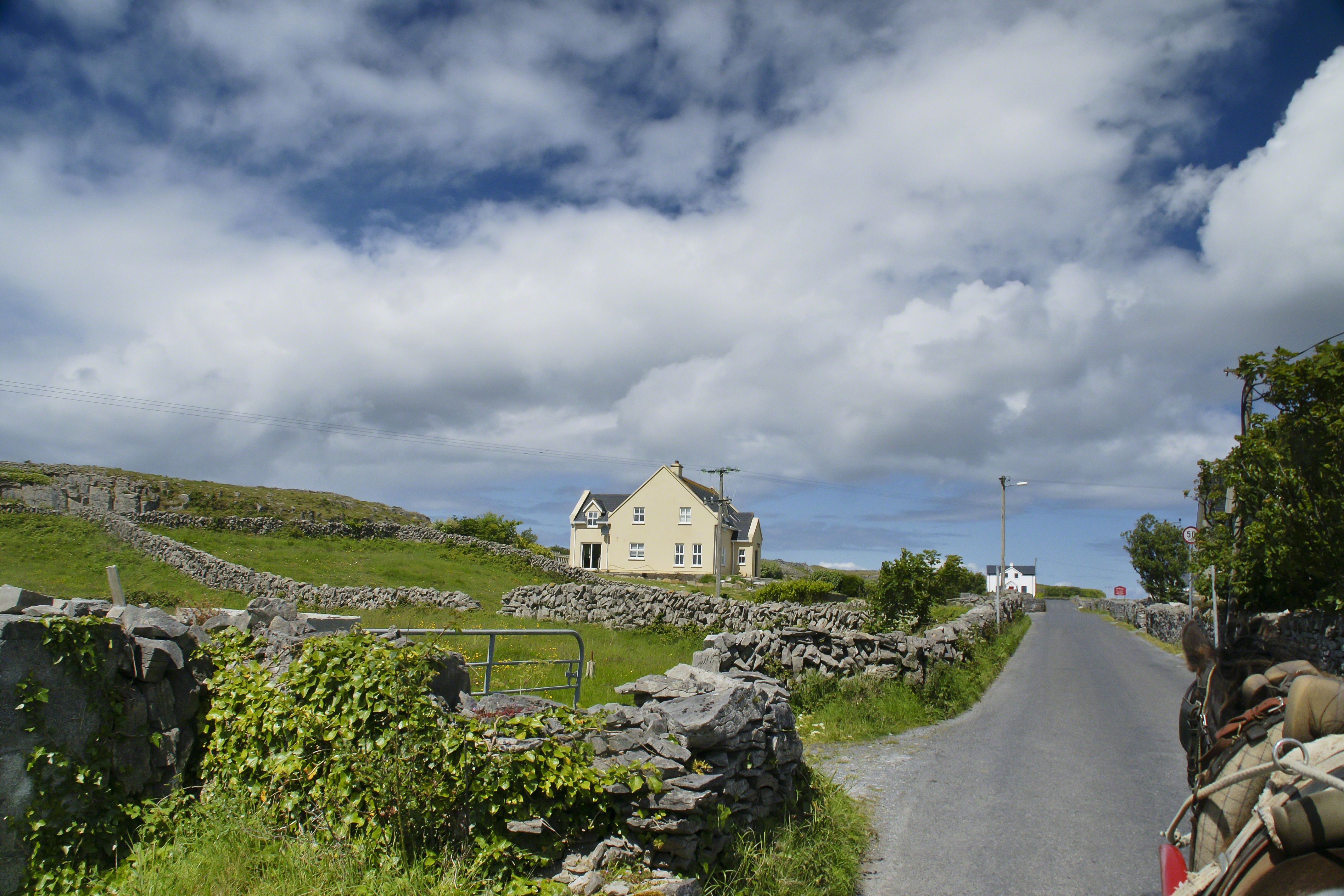
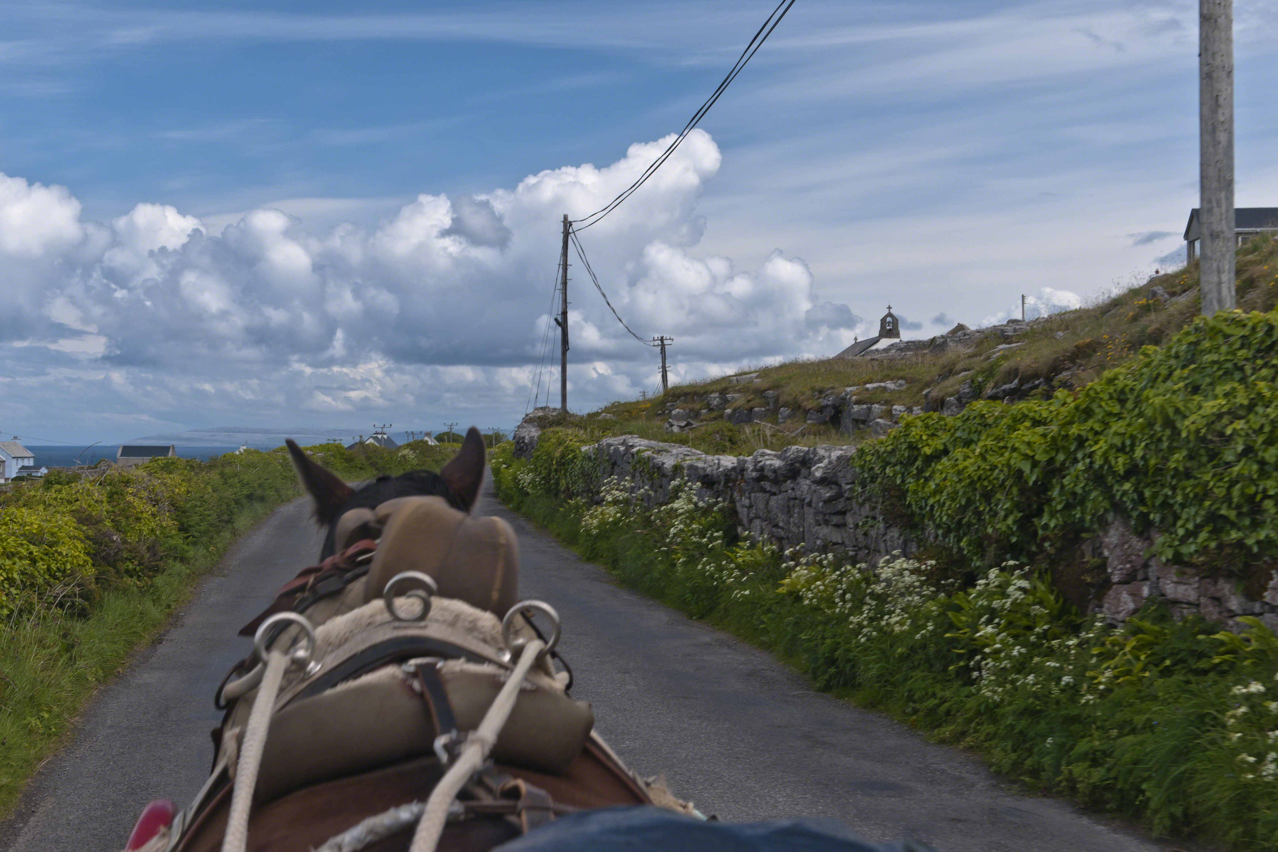
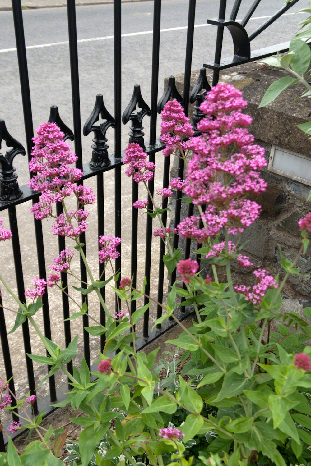
Enjoying travel on a horse trap, a type of carriage, on Inishmore (Inis Mór), the largest Aran Island in Galway Bay we headed up Cottage Road from Kilronan, the main island settlement. It was there we embarked from the ferry, hired the driver, his horse drawn trap. Our destination an iron age fort, Dun Aengus (Dún Aonghasa, the Irish language name) and the sights along the way.
Headed up Cottage Road, I captured this view of dry stone walls and homes against the May sky over the shoulder of our horse.
In this Part 03, some contemporaneous people are introduced, more information on the environment provided, some previous residents named and imagined.
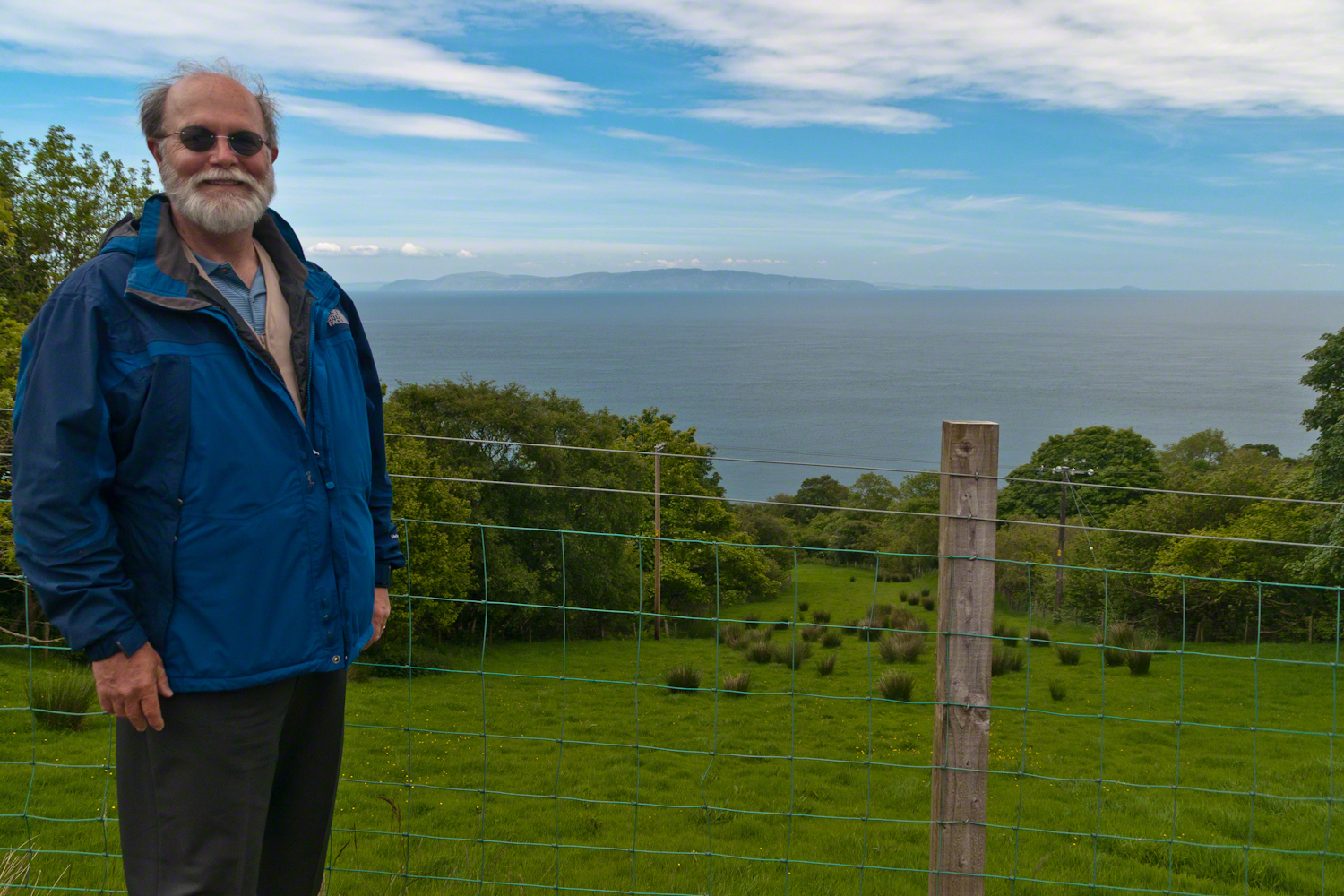
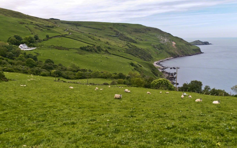
On the way to Torr Head we stopped at this spot in Coolranny Townland to take in this view of the Irish Sea. The land overlooks Loughan Bay toward the Mull of Kintyre and Sanda Island, Scotland. County Antrim, Northern Ireland. Coolranny borders Loughan Townland on the east.
To understand the full beauty of a place, it is necessary to live it, to experience the seasons, approach the land from different aspects; pass the same place many time, noticing overlooked features, enjoying old favorites. We did our best in this single day and took the exploration of this Antrim County coast slow, savoring all the views we noticed as this is a once in a lifetime experience. Imagine our amazement to find Scotland so close at hand. In the past, on a fine day the trip across the North Channel, up eastern Kintyre peninsula shores to Campbeltown at the head of Campbeltown Loch, was easier than a land crossing to a closer town.
I picked Campbeltown because my great great grandfather, a sea captain, emigrated from Scotland to County Louth where my great grandmother, Anne Campbell, married John Mills. In this way Captain Campbell escaped persecution for his Roman Catholic faith.
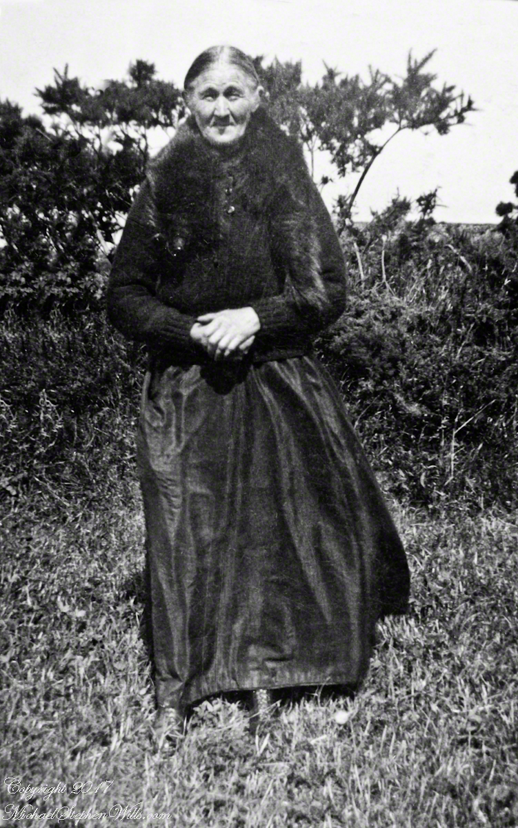
Late in her life, Anne Mills posed for this portrait. I can tell great grandmother Mills is facing north from these clues:
— the press of the eternal east wind on her dress, against her left left and flowing away from the right.
— the sun shadow on her cheek. It was around noon. With the sun, at this latitude, in the south the shadow from her right cheekbone is darker than the left.
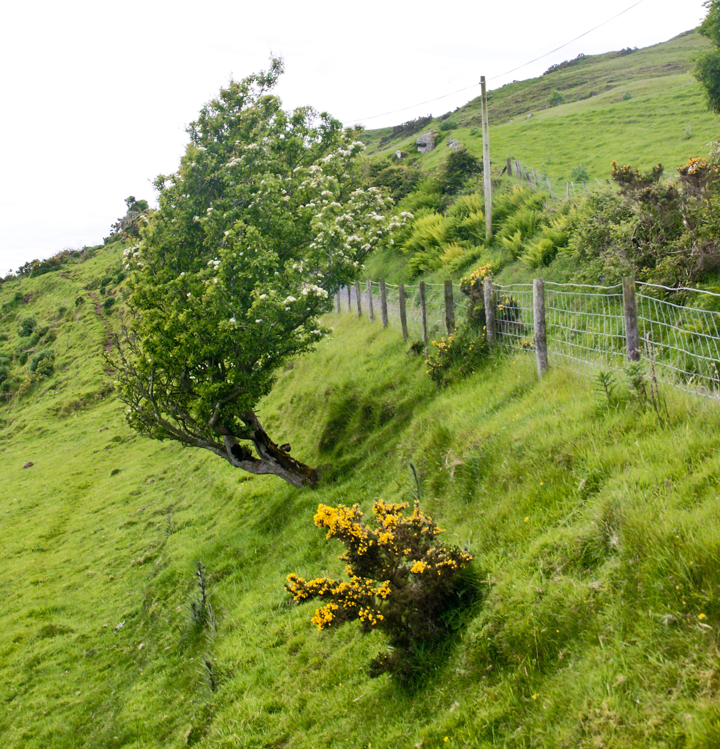
Rowan Tree directional growth from a constant east wind, County Antrim on the Torr Road nort of Cushenden.
A few miles before Loughan Bay, at Coolranny, are informative placards describing the area. I thought the white flowering trees, or shrubs, on the slopes were Hawthorn. On revisiting my capture of the placards I learned these are a different plant named Rowan Tree, aka Mountain-ash. This wind stressed specimen is an typical example of Rowans on this coast, stunted and little more than a bush. This individual is slanted westward from a constant and stiff east wind, as with Anne Mills’ portrait. Residents, past and present, of this coast know this damp, persistent wind well. Note the lack of blossoms on the east side, blossoms that ripen to small dark red fruit called poms (also called rowans). The leaves turn red in the fall. More time, for the fruit to form and leaves to turn, was necessary for me to be certain my identification of this, as a Rowan, is correct.
We parked on a turnout above the Loughan Cottages, near this farmer’s sheep pen. He drove up in a huge tractor and conversed with Pam while I was below shooting the cottages. He made a good impression.
On this day, Friday, June 6, 2014 I did two rounds of shooting the cottages. The first, handheld, with a Sony Alpha 700. Upon returning to the car for the Canon, Pam was talking to a friendly sheep farmer who pulled up in a large tractor pulling a tank. It turned out we parked below the turnout for his sheep enclosure built on the hill west of Torr Road. His flocks grazed the surrounding land. He and I talked, too briefly, about the hard lives of the people who lived here.
The Coolraney placard, up the road, claimed the cottages were deserted in the 19th century. I found evidence, in the 1901 Irish Census, of three Roman Catholic families, 19 men, women, children, living on Loughan Townland. In Part 02 of this series, setting the stage, Loughan is sized at 112 acres, a single photograph captures Loughan entire. These families had nowhere else to live, in Loughan, other than the cottages.
The smallest, and poorest, the poorest of the poor, family was 32 year old Mary Corbit and her two children, 10 year old Mary and Robert, 2 years. The Corbit family lived in a one room, stone walled, house with a wood or thatch roof. Unlike the other families they had no outbuildings, structures to house livestock or to support a farm operation. The house owner was Marj Delargy.
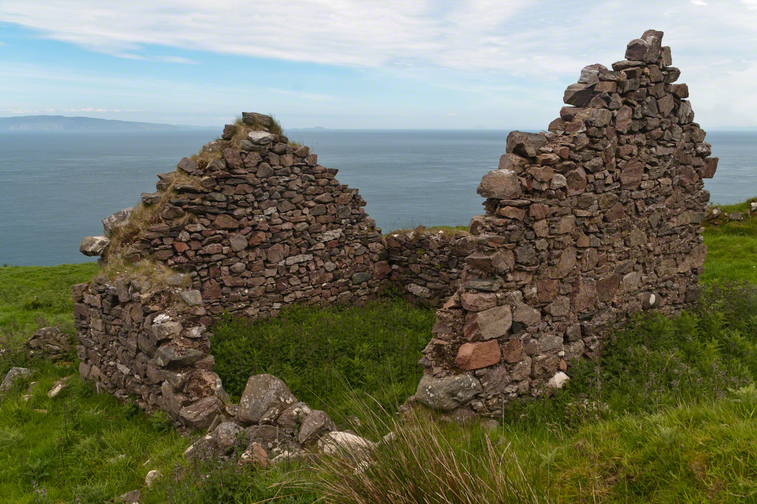
Here is a single room house among the ruins, four low walls, the east/west with intact gables, the stones collected from the hillside. The west wall higher up the slope, the floor now thick with fern.
Little Mary most certainly took care of Robert for part of the day. Did Mary, with Robert along, gather rowans, and other forage?
A thick growth of ferns, grass on the gable was once a home with a view of Scotland’s Mull of Kintyre 12 miles across the Irish Sea. The Isle of Sanda just visible on the right of the far gable. Alisa Crag just visible in the distance, to the left of the nearest gable.
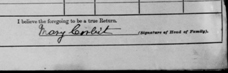
Mary Corbit: head of household, occupation laborer. There is a footnote to Mary’s “Marriage” entry as Married, “husband at sea.” The “C” of her census signature exactly like my mother signed her name Catherine.
Mary Corbit and her children were not listed in Loughan Townland for the 1911 Census.
For me, the romance of a place is settled in exact knowledge as much as a feeling. Starting with a recollection of the ruined cottages making such an impression we found a parking place and hiked into them loaded with photography equipment, three years later returning to use the photographs, bringing back a rush of memories and feelings, it is a matter of using the set of photographs from that day to build the location.
This much I knew, going in: we were touring Antrim Glens entering at Cushendall, after visiting Glenariff Forest Park, proceeding up the coast through Cushendun to Torr Head. A fortuitous encounter with a village of abandoned farm cottages (“ruins”) happened somewhere in between.
Click any image for larger view in a new browser tab. If you are in WordPress Reader, open the post to use this feature.
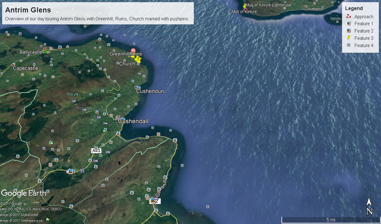
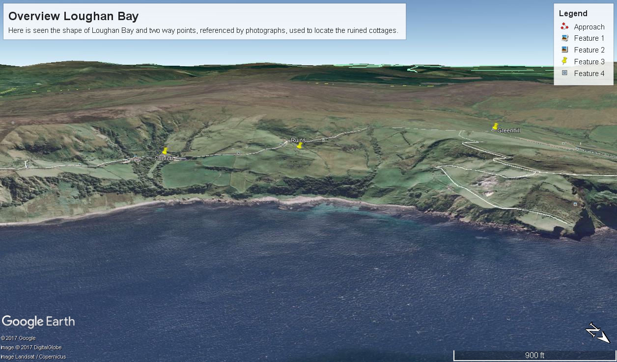
There was a photograph of a notable church prior to the ruins and a fine view, from a place named Greenhill, afterwards.
Here is a picture of the terrain with the three pushpins:
A fine church just off Torr Road, to the west. I found the location in Google Maps, marked as “church”. Google earth showed buildings at the location, this set the “church” pushpin. Associated with the church, using the date/time stamp, were images of signage naming Coolranny townland.
A sign identifying a location as “Greenhill” was after. Neither Google Maps or Earth lists this as a place. It took hours searching web sites of Irish townlands before I found the reference. Greenhill is not a townland; it was listed as a place on one of the maps. Just above the notation was Torr Road, two unique bends in the road. I used these bends to identify the turnoff where I photographed the “Greenhill” sign.
For reasons to be explained later, it is important to know the name of the ruin townland. The place name sign presented in post 1 was a clue (“Loughan an Lochan” — or Loughan Bay), as well at the web site (see link below) listing Irish townlands. The web site map names “Loughan Bay.”
With this information I was able to peruse Google Earth, found the turnoff and the ruins!
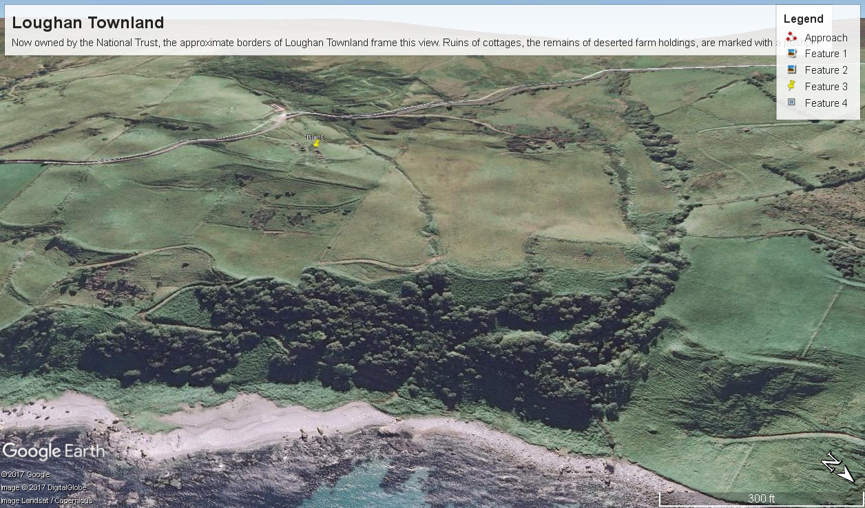
See the above Google Map image sized to approximate the Loughan townland boundaries.
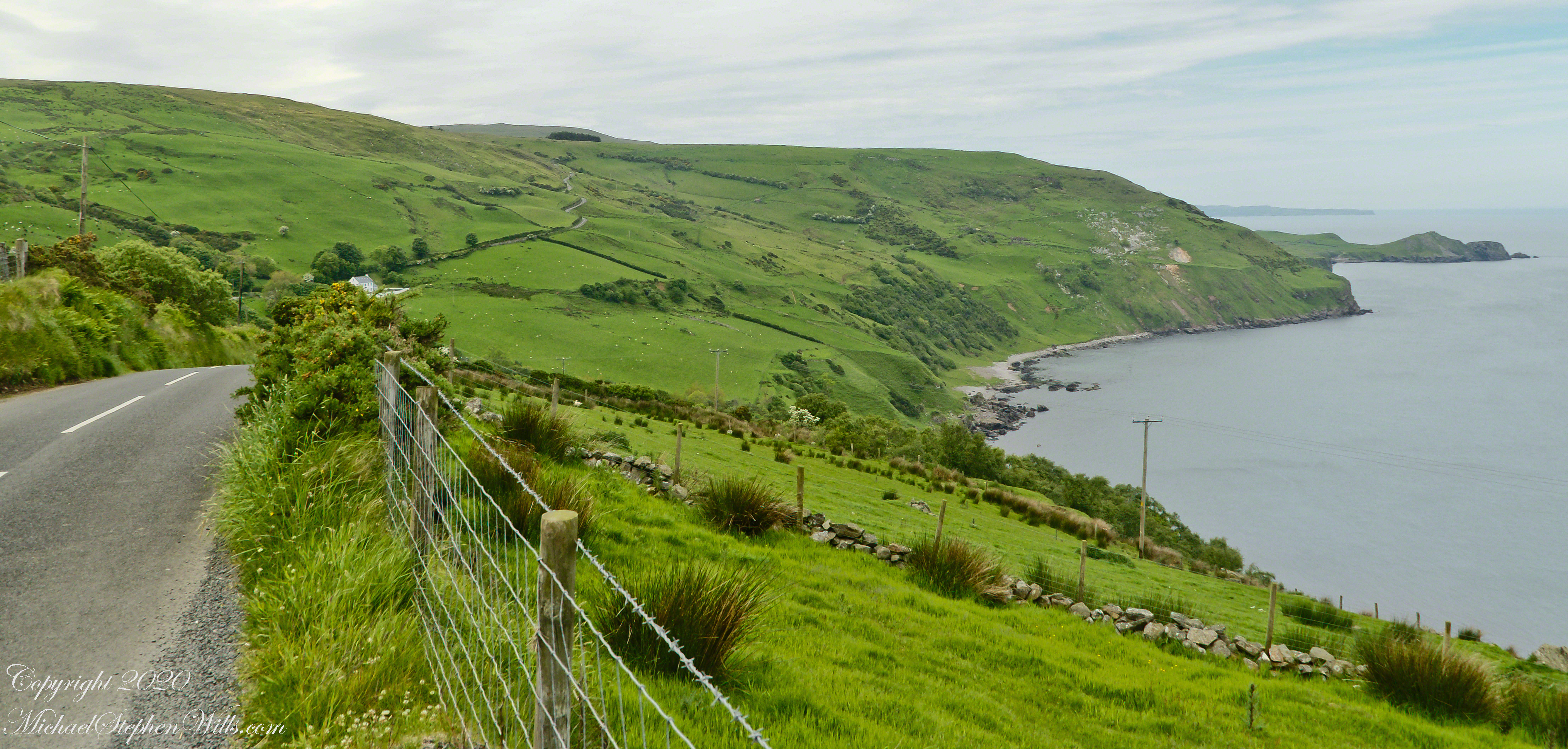
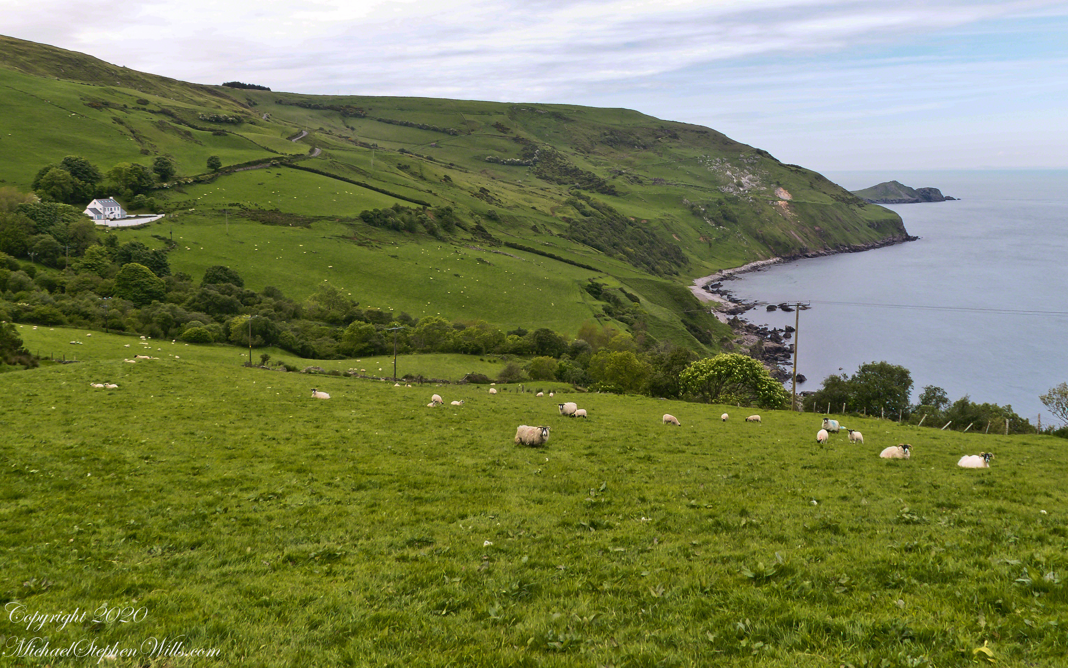
The scenery was jaw dropping lovely the entire time, so I captured view and view. Here are two landscapes time stamped just prior to the church, views including Coolranny and Loughan townlands with Torr Head in the distance.
That is Torr Road….
T
……a bit further along. It is possible to locate the ruin site from the Google Earth picture. There is a signature grove of bushes on the slope below the ruin site, sandy beach along shore. In the landscapes, Loughan Bay is cradled in a curve of coast.
Another aspect of the gradual 1/2 mile inclined path to the central ring of the prehistoric Dun Aonghasa ruins of County Galway, Ireland.
The view north, northwest from this way to Dun Aonghasa (Dun Aengus). In early June, looking across wildflowers, karst landscape, walled fields, farms, the North Atlantic Ocean, coast of Connemara and the 12 Bens (12 Pins) mountains.
Note the doorway (with long lintel) in the surrounding wall, to left of center in middle distance.
To close our time on the Tain Way I offer a poem written and presented to the congregation of the First Unitarian church of Ithaca New York 25 years ago, 1992. Interspersed are final photographs from our walk on the Tain Way of 2014.
The poem content is not directly biographical / confessional although it draws upon my experience as a single parent in the 1980’s through 1990’s.
A Poem Read To The Congregation
I
a crisis threatened an Irish village men women children filled the meeting place everyone participated especially the infants
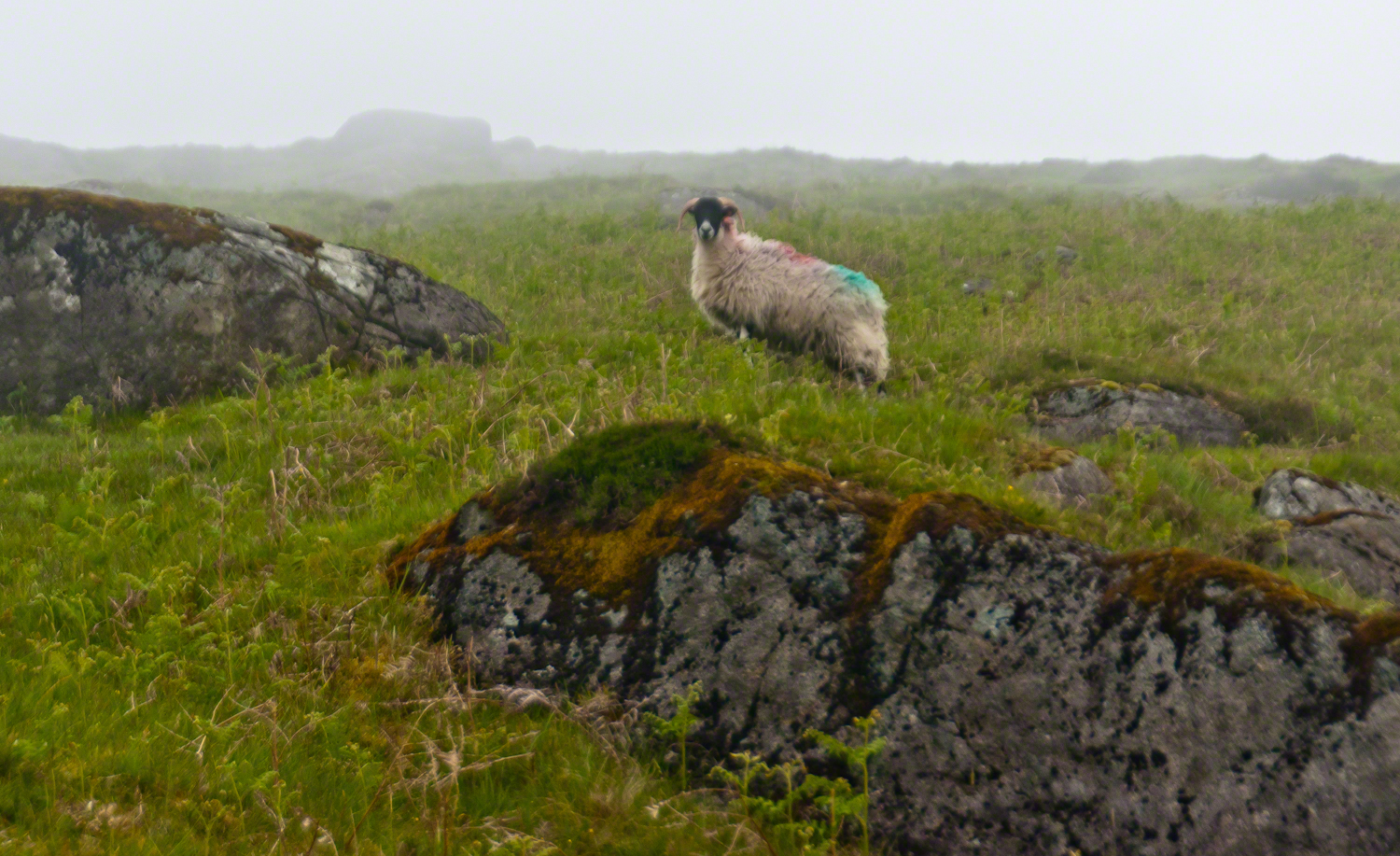
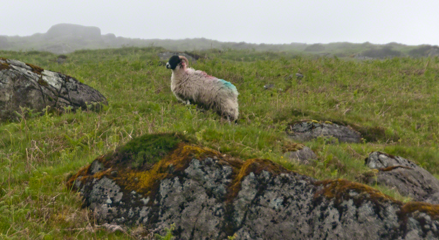
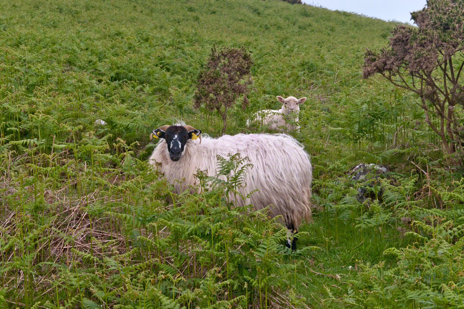
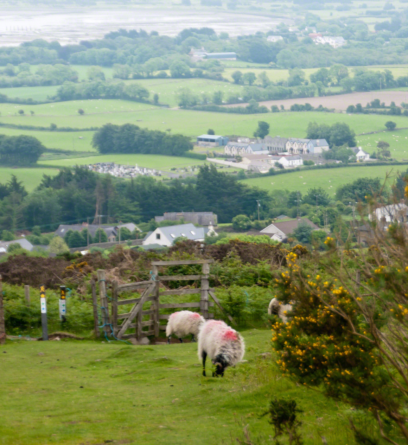
The Tail Way descends from Goliyn Pass to the northeast, passing among commons grazing. I attempted to identify the breed of this ram, but gave up. I can say sheep on the Cooley Peninsula are primarily bred for meat and there are black faced breeds known for meat production.
The flocks of County Louth commonly carry paint brands to identify ownership. Paint branding lessens wool value. This is less of an issue if the livestock are primarily raised for meat.
in spite of it all a plan was arrived at after the vote from the back of the room a man called out
….you know the type…
THIS WILL BE OUR PLAN UNTIL WE FIND OUT WHAT IT IS.
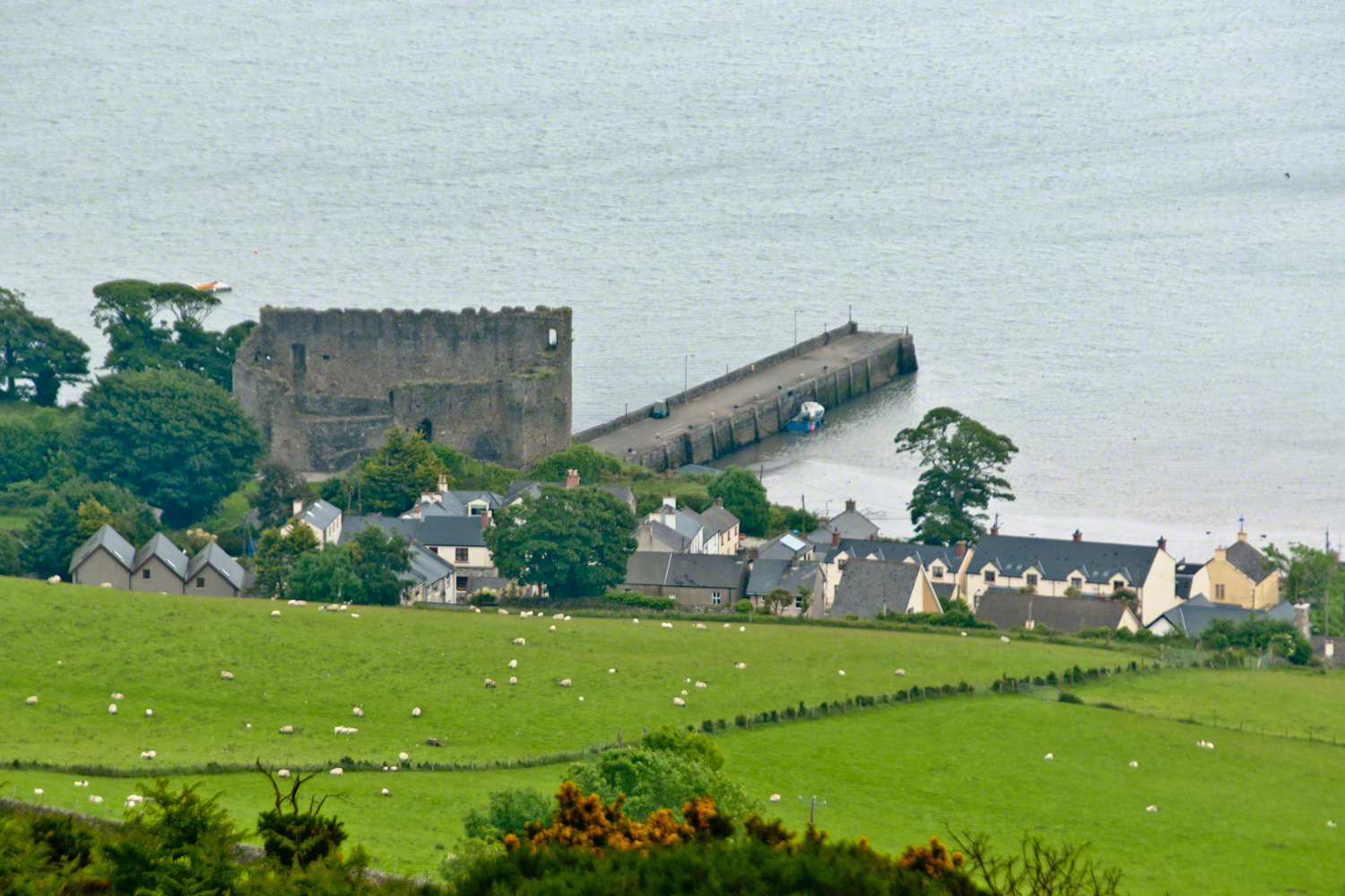
The ancient portion of Carlingford. I called the top of the castle “battlements” in the loose sense, as the ruin now longer has a walkway.
II
my son John and I have a photo of him at 5 years washing dishes standing on a chair up to his elbows in rubber gloves the caption reads “Two Men On Their Own.”
i had agreed to accept a divorce from helen only if john was left with me
one night in particular stands out from that time i did not sleep for planning what john and I would do
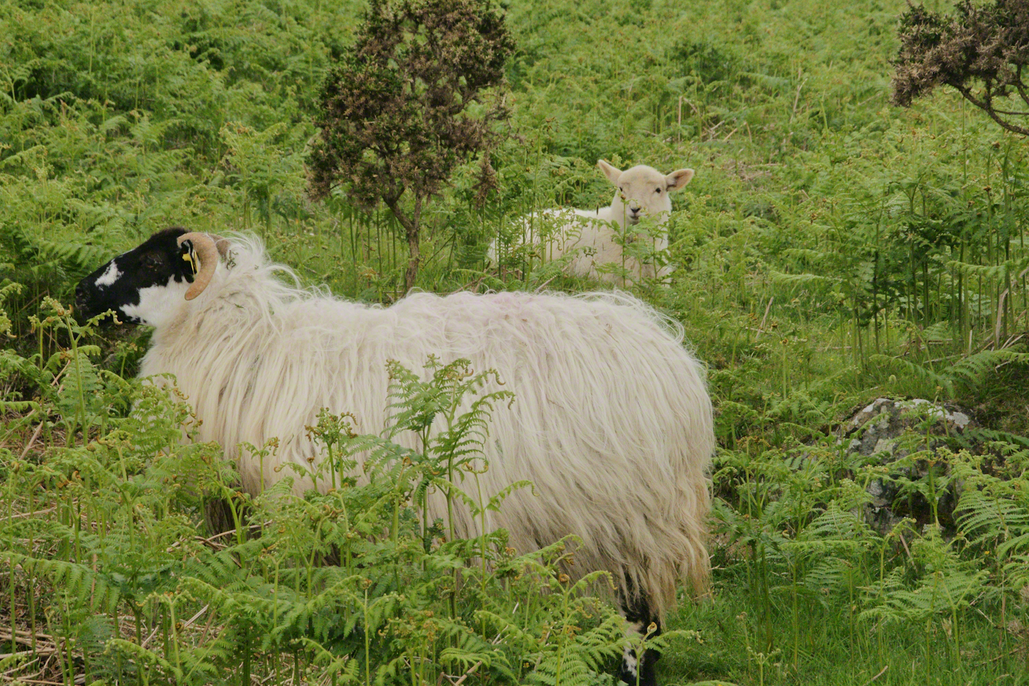
Unbranded, perfect white marks this lamb among an extensive fern bed. Tain Way steepens on approaching Carlingford. Below is the residential Carlingford, the Greenore road running to the right. The large structure with two rows of dark windows is the Four Seasons Hotel where a substantial brunch is served Sundays.
III
seven years passed not a long time since then we’ve moved found another a better life
We descended below the ridge to pass into excellent pasturage. The growth of fern hides a lush grass pasture.
raising John alone was not part of the plan Its been just john and me helen gave birth to john to have a part of me in case of loss i felt the same way and she understood
a welcome feminine voice in our home “Little House on the Prairie” and “Little House in the Big Woods” twice.
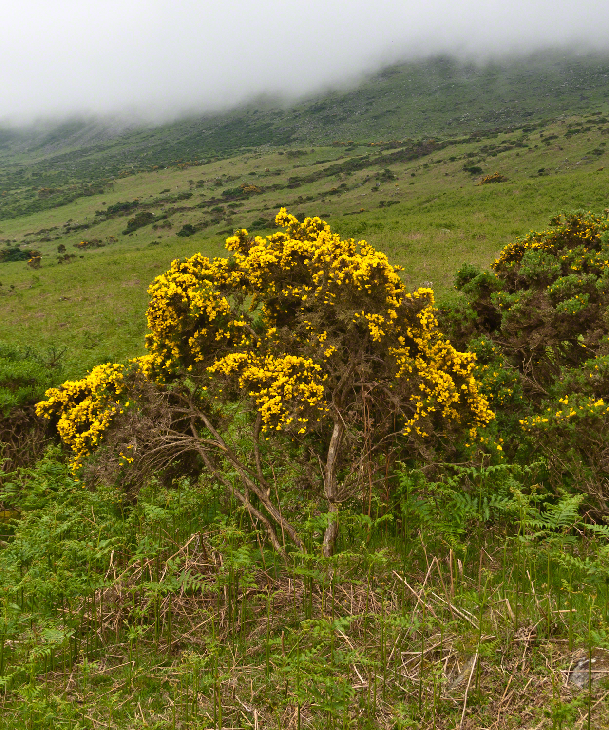
Plants and livestock on these slopes of Slieve Foy contend with adverse conditions in the form of a constant east wind. The stress is evident in the stressed trunk, although this species thrives in this environment, as seen in the strength of bloom and the yellow patches on the slopes, all of which are gorse. Gorse flowers are edible; the entire plant can be used as fodder when crushed to the consistency of moss. In Scotland there’s a museum with a roundish boulder called a Whin Stone.
V
Here is an excerpt from a newspaper article by Wilder called “HOME” that has an emotional resonance for me dated 1923 Wilder was in her 50’s.
Out in the meadow, I picked a wild sunflower, and as I looked into its golden heart, such a wave of homesickness came over me that I almost wept. I wanted Mother, with her gentle voice and quiet firmness; I longed to hear Father’s jolly songs and to see his twinkling blue eyes; I was lonesome for the sister with whom I used to play in the meadow picking daisies and wild sunflowers.
Across the years, the old home and its love called to me, and memories of sweet words of counsel came flooding back. I realize that’s all my life the teaching of these early days have influenced me, and the example set by Father and Mother has been something I have tried to follow, with failure here and there, with rebellion at times; but always coming back to it as the compass needle to the star.
So much depends upon the homemakers. I sometimes wonder if they are so busy now with other things that they are forgetting the importance of this special work. Especially did I wonder when reading recently that there was a great many child suicides in the United States during the last year. Not long ago we had never heard of such a thing in our own country, and I am sure there must be something wrong with the home of a child who commits suicide.
The trail detours around sheep pasture just before descending to the outskirts of Carlingford.
VI
we give so much to our children what’s left over though is ours
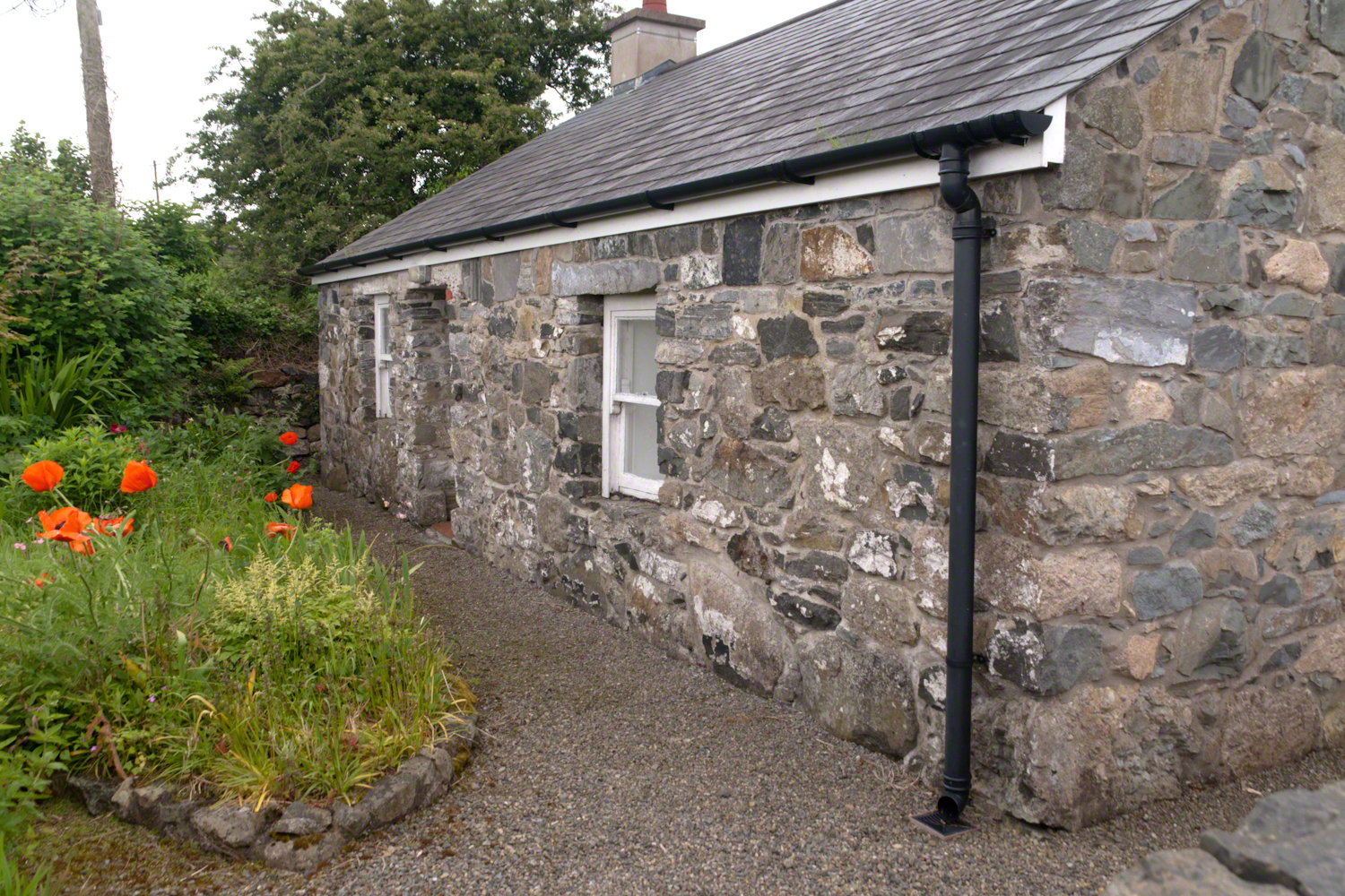
The first Carlingford home passed by the trail is a solid fieldstone home with a slate roof fronted by a natural garden featuring red poppies.
William Carlos Williams wrote it is difficult to get the news from poems yet men diet miserably every day for lack of what is found there
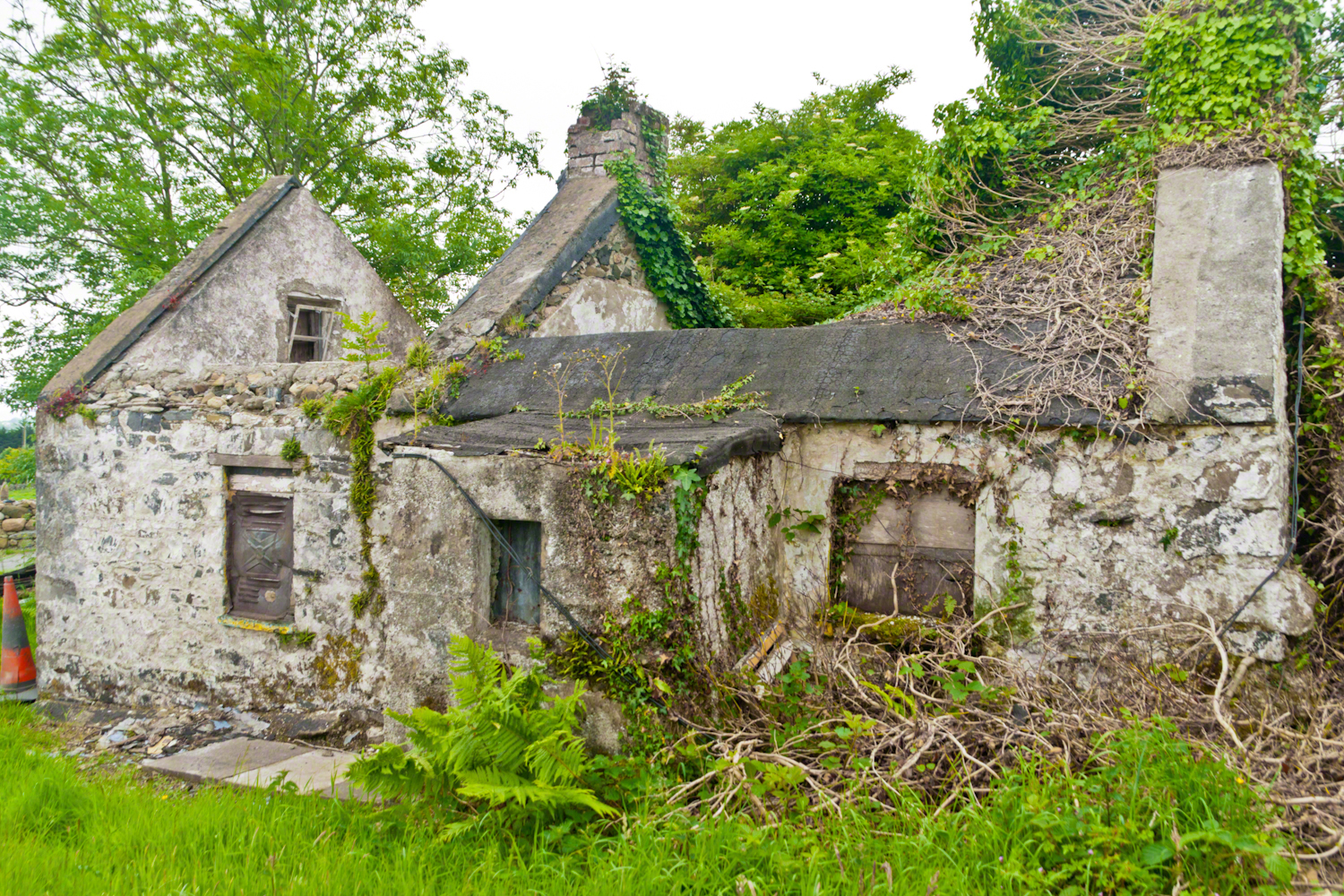
This ruin lies off the Tain Way as it descends through the outskirts of Carlingford town. Constructed of stones, mortar and what looks to be concrete. Long slate slabs protect the eves. It’s been abandoned for an age. What a story it must have, long slow and full of life.
it is not difficult to understand this to live it is another matter
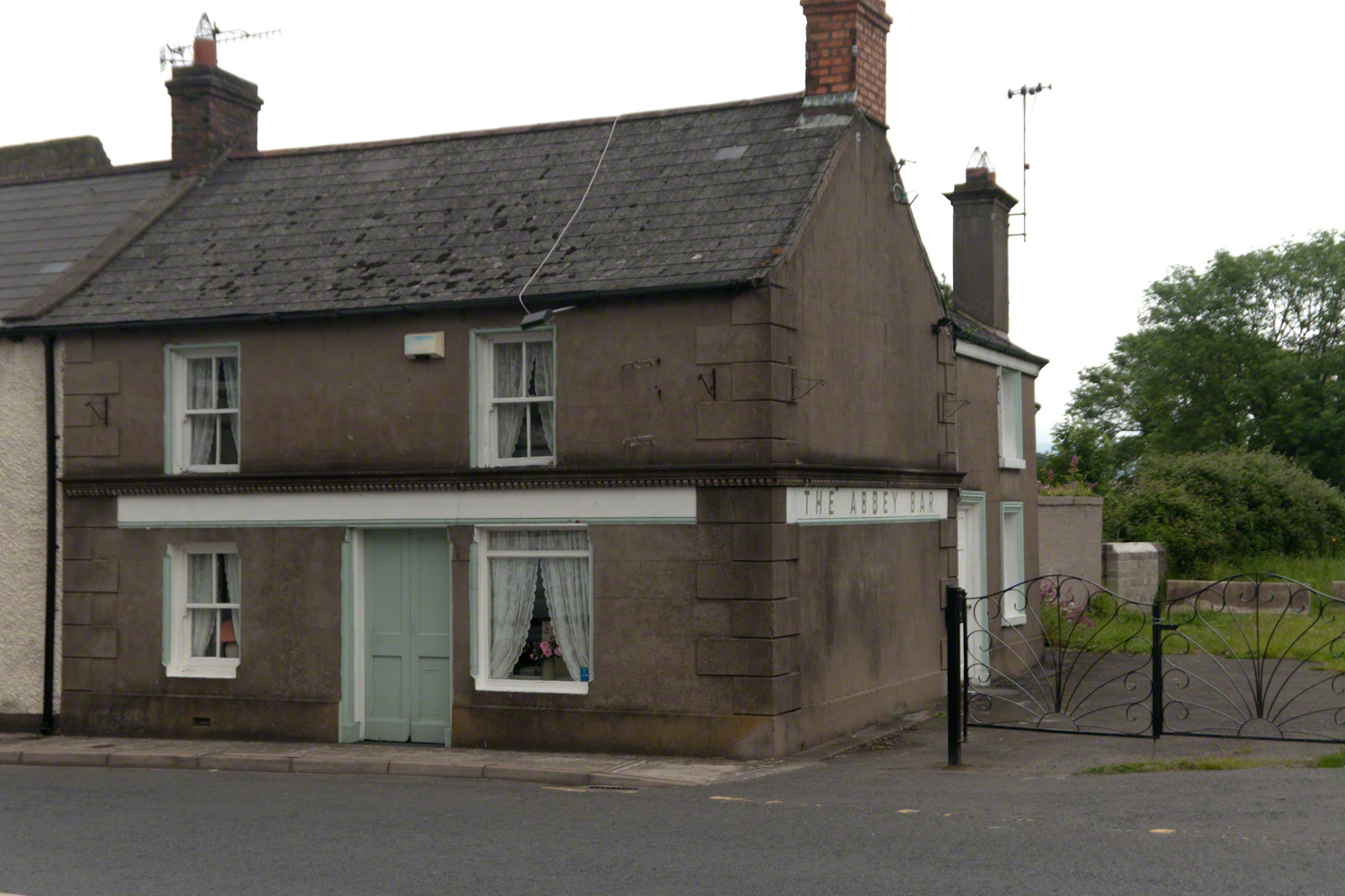
Named for the Carlingford Priory, a nearby ruin, the Abby Bar is located on Dundalk Street (R173), Liberties of Carlingford, Carlingford, Co. Louth, Ireland. Liberties of Carlingford might be called greater Carlingford in the USA.
you have to live it in order to have something left over
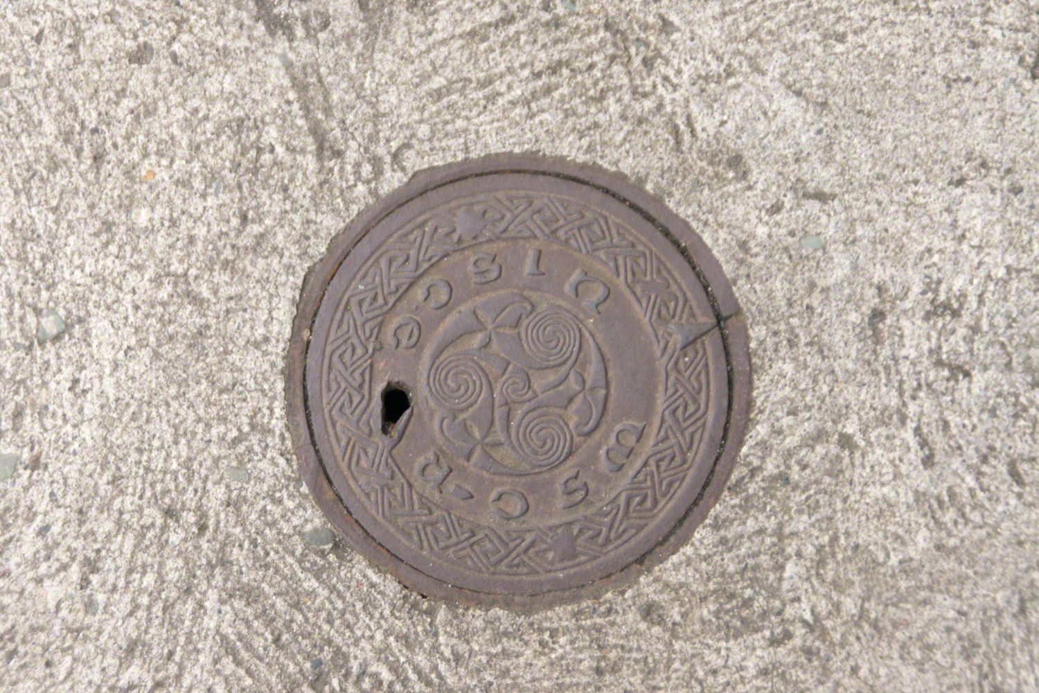
A metal cover, about 8 inches in diameter located in the sidewalk on the left side of The Abby Bar on Dundalk Street, Carlingford. The triple spiral triskelion symbol has become a Christian symbol of faith for Celtic Christians around the world, a visual representation of the Trinity (Father, Son, Holy Spirit) and eternity. In Ireland, the symbol acquired its Christian meaning prior to the 5th century. The triskelion predates Christina and even Celtic culture as petroglyphs of the astronomical calendar at the megalithic tomb Newgrange (3,200 BC). The symbol is associated with Neolithic cultures throughout Western Europe.
VII
never the less my emotional resonance in reading that piece “Home”
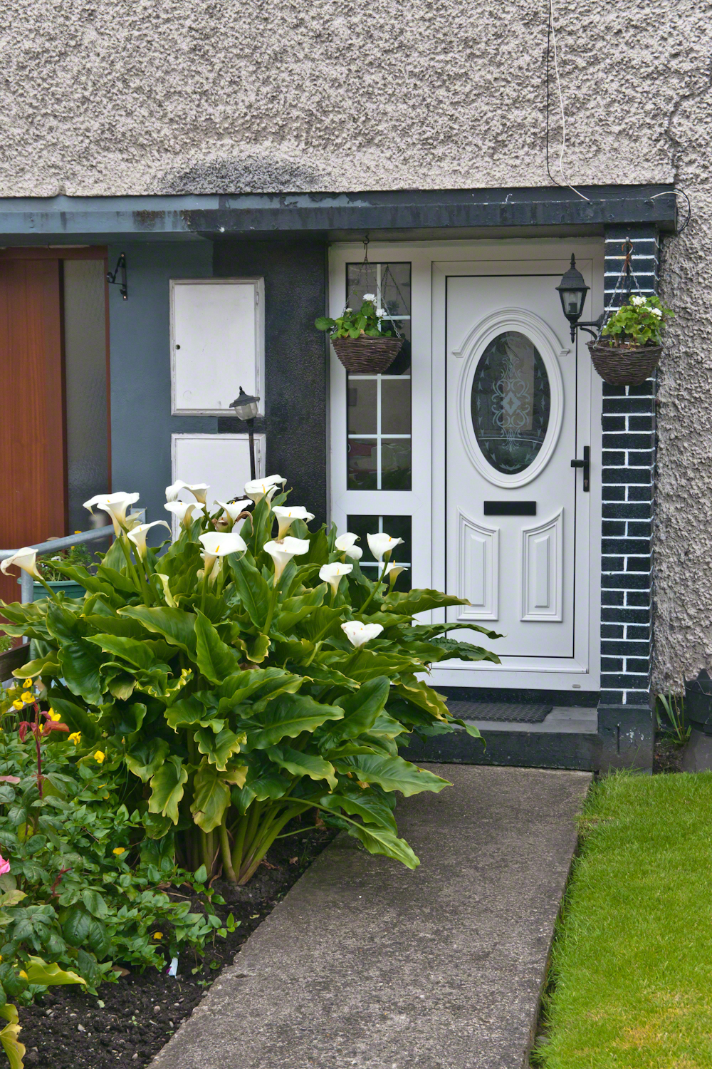
Caring touches to a well-tended home entrance along the Tain Way, Carlingford, County Louth, Ireland.
did not come from the sentiments Wilder so skillfully evoked though I shared them it was that sharp part
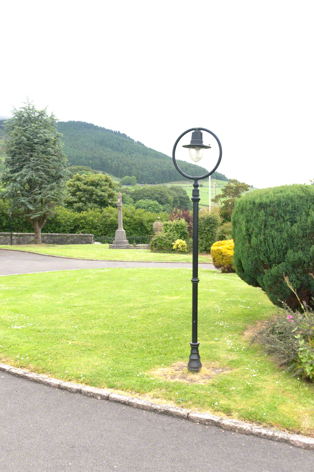
Lamp post on Church of Saint Michael grounds.
i did not agree with it lacking a reason and so must have re-read “Home” fifty times a hundred who knows
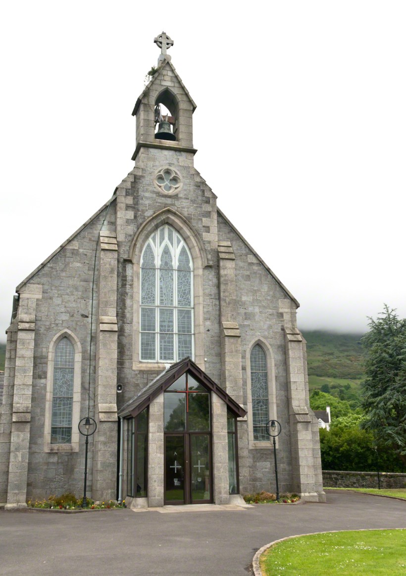
The Church of Saint Michael is a Roman Catholic Church on Dundalk Street (R173), Carlingford.
so committed to speak today and began to write something was bound to shake loose
then those lines form Deuteronomy gave themselves to me
Before you this day is set good and evil, life and death. Choose life, that both you and your descendants might live.
“Home” was a twist of these lines
as long ago as 1923 Wilder was experiencing our present contemplating the unthinkable
Wilder held her own experience as a shield and denied such a tragedy could ever touch her
for me the result is a beautiful poisoned apple innocently offered by a treasured friend
Pam Wills and Sean Mills on the grounds of the Church of Saint Michael, Dundalk Road (R176), Carlingford.
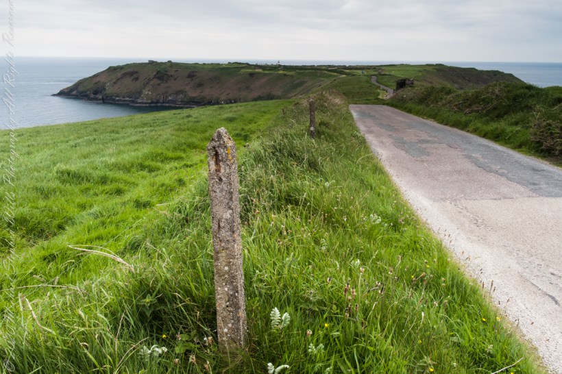
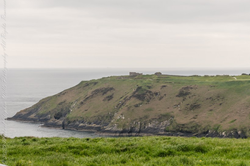
Our day of touring Kinsale and environs, the last day of May 2014, continues with our morning visit to the “Old Head of Kinsale.” Head is short for headland, a narrow strip of land projecting into the sea.
Road to the Old Head of Kinsale
Old Head of Kinsale
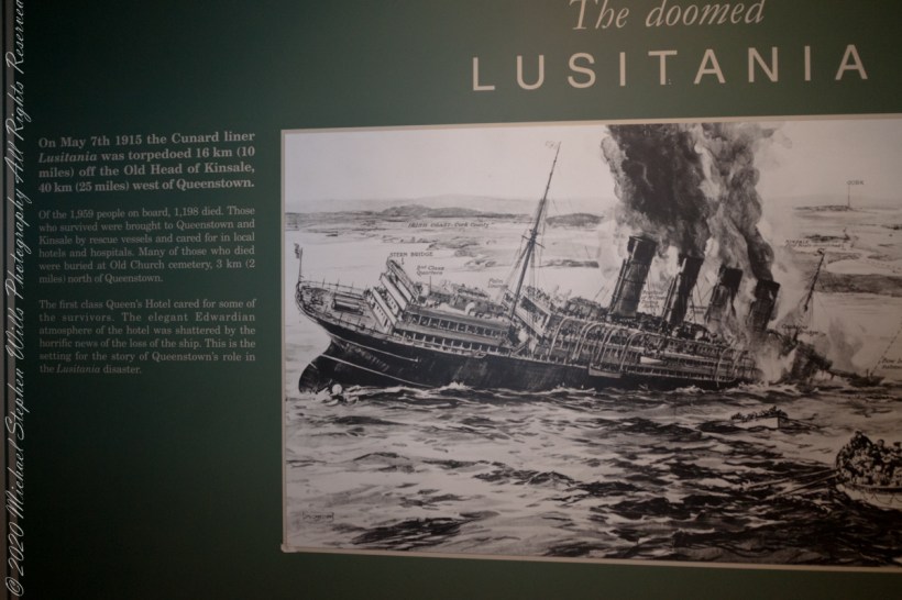
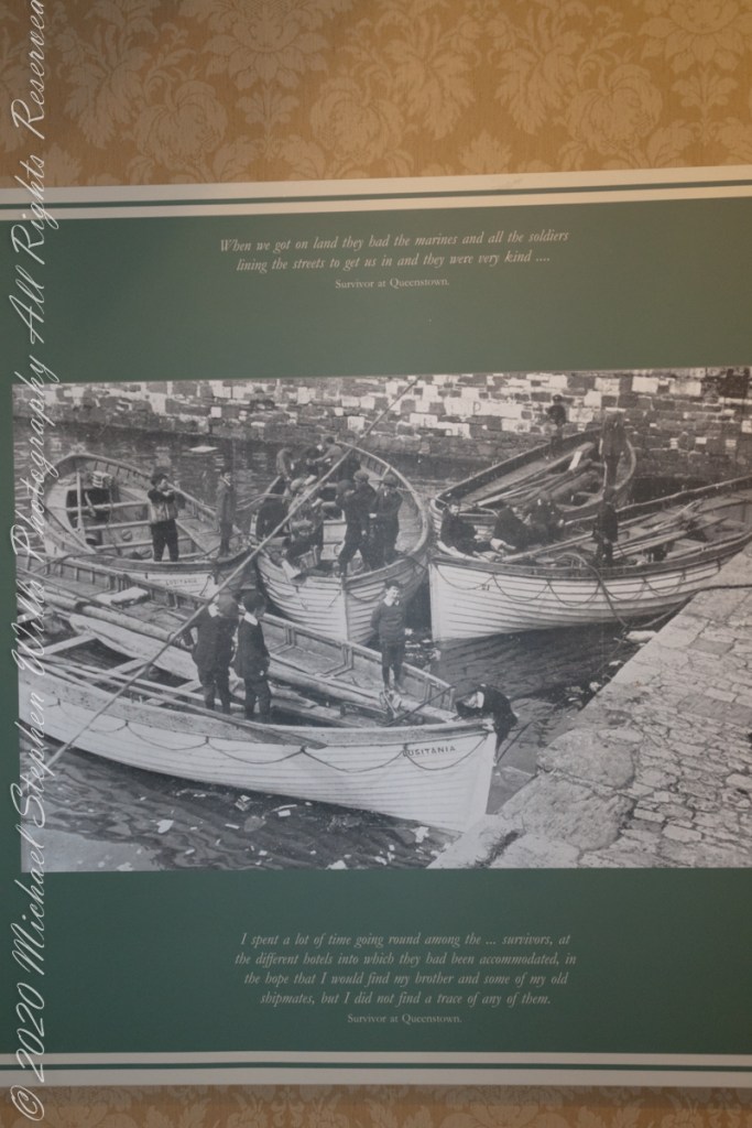
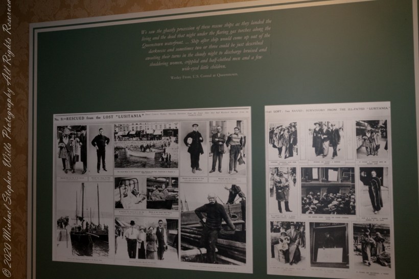
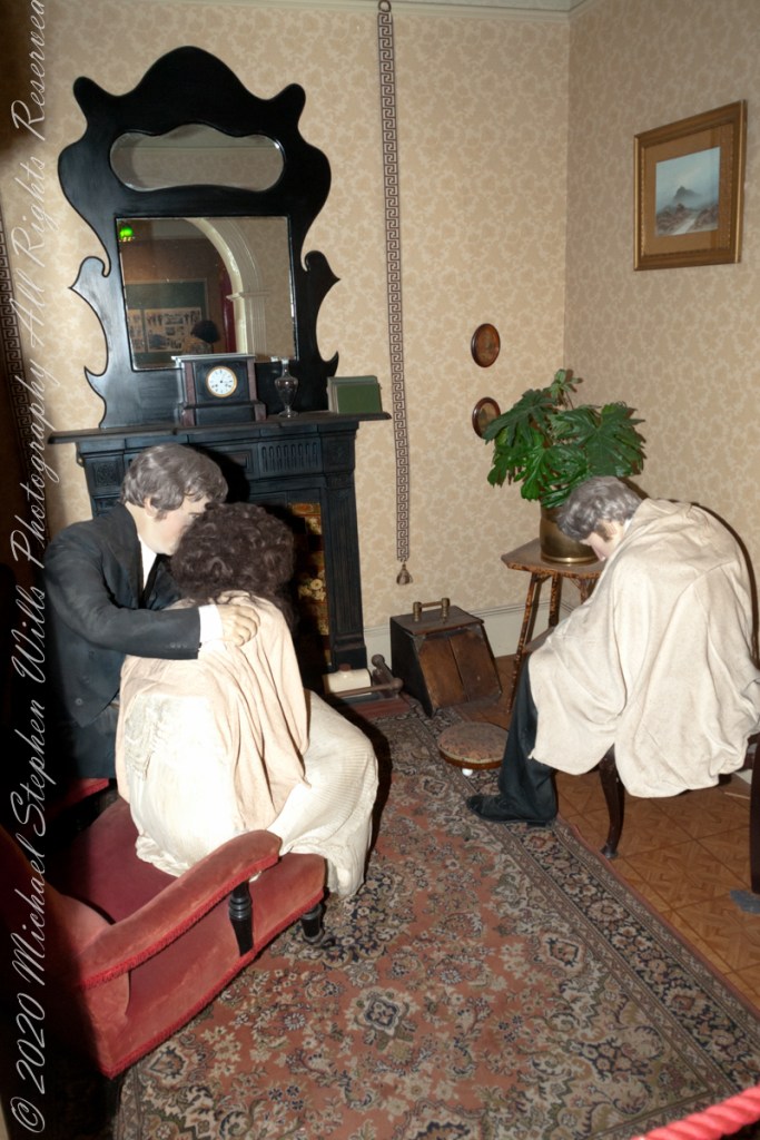
On May 7th, 1915 the Cunard liner Lusitania was torpedoed 16 km (10 miles) off the Old Head of Kinsale, 40 km (25 miles) west of Queenstown. Of the 1,959 people on board, 1,198 died. Those who survived were brought to Queenstown and Kinsale by rescue vessels and cared for in local hotels and hospitals. Many of those who died were buried at Old Church cemetery, 3 km (2 miles) north of Queenstown. The first class Queen’s Hotel cared for some of the survivors. The elegant Edwardian atmosphere of the hotel was shattered by the horrific news of the loss of the ship. This is the setting for the story of Queenstown’s role in the Lusitania disaster. –text from Cobh Heritage Center poster, see image below.
The Old Head is notable, in the contest of the Lusitania attack, for being the land closest to the incident. Cobh, then named “Queenstown”, was the focus of rescue operations. See text below, from a display of the Cobh Heritage Museum.
from Cobh Heritage Museum.
The Kinsale tower is just over nine meters high, with walls up to 80 cm thick. Records show a signal crew was in place in 1804 and the tower finished the following year, though severely affected by dampness. When Napoleon was defeated by Wellingtons forces at Waterloo, 1815. With the diminished threat these expensive installations were neglected. The 1899 Ordnance Survey map lists the site as being in ruins. During our 2014 visit the local community was renovating the tower and the work appears complete sometime before 2021.
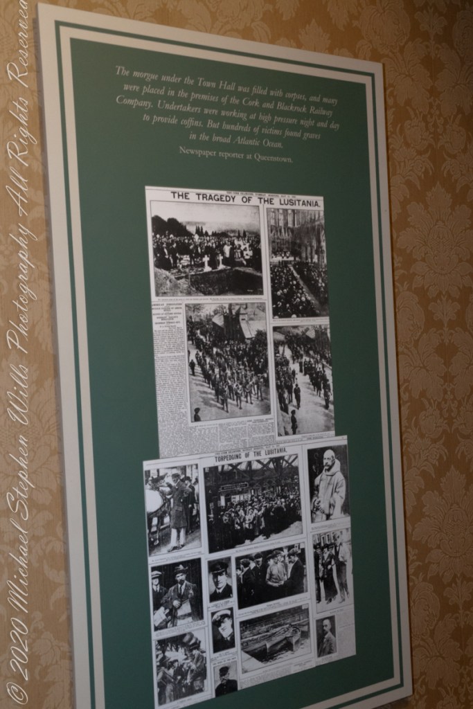
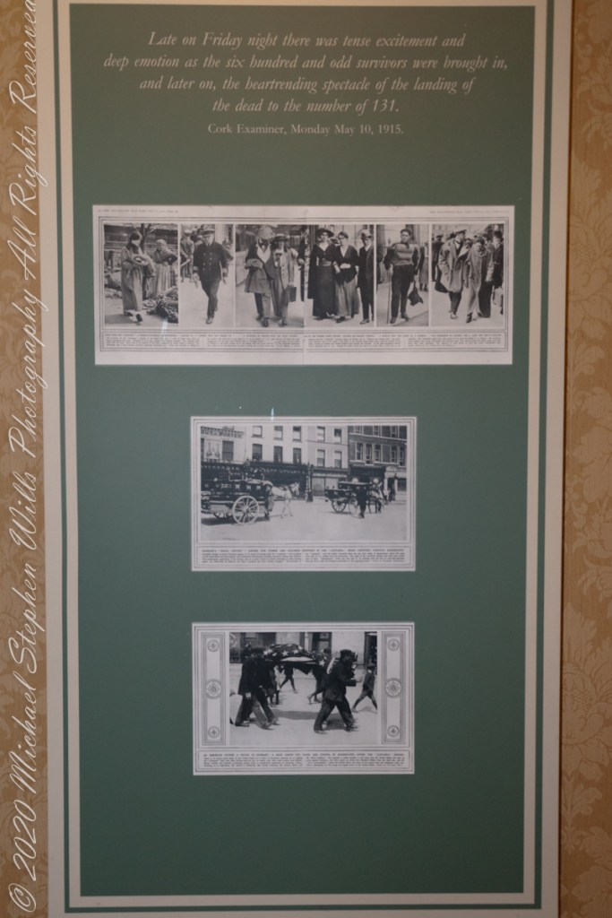
The morgue under the Town Hall was filled with corpses, and many were placed in the premises of the Cork and Blackstock Railway Company. Undertakers were working at high pressure night and day to provide coffins. But hundreds of victims found graves in the broad Atlantic Ocean. –Newspaper reporter at Queenstown. See images in the above gallery for more.
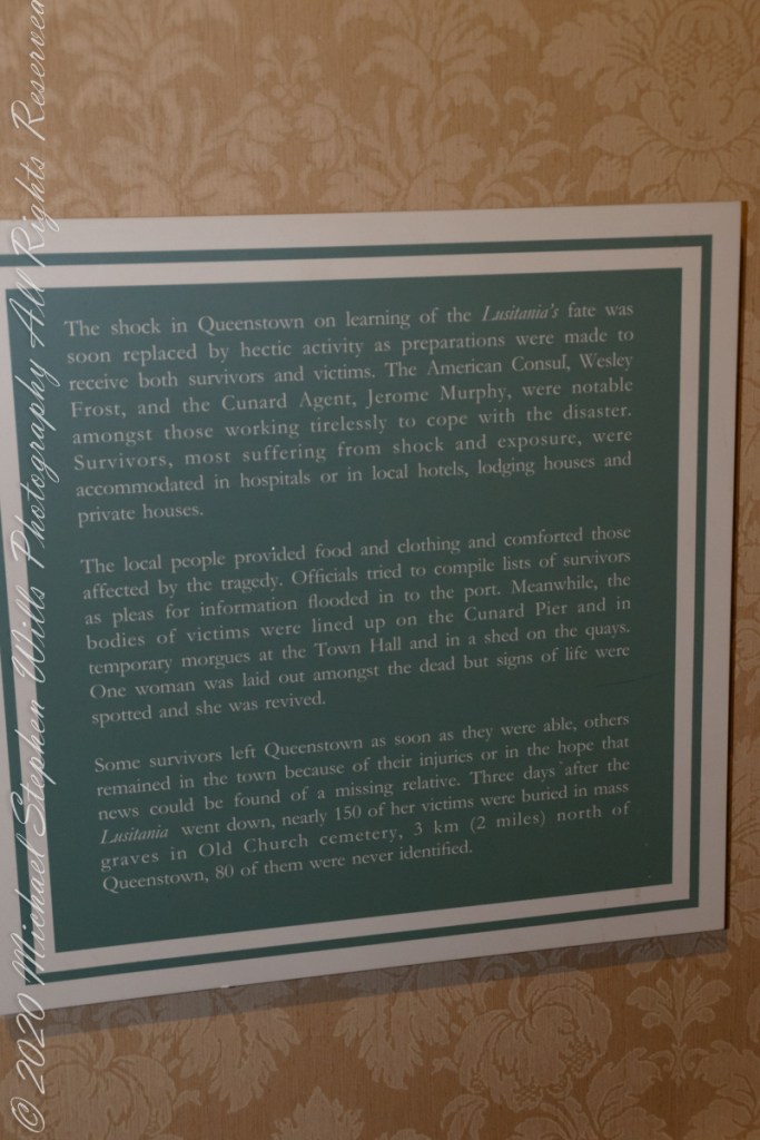
Cobh Heritage Center exhibit of survivor recovery, Queen’s Hotel
I did not see and/or recall much emphasis in the museum for pillorying Germany, after all a German U-boat was responsible. Curious, I did a Wikipedia search and found this text. The topic of Ireland, Germany and World War I is complicated.
On the afternoon of 7 May, a German U-boat torpedoed Lusitania 11 miles (18 km) off the southern coast of Ireland inside the declared war zone. A second internal explosion sank her in 18 minutes, killing 1,198 passengers and crew. The German government justified treating Lusitania as a naval vessel because she was carrying 173 tons of war munitions and ammunition, making her a legitimate military target, and they argued that British merchant ships had violated the cruiser rules from the very beginning of the war. The internationally recognized cruiser rules were obsolete by 1915; it had become more dangerous for submarines to surface and give warning with the introduction of Q-ships in 1915 by the Royal Navy, which were armed with concealed deck guns. The Germans argued that Lusitania was regularly transporting “war munitions”; she operated under the control of the Admiralty; she could be converted into an armed auxiliary cruiser to join the war; her identity had been disguised; and she flew no flags. They claimed that she was a non-neutral vessel in a declared war zone, with orders to evade capture and ram challenging submarines.
However, the ship was not armed for battle and was carrying thousands of civilian passengers, and the British government accused the Germans of breaching the cruiser rules. The sinking caused a storm of protest in the United States because 128 American citizens were among the dead. The sinking shifted public opinion in the United States against Germany and was one of the factors in the declaration of war nearly two years later. After the First World War, successive British governments maintained that there were no munitions on board Lusitania, and the Germans were not justified in treating the ship as a naval vessel. In 1982, the head of the Foreign Office’s American department finally admitted that, although no weapons were shipped, there is a large amount of ammunition in the wreck, some of which is highly dangerous and poses a safety risk to salvage teams.
T
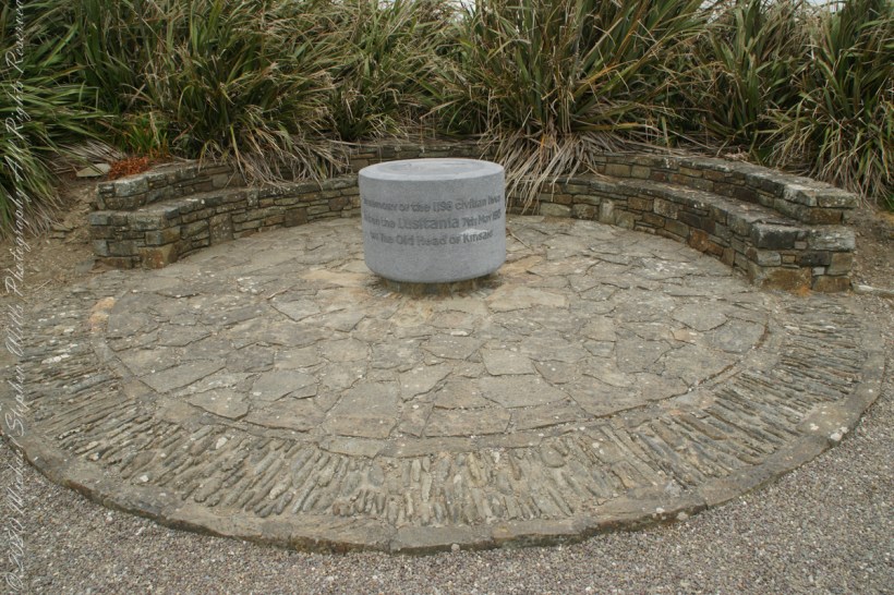
The original memorial to the Lusitania was unveiled on the 80th anniversary of the May 7th, 1915 sinking (May 7, 1995), Old Head of Kinsale, County Cork Ireland. The imemorial nscription reads “In memory of the 1198 civilian lives lost on the Lusitania 7th May 1915 off the Old Head of Kinsale.”
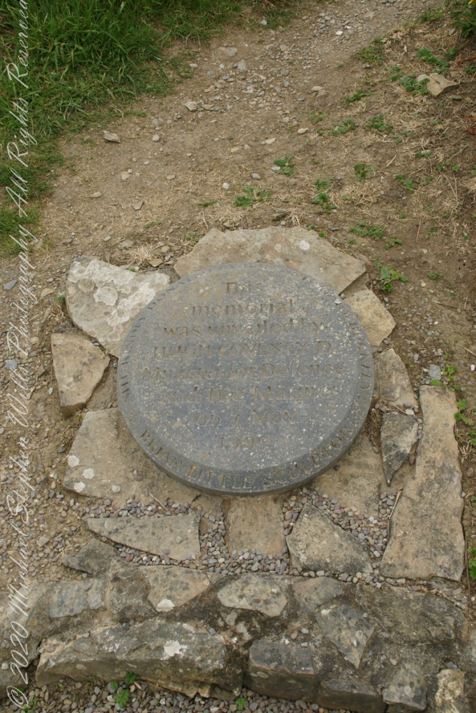
The inscription of the commemoration plaque accompanying the memorial reads, “This memorial was unveiled by Hugh Coveney D Minister of Defense and The Marine on 7 May 1995.” Around the edge of the medallion reads, “Brian Little Sculptor” “This (cannot read) donated by Lan and Mary Buckley”