A Dry Piece of Paradise

A hellish shriek assaulted the cold 3 am darkness.

A hellish shriek assaulted the cold 3 am darkness.

The scream was instantly recognizable. Anything but terrified, after a confused scramble I reinserted the pin into a personal security device hung from my backpack. Wrapped in a silly waffle weave blanket, tossing restless in the cold, the pin lanyard hung up then pulled free. Several minutes had passed with that sound flowing out over the canyon, calling all carnivores to breakfast.

I had drifted off with the wind shaking my tent like a drunken prankster and now all was totally and absolutely quiet. In spite of the cold, the inadequate blanket and the imaginary creatures looking for the source of that scream, the next two hours sped by in a fitful doze.

Agave Heart

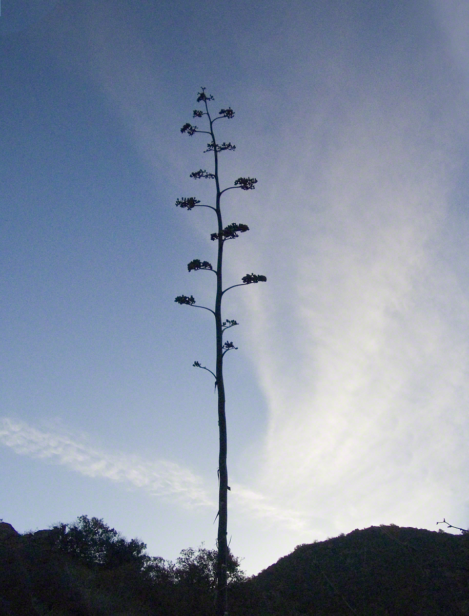
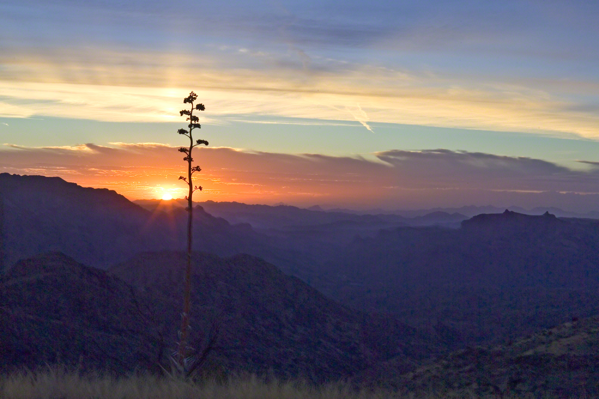
At 5 am I crawled out to find the thinnest crescent moon imaginable gracing the eastern sky, kept company by a century plant silhouetted against the early dawn light.

Click any photograph for a higher resolution image.
Century Plant Dawn
Century Plant Dawn

Click this link to see my photograph “Superstition Spring”

These stalks raise the golden flowers of this agave 10 to 15 feet above the green prickly rosette. Century plant stalks can be seen throughout the Superstitions, even at the high elevations among towering Ponderosa Pine.

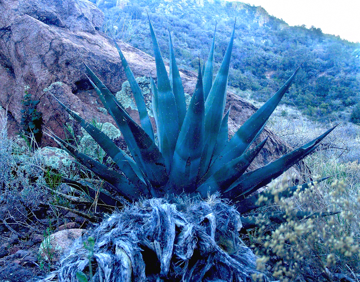
Here is an agave in predawn light I caught on the next day, in Pine Creek canyon.

Agave
Agave in PreDawn Light

The leaves are used as needle and thread with the very sharp tip as the needle and the long leaf fibers, when properly dried and shredded, as thread. These leaves guard the agave heart from the harvest. A poke from an agave spike can be deep and painful.

The young shoots of the stalks are a succulent delicious treat raw. Roasted, the agave heart is a fresh, somewhat sweet delight. The earliest residents of this desert left numerous roasting pits on the mountain slopes, located where the agave still grows.

Dawn and the Pretty Hedgehogs

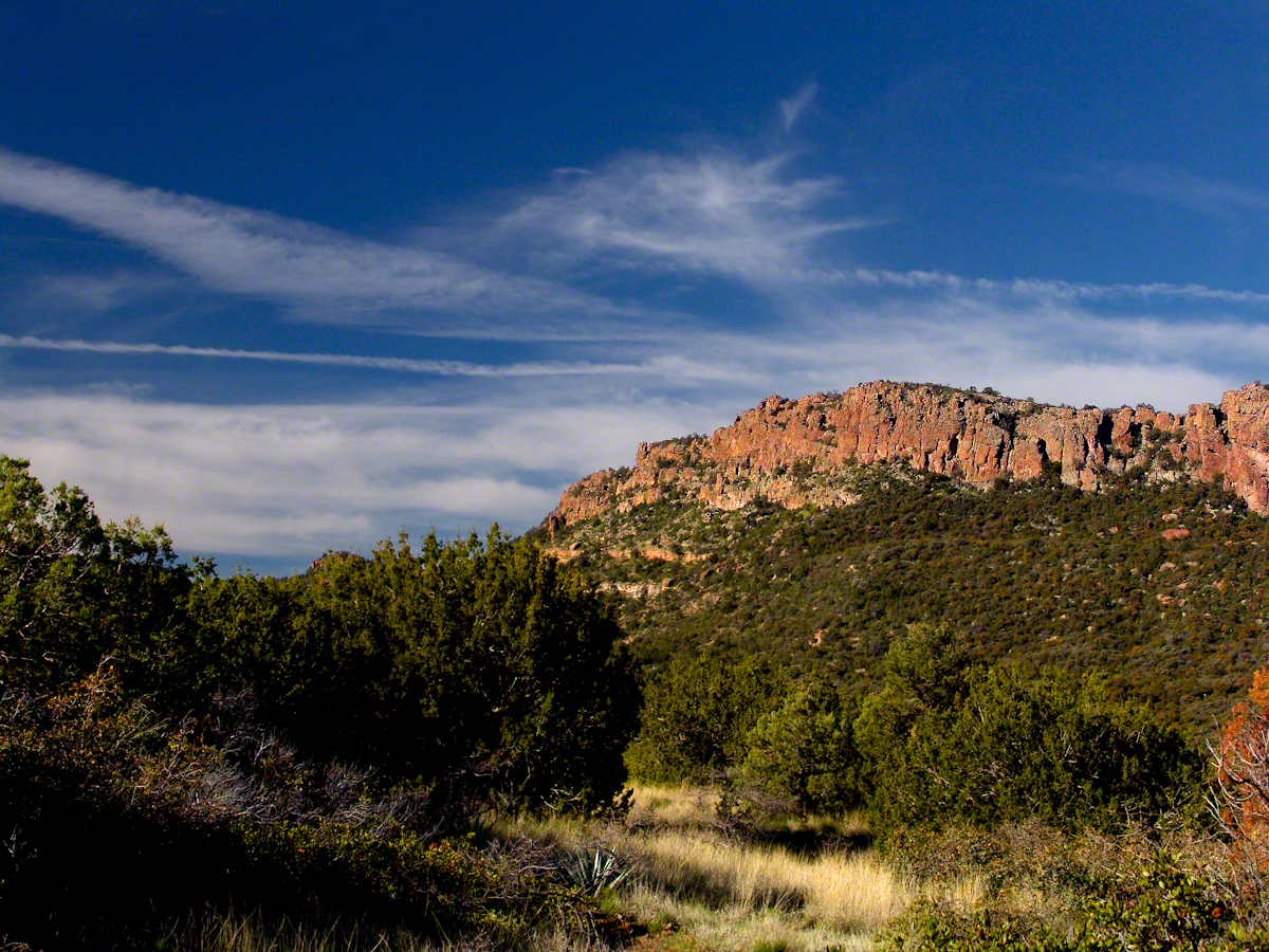
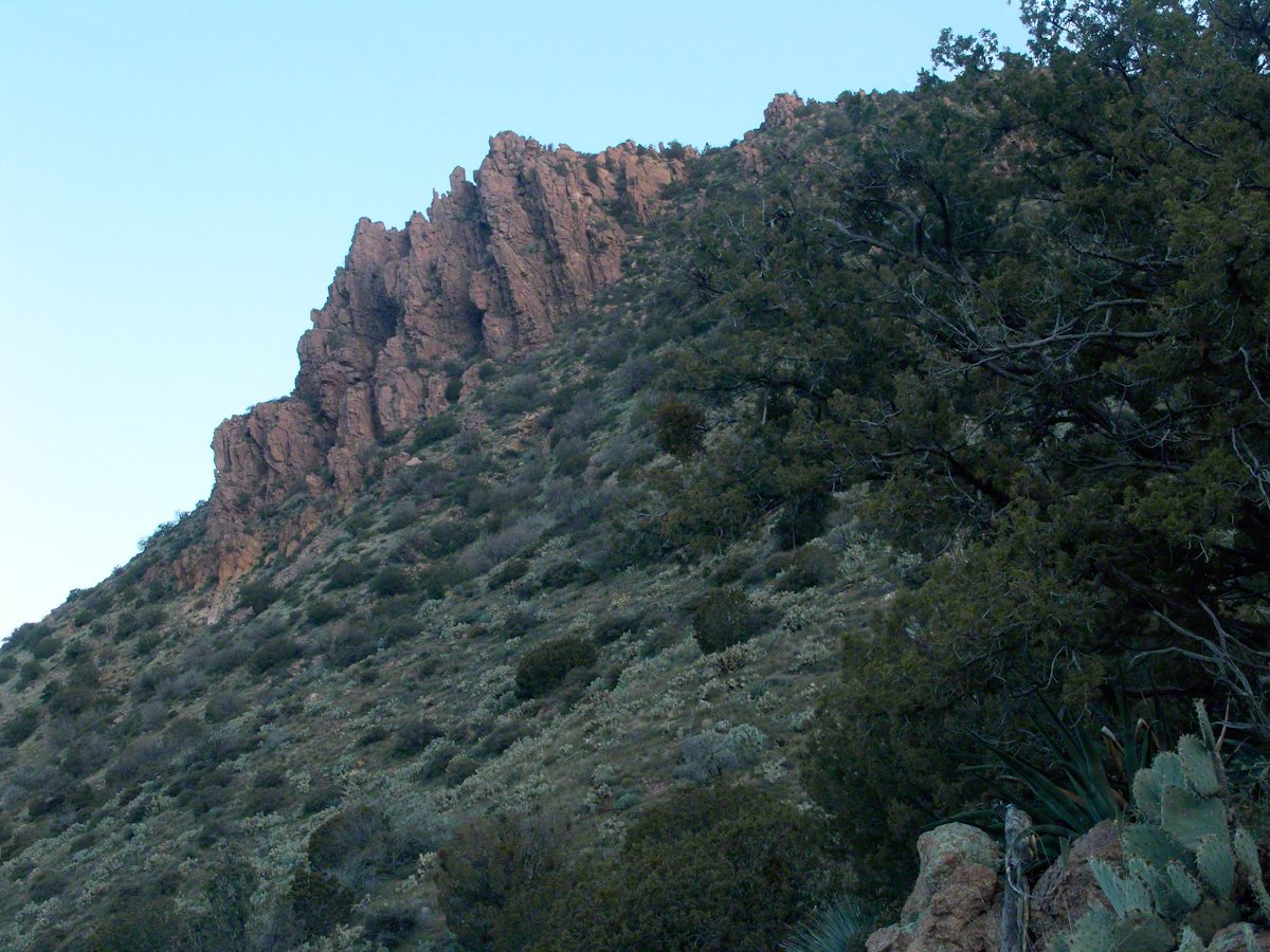
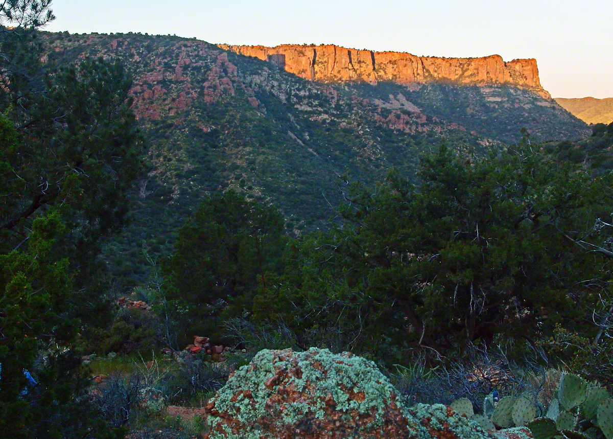
Although cold, the still dry air felt marvelous and even distant objects appeared absolutely clear. In this environment the spread of sun with its rising is a ritual. Here’s a photograph of the canyon walls a few minutes before the sun reached them.

SlopesOf2BarMountainPreDawn
Slopes of Two Bar Mountain in PreDawn Light

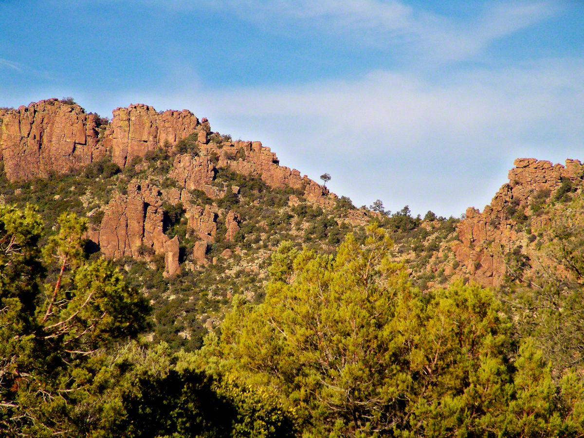
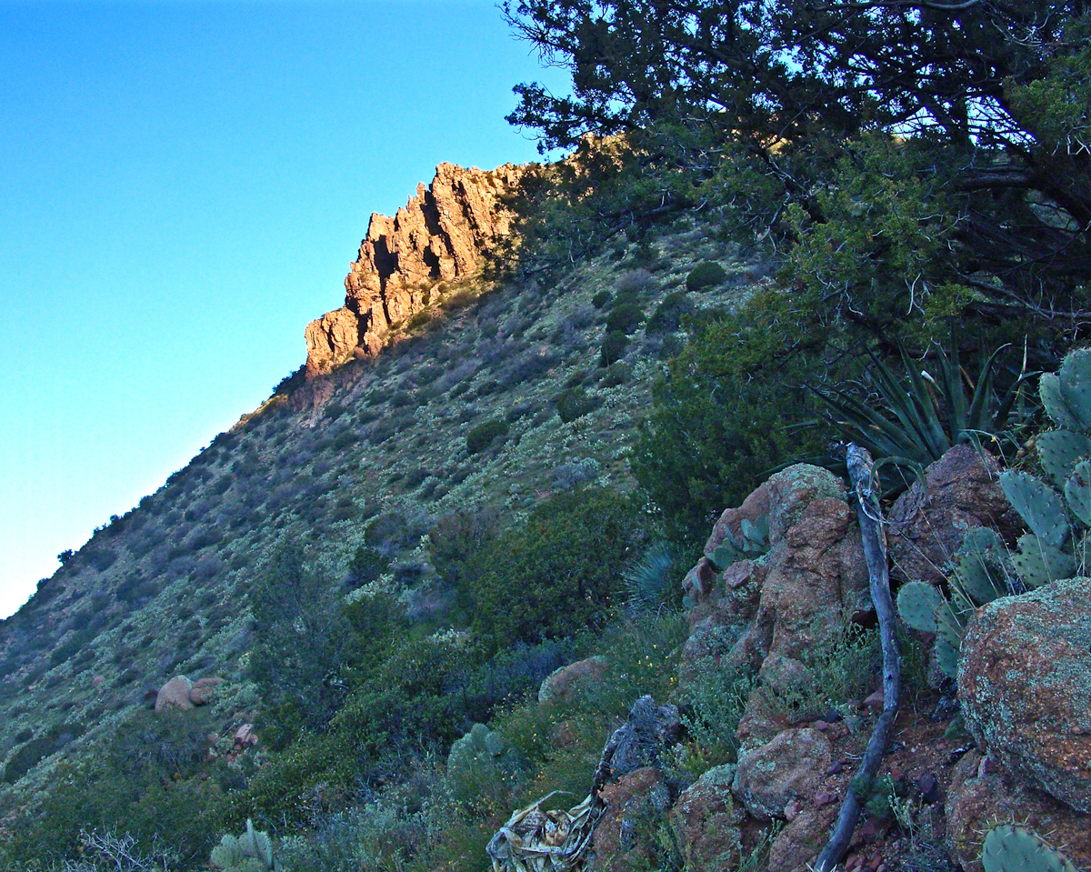
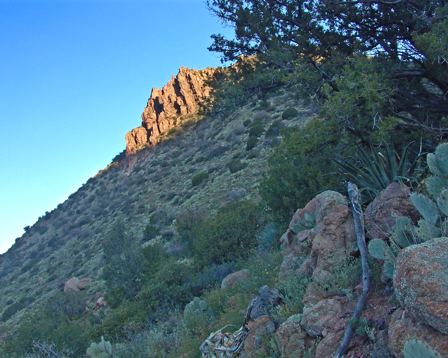
And, a few minutes later, as the sun passed the ridges of Two Bar Mountain.…

SlopesOfTwoBarMtnAtDawn
Dawn on the Slopes of Two Bar Mountain

By the way, that’s a desiccated agave stalk to the lower right, on the rocks.

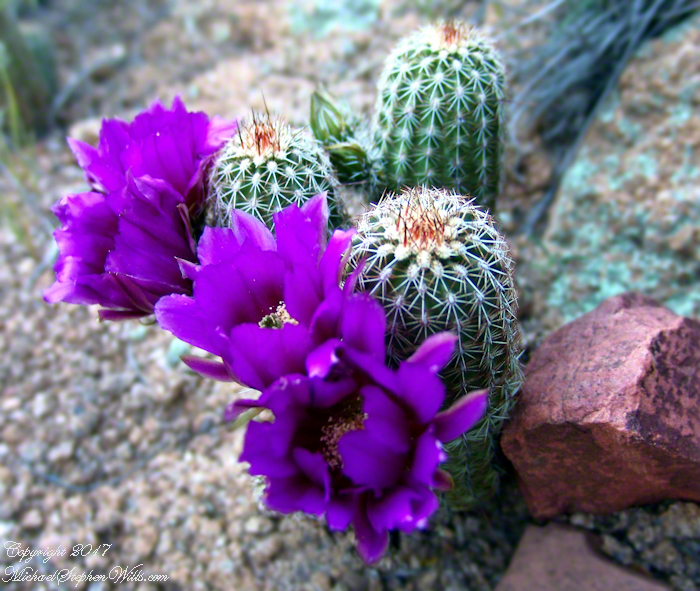
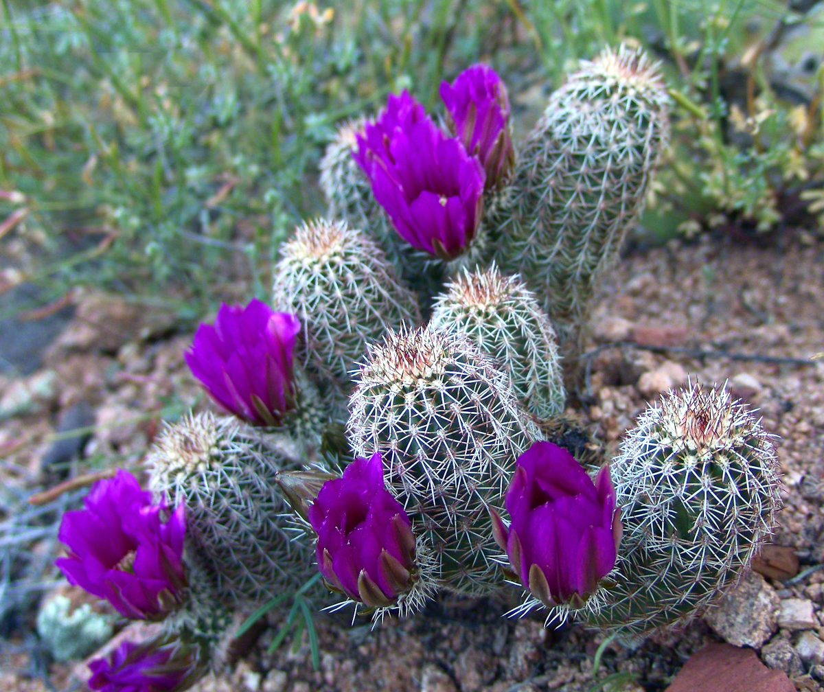
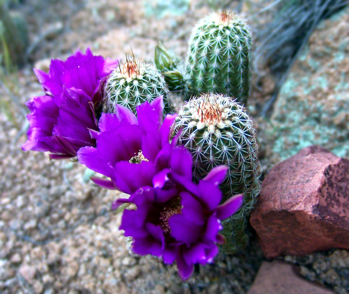
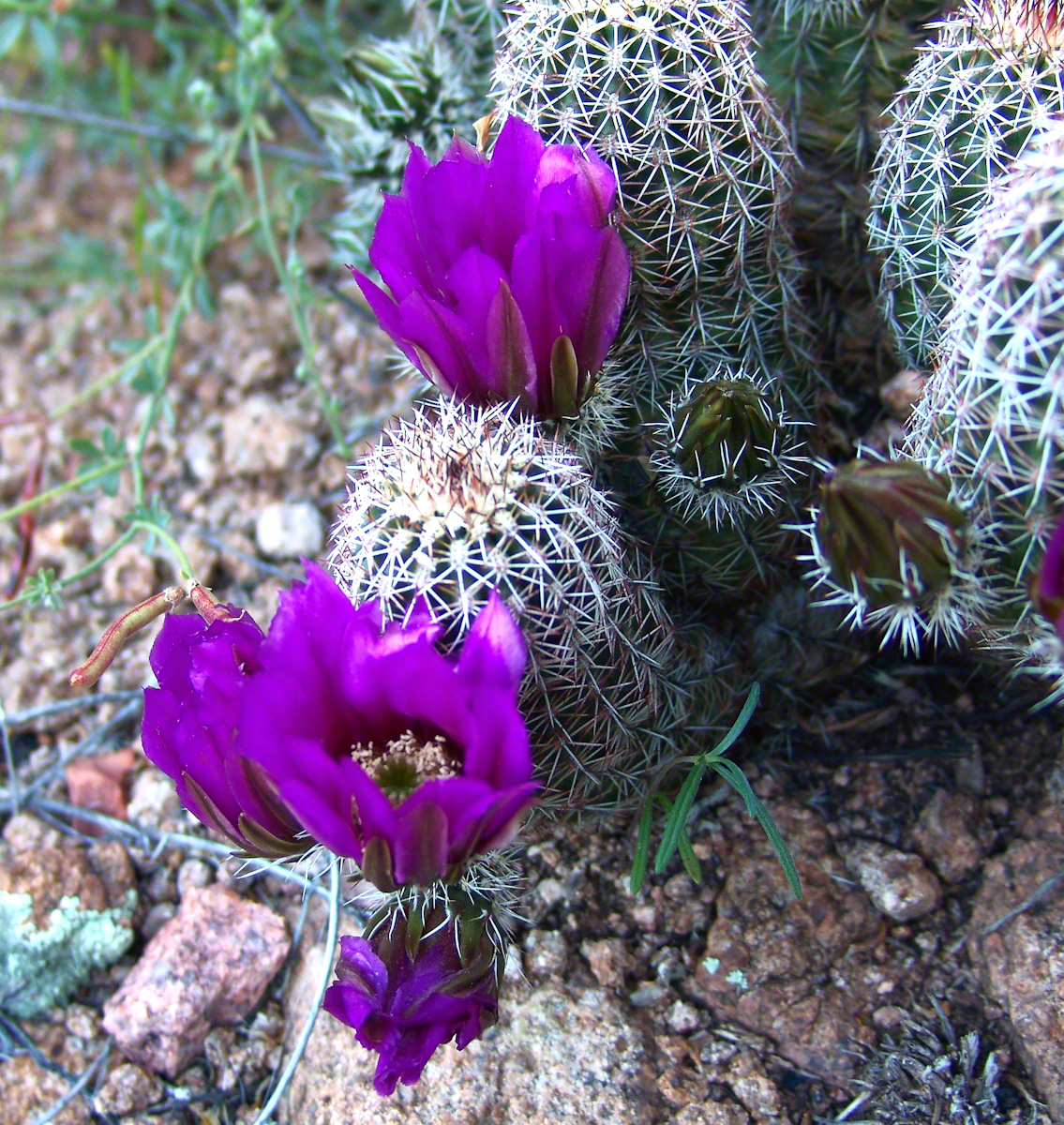
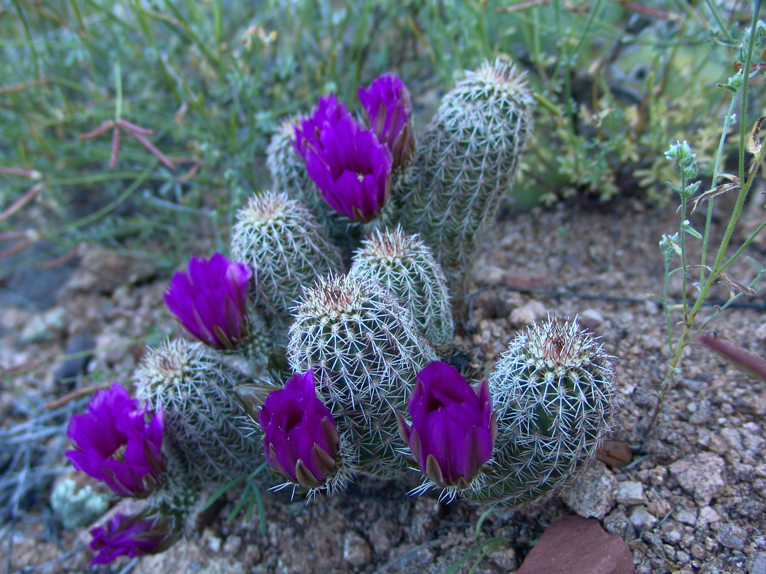
At my feet, spread at intervals on the brown red broken rock, small Hedgehog cacti bloomed lavender.

Lavender Hedgehog, overview
Lavender Hedgehog Blossoms
Lavender Hedgehog Blossoms with Buds

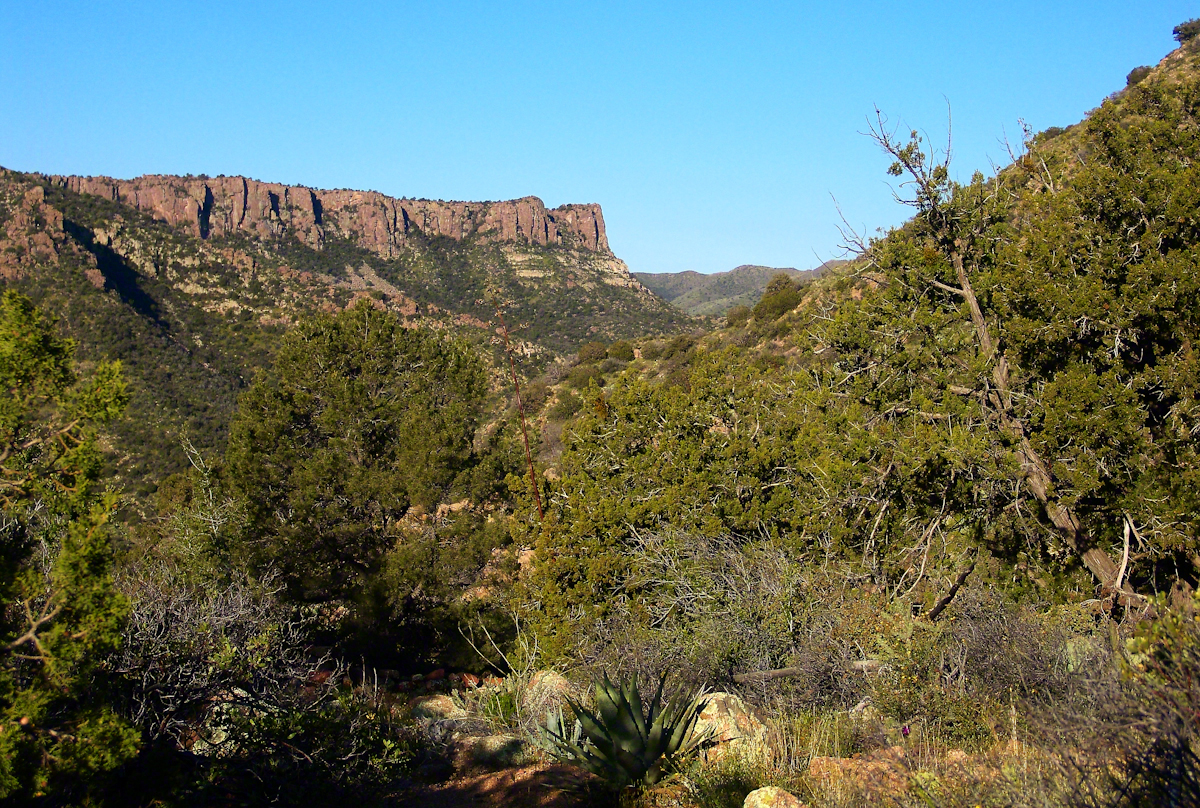
Cacti, such as the blossoming lavender Hedgehog seen above, require a space which enjoys full sunlight for most of the day. The thick grown of juniper trees limited sunlight and compete with the cacti for water. This image will give you an idea of the extent of the juniper growth.
Nameless Canyon in the Dawn

Looking into Nameless Canyon

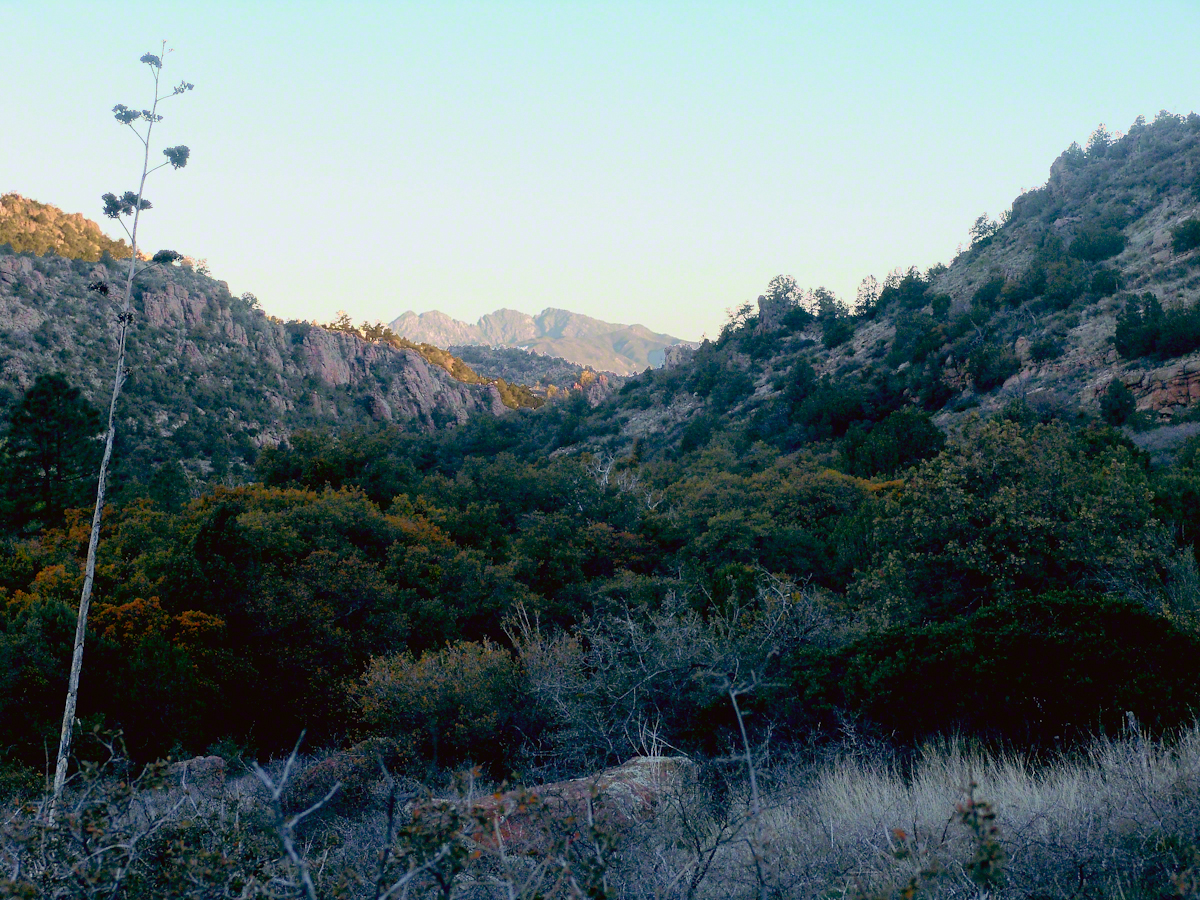
In the above photograph you are looking west over a canyon that is unnamed on maps. The dramatic flat ridge bathed in light is a landmark marking the canyon of Reavis Falls, on the far side in this view. Make your way down the canyon where is joins Reavis Creek, turn left and the falls are a few miles upstream. This is NOT the easiest path to the falls.

As the sun rose I needed to prepare for the day’s trekking, but took one more portrait of this lovely nameless canyon traversed by an almost non-existent path.

Nameless Canyon Morning

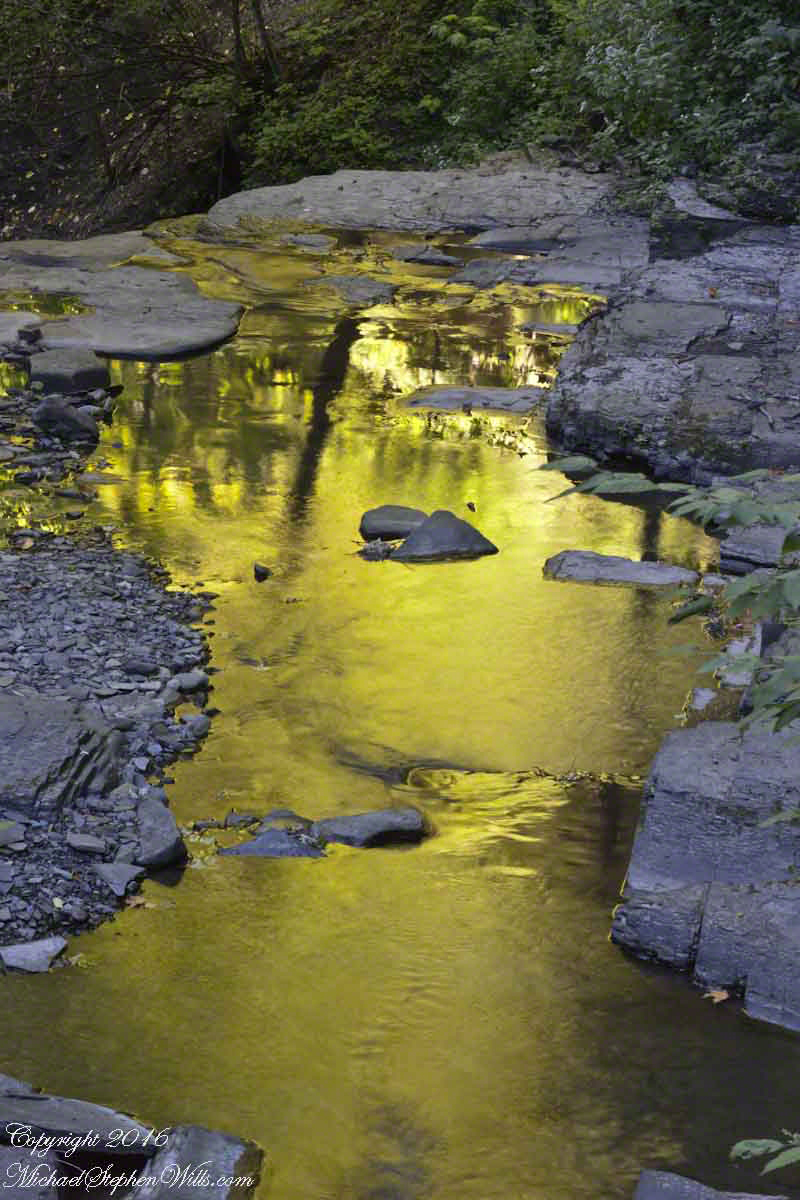
This season, a cold stream ran at canyon bottom. Flowing among the rocks the water produced peals of a crystal bell, but this was not my last memory of this place.

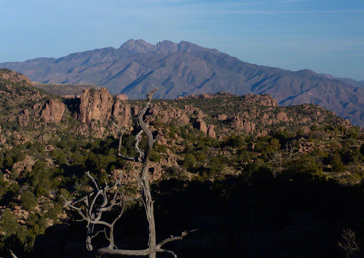
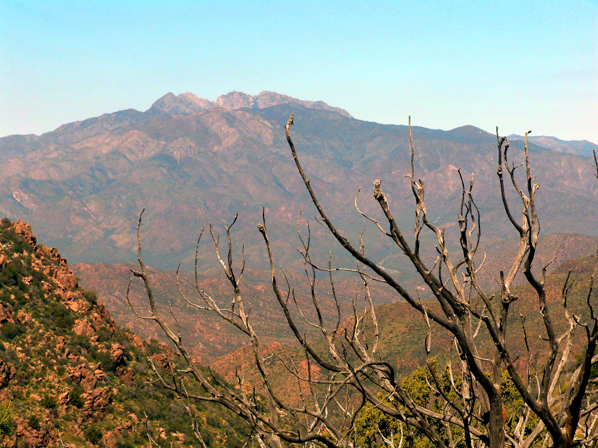
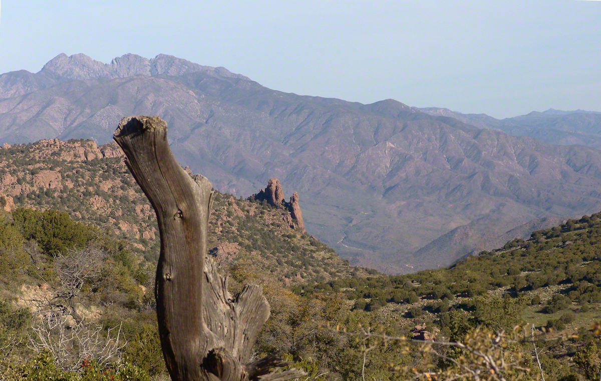
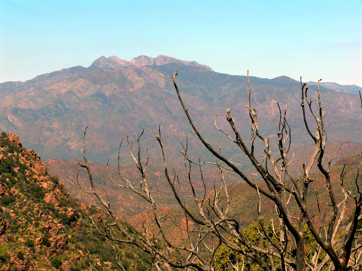
In the “Nameless Canyon Morning” image, on the left there is the almost vertical (no exaggeration) canyon wall I climbed in 4.5 hours that morning. It traversed 800 feet altitude in less than a mile. The path was substantially longer because it followed the contour lines of the land in long loops called switchbacks. As I proceeded up the canyon wall, to the southeast, above the opposite canyon wall, the memorable Four Peaks gradually appeared. Here’s the view from my lunchtime perch…..

Four Peaks from Nameless Canyon

This view looks over the basin of Reavis Creek and includes the, out of sight, 140 foot high Reavis Fall, the highest free fall in Arizona.

Click me for the next episode, “Two Meetings.”

Click me for the previous episode, “Racing the Sun.”

Copyright 2021 Michael Stephen Wills All Rights Reserved

Racing the Sun

Through that afternoon the wind gusts hit me as a physical force like a cat playing with her next meal.

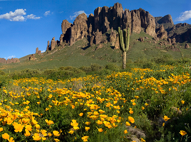
superstitionspring_copyright_640
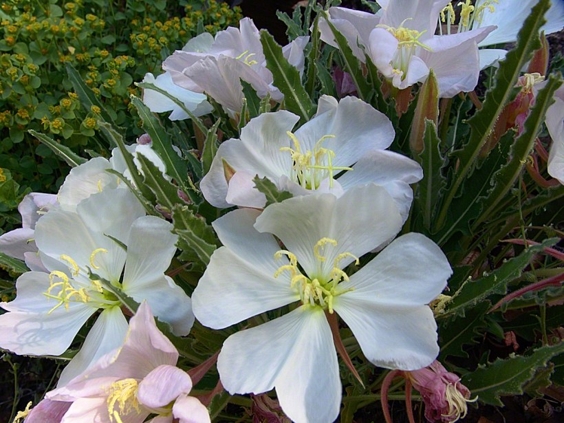
Mexican Poppies bloomed in profusion throughout the Superstitions after the plentiful winter rains of 2008.
Want more? Click for my OnLine Gallery

The four mile climb up the 2,000 foot eastern Superstition Wilderness bajada and escarpment consumed the morning and much of the afternoon.  It was the 80 pound backpack that did it.  Ten days of supplies, tent, equipment and 3.5 gallons (28 pounds) of water; enough food for a trek across the Superstition Wilderness, water enough for two days.  One day in, one day out if the water could not be replenished.  Mine was a water commitment, enough water storage to allow two days to trekking to another source.

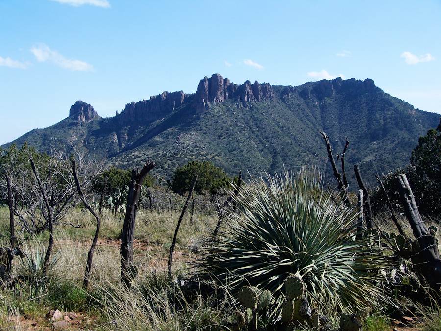
Two Bar Mountain
Two Bar Mountain from Tule Canyon trail with corral made from mesquite trunks and barbed wire. Yucca and prickly pear in foreground.

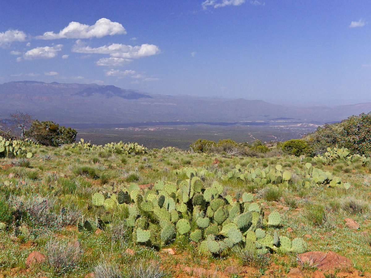
Here the canyon rim view from atop the escarpment…..

viewtoeasttrail122copyright
Here I found the huge mountain lion track in the dry mud from the spring rain, where water pooled and the cat drank.

…over trail 122, the Tule Canyon Trail, looking out from the wilderness.  Tule Canyon trail is very lightly used and only present in the form of occasional cairns.  There is a red rock cairn in the midground.  Theodore Roosevelt Lake of the Salt river is in the distance, as is the dirt road to the trail head.  A settlement is visible, on the right.

A rancher formed a cattle watering hole by damming an ephemeral stream and that day the pool held some water. Shortly after a rain a large mountain lion had approach the pool for a drink, leaving a footprint in the now dry mud.

I knew a mountain lion attack was improbable: I ran more risk of being run down on a New York City sidewalk by a madman or, even more so, of having a heart attack.  Still, during my brief lunch I faced east, looking over Apache Lake for the possibility of a cat leaping up from the canyon.  On all other sides was an open area until, a quarter-mile uphill, there was a thick growth of Manzanita reaching to the ridge.

After that climb to the escarpment rim I was in a race to reach a safe campsite at an unknown location, the other side of Two Bar ridge, before sunset at 6:46 pm mountain time.  Yes, the time was exact to the minute.  If sunset found me on the mountain side or ridge, rapid fall of darkness would force me to set camp.

The following photograph was taken the winter of February 2006 from a campsite below Castle Dome on Reavis Ranch Trail.  A red line, starting to the left, is Trail 119, my path along Two Bar mountain ridge, beneath the mountain peaks, with switchbacks into a nameless canyon.

ff6h3323_twobarmountain_cropped_enhanced001_annotated_resized_copyright
Overview of my path to the nameless canyon behind Two Bar Mountain.

Ahead of me was a 400 foot ascent in a half mile to Two Bar Ridge, two miles along the glorious ridge providing endless views to the west and northwest.  An 800 foot descent to a nameless canyon below Two Bar Mountain.  This left no time for photography!!

This photograph, taken 4 miles to the west and 10 months later, is similar to what I enjoyed, and dreaded, that day.  A flowering century plant stalk grows at the end of the plant’s long life, usually 10 – 30 years.  After death, the plant is reborn through suckers from its roots.
sunsetfromcastledomemarch2006copyright-3372
A Superstition Wilderness Sunset from a February 2006 backpack.

My hope was to find some flat terrain in that canyon, for a camp site. If only there was time enough to reach it. My progress was bedeviled by sudden gusts of wind, grabbing like a large cat, throwing off-balance.  

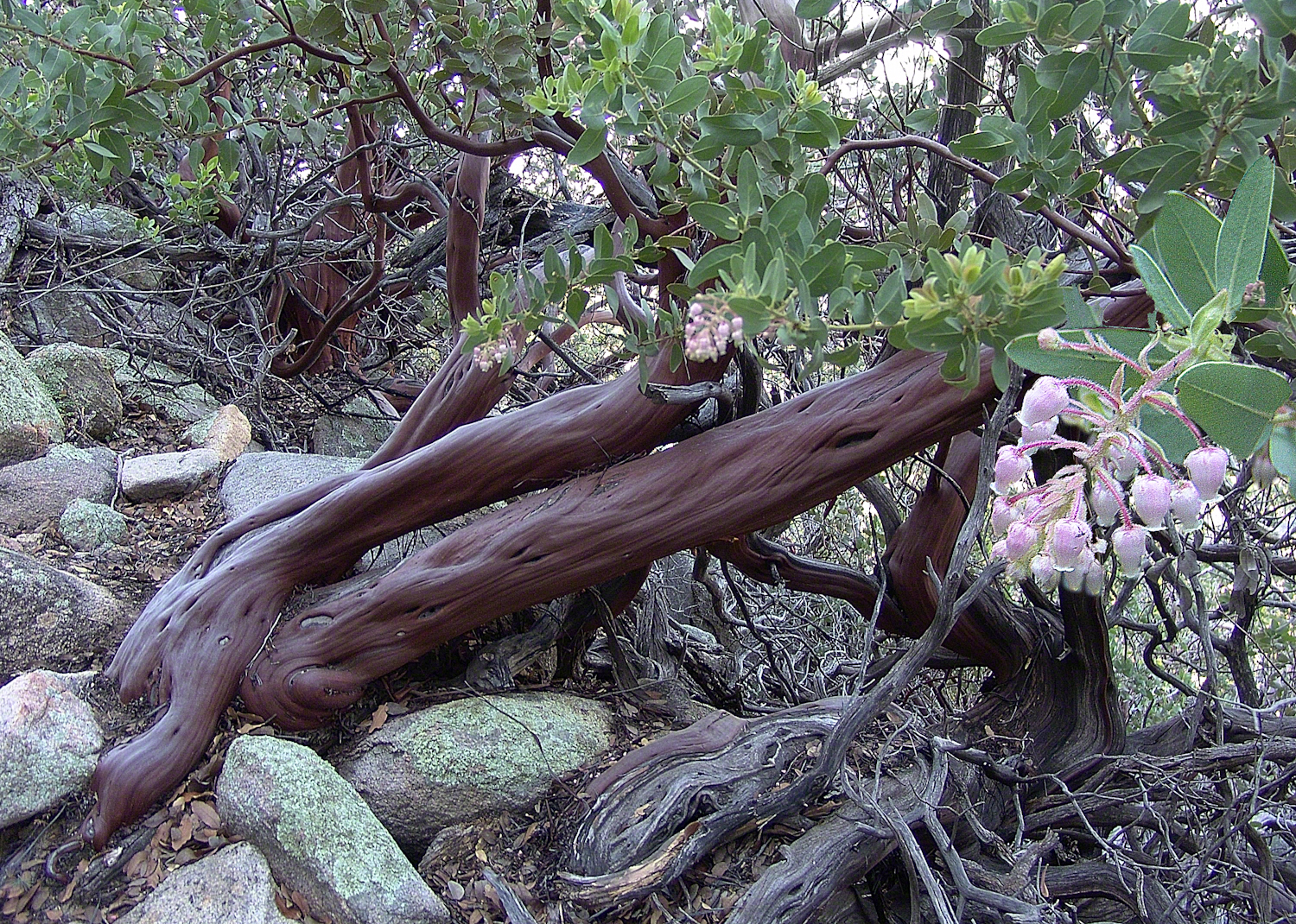
The west wind was whipping the bushes as I entered the Manzanita.  Here is a photo of the plant from a later backpack to the Rincon Mountain Wilderness.  Yes, the trunk is a dark, rich red.  “Manzana” is apple is spanish, the plan is named “Little Apple” for the small green fruits much loved by bears.

Manzanita.
A mature Manzanita growing along the Miller Trail of the Rincon Mountain Wilderness. There is an enlargement of the flowers, to the right.

Manzanita leaves were thick around me snapping in the wind, making it seem at all moments a large creature was moving. The trail was difficult and several times I needed to turn back to find it, all the while climbing continuously.

On ridge was the highest point for a hundred or more miles to the west, so the wind was free to run which it did in huge gusts.  You can get an idea of the openness from the Superstition sunset photo.  For awhile the Manzanita acted as protection, then I descended along the west face of the Two Bar Mountain ridge.

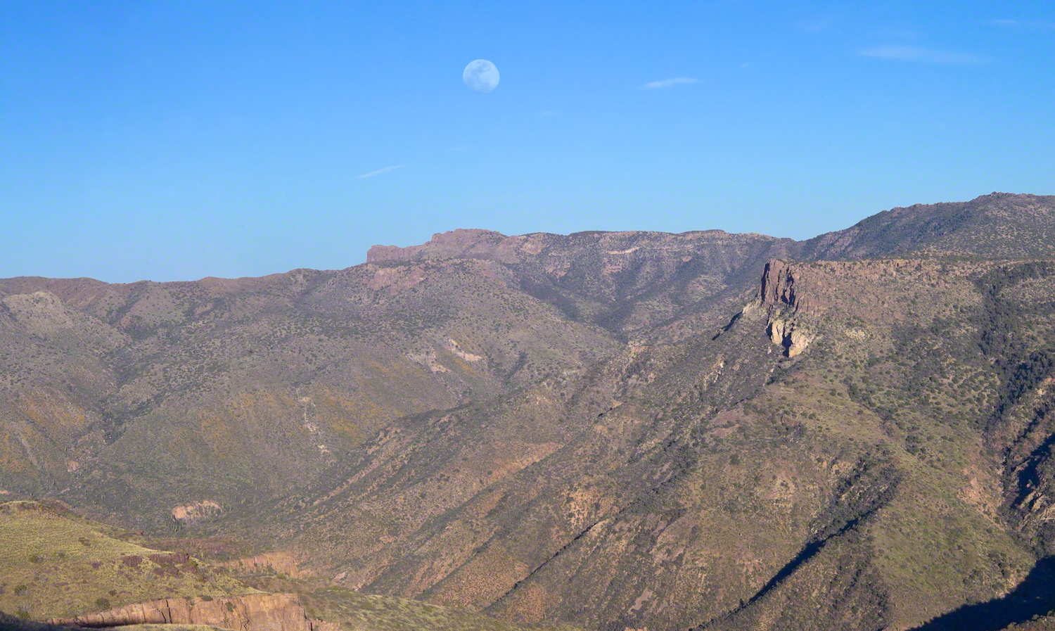
Evening from Lime Mountain to East with Risen Moon
Two Bar Mountain and Ridge from Lime Mountain with rising moon.

My hat tie-down were tested on that two miles of ridge, the brim was molded around the right side of my head. The backpack acted as a sail so that it was taken in the wind gusts, affecting my balance.

On mountain trails the path is full of stones of all sizes and,  aside from the occasional rattlesnakes, critter scat or, at lower elevations, Gila monsters, it is the rock that forces hikers to look four steps ahead, planning moves carefully to avoid falls.  The 80 pound backpack, wind, rocks, high perch and, not forgetting the prickly pear cactus and jumping cholla, all slowed me to less than a mile an hour.  I was jumpy walking through that Manzanita and this slowed me down more.

Trail 122 joins Trail 119 on Two Bar Ridge.  On the ridge a substantial barbed wire fence separates federal land from the working ranch.  Where the trails crosses, the fence has a break.  The hiker needs to wend through a simple maze impassable to cattle.

Of all the trail, this is the most clearly marked.  Fences have deep historical significance for the western United States.  Range wars were fought between men who had different beliefs about land use and ownership.  Many historians associate the building of barbed wire fences with the passing of the Old West.

Up until the fence, cattle grazing visibly damaged the land and plants.  After the fence, the land was free to become as it was since the beginning of time.  Up here, there’s wonderful grass that was, in this season after heavier than normal winter rains, was lush and green.

The trail followed the fence for a ways, then descends steeply into a fold of the land, leaving me in shade as the sun, low in a cloudless sky, raked over the mountainside with a brilliant golden light.  The Two Bar Mountain and Ridge with Moon photograph, above, gives an idea of the effect.

Below, the canyon floor seemed a mass of prickly pear cactus groves.  I decided the lower canyon wall was the best choice for camp…as unlikely as that sounds.

Here, the trail was anything but straight and almost invisible, descending in looping curves called switchbacks.

Here’s a photo from the following morning.  I found a small shelf on a ridge overlooking the canyon floor, amongst wonderful shrubby Juniper trees.  Tiny hedgehog cactuses were covered in lavender blooms.  There is a decrepit stalk of a Century (yucca) plant lying over the rock.

ontheslopesoftwobarmountaincopyrightmichaelstephenwills08
Morning view from my camp in a nameless canyon below Two Bar Mountain.

On approaching the shelf, the air turned suddenly cold as the sun fully set and the wind gained even more in strength flowing up the canyon and over Two Bar Mountain.  Stony ground made it impossible to stake the tent, instead I used small boulders to fix the corners and sides of the tent.  Once inside, I was grateful for an excellent mat to protect me from the small jagged stones at one with the ground.  The tent walls held back the wind.  I forgot to back an excellent sleeping bag for the trip.  Instead of buying one in Phoenix, my sister lent me a light waffle weave blanket.  “What was I thinking???”  It was a restless, cold night.  The sun was very welcome the following day.
Lavender Hedgehog Cactus Blooms
Lavender Hedgehog Cactus Blooms in pre-dawn light

Click me to visit Michael Stephen Wills Online Arizona Gallery.
Copyright 2026 All Rights Reserved Michael Stephen Wills

Loughcrew Hill View

On the Ground in County Meath

The popular name of the Loughcrew megalithic site is, “The Hill of the Witch” (In Irish, Sliabh na Caillí). In lore sites such as this are associated with The Others (“fairies”), living lives parallel and invisible to ours, touched now and then with resolutely ill effect to our side though sometimes theirs as well. Resolute as in these meetings are fated to end poorly unless…..unless the mortal knows the rules. “If you are ever in an Other’s mansion for a party never, ever eat or drink anything. Eating or drinking will condemn you to an eternal round of parties. You will dance till dropping every night.” Rules such as that, and others, can be used to turn the tables, gain an advantage, of beings from the Other Side.
The story of my wife, Pam, how our lives came to be touched by this afternoon of May 27, 2014, is parallel to the tales of mortals benefiting from contact with The Others. The immediate source was the passing of my mother, Catherine Ann Wills (McCardle), at the age of 90. Mom’s passport gave her place of birth as Proleek, a place in Louth. My maternal grandmother, Mary Catherine McCardle (Mills) spoke with a brogue, less a lilt than a down to earth and kind warmth. I remembered the stories of Mom’s passage to Canada with her mother and father in 1926 at the age of three. The Ireland connection with my father was less direct as I never met his mother as an adult and we seldom spoke of her. It was left to me in the time between my Mom’s passing, an invitation for a visit from our cousin’s in County Louth, and our arrival May 2014 to understand more about Elizabeth (Duffy) Wills, my paternal grandmother.
In this way, I discovered Elizabeth came from a family of Dunderry, County Meath, Ireland, her parents Matthew and Teresa (Plunket) Duffy; our tour of Ireland came to start from a bed and breakfast near Trim, County Meath, with Dunderry up the road. May 27th, we planned as an exploration of all things County Meath, to include Loughcrew, the highest point of the county in the west.
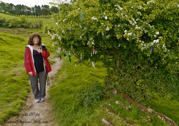
Along the steep path to the hilltop a hawthorn tree covered with flowers and offerings welcomes visitors. May is the month for decorating hawthorns, the blossoms are also known as “Mayflowers” as in the ship the pilgrims sailed to Plymouth Rock.

Click the photograph to open a new window/tab of my Online Gallery.
Pam and Hawthorn– CLICK ME!!!!

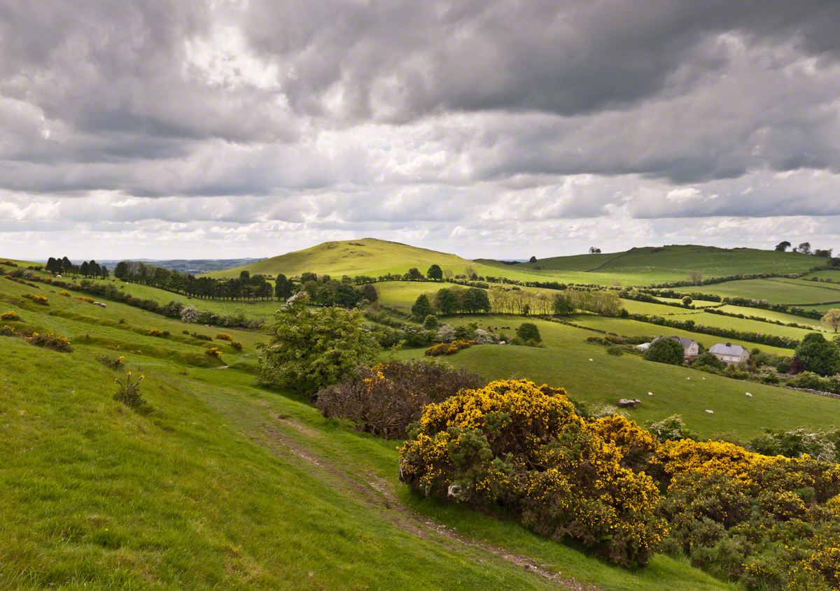
As if we entered a gateway, when pausing and turning high on the hill, this view was revealed, otherworldly in its fullness, scope and wonder as though we passed to the other side to the fairies.
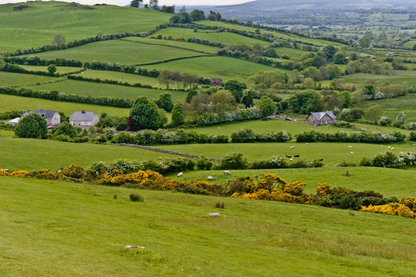
Cairnbane East of the Loughcrew Cairns site, County Meath Ireland, is also known as Hag’s Mountain. We are looking south, southwest from the north side toward Cairnbane West. Flowering yellow whin bush, also known as gorse, is in foreground; white flowering hawthorn trees in distance. No elements of this photograph hint at the year 2014.

Hag's– CLICK ME!!!!

A solitary standing stone below the trail to the Loughcrew site surrounded by whin bush in yellow flower and white blooms of hawthorn hedge rows. A fieldstone fence, farmhouses, a patchwork quilt of fields completes the view.

Hag's– CLICK ME!!!!

Meanwhile, in the real world, when Pam and I complete our round of the island to return to my cousins in County Louth, they told us, on this day, two young men were discovered parked next to a nearby lough, murdered during a drug deal gone bad.

Click for another Ireland posting

Copyright 2021 Michael Stephen Wills All Rights Reserved

Pinelands Connections III

A presence today

“Driving along a sand road between the vanished town of Calico and the vanished town of Munion Field, we passed a house that was so many miles from any other house that Fred said, with evident admiration, “He got well in away from everybody, didn’t he?” Fred made a similar remark every time we passed a house or cabin that was particularly deep and alone in the weeds. Getting — or staying — way from everybody is a criterion that apparently continues to mean as much to many of the people in the pines as it did to some of their forebears who first settled there. Tories, for example, fled into the pines during the American Revolution. People with names like Britton and Brower, loyal to the King, and sometimes covered with feather and tar, left their homes in colonial cities and took refuge in the Pine Barrens. Also, during the eighteenth century, when the farmlands of western New Jersey were heavily populated with Quakers, the Pine Barrens served as a catch basin for Quakers who could not live up to the standards of the Quaker code….” From The New Yorker magazine, November 26, 1967, “Profiles, The Pine Barrens I” creative non-fiction by John McPhee.

……continued from “Pinelands Connections II.

Vanished like the towns of Washington, Calico, Munion Field are the reasons that led to the union of the Quaker George Wills and Mary Dellett, daughter of James, emigrant from Northern Ireland. It is reasonable to surmise George, separated from the Quakers, sought refuge in the pines as a young man.

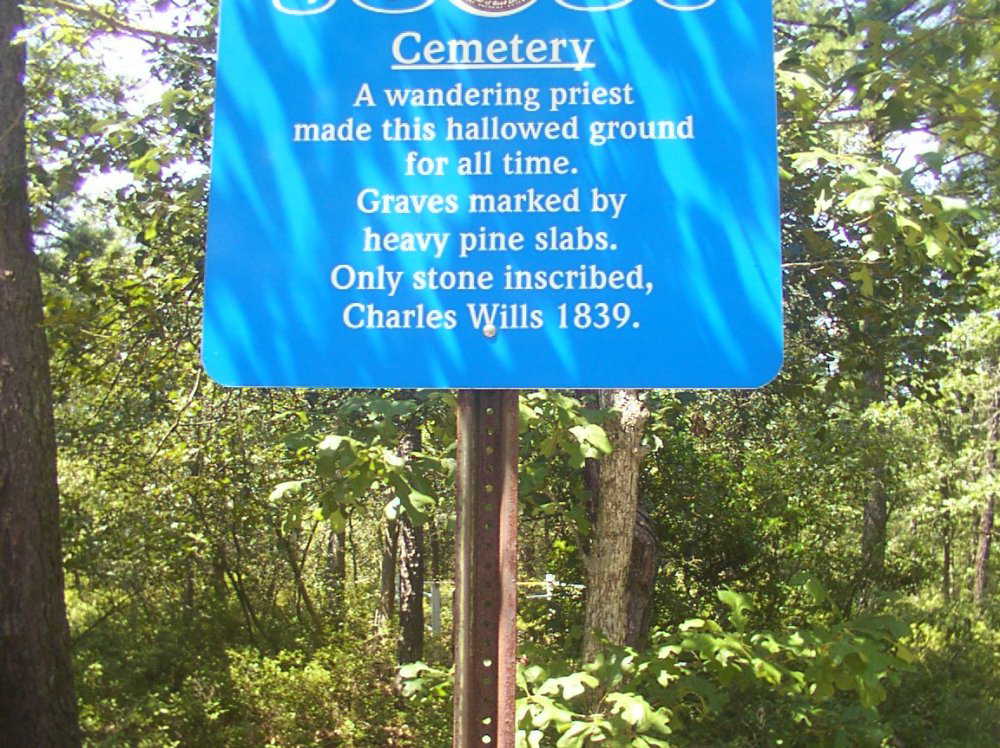
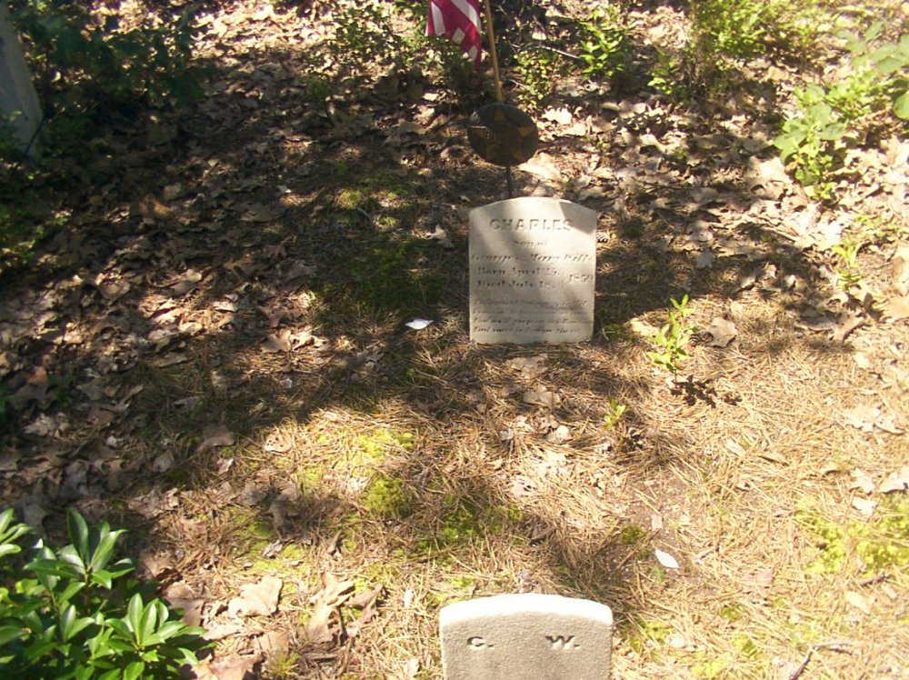
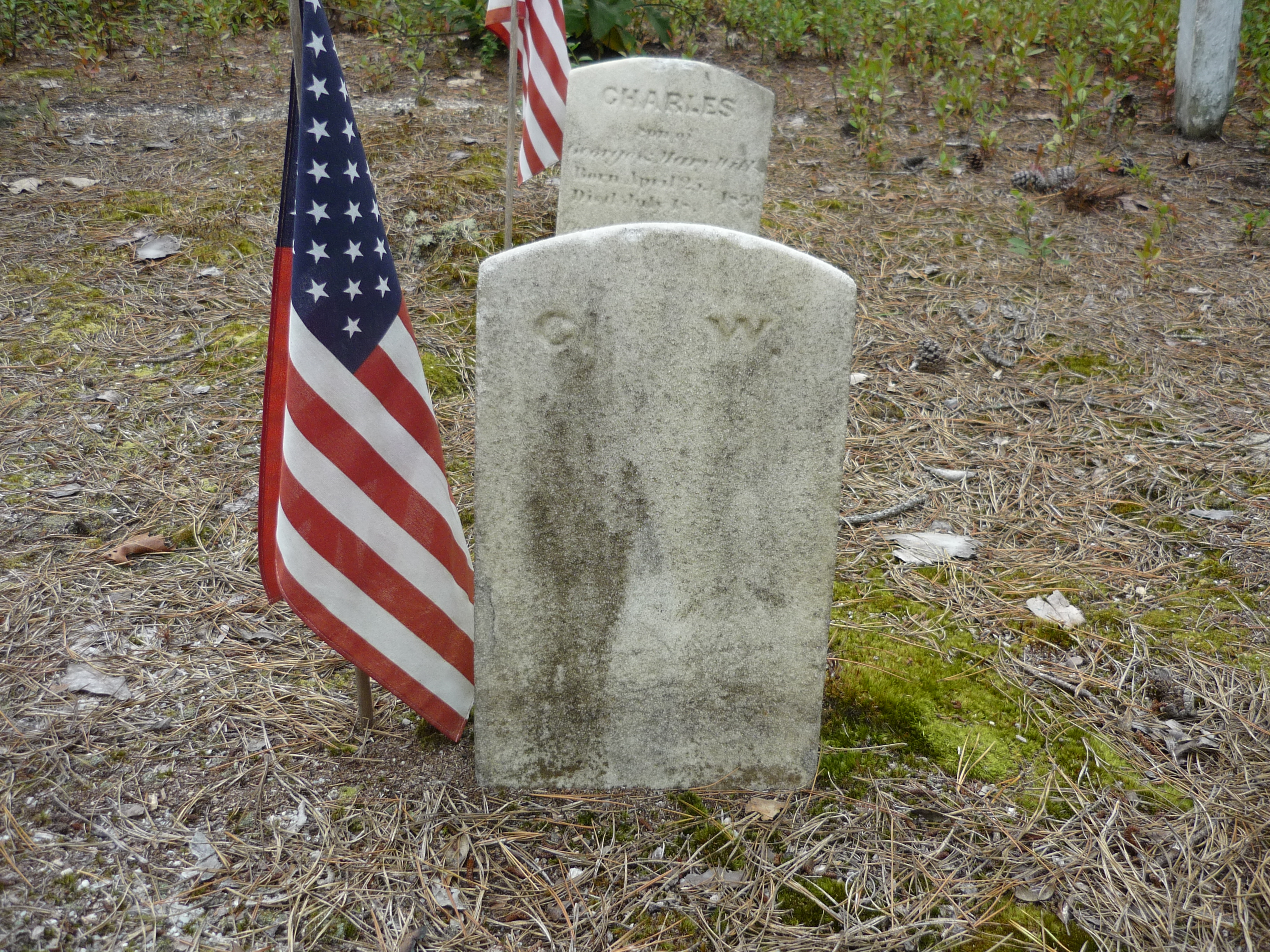
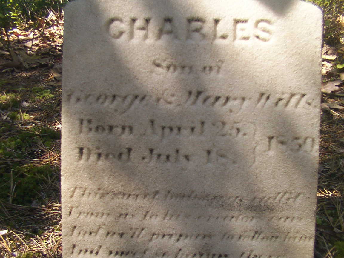
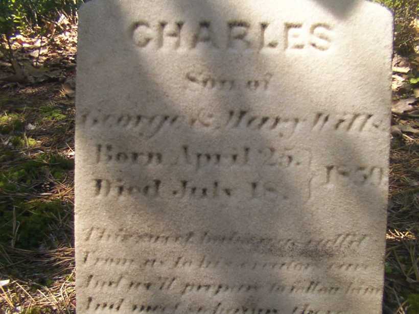
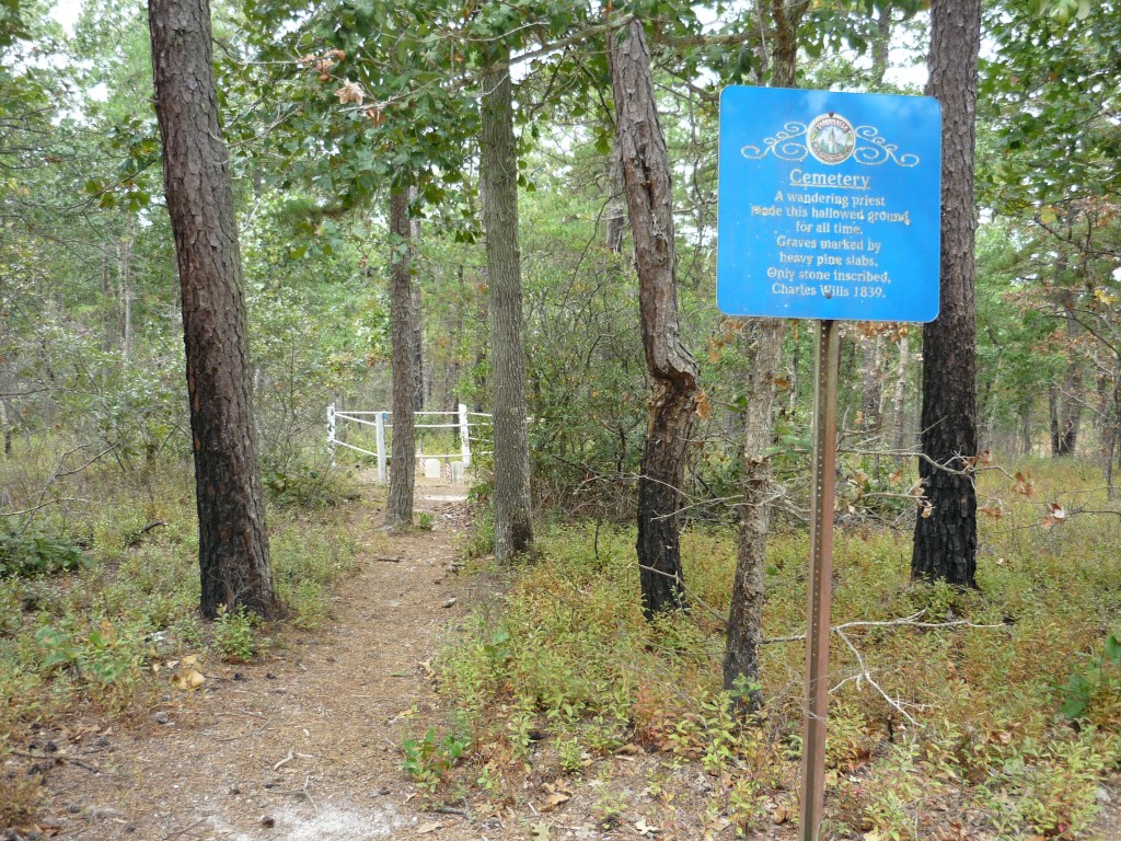
We can tease grief and loss from the records and landscape, When Joseph C. Clark visited George and Mary on August 24, 1850 to record the persons living there, if the U.S. Constitution prescribed the recording of the grief he experienced, the record would show Charles missing from the list. Follow the sand path, “Eagle Road” three miles north where he lays in the ground of the family cemetery, having passed just days before the 1850 census was taken.

The loss of a cherished presence can be inferred from the use of precious marble to mark his resting place. The heavy pine slabs of his companions long since vanished.

As with the Wills Hotel, the Wills Family Cemetery is best found through global coordinates: 39°45’49.7″N 74°34’01.4″W

Click me for Pinelands Connections IV

Copyright 2021 Michael Stephen Wills All Rights Reserved

Hag’s Chair or Mass Rock?

Ancient Tradition

Part of our day in County Meath, Ireland  
Click the photograph to open a new window/tab of my Online Gallery.

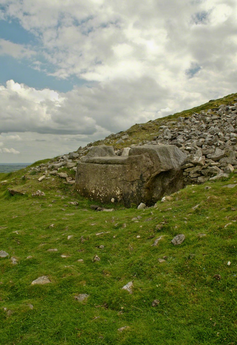
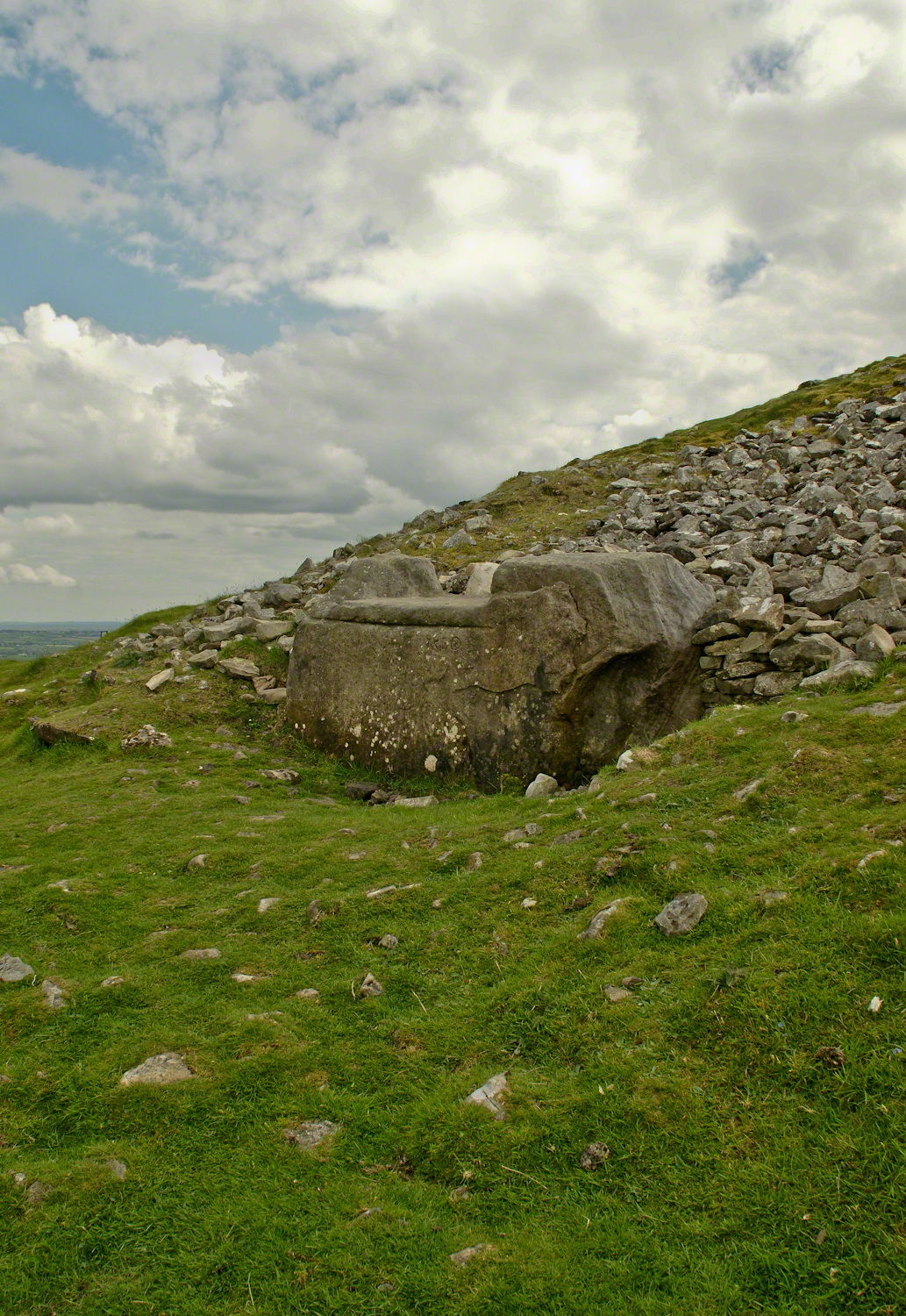
Known as the Hag’s Chair in some contexts, K29 or the Mass Rock, in others, set as a Cairn T, Loughcrew kerbstone thousands of years ago the carved symbols on front, rear and seat are very worn. There is no surviving record to inform us of the stone’s purpose. The upper side appears carved to enhance the form as chair.   Set to the north of Cairn T, not in front of the entrance as with Newgrange, even this is a mystery.  It is the third largest curbstone.

Hag's Chair– CLICK ME!!!!

The popular name refers to the hill itself, “The Hill of the Witch” (In Irish, Sliabh na Caillí).   In lore sites such as this are associated with The Others (“fairies”), living lives parallel to ours.

Tradition holds that, during times of the Penal Laws, Catholics gathers on for Mass using this curbstone as the altar.   By this it is known as the Mass Rock.

Click for another Ireland posting

Copyright 2021 Michael Stephen Wills All Rights Reserved

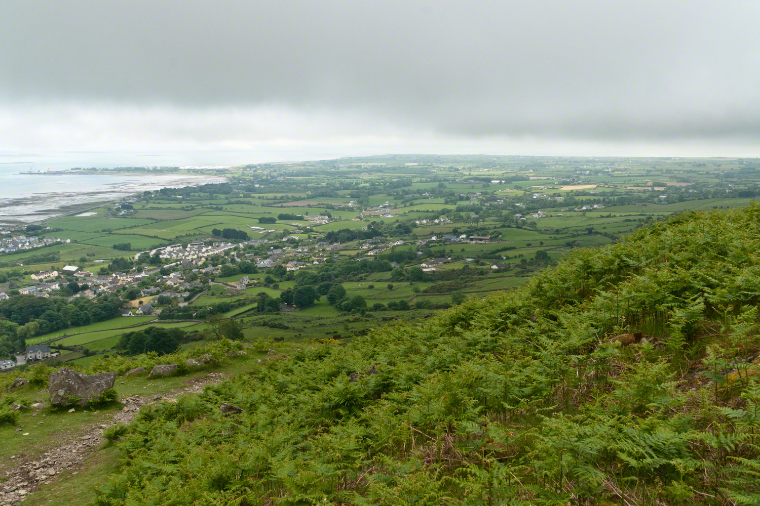
Farmland Southeast of Carlingford

Beauty of the Cooley Peninsula, County Louth, Ireland

I offer here a continuation of descriptions of a 2014 walk on the Tain Way, an appreciation of the lore and beauty of Ireland.

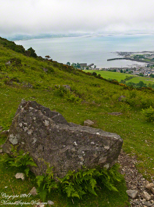
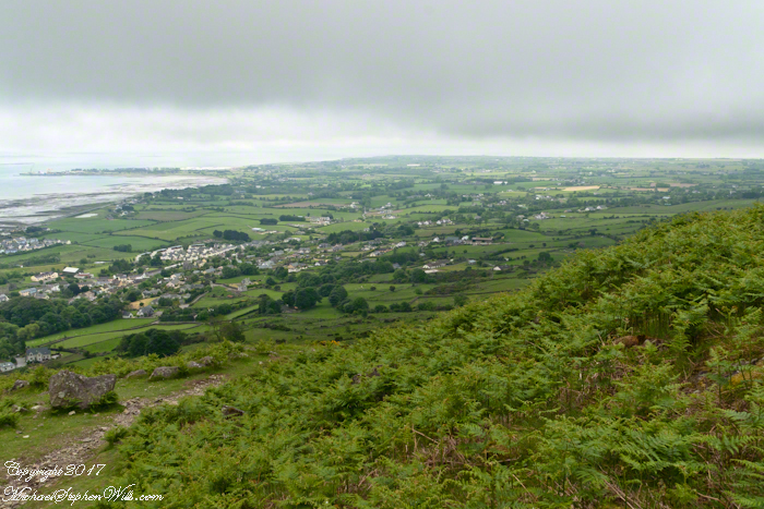
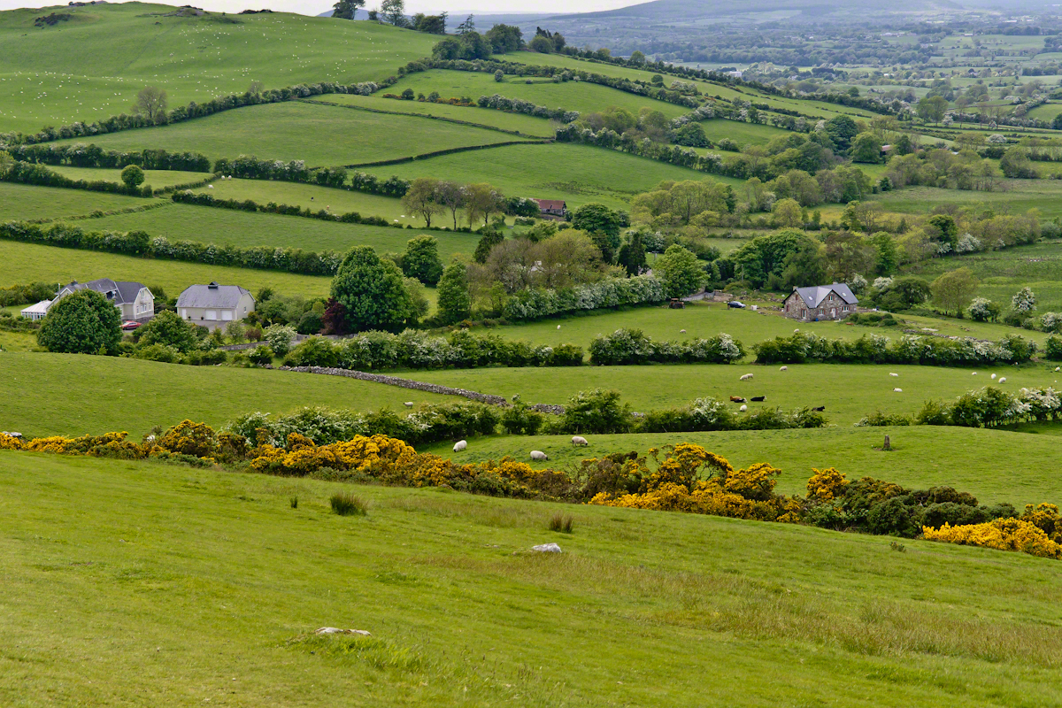
Descending the Tain Way from the ridge of Golyin Pass the sweep of Cooley Peninsula spread before us. Louth is the smallest of the Irish Republic counties, a peninsula which is mountainous where it is not farmland, one exception being Carlingford with the most people, population 1,405 in 2016.

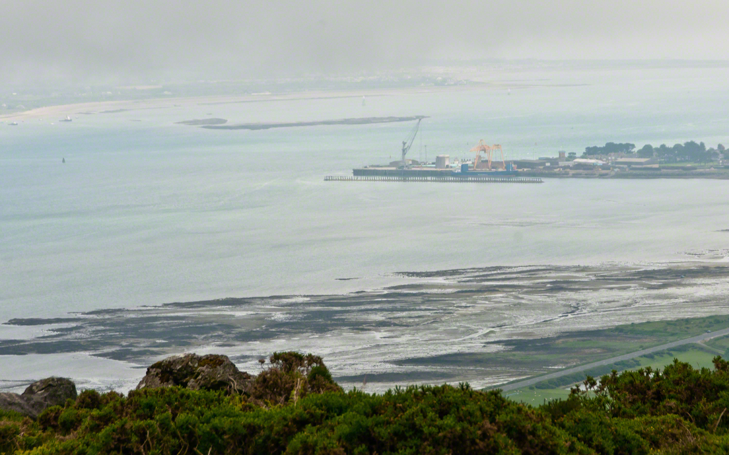
Residential Carlingford continues along the Greenore Road, farmland adjoins then continues southeast along the Cooley Peninsula margin, the Irish Sea beyond. Greenore Town and deep water port on upper left.  These photographs are views from the Tain Way on the slopes of Slieve Foye, the highest mountain of County Louth.

Greenore Town and Deepwater Port
Click this link for my Ireland gallery of Fine Art Photography.

Wander through the place names: Chapel Hill, Liberties of Carlingford, Moneymore, Leminageh, Crossalaney, Mullatee, Millgrange, Ramparts, Muchgrange, Ballyamony, Mullabane, Petestown, Ballagane, Willville, Whites Town.


There is a deepwater port on Carlingford Lough adjacent to and part of Greenore Town. The port employed Cousin John Mills years ago, supplementing his farm income. Across the lough is Greenecastle, Newry in Northern Ireland.

Greenore Town and Deepwater Port

The Irish Sea opens on the far side of Greenore with the Isle of Man about 52 miles east and a little north.

Visit the opening chapter of our time on the Tain Way

Click link for the next posting of this series, “Leprechaun Rock along the Tain Way”

Copyright 2021 Michael Stephen Wills All Rights Reserved

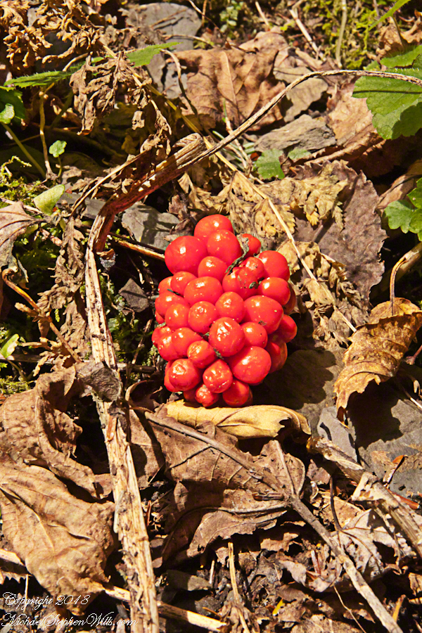
Red Berries

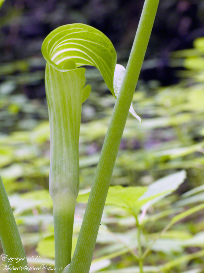
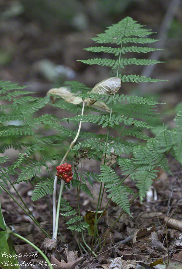
Jack-In-The-Pulpit one June Day

The many names for this plant are reflective of how wide spread it is. Called Arisaema triphyllum (scientific name), jack-in-the-pulpit, bog onion, brown dragon, Indian turnip, American wake robin, or wild turnip this secretive plant flourishes in moist soils across eastern North America, everywhere north to south. I say “secretive” because the varieties I am familiar with hide the flower under the leaves, three of them growing from a stalk.

Click this link to view my Online Gallery.

Lovers Lane Observation Platform– CLICK ME!!!!

Those of you who know Georgia O’Keefe may be familiar with the form and coloring of Jack-in-the-pulpit from the series of six oil canvasses from 1930, her time in the east living near a spring. There is a spathe, the pulpit, strongly colored in dramatic vertical, flowing stripes, wrapped around a spandix, the “jack”, being a stem covered with male and female flowers.

Around the time my photography habit started in 2002 I was surprised by the jacks growing from the walls of Fillmore Glen, spying the distinctive forms flowing a bit above eye level under the three large leaves. Seeing them was like recognizing a friend in Halloween disguise, the exotic O’Keefe shapes in a known place.

From this gift, an awareness of the possibility lead me to recognize “jacks” in many other places. I have yet to exhaust the possibilities.

2015 I acquired a Canon EF 70-300mm f/4-5.6 L IS USM lens for our cruise around South American. It proved very useful for an unending combination of situations. Here, it allowed me to frame this specimen, the former covering of three leaves now sere brown and collapsed, the berries revealed in startling clarity among evergreen ferns, Christmas red and green. The strangely named Dry Creek, the driving force of Fillmore Glen, flowing below this humus layered shelf moist with a constant flow from the gorge walls.

The park trails make for a pleasant choice at the start of each excursion. This day, Pam and I visited Cowshed Falls at the foot of the glen, climbed the north rim trail to walk among the hemlocks, listening the leisurely calls of Hermit Thrust like breaking crystal. The time of mushrooms was past in late September, instead we enjoyed the Indian Summer sun and breeze safe in knowing it will not last.

“Jacks” are part of the known lore of the Native American woodland tribes. These berries are poisonous, so beware of handing them. Wikipedia tells me a ploy was to mix the berry juice with meat to leave for enemies. Hidden by the meat flavor, the heartily enjoyed poison lead to death. The plant grows from a thick root, a corm. Correctly dried and prepared, the corm is food. I can imaging these plants an entities haunting the forest, choosing to reveal themselves, or not, to knowing souls. Maybe this is was drew O’Keefe to these woodland shapes growing around the springs of her summer homes. Leisure and an open, wandering glance are important, anyway, for noticing them. Most strangers wander by, engrossed in conversations, memories, evanescent distractions.

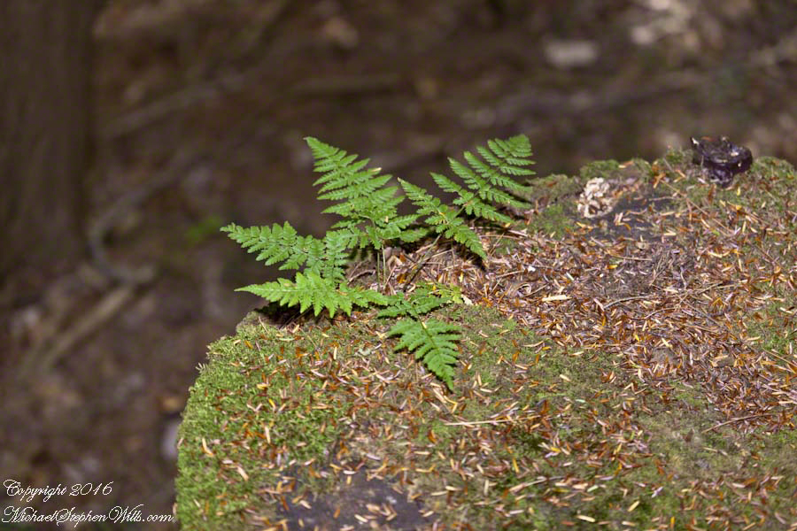
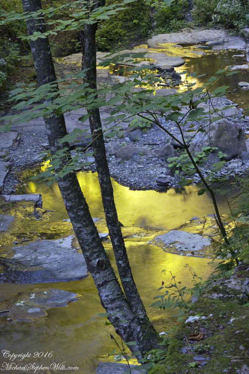
Here are other “shots” from the same day.

Here is another posting about the Finger Lakes of New York State.

Copyright 2021 Michael Stephen Wills All Rights Reserved

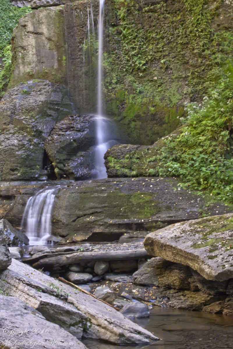
Spillway Falls with Hemlock

hemlock grace and water

The Dry Creek dam is across the upper, eastern, end of Fillmore Glen. Historical records of the dam construction must exist someplace. My opinion is, somewhere in the federal bureaucracy there is a record proving this dam was constructed by Roosevelt’s Civilian Conservation Corps in the 1930’s. That is when the gorge trails were dramatically improved and it is logical a dam was necessary to control water flow during times of heavy rainfall and the spring thaw, to allow a full appreciation of the gorge beauty. It is a substantial concrete structure with cast iron controls, two spillways: one never, the second always flowing. This day the reservoir is full, frequented by beavers, stocked trout, herons, blue jays, crows, hermit thrush. The reservoir banks are thick with wildflowers of the season. This afternoon I noticed purple flowering raspberries: a past prime bloom or two, ripe fruit growing in the late afternoon shade on the south side of the dam.

Unlike its name, Dry Creek is perennial, fed by a broad drainage of pastures, cornfields and forests. Year round the spillway runs, feeding into the gorge a constant, reliable supply of water for the many waterfalls for which Fillmore Glen State Park is known. The very first waterfall is on the rocks supporting the north side of the dam, formed where water from the spillway flows over these rocks into a deep, east west gorge overhung on the south side by mature hemlock trees.

I first encountered Fillmore Glen in the 1980’s with my young son, Sean. On Sundays he and I walked as far as he tolerated, about half way to the dam site, where the gorge makes a turn to the south, the trail on an unstable clay bank against a crumbling shale cliff. Rediscovering the park in the early 2000’s, along with my interest in photography, I noticed the waterfall just below the dam many times and admired it for how the water caught late afternoon light over the many grace points created by rock crags like a wedding cake. The angle from the dam path is wrong for capturing this effect. Today was a first for me to leave the safety of the dam path to climb into the gorge, on the south gorge wall, for a shot.

Here is a view of the spillway fall on a mid-August afternoon, 2017. My photography kit for this walk with my wife, Pam, was minimal: a Sony Alpha 700 with a variable lens, the flash and a Manfrotto carbon fiber tripod. For this version of the spillway I climbed into the gorge on the south wall, about 40 feet above the creek. A hemlock tree branch fell across the view, incorporated into the composition. These hemlocks are not a biological relative of the Socratic, poisonous, hemlock. The relationship is a similar aroma when the leaves are crushed. The f stop is cranked to 36, ISO set to 100 so slow exposure time to 1.6 second. Post shot processing via Photoshop.

Click this link or the photograph for my Online gallery of this offering
Spillway Falls and Hemlock Branch -- CLICK ME!!!!

Copyright 2021 Michael Stephen Wills All Rights Reserved

Long Island Sakura (Cherry Blossoms)

Clouds of Blossoms

We have a selection of teas at home for brewing afternoons as a pick-me-up. Some brought back from travels, most from a local supermarket. This Japanese green tea brings to mind my childhood and our trips to Long Island to visit my Mom until she passed away June 2013.

As you can see from this photograph of the tea in a white lotus bowl, there are pieces of pink and white stuff mixed in. These are called by the Japanese “sakura”, cherry blossoms.

Click any photograph for my Getty portfolio.Japanese Sakura Sencha Green Tea – CLICK ME for my Getty Portfolio.

In Japan, since the 8th century, “Hanami” is the centuries-old practice of picnicking under a blooming sakura or ume tree. Here in the United States, the National Cherry Blossom Festival is celebrated commemorating the 1912 gift of Prunus serrulata Japanese cherry trees from Tokyo to the city of Washington.

Traditionally cherry blossoms remind the Japanese of clouds, the blooms come out en mass, the tree changes shape with the breeze.  Viewing sakura brings to mind thoughts of the transience of existence, the fragility and transience of the exquisite blooms leads one to appreciate the moment.  The following photograph of Pam was taken a month before my Mother’s sudden decline and passing in 2013.  We’d travel to Long Island several times a year to visit her, then take in familiar sights.

The tree over Pam is called a Shirofugen (Scientific name: Prunus serrulata, of the Rosaceae family) and is one species planted around National Tidal Basin, Washington D.C. Shirofugen blossoms are described “Flowers double, deep pink at first, fading to pale pink.”


Click any photograph for my Getty portfolio.Pam with a Shirofugen Flowering Cherry in bloom – CLICK ME for my Getty Portfolio.

Growing up, our family visited the Planting Fields, a state park, several times in the spring and summer. As an adult with a growing family in Glen Cove, right around the corner, the Planting Fields were a welcome outing and visited several time times a year. The following photograph, taken that same May 2013 day, was a favorite park scene.

The two flowering cherry trees in the foreground are a type of Japanese sakura called Yoshino, one the most popular flowering cherries in temperate climates worldwide. All Yoshinos are clones from a single grafting and propagated throughout the world. The scientific name outlines the cross breeding of this variety, Prunus X Yeaoensis. Behind the cherries is an Oak tree, new leaves a bright green, and a pink child’s playhouse cottage.

A changing scene of the park is the now frequent visits by wedding parties and photographers, groups of Asian people, the bride and groom posing under the clouds of blossoms. By frequent I mean a steady stream, one after the other, when the blossoms are full.

Click any photograph for my Getty portfolio.Playhouse with Flowering Cherry and Oak trees – CLICK ME for my Getty Portfolio.

In 2007 I spent hours framing and capturing the following photograph on a Saturday, the day before Mother’s Day, during a visit to my Mother, who was widowed December, 1995. I used an inexpensive tripod, a Kodak DCS Pro slr/c camera body with the Canon 50mm f 1.4 USM lens, a UV filter and lots of time. There were no interruptions that day, at 5:30 pm I had the area to myself.

This child’s garden playhouse, framed by an ancient oak, pink Japanese cherry blossoms and gracious lawn was awarded a Photographic Society of American, Pictorial Print Division, Print of the Month award, published in the society magazine for that month.

My online gallery (see link below) “Memories, Dreams, Reflections”, has this print available for sale on high quality photographic stock with optional framing.

This week, I submitted the photograph for my Getty portfolio.  As of today, I have not received their decision.

Click any photograph for my Getty portfolio.Playhouse – CLICK ME for my Getty Portfolio.

Please browse my reasonably priced stock photography.  License a photograph, download and use it for your website or blog.  Click this link to browse all my Getty IStock Photography offerings.

Or click this link to purchase a print of “Playhouse” with optional custom framing from my Fine Art Gallery.

Loughan Bay Ruins, County Antrim

Deserted Cottages above the Irish Sea

We pulled off the side of Torr Road for this fine view on the way to Torr Head to take in this view of the Irish Sea.  The steeply rising distant headland is the Mull of Kintyre. Loughan an Lochan, County Antrim, Northern Ireland.

Michael Wills – CLICK ME for my Getty Portfolio.

We parked on a turnout above the Loughan Cottages, near this farmer’s sheep pen.  He drove up in a huge tractor and conversed with Pam while I was below shooting the cottages. He made a good impression.

Loughan Bay Farmer – CLICK ME for my Getty Portfolio.

Roofless walls of a cottage more substantial than the other deserted ruins above Loughan Bay, with two fireplaces a walled porch with a view. A number of outbuilding foundations lay around. The integrity of the walls, chimneys and gables speaks to the quality of construction. A freighter in the North Channel of the Irish Sea is visible in the distance above the upper ridge. Beyond is the island of Islay, Scotland, about 30 miles distant. Loughan an Lochan, County Antrim, Northern Ireland.

I am happy to report a series of thirteen (13) photographs of these ruins were accepted for publication by Getty.  You can click any of the photographs in this posting for my Getty portfolio.

Loughan Cottages Ruins above Crockan Point – CLICK ME for my Getty Portfolio.

The land slopes steeply to a rocky beach.

Ruin Above Loughan Bay – CLICK ME for my Getty Portfolio.

A thick growth of ferns, grass on the gable was once a home with a view of Scotland’s Mull of Kintyre 13 miles across the North Channel of the Irish Sea.  The Isle of Sanda just visible on the right of the far gable.  A landform named Alisa Crag is just visible in the distance, to the left of the nearest gable. 

Single Room Loughan Bay Cottage – CLICK ME for my Getty Portfolio.

Please browse my reasonably priced stock photography. License a photograph, download and use it for your website or blog. Click this link to browse all my Getty IStock Photography offerings.

Or click this link or any photograph or this link to select a print with custom framing from my “Ireland” Fine Art Gallery.

Interested in learning more about this site?  I have a series of postings on Loughan Bay.  Click for the first posting in this series.

Copyright 2021 Michael Stephen Wills, All Rights Reserved.