This quiet nook is hidden along the Oak Creek Canyon trail, though easy enough to find.
I visited there just at dawn when the air was still and the usually busy site deserted.
Oak Creek Canyon is named for the native, evergreen oak species unique to desert environments. The leaves conserve moisture: small, thick. I remember camping at the Chiricahua National Monument on November. All night the acorns fell onto the metal picnic tables, a loud metallic thunk.
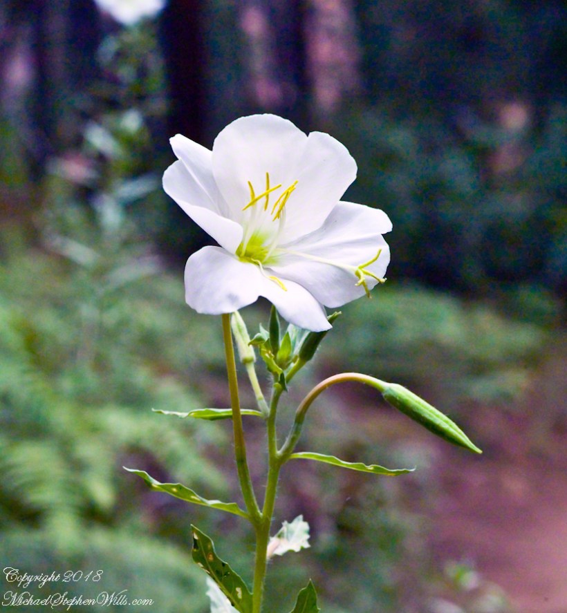
The post header is a primrose flower growing on the bank of Oak Creek.
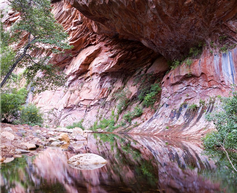
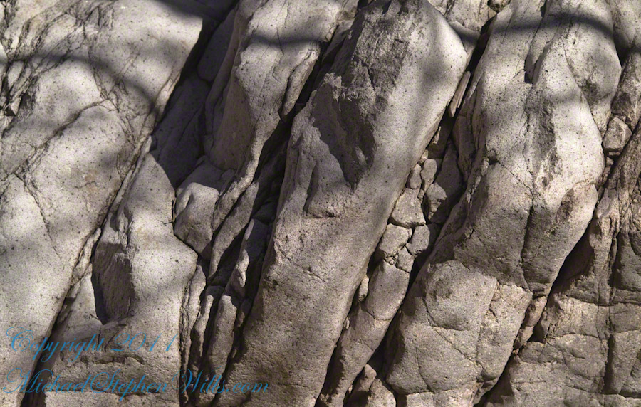
Recognize the rock from “Oak Creek Mandala”? This is farther up the Oak Creek Canyon trail, “photograph by Pam Wills.” I am in my warm weather photography kit of the time having passed the camera to Pam for the shot.
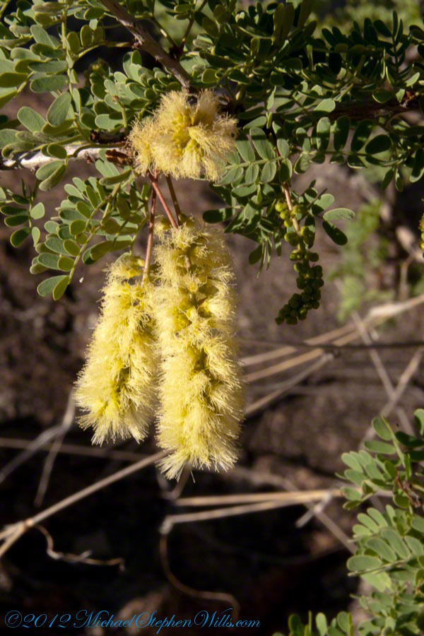
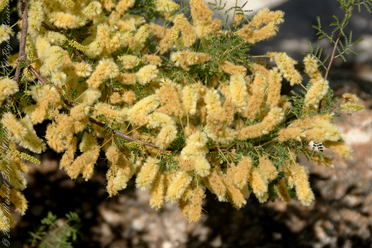
Mesquite is the Sonoran Desert smell carried by distant rain, omnipresent and humble, a survivor with tap root extending 190 feet down to draw on the water table.
Prosopis is the scientific name for about 40 species of leguminous trees. Present in North America since the Pliocene era, mesquite wood has been dated to 1300 BC.
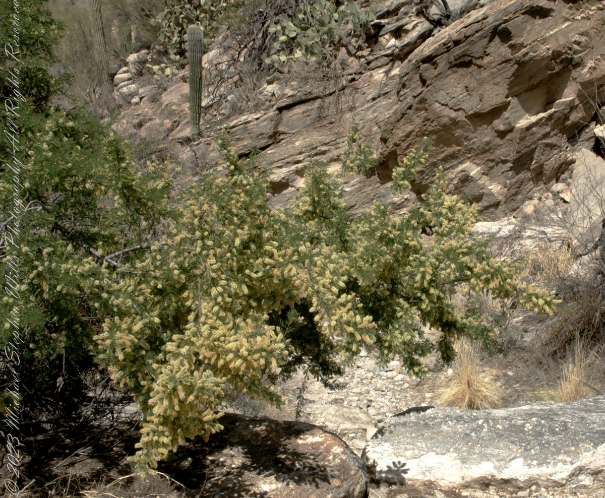
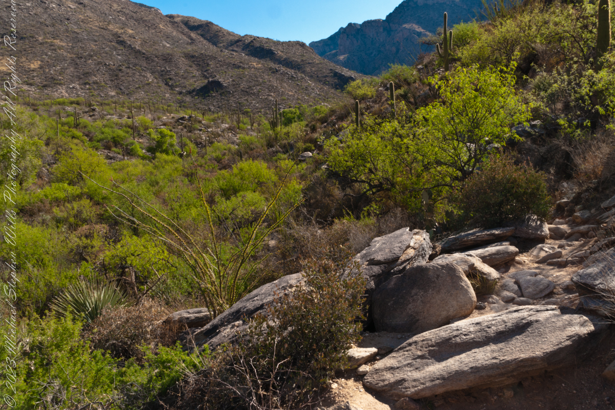
I found this flowering mesquite bush in Finger Rock Canyon of the Catalina Mountains outside Tucson, Arizona.
They are thought to have evolved with megafauna in the New World. The loss of North American megafauna at the end of the Pleistocene era gave way to one theory of how the Prosopis spp. were able to survive.
One theory is that the loss of the megafauna allowed Prosopis spp. to use their fruit pods to attract other organisms to spread their seeds; then, with the introduction of livestock, they were able to spread into grasslands.
The plentiful legumes that develop from these flowers are edible when cooked. The shape and color of the seeds can be understood from this empty seed pod that happens to lie near a tarantula burrow.
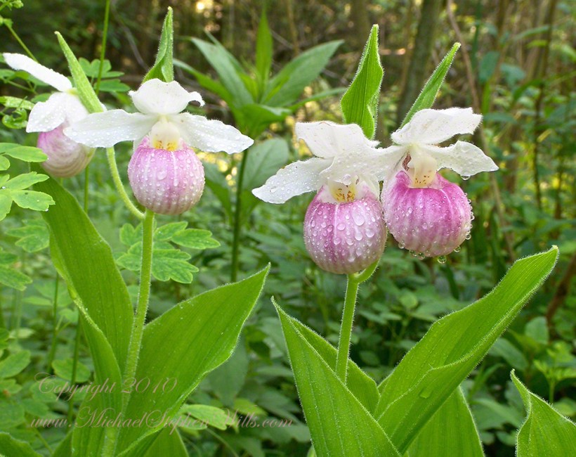
I was lucky enough to live near the site of these wild orchids back in the early 2000’s, close enough to enjoy serial visits, enough to find this perfect moment titled “After the Rain.” In recent visits there were no specimens to be found. The reasons for the disappearance are not clear.
Showy lady’s slipper, scientific name Cypripedium reginae, is also known as pink-and-white lady’s-slipper, and queen’s lady’s-slipper, is a rare lady’s-slipper orchid native to northern North America. Although never common, this plant has vanished from much of its historical range due to habitat loss. It is the state flower of Minnesota.
Cypripedium reginae grows in wetlands such as fens, wooded swamps, and riverbanks. Cypripedium reginae thrives in neutral to basic soils but can be found in slightly acidic conditions. The plants often form in clumps by branching of the underground rhizomes. Its roots are typically within a few inches of the top of the soil. It prefers very loose soil and when growing in fens it will most often be found in mossy hummocks.
It can tolerate full sun but prefers partial shade for some part of the day. When exposed to full sun, the flower lip is somewhat bleached and less deeply colored. It is occasionally eaten by white-tailed deer.
Cypripedium reginae can be found in Canada from Saskatchewan east to Atlantic Canada, and the United States from North Dakota east to the Atlantic and south to Arkansas and Tennessee.
Cypripedium reginae is quite rare. Its increasing rarity is attributable to destruction of a suitable alkaline habitat; it is sensitive to hydrologic disturbances, and is threatened by wetland draining, water contamination, habitat destruction and horticultural collectors. Browsing by an exploding deer population stunts or eliminates the plant’s growth.
Cypripedium reginae contains an irritant, cypripedin, a phenanthrenequinone. The plant is known to cause dermatitis on the hands and face. The first report of the allergy reaction was in 1875 by H. H. Babcock in the United States, 35 years before the term “allergy” was coined. The allergen was later isolated in West Germany by Bjorn M. Hausen and associates.
Reference: “Cypripedium reginae” wikipedia
Images and captions Copyright 2023 Michael Stephen Wills All Rights Reserved
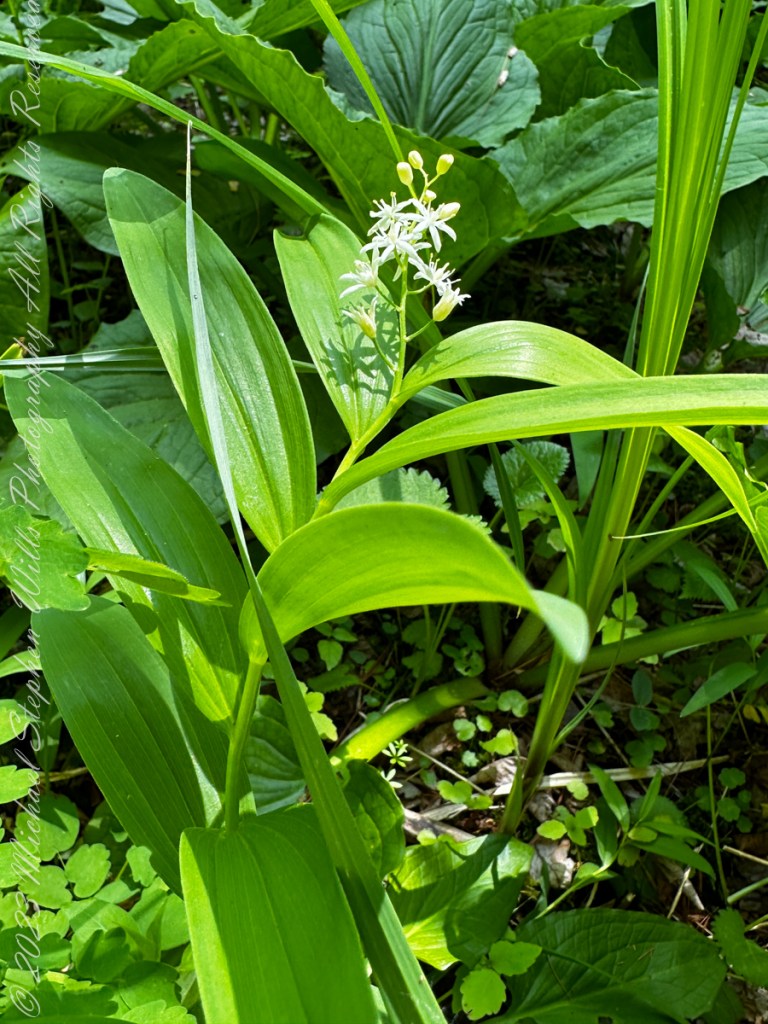
False Solomon’s Seal, scientific name Maianthemum racemosum, is common in the Finger Lakes Region. I found this specimen during a walk with the grandchildren in a local fen among the post-glacial terrain of the Finger Lakes Region.
False Solomon’s Seal is a common, widespread plant with numerous common names and synonyms, known from every US state except Hawaii, and from every Canadian province and territory (except Nunavut and the Yukon), as well as from Mexico. What name do YOU know it by?
Because it resembles plants of the highly toxic Veratrum genus, this species should not be consumed unless identification is positive. The plant becomes fibrous and bitter after it completes flowering and seed-setting, but the tender young shoots can be stripped of their leaves, simmered in water and eaten. Their delicate flavor is somewhat reminiscent of asparagus. The ripe fruits are edible raw or cooked but may be poor in taste. They can be laxative if consumed in large quantities.
Ojibwa harvested the roots of this plant and cooked them in lye water overnight to remove the bitterness and neutralize their strong laxative qualities. Native Americans boiled the roots to make tea for medicinal purposes, including to treat rheumatism, kidney issues, and wounds and back injuries.
Reference: “Maianthemum racemosum” wikipedia
Images and captions Copyright 2023 Michael Stephen Wills All Rights Reserved
Yellow Lady’s Slipper, scientific name Cypripedium parviflorum, is also known as “Moccasin Flower.” I found these on a walk with the grandchildren in a local fen among post-glacial terrain. “All this swamp cabbage, phew!!,” said the youngest.
This is a wild orchid that grows all over, though picky as to habitat.
–Newfoundland to British-Columbia, south to Georgia, Arizona, and Washington; Europe. –Newfoundland to Alaska and south to Oregon in the West. –In the East along the Atlantic Coast, it is in every state except Florida and extends across to Louisiana and eastern Texas. –New Mexico state: Catron, Colfax, Grant, Los Alamos, Otero, San Miguel, San Juan and Santa Fe Counties. –Arizona state: Apache, Graham, and Greenlee Counties.
Habitats and requirements: A more upland plant preferring subacidic to neutral soils. Primarily in mesic to dry-mesic upland forests, woodlands with deep humus or layers of leaf litter, shaded boggy habitats, but also in hill prairies and occasionally in wetlands with organic, well-drained, sandy soils. Moderate shade to nearly full sun in fir, pine, and aspen forest between 6000 and 9500 feet (1830 and 2900 meters). Mountain meadows and on timbered slopes. Dripping seeps on steep to moderately sloped canyon walls.
Reference: “Cypripedium parviflorum” wikipedia
Images and captions Copyright 2023 Michael Stephen Wills All Rights Reserved
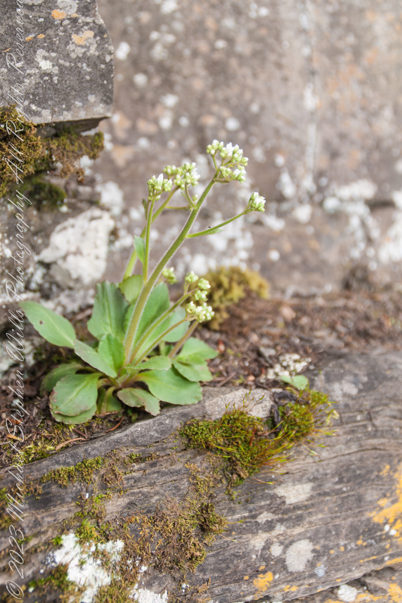
Unidentified wildflower growing on limestone ledge with mosses on aporil afternoon. Fillmore Glen New York State Park, Moravia, Cayuga County, New York
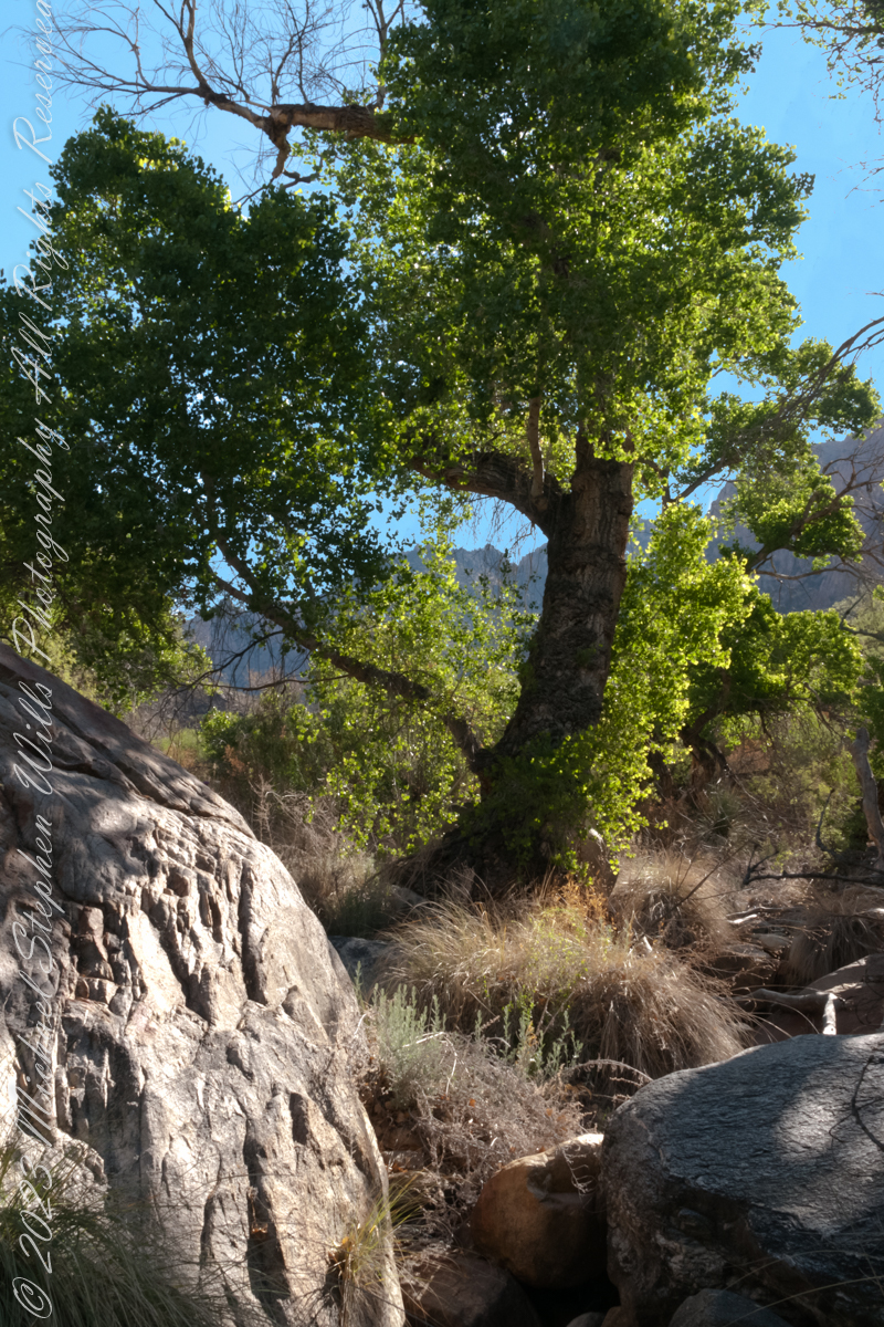
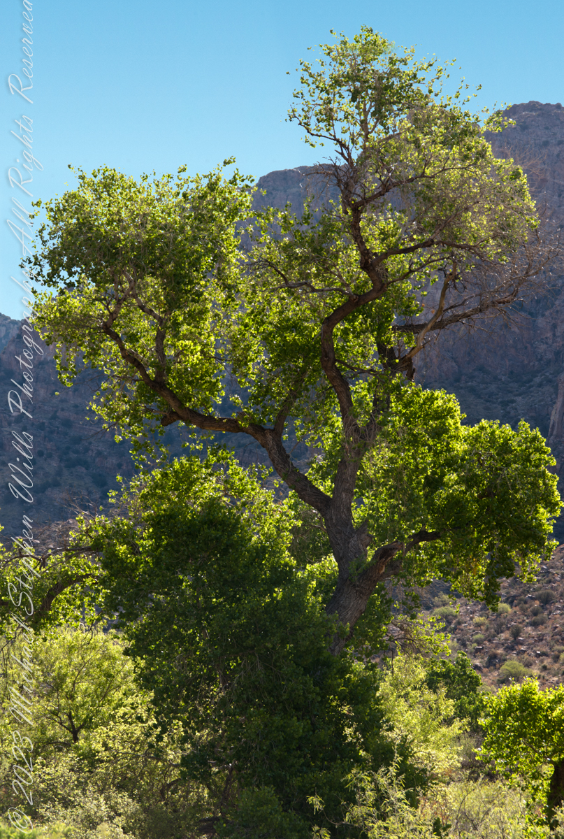
A large Fremont’s Cottonwood Offers shade and protection along the Pima Canyon Trail.
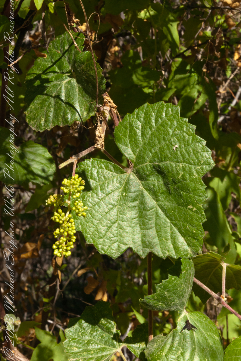
In the shade, a grapevine, offers a vain promise of grapes.
The cottonwood’s deep roots draw water from a mountain stream.
Native Americans in the Western United States and Mexico used parts of Frémont’s cottonwood variously for a medicine, in basket weaving, for tool making, and for musical instruments. The inner bark of Frémont’s cottonwood contains vitamin C and was chewed as an antiscorbutic – treatment for vitamin C deficiency. The bark and leaves could be used to make poultices to reduce inflammation or to treat wounds.
The Pima people of southern Arizona and northern Mexico lived along Sonoran Desert watercourses and used twigs from the tree in the fine and intricate baskets they wove. The Cahuilla people of southern California used the tree’s wood for tool making, the Pueblo peoples for drums, and the Lower Colorado River Quechan people in ritual cremations. The Hopi of Northeastern Arizona carve the root of the cottonwood to create kachina dolls.
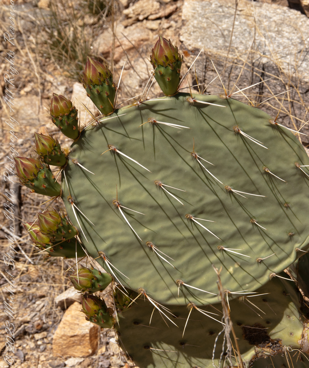
Here are 8 flower bud growing from one cladode (pad). There is a 9th bud on a second cladode. What is interesting about these pads are the needle shadows. Although thin, each provides some protection from the sun.
Cactus Closeup
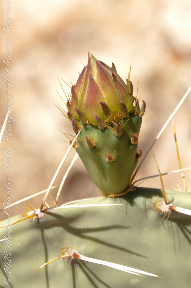
This delicate bud will develop into a flower and, then, into a cactus fruit (in spanish, tuna). The fruit retains those tiny spines, called glochids, which detach on the smallest contact. The pads are also covered with them.
Prickly pears are known for growing into thickets. The Cuban government created a “cactus curtain” of prickly pears around the Guantanamo naval base in the 1960’s, to prevent Cubans from escaping to refuge in the United States.
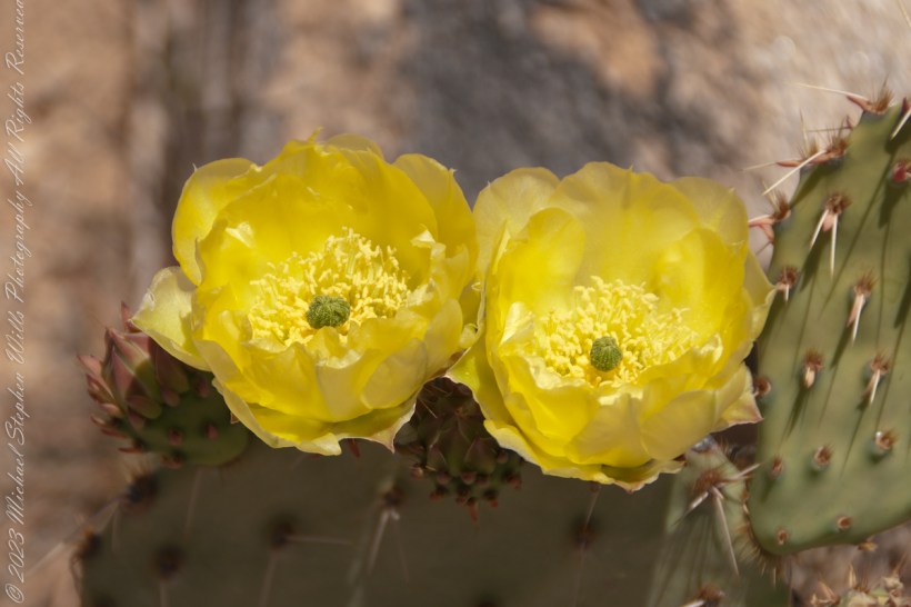
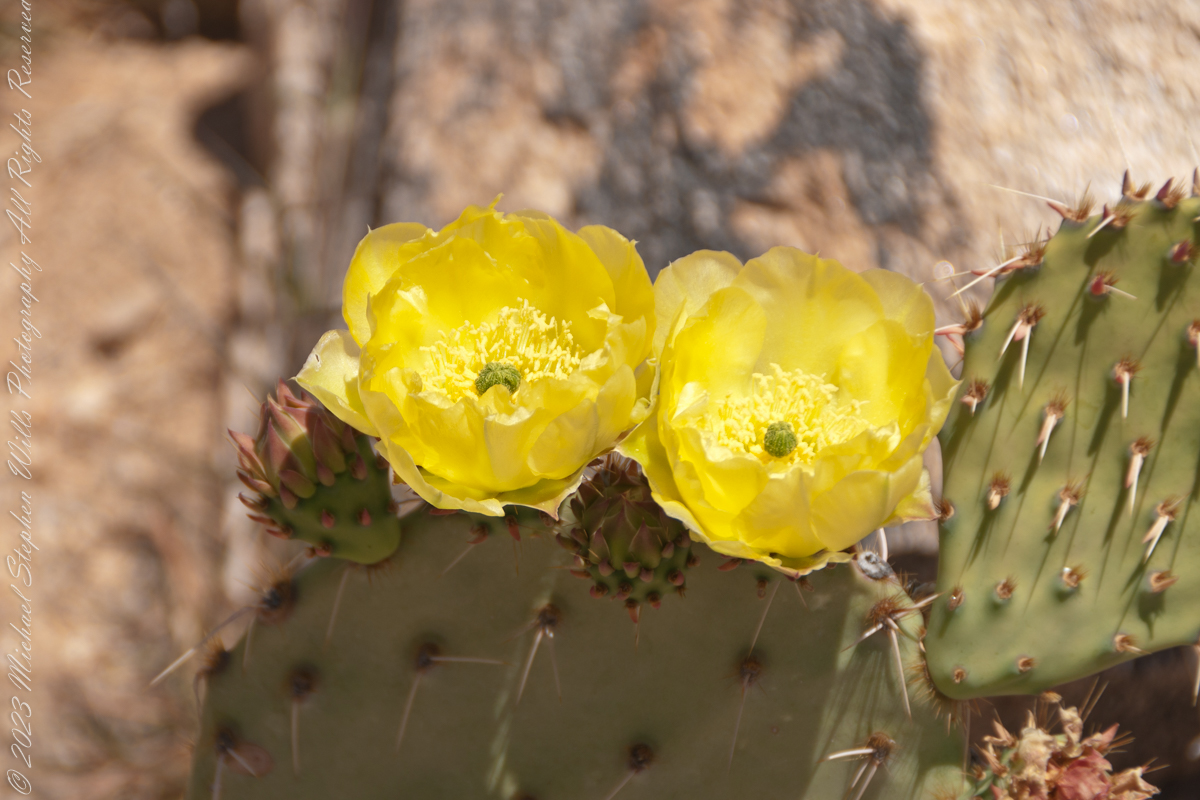
Cactus Flowers
Look closely at the anthers of these flowers. Each curls over when touched, depositing its pollen. The habit of prickly pears to grow together in thickets mean there are clusters of blossoms in springtime.
The canyon below 110 foot Reavis Falls is a wild place of transcendent beauty.
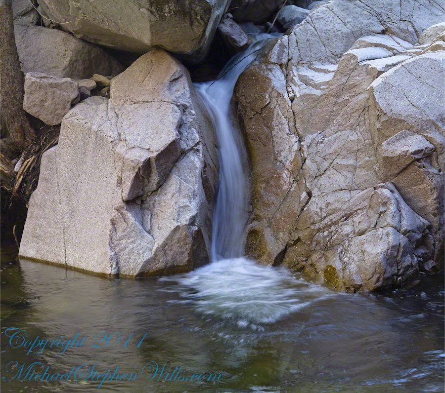
With the afternoon in front of me, the trip back to camp was a slow pleasure. On the way in, I noted several stopping points to capture photographs. Here a natural rock sluice offers a foot tall waterfall, mirroring Reavis Falls, bracketed by white igneous stone.
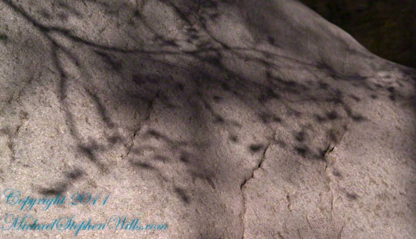
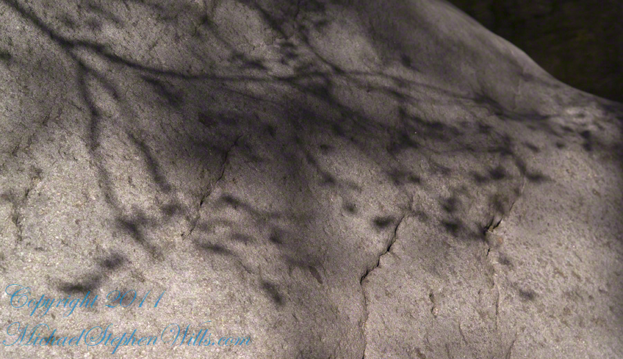
This same stone offers a screen, the bright spring sun throwing the sparse leaves into sharp relief.