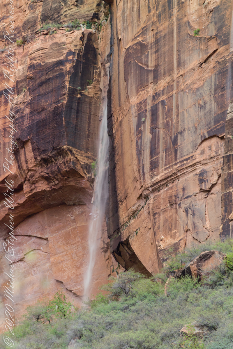
Rainwater from distant thunderstorms on the vast Colorado Plateau emerge from a cliff wall, Zion Canyon. The fall will last for a few hours, we bore lucky witness as do my images shared below.
1/15 sec at f/8.0 ISO 160
Captured with a Kodak DCS Pro SLE/c dslr and a Canon lens EF 200 mm 1:2.8 L II stabilized with the Manfrotto Studio Tripod model 475 and the 468 Hydrostatic ball head. I prefer the details of misting water at the widest lens aperture, focus is clear throughout the plane, excepting some foreground brush.
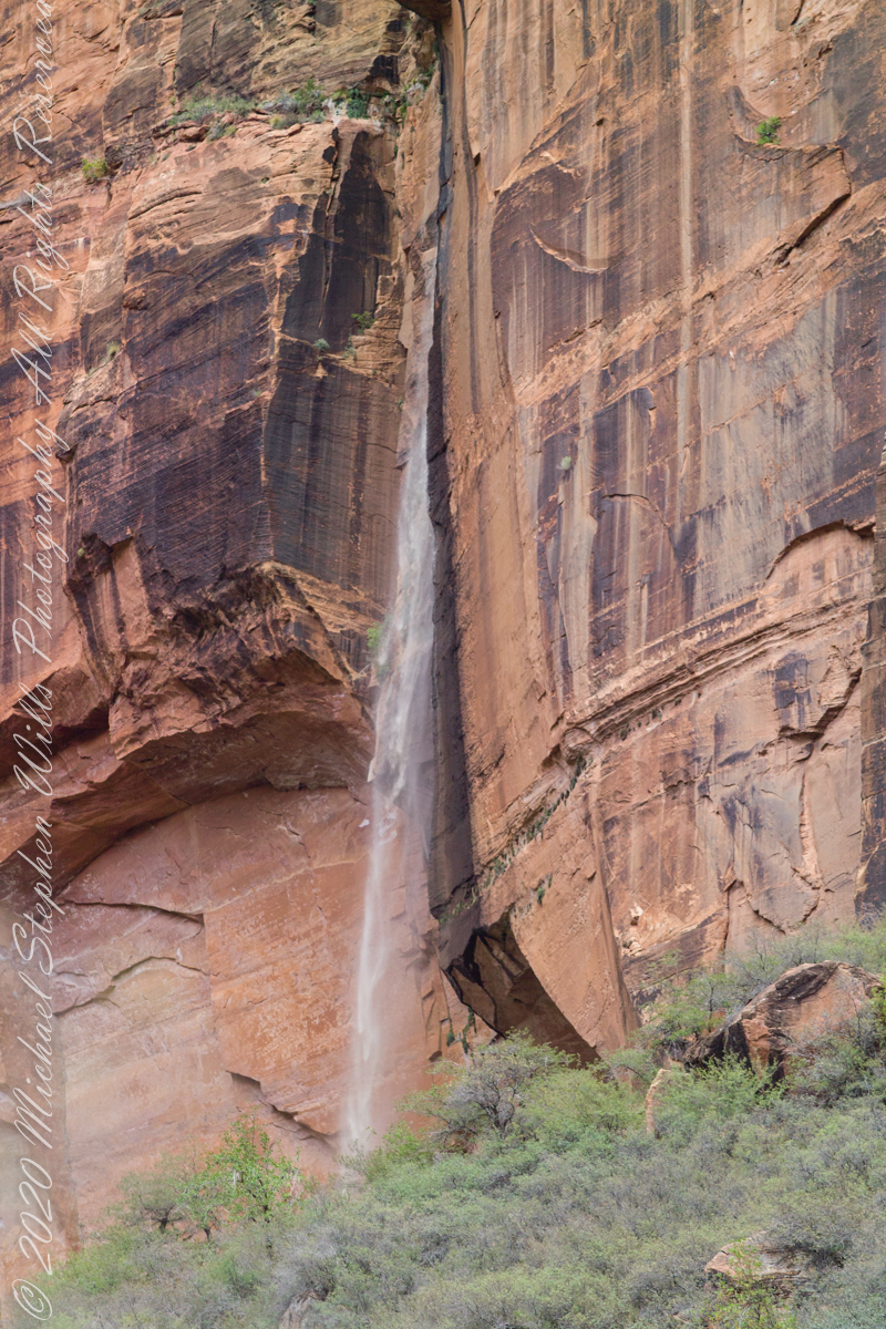
1/125 sec at f/2.8 ISO 160
Copyright 2021 Michael Stephen Wills All Rights Reserved
One weekend my nephew Chris and I backpacked to Peaked Mountain Pond, the Adirondacks wilderness, in the rain. My son, Sean, was to meet us later. The constant rain made the easy trek into a slog. Our attitude improved after the tents setup and the fire. The skies clear to a brilliant display of the Milky Way away from light pollution.
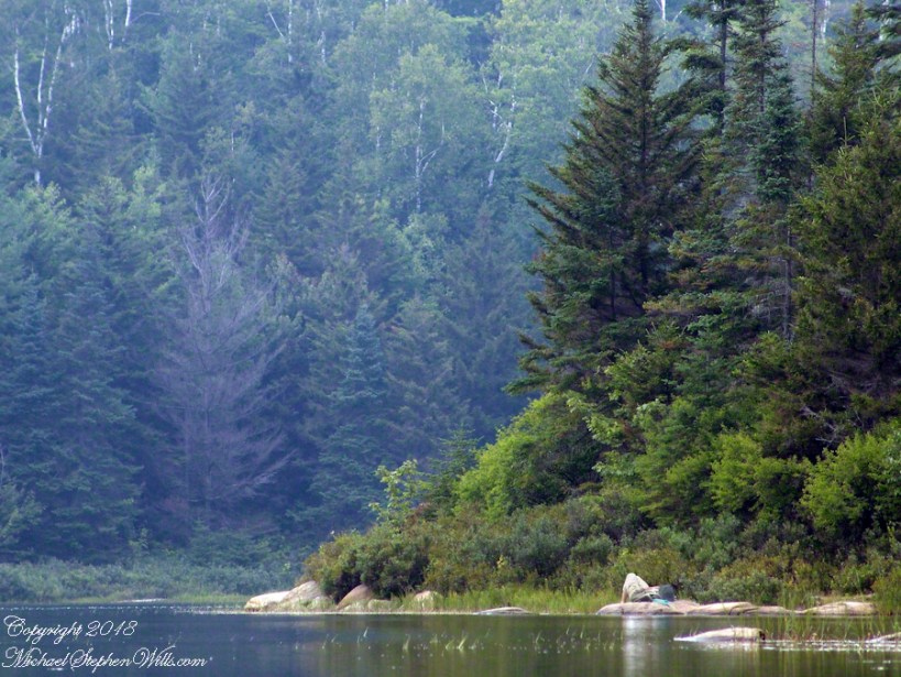
Peaked Mountain in the light of an August dawn taken from the west pond shore. Siamese Ponds Wilderness, Adirondack Park, New York State. At 2,919 feet, Peaked Mountain is a modest height though it rises an impressive 675 feet in 0.4 mile.
Looking north across Peaked Mountain Pond from the west shore shortly after dawn.
Click the photograph to visit my Fine Art Gallery
We used the canoe as a punt, using a solid branch to push around the shallow pond for short distances, after bailing.
Click the photograph to visit my Fine Art Gallery
Mid-morning, we headed up the trail to the peak. I caught this orb-weaver spider web on the way.
Click the photograph to visit my Fine Art Gallery
…and a detail. Technically, this is a macro. Did not wait around for the owner.
Click the photograph to visit my Fine Art Gallery
Later, in the afternoon, Chris caught some Zzzzz’s in a time out from water gathering. We pumped water through a filter, this is necessary throughout New York State to avoid giardia infection.
Click the photograph to visit my Fine Art Gallery
The ultimate in peace and tranquility, though disturbing a hornet pollinator can lead to excitement. This water lily bloom was caught with a tripod mounted long lens. Look closely for the hornet at work inside the flower. HHealthy water lily leaves are the epitome of tranquility because they are always clean, giving the illusion of tranquility. Scientists study water lily leaves to learn how the leaf surface sheds dirt. Imagine self-cleaning cloths.
Correction: it is the Lotus leaf, not lily pad, that is self cleaning.
Looking for the perfect photo for your web site and blog?
Browse my reasonably priced stock photography. This blog features seven (7) photographs I published today to Getty Istock and my Fine Art gallery.
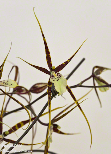
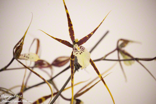
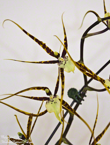
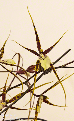
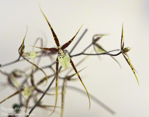
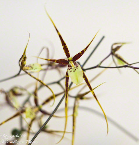
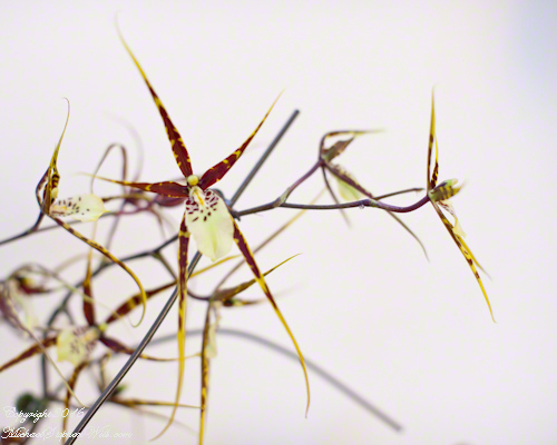
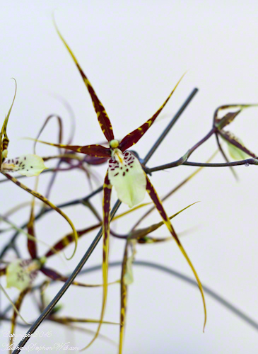
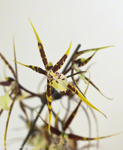
Here in Ithaca we have a greenhouse specializing in orchids. Several years ago if visited and picked up several for my wife, Pam, as a present for our wedding anniversary. Pam’s orchids site in our east facing bay window. This Caladenia, or spider orchid, has bloomed several times under her care. This bloom was especially successful.
These flowers are an achievement. Caladenia are difficult to maintain and cultivate outside of their native environment. Most are endemic to Australia and New Zealand.
Copyright 2020 All Rights Reserved Michael Stephen Wills
See my May Woody Peony postings for background on this peony variety.
These photographs were taken with a Canon EOS 5D Mark IV dslr and the Canon EF 100mm f/2.8 Macro USM lens stabilized with the Manfrotto BeFree Carbon Fiber tripod with ball head.
The morning breezes of May caused me to “up” ISO to 1600 for a faster shutter speed at higher f-stop.
ISO 1600 f32 1/6 sec
Taking full advantage of the macro lens, the higher ISO helped to maintain sharper focus on the highlighted feature, in this case the stamens.
ISO 1600 f5.6 1/400 sec
A gallery of macros with various settings and aspects of the bloom.
ISO 1600 f32 1/6 sec
ISO 100 f32. 1/6 sec
ISO 1600 f5.6 1/320 sec
ISO 1600 f5.6 1/400 sec
Copyright 2021 All Rights Reserved Michael Stephen Wills
Kinsale, a historic seaport in County Cork, showcases unique architecture and geography, with its streets and houses built on steep inclines near the river Bandon.
The first of a series of idiosyncratic posts from a 2014 walking tour of Kinsale.
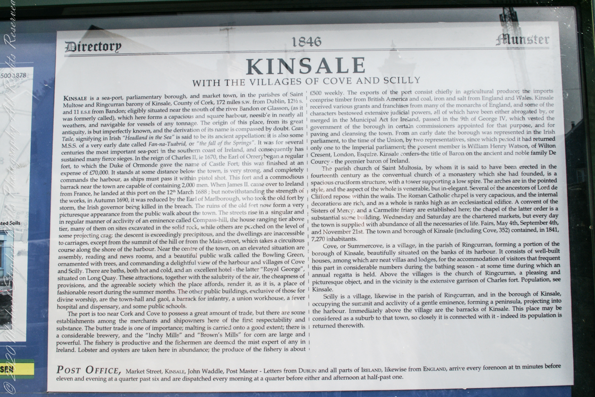
Text from an poster behind glass accessible to all and sundry. Directory 1846 Munster, Kinsale with the villages of Cove and Scilly. Kinsale is a seaport, parliamentary borough and market town in the parishes of Saint Multose and Ringcurran barony of Kinsale, County of Cork, 172 miles s.w. from Dublin, 121/2 s and 11 e.s.e. from Bandon; eligibly situated near the mouth of the river Bandon or Glasson, (as it was formerly called), which here forms a capacious and square harbor, accessible in nearly all weathers, and navigable for vessels of any tonnage. the origin of this place, from its great antiquity, is but imperfectly known, and the derivation of its name is compassed by doubt. Cean Taile (Cionn tSáile), signifying in Irish “Headland in the Sea” is said to be its ancient appellation. (see more in the photograph).
An informative poster behind glass accessible to all and sundry. Text: Directory 1846 Munster, Kinsale with the villiages of Cove and Scilly. Kindale is a sea-0ort, parlimentary borough and market town i the parishes of Saint Multose and Ringcurran barony of Kinsale, County of Cork, 172 miles s.w. from Dublin, 121/2 s and 11 e.s.e. from Bandon; elibibly situated near the mouth of the river Bandon or Glasson, (as it was formerly called), which here forms a capacious and square harbour, accessible in nearly all weathers, and navigable for vessels of any tonnage. the originn of this place, from its great antiquity, is but imperfectly known, and the derivaltion of its name is compassed by doubt. Cean Taile, signifying in Irish “Headland in the Sea” is said to be its anceient appellation. (see more in the photograph)./
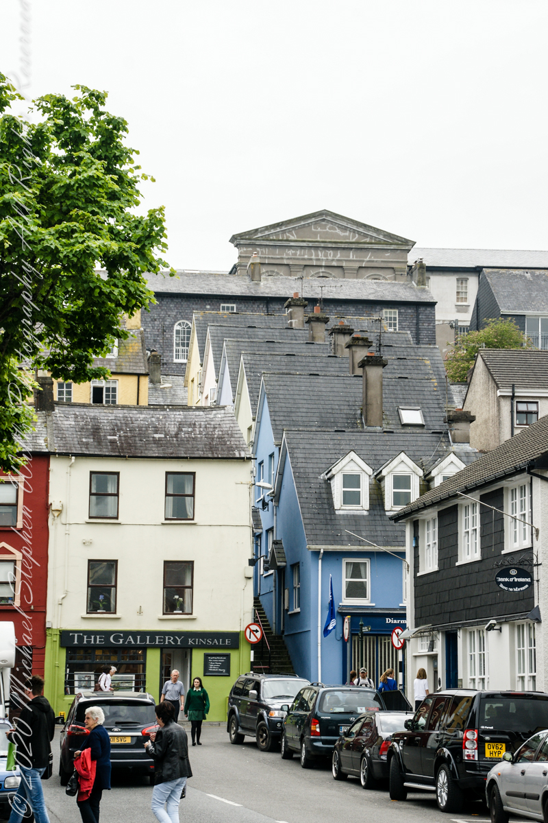
Here we are on Emmet Place. There is a row of houses built along a steep alley named “The Stoney Steps.” At top is the aptly named Higher O’Connell Street.
The Gallery Kinsale
13 Main Street
Kinsale
West Cork
Ireland. From an informative poster…The streets rise in a singular and in regular manner of acclivity of an eminence called Compass Hill, the house ranging tier above tier, many of them on sites excavated in the solid rock, while other are perched on the level of some projecting crag: the descent is exceedingly precipitous, and the dwelling are inaccessible to carriages, except from the summit of the hill or from Main street, which takes a circuitous course along the shore of the harbor.
From the informative poster…The streets rise in a singular and in regular manner of acclivity of an eminence called Compass Hill, the house ranging tier above tier, many of them on sites excavated in the solid rock, while other are perched on the level of some projecting crag: the descent is exceedingly precipitous, and the dwelling are inaccessible to carriages, except from the summit of the hill or from Main street, which takes a circuitous course along the shore of the harbor.
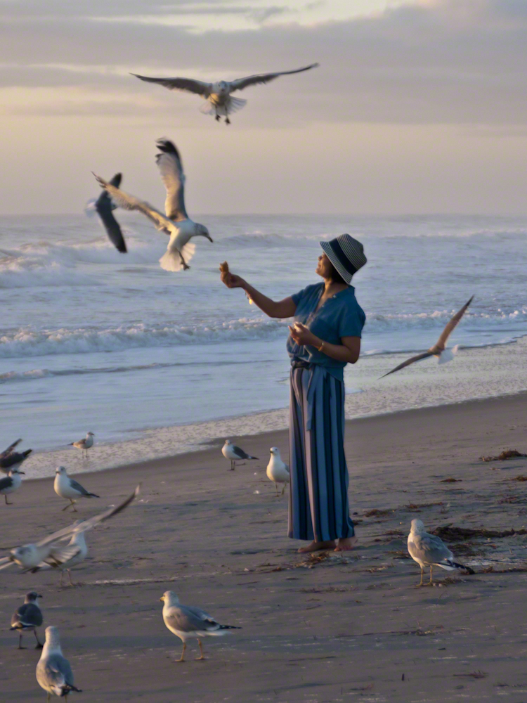
Gulls, an omnipresent element of any beach stroll. Pestiferous, abounding and incessant the gull is simple to deal with. Keep any and all foodstuffs under wraps.
Conversely, for those who adore a crowd of raucous opportunists simply pull out the food and offer it to the air. There is more about this photograph at this post, “Lady Feeding Gulls, Cocoa Beach Dawn.”
Click any photograph for a larger view.
Beach Walking
Pam and I developed a habit of hanging out in Florida during Finger Lakes Winters when the gorges are closed for safety and even walking the streets is perilous, stray black ice encounters abound. We trade icy falls for beach walks.
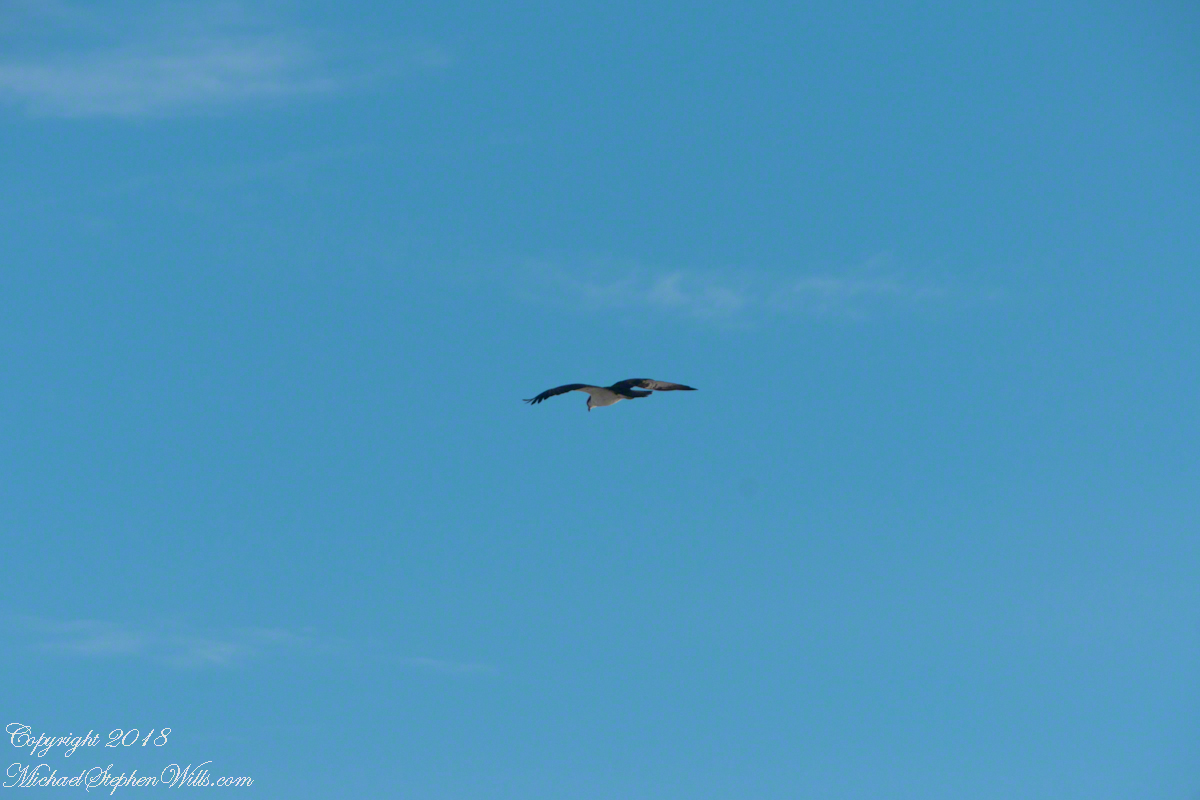
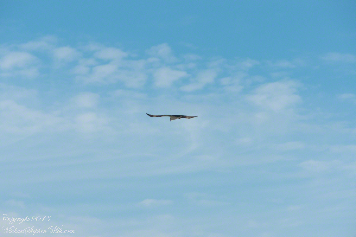
It is natural to become inured to the flight of gulls along the shore. For all my carting along the Sony Alpha 700 with a variable lens ( 18 – 200 mm) there is not a single photograph of a gull in flight. Yet, I have my eye on them until my blindness was lifted by a peculiar individual. It seemed to be a white gull, yet it had a watchful eye.
Gliding shoreline parallel with head down, how could I have mistaken it for a gull?
Osprey occupy an environmental niche along 700,000+ shoreline miles worldwide as a single species Pandion haliaetus. A unique bird with its own family, Pandionidae, and genus, Pandion, some experts recognize sub-species in geographic regions. Ours is the Western Osprey.
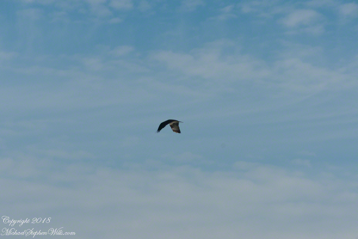
The following photograph is of a wing shape very different from the gull.
Osprey Stalking Behavior
IPhone 8 always in my pocket, I captured this clip of an Osprey stalking fish in the Atlantic Ocean surf. You will have a better viewing experience by clicking on the title of the embedded YouTube, then click on the Full Screen icon at the lower right.
Enter your email to receive notification of future postings. I will not sell or share your email address.
Copyright 2025 All Rights Reserved Michael Stephen Wills
“It is difficult / to get the news from poems / yet men die miserably every day / for lack / of what is found there.” Asphodel that Greeny Flower WC Williams
Here is a Sunny Sunday reader assignment. Which handling of this woody peony blossom do you prefer? Please leave your preferences in the comments section with details of your reasoning. Thank you!!
These photographs were taken with a Canon EOS 5D Mark IV dslr, new for me as of 2020, and the Canon EF 50 mm f/1.2L USM lens stabilized with the Manfrotto BeFree Carbon Fiber tripod with ball head. This setup allowed me to fiddle with camera settings, here you see a variation in the width of the shutter diaphragm opening, or F-stop. The smaller the opening (higher F-stop) less light is let through to the image sensor, longer exposure time (allowing the subject to move, as in the morning breeze) offset by greater depth of field, more of which provides sharp focus as the subject elements are further from the lens.
In this first photograph, the F-stop is moderately high. The entire blossom and plant are in focus, the background moderately blurred though still recognizable.
ISO 200 1/6 sec f/16
For the second photograph F-stop is low, opening up the shutter diaphragm, allowing more light in for a faster shutter release, less time for the morning breeze to rise up and ruin the shot. The beautiful background blurring, bokeh, is a feature of this 50 mm lens. At the same time, at F/4.0 the shutter diaphragm is not wide open. The blossom is entirely in focus, many plant leaves and the other blossom, to left, are out of focus. This places emphasis on the primary subject of the photograph while providing a feel for the surroundings.
ISO 200 1/100 sec F/4.0
Here are the same photographs, click on one to open a gallery for you to flip back and forth to compare.
ISO 200 1/6 sec f/16
ISO 200 1/100 sec F/4.0
Copyright 2021 All Rights Reserved Michael Stephen Wills
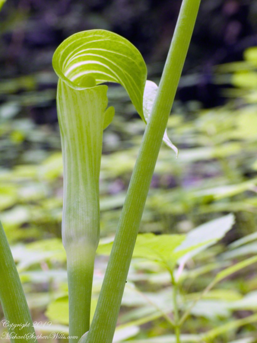
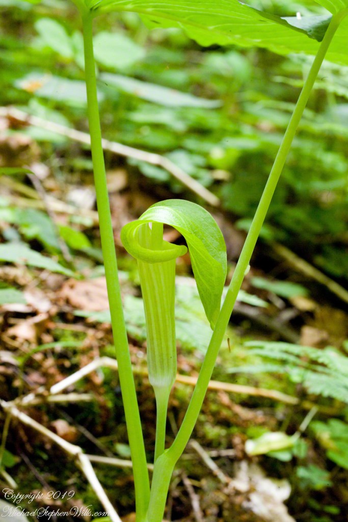
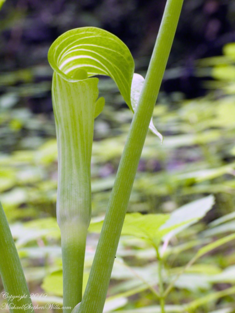
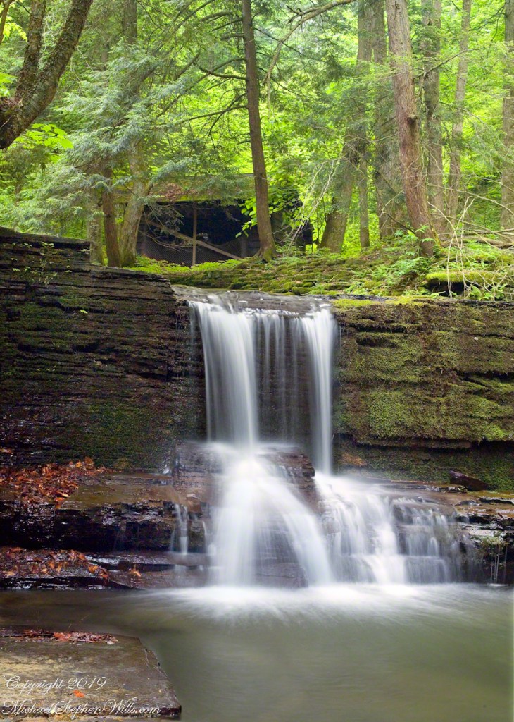
We can roam the woods and gorges this time of year to find these wildflowers camouflaged in their young, green foliage. Here are two images from a June 3rd afternoon in Fillmore Glen with a waterfall. Enjoy!!
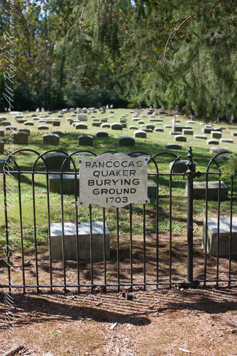
I am happy to share a breakthrough in my family research of our time in Western New Jersey, 225 years for my branch from the 1677 landing of the Kent on Rancocas Creek until my grandfather left for Asbury Park.
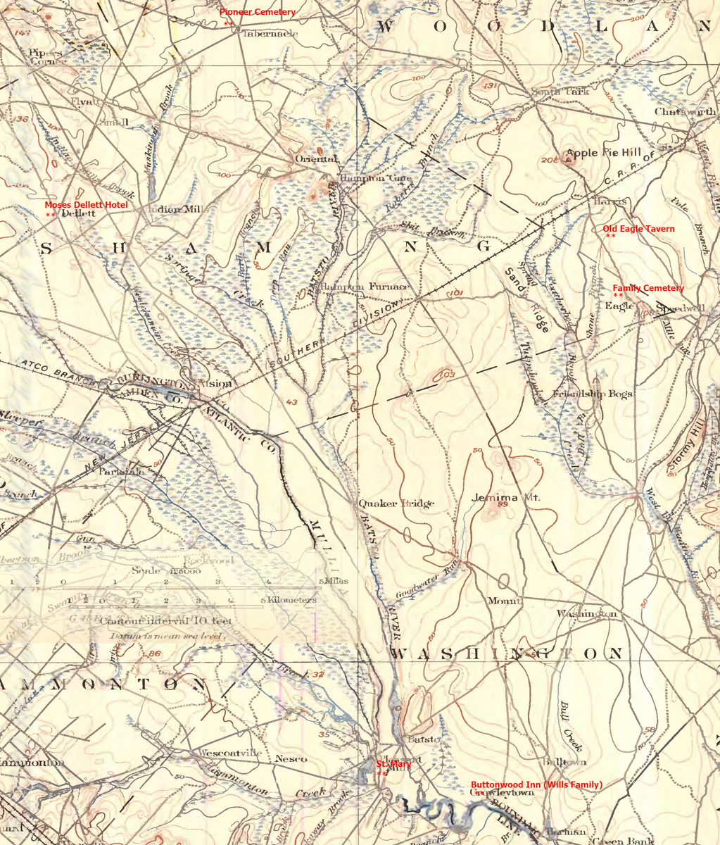
In this rectangle (10 miles by 15 miles) taken from the 1900 US Geological Survey, Rancocas Quadrangle, New Jersey topographic map is shown, upper right hand corner, Apple Pie Hill the starting point of this history where the author John McFee climbed the fire watchtower there, a view encompassing endless acres of pines. I learned an ancestor, third great-grandfather James McCambridge and his wife Mary owned the Old Eagle Tavern less than two miles south of there. The site is marked in red.
The Eagle Tavern existed for 28 years under various owners and names when James and Mary took over in 1926 serving a clientele, workers and visitors, from the struggling Speedwell Ironworks. Samuel Richards was a brother of Jessie Richards who owned the Batsto Ironworks and who provided the land for St. Mary of the Assumption (see my post Pineland Connections V). St. Mary’s is marked in red, bottom center. Samuel purchased Speedwell December 23, 1833 from Ann Randolph, made improvements and started operations without success before closing for good.
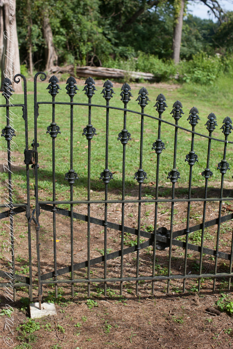
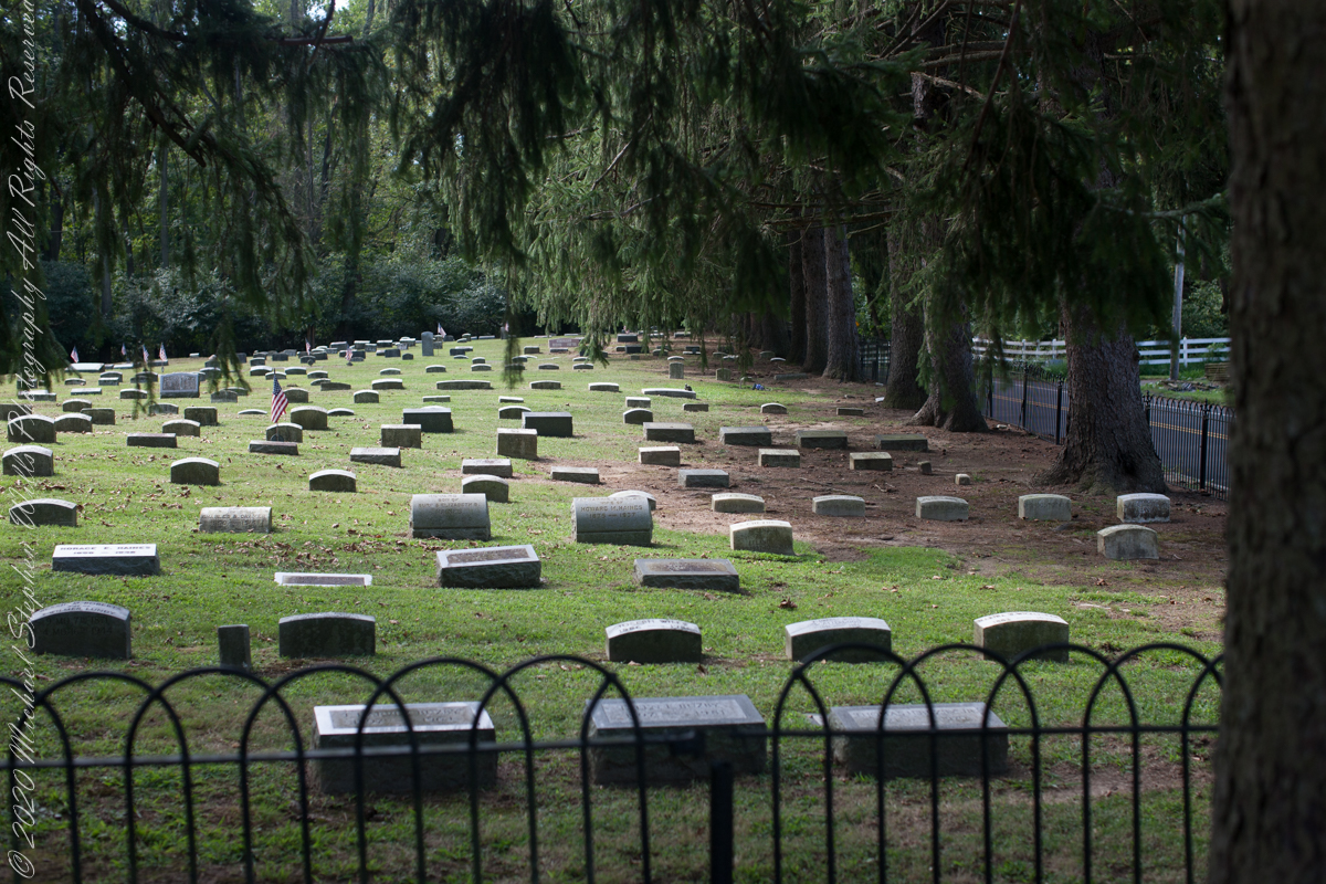
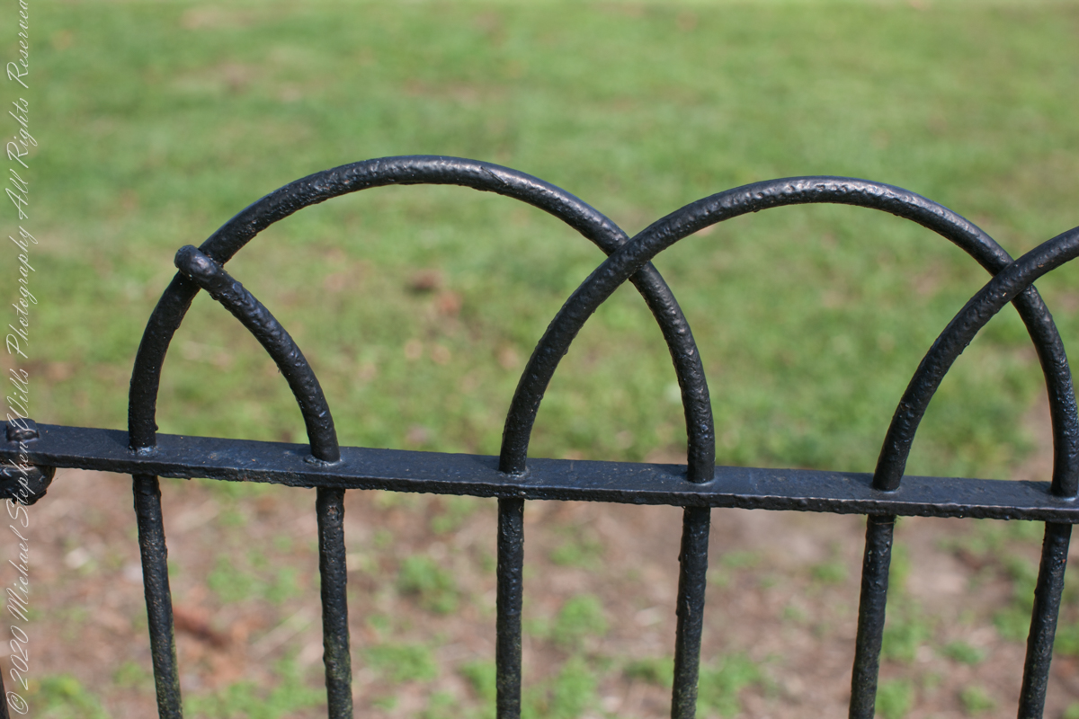
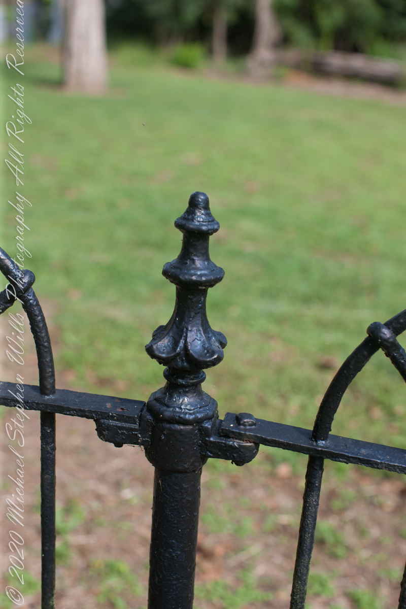
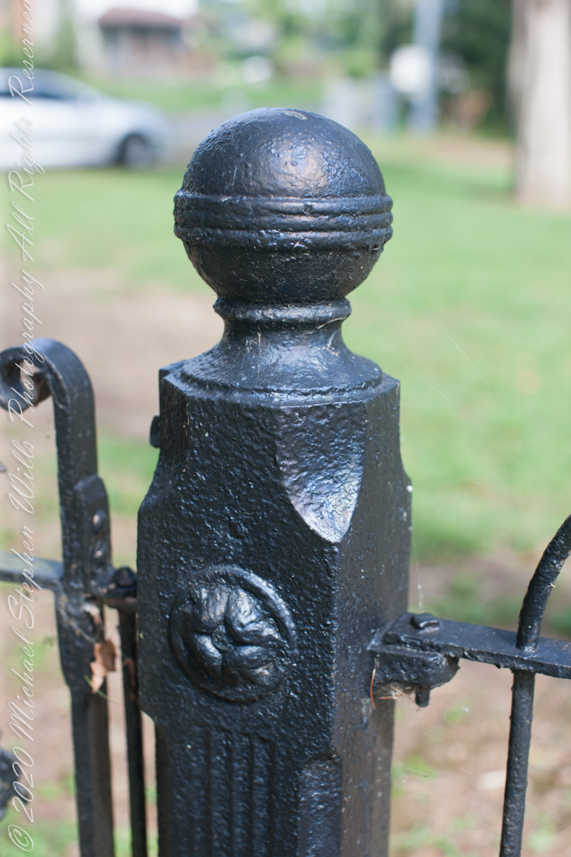
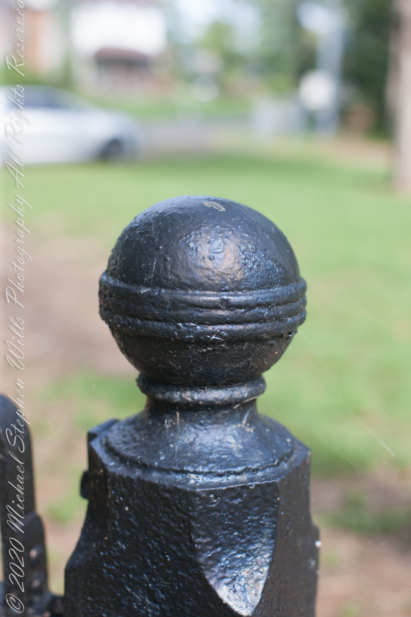
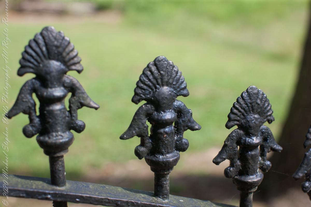
Entrance sign and overviewIron GateFence and burialsfilialIron fence postFilial of Iron Fence PostFilialThe Rancocas Quaker Burial Ground is surrounded by an iron fence, almost certainly of local origins. Here are my photographs of this exceptional ironwork.
On June 30, 1850, James McCambridge purchased Speedwell from the estate, eight years after Samuel’s passing, for $1,750. At this time he had accumulated over 2,000 acres. In this same year his son, James and wife Ann (Milley) (see my post Pineland connections VI) are listed on the US Census. The family lived either in the Eagle Hotel or close by raising nine (9) children: John (20), Mary Ann (16), James (15), Sarah Jane (14), my great grandmother Margaret (11), William (8), George (6), Edward (5) and Catherine (3). The younger James is employment was making charcoal for the ironworks, most likely for Atsion where Ann was employed. By the 1860 US Census Ann had passed away at the age of 50 and James (97) was living with the younger James and family.
Here is a land ownership map from 1876 on which I marked with red asterisks James McCambridge, Apple Pie Hill, and the Delletts, the family of the second greatgrandmother, Mary Dellett. Dellett landownership is also indicated on the rectangle topographic map.
Around the 1850 US census George and Mary Wills lost their two month old son, Charles (See my post Pineland Connections III) who is buried in a family cemetery, land owned by James McCambridge marked in red on the rectangle topographic map. Charles was my greatUncle.
George and Mary Wills, second greatgrandparents
Another breakthrough was identification of the Buttonwood Hill Tavern, Crowleytown as the hotel run by George Wills on the 1850 census. Marked in red on the rectangle topographic map. There was not yet a family union between McCambridge and Wills. That would come with great grandparents George Wills and Margaret McCambridge. The family connection at this time was their shared Roman Catholic faith and Saint Mary of the Assumption church.
I found this information in the book “Heart of the Pines, ghostly voices of the Pine Barrens” by John E. Pearce, Batsto Citizens Committee, 4110 Nesco Road, Hammonton, N.J. 08037-3814.
Copyright 2021 Michael Stephen Wills All Rights Reserved
Hitching the saddled buckskin and lightly packed pinto onto trees on the trail, The Searcher came up to my camp for a visit. I started water for tea and soon we were chatting. Right from the start The Searcher asked for privacy. Devoted to searching the Superstitions for the gold of the “Lost Dutchman Mine”, he assembles his expeditions from a staging point near Phoenix and spends about 60 days a year in the wilderness. Part of his preparation was a desert survival course provided by the Reavis Mountain School, conducted by Peter Bigfoot.
An Invitation from The Searcher
The Search described a place near Pine Creek, he called it “Circlestone,” a large almost perfect circle, of precisely constructed stone wall, on the slopes of Mound Mountain above the headwaters of Pine Creek. My sister, Diane, and I found Circlestone on backpack expeditions March and November 2006.
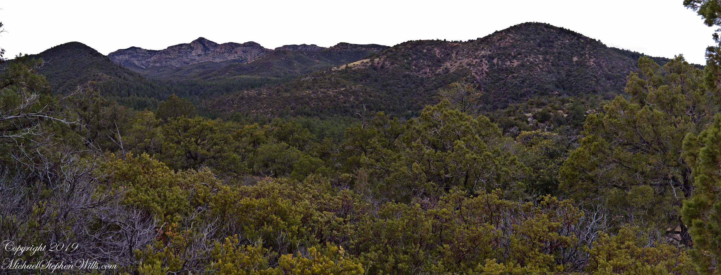
Here is a panorama from March 2006, southwest from the forests of juniper and pinion on the slopes of Mound Mountain.. The southern tip of Reavis Valley is to the right, from there Arizona Trail lead to White Mountain in the distance. It was taken on a later trip, in November of 2006 when my sister, Diane, and I visited Circlestone.
Click any photograph for a larger image.
The Searcher also told of Elisha Marcus Reavis, who settled the Valley west of Pine Creek in 1874. At one point, a band of Apaches planned to kill Reavis, but were respectful of his reputation as a rifle shot. They were waiting him out across from the his dugout, when Reavis stripped naked and with wild hair and a flaming red beard charge their camp, knives in both hands. The Apaches rode off, wary of his insane behavior, and never bothered him again.
We talked about my prospects and plans when The Searcher offered to take me to the Reavis Valley the next day, on horseback. There is a large apple orchard there and, this being April, we’d be treated to masses of apple blossoms. The day after Reavis Ranch, I could pack out with him down the Arizona Trail, past the Reavis Mountain School, over Campaign Creek and drive back to the Lost Dutchman Park. I readily agreed.
To Reavis Ranch on Horseback
The following morning dawn rose from colorless darkness, thin birdsong and brightening high clouds. When the Searcher arrived around 8 am he was leading the pinto, introduced as Colorado, equipped with a western saddle instead of a pack. As an absolute novice trail rider, the Search would hold Colorado’s lead. The reins were wrapped around the saddle horn, leaving me to hang on and “enjoy the view” and swishing tail of the buckskin, named Nugget.
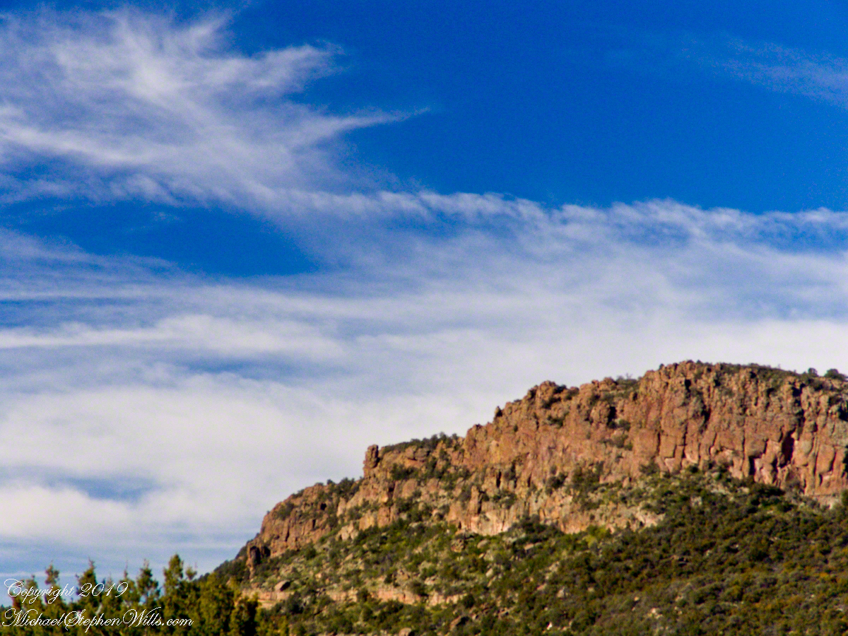
The 2.5 mile trail to Reavis from Pine Creek is typical of the eastern Superstitions, minimally improved, dramatically uneven with large and small boulders to navigate. From Pine Creek there’s a climb of a 631 feet to 5,278 foot elevation, where it meanders beneath a dramatic red cliff with a view of the pinyon/juniper forests on the slopes of Mound Mountain. As he picked our way, The Searcher pointed out the sights. “Circlestone is somewhere over there, a ring of stones overgrown with Alligator Juniper.” I was able to do little more than observe, photography was out of the question.
A cliff along the trail to Reavis Ranch offered cover and the flat perches preferred by cougars. It was not an issue for us in daytime and attacks against horses are very rare. The most either of us ever saw of the cat in all our time in Arizona was the tip of a tail slipping behind brush. This was a lush April after a “wet” winter, so small game was plentiful. Only a sick cat would be hungry. The worst case scenario is for a cougar to meet and become infected from a rabid animal at a water source and we did not linger on this thought.
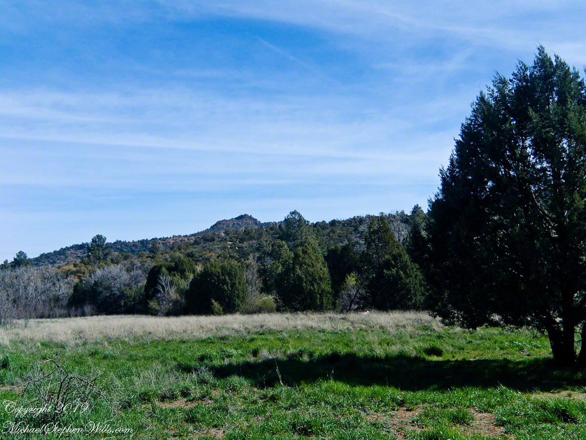
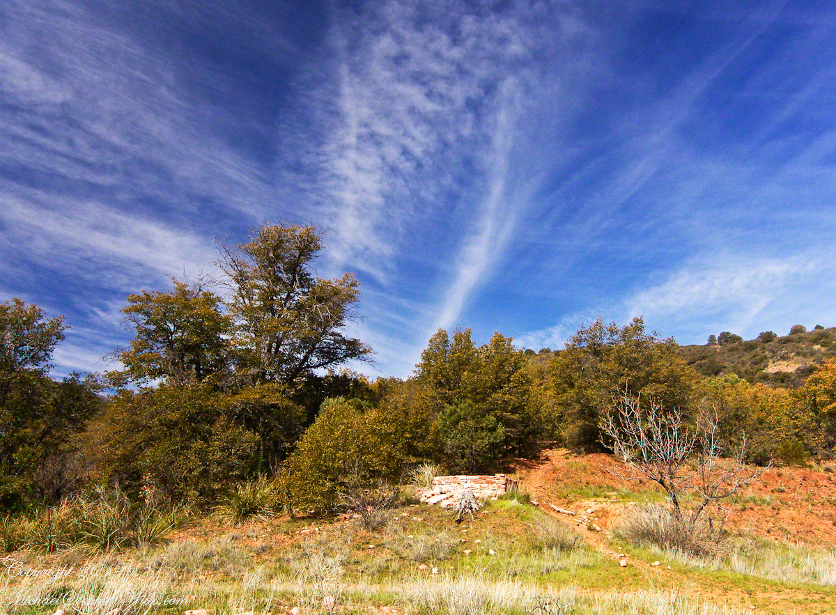
Eventually, the cliff descended with the path, steeply, to Reavis Creek, the valley floor and the intersection with the Reavis Ranch trail. Heading south the Reavis Ranch trail passes the site of a long abandoned ranch. What’s left of the adobe and stone ranch house is on a level valley elevation overlooking what used to be the corral and a large open expanse.
Open field at near the juncture of the trail from Pine Creek with the Reavis Ranch trail.
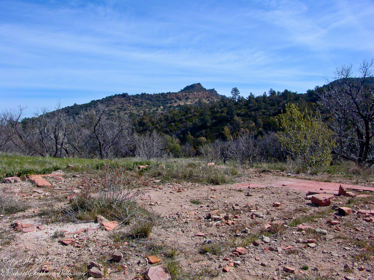
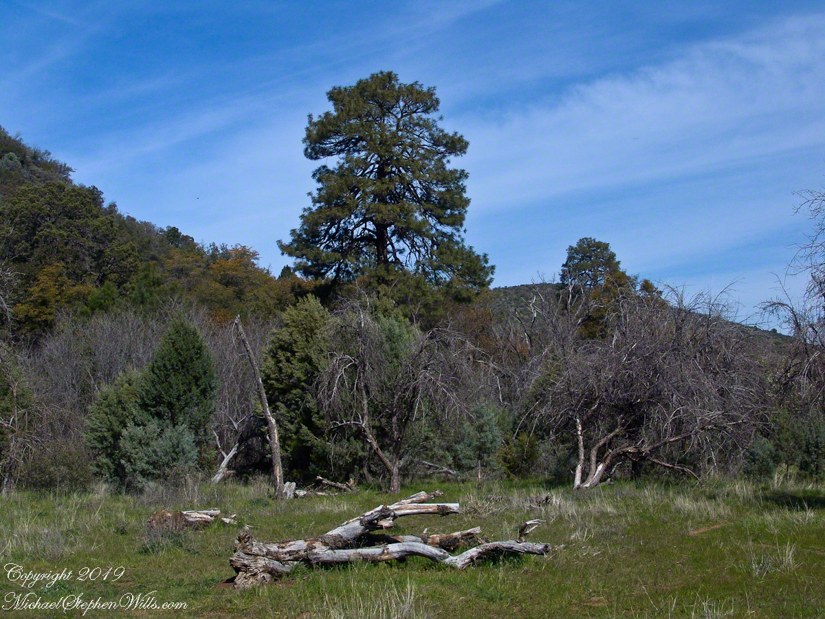
Apple trees in bloom from the former site of the ranch house. There used to be a pond near this spot. With a little imagination, the trail from Pine Creek can be seen on the far ridge.
Reavis Ranch Trail, foreground, traverses the valley length north to south. The Arizona Trail from Pine Creek following below the red rock cliffs in the distance.
The US Forest Service razed the building after it “burned to the ground” around Thanksgiving 1991. I would not call what is left “a foundation,” it is a platform where the house stood. You can see for yourself in this photograph what was once was a homey tile floor. I’ve seen old photographs of the structure with a large pond to the left of this view, a door and simple porch face east and the pond used to hold irrigation water.
Turn around from this ruin and a platform comes into view. Built on the west valley slope, overlooking the ruined house is a hexagonal foundation of adobe bricks. We are looking here across the Reavis Ranch trail. My opinion about this structure rests on an examination of the land to the south, there is excavation of a shallow canal and this was the way water was captured from the upper Reavis Creek or tributary and directed to this catchment basin where it was then directed for storage or irrigation. The spot enjoys clear views of the central valley, an excellent place to enjoy the fall of evening.
The Searcher led me to a place a few hundred yards south, in a narrowing of the valley, where he let Colorado and Nugget roam free. The horses appreciated the level, open spaces and I enjoyed the Ponderosa pines on the west valley slope. We sat on the smooth trunks of fallen trees, 4 feet in diameter, near Reavis Creek.
Colorado took this opportunity to bolt, headed south. We took off after him into and through a thicket of locust trees where The Searcher cornered Colorado to regain control. “He was abused by his previous owner and is difficult at times,” was how The Searcher put it.
We were close to the end of Reavis Valley where Reavis Creek originates from the drainage of White Mountain, to the west.
We headed north here, back to the ranch house site, to the lush new grass of the apple orchard.
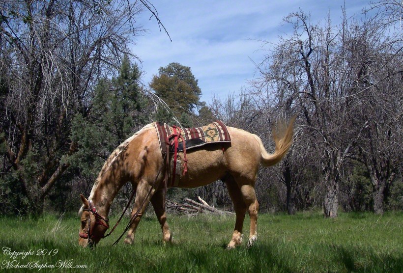
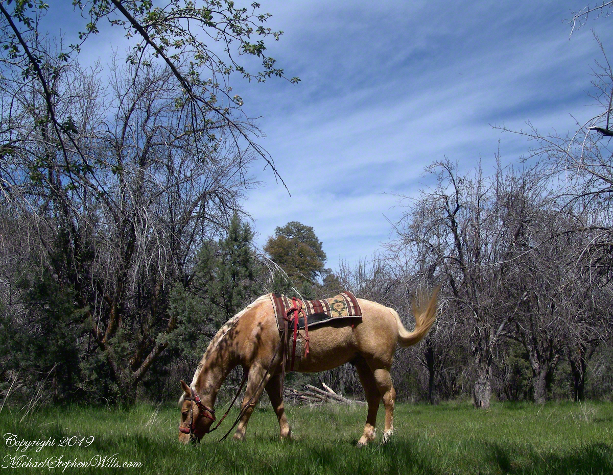
Nugget in Horse Heaven
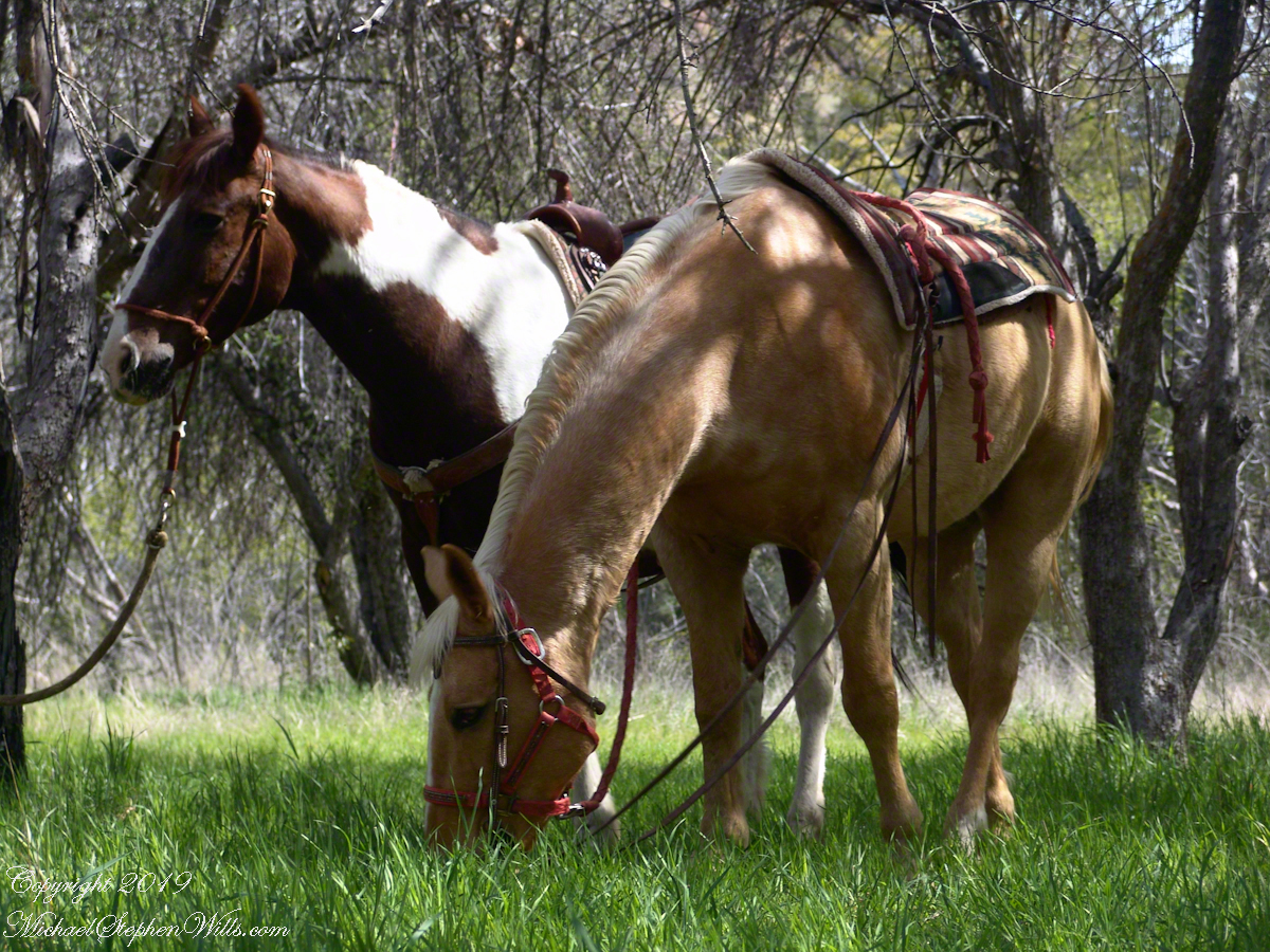
Nugget grazed unfettered. Colorado was tethered with plenty of slack for grazing. This photograph of the pair shows their personalities, Colorado edgy, Nugget content to feast while the grass is available.
Colorado on the alert while Nugget grazes, typical of their personalities.