This yellow woody (also called tree) peony blooms later than our red varieties. The first set of three were photographed May 26, 2021 have unopened buds. Yet, these are early compared to those photographed June 6, 2019 used in the last still life.
These first photographs were taken with a Canon EOS 5D Mark IV dslr, new for me as of 2020, fitted with a 600EX-RT Speedlite (flash) and the Canon EF 70-300 mm (variable) f/4-5.6L USM lens stabilized with the Manfrotto BeFree Carbon Fiber tripod with ball head.
Our Itoh yellow tree peony has flowers on stalks too slender to hold the heavy blooms upright. The flowers open hidden among thick leaves. Here they are a still life of cut blossoms and leaves. The cultivars of Paeonia, the mouton, or hua wang, king of flowers, are ofe of the classic ornamental genera of China. By the 11th and 12th centuries the center off cultivation was in Sichuan, and there yellow-flowered varieties appeared.
Canon EF 70 – 300 mm USM, ISO 400, 146 mm, 0.3 sec at f/6.3
Click the pic for a larger view
Crossbreeding of yellow-flowered P. delavayi with traditional double-flowered P. suffruticosa cultivars by Victor Lemoine in Nancy, France has led to the introduction of the color yellow into the cultivated double-flowered tree-peonies. These hybrids are known as the Paeonia × lemoinei group. In 1948 horticultulturist Toichi Itoh from Tokyo used pollen from ‘Alice Harding’ to fertilize the herbaceous P. lactiflora ‘Katoden’, which resulted in a new category of peonies, the Itoh or intersectional cultivars. These are herbaceous, have leaves like tree peonies, with many large flowers from late spring to early autumn, and good peony wilt resistance. I am guessing our Yellow Wooden Peony is a type of this hybrid because the long stems are more herbaceous than woody, the heavy flowers droop so the best form to capture them is the still life.
Canon EF 70 – 300 mm USM, ISO 400, 70 mm, 1/5 sec at f/5.0
Canon EF 70 – 300 mm USM, ISO 400, 70 mm, 1 sec at f/11
Click the pics to flip back and forth.
Compare the above two exposures to appreciate the effect of the f-stop and excellent bokeh of the Canon “L” lens.
This still life from the 2019 bloom was taken with a Canon EOS-1Ds Mark III dslr and the Canon EF 50 mm f/1.2L USM lens used above. Stabilization provided by a Manfrotto 3036 (studio) tripod with the 468MG hydrostatic ball head. That room is bright from large, east-facing windows. Late afternoon light is soaked up by the black velvet backdrop leaving the lemon yellow leaves to shine.
Canon EF 50mm f/1.2L USM, daylight, 1/8 sec at f/7.1
Click the pic to over a larger view
Copyright 2021 All Rights Reserved Michael Stephen Wills
References
Wikipedia “Paeonia × suffruticosa“
Roger Philips and Martyn Rix, “The Botanical Garden, Vol 1, Trees and Shrubs” p 133
Spring 2021, though cold, is early. As I write this the peony blooms presented here, photographed May 20, 2021 are seeding, the gorgeous purple magenta petals strewn beneath the woody stems. In my last posting, from Memorial Day 2019, the plant is in full bloom the end of May.
These photographs were taken with a Canon EOS 5D Mark IV dslr, new for me as of 2020, and the Canon EF 50 mm f/1.2L USM lens stabilized with the Manfrotto BeFree Carbon Fiber tripod with ball head. Color results from the Canon dslr are impressive, the first time the unique purple magenta is accurately represented here. I found a slight under exposure captured the plum – fine burgundy wine nature of this Japanese cultivar, “Shimadaijin,” planted in the 1970’s or 1980’s.
Here is the last unopened bud of this season, enclosed by a calyx of 5 green sepals with reddish highlights . In the wild, woody (also called tree) peonies favored cliffs and scrub of western and central China, eastern Himalayas (southeastern Tibet).
Lens Canon EF 50mm f/1.2L USM. ISO 200 f5.0
The bud is toward the back, slightly out of focus, of this overview. The woody stems hold the profusion of large flowers each one erect. “Tree” is a misnomer as this plant is a shrub growing mid-thigh high. One of the classic ornamental genera of China, known there as moutan or hua wang “King of Flowers.”
Lens Canon EF 50mm f/1.2L USM. ISO 200 f5.0.
Cultivation in China began in Chekiang in the early 4th century AD. By the early Tang period (circa 700 AD) hundreds of varieties were grown.
Lens Canon EF 50mm f/1.2L USM. ISO 200 f16
Copyright 2021 All Rights Reserved Michael Stephen Wills
References
Wikipedia “Magenta” color
Roger Philips and Martyn Rix, “The Botanical Garden, Vol 1, Trees and Shrubs” p 133
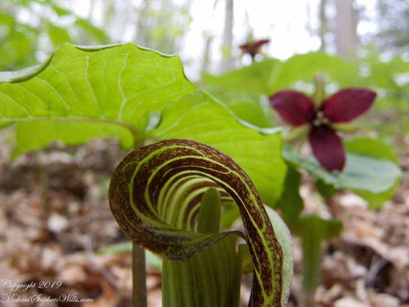
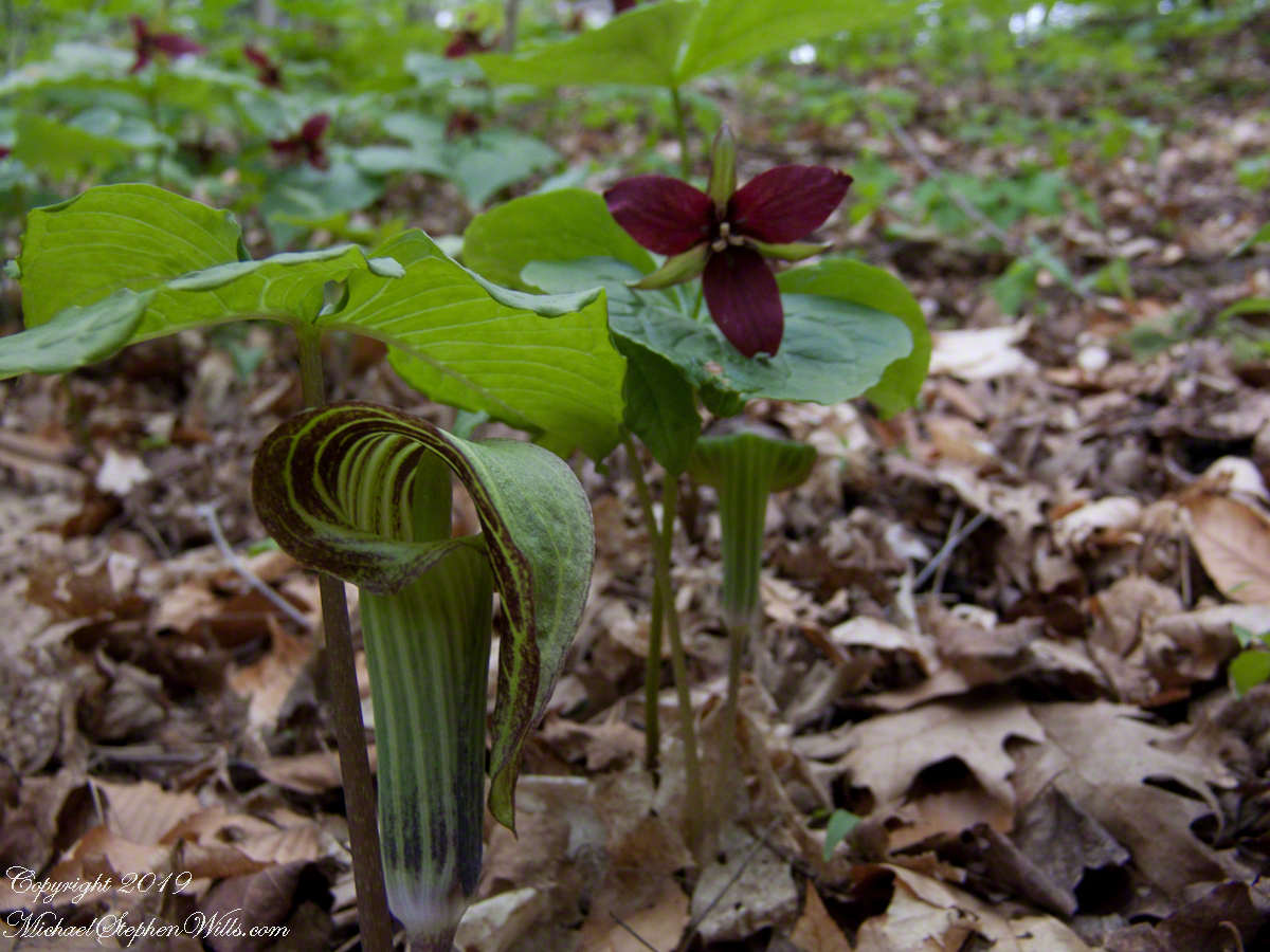
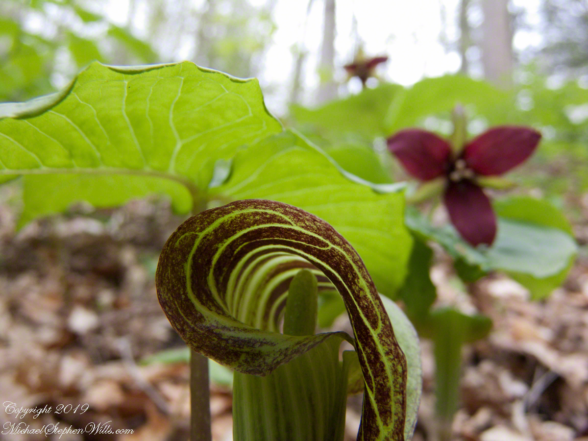
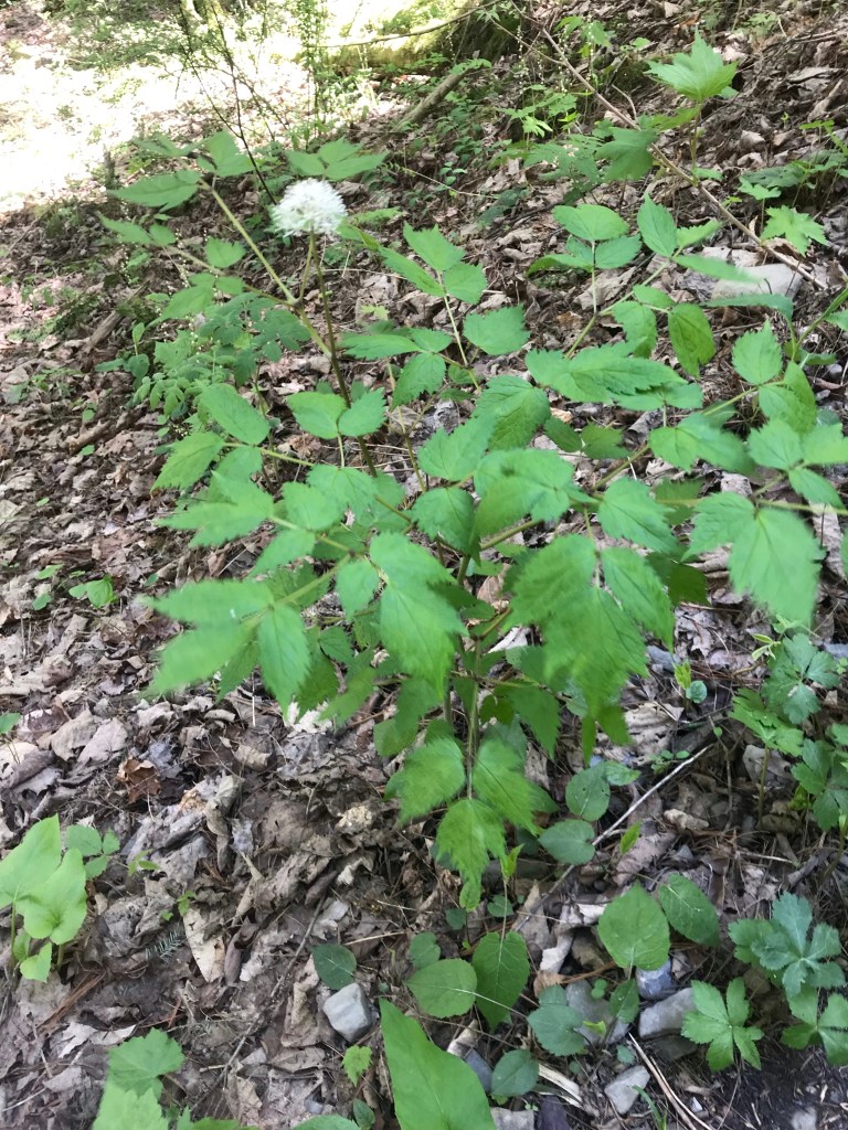
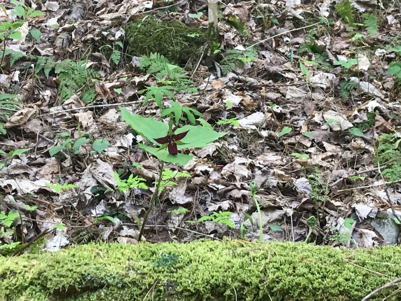
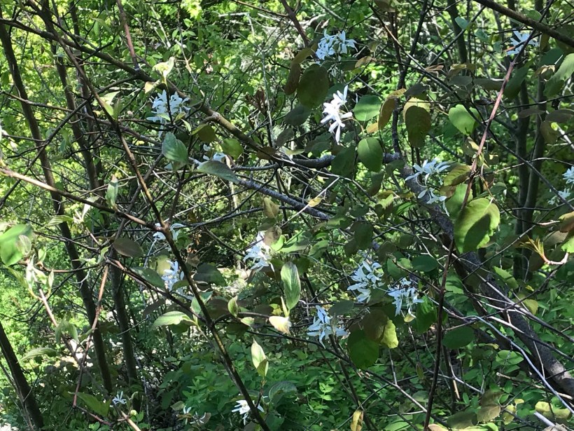
Brown dragon is an apt nickname for Jack-in-the-pulpit, captured here with Red Trillium on the forest floor of Fillmore Glen State Park. I was down in the mud for the closeup,
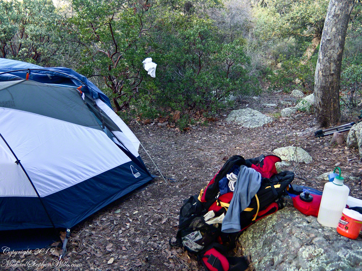
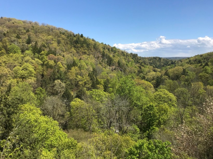
My third wilderness evening was unlike the others. I rested with an unhurried exploration of the camp area. Underfoot was a scatter of dry oak leaves, acorns on hardened desert soil not much softer than the numerous lichen encrusted boulders, all of which formed a bench above Pine Creek.
Pine Creek Camp Overview from a large lichen encrusted boulder
Pumping a gallon of drinking water though the ceramic filter takes more time than meal preparation. The four gallons I packed up were almost used and I enjoyed the luxury of pumping two days supply, 3 gallons in all and planned to down a quart or two of “gator aid” before dinner with the luxurious enjoyment of a flowing Pine Creek for company.
Pine Creek is the most common type for Arizona, recurring. To recur means to happen periodically or repeatedly and, for streams, this means for part of the year no water flows. For these days the flow was low, the water clear, what was left from the plentiful winter rains of 2004/2005.
Looking east toward Manzanita thickets with the unpacked backpack foreground
The wind gently rustled the manzanita and the sun just above the western cliffs as I settled on a boulder to enjoy a quart of fluid. I mulled over my next steps.
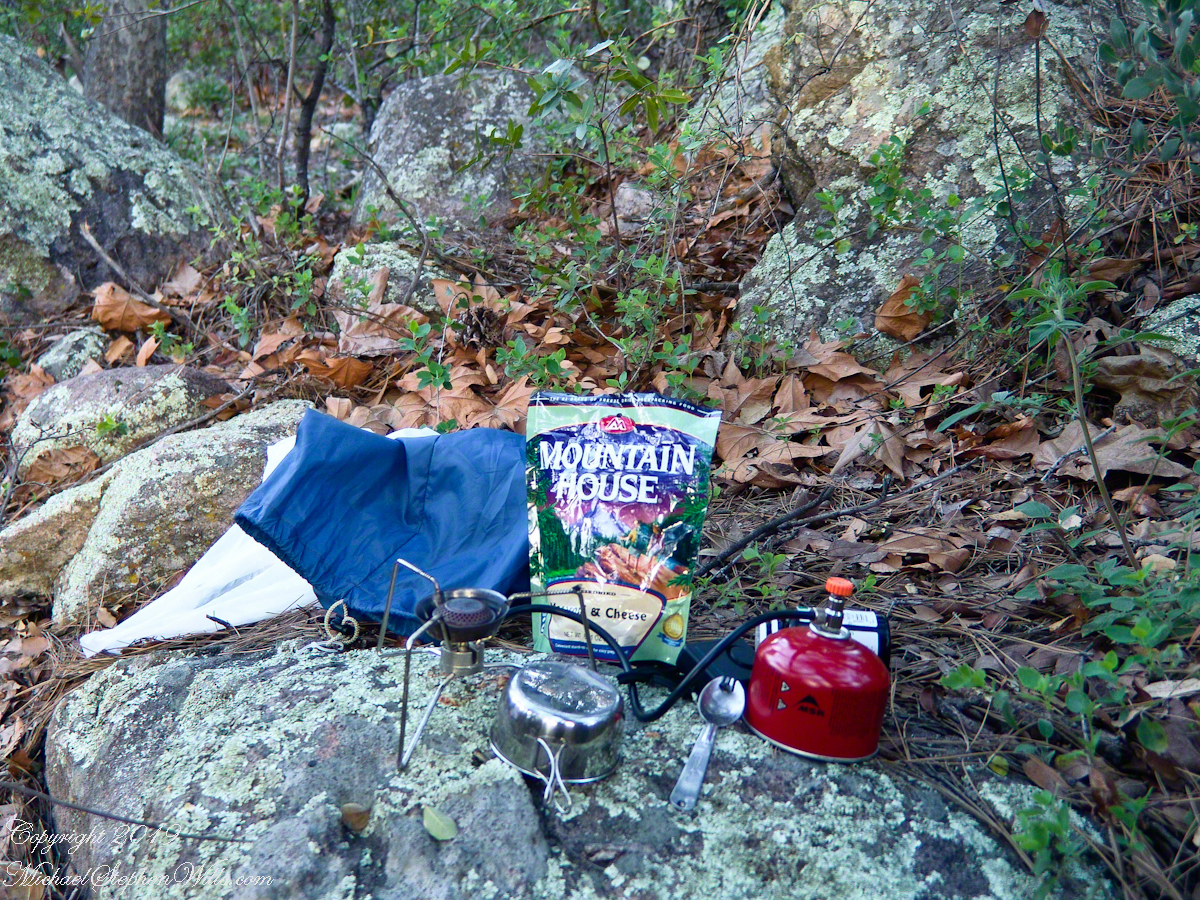
The kitchen: a very light gas burner, spork, dehydrated food with cup for beverages
Initially, the plan was to walk across the Superstition Wilderness, starting on the remote eastern end and emerging on the populated west side, in the Lost Dutchman State Park. My sister expected me there on day 10, but today was the end of day three. I didn’t know at that time the climb on my second day was the steepest of the wilderness and the way forward was much, much easier.
Looking west toward pine creek, manzanita branch foreground and thickets all round, young Ponderosa Pine, Arizona Oak behind tent.
Before a decision could be reach, my thoughts were broken by a different sound from the manzanita: several horses approaching on the trail.
Here is a photographic recap of the previous Superstition Wilderness postings as a gallery. You can page through the photographs.
View to the southwest on the Arizona Trail above Pine Creek.
Pine Creek of the remote eastern Superstition Wilderness hosts this wild Tufted Evening Primrose.
The Arizona Trail passes this spot in the remote eastern Superstition Wilderness. This is the view of my path up from Nameless Canyon. In the distance is the Four Peaks Wilderness Area.
Yesterday, I simultaneously published nine photographs on my ImageKind Ireland Gallery and Getty IStock (click the links to visit): nine views taken from the slopes of Slieve Gullion.
Sunday, May 25, 2014 was a happy day for Pam and I. It was the first full day of an eighteen (18) we filled with Ireland, travelling in a loop of the island following the coast from, naming the counties where we spent time on the ground, Louth, Armagh, Dublin, Meath, Wicklow, Cork, Kerry, Claire, Mayo, Antrim, Down and back to Louth. The counties of Northern Ireland are in italics. Indeed, at this time the politics allowed us to travel freely between the Republic and the North. That day, our morning was spent in Louth attending mass, enjoying our first meeting with the family over a substantial mid-day meal (click the link for my Facebook album of the meeting). We split off that afternoon to visit the home of my cousin, Mary and her husband Joseph in County Armagh, just over the border. When Joseph offered to drive us over to Slieve Gullion it was totally new to us, we had no conception of the place or what to expect.
It was such a gift, we are grateful to Joseph for this experience. Only in 2018 when, at 64 years of age and retired”, was I able to research the place and spend time developing the photographs for publication. Two of the photographs illustrate this posting, to view the others in my online gallery, click either photograph.
Slieve is the Irish language word for “mountain.” Slieve Gullion is a lone eminence, one remnant of volcanic eruptions about 60 million years ago during the rifting of continents that produced the Atlantic Ocean. Around the mountain is the Ring of Gullion, a string of hills, 26 miles by 11 miles, surrounding the mountain and formed from the ancient collapse of a volcanic caldera. The technical name for it is a Ring Dyke and it was the first of its kind to be recognized and mapped, well before the nature of the formation was understood of be volcanic. The name Gullion is derived, in one formulation, from the name of the metalsmith, Culann. In Irish Myth, Culann’s home and workshop was on the slope of Slieve Gullion. A wealthy and respected personage, Culann invited Conchobhar mac_Neasa, king of Ulster to feast. During his approach to the mountain, passing through the surrounding plain, the king stopped to watch boys play hurling. Among them was the future hero of Ulster, the young Sétanta. Impressed with Sétanta athletic abilities, the king invited him to join in the feasting at Culann and the boy promised to follow after the game. Later, while climbing the mountain to fulfill his promise Sétanta was attacked by the guard dog of Culann. The myth says the dog was killed by Sétanta in self-defense. Never the less, in compensation to Culann, Sétanta committed to rearing a replacement and to act as guard dog in the meantime. In this way he became known as Cu Culann, “the dog of Culann.” Click for more about Cu Culann.
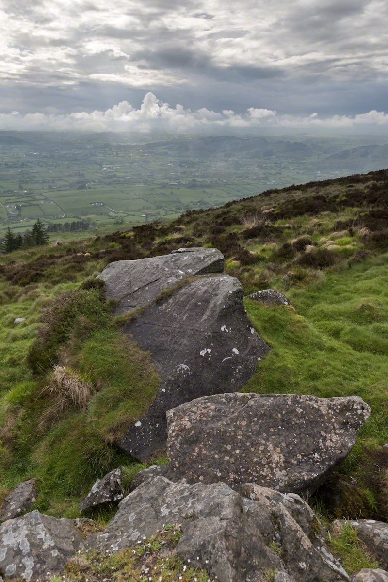
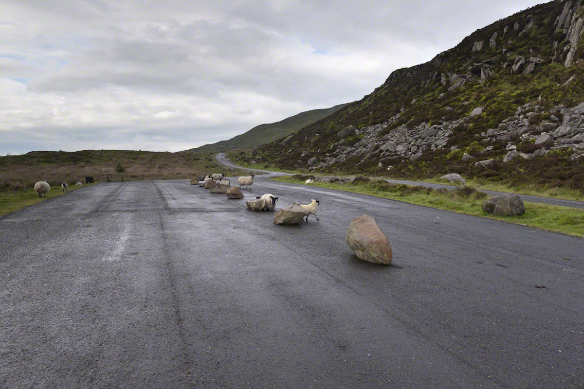
On the summit two cairns north and south of a small lake, tangible proofs of ancient peoples and beliefs. The north cairn is a more ancient passage grave, 90 feet wide, 16 feet high, the opening aligned with the setting sun on the winter solstice. The cairn north of the lake is less ancient containing two cist burials. For our visit Joseph drove us along the 8 mile drive. The following is an image of a viewing platform and the road. Just beyond, on the right, where the ridge meets the road, is the trail to the 1,880 foot summit of Slieve Gullion. Our arrival disturbed sheep resting on the asphalt. I’d have loved to spent a day climbing the summit, but it was not to be this trip.
The way is part of the Slieve Gullion Forest Park. Throughout are turnoffs to admire the view. It was during our frequent stops I pulled out the photography gear to grab the views. Here is one, looking southwest. For the other views, click either photograph to visit my Online Gallery of Ireland.
Copyright 2021 Michael Stephen Wills All Rights Reserved
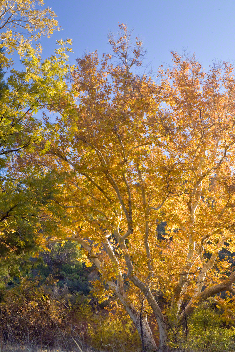
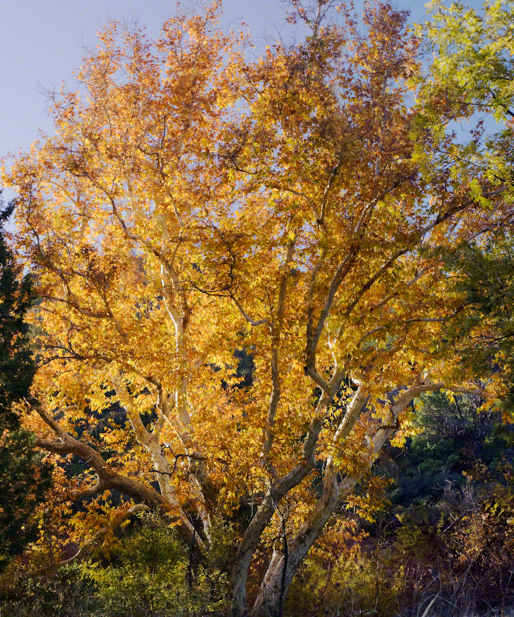
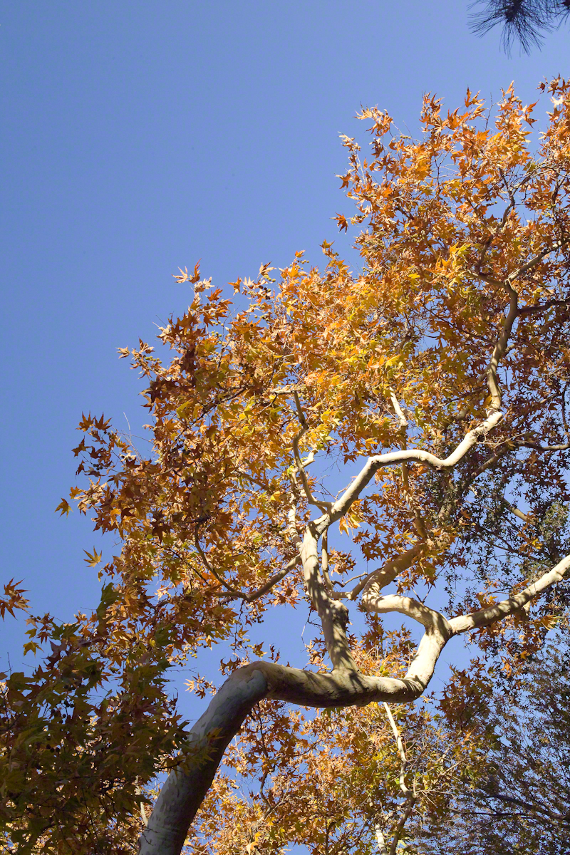
Compare these Arizona Sycamores with the struggling specimen from the last chapter, “A Peaceful Day at Pine Creek.” Many Sycamores such as this one flourish along Reavis Creek, a perennial stream of the eastern Superstition Wilderness. The drainage that feeds Pine Creek is far less acreage than that of Reavis Creek and, when the Pine Creek flow fades in the driest seasons, plants go into survival mode and halt growth and may even slough off limbs to conserve water.
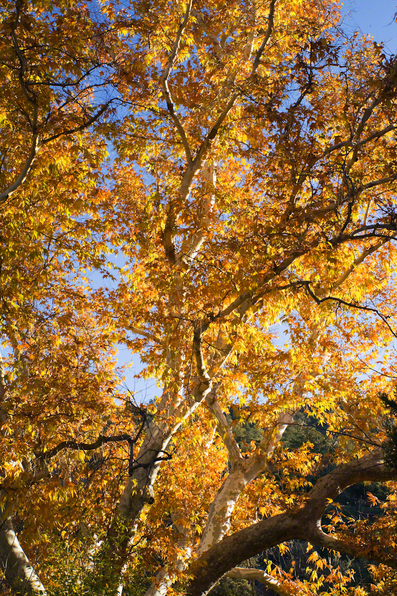
These Sycamores grace a stream that seldom stops flowing, even in the driest of seasons. I had the good fortune to visit the Reavis valley of the Superstition Wilderness in November 2007, when these trees were at peak autumn foliage.
The tree requires a supply of water to thrive. This specimen demonstrates the species growth habit growing multiple trunks with a shape driven by water availability and the environmental context. The multiple trunks may be a desert survival mechanism. In dry periods a trunk or trunks are sloughed off to reduce moisture loss. This is why the Sycamore of “A Peaceful Day at Pine Creek” has a single trunk.”
To encounter a riparian space of the Arizona desert is a revelation, to progress from Sonoran desert spaces assailed by the breath of dry wind, to see the first signs of water in the distance as a welcome fluttering of leaves, to feel a welcome odor of water.
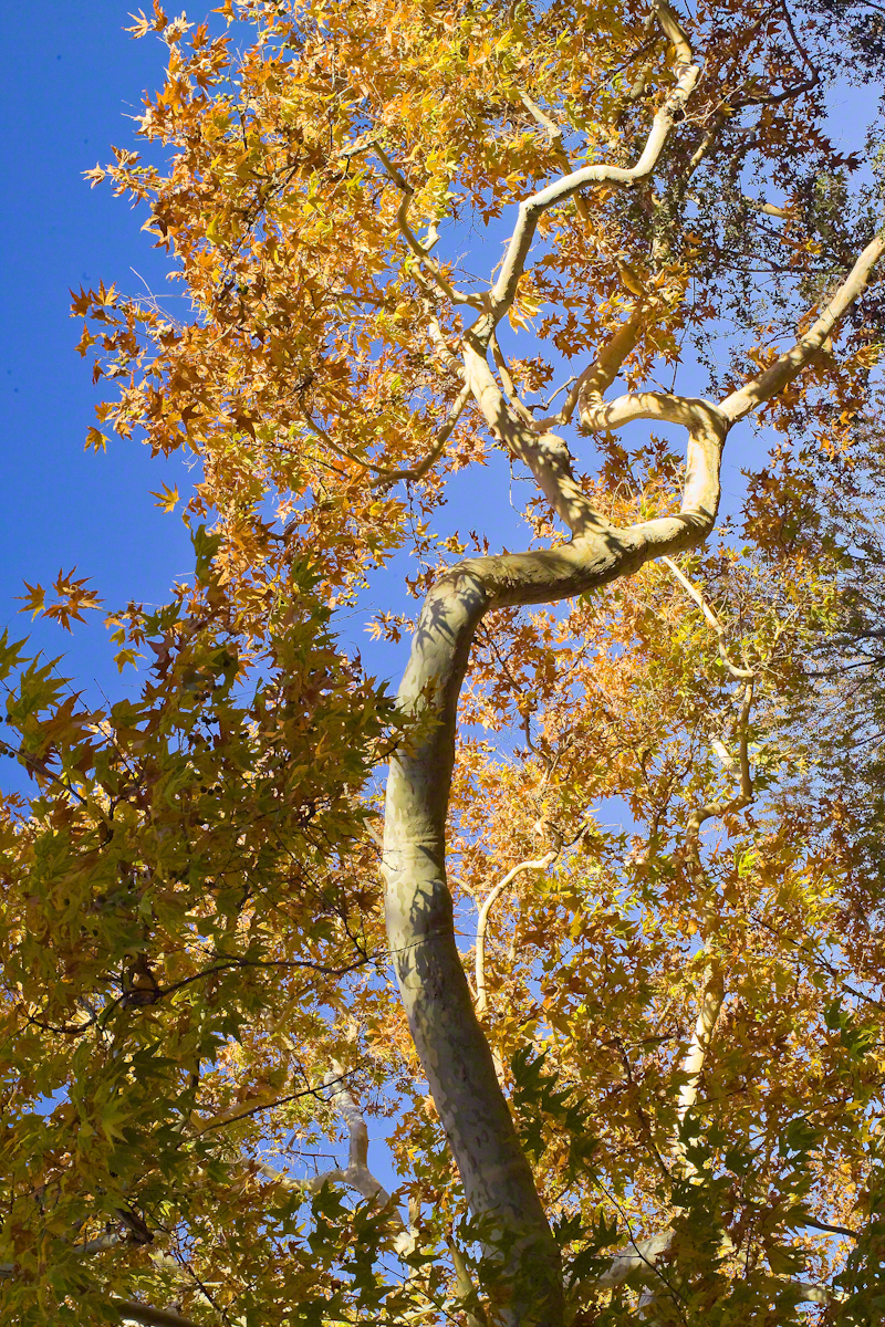
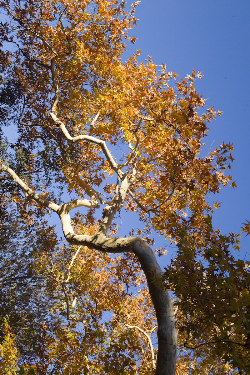
Yes, the first effect of a riparian space on the senses is the smell of water. Let’s finish this post with limbs of the Reavis Creek Arizona Sycamore reaching for the sky.
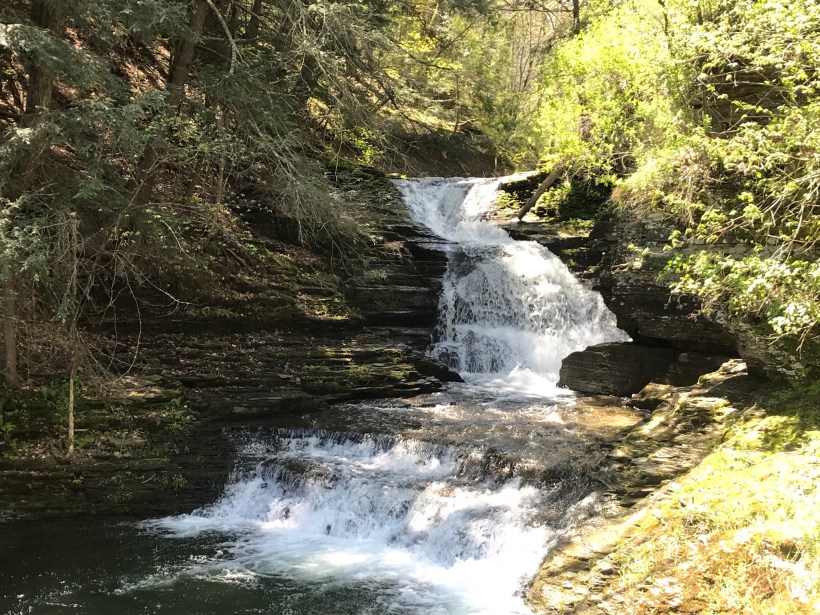
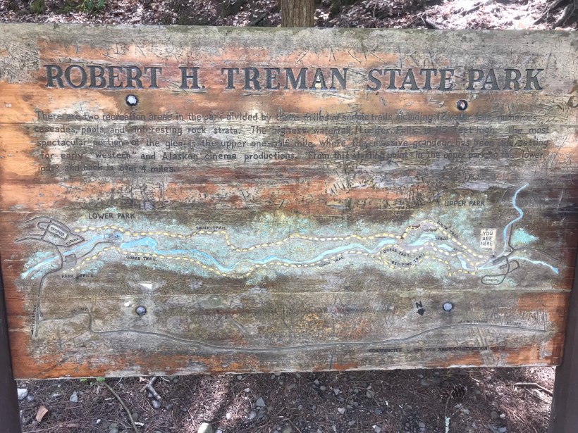
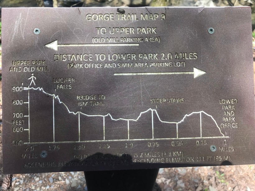
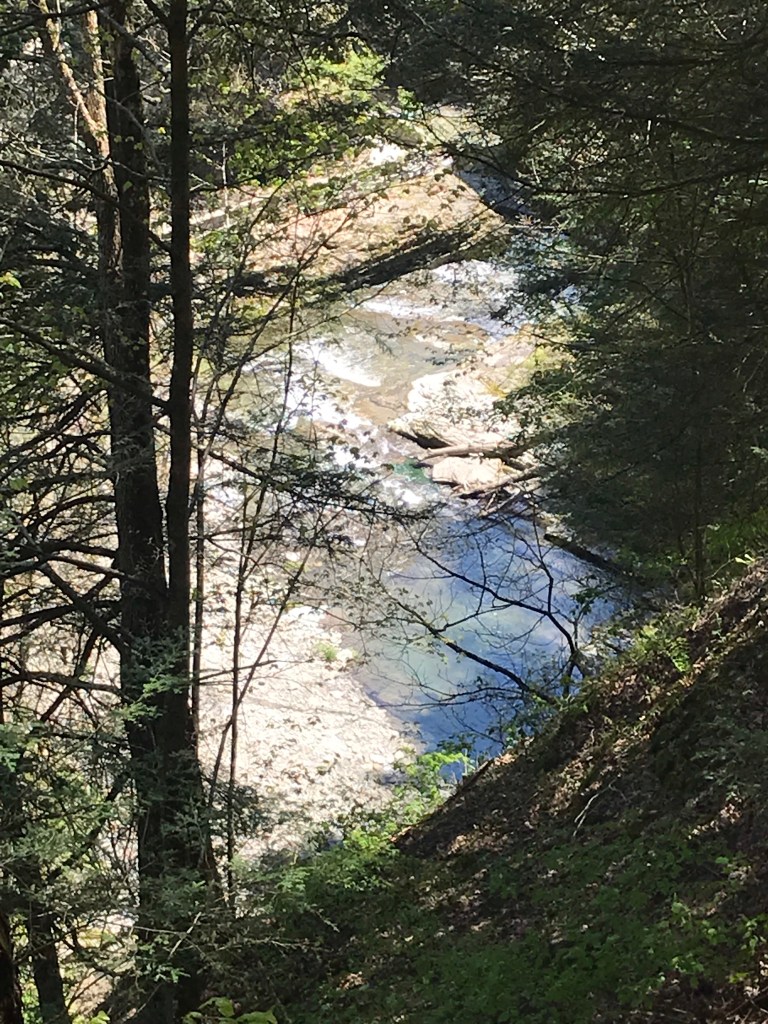
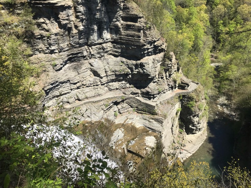
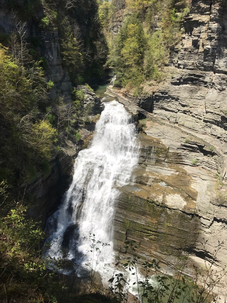
Pam and I headed out to Treman Park for a walk to the Lucifer Falls overlook. The Gorge Trail is not yet open due to the danger of rock falling from the gorge walls — the park maintenance staff needs to survey winter damage and knock down material in danger of falling.
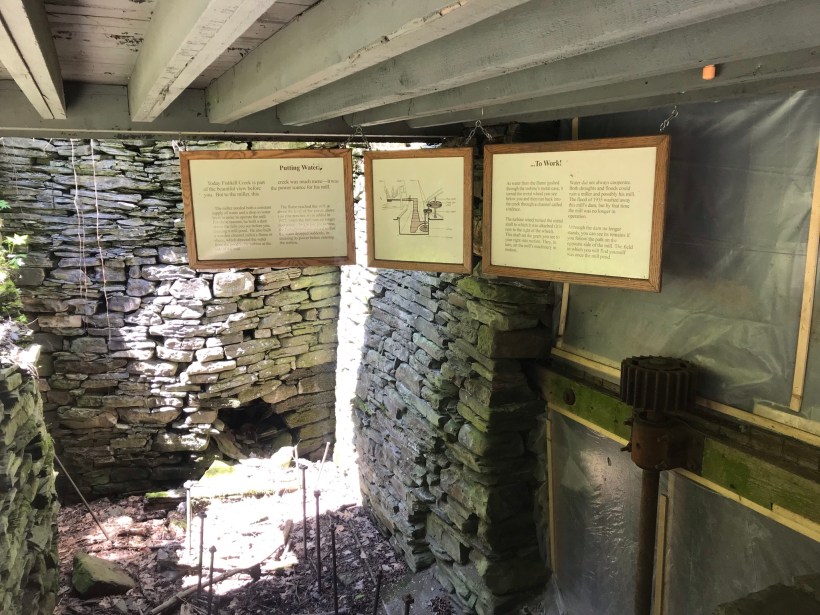
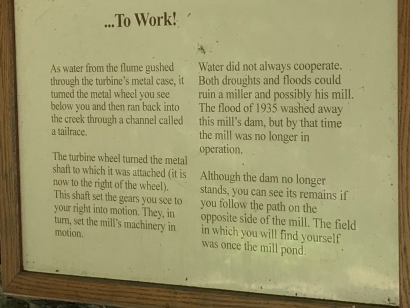
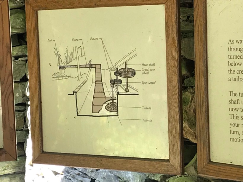
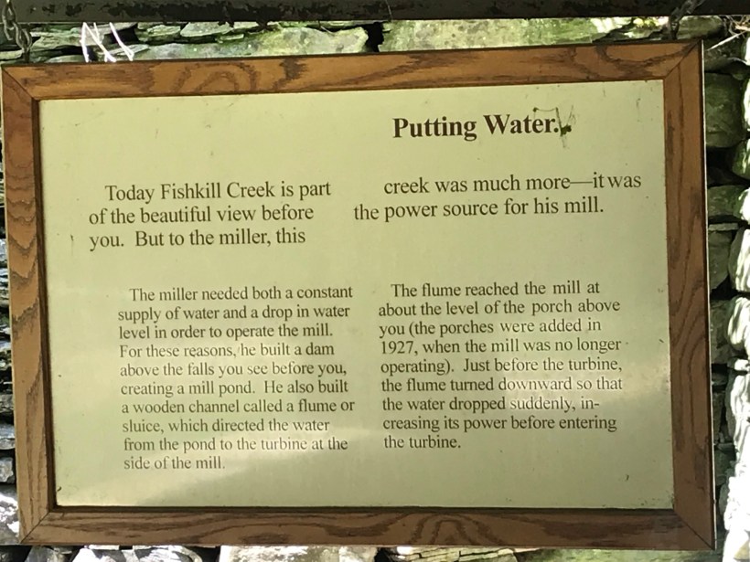
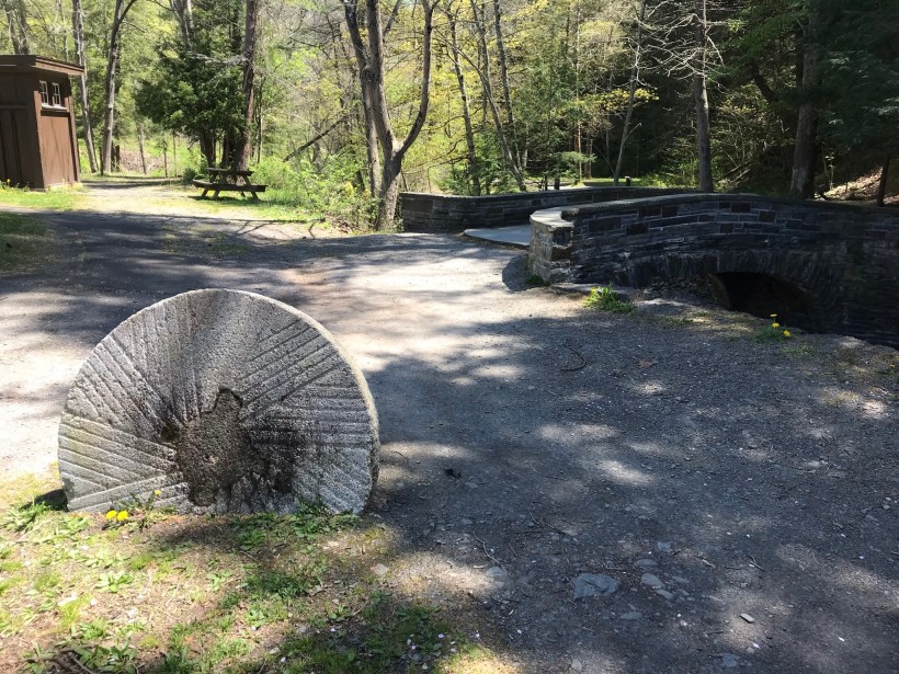
Our first stop was the mill waterfall. This was was directed to the mill stream to power the mill where grain was ground to order.
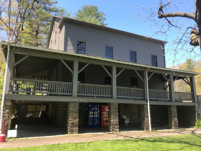
Here is an overview of the Mill, now a museum not yet opened post-Covid. The millstone stands at the start of the foot trails. All media on this post is from my IPhone 7, lightweight equipment for this hike. The automatic upload to ICloud is convenient.
Round trip is four-plus miles, with several hundred feet elevation change. Pam and I discussed a car caravan for our next visit, to support a one-way downhill hike (still plenty of uphill hiking). We need to work up to the round trip after our winter inactivity.
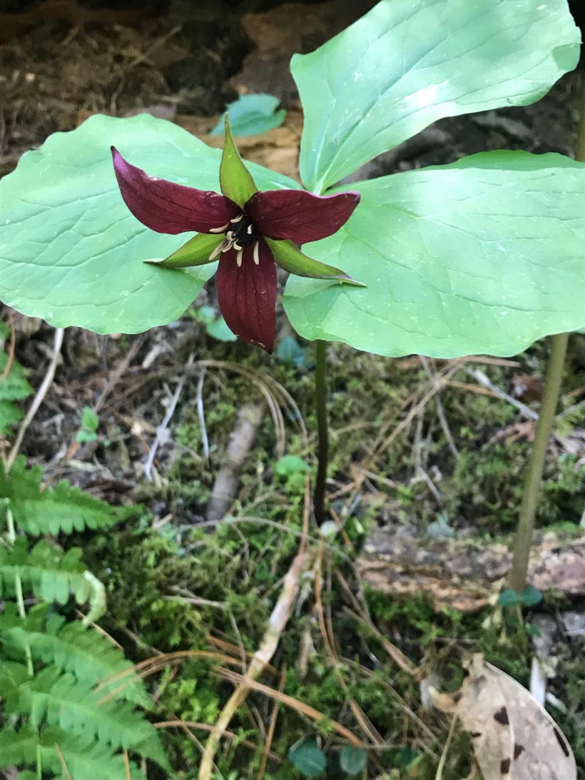
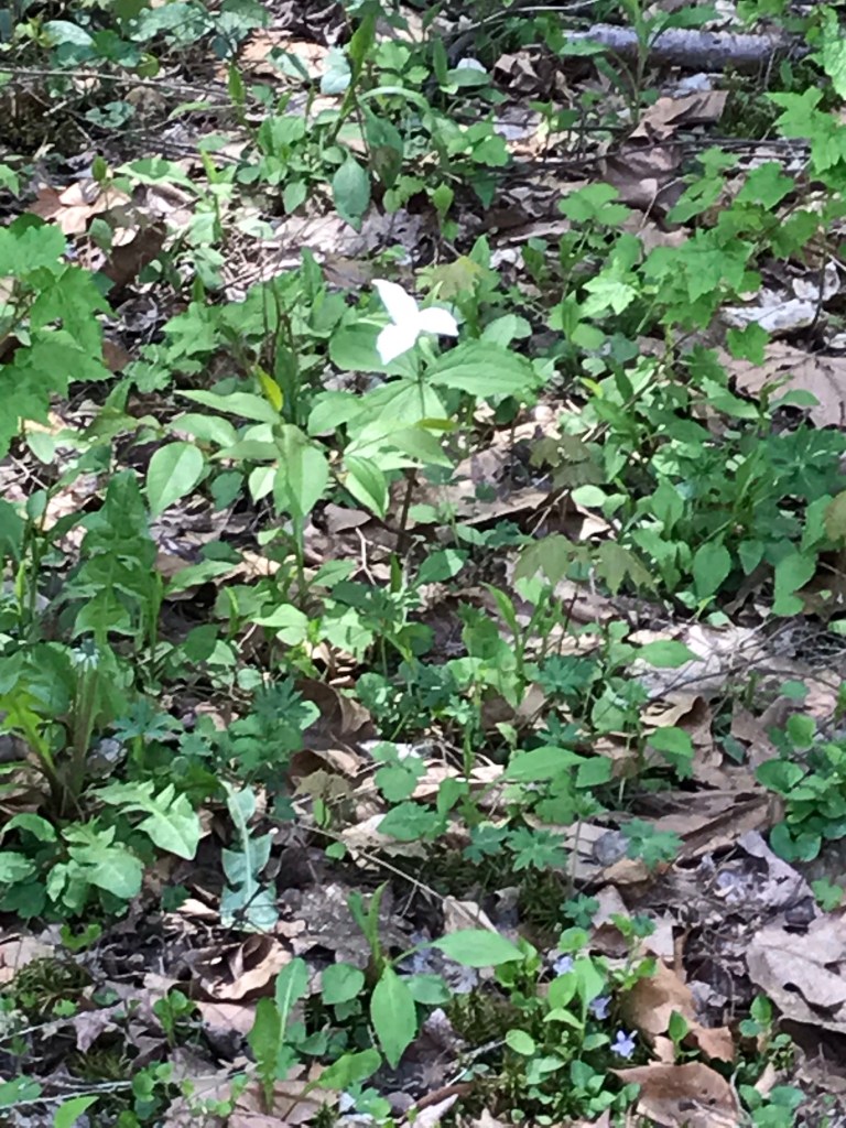
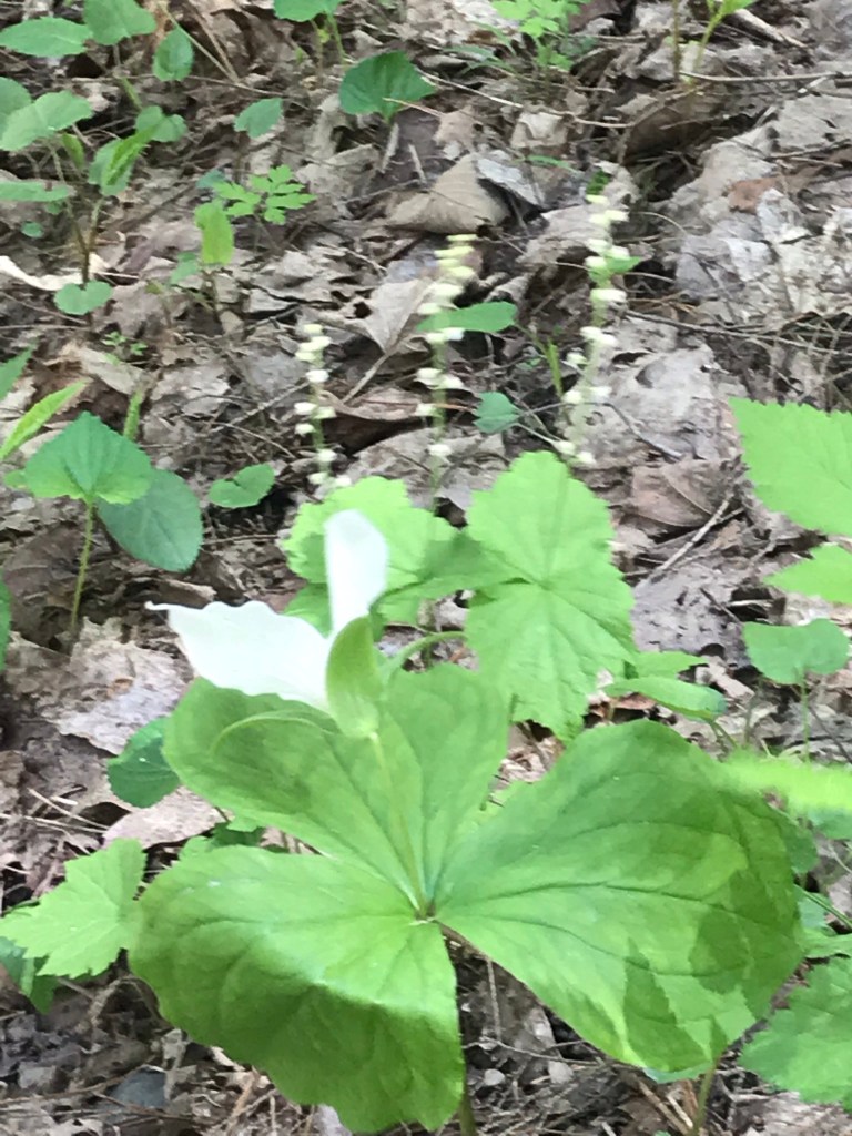
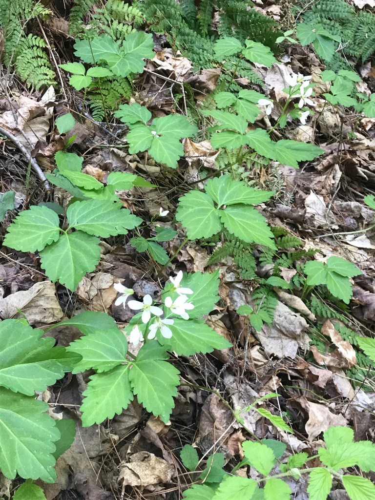
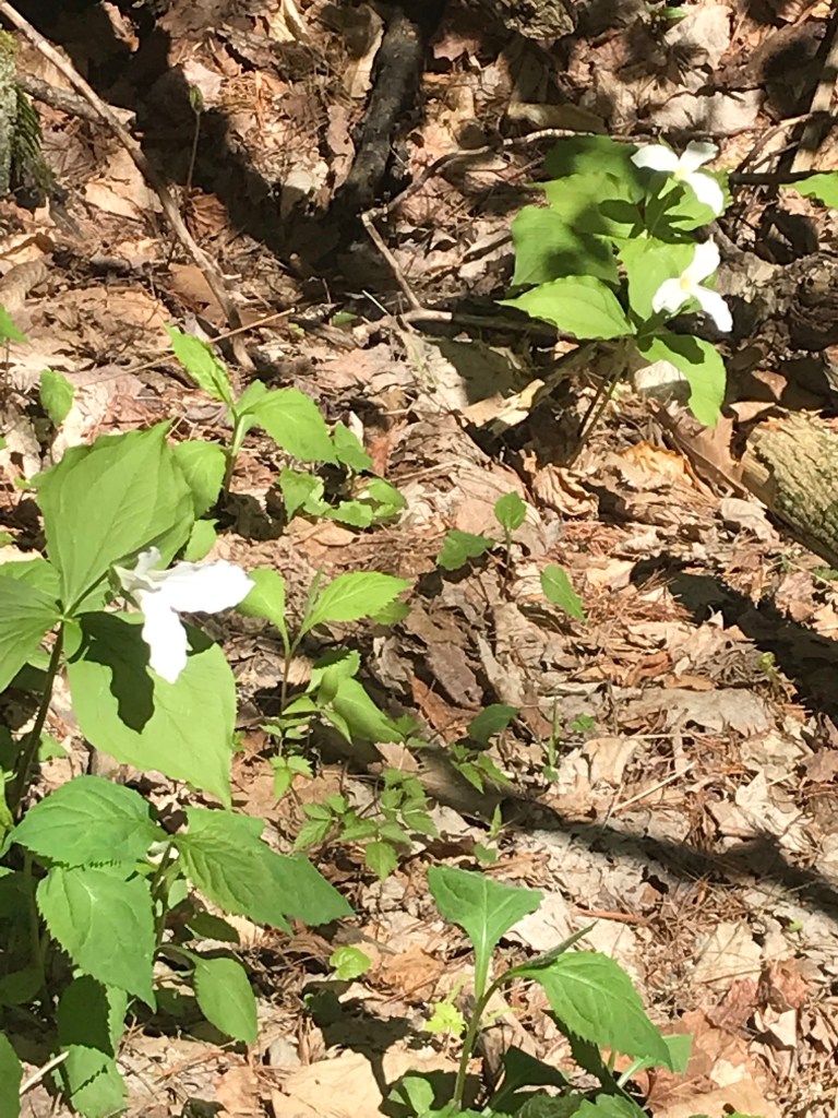
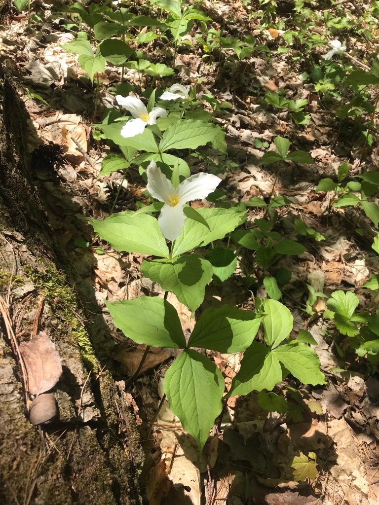
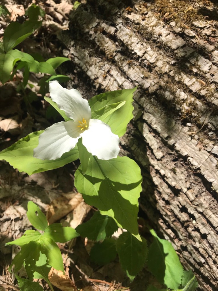
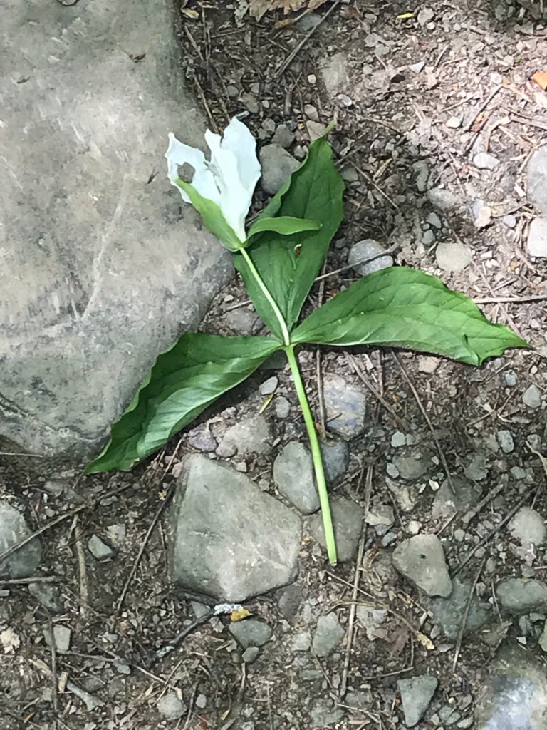
Trillium are in bloom!!
Multiple overlooks into the gorge grace this trail.
More trillium before we reached the overlook. Lucifer falls and the incredible path etched into the cliff by the Civilian Conservation Corps (Roosevelt’s Tree Army during the Depression).
After the Lucifer Falls overlook is this stupendous view from the top of the Cliff Stairs, 224 steps continue to link to the Gorge and South Rim trails.
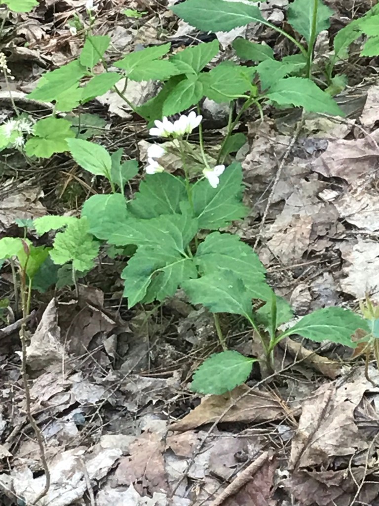
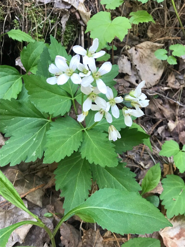
As we lingered on the top steps the flowering plants slowly revealed themselves.
I captured this tragic image on the return trip….a trillium discarded on the trail. Stiff fines await anyone caught doing this.
Copyright 2021 Michael Stephen Wills All Rights Reserved
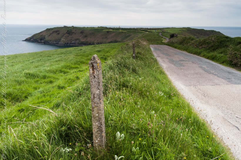
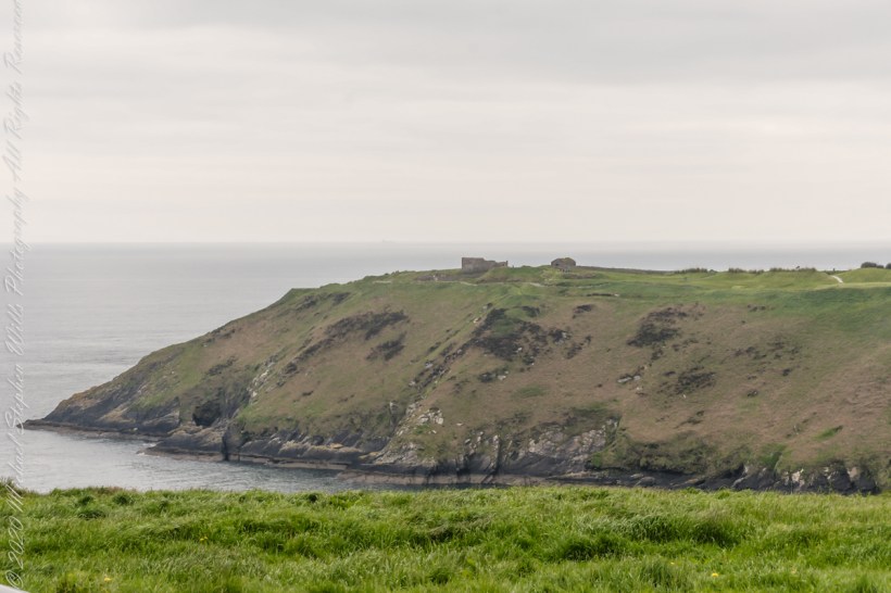
Our day of touring Kinsale and environs, the last day of May 2014, continues with our morning visit to the “Old Head of Kinsale.” Head is short for headland, a narrow strip of land projecting into the sea.
Road to the Old Head of Kinsale
Old Head of Kinsale
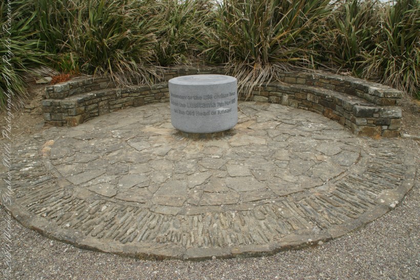
On May 7th, 1915 the Cunard liner Lusitania was torpedoed 16 km (10 miles) off the Old Head of Kinsale, 40 km (25 miles) west of Queenstown. Of the 1,959 people on board, 1,198 died. Those who survived were brought to Queenstown and Kinsale by rescue vessels and cared for in local hotels and hospitals. Many of those who died were buried at Old Church cemetery, 3 km (2 miles) north of Queenstown. The first class Queen’s Hotel cared for some of the survivors. The elegant Edwardian atmosphere of the hotel was shattered by the horrific news of the loss of the ship. This is the setting for the story of Queenstown’s role in the Lusitania disaster. –text from Cobh Heritage Center poster, see image below.
The Old Head is notable, in the contest of the Lusitania attack, for being the land closest to the incident. Cobh, then named “Queenstown”, was the focus of rescue operations. See text below, from a display of the Cobh Heritage Museum.
from Cobh Heritage Museum.
The Kinsale tower is just over nine meters high, with walls up to 80 cm thick. Records show a signal crew was in place in 1804 and the tower finished the following year, though severely affected by dampness. When Napoleon was defeated by Wellingtons forces at Waterloo, 1815. With the diminished threat these expensive installations were neglected. The 1899 Ordnance Survey map lists the site as being in ruins. During our 2014 visit the local community was renovating the tower and the work appears complete sometime before 2021.
The morgue under the Town Hall was filled with corpses, and many were placed in the premises of the Cork and Blackstock Railway Company. Undertakers were working at high pressure night and day to provide coffins. But hundreds of victims found graves in the broad Atlantic Ocean. –Newspaper reporter at Queenstown. See images in the above gallery for more.
Cobh Heritage Center exhibit of survivor recovery, Queen’s Hotel
I did not see and/or recall much emphasis in the museum for pillorying Germany, after all a German U-boat was responsible. Curious, I did a Wikipedia search and found this text. The topic of Ireland, Germany and World War I is complicated.
On the afternoon of 7 May, a German U-boat torpedoed Lusitania 11 miles (18 km) off the southern coast of Ireland inside the declared war zone. A second internal explosion sank her in 18 minutes, killing 1,198 passengers and crew. The German government justified treating Lusitania as a naval vessel because she was carrying 173 tons of war munitions and ammunition, making her a legitimate military target, and they argued that British merchant ships had violated the cruiser rules from the very beginning of the war. The internationally recognized cruiser rules were obsolete by 1915; it had become more dangerous for submarines to surface and give warning with the introduction of Q-ships in 1915 by the Royal Navy, which were armed with concealed deck guns. The Germans argued that Lusitania was regularly transporting “war munitions”; she operated under the control of the Admiralty; she could be converted into an armed auxiliary cruiser to join the war; her identity had been disguised; and she flew no flags. They claimed that she was a non-neutral vessel in a declared war zone, with orders to evade capture and ram challenging submarines.
However, the ship was not armed for battle and was carrying thousands of civilian passengers, and the British government accused the Germans of breaching the cruiser rules. The sinking caused a storm of protest in the United States because 128 American citizens were among the dead. The sinking shifted public opinion in the United States against Germany and was one of the factors in the declaration of war nearly two years later. After the First World War, successive British governments maintained that there were no munitions on board Lusitania, and the Germans were not justified in treating the ship as a naval vessel. In 1982, the head of the Foreign Office’s American department finally admitted that, although no weapons were shipped, there is a large amount of ammunition in the wreck, some of which is highly dangerous and poses a safety risk to salvage teams.
T
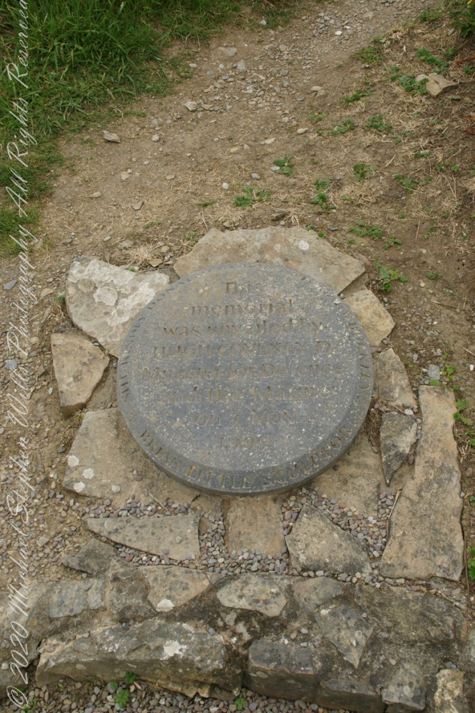
The original memorial to the Lusitania was unveiled on the 80th anniversary of the May 7th, 1915 sinking (May 7, 1995), Old Head of Kinsale, County Cork Ireland. The imemorial nscription reads “In memory of the 1198 civilian lives lost on the Lusitania 7th May 1915 off the Old Head of Kinsale.”
The inscription of the commemoration plaque accompanying the memorial reads, “This memorial was unveiled by Hugh Coveney D Minister of Defense and The Marine on 7 May 1995.” Around the edge of the medallion reads, “Brian Little Sculptor” “This (cannot read) donated by Lan and Mary Buckley”
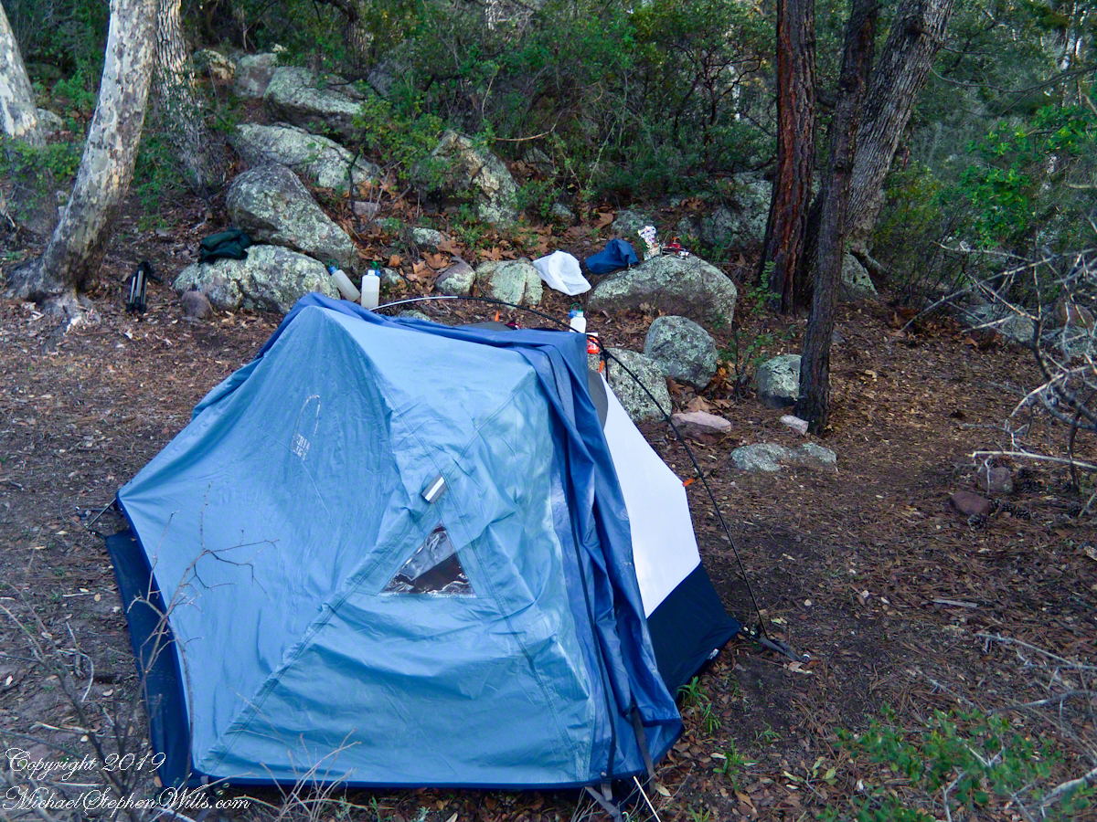
The spring gales persisted through my late afternoon arrival in Pine Creek, into the night and next morning. Protected from the west wind by the rising land, the tent was not buffeted like I described in the chapter “A Dry Piece of Paradise.” The song of soughing pines was my last impression of the evening and the first of the next morning.
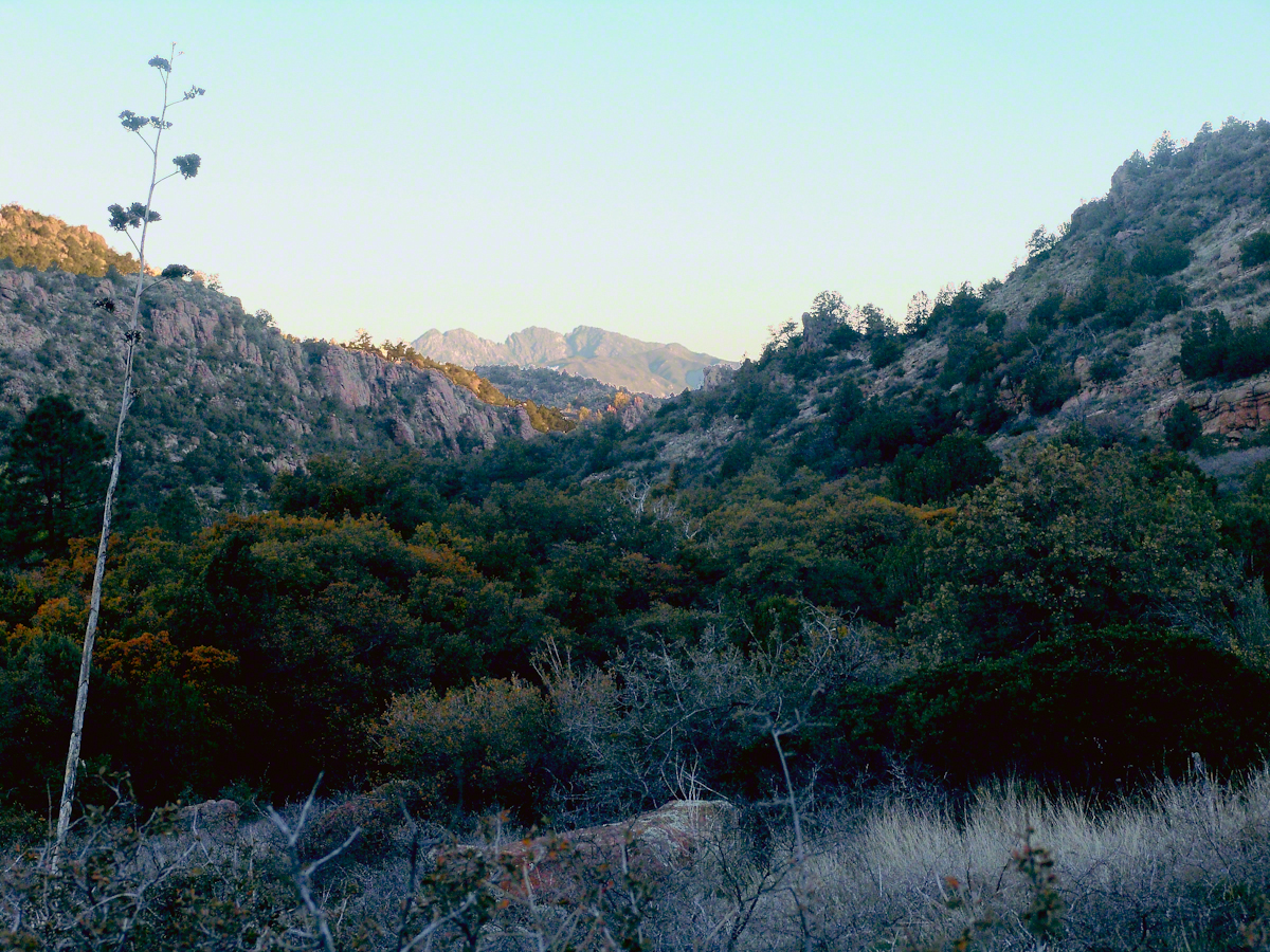
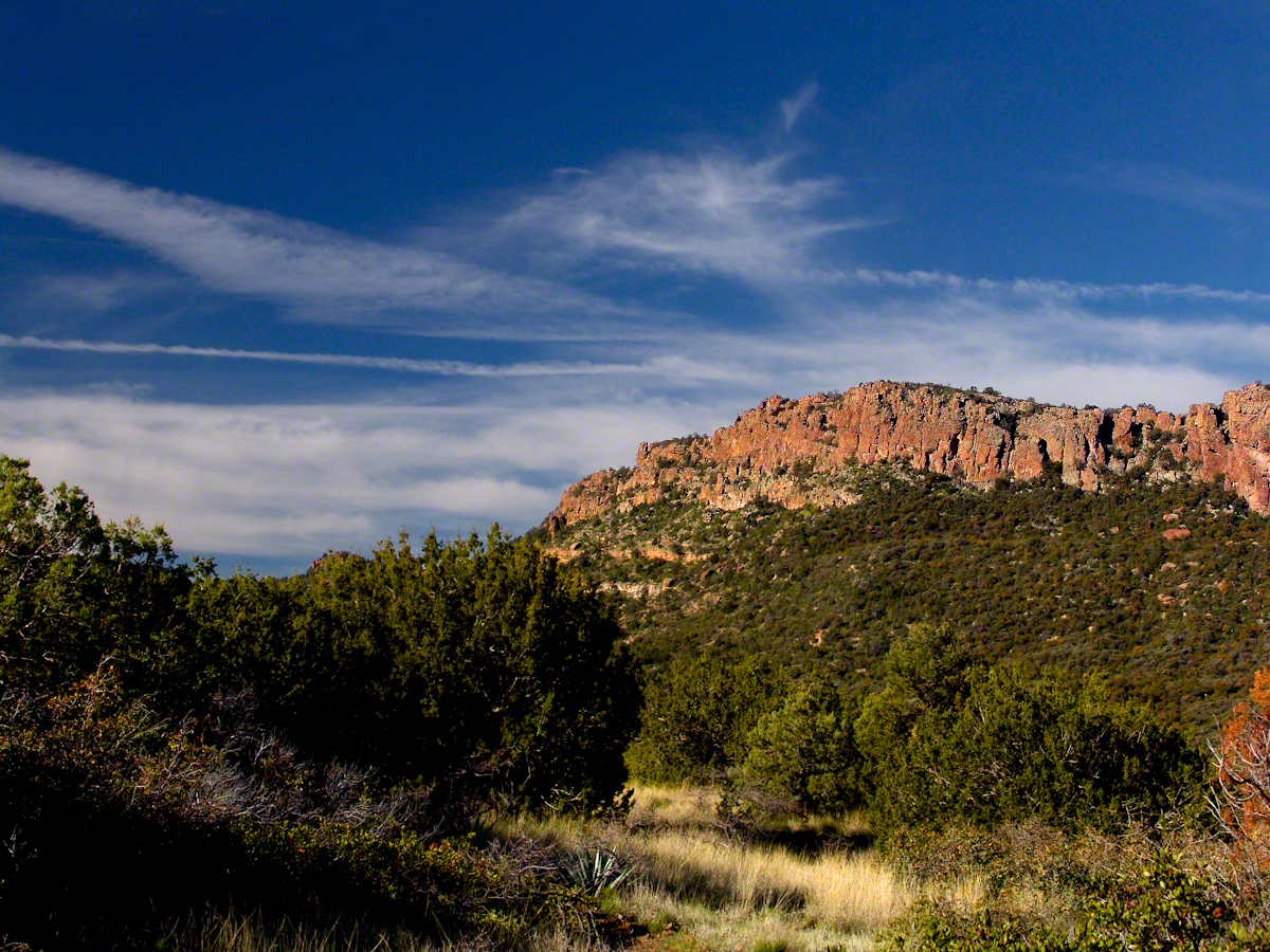
Where the Arizona trail crosses, Pine Creek flows at 4,600 foot elevation through a canyon of broadly sloping sides. The flow originates at the foot of Mound Mountain to the southwest, at 6,253 feet the highest elevation in the Superstitions. There are 5,500 foot peaks to the east and west. The land falls away to the north giving great views of the Four Peaks Wilderness.
I chose a flat site to camp above the creek among Arizona White Oak, Arizona Sycamore, Ponderosa Pine and Manzanita. Of these, it’s Manzanita fruit for which the bears come in the summer. Manzanita thickets made approach to the camp site difficult from all directions but the path. Bear sign was thick among this growth. Go to my chapter, “Racing the Sun,” to see the red barked Manzanita and pink blossoms from which grow tiny green fruits that ripen summertime into a bright red, like tiny apples. Indians used this bland tasting fruit containing five hard seeds for food and a cider beverage.
Well before dawn I grabbed warm clothes, hat, camera to head out for a full day of leisure.
On a shallow rise above Pine Creek I took the two shots of agave (Century Plant) stalks in dawn light. These start the chapter, “A Dry Piece of Paradise.” One dry agave flower is to the left in this North view, looking down the creek not far from the creek crossing.
Click any photograph for a larger view
North View from Pine Creek, early morning
In the photograph notice how the canyon narrows as the creek flows north, the walls rising above it for hundreds of feet.
When I climbed about 200 feet above the creek to a ledge that provided great views, the protective canyon walls fell away and wind gusts threatened to up end the light tripod. It was necessary to anchor it with the daypack and I tied down my hat as well.
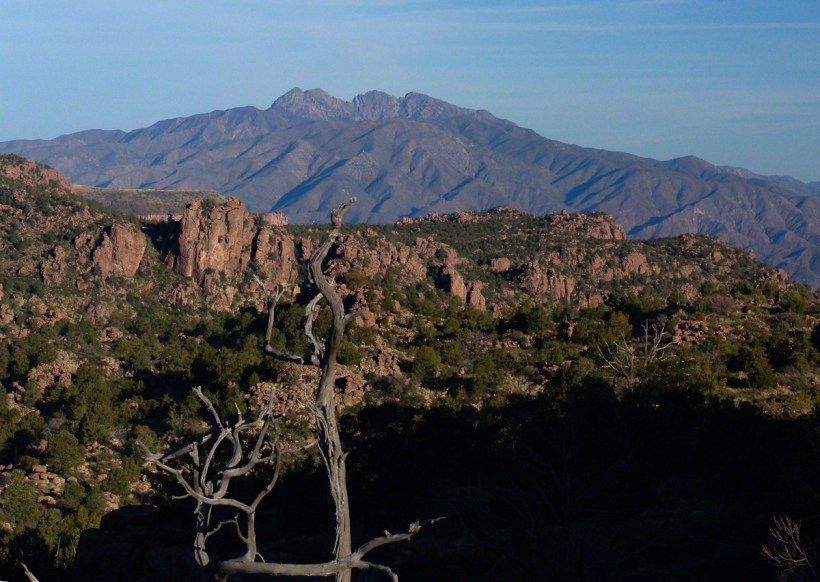
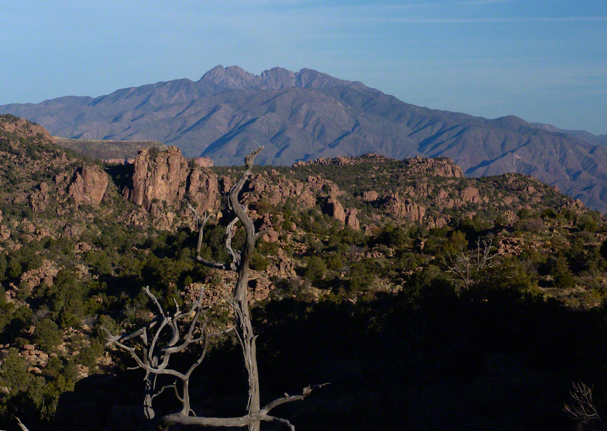
Shadows of night lie below, dominated by Four Peaks Wilderness. A unique long flat ridge is behind the near dramatic ridge above Pine Creek. This view leads me to daydreams. The long ridge is clearly visible in two photographs titled “Nameless Canyon in the Dawn” and “Nameless Canyon Morning” of my post “A Dry Piece of Paradise.” A view from the west is available in my post “Racing the Sun.” Look at the photograph captioned, “Overview of my path to the Nameless Canyon behind Two Bar Mountain,” the flat ridge is just above the shadow of Castle Dome. The view from that spot must be incredible across the lower Reavis Creek valley. From here it is a day trip 4+ mile roundtrip bushwhack over the cliffs above Pine Creek.
North View from Pine Creek
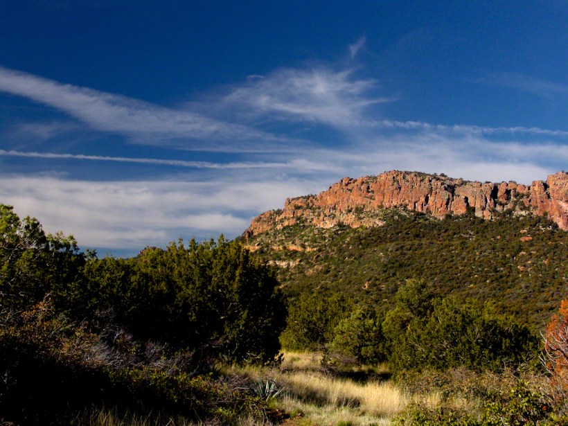
Those evergreens in the following photograph are Oneseed Juniper (“Shagbark Juniper”) of the three species common to the Superstitions, this has this spherical, bushy appearance. Here the elevation is just high enough for junipers because there are none down below. The trail crosses Pine Creek to ascend the lower slopes of these red cliffs, following it around to the west and over to the next valley, Reavis Ranch, a distance of 3.5 miles. In my “Two Meetings” blog is a sweeping view of Pine Creek Canyon, from the southern approach.
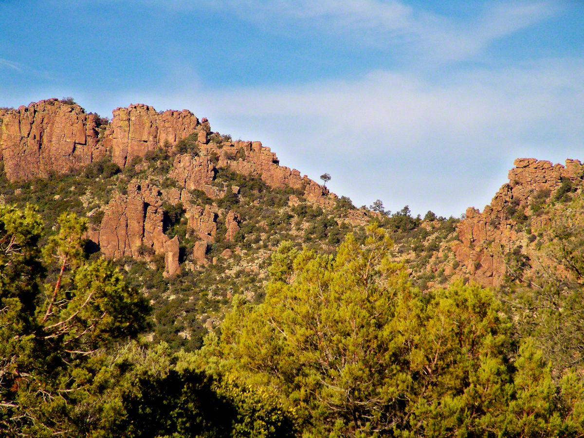
For most people a 400+ foot climb over these steep cliffs is impossible. Fortunately, a saddle to the right of this photograph is a possible route.
Southwest View from the Arizona Trail above Pine Creek
The saddle is 100 feet lower without cliffs. Still, this entrance to remote, fascinating locations is a steep 300+ climb.
A Saddle breaks a line of cliffs
“The Searcher” arrived around this time riding the buckskin gelding and leading a pinto. He saw me and my camera equipment and stopped for a chat. His plan was to follow the trail I came up yesterday to find a rumored camp with good water. The howling wind made conversation difficult. I wondered where his camp of last night was located, since there was no sign of him. Before I could ask, his cowboy hat flew away with a wind gust. He hopped off the gelding, “That’s my best beaver hat.” After a quick brush and tie-down they were off.
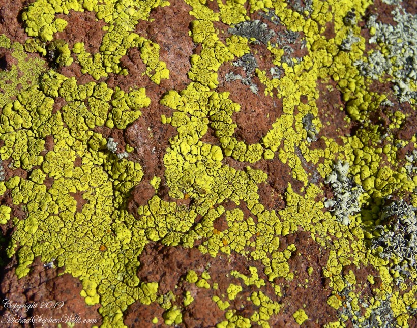
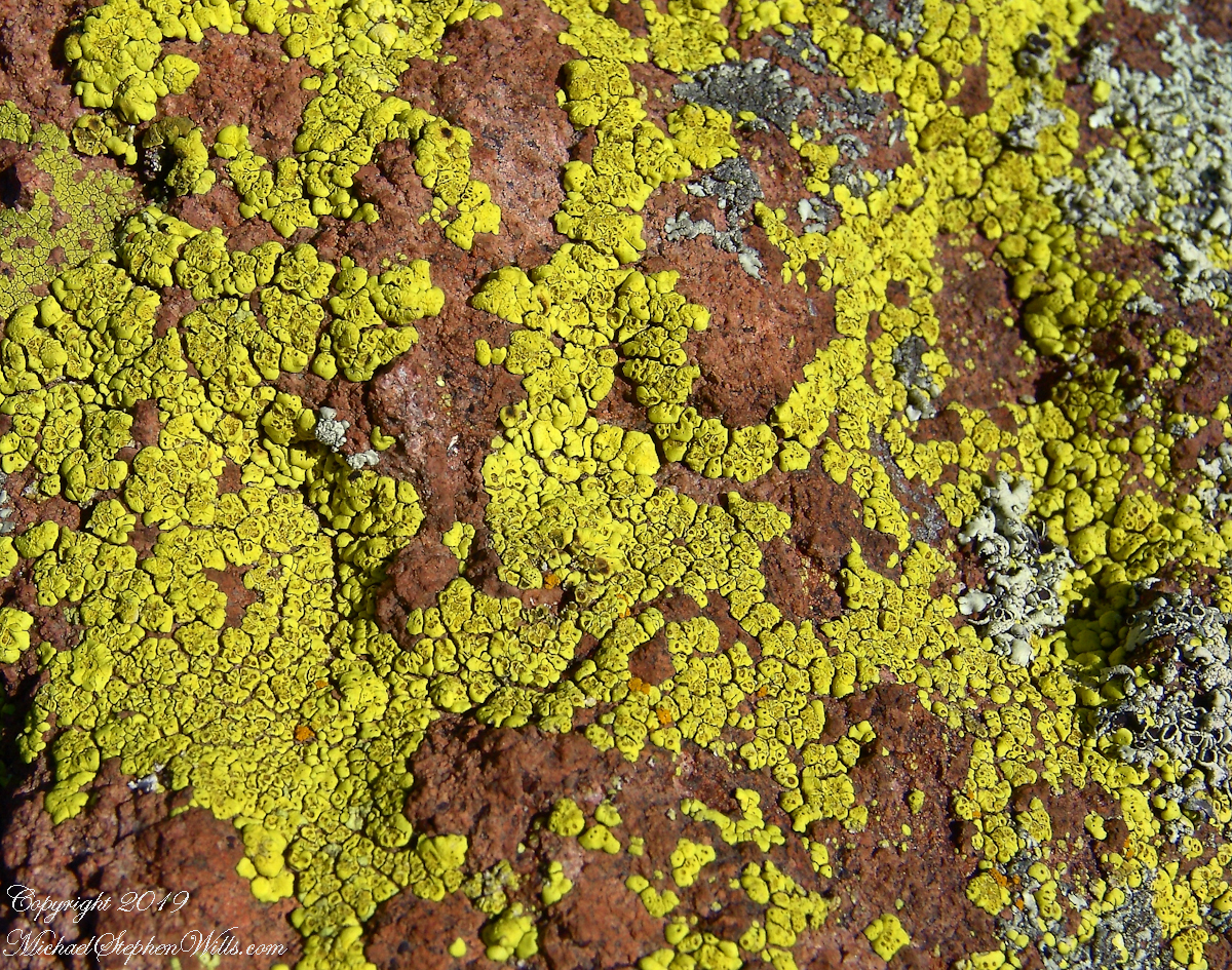
Heading back down to the creek, here is a macro of lichen that covered the crumbling surfaces of boulders that littered the slope.
Nature’s Abstract
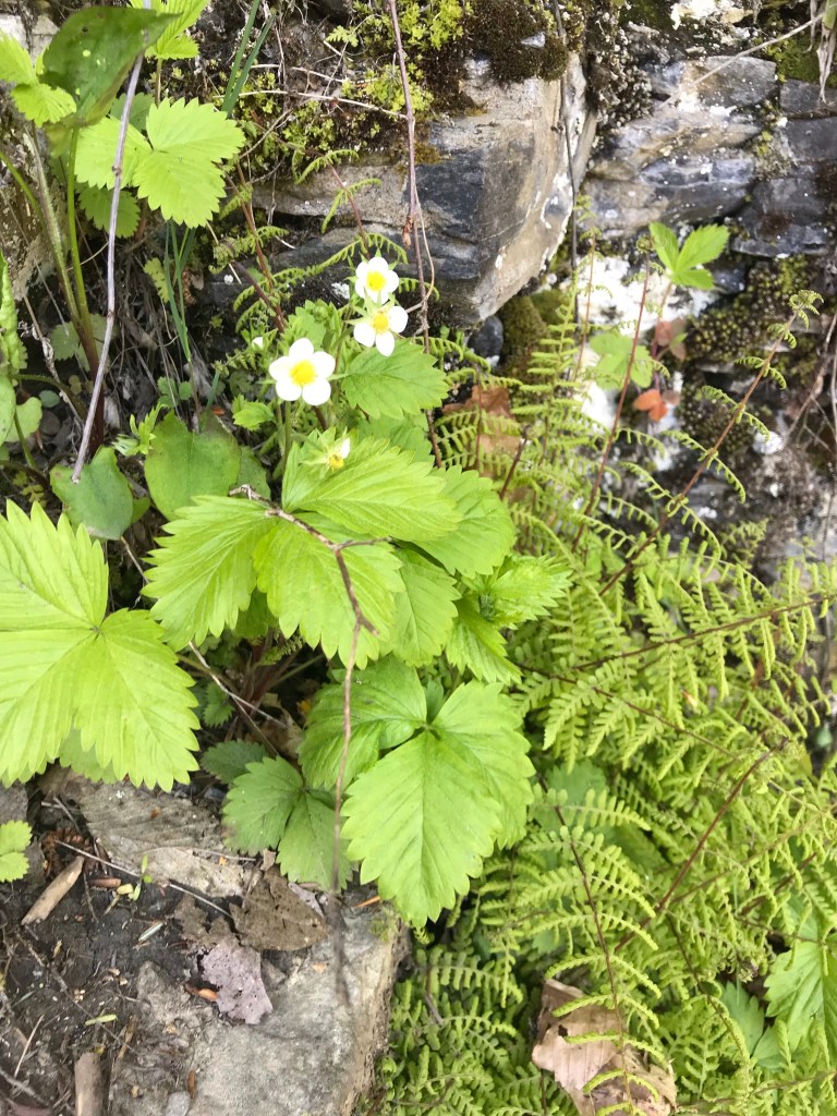
During the previous night fresh primrose blossoms opened, this one flourishing in the earth of a south facing slope. There is a reddish spent blossom at lower left. The soil here formed over eons by the action of the creek water, atmosphere and plant life. I have more about the Primrose and these yellow flowers in the background in my “Two Meetings” blog.
Pine Creek of the remote eastern Superstition Wilderness hosts this wild Tufted Evening Primrose.
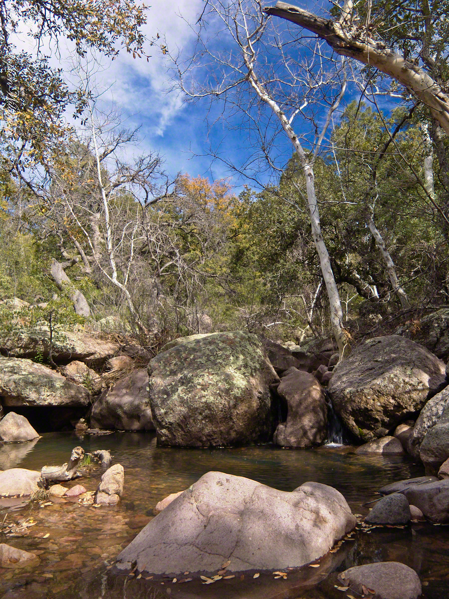
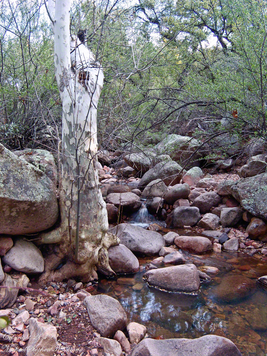
Turn left (up stream) where the Arizona Trail crosses Pine Creek and jump boulder to boulder for a hundred feet or so and you come to this view. The creek bank, covered by vegetation, rises on both sides and makes it difficult to leave the creek. Those are Arizona White Oak leaves floating along the large foreground boulder.
Pine Creek Pool with Young Arizona Sycamores
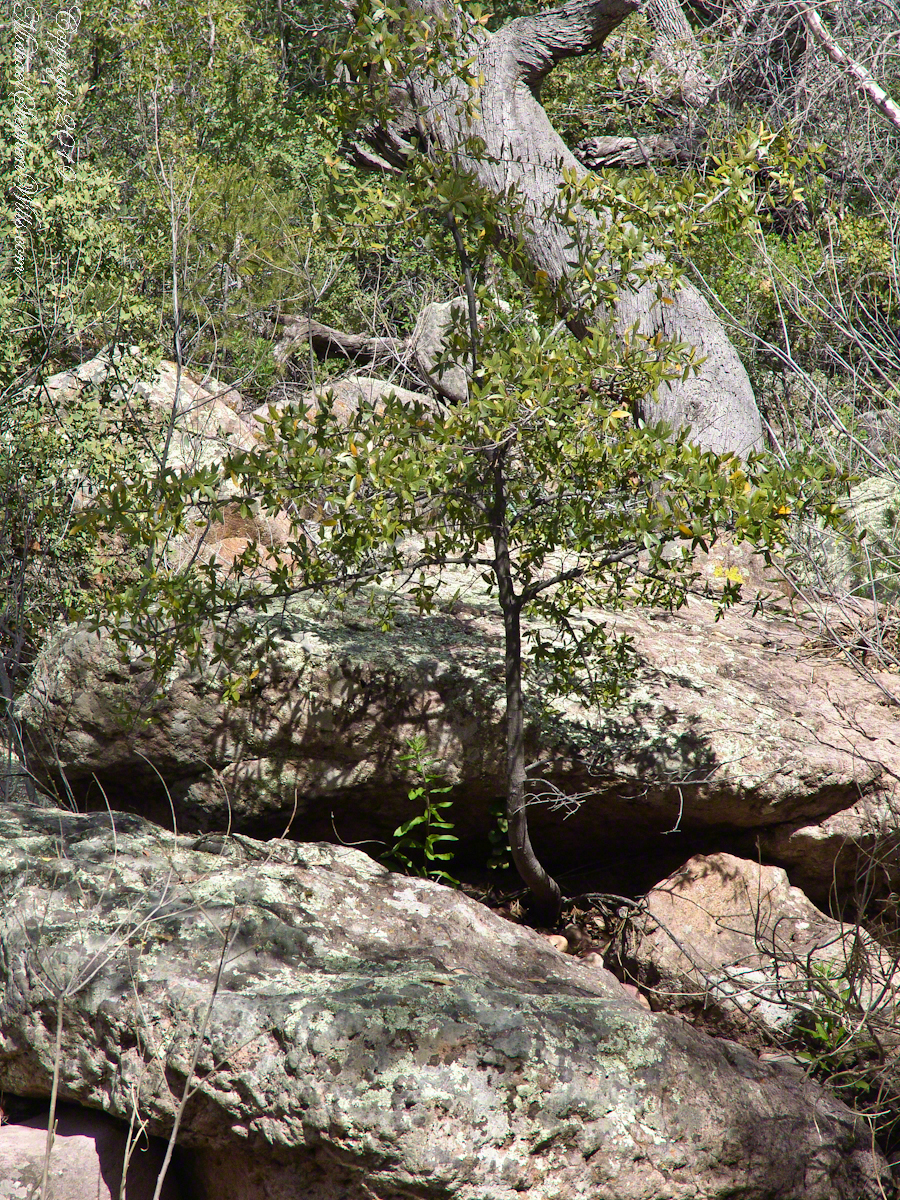
This is a very young Arizona White Oak, common species growing along the creek. The leaves are not what you’d expect from an oak, being 2 – 3 inches long in the shape of a lance blade and without obvious lobes Mature Arizona White Oak has a rough bark and, at most, 24 inch trunks.
Arizona White Oak
There are better examples of grand Arizona Sycamores along the perennial Reavis Creek. Pine Creek does not flow in the driest seasons, this tree sloughed its branches in order to survive. You can see from the many young Sycamores in the Pine Creek Pool photograph the previous photo the sycamores are successful in this environment.
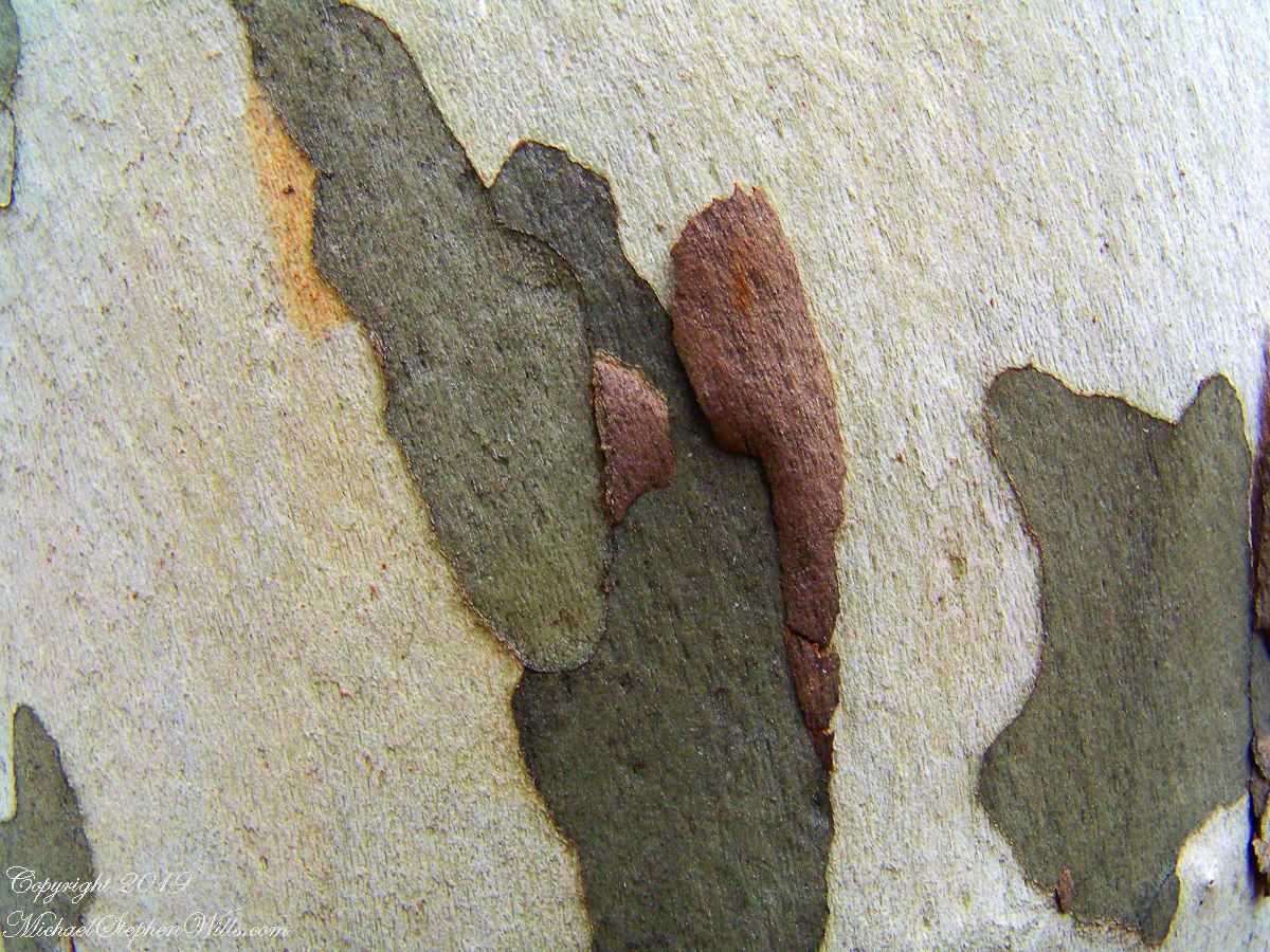
I spent some time with this Sycamore, capturing abstract patters of the bark.
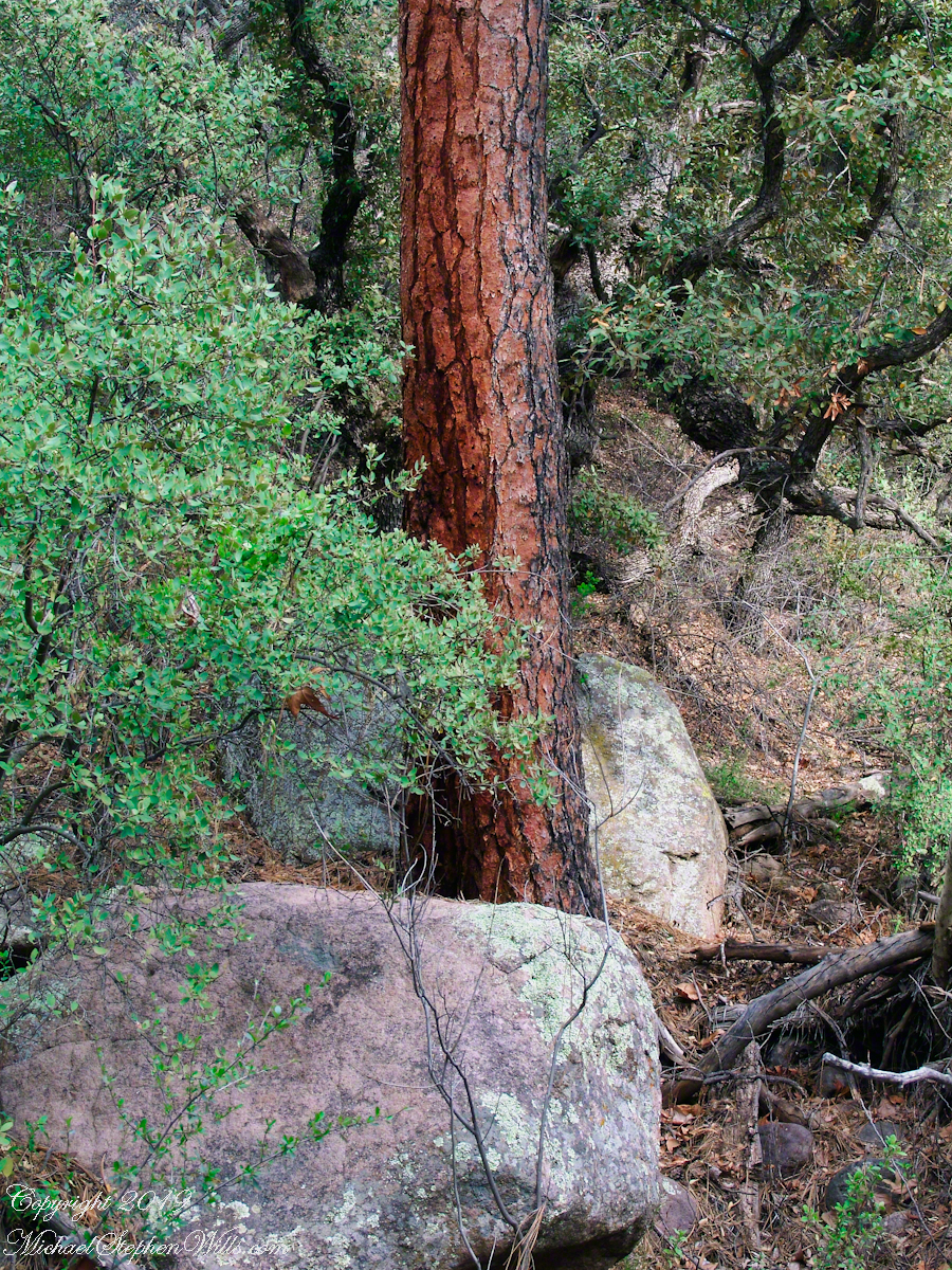
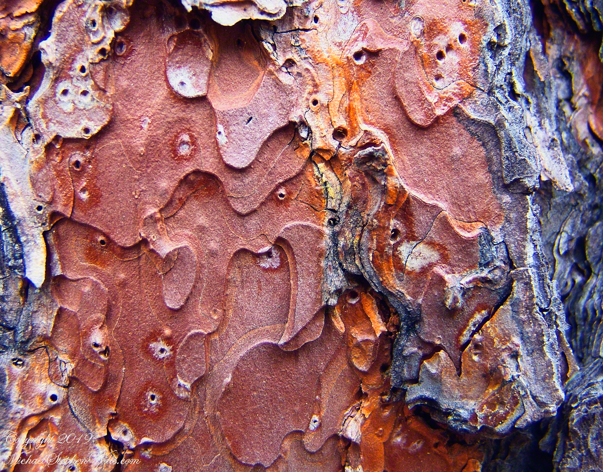
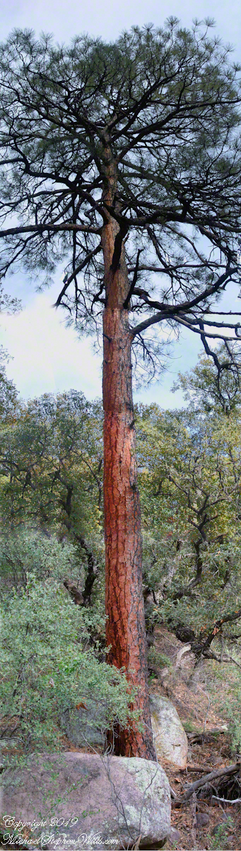
The abundance of Ponderosa Pines here demonstrate the species thrives at this altitude and dry environment. This specimen grows on the creek bank. Those are shrubby Arizona Oaks around the trunk.
Abstract patterns in the bark of this Ponderosa. The popular and scientific name (Pinus ponderosa) for this species is from the dense weight of the wood.
The tree is over 100 feet tall. I patched together four shots for this view.
In the afternoon I explored the Arizona Trail to Reavis Ranch. It crosses the creek to ascend the cliff in broad switchbacks. Eventually it follows a contour below a cliff with fine views of Pine Creek Canyon. I turned back to leave the hike to Reavis Ranch for another day.
“Out in the meadow, I picked a wild sunflower, and as I looked into its golden heart,such a wave of homesickness came over me that I almost wept. I wanted Mother, withher gentle voice and quiet firmness; I longed to hear Father’s jolly songs and to see his twinkling blue eyes; I was lonesome for the sister with whom I used to play in the meadow picking daisies and wild sunflowers.”
from “Laura Ingalls Wilder, Farm Journalist, Writings from the Ozarks” edited by Stephen W. Hines”
Photography Copyright 2021 Michael Stephen Wills All Rights Reserved