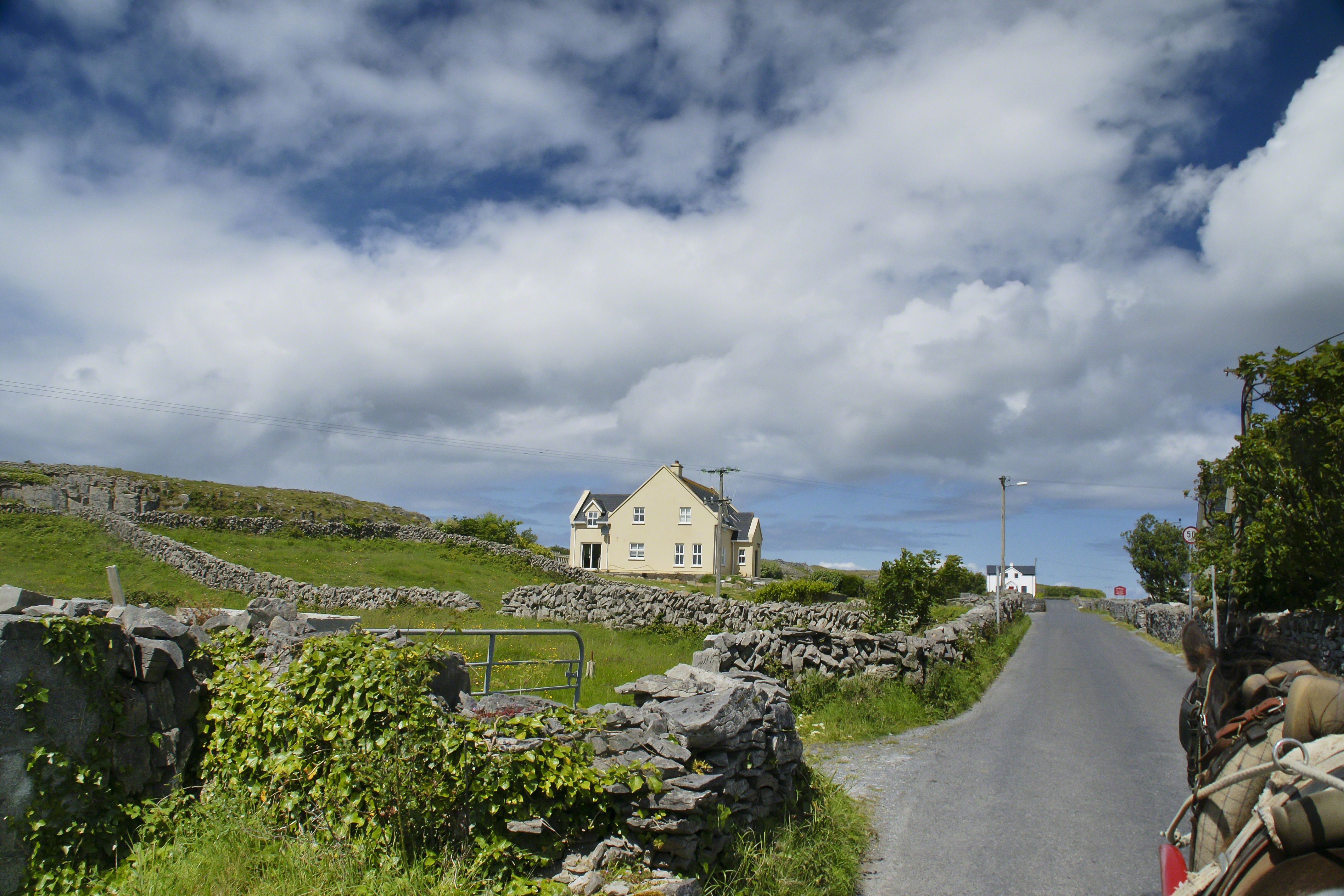
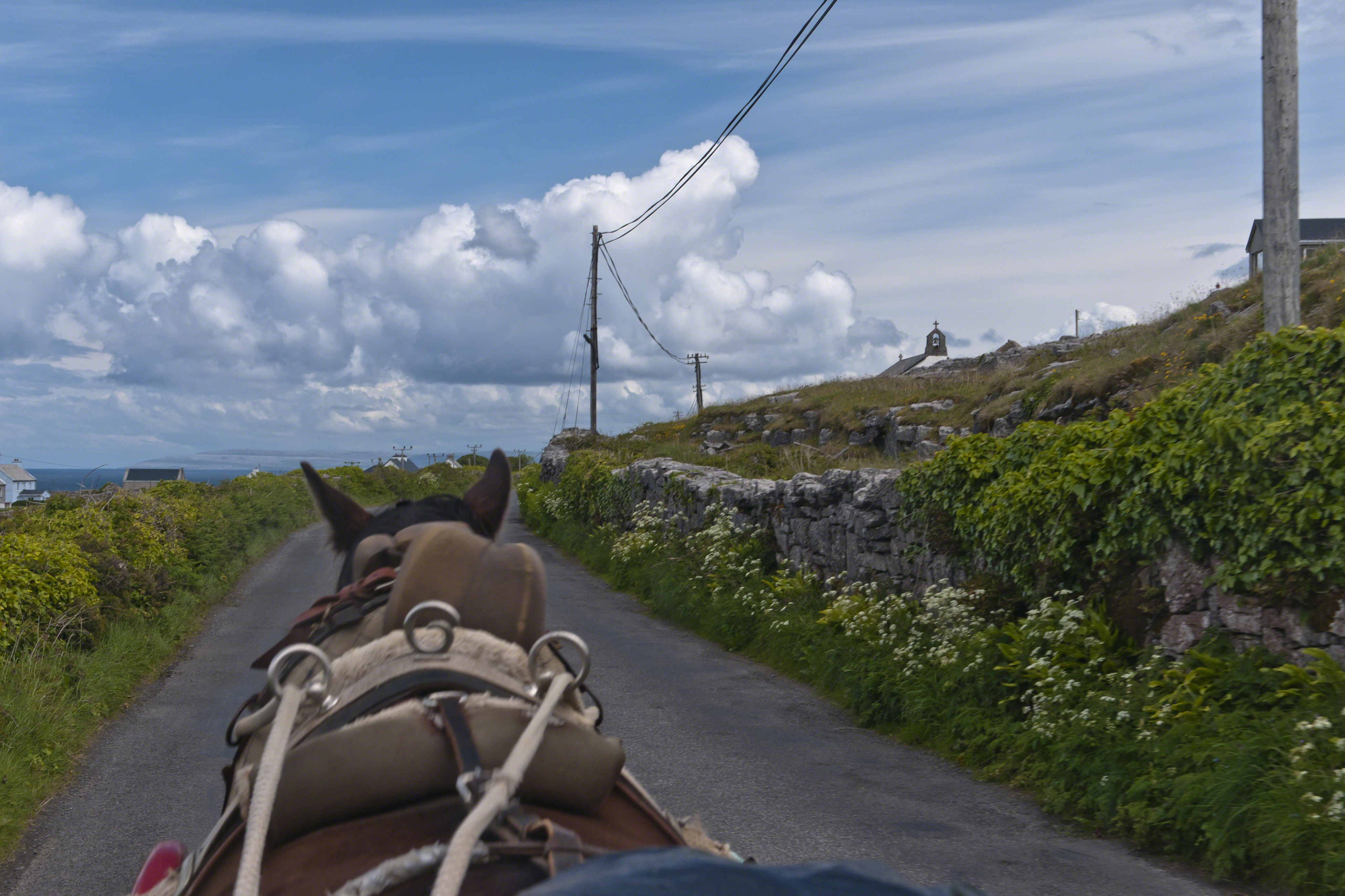
Enjoying travel on a horse trap, a type of carriage, on Inishmore (Inis Mór), the largest Aran Island in Galway Bay we headed up Cottage Road from Kilronan, the main island settlement. It was there we embarked from the ferry, hired the driver, his horse drawn trap. Our destination an iron age fort, Dun Aengus (Dún Aonghasa, the Irish language name) and the sights along the way.
Headed up Cottage Road, I captured this view of dry stone walls and homes against the May sky over the shoulder of our horse.
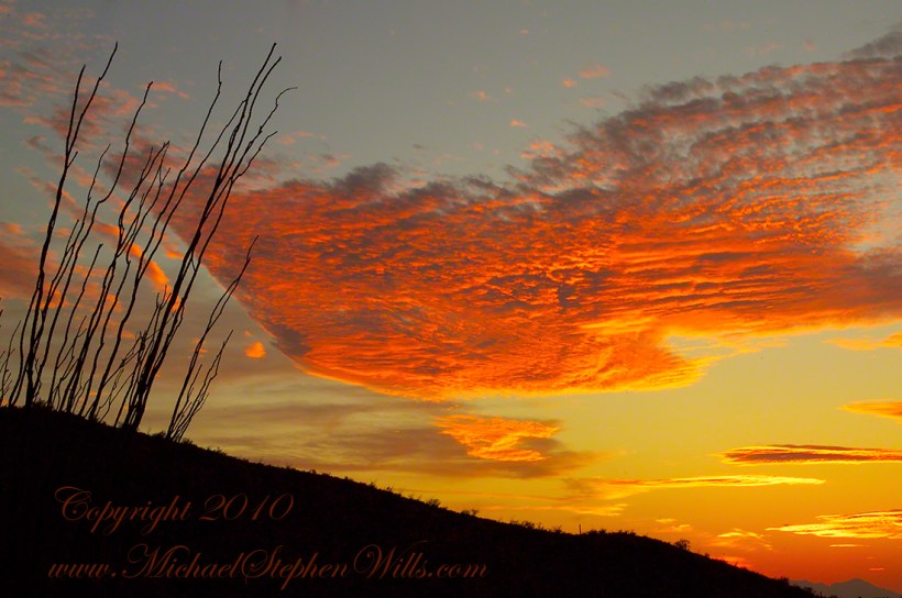
This is a retrospective diary of the day I created my print “Octillo Sunset.” You can visit “Octillo Sunset” on my online gallery by clicking on any of my blog photographs.
Choices of the Evening
Angled to the Sun
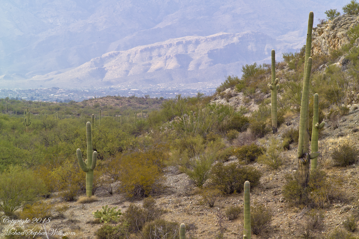
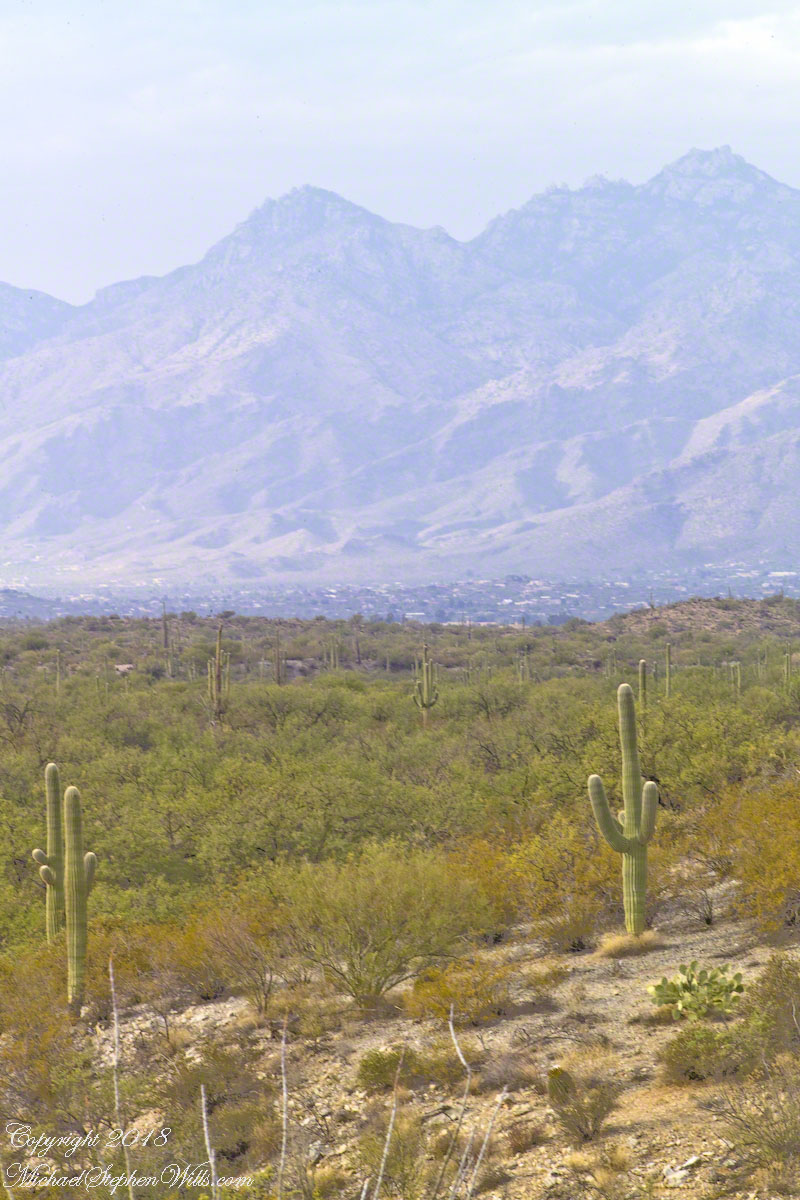
The following photograph of saguaros and distant Santa Catalina mountains is a similar view from Part 2 of this diary. Notice the saguaro on the right is also on the left in the Part 2 photo. What is happening is I turned the lens more toward the west and the sun. At this angle the lens hood offers less protection, especially as the sun is lower in the west and the time of day is passing to the best light from the lowering sun that rakes across the landscape. All this means I can bring the lens further to the west even though the lens hood is less effective.
Click any photograph to view Ocotillo Sunset
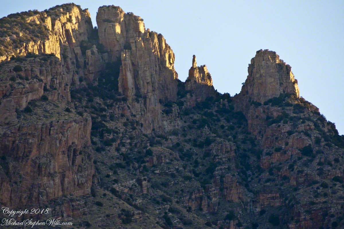
Finger Rock!!
One reason why I am offering it, is high on the Catalina mountains, in the distance, you can just see a formation called “Finger Rock”. This time of day, the lower angle of the sun brings out the canyon-shadows. Finger Rock canyon has a high western wall, you can see it as a high long shadow starting toward the very center of the picture and building up and to the right.
The following photograph is the view of Finger Rock from the floor of that canyon taken during a Spring 2011 Tucson visit. I started hiking in pre-dawn hours to catch the dawn rays on the finger.
Click any photograph to view Ocotillo Sunset
The Importance of Knowing Topography
Another aspect of this photograph is the landscape. There is a sloping bajada (alluvial fan) formed by water breaking up the mountain (in this case the Rincons) and washing it into the valley. It is the reason the saguaros appear to march into the distance. The same effect is used in movie theaters to allow the people in the rear to see over the head of people in the front.
This bajada and the higher elevation is the reason I moved from Sabino Canyon to here for a better position to view the sunset. Here is a nearly identical view, same 200 mm lens, in landscape format. The sloping land of the bajada is more visible.
Click any photograph to view Ocotillo Sunset
Changing the Lens/Sun Angle
Looking in the opposite direction, back over Lime Kiln Falls to the Rincon (mountain) foothills, the lens hood offers maximum protection. The sun is at my back and, even though it is low in the sky at the beginning of the Golden Hour, this aspect gives great color depth at the expense of loss of shadows losing some depth of field. Still, this is an interesting photograph.
On the ground in Sabino Canyon, I rethought my plans for the afternoon, given the potential of an incredible desert sunset, and decided to seek the high ground east of Tucson up against the Rincon Mountains in the Saguaro National Monument. There was still plenty of time to travel there and set up.
On arrival at the monument I took the scenic “loop” road that meandered around the desert. The Lime Kiln Falls trail makes some elevation, so I hiked that to the end. In the 1800’s the rocks in the area were exploited for their mineral content by heating them, on site, to high temperatures that released a highly caustic (chemically reactive) “quick lime” that was in high demand. All that’s left of this work is some ground discoloration.
The Dry Water Fall and former Mining Site
The “Falls” in question were a totally dry rock ledge that I climbed for these views. In the first photo, on the right in the distance, you can see the same mountain peaks I shared in Part One. I used the same 200 mm telephoto lens because that interesting stand of saguaros were over 100 feet away across a steep slope.
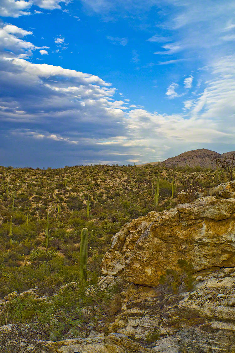
Young Saguaros
The saguaros are interesting, to me, because they are all so young and grouped together. As though s clutch of seeds from the same specimen landed together on the same spot. The saguaros are notable for their lack of arms which will form with the passing years.
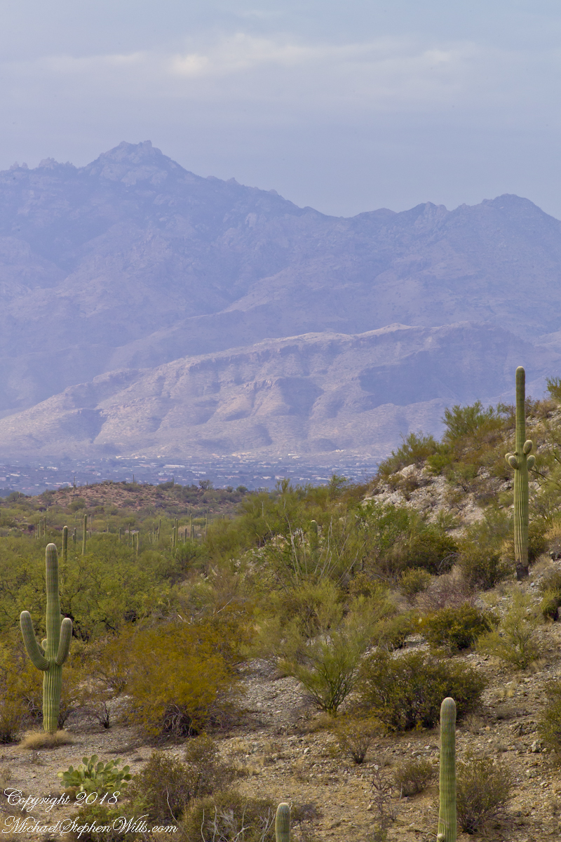
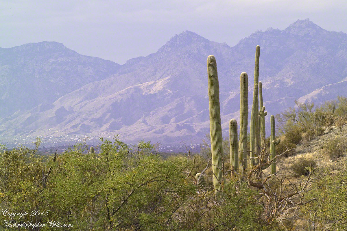
A View of the Catalinas
Late afternoon is the perfect time to photograph the Catalinas in the distance and the high, thin gathering cloud cover made for dramatic shading of the peaks. I needed to wait for a perfect moment because the light and view changed, literally, second by second. If you look closely, the city of Tucson can be seen among the foothills, to the left.
Why the Distance Stands Out (high contrast)
The lens was fitted with a deep hood. Besides being black, the interior of the hood is surfaced with black felt, the same as used for large telescopes, to capture any stray light. Light falling across the lens surface causes reflections, which is what this hood prevents. The result is the amount of contrast I captured, using the appropriate exposure and other settings. For this photograph I used F14, 1/125 and ISO160.
Click any photograph to view Ocotillo Sunset
Another Catalina View
A bit further down the same trail, the desert view features an army of saguaros marching into Tucson.
Click any photograph to view Ocotillo Sunset
The Catalina Highway runs along the escarpment, in the distance, and to the top of Mount Lemmon, a 9157 foot peak. In season, you can ski in the morning, on the peak, and in an hour or so travel to the desert to sunbathe comfortably. From the trail to the top of the Rincon Mountains this view just keeps opening up farther and farther and farther. My wife, Pam, and I backpacked up there April 2011.
On a Tucson November 2005 afternoon, after my volunteer work for the University of Arizona, CALS college, alumni board of directors, in the mid-afternoon I headed for Sabino Canyon with my photography kit.
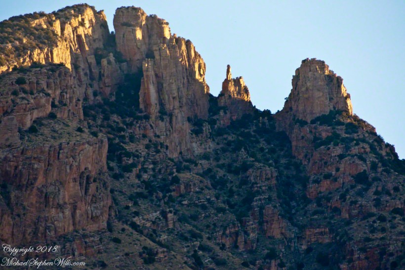
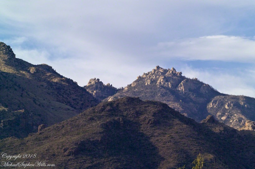
With a 25-pound pack on my back, walking from the parking lot I looked up at the incredible rock formations of the Santa Catalina mountains. It took some time to set up the tripod (at that time I was using a cheap swivel head on adjustable aluminum legs) with a 200mm telephoto lens (Canon L-series EF 200mm USM) I grabbed this shot of the hoodoo fringed peaks beyond the foothills (f16, 1/30, ISO160). The lower sun angle made the formations pop out.
Hoodoos in the Hills
You call those strange formations of upright rocks “hoodoos. Some people believe the fantastic shapes were created by spirits, today the explanation is wind, water and time create hoodoos from rock of the right stuff. It is a wonderful experience to wander among hoodoos, though unsettling because some of these large rocks are seemingly in danger of falling over at any moment.
Moving On
I have a mental list of photographic “to do’s” and the gathering clouds, typical for a Tucson November day, reminded me an awesome desert sunset was on this list, so I packed up to head for the east side of Tucson for a shot looking toward the Tucson Mountains (on the west side).
Clouds gather at sunset above a ridge serrated by saguaros.
Click any photograph to view Ocotillo Sunset
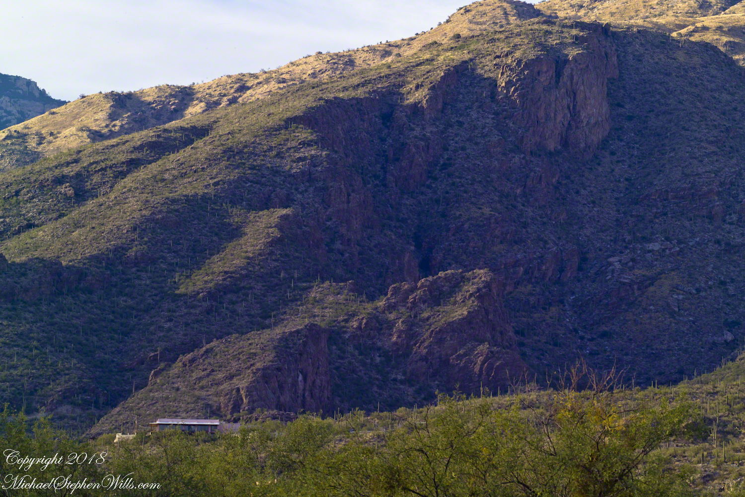
Sabino Canyon House
Before we move on, this is a fascinating image of a typical southern Arizona house perched on a ridge at the mouth of Sabino Canyon. In this image the viewer sympathizes because the telephoto lens gathers the majestic rocks around the tiny structure.
The house is perched on a Santa Catalina foothill ridge running east west, a wall of picture windows facing south with a view across the Tucson valley toward Mount Wrightson of the Santa Rita mountains, 42 miles distant. Summer thunderstorms gather on this peak, wreathing it with lightening. These times, evenings and night, the view pays for the inconvenience of this distant, hot ridge. Another time to be there is for sunsets.
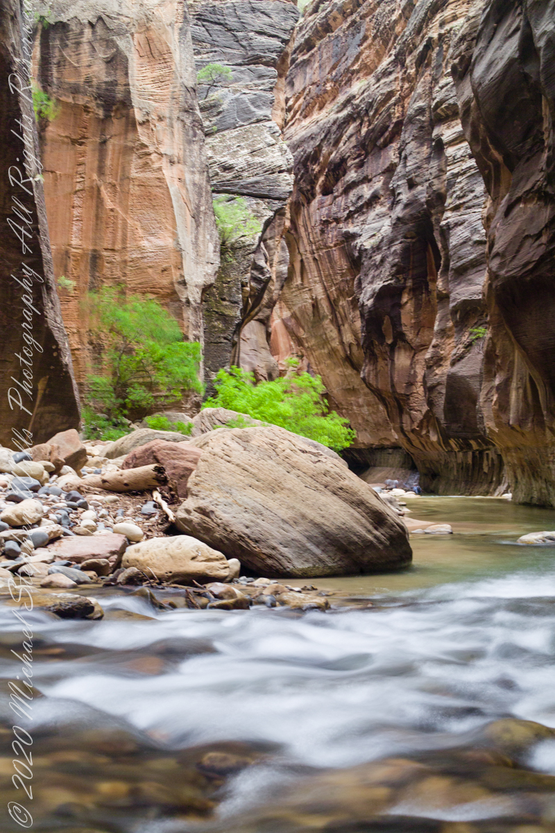
In this series of three exposures from a tripod mounted Kodak DSC Pro SLR/c and Canon EF 50 mm f/1.4 USM lens, all were ISO 250, at f/8. The difference was the exposure time. In is the shortest exposure, 1.6 second, the human figures are blurred, though to a lesser extent than the second image, released earlier.
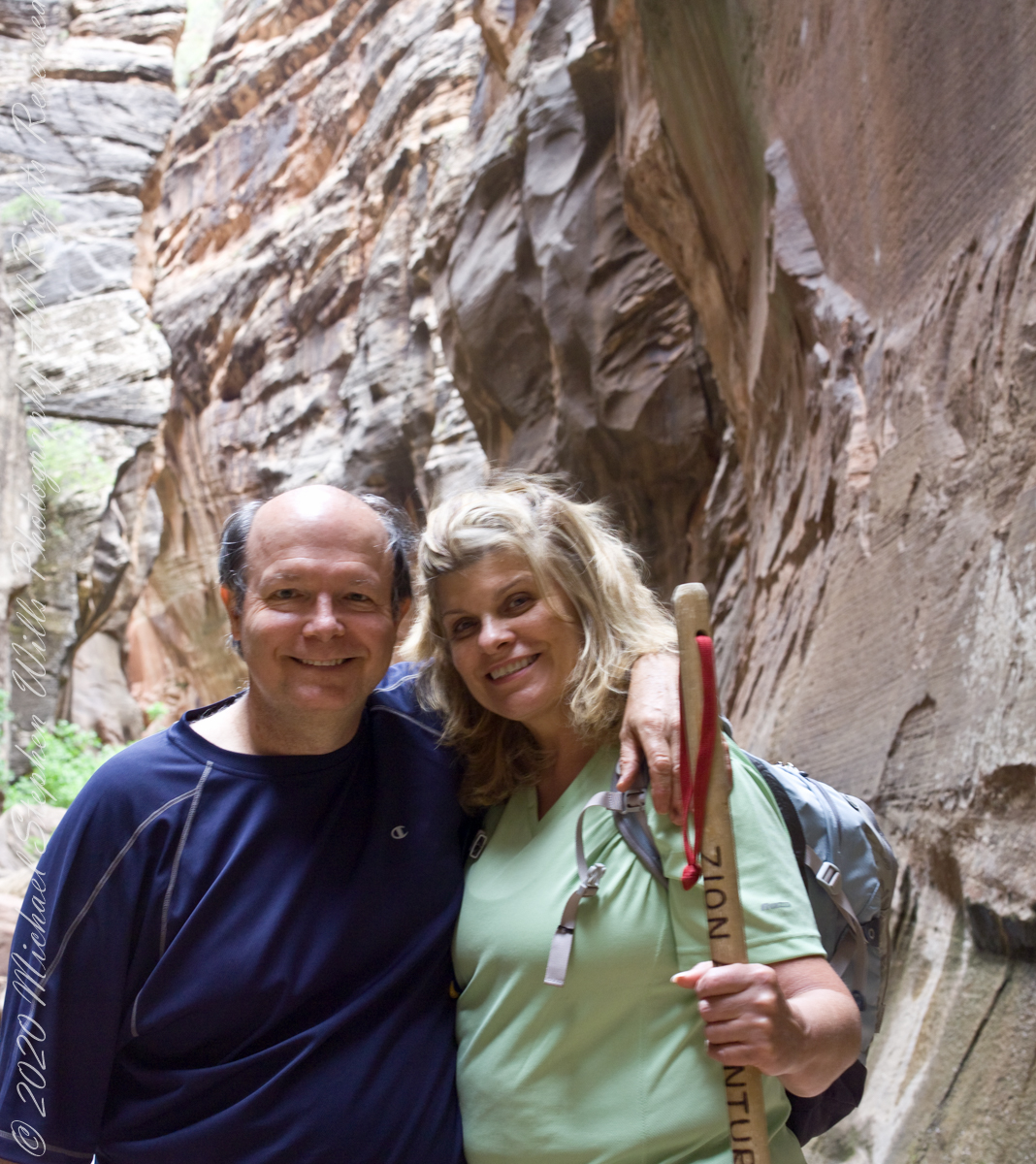
This is the last image of our trip to Zion National Park.
Copyright 2021 Michael Stephen Wills All Rights Reserved
Another aspect of the gradual 1/2 mile inclined path to the central ring of the prehistoric Dun Aonghasa ruins of County Galway, Ireland.
The view north, northwest from this way to Dun Aonghasa (Dun Aengus). In early June, looking across wildflowers, karst landscape, walled fields, farms, the North Atlantic Ocean, coast of Connemara and the 12 Bens (12 Pins) mountains.
Note the doorway (with long lintel) in the surrounding wall, to left of center in middle distance.
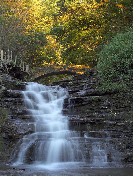
An 84-degree October walk up Cascadilla Gorge—quiet paths, bluestone porches, fresh paint on the bridge—waiting for the footbridge to catch the last, warm evening sunlight.
Every fall I make a point of walking Cascadilla Gorge at least once. On an 84-degree October 9 afternoon, Pam was tied up with chores, so I parked downtown and stopped to see the grandchildren. They were with their mom. Two were “too tired” after school to do anything. The youngest, at the age of four, was not yet in school and he floated the idea of the skateboard park; for me, that wasn’t in the cards. So I set off on foot up Court Street, past the residence of Buddhist monks at the gorge entrance.
Cascadilla Gorge is part of Cornell Botanic Gardens (formerly the Plantations), the university unit that stewards natural areas and gardens across campus. Foot traffic was light. A sign explained why: the lower trail was closed at Stewart Avenue, where the bridge spans the ravine. I crossed to the north side by the Christian Science church and wound up Cascadilla Park Road to the rim trail that climbs East Hill toward campus.
Homes line this stretch, porches facing the gorge where the constant music of creek and falls carries up. Not feeling ambitious, I made a few phone snapshots. Here the path squeezes past a porch built of local “bluestone,” a feldspathic sandstone native to the region—around town it’s sometimes called “Llenroc,” Cornell in reverse.
That pot you see in the previous photo gets a closer look here, with more of the same weathered bluestone.
The drop to the gorge floor is steep, sheer in places. The barrier fence looks stout in some sections and thins to almost nothing in others. A few years ago, a recent Cornell graduate walking home late along this path fell to his death. I continued to the fork for the Ithaca City Cemetery, climbed to Stewart Avenue, turned right to cross the Cascadilla bridge, then right again onto the Gorge Rim Trail back toward town. At the bridge I noticed part of the closure work: fresh paint on the bridge and on the suicide-prevention netting beneath. On September 24—just fifteen days earlier—a Cornell senior had jumped; the net caught him, and the fire department brought him to safety.
From the concrete barrier in that photo you can peer into the gorge: a beautiful view, the steady voice of water rising from below. I try to leave the darker stories where they belong—at least until the sight of fresh paint pulls them back to mind.
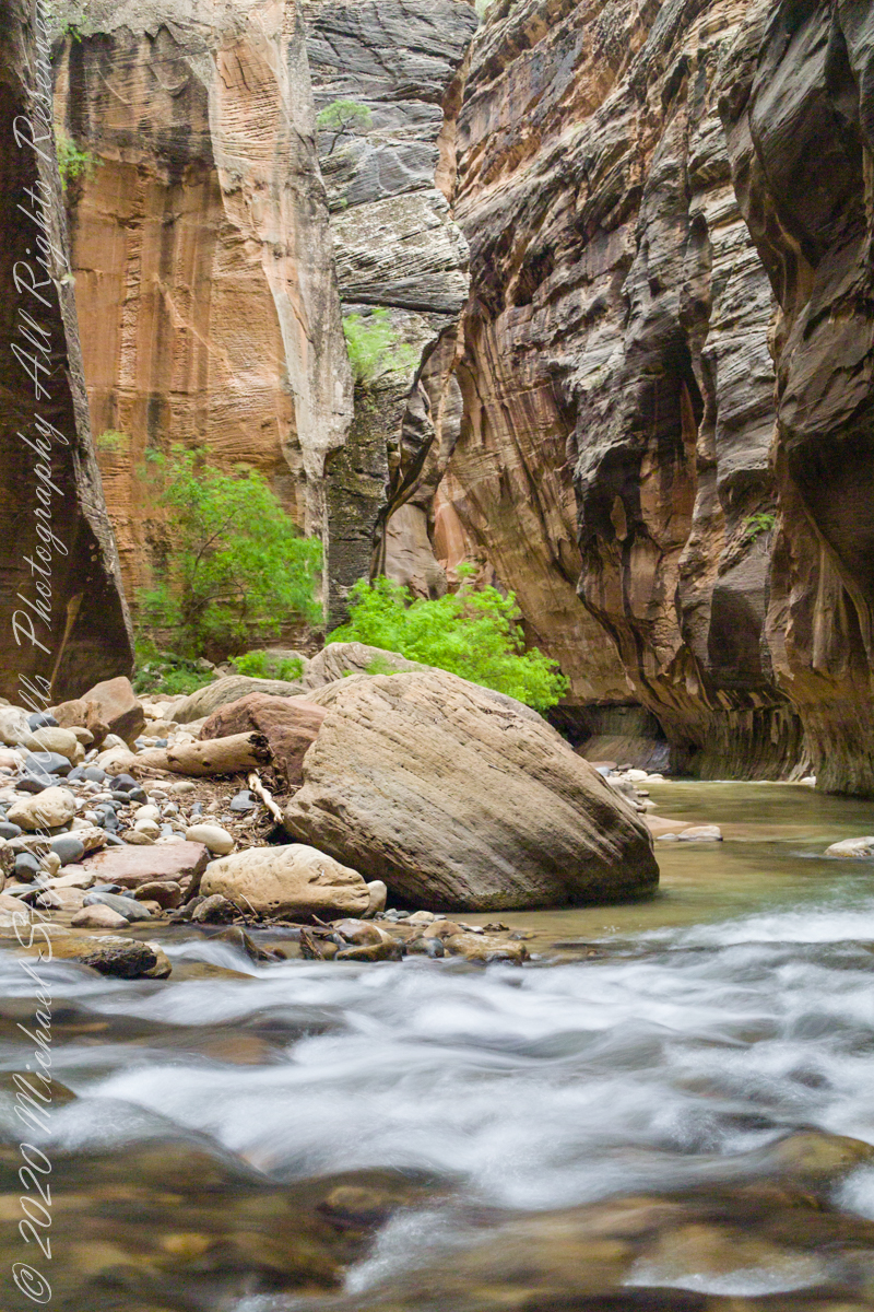
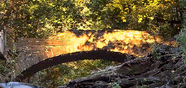
I took the following photograph in 2005, the September before my previous post, “Autumn Stroll in Sapsucker Woods” with the Kodak DSC pro slr-c, an ND filter, 50 mm lens and a tripod. It was a planned session, I work waterproof boots and was able to stand in the creek after a series of rain-free days. At this time of the year the gorge opens to the setting sun. I waited, taking a series of photographs for the perfect amount of light on the footbridge. The feature photograph (the header to this posting) is a detail from a shot with the bridge more fully lit.
The header image for this post comes from a planned session in September 2005, just before the photograph of my “Autumn Stroll in Sapsucker Woods” post. I used a Kodak DCS Pro SLR/c with an ND filter, a 50 mm lens, and a tripod. After several rain-free days I wore waterproof boots and stood mid-creek. In autumn the gorge opens to the setting sun; I waited and shot a sequence until the light laid perfectly across the footbridge. The banner image is a detail from a frame where the bridge is more fully lit.
We have a framed print of that photograph at home. I mounted it as a gift to Pam on our first Valentine’s Day.
“September Sunset in Cascadilla Gorge”
If you’ve walked Cascadilla Gorge in autumn, I’d love to hear your favorite vantage points—porches along the rim, the lower stone steps, or the footbridge at golden hour. Do you know any stories about Llenroc bluestone on these houses, or remember the Stewart Avenue Bridge before its safety upgrades? Photographers: what helps you balance deep shade and bright water from the designated trails? Share a tip or a memory in the comments.
Enter your email to receive notification of future postings. I will not sell or share your email address.
Copyright 2025 All Rights Reserved Michael Stephen Wills
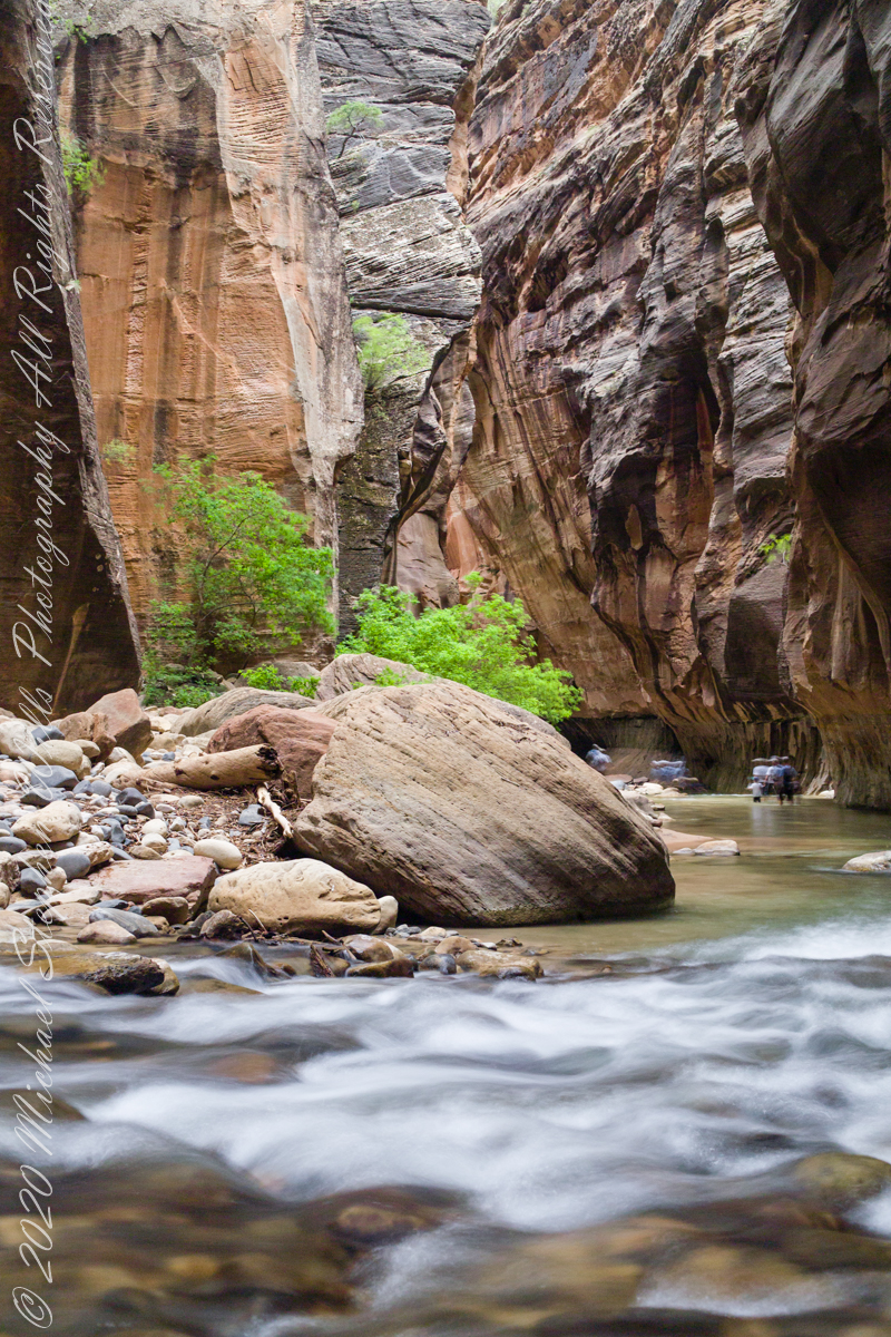
The image is from a tripod mounted Kodak DSC Pro SLR/c and Canon EF 50 mm f/1.4 USM lens, ISO 250, exposure 3.5 sec at f/8. The flowing water in forground has an appealing blur, fellow waders, in the distance under beeteling cliffs, are blurred and unrecognizable.
Here the canyon turns sharply to the right.
Copyright 2021 Michael Stephen Wills All Rights Reserved