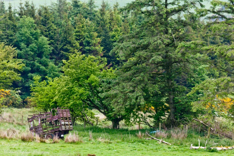
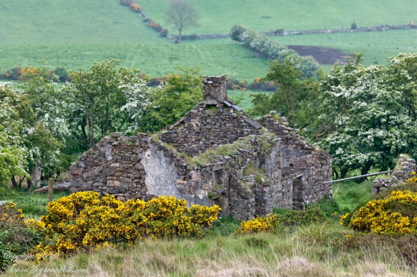
In the early dawn, I walked the path to Killen, drawn by the legacy of my mother’s Irish youth. An abandoned hay wagon stood, a relic amidst the whispers of history and myth. Join me in uncovering the roots that intertwine family and the enduring Irish land.
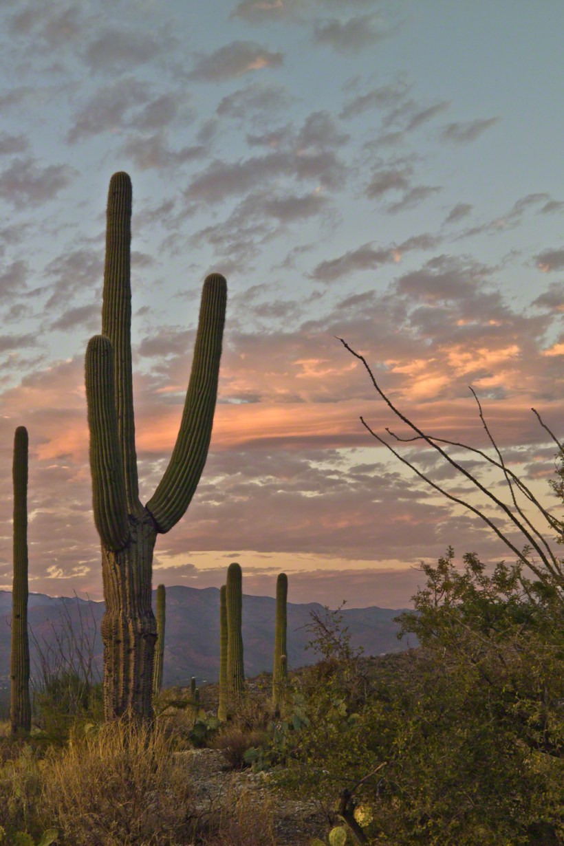
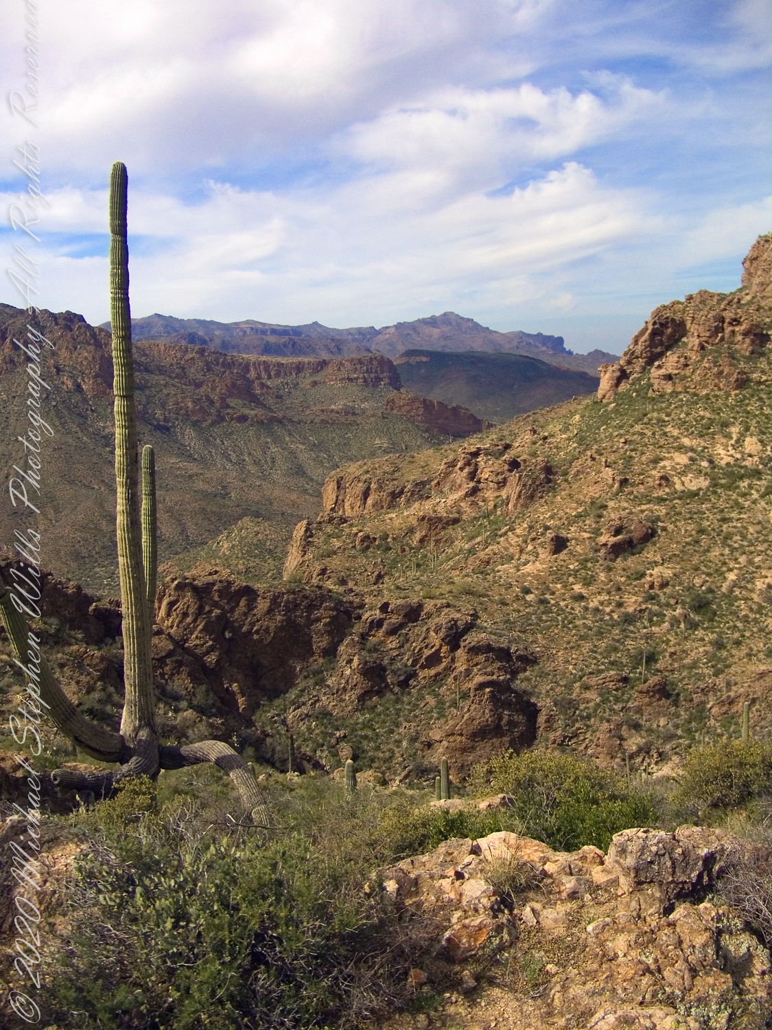
Embrace with me the unique splendor of southern Arizona’s deserts in November. Join me atop the Tanque Verde Ridge as we capture the last light accentuating the saguaros against an evolving sky.
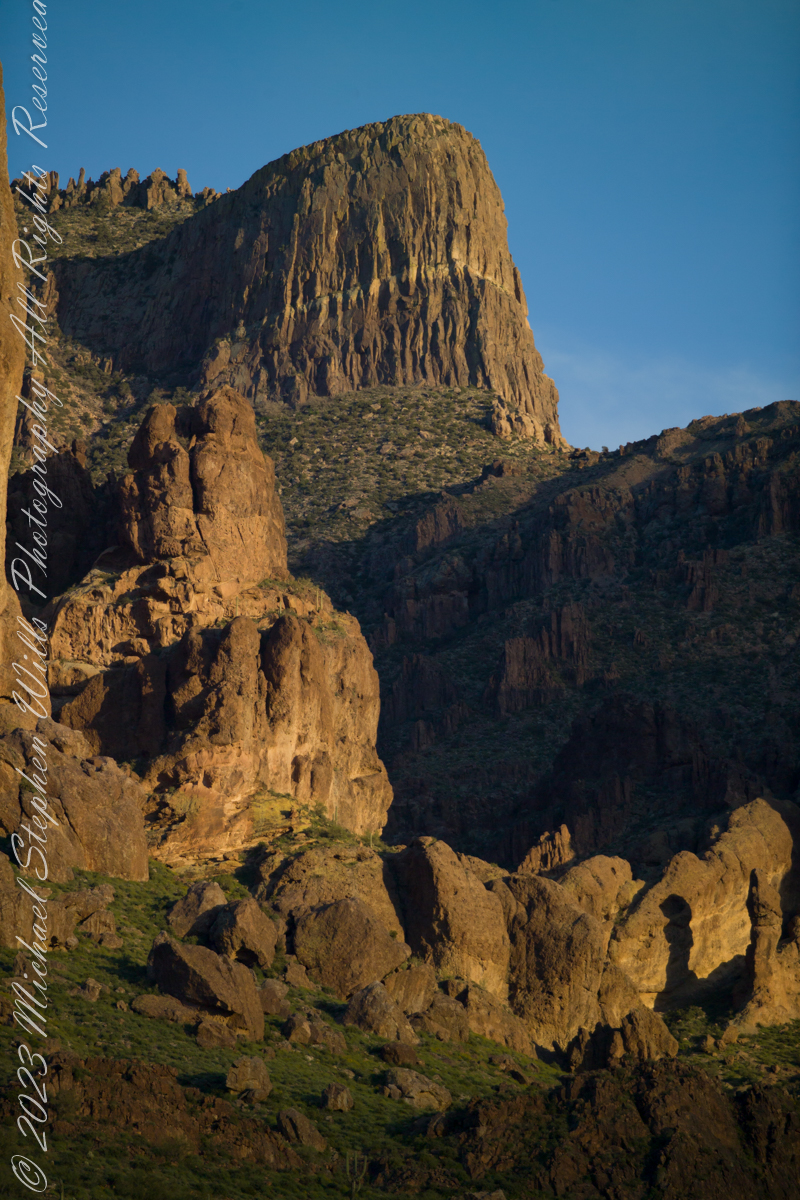
The mountain was formed by a series of volcanic eruptions between 20.5 and 18 million years ago. The west face of the mountain is composed of dacite lava and rhyolitic tuff. The overlying tuff was deposited during an eruption which created a collapse caldera bounded by faults. Dome resurgence reactivated these faults, causing uplift of the caldera floor which juxtaposed the softer tuff and more resistant dacite. Differential weathering caused the outer tuff to erode faster, leaving the dacite cliffs exposed and creating the prominent mountain visible today.
The Flatiron, the mesa-like projection above us in this view, is long solidified dacite lava. The word dacite comes from Dacia, a province of the Roman Empire which lay between the Danube River and Carpathian Mountains (now modern Romania and Moldova) where the rock was first described. Lost Dutchman State Park, Apache Junction, Maricopa County, Arizona
Reference: Wikipedia “Superstition Mountain” and “Dacite Lava.”
Copyright 2023 Michael Stephen Wills All Rights Reserved
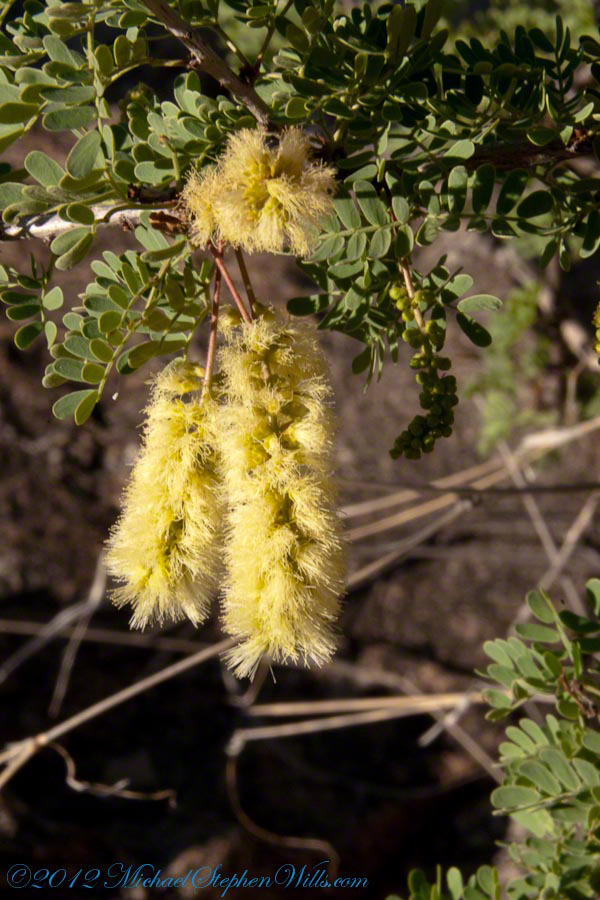
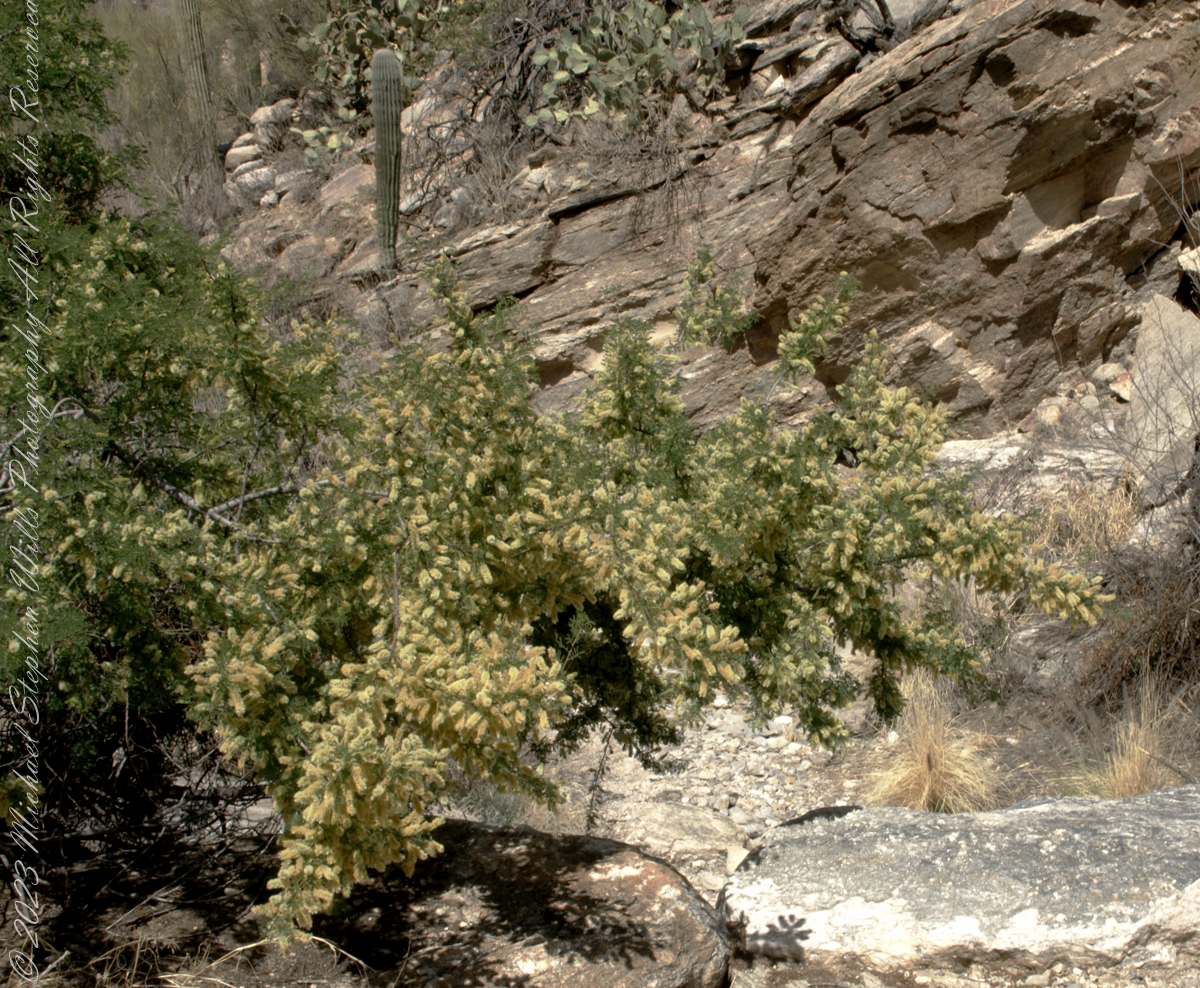
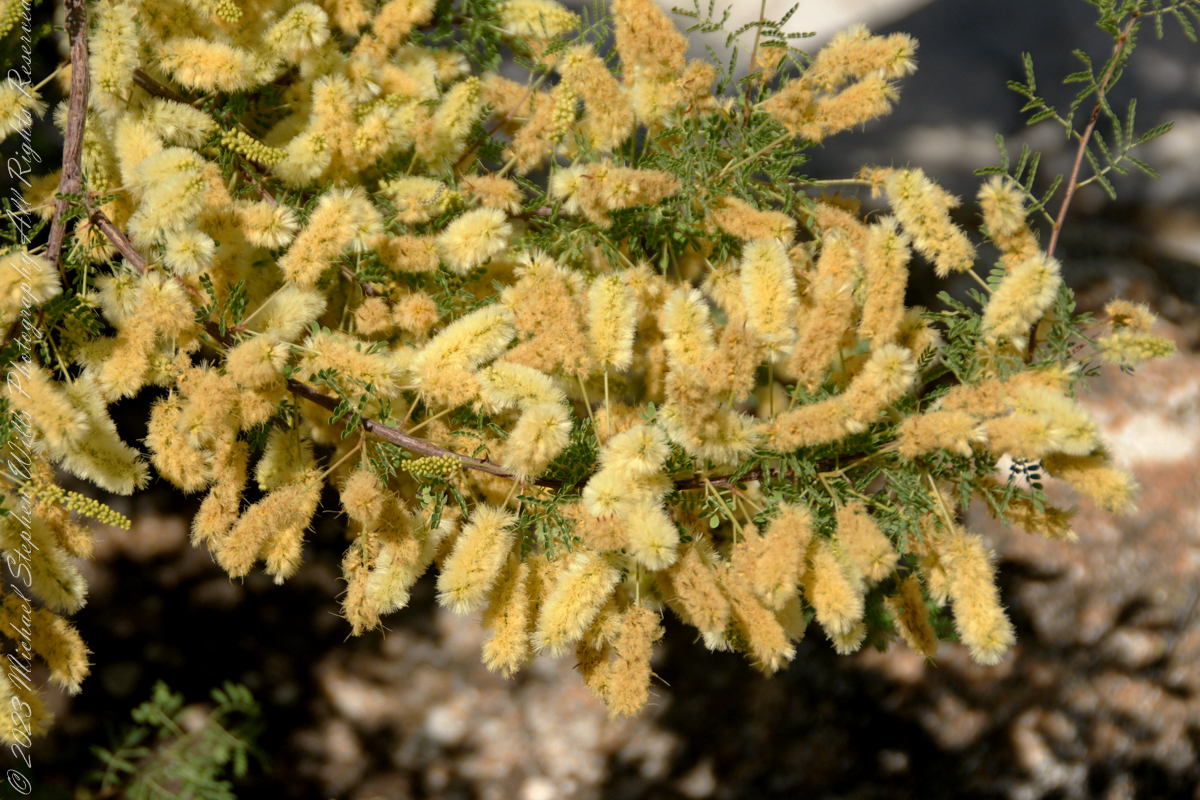
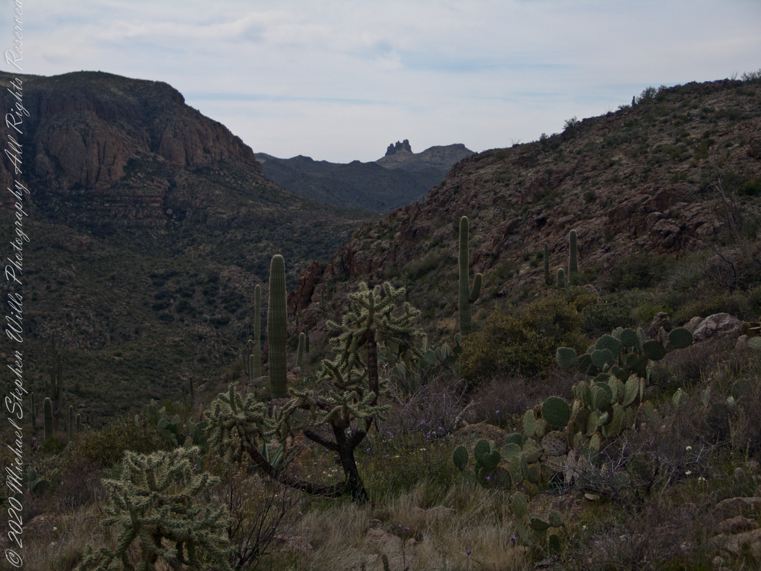
Mesquite is the Sonoran Desert smell carried by distant rain, omnipresent and humble, a survivor with tap root extending 190 feet down to draw on the water table.
Prosopis is the scientific name for about 40 species of leguminous trees. Present in North America since the Pliocene era, mesquite wood has been dated to 1300 BC.
I found this flowering mesquite bush in Finger Rock Canyon of the Catalina Mountains outside Tucson, Arizona.
They are thought to have evolved with megafauna in the New World. The loss of North American megafauna at the end of the Pleistocene era gave way to one theory of how the Prosopis spp. were able to survive.
One theory is that the loss of the megafauna allowed Prosopis spp. to use their fruit pods to attract other organisms to spread their seeds; then, with the introduction of livestock, they were able to spread into grasslands.
The plentiful legumes that develop from these flowers are edible when cooked. The shape and color of the seeds can be understood from this empty seed pod that happens to lie near a tarantula burrow.
November is a special time for the ranges and basins of southern Arizona deserts. Climb a bajada of foothills, face west and wait for the sunset. That is what I did this day, November 3, 2005. East of Tucson the Saguaro National Monument at the foot of the Rincon Mountain Wilderness is where I parked, unpacked the photo gear and climbed the side of the Tanque Verde Ridge for a favorable view. Weather was pushing high level moisture from the west, clouds were developing.
You see here a shot from that session. In the distance, looking across Tanque Verde, are the Santa Catalina mountains. Months since the last rainfall, the giant Saguaros are using internal moisture reserves drawn up from a shallow root system, the flesh is less plump, the supporting structure of the ribs, always evident, are more pronounced. The last light catches these ribs in relief against a dramatic sky.
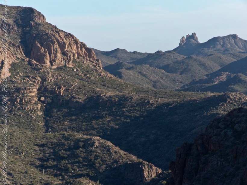
View North / Northwest from Peter’s Mesa. At our feet is a mature Saguaro Cactus towering over Charlebois Canyon, to the right Black Mountain. Bluff Spring Mountain, middle distance, then Black Top Mesa. Flatiron Peak, of the famed Superstition Mountain, is in distance. Photographed from Peter’s Trail on a March afternoon 2008. Superstition Wilderness, Tonto National Forest, Arizona
Bluff Spring Mountain, middle distance, then Black Top Mesa. Flatiron Peak, of the famed Superstition Mountain, is in distance. Photographed from Peter’s Trail on a March afternoon 2008. Superstition Wilderness, Tonto National Forest, Arizona
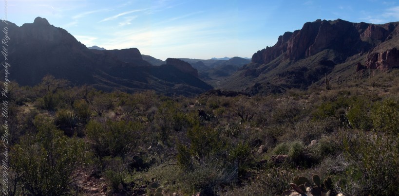
The eye of Miner’s Needle is clear in both these South / Southeast views from Peter’s Mesa looking across the Music Canyon.
Morning
Many wildflowers, sprinkled like stars through the foreground of the morning photograph with Prickly Pear, Cholla and Saguaro cactus. Beware of “Jumping Cholla”, named for its seeming ability to attack passers-by. Another name, “Hanging Chain Cholla”, is more appropriate. Each chain with many hooked barbs is lightly attached to the branch, ready to snag a ride from unwary hikers.
Light rakes across the landscape in the evening photograph, taken from another vantage point on Peter’s Mesa. Miner’s Needle is four (4) miles away “as the crow flies,” i.e., line of sight distance.
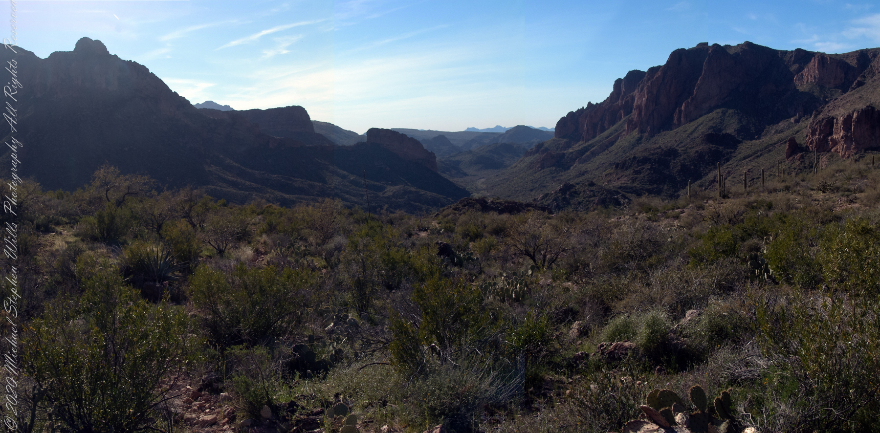
View North / Northwest from Peter’s Trail looking back the way we came. Black Mountain on right, Bluff Spring Mountain left with LaBarge Canyon running to the Red Hills center. On a March afternoon 2008.