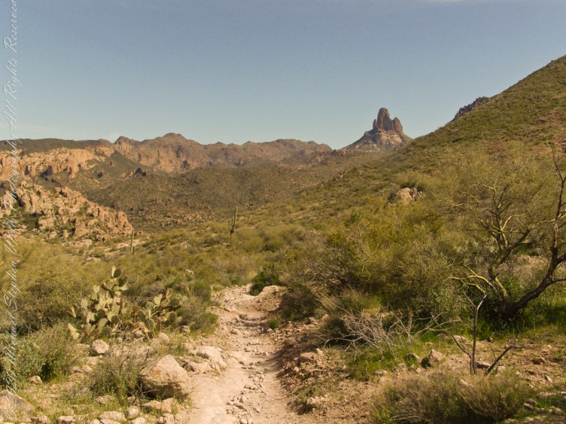
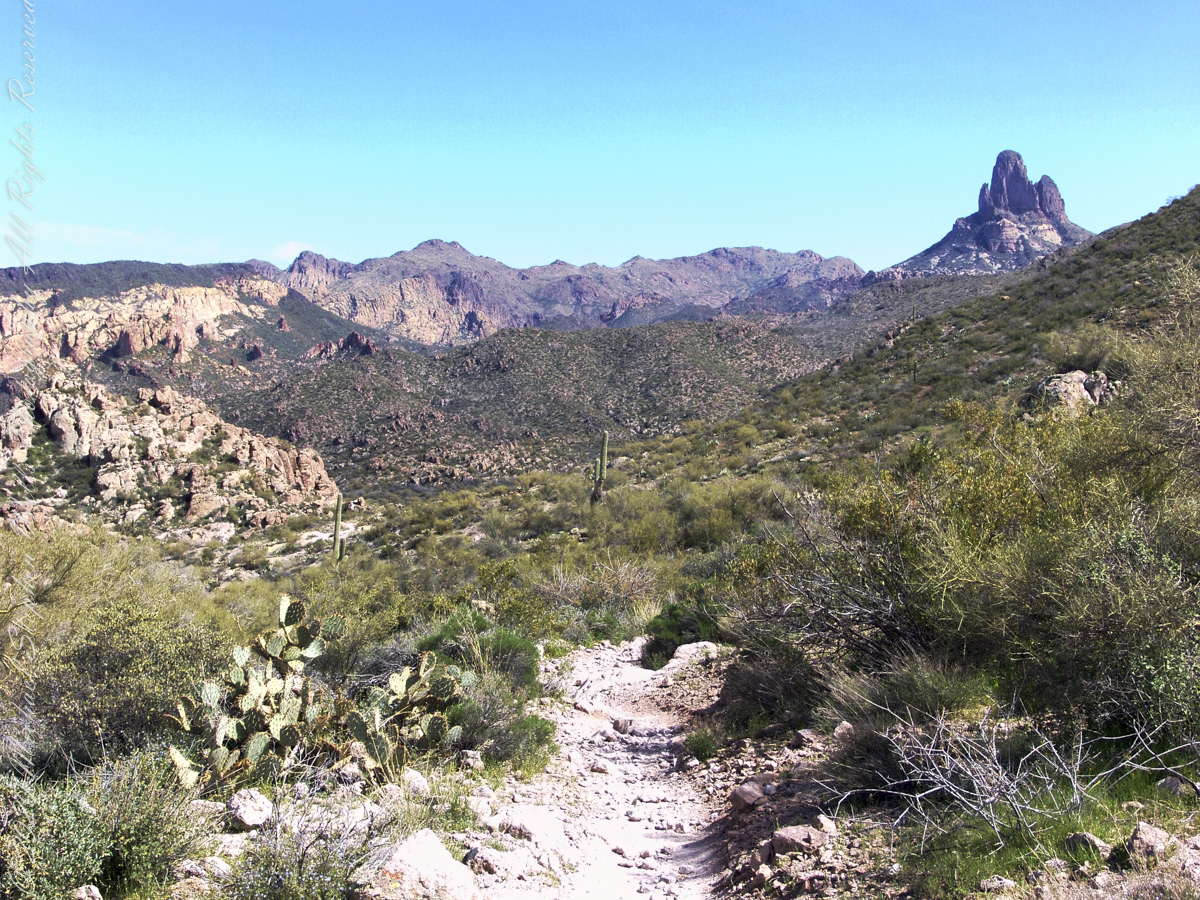
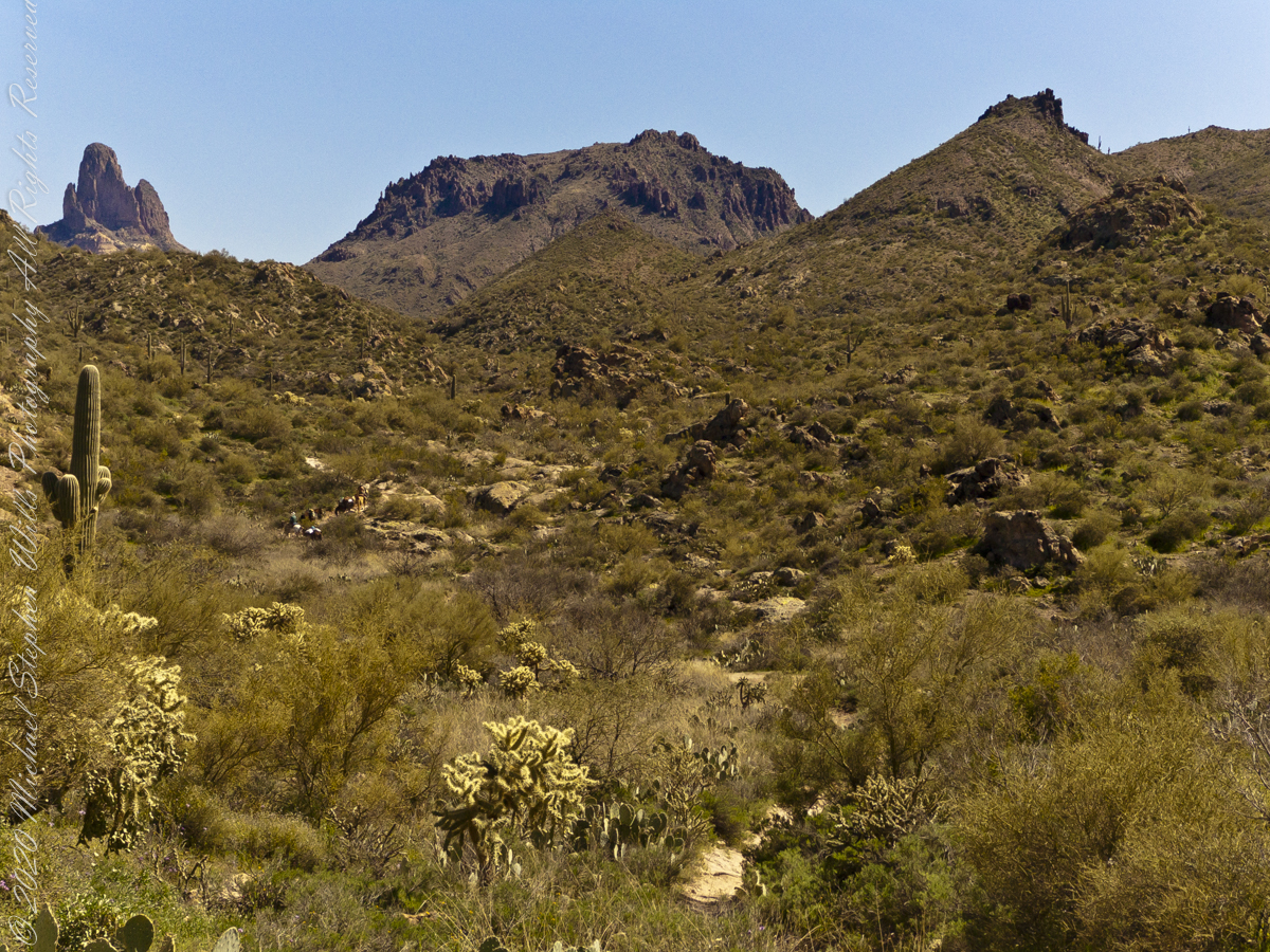
My party is out of sight, Parker Pass seems no closer, Weaver’s Needle looms 3.1 miles away over several ridges.
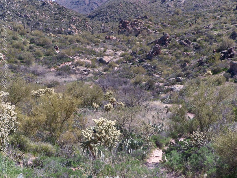
A sole day hiker is on the trail ahead. I carried a gallon of water with a siphon pipe, so was taking sips every so often and becoming dehydrated anyway. Ahead is the ridge of Parker Pass, the pass is the green slant of land on right.
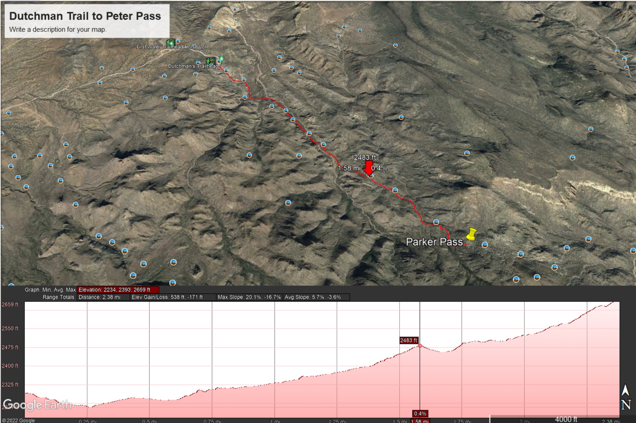
This is a capture from Google Earth of our route to Parker Pass, with a chart of the elevation changes. I am on that last hump with a few more up and down climbs before the pass.
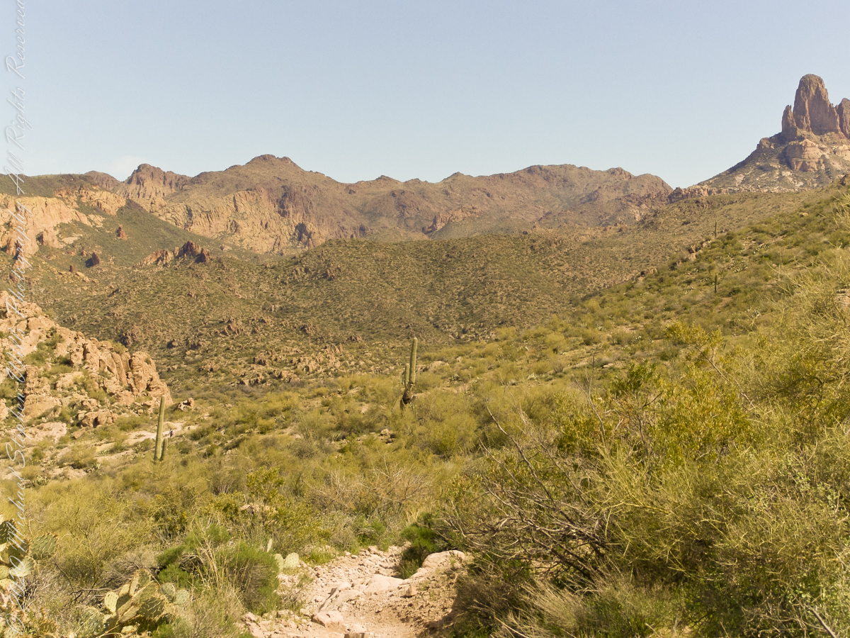
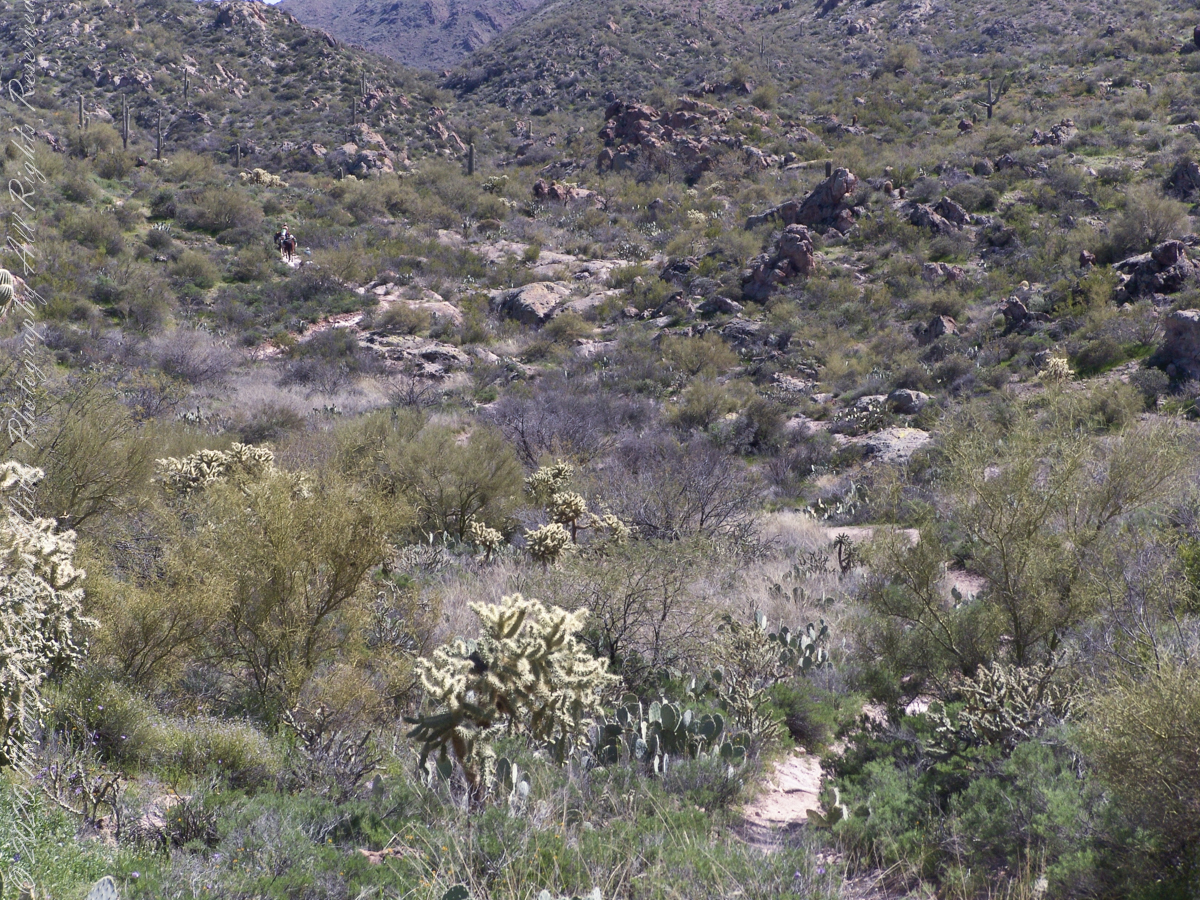
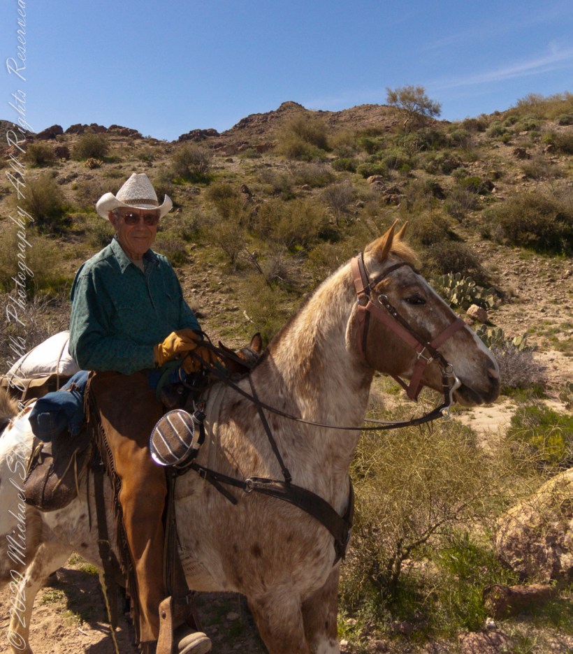
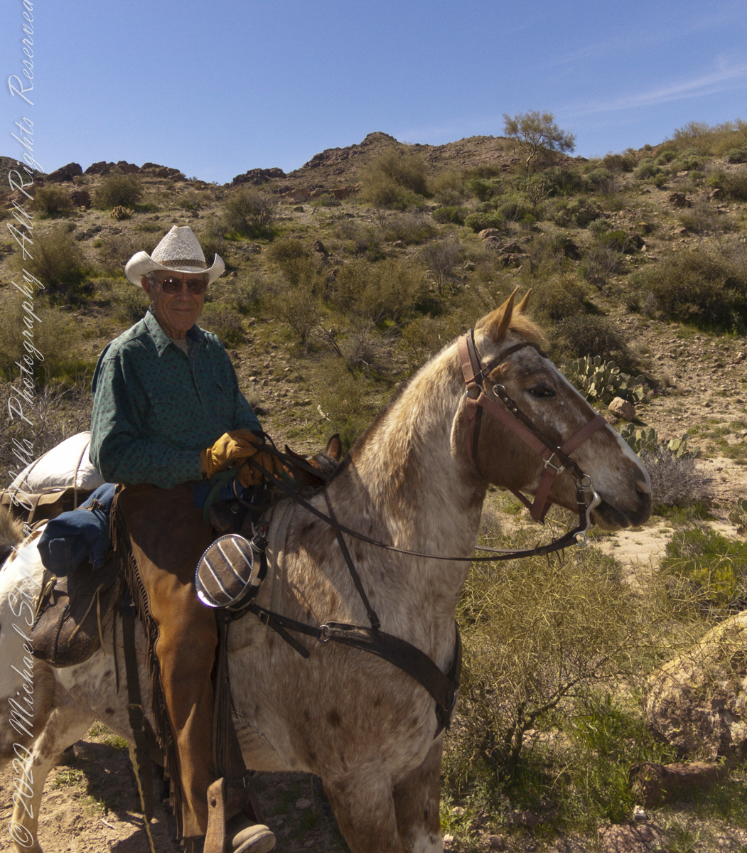
Our expedition party on Dutchman Trail. Ahead is Parker Pass. Look carefully to pick out two horsemen and three horses packing equipment and supplies. They travelled much faster than my 3 – 4 miles per hour on foot.
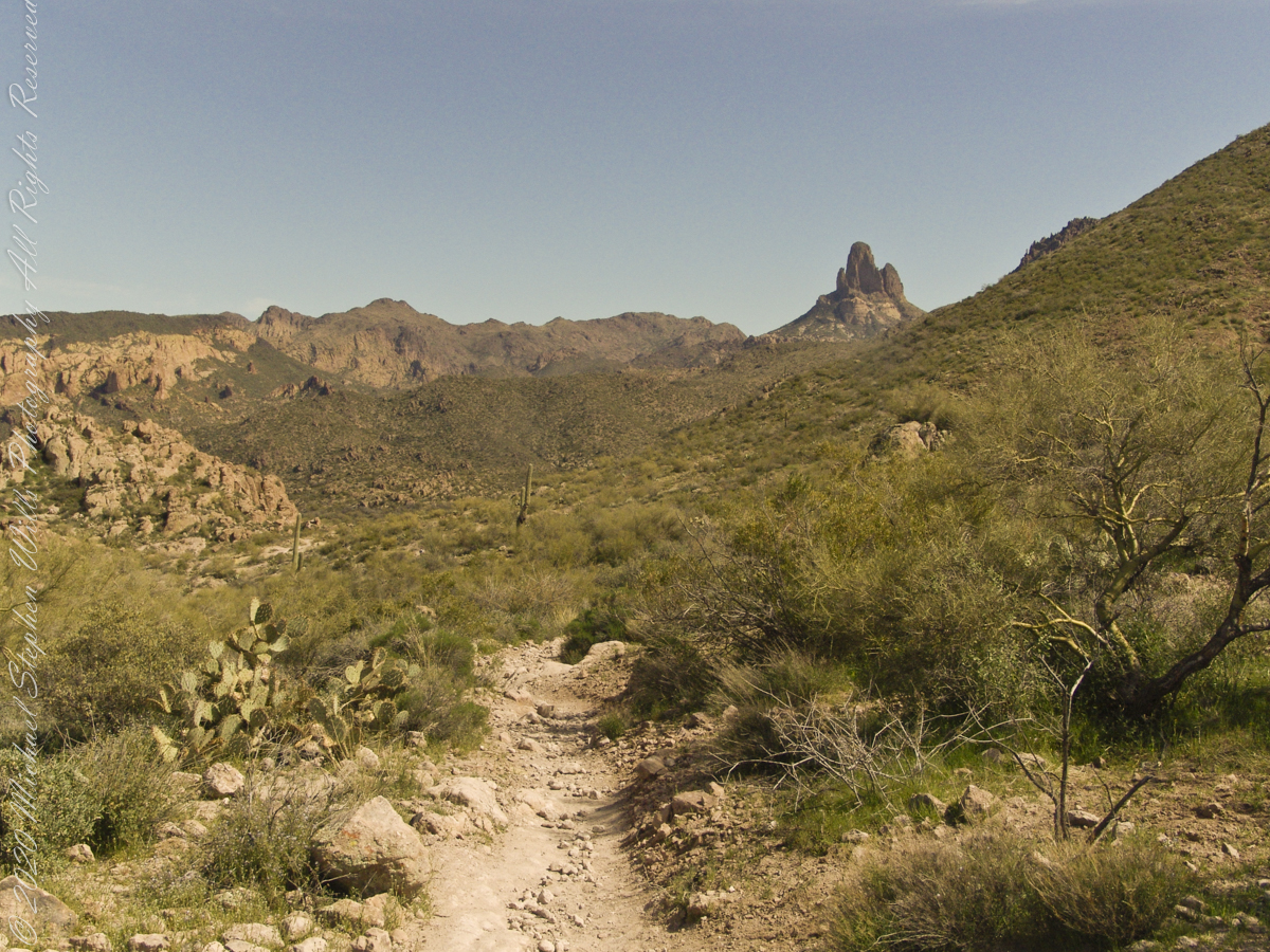
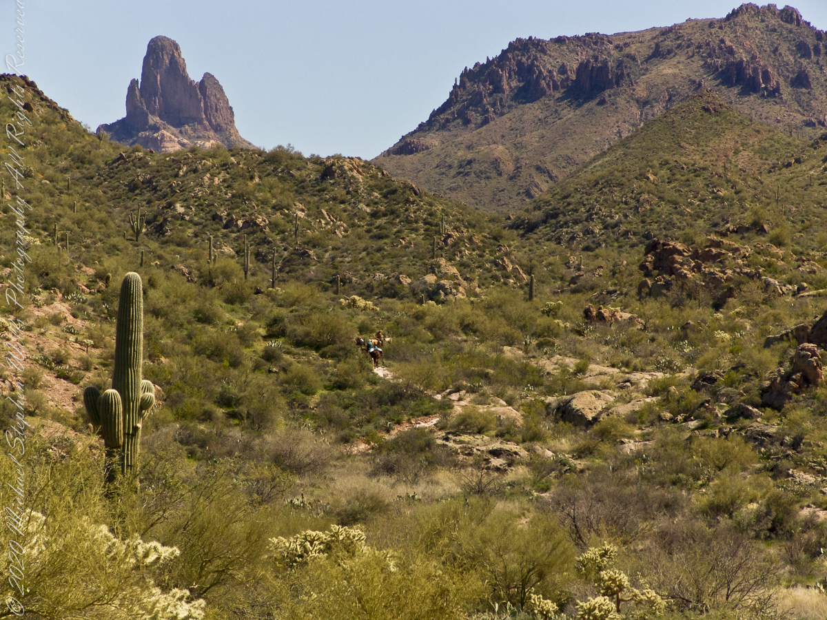
Ahead is Parker Pass, the opening between the two hills in the middle distance. Weaver’s Needle, 3.7 miles distant, at left above the Parker Pass ridge. You can still see my party, ahead. I “zoomed” in for a better view of the party, rapidly pulling ahead and out of sight.
As I top a rise my party is out of sight, more of Weaver’s Needle is visible on the right. The trail falls here before rising again to achieve Parker Pass. Distances on the Lost Dutchman trail are difficult to estimate, visible objectives are much farther then they appear. Constant sun, clear air, difficult terrain conspires against the unprepared leading many into overextending their luck. As a case in point, 37 minutes transpired between the second and third photographs.
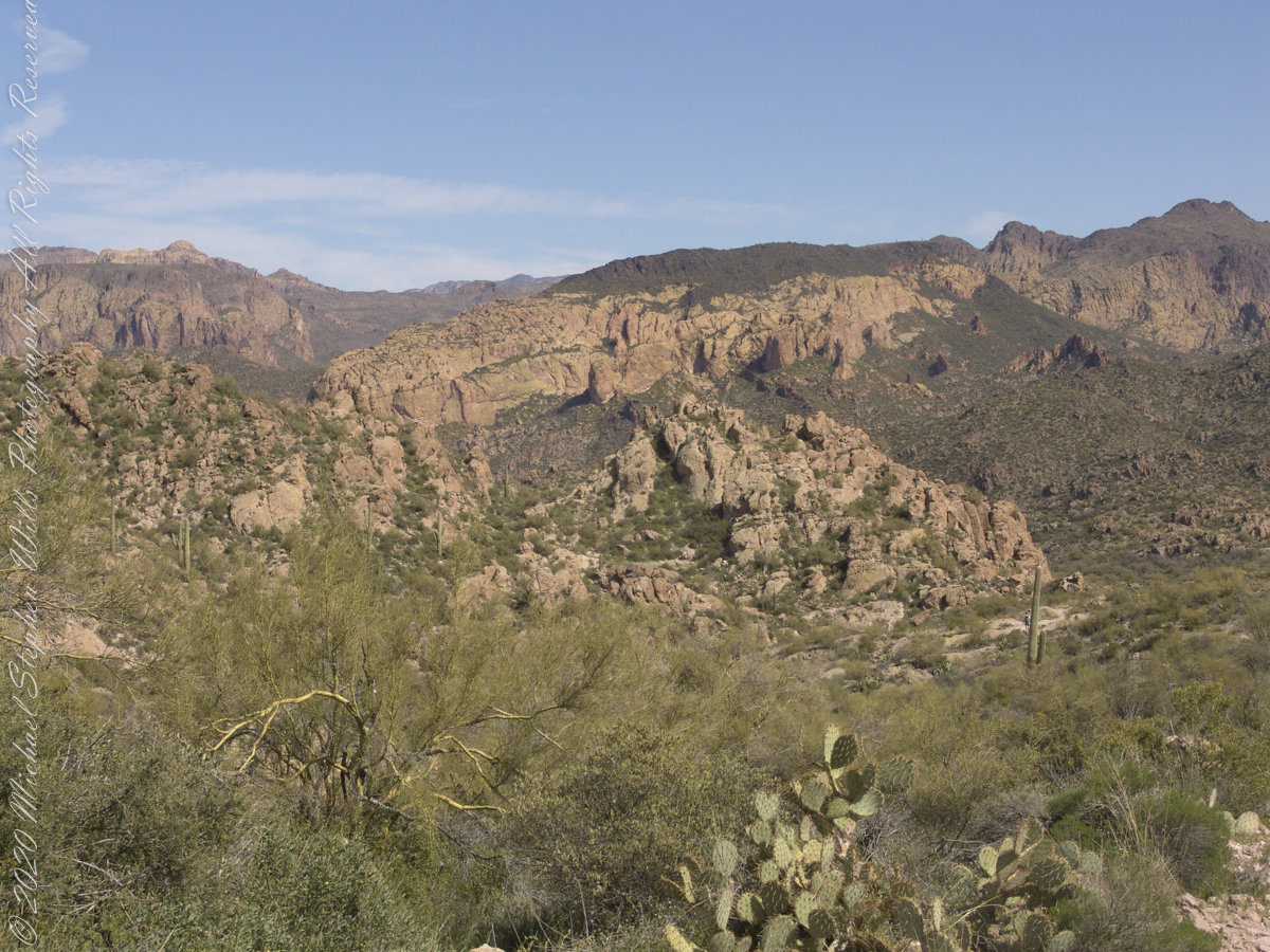
Dutchman’s trail, starting from First Water Trailhead, meanders through Sonoran Desert hills and washes, gradually climbing about 400 feet before descending into Boulder canyon.
We were a party of three with five horses: two mounts and three pack. I was on foot, unencumbered by the usual backpack loaded with 80+ pounds of equipment and supplies for an extended wilderness expedition. I used the opportunity to wear a Sony F828 camera, used for the handheld photographs of this series.
The following photograph is our expedition party on First Water Trail. That is Parker Pass, the opening between the two hills in the middle distance. Look carefully to pick out two horsemen and three horses packing equipment and supplied. They travelled much faster than my 3 – 4 miles per hour on foot.
Foregrounds are the “jumping” Cholla, cactus with sharp spines that seem to reach out and grab the unwary. During out trek from Apache Junction to First Water trail head we negotiated forests of this nasty plants.
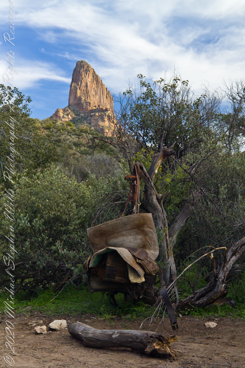
The end of a day trekking to East Boulder Canyon at the foot of Weaver’s Needle, Superstition Wilderness. I had a light pack with the camera equipment and supplies packed in on horseback.
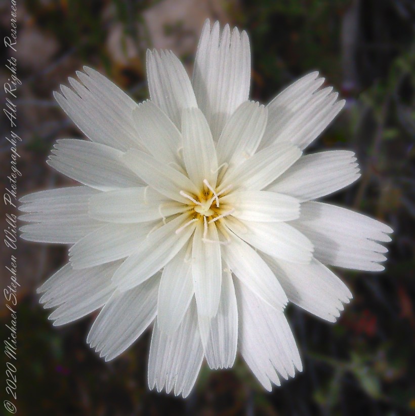
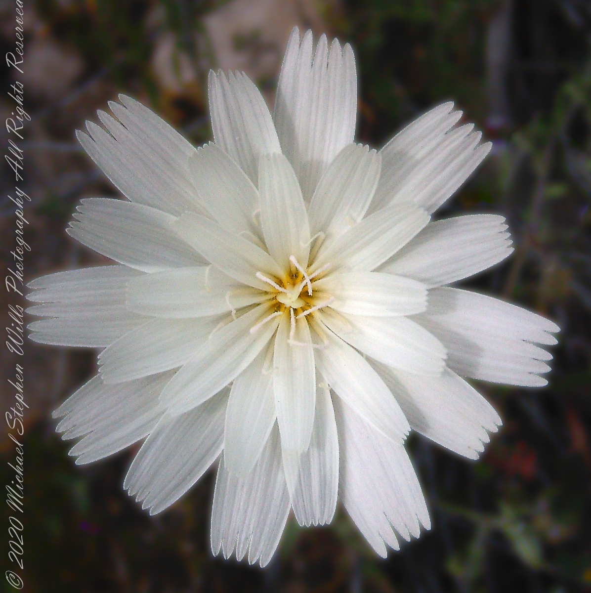
This is a type of daisy, formal name Rafinesquia neomexicana. This season, March 2008, it grew throughout the wilderness. You might know it as Plumeseed or New Mexico Plumeseed.
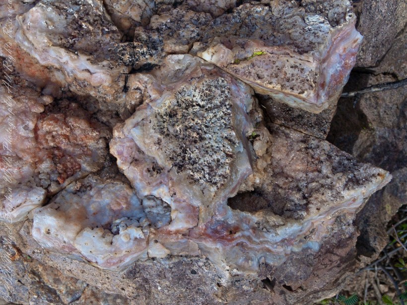
Marled and rose quartz outcroppings such as this appear throughout the Superstitions. The stories are of soldiers and prospectors who return from the wilderness with hoards of gold nuggets picked from quartz.
Marled and rose quartz outcroppings such as this appear throughout the Superstitions. The stories are of soldiers and prospectors who return from the wilderness with hoards of gold nuggets picked from quartz.
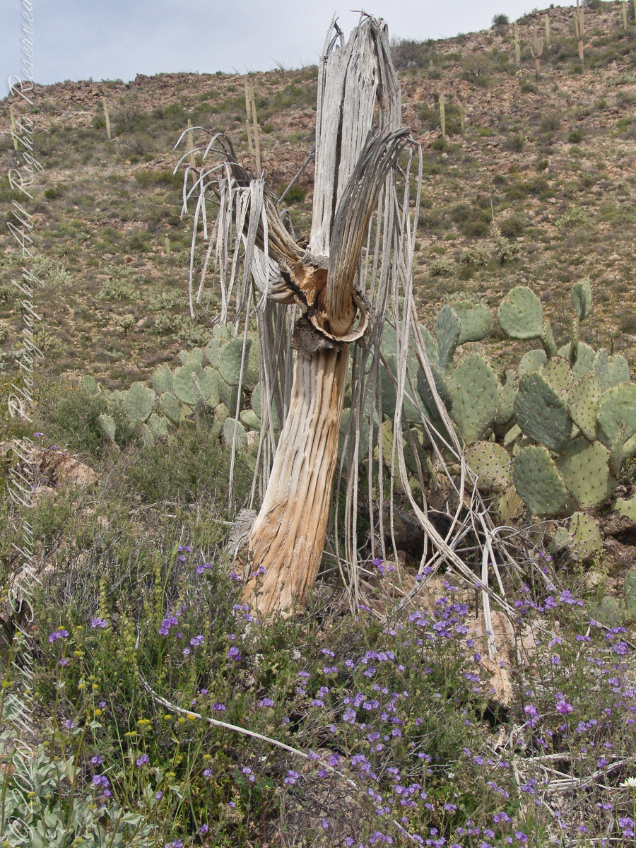
In my experience to come across the denuded ribs of an expired Saguaro cactus is to find a single one among thousands of flourishing, many-armed giants. Fourteen years ago, when this photograph was taken March 2008, a drought hung over Arizona since 1994, fourteen years. One documented effect of twenty-eight drought years is fewer young saguaro now survive into adulthood, the number of standing specimens is slowly decreasing.
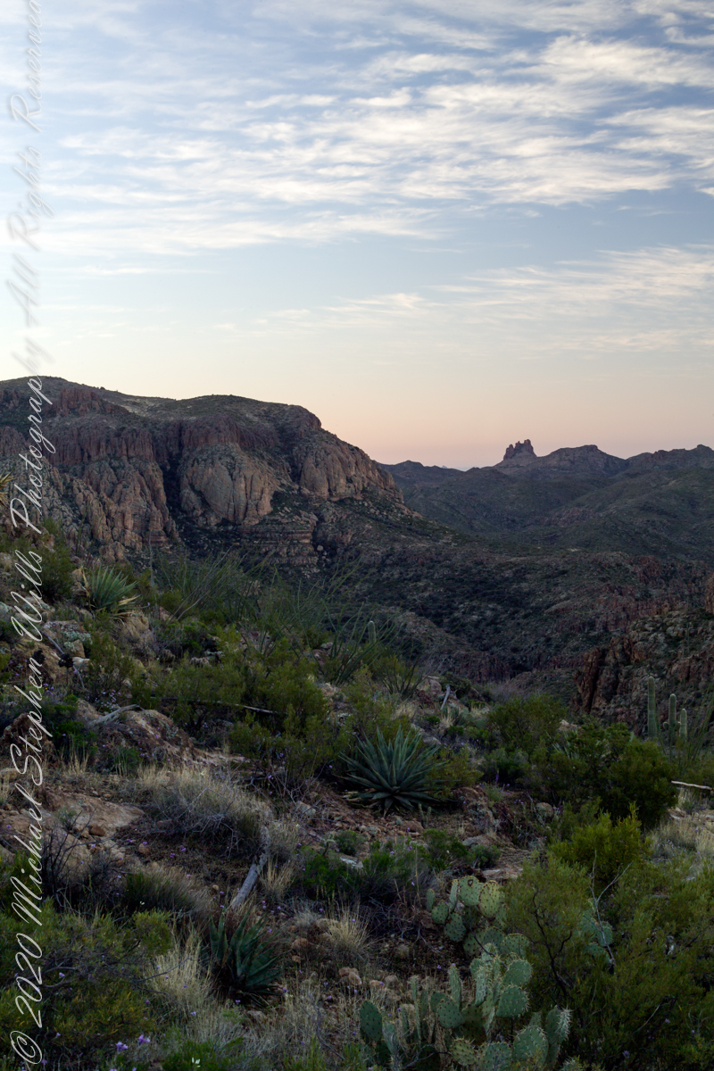
On the slopes of Peter’s Mesa, Superstition Wilderness, Arizona
Here we are below the rim of Peter’s Mesa of the Superstition Wilderness. Blue Dicks flourish as the feet of the long-expired giant, the wildflowers grow from corms long used as food by Native Americans. Behind is a large stand of Prickly Pear cactus whose fruit, called tunas, is another food source.
Copyright 2022 Michael Stephen Wills All Rights Reserved
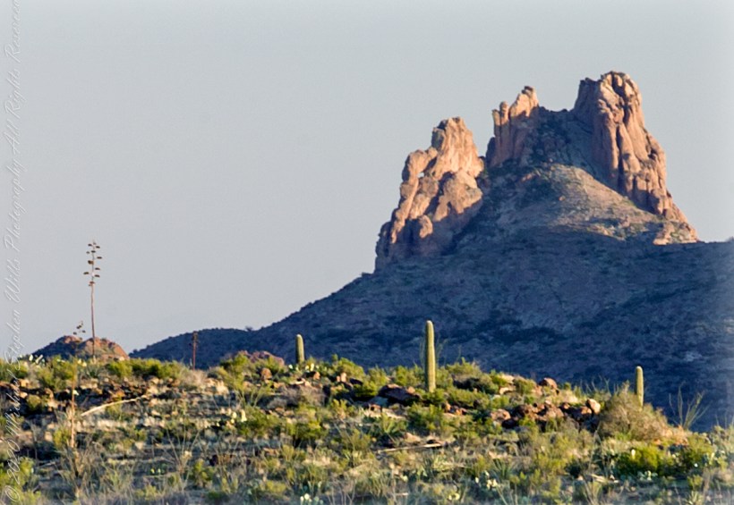
I was a member of an expedition to Peter’s Mesa March 2008, a place central to Superstition Wilderness treasure legends. This is a sunset view, looking south, southwest. Light raking across the desolation and Miner’s Needle creates a fascinating spectacle. Ancient volcanism, apparent throughout the Superstition Wilderness, is here seen in the texture, form and type of rock as well as the mineral deposits. Miner’s Needle, like Weaver’s Needle (not seen in this view), are eroded volcanic summits. Look closely for the “eye” of Miner’s Needle, easier seen in the cropped heading photograph. To this day, hopeful prospectors search for gold nuggets.
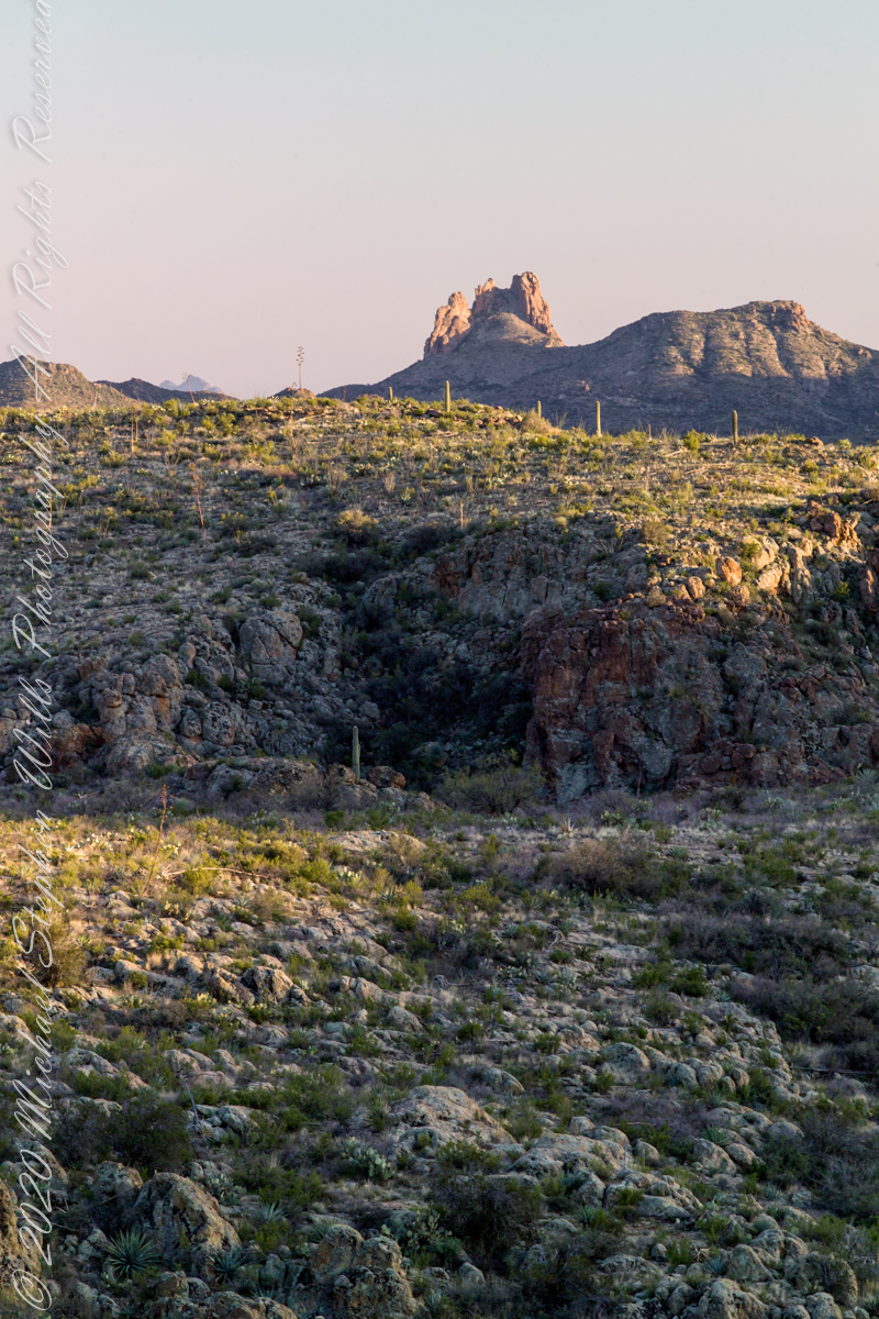
There is one form of volcanism present today as an eerie rumble or hiss, similar to an enormous distant jet engine heard now and then during our two days on the mesa, louder and closer than an overhead plane could produce. The view includes many notable Sonoran Desert plants. Many young Saguaro cactus are in the form of green poles. Catching the dramatic light, on the ridge is a tall single flower of an Agave, known as the “Century Plant” it flowers once in a long life and dies.
Peters Mesa is named after “Old Pete” Gottfried Petrasch, father of Hermann and Rhiney Petrasch. Old Pete worked for Jim Bark for awhile in the 1890s doing odd jobs. Irregular employment gave Pete and Sons time to s searched for the Lost Dutchman Mine in the years following the death of the source of the legend, the “Dutchman” Jacob Waltz. The Petrasches were one of the first groups to search for the mine, and gold in general. They covered almost the entire Superstition range in their combined searches.
Sunrise looking across Music and LaBarge Canyons to Miner’s Needle
On our first day on the mesa, we came across the remains of one of these camps, on the top of Squaw Canyon, a deplorable junk pile discarded by searchers, presumably disappointed, too lazy to cart it out. That March, we were lucky to find the remnants of winter rains in the form of a meager trickle at the bottom of a shallow draw off Peter’s Mesa trail up from La Barge canyon. We had a good time of it until the trip was cut short by a storm front and torrential rains. We were back in Apache Junction before they hit.
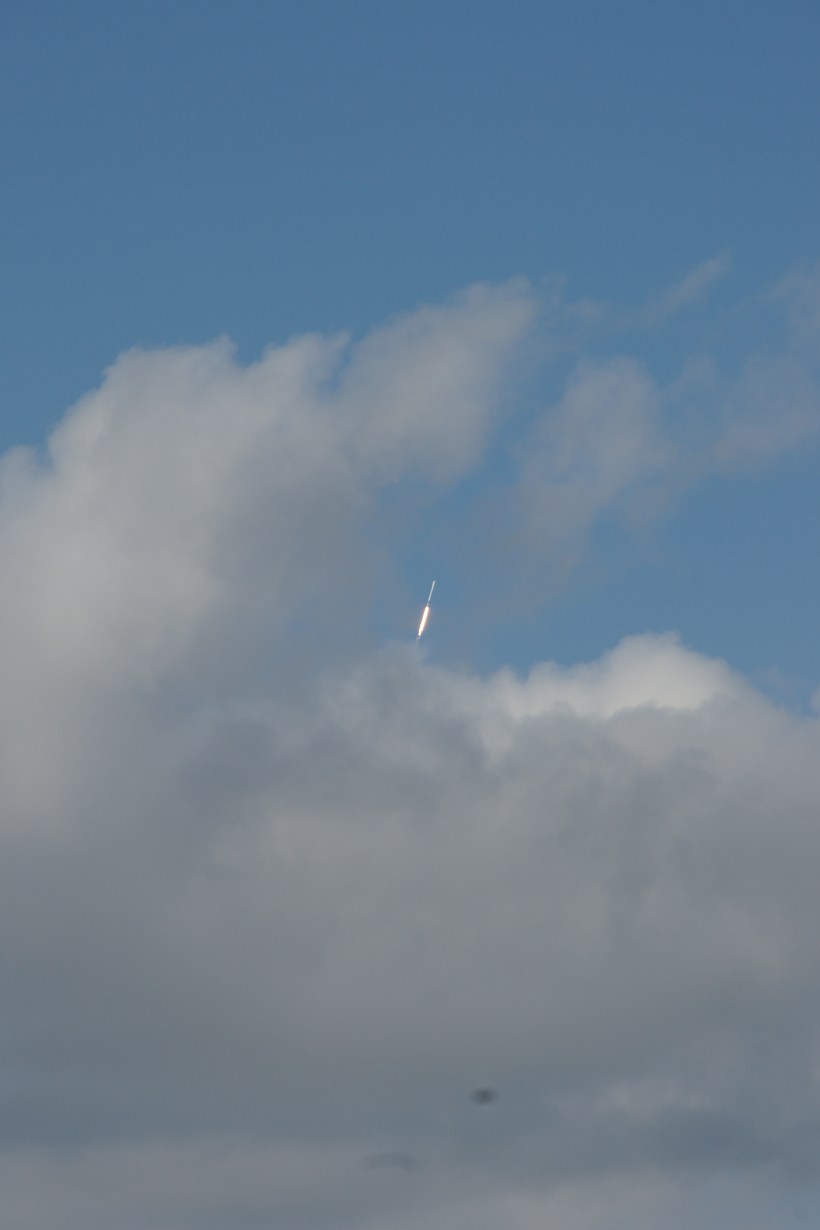
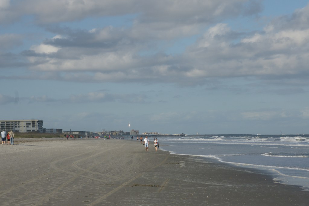
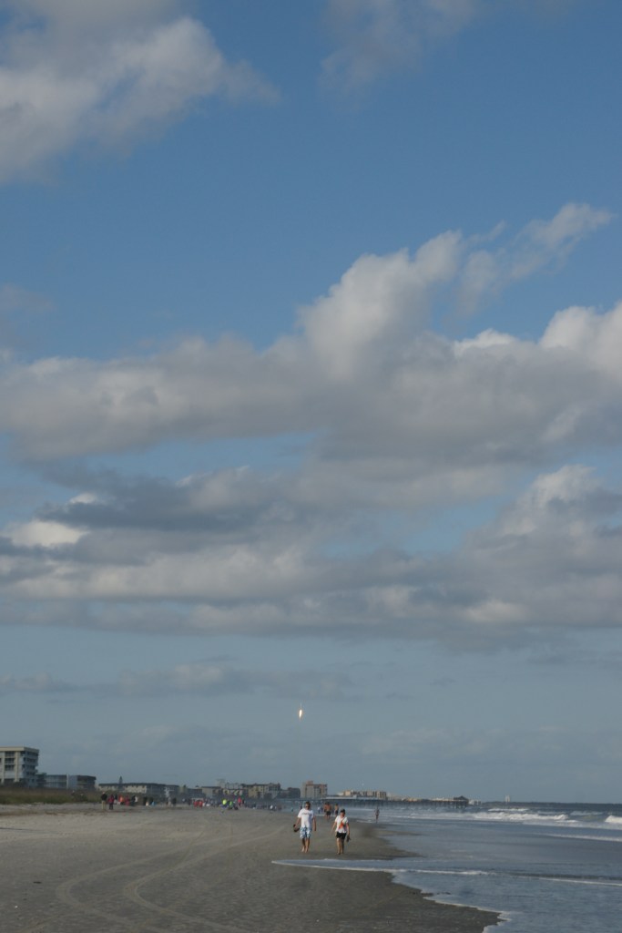
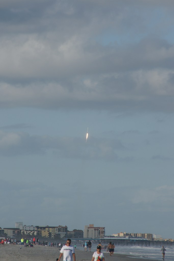
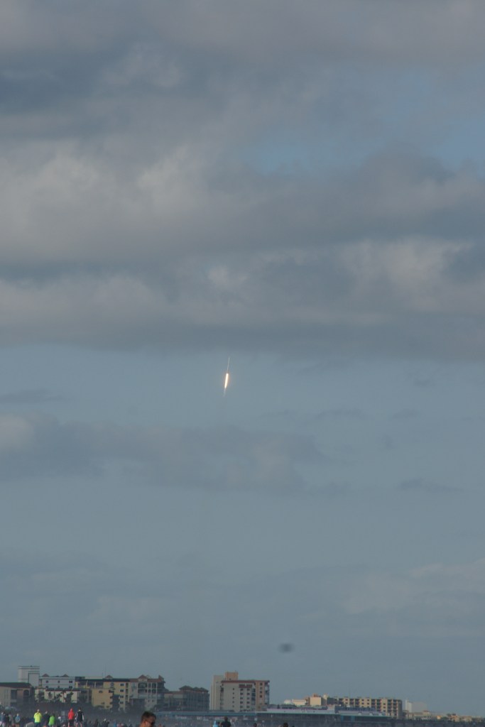
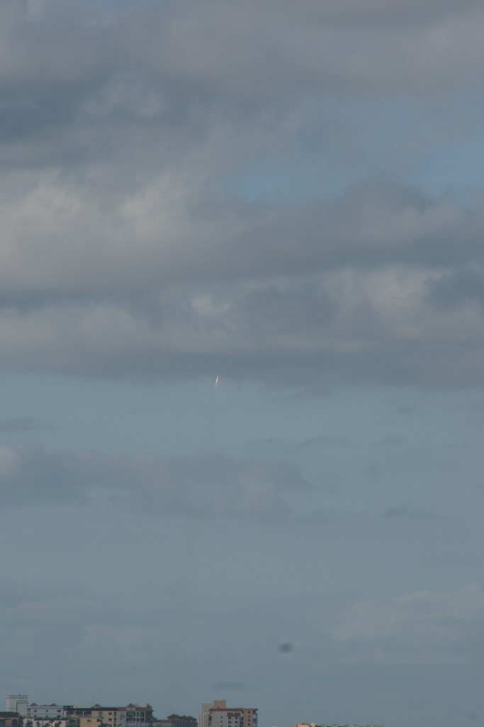
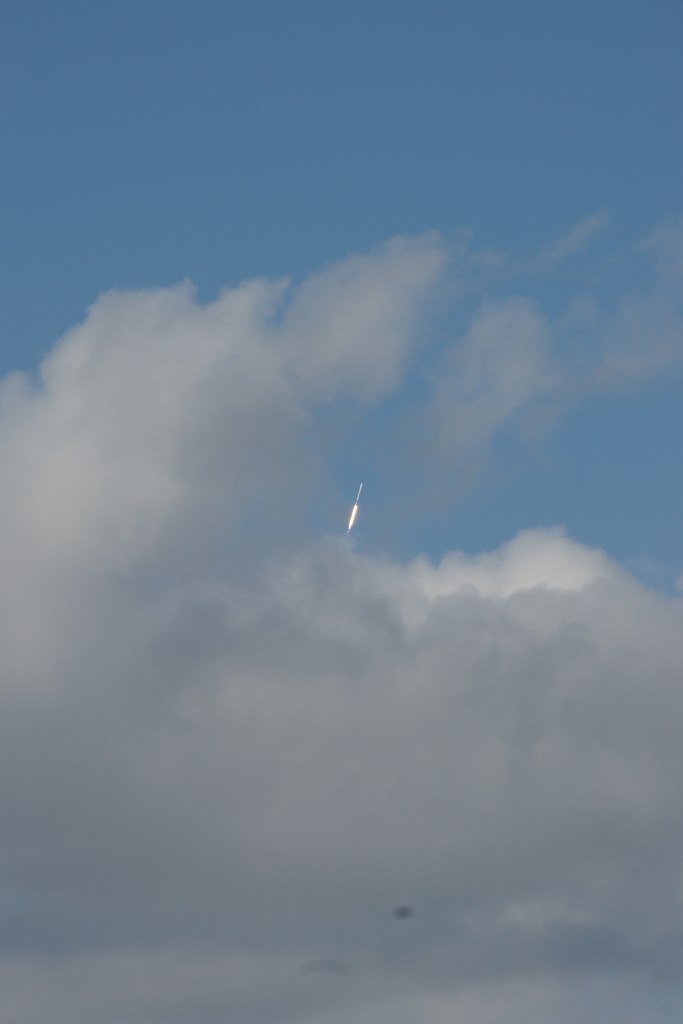
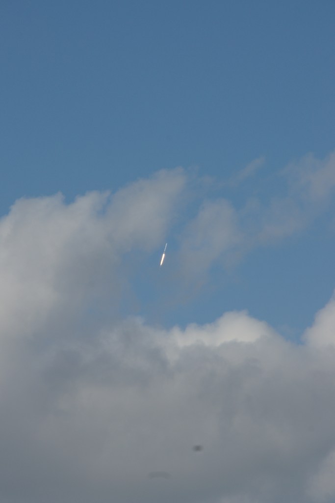
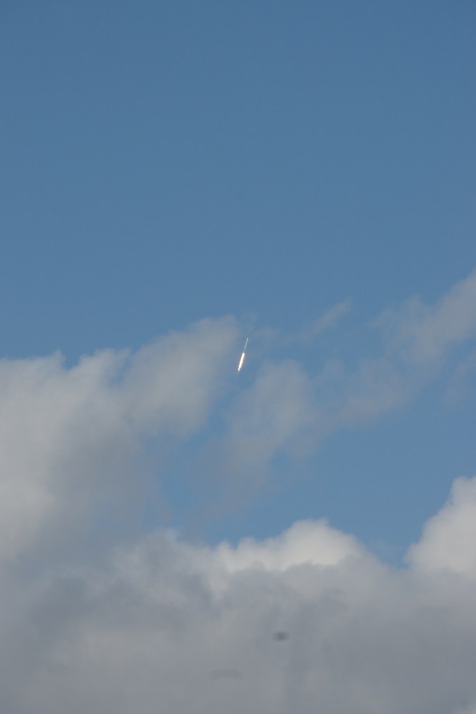
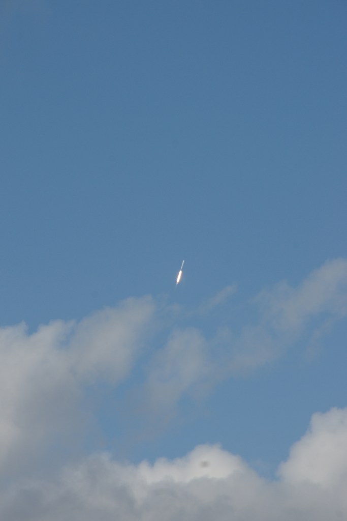
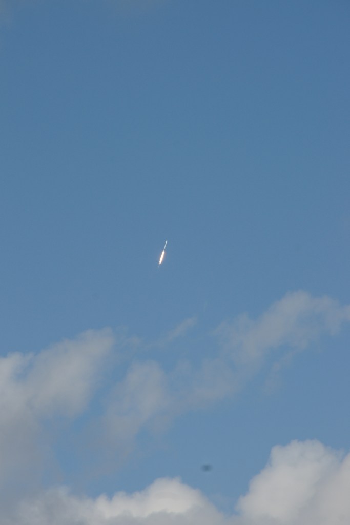
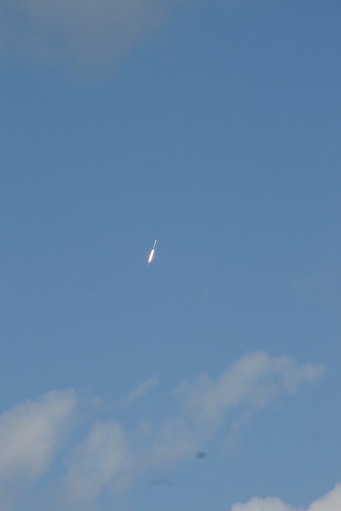
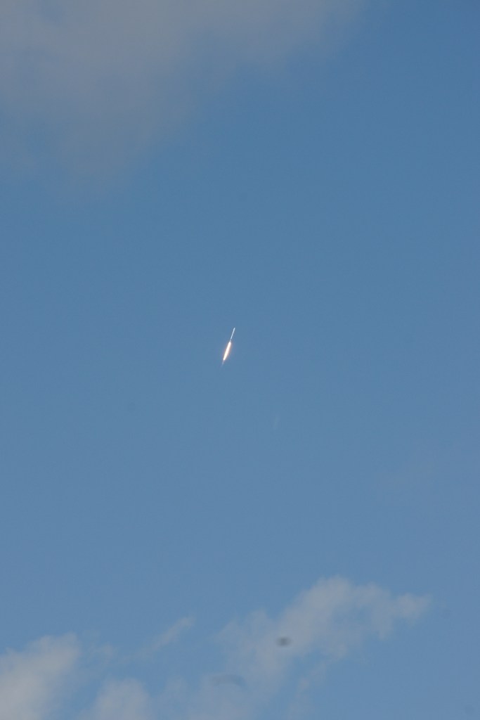
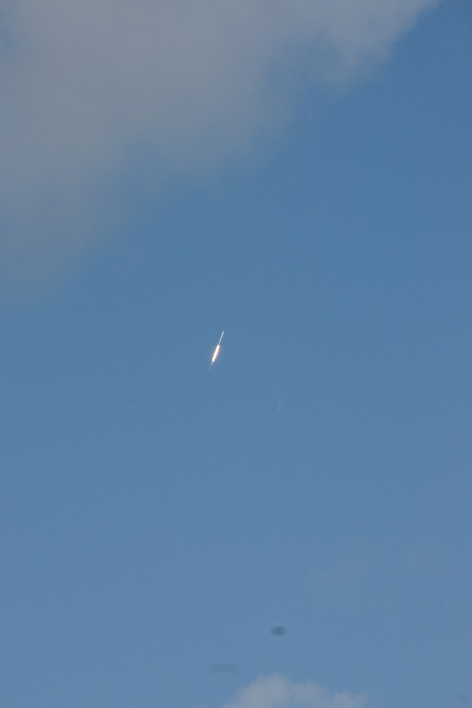
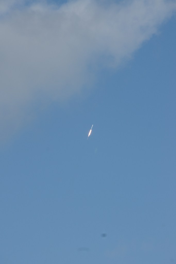
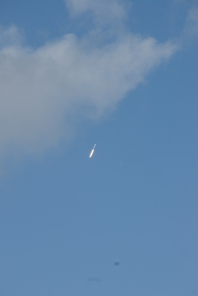
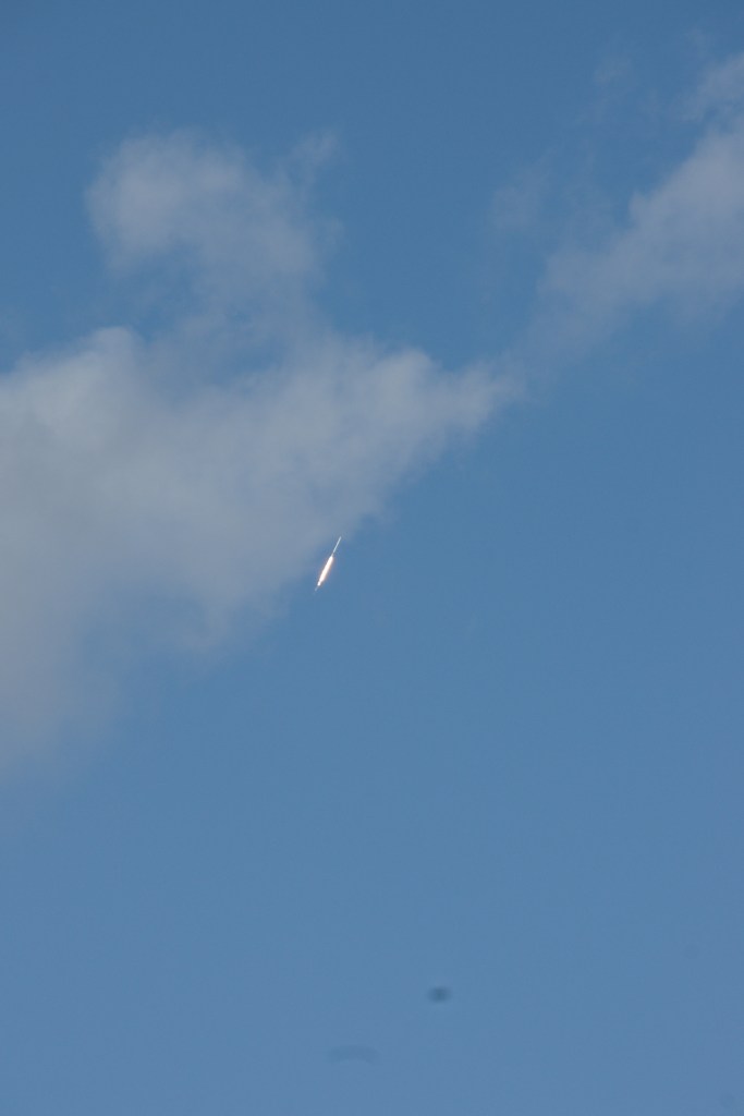
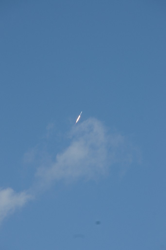
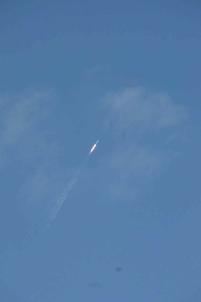
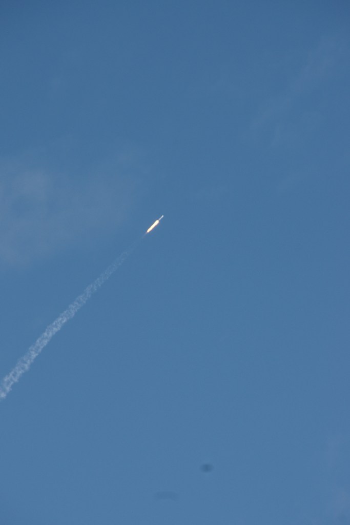
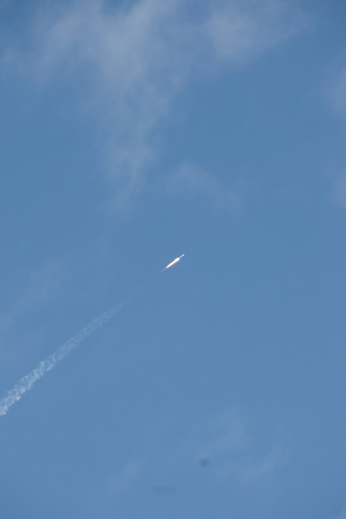
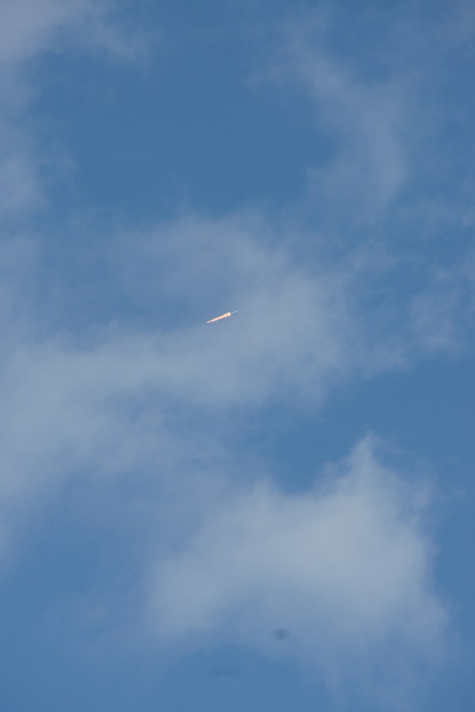
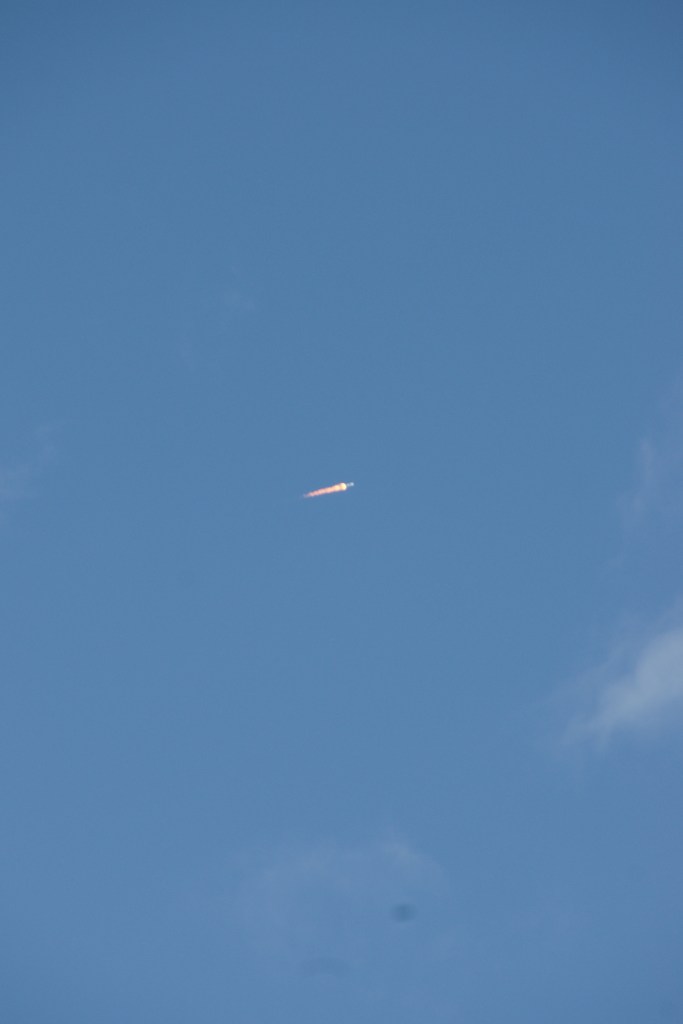
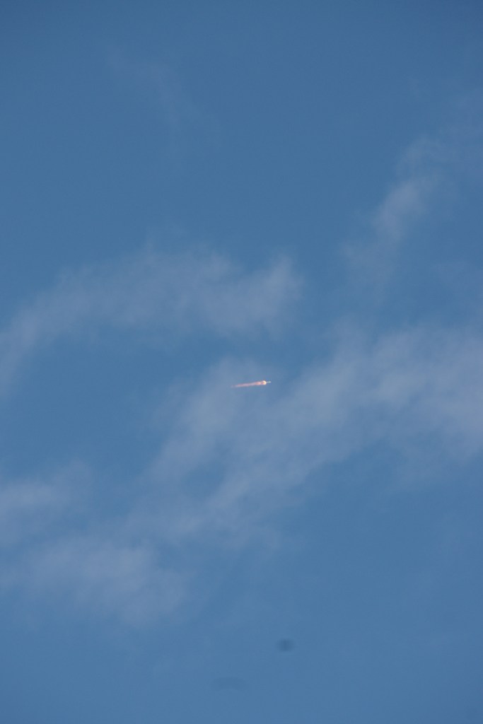
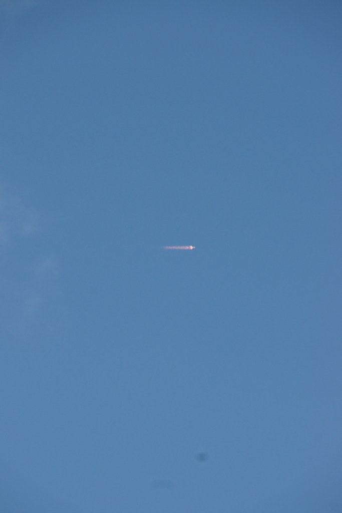
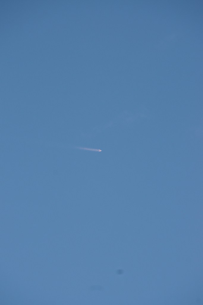
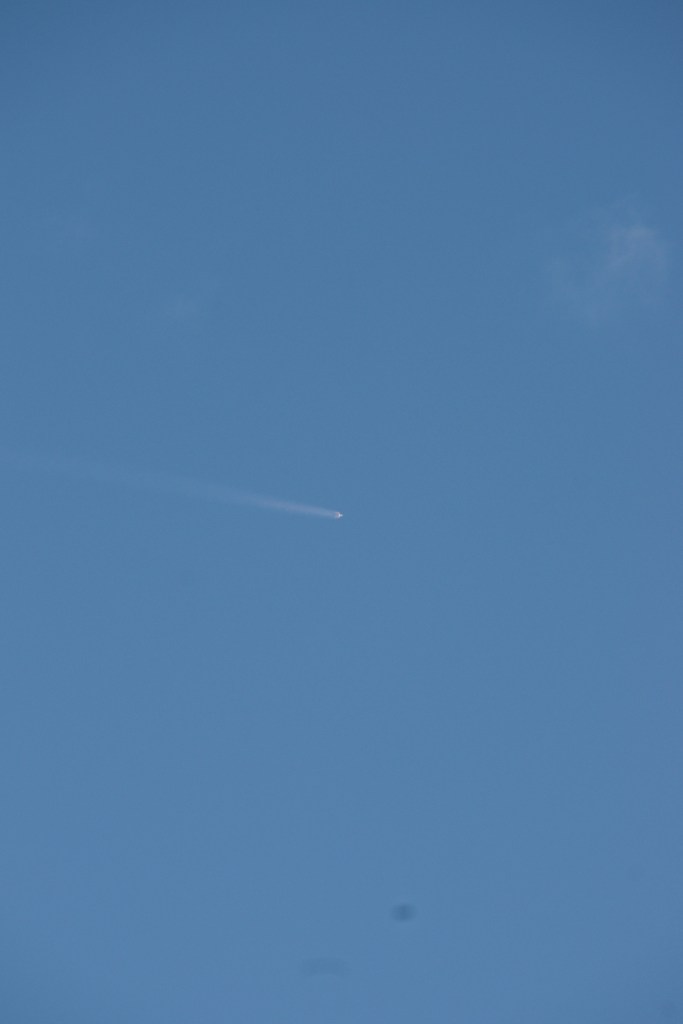
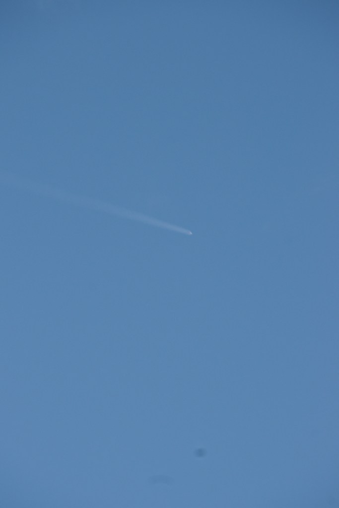
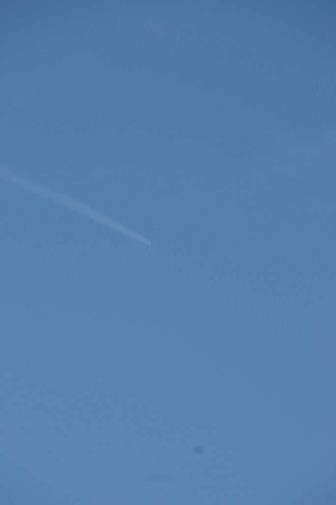
Here is a series of photographs of the January 31, 2018 SpaceX launch of a Falcon9 bearing a Govsat1 (aka SES-16) satellite for Luxembourg. The re-used Falcon 9 was in expendable mode. The photographs, taken from Cocoa Beach, Florida show the rocket rising above the city and port of Cape Canaveral, through cumulous clouds and into space.
There are the unedited “jpeg” files from the series. I need to crop out the dust spots and such.
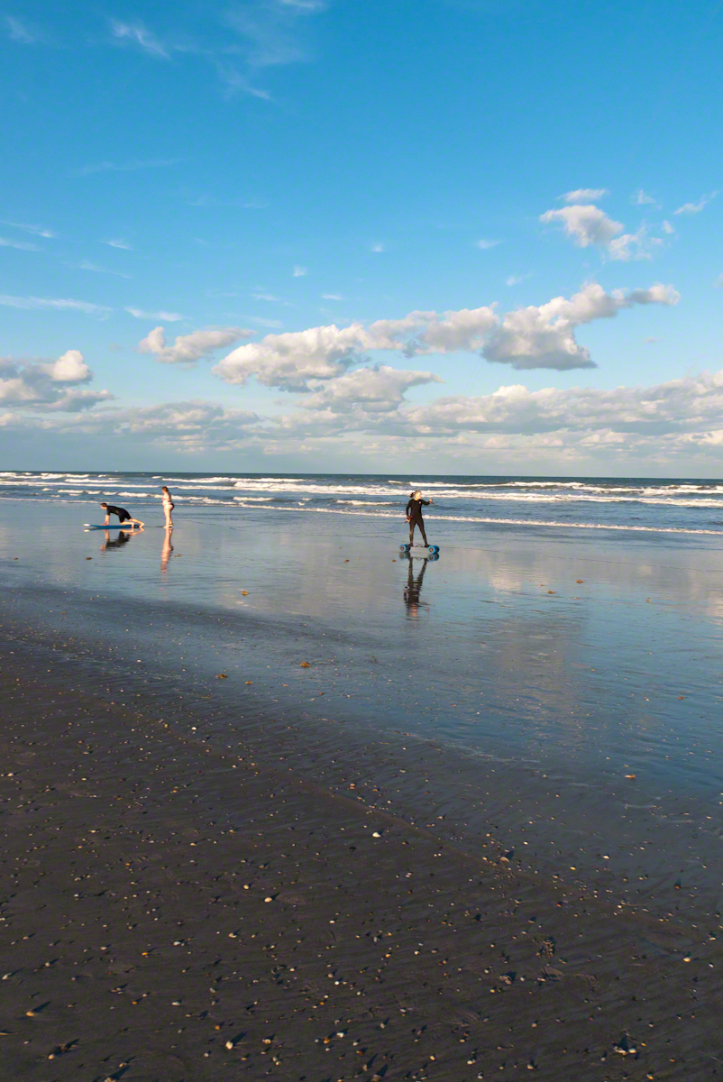
In the early morning hours of Sunday, September 10, 2017 as Hurricane Irma approached the Florida Keys, I cannot sleep, worried about family members north of Miami and in Daytona Beach. To pass the time, I returned to the golden hours of March 4, 2017 evening. On vacation, Pam and I walked Cocoa Beach starting from Lori Wilson Park, headed north.
The light was perfect when I decided to switch to Raw-Jpeg mode, feeling the extra space was worth it. I don’t know why I don’t shoot Raw 100% of the time, as always, in retrospect, I regret using jpeg only. The camera was the Sony Alpha 700 dslr with a DT 18-200mm f3.5-6.3 lens purchased 2008 after an expedition to the Superstition Wilderness.
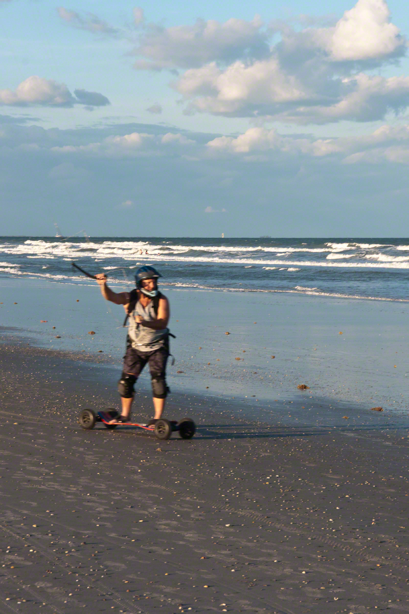
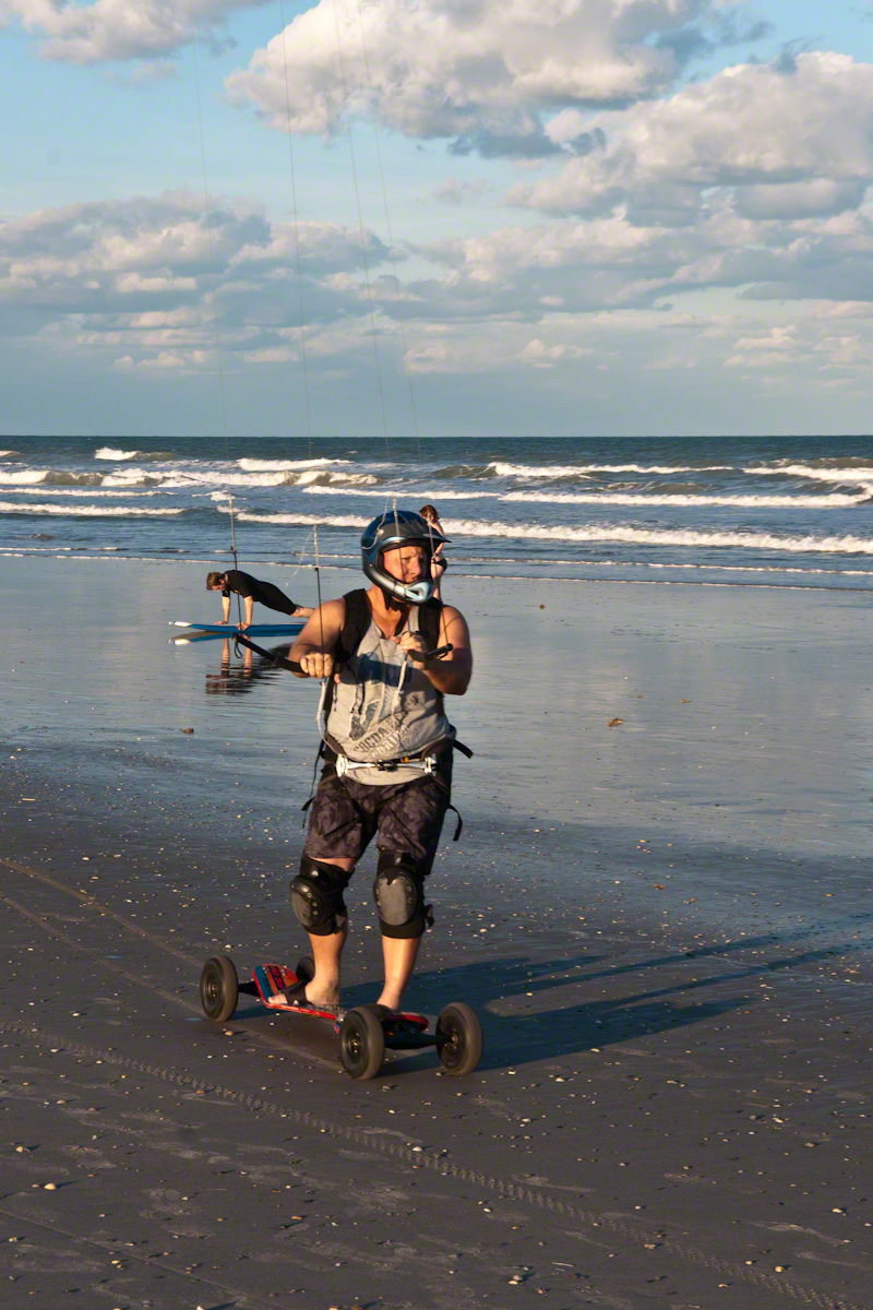
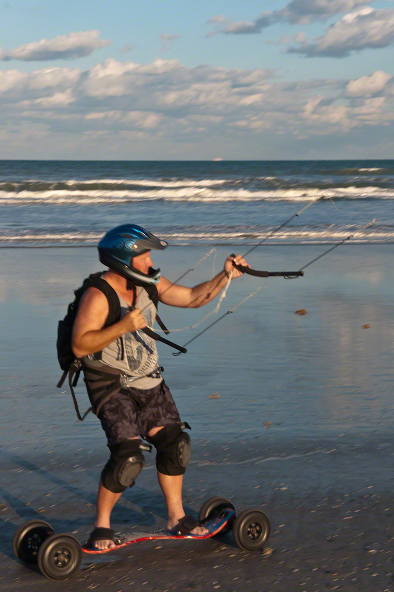
After capturing a wedding photo shoot and surfers there was this set of two Kite Skaters going at least 20 miles an hour. The Sony Alpha was quick enough to capture some of the action in raw mode, I am not satisfied with the sharpness of the images as the lens was not fast enough.
We had never watched kite skaters before and were prepared to understand the vision from watching distant kite surfers out beyond the breakers. North winds are the best for any type of kiting on Cocoa Beach and, that day, the wind was northeast. These riders zipped by in less than a minute. The sport is low key, it does not exist on Wikipedia. Image that. These two are having a fantastic time and stayed upright, going on and on and on down the miles long beach.
Sailskater Dreamview with Cruise Ship
1990 KiteSkate pioneers on the USA east coast experimented with four-line controllable parafoil kites powering in-line skates for exciting rides on asphalt surfaces.
Her partner approaches
The name “Wheels of Doom” suggest the danger of going this fast over a hard, rough surface.
He makes it look easy
These Cocoa Beach riders are outfitted for speed and safety: pads, helmets.
He maneuvers kite overhead to slow down.
Barefeet?? Unprotected skin? They must know how to dress, though maybe not. He has never fallen?
Full speed ahead with the kite positioned forward.
The beach within the tide line is solid, the pebbles, broken shells and such unforgiving as asphalt.