Several possible sources have been proposed for the name Taughannock, all of which describe Native American origins. One translation suggests that the name is derived from a combination of Iroquois and Algonquin terms meaning “great fall in the woods”. An alternate theory suggests that the name may refer to a Lenni Lenape (Delaware) chief named Taughannock who died near the falls during a battle.
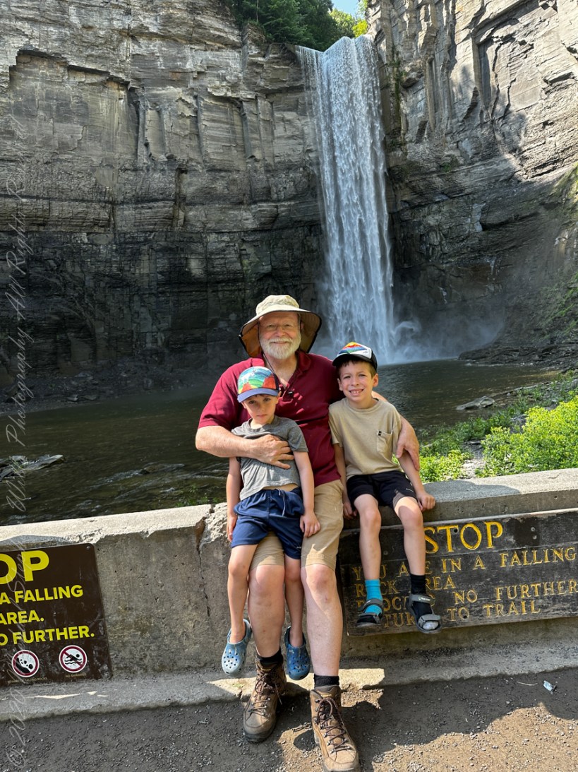
A nice lady offered to take the photo….challenged to keep it straight.
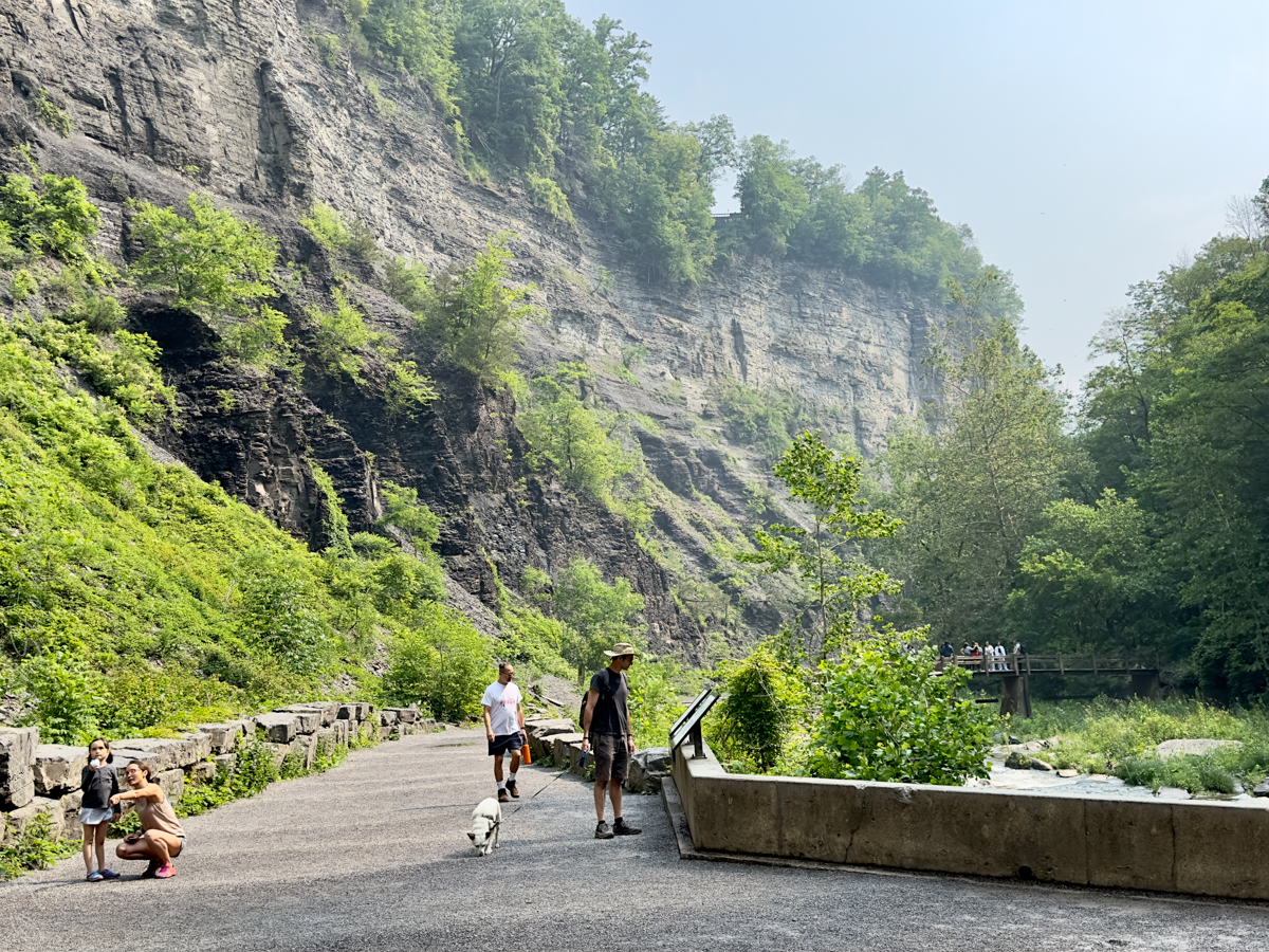
During the second half of the nineteenth century, steamboats, railroads and Victorian hotels were built in the region to serve tourists who traveled to view the falls. By 1925 the hotels were failing due to a decline in tourism, and New York State began acquiring land to form a park.
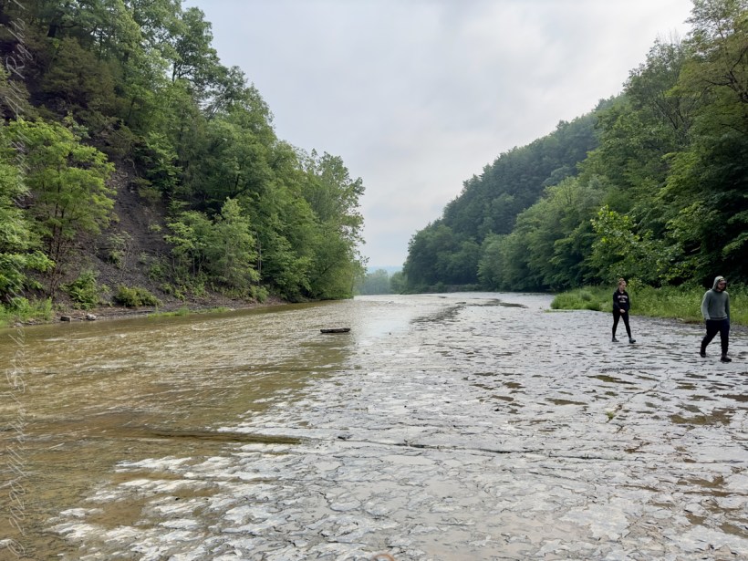
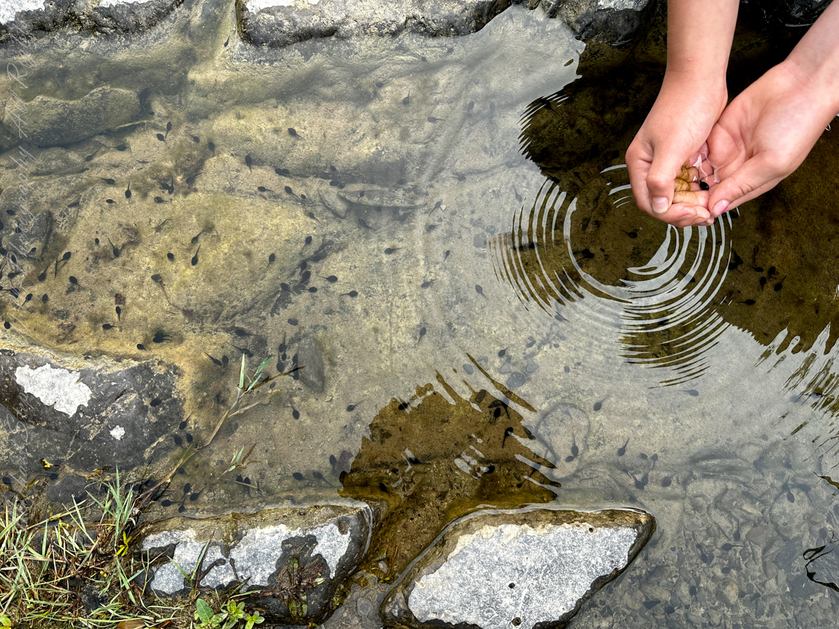
Pollywogs!! Catch and release
J.S. Halsey built a two and a half story hotel in 1850, known variously as the Cataract Hotel or Taughannock House (or simply as Halsey’s Hotel) at the Taughannock Falls Overlook.
Visitors could reach the hotel by taking a train to Cayuga Lake, take a steamboat across the lake to Goodwin’s Point, then finally board a stagecoach to reach the hotel. The hotel site today is the location of the park visitor center and parking lot.
Enjoy!!
Copyright 2023 Michael Stephen Wills All Rights Reserved
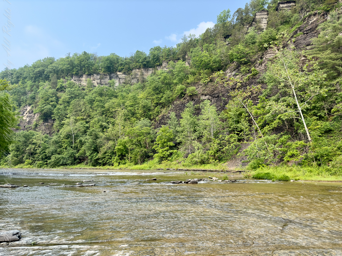
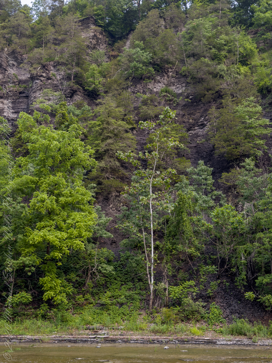
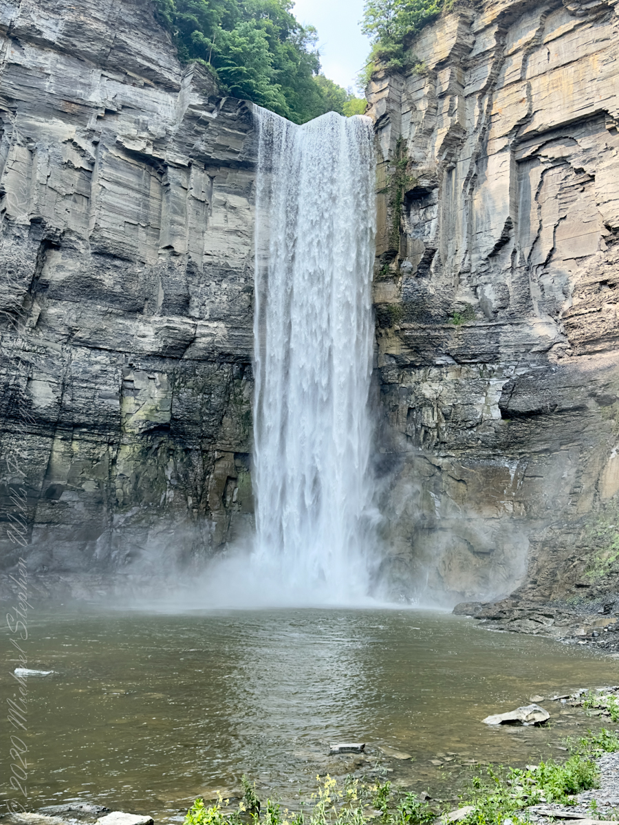
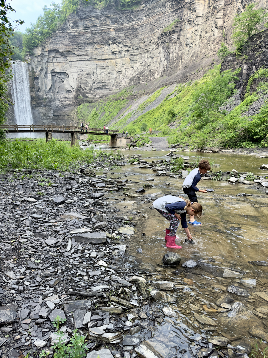
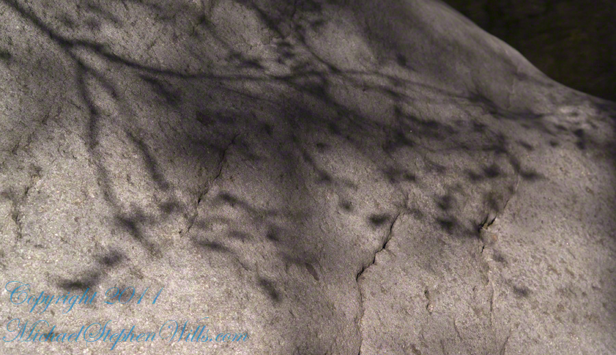
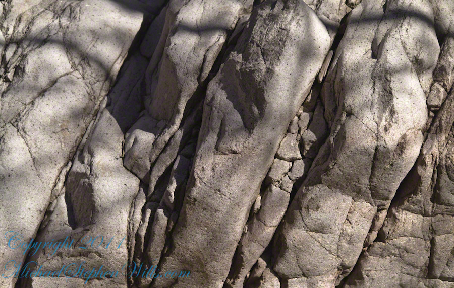
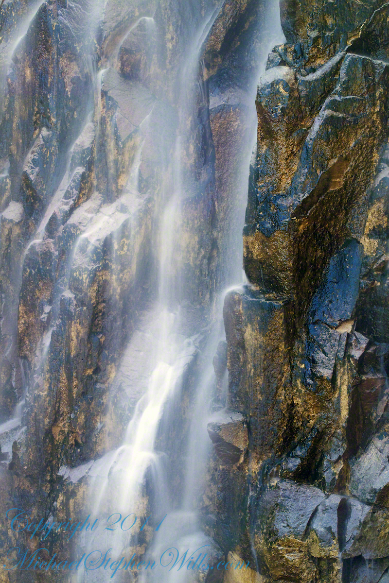
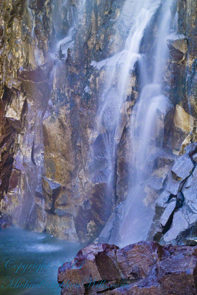
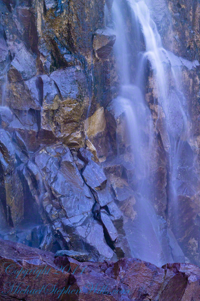
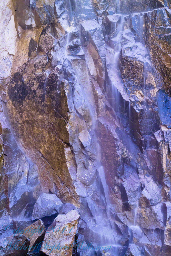
The waterfall and gorge comprise an example of a hanging valley, formed where Taughannock Creek’s stream-carved valley meets the deeper glacially carved valley that contains Cayuga Lake.
The gorge has continued to retreat westward from Cayuga Lake as easily eroded shale near the fall’s base is worn away by the stream, which supports erosion-resistant siltstone and sandstone found in the upper portions of the gorge.
Pollywogs!! Catch and release
Annual freeze and thaw cycles also act upon small faults in the rock, causing large sections to occasionally break away, further expanding the gorge.
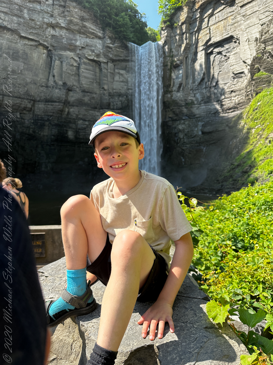
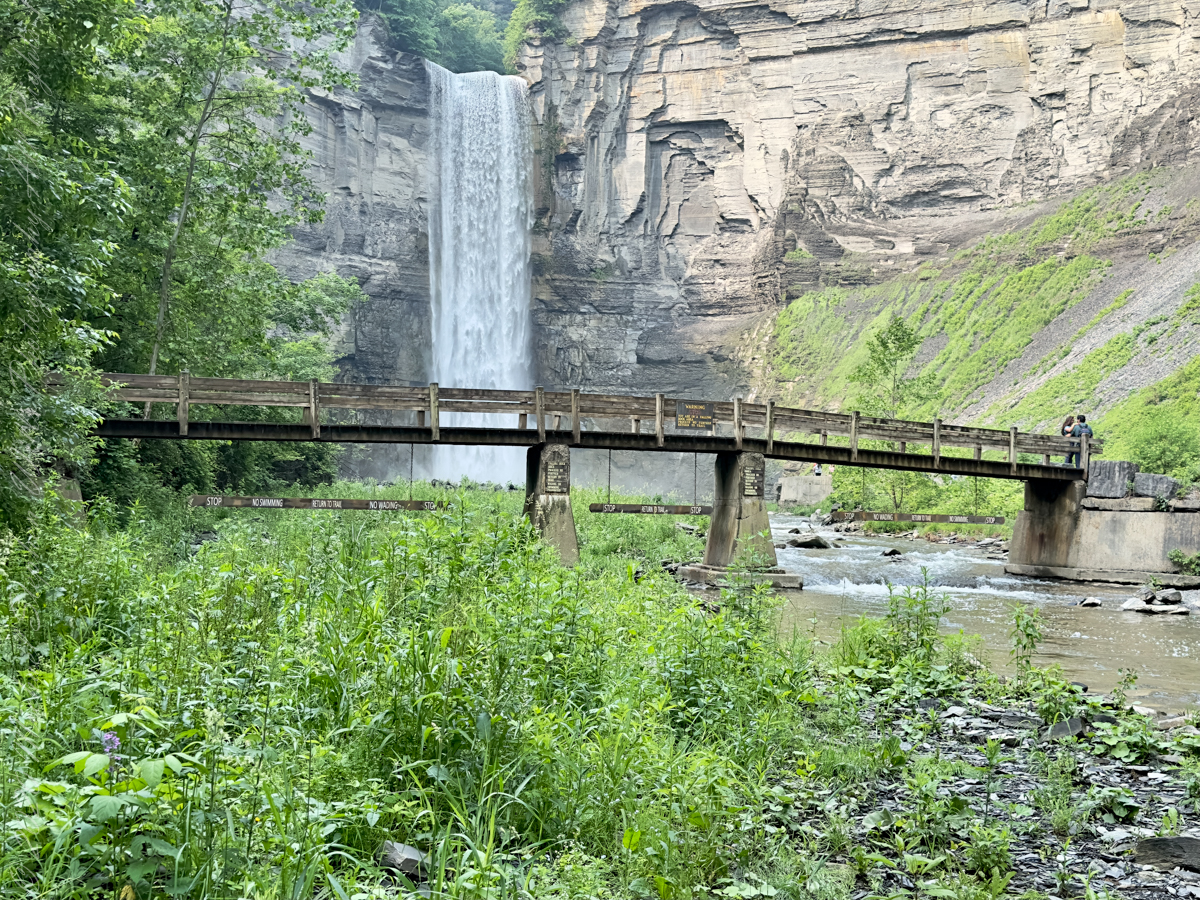
Taughannock Falls’ main cataract is a 215-foot drop (66 m), making it 33 feet (10 m) taller than Niagara Falls. It is the tallest single-drop waterfall east of the Rocky Mountains. The waterfall is located along Taughannock Creek, which flows through a long gorge with cliffs up to 400 feet (120 m) high.
Enjoy!!
Copyright 2023 Michael Stephen Wills All Rights Reserved
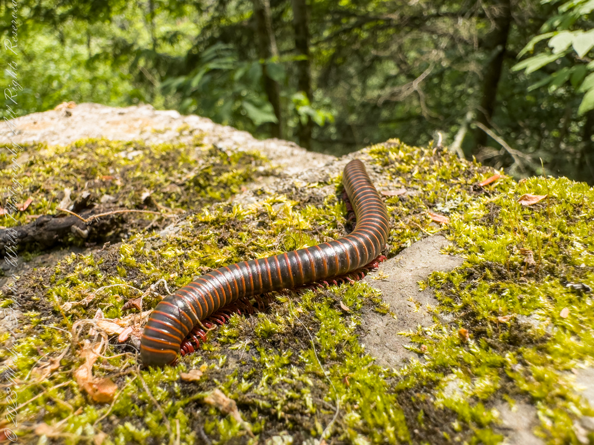
Visitors to Robert H. Treman park think nothing of crushing millipedes on the trail, it is concerning to encounter evidence of such disrespectful and boorish behavior. Here is an intact millipede I found last week. Millipedes are a group of arthropods that are characterized by having two pairs of jointed legs on most body segments; […]
Visitors to Robert H. Treman park think nothing of crushing millipedes on the trail, it is concerning to encounter evidence of such disrespectful and boorish behavior. Here is an intact millipede I found last week.
Millipedes are a group of arthropods that are characterized by having two pairs of jointed legs on most body segments; they are known scientifically as the class Diplopoda, the name derived from this feature. Each double-legged segment is a result of two single segments fused together. Most millipedes have very elongated cylindrical or flattened bodies with more than 20 segments, while pill millipedes are shorter and can roll into a tight ball. Although the name “millipede” derives from Latin for “thousand feet”, no species was known to have 1,000 or more until the discovery of Eumillipes persephone, which can have over 1,300 legs.
There are approximately 12,000 named species classified into 16 orders and around 140 families, making Diplopoda the largest class of myriapods, an arthropod group which also includes centipedes and other multi-legged creatures. Most millipedes are slow-moving detritivores, eating decaying leaves and other dead plant matter. Some eat fungi or drink plant fluids, and a small number are predatory.
Millipedes are generally harmless to humans, although some can become household or garden pests. Millipedes can be an unwanted nuisance particularly in greenhouses where they can potentially cause severe damage to emergent seedlings. Most millipedes defend themselves with a variety of chemicals secreted from pores along the body, although the tiny bristle millipedes are covered with tufts of detachable bristles. Its primary defense mechanism is to curl into a tight coil, thereby protecting its legs and other vital delicate areas on the body behind a hard exoskeleton. Reproduction in most species is carried out by modified male legs called gonopods, which transfer packets of sperm to females.
Millipedes are among the first animals to have colonized land during the Silurian period. Early forms probably ate mosses and primitive vascular plants. Millipedes also exhibit the earliest evidence of chemical defense, as some Devonian fossils have defensive gland openings called ozopores. Millipedes, centipedes, and other terrestrial arthropods attained very large sizes in comparison to modern species in the oxygen-rich environments of the Devonian and Carboniferous periods, and some could grow larger than one meter. As oxygen levels lowered through time, arthropods became smaller.
Most millipedes are detritivores and feed on decomposing vegetation, feces, or organic matter mixed with soil. They often play important roles in the breakdown and decomposition of plant litter: estimates of consumption rates for individual species range from 1 to 11 percent of all leaf litter, depending on species and region, and collectively millipedes may consume nearly all the leaf litter in a region. The leaf litter is fragmented in the millipede gut and excreted as pellets of leaf fragments, algae, fungi, and bacteria, which facilitates decomposition by the microorganisms.
Reference: “Millipede” Wikipedia
Copyright 2023 All Rights Reserved Michael Stephen Wills
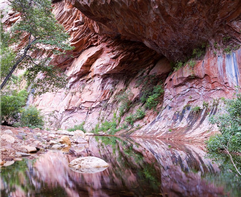
This quiet nook is hidden along the Oak Creek Canyon trail, though easy enough to find.
I visited there just at dawn when the air was still and the usually busy site deserted.
Oak Creek Canyon is named for the native, evergreen oak species unique to desert environments. The leaves conserve moisture: small, thick. I remember camping at the Chiricahua National Monument on November. All night the acorns fell onto the metal picnic tables, a loud metallic thunk.
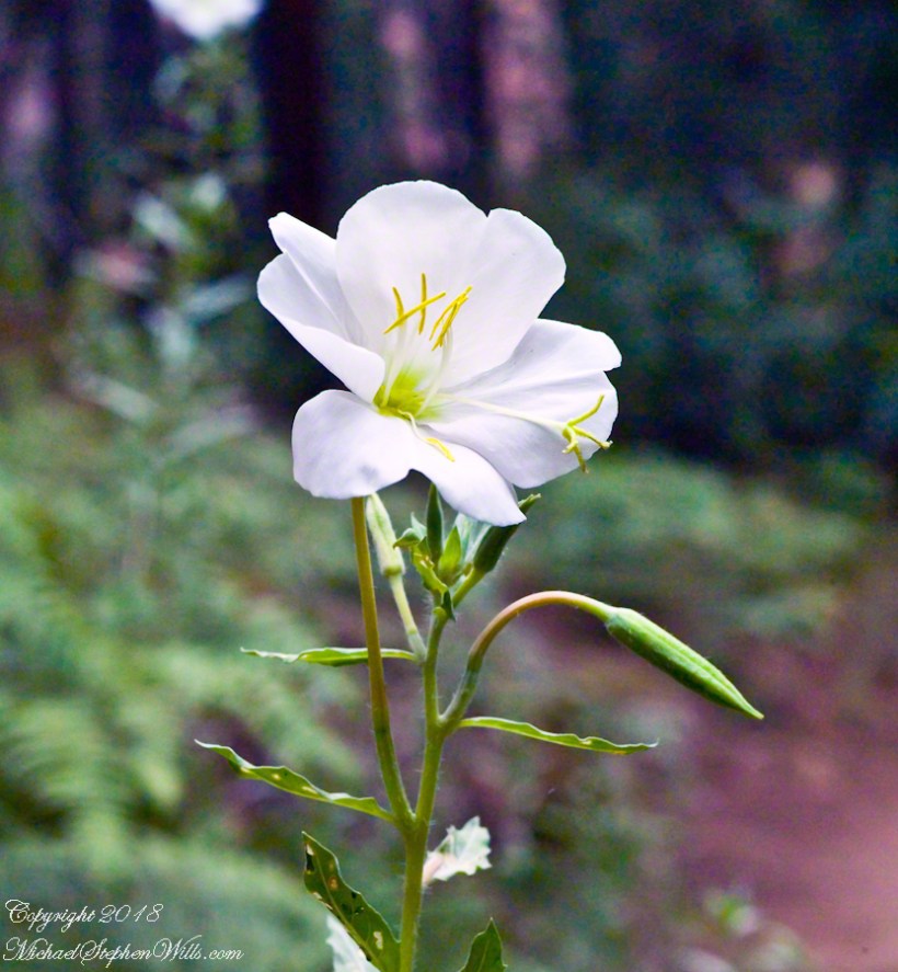
The post header is a primrose flower growing on the bank of Oak Creek.
Recognize the rock from “Oak Creek Mandala”? This is farther up the Oak Creek Canyon trail, “photograph by Pam Wills.” I am in my warm weather photography kit of the time having passed the camera to Pam for the shot.
Interstate 10 between Benson and Wilcox ascends through a field of enormous, eroded granite boulders. Off to the west are the Dragoon Mountains, otherwise known as “Cochise Stronghold.”
Informative sign at campsite
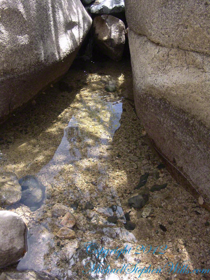
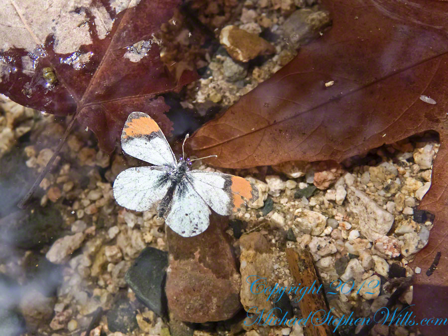
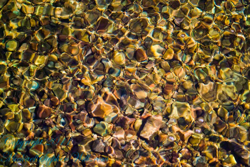
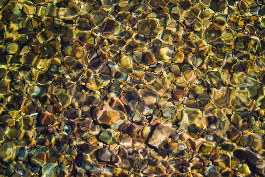
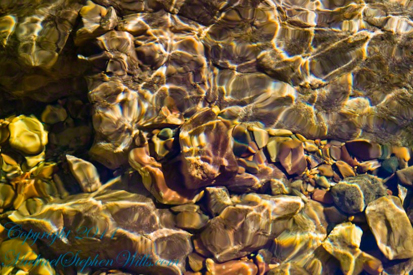
Starting from the campsite is the “Sky Islands Traverse” hiking trail, leading up into the mountains. I wandered from the trail to follow a dry streambed to this residual pool of water, the time being early spring, and this is what remained from the winter rains.
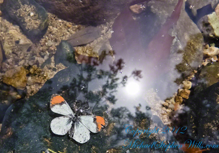
A single butterfly of the genus Anthocharis generally called “Orangetip” for the colorful upper wing tips. These exist throughout the world, here in Arizona they migrate across the desert, obtaining refuge and nourishment from “Sky Islands” such as the Dragoon Mountains
Copyright 2022 Michael Stephen Wills All Rights Reserved
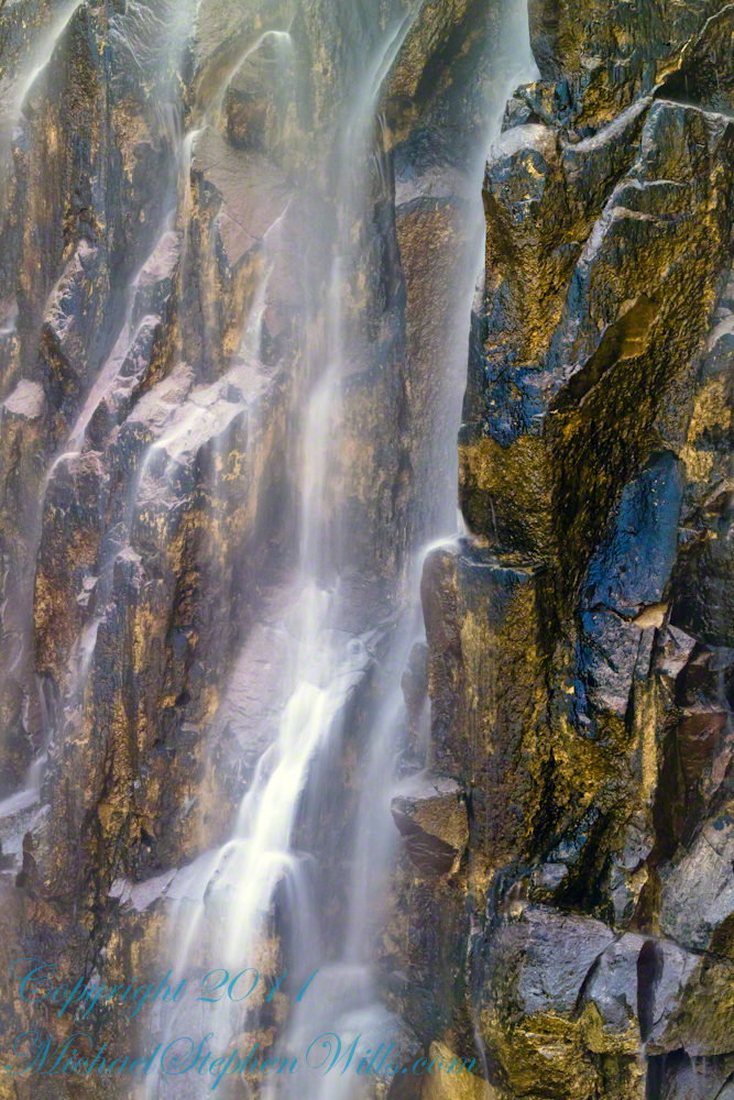
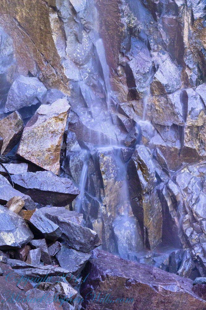
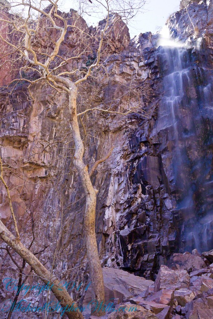
The canyon below 110 foot Reavis Falls is a wild place of transcendent beauty.
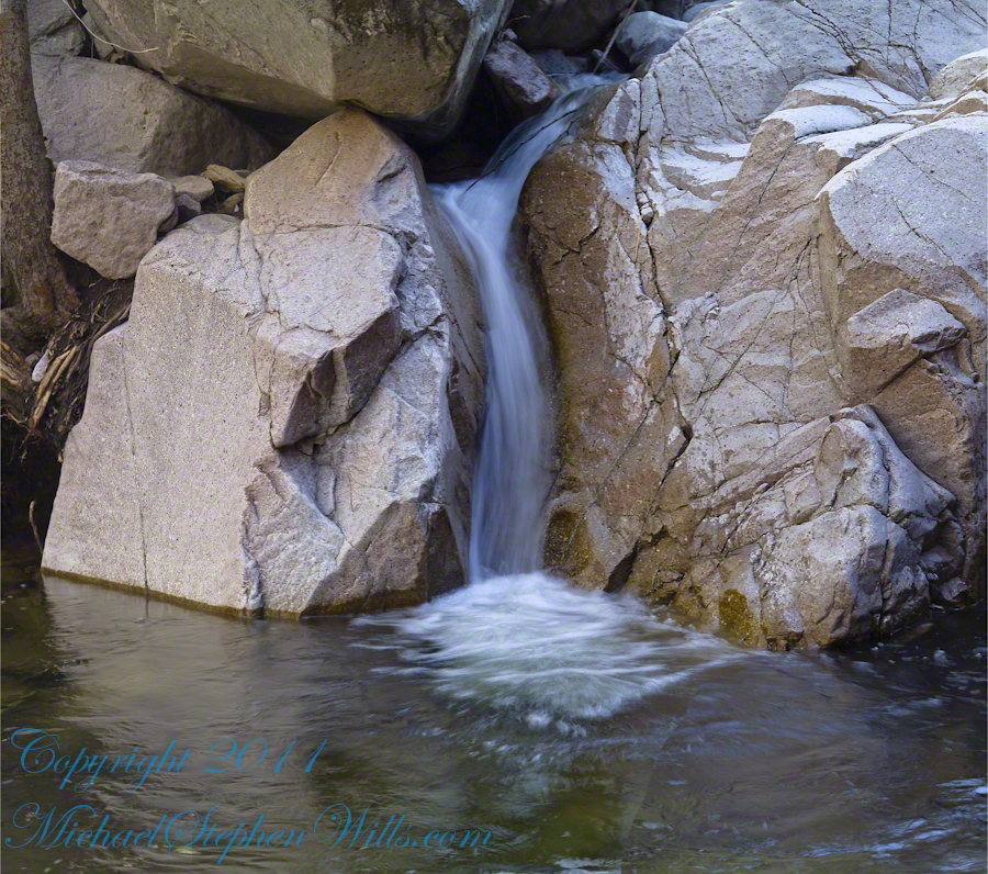
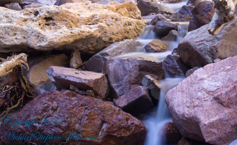
With the afternoon in front of me, the trip back to camp was a slow pleasure. On the way in, I noted several stopping points to capture photographs. Here a natural rock sluice offers a foot tall waterfall, mirroring Reavis Falls, bracketed by white igneous stone.
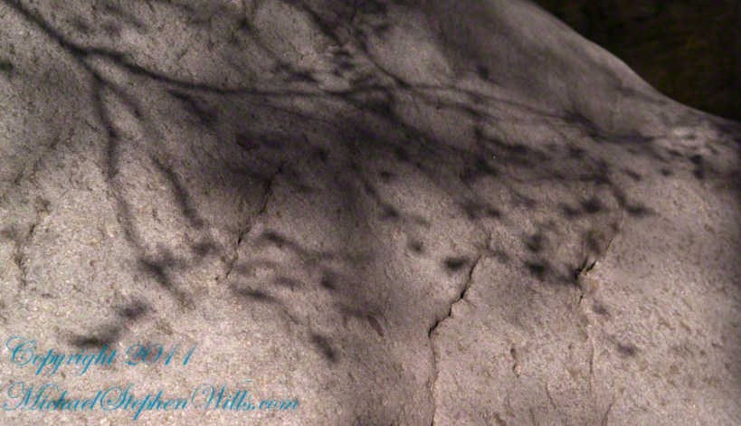
This same stone offers a screen, the bright spring sun throwing the sparse leaves into sharp relief.
Reaching Reavis Falls, once you find the canyon mouth, is three-fourths of a mile of boulder hopping and bushwacking over and around landslides, deep pools and fallen trees. Odds are you will be the only person in the canyon for weeks, if not months. Expect to be surprised. In this chapter you will (finally) visit the falls themselves.
A Camp in the Canyon
Click me for the chapter about the environment around the mouth of Reavis Canyon below the falls.
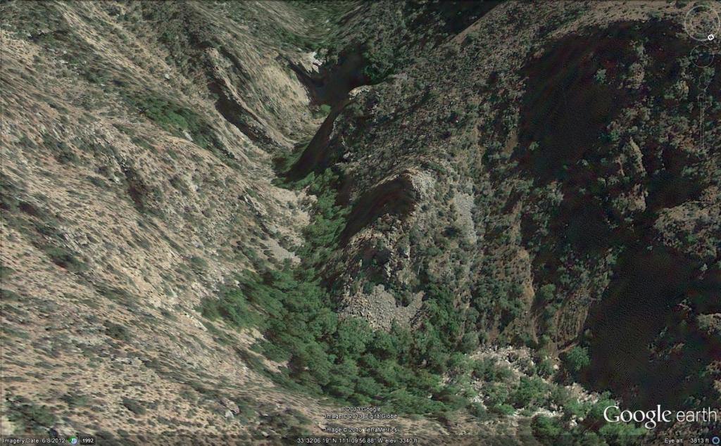
The Last Mile
Here is an overview of the last third mile of Reavis Canyon. You can see the wall of the falls nestled in the folds of ridges towards the top, just off center.
On the lower right is a large landslide and, below there, it is complete chaos.
The vegetation grows shoulder to shoulder with interleaved branches. You will not get through there. The solution is to find a way around, usually over and around house-sized boulders.
The image was captured from Google Earth
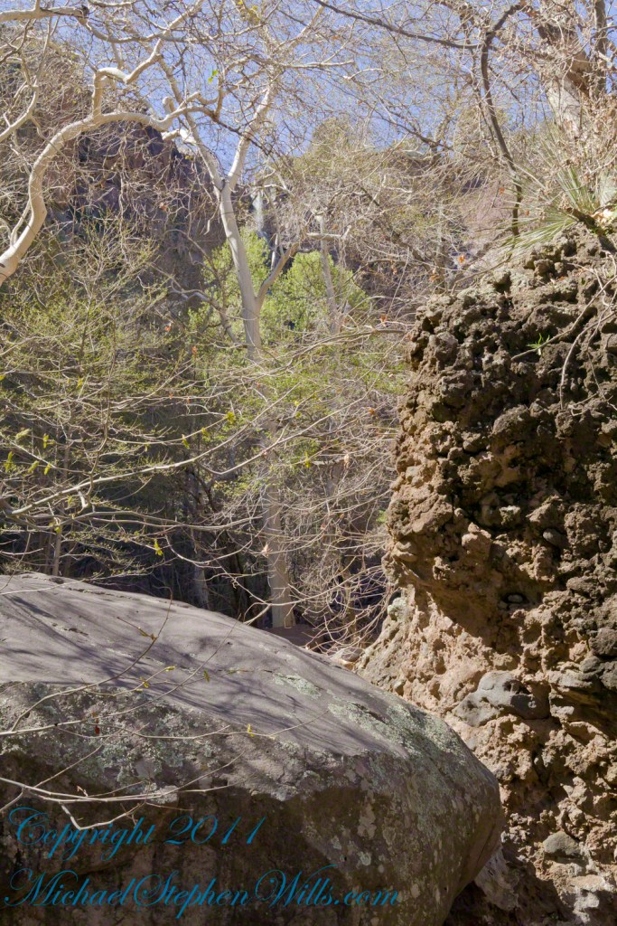
After almost two hours of picking my way, there was a flicker of light. The fall waters were sparkling in the sunlight high above the cottonwood trees, in full Mach bloom, and the still leafless Arizona Sycamores.
This was my view of Reavis Falls from the canyon on a March day before the Arizona Sycamores have leaved. The falls are the tiny patch of white to the left of midline where the earth meets the sky. Jumbles of infallen boulders and thick growth of sycamores, oaks and fully leaved cottonwoods cloak the falls.
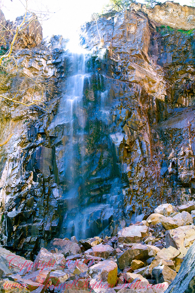
Another 30 minutes of canyoneering brought me to the foot of the falls.
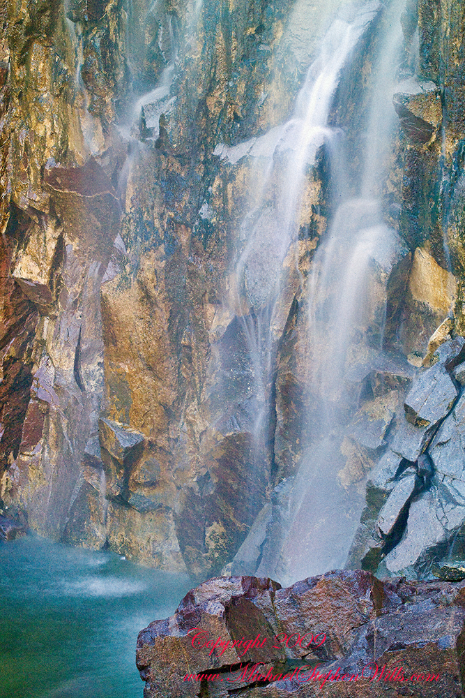
At the Foot of Reavis Falls
Looking up at Reavis Falls from a 20 foot tall mound of talus.
These are boulders washed down at flood time.
The rock wall is thick with microorganisms, fungi and mosses.
After clambering around the talus pile I found this angle….
An Arizona Sycamore, before the spring leafing, at the Foot of Reavis Falls
Talus at the Foot of Reavis Falls
The Reavis Falls talus is large boulders carried down Reavis Creek and washed over the falls at flood time as well as blocks fractured from the cliff face. You can see the base of the Sycamore from the previous photograph.
The falls are formed where Reavis Creek flows over a solid mass of rock. The talus is composed mostly of this red rock. From the edge of this cliff to the base, where the falls hit the canyon floor, is all of 140 feet. This is a far as you can proceed into the canyon without some serious climbing skills.
It is possible to climb around the canyon by climbing up the ridge from which I captured the Cedar Basin Hoodoos. See my posts below for this location (you need to work it our for yourself).
This is NOT the last post of the series. From here I will focus on the beauty of Reavis Falls and the canyon that holds them.
It was a four-day expedition so there are a few chapters covering the approach to the Falls:
The Superstition Wilderness was born from volcanic eruption and in some places (Peters Mesa) the earth still rumbles.
Here in Reavis Canyon it is the huge spring runoff that builds the environment, grinding and scouring the canyon. In my chapter The Mouth of Reavis Canyon is the story of this aspect of the canyon.
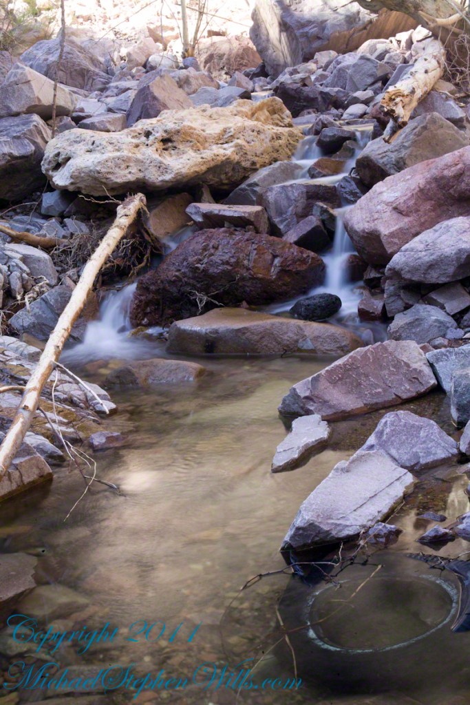
The history of this spot is written on these volcanic and igneous rocks and boulders, the uprooted tree roots and fresh water.
The tire must have washed down from Reavis Ranch.
A Canyon of Wonder and Beauty
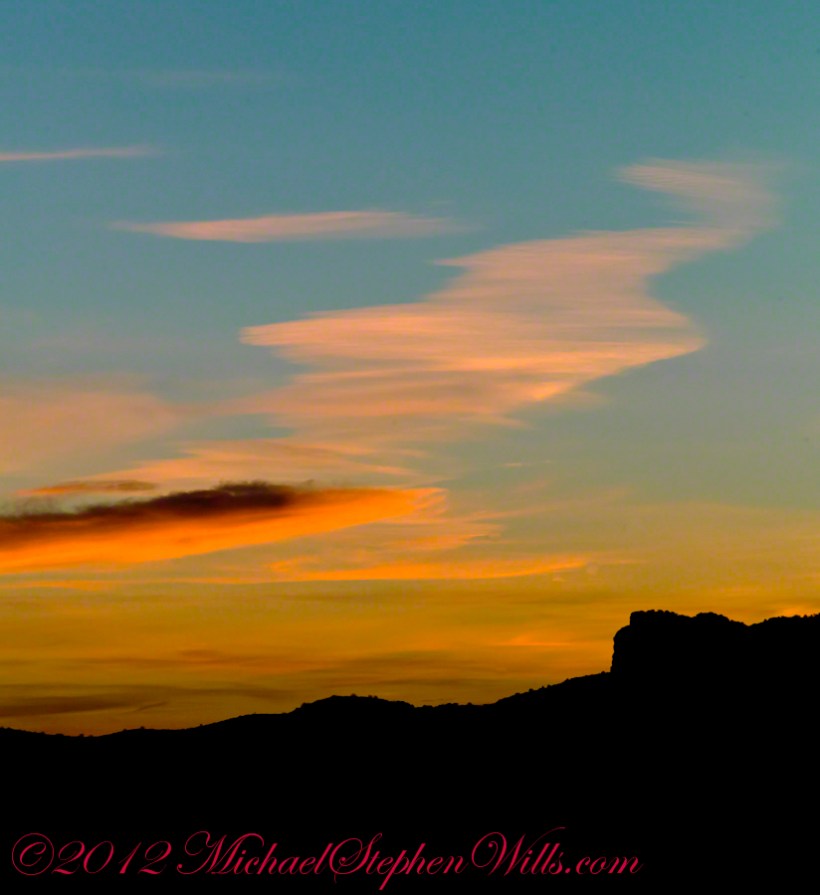
In this chapter I present, in the header, the lovely dawn sky of that day, and a tiny corner of a rock jumble in Reavis Creek. There is a large format version of the sky in my previous post, “The Mouth of Reavis Canyon.”
Rivulets and Rocks
Copyright 2023 Michael Stephen Wills All Rights Reserved