Backlit

Ferns, ancient plants with unique reproduction strategies and ecological significance, adapt to diverse environments while contributing to overall biodiversity and human culture.

In the vast tapestry of the plant kingdom, ferns occupy a unique and enduring place. These ancient plants, often overlooked in favor of their flowering counterparts, have a fascinating and seemingly eternal existence that spans millions of years. Ferns, with their lush green fronds and distinctive reproductive mechanisms, offer us a glimpse into the enduring legacy of life on Earth and the remarkable adaptations that have allowed them to persist through the ages.

Ferns belong to the group of plants known as Pteridophytes, which evolved more than 360 million years ago during the late Devonian period. Their evolutionary history predates the appearance of flowering plants, making ferns some of the oldest living organisms on our planet. This remarkable longevity raises the question: how have ferns managed to survive and thrive for so long?

One key to the success of ferns lies in their unique reproductive strategy. Unlike flowering plants that produce seeds, ferns reproduce via spores. These small, dust-like structures contain the genetic material necessary for ferns to reproduce. When mature, ferns release spores into the environment, where they can be carried by the wind or water to new locations. Once a spore finds a suitable environment, it can germinate and develop into a new fern plant.

The spore-based reproduction of ferns is not only ancient but also highly efficient. It allows ferns to colonize diverse habitats, from moist, shaded forests to arid deserts. Additionally, ferns can form extensive networks of underground rhizomes, which are creeping stems that give rise to new fronds. This vegetative propagation further contributes to their resilience and adaptability.

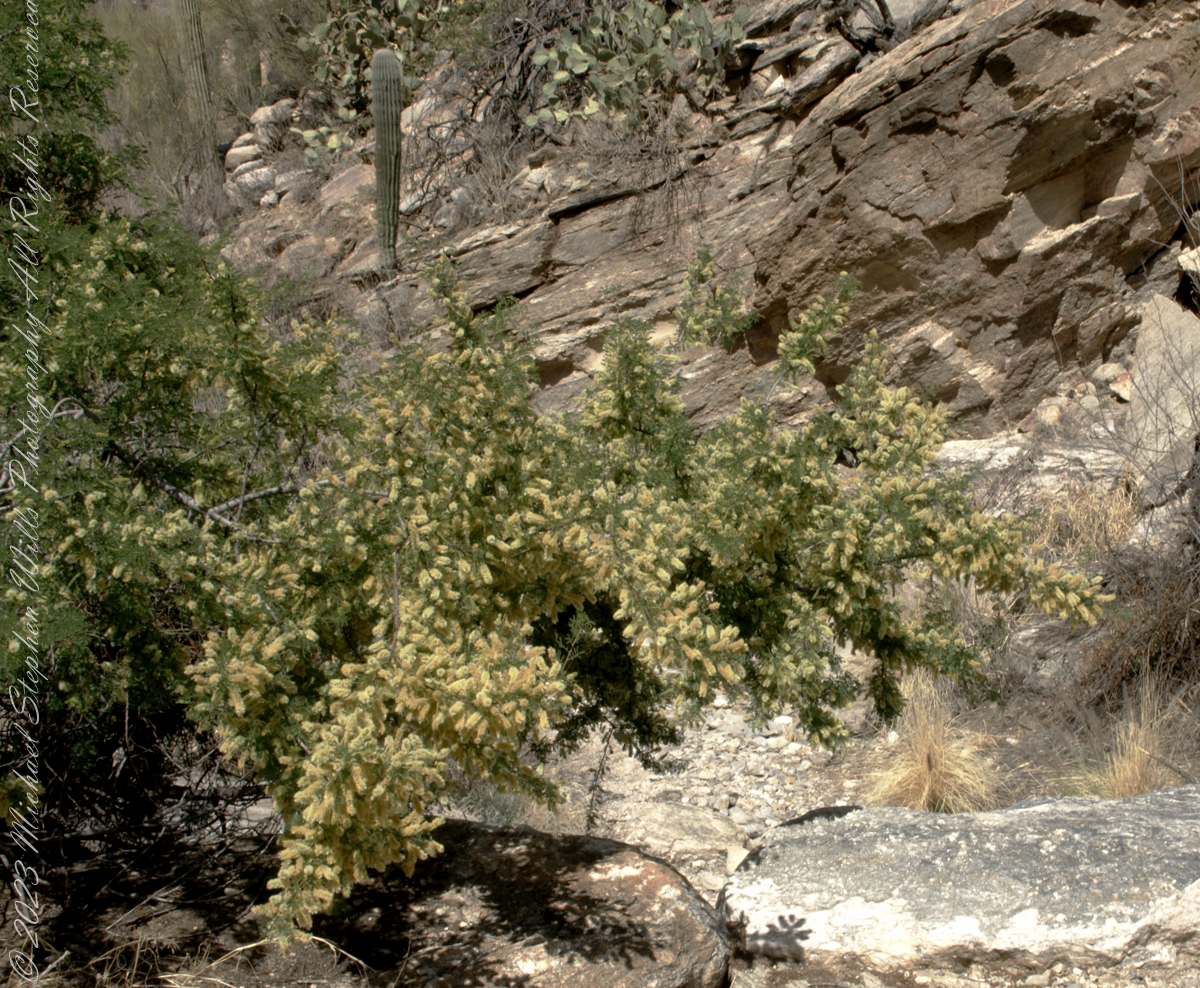
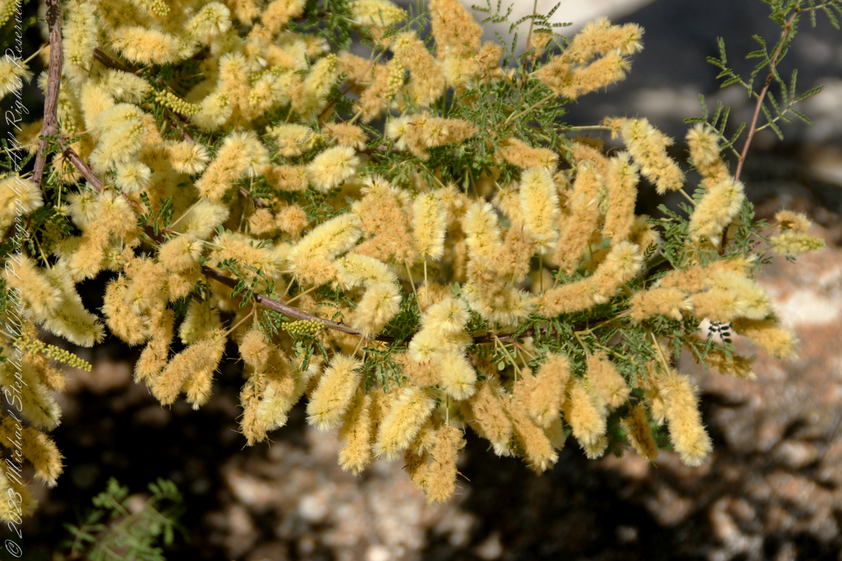
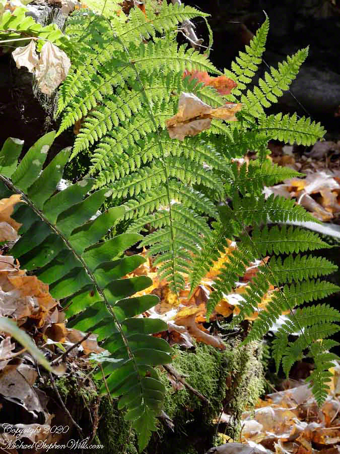
Ferns have also developed a range of adaptations that enable them to thrive in various environmental conditions. Some fern species, such as the resurrection fern (Pleopeltis polypodioides), can endure extreme desiccation. When conditions are dry, these ferns curl up and appear dead, but they can quickly revive and unfurl their fronds when moisture returns. Backpacking through mountainous Arizona wilderness I encountered small ferns growing in the shade of rock ledges, maybe this was Phillips Cliff Fern (Woodsia phillipsii). My guide called it “Ridgeline Fern” and claimed it was important for desert survival, could be eaten in extremis situations. This remarkable ability to withstand drought and promote human survival is a testament to the tenacity and usefulness of ferns.

Another intriguing aspect of ferns is their mutualistic relationship with mycorrhizal fungi. These fungi form symbiotic associations with fern roots, aiding in nutrient absorption and enhancing the fern’s ability to thrive in nutrient-poor soils. This partnership has likely contributed to the fern’s ability to colonize a wide range of habitats and compete with other plant species.

While ferns have proven to be resilient survivors, they have also played a crucial role in shaping Earth’s ecosystems. Ferns are often early colonizers in disturbed or newly formed habitats, and their presence can help stabilize soils and create conditions suitable for the establishment of other plant species. In this way, ferns contribute to the ecological succession and overall biodiversity of ecosystems.

Beyond their ecological significance, ferns have captured the human imagination for centuries. Their delicate and intricate fronds have inspired art, literature, and even garden design. Many garden enthusiasts cultivate ferns for their ornamental beauty and unique charm.

In conclusion, the eternal life of ferns is a testament to the remarkable adaptability and resilience of these ancient plants. Their longevity, dating back millions of years, serves as a reminder of the enduring nature of life on Earth. Ferns have evolved unique reproductive strategies, adaptations to various environments, and mutualistic relationships that have allowed them to persist and thrive. Whether they are serving as pioneers in newly formed habitats or gracing our gardens with their elegance, ferns continue to capture our fascination and enrich the natural world. Their legacy reminds us of the intricate and interconnected web of life that has persisted on our planet through the ages.

Copyright 2023 Michael Stephen Wills All Right Reserved MichaelStephenWills.com

History and Ghosts of the Triangle T Ranch

1975 University of Arizona alumnus recounts annual homecoming trips and an encounter with a haunted ranch.

In my Homecoming Parade 2003, I described my initial reconnection with the University of Arizona (U of A) as a 1975 graduate and alumnus.  This personal project of involvement with U of A and Arizona continued through 2011 with annual autumn trips to coincide with Homecoming.  The travel was as a CALS (College of Agriculture and Life Sciences) Alumni Board of Directors member, a primary responsibility was raising funds for scholarships.

I met, Linda Kelly, the owner of the Triangle T Guest Ranch, while camping in the Chiricahua Mountains.  I arrived a week before homecoming to photograph the landscape, nature and rock formations of the Chiricahua National Monument.  Click this link for my Arizona Online gallery, including some work from that time.  Linda and a friend were visiting that day and we struck up a conversation about the area and her Triangle T Guest ranch.  The next day I was scheduled to guest lecture a class at the U of A, as an alumnus of CALS.  The ranch was on the way and I needed a place to stay, so Linda gave me directions and I checked in.

She gave me a tour of the incredible weather granite rock formations of Texas Canyon and, meanwhile, shared stories of the history of Texas Canyon.  It is appropriate for the Amerind Foundation to be here (see first photograph), the winter camp of an Apache tribe for generations.

Weathered granite boulders greet visitors to the Triangle T Ranch.

That night, my request was for a room storied to be haunted by a spirit they call “Grandma,” as in when her footsteps wake you from a sound sleep you say, “It’s all right, Grandmother.”  She woke me that night, footsteps in the dark, hollow on the wood floor, the room filled with a hard cold.  I talked to her, without a response, while swinging my legs out of bed to reach the gas heater in the wall.  I turned on the heat and the sound of expanding metal heat fins lulled me to sleep.

It made a good story for the students.  They were surprised I could fall back asleep, but after all I had to be there the following morning.

I gave Linda a few of my photographs from that day and we made arrangements for the Triangle T to supply a two night package for the CALS “Dean’s Almost World Famous Burrito Breakfast” silent auction during 2008 homecoming.

Copyright 2023 Michael Stephen Wills All Rights Reserved

Juniper Sunrise

crack of dawn

In this post we start the day of my posting “Family Trek, July 19, 2008, when, well before the sun rose at 6:23 am Mountain Daylight Time (the Navajo Reservation observes daylight savings, the rest of Arizona does not), Pam and I were at the Spider Rock Overlook.

Most visitors to the canyon make use of a system of roads and parking lots next to strategic views.  There is the White House Overlook we visited our first day, July 18, to hike from the trailhead into the canyon.  There are also, on the south side of the canyon:

  • Tsegi Overlook, taken from a Navajo word that translates directly to “between the rocks” and usually refers to a deep canyon with steep cliffs.
  • Junction Overlook above the point where Canyon Del Muerto (see my posting “Sun and Shade, Canyon Del Muerto”, and Canyon De Chelly intersect.  There is an Anasazi ruin in the south-facing cliff across the canyon.
  • Sliding House Overlook, another Anasazi run across the canyon.
  • Face Rock Overlook, to view the eponymous formation.
  • Spider Rock Overlook, the most stunning rock formation. 
Sunrise Canyon De Chelly
Looking east from the Spider Rock overlook, Canyon De Chelly.

While getting ready I scoped out the location for interesting visual tropes.  Utah Junipers are exceptionally hardy shrubs, stressed individual plants grow into compelling forms shaped by hardship.  As the sun rose, this specimen emerged from the gloom and caught the first sun rays.

Juniper Sunrise
A distressed Utah Juniper on the edge of Canyon De Chelly overlooking Needle Rock a few moments after sunrise.

Enjoy!!

Click for the first posting of this series, “Portrait of a Navajo Guide.”
 

The Flatiron

Where is the ironing board?

The setting sun’s glow on the end point of Upper Siphon Draw trail, The Flatiron.

Click Me for my Online Gallery

The mountain was formed by a series of volcanic eruptions between 20.5 and 18 million years ago. The west face of the mountain is composed of dacite lava and rhyolitic tuff. The overlying tuff was deposited during an eruption which created a collapse caldera bounded by faults. Dome resurgence reactivated these faults, causing uplift of the caldera floor which juxtaposed the softer tuff and more resistant dacite. Differential weathering caused the outer tuff to erode faster, leaving the dacite cliffs exposed and creating the prominent mountain visible today.

The Flatiron, the mesa-like projection above us in this view, is long solidified dacite lava. The word dacite comes from Dacia, a province of the Roman Empire which lay between the Danube River and Carpathian Mountains (now modern Romania and Moldova) where the rock was first described. Lost Dutchman State Park, Apache Junction, Maricopa County, Arizona

Reference: Wikipedia “Superstition Mountain” and “Dacite Lava.”

Copyright 2023 Michael Stephen Wills All Rights Reserved

Dragoon Ridge

Dragoon, not dragon

Dragoon Mountains of southeastern Arizona are named, not for the resemblance of this ridge to the back of a Dragon, but for a type of soldier trained for horseback riding and infantry.  These were the U.S. troops sent to “pacify” the Chiricahua Apache homeland.

Understanding location lighting is a matter of experience and luck.

Cochise Stronghold campsites are on the eastern slope of the Dragoons, sheltering them from the late afternoon sun.

One this day in April I explored the trails until sunset and was lucky enough to be setup for the 14 minutes of that day when the light was absolutely perfect.

Copyright 2023 Michael Stephen Wills All Rights Reserved

Dragoon Spires

Lucky enough

Understanding location lighting is a matter of experience and luck.

Cochise Stronghold campsites are on the eastern slope of the Dragoons, sheltering them from the late afternoon sun.

One this day in April I explored the trails until sunset and was lucky enough to be setup for the 14 minutes of that day when the light was absolutely perfect.

“Dragoon Spires in Afternoon Light”

These photographs are from two days spent at Cochise Stronghold, a part of the U.S. Forest Service Coronado Forest managed by Arizona State Parks located off the Interstate 10 East of Tucson between Benson and Wilcox.

This rugged natural fortress was, for some 15 years, the home and base of operations for the famed Chiricahua Apache Chief, Cochise.  Cochise and about 1,000 of his followers, of whom some 250 were warriors, located here.

Click Me for my OnLine Gallery

Born in present-day Arizona, Cochise led the Chiricahua band of the Apache tribe during a period of violent social upheaval. In 1850, the United States took control over the territory that today comprises Arizona and New Mexico.  Not hostile to the whites at first, he kept peace with the Anglo-Americans until 1861, when he became their implacable foe because of the blunder of a young U.S. Army officer, Lt. George Bascom.   In that year, Cochise and several of his relatives had gone to an encampment of soldiers in order to deny the accusation that they had abducted a child from a ranch. The boy was later proved to have been kidnapped by another band of Apaches.

During the parley, Cochise and his followers were ordered held as hostages by Bascom, but Cochise managed to escape almost immediately by cutting a hole in a tent. Bascom later ordered the other Apache hostages hanged, and the embittered Cochise joined forces with Mangas Coloradas, his father-in-law, in a guerrilla struggle against the American army and settlers. The capture and murder of Mangas Coloradas in 1863 left Cochise as the Apache war chief.   The U.S. Army captured him in 1871 and prepared to transfer the Chiricahua to a reservation hundreds of miles away, but he escaped again and renewed the resistance campaign. The following year after negotiating a new treaty with the help of Thomas Jeffords, the band was allowed  to stay in their homeland.

Cochise is reputed to have been a master strategist and leader who was never conquered in battle.  He died peacefully on the newly formed Chiricahua  reservation in 1874.  His son, Taza succeeded him as chief.   Upon his death, he was secretly buried somewhere in or near his impregnable fortress.  The exact location has never been revealed or determined.

The town of Cochise, Cochise County, the renowned geological feature known as Cochise’s Head in the Chiricahua Mountains, and the Stronghold are all named in tribute to him.

Copyright 2023 Michael Stephen Wills All Rights Reserved

Cochise Stronghold Introduction

Campground is closed in June, July, and August due to the often-extreme heat

These photographs are from two days spent at Cochise Stronghold, a part of the U.S. Forest Service Coronado Forest managed by Arizona State Parks located off the Interstate 10 East of Tucson between Benson and Wilcox.

“Idyllic Desert Landscape with Boulders”


Click Me for my OnLine Gallery

“Generations”


Here is the Cochise Stronghold information sign from the Douglas Ranger District of the Coronado National Forest.

The Dragoon Mountains are a low range that barely rises above the surrounding desert floor. Nevertheless, the granite boulders are spectacular and well worth visiting for the scenery alone. This mountain range is remote from cities or even any large towns, so visitation is light. Late fall, winter, and early spring are the best times to visit. Temperatures exceeding 100 degrees are common even in spring and fall. Cochise Stronghold Campground is closed in June, July, and August due to the often-extreme heat.

Safety First: Heat and low humidity are real hazards for people unfamiliar with desert climates. A person can loose up to 5 quarts of fluid a day and it is easy to become seriously dehydrated without realizing it, so drink plenty of fluids even if you do not feel very thirsty. Always carry extra water in your car. When going on a hike, even if a short one, take a day pack with water, snack foods, protective clothing, flashlight, first aid kit, compass, and map. To avoid sun in

Copyright 2023 Michael Stephen Wills All Rights Reserved

Oak Creek Mandala

early one still morning

This quiet nook is hidden along the Oak Creek Canyon trail, though easy enough to find.

I visited there just at dawn when the air was still and the usually busy site deserted.

Oak Creek Canyon is named for the native, evergreen oak species unique to desert environments.  The leaves conserve moisture: small, thick.  I remember camping at the Chiricahua National Monument on November.  All night the acorns fell onto the metal picnic tables, a loud metallic thunk.  

The post header is a primrose flower growing on the bank of Oak Creek.

Recognize the rock from “Oak Creek Mandala”?  This is farther up the Oak Creek Canyon trail, “photograph by Pam Wills.”  I am in my warm weather photography kit of the time having passed the camera to Pam for the shot.

Click this link for my Fine Art Photography gallery. You can find Oak Creek Mandala in the Arizona gallery.  The gallery description gives more information about the site.

Click this link for another Arizona post, “Cochise Dawn.”

Cochise Spring

ancestral Apache land

Interstate 10 between Benson and Wilcox ascends through a field of enormous, eroded granite boulders. Off to the west are the Dragoon Mountains, otherwise known as “Cochise Stronghold.”

Informative sign at campsite

Starting from the campsite is the “Sky Islands Traverse” hiking trail, leading up into the mountains. I wandered from the trail to follow a dry streambed to this residual pool of water, the time being early spring, and this is what remained from the winter rains.

Click Me for my Online Galleries

A single butterfly of the genus Anthocharis generally called “Orangetip” for the colorful upper wing tips. These exist throughout the world, here in Arizona they migrate across the desert, obtaining refuge and nourishment from “Sky Islands” such as the Dragoon Mountains

Copyright 2022 Michael Stephen Wills All Rights Reserved

Mesquite Flowers and Seeds

desert survival

Mesquite is the Sonoran Desert smell carried by distant rain, omnipresent and humble, a survivor with tap root extending 190 feet down to draw on the water table.

Click Me for my Online Gallery

Prosopis is the scientific name for about 40 species of leguminous trees. Present in North America since the Pliocene era, mesquite wood has been dated to 1300 BC.

I found this flowering mesquite bush in Finger Rock Canyon of the Catalina Mountains outside Tucson, Arizona.

They are thought to have evolved with megafauna in the New World. The loss of North American megafauna at the end of the Pleistocene era gave way to one theory of how the Prosopis spp. were able to survive.

One theory is that the loss of the megafauna allowed Prosopis spp. to use their fruit pods to attract other organisms to spread their seeds; then, with the introduction of livestock, they were able to spread into grasslands.

The plentiful legumes that develop from these flowers are edible when cooked. The shape and color of the seeds can be understood from this empty seed pod that happens to lie near a tarantula burrow.

Click me to read more about the uses of mesquite.

References:
“Mesquite,” Wikipedia

Copyright 2023 Michael Stephen Wills All Rights Reserved