This the fifth and final of a series of landscape photographs taken from this position.
Click photograph for a larger view. To do this from WordPress Reader, you need to first click the title of this post to open a new page.
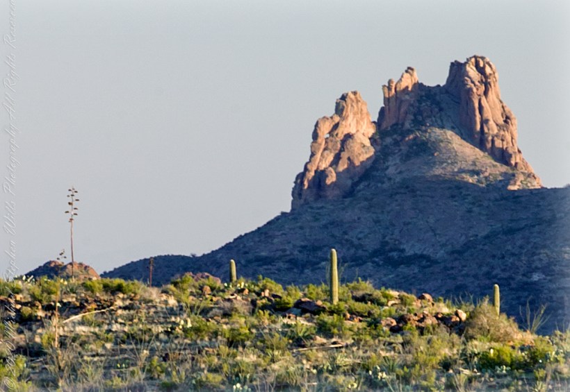
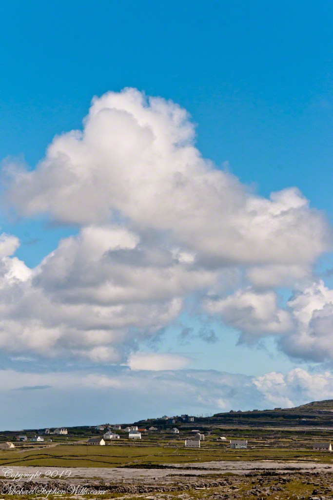
Slievenaglogh View with road, east
The peak is named, in the English language, Slievenaglogh. It is so strange as it’s not English, being instead a transliteration of the Irish name “Sliabh na gCloch.” This is “Rock Mountain” translated literally. Slievenaglogh is carried to the townland, a long thin swath of land being the peak and associated ridge-line.
The rocks up there are called “gabbro,” a type of magma slowly cooled under ground. Slievenaglog, Slieve Foy across the valley, and the Morne mountains all formed within volcano magma chamber(s) of the Paleocene, 66 million years ago, a time associated with extensive volcanism and the Cretaceous–Paleogene extinction event that gave rise to the current age.
Our younger cousin has been up there, optimistically we left it for a later trip.
Slievenaglogh View, northeastSlievenaglogh View, east northeastSlievenaglogh View, east northeastSlievenaglogh View, north northeastSlievenaglogh View with road, east
This the fourth of a series of landscape photographs taken from this position.
Click photograph for a larger view. To do this from WordPress Reader, you need to first click the title of this post to open a new page.
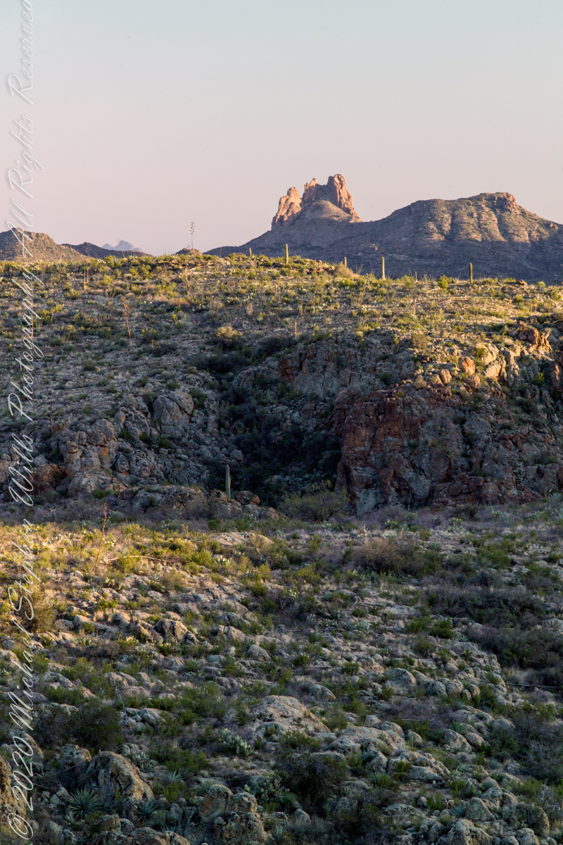
Slievenaglogh View, north northeast
The distant ridge, Slieve Foy, is the site of a mythic battle from the epic “The Cattle Raid of Cooley” (Irish: Táin Bó Cúailnge).
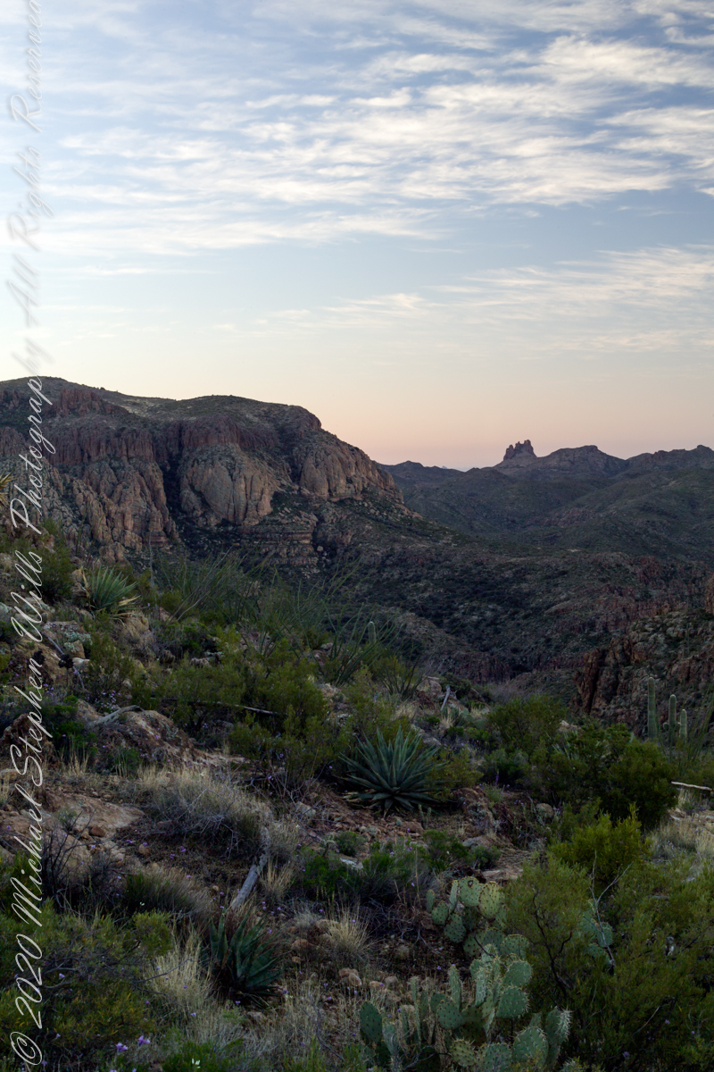
Pam and I did a circuit of the island, returning to the home of my Mom’s first cousin. Our last full day on Ireland a cousin took us on the Tain Trail, over Maeve’s Gap of Slieve Foy and into Carlingford town.
Our route is partly visible to the right of the ridge, hidden in low clouds.
These are the second and third of a series of landscape photographs taken from this position. See the previous post for the first.
Click photograph for a larger view. To do this from WordPress Reader, you need to first click the title of this post to open a new page.
Slievenaglogh View, east northeastSlievenaglogh View, east northeast
I visited here early morning of the Monday Pam and I embarked on a trip around the island of Ireland.
Arrived the previous Saturday when, after some sites between Dublin airport and the Cooley Peninsula, we met my Mom’s first cousin who had invited us for a visit. We had a grand time meeting them.
The ruin in this view is on the slopes of the peak. Some of these ruins are former homes with the replacement nearby. This appears to be an abandoned farm.
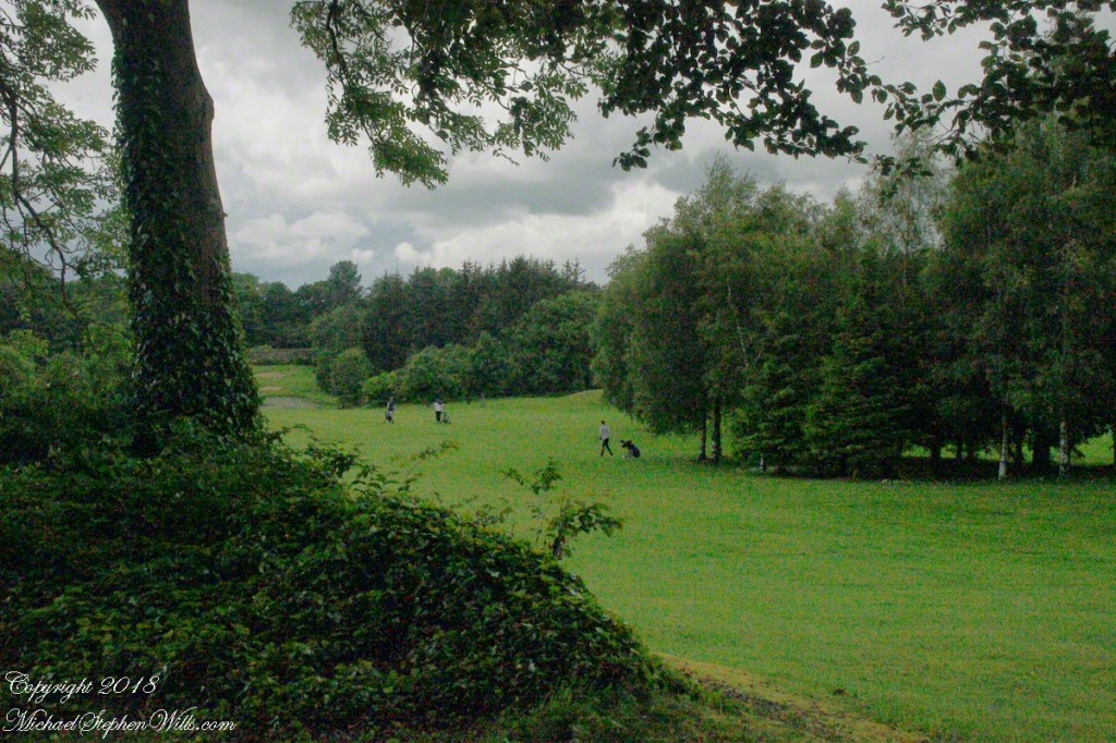
Slievenaglogh is the name of a peak on the Cooley Peninsula of County Louth, Ireland near to the birthplace of my Mom, Proleek, a few townlands to the west.
Click photograph for a larger view. To do this from WordPress Reader, you need to first click the title of this post to open a new page.
Slievenaglogh View, northeast
On the northeast slope of Slievenaglogh peak (Irish: Sliabh na gCloch) on the road from Mullaghattin Townland to Riverstown.
Here we look northeast from the Slievenaglogh Townland, the valley between Slieve Foy and Slievenaglogh peaks.
The view includes Little River, Ballycoly Townland and Castletown River.
Adjacent is a sheep pasture with a farm ruin behind the yellow flowered gorse (whin bush, scientific name Ulex).
Slieve Foy is the far ridge lost in clouds. Early morning, late May 2014.
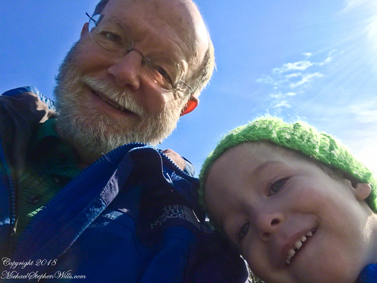
On a sunny autumn morning we set out, my soon to be three grandson Sam and I, to the Lime Hollow Nature Center near Cortland for an adventure. For the first time I brought a newly purchased iPhone 7 instead of the usual slr camera. The phone can be carried in a pocket and is simpler to us, to allow me to give full attention to Sam.
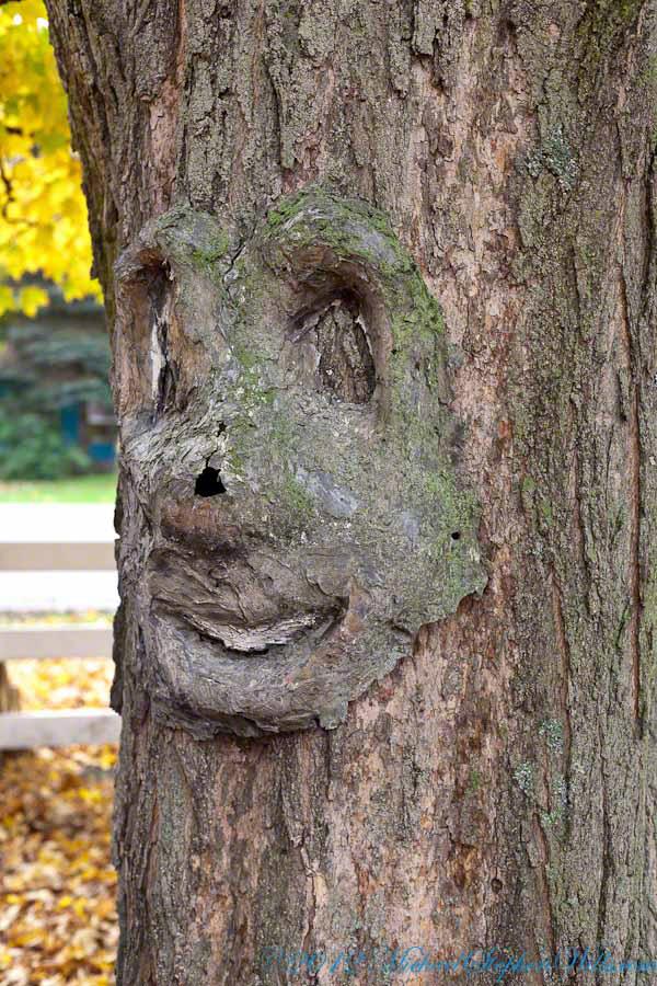
At the start is a large, today sunlit, field with an “art trail.” There are various anthropomorphic transformations on the trees and a very large sculpture of a blue face. Here is a tree from another place near here, to give you an idea.
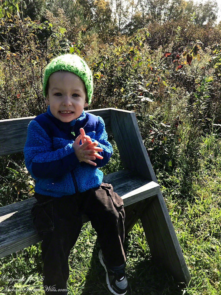
I do not point out the tree faces to Sam. His Mom likes to say he enjoys being frightened and, when the blue face came into view, he turned back and said, “home.” Sam was mildly anxious, so I carried him and tried to turn him up the trail away from the face. He turned to keep an eye on it while I assured him it could not move. This and a climb up a 230 foot hill were the only times he didn’t walk the half mile to a open grassy knoll with a bench.
There we sat for 30 minutes, still and watching, Sam and I talked about our sightings: 1. The sunlit sky of clouds, from a milky blue towards the north to, overhead, a bright robins egg blue. 2. A circling hawk, shadow crossing over us. 3. One blue jay in a maple turning red, loudly calling over and over. 4. A little while after a second jay, landing in a tree turned yellow, drawn in and giving answer. 5. A monarch butterfly’s steady progress south. Such a strong gliding path. 6. A yellow butterfly who did not leave us, fluttering round and round. 7. Four honking Canadian geese flying north east, turned to check out a nearby pond, the returned to the original heading. 8. The sound of wind through the trees, listening to the sound made by each tree. 9. The late season golden rod, now dried gray. 10. A distant chittering red squirrel. 11. Distant peeper frogs in the swamps at the foot of the hill.
Sam did not want to leave the bench, eventually we headed on to the pond the geese checked out.
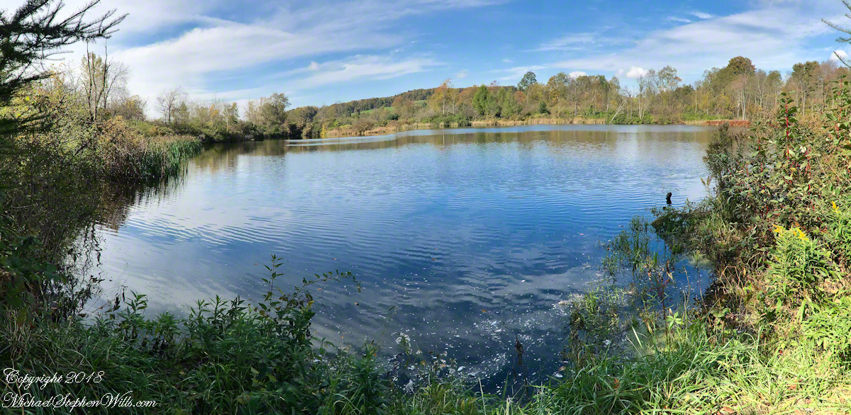
I used the “panoramic” feature of the iPhone 7 for this shot. On the hill we were sheltered by trees and bushes from the steady northeast wind. Here, on a bench by the pond, that direction was open to the wind. The sun kept us warm. It was clear why the geese did not land, the water surface was deserted, filled only by rippling wind driven waves.
On our walk back we sat on a bench on the edge of the art trail field, the blue face out of sight. A woman, the only other person encountered, emerged from one of the trails cut from the brush, camera in hand. She was collecting images for a Cortland Historical Society publication and asked to take our photograph. “OK,”, I said and gave the story of living here for 25 years in the house on Fall Creek where my son’s family lives now. She replied, “My daughter is in San Francisco. We don’t know who will have our house when we are gone.”
I was a member of an expedition to Peter’s Mesa March 2008, a place central to Superstition Wilderness treasure legends. This is a sunset view, looking south, southwest. Light raking across the desolation and Miner’s Needle creates a fascinating spectacle. Ancient volcanism, apparent throughout the Superstition Wilderness, is here seen in the texture, form and type of rock as well as the mineral deposits. Miner’s Needle, like Weaver’s Needle (not seen in this view), are eroded volcanic summits. Look closely for the “eye” of Miner’s Needle, easier seen in the cropped heading photograph. To this day, hopeful prospectors search for gold nuggets.
There is one form of volcanism present today as an eerie rumble or hiss, similar to an enormous distant jet engine heard now and then during our two days on the mesa, louder and closer than an overhead plane could produce. The view includes many notable Sonoran Desert plants. Many young Saguaro cactus are in the form of green poles. Catching the dramatic light, on the ridge is a tall single flower of an Agave, known as the “Century Plant” it flowers once in a long life and dies.
Peters Mesa is named after “Old Pete” Gottfried Petrasch, father of Hermann and Rhiney Petrasch. Old Pete worked for Jim Bark for awhile in the 1890s doing odd jobs. Irregular employment gave Pete and Sons time to s searched for the Lost Dutchman Mine in the years following the death of the source of the legend, the “Dutchman” Jacob Waltz. The Petrasches were one of the first groups to search for the mine, and gold in general. They covered almost the entire Superstition range in their combined searches.
Sunrise looking across Music and LaBarge Canyons to Miner’s Needle
On our first day on the mesa, we came across the remains of one of these camps, on the top of Squaw Canyon, a deplorable junk pile discarded by searchers, presumably disappointed, too lazy to cart it out. That March, we were lucky to find the remnants of winter rains in the form of a meager trickle at the bottom of a shallow draw off Peter’s Mesa trail up from La Barge canyon. We had a good time of it until the trip was cut short by a storm front and torrential rains. We were back in Apache Junction before they hit.
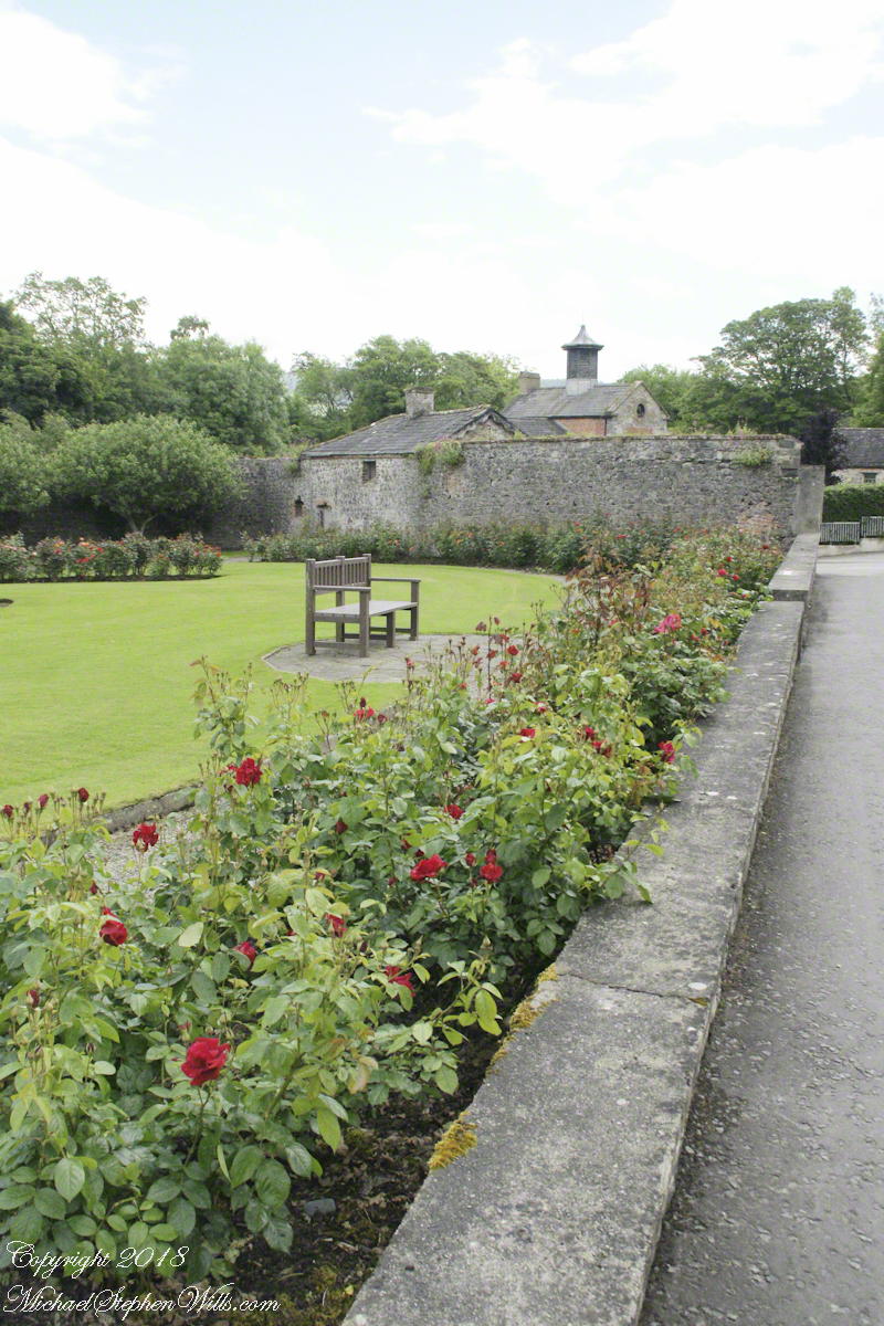
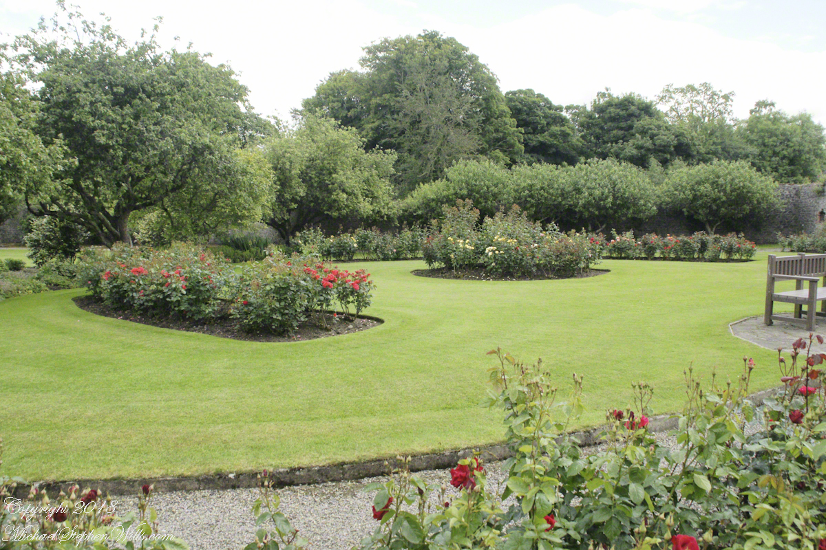
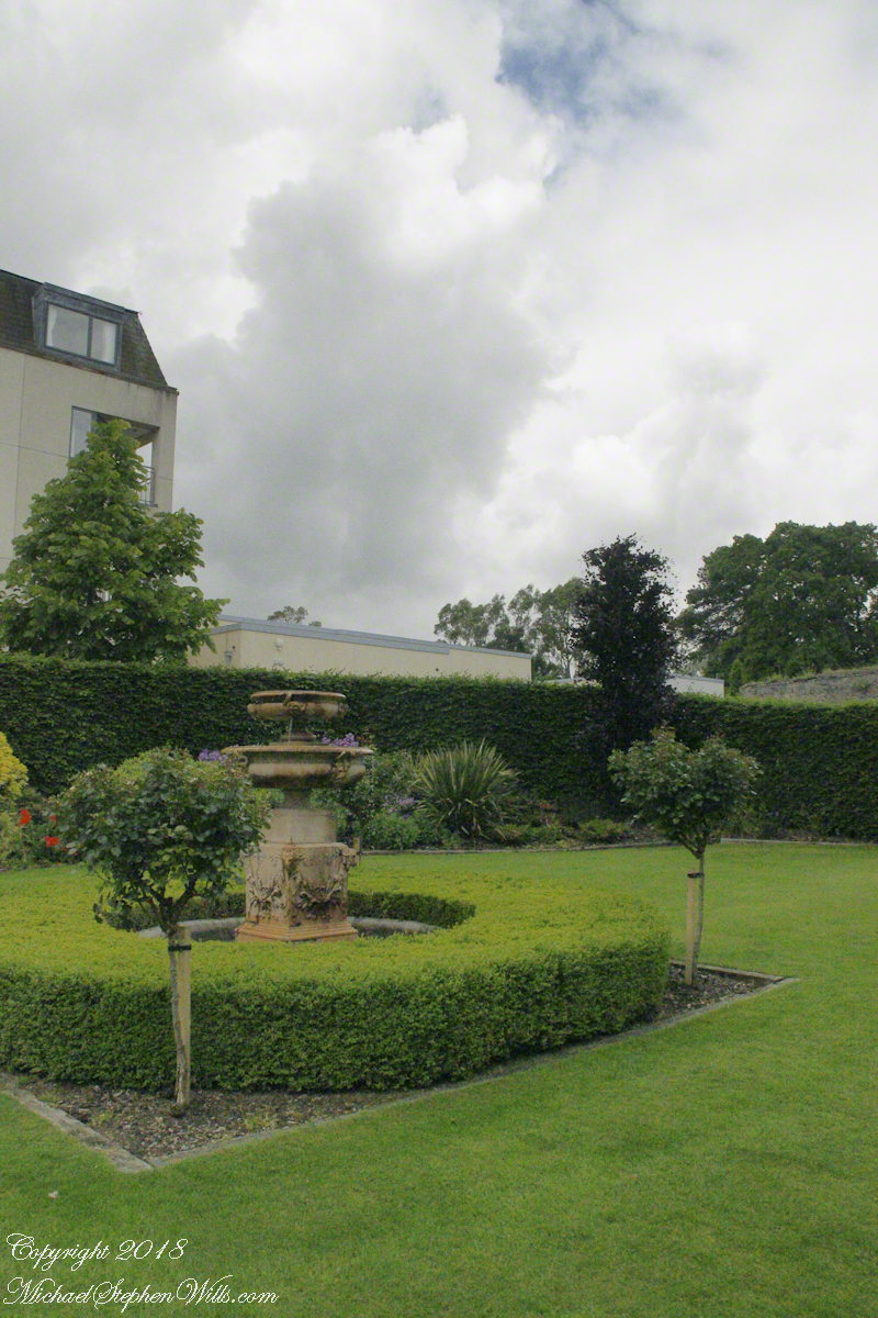
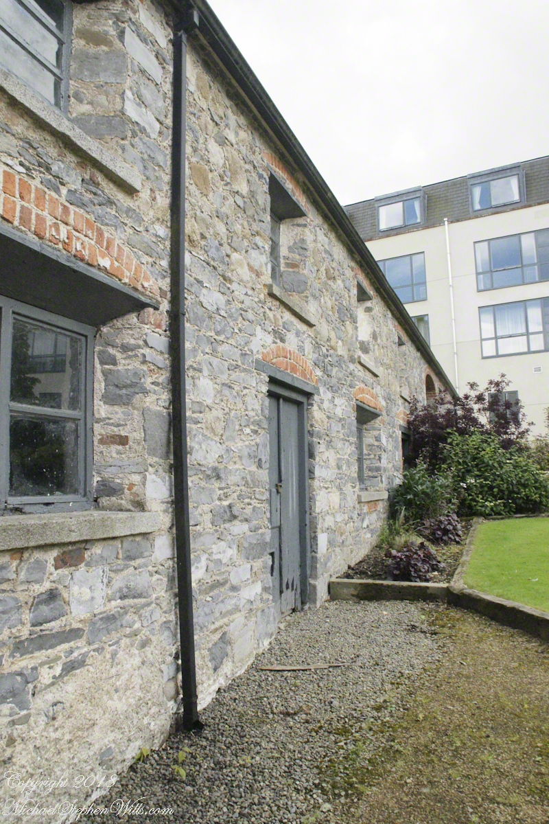
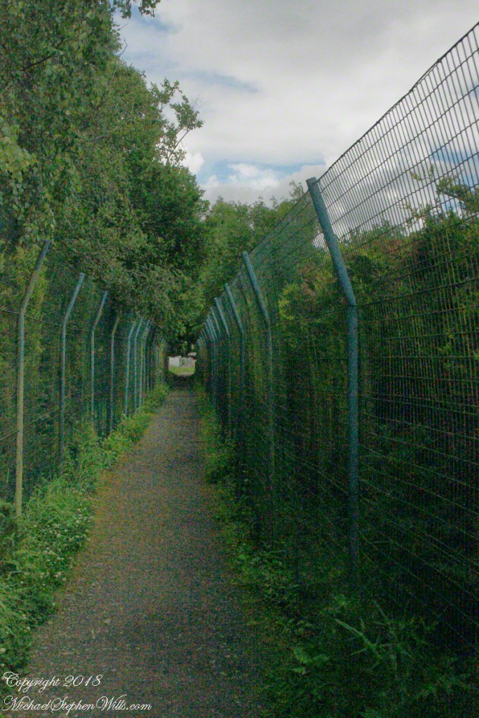
I have an update to my post “Proleek, Grandfather McCardle’s home” where we explored the site of the boyhood home of my grandfather, Peter McCardle, on great grandfather James McCardle’s Proleek farm. April 2018 an email arrived from the brother of the owner of the house across the road. He recognized the property from the blog photography and reached out to introduce himself and share information. His own genealogical research suggested we shared a great aunt. We now work together to define this connection.
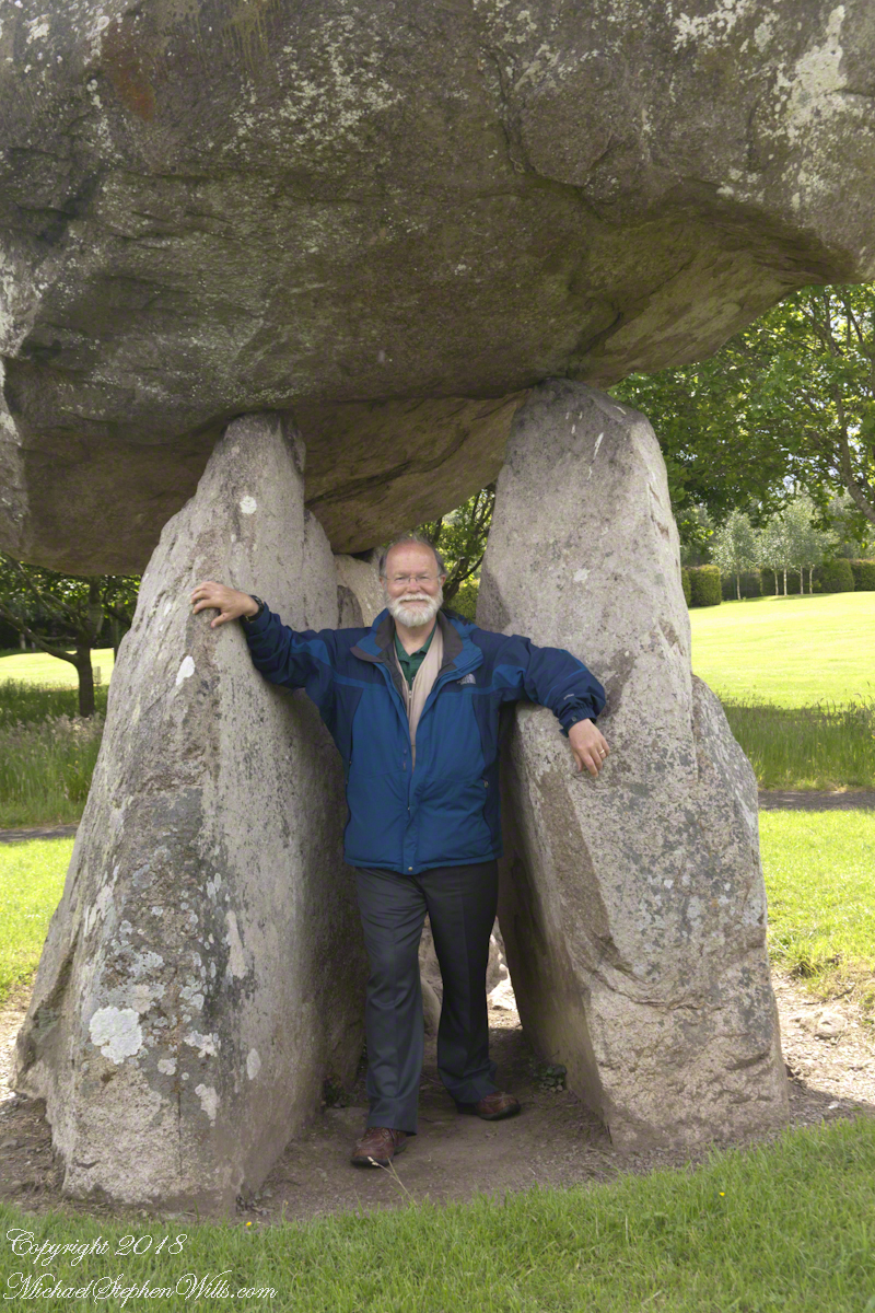
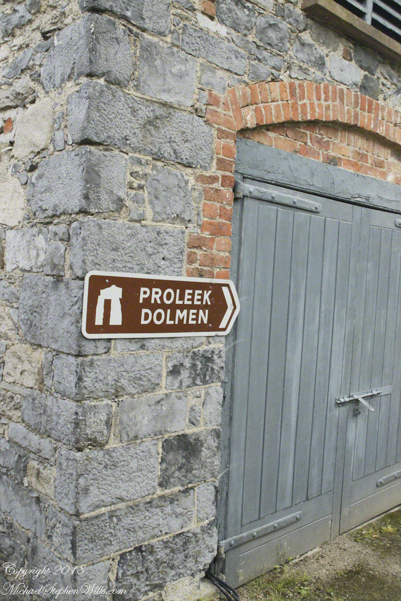
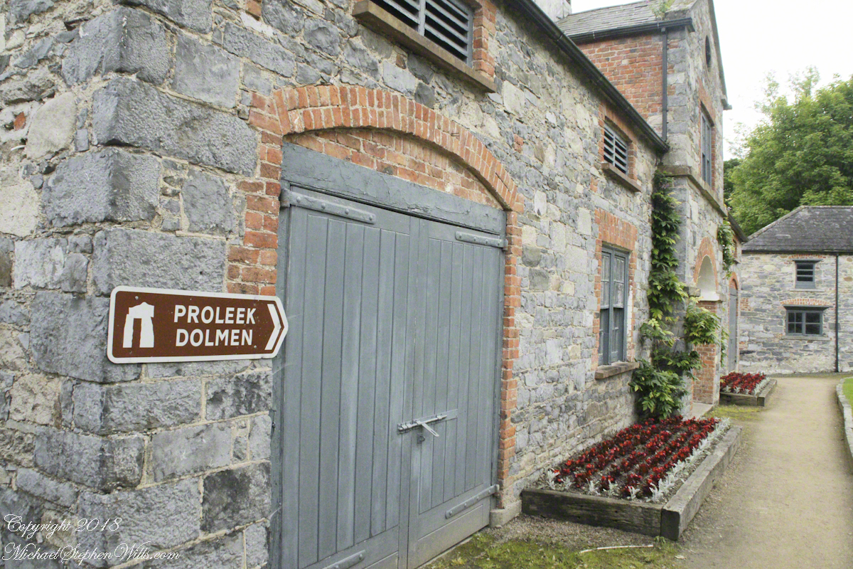
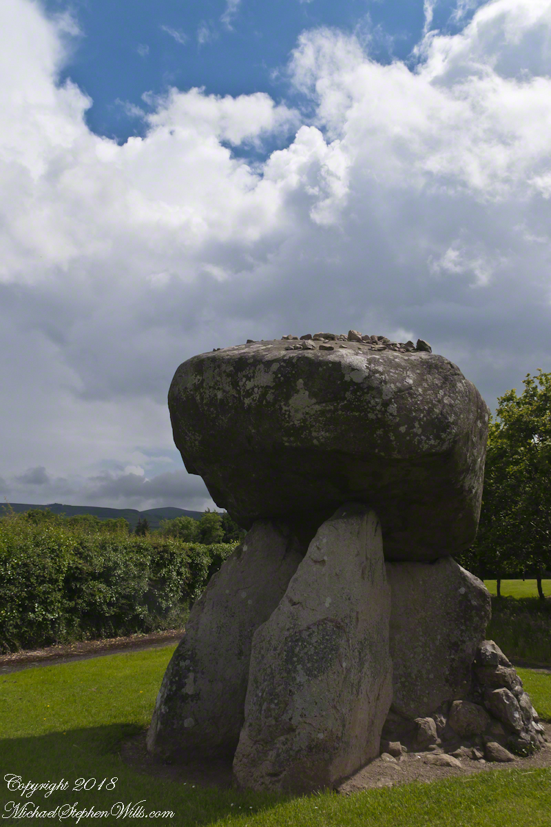
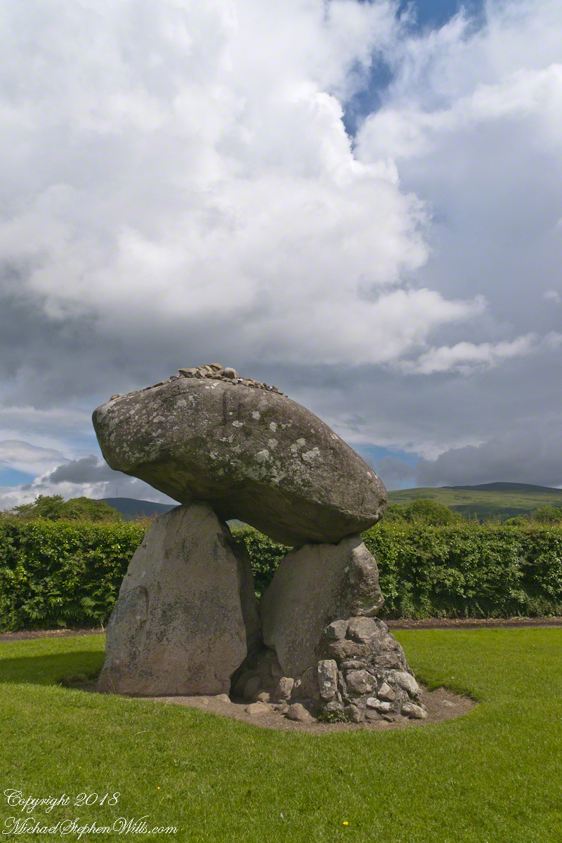
Our tour of Ireland was bookended by a visit to the farm site and, located little more than a kilometer away, a 5,000+ year old portal tomb, the last site Pam and I visited. We parked at the hotel / golf course built around the monuments. There is no fee to visit the site, number 476 on the list of Republic of Ireland National Monuments (Irish: Séadchomhartha Náisiúnta), protected at the level of guardianship by the National Monuments Act of 1930. The townland is named after the dolmen. The anglicized “Proleek” is derived from the Irish for “bruising rock”, as in a millstone. The grave is attributed in folklore to the resting place of the Scotch Giant, Para Buidhe More Mahac Seoidin, who came to challenge Fin Mac Coole.
Click photograph to view my Ireland gallery
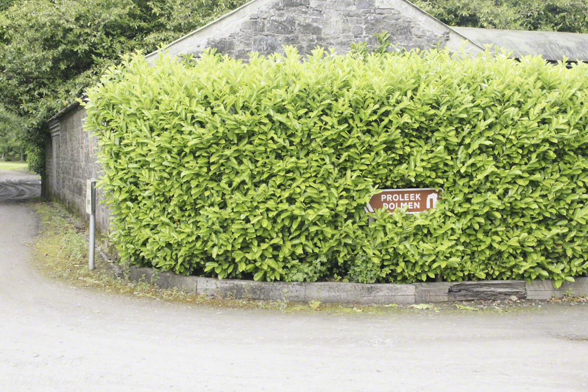
Ballymascanlon House Hotel is on the R173, on the left heading from the M1 towards Jenkinstown. Path to the monument is marked here and there and requires attention. It helps to understand the general location of the monument on the property. The parking lot and hotel are on the southern end, the monument is on the north end.
The path leads through the hotel grounds….
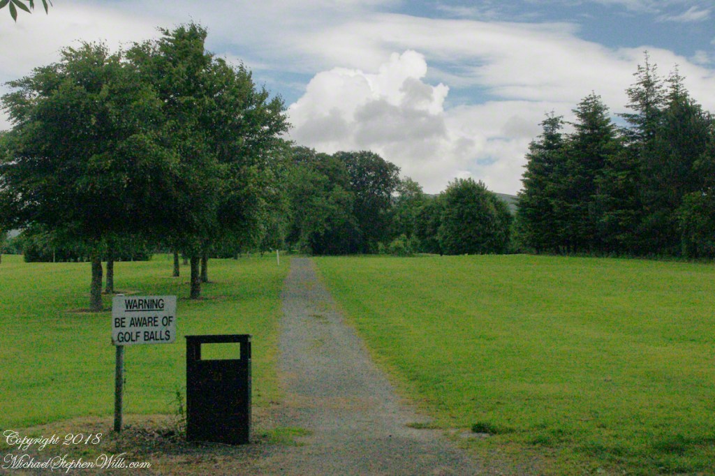
….and golf course…
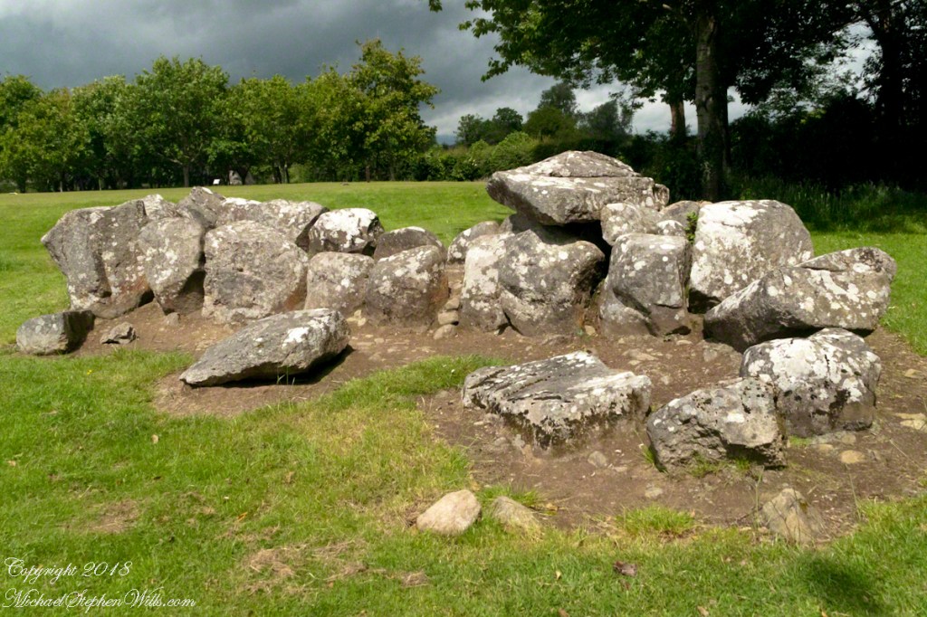
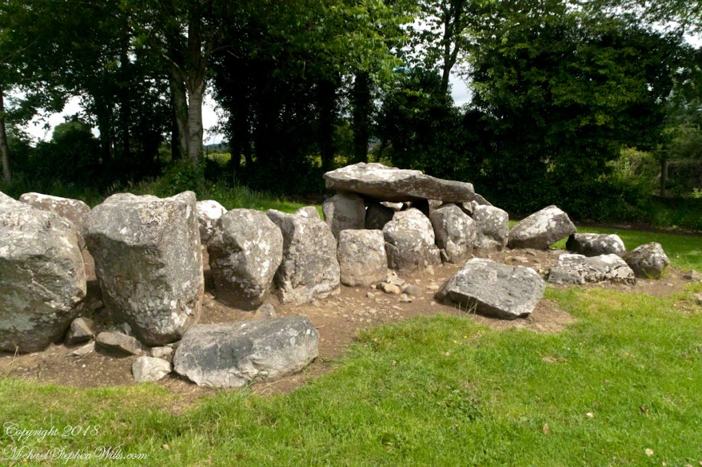
…and you first encounter the megalithic Gallery Grave of a type named “wedge shaped.”
Click any of the following photographs to view my Ireland gallery
The 22 foot long tomb gallery supported stories of a giant burial. Pam poses for a sense of scale.
These are the only ancient monuments in Ireland were a stray golf ball may be encountered.
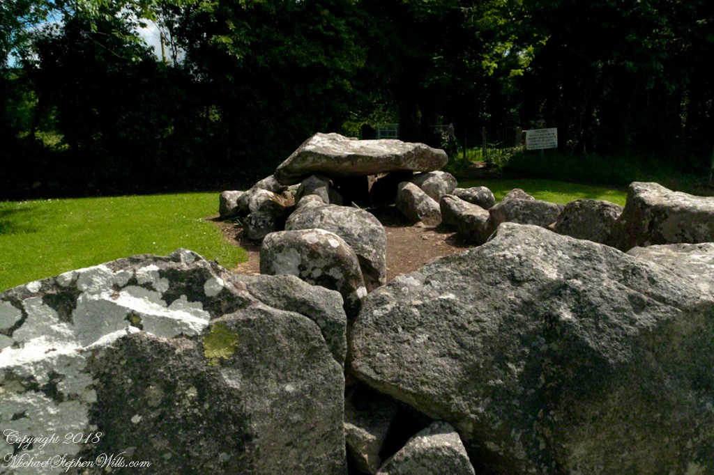
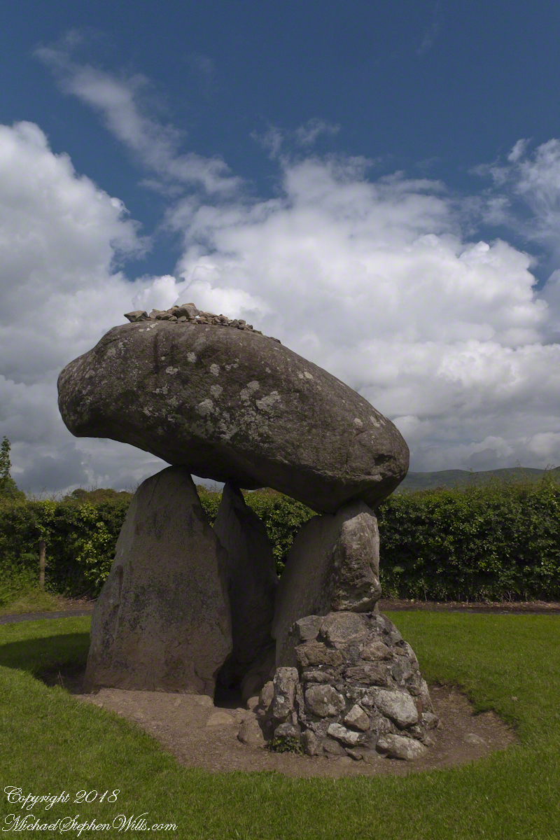
A short way ahead is the dolmen, or portal tomb. The informational placard is in English and Gaelic. There is an illustration of the stones covered with earth with a stone façade.
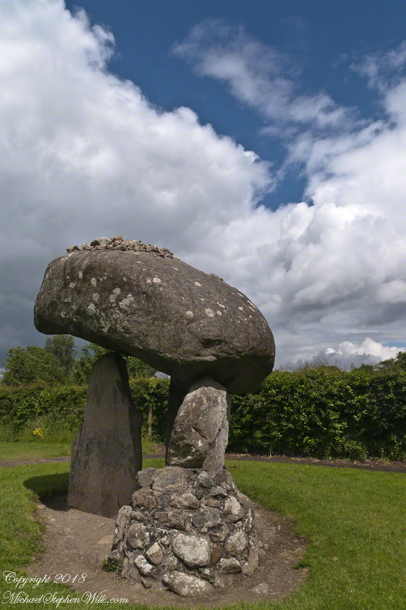
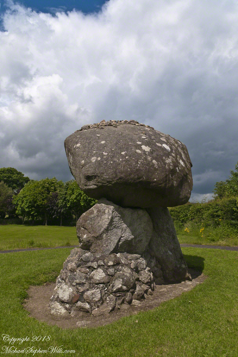
Some describe the formation as a giant mushroom with warts. The posting feature image is of the same aspect as the next photograph, with me for scale.
Click any of the following photographs to view my Ireland gallery
We are surrounded on three sides by the golf course. The “entrance” to the tomb, through the two upright portal stones, faces northwest toward Slieve Gullion, a mountain with its own Neolithic burial site next to a lake on the summit. The mountain and the flat land, such as Proleek township, feature in the story of how the Irish hero Cú Chulainn came by his name. To learn more, click this link for “On the Tain Way” the first of my posting that includes some stories of the hero.
The fifth hole.
We had a beautiful day, so I took time to capture all aspects. The hedge is the northern property border.
The “warts” are stones. There is a local saying that success in placing three stones on top will give a wish or lead to marriage within the year.
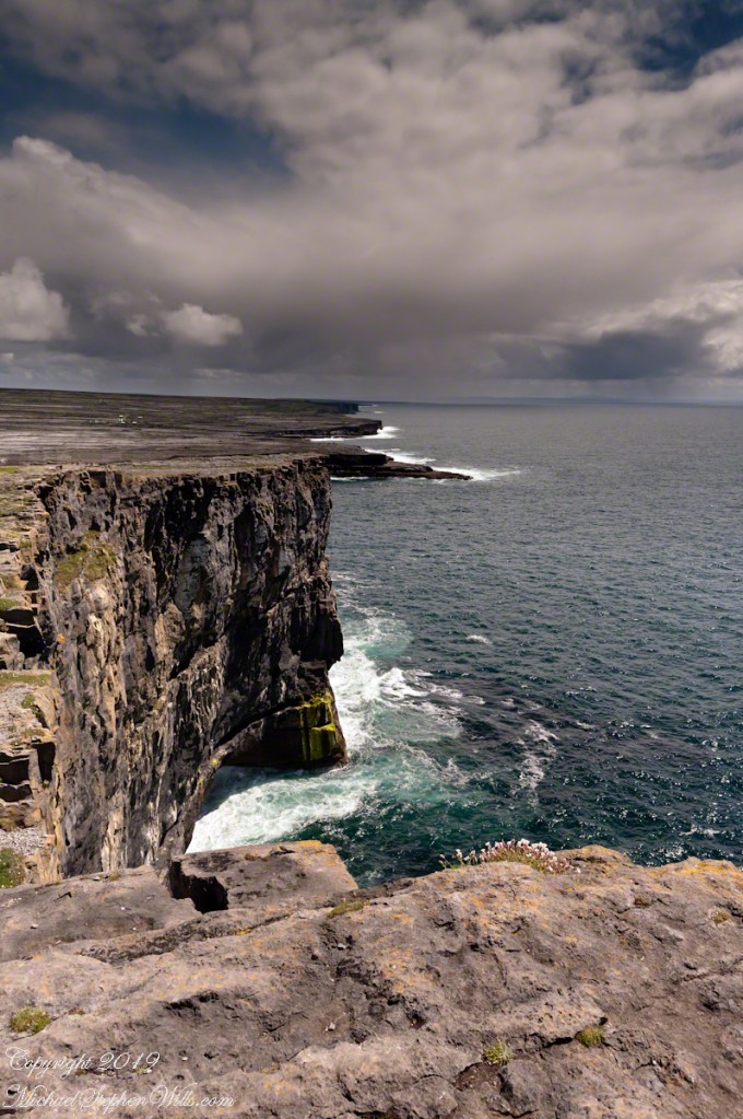
Imagine yourselves in an open cart exploring the island. Here are the photographs from my Inishmore exploration posts. Enjoy!!
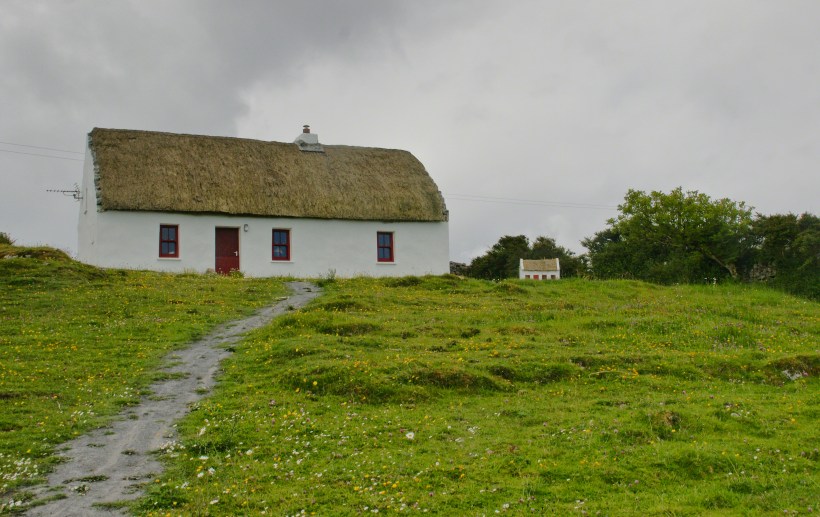
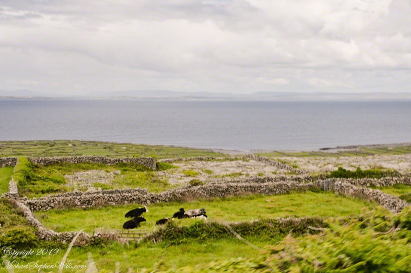
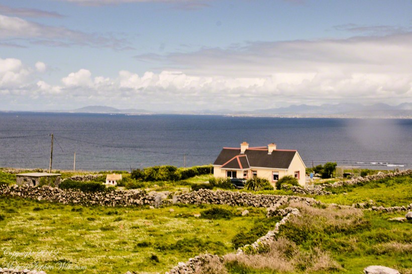
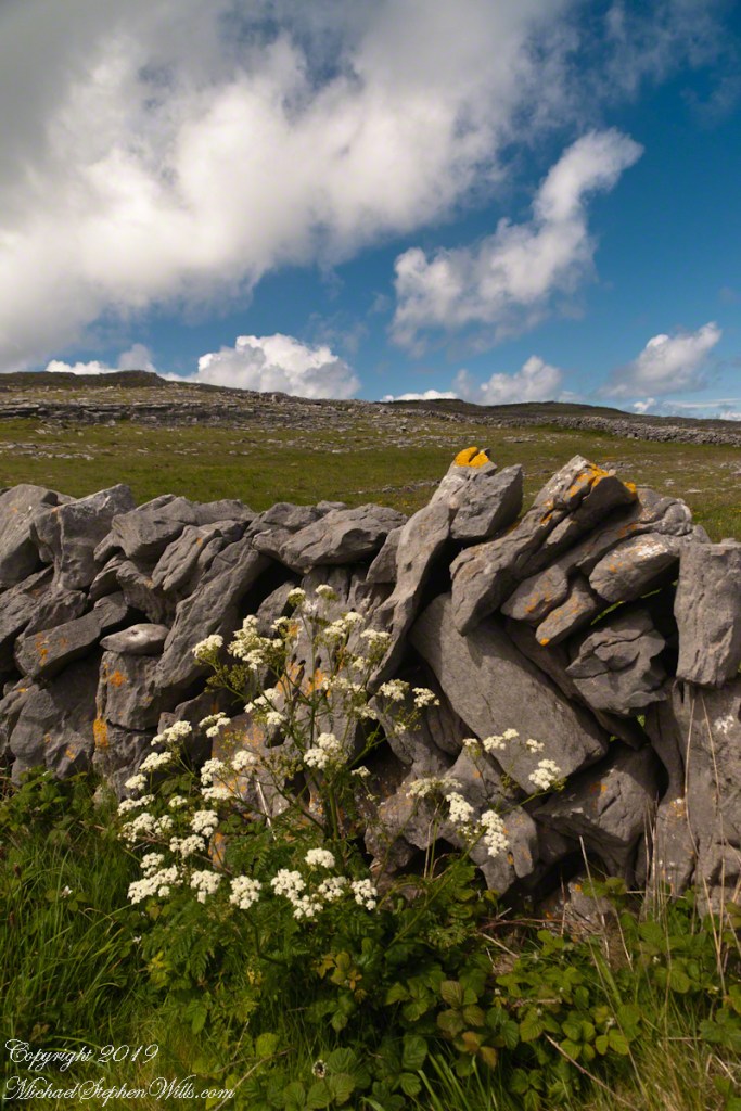
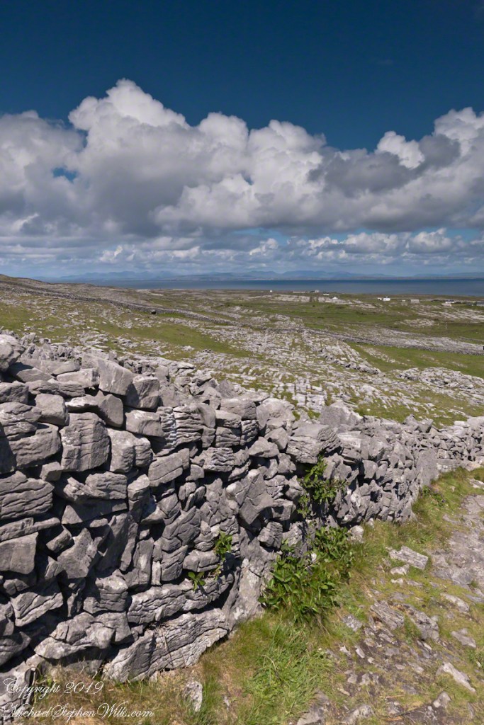
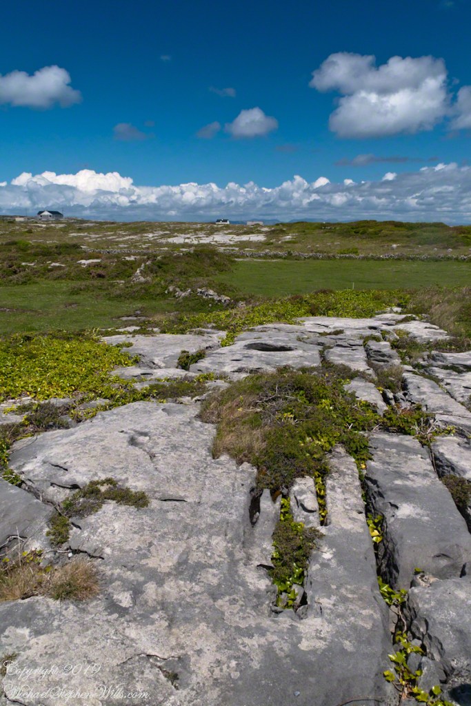
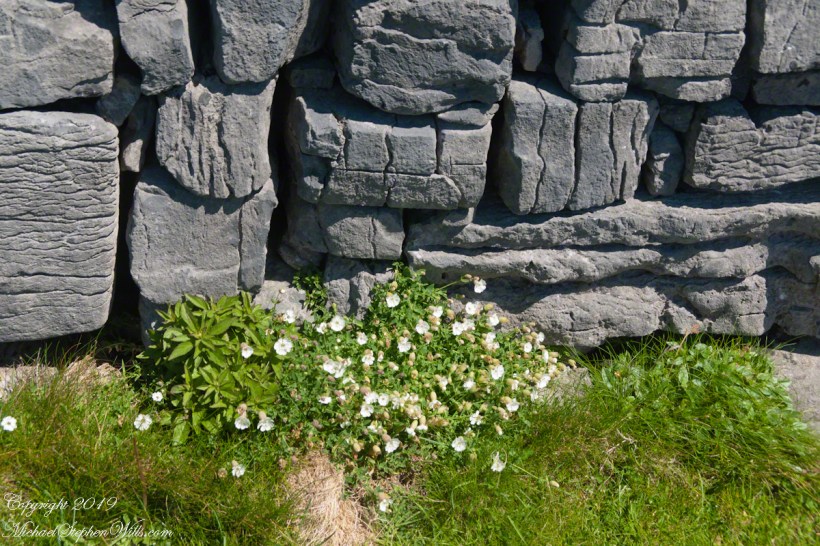
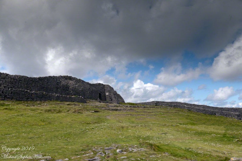
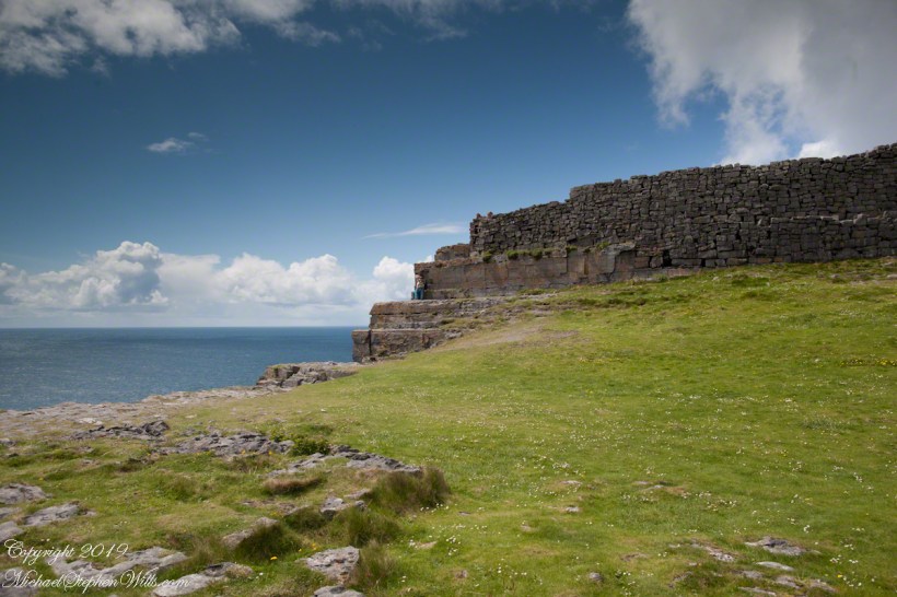
Kilronan bibycle hireView from a horse drawn trap headed down Cottage Road toward the village of Kilronan on a early June day, the island of Inishmore. On the right a stone ditch (wall), at the base the white flowers of Greater Burnet saxifrage (Scientific Name: Pimpinella saxifraga) (Irish Name: Ainís fhiáin). A steeple with bell and cross just visible. In the distance is the island of Inishmaan, the North Atlantic and Galway Bay. Aran islands, County Galway, Ireland.This ruined church is on the right side as you travel Cottage Road out of Kilronan Village, Inishmore, County Galway, Ireland. The distant highland is Inis Mann, across Galway Bay. A curious horse looks over a wrought metal gate set in a dry stacked limestone wall.Riding a horse and trap on Cottage Road from Kilronan village, Inishmore, Aran Islands, Country Galway, irelandThose bicyclists could have been us.This thatched cottage with matching child’s playhouse is on Cottage Road out of Kilronan Village on the Aran island, Inishmore, County Galway, Ireland.Roadside daisies on Cottage Road out of Kilronan village, Inishmore, Aran Islands, County Galway, IrelandNorth view from Cottage Road overlooks walled fields, karstNorth view from Cottage Road overlooks walled fields, karstAn island cottage among fields along the Galway Bay coast, the twelve pins of Connemara beyond.An island cottage among fields along the Galway Bay coast, the twelve pins of Connemara beyond.We stopped for lunch and a present for my son, a sweather purchased from the woman who knitted it.SONY DSCThe view is looking southwest from the path leading to Dun Aonghasa in springtime. We see here dry stone wall of limestone laid in a pattern suggestive of herringbone, splotches of orange lichen mark the stones. Against the wall is growing a variety of plants. The prominent white flowers are Greater Burnet saxifrage (Scientific Name: Pimpinella major) (Irish Name: Coll an dromáin). Beneath are leaves of Wild Strawberry (Scientific Name: Fragaria vesca) (Irish Name: Sú talún fiáin) as well as fern and grass. Beyond the wall is karst landscape rising to the ridge. Above the ridge, storm clouds gather. Inishmore, Aran Islands, County Galway, Ireland.This defensive structure called a Cheval de fries field surrounds Dun Aonghasa (Dun Aengus). This northwest view looks across the field and surrounding defensive walls. It is an early June day and, in the foreground, are colorful wildflowers among the limestone shards and blocks. Inishmore, Aran Islands, County Galway, Ireland.Looking North, Northwest across the slopes below Dun Aonghasa (Dun Aengus), InishmoreWalled Path to Dun Aonghasa (Dun Aengus) with Island Landscape, InishmoreKarst landscape with Green Field and Clouds, InishmoreInishmore LandscapeKarst Landscape with Interior Walls of Dun AonghasaDetail of Dun Aonghasa Dry Stone Wall with White Flowers of SeaAncient Fort Entrance, Dun Aonghasa (Dun Aengus)Ancient fort wall with tourists and Cliff Edge of Dun Aonghasa (Dun Aengus)View east, southeast from the Cliff Edge of the Ancient fort walView east, southeast from the Cliff Edge of the Ancient fort walRoadside Shrine and Island Landscape, Inishmore, Aran Islands, County Galway, Ireland
Copyright 2019 All Rights Reserved Michael Stephen Wills
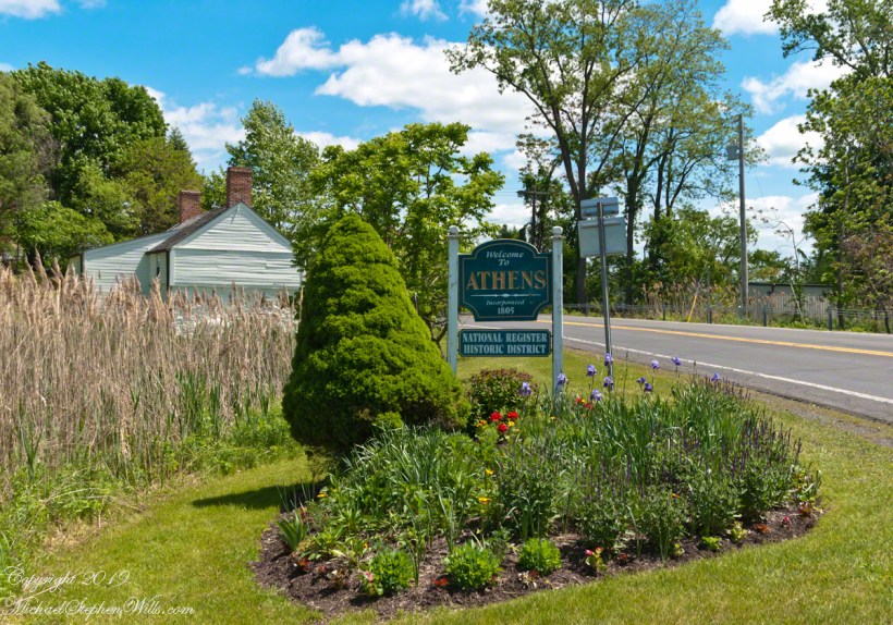
Memorial Day Weekend 2019 Pam and I visited Athens, first settled in the 17th Century by an ancestor through her maternal grandmother. Click me for more about the Van Loons. Jan Van Loon is 10 generations removed from Pam and her siblings and is one of 1024 (512 pairs) of ancestors. Whatever became of the other 1022 people (and all those in between) Pam was there with me that day to enjoy the experience of walking around town and talking about Jan Van Loon’s connection to herself.
Click any photograph for a larger version
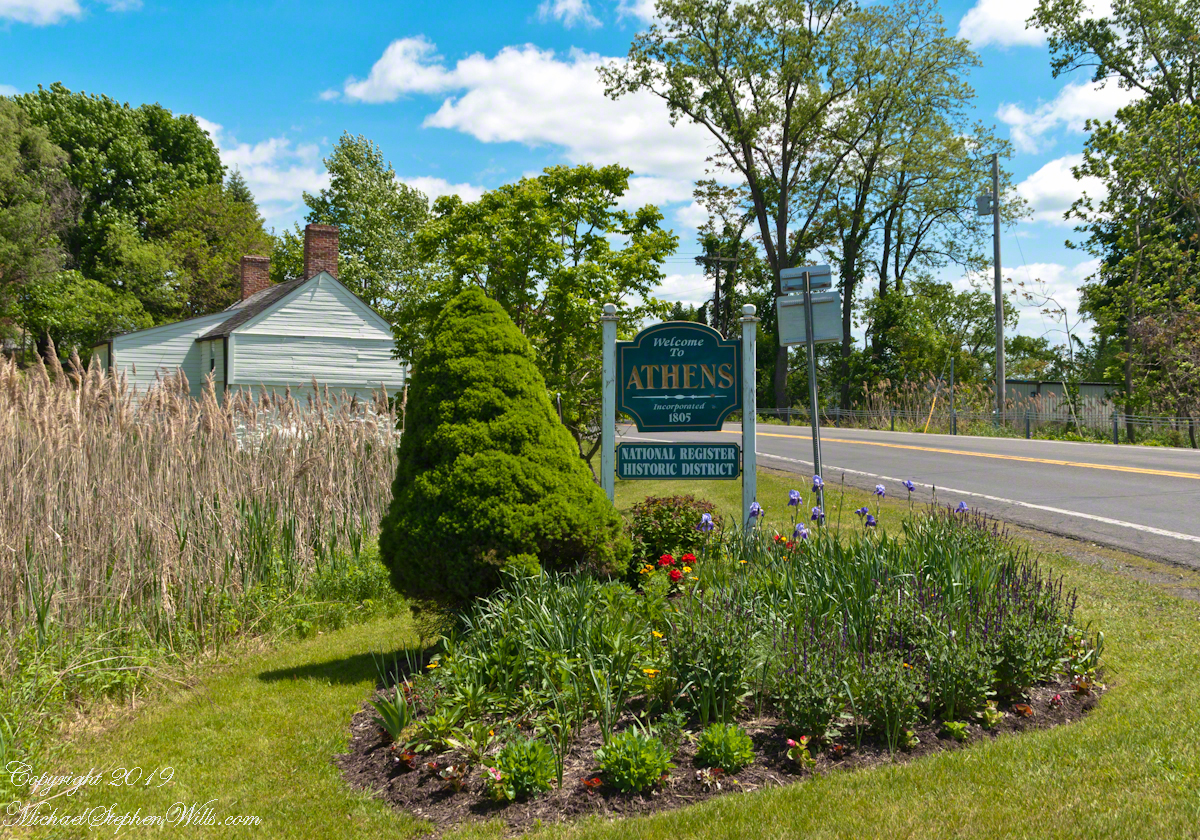
Founded as Loonenberg, named after the first settler Jan Van Loon. today,Athens is a lovely destination, a historic village on the Hudson River.
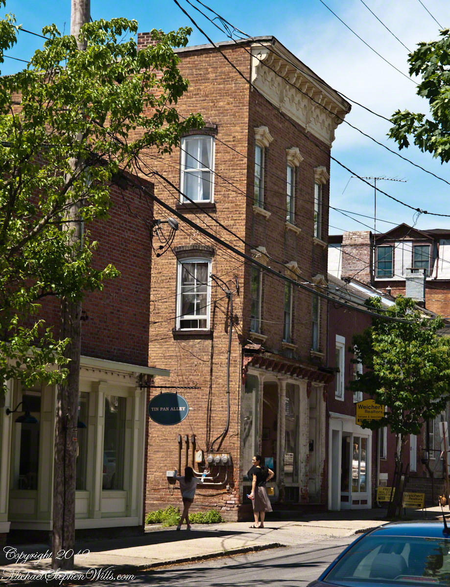
We stopped for a very enjoyable latte at Bonfiglio and Bread on 2nd street. As we ambled south on 2nd street Pam spotted someone to talk to and I proceeded with the goal of the Hudson River, visible at the bottom of the street.
I noticed this architectural specimen and turned to capture this side in a good light and was lucky to capture a young co-admirer of its style with whom I assume is her Mother. Athens, developed as a “National Register Historic Site,” is a charming place to stroll and admire.
Southeast view on 2nd Street between Water and Washington streets. Athens, New York
Hudson Riverfront
Yesterday I did a Red Cross blood donation at an elementary school on Hudson Street here in Ithaca. Henry Hudson, the first European to sail up the river that now bears his name, is memorialized this way across New York State so much so it is unusual to find the “Riverfront Park” named as such.
The city of Hudson, in Columbia County directly across the river named its park “Henry Hudson Riverfront Park.”
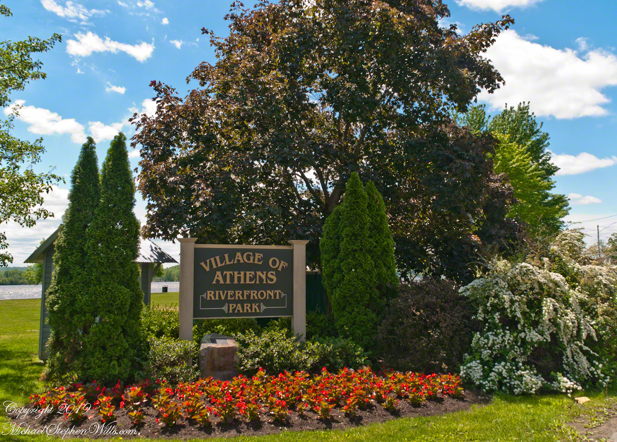
Looking east toward the entrance of the Riverfront Park, Athens, New York. Found at the east end of 2nd Street.
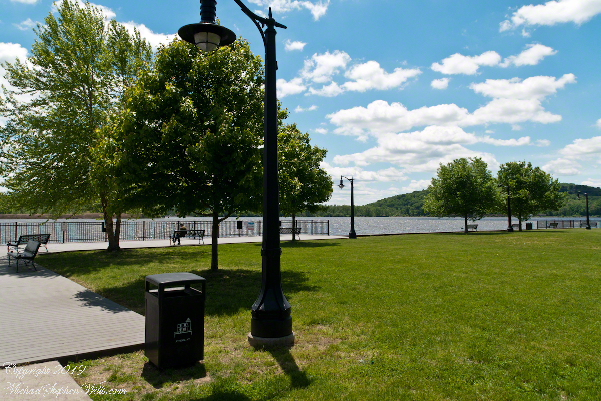
“Peace and Quiet“
The Athens Park is a gathering place for the village with a large swath of grass, a short boardwalk, benches and generous shade trees along with river…….
The photograph captions will speak for themselves for the rest of today’s post. Enjoy!!
A sole reader enjoys the solitude and view across the Hudson. A large mid-stream island, Middle Ground Flats, provides a swath of green instead of a view of the city Hudson.
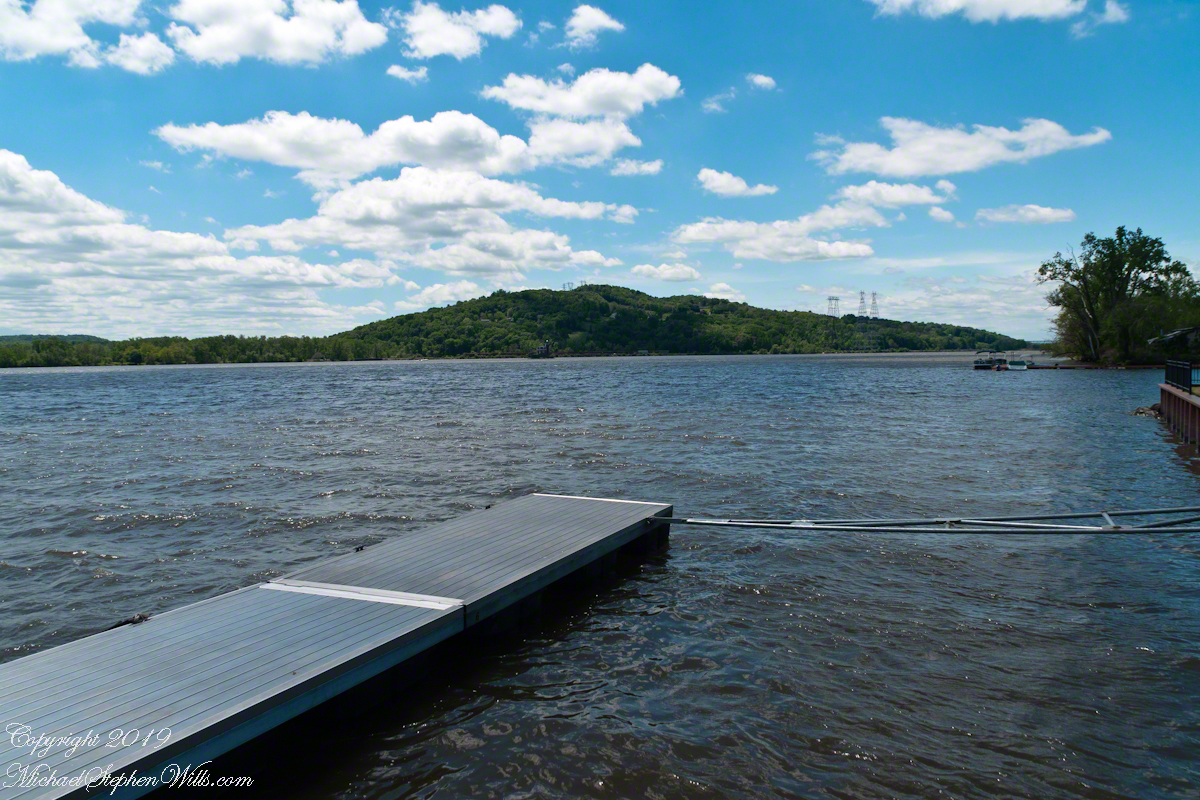
…and a dock.
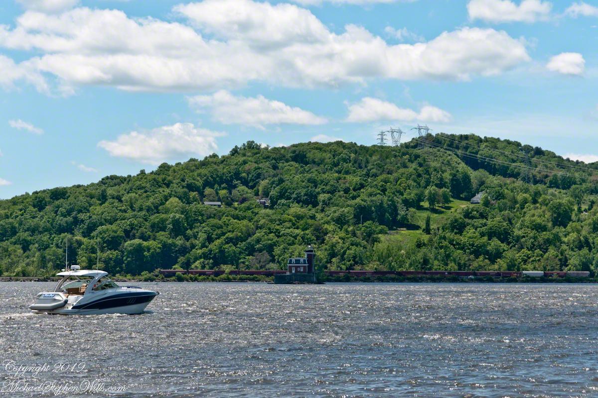
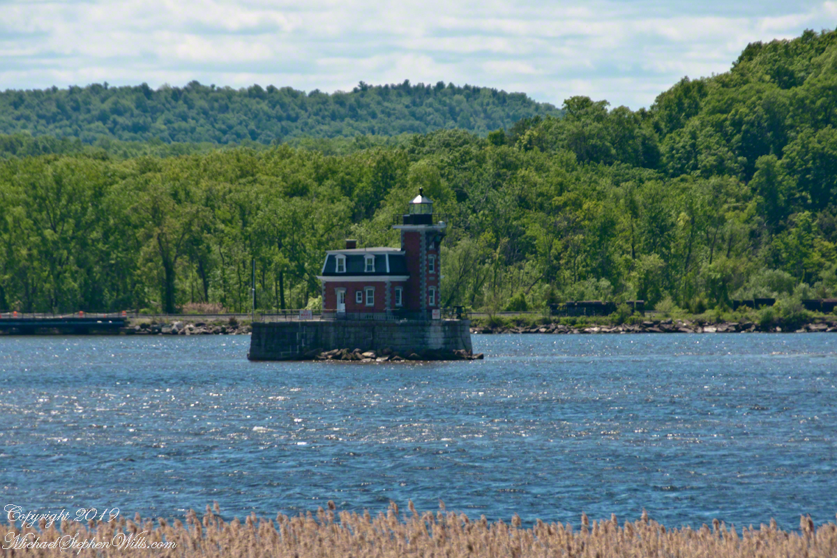
The map shows a dotted line between this dock in the Athens Riverside Park and the Henry Hudson Riverside park of the city of Hudson. Barely visible in front of the wooded hills is the Hudson-Athens lighthouse.A pleasure craft motoring south on the Hudson River passes in front of the Hudson-Athens Lighthouse. On the eastern shore is a line of freight cars. Amtrack uses this line for service between New York City, Albany and beyond. We have enjoyed this Hudson River view from the train and highly recommend that trip.Built 1874, the Hudson-Athens lighthouse guides traffics around the island named “Middle Ground Flats.”
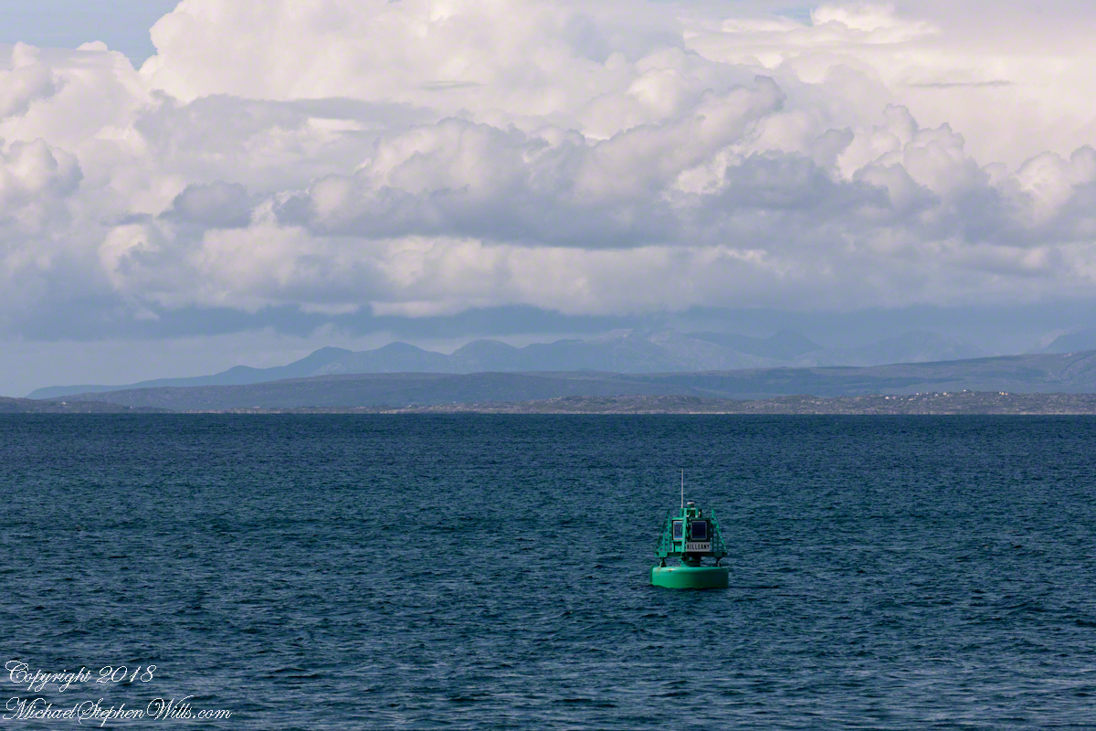
The approach to Killeany Bay of the Aran Island Inishmore is very dangerous, guarded by a Lighthouse on Straw Island to the South and the Killeany buoy to the North.
This view is to the north, northwest from a ferry en route to Inishmaan through Galway Bay. In the distance is the Connemara and the 12 Bens (12 Pins) mountains. Aran Islands, County Galway, Ireland.
There of stories of this buoy coming unmoored. October 27th 2012 it went adrift. An Aran fisherman, Micheál Seóighe (Ml Joyce) and his boat Naomh Beanán tracked it down, hauled it back to the harbor. The buoy was back in service shortly after.
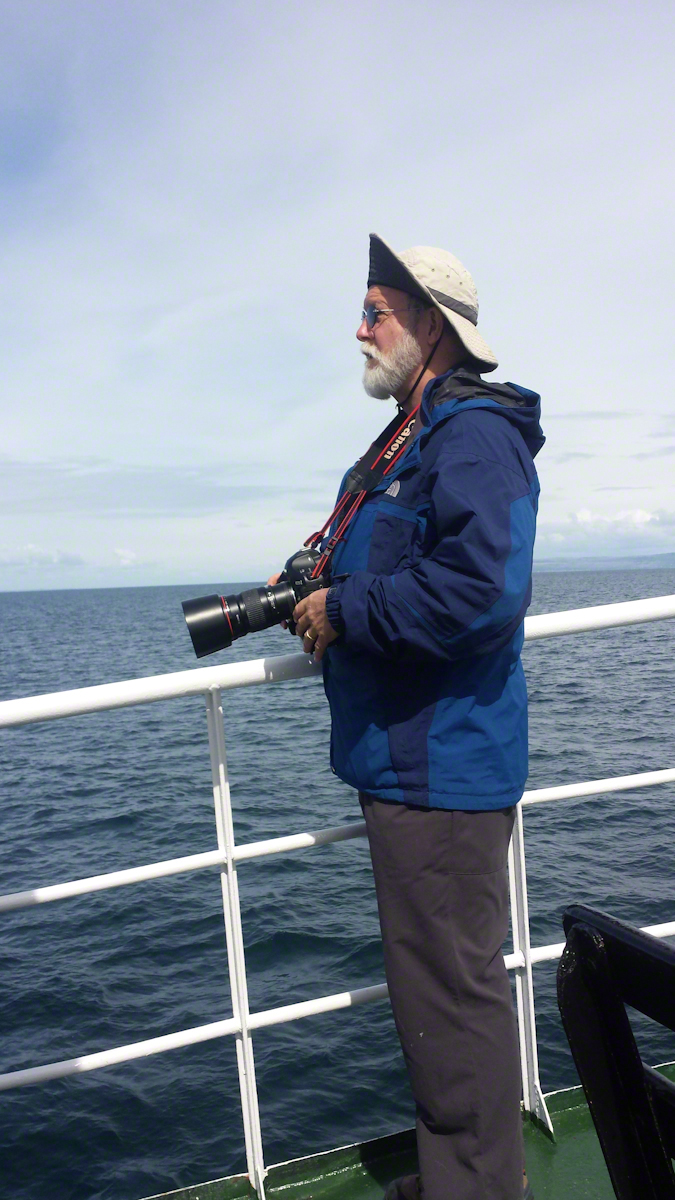
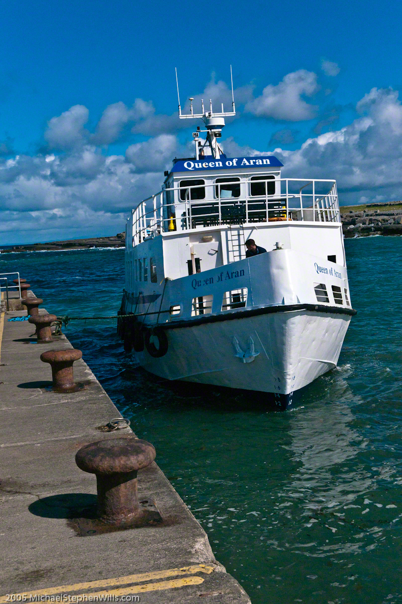
Here is a photograph of me with the camera used. It is a Canon EOS 1Ds Mark III with a Canon lens 200 mm f2.8/L. I am standing on the deck of the Queen of Aran ferry out of Doolin next to the Cliffs of Mohr.
Pam Wills took this photograph with her Samsung Galaxy 4 smart phone.