See Evening on Two Bar Mountain for another chapter of my four-day solo expedition to Reavis Falls in the remote eastern Superstition Wilderness.
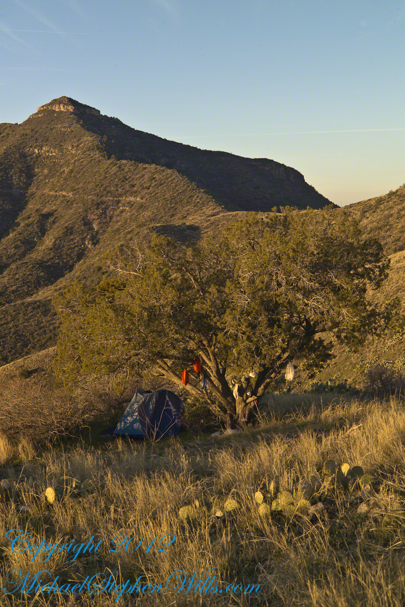
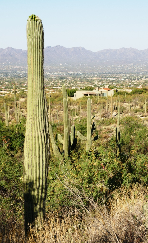
Campsite at Morning
On the late-morning of day three I climbed out of the Reavis Creek valley to camp on the slopes of Lime Mountain. There I watched the afternoon progress to evening, a full moon rise in a bright sky and other events featured in this blog. All around my campsite under a lone juniper the mountain side was blooming.
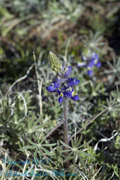
Grasses, Cacti and Flowers
Among the grasses, cacti and lichen-covered rocks were many small wildflowers. I was careful to avoid damaging them and otherwise enjoyed their beauty and plentiful blooms my entire stay. I capture some of them in the early morning light and spent some time identifying them for you.
Desert Hyacinth is a perennial lilly (Liliaceae).
It grows from an onion-like bulb used for food by pioneers and Native Americans. This lilly propagates through this bulb and, also, from seed that forms from these flowers.
The umbel-shaped flowers grow in clusters at the end of long, leafless stalks. Each blossom is an inch across and has six segments that are like petals.
Also called Blue Dicks, bluedicks, Papago lily, purplehead, grassnuts, covena, coveria.
Lupine is a pea, a perennial herb and a favorite of bees. Like other lupines, it improves the soil. Their root nodules, with the aid of certain bacteria, allow lupines and other legumes to absorb free nitrogen from the air.
A member of the Phlox family (Polemonium), this five (5) petal flower bloomed in small groups on erect stalks with sparse leaves. The stamen heads are notable for a bright blue color.
Copyright 2023 Michael Stephen Wills All Rights Reserved
In more recent centuries Loughcrew became the seat of a branch of the Norman-Irish Plunkett family, whose most famous member became the martyred St Oliver Plunkett. The family church stands in the grounds of Loughcrew Gardens. With its barren isolated location, Sliabh na Caillí became a critical meeting point throughout the Penal Laws for Roman Catholics. Even though the woods are now gone an excellent example of a Mass Rock can still be seen on the top of Sliabh na Caillí today. The Plunketts were involved in running the Irish Confederacy of the 1640s and were dispossessed in the Cromwellian Settlement of 1652. Their estate at Loughcrew was assigned by Sir William Petty to the Napier Family c.1655. The Napiers are descended from Sir Robert Napier who was Chief Baron of the Exchequer of Ireland in 1593.
Cairnbane East in Ireland, part of the Loughcrew Cairns complex, combines historical significance and folklore, particularly about a witch shaping these megalithic structures.
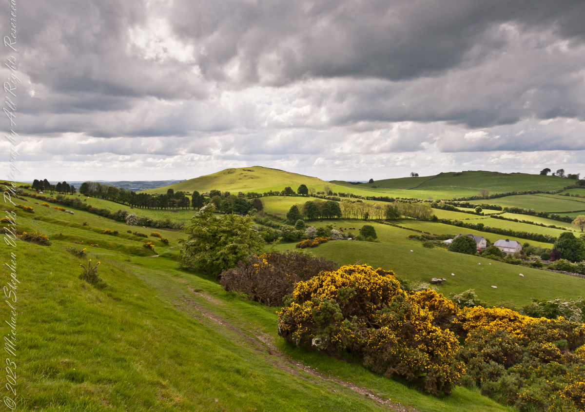
Here we are looking south, southwest from the north side of Slieve na Calliagh (aka Cairnbane East) toward Cairnbane West. Flowering yellow whin bush is in foreground, white flowering hawthorn trees in distance.
Cairnbane East hill is topped by a fine and accessible passage tomb, Cairn T.
Cairnbane East of the Loughcrew Cairns, known colloquially as “Hag’s Mountain,” nestled amidst the rolling hills of County Meath, Ireland, is a site of profound antiquity that beckons the curious traveler with its enigmatic charm. In this beguiling corner of the world, where history and folklore converge like two ethereal streams, the Loughcrew hills with their cairns rise, sentinels of a bygone age, each with its own tale to tell. But it is the myth of the witch, the “Hag of Loughcrew,” that lend a haunting aura to these ancient megalithic structures, invoking a world where magic and reality danced together in a mesmerizing waltz.
The Loughcrew Cairns
The Loughcrew Cairns, those hallowed remnants of an era long past, are monuments that defy the erosion of time. Constructed during the Neolithic period, they bear witness to the ingenuity of ancient minds and the profound spiritual significance these structures held. These tombs, hewn from the earth and stone, were not mere resting places for the departed, but sacred vessels of cosmic alignment, paying homage to the celestial dance of the heavens.
The Witch’s Role
One of the most enduring legends surrounding Hag’s Mountain is the story of a powerful witch who was said to have constructed the cairns. Cairn T includes a kerbstone known as “the hag’s chair.” According to folklore, this enigmatic figure, known as the “Hag of Loughcrew” or the “Cailleach,” commanded supernatural abilities and controlled the forces of nature. The Cailleach, which translates as ‘old woman’, ‘hag’, and ‘veiled one’, exists in both Irish and Scottish Gaelic, and is an expression of the hag or crone archetype found throughout world cultures. Related words include the Gaelic caileag and the Irish cailín (‘young woman, girl, colleen’), the diminutive of caile ‘woman’, and the Lowland Scots carline/carlin (‘old woman, witch’). The Cailleach is associated with winter, and it is believed that she uses her staff to create the winter snows. In some folk tales it is said that she carried massive stones from distant quarries to build the cairns, working tirelessly through the night and completing tasks that would have been impossible for ordinary mortals.
In these legends the Cailleach’s role in the construction of the cairns is believed to explain their precision and alignment with celestial events. The Cailleach used her magical powers to ensure that the cairns’ passageways perfectly aligned with the sun’s rays during the equinoxes, illuminating the inner chambers in a spectacular display of light and shadow.
Conclusion
Slieve na Calliagh weaves a tapestry where history’s threads intertwine with the shimmering strands of folklore. In its stony silence, it echoes the time when myths and reality were inseparable, when the land bore witness to the otherworldly. As we wander amidst the Loughcrew Cairns, gazing upon the ancient stones, we become travelers in a world where the mystical and the corporeal coalesce, and the stories of the witch endure as whispers in the wind, carried through the ages.
Copyright 2023 Michael Stephen Wills All Rights Reserved
On a May afternoon my dear wife, Pam, and I climbed to the summit of in Irish “Sliabh na Caillí” anglicized as “Slieve na Calliagh” translated to the english language as “Hag’s Mountain”, the site of 5000+ year old megalithic monuments. Here you are looking to the northeast with a collapsed tomb to the right foreground. In closeup is a curbstone, one of many laid side to side to form the outer tomb margin. In the middle distance is a hill with additional megalithic ruins, not visible.
Megalithic is an architectural style used throughout the world, between 6,000 and 4,000 years ago in the Neolithic and Bronze Ages. Megalithic ruins are scattered throughout the island and County Meath is especially noted for them.
We stand in Corstown townland, the townlands of Ballinvally is to your left, ahead and to the right is Patrickstown, all in County Meath, Ireland.
Copyright 2023 Michael Stephen Wills All Rights Reserved
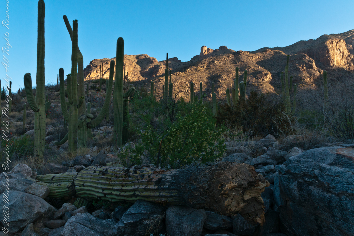
My visit to Finger Rock Canyon of the Santa Catalina Mountains filled two mornings. On the first morning, the subject was the lower canyon as morning light filtered over the eastern ridge.
Early morning to the north / northwest looking over a 20-foot fallen Saguaro Cactus (Carnegiea gigantean), toward lower ridges of the Santa Catalina Mountains. The saguaro is among a stand of healthy fellows, some with new growth and flowers on the tips of arms and main columns. This giant must have grown over rock through 60 years. It was brought down when the roots weakened. Specimens that are more reliably rooted can live to 200 years.
A clump of brittlebush shrub (Encelia farinosa) grows from the same rock.
Pima Canyon is the next over, behind that near ridge which provides similar shade. Unlike Finger Rock Canyon, the Pima Canyon trail follows the western cliff and loses the shade much sooner. During our three-week trip, my wife, Pam, and I visited Pima in our first week.
These photos were taken between 6:20 and 7:00 am.
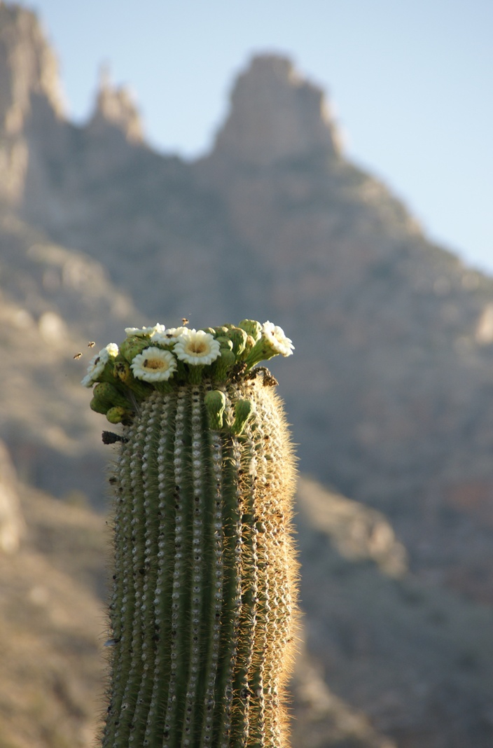
Along the trail I noticed a multitude of buds on the tip of selected saguaro arms. In a previous blog, there’s a photo of this same saguaro in the shade. The following series captures the one blossoming top just as the sun passes over the eastern, shadowing, ridge.
The same saguaro, two minutes later…….
Here is a portion of the saguaro forest, around 7 am with the lower canyon filled with light. There are a few foothill homes with west and southwest Tucson. The Tucson Mountains are in the distance.
Theresa (2), Michael (5), Christine (4) in the livingroom of 107 Deepdale Parkway, Albertson, New York on Valentines Day 1959Chocolate Valentines Day cake by Pamela WillsPam and I aboard the Oceania Regatta sailing the Pacific Ocean off Chile. The following day we reached Puerto Montt.
Copyright 2025 Michael Stephen Wills All Rights Reserved
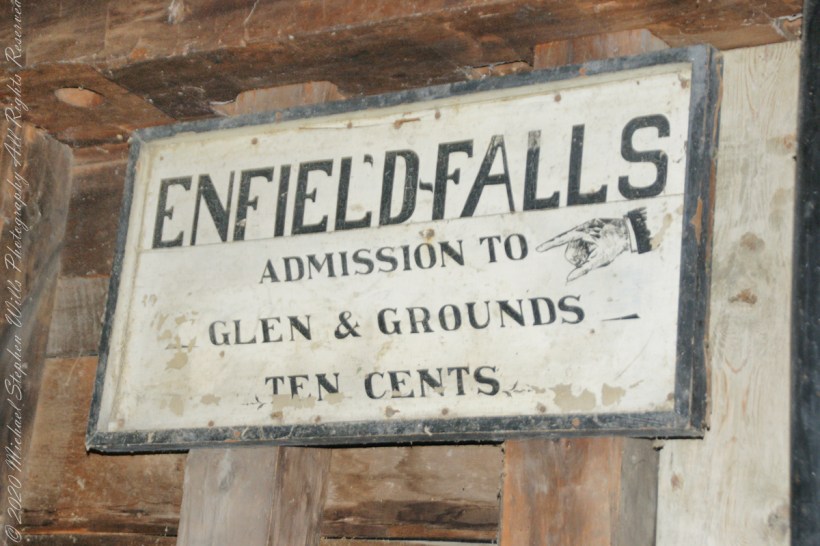
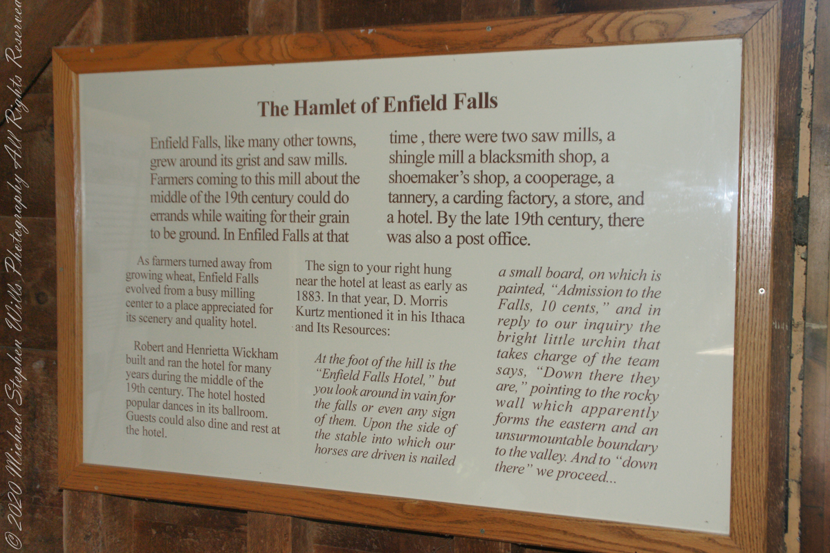
“Enfield Falls, like many other towns, grew around its grist and sawmills. Farmers coming to this mill about the middle of the 19th century could do errands while waiting for their grain to be ground. In Enfield Falls at that time, there were two sawmills, a shingle mill, cooperage, tannery, carding factory, store and hotel. By the late 19th century there was also a post office.”
“As farmers turned asway from growing wheat, Enfield Falls evolved from a busy milling center to a place appreciated for scenery and a quality hotel. Robert and Henrietta Wickham build and ran the hotel for many years during the middle of the 19th century. The hotel hosted popular dances in its ballroom. Guests could also dine and rest at the hotel.”
This placard from the Mill Museum at Treman Park is the source of much of today’s information. I used italics and quotes to attribute this source.
The sign in the heading of this post “hung near the hotel at least as early as 1883. In that year, D. Morris Kurtz mentioned it in his “Ithaca and Its Resources”: “At the foot of the hill is the Enfield Falls Hotel, but you look around in vain for the falls or even any sign of them. Upon the side of the stable into which our horses are driven is nailed a small board, on which is painted ‘Admission to the Falls, 10 cents.’ In reply to our inquiry the bright little urchin that takes charge of the team says, ‘Down there they are,’ pointing to the rocky wall which apparently forms the eastern and an unsurmountable boundary to the valley. And to ‘down there’ we proceed……“
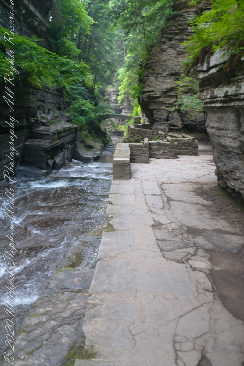
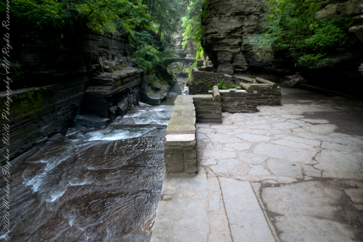
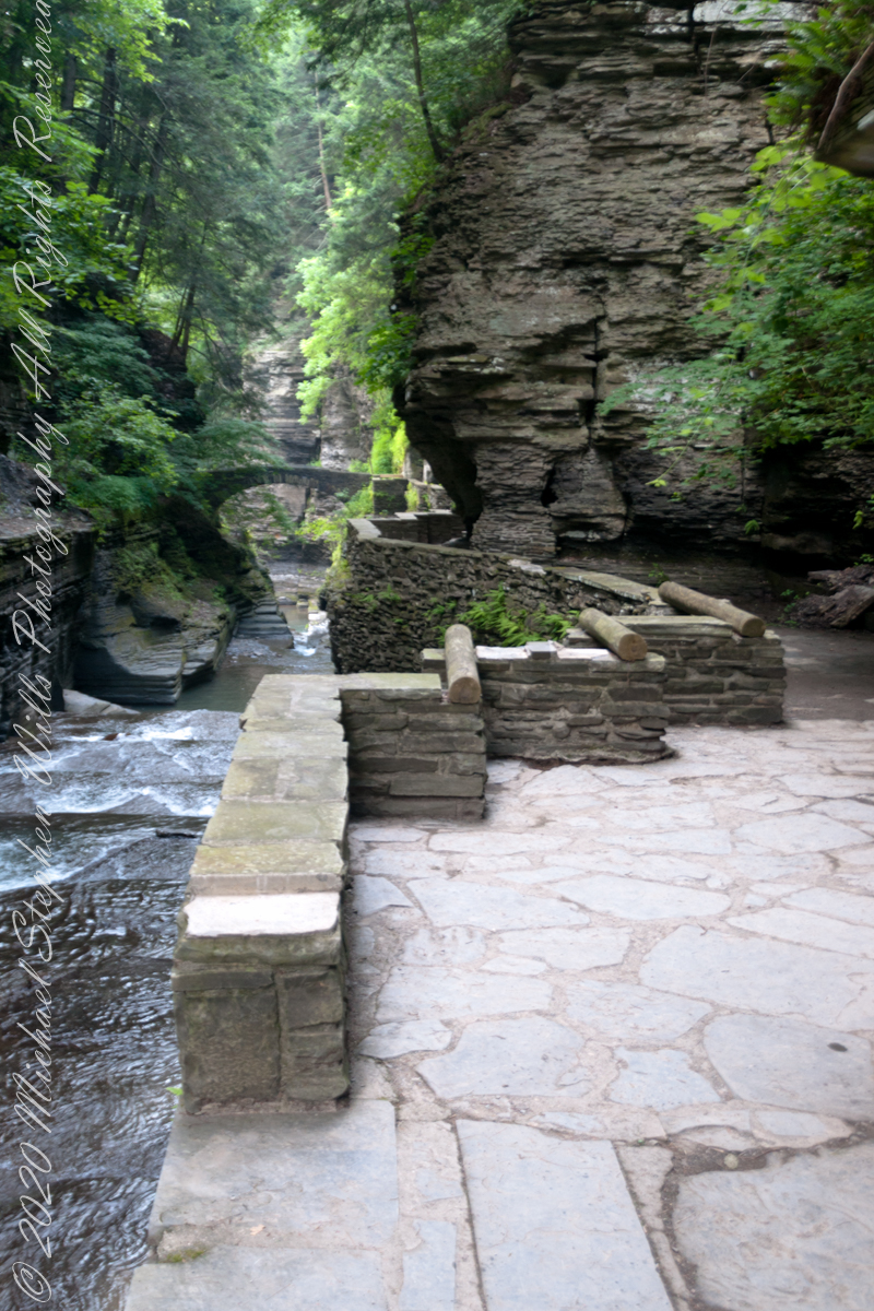
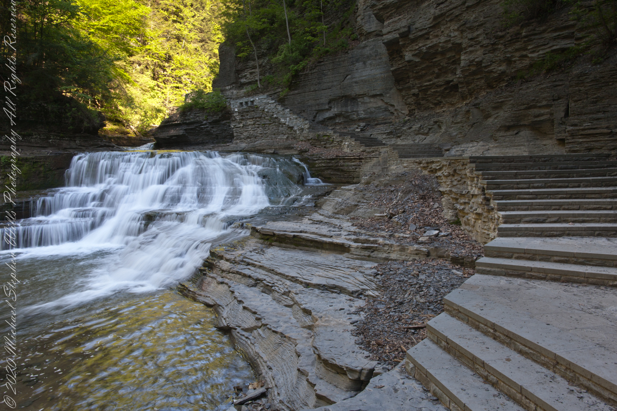
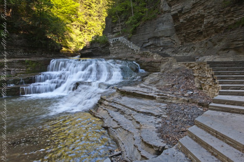
Treman Gorge Trail from the Old Mill enters a narrow gallery looking here southeast along Enfield Creek, passing over a stone footbridge. This was the control point in the 19th century for collecting the ten cent admission fee. Here are some photographs of the entrance as it exists today. The retaining wall, footpath and stone bridge were constructed in the 1930’s by the Civilian Conservation Corps. The site was far rougher for those earlier visitors.
The Gorge Trail next to Enfield Creek on a midsummer morning. Robert H. Treman State Park, Ithaca, Tompkins County, New YorkThis walkway, retaining wall, path, stone bridge were built by the Civilian Conservation Corps, “Roosevelt’s Tree Army,” during the Great Depression in the 1930’s. The north side is sedimentary rock worn through over the ages by what we call Enfield Creek today.
Photograph captured on a midsummer morning. Robert H. Treman State Park, Ithaca, Tompkins County, New York
Copyright 2023 All Rights Reserved Michael Stephen Wills
Can you see the small difference between yesterday and today’s take on Devil’s Kitchen? Is the change and improvement, degradation or no difference? User Response Requested: respond in comments.
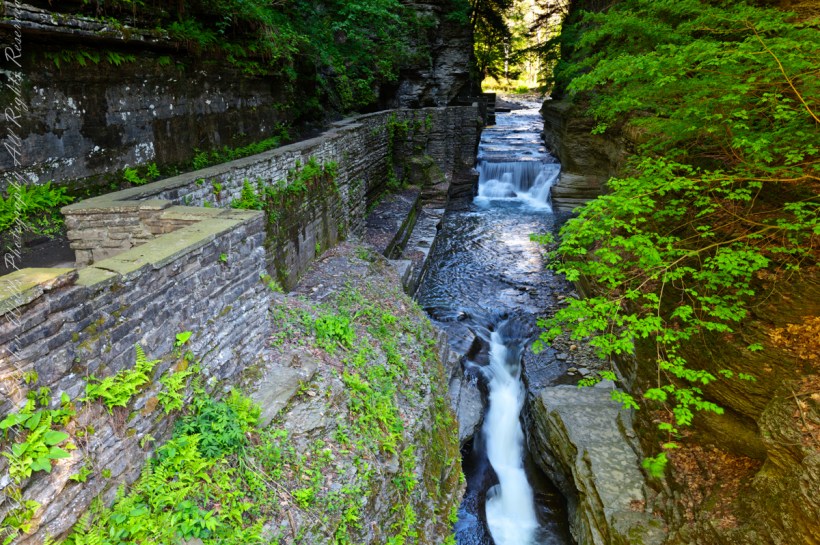
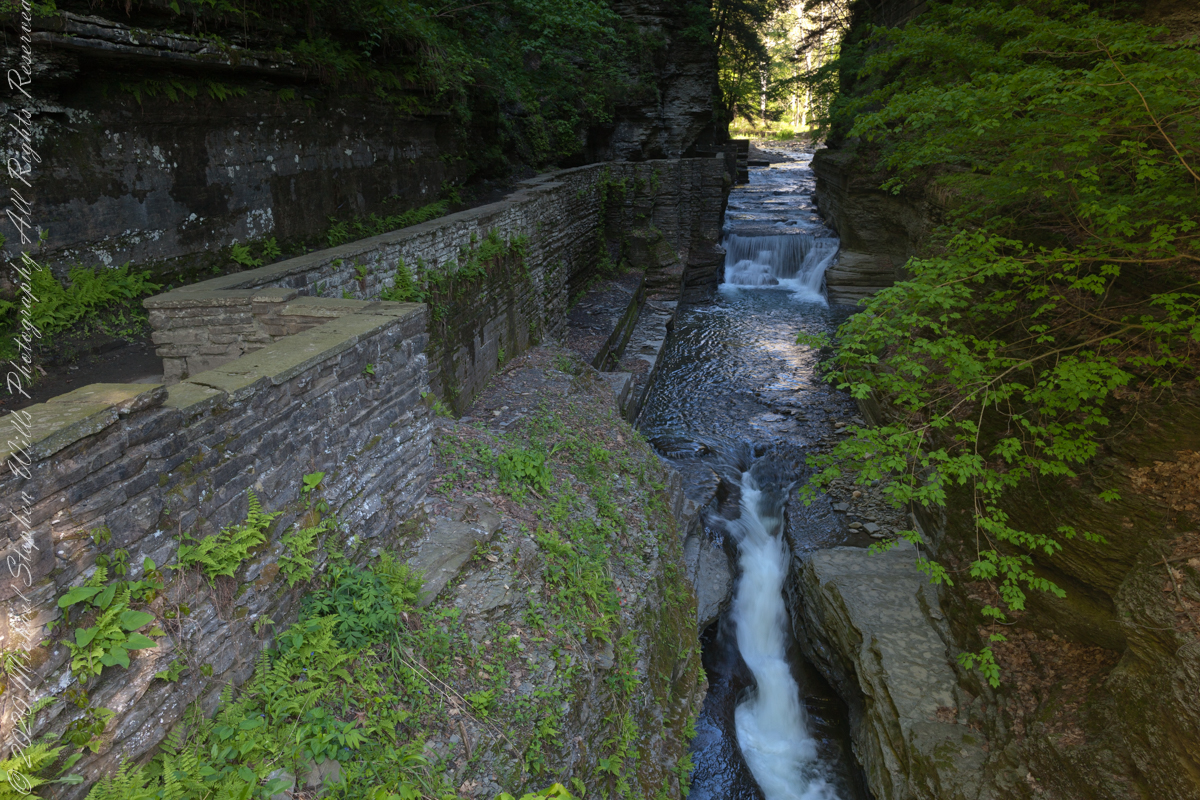
Aptly named Devil’s Kitchen is where Enfield Creek passes over these 20 foot falls before the Lucifer Falls 115 foot rock face cascade. Captured on a Memorial Day morning. Robert H. Treman State Park, Ithaca, Tompkins County, New York.
Here they are side by side.
YesterdayToday
It is 9:00am on a Memorial Daty morning Robert H. Treman Park, Ithaca, Tompkins County, Ithaca, New York,
Copyright 2023 All Rights Reserved Michael Stephen Wills
Aptly named Devil’s Kitchen is where Enfield Creek passes over these 20 foot falls before the Lucifer Falls 115 foot rock face cascade. We are occasionally appalled by families and adventure seekers climbing over these falls, wading in the water downstream and other insanities happening next to a waterfall so dangerous it is named after the Prince of Darkness and this very location “his” kitchen.
I am not one to talk, though. One winter on this very spot when the Gorge Trail was closed for winter, black ice brought me down almost into the water. All for a winter scene (photograph) of this marvel. Thankfully, I am wiser for the experience.
It is 9:00 am on a Memorial Daty morning Robert H. Treman Park, Ithaca, Tompkins County, Ithaca, New York,
Copyright 2023 All Rights Reserved Michael Stephen Wills
View shared by generations of newlyweds standing on a stone bridge across Enfield Creek. This is another version, taken a few years later and earlier in the season, Memorial Day morning.
Here is an image having me rethinking my conclusions. Here, I combined two images and worked hours to make many adjustments. The resulting Tiff is four times the filesize of the Raw file from yesterday.
Here they are side by side. In this case IMHO the extra disk space and time are worth it.
It is 8:30 am on a Memorial Daty morning Robert H. Treman Park, Ithaca, Tompkins County, Ithaca, New York,
P.S. I mistakenly published this post with a repetition of III in the title. Today, I changed it to “IV.”
Copyright 2023 All Rights Reserved Michael Stephen Wills