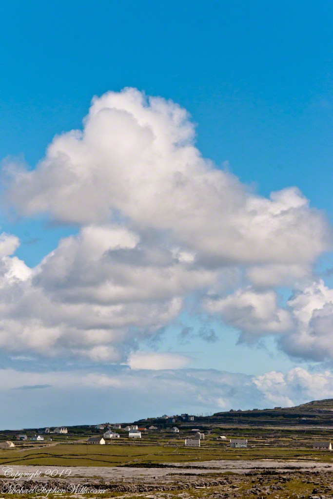
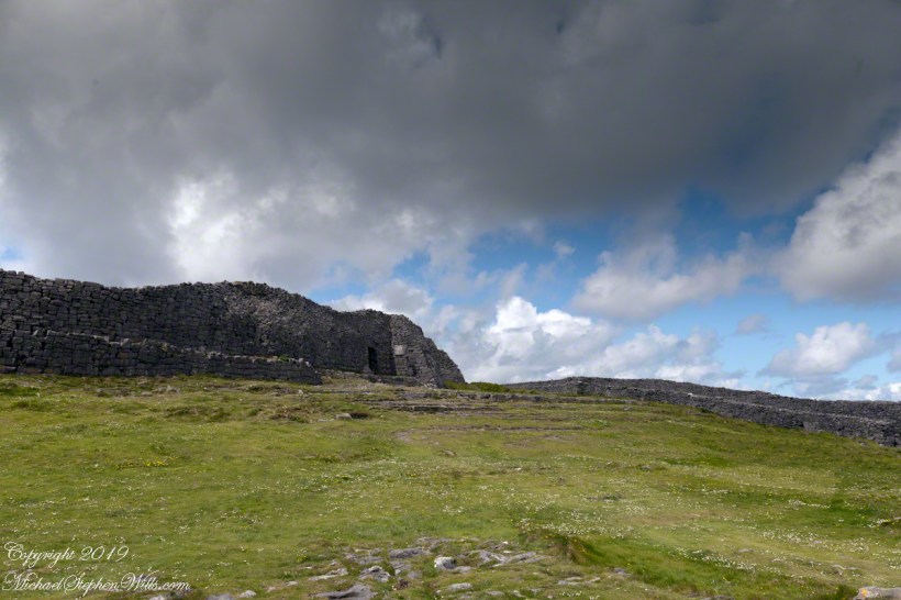
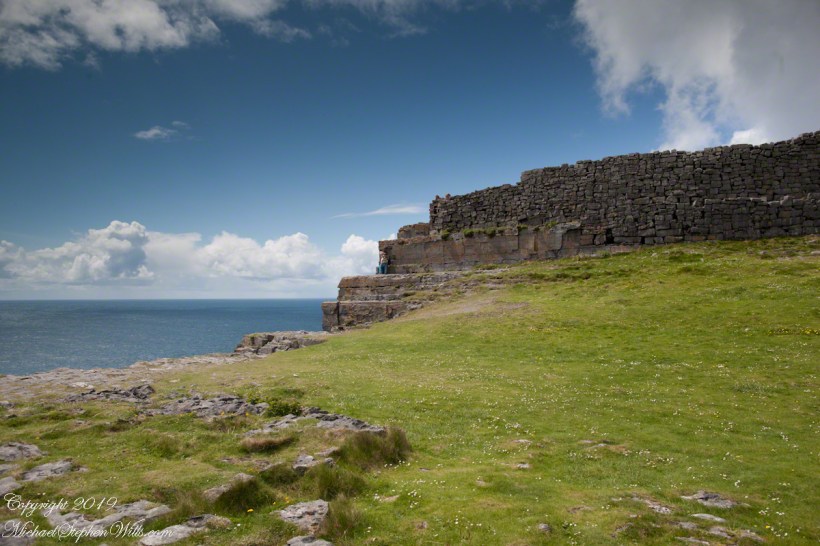
A span of 10,000 years spreads between now and the first possibility of settlement on the island of Eire, then swept clean to bare rock by the weight of ice. Current scholarship of the Dún Aonghasa ruins, Inishmore, County Galway, the Irish Republic place a settlement within the inner of the four dry stone rings after 6,500 years (1,500 BC or 3,500 years ago). By way of scale, the first settlement took about 30 times the duration of the U.S. Constitution ratification through 2025: the last state, Rhode Island, ratified the Constitution 1789.
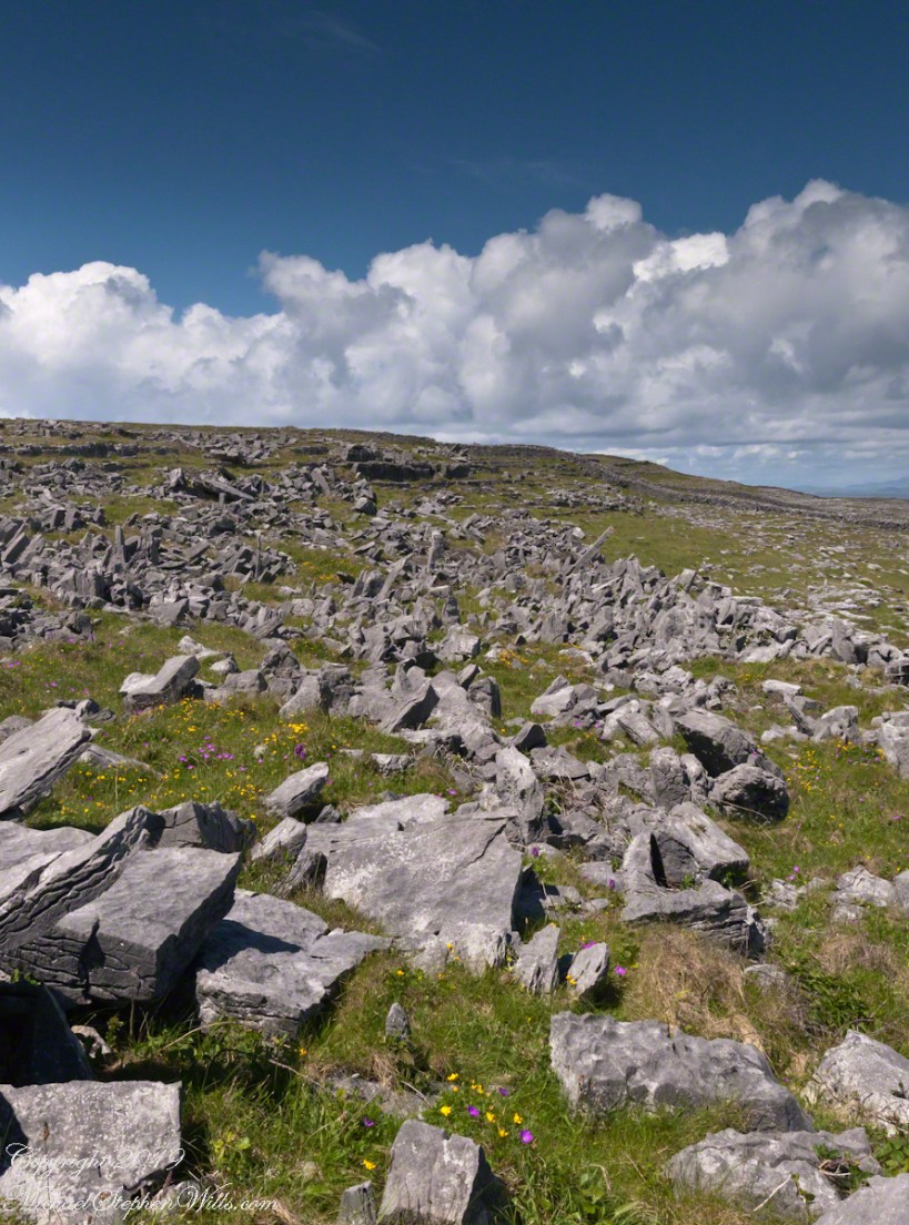
By 700 BC, 2,700 years ago, a series of upright, closely placed stones, were erected between the second and third rings called a cheval de fries field (“Frisian horses” in English) today, this defensive structure evokes the enormous scale of the struggles around this place of defense.
This is a portion of that field, I believe, taken as Pam and I approach the inner ring entrance, walking a wide path cleared of barriers. Click the photograph for a larger image with caption.
It was the kind of overcast morning that seems to cradle the island in a blanket of mist, a gentle hush falling over the land as though even the Atlantic held its breath. Pam and I had arrived by ferry at Kilronan, the main settlement on Inishmore (Inis Mór), the largest of the Aran Islands nestled in Galway Bay. There, amid the bustle of arrivals and greetings, we found our driver—a wiry, weather-worn man with a soft brogue and kind eyes—and his horse trap, a simple two-wheeled carriage with room enough for three and the sounds of hooves to accompany our journey.
We set out up Cottage Road, the stone-paved track winding westward from the harbor. The sea fell away behind us as we climbed, a gray shimmer stretching to the hazy outline of Connemara’s mountains on the far side of the bay. Our destination was the dramatic cliffside ringfort of Dún Aonghasa, a place older than memory. But it was the unexpected moments in between—the ones not printed in guidebooks—that linger longest in the mind.
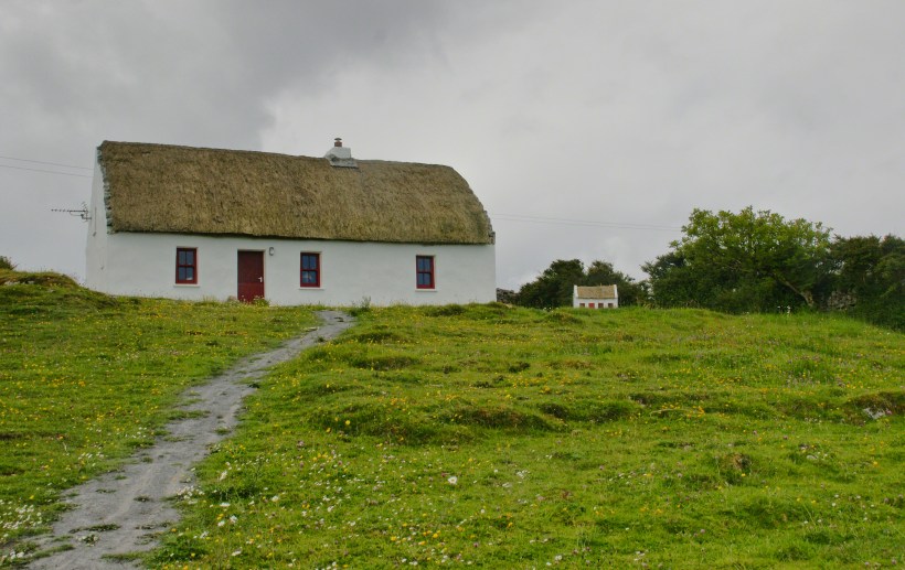
As we rounded a bend flanked by low stone walls, wildflowers blooming defiantly in the cracks, our driver pulled the reins gently and pointed with his crop.
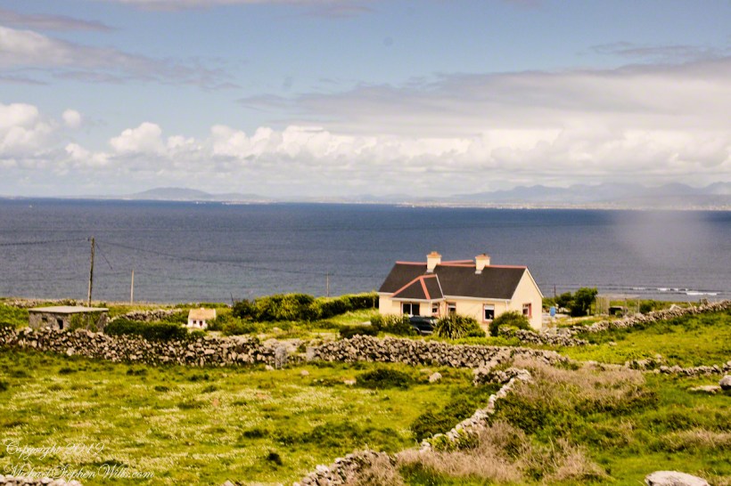
“There,” he said, nodding ahead, “is a fine example of a traditional Aran cottage.”
And there it was—a vision from another time. The thatched roof curved softly like a that blanket itself, straw golden against the brooding sky. The walls were whitewashed to a perfect matte sheen, gleaming in spite of the cloud cover. A crimson door and two window frames punctuated the front façade like punctuation in a poem. Just to its right, set further back on the hill, stood a tiny replica of the same cottage, identical in every feature. I blinked, half believing it was an illusion.
This thatched cottage with matching child’s playhouse is on Cottage Road out of Kilronan Village on the Aran island, Inishmore, County Galway, Ireland.
We only stopped briefly—it was a private residence—but the sight of it left a kind of imprint. I turned in the trap seat to keep it in view as long as I could. The cottage was perfectly placed, facing Galway Bay with a commanding view. I imagined the light pouring across the line of mountains, catching the glint of sea and sky.
“There’s a name for that finish,” I said, recalling something I’d read, “whitewash, or lime paint.”
Our driver nodded. “That’s the old way. Made from slaked lime. We’d call it ‘whitening’ when I was a lad.”
Whitewash differs from paint in the most elemental of ways. It becomes part of the stone, absorbed into the very surface. Like a memory of bone. And yet, it requires care. Apply it to a wall not properly cleaned or moistened, and it flakes, pulls away like a broken promise. But done right, it lasts, breathes with the building.
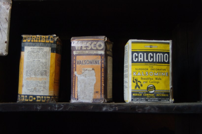
Upon our return, researching “whitewash,” if found this photograph from the Yarloop railway workshops Yarloop, Western Australia. There, on a shelf, where three old boxes sat like relics: DURABLO, WESCO, and CALCIMO. All contained kalsomine—the powdered form of lime paint. CALCIMO promised to “beautify walls and ceilings” and was proudly marked “LIME PROOF.” There was something quietly heroic in that. Lime-proof, as though against time itself.
Looking at the box of Calcimo, a product of the Murabo Company of Australia, I was struck by how far the tradition had traveled. From island cottages in the Atlantic to distant corners of the Southern Hemisphere, the language of whitewash—of simplicity and purity—had touched the world.
We returned by the same road, past that same cottage, the small one still keeping watch beside it like a child beside a parent. And I knew then that the islands hadn’t just given me sights—they had offered stories, silent ones written in thatch and stone, in lime and wind.
Sources for this post: search wikipedia for “White Wash”. White wash photo author: Wikipedia commons user Gnangarra
Join me on a journey through Inishmore, Galway Bay on a horse-drawn carriage. We’ll see a ruined church, horse pasture, and iron age fort, Dun Aengus, with reflections on the word ‘riven.’
All photography using the IPhone 14 ProMax triple camera, raw format, edited on the phone.
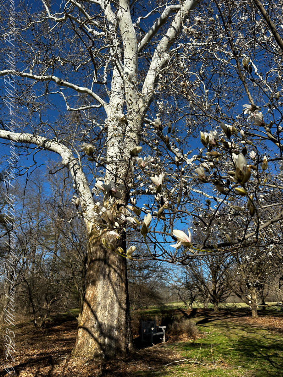
The signage attached to a branch disabused us of this impression, incorrect all for being true until the flowers burst forth.
Magnolia “Golden Gift” Magnoliaceae
Description
A visually beautiful magnolia whose golden flowers bloom in abundance and persist well; a small tree or large shrub with a loosely pyramidal form and large relatively coarse leaves; flowers appear before the foliage; an ideal landscape or garden accent
Ornamental Features
Golden Gift Magnolia is covered in stunning fragrant gold cup-shaped flowers held atop the branches in early spring before the leaves. It has dark green deciduous foliage. The large pointy leaves turn coppery bronze in fall.
Landscape Attributes
Golden Gift Magnolia is a deciduous tree with a distinctive and refined pyramidal form. Its relatively coarse texture can be used to stand it apart from other landscape plants with finer foliage. This is a relatively low maintenance tree and should only be pruned after flowering to avoid removing any of the current season’s flowers. It has no significant negative characteristics.
Ancient
Magnolia is an ancient genus. Appearing before bees evolved, the flowers are theorized to have evolved to encourage pollination by beetles. To avoid damage from pollinating beetles, the carpels of Magnolia flowers are extremely tough. Fossilized specimens of M. acuminata have been found dating to 20 million years ago, and fossils of plants identifiably belonging to the Magnoliaceae date to 95 million years ago. Another aspect of Magnolia considered to represent an ancestral state is that the flower bud is enclosed in a bract rather than in sepals; the perianth parts are undifferentiated and called tepals rather than distinct sepals and petals. Magnolia shares the tepal characteristic with several other flowering plants near the base of the flowering plant lineage such as Amborella and Nymphaea (as well as with many more recently derived plants such as Lilium).
With a neighbor, Sycamore or “Buttonwood”
Copyright 2023 Michael Stephen Wills All Rights Reserved
Pam and I ambled around the Arboretum for our Easter 2023 outing. Ezra Cornell had a large farm on the East Hill above Ithaca, New York. As part of locating New York State’s land-grant college in Ithaca, Cornell offered to donate the farm for use as a campus. Parts of this property remain in use as farmland. Our walk followed the outer Arboretum reaches along this research farm.
All photography using the IPhone 14 ProMax triple camera, raw format, edited on the phone.
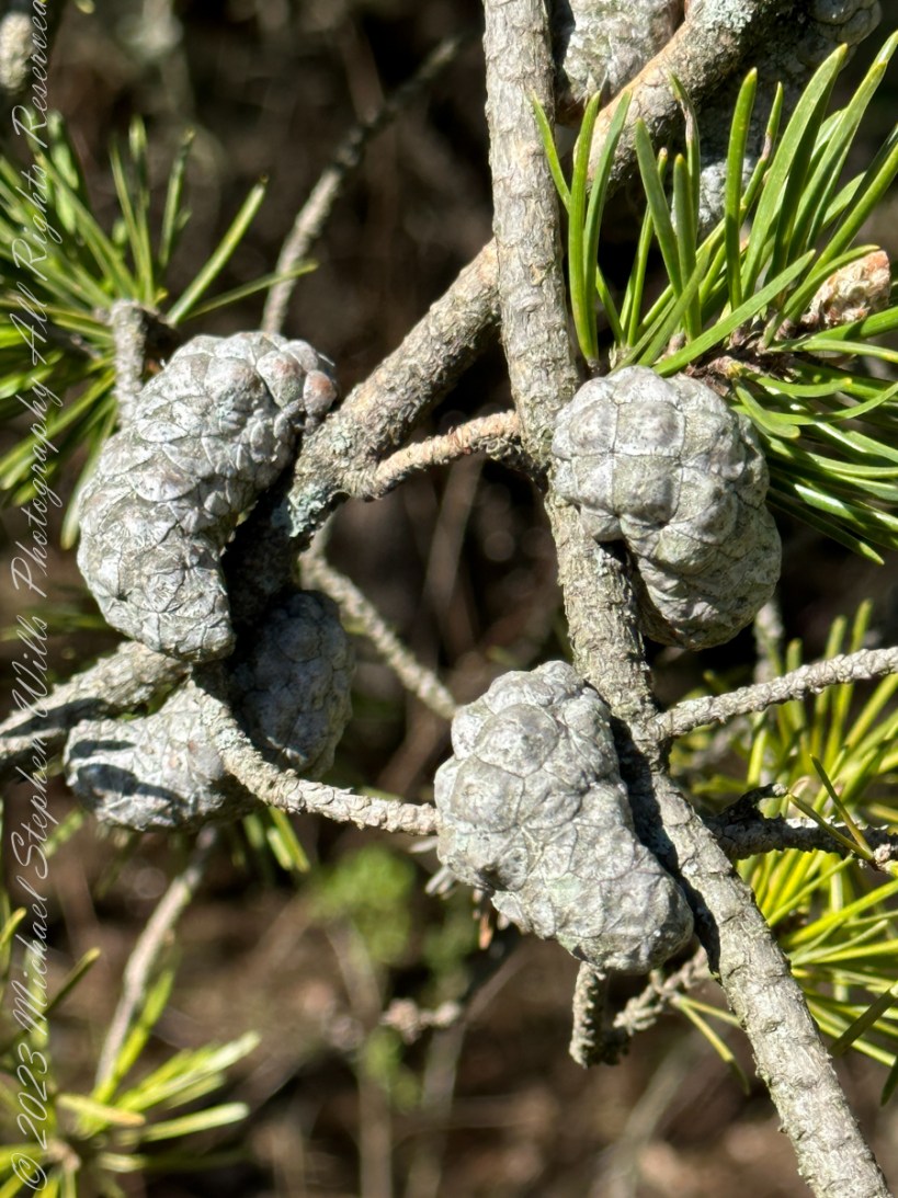
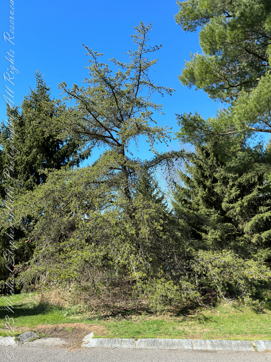
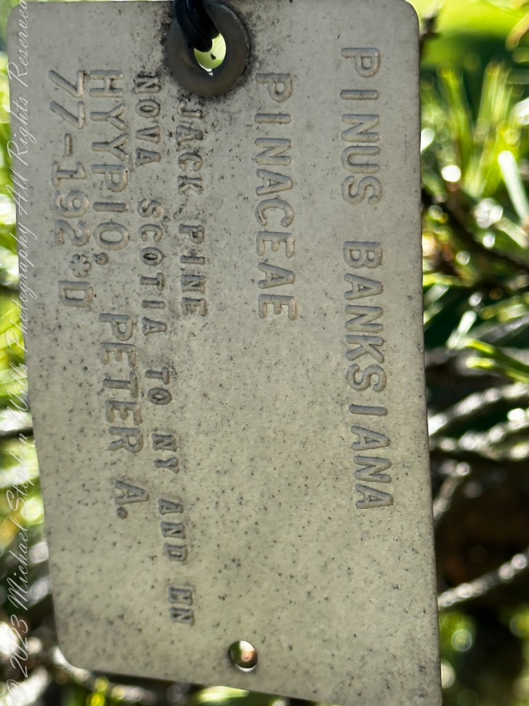
Growing off the road that loops around the Arboretum, this scraggly pine, the Jack Pine, attracted our attention by the grey colored growths curving around the branches
Serotinous
These are pinecones with the unusual property of not opening, hanging onto the branch, turning this color, until the appropriate conditions arise, serotinous is the botanic term for this. They open when exposed to intense heat, greater than or equal to 50 °C (122 °F). The typical case is in a fire, however cones on the lower branches can open when temperatures reach 27 °C (81 °F) due to the heat being reflected off the ground.
The Color of Younger Jack Pine Cones
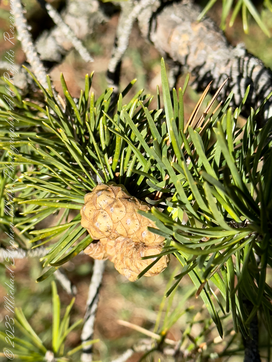
Form and Behavior
Tolerant of conditions that preclude other trees, Jack Pines can form pure stands on sandy or rocky soil. It is fire-adapted to stand-replacing fires, with the cones remaining closed for many years, until a forest fire kills the mature trees and opens the cones, reseeding the burnt ground.
Native
Pinus Banksiana, Pinaceae, Jack Pine, Nova scotia to New York and Minnesota
Joseph Banks classified this pine during a 1766 expedition to Labrador and Newfoundland, the scientific name, Pinus Banksiana, is in his honor. Jack Pine is native to eastern North America in the far north, south to northwestern Pennsylvania, including New York State.
Copyright 2023 Michael Stephen Wills All Rights Reserved
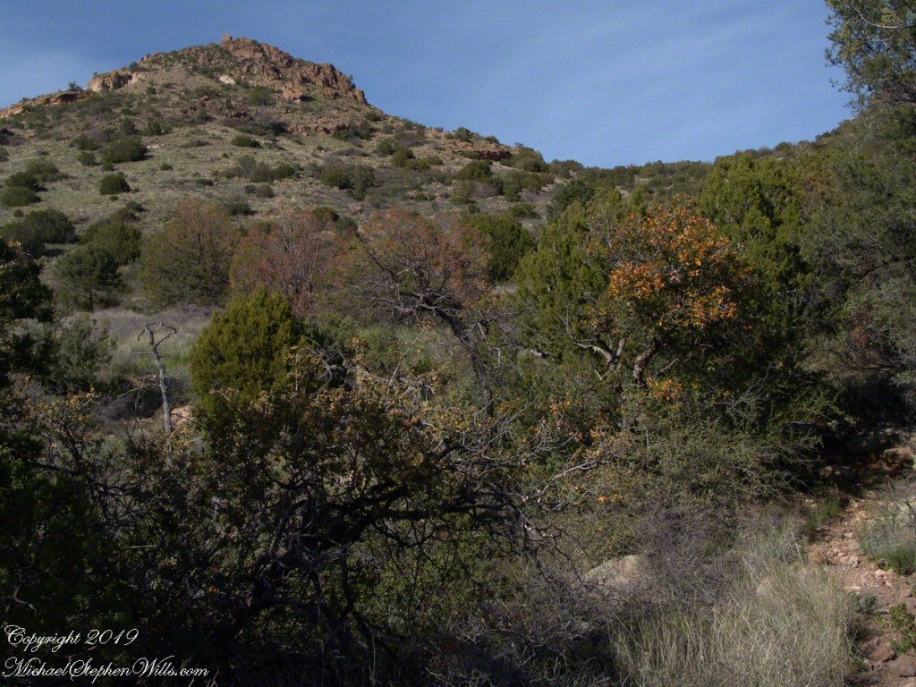
Nugget and Colorado had eaten their fill of the rich early spring grass of the apple orchard, The Searcher pulled together the pair for the return to Pine Creek. Perched on Colorado, the lead held by The Searcher, I listened as he shared survival facts remembered from Peter Bigfoot’s desert survival course. The Reavis Mountain School of Self Reliance, founded 1979, is along same Reavis Gap Trail (#117) we traversed. After descending to Pine Creek and up to Reavis Gap (where I first met The Searcher), it descends to meet Campaign Creek where the survival school is located.
He pointed out on the many flowering Century Plant stalks along the trail. “These are great to roast when young, just as the stalk starts to bud from the center, before it starts to lengthen.” By the time the stalk flowers, as in the following photograph, it is quite tough.
Agave flower spike against the dawn in the nameless canyon west of Two Bar Mountain, Superstition Wilderness, Arizona.
At the base of boulders, shaded from the sun, the ridgeline fern takes hold. Surviving on seasonal water seepage, it dries out during dry spells to later revive and reproduce via spores. As I recall, the dry or fresh form is useful as an analgesic.
An absolute necessity for bushwacking (walking off the path), a pair of rattlesnake proof boots were worn on every expedition. These rose to mid-calf with a layer of lexan, the same as used for bullet proof glass.
Swept from the Saddle
We passed the time in this way, me holding on to the saddle horn bouncing and shifting as Colorado negotiated the rough and steep path down to Pine Creek where the vegetation changed from very sparse to the thick growth you saw in my post “A Peaceful Day at Pine Creek”. On the east side of Pine Creek a trail, unmarked on the maps, follows the creek bed uphill north towards Mound Mountain. In 50 feet or so we passed the side trail to my campsite, our destination was The Searcher’s campsite. I was not paying near enough attention to the surroundings when I looked up to see an Arizona Oak limb headed to my chest. With no time or space to negotiate the obstacle I was left to grab hold and hang on to be swept from the saddle. The branch held my bulk for, at most, a second before giving way.
In bending flexibly before breaking the live Oak wood and centuries of soil underneath the trees softened my fall enough so I was badly shaken and unhurt. Falling a foot or so in any direction would have resulted in serious injury or instant death. Colorado stopped, looking briefly back as I slowly came to my feet. After taking account and letting the circumstance wash over me, I got up and proceeded slowly while we both contemplated my miraculous survival.
Bear Shelter
I now took up the rear as in a few hundred yards the valley wall rose on both sides of the Creek to form a short, narrow pass. The walls fell away just as quickly, the valley floor leveled out and we came to The Searcher’s camp. The bear shelter stood out right away. This was a ten foot high teepee of 4 – 6 inch diameter tree trunks tied with rope, within was a hammock . The three foot wide opening left only one unprotected side while he slept, offering some protection from the all too common roaming bears, most commonly from September to November when mazanita fruit ripens.
Well stocked in every respect, for a wilderness camp. In the following years of roaming the wilderness the camps of other horse people were similar in this way: stoves, comfortable cots, radios, pots and pans all fit into panniers. As a noun pannier is seldom used in the singular because there are always two, one on each side of the horse for balance. I sat on the wide top of one enjoying a cold beer pulled from a bed of ice.
We discussed the benefits and drawback of horses for exploration. I required a gallon and a half of water daily and in the desert wilderness provided for storage of three days, 4 and a half gallons. At 8 pounds each, that is 36 pounds!! Starting out, my pack weighted 90 pounds with a camera and tripod.
There are benefits to having a mode of transport that thinks for itself and drawbacks. Each individual has its own personality and horses do try to get away with what they can. It is wise to limit your dependence on a horse until you know each other well. In retrospect, I was “out on a limb” riding Colorado modified by being led by someone the horse knew well.
It was soon time for me to head back to camp. We set the agenda for the next day, an early start for the hike out. Colorado was to be fully loaded so my riding was not an option, just as well. It was possible to lighten my pack to almost nothing and I looked forward to that.
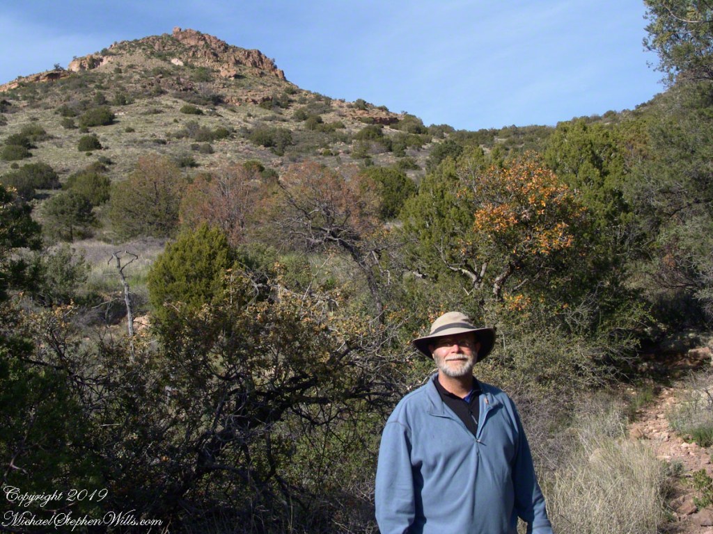
I took some time before dinner to set up the tripod for a self-portrait on my last full day in Pine Creek. The view is northeast from the Arizona Trail near my camp, the ridge overlooks Reavis Gap. I did a version of the view with and without me.
A roadside shrine on Cottage Road, Inishmore. The faith brought by the saints has deep roots here.
A large crucifix set with wet stone walls with cut flowers. The walls are the native limestone.
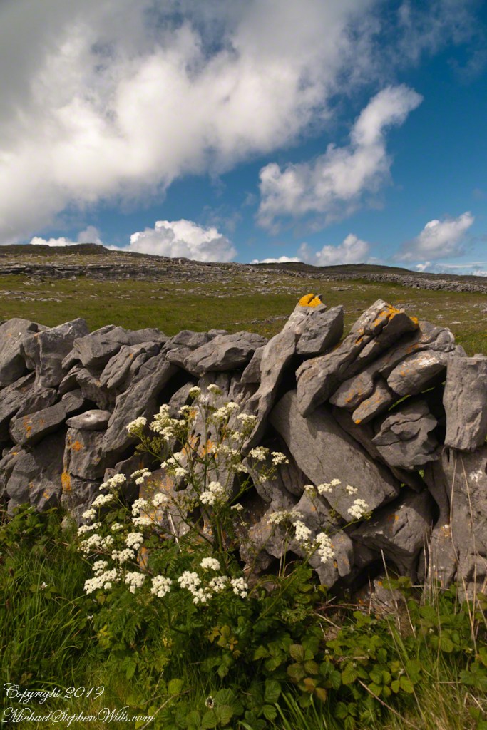
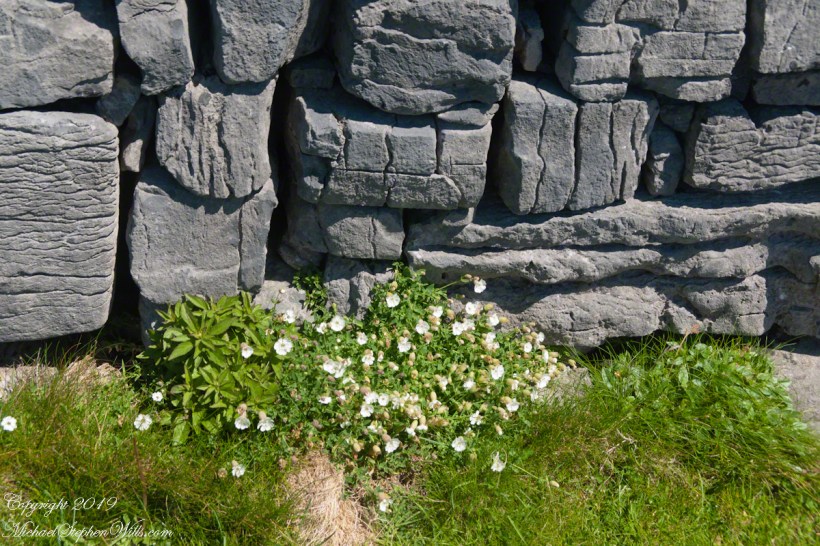
It is a spring (early June) afternoon and there are fern and wildflowers. The white flowers are Greater Burnet saxifrage (Scientific Name: Pimpinella major).
The existing dry stone wall was interrupted by the shrine. In the distance are dry stone walls around fields, a stone shed, feeding horses and the sea, being Galway Bay, storm clouds with distant rain.
Aran Islands, County Galway, Ireland.
Roadside Shrine and Island Landscape, Inishmore, Aran Islands, County Galway, Ireland
Imagine yourselves in an open cart exploring the island. Here are the photographs from my Inishmore exploration posts. Enjoy!!
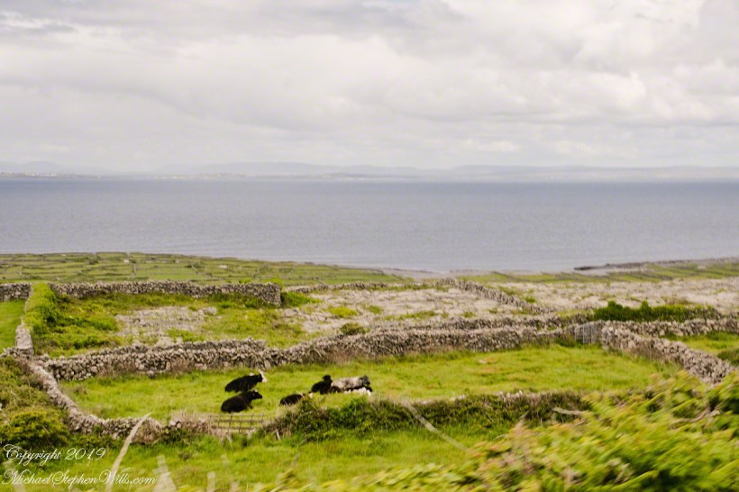
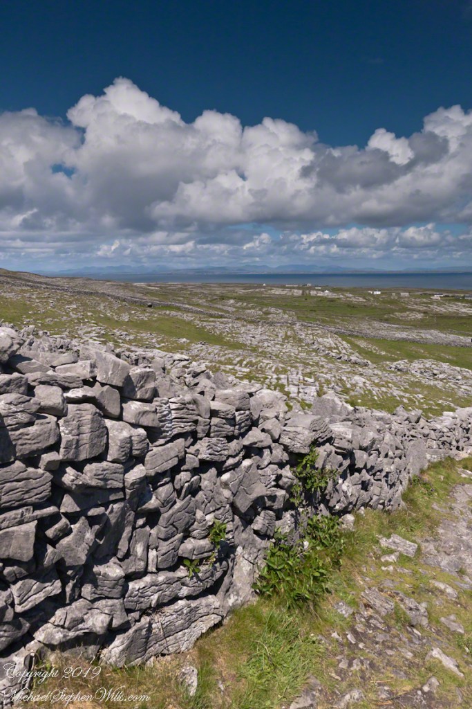
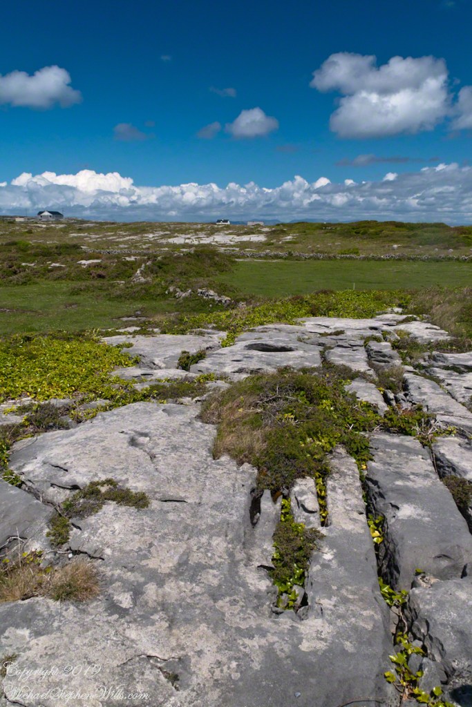
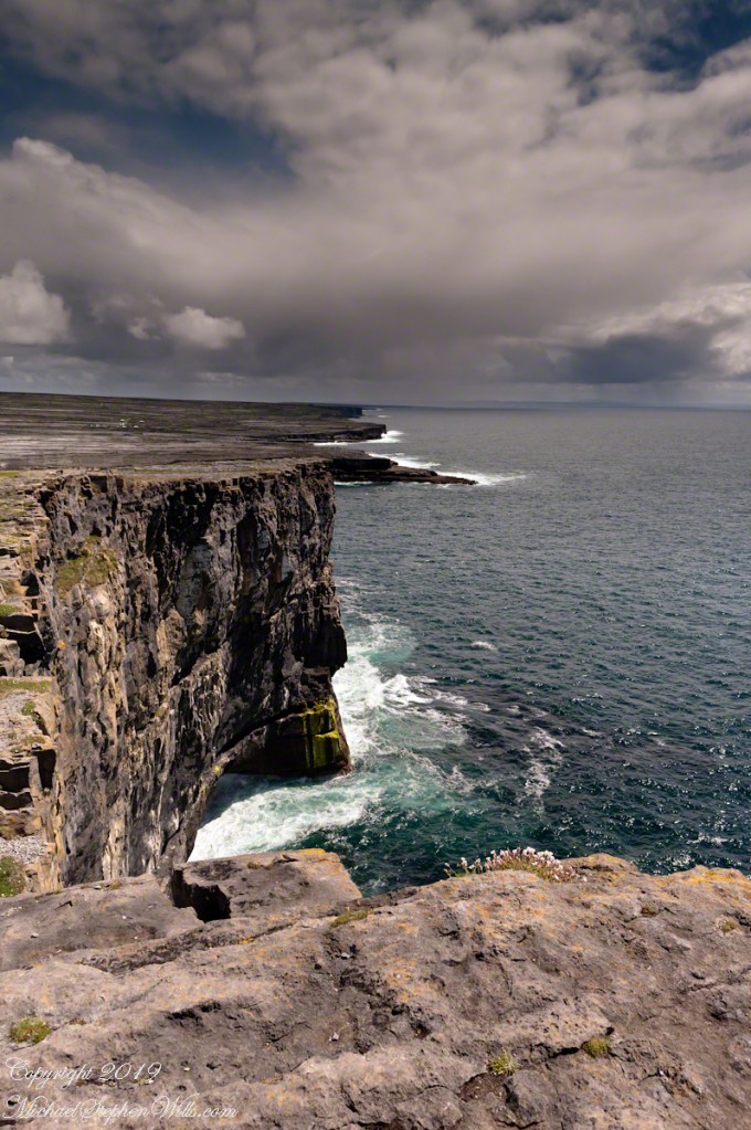
Kilronan bibycle hireView from a horse drawn trap headed down Cottage Road toward the village of Kilronan on a early June day, the island of Inishmore. On the right a stone ditch (wall), at the base the white flowers of Greater Burnet saxifrage (Scientific Name: Pimpinella saxifraga) (Irish Name: Ainís fhiáin). A steeple with bell and cross just visible. In the distance is the island of Inishmaan, the North Atlantic and Galway Bay. Aran islands, County Galway, Ireland.This ruined church is on the right side as you travel Cottage Road out of Kilronan Village, Inishmore, County Galway, Ireland. The distant highland is Inis Mann, across Galway Bay. A curious horse looks over a wrought metal gate set in a dry stacked limestone wall.Riding a horse and trap on Cottage Road from Kilronan village, Inishmore, Aran Islands, Country Galway, irelandThose bicyclists could have been us.This thatched cottage with matching child’s playhouse is on Cottage Road out of Kilronan Village on the Aran island, Inishmore, County Galway, Ireland.Roadside daisies on Cottage Road out of Kilronan village, Inishmore, Aran Islands, County Galway, IrelandNorth view from Cottage Road overlooks walled fields, karstNorth view from Cottage Road overlooks walled fields, karstAn island cottage among fields along the Galway Bay coast, the twelve pins of Connemara beyond.An island cottage among fields along the Galway Bay coast, the twelve pins of Connemara beyond.We stopped for lunch and a present for my son, a sweather purchased from the woman who knitted it.SONY DSCThe view is looking southwest from the path leading to Dun Aonghasa in springtime. We see here dry stone wall of limestone laid in a pattern suggestive of herringbone, splotches of orange lichen mark the stones. Against the wall is growing a variety of plants. The prominent white flowers are Greater Burnet saxifrage (Scientific Name: Pimpinella major) (Irish Name: Coll an dromáin). Beneath are leaves of Wild Strawberry (Scientific Name: Fragaria vesca) (Irish Name: Sú talún fiáin) as well as fern and grass. Beyond the wall is karst landscape rising to the ridge. Above the ridge, storm clouds gather. Inishmore, Aran Islands, County Galway, Ireland.This defensive structure called a Cheval de fries field surrounds Dun Aonghasa (Dun Aengus). This northwest view looks across the field and surrounding defensive walls. It is an early June day and, in the foreground, are colorful wildflowers among the limestone shards and blocks. Inishmore, Aran Islands, County Galway, Ireland.Looking North, Northwest across the slopes below Dun Aonghasa (Dun Aengus), InishmoreWalled Path to Dun Aonghasa (Dun Aengus) with Island Landscape, InishmoreKarst landscape with Green Field and Clouds, InishmoreInishmore LandscapeKarst Landscape with Interior Walls of Dun AonghasaDetail of Dun Aonghasa Dry Stone Wall with White Flowers of SeaAncient Fort Entrance, Dun Aonghasa (Dun Aengus)Ancient fort wall with tourists and Cliff Edge of Dun Aonghasa (Dun Aengus)View east, southeast from the Cliff Edge of the Ancient fort walView east, southeast from the Cliff Edge of the Ancient fort walRoadside Shrine and Island Landscape, Inishmore, Aran Islands, County Galway, Ireland
Copyright 2019 All Rights Reserved Michael Stephen Wills