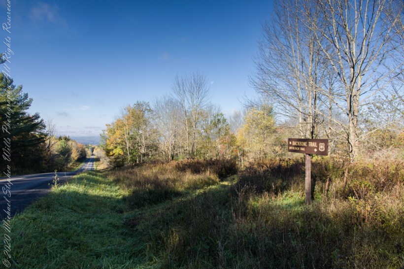
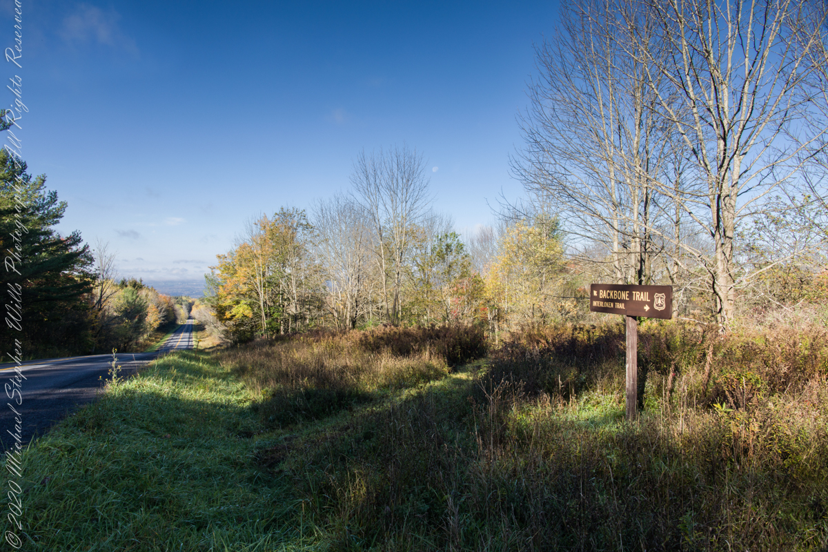
An open road, autumn morning, a hiking trail under a setting moon. Thirty miles of hiking trails thread these 16,212 acres. Some, like the Backbone trail, traverse farmland reverted to forest and meadow, popular for horseback riding.
Click photograph for a larger view. To do this from WordPress Reader, you need to first click the title of this post to open a new page.
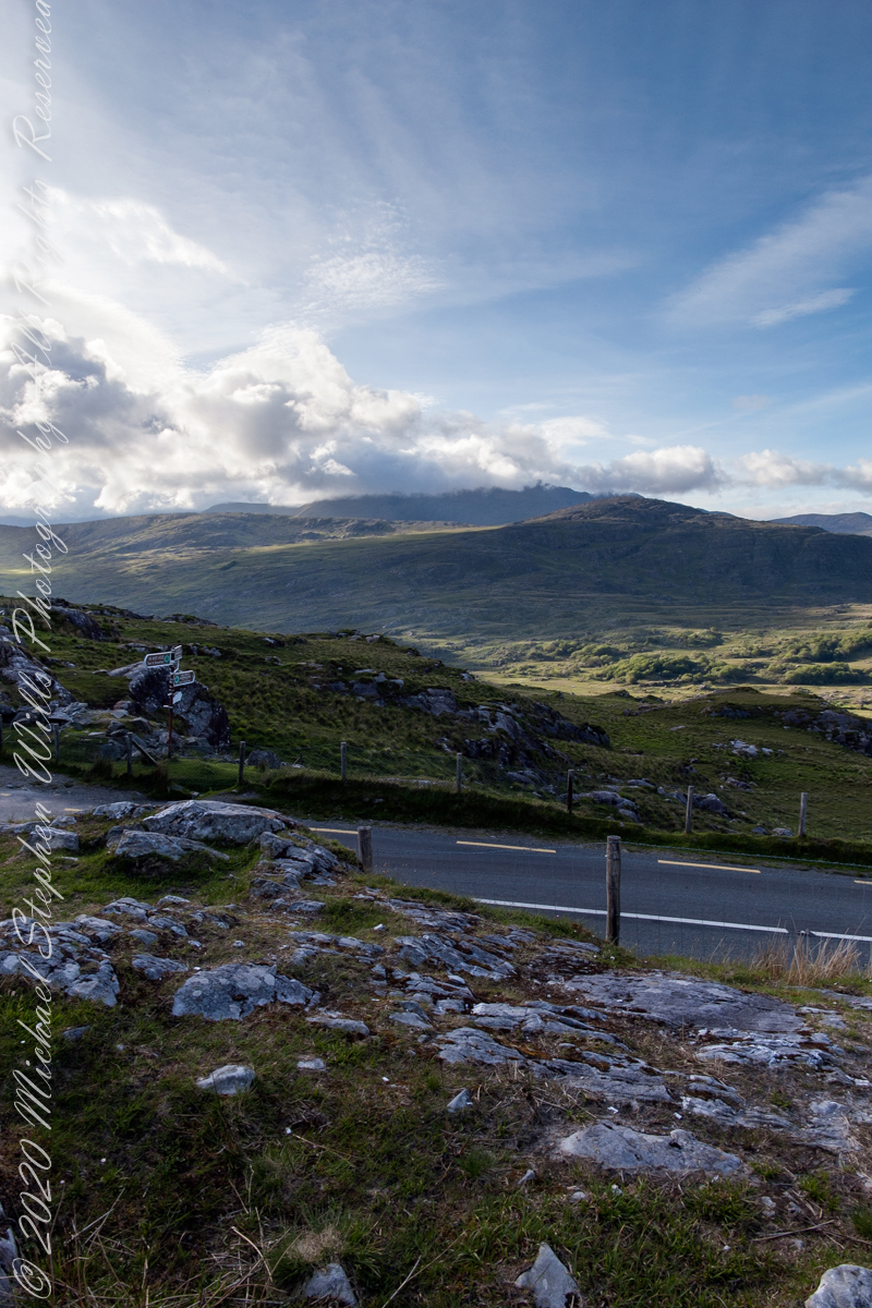
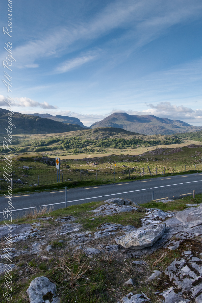
Here we are standing in Moll’s Gap, looking northwest into Black Valley, a place so remote it was among the last, on the island itself (“mainland”) to be electrified or connected to telephone networks.
Beneath our feet are the slopes of Derrygarriff (in Irish Doire Gharbh) of the Mangerton range. Across the way is Crossderry peak of the Dunkerron mountains, the townland is named for the peak. Black Valley, now a southerly route to the Gap of Dunloe well known to certain hikers and cyclists, is beyond the far mountains.
Click pic for larger view in a new browser tab. If you are in WordPress Reader, open the post to use this feature.
Copyright 2021 Michael Stephen Wills All Rights Reserved
The only National Forest in New York State, this land is visible as a ridge to the west of our home. Here we are on the west side, the ridge of Seneca Lake in the distance.
Click photograph for a larger view. To do this from WordPress Reader, you need to first click the title of this post to open a new page.
Here we are, on the road from Kenmare to Killarney, N71, part of the Ring of Kerry around the Iveragh Peninsula. The spot is the mountain pass Moll’s Gap, also known in the Irish language as Céim an Daimh (meaning, Gap of the Ox). In the Nineteenth Century a woman named Moll Kissane ran a public house here, operating illegally.
The mountain of this townland, named Eirk (also known as Adhard) , is composed of a fine grained sandstone found in a wide swath from North America’s northeastern coast, Greenland, Ireland, Great Britain — lands formerly part of the same ancient continent.
Click pic for larger view in a new browser tab. If you are in WordPress Reader, open the post to use this feature.
Iveragh Peninsula, Eirk townland, County Kerry, Republic of Ireland.
Copyright 2021 Michael Stephen Wills All Rights Reserved
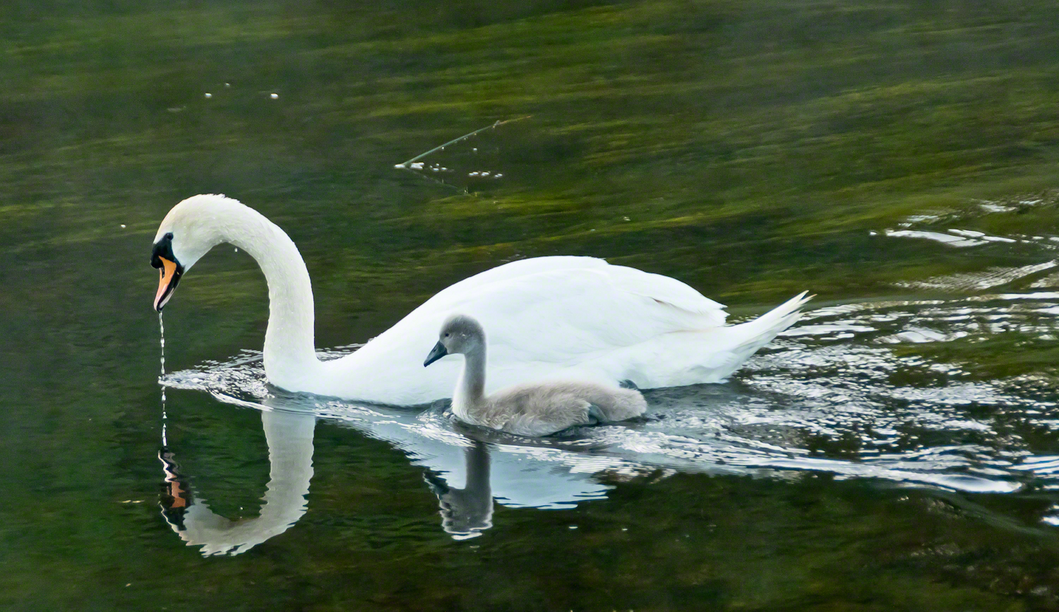
A parent swan and cygnet feeding on the River Cong outside the front door of Ashford Castle in County Mayo, in the west of Ireland. Click this link to read another Ireland story “The Cloigtheach of Glendalough.” Enter your email to receive notification of future postings. I will not sell or share your email address. […]
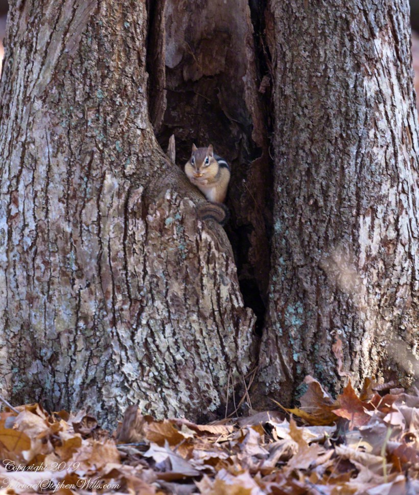
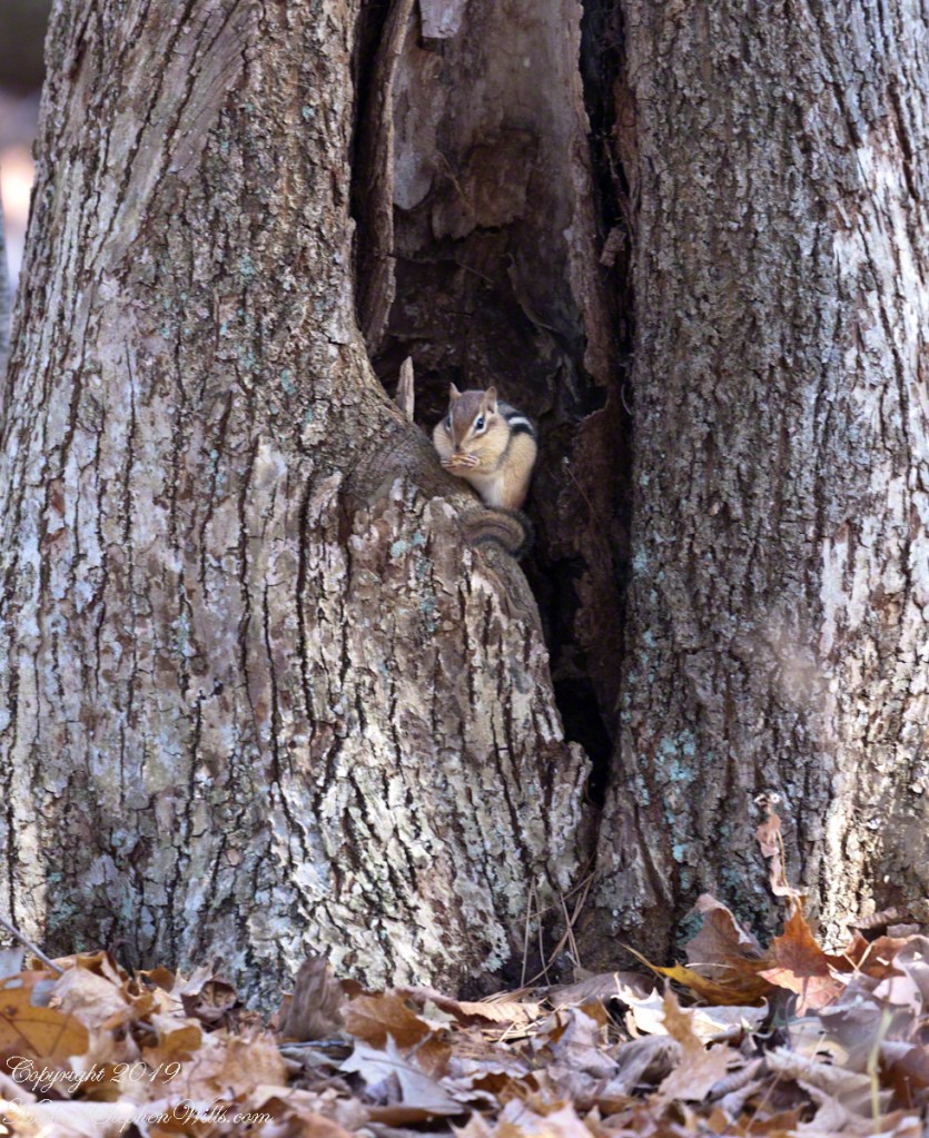
Perched on its doorstep, an Eastern Chipmunk gorges on an ample supply of acorns. These small rodents are omnivores. Here are two shots, each with an acorn in hand and full cheek pouches.
Wary Chipmunk with acorn
Chipmunk eating acorn
Copyright 2021 All Rights Reserved Michael Stephen Wills
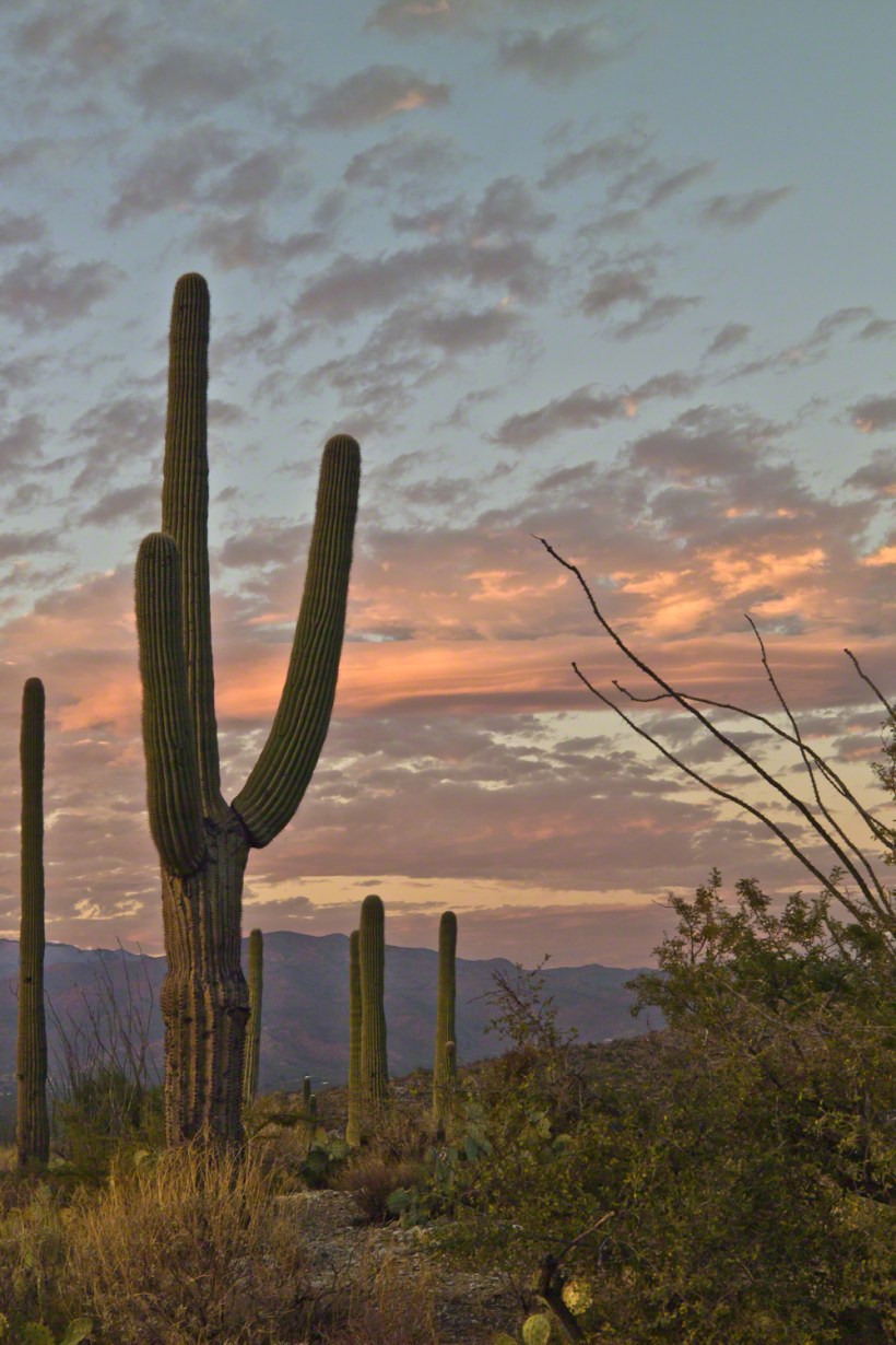
November is a special time for the ranges and basins of southern Arizona deserts. Climb a bajada of foothills, face west and wait for the sunset. That is what I did this day, November 3, 2005. East of Tucson the Saguaro National Monument at the foot of the Rincon Mountain Wilderness is where I parked, unpacked the photo gear and climbed the side of the Tanque Verde Ridge for a favorable view. Weather was pushing high level moisture from the west, clouds were developing.
You see here a shot from that session. In the distance, looking across Tanque Verde, are the Santa Catalina mountains. Months since the last rainfall, the giant Saguaros are using internal moisture reserves drawn up from a shallow root system, the flesh is less plump, the supporting structure of the ribs, always evident, are more pronounced. The last light catches these ribs in relief against a dramatic sky.
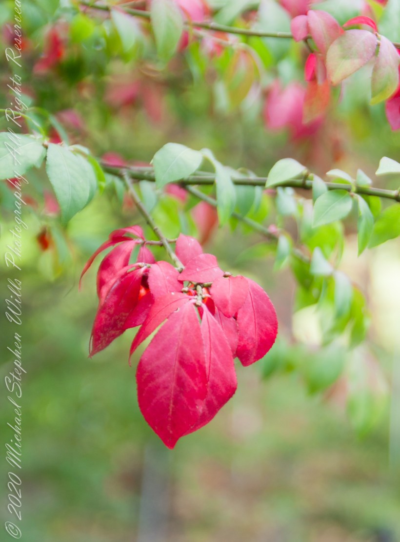
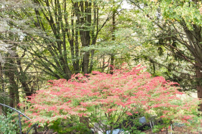
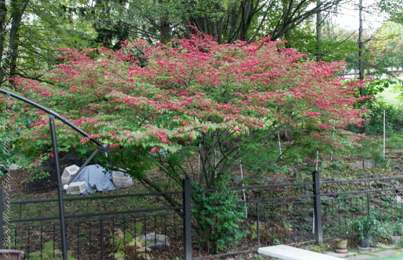
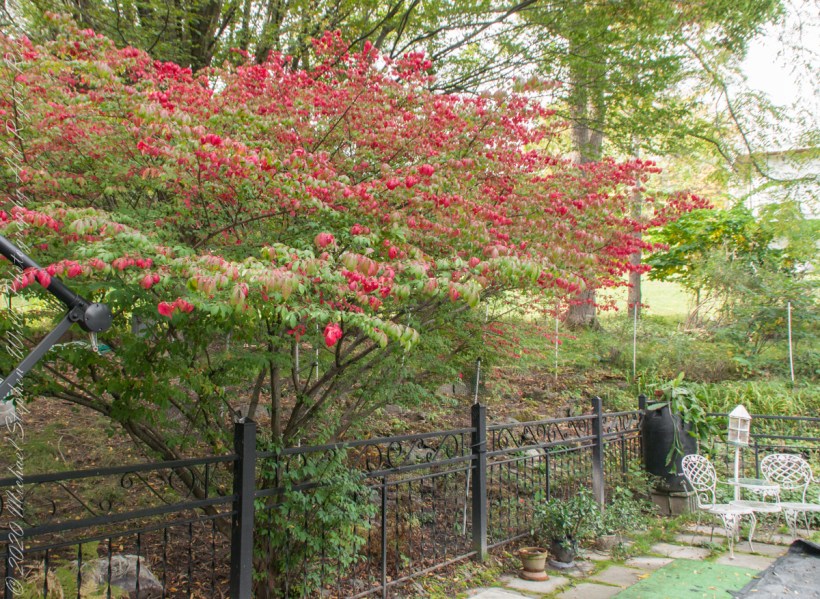
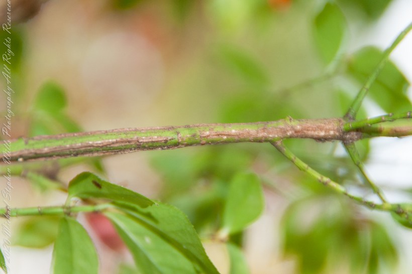
After we came home from the Underground Railroad excursion, with a camera and time on my hands, this Euonymus bush fringed with scarlet leaves caught my eye. Starting with a leaf here and there in September the flame-like color spreads until it takes on the character it is named for “Firebush.”
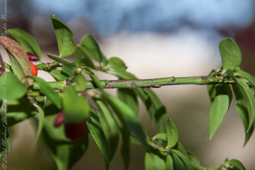
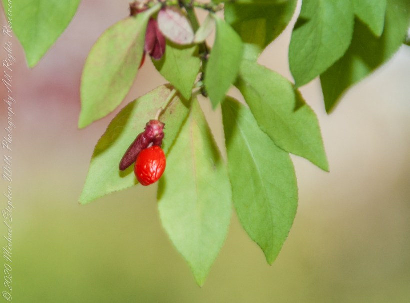
Springtime it is covered with tiny green flowers, each turns to a small, fleshy fruit encapsulating tiny seeds said to be loved by birds. As ours neglect the fruits, I’ve taken to collecting them to spread along the borders of our back property. Here and there some have sprouted around the bush, this year I marked a few to move this winter when the plant is dormant. I have high hopes for success of this project as the species is known as “invasive” in 21 states.
Click pic for larger view in a new browser tab. If you are in WordPress Reader, open the post to use this feature.
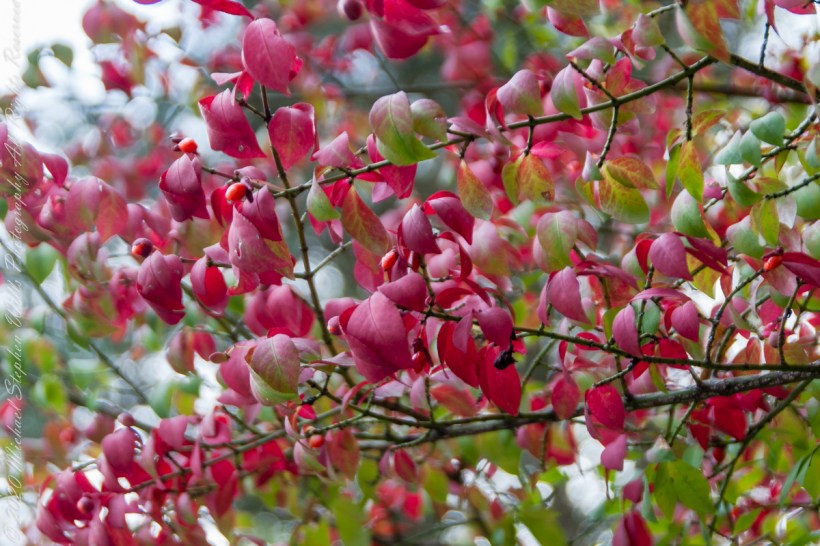
All parts of the plant are toxic, causing severe discomfort when eaten. The name “Spindle plant” was given it in England for the corky wings that grow long the length of stems, not so pronounced with our Euonymus species.
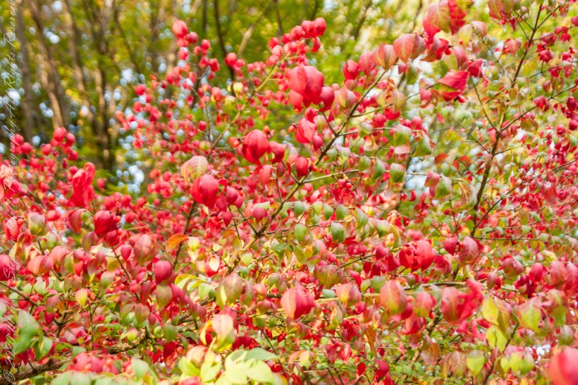
Here are macros of the flaming leaves and fleshy berry.
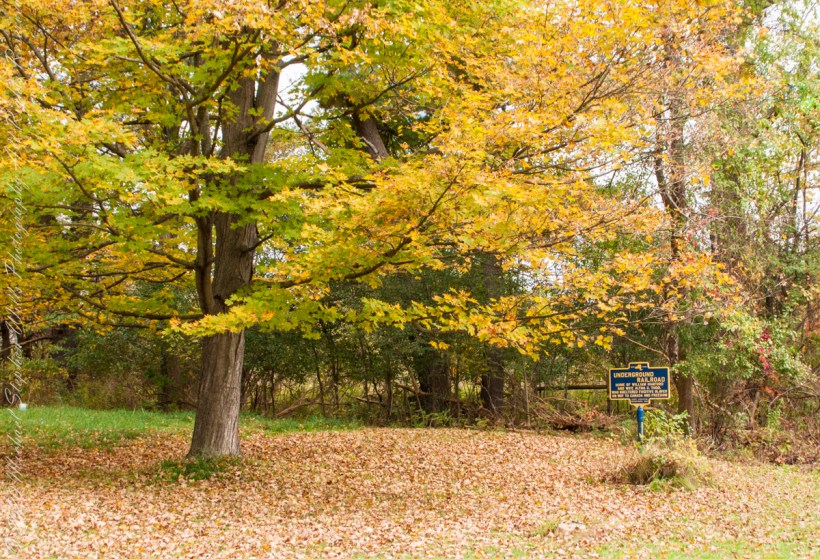
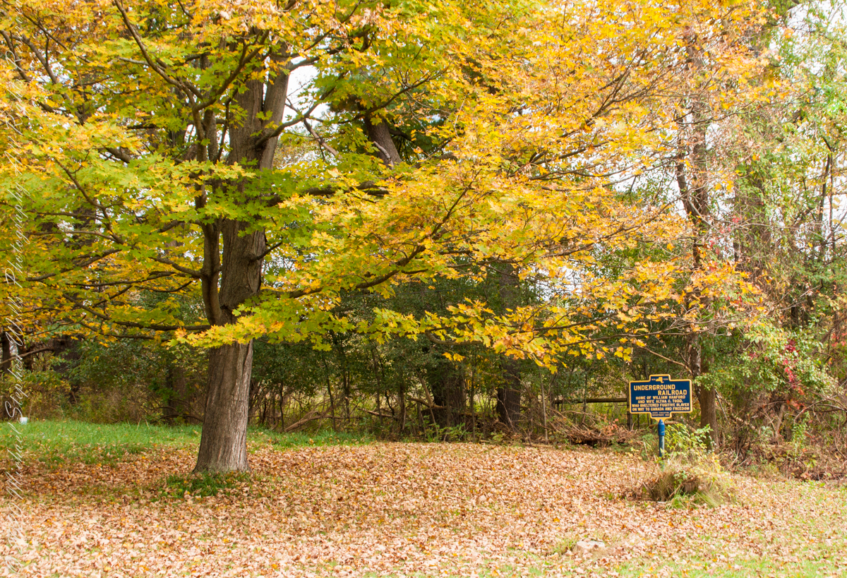
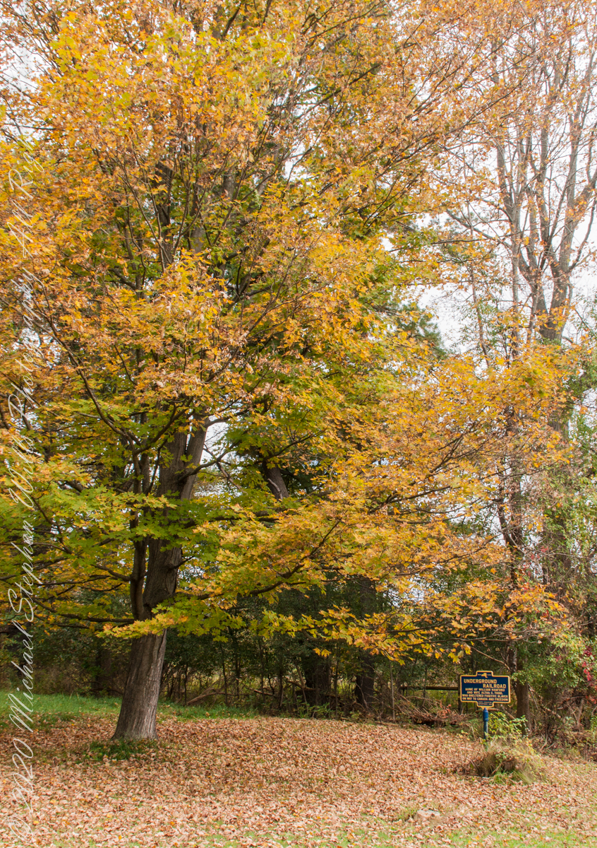
We have often travelled Lower Creek Road as an alternate route to visit my son and his family who live in Freeville, a village named for the activity of the Underground Railroad. After noticing this sign in passing for years, this week we stopped on a glorious autumn morning to capture it. I had packed the Sony Alpha 700 dslr for just such an opportunity.
Just off the road, under a maple tree in full autumn color (yellow), ground covered with fallen leaves (brown) on a fine early October morning, the sign reads, “New York, UNDERGROUND RAILROAD, HOME OF WILLIAM HANFORD AND WIFE ALTHA C. TODD, WHO SHELTERED FUGITIVE SLAVES ON THE WAY TO CANADA AND FREEDOM, STATE EDUCATION DEPARTMENT 1932”. These dark blue background, bright yellow letter signed are found throughout this region and much appreciated.