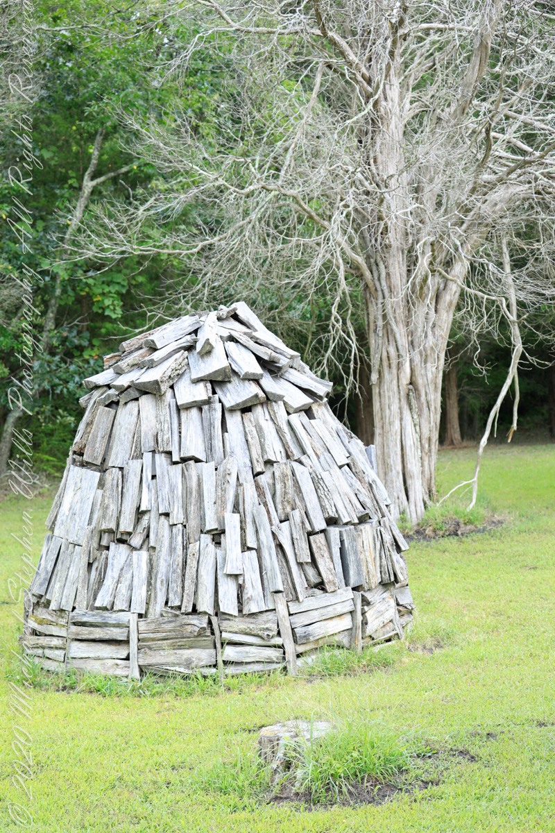
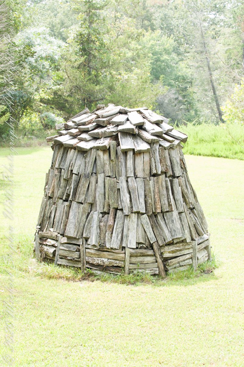
Here my exploration of Wharton State Forest, Pitch Pine Forest III, branches to the genealogical exploration of this landscape as my sister, Theresa and I, proceed along the humped, pitted sand road Goodwater through the wilderness to emerge in Batsto Village, a recreation of lives that touched my great great grandparents, James and Ann McCambridge among them. Ann saved money earned as a cook for Atsion furnace, the historical site at the start of the road to Quaker Bridge. Her husband James worked as a collier, supplying fuel for the iron furnaces at Atsion and Batsto, among other enterprises. During our Batsto Village visit we found these reproductions of charcoal clamps.
A charcoal clamp (a word derived from Dutch for “heap’) is build around a chimney formed from the wood and covered with materials such as earth to control air flow.One the burn was started, the process was watched closely. The person in charge was called a collier.
Since earliest times charcoal was used for cooking and heating. It was the best heat source for metal furnaces. Entire deforested regions are attributed to the demand for charcoal. Thomas Jefferson experimented with charcoal clamp designs, modifying air flow from the base.
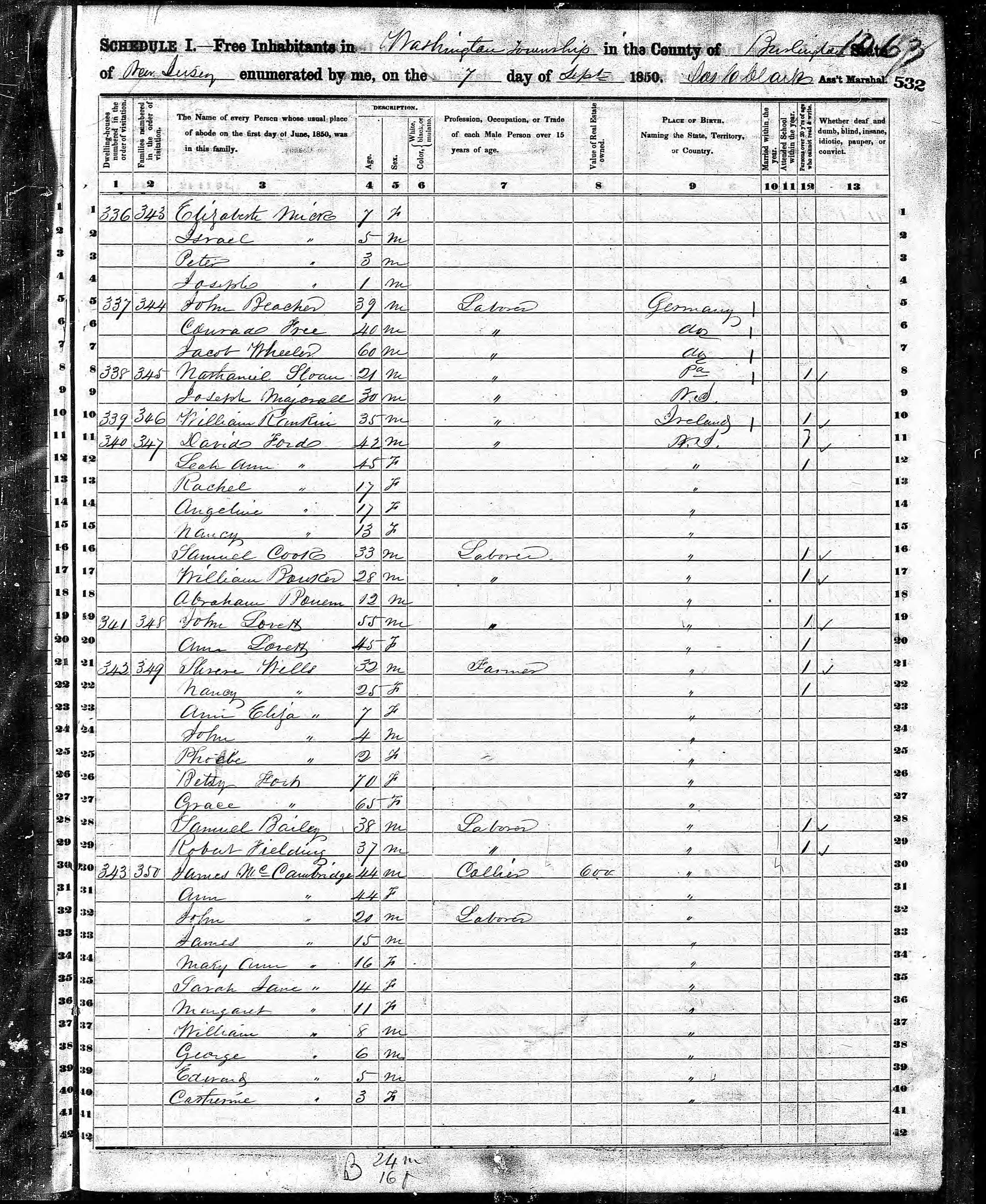
James and Ann lived on the land that provided a livelihood, enough to support themselves and nine (9) children. From September 7, 1850 is the US Census for this family of my second great grandparents. Great Grandmother Margaret was 11 years. James is listed as a Collier, the value of Real Estate owned was 6,000 (a fortune for the time).
Leaving the jeep on the west side of Quaker Bridge, I walked over to inspect the structure and poke around the other side, carrying a Canon 5d Mark IV (camera body) / EF 70 – 300 mm f/4-5.6 L IMS (lens), shooting as I walked. My sister Theresa and Maxie, a little white dog, lagged behind taking in the surroundings. Here they are, in shadow, on the west side.
Click pic for larger view in a new browser tab. If you are in WordPress Reader, open the post to use this feature.
My work on the east side was shared in previous posts, “Pinelands Connections VIII,”I and II “Around Quaker Bridge,” and I and II “Pitch Pine Forest,” work interrupted by the sound of an approaching engine, a Humvee came into view. I waved my arm up and down, a sign to slow down, pulling alongside the driver looked up with dead eyes, no element of recognition of a fellow human, as I explained my sister was on the bridge. A stink of unfamiliar hydrocarbons, diesel fuel?, rose through the heat as they pulled forward with no acknowledgement of my request. Thankfully they slowed down as Theresa, Max in her arms, said, “hi.”
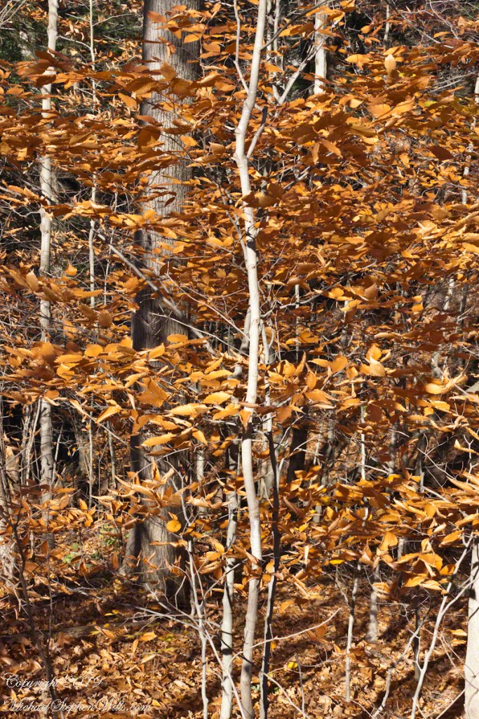
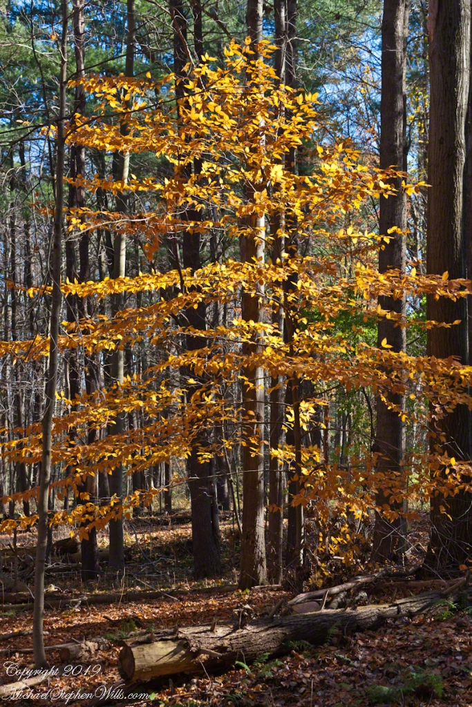
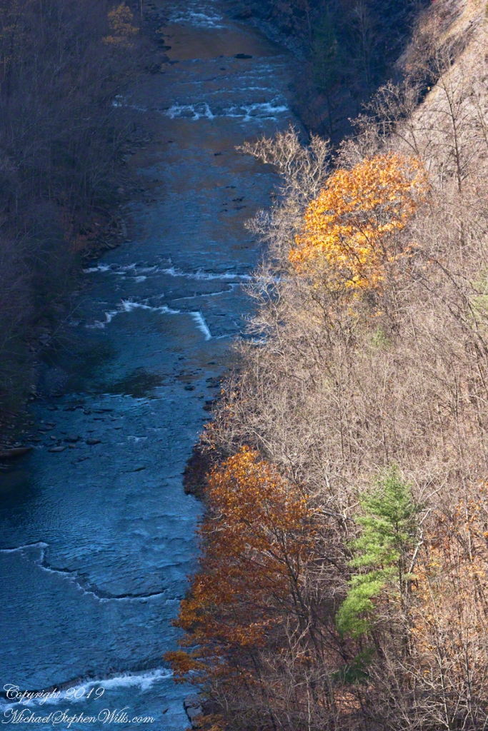
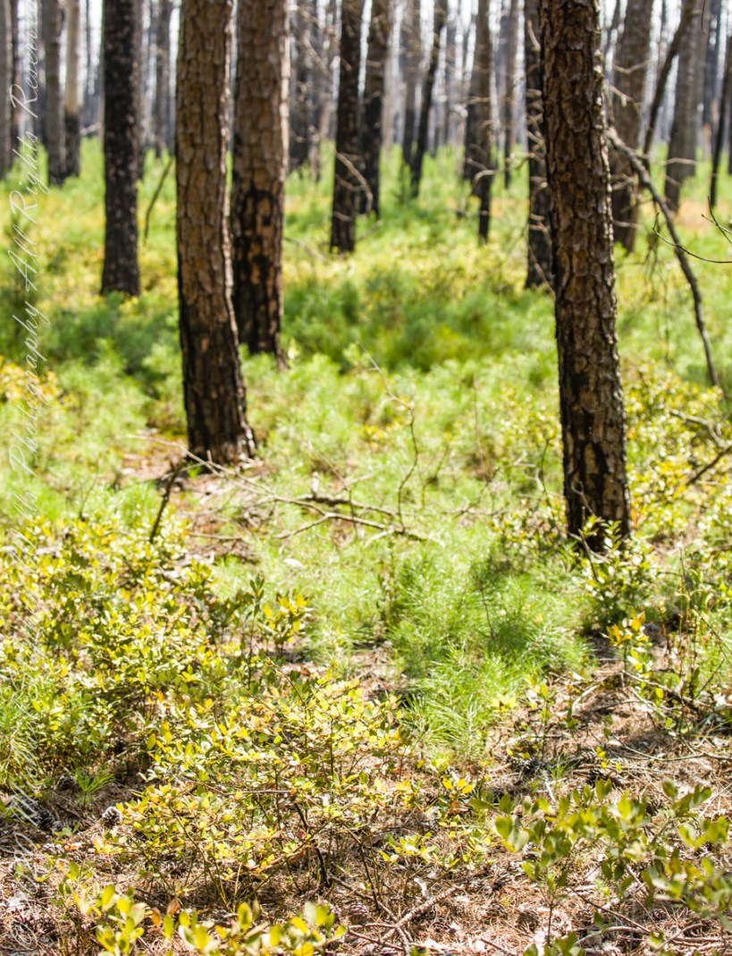
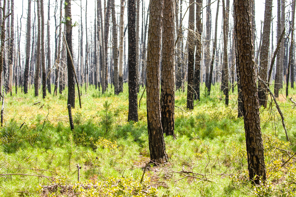
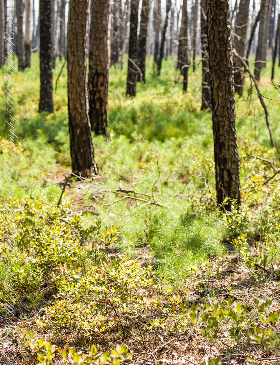
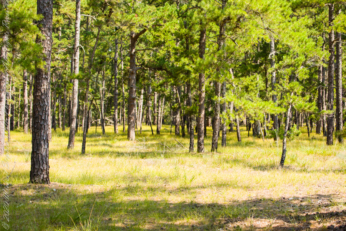
Multiple roads converge from all directions on Quaker Bridge, using GoogleMaps (surprising these unimproved, “jeep” sand roads were listed) I chose Goodwater Road as a route to Batsto Village, on the southern side of Wharton State Forest. The 6.1 mile road follows the east bank of Mullica River at a distance, a very rough passage through ancient Pitch Pine forest. Here are photographs of the enormous capacity of the pines to regrow after fire. Note a thick seeding growth among the mature pine trunks, lower portions fire blackened.
Copyright 2021 Michael Stephen Wills All Rights Reserved
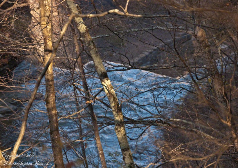
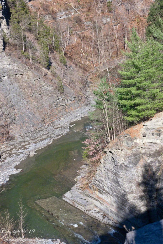
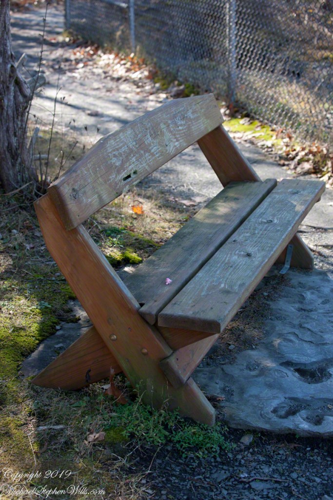
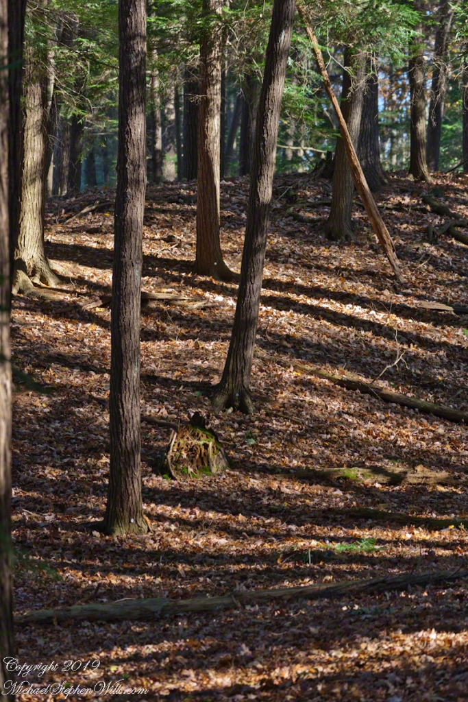
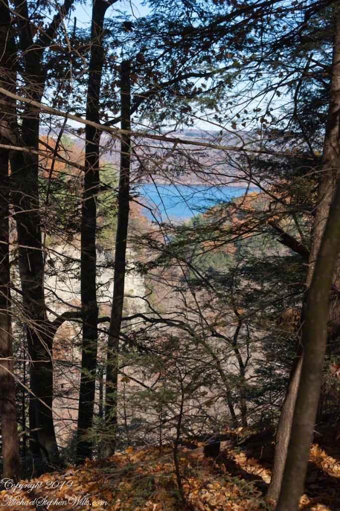
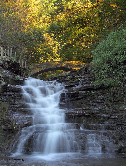
These photographs were taken deep in the wilderness of Wharton State forest, near where Quaker Bridge spans the Mullica River.
Click pic for larger view in a new browser tab. If you are in WordPress Reader, open the post to use this feature.
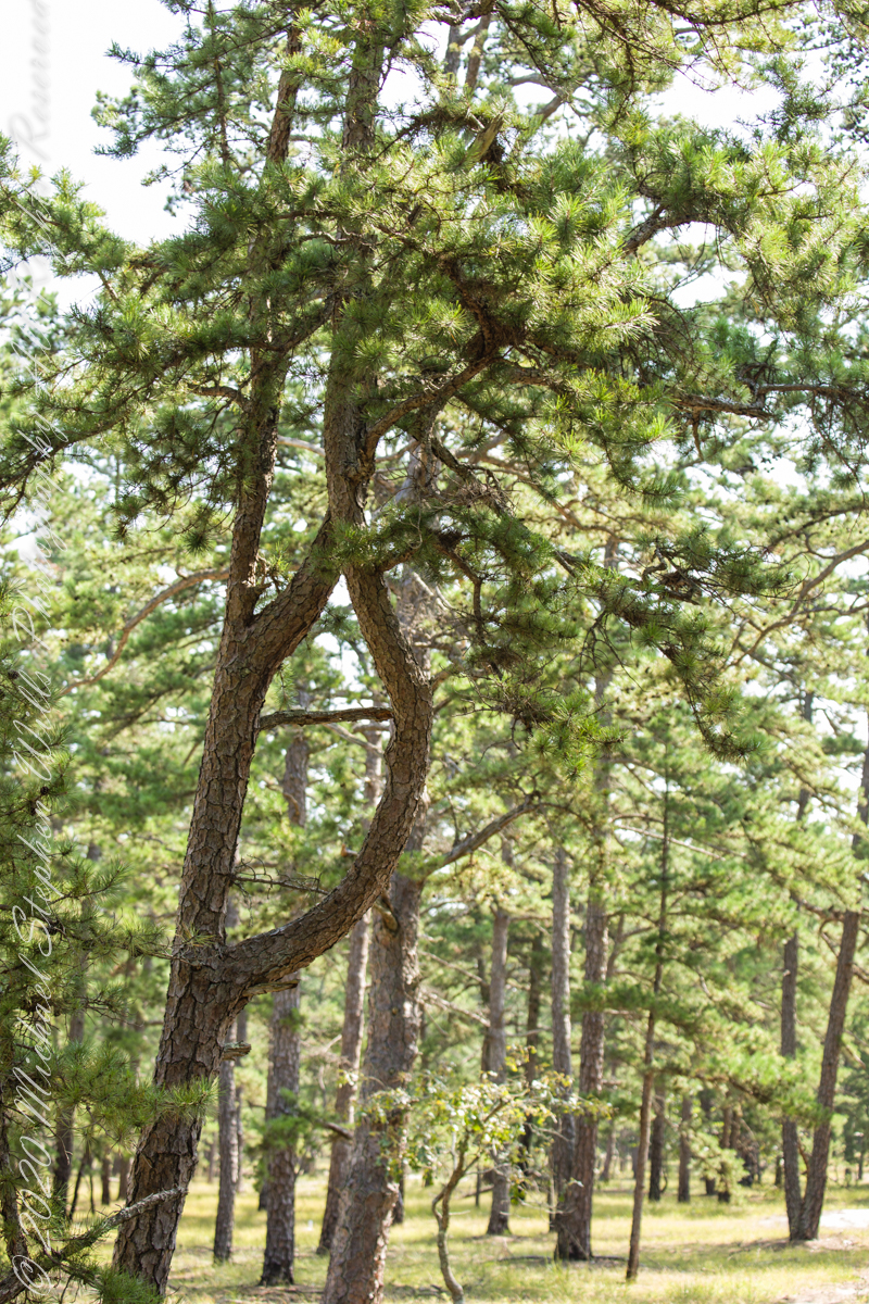
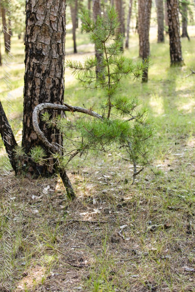
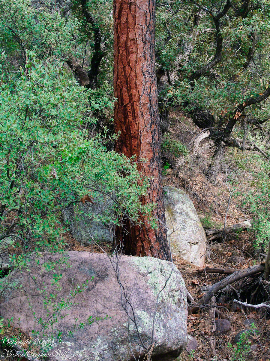
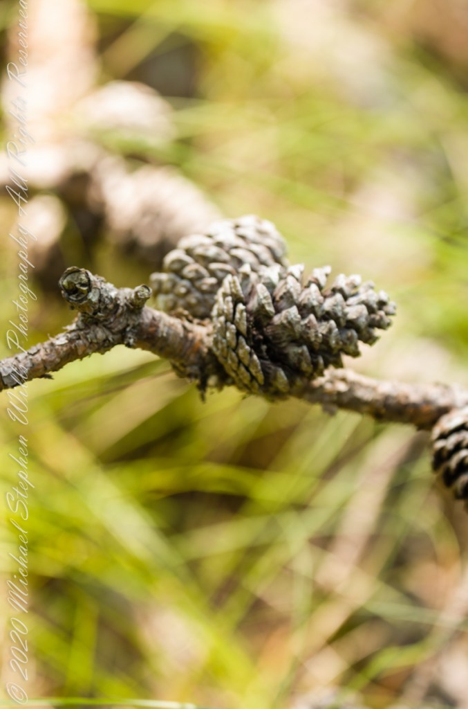
The pitch pine is irregular in shape, in these forests a mature tree typically lives through multiple cycles of fire and regrowth.
Burnt pitch pines often form stunted, twisted trees with multiple trunks as a result of resprouting. Bonsai artists exploit this characteristic for their creations.
Copyright 2021 Michael Stephen Wills All Rights Reserved
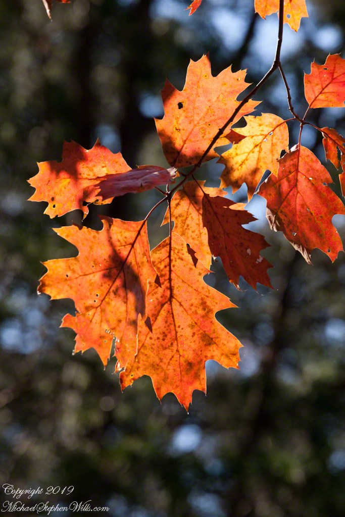
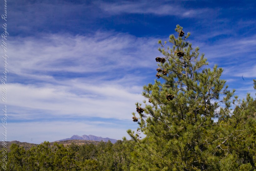
The 115,000 acres of Wharton State Forest are predomenantly Pitch Pine, scientific name Pinus Rigida, and AKA Black Pine and Hard Pine. Climb the fire tower of Apple Pie Hill, in all directions will be a sea of these trees interspersed here and there with occasional oaks. Cedars mark water courses. These photographs, unless otherwise identified, were taken deep in the forest, near where Quaker Bridge spans the Mullica River.
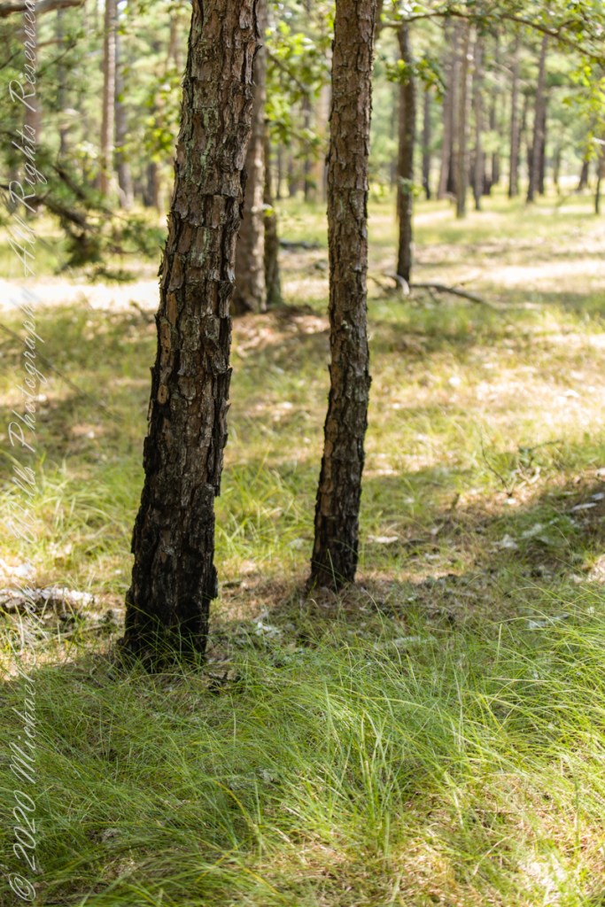
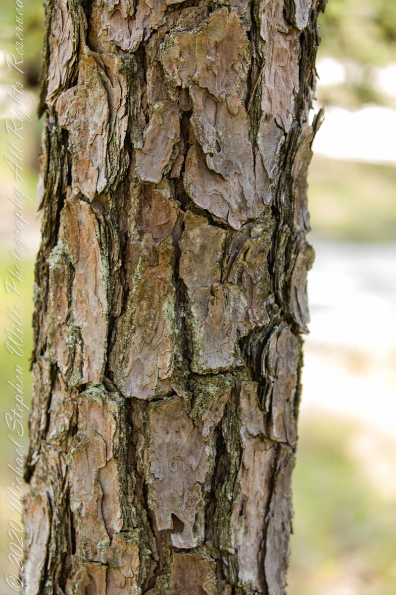
A mature Pitch Pine has bark of large, thick, irregular plates, adapted to survive forest first, similar to another member of the Pinus genera, the Ponderosa Pine.
Click pic for larger view in a new browser tab. If you are in WordPress Reader, open the post to use this feature.
Trunk of a mature pitch pine
Trunk of Ponderosa Pine, Superstition Wilderness
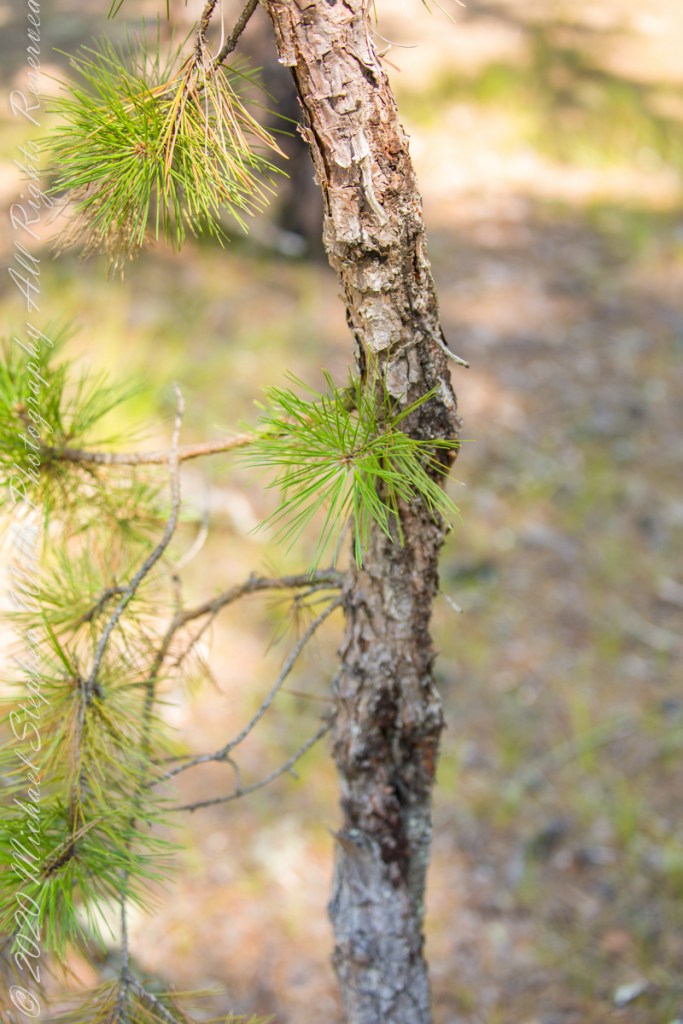
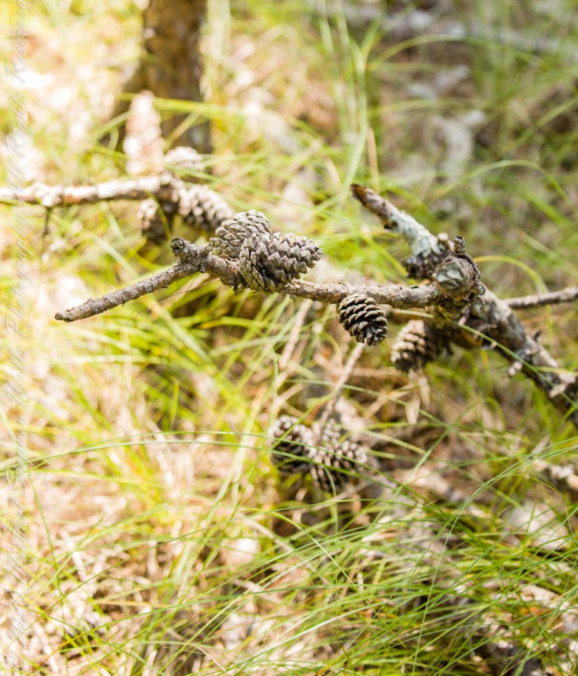
Open-growth trees begin bearing cones in as little as three years, with shade-inhabiting pines taking a few years longer. The cones are 4–7 cm (1+1⁄2–2+3⁄4 in) long and oval, with prickles on the scales. Cones take two years to mature. Seed dispersal occurs over the fall and winter.
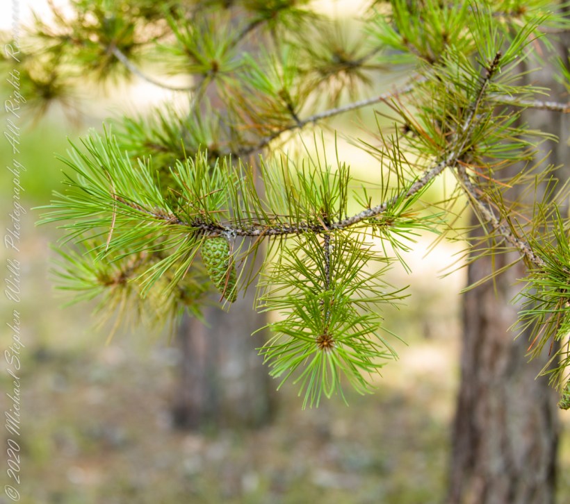
Unlike the another member of genus Pinus, the Pinyon Pine, the seeds released by Pitch Pine cones are not sought out for human consumption.
Large Pinyon Pine with mature cones on the slopes of Mound Mountain above Reavis Valley. Superstition Wilderness, Arizona. Four Peaks Wilderness is in the distance.
Copyright 2021 Michael Stephen Wills All Rights Reserved
An 84-degree October walk up Cascadilla Gorge—quiet paths, bluestone porches, fresh paint on the bridge—waiting for the footbridge to catch the last, warm evening sunlight.
Every fall I make a point of walking Cascadilla Gorge at least once. On an 84-degree October 9 afternoon, Pam was tied up with chores, so I parked downtown and stopped to see the grandchildren. They were with their mom. Two were “too tired” after school to do anything. The youngest, at the age of four, was not yet in school and he floated the idea of the skateboard park; for me, that wasn’t in the cards. So I set off on foot up Court Street, past the residence of Buddhist monks at the gorge entrance.
Cascadilla Gorge is part of Cornell Botanic Gardens (formerly the Plantations), the university unit that stewards natural areas and gardens across campus. Foot traffic was light. A sign explained why: the lower trail was closed at Stewart Avenue, where the bridge spans the ravine. I crossed to the north side by the Christian Science church and wound up Cascadilla Park Road to the rim trail that climbs East Hill toward campus.
Homes line this stretch, porches facing the gorge where the constant music of creek and falls carries up. Not feeling ambitious, I made a few phone snapshots. Here the path squeezes past a porch built of local “bluestone,” a feldspathic sandstone native to the region—around town it’s sometimes called “Llenroc,” Cornell in reverse.
That pot you see in the previous photo gets a closer look here, with more of the same weathered bluestone.
The drop to the gorge floor is steep, sheer in places. The barrier fence looks stout in some sections and thins to almost nothing in others. A few years ago, a recent Cornell graduate walking home late along this path fell to his death. I continued to the fork for the Ithaca City Cemetery, climbed to Stewart Avenue, turned right to cross the Cascadilla bridge, then right again onto the Gorge Rim Trail back toward town. At the bridge I noticed part of the closure work: fresh paint on the bridge and on the suicide-prevention netting beneath. On September 24—just fifteen days earlier—a Cornell senior had jumped; the net caught him, and the fire department brought him to safety.
From the concrete barrier in that photo you can peer into the gorge: a beautiful view, the steady voice of water rising from below. I try to leave the darker stories where they belong—at least until the sight of fresh paint pulls them back to mind.
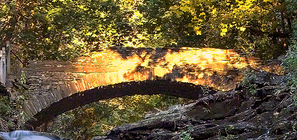
I took the following photograph in 2005, the September before my previous post, “Autumn Stroll in Sapsucker Woods” with the Kodak DSC pro slr-c, an ND filter, 50 mm lens and a tripod. It was a planned session, I work waterproof boots and was able to stand in the creek after a series of rain-free days. At this time of the year the gorge opens to the setting sun. I waited, taking a series of photographs for the perfect amount of light on the footbridge. The feature photograph (the header to this posting) is a detail from a shot with the bridge more fully lit.
The header image for this post comes from a planned session in September 2005, just before the photograph of my “Autumn Stroll in Sapsucker Woods” post. I used a Kodak DCS Pro SLR/c with an ND filter, a 50 mm lens, and a tripod. After several rain-free days I wore waterproof boots and stood mid-creek. In autumn the gorge opens to the setting sun; I waited and shot a sequence until the light laid perfectly across the footbridge. The banner image is a detail from a frame where the bridge is more fully lit.
We have a framed print of that photograph at home. I mounted it as a gift to Pam on our first Valentine’s Day.
“September Sunset in Cascadilla Gorge”
If you’ve walked Cascadilla Gorge in autumn, I’d love to hear your favorite vantage points—porches along the rim, the lower stone steps, or the footbridge at golden hour. Do you know any stories about Llenroc bluestone on these houses, or remember the Stewart Avenue Bridge before its safety upgrades? Photographers: what helps you balance deep shade and bright water from the designated trails? Share a tip or a memory in the comments.
Enter your email to receive notification of future postings. I will not sell or share your email address.
Copyright 2025 All Rights Reserved Michael Stephen Wills
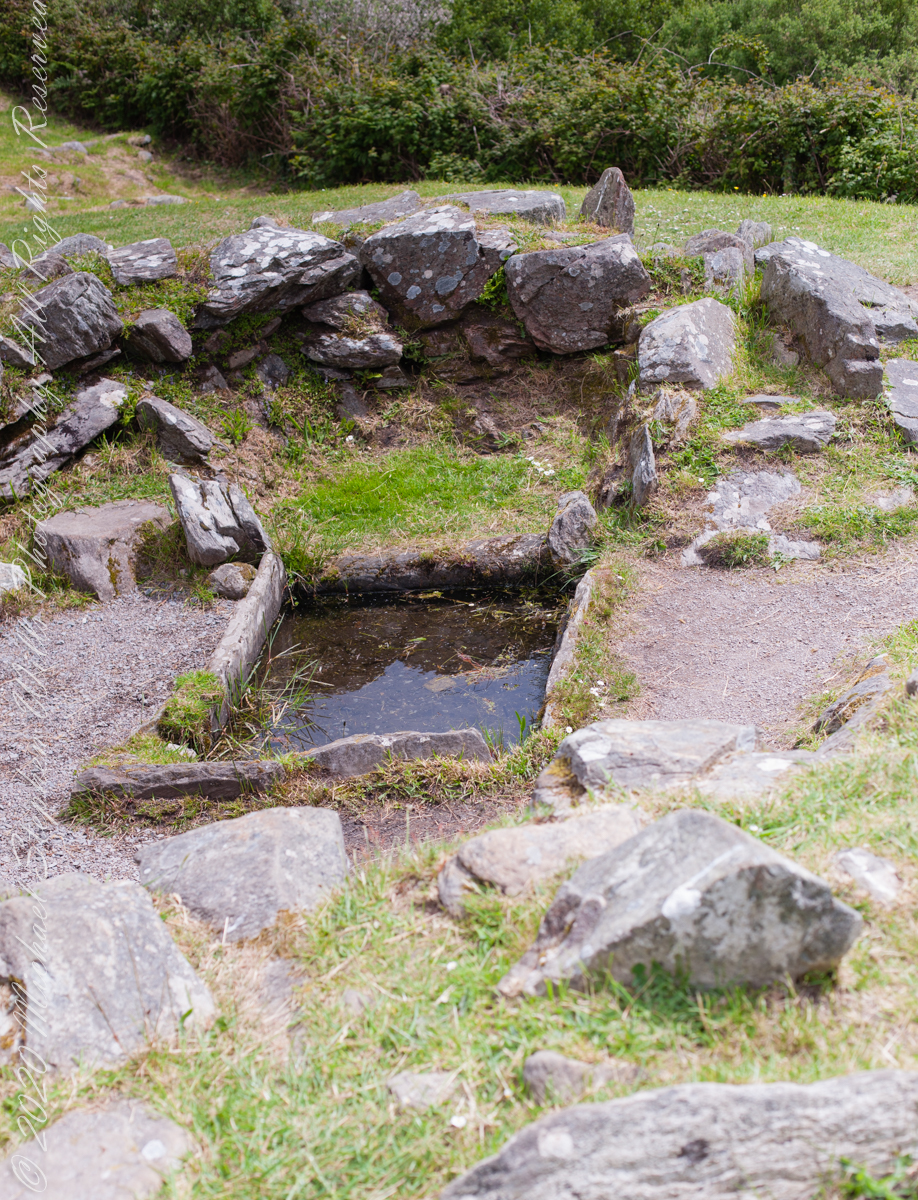
The previous post was an overview the Fulacht Fiadh associated with the Drombeg Stone Ring of County Cork, Republic of Ireland.
In this post, we explore the elements of these fascinating remnants from the late Bronze Age, over 3,000 years ago.
Click pic for a larger view, in a new tab. When using WordPress Reader, you need to open the post first.
rock- lined pit
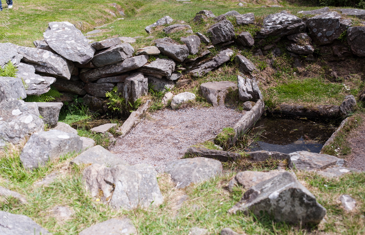
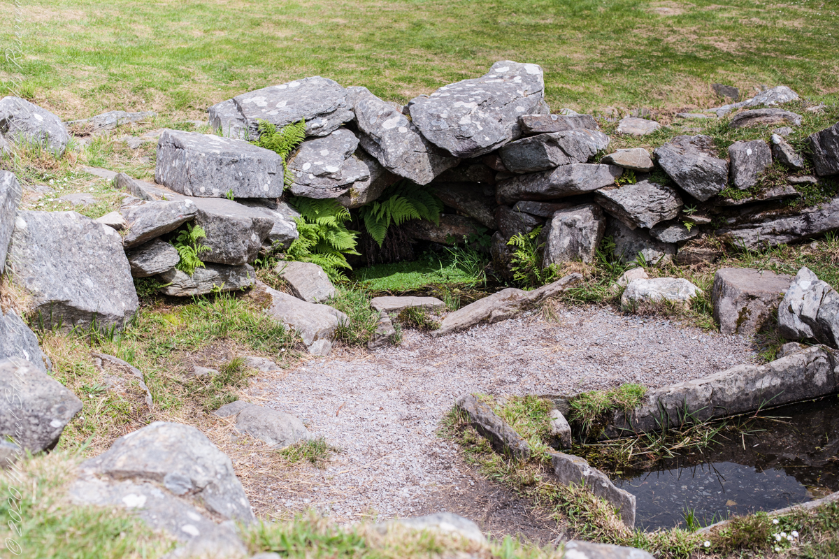
It is amazing the rock wall survived human need for the valuable wall stones. Portions were stolen, though for the most part we can see enough to understand.
rock- lined pit and hearthView of entrance to the south from above the spring, visible is the rock lines cooking pit filled with ground water.
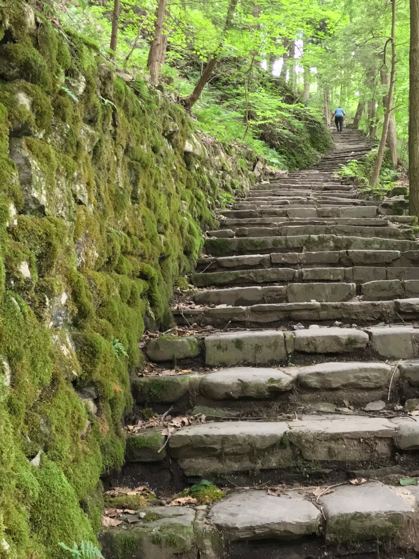
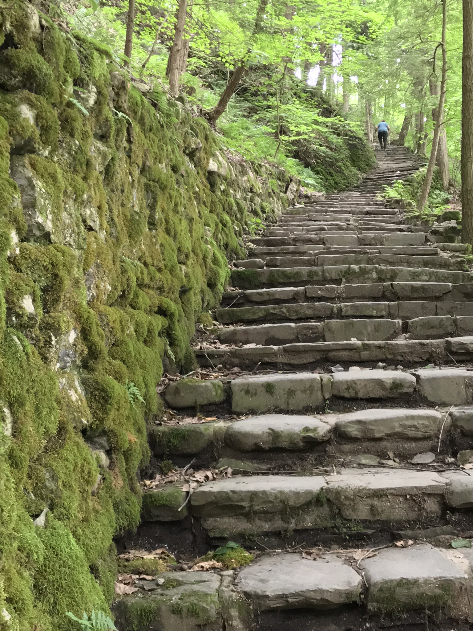
Capturing photographs and videos on the fly using an Iphone, we visited Fillmore Glen State Park, Moravia, New York with our granddaughter, Nia. This is the third post of this series. Click me for the first post in this series.
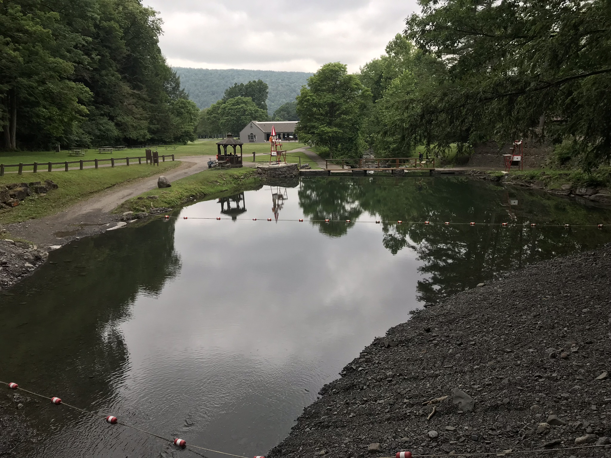
Emerging from the blind canyon of Cowsheds Waterfall, we are faced with this gorgeous pool fed by Dry Creek (yes, that is the name). Formed by a dam, the water is deep and very cold.
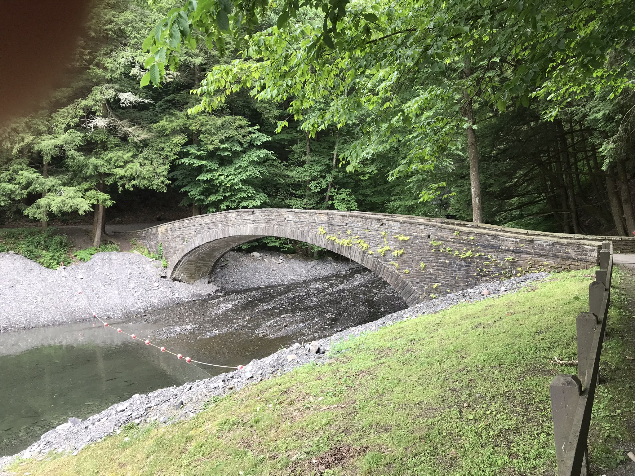
We were standing on this footbridge for the above photograph. The trail to Cowsheds is on the far side of Dry Creek and to the right.
We have yet to count these steps, don’t know why. The limestone blocks were quarried locally from the same stone of the creek bed. The gorge trail begins at the top.
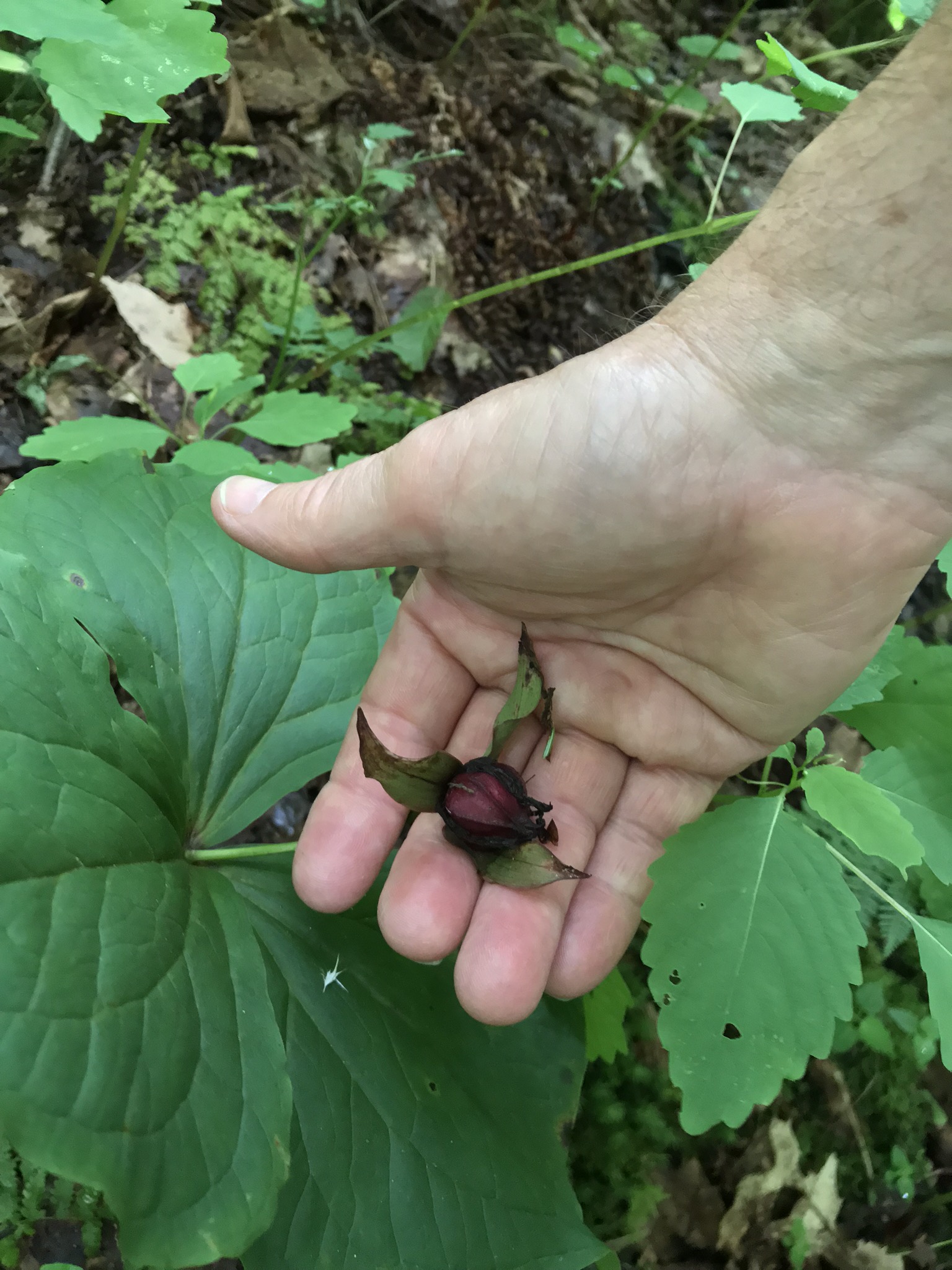
Trillium Seed Capsule
This is a Purple Trillium, I believe, formal name Trillium erectum. It is a large specimen judging form the width of the bracts, leaf like structures at the based of the flower stalk. When fertilized, the ovaries form this seed capsule containing up to 16 seeds, each with lipid with a high content of oleic acid. During summer, the capsule opens, seeds disperse. Ants encounter the seed elaiosome, the oleic acid content triggers “corpse carrying behavior.” The ants carry the seeds into their nests, consume the lipids leaving the seeds. After a year dormancy the seeds sprout and the additional depth in the ant nest provides a good start.
Trillium are a favorite food of deer, unfortunately. Some seeds are spread this way, passing through the digestive tract and out in fecal waste. I use the color of the seed capsule to identify it was Purple Trillium. In my experience the white variety (Trillium grandiflorum, and others) has a light colored seed capsule.
Copyright 2021 Michael Stephen Wills All Rights Reserved
Our “Night Blooming Cereus” is blooming earlier in 2021, blooms opened twice during nights of early August. I put the name in quotes because during the course of writing the first seven posts ( I through VII ) I learned this is NOT a member of the genus Cereus, it is actually an epiphyte of the Epiphyllum genus.
For those familiar with the early history of New York City and Hudson Valley it is easy to see why a common name of the plant is “Dutchman’s Pipe Cactus.”