Loughan an Lochan Ruins Setting the Stage

Romance of Ruins

For me, the romance of a place is settled in exact knowledge as much as a feeling. Starting with a recollection of the ruined cottages making such an impression we found a parking place and hiked into them loaded with photography equipment, three years later returning to use the photographs, bringing back a rush of memories and feelings, it is a matter of using the set of photographs from that day to build the location.

This much I knew, going in: we were touring Antrim Glens entering at Cushendall, after visiting Glenariff Forest Park, proceeding up the coast through Cushendun to Torr Head. A fortuitous encounter with a village of abandoned farm cottages (“ruins”) happened somewhere in between.

Click any image for larger view in a new browser tab. If you are in WordPress Reader, open the post to use this feature.

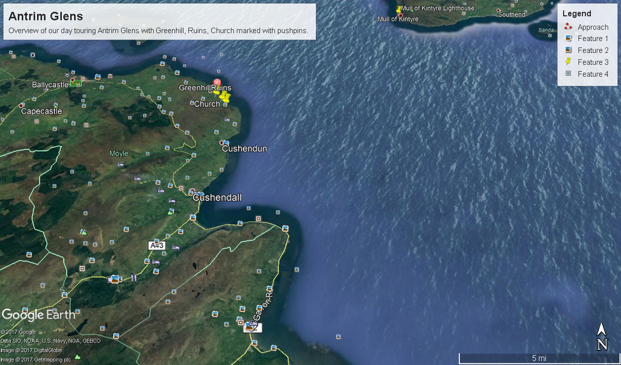
There was a photograph of a notable church prior to the ruins and a fine view, from a place named Greenhill, afterwards.

Here is a picture of the terrain with the three pushpins:

  • A fine church just off Torr Road, to the west. I found the location in Google Maps, marked as “church”. Google earth showed buildings at the location, this set the “church” pushpin. Associated with the church, using the date/time stamp, were images of signage naming Coolranny townland.
  • A sign identifying a location as “Greenhill” was after. Neither Google Maps or Earth lists this as a place. It took hours searching web sites of Irish townlands before I found the reference. Greenhill is not a townland; it was listed as a place on one of the maps. Just above the notation was Torr Road, two unique bends in the road. I used these bends to identify the turnoff where I photographed the “Greenhill” sign.

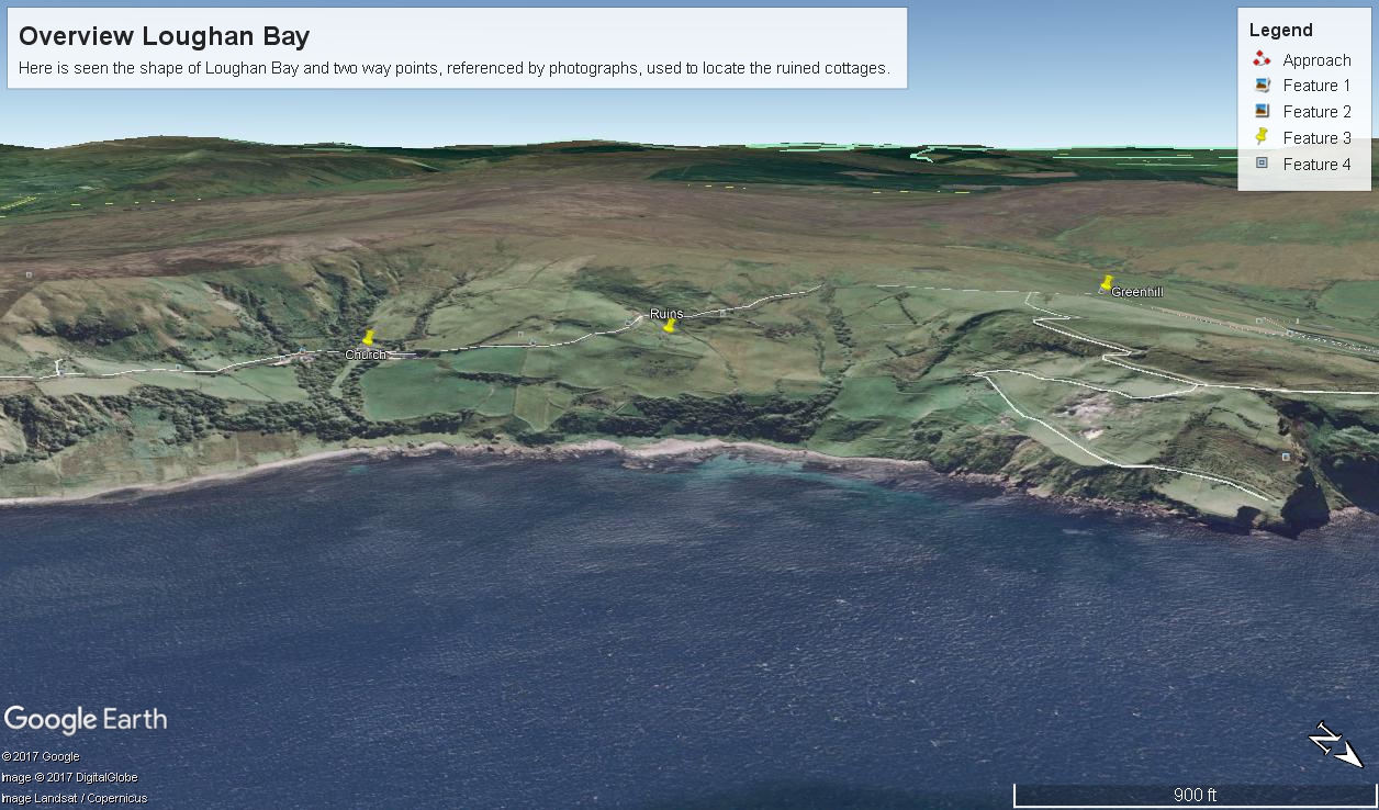
For reasons to be explained later, it is important to know the name of the ruin townland. The place name sign presented in post 1 was a clue (“Loughan an Lochan” — or Loughan Bay), as well at the web site (see link below) listing Irish townlands. The web site map names “Loughan Bay.”

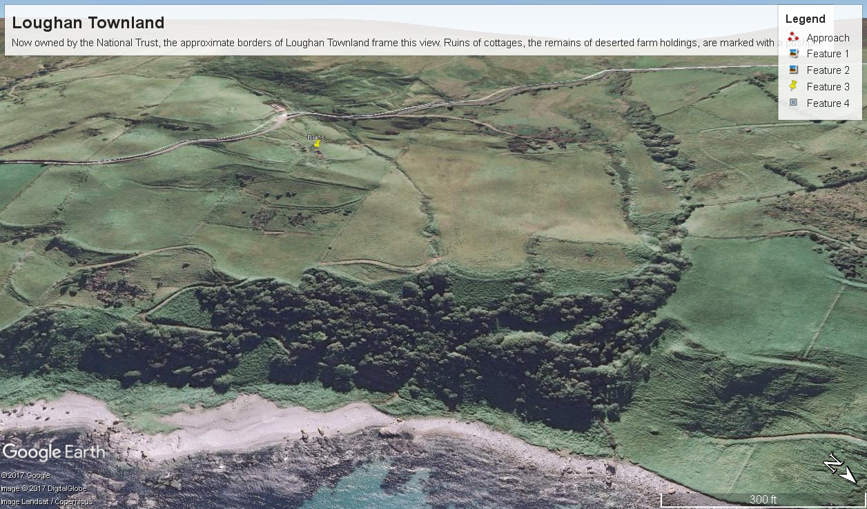
Click for a site providing the exact boundaries of Loughan townland

With this information I was able to peruse Google Earth, found the turnoff and the ruins!

See the above Google Map image sized to approximate the Loughan townland boundaries.

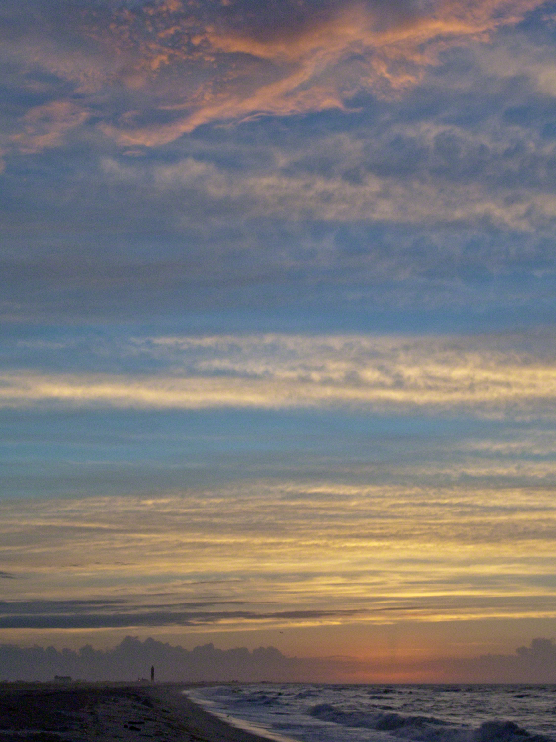
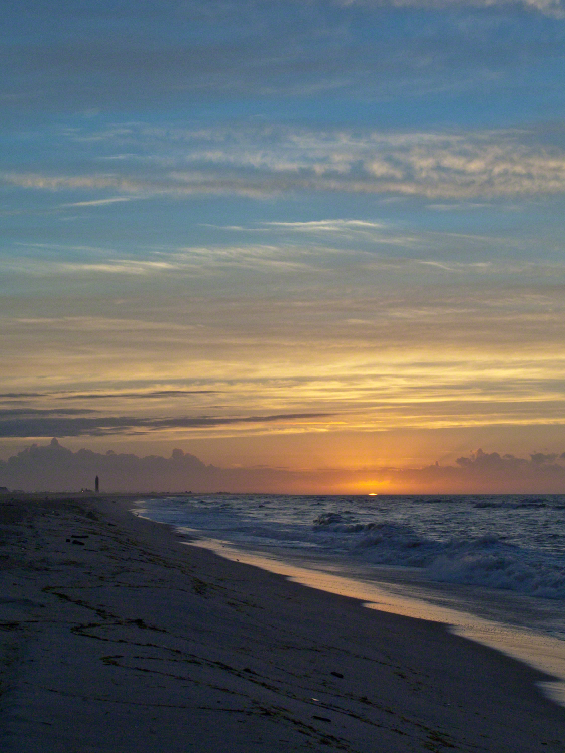
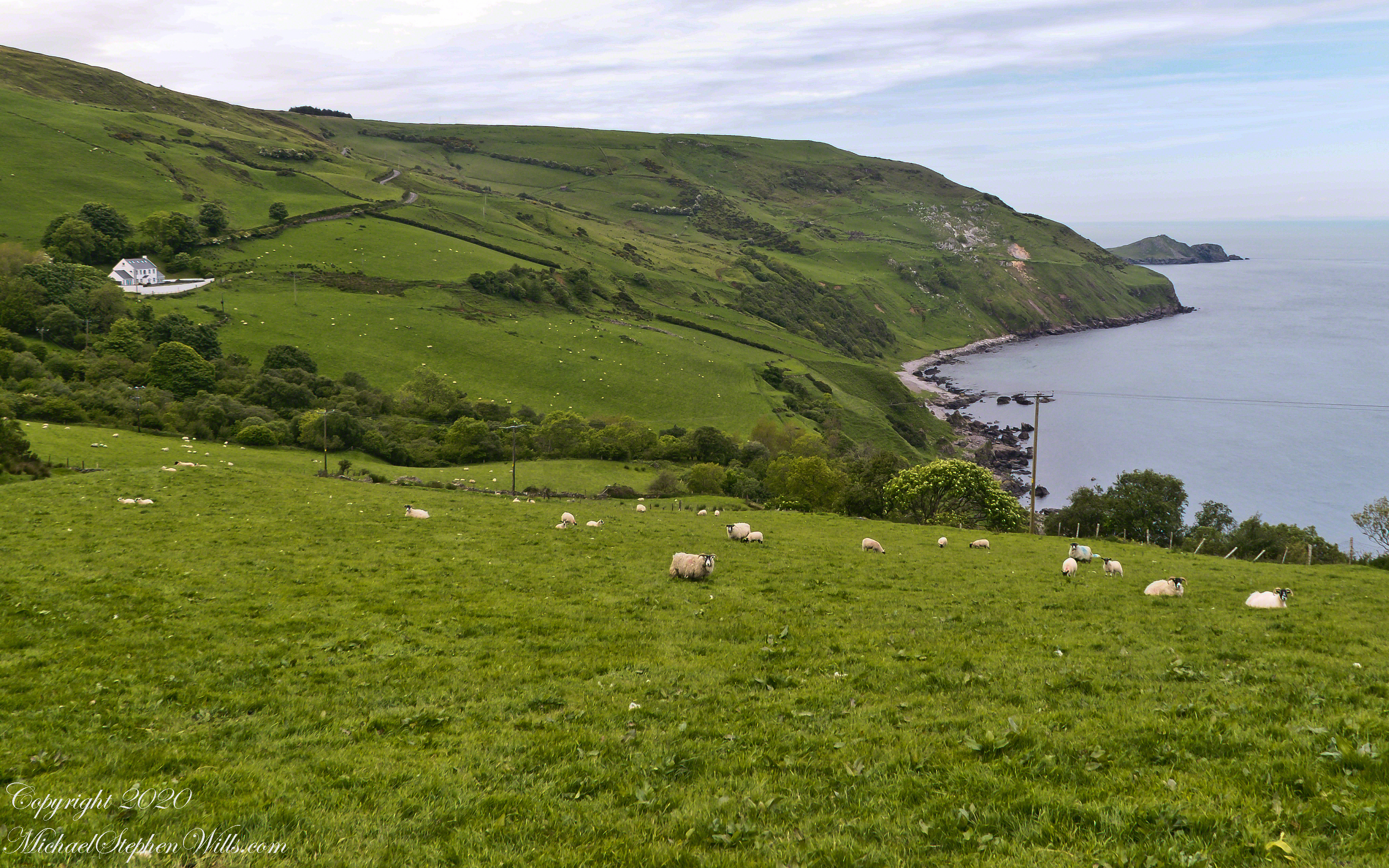
The scenery was jaw dropping lovely the entire time, so I captured view and view. Here are two landscapes time stamped just prior to the church, views including Coolranny and Loughan townlands with Torr Head in the distance.
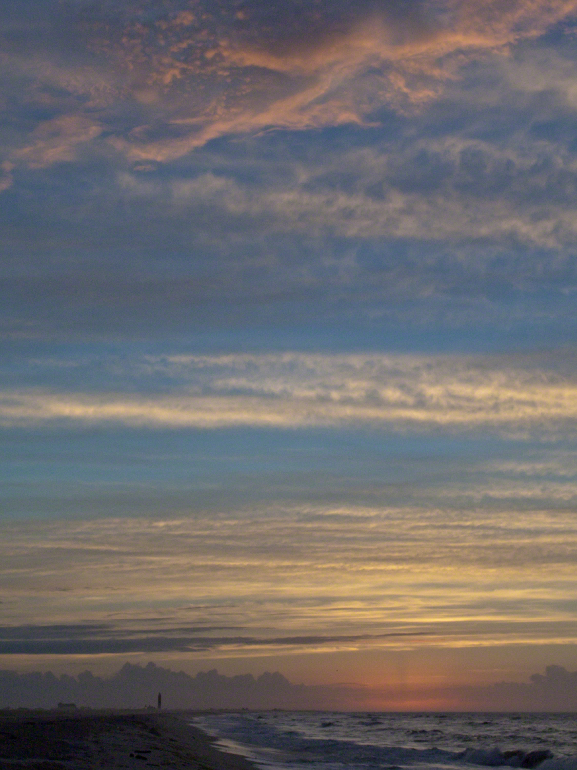
That is Torr Road….

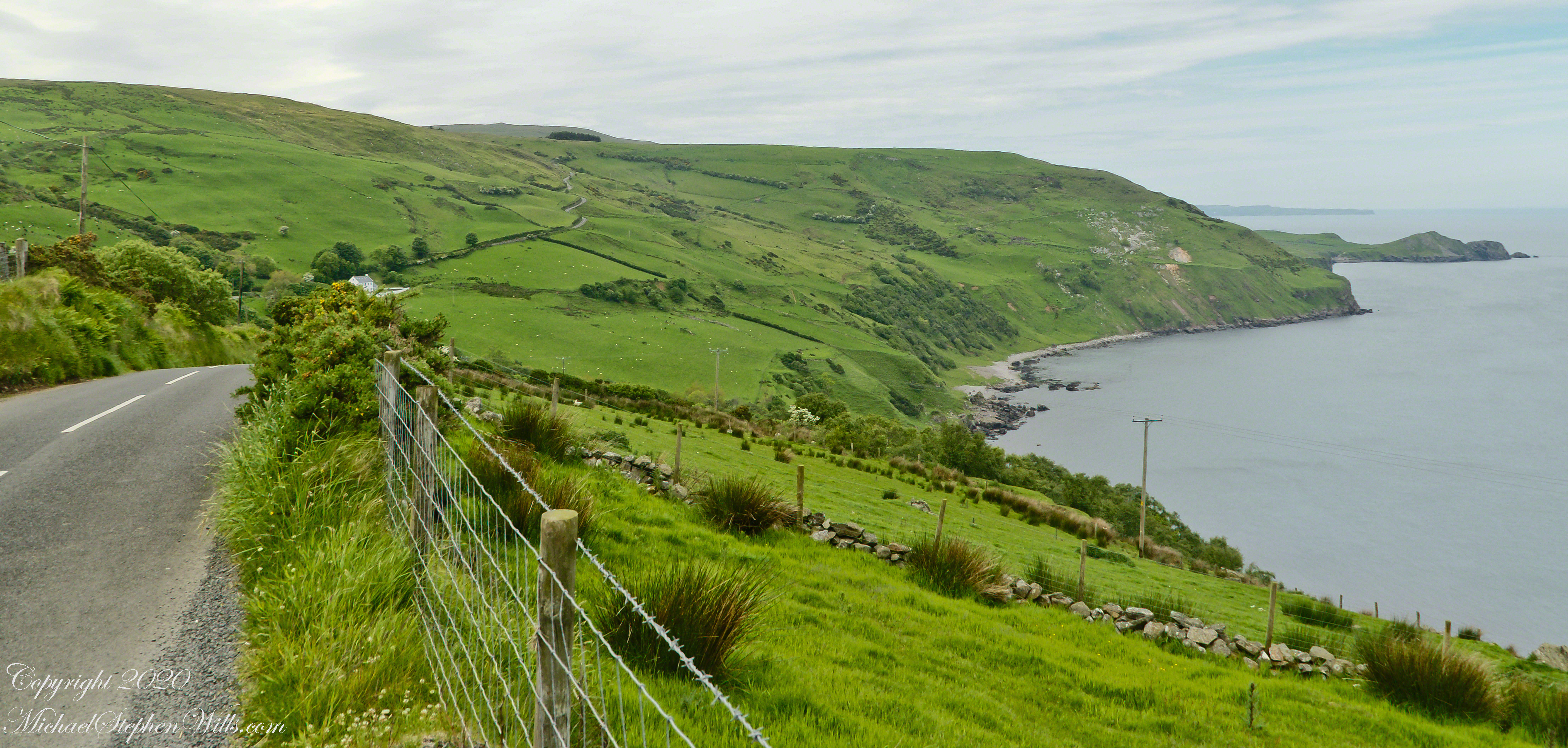
……a bit further along. It is possible to locate the ruin site from the Google Earth picture. There is a signature grove of bushes on the slope below the ruin site, sandy beach along shore. In the landscapes, Loughan Bay is cradled in a curve of coast.

Want more photography? Click the link for my Online Gallery
Click for the first postings of this series.

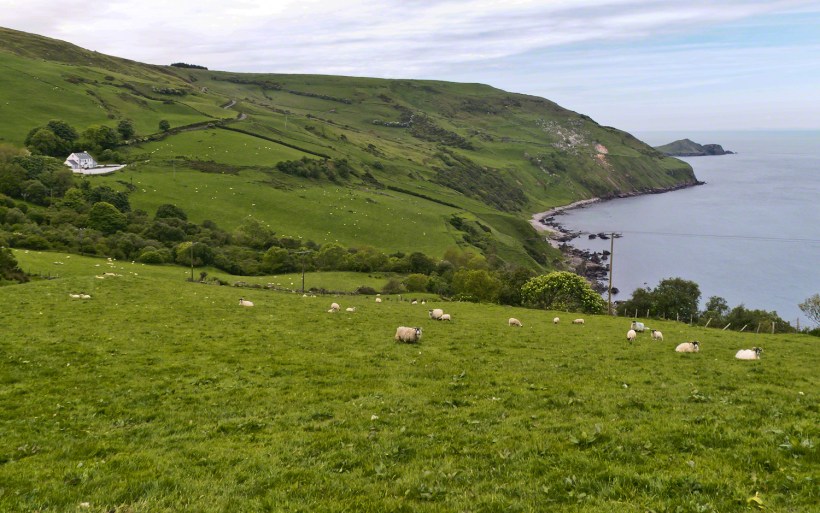
Imagine the effect of this environment on the inhabitants, the love of it grows with time.

Want more? Click the link for my Ireland Gallery

Enter your email to receive notification of future postings. I will not sell or share your email address.

Autumn Mushroom

Moments from a September backpack

A budding mushroom

Autumn Mushroom

among autumn leaf litter

along mountain shores

Peaked Mountain

Peaked Mountain and Pond, Siamese Ponds Wilderness, The Adirondacks

Click this link for my Online Gallery, “Memories, Dreams, Reflections”

Copyright 2021All Rights Reserved Michael Stephen Wills

Cascadilla Gorge Walks: Scenic Views and History

An 84-degree October walk up Cascadilla Gorge—quiet paths, bluestone porches, fresh paint on the bridge—waiting for the footbridge to catch the last, warm evening sunlight.

Every fall I make a point of walking Cascadilla Gorge at least once. On an 84-degree October 9 afternoon, Pam was tied up with chores, so I parked downtown and stopped to see the grandchildren. They were with their mom. Two were “too tired” after school to do anything. The youngest, at the age of four, was not yet in school and he floated the idea of the skateboard park; for me, that wasn’t in the cards. So I set off on foot up Court Street, past the residence of Buddhist monks at the gorge entrance.

Cascadilla Gorge is part of Cornell Botanic Gardens (formerly the Plantations), the university unit that stewards natural areas and gardens across campus. Foot traffic was light. A sign explained why: the lower trail was closed at Stewart Avenue, where the bridge spans the ravine. I crossed to the north side by the Christian Science church and wound up Cascadilla Park Road to the rim trail that climbs East Hill toward campus.

Homes line this stretch, porches facing the gorge where the constant music of creek and falls carries up. Not feeling ambitious, I made a few phone snapshots. Here the path squeezes past a porch built of local “bluestone,” a feldspathic sandstone native to the region—around town it’s sometimes called “Llenroc,” Cornell in reverse.

That pot you see in the previous photo gets a closer look here, with more of the same weathered bluestone.

The drop to the gorge floor is steep, sheer in places. The barrier fence looks stout in some sections and thins to almost nothing in others. A few years ago, a recent Cornell graduate walking home late along this path fell to his death. I continued to the fork for the Ithaca City Cemetery, climbed to Stewart Avenue, turned right to cross the Cascadilla bridge, then right again onto the Gorge Rim Trail back toward town. At the bridge I noticed part of the closure work: fresh paint on the bridge and on the suicide-prevention netting beneath. On September 24—just fifteen days earlier—a Cornell senior had jumped; the net caught him, and the fire department brought him to safety.

From the concrete barrier in that photo you can peer into the gorge: a beautiful view, the steady voice of water rising from below. I try to leave the darker stories where they belong—at least until the sight of fresh paint pulls them back to mind.

I took the following photograph in 2005, the September before my previous post, “Autumn Stroll in Sapsucker Woods” with the Kodak DSC pro slr-c, an ND filter, 50 mm lens and a tripod. It was a planned session, I work waterproof boots and was able to stand in the creek after a series of rain-free days. At this time of the year the gorge opens to the setting sun. I waited, taking a series of photographs for the perfect amount of light on the footbridge. The feature photograph (the header to this posting) is a detail from a shot with the bridge more fully lit.

The header image for this post comes from a planned session in September 2005, just before the photograph of my “Autumn Stroll in Sapsucker Woods” post. I used a Kodak DCS Pro SLR/c with an ND filter, a 50 mm lens, and a tripod. After several rain-free days I wore waterproof boots and stood mid-creek. In autumn the gorge opens to the setting sun; I waited and shot a sequence until the light laid perfectly across the footbridge. The banner image is a detail from a frame where the bridge is more fully lit.

We have a framed print of that photograph at home. I mounted it as a gift to Pam on our first Valentine’s Day.

“September Sunset in Cascadilla Gorge”

If you’ve walked Cascadilla Gorge in autumn, I’d love to hear your favorite vantage points—porches along the rim, the lower stone steps, or the footbridge at golden hour. Do you know any stories about Llenroc bluestone on these houses, or remember the Stewart Avenue Bridge before its safety upgrades? Photographers: what helps you balance deep shade and bright water from the designated trails? Share a tip or a memory in the comments.

Enter your email to receive notification of future postings. I will not sell or share your email address.

Antique Silo Apple Harvest

A Bumper Apple Crop

More from the day Pam and I walked up the hill from our Malloryville Mill House.

The setting sun works its magic on a century plus maple tree on an esker bank.  The glaciers deposited this esker, under the tree, when waters from the melting flowed under the ice to carve a tunnel later filled with glacier debris.

Click any photograph to visit my Online Gallery “Finger Lakes Memories.”

The light brings out the beauty of two this pair of silos from the early 20th century abutting an abandoned barn and active cornfields.

Pam is using my first camera, a Sony Mavica.  It writes to a 4.5″ disk that limits the number of exposures and I carried a number of the disks.  It has a decent variable lens.  We still have that camera.  These photos are from my Sony dslr Apha700 with a variable lens.

At that time, our three apple trees gave a bountiful harvest.  We spent two days making and canning apple sauce.  For some batches we’d grind in blackberries or concord grapes.  We enjoyed the work over the next year.  Our grandchildren loved that stuff.

These apples hung from a tree of the farm house next to the abandoned barn.  A young family lived there, their toddler daughter recognized us from other walks and came over for a “hello”.

Other postings this Harvest View evening.  Click the link to go there.
“Celestial Geese”
“Harvest Views”
Copyright 2018 Michael Stephen Wills All Rights Reserved

Through A Glass Darkly

Visual Spirit

The title is a fragment from the thirteenth chapter of the First Epistle to the Corinthians.

During brief moments of the upstate New York autumn season perfect images are mirrored in quiet pond waters.

It this case the effects lasted a few seconds.

The site of this photograph, McLean Bogs, is part of Cornell Plantations. McLean Bogs is known for its biodiversity and is reserved for research.

This work is a composite of four images, the mirror image of each of two photographs. I print it on a stretched canvas 5 feet wide by 4 feet high.

Click the photograph to visit my online gallery “Memories Dreams Reflections”
Copyright 2021 Michael Stephen Wills All Rights Reserved

Libe Slope Autumn

A Magnificent Display

Libe Slope

Libe Slope is between the West Campus and Quadrangle / Libraries.

Click to view my Finger Lakes Memory gallery
Cornell University is on a west-facing hill above Cayuga lake.

Besides the exercise of walking the 18 degree incline several times each day, Cornell students and alumni remember The Slope for autumn color.


Wonderful Flow of Limbs among Gold

Click to view my Finger Lakes Memory gallery

Hickory

Seen from the north on a cloudy October day, this Pignut Hickory (Carya glabra) is the largest tree on the Cornell Campus, at 79 inches in diameter.

Click to view my Finger Lakes Memory gallery
Cornell University is on a west-facing hill above Cayuga lake.

Take another look at the previous image. Can you find the grey squirrel? This hickory grows south of the Johnson Museum and among the autumn glories, it is the largest and brightest yellow canopy on Libe Slope.

Contrast

An overcast day is the best to capture this spectacle. October 20, 2012 provided both bright sun and dark, rolling autumn clouds. I waited on the north side, sheltered from the glare of the sky, for these perfect moments.

Click to view my Finger Lakes Memory gallery
I remember this hickory for the contrast between the canopy and trunk, the way the clumps of yellow hang from dark boughs.

The pignut hickory is native to these Eastern United States. It is known to favor moist slopes and this specimen has thrived on The Slope. The ground beneath it is thick with nuts.

Click to view my Finger Lakes Memory gallery

One week later

Just one week later, late afternoon on a sunny Friday as hurricane Sandy approached the east coast the hickory has fewer, tawny golden leaves.

Copyright 2021 Michael Stephen Wills All Rights Reserved

A Perfect Afternoon On Beebee Lake

Anticipating Our Tenth Wedding Anniversary

After work on a 2008 Friday afternoon in October we sped over to Beebee Lake on the Cornell University Campus to catch the late afternoon glow.

Beebe Lake is formed by a dam on Fall Creek.  It seems to be the flooded meadow it is, surrounded by hills formed by glaciers 10,000 years ago.  Cornell maintains footpaths around the lake.

People say that if a couple walk the a mile around the lake and over a bridge at either end, they are destined to be married.  This day we passed only joggers and families.  Pam and I will celebrated our tenth anniversary March 2019, so the legend worked for us.

Here are four snapshots from that time, presented in chronological order. Each is a handheld shot taken on the fly using my Sony Alpha 700 I use for exploratory photography.

Click any photograph to view my Finger Lakes Memory gallery
A terraced stair descends to the east side meadow to south lake shore path

I walked down a path trod by Canadian geese to reach a clear view of the water.

View of Helen Newman Hall

Lily pads and iris fronds grow along the bank. 

Evening sunlight reflected from smooth water crests driven by a steady light wind

Being on the west side of the lake, the dam is bathed in golden autumn light.  

The Dam That Forms Beebee Lake

On top the hill, not visible behind the trees, above the opposite bank is Fuertes Observatory.  We visited it this night, opened to the public as it is on all clear Friday nights while classes are running.

Copyright 2021 Michael Stephen Wills All Rights Reserved

Cochise Dawn

ancestral Apache land

From 2004 through 2011 I visited Arizona every Autumn, October or November. As a University of Arizona Alumni Board member for the College of Agriculture and Life Sciences we had a meeting during “homecoming” and a fund raising event. I’d come early or stay later for getting acquainted with Arizona, more than was possible as an undergraduate. In 2007 I camped for several days Chiricahua National Monument of the remote south eastern corner of the state.

The park empties out this time of year, for some reason. The weather is perfection with clear skies, moderate daytime temperatures, cool nights. This time of year the Arizona White Oak acorns ripen and fall. The campground has aluminum picnic tables, the falling acorns made a loud plunks throughout the night. This would annoy some people. Me, it is a great memory.

The following two images are great memories from my first morning.

Click any photograph for my Online gallery.
Rhyolite Moon
These formations hovered over the trail on my first morning. The rising full moon was an unplanned bonus.

I experimented this trip with a breakfast of granola with dried whole milk. It was delicious (for me) and got me out on the trail quickly. This first morning I clicked my hiking poles together to scare away bears as I walked in the pre-dawn dark. The preparation and extra effort paid off with this photograph.

Click any photograph for my Online gallery.

I met one hiker who was a harbor pilot from Hamburg, Germany. He came just to view a particular rock formation that was, literally, the rubber bath duck. It is several miles to the site, a moderate hike with significant elevation gain. He took his snapshot with a little camera and was on his way.

The following is my masterpiece from the trip. Imaging the effect of seeing this image on settlers. That same first day I turned a corner and there this was…it took a few minutes to comprehend what I saw, it was so incredible and, for me, unexpected. It first, the only perception is a huge rock dome of rough rock, then, slowly, the image of a native American profile forms in the mind.
Cochise Dawn

Click any photograph for my Online gallery.
Cochise Dawn
Cochise Dawn

Click link for the complete story behind how I captured this image, from my Online Gallery.

Michael Wills Inspiration Point

During the session for Cochise Dawn I turned the camera for the view northwest and did a self portrait. In the distance are the Galiuro Mountains and Wilderness. Tucked alongside is the Aravaipa Canyon Wilderness, hosting one of the few perennial streams of Arizona.

Copyright 2017 Michael Stephen Wills All Rights Reserved

Sun and Shade, Canyon Del Muerto

watch out for quicksand

In my post Canyon of Music, Wind, Light I shared a different photograph of this beetle crawling on sandstone, naming it as a “dung beetle”. I had assumed it was one from once having seen a beetle in an Arizona desert pushing a ball of dung around. This morning, to confirm my assumption, I searched for images of “Arizona Dung Beetle” and was dismayed to find this beetle shares no characteristics with the photographs. Absent smoking gun evidence, sadly lacking in this photograph, I have to admit my “dung beetle” attribution is in error.

Supporting the beetle, the luminous surface of the red sandstone named “de Chelly,” sunlight reflects from durable remnants of the ancestral Rocky Mountains wore to these bits of rock, piled to mountainous dunes by the winds of tens of thousands years, polished to smoothness each against the others.

Natural Markings
Mysterious abrasion and grooves in a de Chelly sandstone cliff, Canyon de Chelly.

The above photograph is a detail from the brightly lit cliff of the following photograph. The desert varnish and underlying rock was weathered over thousands of years, the sand grains falling to the canyon floor.

Click to view my Arizona fine art gallery
Breadth, Light, Shadow
Canyon Del Muerto vista from a ledge.

The soil of the canyon is composed of these bits of the ancestral Rocky Mountains. What appears to be a white road in the above photograph is not man-made, it is the dried bed of a stream. When a waterway is dry like this, only flowing with rains, it is called a wash. When water fills the wash of the Canyon Del Muerto, the polished sand granules become a dangerous morass, sucking down horses, people, anything unlucky enough to step into it. Every movement, struggling for freedom, pulls the victim deeper down until the wet sand closes over the head and suffocation and death ensues.

Sandstone Stairs
Stairs cut into the sandstone cliff of Canyon de Chelly

The waters Canyon De Chelly National Monument naturally form a vast Y into the Defiance Plateau, naturally because two major streams merge into one canyon a few miles above Chinle. On both our guided trips, heading east from Chinle there is a branch. On the right De Chelly canyon continues. On the left is Canyon Del Muerto. The photos in this post are all from “The Canyon of the Dead”, what the name means translated into English.

Click to view my Arizona fine art gallery

No, it is not named this because of the quicksand. Conditions for quicksand are present throughout canyons of the southwest. It is history of human occupation for which this canyon was named. I will cover it in a future posting. For now, I will say the above views are from the spot featured in “Family Trek.”

My first visit, in 2003, while my son Sean climbed the rocks with our guide, I was left to document the wondrous surroundings. The above shallow cave is reached by that stairway carved into the precipitous ledge. The access to the cave is via those naturally occurring ridges of the cross bedded sandstone. It is another example of De Chelly sandstone formed from the windblown edge of a monstrous ancient sand dune.

Monumental Cliff
A solid block of De Chelly sandstone formed from the central bulk of a sand dune.

Here is another example of rock formed from the solid body of the sand dune, that unbroken and un-striated cliff. Below is the cross-bedded, windblown sand.

Cliff with Foliage
Autumn lights up the floor of Canyon De Chelly, the foliage rivals the cliffs for wonder at this time.

As we proceeded generally east from the climbing spot of “Family Trek”, driving by the golden cottonwood foliage I asked the guide to stop for these photographs.

Canyon de Chelly
Canyon walls

Soon the cliffs hid the sun.

Canyon de Chelly

Notice the modern water distribution system (pipe) at the foot of cliff on right. These vast tracks of shadow adjacent to bright sunlight are a fact of life for canyon dwellers, a source of joy and wonder.

Canyon de Chelly

The canyon here is rather like the Narrows of Zion, without the water.

Canyon de Chelly

Enjoy!!

Click for the another Arizona post, “Juniper Sunrise.”

Click for the first posting of this series, “Portrait of a Navajo Guide.”
 
Copyright 2021 Michael Stephen Wills Photography

Katrina Sunrise, August 28, 2005

The effects of the category 5 hurricane Katrina

Hurricane Katrina approached the Gulf Coast and New Orleans as the sun rose on the West End of Jones Beach on Long Island, August 28, 2005. This amazing sunrise was an element of the unusual atmospheric effects that are evidence of the power of this storm.

The featured image (heading this blog) is my print, “Katrina Sunrise”.  This work is enjoyed by hundreds of my clients.  Use the link, below, to acquire your own.  Custom framing is available.

Click this link for Katrina Sunrise from my Memory Dreams Reflections Online gallery


The following images are the rough drafts taken in the early morning hours. The beach was literally deserted as I mounted the camera and framed the view for this series. Many image captions include the file time stamp, for example 6:07:13 is 6 am and 7 minutes 13 seconds.

West End Sunrise 6:07:13
6:07:13 First image of the set. Below the horizon the sun lights the upper atmosphere.
West End Sunrise 6:07:34
6:07:34 As the sun approaches the horizon the lower clouds catch light. My Camera was a Sony DSC-F828 tripod mounted with a polarizing filter.
West End Sunrise 6:07:56
6:07:56 I panned slightly to the east. ISO was set to 64 throughout.
West End Sunrise 6:08:16
6:08:16 Gradual brightening. The lens is 7.1 – 51.0 mm f/2.0-2.8.
West End Sunrise 6:08:38
6:08:38 All levels are brighter. It seems those low clouds will block the horizon. That was not the case. The variable focal length is 15.6 mm.
West End Sunrise 6:09:05
6:09:05 It is happening!!!! Exposure was set to automatic on a f stop of 8.0. It was 1/3 second for this image.
West End Sunrise 6:14:34
6:14:34 The view is panned west. That is the Robert Moses water tower of Jones Beach State Park looking like a rocket ready to blast off.
West End Sunrise 6:15:15
6:15:15 Will those low clouds block the sun? Looks promising.
West End Sunrise 6:16:11
6:16:11 Clouds on the upper margin catching the sun. Horizon brightening….. Exposure 1/20 second.
West End Sunrise 6:14:39
6:14:39 This will be a disappointment if that sun does not show. Exposure 1/25 second.
West End Sunrise 6:18:27
6:18:27 Almost there….1/15 second exposure….
West End Sunrise 6:19:07
6:19:07 Quick framing adjustment to bring the lighting of shore margin into the composition. The final version was created from two images captured seconds after this.
Hurricane Rainbow Panorama
As the sun rose a rainbow formed in the western sky.

Click this link for my blog “Sunrise Photo Album March 2 2017.”

Copyright 2023 Michael Stephen Wills All Rights Reserved