In my Homecoming Parade 2003, I described my initial reconnection with the University of Arizona (U of A) as a 1975 graduate and alumnus. This personal project of involvement with U of A and Arizona continued through 2011 with annual autumn trips to coincide with Homecoming. The travel was as a CALS (College of Agriculture and Life Sciences) Alumni Board of Directors member, a primary responsibility was raising funds for scholarships.
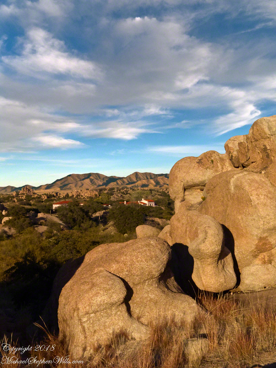
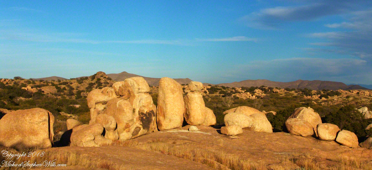
The Amerind Foundation and weathered boulders of Texas Canyon granite. Beyond are the Dragoon Mountains
I met, Linda Kelly, the owner of the Triangle T Guest Ranch, while camping in the Chiricahua Mountains. I arrived a week before homecoming to photograph the landscape, nature and rock formations of the Chiricahua National Monument. Click this link for my Arizona Online gallery, including some work from that time. Linda and a friend were visiting that day and we struck up a conversation about the area and her Triangle T Guest ranch. The next day I was scheduled to guest lecture a class at the U of A, as an alumnus of CALS. The ranch was on the way and I needed a place to stay, so Linda gave me directions and I checked in.
She gave me a tour of the incredible weather granite rock formations of Texas Canyon and, meanwhile, shared stories of the history of Texas Canyon. It is appropriate for the Amerind Foundation to be here (see first photograph), the winter camp of an Apache tribe for generations.
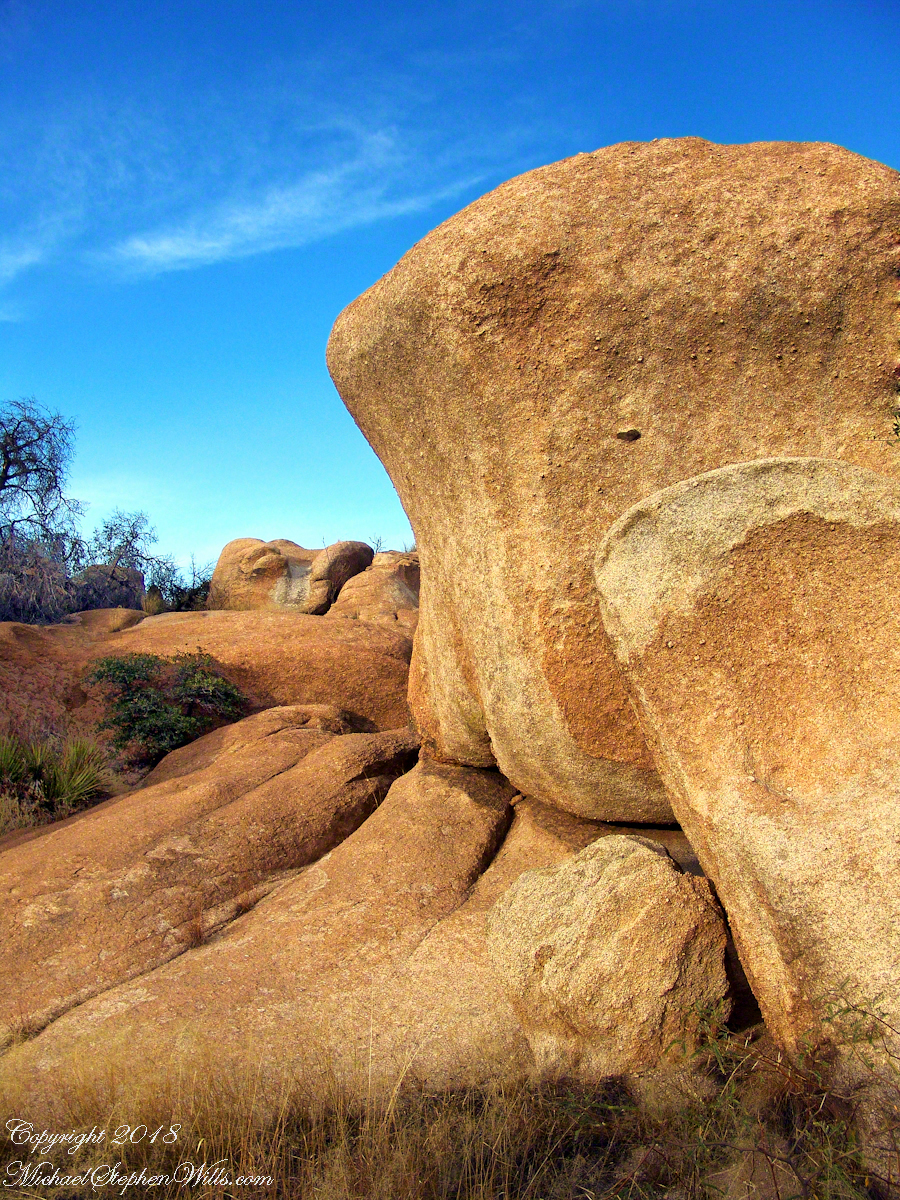
Weathered granite boulders greet visitors to the Triangle T Ranch.
That night, my request was for a room storied to be haunted by a spirit they call “Grandma,” as in when her footsteps wake you from a sound sleep you say, “It’s all right, Grandmother.” She woke me that night, footsteps in the dark, hollow on the wood floor, the room filled with a hard cold. I talked to her, without a response, while swinging my legs out of bed to reach the gas heater in the wall. I turned on the heat and the sound of expanding metal heat fins lulled me to sleep.
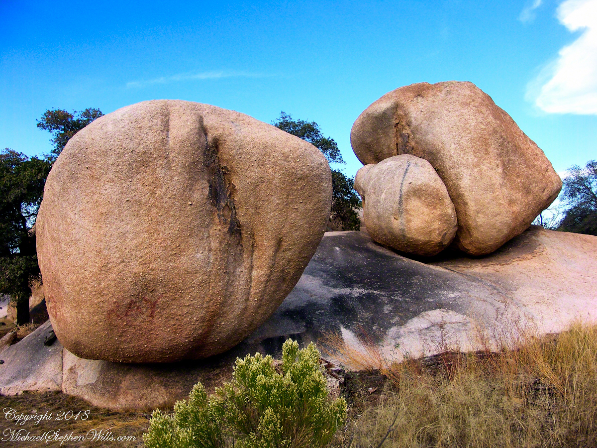
I call this pair, “Father and Son.” The restaurant is built around a round boulder.
It made a good story for the students. They were surprised I could fall back asleep, but after all I had to be there the following morning.
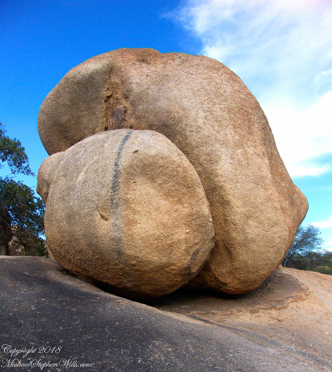
Your imagination roams among the natural forms.
I gave Linda a few of my photographs from that day and we made arrangements for the Triangle T to supply a two night package for the CALS “Dean’s Almost World Famous Burrito Breakfast” silent auction during 2008 homecoming.
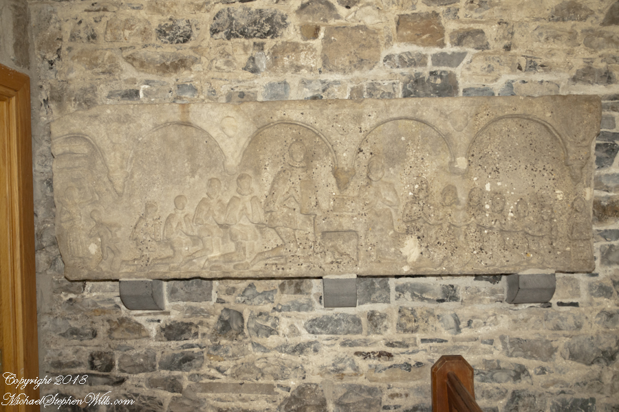
A tableau of figures keep silent watch with the ghosts of Texas Canyon.
Copyright 2023 Michael Stephen Wills All Rights Reserved
In more recent centuries Loughcrew became the seat of a branch of the Norman-Irish Plunkett family, whose most famous member became the martyred St Oliver Plunkett. The family church stands in the grounds of Loughcrew Gardens. With its barren isolated location, Sliabh na Caillí became a critical meeting point throughout the Penal Laws for Roman Catholics. Even though the woods are now gone an excellent example of a Mass Rock can still be seen on the top of Sliabh na Caillí today. The Plunketts were involved in running the Irish Confederacy of the 1640s and were dispossessed in the Cromwellian Settlement of 1652. Their estate at Loughcrew was assigned by Sir William Petty to the Napier Family c.1655. The Napiers are descended from Sir Robert Napier who was Chief Baron of the Exchequer of Ireland in 1593.
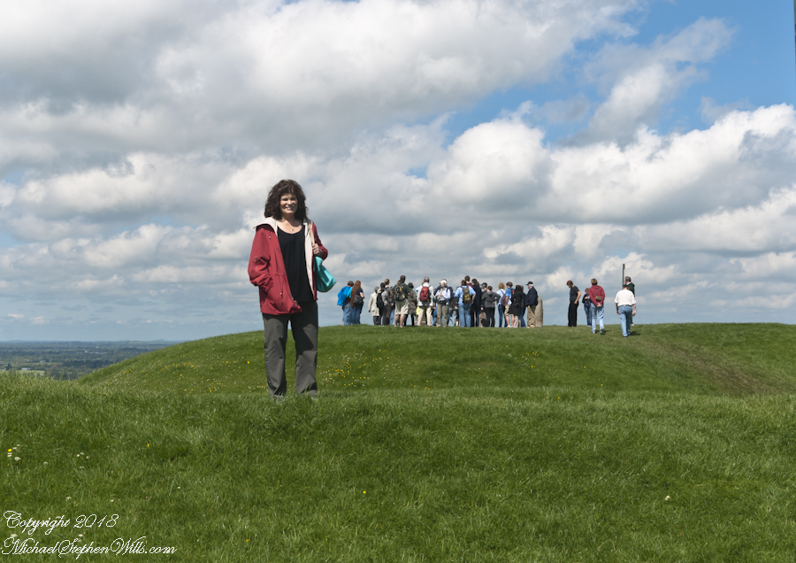
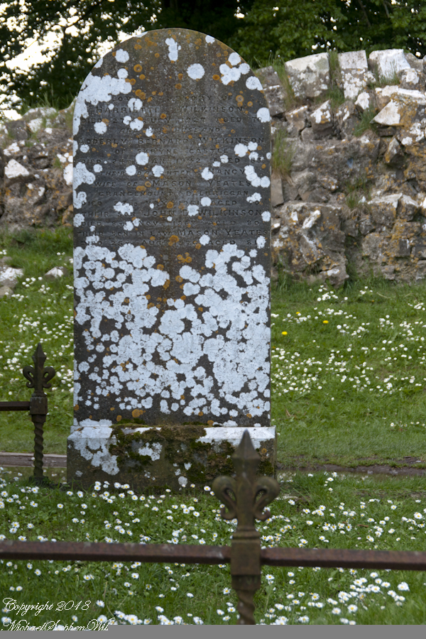
Cairnbane East in Ireland, part of the Loughcrew Cairns complex, combines historical significance and folklore, particularly about a witch shaping these megalithic structures.
Here we are looking south, southwest from the north side of Slieve na Calliagh (aka Cairnbane East) toward Cairnbane West. Flowering yellow whin bush is in foreground, white flowering hawthorn trees in distance.
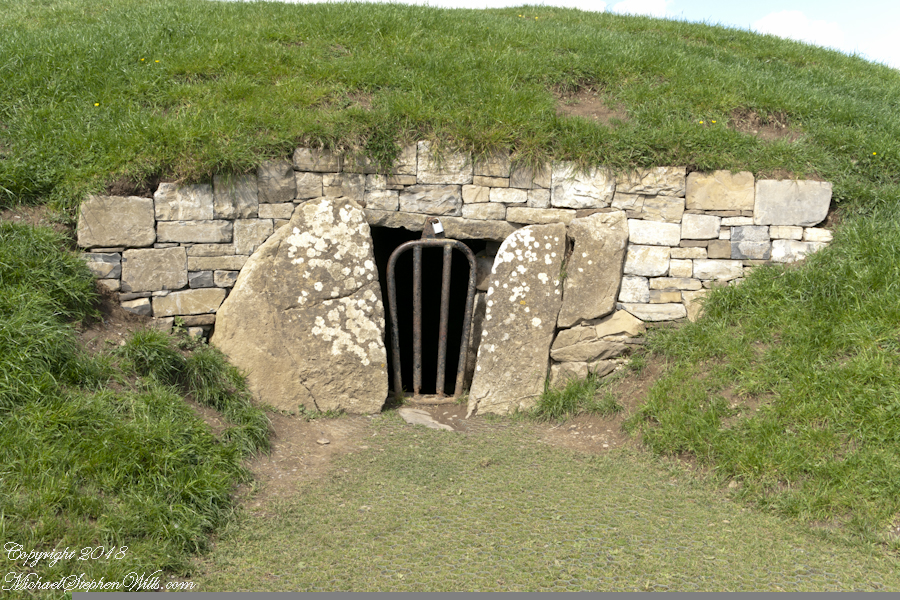
Cairnbane East hill is topped by a fine and accessible passage tomb, Cairn T.
Cairnbane East of the Loughcrew Cairns, known colloquially as “Hag’s Mountain,” nestled amidst the rolling hills of County Meath, Ireland, is a site of profound antiquity that beckons the curious traveler with its enigmatic charm. In this beguiling corner of the world, where history and folklore converge like two ethereal streams, the Loughcrew hills with their cairns rise, sentinels of a bygone age, each with its own tale to tell. But it is the myth of the witch, the “Hag of Loughcrew,” that lend a haunting aura to these ancient megalithic structures, invoking a world where magic and reality danced together in a mesmerizing waltz.
The Loughcrew Cairns
The Loughcrew Cairns, those hallowed remnants of an era long past, are monuments that defy the erosion of time. Constructed during the Neolithic period, they bear witness to the ingenuity of ancient minds and the profound spiritual significance these structures held. These tombs, hewn from the earth and stone, were not mere resting places for the departed, but sacred vessels of cosmic alignment, paying homage to the celestial dance of the heavens.
The Witch’s Role
One of the most enduring legends surrounding Hag’s Mountain is the story of a powerful witch who was said to have constructed the cairns. Cairn T includes a kerbstone known as “the hag’s chair.” According to folklore, this enigmatic figure, known as the “Hag of Loughcrew” or the “Cailleach,” commanded supernatural abilities and controlled the forces of nature. The Cailleach, which translates as ‘old woman’, ‘hag’, and ‘veiled one’, exists in both Irish and Scottish Gaelic, and is an expression of the hag or crone archetype found throughout world cultures. Related words include the Gaelic caileag and the Irish cailín (‘young woman, girl, colleen’), the diminutive of caile ‘woman’, and the Lowland Scots carline/carlin (‘old woman, witch’). The Cailleach is associated with winter, and it is believed that she uses her staff to create the winter snows. In some folk tales it is said that she carried massive stones from distant quarries to build the cairns, working tirelessly through the night and completing tasks that would have been impossible for ordinary mortals.
In these legends the Cailleach’s role in the construction of the cairns is believed to explain their precision and alignment with celestial events. The Cailleach used her magical powers to ensure that the cairns’ passageways perfectly aligned with the sun’s rays during the equinoxes, illuminating the inner chambers in a spectacular display of light and shadow.
Conclusion
Slieve na Calliagh weaves a tapestry where history’s threads intertwine with the shimmering strands of folklore. In its stony silence, it echoes the time when myths and reality were inseparable, when the land bore witness to the otherworldly. As we wander amidst the Loughcrew Cairns, gazing upon the ancient stones, we become travelers in a world where the mystical and the corporeal coalesce, and the stories of the witch endure as whispers in the wind, carried through the ages.
Copyright 2023 Michael Stephen Wills All Rights Reserved
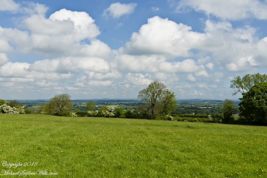
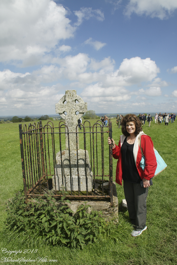
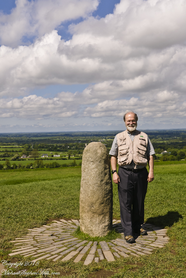
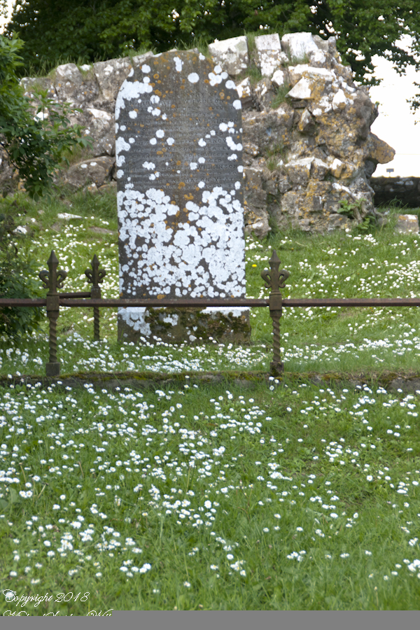
On a May afternoon my dear wife, Pam, and I climbed to the summit of in Irish “Sliabh na Caillí” anglicized as “Slieve na Calliagh” translated to the english language as “Hag’s Mountain”, the site of 5000+ year old megalithic monuments. Here you are looking to the northeast with a collapsed tomb to the right foreground. In closeup is a curbstone, one of many laid side to side to form the outer tomb margin. In the middle distance is a hill with additional megalithic ruins, not visible.
Megalithic is an architectural style used throughout the world, between 6,000 and 4,000 years ago in the Neolithic and Bronze Ages. Megalithic ruins are scattered throughout the island and County Meath is especially noted for them.
We stand in Corstown townland, the townlands of Ballinvally is to your left, ahead and to the right is Patrickstown, all in County Meath, Ireland.
Copyright 2023 Michael Stephen Wills All Rights Reserved
I first learned about Circlestone from stories The Searcher told during my first backpack into the eastern Superstition Mountains, on the Tule trail, April 2005. I described this in “Riding from Pine Creek to the Reavis Valley” where the Searcher described a stone circle, overgrown with Alligator Juniper, on the slopes of Mound Mountain. He pointed south toward a peak and foothills that rose from the valley floor and said, “follow the fire trail east from the southern Reavis Ranch valley.” There were strange happenings associated with Circlestone (as he called it) and he’d never taken the time to go there. “There is a book full of stories.” I eventually sought out Circlestone on the web and in books, but after I found it on my own using only the Searcher’s directions and advice from friends met on the way.
Sunset from Castle Dome
Backpacking with my sister
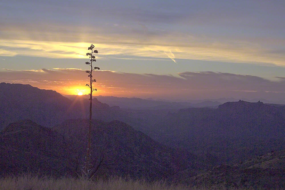
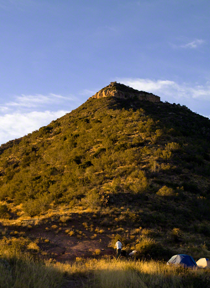
In 2006 I explored Circlestone twice along with my sister, Diane, who accompanied me. First for nine days early March 2006 using the Reavis Ranch trail from the north and the second for five days in November 2006, coming us the same trail from the south. Our first trip was Diane’s first “real” backpack adventure and we took it slow with a camp at Castle Dome where there are flat areas and exceptional views. Above, is the sunset from our second night (I camped the first night next to the car…we took it very, very sloooowwww).
Four Peaks Sunrise
Castle Dome
Then, there was morning of our third day. Here is the Four Peaks Wilderness in the first rays of dawn. These are green, rolling foothills of grass, low shrubs and a few juniper. If you know where to look, there’s an unmarked trail to Reavis Falls (the highest waterfall in Arizona). I found the trail and visited the falls on a later trip.
Castle Dome Sunrise
After enjoying the Four Peaks, you turn around and see Castle Dome in the morning light, as in this photograph. Remember the same of the “dome”, because it is visible from the ultimate view from Circlestone.
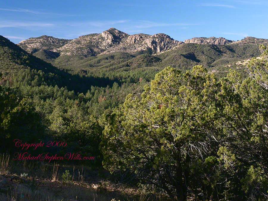
Reavis Valley and White Mountain from the trail to Circlestone
The Trail to Circlestone
Our camp was in the Reavis Valley, one of the first sites along the creek coming from the north. There were fantastic rock formations across the creek. Not far from there, the land falls away into steepness and then Reavis Falls. The Searcher told me about going that way, once. There is no trail down to the falls overlook and deep canyon carved by the water.
This photograph, above, is from a lovely forest of pinyon trees that grow along the trail to Circlestone (described by the Searcher as rising from the southern Reavis Valley). You can see the valley, just to the right, and a longer and steeper valley that rises from it up to White Mountain. That way is the southern legs of Reavis Trail. I have a movie clip from this same spot of the pinyons moving in the breeze and may post it at a later time.
All of the trail to Circlestone is a climb. You pass over “Whiskey Spring”, named for a still kept there in the 1800’s and over a steep defile gouged from the rock. The trail is well marked and I am told that, sometimes, there is no cairn marking the trail to Circlestone. If you are desperate to get there, look-up some excellent hiking directions available on the web. I have even found the circle on GoogleEarth, since I know where to look. If you like a challenge and the adventure, go from the directions the Searcher gave me.
Four Peaks from Circlestone
From the fire line trail, the unmarked branch to Circlestone climbs steeply and follows a ridge through Alligator juniper, punctuated by stalks of century plant, to a broad way that rises to Circlestone as though to a monument overgrown by the same juniper.
My Circlestone Mystery
There was an unusual experience on our first trip, on this portion of the trail. We were winding through the Juniper and, as it happened, Diane fell behind. After awhile I missed her and waited and, after a minute, went back to look for her. I found Diane sobbing uncontrollably, deep in grief over our father who passed away eleven years before. We talked about it until she felt better. She said it was as though a door opened and she could feel out father. What makes this exceptional is Diane is not given to anything like this and I ascribe her deep grief to the nature of the site. It is a mystery to this day.
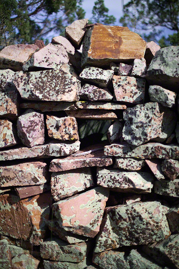
At Circlestone, that first trip, we explored and experienced the site. You cannot see the entire wall at any point and need to wander through and over it, being careful not to disturb anything. Here and there, in the outer wall, are openings like the one in this photograph.
Site-Hole in the Circlestone Wall
At Circlestone
I call it a site hole because, on your knees, it is possible to look through and see the distant view through the trees. As you can see, the stones are a striking red color with green lichen growing thick.
On the second trip in November, knowing the way and having great weather, I brought my cameras to capture the exceptional views, one of which is above. I’d dearly love to come back to camp just below the ruin and do some work in the evening and morning light. For now, I can enjoy those views from Castle Dome.
Three Horsemen and Castle Dome
Can you see the dome in the middle distance. I did a portrait of three horsemen who road up to Circlestone in November. We came to know them pretty well, that afternoon and the following morning down in the valley.
Three Horsemen
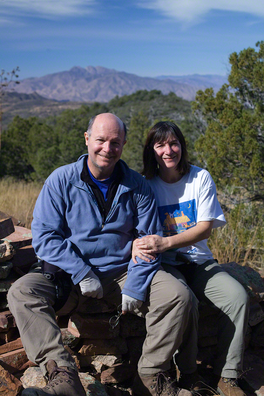
I carted up a tripod, so you can see Diane and I in the same spot.
Mike and Diane at Circlestone
Copyright 2023 Michael Stephen Wills, All Rights Reserved
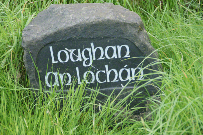
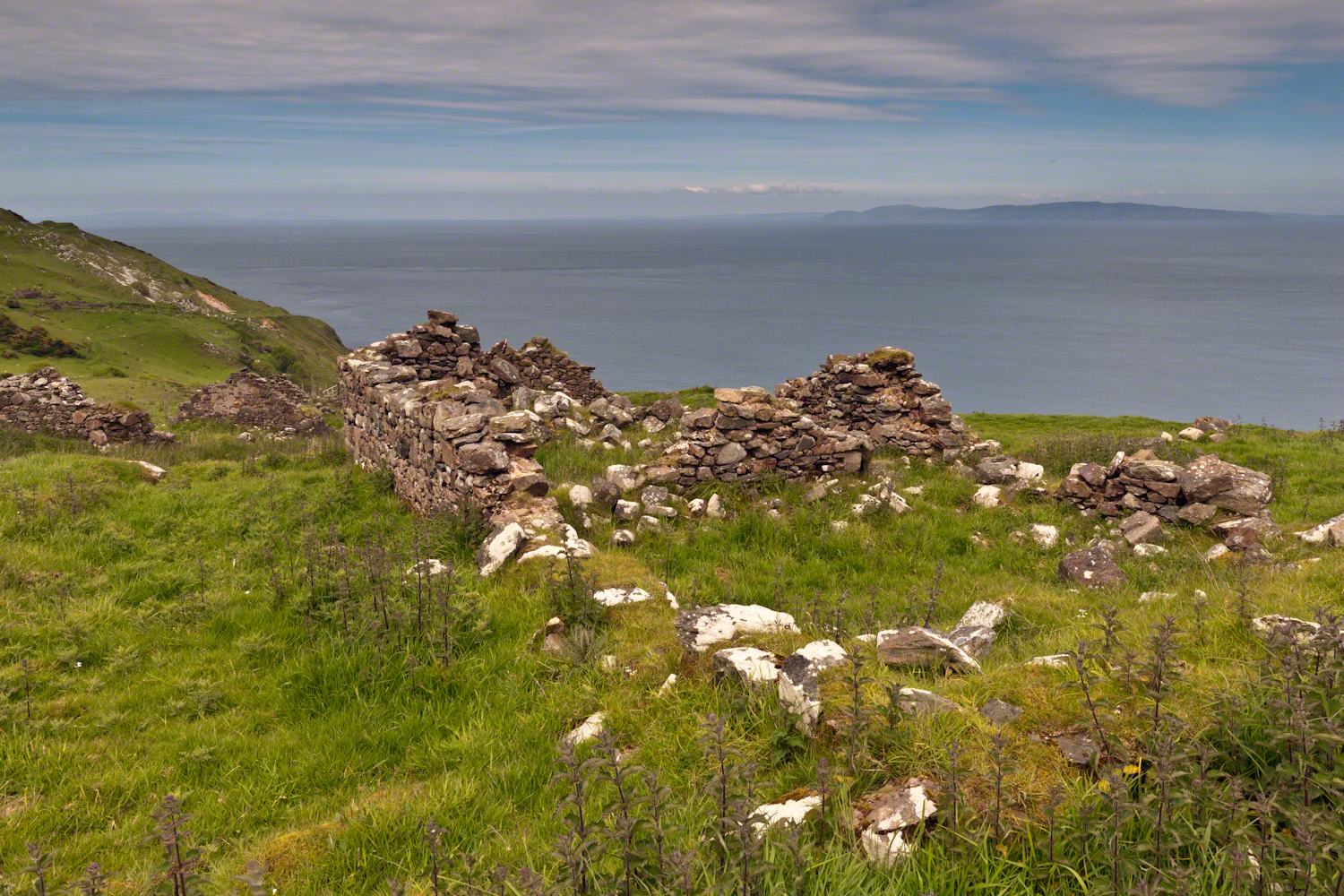
Here is a photograph from our day touring the Glens of Antrim. While making our way up the coast to Torr Head a group of stone walls resolved into ruins. A cluster of cottages on grassy slopes above the Irish sea above Loughan Bay. This is the townland of Loughan. Along the road are wonderful signs providing in handsome carved letters the place name in english and gaelic. Here a signed only provided a gaelic name: “Loughan an Lochan”…near enough to meaning “Loughan Bay” in English. The bay is a shallow scallop shaped indentation of the coast, a margin of narrow sand strand.
Ruins are spread across the slope. Immediately before the views are traces of a foundation above the grass. Beyond the top of a gable, an entire gable to the left. On the far ridge, just visible, is an entire structure with doorways, gables, walls.
Across the Irish Sea, 13 miles distant, is the Mull of Kintyre. In faint outline, rising above the horizon, find the highlands of Islay more than 30 miles. Both are tips of peninsulas jutting from Scotland.
Click pic for larger view in a new browser tab. If you are in WordPress Reader, open the post to use this feature.
The ruins lead to curiosity over who live here? What were their lives like? Why did they leave?
On Monday, June 9, 2014, cousin John Mills dropped his son, Sean Mills, myself and Pam Wills off at the foot of the western slopes of Slieve Foy on the Tain Way. Sean, Pam and I walked the way over the mountain and into Carlingford in the footsteps of epic Irish heroes.
Click the pic to visit my online gallery
Copyright 2022 Michael Stephen Wills All Rights Reserved
In follow-up to my last post my IStock photograph of Saint Patrick on the Hill of Tara was accepted and is available for viewing (click the link to go there).
Since July 2008 a sea generation tidal turban, “SeaGen”, produces electricity (1.2 MW) for between 18 and 20 hours a day while the tide is forced in and out of Strangeford Lough through the Narrows where the generator is installed. The first large scale commercial production of electricity from the tide, “SeaGen” is located between the Northern Ireland towns of Strangeford and Portaferry, the strength of the tides there were used by the earliest tidal mill known, the Nendrum Monastery mill dating 787 based on archeological excavation.
History records Patrick converted the island of Erin (Ireland) to Christianity in the Fifth Century AD as a return to his place of captivity and slavery.
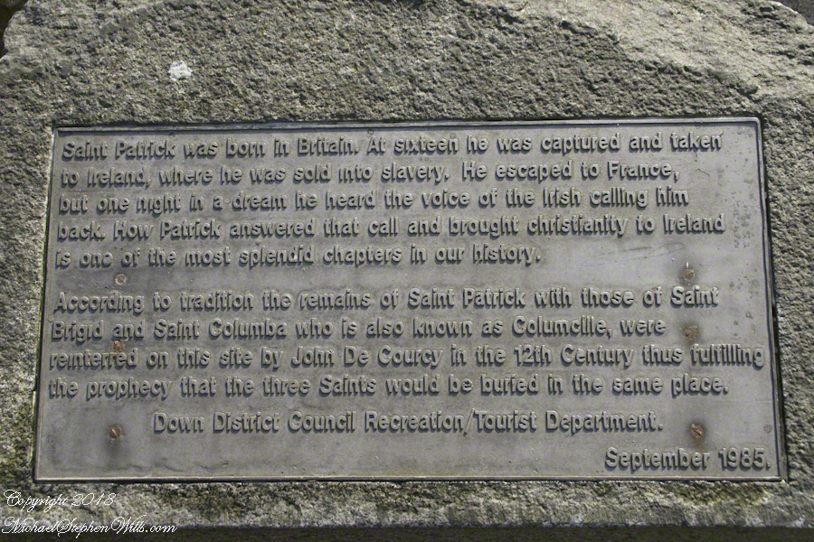
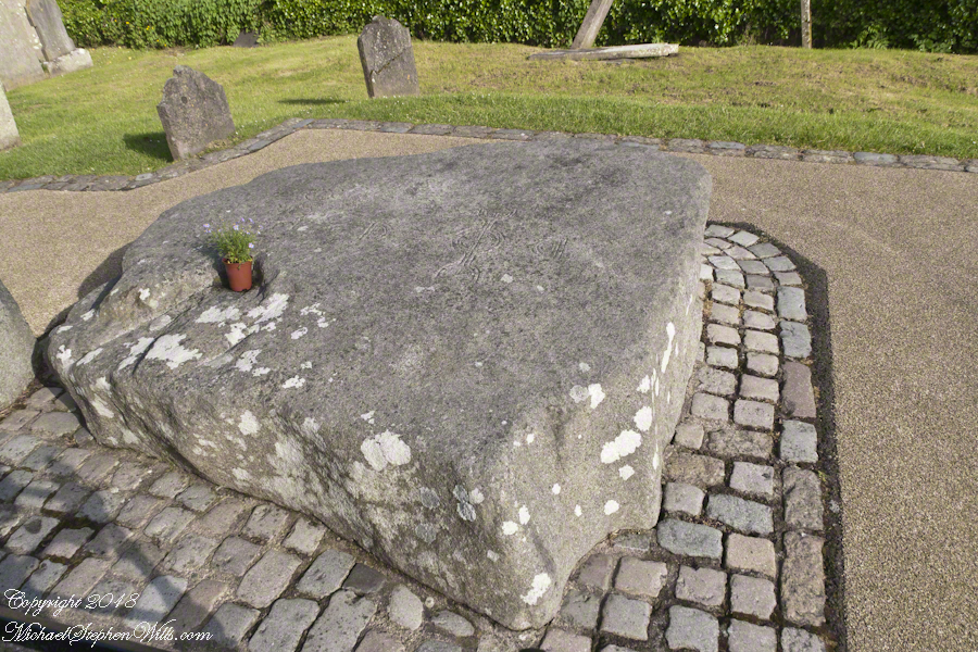
An informational plaque mounted on granite next to the grave of Saint Patrick.
There is a connection between “SeaGen” and the return of Patrick to Ireland. The first sanctuary dedicated by Patrick was at Saul, County Down not far from River Quoile that drains into Strangeford Lough. Historians identify Patrick’s first landing site, upon return, as Wicklow where he was forced to leave by the locals. Heading north in the boats of the time, the strong tide of Strangeford Narrows pulled them into the Lough and, from there, headed up the River Quoile to encounter the local chieftain, Díchu mac Trichim. Patrick’s first Irish convert to Christianity, the feast of Saint Dichu is April 29.
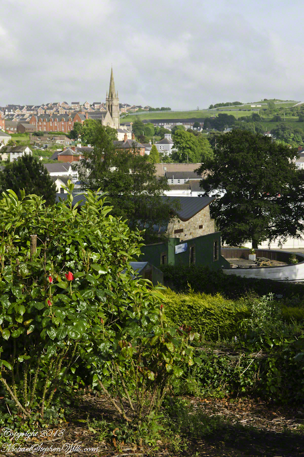
On June 7, 2014 Pam and I visited this area. Here are some photographs of the traditional burial place of Saint Patrick.
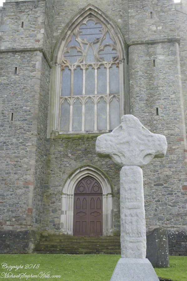
View of Downpatrick from the hill of the Cathedral Church of Holy Trinity (Down Cathedral)The High Cross of Downpatrick fronts Down Cathedral on a hill overlooking the town. The informational placard reads “The granite head and shaft date to about 900 AD and were once re-used as part of a Market Cross at the bottom of English Street. The pieces were found in various places in town, reassembled and presented to the Dean and Chapter of the Cathedral in 1897.”The placard text reads: “A large memorial stone of Mourne granite was place here in 1900 to mark the traditional burial-place of St. Patrick. The stone was quarried at Slieve-na-largie near Castlewellan, and it took 12 men 14 days to cut from the quarry.”Inscription on the upper surface of stone marking grave of Saint Patrick.
Explore the Hill of Tara with us! Discover the rich history of Saint Patrick’s statue, the legendary bonfire, and stunning panoramic views of County Meath. Join our journey through Ireland’s ancient and mystical landscapes in our blog post.
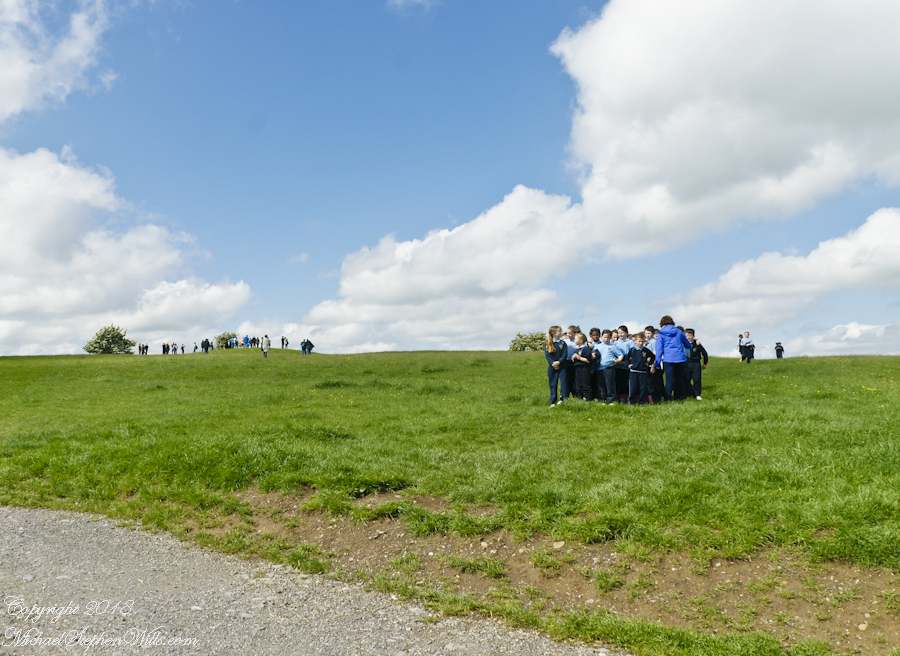
Arriving around noon on a Tuesday, Pam and I were greeted at the Hill of Tara by these children, headed to the school bus.
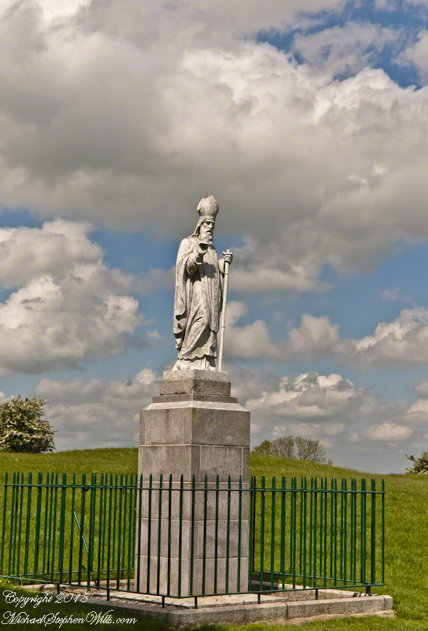
A statue of Saint Patrick fittingly welcomes visitors to the Hill of Tara, County Meath, Ireland. This statue of cast concrete was an existing statue donated by the Sisters of Charity, moved from an existing installation to the Hill of Tara in the year 2000 AD. The creator is anonymous, the is no plaque or other attribution on or around the statue. The original statue was erected on the summit of the Hill of Tara shortly after Catholic emancipation in 1829, commemorated the events of 433AD when St. Patrick lit a bonfire on the nearby hill of Slane on the eve of Easter Sunday. Slane was the second site we visited on our day of arrival, Saturday, May 24.
Lighting such a fire was contrary to the pagan laws of the time which dictated that the first fire lit that night be in Tara. Observing St. Patrick’s bonfire from afar, the chief druid of the ancient Gaelic capital predicted that if the flame were not extinguished that night, Christianity would never be extinguished in Ireland. The saint’s bonfire continued burning and the next morning, Easter Sunday, St. Patrick entered Tara to convert the king and his followers to Christianity.
A series of mounds surmounts the hilltop, one is visible across the expanse of grass.
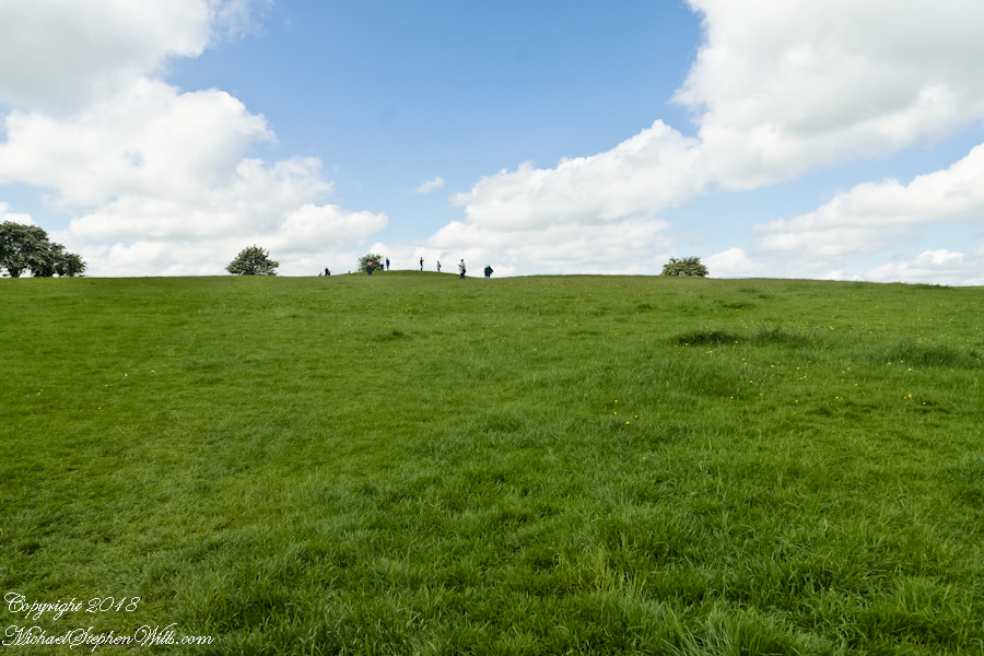
Climbing higher, the view opens.
On the top, views from all cardinal directions, 360 degrees.
The Hill of Slane is visible in the east, the tall cathedral ruin though not visible in this view.
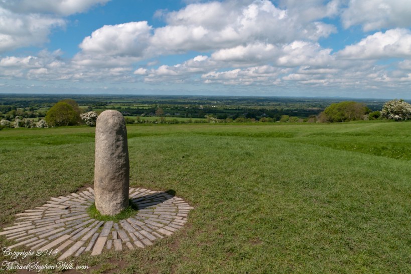
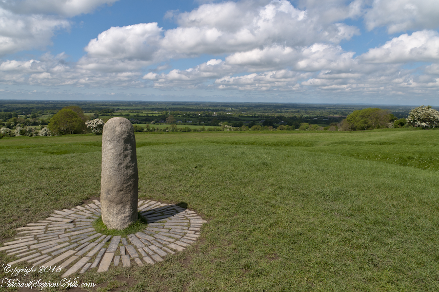
The first of the following panel is a view northwest from looking across County Meath with views of Counties Westmeath and Cavan. On the horizon, right, is Hag’s Mountain, (Irish: Sliabh na Caillí) , site of the Loughcrew Cairns. The standing stone is the “Stone of Destiny: (Irish: Lia Fáil), which served in coronation the coronation of the High Kings of Ireland. It stands on the Inauguration Mound (Irish: an Forrad) of Tara. This photograph was taken the morning of May 27, 2014 hours before the stone was vandalized, doused with green and red paint.
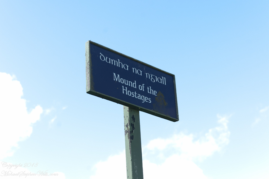
A bit to the east is the Mound of the Hostages, a passage tomb.
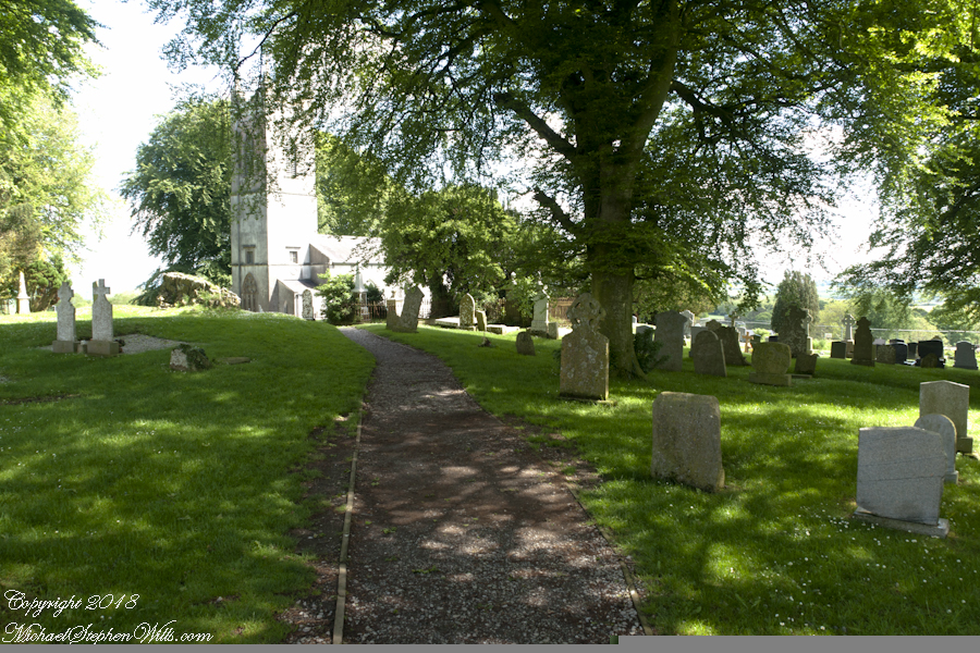
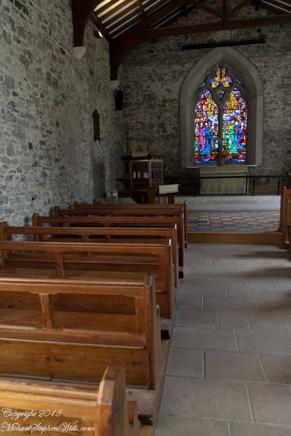
Walk into a glade, through the ancient graveyard to the visitors center in a deconsecrated church.
Browse my reasonably priced stock photography. This blog features three (3) photographs I published last week to Getty Istock and my Fine Art gallery.
Our Black Friday visit to Jim Thorpe included shopping along Broadway. One marvelous shop at 61 Broadway, The Vintagerie, offered a small bin of antique post cards. Vaguely curious, I picked up a pile. Many were unused. A few, like the two below, travelled the US Mail, included post marks, postage and communications.
Please click any of the following images to visit a work from my online gallery. Hover your mouse over each image for more information.
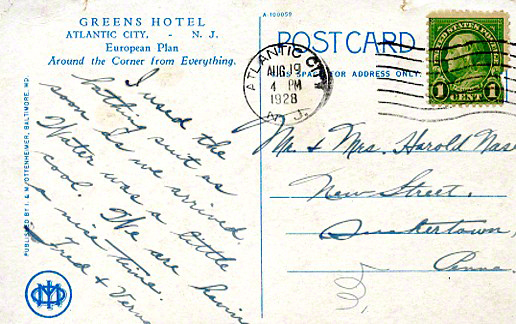
Verna’s slanted and precise cursive, the message carefully planned to fit available space, demonstrate her to be stylish. The bathing suit was purchased for the trip. Before leaving, Verna shared the purchase with her acquaintance, Mrs. Nace (misspelled Nase).
Fourteen months after their vacation, the Stock Market Crashed, October 1929, leading to The Great Depression. How were Fred and Verna affected? Were there Atlantic City vacations?
The next card was purchased and sent from Allentown. It is unlikely Sara was on vacation, was it purchased during a rare trip to the city?
I know Verna misspelled Nace because, ten years into the great depression, Mrs. Nace, Emma, received this postcard from Sara. The postage is still 1 cent. Emma has moved to a new address. The message is more significant, written in a hurried hand by Sara, who concludes with love.
Emma Nace kept these cards as treasured possessions and memories until, with her passing, they were acquired, maybe in an estate sale, bundled together, transported 54 miles to 61 Broadway to be found by me, scanned (digitalized), and sent along in this blog.
Copyright 2021 Michael Stephen Wills All Rights Reserved