Our tour tickets and bus designation ( “number 2” ) firmly in hand, Pam and I walked the gangplank from the tender (see yesterday’s post), into the Iquique International Cruise terminal, then out to the sunshine to find out bus, following the crowd.
Click any photograph for a larger view and use Ctrl-x to zoom in closer.
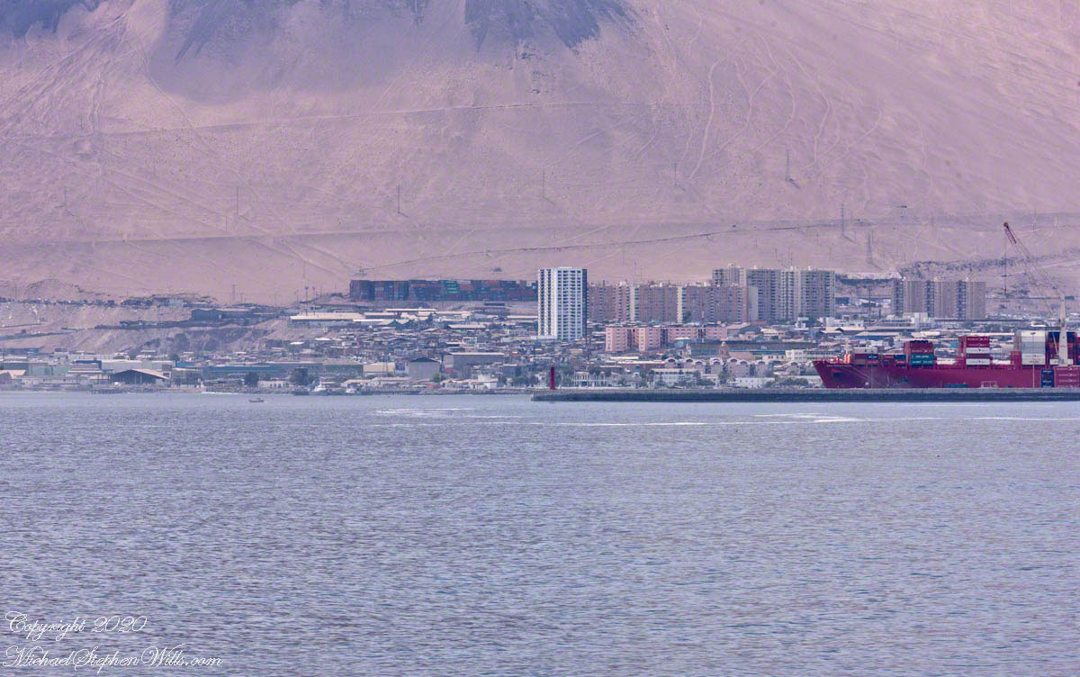
Downtown High rises soar above downtown
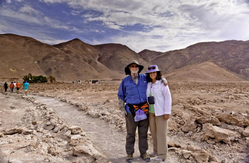
Touring this way can feel link a rodent maze, it was not our feeling at all. The groups maxed at 15, the guides friendly and knowledgeable, the tour buses luxurious. We enjoyed ourselves immensely. Here we are, later that day, dressed for adventure.
Mike and Pam Wills on tour at the Pintados Geoglyphs, Tarapacá, Chile within the Atacama desert.
Our itinerary for the day is to navigate through the city, across the desert to visit a World Heritage Site, Humberstone, and ancient geoglyph sites, touching on local ecology.
Another view of the Cathedral of the Immaculate Conception among the downtown high-rises of Iquique.
Here is our tour, time to hop on the bus, get going.
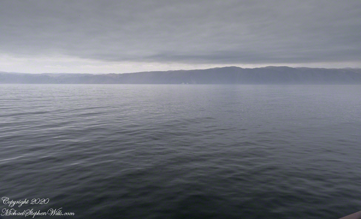
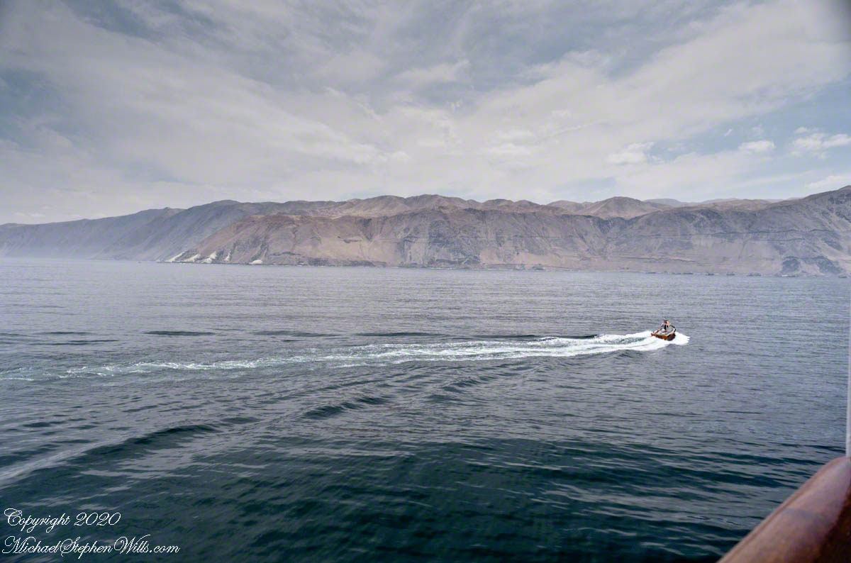
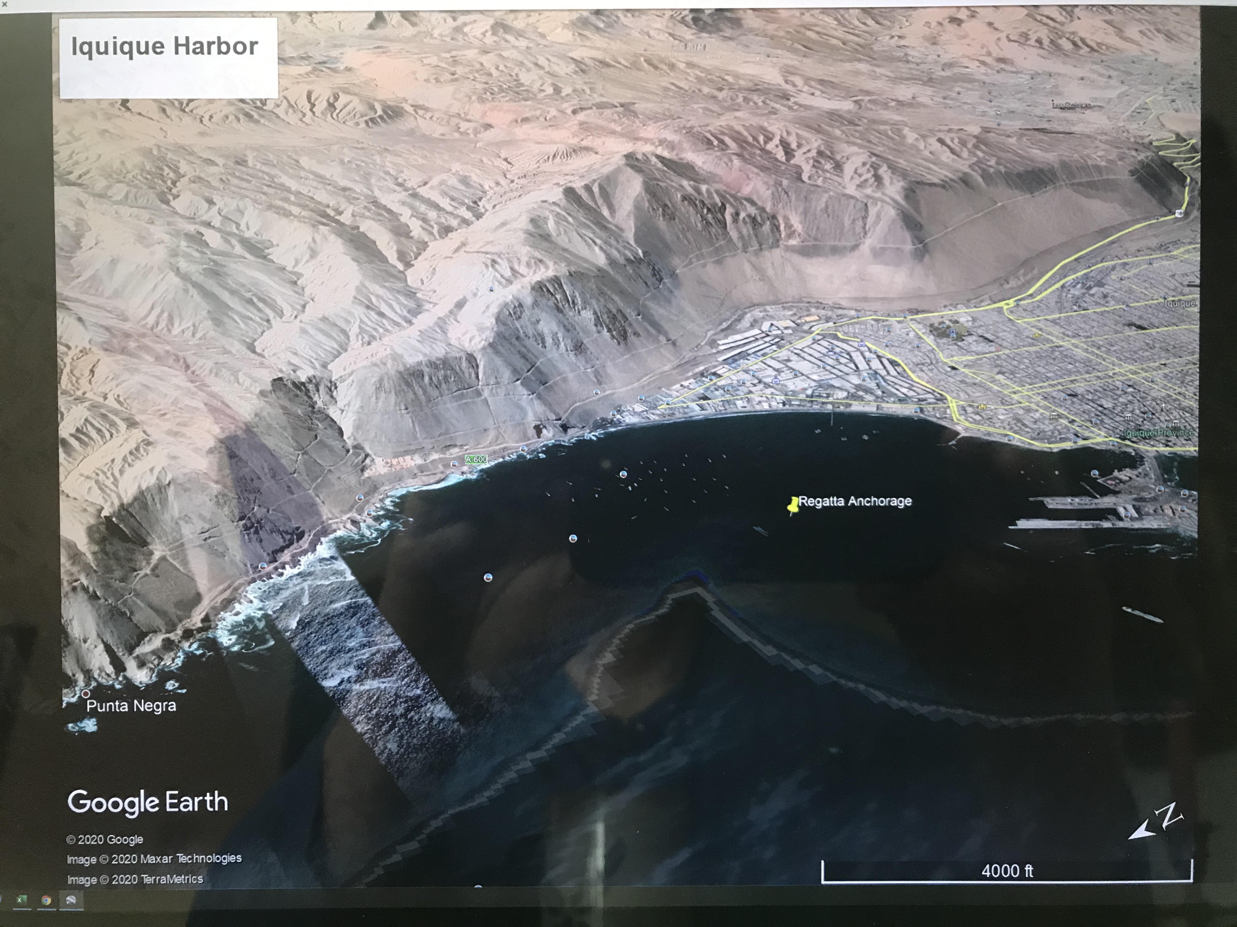
Ninety minutes after docking our assigned tender pulled away from the Regatta for a twenty minute trip to Iquique. A tender is a boat with an enclosed seating area designed to transport about twenty persons in quiet waters from an anchorage to port. I recall the morning announcement from the ship Captain advising use the winds were high (or the waves), and he negotiated a mooring with the port, instead of the planned docking, in order to save our visit to Iquique.
Click any photograph for a larger view and use Ctrl-x to zoom in closer.
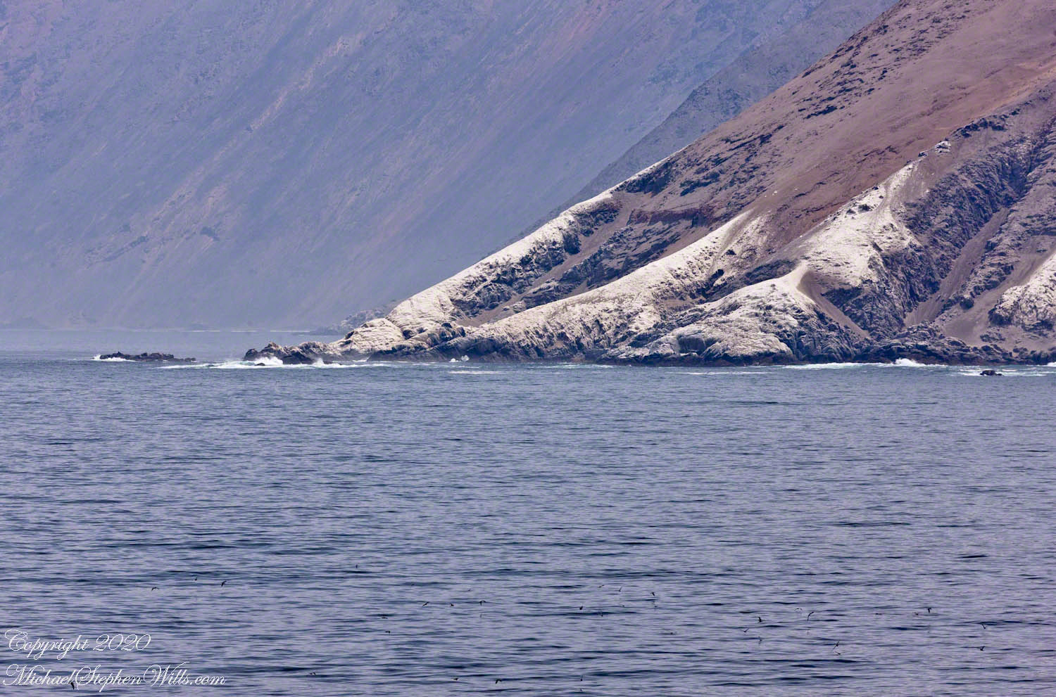
The approximate anchorage of the Regatta marked with a pushpin. The tender transported use from the Regatta to the base of the island port.
Above is a screen capture from Google Earth, the entire Iquique harbor is pictured from Punta Negra (see photo from yesterday) to the base of the island port connected to the mainland with a road. The tender port is at this base, on the shore side. If you wish, download the following PDF document with a clearer image. You will need a PDF viewer.
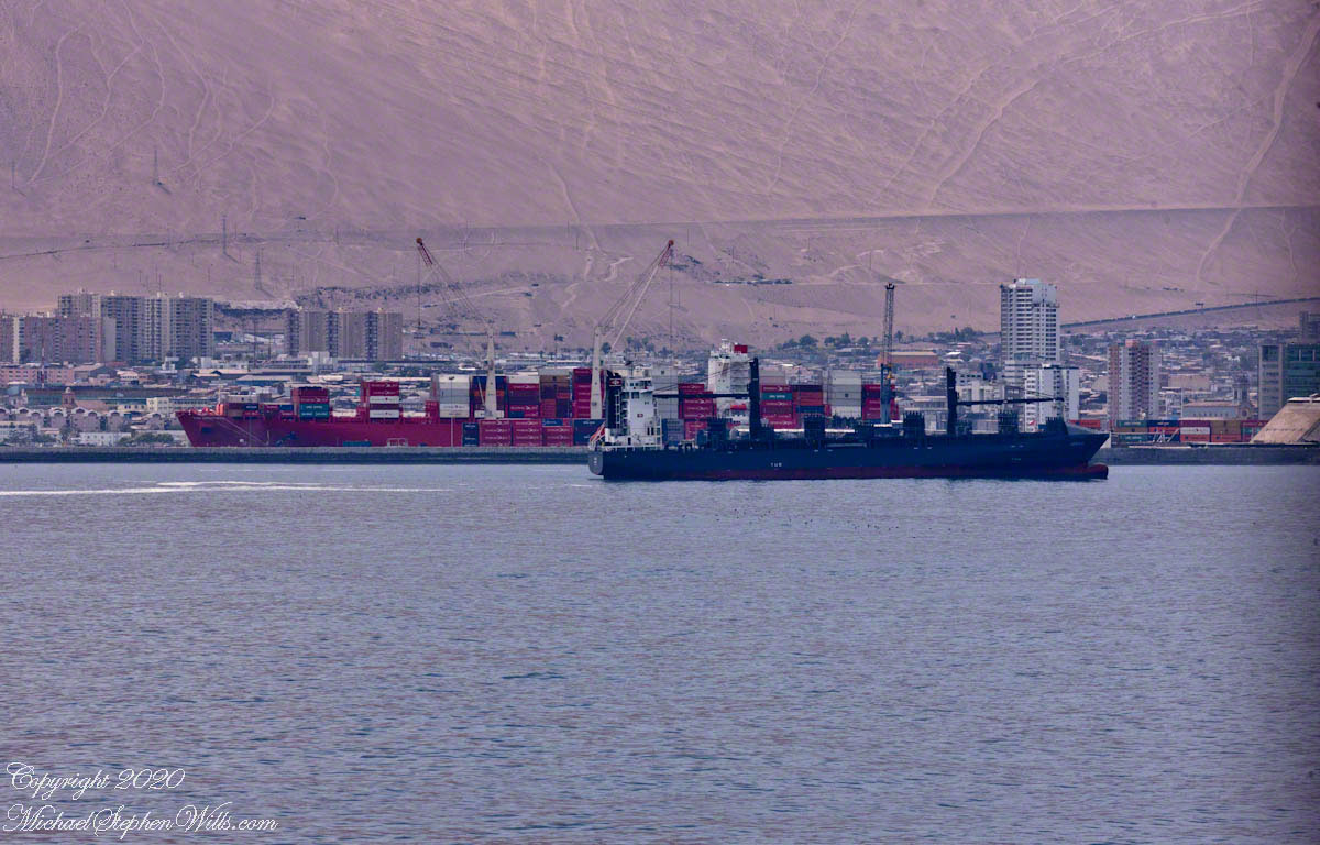
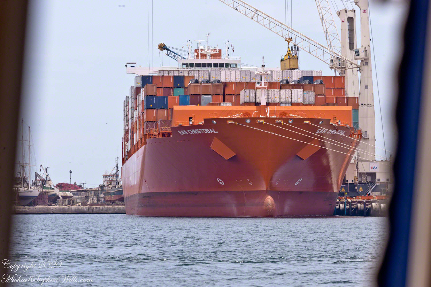
Shipping containers being unloaded from the container ship San Christobal.
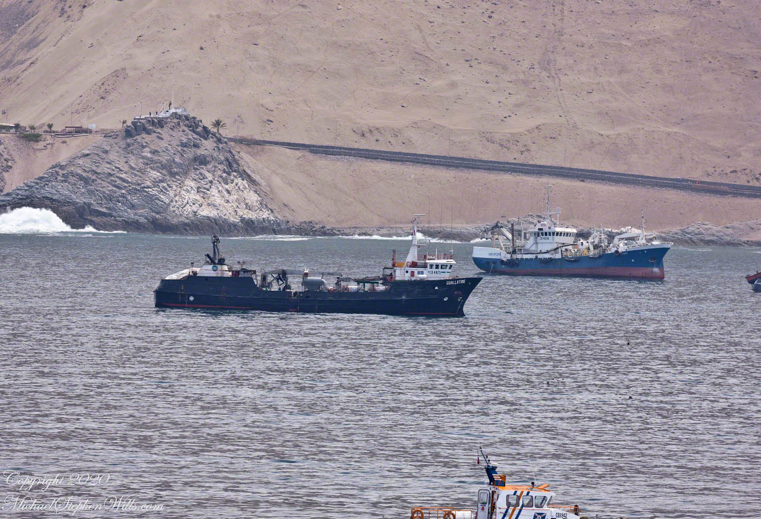
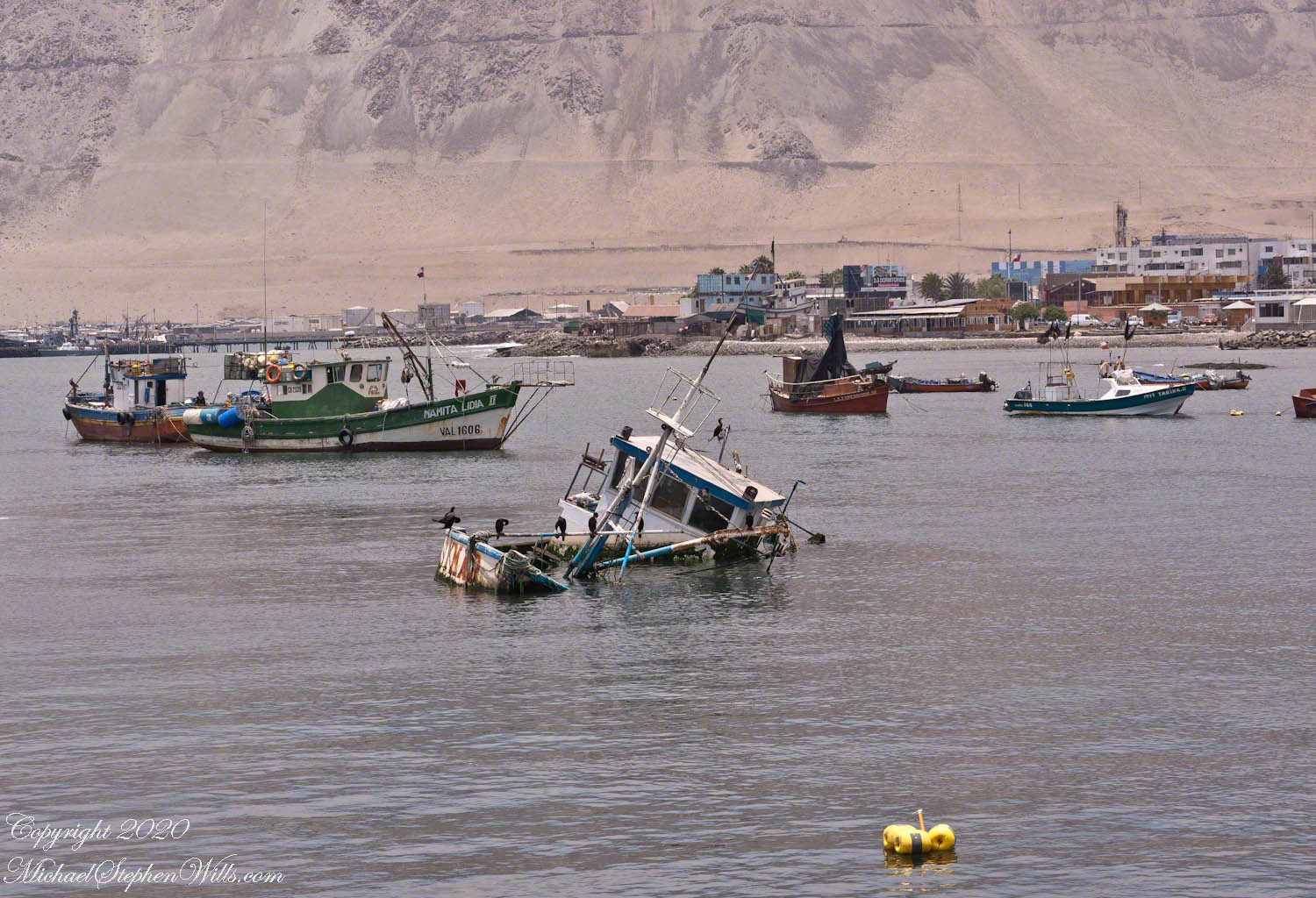
Here are some of the sights visible from the tender. I recall sitting next to the large rear window. Above is the large red container ship. From earlier posts, the San Christobal is docked at the outer berth. The ship is being unloaded, you can see a yellow shipping container on the crane.
Today, aneconomic reason for Iquque’s prosperity is the status as a duty free zone the government dubbed “ZOFRI.” Another is tourists flocking to this “Miami of South America” for duty free shopping (there is a mall), the shore lined with tall hotels and condominiums. Adventure-seekers love the surfing and hang gliding from the escarpment.
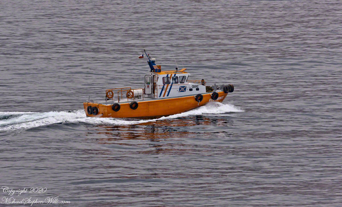
Notice the fishing nets in the stern with yellow floats
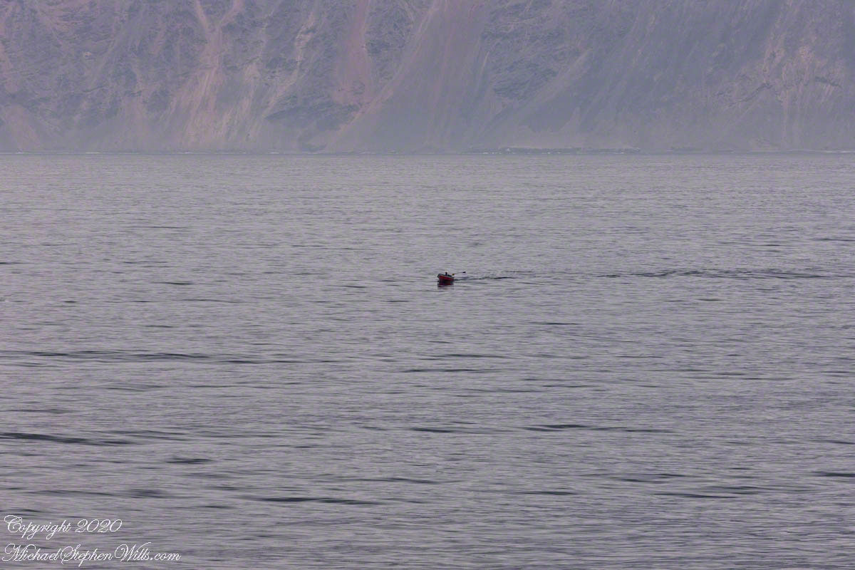
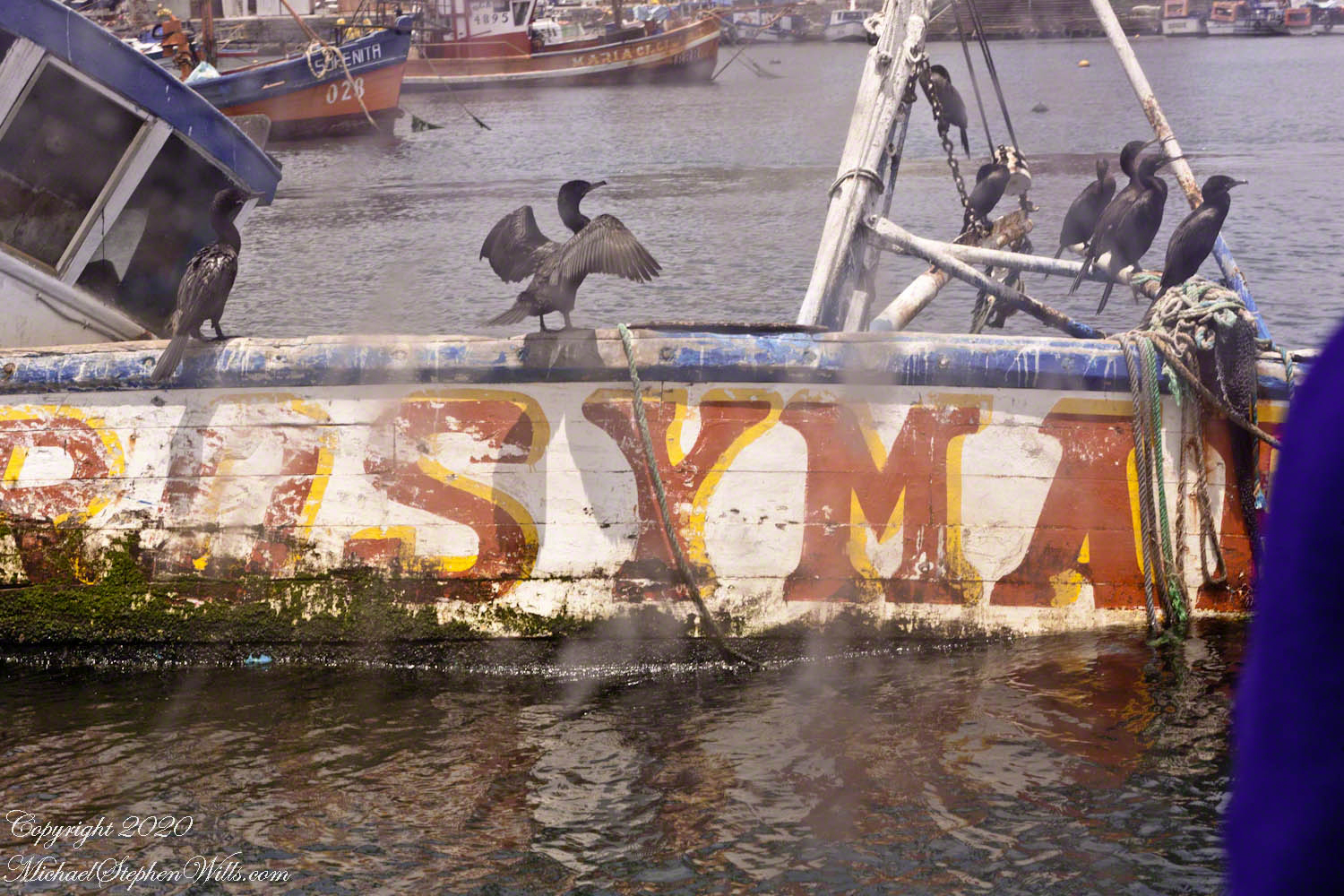
This is the scene close to the tender port, past mooring for smaller fishing and other boats.
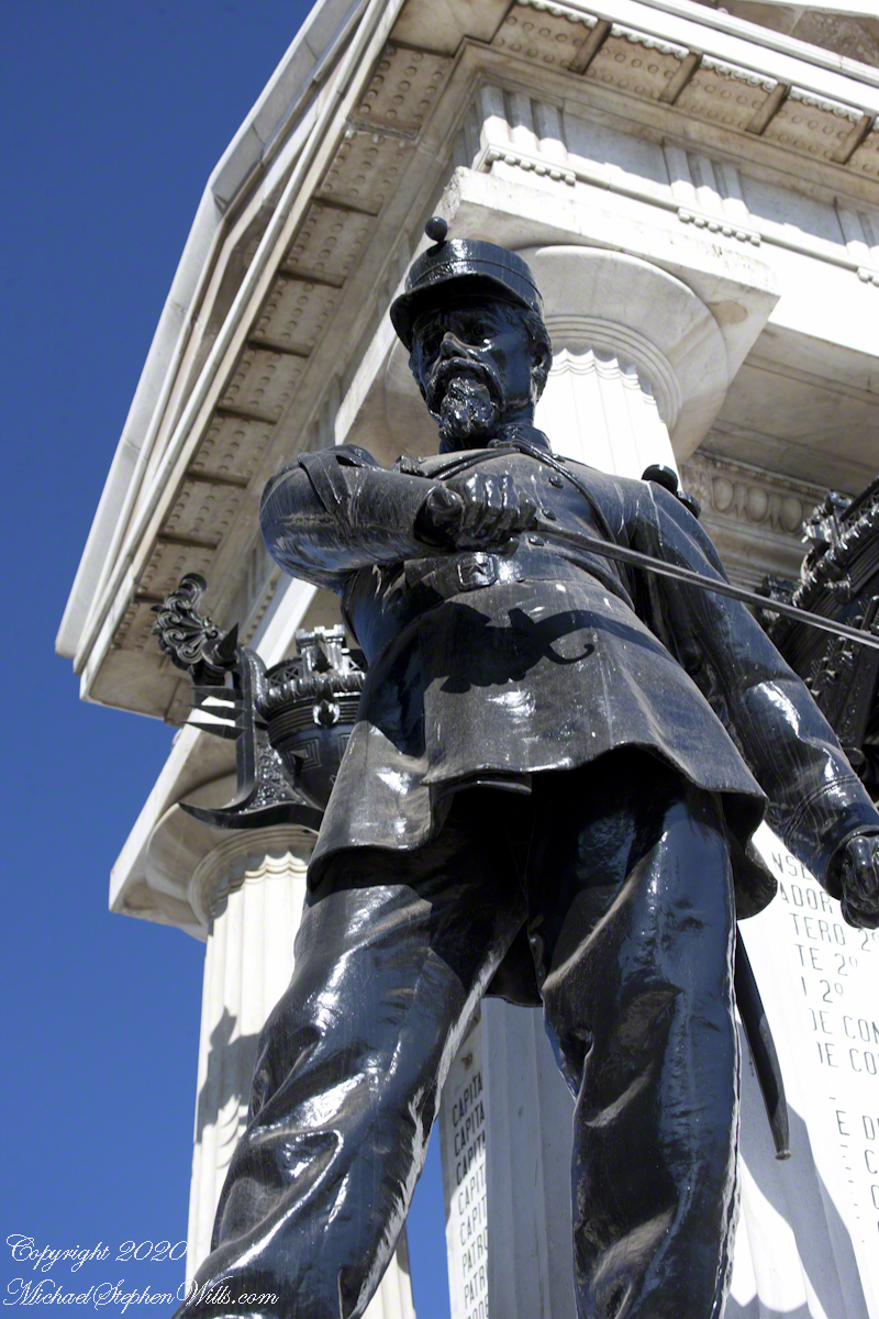
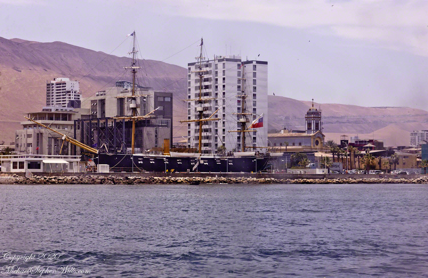
Replica of the Chilean navy ship Esmeralda sunk during the Battle of Iquique. It is a nautical “living museum.” From the website: “The museum script of the Museum ‘Emerald Corvette’ is represented by thirteen museum scenes that inspire the guided tour, where it was recreated what life was like on board on May 20, 1879, the day before the historic Pacific War day.” The Cathedral of the Immaculate Conception is to the right of the ship stern. Here is a previous post with more about the Esmeralda in historical context.
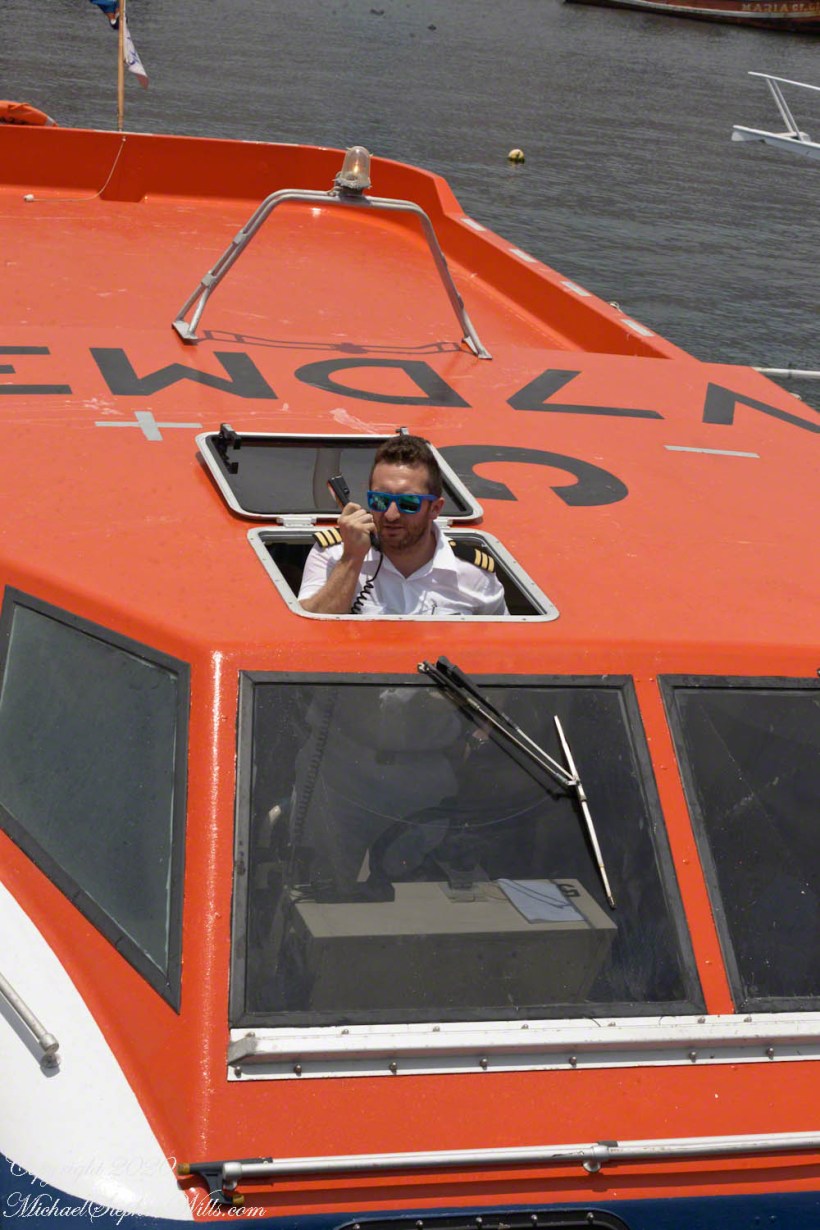
After disembarkation, I looked back for this shot of our tender pilot.
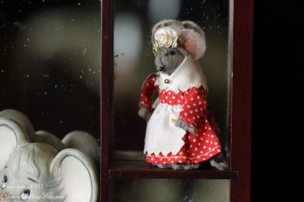
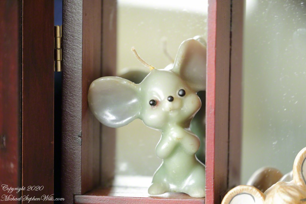
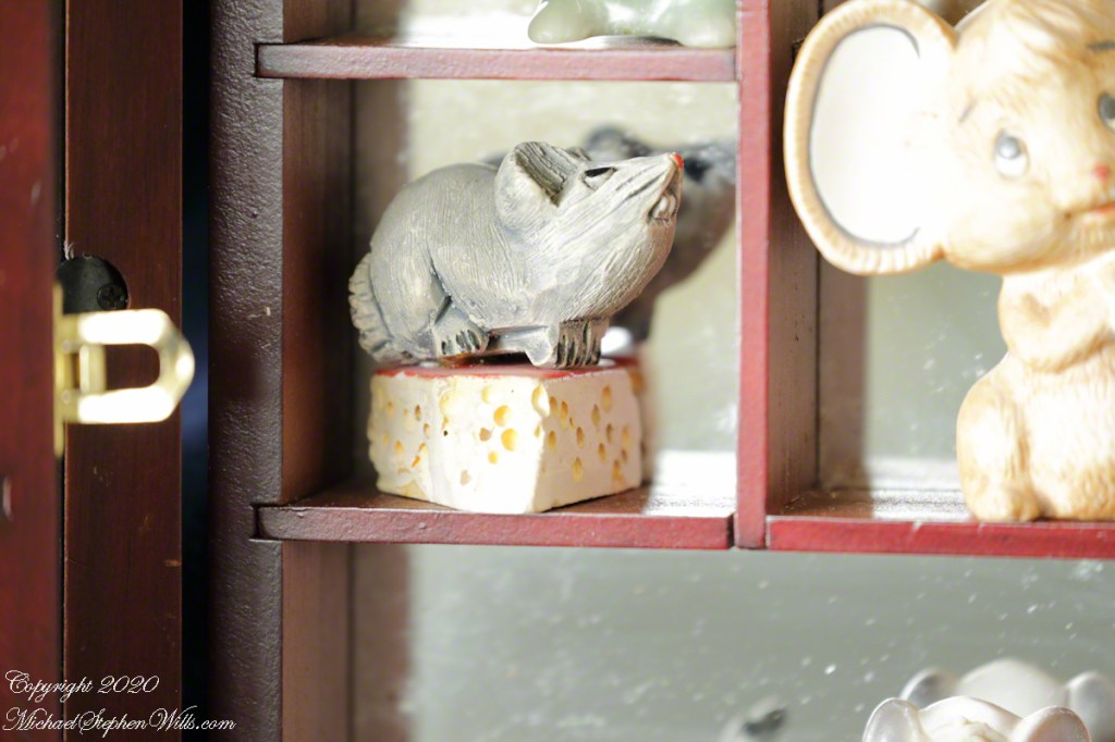
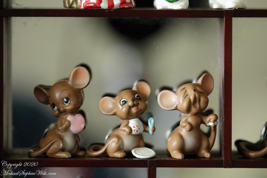
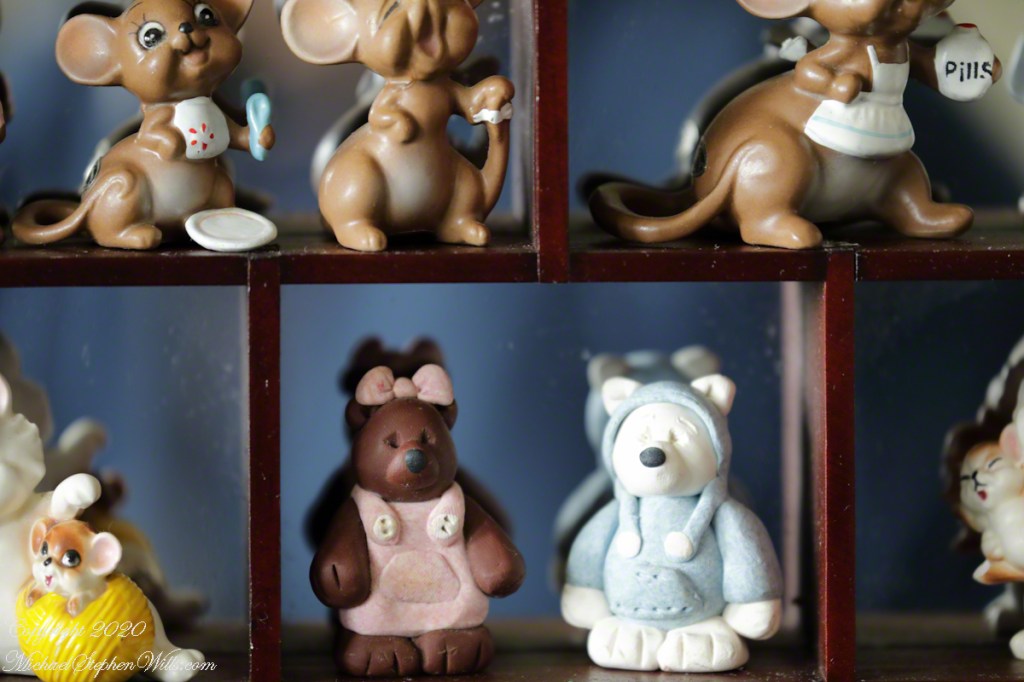
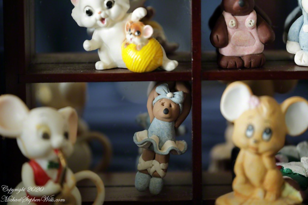
Here is a project completed for a “Fundamentals of Photography” refresher course. The task is to use a variety of lenses of my choice to document scene from my surroundings. These photographs document a family heirloom, mouse figurines collected by my wife, Pam’s, mother, Patricia Crist, assembled by Pam into two display cases with assorted figures created by Pam’s daughter, Denna.
24 mm wide angle fixed lens, f/22
50 mm fixed lens, f/6.3
70 – 300 variable lens, f/9.0
70 – 300 variable lens used for macro photography
Copyright 2020 All Rights Reserved Michael Stephen Wills
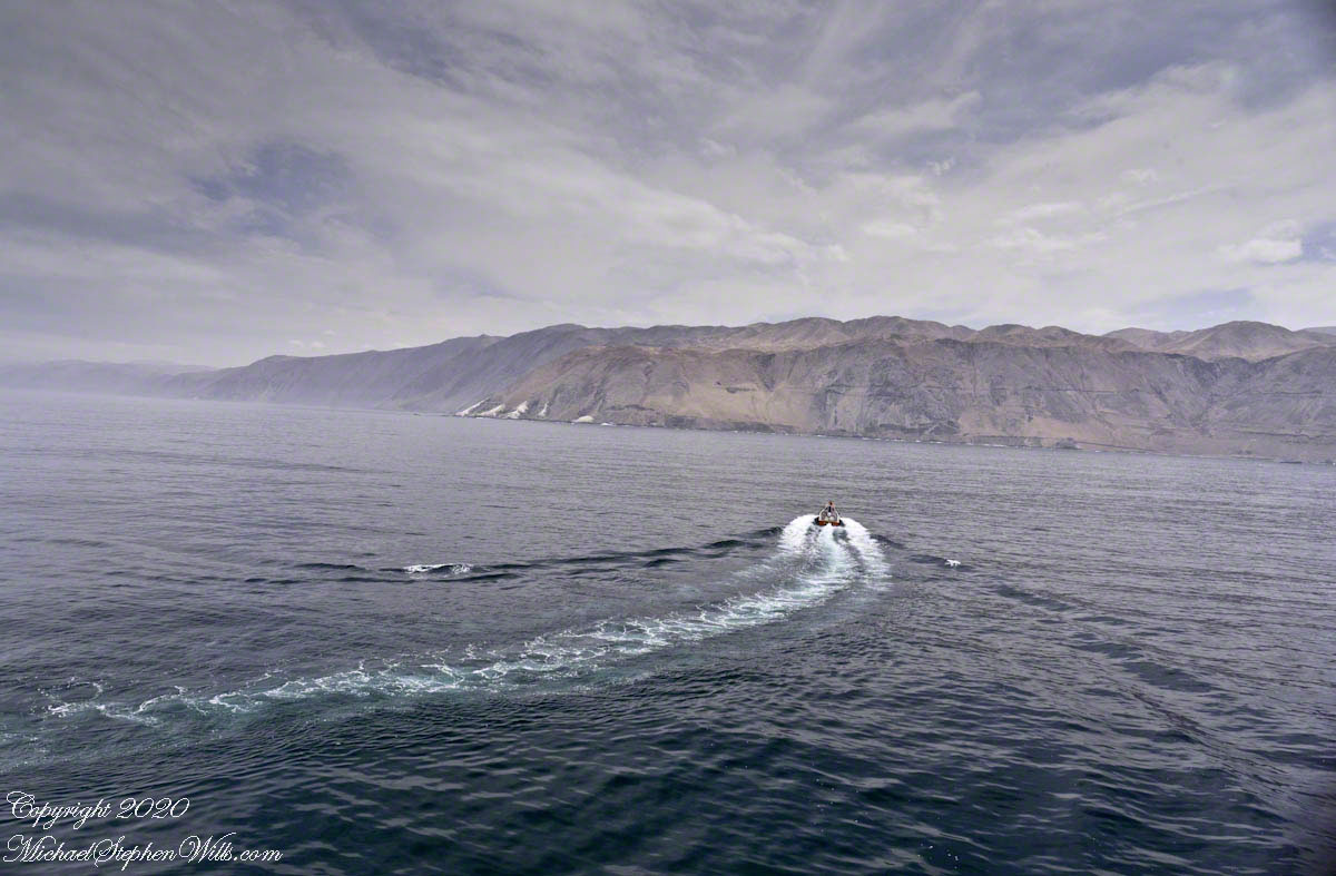
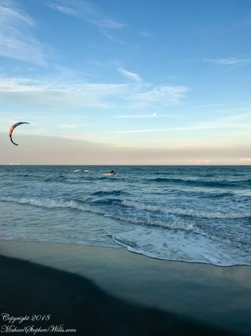
Awhile after encountering the hydrofoil the same north wind powered a large, eight foot wingspan kite high overhead. Cheri Down Park, my meeting point for lunch with Pam, was in sight as I took a detour to talk with the kite flier.
Seated in a comfortable beach chair, he turned a one foot diameter reel pulling the kite in. Kite flying was a relaxation for this permanent resident. As the kite descended overhead I caught this short video. In retrospect the beauty is ominous, a metaphor for the approaching novel coronavirus (COVID-19).
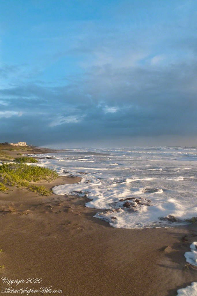
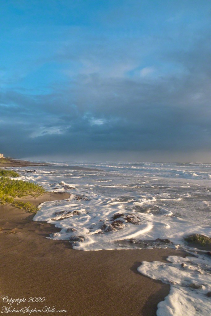
Morning walks through January 2020 were solitary events, more so on stormy morning such as this, January 23rd. Even the dog walkers stayed home. The surf surged to the dunes. Click me for my posting, “Rough Surf.”
Click photograph for a larger view. To do this from WordPress Reader, you need to first click the title of this post to open a new page.
The sun broke through between clouds to rake with light the beach scurf and wind scud. In the distance, a steady west gale blows surf onto itself as a white curtain.
Click photograph for a larger view. To do this from WordPress Reader, you need to first click the title of this post to open a new page.
Click photograph for a larger view. You will open a gallery to flip back and for between images.
Copyright 2020 All Right Reserved Michael Stephen Wills Photography
At dawn I walked on the beach from North 1st street to South 8th Street Cocoa Beach. Tide was at peak of high, the surf still high from gale winds. Click me for yesterday’s posting, “Rough Surf.”
In the first video, set the effect of a strong west wind pushing surf spray back onto itself, the ocean brightly lit across dunes. I was standing on a boardwalk access from South 8th Street.
Squalls returned, forcing me to hide the DSLR (digital single-lens reflex camera) under my waterproof shell. Then, the squall broken once again, releasing sunlight for this double rainbow.
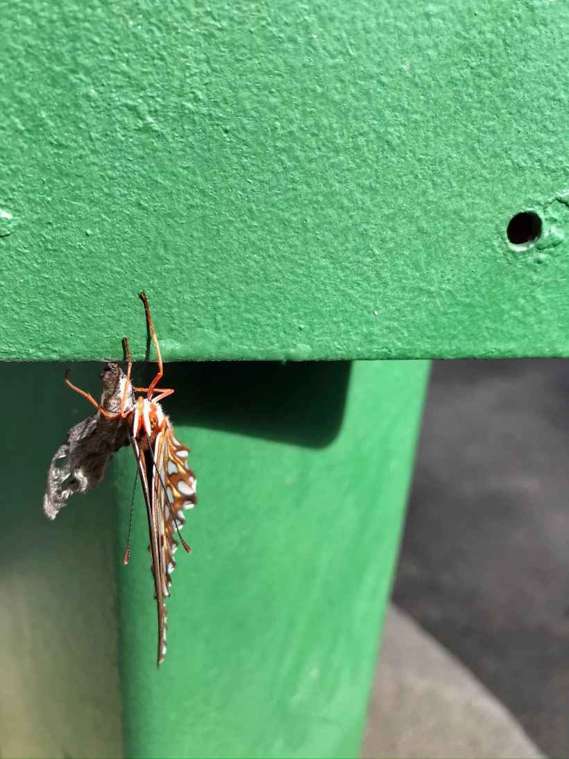
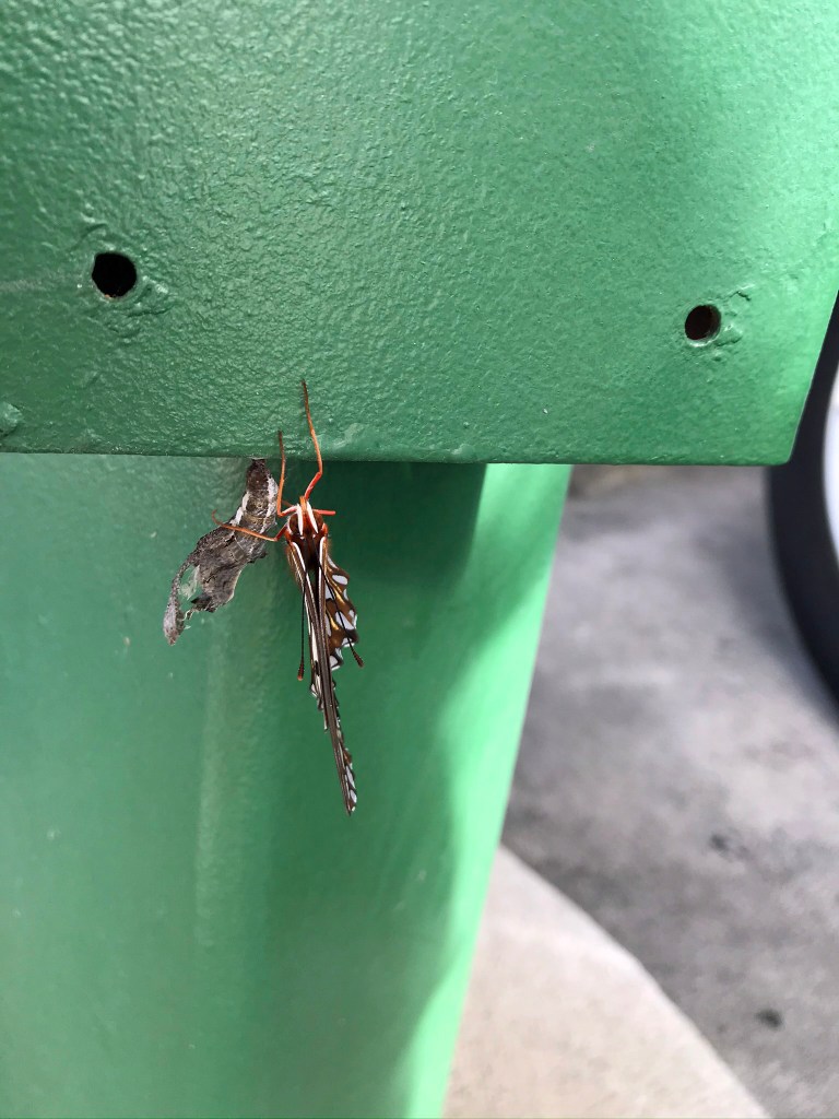
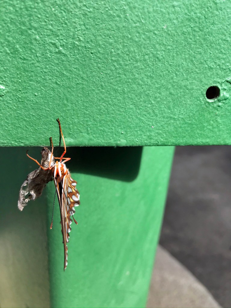
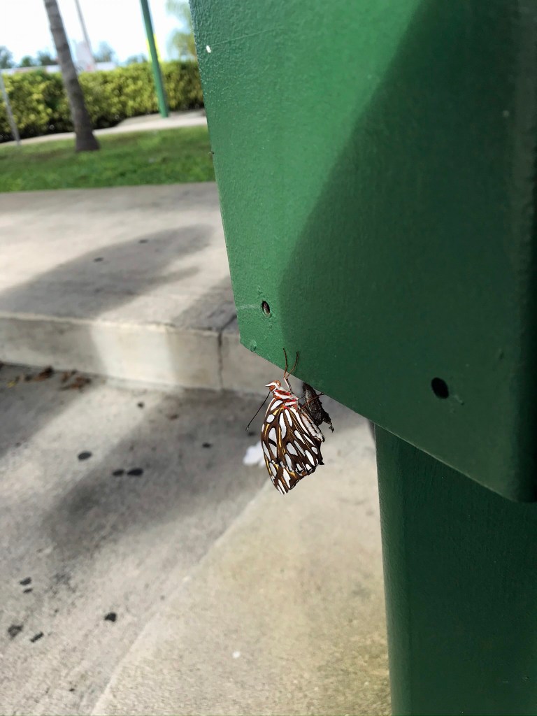
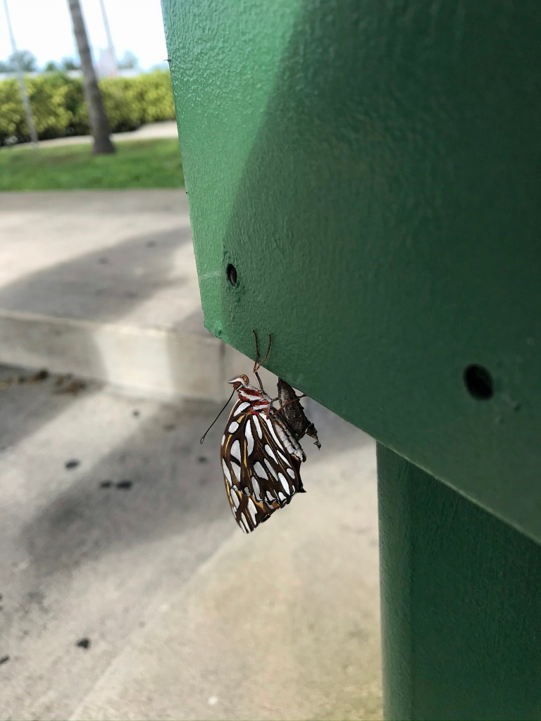
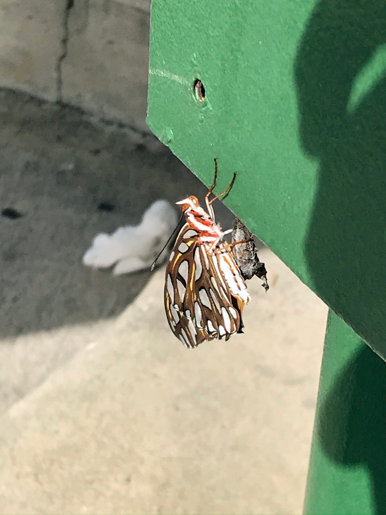
On Tuesday, December 17, 2019 a caterpillar dropped from vegetation to crawl across the parking lot of Sonic Drive-In, 2140 N Courtenay Pkwy, Merritt Island, FL 32953, crawl up an order station, affix its tail to the kelly green semi-gloss enamel, to form a chrysalis.
The afternoon of New Years Eve, 14 days later, we spied the Retro theme of this fast food business, finding it appealing, stopped for a hi-fat lunch of hamburgers, onion rings (“highly recommended, very delicious”) and (ha, ha) diet sodas, choosing this same order station where the emerged Brush-foot butterfly, of the family Nymphalidae, clung, drying in anticipation of flight.
Captured here with the Apple IPhone 8. I cannot identify the exact butterfly species this is. Source: wikipedia article on Nymphalidae.
Click photograph for the slide show. To do this from WordPress Reader, you need to first click the title of this post to open a new page.
Copyright 2020 All Rights Reserved Michael Stephen Wills
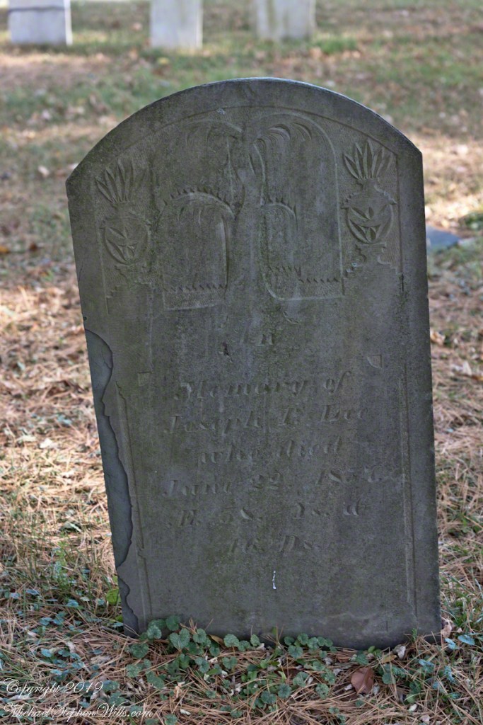
Joseph P. Lee, a middle aged gentleman with carvings of a mature willow flanked by urns. In the intervening 162 years the upper layers of slate flake at the edges.
Click photograph for a larger view. To do this from WordPress Reader, you need to first click the title of this post to open a new page.
Born June 6, 1799 Died June 22, 1857 Lived 58 years and 16 Days
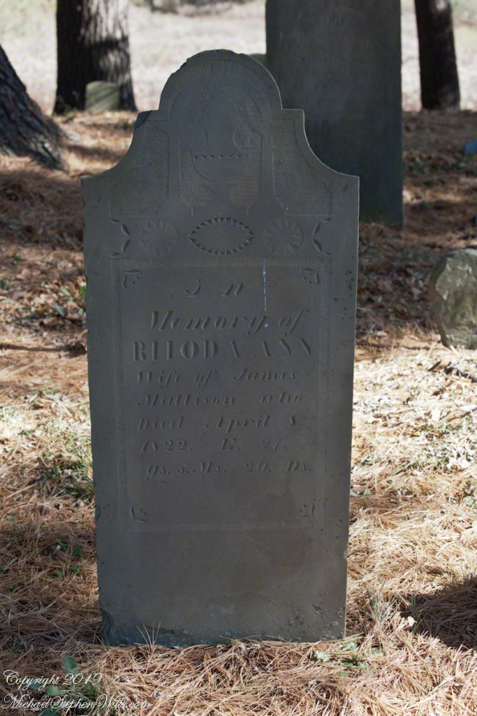
Rhoda Ann Mattison, a wife who died too young. What was the relationship of James and Rhoda to Catherine and John?
Born October 14, 1794 Diet April 8, 1822 Lived 27 years 5 months 20 days. Wife of James Mattison
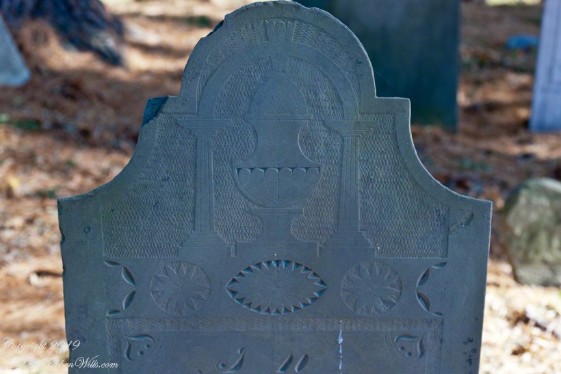
The carving is a pineapple (for hospitality) set in a elegant vase on a plinth flanked by ionic columns, a simple arch (banded to imply a rainbow?) surmounts all. Cross hatching implies space. An implied eternal banding of stylized leaves as starbursts.
I brought out the characteristic slate coloring. There is evidence of ware from the intervening 197 years, though the carving is surprising crisp.
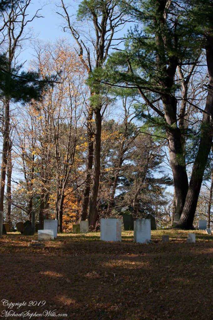
Slideshow of photographs in this series
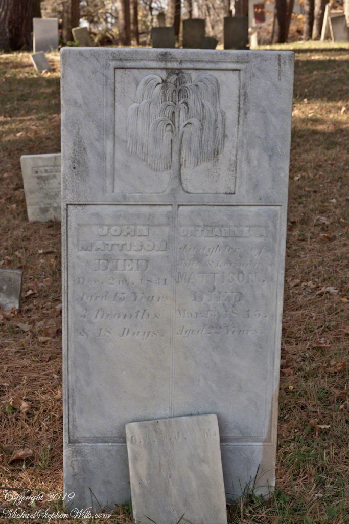
Catherine A. Mattison Born 1792/1793, Death March 13, 1815. Lived 22 years.
John Mattison, Death December 2, 1831, Born August 15, 1815 (5 months after Catherine’s Death), Lived 15 years, 3 months and 18 days.
Copyright 2019 All Rights Reserved Michael Stephen Wills
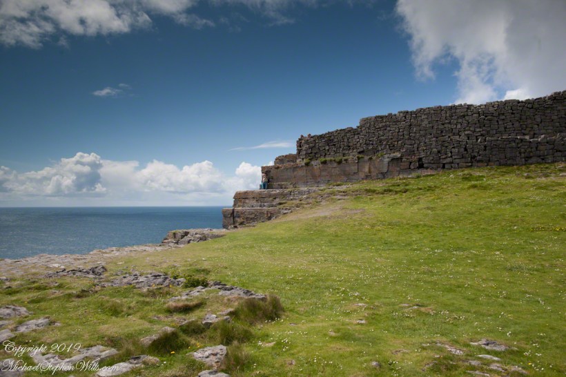
Here is the east side of the inner enclosure wall of Dun Aonghasa (Dun Aengus) where it ends at a cliff edge over the Atlantic ocean.
Visible are the last 60 feet or so of the limestone strata supporting the inner ring.
When first constructed, the inner ring was complete, the western side 1,000 feet from the cliff.. Today’s form of a semi-circle was created by nature when the force of Atlantic Ocean waves eroded the cliff, undercutting the strata.
Look close to see a fracture where the next block of limestone will fall into the waves.
Ancient fort wall with tourists and Cliff Edge of Dun Aonghasa (Dun Aengus)
Wishing a blessed All Saints Day (November 1st) for all my readers.