Friday last Pam and I joined a “James Potorti Memorial Gorge Walk” through Buttermilk Falls State Park where we learned interesting facts connected to one of my most successful photographs, “Summer Dream: Buttermilk Falls.” This is the second post of this series.
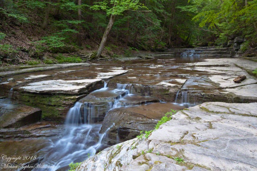
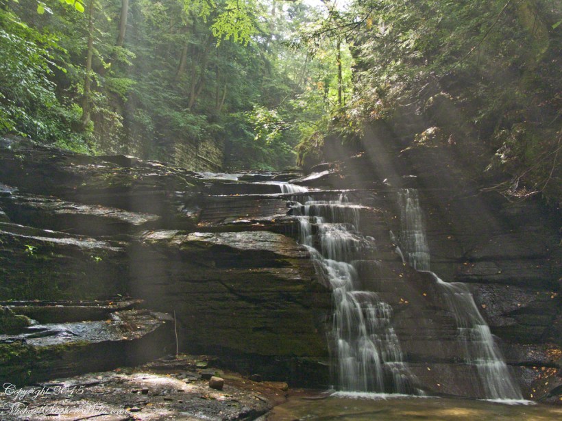
On a July morning 2018 I walked Buttermilk Creek from the scene of my “Summer Dream: Buttermilk Falls”, up the steps on the right of that photograph to where the water flows across a flat expanse of stone. This is a photograph of that expanse taken using a tripod mounted Canon EOS 1DS Mark III body with the Canon lens EF 24mm f/1.4L II USM w/a neutral density filter (0.6 as I recall).
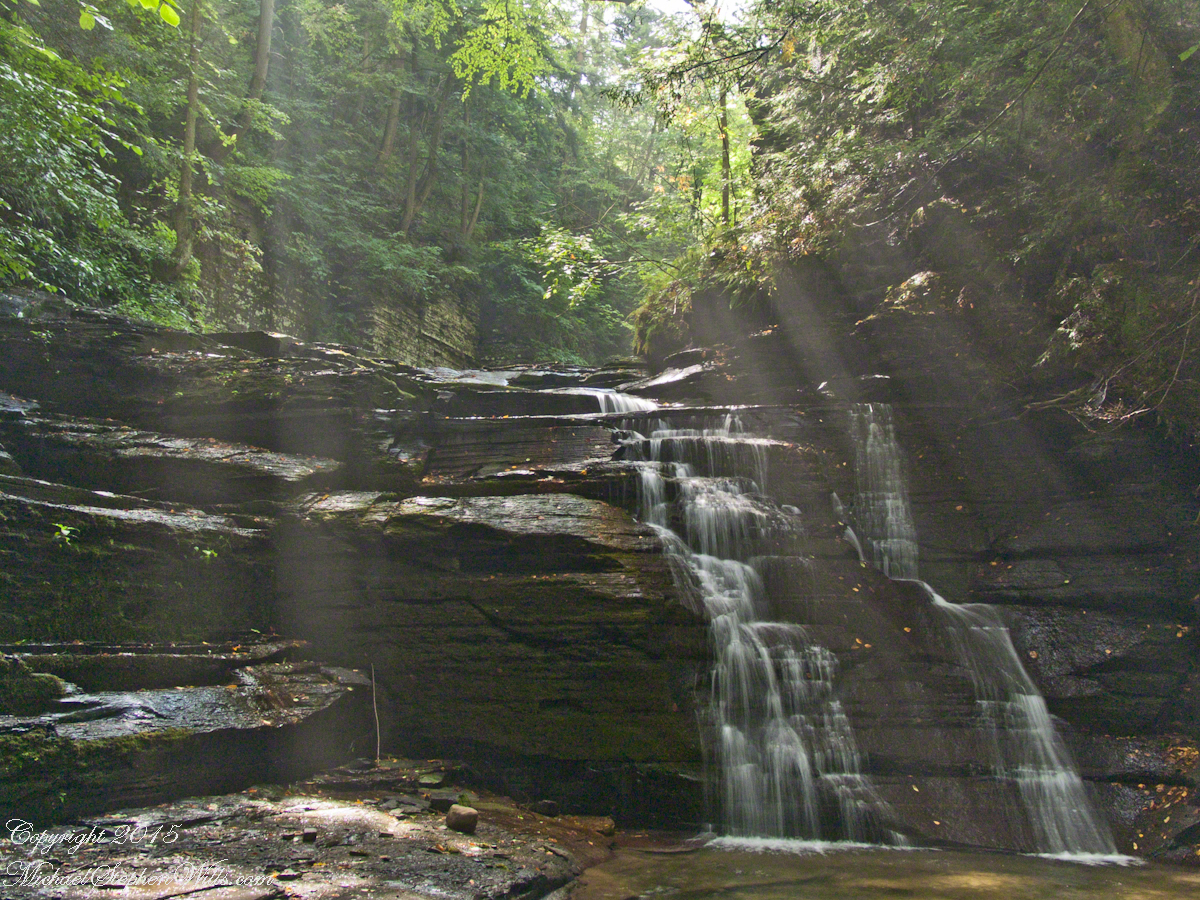
Click photograph for a larger view.
“Summertime Cascades – 2018”
For a scene from nature there are many straight lines and, even, right angles in addition to the layering of the sedimentary rock from its origin as eroded material from the ancient Arcadia mountains collected on the floor of a warm shallow sea. We learned from Friday’s walking tour this sea was close to the equator at that time, riding on a tectonic plate that’s since drifted north. This North American Plate jostling with the others.
Beneath these rocks were older formations in which decomposed organic matter had transformed to methane gas. When the African plate and this pressed together, the stressed rocks weakened at right angles to the force, each stress point joining others in straight lines. The methane gas pressure from below forced the weak points to open a straight line fractures.
As the plates continued to move, orientation to the African plate transformed by ninety degrees and the two pressed together again. Methane gas pressure was present, causing straight line fractures at right angles to the others. Everywhere these rocks are exposed across the Finger Lakes region we see these right angle fractures.
In Memorium
James Potorti was a native of Ithaca who perished at 52 years of age in New York City on September 11, 2001 were he worked on the 96th floor of 1 World Trade Center.
Copyright 2022, Michael Stephen Wills All Rights Reserved
Join us on a journey through Buttermilk Falls State Park, where we uncover fascinating geological facts that shape the gentle cascades of “Summer Dream: Buttermilk Falls.” Discover the hidden beauty of this serene landscape.
Early one Friday morning Pam and I joined a “James Potorti Memorial Gorge Walk” through Buttermilk Falls State Park where we learned interesting facts connected to one of my most successful photographs, “Summer Dream: Buttermilk Falls.”
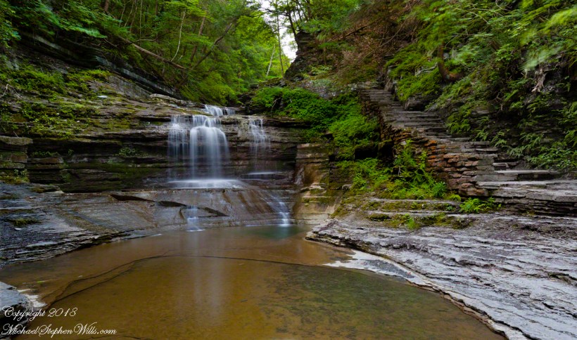
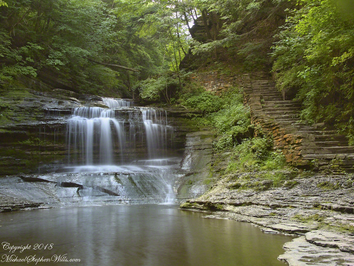
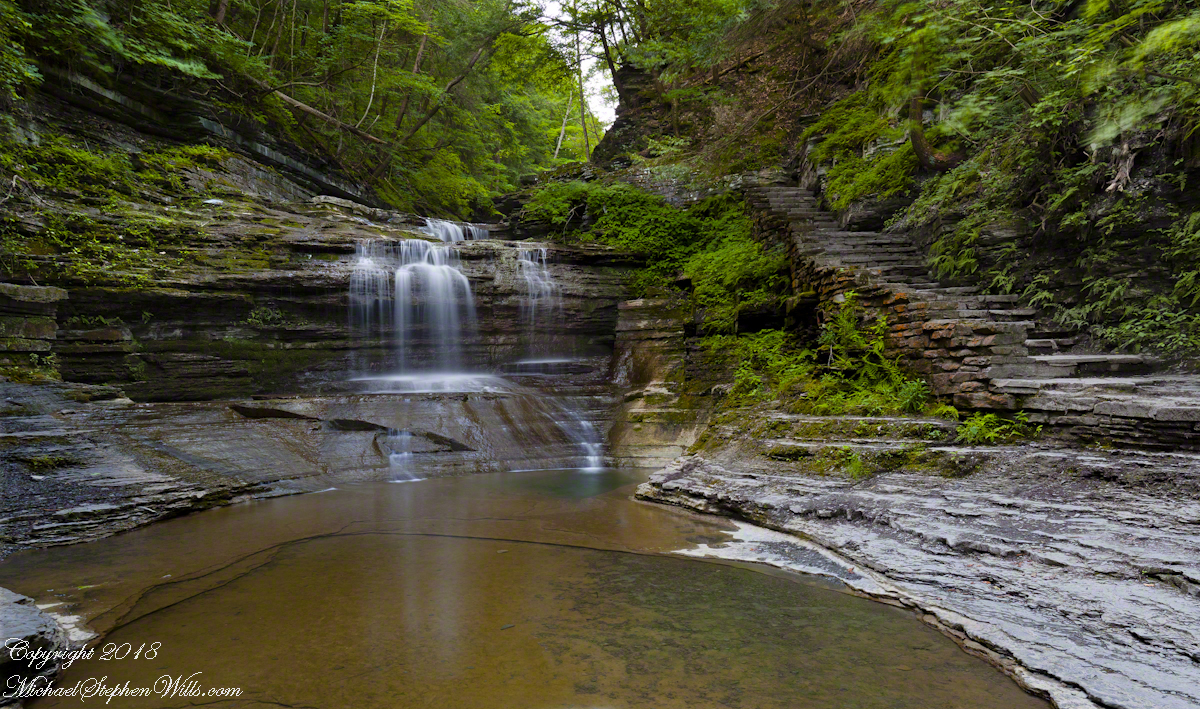
Presented here is the original photograph from July 2004 and an second version, produced July 2018. Both were produced at a low flow after many days without rainfall. The first learned fact is a significant water source for Buttermilk Creek and all the Finger Lakes gorge creeks, is ground water percolating through the sedimentary rocks cut through by the running water. The beautiful fall of water seen here is possible because the creeks flow through periods of drought, a lower flow creating these gentle cascades.
Click either photograph for a larger view.
“Summer Dream, Buttermilk Falls -2004”
pH
Secondly, because Finger Lakes sedimentary rock formed beneath warm, shallow seas 400 million years ago, water percolating trough the stone acquires soluble carbonate (calcium carbonate, Ca CO 3), an chemical imparting basic (as opposed to acidic) properties to the water. This characteristic buffers the water protecting us in the Finger Lakes from the effects of acid rain. When the pH of rainwater falling on the Finger Lakes is measured, it is acidic, falling below 5 on the scale. pH is a measure of reactive hydrogen in water, the more hydrogen the more acidic. Neutral pH is a 7. The water flowing in Buttermilk Creek is consistently around 8, in the basic side of the scale.
“Summer Dream, Buttermilk Falls – 2018”
James Potorti was a native of Ithaca who perished at 52 years of age in New York City on September 11, 2001 were he worked on the 96th floor of 1 World Trade Center.
Copyright 2022 Michael Stephen Wills All Rights Reserved
Augusts are typically dry in the Finger Lakes, drawing down creeks to a thin flow perfect for photography. I took the opportunity of Sunday leisure time to climb into Fillmore Glen gorge, set up the tripod and shoot.
The sun broke through the clouds for this shot.
Copyright 2021 Michael Stephen Wills All Rights Reserved
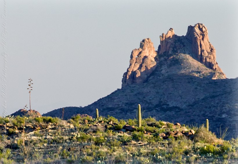
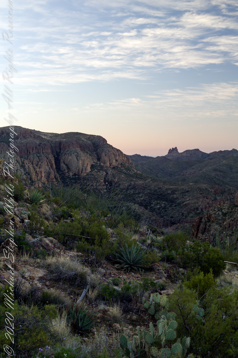
I was a member of an expedition to Peter’s Mesa March 2008, a place central to Superstition Wilderness treasure legends. This is a sunset view, looking south, southwest. Light raking across the desolation and Miner’s Needle creates a fascinating spectacle. Ancient volcanism, apparent throughout the Superstition Wilderness, is here seen in the texture, form and type of rock as well as the mineral deposits. Miner’s Needle, like Weaver’s Needle (not seen in this view), are eroded volcanic summits. Look closely for the “eye” of Miner’s Needle, easier seen in the cropped heading photograph. To this day, hopeful prospectors search for gold nuggets.
There is one form of volcanism present today as an eerie rumble or hiss, similar to an enormous distant jet engine heard now and then during our two days on the mesa, louder and closer than an overhead plane could produce. The view includes many notable Sonoran Desert plants. Many young Saguaro cactus are in the form of green poles. Catching the dramatic light, on the ridge is a tall single flower of an Agave, known as the “Century Plant” it flowers once in a long life and dies.
Peters Mesa is named after “Old Pete” Gottfried Petrasch, father of Hermann and Rhiney Petrasch. Old Pete worked for Jim Bark for awhile in the 1890s doing odd jobs. Irregular employment gave Pete and Sons time to s searched for the Lost Dutchman Mine in the years following the death of the source of the legend, the “Dutchman” Jacob Waltz. The Petrasches were one of the first groups to search for the mine, and gold in general. They covered almost the entire Superstition range in their combined searches.
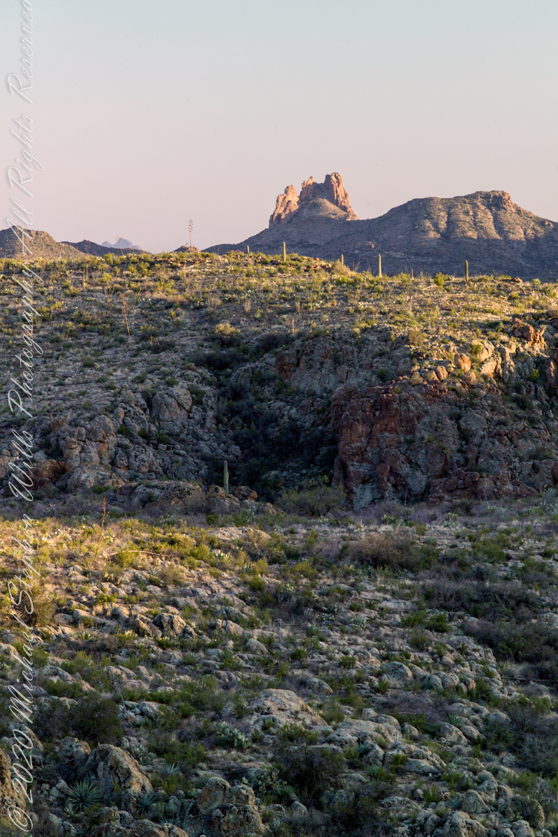
Sunrise looking across Music and LaBarge Canyons to Miner’s Needle
On our first day on the mesa, we came across the remains of one of these camps, on the top of Squaw Canyon, a deplorable junk pile discarded by searchers, presumably disappointed, too lazy to cart it out. That March, we were lucky to find the remnants of winter rains in the form of a meager trickle at the bottom of a shallow draw off Peter’s Mesa trail up from La Barge canyon. We had a good time of it until the trip was cut short by a storm front and torrential rains. We were back in Apache Junction before they hit.
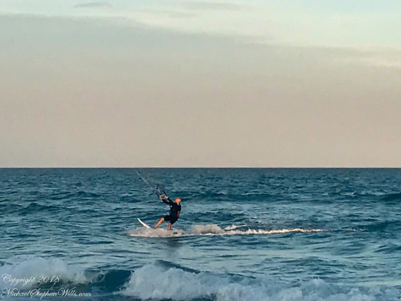
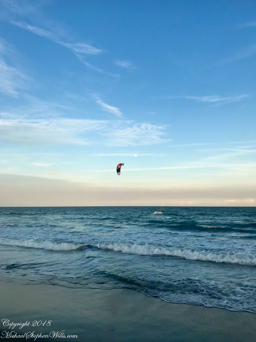
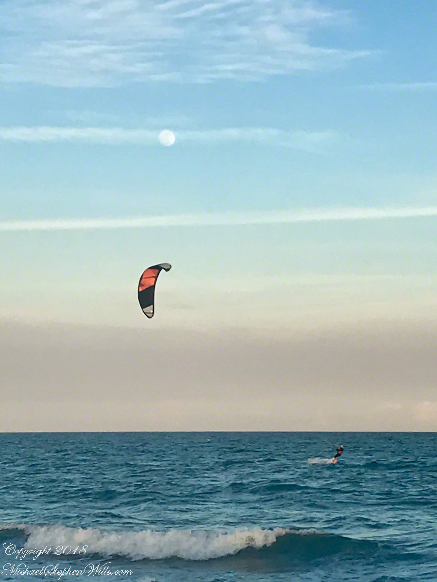
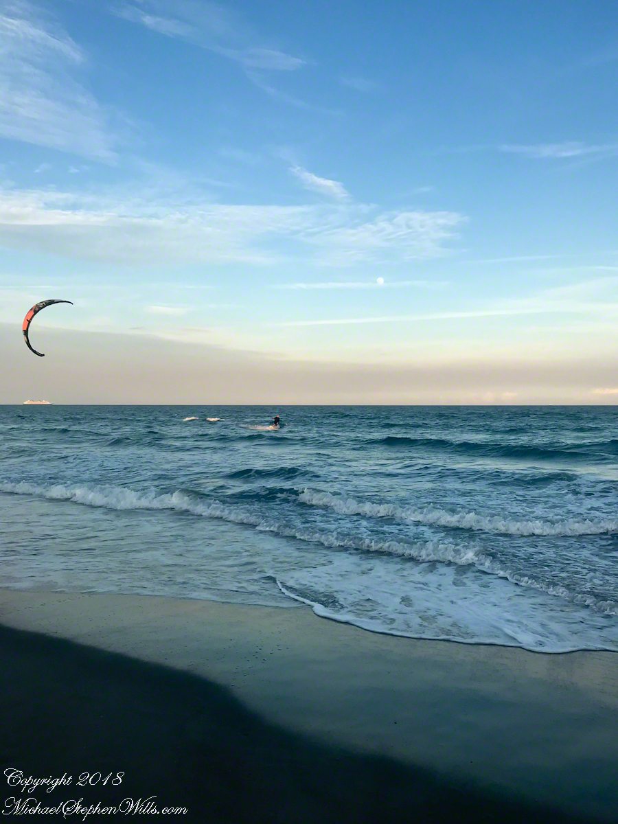
One day before the 2019 Total Lunar Eclipse a full moon rose 4:25 pm above the Atlantic Ocean off Cocoa Beach, the “Space Coast” of Florida. We saw a power kite to the south, with the southerly winds there was time before he was on us. I took the following photographs with what was at hand, an iPhone 8.
Click any photograph to visit my Online Fine Art Photography Gallery
At 50 minutes post moonrise, I included the orb in this frame as the rider tacked, rising a water crest.
Risen Full Moon and Surf Boarder at Sunset
A flick of the fingers to zoom in, the moon and rider are together as he rides toward shore.
Risen Full Moon and Surf Boarder at Sunset with cruise ship
This time of, Saturdays, the cruise ships depart Cape Canaveral Port. The kite is above the distant ship. It is amazing the kite allows sailing into the wind, his heading is southwest. The shore limits his progress, forcing a tack towards a southeast heading.
Kite Surfer coming to shore at sunset.
Or not, it seems he plans to tack to the northeast, continuing progress north up the coast. I have to wonder how he will return to the starting point?
Copyright 2022 All Rights Reserved Michael Stephen Wills
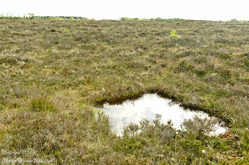
On this occasion we will explore a time machine found four miles south of Kells, County Meath, Ireland.
Step into this pool and you, too, can emerge 4,000-odd years later, skin intact, to achieve fame and fortune, a place in a museum and the record books if such exist 6019 AD. Reference the Cashel Man from Cúl na Móna bog near Cashel in County Laois, Ireland who now resides within the National Museum of Ireland.
Click photograph for the expanded view. To do this from WordPress Reader, you need to first click the title of this post to open a new page.
Girley Bog Pool
True, post mortem fame is hollow for the individual. Maybe, attaching your life story engraved on a gold plaque with a gold chain encircling your torso will offset the loss of your bones (dissolved in the acidic waters) and life itself.
The water of this pool is colored dark by long decayed vegetable matter. Beware of walking the bog surface, it is dangerous and destructive to the environment. Pam and I visited Girley Bog on our tour of County Meath, Ireland.
Copyright 2022 All Rights Reserved Michael Stephen Wills
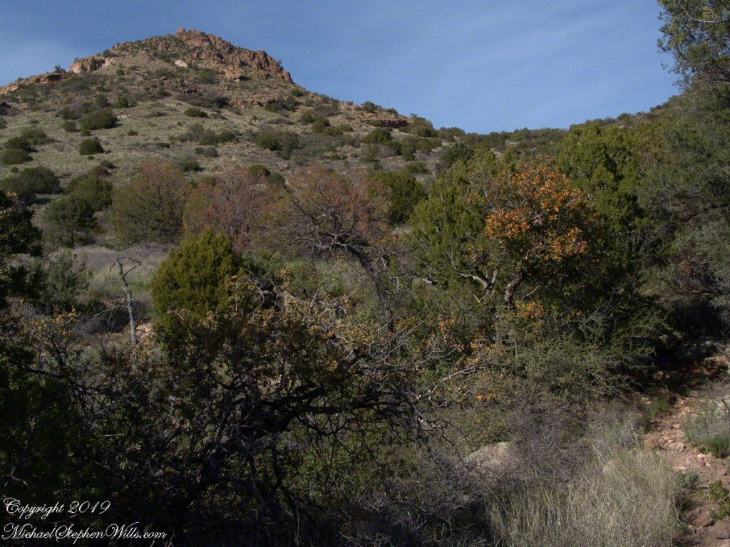
Nugget and Colorado had eaten their fill of the rich early spring grass of the apple orchard, The Searcher pulled together the pair for the return to Pine Creek. Perched on Colorado, the lead held by The Searcher, I listened as he shared survival facts remembered from Peter Bigfoot’s desert survival course. The Reavis Mountain School of Self Reliance, founded 1979, is along same Reavis Gap Trail (#117) we traversed. After descending to Pine Creek and up to Reavis Gap (where I first met The Searcher), it descends to meet Campaign Creek where the survival school is located.
He pointed out on the many flowering Century Plant stalks along the trail. “These are great to roast when young, just as the stalk starts to bud from the center, before it starts to lengthen.” By the time the stalk flowers, as in the following photograph, it is quite tough.
Agave flower spike against the dawn in the nameless canyon west of Two Bar Mountain, Superstition Wilderness, Arizona.
At the base of boulders, shaded from the sun, the ridgeline fern takes hold. Surviving on seasonal water seepage, it dries out during dry spells to later revive and reproduce via spores. As I recall, the dry or fresh form is useful as an analgesic.
An absolute necessity for bushwacking (walking off the path), a pair of rattlesnake proof boots were worn on every expedition. These rose to mid-calf with a layer of lexan, the same as used for bullet proof glass.
Swept from the Saddle
We passed the time in this way, me holding on to the saddle horn bouncing and shifting as Colorado negotiated the rough and steep path down to Pine Creek where the vegetation changed from very sparse to the thick growth you saw in my post “A Peaceful Day at Pine Creek”. On the east side of Pine Creek a trail, unmarked on the maps, follows the creek bed uphill north towards Mound Mountain. In 50 feet or so we passed the side trail to my campsite, our destination was The Searcher’s campsite. I was not paying near enough attention to the surroundings when I looked up to see an Arizona Oak limb headed to my chest. With no time or space to negotiate the obstacle I was left to grab hold and hang on to be swept from the saddle. The branch held my bulk for, at most, a second before giving way.
In bending flexibly before breaking the live Oak wood and centuries of soil underneath the trees softened my fall enough so I was badly shaken and unhurt. Falling a foot or so in any direction would have resulted in serious injury or instant death. Colorado stopped, looking briefly back as I slowly came to my feet. After taking account and letting the circumstance wash over me, I got up and proceeded slowly while we both contemplated my miraculous survival.
Bear Shelter
I now took up the rear as in a few hundred yards the valley wall rose on both sides of the Creek to form a short, narrow pass. The walls fell away just as quickly, the valley floor leveled out and we came to The Searcher’s camp. The bear shelter stood out right away. This was a ten foot high teepee of 4 – 6 inch diameter tree trunks tied with rope, within was a hammock . The three foot wide opening left only one unprotected side while he slept, offering some protection from the all too common roaming bears, most commonly from September to November when mazanita fruit ripens.
Well stocked in every respect, for a wilderness camp. In the following years of roaming the wilderness the camps of other horse people were similar in this way: stoves, comfortable cots, radios, pots and pans all fit into panniers. As a noun pannier is seldom used in the singular because there are always two, one on each side of the horse for balance. I sat on the wide top of one enjoying a cold beer pulled from a bed of ice.
We discussed the benefits and drawback of horses for exploration. I required a gallon and a half of water daily and in the desert wilderness provided for storage of three days, 4 and a half gallons. At 8 pounds each, that is 36 pounds!! Starting out, my pack weighted 90 pounds with a camera and tripod.
There are benefits to having a mode of transport that thinks for itself and drawbacks. Each individual has its own personality and horses do try to get away with what they can. It is wise to limit your dependence on a horse until you know each other well. In retrospect, I was “out on a limb” riding Colorado modified by being led by someone the horse knew well.
It was soon time for me to head back to camp. We set the agenda for the next day, an early start for the hike out. Colorado was to be fully loaded so my riding was not an option, just as well. It was possible to lighten my pack to almost nothing and I looked forward to that.
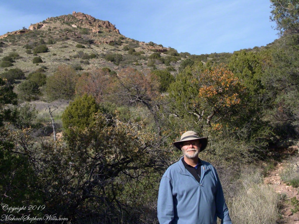
I took some time before dinner to set up the tripod for a self-portrait on my last full day in Pine Creek. The view is northeast from the Arizona Trail near my camp, the ridge overlooks Reavis Gap. I did a version of the view with and without me.
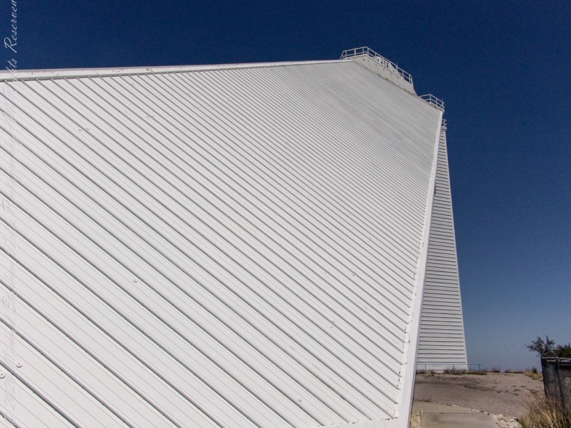
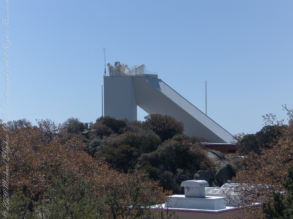
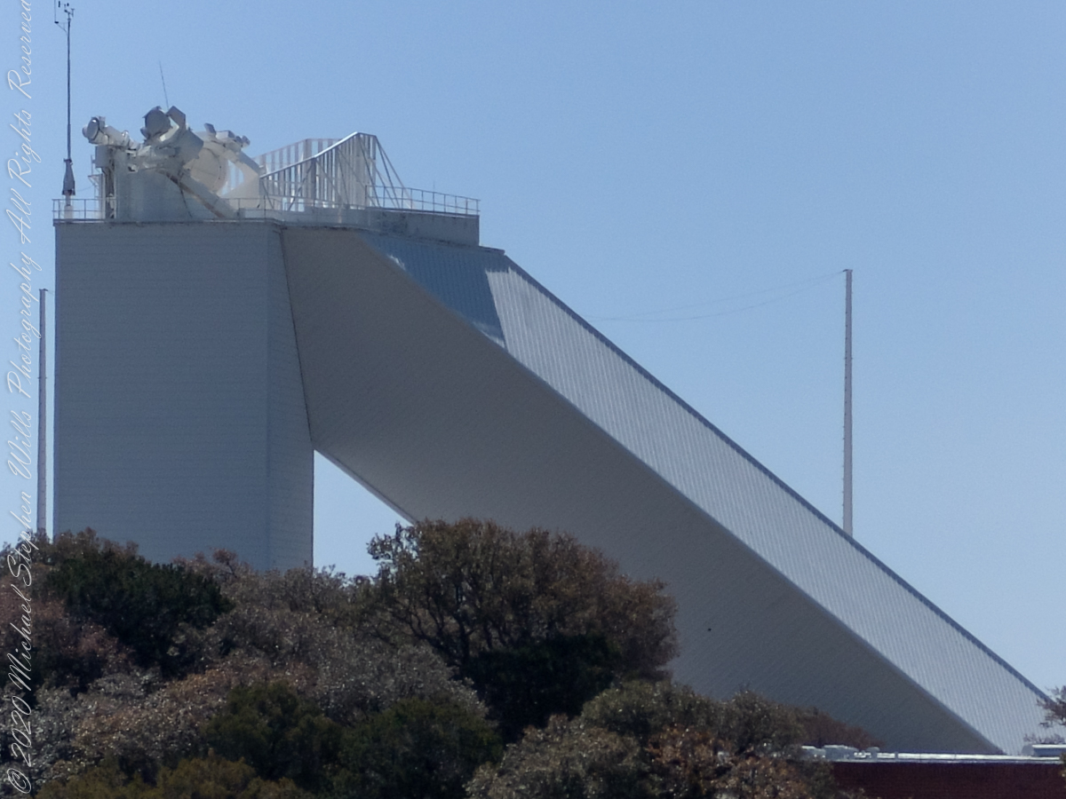
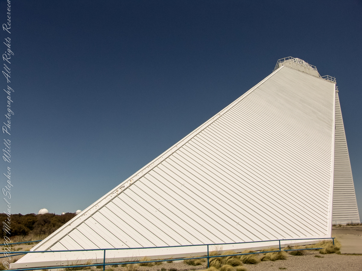
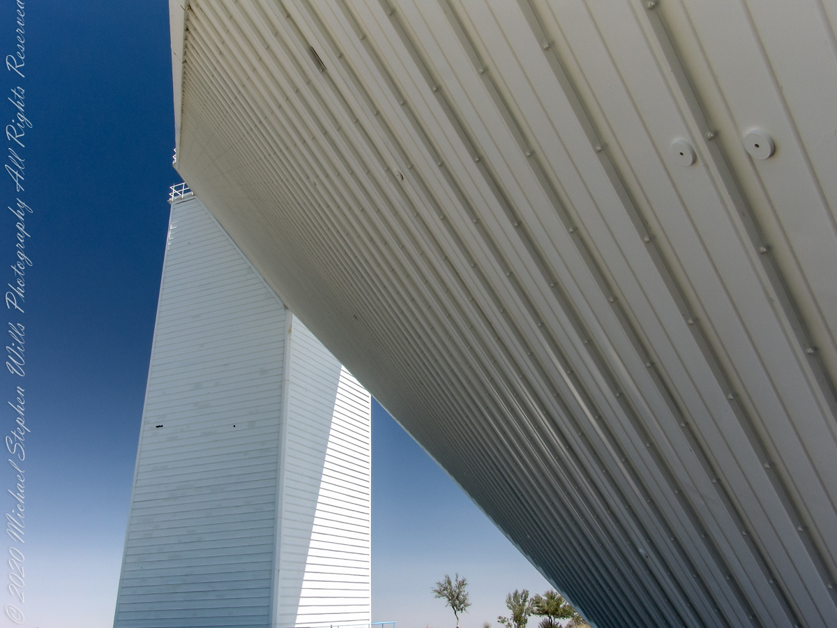
These views of the McMath–Pierce solar telescope enclosure are the preliminary to a guided tour of the instrument, April 20, 2005.
On the tower are three heliostats, plane (flat) mirrors mounted on computer-controlled platforms to follow the sun across the sky to direct sunlight to primary mirrors underground, beneath the base of the slanted shaft
Built in 1962, the building was designed by American architect Myron Goldsmith and Bangladeshi-American structural engineer Fazlur Rahman Khan. It was the largest solar telescope and the largest unobstructed aperture telescope in the world. It is named after the astronomers Robert Raynolds McMath and Keith Pierce.
The slanted shaft, looking toward the tower.View of the slanted shaft, looking toward the tower.View from underneath the slanted shaft, looking toward the tower.
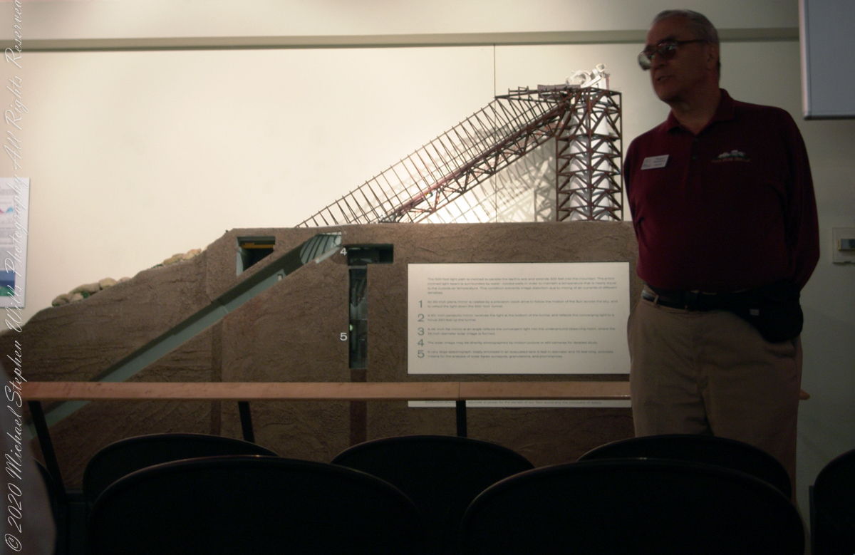
Inside the McMath–Pierce solar telescope is this keyed model of the observatory. Our docent for the morning tour stands alongside.
Reference: Wikipedia “McMath–Pierce solar telescope”
Copyright 2022 Michael Stephen Wills All Rights Reserved
“When George J. Roskruge created the official map of Pima County in 1893, he named the range after James Quinlin, who had opened a stagecoach station in the nearby town of Quinlin in 1884.” — Wikipedia article for “Quinlan Mountains.”
Kitt Peak is the highest point of the Quinlan Mountains, one of a series of ranges starting near the border with Mexico, the Baboquivari Mountains. Pan Tak pass separates Coyote Mountains from the Quinlans. Farther north there is even the Roskruge Mountains and a range named for a silver mine, the Silver Bells. Roskruge originally named “Kit’s Peak” for his sister, Phillippa, married to William F. Kitt. The peak was renamed to Kitt Peak William’s request.
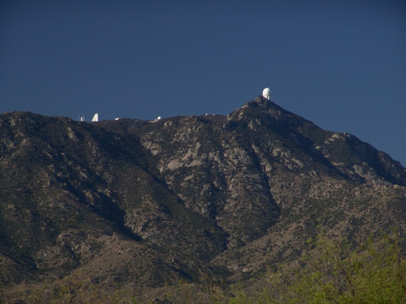
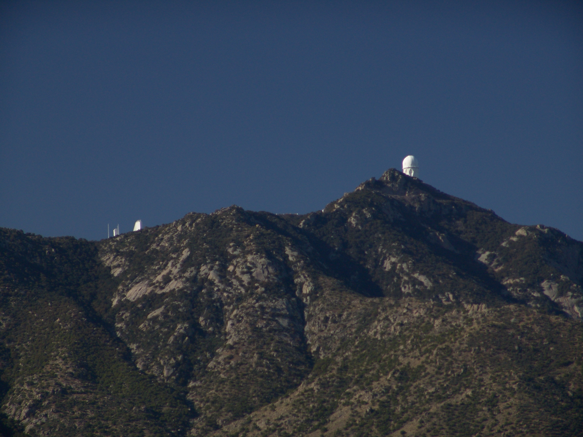
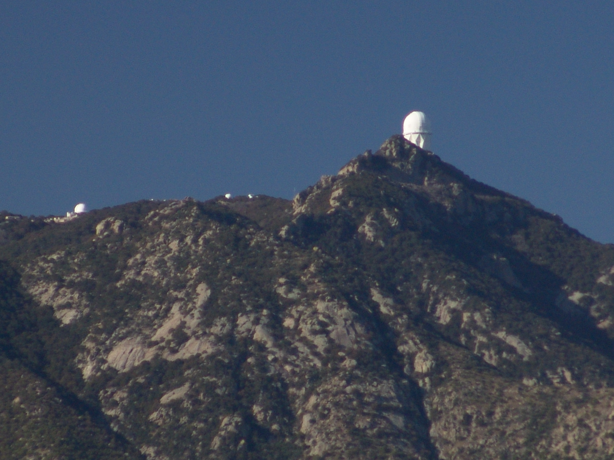
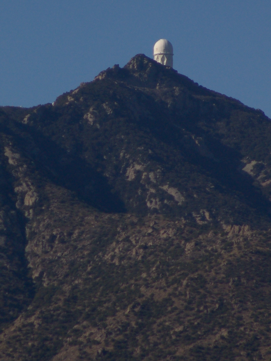
Here we see a dramatic view of Quinlan Ridge with Kitt Peak observatories, taken from the access road Arizona Routh 386. The instruments I recognize are, from left to right, McMath-Pierce Solar Telescope (second in line) and, on the end, Mayall Telescope.
And more views as I progressed toward the top.
.
The dramatic peaks are hypothesized to be igneous intrusions into metamorphic rock, these are called “Sky Islands” for the environments supported on them, radically different from surrounding lowlands. Kitt Peak is known for the stands of Manzanita Bushes
A mature Manzanita growing along the Miller Trail of the Rincon Mountain Wilderness. There is an enlargement of the flowers, to the right.
Copyright 2022 Michael Stephen Wills All Rights Reserved
The Contreras fire threatening Kitt Peak last month brought to mind a spring visit of mine to the National Observatory.
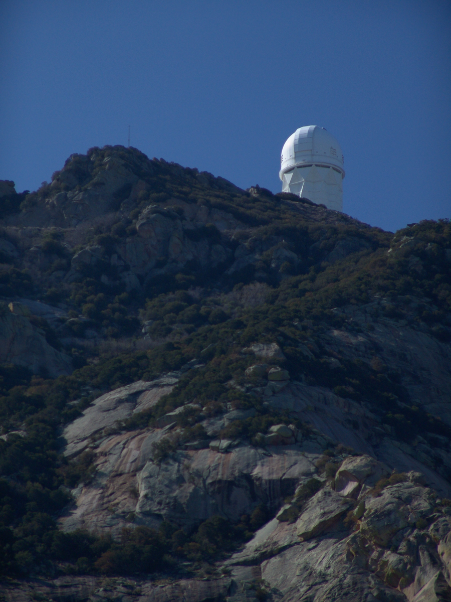
From downtown Tucson get onto Interstate 10, heading “east” toward El Paso. East in quotations as the road only turns east after the fork for Interstate 19, headed south past San Xavier del Bac mission and Nogales at the Mexican border. A few miles down I19, well before the mission, a turnoff for Arizona route 86, a road you’ll follow the better part of 36 miles, passing the Tucson Mountains on the right. Most days, the Mayall Telescope of Kitt Peak shines bright white ahead, as it did the right after dawn on Wednesday, April 20, 2005.
At some point R86 enters the 4,453.307 square mile extent Tohono O’odham Nation Reservation, you pass the town Three Points where Arizona route 286 heads south to Sasabe and the Mexican border. The next turn south is the Kitt Peak access road, Arizona route 386. On that Wednesday I was so early the gate to the peak was locked, so I pulled off the road and waited. It is a lonely place on the route for migrants from Mexico. I wandered off the road, into a wash (dry, sandy stream bed), to relieve myself, where junk from migrants was scattered around. Back in the car a helicopter approached with a black SUV. A big guy got out, walking by into the wash: the border patrol.
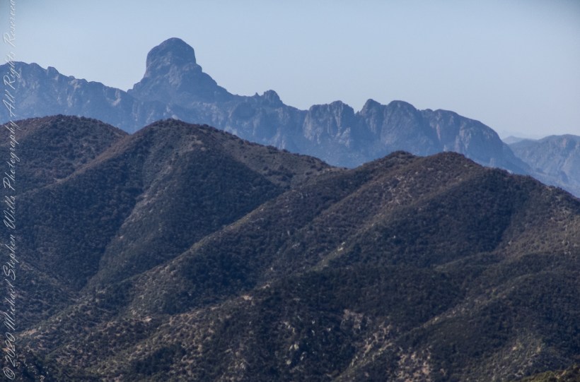
Here is a photograph from that day of Baboquivari Peak taken from Kitt Peak’
Baboquivari Peak is the most sacred place to the Tohono O’odham people. It is the center of the Tohono O’odham cosmology and the home of the creator, I’itoi. According to tribal legend, he resides in a cave below the base of the mountain. This mountain is regarded by the O’odham nation as the navel of the world – a place where the earth opened, and the people emerged after the great flood. Baboquivari Peak is also sometimes referred to as I’Itoi Mountain. In the native O’odham language, it is referred to as Waw Kiwulik, meaning “narrow about the middle”. The O’odham people believe that he watches over their people to this day. — Wikipedia
Baboquivari Peak was mentioned in the journals of Jesuit missionary Padre Kino, who made many expeditions into this region of the Sonoran Desert, beginning in 1699, establishing Spanish Missions in the area. — Wikipedia
Kitt Peak is in the sacred precinct of Baboquivari, the land just below the peak is the “Gardens of the Sacred Tohono O’odham Spirit I’itoi.” The month of my visit, the O’odham nation brought legal suit against Kitt Peak to halt construction of new telescopes in the garden. The issue was settled out of court.
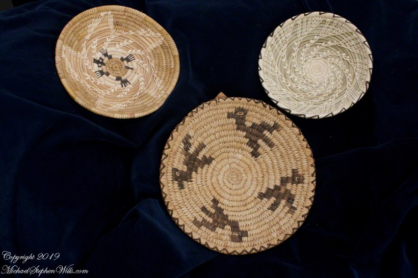
About the header photograph: From the bottom clockwise. Birds by Anmelia Juan of Geawuk (Kitt Peak 1972) – I purchased this from the Kitt Peak gift shop during my first visit; Turtle by Olvera and Simon Valenquela (Saguaro National Monument 2005); Stars by Simon Valenzuela for his daughter Pasquala Valenquela 16th Birthday (2018). Simon is of the Pascua Yaqui tribe who Learned basketmaking from his wife’s family.
Copyright 2022 Michael Stephen Wills All Rights Reserved