A Japanese flowering cherry tree in bloom on an early May day. Called a Shirofugen (Secientific name: Prunue serrulata, of the Rosaceae family this is the species planted around National Tidal Basin, Washington D.C. and around which the National Cherry Blossom Festival is celebrated commemorating the 1912 gift of Prunus serrulata Japanese cherry trees from Tokyo to the city of Washington.
The tree over Pam is called a Shirofugen (Scientific name: Prunus serrulata, of the Rosaceae family) and is one species planted around National Tidal Basin, Washington D.C. Shirofugen blossoms are described “Flowers double, deep pink at first, fading to pale pink.”
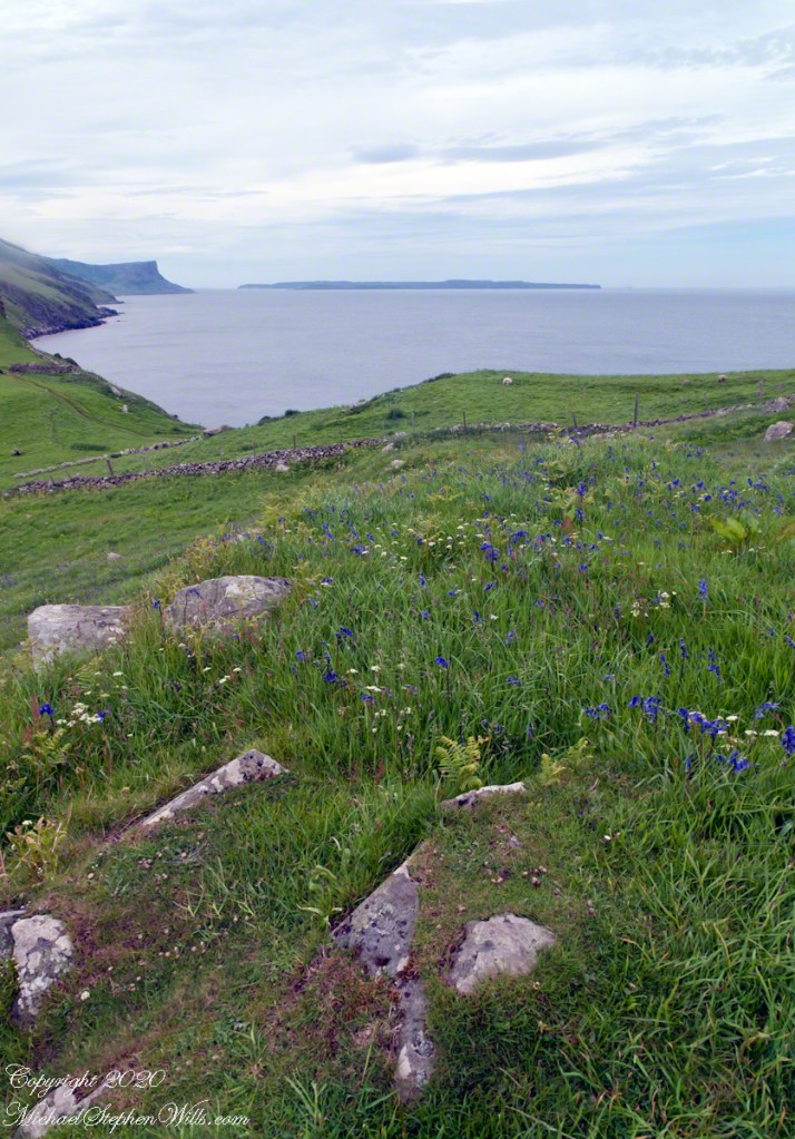
Click any photograph for my Getty portfolio.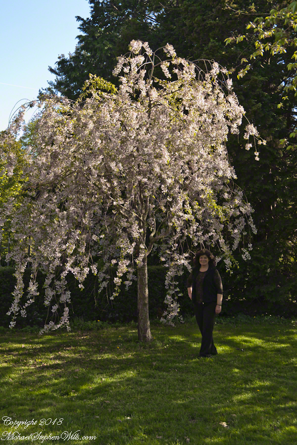
In Japan, since the 8th century, “Hanami” is the centuries-old practice of picnicking under a blooming sakura or ume tree. Here in the United States, the National Cherry Blossom Festival is celebrated commemorating the 1912 gift of Prunus serrulata Japanese cherry trees from Tokyo to the city of Washington.
Traditionally cherry blossoms remind the Japanese of clouds, the blooms come out en mass, the tree changes shape with the breeze. Viewing sakura brings to mind thoughts of the transience of existence, the fragility and transience of the exquisite blooms leads one to appreciate the moment. The following photograph of Pam was taken a month before my Mother’s sudden decline and passing in 2013. We’d travel to Long Island several times a year to visit her, then take in familiar sights.
Growing up, our family visited the Planting Fields, a state park, several times in the spring and summer. As an adult with a growing family in Glen Cove, right around the corner, the Planting Fields were a welcome outing and visited several time times a year. The following photograph, taken that same May 2013 day, was a favorite park scene.
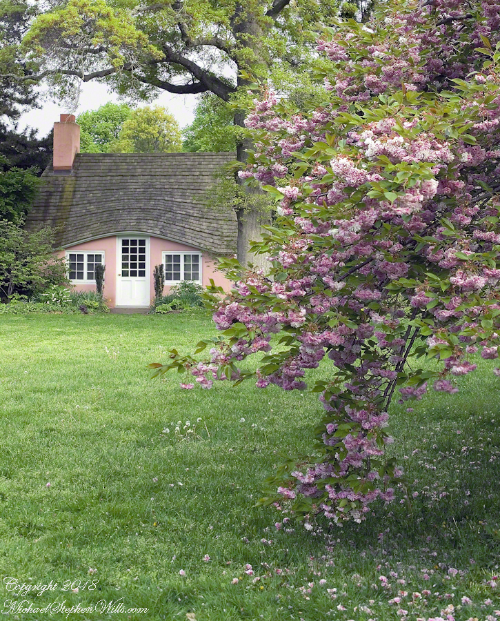
The two flowering cherry trees in the foreground are a type of Japanese sakura called Yoshino, one the most popular flowering cherries in temperate climates worldwide. All Yoshinos are clones from a single grafting and propagated throughout the world. The scientific name outlines the cross breeding of this variety, Prunus X Yeaoensis. Behind the cherries is an Oak tree, new leaves a bright green, and a pink child’s playhouse cottage.
A changing scene of the park is the now frequent visits by wedding parties and photographers, groups of Asian people, the bride and groom posing under the clouds of blossoms. By frequent I mean a steady stream, one after the other, when the blossoms are full.
Click any photograph for my Getty portfolio.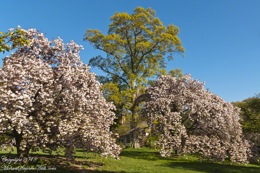
In 2007 I spent hours framing and capturing the following photograph on a Saturday, the day before Mother’s Day, during a visit to my Mother, who was widowed December, 1995. I used an inexpensive tripod, a Kodak DCS Pro slr/c camera body with the Canon 50mm f 1.4 USM lens, a UV filter and lots of time. There were no interruptions that day, at 5:30 pm I had the area to myself.
This child’s garden playhouse, framed by an ancient oak, pink Japanese cherry blossoms and gracious lawn was awarded a Photographic Society of American, Pictorial Print Division, Print of the Month award, published in the society magazine for that month.
Click any photograph for my Getty portfolio.
Please browse my reasonably priced stock photography. License a photograph, download and use it for your website or blog. Click this link to browse all my Getty IStock Photography offerings.
Or click this link to purchase a print of “Playhouse” with optional custom framing from my Fine Art Gallery.
Copyright 2023 Michael Stephen Wills All Rights Reserved