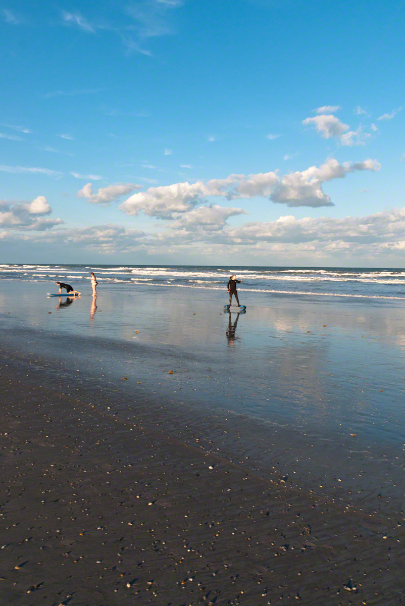
In the early morning hours of Sunday, September 10, 2017 as Hurricane Irma approached the Florida Keys, I cannot sleep, worried about family members north of Miami and in Daytona Beach. To pass the time, I returned to the golden hours of March 4, 2017 evening. On vacation, Pam and I walked Cocoa Beach starting from Lori Wilson Park, headed north.
The light was perfect when I decided to switch to Raw-Jpeg mode, feeling the extra space was worth it. I don’t know why I don’t shoot Raw 100% of the time, as always, in retrospect, I regret using jpeg only. The camera was the Sony Alpha 700 dslr with a DT 18-200mm f3.5-6.3 lens purchased 2008 after an expedition to the Superstition Wilderness.
After capturing a wedding photo shoot and surfers there was this set of two Kite Skaters going at least 20 miles an hour. The Sony Alpha was quick enough to capture some of the action in raw mode, I am not satisfied with the sharpness of the images as the lens was not fast enough.
We had never watched kite skaters before and were prepared to understand the vision from watching distant kite surfers out beyond the breakers. North winds are the best for any type of kiting on Cocoa Beach and, that day, the wind was northeast. These riders zipped by in less than a minute. The sport is low key, it does not exist on Wikipedia. Image that. These two are having a fantastic time and stayed upright, going on and on and on down the miles long beach.
Sailskater Dreamview with Cruise Ship
1990 KiteSkate pioneers on the USA east coast experimented with four-line controllable parafoil kites powering in-line skates for exciting rides on asphalt surfaces.
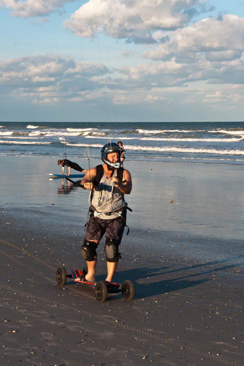
Her partner approaches
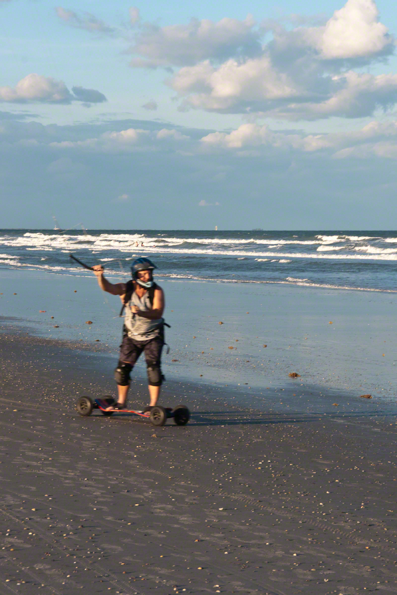
The name “Wheels of Doom” suggest the danger of going this fast over a hard, rough surface.
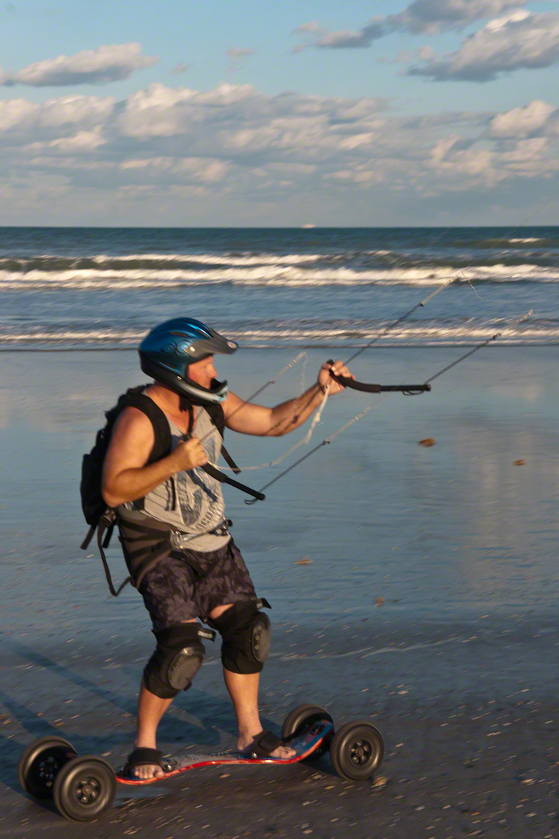
He makes it look easy
These Cocoa Beach riders are outfitted for speed and safety: pads, helmets.
He maneuvers kite overhead to slow down.
Barefeet?? Unprotected skin? They must know how to dress, though maybe not. He has never fallen?
Full speed ahead with the kite positioned forward.
The beach within the tide line is solid, the pebbles, broken shells and such unforgiving as asphalt.
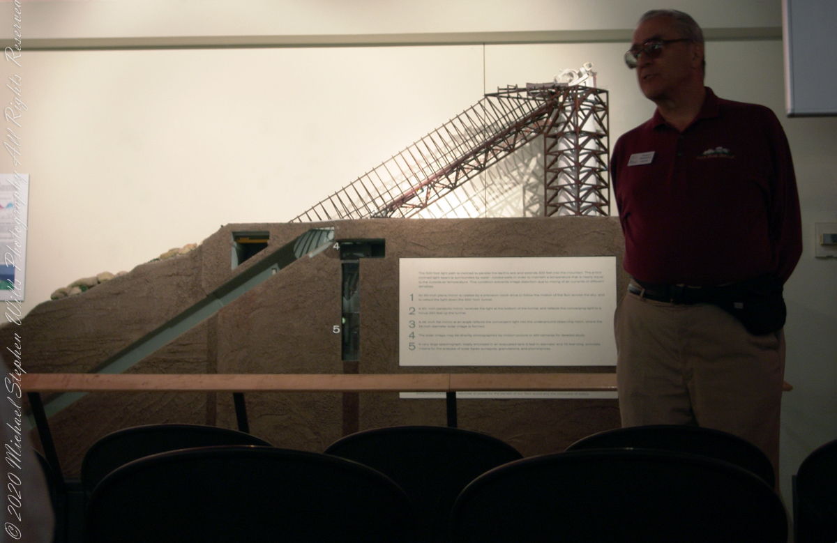
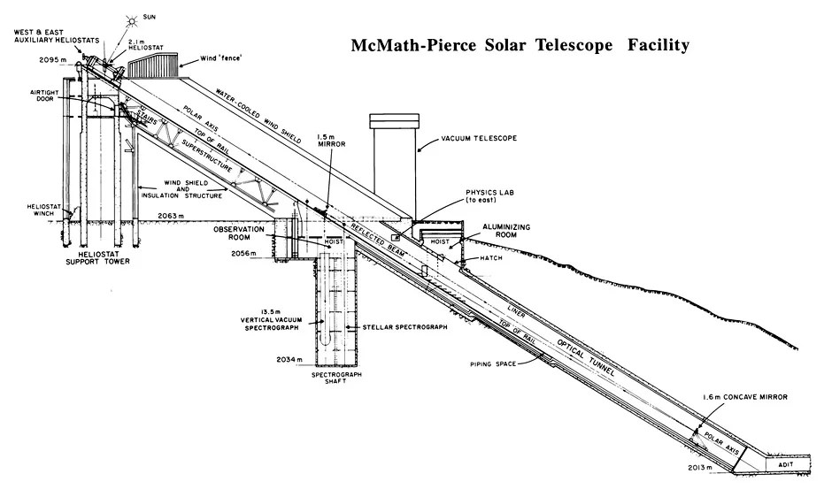
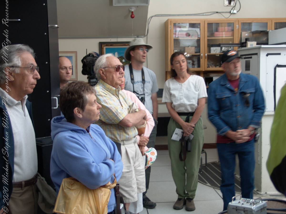
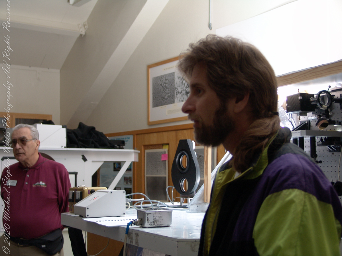
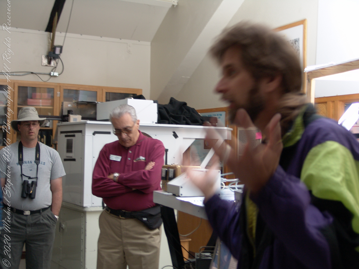
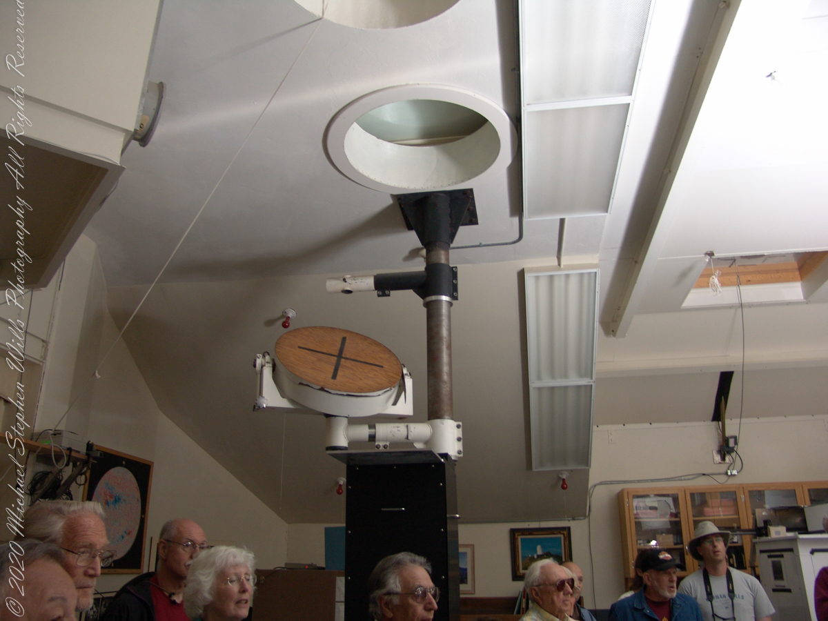
These views within the McMath–Pierce solar telescope enclosure were captured during a guided tour of the instrument, April 20, 2005. By way of orientation, the observation room we visited is near the location labeled “4” on the model of the following photograph or the “Observation Room” of the drawing.
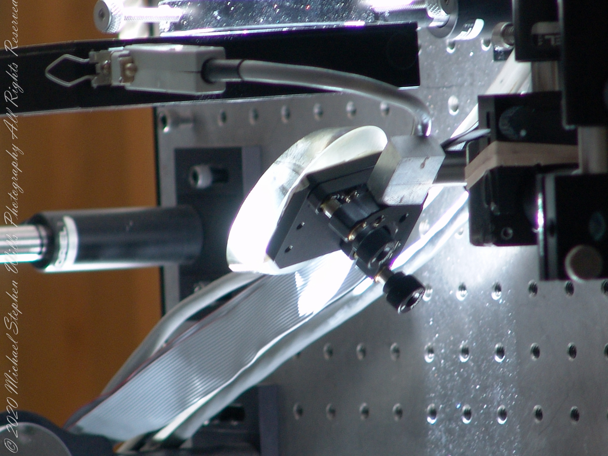
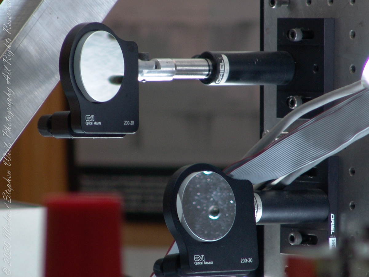
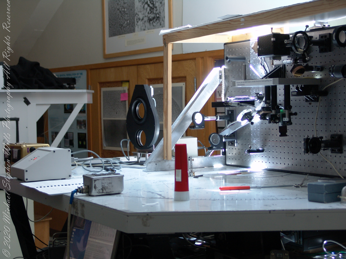
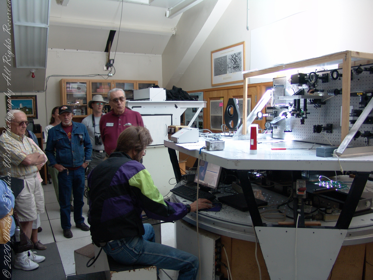
We learned each of the sets of mirrors is considered a separate telescope. The first step in designing the new solar telescope was to determine the optimal image scale. Working on the spectra of the solar granules, on the physical structure of the sunspots and their associated magnetic fields, requires a considerable image size. Past experience has shown that the optimal image of the sun should be approximately 0.91 meters. The highlight of our visit to the Main Observation room was meeting with the technician operating the recently developed low-cost adaptive optics system.
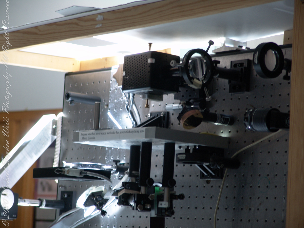
Tip-tilt correction and low order wavefront correction is available with a number of portable optical benches. These are primarily used with the Main spectrograph and the Solar Stellar spectrograph on the Main telescope, but due to their compact mounting they could be used with other telescopes and instruments in the facility.
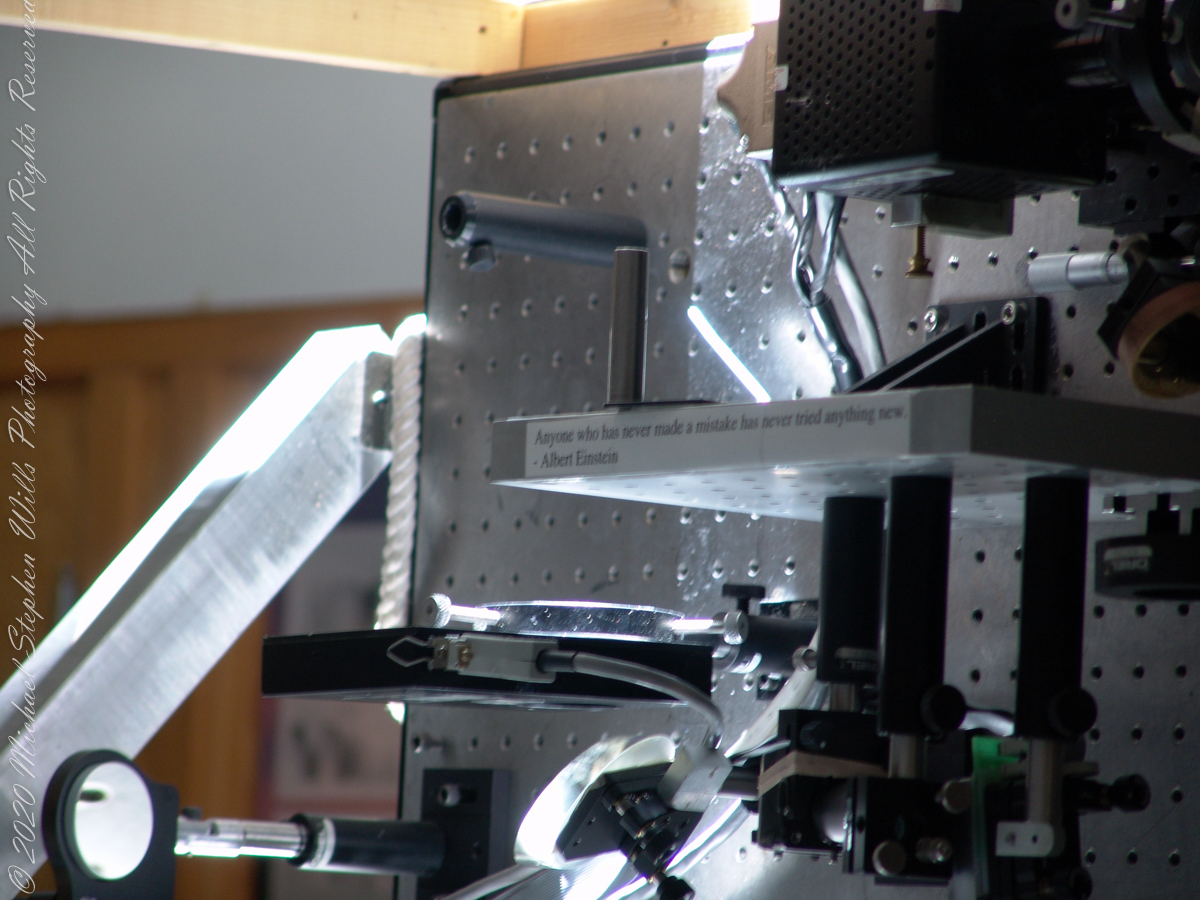
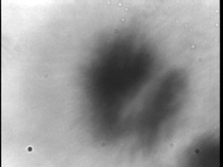
This configuration uses a rapidly deformable mirror to correct distortions introduced by the turbulent atmosphere. Using sensors to measure the degree of image distortion, the adaptive optics system adjusts the shape of the mirror accordingly and converts a blurred image into a clear one. The following image demonstrates the correction. “Low-cost” = $25,000 in 2003 US dollars. Under references is a link to a full description of the device by the creator.
Christopher Keller, Public domain, via Wikimedia Commons
A main area of study in the observatory is the structure of sunspots, which are relatively cold, dark spots on the surface of the Sun created by intense magnetic activity.
Some of the most important discoveries made at McMath-Pierce include the detection of water vapor in the Sun, the measurement of kilogauss magnetic fields (thousands of times stronger than those on Earth) outside sunspots and the detection of a natural maser (like a laser, but with a microwave instead of visible light) in the Martian atmosphere.
Over the years and technological advances, the National Solar Observatory has moved its headquarters from Tucson to Boulder, Colorado. The organization abandoned its solar telescopes at Kitt Peak and in New Mexico for a larger instrument in Hawaii, the Daniel K. Inouye Solar Telescope on the island of Maui, which began operating in 1919.
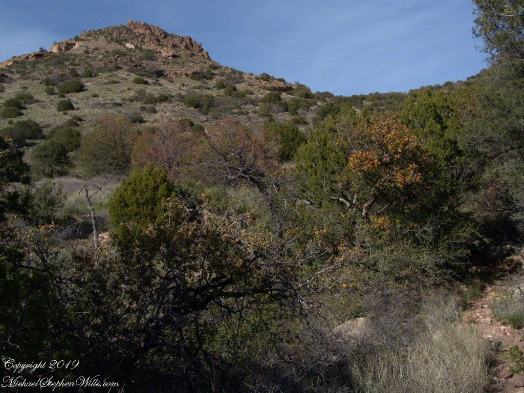
Nugget and Colorado had eaten their fill of the rich early spring grass of the apple orchard, The Searcher pulled together the pair for the return to Pine Creek. Perched on Colorado, the lead held by The Searcher, I listened as he shared survival facts remembered from Peter Bigfoot’s desert survival course. The Reavis Mountain School of Self Reliance, founded 1979, is along same Reavis Gap Trail (#117) we traversed. After descending to Pine Creek and up to Reavis Gap (where I first met The Searcher), it descends to meet Campaign Creek where the survival school is located.
He pointed out on the many flowering Century Plant stalks along the trail. “These are great to roast when young, just as the stalk starts to bud from the center, before it starts to lengthen.” By the time the stalk flowers, as in the following photograph, it is quite tough.
Agave flower spike against the dawn in the nameless canyon west of Two Bar Mountain, Superstition Wilderness, Arizona.
At the base of boulders, shaded from the sun, the ridgeline fern takes hold. Surviving on seasonal water seepage, it dries out during dry spells to later revive and reproduce via spores. As I recall, the dry or fresh form is useful as an analgesic.
An absolute necessity for bushwacking (walking off the path), a pair of rattlesnake proof boots were worn on every expedition. These rose to mid-calf with a layer of lexan, the same as used for bullet proof glass.
Swept from the Saddle
We passed the time in this way, me holding on to the saddle horn bouncing and shifting as Colorado negotiated the rough and steep path down to Pine Creek where the vegetation changed from very sparse to the thick growth you saw in my post “A Peaceful Day at Pine Creek”. On the east side of Pine Creek a trail, unmarked on the maps, follows the creek bed uphill north towards Mound Mountain. In 50 feet or so we passed the side trail to my campsite, our destination was The Searcher’s campsite. I was not paying near enough attention to the surroundings when I looked up to see an Arizona Oak limb headed to my chest. With no time or space to negotiate the obstacle I was left to grab hold and hang on to be swept from the saddle. The branch held my bulk for, at most, a second before giving way.
In bending flexibly before breaking the live Oak wood and centuries of soil underneath the trees softened my fall enough so I was badly shaken and unhurt. Falling a foot or so in any direction would have resulted in serious injury or instant death. Colorado stopped, looking briefly back as I slowly came to my feet. After taking account and letting the circumstance wash over me, I got up and proceeded slowly while we both contemplated my miraculous survival.
Bear Shelter
I now took up the rear as in a few hundred yards the valley wall rose on both sides of the Creek to form a short, narrow pass. The walls fell away just as quickly, the valley floor leveled out and we came to The Searcher’s camp. The bear shelter stood out right away. This was a ten foot high teepee of 4 – 6 inch diameter tree trunks tied with rope, within was a hammock . The three foot wide opening left only one unprotected side while he slept, offering some protection from the all too common roaming bears, most commonly from September to November when mazanita fruit ripens.
Well stocked in every respect, for a wilderness camp. In the following years of roaming the wilderness the camps of other horse people were similar in this way: stoves, comfortable cots, radios, pots and pans all fit into panniers. As a noun pannier is seldom used in the singular because there are always two, one on each side of the horse for balance. I sat on the wide top of one enjoying a cold beer pulled from a bed of ice.
We discussed the benefits and drawback of horses for exploration. I required a gallon and a half of water daily and in the desert wilderness provided for storage of three days, 4 and a half gallons. At 8 pounds each, that is 36 pounds!! Starting out, my pack weighted 90 pounds with a camera and tripod.
There are benefits to having a mode of transport that thinks for itself and drawbacks. Each individual has its own personality and horses do try to get away with what they can. It is wise to limit your dependence on a horse until you know each other well. In retrospect, I was “out on a limb” riding Colorado modified by being led by someone the horse knew well.
It was soon time for me to head back to camp. We set the agenda for the next day, an early start for the hike out. Colorado was to be fully loaded so my riding was not an option, just as well. It was possible to lighten my pack to almost nothing and I looked forward to that.
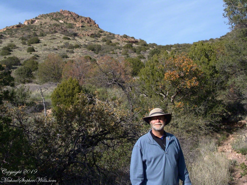
I took some time before dinner to set up the tripod for a self-portrait on my last full day in Pine Creek. The view is northeast from the Arizona Trail near my camp, the ridge overlooks Reavis Gap. I did a version of the view with and without me.
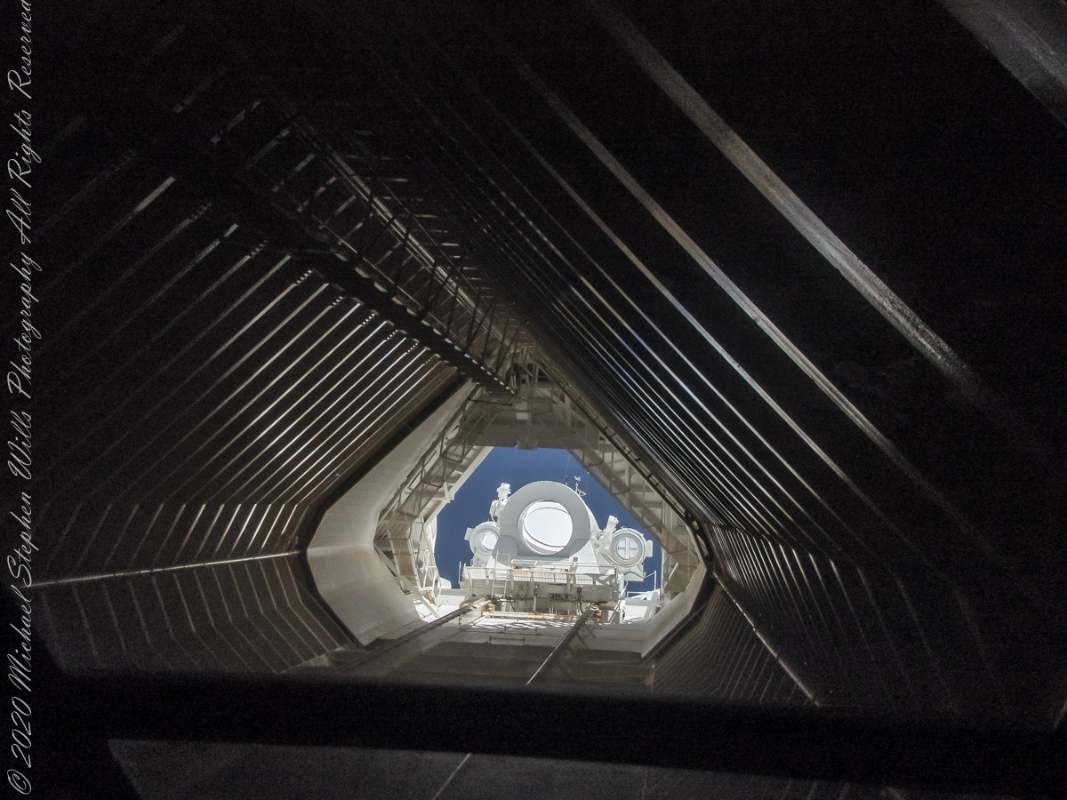
These views within the McMath–Pierce solar telescope enclosure were captured during a guided tour of the instrument, April 20, 2005. By way of orientation, think of yourself at the location labeled “4” on this model. This is the only large telescope where humans can view the interior and visually experience the light paths “bouncing” between the mirrors.
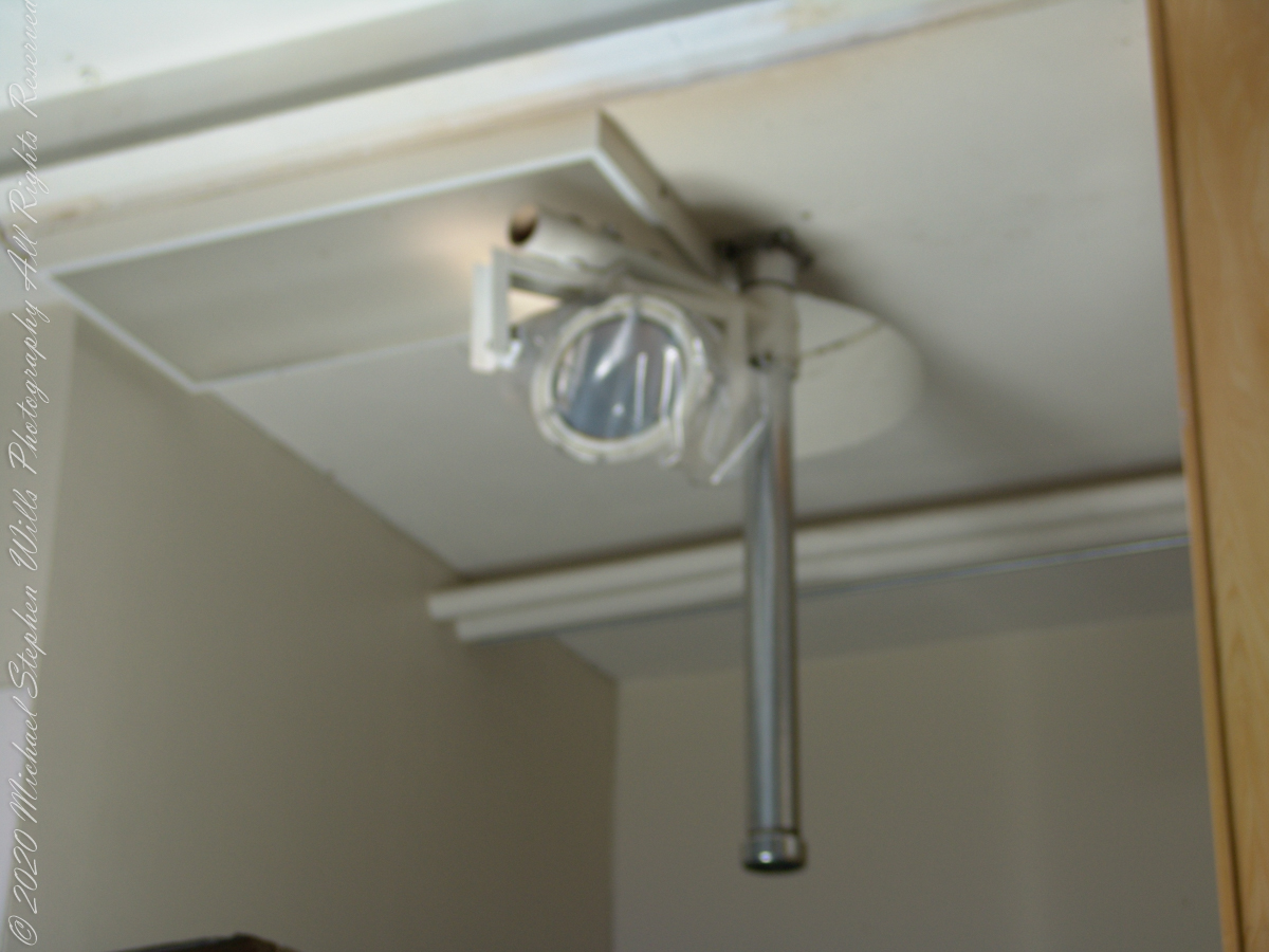
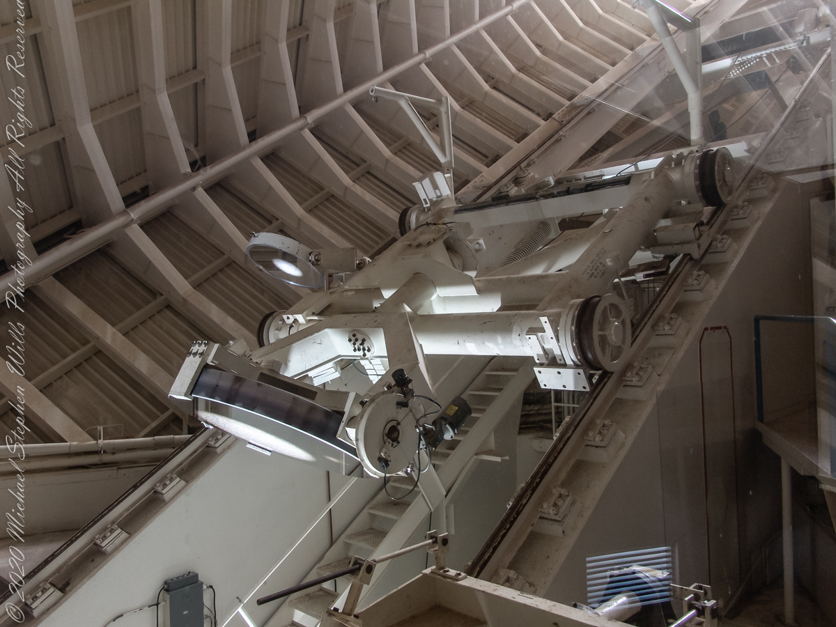
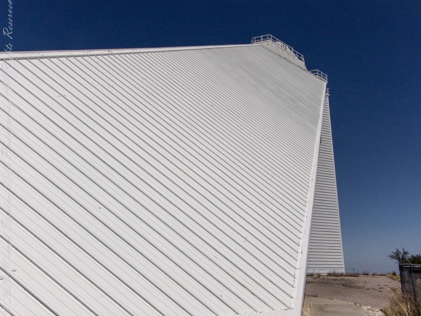
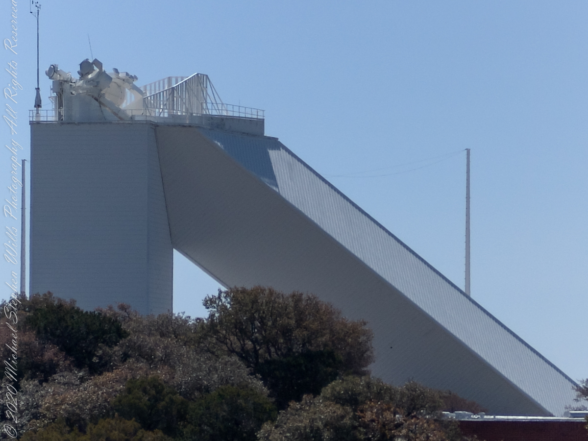
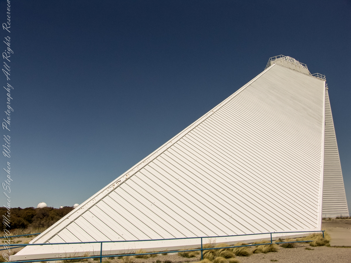
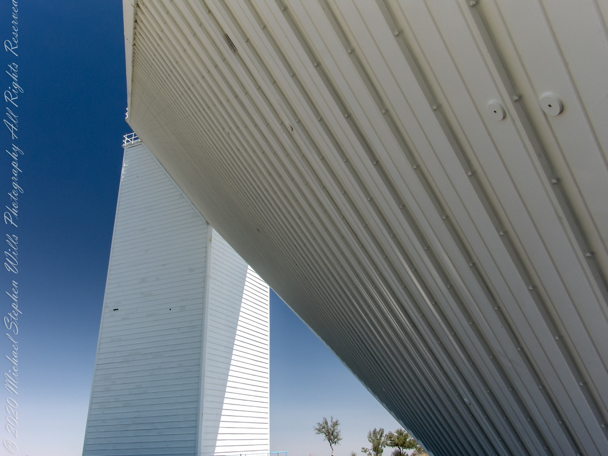
McMath–Pierce solar telescope has three heliostats mounted on a 110-foot tower adjacent to a slanted enclosure. The 2.03-meter heliostat feeds a 1.61-meter primary mirror, there are 1.07-meter and 0.91-meter primary mirrors fed by a pair of 0.81-meter heliostats. Here we are inside the slanted enclosure, looking up the shaft to the tower mounted heliostats, readily identified as the three circles, the largest at center (3.51 feet in diameter). The smaller (2.66 feet) heliostats named “East” (on left) and “West.”
Built in 1962, the building was designed by American architect Myron Goldsmith and Bangladeshi-American structural engineer Fazlur Rahman Khan. It was the largest solar telescope and the largest unobstructed aperture telescope in the world. It is named after the astronomers Robert Raynolds McMath and Keith Pierce. Painted white to reflect sunlight to reduce heat accumulation, the enclosure is water cooled to prevent convection currents through the column of air within the slanted enclosure, keeping the air as still as possible along the light path between the mirrors.
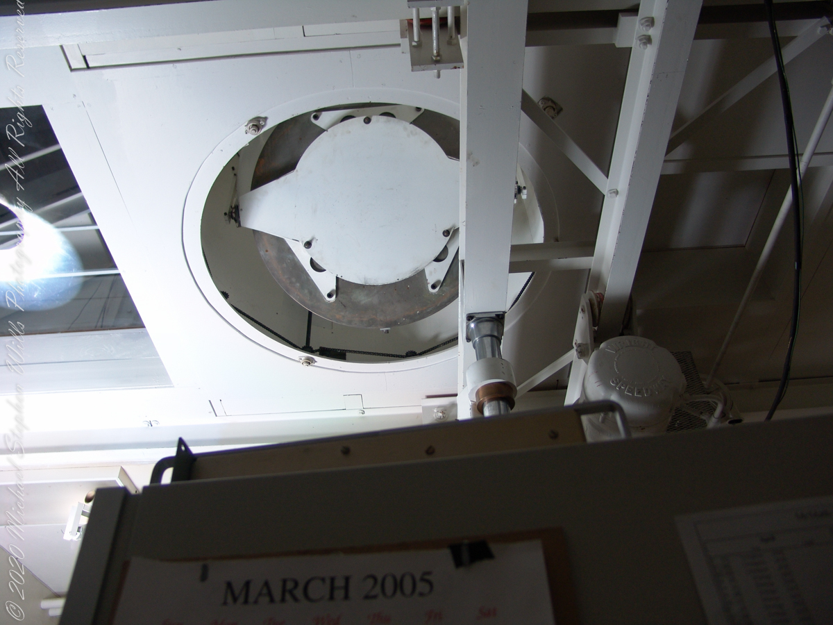
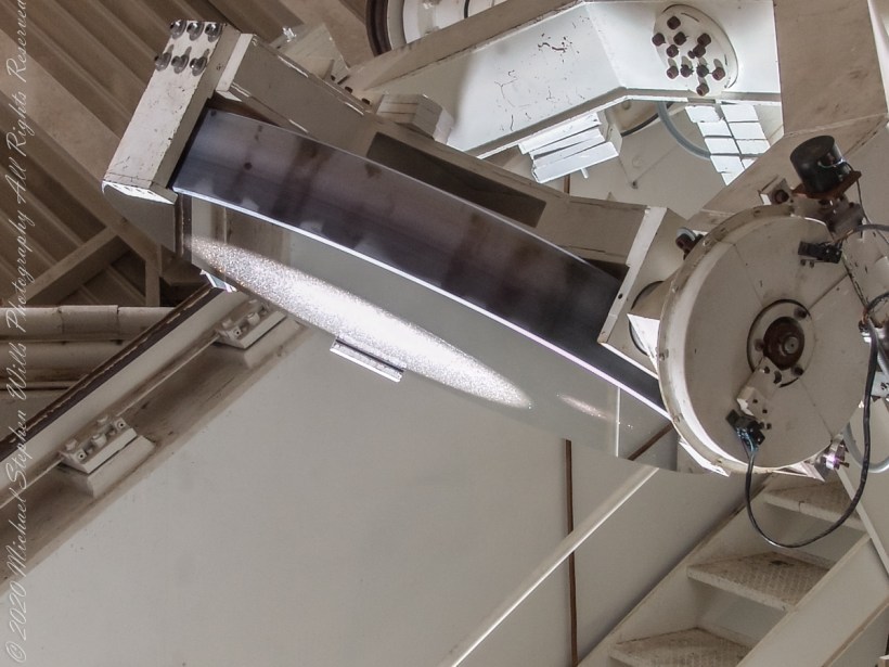
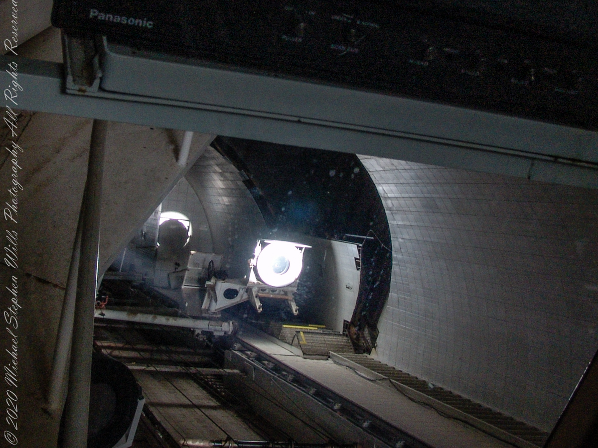
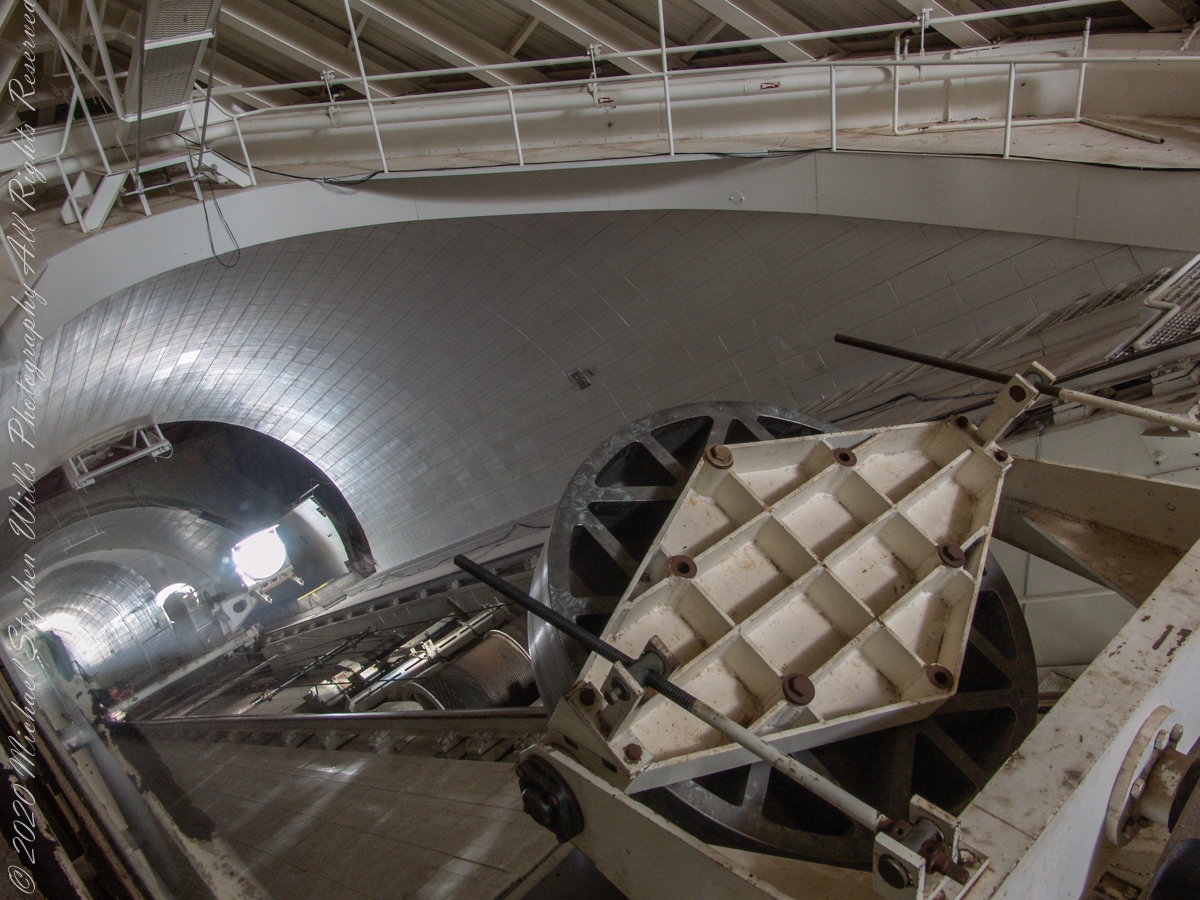
In the three photographs following, we face the underground portion of the slanted shaft and (what looks to be) the 0.91 meter (2.99 feet) primary concave mirror. I say that because in some of the photographs a beam of light, to the left of the mirror, can be seen travelling further underground, presumably to the largest primary mirror. As there is only one such light beam, I conclude the west heliostat is inactive.
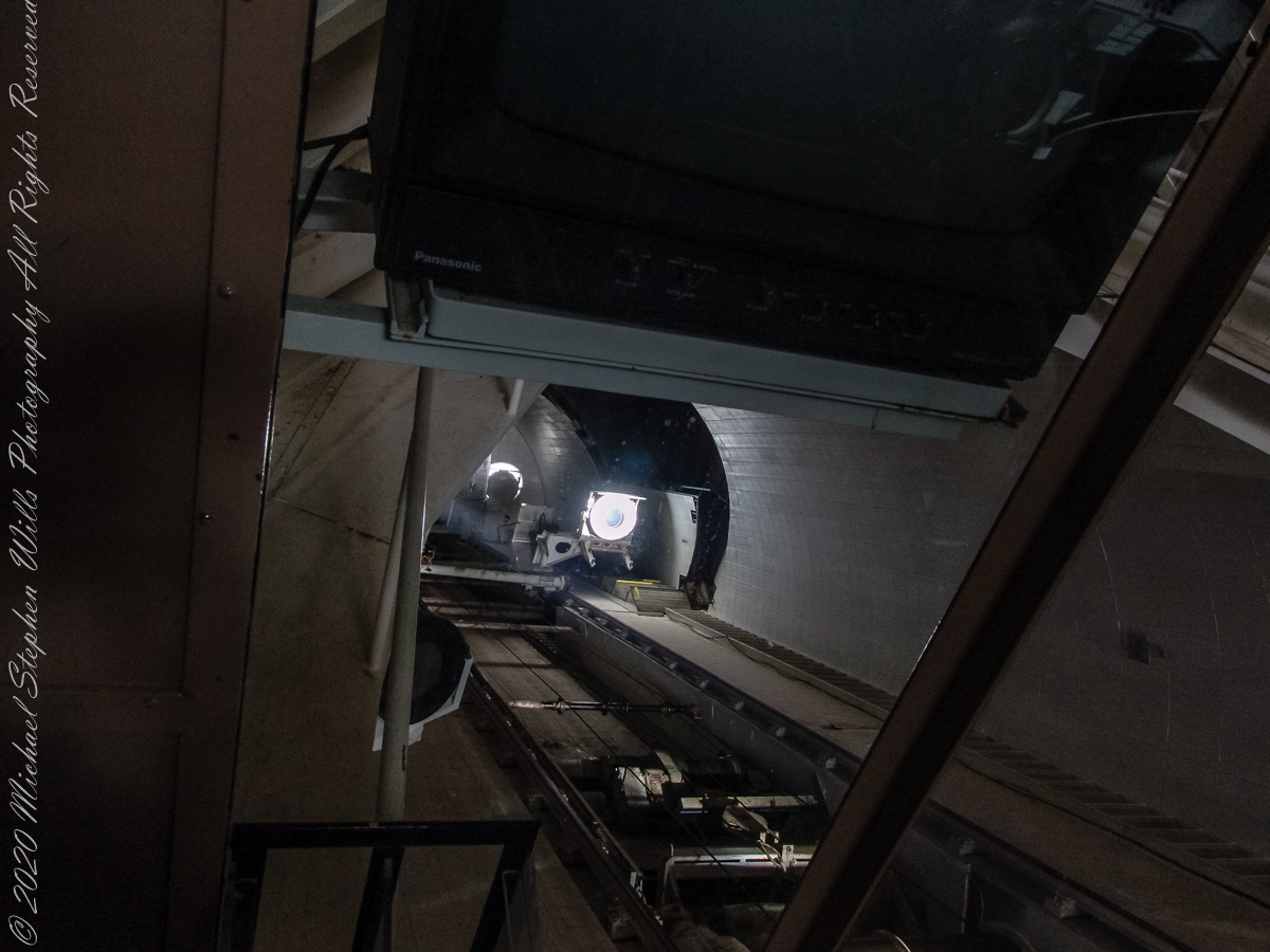
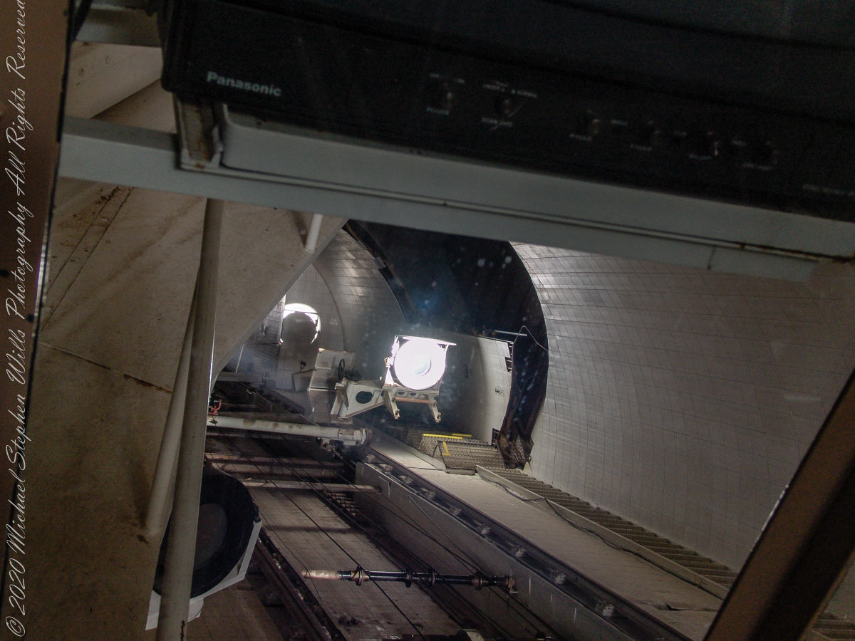
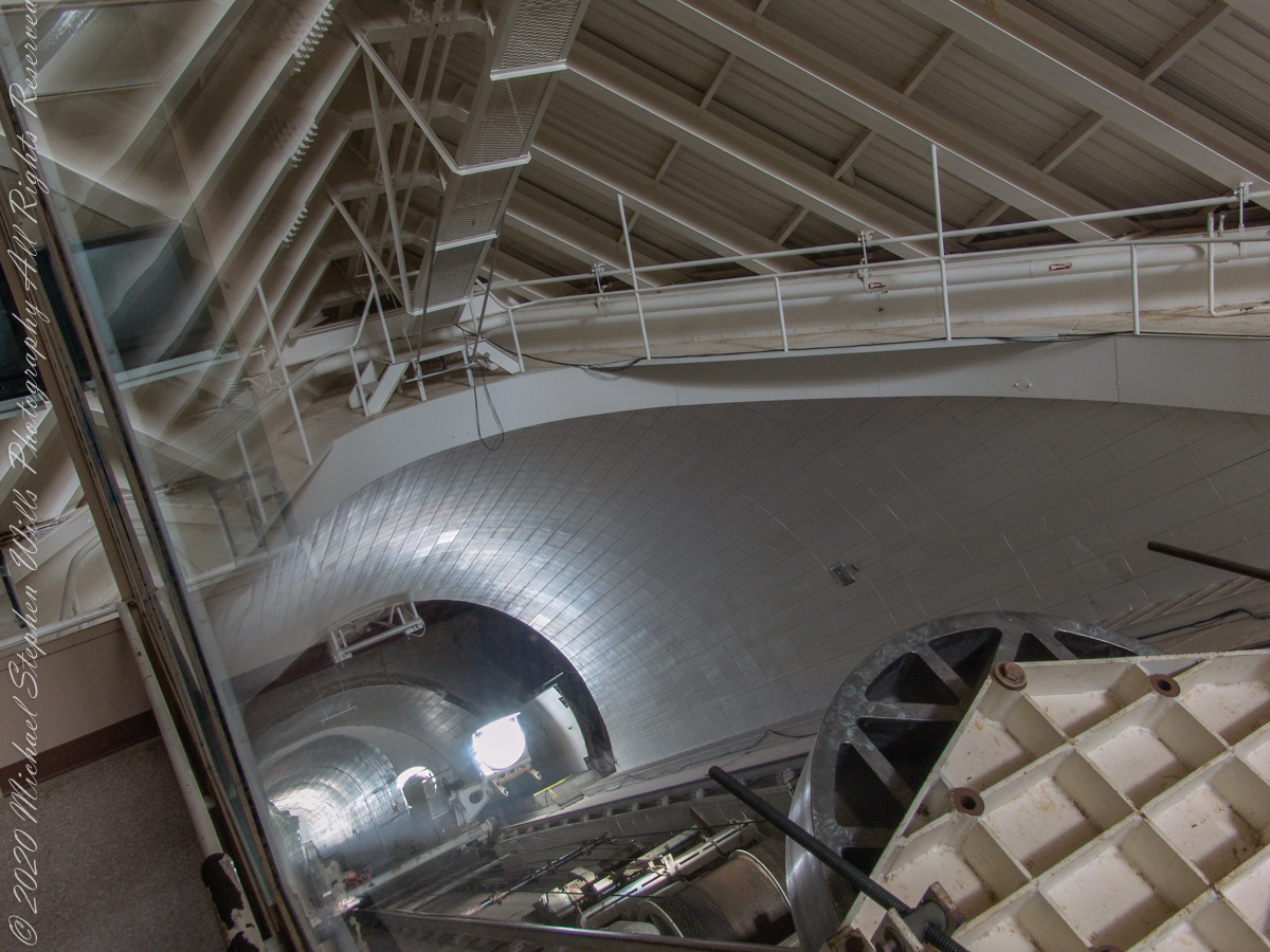
Here we looking up the slanted enclosure. Look carefully at the first photograph, below, to see reflections on the glass partition. The observation platform was separated from the light paths to maintain the stillness of the air column. The two mirrors of the first photograph are the third mirror, reflecting concentrated sunlight from the 0.91 and 1.61-meter primary mirrors into the observatory rooms. The mirror for the 1.07-meter primary is out of sight in foreground, I believe this set of three mirrors (West heliostats, primary and third) was out of service.
The second photograph, on right, is a close up of the third mirror for the largest primary. A foreshortened, perfectly round light disk is clearly visible.
Here we are inside the slanted enclosure, facing the underground portion of the slanted shaft and (what looks to be) the 0.91-meter primary concave mirror. In the lower right corner is the reverse side of the third mirror for the largest primary mirror, the 1.61-meter.
Reference: Wikipedia “McMath–Pierce solar telescope”
Copyright 2022 Michael Stephen Wills All Rights Reserved
These views of the McMath–Pierce solar telescope enclosure are the preliminary to a guided tour of the instrument, April 20, 2005.
On the tower are three heliostats, plane (flat) mirrors mounted on computer-controlled platforms to follow the sun across the sky to direct sunlight to primary mirrors underground, beneath the base of the slanted shaft
Built in 1962, the building was designed by American architect Myron Goldsmith and Bangladeshi-American structural engineer Fazlur Rahman Khan. It was the largest solar telescope and the largest unobstructed aperture telescope in the world. It is named after the astronomers Robert Raynolds McMath and Keith Pierce.
The slanted shaft, looking toward the tower.View of the slanted shaft, looking toward the tower.View from underneath the slanted shaft, looking toward the tower.
Inside the McMath–Pierce solar telescope is this keyed model of the observatory. Our docent for the morning tour stands alongside.
Reference: Wikipedia “McMath–Pierce solar telescope”
Copyright 2022 Michael Stephen Wills All Rights Reserved
“When George J. Roskruge created the official map of Pima County in 1893, he named the range after James Quinlin, who had opened a stagecoach station in the nearby town of Quinlin in 1884.” — Wikipedia article for “Quinlan Mountains.”
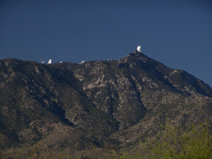
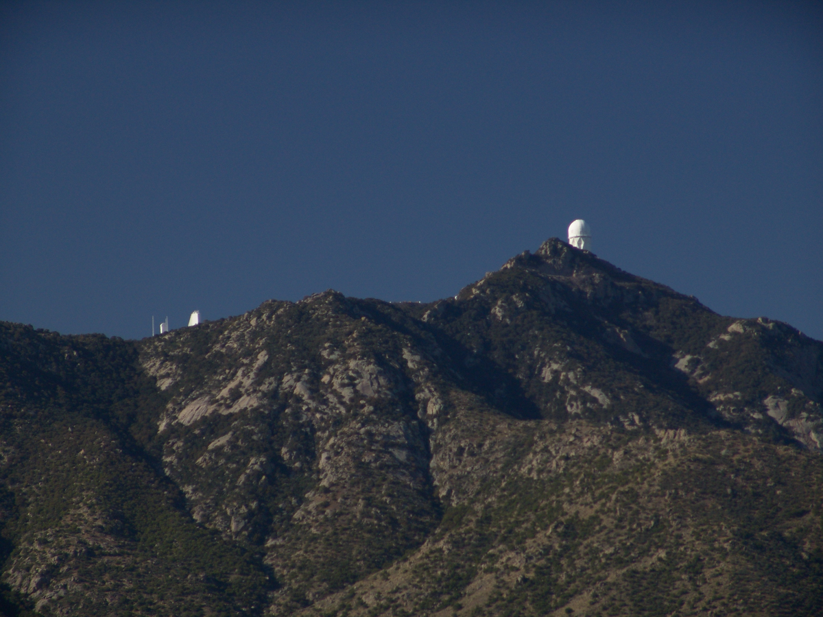
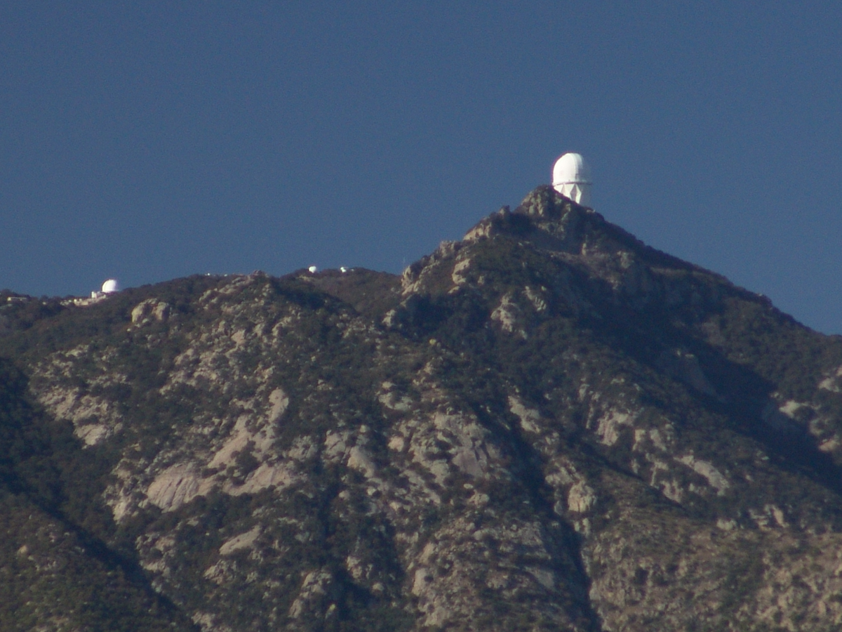
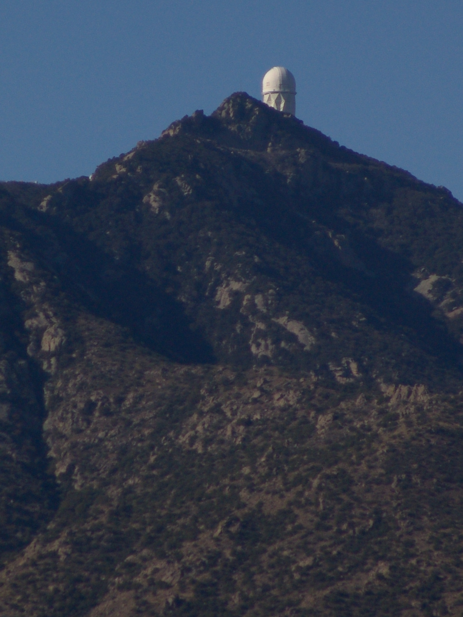
Kitt Peak is the highest point of the Quinlan Mountains, one of a series of ranges starting near the border with Mexico, the Baboquivari Mountains. Pan Tak pass separates Coyote Mountains from the Quinlans. Farther north there is even the Roskruge Mountains and a range named for a silver mine, the Silver Bells. Roskruge originally named “Kit’s Peak” for his sister, Phillippa, married to William F. Kitt. The peak was renamed to Kitt Peak William’s request.
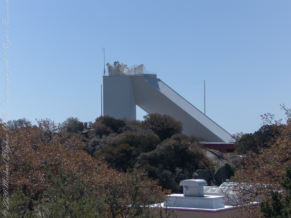
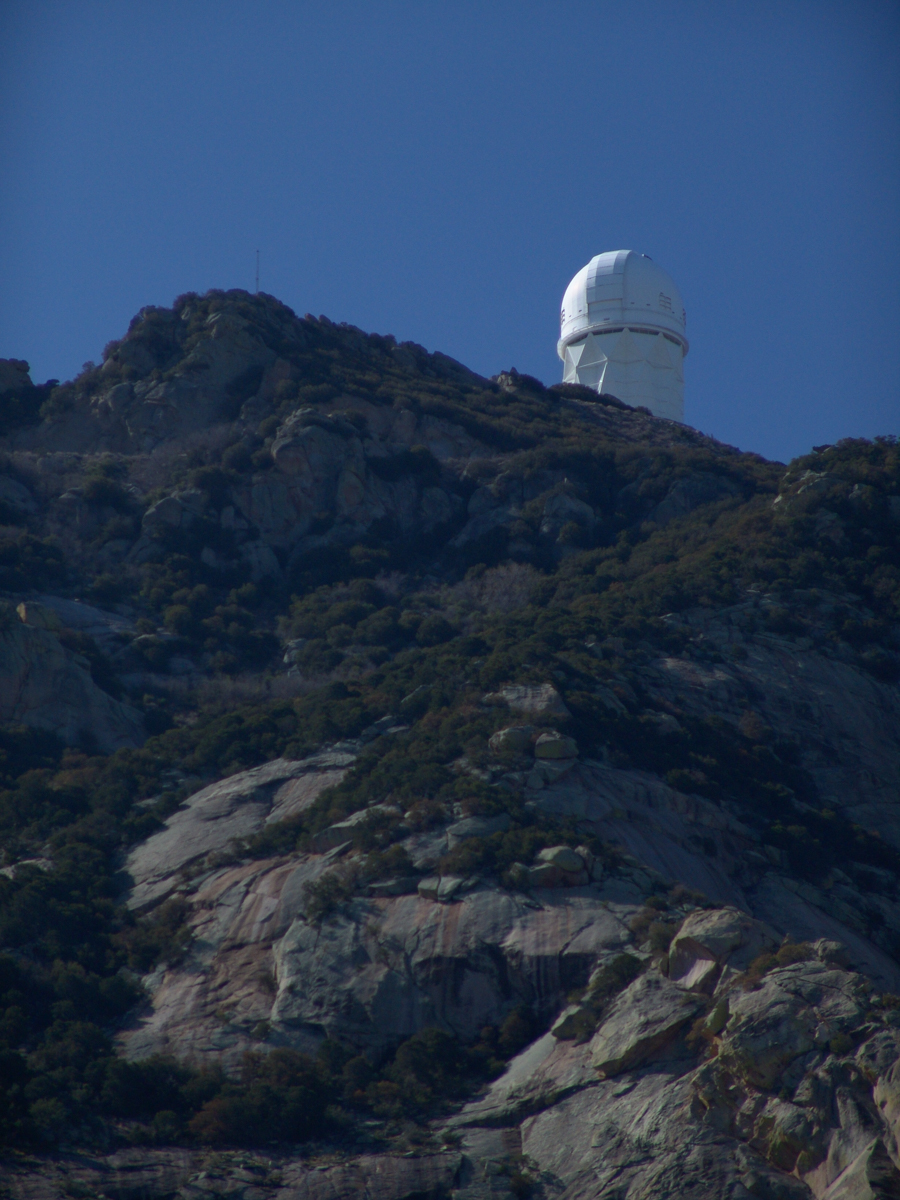
Here we see a dramatic view of Quinlan Ridge with Kitt Peak observatories, taken from the access road Arizona Routh 386. The instruments I recognize are, from left to right, McMath-Pierce Solar Telescope (second in line) and, on the end, Mayall Telescope.
And more views as I progressed toward the top.
.
The dramatic peaks are hypothesized to be igneous intrusions into metamorphic rock, these are called “Sky Islands” for the environments supported on them, radically different from surrounding lowlands. Kitt Peak is known for the stands of Manzanita Bushes
A mature Manzanita growing along the Miller Trail of the Rincon Mountain Wilderness. There is an enlargement of the flowers, to the right.
Copyright 2022 Michael Stephen Wills All Rights Reserved
The Contreras fire threatening Kitt Peak last month brought to mind a spring visit of mine to the National Observatory.
From downtown Tucson get onto Interstate 10, heading “east” toward El Paso. East in quotations as the road only turns east after the fork for Interstate 19, headed south past San Xavier del Bac mission and Nogales at the Mexican border. A few miles down I19, well before the mission, a turnoff for Arizona route 86, a road you’ll follow the better part of 36 miles, passing the Tucson Mountains on the right. Most days, the Mayall Telescope of Kitt Peak shines bright white ahead, as it did the right after dawn on Wednesday, April 20, 2005.
At some point R86 enters the 4,453.307 square mile extent Tohono O’odham Nation Reservation, you pass the town Three Points where Arizona route 286 heads south to Sasabe and the Mexican border. The next turn south is the Kitt Peak access road, Arizona route 386. On that Wednesday I was so early the gate to the peak was locked, so I pulled off the road and waited. It is a lonely place on the route for migrants from Mexico. I wandered off the road, into a wash (dry, sandy stream bed), to relieve myself, where junk from migrants was scattered around. Back in the car a helicopter approached with a black SUV. A big guy got out, walking by into the wash: the border patrol.
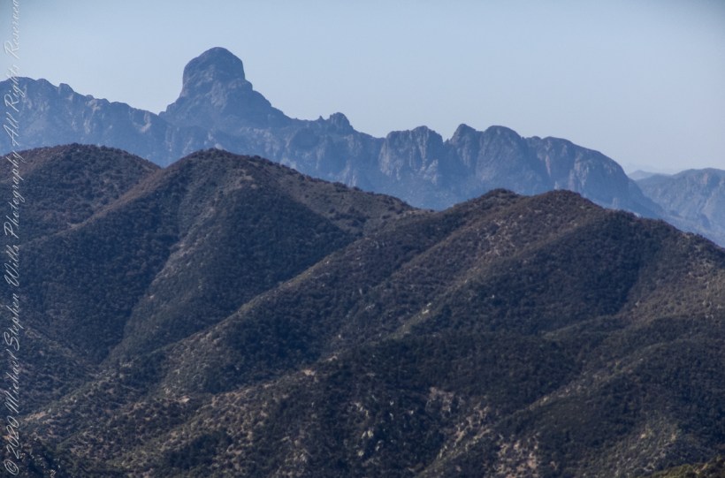
Here is a photograph from that day of Baboquivari Peak taken from Kitt Peak’
Baboquivari Peak is the most sacred place to the Tohono O’odham people. It is the center of the Tohono O’odham cosmology and the home of the creator, I’itoi. According to tribal legend, he resides in a cave below the base of the mountain. This mountain is regarded by the O’odham nation as the navel of the world – a place where the earth opened, and the people emerged after the great flood. Baboquivari Peak is also sometimes referred to as I’Itoi Mountain. In the native O’odham language, it is referred to as Waw Kiwulik, meaning “narrow about the middle”. The O’odham people believe that he watches over their people to this day. — Wikipedia
Baboquivari Peak was mentioned in the journals of Jesuit missionary Padre Kino, who made many expeditions into this region of the Sonoran Desert, beginning in 1699, establishing Spanish Missions in the area. — Wikipedia
Kitt Peak is in the sacred precinct of Baboquivari, the land just below the peak is the “Gardens of the Sacred Tohono O’odham Spirit I’itoi.” The month of my visit, the O’odham nation brought legal suit against Kitt Peak to halt construction of new telescopes in the garden. The issue was settled out of court.
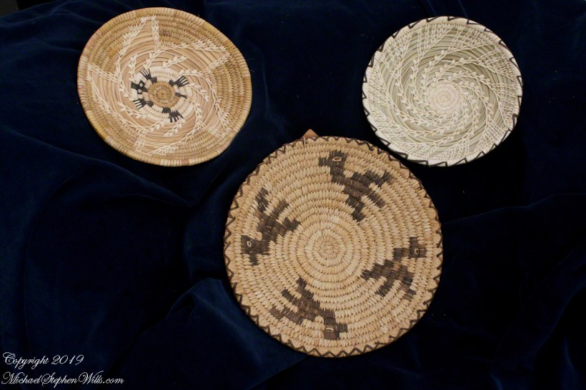
About the header photograph: From the bottom clockwise. Birds by Anmelia Juan of Geawuk (Kitt Peak 1972) – I purchased this from the Kitt Peak gift shop during my first visit; Turtle by Olvera and Simon Valenquela (Saguaro National Monument 2005); Stars by Simon Valenzuela for his daughter Pasquala Valenquela 16th Birthday (2018). Simon is of the Pascua Yaqui tribe who Learned basketmaking from his wife’s family.
Copyright 2022 Michael Stephen Wills All Rights Reserved
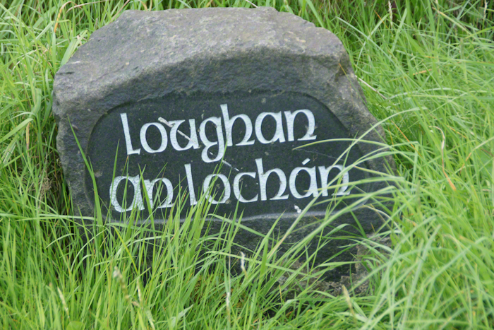
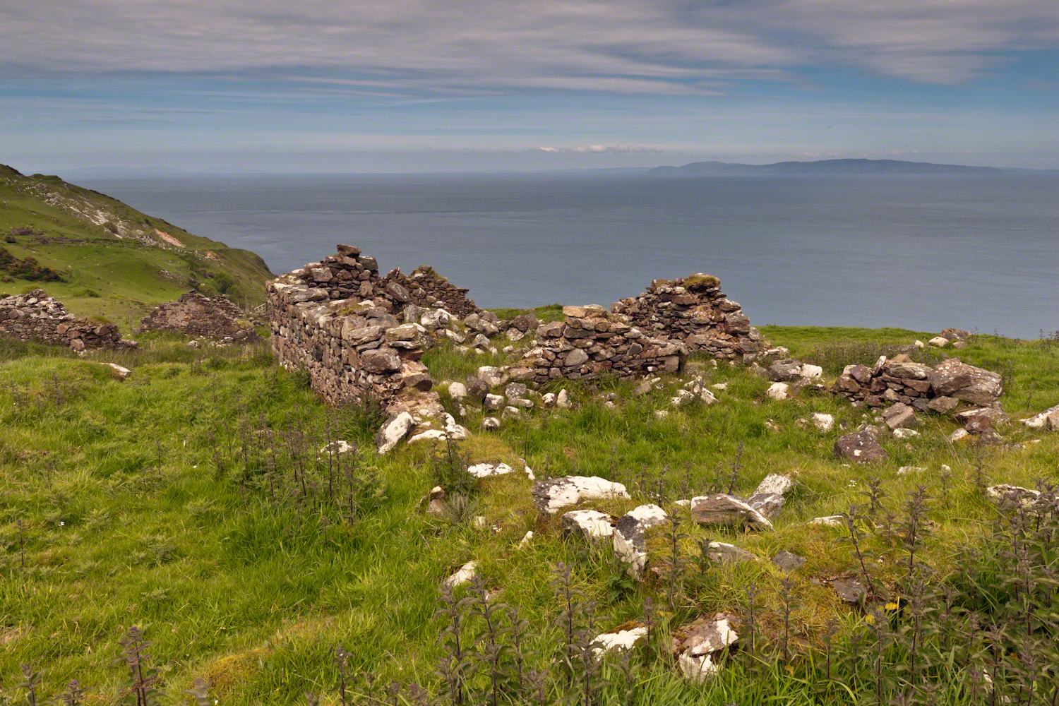
Here is a photograph from our day touring the Glens of Antrim. While making our way up the coast to Torr Head a group of stone walls resolved into ruins. A cluster of cottages on grassy slopes above the Irish sea above Loughan Bay. This is the townland of Loughan. Along the road are wonderful signs providing in handsome carved letters the place name in english and gaelic. Here a signed only provided a gaelic name: “Loughan an Lochan”…near enough to meaning “Loughan Bay” in English. The bay is a shallow scallop shaped indentation of the coast, a margin of narrow sand strand.
Ruins are spread across the slope. Immediately before the views are traces of a foundation above the grass. Beyond the top of a gable, an entire gable to the left. On the far ridge, just visible, is an entire structure with doorways, gables, walls.
Across the Irish Sea, 13 miles distant, is the Mull of Kintyre. In faint outline, rising above the horizon, find the highlands of Islay more than 30 miles. Both are tips of peninsulas jutting from Scotland.
Click pic for larger view in a new browser tab. If you are in WordPress Reader, open the post to use this feature.
The ruins lead to curiosity over who live here? What were their lives like? Why did they leave?
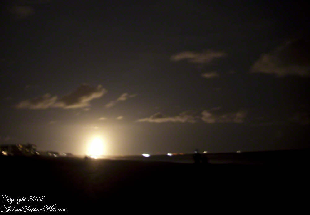
Driving to Cocoa Beach from Ithaca, Pam and I missed a horrendous storm because we did a side trip to Louisville, Kentucky, avoiding I95 January 4th and 5th and a rare and treacherous ice storm.
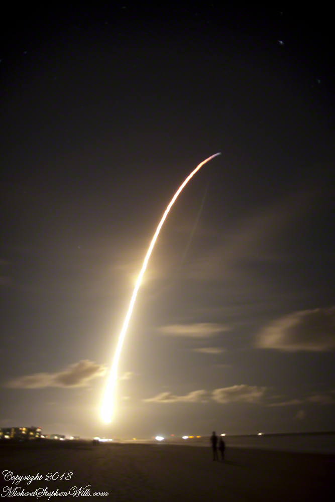
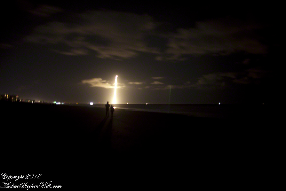
We met people who were stranded overnight near Savannah, Georgia while, on the same days, we drove Kentucky Hill Country for an overnight at Macon, Georgia all in excellent, dry, cold weather. The storm itself, was a stroke of luck. The first Space X launch of 2018 was delayed by the weather until the evening of Sunday, January 7th. I was in place, in the dark, on Cocoa Beach with my Canon DSLR on bulb mode, securely mounted on a travel tripod. My choice of lens was the 24 mm “wide angle.”
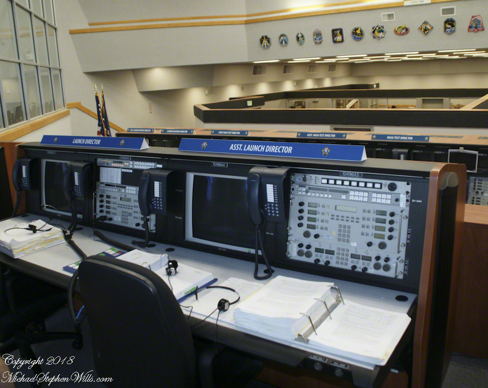
Proximity to the Kennedy Space Center is a reason we return to Cocoa Beach. A year ago, March 2007, we did the “Launch Director Tour” offered once a month (if at all) and had a fantastic day. I’ll need to blog about it.
For now, here is a shot from the former Space Shuttle launch room.
I planned camera placement well for this night launch. The view held the entire parabola of the trail. Camera placement was based on researching the launch complex, finding it on Google Earth, using the line feature to determine the orientation of the complex from my location on Cocoa Beach.
Live, the start of the launch is like a dawn in the northern sky. I broke off the exposure to somewhat capture the effect.
The human eye, only the Falcon 9 flame is visible, as a single point of bright light ever rising, lighting the beach and clouds in a soft glow.
The long exposure blends the flame into a bright parabola, at one point the rocket engines throttle back, eventually the color changed to reddish from bright white. I held the exposure until the rocket flame, in the image, turned to blue and faded away.
We waited for six (6) or so minutes, the camera mount and orientation unchanged, and then the incredible returning booster briefly lit up to land at Cape Canaveral Air Force Station. I missed the beginning of the burn. In retrospect, I should have timed the launch and opened the shuttle 5 minutes or so after “blast off.”
Followed by a TWO sonic boom finale. Kabooom….Kabooom.
We read in the news the secret military satellite, named “Zuma”, on top of the Falcon crashed into the Indian Ocean. SpaceX claimed the launch was a success (??), that the protective fairing jettisoned successfully. No mention was made of the secret payload. The failure was with the Northup Grumman built “Zuma” satellite? Hmmmmm.
Copyright 2022 Michael Stephen Wills All Rights Reserved.
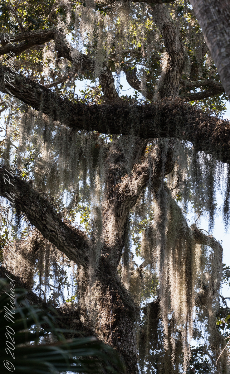
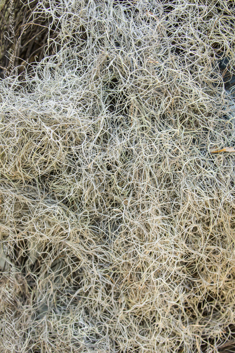
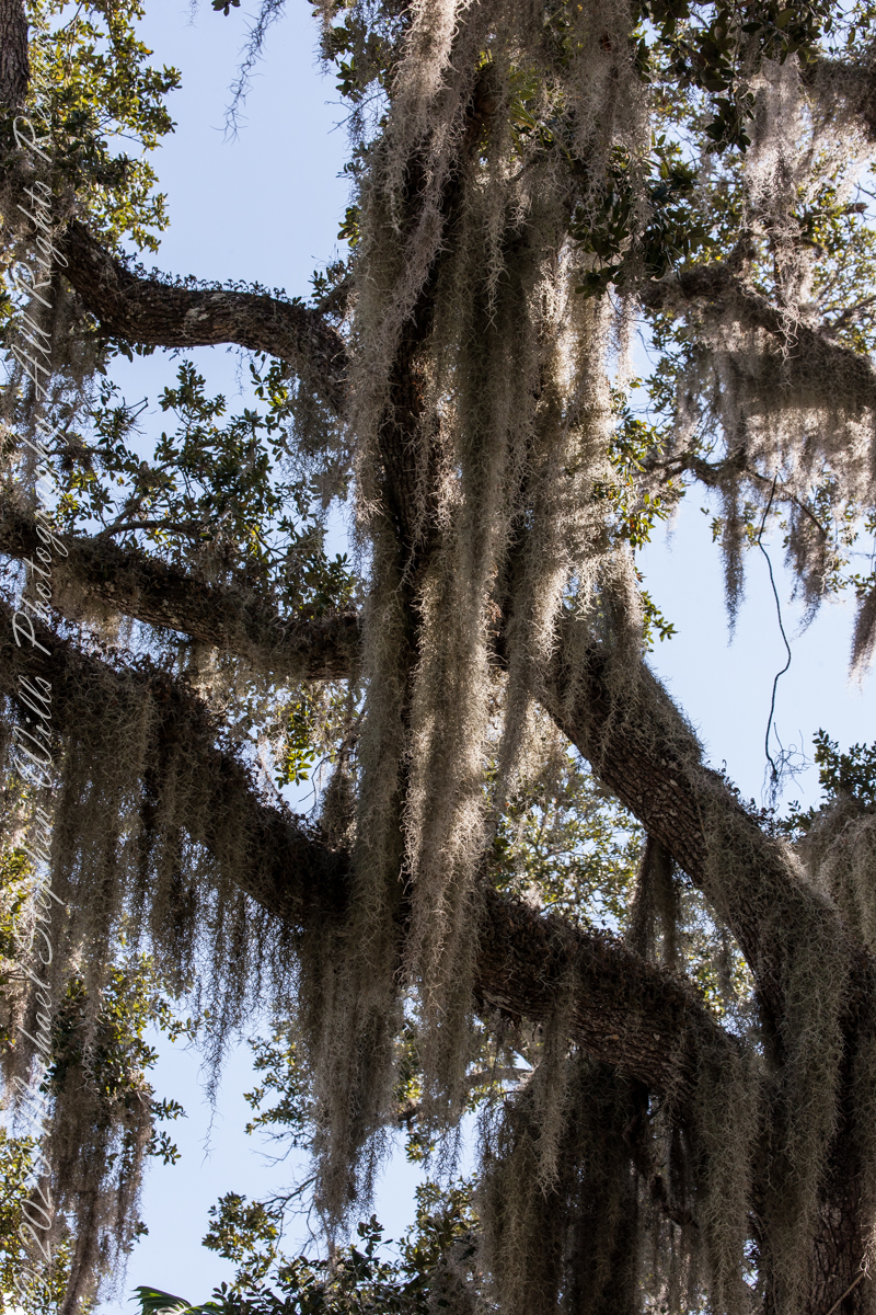
We spotted this stuff within minutes of arriving at McKee Gardens for an afternoon visit with the grandchildren. Festooned above our heads from thick Oak branches, I could not resist pulling out the camera for this photograph to capture the flavor of Southern Gothic. Fortunately, our group included neither deeply flawed nor disturbing characters, though we can confess to a touch of eccentricity.
Above the Cafe tables
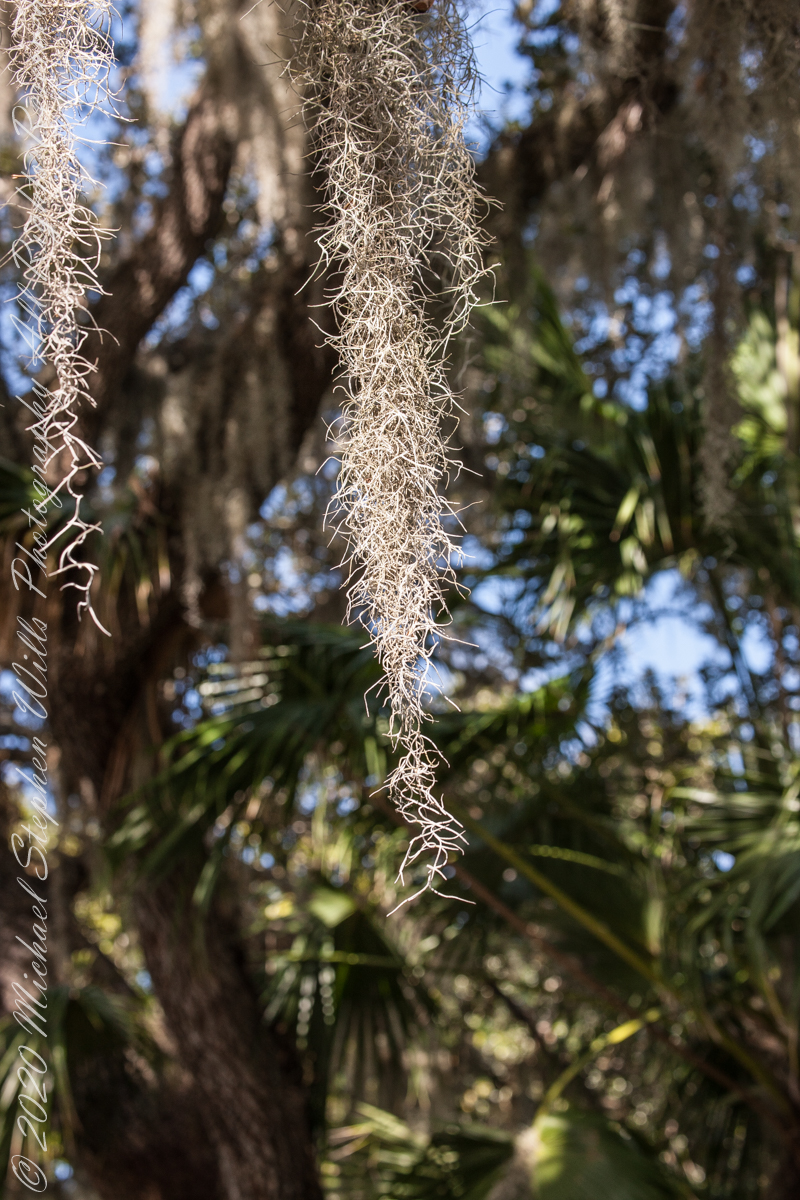
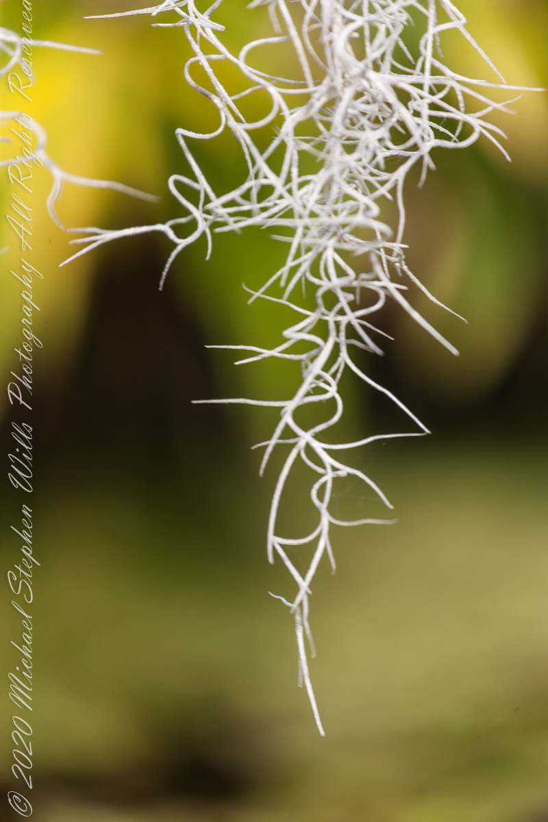
Spanish Moss produces inconspicuous flowers with tiny seeds. Spanish Moss also propagates from fragments of the fine leaves.
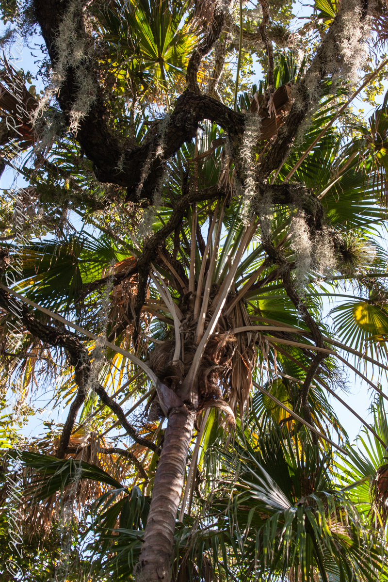
Spanish Moss is neither moss nor Spanish. Scientific name Tillandsia usneoides, this flowering plant is in the family Bromeliaceae that includes pineapple. Here we have two epiphytic bromelias sharing the trunk of a palm.
Spanish Moss with other Bromeliads
A rootless epiphyte native to the tropical / semi-tropical Americas, Spanish Moss has a preference for southern live oak (Quercus virginiana) and bald cypress (Taxodium distichum) because of their high rates of foliar mineral leaching (calcium, magnesium, potassium, and phosphorus) that provides an abundant supply of nutrients to the epiphytic plant.
Spanish Moss on PalmsSpanish Moss on Southern Live Oak
My two volume “go to” resource for plants and trees had sparse information about Spanish Moss and no wonder as it is a burden on trees, though not parasitic, and so more a pest than a decorative element to cherish. Surprisingly, Spanish Moss was purposely introduced to Hawaii where it is now known as “Pele’s Hair” after their fire goddess.